Impacts of a Cascadia Subduction Zone Earthquake
|
|
|
- Judith Norris
- 5 years ago
- Views:
Transcription
1 Impacts of a Cascadia Subduction Zone Earthquake Presentation to the Communications Academy Robert Ezelle, Emergency Management Director 14 April

2 EMD Mission EMD leads and coordinates mitigation, preparedness, response and recovery in Washington State to minimize the impact of disasters and emergencies on the people, property, environment and economy. 2


3 National Response Framework (NRF) Guidance for all-hazards response Partnership between all levels of government: Local government responds first State government assists as needed Federal government assistance as the last resort 3


4 Off-scene Coordination Requests and Information Resources NIMS/ICS Across All Levels of Government Joint Field Office with Unified Coordination Group State Emergency Operations Center and elected officials Mutual Aid: EMAC, PNEMA City/County Emergency Operations Center and elected Officials Mutual Aid: WAMAS On-scene Command Delegation of Authority Incident Command Post with Incident Command/Unified Command/ Type III, II, or I Incident Management Team Mutual Aid: LE, Fire, EMS 4

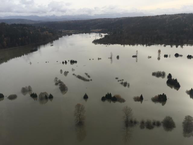


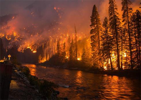

5 Seasonal Hazards

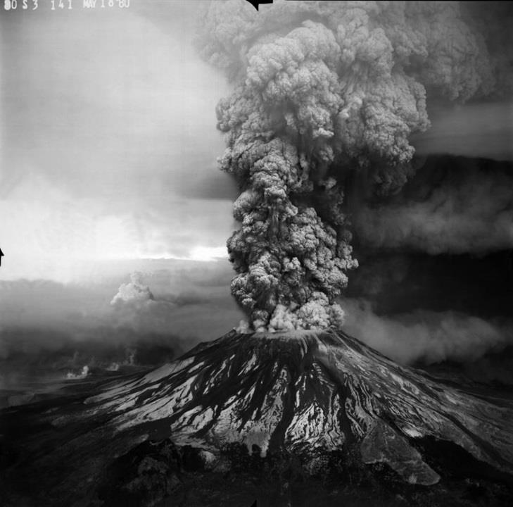

6 Geologic Hazards


7 Other Hazards
8 Washington s Disasters Over Time Since Federal Declarations 53 Major Disasters 7 Emergency Declarations 92 Federal Fire Suppression/Management Declarations 8 8
9 FMAG Declarations by Decade Major Disasters by Decade Disaster Growth Total Declarations by Decade
10 The CSZ Threat

11 Ring of Fire The Ring of Fire accounts for 90% of all earthquakes, and 81% of the world s largest earthquakes Subduction zones are shown in red The CSZ fault line is part of the Ring of Fire The CSZ is the only significant fault line on the Ring of Fire without a major quake in the last 50 years (see blue stars)

.")
12 Cascadia Subduction Zone The CSZ runs 800 miles from Southern British Columbia to Northern California, and lies 50 to 80 miles off the Pacific Coast The heavy Juan de Fuca plate is sliding under the lighter North American plate A magnitude 9.0 CSZ earthquake has occurred every 300 to 500 years (USGS years). The last CSZ earthquake occurred in the year 1700 (January 26).

13 An increase of 1 in magnitude results in ten times the shaking and 32 times more energy released by an earthquake. A Magnitude 9.0 Quake will be 100 times more powerful in terms of shaking and 1024 times more powerful in terms of energy release than the 2001 Magnitude 6.8 Nisqually earthquake. Our probability of experiencing a M6.0 or greater quake within the next 50 years is more than 80%. GET PREPARED NOW!!
14 Earthquake Aftershocks In the first week of a 9.0 Richter Scale Earthquake there will be one 8.0+ and ten 7.0+ Aftershocks Source: USGS


15 Mercalli Index Ground Shaking Effects Liquefaction Mercalli Index: Ground shaking will depend on the actual fault rupture method and can not be accurately forecast. It is anticipated that the fault will rupture along its entire 700 mile length resulting in a magnitude 9.0 earthquake that will last 3-5 minutes. The intensity of the shaking will decrease with distance from the fault. Even so, Seattle is expected to experience a 7.0 magnitude or higher earthquake with 5 minutes of shaking. Landslides Tsunami Liquefaction: The cause of some of the most dramatic damage resulting from an earthquake, liquefaction areas can be accurately forecast based on soil types and water content. Some of the most susceptible areas are areas that have a high commercial potentiality, i.e. ports, bridges, commercial areas. Landslides: Landslides will occur up to hundreds of miles from the fault due to the intensity of the shaking. Landslide potential significantly increases with water content. If the CSZ rupture occurs during the rainy season, landslides will be most prolific. Tsunami Inundation: Tsunami s are historically the biggest killer associated with earthquakes. The residents most affected are along Pacific Coastal areas. The numbers in jeopardy will increase sharply in summer months. Current estimates place as many as 50,000 residents in the hazard zone in February.


16 1 st Order Effects - Shaking


17 1 st Order Effects - Liquefaction

18 Tsunami Inundation Areas


19 1 st Order Effects - Tsunami
20 Legend Complete = Totally Destroyed. Severe = Severely Damaged Not Useable Moderate = Moderately Damaged 50% Capacity Slight = Slightly Damaged Useable None = Not Damaged The HITRAC study is designed and intended to be REPRESENTATIVE not PREDICTIVE.

21 Emergency Ops Centers These are general locations and forecast status of the known City, County and State EOCs. There are 48 EOCs. 30% are completely destroyed, and 7% suffer severe damage and are unusable. Result is 37% must devolve. 7% suffer moderate damage and may be partially usable, may devolve. 50% suffer slight damage, 6% suffer no damage. 56% are able to continue operations with minimal interruption. State EOC sustains slight damage.

22 Hospitals These are general locations and forecast status of the known Hospitals. There are 112 Hospitals in the affected area. 36% suffer severe damage, are unusable, and will likely be completely offline. 17% suffer moderate damage and are only assumed capable of 50% normal capacity. Total reduction is assumed to be 45% of total hospital capacity. 47% suffer slight damage and are able to continue to operate at capacity. The facilities nearer to the epicenter suffer most significant damage resulting in virtually no Hospital capacity west of the I5 corridor. These numbers discuss STRUCTURAL capacity, not patient capacity, which is further reduced due to lack of electricity, potable water, sanitation, etc.

23 Fire Stations These are general locations and forecast status of the known Fire Stations. There are 971 Fire Stations in the affected area. 30% suffer severe damage, are unusable, and are planned to be completely offline. 6% suffer moderate damage and are only assumed capable of 50% normal capacity. Total reduction is assumed to be 33% of Fire Response capability. 64% suffer slight or no damage and are able to continue to operate at capacity. The facilities nearer to the epicenter suffer most significant damage resulting in significantly reduced capability west of Shelton.

24 Police Stations These are general locations and forecast status of the known Police Stations. There are 178 Police Stations in the affected area. 41% are completely destroyed, 7% suffer severe damage, are unusable, and are planned to be completely offline. 5% suffer moderate damage and are only assumed capable of 50% normal capacity. Total reduction is assumed to be 51% of Police Response capability. 48% suffer slight or no damage and are able to continue to operate at capacity. The facilities nearer to the epicenter suffer most significant damage resulting in significant degradation of Law Enforcement capability west of Shelton.
25 Transportation - Sea, Air, Rail Most facilities west of the I-5 corridor suffer complete to severe damage Most facilities along the I-5 corridor suffer severe to moderate damage Most facilities east of the I-5 corridor suffer slight to no damage Many of these facilities are located in liquefaction zones

26 Transportation- Highways There is a vast network of County, State, and Federally maintained highways in the affected area. Ground transportation is the primary method of movement for most commodities. The highway system will suffer the most damage in the vicinity of the coast with both earthquake and tsunami damage. This will significantly impact any lifesaving or recovery operations, and will drive route clearance and roadway repair to a very high priority across the region. In the I-5 corridor roads in areas of high liquefaction susceptibility are likely to prove impassable. In the initial stages of the CSZ response the only method of reaching coastal communities will be by air. There are no surviving ground routes to the coastal region.

27 Transportation- Hwy Bridges Virtually every highway crosses numerous bridges. Route identification that does not cross a bridge will not be possible when attempting to reach any isolated community. Bridges in the affected are predominantly old and were built prior to establishment of significant seismic building requirements. The assessment of bridges as early in the IAA process as possible will be key to the development of routes into isolated communities. Identifying bridges that need the least repairs will speed up recovery operations. The lack of suitable bridges will be a factor in the determination of the recovery efforts and timelines.

28 Communication Facilities This slide represents the number of communications facilities in the affected area as of the time of the creation of the FEMA analysis. There are approximately 53 AM Broadcast Stations, 42 FM Broadcast Stations, 15 TV Broadcast Stations, 1 Internet Exchange Point, and 171 Cellular Towers. In general terms the communications infrastructure suffers damage commensurate with the significance of the MMI index. Although the communication infrastructure is ultimately dependant upon electrical power and may be unavailable after the CSZ for an extended period in the entire region, and for even longer periods in the areas of greatest damage, due to the inability to repair and sustain these facilities. These factors will greatly affect mass communications ability. Additionally, this slide shows cell towers, but does not account for the cellular control facilities and/or switchboards. Those facilities are presumably much more difficult to repair or replace then a cellular tower.

29 Utilities This slide provides an overview of the utilities networks across the affected area. In general the amount of damage decreases from West to East. Major networks will be out-of-service until significant repairs can be made. There are approximately 440 major electrical facilities and a vast network of electrical power lines, both above and underground throughout the region. There are 68 major Natural Gas facilities and 12 counties contain 22 major sections of NG pipe network. There are 54 petroleum processing facilities, and 9 counties contain 16 major sections of petroleum pipeline. There are 35 known Potable Water Facilities.
30 Planning Factors (FEMA) Washington Total Notes Land Area (Sq. Miles) 71,303 Miles of Pacific Coastline 157 Does not include Strait of Juan de Fuca or shores of Puget Sound. Population 6,894,121 Population exposed to tsunami 50,190 Residential buildings damaged (Slight to complete damage) Short term human sheltering requirements Short term pet sheltering requirements Mass feeding and hydration requirements (People) Mass feeding and hydration requirements (Pets) 507, , ,357 1,274, ,340 Deaths 8,440 Injuries 12,114 Projection accounts for initial earthquake and tsunami, does not account for exposure, disease, dehydration, starvation, or follow on tsunami's and aftershocks. Hospital patient evacuation requirements Nursing home patient evacuation requirements 15,501 65,249 Evacuation requirements based on projected numbers of facilities determined to be unusable. Does not account for evacuation to create room for newly injured. Building debris (Cubic Yards) 13,174,243

31 Major Fault Zones in the Puget Sound Tacoma Fault Olympia Structure 31
32 Cascadia Rising 16 32
33 Cascadia Rising 16 Joint Federal, State, Local Exercise conducted 7 to 10 June, 2016 National Linkage Focus Areas: Operational Coordination Operational Communication Situational Awareness Mass Care Public Health and Medical Services Critical Transportation 33
34 Cascadia Rising 16 Strategic Observations Time is of the essence Massive National/International response required Needs and immediacy are overwhelming Detailed Planning is imperative Transportation infrastructure is the lynchpin of successful response Effective, survivable communication is essential Public preparedness is crucial CSZ is a National Issue Hurricane Maria has validated the importance of these We are not prepared to operate in a degraded communications environment over an extended period. 34
35 Response Planning ESF-6 Mass Care and Sheltering ESF-8 Public Health and Medical ESF-1 Transportation ESF-2 Communications ESF-12 Energy Mitigation Planning Focused on building resiliency in our critical infrastructure, in particular our lifeline sectors - transportation, communications, energy Family and personal preparedness/resiliency Recovery Planning Washington Restoration Framework Our Focus Going Forward 35

36 Clallam County Micro Islands

37 Resilient Washington State A resilient state is one that maintains services and livelihoods after an earthquake. In the event that services and livelihoods are disrupted, recovery occurs rapidly, with minimal social disruption, and results in a new and better condition. November 2012

38 Resilient Washington State
39 Resilient Washington Subcabinet The Resilient Washington Subcabinet was convened in January of 2017 to help our state better prepare for natural disasters, including earthquakes, tsunamis, wildfires, drought, storms and flooding. Recommendation 2 of 10: Encourage utility providers to identify vulnerabilities in their system and mitigate deficiencies.
40 Emergency Support Function 2 - Communications Coordination with telecommunications and information technology industries Restoration and repair of telecommunications infrastructure Protection, restoration, and sustainment of national cyber and information technology resources Oversight of communications within the state incident management and response structures


41 Emergency Support Function 2 - Partners
42 Washington Emergency Communications Coordination Workgroup (WECCWG) Purpose: To forge and strengthen our public, private, and tribal partnerships to enhance emergency communications statewide. Vision: A community of professionals working together to provide reliable and resilient emergency communications throughout Washington state in times of crisis.

43 Upcoming WECCWG Meetings Date: May 10 Location: Federal Way Theme: Catastrophic Planning Date: September 27 Location: TBD in Central Washington Theme: Public Warning Information:

44 Amateur Radio Emergency Services Strengths Number of licensed amateur radio operators Resilience of technologies Technical expertise Mode and band agility Mobility Cheaper equipment Evolving technologies

45 Amateur Radio Emergency Services Opportunities Development, synchronization, and maintenance of local, regional, and state communication plans Integration of amateur radio in EOC organization, infrastructure, and procedures Increased standardization of processes and procedures Inventory/directory of resources/ infrastructure Increased involvement of amateur radio in emergency management exercises
 in 2015")


46 Emergency Public Information System (EPIS) Effort initiated by the State Emergency Communications Committee (SECC) in 2015 Collaboration between emergency management and media broadcasters to continue the delivery of coordinated, reliable information to the whole community following a catastrophic incident which likely will have damaged large portions of the broadcast infrastructure.

47 Wireless Emergency Alerts (WEA) Delivery to 100% of the target area with no more than a onetenth of a mile overshoot Require the WEA alerts be preserved for at least 24 hours after the alert is received Message length extended to 360 characters and include support for Spanish-language messages


48 Missile Alert On January 13, Hawaii Emergency Management issued a false alert for an incoming ballistic missile. The warning was cancelled 34 minutes later. FCC determined: Combination of human error and inadequate safeguards Lack of preparation for how to cancel false alert

49 Washington State EOC Alert & Warning Center EMD/FEMA Region X joint review of attack warning procedures Public alert origination at federal level Safeguards commensurate with warning significance/ consequences
50 Questions? 50
Comprehensive Emergency Management Plan
 Comprehensive Emergency Management Plan Section 6-Earthquake Annex Blank Intentionally 2 CEMP Annex 6 1 Earthquake Annex I. PURPOSE II. SITUATION The earthquake annex is a hazard-specific annex to be used
Preparing for the BIG one Cascadia Subduction Zone Event
 Preparing for the BIG one Cascadia Subduction Zone Event Source - 2016 CZS Excercise updated Jan 2015 1 Earthquake Faults in Washington State Emergency Management Ring of Fire The Ring of Fire accounts
United States Multi-Hazard Early Warning System
 United States Multi-Hazard Early Warning System Saving Lives Through Partnership Lynn Maximuk National Weather Service Director, Central Region Kansas City, Missouri America s s Weather Enterprise: Protecting
How to communicate Cascadia Subduction Zone earthquake hazards
 How to communicate Cascadia Subduction Zone earthquake hazards Tom Brocher Research Geophysicist Earthquake Science Center U.S. Geological Survey Menlo Park, California Seattle Post-Intelligencer Lessons
A HURRICANE IS COMING. Presented by Atiba Upchurch Broward Emergency Management Division
 A HURRICANE IS COMING Presented by Atiba Upchurch Broward Emergency Management Division Mission Statement To safeguard the lives and property of the people of Broward County from major hazards and emergencies
Cascadia megathrust earthquakes: reducing risk through science, engineering, and planning
 Cascadia megathrust earthquakes: reducing risk through science, engineering, and planning NSF Hazards SEES EAR-1331412 Urban Science and Engineering Workshop 21 July 2014 Everything to do with M9 Cascadia
Surviving the Big One: Understanding and Preparing for a Major Earthquake in Western Oregon
 Surviving the Big One: Understanding and Preparing for a Major Earthquake in Western Oregon May 21, 2013 City of Salem Salem Public Library Althea Rizzo, Geological Hazards Program Coordinator Oregon Emergency
WESTERN STATES SEISMIC POLICY COUNCIL POLICY RECOMMENDATION Earthquake and Tsunami Planning Scenarios
 WESTERN STATES SEISMIC POLICY COUNCIL POLICY RECOMMENDATION 18-1 Earthquake and Tsunami Planning Scenarios Policy Recommendation 18-1 WSSPC strongly encourages states, provinces, territories, First Nations,
NOAA s National Weather Service. National Weather Service
 NOAA s National Weather Service Serving the Nation s Environmental Forecasting Needs Lynn Maximuk Regional Director National Weather Service Central Region Headquarters Kansas City, Missouri America s
National Situation Report As of 3:00 a.m. EDT, Thursday, September 21, 2017 Table of Contents Current Operations Monitoring Recovery
 25k Overview National Situation Report As of 3:00 a.m. EDT, Thursday, September 21, 2017 Table of Contents Current Operations Monitoring Recovery FEMA Headquarters Status FEMA Region Status NRCC Level
Table-Top Exercise for Emergency Preparedness Evaluation: Little Anse, Isle Madame
 Table-Top Exercise for Emergency Preparedness Evaluation: Little Anse, Isle Madame Alexander Chung, M.Sc. Candidate C-Change Student Research Associate May 2013 The Community of Little Anse Coastal community
Baldwin County, Alabama
 2015 Baldwin County, Alabama Multi-Hazard Mitigation Plan I. Comprehensive Plan A multi-jurisdiction plan City of Bay Minette City of Daphne Town of Elberta City of Fairhope City of Foley City of Gulf
Unit 5: NWS Hazardous Weather Products. Hazardous Weather and Flooding Preparedness
 Unit 5: NWS Hazardous Weather Products Objectives Describe the mission of the NWS Describe the basic organizational structure of the NWS Explain the purpose of various NWS products Explain how Probability
Daily Operations Briefing. Saturday, March 17, :30 a.m. EDT
 Daily Operations Briefing Saturday, March 17, 2018 8:30 a.m. EDT Significant Activity Mar 16-17 Significant Events: None Tropical Activity: Western Pacific No activity affecting U.S. interests Significant
Hazard Warnings and Warning Systems
 Hazard Warnings and Warning Systems Lecture Objectives: -Know the main features and limitations of our national warning system -learn the key features of an effective warning system Sorensen, J.H. (2000)
HAZUS-MH: Earthquake Event Report
 HAZUS-MH: Earthquake Event Report Region Name: El Paso County Earthquake Scenario: El Paso County Random EQ Print Date: February 08, 2006 Disclaimer: The estimates of social and economic impacts contained
2014 Annual Mitigation Plan Review Meeting
 2014 Annual Mitigation Plan Review Meeting Highland County EMA MEETING OBJECTIVES Understand Your Natural Disaster Risk Review of Previous Plans Current Plan Status Future Activity Plan/Needs of Each Community
APPLICATIONS OF EARTHQUAKE HAZARD MAPS TO LAND-USE AND EMERGENCY PLANNING EXAMPLES FROM THE PORTLAND AREA
 APPLICATIONS OF EARTHQUAKE HAZARD MAPS TO LAND-USE AND EMERGENCY PLANNING EXAMPLES FROM THE PORTLAND AREA O. Gerald Uba Metro, Portland, Oregon OVERVIEW The extent to which we understand "below ground"
Table G - 6. Mitigation Actions Identified for Implementation by the City of Kent ( ) (From Wilkin County Master Mitigation Action Chart)
 (From Wilkin County Master Mitigation Action Chart)") Table G - 6. Actions Identified by the () (From Master Action Chart) Multi-Hazard Plan, 2017 Action Comments 5 All-Hazards Local Planning & Regulations Update the Operations Plan on an annual basis. Work
Table G - 6. Actions Identified by the () (From Master Action Chart) Multi-Hazard Plan, 2017 Action Comments 5 All-Hazards Local Planning & Regulations Update the Operations Plan on an annual basis. Work
City of Punta Gorda Community Emergency Management Plan 2013
 City of Punta Gorda Community Emergency Management Plan 2013 Hurricane Andrew- August 24, 1992 Category 5 hurricane. The second-most-destructive hurricane in U.S. history. The first named storm of the
BE INFORMED MAKE A PLAN BUILD TWO KITS CASCADIA MEDICAL READINESS LEARNING OBJECTIVES
 LEARNING OBJECTIVES CASCADIA MEDICAL READINESS The Cascadia Subduction Zone (CSZ) Earthquake s Impact on Central Oregon s Medical Care Characterize the consequences of disasters on health services Characterize
The Magnitude 7.2 Earthquake from the West Valley Fault: Implications for Metro Manila and Nearby Provinces
 The Magnitude 7.2 Earthquake from the West Valley Fault: Implications for Metro Manila and Nearby Provinces First DRI Collegiate Conference in the Philippines 16 March 2017 Renato U. Solidum, Jr. Department
Miami-Dade County Overview
 Miami-Dade County Overview 2,000 square miles World s busiest cruise port 2.6 million residents Second busiest US airport for international travelers Gateway to the Caribbean and Latin America Natural
2014 Russell County Hazard Mitigation Plan Update STAKEHOLDERS AND TECHNICAL ADVISORS MEETING 2/6/14
 2014 Russell County Hazard Mitigation Plan Update STAKEHOLDERS AND TECHNICAL ADVISORS MEETING 2/6/14 Welcome and Introductions We cannot direct the wind, but we can adjust our sails. 44 CFR 201.6; Local
Flood Scenario Worksheet
 Flood Scenario Worksheet Scenario adapted from: http://www.epa.gov/watersecurity/tools/trainingcd/simple/source/scenario-8/ssc8-0.pdf Simple Tabletop Exercise, Interdependency Natural Disaster Scenario,
Daily Operations Briefing. Friday, May 30, :30 a.m. EDT
 Daily Operations Briefing Friday, May 30, 2014 8:30 a.m. EDT Significant Activity: May 29 30 Significant Events: M5.9 Earthquake Pingyang, China Tropical Activity Eastern Pacific (Low 10%) Significant
National Weather Service 1
 National Weather Service 1 National Weather Service Source: FEMA 2 The Need for a Robust/Diverse Severe Weather Plan Presidential Disaster Declarations 2015 Kentucky Disaster Declarations DR-4216 (Feb
M 7.1 EARTHQUAKE 5KM ENE OF RABOSO, MEXICO EXACT LOCATION: N W DEPTH: 51.0KM SEPTEMBER 19, 1:14 LOCAL TIME
 M 7.1 EARTHQUAKE 5KM ENE OF RABOSO, MEXICO EXACT LOCATION: 18.584 N 98.399 W DEPTH: 51.0KM SEPTEMBER 19, 2017 @ 1:14 LOCAL TIME Photo: Eduardo Verdugo / AP Photo: Alfredo Estrella/ Agence France-Presse/
Daily Operations Briefing. Wednesday, October 18, :30 a.m. EDT
 Daily Operations Briefing Wednesday, October 18, 2017 8:30 a.m. EDT Significant Activity Oct 17-18 Significant Events: Response and recovery Harvey, Irma, Maria; CA Wildfires Tropical Activity: Atlantic
Daily Operations Briefing Monday, March 13, :30 a.m. EDT
 Daily Operations Briefing Monday, March 13, 2017 8:30 a.m. EDT Significant Activity Mar 10-13 Significant Events: Nor easter Northeastern U.S. March 13-14 Significant Weather: Heavy snow possible Mid-Atlantic
Daily Operations Briefing. Wednesday, September 27, :30 a.m. EDT
 Daily Operations Briefing Wednesday, September 27, 2017 8:30 a.m. EDT Significant Activity Sep 26-27 Significant Events: Response for Hurricane Maria Tropical Activity: Atlantic Tropical Storm Maria; Hurricane
Pacific Catastrophe Risk Assessment And Financing Initiative
 Pacific Catastrophe Risk Assessment And Financing Initiative TIMOR-LESTE September Timor-Leste is expected to incur, on average, 5.9 million USD per year in losses due to earthquakes and tropical cyclones.
Portland Water Bureau. Preparing Portland s Water Supply for The Big One. July 11, Tim Collins, P.E., G.E.
 Portland Water Bureau Preparing Portland s Water Supply for The Big One July 11, 2018 Tim Collins, P.E., G.E. Presentation Outline Portland water system overview Pacific Northwest seismic hazards Building
Region IX Daily Situational Awareness Report (DSAR) As of 0900 PDT, Saturday, September 19, 2015
 As of 0900 PDT, Saturday, September 19, 2015") Region IX Daily Situational Awareness Report (DSAR) As of 0900 PDT, Saturday, September 19, 2015 For Official Use Only (FOUO) by the employees of the Federal Emergency Management Agency and other agencies
Region IX Daily Situational Awareness Report (DSAR) As of 0900 PDT, Saturday, September 19, 2015 For Official Use Only (FOUO) by the employees of the Federal Emergency Management Agency and other agencies
Daily Operations Briefing Monday, March 30, :30 a.m. EDT
 Daily Operations Briefing Monday, March 30, 2015 8:30 a.m. EDT Significant Activity: Mar 27 30 Significant Events: Pacific earthquakes; no tsunami Significant Weather: Snow Upper Great Lakes and Northern
Pacific Catastrophe Risk Assessment And Financing Initiative
 Pacific Catastrophe Risk Assessment And Financing Initiative PALAU September is expected to incur, on average,.7 million USD per year in losses due to earthquakes and tropical cyclones. In the next 5 years,
Tuesday, November 20, :30 a.m. EST
 Tuesday, November 20, 2018 8:30 a.m. EST Significant Activity Nov 19-20 Significant Events: CA Wildfires Tropical Activity: Atlantic No new tropical cyclones are expected during the next 5 days Eastern
Thursday, November 1, :30 a.m. EDT
 Thursday, November 1, 2018 8:30 a.m. EDT Significant Activity Oct 31- Nov 1 Significant Events: Tropical Cyclone Yutu Response Tropical Activity: Atlantic Hurricane Oscar (CAT 1) FINAL; no new tropical
5.2 IDENTIFICATION OF HAZARDS OF CONCERN
 5.2 IDENTIFICATION OF HAZARDS OF CONCERN 2016 HMP Update Changes The 2011 HMP hazard identification was presented in Section 3. For the 2016 HMP update, the hazard identification is presented in subsection
PERSONAL DISASTER PREPAREDNESS
 PERSONAL DISASTER PREPAREDNESS WHY PREPARE? Saves Lives Protects Property Speeds Recovery Preparedness Minimizes Panic and Confusion Prepares for Recovery Earthquakes If you re prepared for Earthquakes,
Monday, November 19, :30 a.m. EST
 Monday, November 19, 2018 8:30 a.m. EST Significant Activity Nov 16-19 Significant Events: CA Wildfires Tropical Activity: Atlantic No new tropical cyclones are expected during the next 5 days Eastern
Magnitude 7.6 SOUTH OF IQUIQUE, CHILE
 A powerful aftershock struck off northern Chile prompting an evacuation of the coastal area and raising fears of a tsunami. This magnitude 7.6 earthquake is the largest of a series of aftershocks following
Flood and emergency preparedness CARNATION DUVALL CITIZEN CORPS DUVALL KING COUNTY FIRE DISTRICT 45 SEPTEMBER 11, 2018
 Flood and emergency preparedness CARNATION DUVALL CITIZEN CORPS DUVALL KING COUNTY FIRE DISTRICT 45 SEPTEMBER 11, 2018 Let s get started Important info! Presenters Kathy Brasch, Carnation-Duvall Citizen
STEUBEN COUNTY, NEW YORK. Hazard Analysis Report
 STEUBEN COUNTY, NEW YORK Hazard Analysis Report Prepared by: April 1, 2014 Background On April 1, 2014 the Steuben County Office of Emergency Management conducted a hazard analysis using the automated
Daily Operations Briefing Friday, February 7, :30 a.m. EST
 Daily Operations Briefing Friday, February 7, 2014 8:30 a.m. EST Significant Activity: February 6 7 Significant Events: Winter Weather Recovery Plains to Northeast Emergency Declaration (FEMA-3367-EM)
Weather Information for Surface Transportation (WIST): Update on Weather Impacts and WIST Progress
: Update on Weather Impacts and WIST Progress") Weather Information for Surface Transportation (WIST): Update on Weather Impacts and WIST Progress Samuel P. Williamson Office of the Federal Coordinator for Meteorological Services and Supporting Research
Weather Information for Surface Transportation (WIST): Update on Weather Impacts and WIST Progress Samuel P. Williamson Office of the Federal Coordinator for Meteorological Services and Supporting Research
Storm Surge/Coastal Inundation State of the Union. Jamie Rhome Storm Surge Team Lead NOAA/National Hurricane Center
 Storm Surge/Coastal Inundation State of the Union Jamie Rhome Storm Surge Team Lead NOAA/National Hurricane Center 2 Tampa: Cat 5 Scenario 3 4 The Stakes are High Combination of SLR and increasing coastal
Oregon APA Legal Issues Workshop December 7, Tricia Sears, DLCD With information from Bill Burns, DOGAMI
 Oregon APA Legal Issues Workshop December 7, 2018 Tricia Sears, DLCD With information from Bill Burns, DOGAMI How this Topic Arrived WE FREQUENTLY HEAR CONCERNS ABOUT LIABILITY AND TAKINGS. Current federal
4.1 Hazard Identification: Natural Hazards
 data is provided in an annex, it should be assumed that the risk and potential impacts to the affected jurisdiction are similar to those described here for the entire Sacramento County Planning Area. This
Thursday, September 27, :30 a.m. EDT
 Thursday, September 27, 2018 8:30 a.m. EDT Significant Activity Sep 26-27 Significant Events: Hurricane Florence Response / Recovery Tropical Activity: Atlantic Tropical Storm Kirk; Disturbance 1: High
WINTER STORM Annex II
 WINTER STORM Annex II I. PURPOSE A. This annex has been prepared to ensure a coordinated response by state agencies to requests from local jurisdictions to reduce potential loss of life and to ensure essential
State of Georgia Snow and Ice Plan
 State of Georgia Snow and Ice Plan Annex to: Georgia Emergency Operations Plan 2013 The State of Georgia Snow and Ice Plan contains information needed by local and state planners and response personnel.
NC Emergency Management A View from the Counties
 NC Emergency Management A View from the Counties Amy Bason, NCACC Rocky Hyder, Henderson County Jeff Batten, Durham County Norman Bryson, Onslow County PARTNERSHIP Emergency Management efforts require
CITY OF RIVERSIDE USING HAZUS TO CREATE A EARTHQUAKE PLANNING GUIDE FOR A UNIFIED FIELD RESPONSE
 CITY OF RIVERSIDE USING HAZUS TO CREATE A EARTHQUAKE PLANNING GUIDE FOR A UNIFIED FIELD RESPONSE Presented by the Phil McCormick City of Riverside Office of Emergency Management HISTORY The City had several
Pacific Catastrophe Risk Assessment And Financing Initiative
 Pacific Catastrophe Risk Assessment And Financing Initiative VANUATU September 211 Country Risk Profile: VANUATU is expected to incur, on average, 48 million USD per year in losses due to earthquakes and
TXWARN Tabletop Exercise: Hurricane Helen
 TXWARN Tabletop Exercise: Hurricane Helen July 31, 2015 Administrative Details In-studio participants and remote participants Situation manual Evaluations Training hours 1 In Studio: Welcome and Introductions
Washington State K 12 Facilities Pre-Disaster Mitigation Program Final Mitigation Plan
 Washington State K 12 Facilities Pre-Disaster Mitigation Program Final Mitigation Plan ESD Meeting, January 2015 Office of Superintendent of Public Instruction School Facilities & Organization 1 Mitigating
Saturday, November 17, :30 a.m. EST
 Saturday, November 17, 2018 8:30 a.m. EST Significant Activity Nov 16-17 Significant Events: CA Wildfires Tropical Activity: Atlantic No new tropical cyclones are expected during the next 5 days Eastern
PUBLIC SAFETY POWER SHUTOFF POLICIES AND PROCEDURES
 PACIFIC GAS AND ELECTRIC COMPANY PUBLIC SAFETY POWER SHUTOFF POLICIES AND PROCEDURES SEPTEMBER 2018 1 PACIFIC GAS AND ELECTRIC COMPANY PUBLIC SAFETY POWER SHUTOFF POLICIES AND PROCEDURES SEPTEMBER 2018
Tuesday, November 13, :30 a.m. EST
 Tuesday, November 13, 2018 8:30 a.m. EST Significant Activity Nov 9-13 Significant Events: CA Wildfires Tropical Cyclone Yutu Recovery Tropical Activity: Atlantic Disturbance 1: Low (30%) Eastern Pacific
Earthquakes. & Expansive Soils
 Earthquakes & Expansive Soils January 22, 2009 Plan Update Flanagan & Associates, LLC Consultants Tulsa, OK www.rdflanagan.com rdflanagan@rdflanagan.com Plan can be reviewed at: www.rdflanagan.com/.html
5.2. IDENTIFICATION OF NATURAL HAZARDS OF CONCERN
 5.2. IDENTIFICATION OF NATURAL HAZARDS OF CONCERN To provide a strong foundation for mitigation strategies considered in Sections 6 and 9, County considered a full range of natural hazards that could impact
Building earthquake early warning for the west coast. Ken Creager Professor of Earth and Space Sciences University of Washington
 Building earthquake early warning for the west coast Ken Creager Professor of Earth and Space Sciences University of Washington How Earthquake Early Warning works: P-waves S-waves 3-fold way of Earthquake
Establishment and Operation of a Regional Tsunami Warning Centre
 Establishment and Operation of a Regional Tsunami Warning Centre Dr. Charles McCreery, Director NOAA Richard H. Hagemeyer Pacific Tsunami Warning Center Ewa Beach, Hawaii USA Why A Regional Tsunami Warning
Magnitude 7.7 QUEEN CHARLOTTE ISLANDS REGION
 A major 7.7 magnitude earthquake struck at 8:04 PM local time in western British Columbia, Canada. The epicenter is located on Moresby Island, the southern large island in the Queen Charlotte Islands region.
Initiative. Country Risk Profile: papua new guinea. Better Risk Information for Smarter Investments PAPUA NEW GUINEA.
 Pacific Catastrophe Risk Assessment And Financing Initiative PAPUA NEW GUINEA September 211 Country Risk Profile: papua new is expected to incur, on average, 85 million USD per year in losses due to earthquakes
THE PACIFIC NORTHWEST LIES WITHIN ONE OF THE MOST DANGEROUS SEISMIC ZONES IN THE WORLD
 THE PACIFIC NORTHWEST LIES WITHIN ONE OF THE MOST DANGEROUS SEISMIC ZONES IN THE WORLD. THE RISKS ARE ENORMOUS, BUT PUBLIC OFFICIALS AND ENGINEERS ARE SCRAMBLING TO ENHANCE THE REGION S EARTHQUAKE RESILIENCY
KNOWLEDGE NOTE 5-1. Risk Assessment and Hazard Mapping. CLUSTER 5: Hazard and Risk Information and Decision Making. Public Disclosure Authorized
 Public Disclosure Authorized Public Disclosure Authorized Public Disclosure Authorized Public Disclosure Authorized KNOWLEDGE NOTE 5-1 CLUSTER 5: Hazard and Risk Information and Decision Making Risk Assessment
Like other coastal cities, Honolulu s
 Worst-Case Scenarios: Flooding and Evacuation Plans in Honolulu Karl Kim, Pradip Pant, Eric Yamashita Like other coastal cities, Honolulu s long-term viability depends on how well it can adapt to climate
5 Hazard-Specific Annex - Earthquake
 5 Hazard-Specific Annex - Earthquake Approved (November 1, 2010) This page left blank intentionally 1 Purpose To describe the potential hazards and identify special considerations or activities specific
The Three Things You Need to Know About Tsunami Preparedness Patrick Corcoran, Oregon Sea Grant,
 The Three Things You Need to Know About Tsunami Preparedness Patrick Corcoran, Oregon Sea Grant, 10.11.13 NSF/CEETEP Workshop for Coastal Educators, October 11-14, Astoria, OR The Bottom Line Giant Earthquakes
RISK ASSESSMENT COMMUNITY PROFILE NATURAL HAZARDS COMMUNITY RISK PROFILES. Page 13 of 524
 RISK ASSESSMENT COMMUNITY PROFILE NATURAL HAZARDS COMMUNITY RISK PROFILES Page 13 of 524 Introduction The Risk Assessment identifies and characterizes Tillamook County s natural hazards and describes how
Hayden Island. i t. a u. p e. e k. By your Neighborhood Emergency Team
 Hayden Island n o i t a r a p e r P e k a u q h Eart By your Neighborhood Emergency Team Who are Hayden Island Nets? Your neighbors Completed 30 hr training from Fire Bureau and Portland Emergency Management
Residents Emergency Response Checklist
 COMMUNITY RESILIENCE PLAN Residents Emergency Response Checklist A helpful guide in the event of extreme weather or bushfire events. < PREVIOUS I NEXT > 02 Purchasing an existing property or building a
Monday, November 5, :30 a.m. EST
 Monday, November 5, 2018 8:30 a.m. EST Significant Activity Nov 3-5 Significant Events: Tropical Cyclone Yutu Recovery Tropical Activity: Atlantic No new tropical cyclones are expected during the next
WHAT HAPPENS WHEN A TORNADO STRIKES THE COMMUNITY? Carroll County Sheriff s Office Emergency Management
 WHAT HAPPENS WHEN A TORNADO STRIKES THE COMMUNITY? Carroll County Sheriff s Office Emergency Management WHAT IS EMERGENCY MANAGEMENT? Carroll County Sheriff s Office Emergency Management Agency is responsible
Daily Operations Briefing. Tuesday, June 27, :30 a.m. EDT
 Daily Operations Briefing Tuesday, June 27, 2017 8:30 a.m. EDT Significant Activity June 26-27 Significant Events: None Tropical Activity: Atlantic Disturbance 1: Low (near 0%) Eastern Pacific Hurricane
Daily Operations Briefing Monday, July 11, :30 a.m. EDT
 Daily Operations Briefing Monday, July 11, 2016 8:30 a.m. EDT Sage Fire California (Final) Fire Name Location Acres burned % Contained Est. Full Containment FMAG Structures Lost / Threatened Fatalities
Daily Operations Briefing. Tuesday, October 10, :30 a.m. EDT
 Daily Operations Briefing Tuesday, October 10, 2017 8:30 a.m. EDT Significant Activity Oct 9-10 Significant Events: Response for Hurricane Maria; California Wildfires Tropical Activity: Atlantic Tropical
Daily Operations Briefing Sunday, July 24, :30 a.m. EDT
 Daily Operations Briefing Sunday, July 24, 2016 8:30 a.m. EDT Central Pacific Tropical Storm Darby http://www.prh.noaa.gov/cphc/ Tropical Storm Darby: (Advisory #51 as of 5:00 a.m. EDT) Located 145 miles
Superstorm Sandy What Risk Managers and Underwriters Learned
 Superstorm Sandy What Risk Managers and Underwriters Learned Gary Ladman Vice President, Property Underwriting AEGIS Insurance Services, Inc. Superstorm Sandy Change in the Weather Recent years appears
What is a tsunami? Capital Regional District Tsunami Frequently Asked Questions (FAQ s) Tsunami (soo-nah-mee)
 Tsunami (soo-nah-mee)") Tsunami (soo-nah-mee) Tsunamis (Japanese translation harbour wave ) are waves with a great distance between crests, and are caused by any widespread, sudden movement of large volumes of water. The tsunami
Tsunami (soo-nah-mee) Tsunamis (Japanese translation harbour wave ) are waves with a great distance between crests, and are caused by any widespread, sudden movement of large volumes of water. The tsunami
2014 San Gabriel Valley Water Forum. October 2, 2014
 2014 San Gabriel Valley Water Forum October 2, 2014 Panel 3 Are we Ready? Flooding, Fires and Earthquakes Don Boland, California Utilities Emergency Association Southern California Catastrophic Earthquake
Saturday, December 1, :30 a.m. EST
 Saturday, December 1, 2018 8:30 a.m. EST Significant Activity Nov 30 Dec 1 Significant Events: Earthquake Alaska Passing of President George H.W. Bush Tropical Activity: Atlantic No new tropical cyclones
Region IX Daily Situational Awareness Report (DSAR) As of 0900 PDT, Monday, October 05, 2015
 As of 0900 PDT, Monday, October 05, 2015") Region IX Daily Situational Awareness Report (DSAR) As of 0900 PDT, Monday, October 05, 2015 For Official Use Only (FOUO) by the employees of the Federal Emergency Management Agency and other agencies
Region IX Daily Situational Awareness Report (DSAR) As of 0900 PDT, Monday, October 05, 2015 For Official Use Only (FOUO) by the employees of the Federal Emergency Management Agency and other agencies
Pacific Catastrophe Risk Assessment And Financing Initiative
 Pacific Catastrophe Risk Assessment And Financing Initiative TUVALU is expected to incur, on average,. million USD per year in losses due to earthquakes and tropical cyclones. In the next 5 years, has
Daily Operations Briefing Wednesday, February 15, :30 a.m. EST
 Daily Operations Briefing Wednesday, February 15, 2017 8:30 a.m. EST Oroville Dam Spillway Erosion CA Situation Erosion on the main spillway is not expected to expand further upstream and approach the
Thursday, May 17, :30 a.m. EDT
 Thursday, May 17, 2018 8:30 a.m. EDT Significant Activity May 16-17 Significant Events: Kīlauea Volcano eruption Tropical Activity: Western Pacific no activity affecting U.S. interests Significant Weather:
Daily Operations Briefing. Thursday, March 27, :30 a.m. EDT
 Daily Operations Briefing Thursday, March 27, 2014 8:30 a.m. EDT Significant Activity: Mar 26 27 Significant Events: Mudslide Snohomish County, WA Fire Boston, MA Significant Weather: Slight risk of severe
Dozens Killed after Earthquake in Lombok, Indonesia
 Dozens Killed after Earthquake in Lombok, Indonesia KEY POINTS 91 people have been killed and hundreds injured after a 6.9-magnitude earthquake struck Lombok, Indonesia on 05 August 2018. Widespread damage
Wednesday, December 5, :30 a.m. EST
 Wednesday, December 5, 2018 8:30 a.m. EST Significant Activity Dec 4 5 Significant Events: None Tropical Activity: Western Pacific No activity affecting U.S. interests Significant Weather: Rain / Snow
M-8.1 EARTHQUAKE 87KM SW OF PIJIJIAPAN, MEXICO EXACT LOCATION: N W DEPTH: 69.7KM SEPTEMBER 7, 11:49 PST
 M-8.1 EARTHQUAKE 87KM SW OF PIJIJIAPAN, MEXICO EXACT LOCATION: 15.068 N 93.715 W DEPTH: 69.7KM SEPTEMBER 7, 2017 @ 11:49 PST Photo: Luis Alberto Cruz / AP Photo: Carlos Jasso 1 THE 2017 CHIAPAS MEXICO
Wednesday, November 7, :30 a.m. EST
 Wednesday, November 7, 2018 8:30 a.m. EST Significant Activity Nov 6-7 Significant Events: Tropical Cyclone Yutu Recovery Tropical Activity: Atlantic No new tropical cyclones are expected during the next
Magnitude 6.3 SOUTH ISLAND OF NEW ZEALAND
 A magnitude 6.3 earthquake shook the southern New Zealand city of Christchurch. At least 100 people are reported dead, and there are reports of collapsed buildings, cracked streets and flooding due to
Daily Operations Briefing. Wednesday, August 23, :30 a.m. EDT
 Daily Operations Briefing Wednesday, August 23, 2017 8:30 a.m. EDT Significant Activity August 22-23 Significant Events: Tropical Weather Threat Gulf Coast Tropical Activity: Atlantic Disturbance 1 High
Daily Operations Briefing. Wednesday, April 2, :30 a.m. EDT
 Daily Operations Briefing Wednesday, April 2, 2014 8:30 a.m. EDT Significant Activity: Apr 1 2 Significant Events: Mudslide Snohomish County, WA M 8.2 earthquake offshore, northern Chile Significant Weather:
Disclaimer. This report was compiled by an ADRC visiting researcher (VR) from ADRC member countries.
 from ADRC member countries.") Disclaimer This report was compiled by an ADRC visiting researcher (VR) from ADRC member countries. The views expressed in the report do not necessarily reflect the views of the ADRC. The boundaries and
Disclaimer This report was compiled by an ADRC visiting researcher (VR) from ADRC member countries. The views expressed in the report do not necessarily reflect the views of the ADRC. The boundaries and
Interpretive Map Series 24
 Oregon Department of Geology and Mineral Industries Interpretive Map Series 24 Geologic Hazards, and Hazard Maps, and Future Damage Estimates for Six Counties in the Mid/Southern Willamette Valley Including
Daily Operations Briefing. Wednesday, March 26, :30 a.m. EDT
 Daily Operations Briefing Wednesday, March 26, 2014 8:30 a.m. EDT Mudslide Washington State March 22, 2014 Large mudslide impacting a subdivision near the town of Oso (pop. 180) in Snohomish County; area
Geologic Hazards. Montour County Multi-jurisdictional. General. Earthquake
 Geologic Hazards General s are very rare in Pennsylvania and have caused little damage with no reported injuries or causalities. s that do occur in Pennsylvania happen deep within the Earth s crust. This