Flood and emergency preparedness CARNATION DUVALL CITIZEN CORPS DUVALL KING COUNTY FIRE DISTRICT 45 SEPTEMBER 11, 2018
|
|
|
- Mervyn Henry
- 5 years ago
- Views:
Transcription
1 Flood and emergency preparedness CARNATION DUVALL CITIZEN CORPS DUVALL KING COUNTY FIRE DISTRICT 45 SEPTEMBER 11, 2018
2 Let s get started Important info! Presenters Kathy Brasch, Carnation-Duvall Citizen Corps Maria Mahowald, Carnation-Duvall Citizen Corps, Riverview School District BC Greg Bawden, Duvall King County Fire District 45 Have you experienced Snoqualmie Valley Flooding? Handouts Sign up for w/links
3

4 Tonight You will learn about: Flood frequency and severity Other winter weather hazards Where to look for flood and road information How to sign up for alerts Emergency preparedness basics

5 Why? Flooding is. Inconvenient A popular topic of conversation and speculation Is 124 th open?? Can be deadly

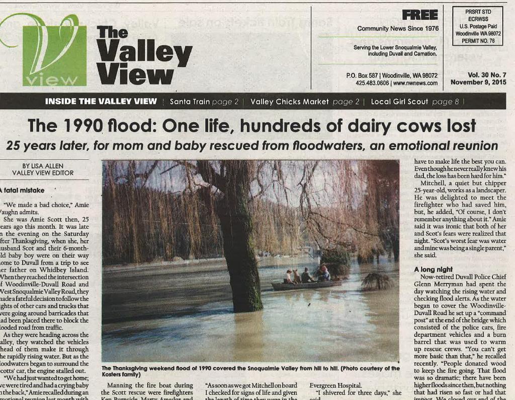
6 Flood history The valley floods every winter. Several times each year Early November through March One or more roads closed Significant traffic disruptions
7

8 Flood history Major floods approx. 5 year intervals No road access * So we re due for a big one!
9 Predictable road closures 1) NE Tolt Hill Road 2) NE 124 th 3) NE Carnation Farm Road 4) 203 south of Carnation 5) 203 north of Duvall 6) Woodinville-Duvall Road. Note, the Woodinville Duvall Road rarely closes

10 Four roads in/out of Duvall
 NO ALTERNATIVES Re-open south to north Many")
11 Complete isolation Some roads closed 4 to 5 days. All roads closed: Generally between 24 to 36 hours (plus repairs) NO ALTERNATIVES Re-open south to north Many factors Rainfall quantity and duration Snohomish/Skykomish River Tides

12 Flood consequences Disruptive In Duvall/lower valley some flooded homes and farms Most flood plain residents know the routine Risk to life

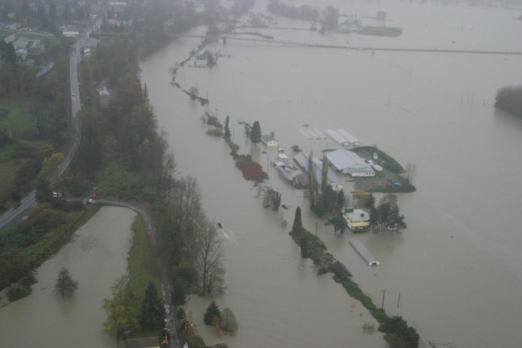
13 Flood consequences History 1990 Wood-Duvall Rd 1995 Tolt Hill Road th Ave NE 2006 Wood-Duvall Bridge 2015 West Snoq River Road

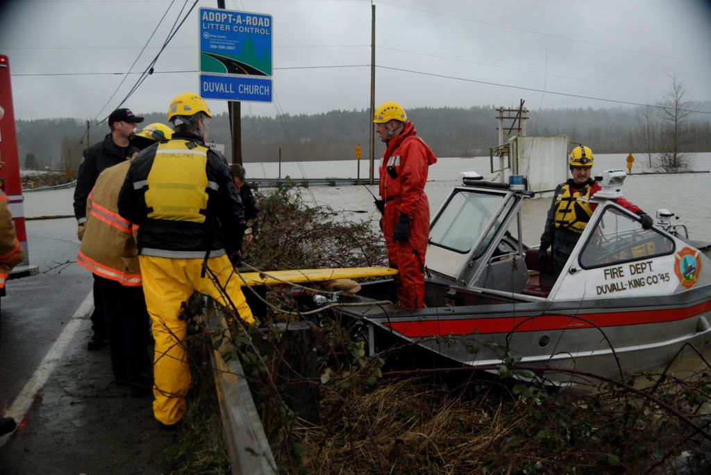
14 Flood warning Unlike earthquakes and fires. We know when floods will occur! Approx. 2 to 3 days notice

15 National Weather Service Summer flows Snoqualmie River at Carnation Sept 2016

16 National Weather Service Moderate Flooding December 2015 Limited road closures

17 National Weather Service Major flooding December 2015 Woodinville Duvall Road predicted to close

18 King County Alerts Website

19 King County King County flood warnings and alerts

20 Date For comparison, river levels in September Sum of the forks Near Snoqualmie Near Carnation, CFS Near Carnation Ft Sept 4, cfs

21 Photo: Seattle Times, January 2009

22 Emergency services When major floods are expected: Duvall Fire extra staff Redmond Medic One sends a crew Woodinville Fire will meet us and transport urgent patients Airlift NW will fly critical patients Private ambulances will meet us and transport less critical patients
23

24 Loading a patient for transport to Harborview

25 Medical evacuations Normal medical procedures on a normal day you drive. Normal medical procedures during a major flood we drive! Call 911, explain it is not an emergency.

26 Community Preparedness Shelters Last major flood, City, CERT, and Red Cross opened a shelter Mostly for people trapped in Duvall

27 Traffic control Barricades Main light controlled by Duvall Police West Snoqualmie lights = King County

28 Flood advice Sign up for flood and road alerts Learn where to look for flood information Monitor flood and weather information Practice good emergency preparedness by stocking supplies year round DO NOT DRIVE THROUGH FLOOD WATERS!

29 Windstorm frequency Major storms every 10 to 10 years. Some of the biggest: Hanukah Eve Storm in December 2006 Inauguration Day Storm, January 1993 Columbus Day Storm 1962 Smaller, but disruptive storms happen almost yearly. And usually on Thanksgiving!

30 Windstorm impacts Hanukah Eve Storm in December 2006 Winds up to 89 mph 14 deaths in Western Washington* Power out in Duvall 7 days Power out longer in outlying areas Grocery stores closed No gasoline Schools closed 11 days * 8 killed by carbon monoxide

31 Snow and ice storms January 2012 snow storm January 2004 ice storm December 1996-January 1997 snow storm
 wires Property damage from freezing temps and falling")
32 Snow and ice storm impacts Roads closed for days, especially in east portion of the district No power Frozen water lines Downed (live) wires Property damage from freezing temps and falling trees
33 Earthquakes Not winter related but preparation is essential! Date Name Magnatude Deaths Injuries Damage Feb 2, 2001 Nisqually $1 to 4 billion July 3, 1999 Satsop $8.1 million May 2, 1995 Duvall None reported April 29, 1965 November 11, 1962 Puget Sound Clark County $12.5 million 5.2 Minor April 13, 1949 Olympia $25 million
 King County Traffic")
34 Links Alert King County King County Flood Alerts King County Road Alerts King County Flood Warning Center Duvall Mobile Flood and Snowmagedddan Page (Jim Gale) King County Traffic Cameras

35 More links City of Duvall road closure info National Weather Service Seattle National Weather Service River Observations Duvall Fire - emergency prep Tolt Reservoir

36 Emergency preparedness information Carnation Duvall Citizen Corps King County Emergency Management WA State Emergency Management
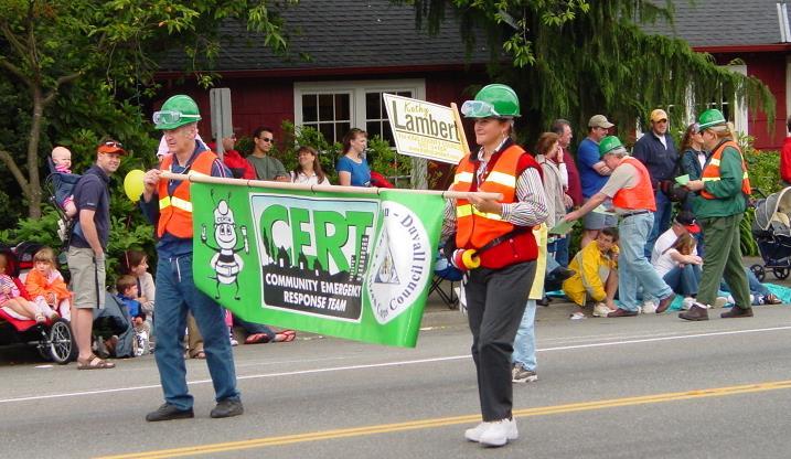
37 CERT
38 Questions?
HAZARD DESCRIPTION... 1 LOCATION... 1 EXTENT... 1 HISTORICAL OCCURRENCES...
 WINTER STORM HAZARD DESCRIPTION... 1 LOCATION... 1 EXTENT... 1 HISTORICAL OCCURRENCES... 3 SIGNIFICANT PAST EVENTS... 4 PROBABILITY OF FUTURE EVENTS... 5 VULNERABILITY AND IMPACT... 5 Hazard Description
Tornadoes pose a high risk because the low atmospheric pressure, combined with high wind velocity, can:
 Tornadoes are powerful, circular windstorms that may be accompanied by winds in excess of 200 miles per hour. Tornadoes typically develop during severe thunderstorms and may range in width from several
WINTER STORM Annex II
 WINTER STORM Annex II I. PURPOSE A. This annex has been prepared to ensure a coordinated response by state agencies to requests from local jurisdictions to reduce potential loss of life and to ensure essential
Tornadoes. Tornadoes COMMUNITY EMERGENCY RESPONSE TEAM TORNADOES
 Tornadoes Tornadoes Tell the participants that tornadoes are powerful, circular windstorms that may be accompanied by winds in excess of 200 miles per hour. Tornadoes typically develop during severe thunderstorms
SIGNIFICANT EVENTS Severe Storms November 1994 January 1996 August 1998 and May 2000 March 2002 May 2002 Champaign County
 SIGNIFICANT EVENTS Severe Storms November 1994 On Nov. 1, 1994, high winds gusted over 60 mph at times across the northwest third of Ohio. The highest measured wind gust was 63 mph at Columbus Grove (Putnam).
Kentucky Weather Hazards: What is Your Risk?
 Kentucky Weather Hazards: What is Your Risk? Stuart A. Foster State Climatologist for Kentucky 2010 Kentucky Weather Conference Bowling Green, Kentucky January 16, 2010 Perspectives on Kentucky s Climate
President s Day Weekend Storm Community Meeting and Workshop April 17, 2017
 President s Day Weekend Storm Community Meeting and Workshop April 17, 2017 Meeting outline 1. Progress update on the City of San Jose s recovery efforts 2. Water district presentation on: Weather situation
TORNADOES. DISPLAY VISUAL A Tornado Is... Tornadoes can: Rip trees apart. Destroy buildings. Uproot structures and objects.
 TORNADOES Introduce tornadoes by explaining what a tornado is. DISPLAY VISUAL A Tornado Is... A powerful, circular windstorm that may be accompanied by winds in excess of 250 miles per hour. Tell the participants
COMMUNITY EMERGENCY RESPONSE TEAM TORNADOES
 Tornadoes are powerful, circular windstorms that may be accompanied by winds in excess of 200 miles per hour. Tornadoes typically develop during severe thunderstorms and may range in width from several
Flood Scenario Worksheet
 Flood Scenario Worksheet Scenario adapted from: http://www.epa.gov/watersecurity/tools/trainingcd/simple/source/scenario-8/ssc8-0.pdf Simple Tabletop Exercise, Interdependency Natural Disaster Scenario,
IWT Scenario 2 Integrated Warning Team Workshop National Weather Service Albany, NY October 31, 2014
 IWT Scenario 2 Integrated Warning Team Workshop National Weather Service Albany, NY October 31, 2014 09 10 11 12 13 Scenario 2 Timeline December 9-13 Tue Wed Thu Fri Sat Tue, Dec. 9 @ 5 am 2014 2014 2014
Winter Storm Update. Through Late Afternoon: Jacksonville, FL Weather Forecast Office. Northeast Florida and Southeast Georgia
 Winter Storm Update Through Late Afternoon: Winter Storm Warning for all of Southeast GA and portions of Suwannee Valley and I-10 Corridor west of Jacksonville. Dangerous ice storm expected from Live Oak
Daily Operations Briefing Tuesday, January 6, :30 a.m. EST
 Daily Operations Briefing Tuesday, January 6, 2015 8:30 a.m. EST Significant Activity: Jan 5-6 Significant Events: Flooding Western WA - FINAL Significant Weather: Snow Northern/Central Rockies to Northern/Central
Major Winter Storm to impact Western Washington. 17 January 2012 National Weather Service Seattle/Tacoma
 Major Winter Storm to impact Western Washington 17 January 2012 National Weather Service Seattle/Tacoma Current Warnings Winter Storm Warning for all of Western Washington, except: Northwest interior Extreme
Weather Briefing. Coastal Storm Monday-Wednesday Dec 8-10, National Weather Service. Prepared 12/8/14 6:30 AM
 Weather Briefing Coastal Storm Monday-Wednesday Dec 8-10, 2014 National Weather Service http://www.weather.gov/nyc Prepared 12/8/14 6:30 AM Overview of Potential Hazards A strong low pressure system will
United States Multi-Hazard Early Warning System
 United States Multi-Hazard Early Warning System Saving Lives Through Partnership Lynn Maximuk National Weather Service Director, Central Region Kansas City, Missouri America s s Weather Enterprise: Protecting
Daily Operations Briefing Monday, February 13, :30 a.m. EST
 Daily Operations Briefing Monday, February 13, 2017 8:30 a.m. EST Significant Activity Feb 10-13 Significant Events: Oroville Dam Spillway Erosion CA Significant Weather: Heavy Snow Southwest to Southern
We Had No Warning An Overview of Available Forecast Products Before and During Severe Weather Events
 We Had No Warning An Overview of Available Forecast Products Before and During Severe Weather Events Two main sources for severe weather info NOAA/NWS Storm Prediction Center (SPC) Convective Outlooks
Dunn County Snow Removal Policy
 Dunn County Snow Removal Policy OVERVIEW With the advent of another winter season in the northern plains comes the possibility of snow, freezing rain and slippery roadways, and area resident s concern
Hazardous Weather and Flooding Preparedness. Hazardous Weather and Flooding Preparedness
 Hazardous Weather and Flooding Preparedness 1 A Cooperative Effort 2 Administrative Information Emergency exits and procedures Location of restrooms Mobile devices Procedure for questions Course materials
Table-Top Exercise for Emergency Preparedness Evaluation: Little Anse, Isle Madame
 Table-Top Exercise for Emergency Preparedness Evaluation: Little Anse, Isle Madame Alexander Chung, M.Sc. Candidate C-Change Student Research Associate May 2013 The Community of Little Anse Coastal community
Unit 4. This unit will enable you to improve coordination and communication with State and local agencies when hazardous weather threatens.
 Unit 4 This unit will enable you to improve coordination and communication with State and local agencies when hazardous weather threatens. In this unit we will discuss the role of Emergency Managers in
A HURRICANE IS COMING. Presented by Atiba Upchurch Broward Emergency Management Division
 A HURRICANE IS COMING Presented by Atiba Upchurch Broward Emergency Management Division Mission Statement To safeguard the lives and property of the people of Broward County from major hazards and emergencies
Thursday, May 17, :30 a.m. EDT
 Thursday, May 17, 2018 8:30 a.m. EDT Significant Activity May 16-17 Significant Events: Kīlauea Volcano eruption Tropical Activity: Western Pacific no activity affecting U.S. interests Significant Weather:
Colorado Front Range Wildfires Situation Report #7 Monday, July 02, :15 AM (MDT)
") Colorado Front Range Wildfires Situation Report #7 Monday, July 02, 2012 10:15 AM (MDT) Mandatory evacuations for the Waldo Canyon fire have been reduced from 35,000 to 3,000. Remaining evacuations are
Colorado Front Range Wildfires Situation Report #7 Monday, July 02, 2012 10:15 AM (MDT) Mandatory evacuations for the Waldo Canyon fire have been reduced from 35,000 to 3,000. Remaining evacuations are
Winter Weather Threat Friday night and Saturday January 7, 2017
 Winter Weather Threat Friday night and Saturday January 7, 2017 National Weather Service Newport/Morehead City, NC Date/Time Created: 1/6/2017, 6 AM EST Winter Weather Threat Summary Tonight and Saturday
EMERGENCY WARNING SYSTEM PROCEDURES FOR DEBRIS FLOWS IN WESTERN OREGON
 EMERGENCY WARNING SYSTEM PROCEDURES FOR DEBRIS FLOWS IN WESTERN OREGON Updated: 12/03/2007 by the Oregon Department of Forestry and the Oregon Department of Geology and Mineral Industries Debris flows
SCHOOL EMERGENCY MANAGEMENT PLAN FOR NATURAL DISASTERS
 SCHOOL EMERGENCY MANAGEMENT PLAN FOR NATURAL DISASTERS MANAGING EMERGENCIES EFFECTIVELY Keith Thomas, Loss Prevention & Risk Manager LEADERSHIP, ADVOCACY AND SERVICE FOR MANITOBA S PUBLIC SCHOOL BOARDS
SITUATION REPORT. Hurricane Nate. Operational Period: October 8, to October 9,
 SITUATION REPORT Hurricane Nate Operational Period: October 8, 2017 0800 to October 9, 2017 0759 CURRENT SITUATION 2:00 p.m. Briefing Hurricane Nate WEATHER SUMMARY All watches and warnings discontinued.
Daily Operations Briefing. Sunday, March 4, :30 a.m. EST
 Daily Operations Briefing Sunday, March 4, 2018 8:30 a.m. EST Significant Activity Mar 3-4 Significant Events: Northeast coastal storm Tropical Activity: Western Pacific No activity affecting U.S. interests
Saturday, April 14, :30 a.m. EDT
 Saturday, April 14, 2018 8:30 a.m. EDT Significant Activity April 13-14 Significant Events: Severe Weather Southern/Central Plains and Lower/Middle Mississippi Valley Tropical Activity: Western Pacific
THE WEATHER CASE STUDIES
 THE WEATHER CASE STUDIES Hedi Maurer, NEA (Panteia) Athens, 23.04.2012 Case studies, regions and modes 1. Flood of 2002 in Eastern Germany 2. Summer heat 2007 in Southern Europe 3. Flooding of the rail
ICE STORM! Emergency Preparedness Exercise February 20, 2008
 ICE STORM! Emergency Preparedness Exercise February 20, 2008 Exercise Objectives 1. To identify issues to consider when planning for an ice storm emergency. 2. To encourage development of an operational
WEATHER SYSTEMS IMPACTING THE CAYMAN ISLANDS Prepared by the staff of the Cayman Islands National Weather Service
 WEATHER SYSTEMS IMPACTING THE CAYMAN ISLANDS 2008 Prepared by the staff of the Cayman Islands National Weather Service TROPICAL STORM DOLLY Formed 194 miles west of Grand Cayman July 19 th. The tropical
El Niño Update Impacts on Florida
 Current Issues in Emergency Management (CIEM) Sessions 1 &2 October 12 th and 26 th, 2006 Florida Division of Emergency Management Tallahassee, Florida El Niño Update Impacts on Florida Bart Hagemeyer
Daily Operations Briefing. Saturday, March 17, :30 a.m. EDT
 Daily Operations Briefing Saturday, March 17, 2018 8:30 a.m. EDT Significant Activity Mar 16-17 Significant Events: None Tropical Activity: Western Pacific No activity affecting U.S. interests Significant
16 th Nov 1771 Solway Moss Landslide 20 farmhouses buried 1908 Train blown off Ulverston Viaduct September 20 th 1919 Heavy snowfall down to 800ft
 Extreme Weather Events 1771-2007 Date Event 16 th Nov 1771 Solway Moss Landslide 20 farmhouses buried 1908 Train blown off Ulverston Viaduct September 20 th 1919 Heavy snowfall down to 800ft February 1932
Evaluation of NDDOT Fixed Automated Spray Technology (FAST) Systems November 24, 2009
 Systems November 24, 2009") Evaluation of NDDOT Fixed Automated Spray Technology (FAST) Systems November 4, 009 Shawn Birst, PE Program Director, ATAC Associate Research Fellow Upper Great Plains Transportation Institute North Dakota
Evaluation of NDDOT Fixed Automated Spray Technology (FAST) Systems November 4, 009 Shawn Birst, PE Program Director, ATAC Associate Research Fellow Upper Great Plains Transportation Institute North Dakota
STEUBEN COUNTY, NEW YORK. Hazard Analysis Report
 STEUBEN COUNTY, NEW YORK Hazard Analysis Report Prepared by: April 1, 2014 Background On April 1, 2014 the Steuben County Office of Emergency Management conducted a hazard analysis using the automated
Severe Weather Hazards Are Real
 Severe Weather Hazards Are Real In the past 10 years, more than 40 people have died and dozens more injured as a result of weatherrelated events in Minnesota (not including motor vehicles.) The top severe
Superstorm Sandy What Risk Managers and Underwriters Learned
 Superstorm Sandy What Risk Managers and Underwriters Learned Gary Ladman Vice President, Property Underwriting AEGIS Insurance Services, Inc. Superstorm Sandy Change in the Weather Recent years appears
Residents Emergency Response Checklist
 COMMUNITY RESILIENCE PLAN Residents Emergency Response Checklist A helpful guide in the event of extreme weather or bushfire events. < PREVIOUS I NEXT > 02 Purchasing an existing property or building a
The Leader in Landscape Solutions
 The Leader in Landscape Solutions Emergency Action Plan Hurricane Preparedness Go To Mainscape.com For More Information! Purpose: To provide the Federation at Kings Point and their residents an informative
Natural Disasters and Storms in Philadelphia. What is a storm? When cold, dry air meets warm, moist (wet) air, there is a storm.
 air, there is a storm.") Natural Disasters and Storms in Philadelphia 1. What is a natural disaster? 2. Does Philadelphia have many natural disasters? o Nature (noun) everything in the world not made No. Philadelphia does not
Natural Disasters and Storms in Philadelphia 1. What is a natural disaster? 2. Does Philadelphia have many natural disasters? o Nature (noun) everything in the world not made No. Philadelphia does not
Sunday, December 2, :30 a.m. EST
 Sunday, December 2, 2018 8:30 a.m. EST Significant Activity Dec 1-2 Significant Events: Earthquake Alaska Tropical Activity: Western Pacific No activity affecting U.S. interests Significant Weather: Winter
Monday, May 28, :30 a.m. EDT
 Monday, May 28, 2018 8:30 a.m. EDT Significant Activity May 27-28 Significant Events: Subtropical Storm Alberto; Ellicott City, MD flooding Tropical Activity: Atlantic Subtropical Storm Alberto Significant
Daily Operations Briefing Wednesday, April 5, :30 a.m. EDT
 Daily Operations Briefing Wednesday, April 5, 2017 8:30 a.m. EDT Significant Activity Apr 4-5 Significant Events: Severe Weather Southern Plains to Southeast Significant Weather: Severe thunderstorms &
Emergency Preparedness Questions
 Emergency Preparedness Questions 1. A family emergency plan should NOT include which of the following? a) Information about your children's school(s) b) The name and phone number of an out-of-town contact
Severe Weather. Copyright 2006 InstructorWeb
 Severe Weather People need to know what the weather is going to do. Sometimes severe weather can happen. Severe weather can cause property damage, injuries to people and animals, and even loss of life.
El Niño & Expected Florida Severe Weather
 El Niño & Expected Florida Severe Weather Brady Smith, AICP, CFM Tampa Bay Regional Planning Council brady@tbrpc.org ONE BAY Resilient Communities Working Group Meeting February 5, 2016 El Niño & Expected
The Colorado Drought of 2002 in Perspective
 The Colorado Drought of 2002 in Perspective Colorado Climate Center Nolan Doesken and Roger Pielke, Sr. Prepared by Tara Green and Odie Bliss http://climate.atmos.colostate.edu Known Characteristics of
Analysis of fatalities attributed to Hurricane Florence in the US.
 Analysis of fatalities attributed to Hurricane Florence in the US. Jonathan van Leeuwen Hurricane Florence impacted the US East Coast in September 2018 resulting in dangerous surf conditions, strong winds,
Daily Operations Briefing. Friday, May 5, :30 a.m. EDT
 Daily Operations Briefing Friday, May 5, 2017 8:30 a.m. EDT Significant Activity May 4-5 Significant Events: Flooding Southern/Central Plains Significant Weather: Flash flooding possible Mid-Atlantic through
Weather in Saskatchewan. John Paul Cragg Warning Preparedness Meteorologist Environment and Climate Change Canada
 Weather in Saskatchewan John Paul Cragg Warning Preparedness Meteorologist Environment and Climate Change Canada The Climate of Saskatchewan -35 Average January Low Temperature -30-25 -20-15 -10-5 0 5
Also, when Cascade volcanoes do erupt, high-speed avalanches of pyroclastic flows
 INTRODUCTION A volcano is a vent through which molten rock escapes to the Earth s surface. Unlike other mountains, which are pushed up from below, volcanoes are built by surface accumulation of their eruptive
Welcome Jeff Orrock Warning Coordination Meteorologist National Weather Service Raleigh
 Welcome Jeff Orrock Warning Coordination Meteorologist National Weather Service Raleigh Jeff.orrock@noaa.gov Sources: Operational Significant Event Imagery and the Environmental Applications Team (EAT)
Section 12. Winter Storms
 Section 12. Winter Storms Contents Why Winter Storms are a Threat...12-1 Hazard Profile...12-1 History of Winter Storms...12-4 People and Property at Risk...12-7 Potential Damages and Losses...12-7 Why
Severe Weather Watches, Advisories & Warnings
 Severe Weather Watches, Advisories & Warnings Tornado Watch Issued by the Storm Prediction Center when conditions are favorable for the development of severe thunderstorms and tornadoes over a larger-scale
Daily Operations Briefing. Monday, April 2, :30 a.m. EDT
 Daily Operations Briefing Monday, April 2, 2018 8:30 a.m. EDT Significant Activity Mar 31-April 2 Significant Events: None Tropical Activity: No significant activity Significant Weather: Heavy Snow Northern
Coastal Storm. Wednesday through Friday, 3/6-8/2013 Weather Briefing
 Coastal Storm Wednesday through Friday, 3/6-8/2013 Weather Briefing Prepared 2:00 PM EST Wednesday, March 6, 2013 National Weather Service New York, NY Purpose of Briefing Promote Situational Awareness
The Climate of Payne County
 The Climate of Payne County Payne County is part of the Central Great Plains in the west, encompassing some of the best agricultural land in Oklahoma. Payne County is also part of the Crosstimbers in the
NWS HURRICANES June 3, 2015
 NWS HURRICANES June 3, 2015 Hurricane Season June 1 November 30 2 What s the concern? All tropical systems passing within 125nm of central Maryland since 1950 Mid-Atlantic Hurricanes Greatest Risk: August
PUBLIC SAFETY POWER SHUTOFF POLICIES AND PROCEDURES
 PACIFIC GAS AND ELECTRIC COMPANY PUBLIC SAFETY POWER SHUTOFF POLICIES AND PROCEDURES SEPTEMBER 2018 1 PACIFIC GAS AND ELECTRIC COMPANY PUBLIC SAFETY POWER SHUTOFF POLICIES AND PROCEDURES SEPTEMBER 2018
2011 Year in Review TORNADOES
 2011 Year in Review The year 2011 had weather events that will be remembered for a long time. Two significant tornado outbreaks in April, widespread damage and power outages from Hurricane Irene in August
Wednesday, May 23, :30 a.m. EDT
 Wednesday, May 23, 2018 8:30 a.m. EDT Significant Activity May 22-23 Significant Events: Kīlauea Volcano eruption Tropical Activity: Atlantic Invest 90L MEDIUM chance (60%) Significant Weather: Severe
CITY OF MINOT SNOW REMOVAL PLAN November 2017
 CITY OF MINOT SNOW REMOVAL PLAN November 2017 1.0 GENERAL This plan has been written to provide information regarding snow removal procedures and policies. The plan provides guidance, while maintaining
The hydrologic service area (HSA) for this office covers Central Kentucky and South Central Indiana.
 for this office covers Central Kentucky and South Central Indiana.") January 2012 February 13, 2012 An X inside this box indicates that no flooding occurred within this hydrologic service area. January 2012 continued the string of wet months this winter. Rainfall was generally
January 2012 February 13, 2012 An X inside this box indicates that no flooding occurred within this hydrologic service area. January 2012 continued the string of wet months this winter. Rainfall was generally
Severe Thunderstorms
 Severe Thunderstorms Severe Thunderstorms Explain that, while all thunderstorms are dangerous, the National Weather Service (NWS) defines a severe thunderstorm as one that: Display Slide Th-0 Produces
Flooding in Western North Carolina: Some Spatial, Hydrologic, and Seasonal Characteristics CAUTION!! Outline. Basic Flood Facts.
 Flooding in Western North Carolina: Some Spatial, Hydrologic, and Seasonal Characteristics J. Greg Dobson CAUTION!! National Environmental Modeling and Analysis Center RENCI at UNC-Asheville Engagement
Wednesday, May 30, :30 a.m. EDT
 Wednesday, May 30, 2018 8:30 a.m. EDT Significant Activity May 29-30 Significant Events: Remnants of Tropical Depression Alberto Tropical Activity: Western Pacific No activity affecting U.S. interests
Significant Coastal Storm Today through Thursday, 11/7-8. Weather Briefing
 Significant Coastal Storm Today through Thursday, 11/7-8 Weather Briefing Prepared 10:00 am EST Wednesday, November 7, 2012 Presented by Gary Conte, Warning Coordination Meteorologist NOAA s National Weather
ICE STORM! a mini tabletop exercise for home care agencies
 1 ICE STORM! a mini tabletop exercise for home care agencies HCA Education and Research Winter 2010 2011 2 What is a tabletop exercise? People come together to review and discuss a hypothetical emergency
Daily Operations Briefing Monday, March 13, :30 a.m. EDT
 Daily Operations Briefing Monday, March 13, 2017 8:30 a.m. EDT Significant Activity Mar 10-13 Significant Events: Nor easter Northeastern U.S. March 13-14 Significant Weather: Heavy snow possible Mid-Atlantic
Daily Operations Briefing. Tuesday, January 9, :30 a.m. EST
 Daily Operations Briefing Tuesday, January 9, 2018 8:30 a.m. EST Significant Activity Jan 8-9 Significant Events: Flash Flooding CA Tropical Activity: None Significant Weather: Heavy rain and Thunderstorms
Jim Witt Long Range Calendar
 Jim Witt Long Range Calendar 2012-2013 November 2012 Toll Free 1-0-287-03 Studio Line (207) 9- Generally 20 40 50 60 70 0 Generally Cloudy, Cool Change Of Rain Or Wet Snow (Heavy) Changing To Rain 1 120
2014 Annual Mitigation Plan Review Meeting
 2014 Annual Mitigation Plan Review Meeting Highland County EMA MEETING OBJECTIVES Understand Your Natural Disaster Risk Review of Previous Plans Current Plan Status Future Activity Plan/Needs of Each Community
Daily Operations Briefing Friday, May 8, :30 a.m. EDT
 Daily Operations Briefing Friday, May 8, 2015 8:30 a.m. EDT Significant Activity: May 7-8 Significant Events: Severe weather Central/Southern Plains Tropical Activity: Atlantic: Subtropical Storm Ana Western
Daily Operations Briefing December 25, 2012 As of 6:30 a.m. EST
 Daily Operations Briefing December 25, 2012 As of 6:30 a.m. EST 1 Significant Activity: Dec 24-25 Significant Events: Possible Severe thunderstorms - Gulf Coast Sandy/Nor easter recovery Significant Weather:
Daily Operations Briefing Wednesday, February 15, :30 a.m. EST
 Daily Operations Briefing Wednesday, February 15, 2017 8:30 a.m. EST Oroville Dam Spillway Erosion CA Situation Erosion on the main spillway is not expected to expand further upstream and approach the
Exercise Brunswick ALPHA 2018
 ALPHA Exercise Brunswick ALPHA 2018 Who we are (our structure) What we do (our forecasts) How you can access the information Tropical cyclone information (basic) Overview of the products used for Exercise
Volcanoes. Introduction
 Volcanoes Introduction Display Slide V-0 Explain that a volcano is a vent through which molten rock escapes to the Earth s surface. Unlike other mountains, which are pushed up from below, volcanoes are
Daily Operations Briefing Thursday, April 6, :30 a.m. EDT
 Daily Operations Briefing Thursday, April 6, 2017 8:30 a.m. EDT Significant Activity Apr 5-6 Significant Events: Severe Weather Southeast and Mid-Atlantic Significant Weather: Severe thunderstorms possible
NOAA s National Weather Service. National Weather Service
 NOAA s National Weather Service Serving the Nation s Environmental Forecasting Needs Lynn Maximuk Regional Director National Weather Service Central Region Headquarters Kansas City, Missouri America s
Flood Risk Assessment
 Flood Risk Assessment February 14, 2008 Larry Schick Army Corps of Engineers Seattle District Meteorologist General Assessment As promised, La Nina caused an active winter with above to much above normal
Tuesday, May 29, :30 a.m. EDT
 Tuesday, May 29, 2018 8:30 a.m. EDT Significant Activity May 25-29 Significant Events: Subtropical Depression Alberto; Flooding Ellicott City, MD; Kīlauea Volcano Tropical Activity: Atlantic Subtropical
Daily Operations Briefing Wednesday, March 1, :30 a.m. EST
 Daily Operations Briefing Wednesday, March 1, 2017 8:30 a.m. EST Significant Activity Feb 28-Mar 1 Significant Events: Severe Weather Midwest to East Coast Significant Weather: Severe Thunderstorms Lower
Daily Operations Briefing Tuesday, April 4, :30 a.m. EDT
 Daily Operations Briefing Tuesday, April 4, 2017 8:30 a.m. EDT Significant Activity Apr 3-4 Significant Events: Severe Weather Southern Plains to Southeast Significant Weather: Severe Thunderstorms and
Complete Weather Intelligence for Public Safety from DTN
 Complete Weather Intelligence for Public Safety from DTN September 2017 White Paper www.dtn.com / 1.800.610.0777 From flooding to tornados to severe winter storms, the threats to public safety from weather-related
IN VEHICLES: Do not try to outrun a tornado. Abandon your vehicle and hide in a nearby ditch or depression and cover your head.
 TORNADO SAFETY TORNADO! The very word strikes fear in many people. While a tornado is perhaps nature's most destructive storm, deaths and injuries can be prevented. By following Tornado Safety Rules, lives
The hydrologic service area (HSA) for this office covers Central Kentucky and South Central Indiana.
 for this office covers Central Kentucky and South Central Indiana.") MONTH YEAR January 2011 February 15, 2011 X An X inside this box indicates that no flooding occurred within this hydrologic service area. January 2011 was drier than normal in all locations in the area.
MONTH YEAR January 2011 February 15, 2011 X An X inside this box indicates that no flooding occurred within this hydrologic service area. January 2011 was drier than normal in all locations in the area.
4.4 Assessing Vulnerability: Estimating Potential Losses
 4.4 Assessing Vulnerability: Estimating Potential Losses This section presents exposure, damage, and loss estimates, for each of the 8 hazards evaluated. The findings support planning efforts based on
Running Head: HAZARD MITIGATION PLAN OUTLINE FOR MISSISSIPPI 1
 Running Head: HAZARD MITIGATION PLAN OUTLINE FOR MISSISSIPPI 1 Hazard Mitigation Plan Outline for Mississippi Name: Institution: HAZARD MITIGATION PLAN OUTLINE FOR MISSISSIPPI 2 Hazard Mitigation Plan
A summary of the Local Climate Impacts Profile for Nottingham
 A summary of the Local Climate Impacts Profile for Nottingham Understanding the local impacts of extreme weather events on public services, places and people, helping us to prepare for future climate change
Daily Operations Briefing Sunday, January 8, :30 a.m. EST
 Daily Operations Briefing Sunday, January 8, 2017 8:30 a.m. EST Significant Activity Jan 6-8 Significant Events: Heavy Precipitation forecast to impact CA and NV Significant Weather: Freezing rain Pacific
Winter Weather. National Weather Service Buffalo, NY
 Winter Weather National Weather Service Buffalo, NY Average Seasonal Snowfall SNOWFALL = BIG IMPACTS School / government / business closures Airport shutdowns/delays Traffic accidents with injuries/fatalities
Hurricane Preparation and Recovery. October 11, 2011 Jon Nance, Chief Engineer, NCDOT
 Hurricane Preparation and Recovery October 11, 2011 Jon Nance, Chief Engineer, NCDOT North Carolina & Severe Weather Our state often bears the brunt of storms, which include: Ice storms Snow storms Heavy
2008 Hurricane Caravan. Daniel Noah Meteorologist National Weather Service x1 May 22, 2008
 2008 Hurricane Caravan Daniel Noah Meteorologist National Weather Service daniel.noah@noaa.gov, 813-645-2323 x1 May 22, 2008 National Weather Service We never close! Open 24 hours a day 365 days per year
2018 Year in Review for Central and Southeast Illinois By: Chris Geelhart, Meteorologist National Weather Service, Lincoln IL
 By: Chris Geelhart, Meteorologist National Weather Service, Lincoln IL While 2018 featured some significant out-of-season weather, including below zero temperatures in April and 90-degree highs in early
Jan 7, 2017 Winter Weather Event
 Jan 7, 2017 Winter Weather Event Decision Support Briefing # 5 Assessment for northeast South Carolina & southeast North Carolina National Weather Service Wilmington NC 4 PM EST Friday January 6, 2017