Storm Surge/Coastal Inundation State of the Union. Jamie Rhome Storm Surge Team Lead NOAA/National Hurricane Center
|
|
|
- Lindsey Houston
- 5 years ago
- Views:
Transcription


1 Storm Surge/Coastal Inundation State of the Union Jamie Rhome Storm Surge Team Lead NOAA/National Hurricane Center

2 2

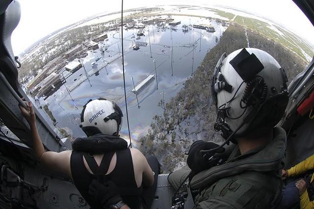
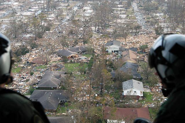
3 Tampa: Cat 5 Scenario 3
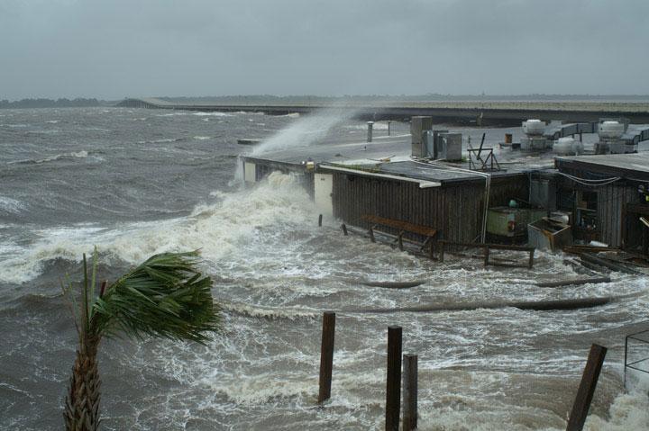
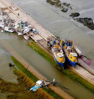
4 4 The Stakes are High Combination of SLR and increasing coastal population density is making our Nation increasingly vulnerable to storm surge/coastal inundation Why: rising sea-level provides a higher base for future surge/inundation events thus producing an increasing threat to: Coastal communities Ecosystems (wetlands, critical species, habitat loss, etc) Transportation systems (highway systems, ports, rail) Economic viability (tourism, transport of goods, natural resources) Energy
5 5 Vulnerability From , population density increased in coastal counties by 28% (Crossett et al., 2004) Over half of the Nation s economic productivity is located within coastal zones 72% of ports, 27% of major roads, and 9% of rail lines within the Gulf Coast region are at or below 4 ft elevation (CCSP, SAP 4-7) Storm surge of 23 ft: 67% of interstates, 57% of arterials, almost half of rail miles, 29 airports, and virtually all ports in the Gulf Coast area subject to inundation (CCSP SAP 4-7)
 Increased vulnerability to storm surge/inundation Lack of")

6 6 Perspective Surge/Inundation threat is increasing Coastal population trends and sea-level rise (SLR) Increased vulnerability to storm surge/inundation Lack of coordination across spectrum of storm surge/inundation community Disjointed data sources Conflicting efforts Insufficient coordination Inefficient integration of new S&T
7 7 Storm Surge Does Not Fit Into a Single Box Storm surge/inundation Atmospheric Sciences Oceanography
8 8 Expertise Needed for Storm Surge/Coastal Inundation GIS Remote Sensing/Lidar Oceanography Emergency management Statistics Modeling Sociology What agency houses all this expertise Instrumentation Physics Bathymetry Cartography Meteorology Geology Coastal Morphology Geodesy
9 9 Partnering Agencies FEMA Mitigation, planning, mapping, response & recovery, post-storm observations, and education, NASA Remote sensing (LIDAR, altimetry) USGS Storm tide observations, mapping U.S. ACE Modeling, S&T, shore/community protection NOAA Prediction, warning, S&T, modeling, mapping, real-time weather & water observations, remote sensing, coastal land use and resiliency, and outreach/education NIST Risk-based storm surge maps for design in coastal regions
10 10 Current Challenges No overarching storm surge/coastal inundation coordination body results in: Insufficient inter/intra-governmental coordination and communication especially in strategic planning No mechanism for cost sharing Lack of framework and standards Models Observations Verification Poor linkage between government/academia Inability to fully incorporate all necessary disciplines Inconsistent message
11 11 Do We Have a Community Approach? Community Approach A team drawn from all parts of the community Common ownership Group of participants having common interests and goals Group of interdependent individual/entities efficiently interacting with each other
12 12 Conclusion We don t have a functional community-based method The lack of a community approach is hindering progress and limiting opportunity We are not adequately servicing the needs of our constituents/customers
13 13 Example HAZUS FEMA s software program for estimating potential losses from disasters Included models: earthquake, hurricane wind, and floods Currently lacks a storm surge component If surge could be added to HAZUS Which model would we use? What would be basis of decision? Who would develop/maintain model? Would that model incorporate the collective expertise of the entire community?
14 14 Establishing a Community Approach Communication: effectively translate findings into coherent information that can be easily understood by decision makers, the general public, and other scientists Coordination: consider findings not in isolation but as part of a broader knowledge base Sharing: strengthening collective efforts by pooling resources and expertise Governance: a body of individuals which consists of members from the community whose purpose is to set goals, develop plans, and oversee progress
15 15 Guidance President s National Science and Technology Council/Committee of Environment and Natural Resources/Subcommittee on Disaster Reduction (SDR) How can SDR help? The SDR facilitates US Government and private/academic activities to reduce vulnerability to natural hazards SDR has already developed priority science and technology interagency actions for coastal inundation that will help the Nation become more resilient


16 16 SDR Inundation Grand Challenges Provide hazard and disaster information where and when it is needed Understand the natural processes that produce hazards Develop hazard mitigation strategies and technologies Reduce the vulnerability of infrastructure Assess disaster resilience Promote risk-wise behavior
17 My Challenge to You Consider the SDR Grand Challenges Evaluate existing storm surge/coastal inundation research, data, and agency operating plans Identify gaps and areas of improvement Identify possible synergies Establish a road map and set priorities Establish clear roles for the participating agencies based on available resources, expertise, and infrastructure Consider how we can coordinate agency priorities, planning, and budget processes Consider what governance structure/mechanism the community needs to move forward 17
18 18 Storm Surge/Inundation Community Vision Coastal communities will be safer from storm surge/coastal inundation: Through improved observations, modeling, and decision support tools, forecasters will have the necessary information to improve forecasts, warnings, and lead time Coastal communities provided with necessary information, spanning appropriate time scales, to protect life and property Development of disaster resilient communities: Improved tools, datasets, and other coastal management information will promote sound coastal planning, policy making, and decisions


19 19 Partnerships for the Protection of Coastal Communities The objective is to: provide the right information in the right format at the right time to the right people to make the right decisions
NOAA Hurricane Forecast Improvement Project
 NOAA Hurricane Forecast Improvement Project Fred Toepfer Hurricane Forecast Improvement Project Manager November 9 th, 2009 Outline NOAA Hurricane Forecast Improvement Project Driving Issue Purpose NOAA
Coastal Inundation Forecasting Demonstration Project CIFDP. Flood Forecasting Initiative-Advisory Group (FFI-AG 3), Geneva, 5-7 Dec, 2017
, Geneva, 5-7 Dec, 2017") Coastal Inundation Forecasting Demonstration Project CIFDP Flood Forecasting Initiative-Advisory Group (FFI-AG 3), Geneva, 5-7 Dec, 2017 Coastal Flooding & Vulnerable Populations Coastal populations are
Coastal Inundation Forecasting Demonstration Project CIFDP Flood Forecasting Initiative-Advisory Group (FFI-AG 3), Geneva, 5-7 Dec, 2017 Coastal Flooding & Vulnerable Populations Coastal populations are
Hurricane Readiness for Coastal Communities
 Hurricane Readiness for Participant Guide Developed for: Federal Emergency Management Agency Emergency Management Institute 16825 South Seton Avenue Emmitsburg, MD 21727-8998 Developed by: C² Technologies,
TRB First International Conference on Surface Transportation Resilience
 TRB First International Conference on Surface Transportation Resilience Applying the Sea-Level Scenario Sketch Planning Tool to Enhance the Resilience of Long-Range Transportation Plans: Lessons Learned
Preliminary Vulnerability Assessment of Coastal Flooding Threats - Taylor County, Florida
 Preliminary Vulnerability Assessment of Coastal Flooding Threats - Taylor County, Florida North Central Florida Regional Planning Council Northeast Florida Regional Council April 28, 2016 BACKGROUND This
JCOMM-CHy Coastal Inundation Forecasting Demonstration Project (CIFDP)
") WMO World Meteorological Organization Working together in weather, climate and water JCOMM-CHy Coastal Inundation Forecasting Demonstration Project (CIFDP) Coastal Flooding & Vulnerable Populations Coastal
WMO World Meteorological Organization Working together in weather, climate and water JCOMM-CHy Coastal Inundation Forecasting Demonstration Project (CIFDP) Coastal Flooding & Vulnerable Populations Coastal
Improving global coastal inundation forecasting WMO Panel, UR2014, London, 2 July 2014
 Improving global coastal inundation forecasting WMO Panel, UR2014, London, 2 July 2014 Cyclone Sidr, November 2007 Hurricane Katrina, 2005 Prof. Kevin Horsburgh Head of marine physics, UK National Oceanography
17 th Session of RA IV
 17 th Session of RA IV Agenda Item 4.1: Disaster Risk Reduction, Resilience and Prevention, Focusing on Impact-Based Decision Support Services Doc 4.1.(6):Coastal Inundation Forecasting Demonstration Project
SOUTHEAST COASTAL ASSESSMENT: Creating a shared vision
 SOUTHEAST COASTAL ASSESSMENT: Creating a shared vision November 12, 2017 Jacqueline Keiser, PG, PMP Regional Sediment Management Regional Center of Expertise SOUTH ATLANTIC DIVISION U.S. ARMY CORPS OF
Storm Surge Analysis Update Meeting Cross City, Florida June 17, 2014
 Big Bend Coastal Storm Surge Study Storm Surge Analysis Update Meeting Cross City, Florida June 17, 2014 Introductions Risk MAP Project Team FEMA Region IV Florida Division of Emergency Management (FDEM)
The Coastal Change Analysis Program and the Land Cover Atlas. Rebecca Love NOAA Office for Coastal Management
 The Coastal Change Analysis Program and the Land Cover Atlas Rebecca Love NOAA Office for Coastal Management Natural Infrastructure = Greater Resilience NOAA C-CAP Regional Land Cover and Change coast.noaa.gov/digitalcoast/data/ccapregional
Coastal Inundation Forecasting Demonstration Project (CIFDP)
") WMO World Meteorological Organization Working together in weather, climate and water Coastal Inundation Forecasting Demonstration Project (CIFDP) WMO Technical Commission for Oceanography and Marine Meteorology
WMO World Meteorological Organization Working together in weather, climate and water Coastal Inundation Forecasting Demonstration Project (CIFDP) WMO Technical Commission for Oceanography and Marine Meteorology
Liana Talaue McManus. Division of Marine Affairs and Policy Rosenstiel School of Marine & Atmospheric Science University of Miami
 Liana Talaue McManus Division of Marine Affairs and Policy Rosenstiel School of Marine & Atmospheric Science University of Miami Outline 1. Coasts as vulnerable & resilient social ecological systems 2.
Miami-Dade County Overview
 Miami-Dade County Overview 2,000 square miles World s busiest cruise port 2.6 million residents Second busiest US airport for international travelers Gateway to the Caribbean and Latin America Natural
NOAA Surface Weather Program
 NOAA Surface Weather Program Maintenance Decision Support System Stakeholder Meeting #9 Jim O Sullivan NOAA Surface Weather Program Manager NWS Office of Climate, Water, and Weather Services September
Rainfall-River Forecasting: Overview of NOAA s Role, Responsibilities, and Services
 Dr. Thomas Graziano Chief Hydrologic Services Division NWS Headquarters Steve Buan Service Coordination Hydrologist NWS North Central River Forecast Center Rainfall-River Forecasting: Overview of NOAA
Summary of Available Datasets that are Relevant to Flood Risk Characterization
 Inter-Agency Characterization Workshop February 25-27, 2014 USACE Institute for Water Resources, Alexandria, VA, IWR Classroom Summary of Available Datasets that are Relevant to Characterization National
The UN-GGIM: Europe core data initiative to encourage Geographic information supporting Sustainable Development Goals Dominique Laurent, France
 INSPIRE conference Strasbourg 6 September 2017 The UN-GGIM: Europe core data initiative to encourage Geographic information supporting Sustainable Development Goals Dominique Laurent, France Introduction
From Vulnerability to Resilience And the Tools to Get There. Out of Harm s Way Partnership for the Delaware Estuary August 1, 2012
 From Vulnerability to Resilience And the Tools to Get There Out of Harm s Way Partnership for the Delaware Estuary August 1, 2012 Today s Presentation Tour of New Jersey Challenges Definitions so we re
Assessing the relevance of wetlands for storm surge protection: a coupled hydrodynamic and geospatial framework
 Civil, Environmental, and Infrastructure Engineering VOLGENAU SCHOOL OF ENGINEERING Assessing the relevance of wetlands for storm surge protection: a coupled hydrodynamic and geospatial framework Jana
The Tampa Bay Catastrophic Plan Presentation to CFGIS Users Group FDOT District 5 Urban Offices - Orlando July 30, 2010
 The Tampa Bay Catastrophic Plan Presentation to CFGIS Users Group FDOT District 5 Urban Offices - Orlando July 30, 2010 Brady Smith Senior Planner Tampa Bay Regional Planning Council Introduction Recent
Utilizing GIS to Identify and Mobilize Interdisciplinary Disaster Reconnaissance Research Teams: The SSEER and ISEEER Platforms
 Utilizing GIS to Identify and Mobilize Interdisciplinary Disaster Reconnaissance Research Teams: The SSEER and ISEEER Platforms NSF-EAGER Award #1745611 Lori Peek, Director Mason Mathews and Haorui Wu,
Like other coastal cities, Honolulu s
 Worst-Case Scenarios: Flooding and Evacuation Plans in Honolulu Karl Kim, Pradip Pant, Eric Yamashita Like other coastal cities, Honolulu s long-term viability depends on how well it can adapt to climate
New Jersey Department of Transportation Extreme Weather Asset Management Pilot Study
 New Jersey Department of Transportation Extreme Weather Asset Management Pilot Study Overview Prepared for: June 26, 2018 Introduction Overview of Pilot Study New Jersey s Climate New Jersey s Transportation
Geodesy. orientation. shape. gravity field
 Geodesy noun Science of measuring the shape, orientation and gravity field of the Earth and how it changes over time. shape orientation gravity field Positioning has always been important Downstream applications
Hurricane Shelter Standards Governors Hurricane Conference 2018
 Hurricane Shelter Standards Governors Hurricane Conference 2018 Partnership with Florida Local Level State Level Hurricane Evacuation Studies Hurricane Evacuation Study Fresh Water Flooding Storm Surge
Presentation Outline. Project Overview. Sea Level Rise Assessment & Decision Tools. Community Engagement. Tina Whitman, Friends of the San Juans
 Healthy Beaches for People & Fish Sea Level Rise Adaptation Tools for San Juan County, WA Tina Whitman & Andrea MacLennan December 10, 2015 Presentation Outline Project Overview Tina Whitman, Friends of
Weather Information for Surface Transportation (WIST): Update on Weather Impacts and WIST Progress
: Update on Weather Impacts and WIST Progress") Weather Information for Surface Transportation (WIST): Update on Weather Impacts and WIST Progress Samuel P. Williamson Office of the Federal Coordinator for Meteorological Services and Supporting Research
Weather Information for Surface Transportation (WIST): Update on Weather Impacts and WIST Progress Samuel P. Williamson Office of the Federal Coordinator for Meteorological Services and Supporting Research
Meteorological instruments and observations methods: a key component of the Global Earth Observing System of Systems (GEOSS)
") GLOBAL OBSERVING SYSTEMS Instruments and Methods of Observation Programme Meteorological instruments and observations methods: a key component of the Global Earth Observing System of Systems (GEOSS) Dr.
GLOBAL OBSERVING SYSTEMS Instruments and Methods of Observation Programme Meteorological instruments and observations methods: a key component of the Global Earth Observing System of Systems (GEOSS) Dr.
Outline of Guideline for Development and Utilization of Tsunami Disaster Management Map
 Outline of Guideline for Development and Utilization of Tsunami Disaster Management Map Port and Airport Research Institute, Japan The Overseas Coastal Area Development Institute of Japan Ports and Harbours
2006 & 2007 Pre-Hurricane Scenario Analyses
 2006 & 2007 Pre-Hurricane Scenario Analyses Executive Summary May 2007 Page 1 OF X FOR OFFICIAL USE ONLY 4 Public Availability to be Determined Under 5 U.S.C. 552 NOTE: Limited Distribution. Release of
5/25/2017. What is projected for Coastal texas? PROTECTING CRITICAL WATER INFRASTRUCTURE FROM SEA LEVEL RISE
 PROTECTING CRITICAL WATER INFRASTRUCTURE FROM SEA LEVEL RISE What is projected for Coastal texas? Mean Sea Level has risen 3 18 to 37 above Mean Sea Level 1800-1992 1992-2015 2030 2060 2100 Mean Sea Level
Crisis Support and Disaster Response. in Latin America and the Caribbean
 Crisis Support and Disaster Response in Latin America and the Caribbean The Pan American Agenda 2010-2020 of the Pan American Institute of Geography and History (PAIGH), and the resulting 2010 Implementation
Geospatial Information Management in the Americas: Lessons for the Post-2015 development agenda
 Geospatial Information Management in the Americas: Lessons for the Post-2015 development agenda Rolando Ocampo President, UN-GGIM: Americas October 2014 The integration of statistical and geographical
A HURRICANE IS COMING. Presented by Atiba Upchurch Broward Emergency Management Division
 A HURRICANE IS COMING Presented by Atiba Upchurch Broward Emergency Management Division Mission Statement To safeguard the lives and property of the people of Broward County from major hazards and emergencies
Business Preparedness and Hurricane Risk
 Business Preparedness and Hurricane Risk Hurricanes are one of the more predictable natural disasters compared to events such as earthquakes, wildfires and tornadoes. Meteorologists gather data to predict
DEPARTMENT OF GEOLOGY AND MINERAL INDUSTRIES WAYS & MEANS SUBCOMMITTEE ON NATURAL RESOURCES MARCH 2, 2017
 DEPARTMENT OF GEOLOGY AND MINERAL INDUSTRIES WAYS & MEANS SUBCOMMITTEE ON NATURAL RESOURCES MARCH 2, 2017 1 ABOUT DOGAMI AGENCY MISSION, VISION & GOALS 2 Lidar image of a stream network along the Umpqua
Coastal Barrier Island Network (CBIN): Management strategies for the future
: Management strategies for the future") Coastal Barrier Island Network (CBIN): Management strategies for the future Heather Joesting*, Amy Williams**, Rusty Feagin**, and William K. Smith* *Department of Biology, Wake Forest University, Winston
Coastal Barrier Island Network (CBIN): Management strategies for the future Heather Joesting*, Amy Williams**, Rusty Feagin**, and William K. Smith* *Department of Biology, Wake Forest University, Winston
Sea Level Rise and Hurricane Florence storm surge research methodology
 Sea Level Rise and Hurricane Florence storm surge research methodology Hurricane Florence storm surge analysis was conducted using a variety of input sources. In order to determine the maximum storm surge
Sea-level Rise on Cape Cod: How Vulnerable Are We? Rob Thieler U.S. Geological Survey Woods Hole, MA
 Sea-level Rise on Cape Cod: How Vulnerable Are We? Rob Thieler U.S. Geological Survey Woods Hole, MA Outline Sea-level and coastal processes Past sea-level change Predictions for the future Coastal responses
International Union of Geodesy and Geophysics. Resolutions
 International Union of Geodesy and Geophysics Resolutions ADOPTED BY THE COUNCIL AT THE XXVI GENERAL ASSEMBLY PRAGUE, CZECH REPUBLIC (22 JUNE 2 JULY 2015) 0 Page Resolution 1: Role of Ocean in Climate
Randall W. Parkinson, Ph.D., P.G. Institute of Water and Environment Florida International University
 An Update on Adaptation Action Activities Undertaken Since Completion of the City of Satellite Beach (FL) Vulnerability Assessment to Rising Seas (2010) Randall W. Parkinson, Ph.D., P.G. Institute of Water
National Disaster Management Centre (NDMC) Republic of Maldives. Location
 Republic of Maldives. Location") National Disaster Management Centre (NDMC) Republic of Maldives Location Country Profile 1,190 islands. 198 Inhabited Islands. Total land area 300 sq km Islands range b/w 0.2 5 sq km Population approx.
National Disaster Management Centre (NDMC) Republic of Maldives Location Country Profile 1,190 islands. 198 Inhabited Islands. Total land area 300 sq km Islands range b/w 0.2 5 sq km Population approx.
Use of Geospatial data for disaster managements
 Use of Geospatial data for disaster managements Source: http://alertsystemsgroup.com Instructor : Professor Dr. Yuji Murayama Teaching Assistant : Manjula Ranagalage What is GIS? A powerful set of tools
Sea Level Rise and Coastal Inundation Thursday 11 th October, 2012, 1.00pm, With lunch in the Legislative Council Committee Room
 The Presiding Officers invite Parliamentarians and Staff to a Science Briefing on Sea Level Rise and Coastal Inundation Thursday 11 th October, 2012, 1.00pm, With lunch in the Legislative Council Committee
Opportunities and Priorities in a New Era for Weather and Climate Services
 Opportunities and Priorities in a New Era for Weather and Climate Services John A. Dutton The Pennsylvania State University 1. Progress in Weather and Climate Services Rapid changes are sweeping through
13.2 USING VIRTUAL GLOBES TO IMPROVE SITUATIONAL AWARENESS IN THE NATIONAL WEATHER SERVICE
 13.2 USING VIRTUAL GLOBES TO IMPROVE SITUATIONAL AWARENESS IN THE NATIONAL WEATHER SERVICE Andy Foster* National Weather Service Springfield, Missouri* Keith Stellman National Weather Service Shreveport,
GEO Geohazards Community of Practice
 GEO Geohazards Community of Practice 1) Co-Chair of GHCP With input from: Stuart Marsh, GHCP Co-Chair Francesco Gaetani, GEO Secretariat and many GHCP contributors 1) Nevada Bureau of Mines and Geology
Probabilistic Hurricane Storm Surge A Local Perspective
 Probabilistic Hurricane Storm Surge A Local Perspective Florida Governor Hurricane Conference May 11-16 2014 2014 FLGHC TS 22 Pablo Santos Meteorologist In Charge NWS Miami/South Florida Forecast Office
HURRICANE MATTHEW A GIS PERSPECTIVE GLYNN COUNTY GIS
 HURRICANE MATTHEW A GIS PERSPECTIVE GLYNN COUNTY GIS Situation September 25 th October 9 th 2016 Hurricane Matthew tracked its way up the east coast bringing hurricane force winds and flooding from Haiti
Population Trends Along the Coastal United States:
 Coastal Trends Report Series Population Trends Along the Coastal United States: 1980-2008 U.S. Department of Commerce National Oceanic and Atmospheric Administration National Ocean Service Assessing the
Adaptation to Sea Level Rise A Regional Approach
 Adaptation to Sea Level Rise A Regional Approach Project Partners: in Saco Bay, ME Peter Slovinsky, Marine Geologist Maine Geological Survey, Department of Conservation Project Funding from: Saco Bay Hazards
Climate Change Impacts in Alaska: the Weather Perspective
 Climate Change Impacts in Alaska: the Weather Perspective September 18, 2007 NOAA s National Weather Service, Alaska Region James Partain, Chief Environmental and Scientific Services Division NOAA NWS
B.2 Sources for Hazard Identification, Profiling, and Ranking (Section 3) Overview of Sussex County s History of Hazards
 Overview of Sussex County s History of Hazards") Appendix B Sources B.1 Sources for Planning Process (Section 2) FEMA. Mitigation Planning Guidance (386 Series). Available on the web at: http://www.fema.gov/plan/mitplanning/planning_resources.shtm FEMA
Appendix B Sources B.1 Sources for Planning Process (Section 2) FEMA. Mitigation Planning Guidance (386 Series). Available on the web at: http://www.fema.gov/plan/mitplanning/planning_resources.shtm FEMA
Tools for Climate Change Adaptation Planning
 Adaptation base for Planning Tool (ADAPT) CRiSTAL (Community-based Risk Screening Tool Adaptation and Livelihoods) NOAA CSC Coastal Inundation Toolkit NOAA CSC Roadmap Ecosystem-Based Managment Tools Network
Coastal Erosion & Climate Change: PRIDE 2005 Towards an Alaska Wind/Wave Climatology
 Coastal Erosion & Climate Change: PRIDE 2005 Towards an Alaska Wind/Wave Climatology 2 nd PRIDE Workshop August 9-10, 2005 David Atkinson, Int l Arctic Research Center, Univ. Of Alaska-Fairbanks James
Vulnerability Assessment of Coastal Flooding Threats St. Joseph Bay to Apalachee Bay Coastline - Draft
 Vulnerability Assessment of Coastal Flooding Threats St. Joseph Bay to Apalachee Bay Coastline - Draft INTRODUCTION Located on the Gulf coast of Florida, the Apalachee Bay Region includes four coastal
Doug Kluck NOAA Kansas City, MO National Center for Environmental Information (NCEI) National Integrated Drought Information System (NIDIS)
 National Integrated Drought Information System (NIDIS)") National Integrated Drought Information System (NIDIS) for the Missouri River Basin Drought Early Warning Information System (DEWS) & Runoff Trends in the Missouri Basin & Latest Flood Outlook Doug Kluck
National Integrated Drought Information System (NIDIS) for the Missouri River Basin Drought Early Warning Information System (DEWS) & Runoff Trends in the Missouri Basin & Latest Flood Outlook Doug Kluck
NOAA Arctic Priorities and Potential Contributions to PPP/YOPP. Randall Dole NOAA Earth System Research Laboratory Physical Sciences Division
 NOAA Arctic Priorities and Potential Contributions to PPP/YOPP Randall Dole NOAA Earth System Research Laboratory Physical Sciences Division 1 NOAA s Arctic Goals Forecast Sea Ice Strengthen Foundational
TOOLS FOR RISK MANAGEMENT Related to climate change
 TOOLS FOR RISK MANAGEMENT Related to climate change copyright CONTENT 1 CLIMATE CHANGE AND ENVIRONMENTAL STUDIES 2 METHODS AND TOOLS DEVELOPED BY EGIS For infrastructures For urban areas For crisis management
ACTION PLAN FOR WORLD HERITAGE IN LATIN AMERICA AND THE CARIBBEAN ( )
") Annex ACTION PLAN FOR WORLD HERITAGE IN LATIN AMERICA AND THE CARIBBEAN (2014-2024) The current Regional Action Plan for Latin America and the Caribbean for 2014-2024 has been elaborated by the State Parties
Annex ACTION PLAN FOR WORLD HERITAGE IN LATIN AMERICA AND THE CARIBBEAN (2014-2024) The current Regional Action Plan for Latin America and the Caribbean for 2014-2024 has been elaborated by the State Parties
Crystal Goodison & Alexis Thomas University of Florida GeoPlan Center
 Crystal Goodison & Alexis Thomas University of Florida GeoPlan Center A1A Fort Lauderdale, Hurricane Sandy, October 2012 Photo Credits: Susan Stocker, Sun Sentinel FAU s Research Report (completed Jan
Regional-scale understanding of the geologic character and sand resources of the Atlantic inner continental shelf, Maine to Virginia
 Regional-scale understanding of the geologic character and sand resources of the Atlantic inner continental shelf, Maine to Virginia Workshop on Dredging, Beach Nourishment and Bird Conservation Atlantic
Assessing Hazards and Risk
 Page 1 of 6 EENS 204 Tulane University Natural Disasters Prof. Stephen A. Nelson Assessing Hazards and Risk This page last updated on 07-Jan-2004 As discussed before, natural disasters are produced by
Geospatial application in Kiribati
 Geospatial application in Kiribati ICC-21 ST RESAP (9 TH TO 13 TH OCTOBER, 2017) BANGKOK, THAILAND Outline Kiribati Profile Natural disasters in Kiribati Achievements Challenges/Issues Ways forward 1 Kiribati
A More Comprehensive Vulnerability Assessment: Flood Damage in Virginia Beach
 A More Comprehensive Vulnerability Assessment: Flood Damage in Virginia Beach By Raj Shah GIS in Water Resources Fall 2017 Introduction One of the most obvious effects of flooding events is death. Humans
FINDINGS OF THE ARCTIC METEOROLOGY SUMMIT
 FINDINGS OF THE ARCTIC METEOROLOGY SUMMIT 2018 WWW.FMI.FI CHAIR S SUMMARY: 1 2 3 We need to be curious to explore the known unknowns. Meteorology is an elemental part of international collaboration in
Linkage to the National Program
 Linkage to the National Program Frank González Pacific Marine Environmental Laboratory Seattle, WA Frank González, NOAA TIME Center, PMEL, Seattle, WA NOAA is about FORECASTS and WARNINGS -Hurricanes Sunspots
The known requirements for Arctic climate services
 The known requirements for Arctic climate services based on findings described in STT White paper 8/2015 Johanna Ekman / EC PHORS STT Regional drivers The Arctic region is home to almost four million people
GEO Coastal Zone Community of Practice (CZCP)
") ! "#$%&" $'( )$*+,-.'// Global, regional and local trends in natural processes and human demands on coastal ecosystems jeopardize the ability of these ecosystems to support commerce, living resources,
! "#$%&" $'( )$*+,-.'// Global, regional and local trends in natural processes and human demands on coastal ecosystems jeopardize the ability of these ecosystems to support commerce, living resources,
ISSUES BRIEF Plenary A Risk-informed Approach to Sustainable Development and Resilience for Countries in Special Situations
 ISSUES BRIEF Plenary A Risk-informed Approach to Sustainable Development and Resilience for Countries in Special Situations Rationale All recent international agreements, including the Sendai Framework
SPLAN-Natura Towards an integrated spatial planning approach for Natura th January, 2017 Brussels. Commissioned by DG Environment
 SPLAN-Natura 2000 Towards an integrated spatial planning approach for Natura 2000 Commissioned by DG Environment 17 th January, 2017 Brussels V. Simeonova (Ph.D.) Drivers towards integrating Biodiversity
Baldwin County, Alabama
 2015 Baldwin County, Alabama Multi-Hazard Mitigation Plan I. Comprehensive Plan A multi-jurisdiction plan City of Bay Minette City of Daphne Town of Elberta City of Fairhope City of Foley City of Gulf
Flood Risk Mapping and Forecasting in England
 Flood Risk Mapping and Forecasting in England Mark Franklin Environment Agency, England NORDESS Workshop on Risk Assessment and Acceptable Risk Outline Flood risk in England Who we are and how we work
MISSOURI LiDAR Stakeholders Meeting
 MISSOURI LiDAR Stakeholders Meeting East-West Gateway June 18, 2010 Tim Haithcoat Missouri GIO Enhanced Elevation Data What s different about it? Business requirements are changing.fast New data collection
Ellen L. Mecray NOAA Regional Climate Services Director, Eastern Region Taunton, MA
 Ellen L. Mecray NOAA Regional Climate Services Director, Eastern Region Taunton, MA Regions of the US National Climate Assessment What we Observe: Climate changes and impacts Extreme precipitation and
TERMS OF REFERENCE CONSULTANCY TO DEVELOP CLIMATE PRODUCTS AND SERVICES FOR THE CARIBBEAN TOURISM INDUSTRY (FEASIBILITY STUDY)
") Appendix 2 TERMS OF REFERENCE CONSULTANCY TO DEVELOP CLIMATE PRODUCTS AND SERVICES FOR THE CARIBBEAN TOURISM INDUSTRY (FEASIBILITY STUDY) 1. BACKGROUND 1.01 The Caribbean tourism product depends largely
Appendix 2 TERMS OF REFERENCE CONSULTANCY TO DEVELOP CLIMATE PRODUCTS AND SERVICES FOR THE CARIBBEAN TOURISM INDUSTRY (FEASIBILITY STUDY) 1. BACKGROUND 1.01 The Caribbean tourism product depends largely
Natura 2000 and spatial planning. Executive summary
 Natura 2000 and spatial planning Executive summary DISCLAIMER The information and views set out in this study are those of the author(s) and do not necessarily reflect the official opinion of the Commission.
Interpretive Map Series 24
 Oregon Department of Geology and Mineral Industries Interpretive Map Series 24 Geologic Hazards, and Hazard Maps, and Future Damage Estimates for Six Counties in the Mid/Southern Willamette Valley Including
2017 Hurricane Season and Beyond
 2017 Hurricane Season and Beyond Ken Graham National Hurricane Center Building a Weather-Ready Nation Much of U.S. Coast Saw Tropical Wind Watches or Warnings 2017 Hurricane Season Facts and Figures 7th
Communicating Hurricane Threats and Impacts on a National Scale. Daniel Brown Warning Coordination Meteorologist National Hurricane Center
 Communicating Hurricane Threats and Impacts on a National Scale Daniel Brown Warning Coordination Meteorologist National Hurricane Center New NWS Products to Help Communicate Potential Impacts New probabilistic
Reducing Vulnerability to Extreme Heat: Science-Policy Interface
 Reducing Vulnerability to Extreme Heat: Science-Policy Interface Olga Wilhelmi, Mary Hayden, Jennifer Boehnert, Ursula Lauper and SIMMER research team October 23, 2013 Toronto SIMMER workshop Science-Policy
Services Requirements Paper Executive Council Panel of Experts on Polar & High Mountain Observations, Research, and Services
 Services Requirements Paper Executive Council Panel of Experts on Polar & High Mountain Observations, Research, and Services Aimee M. Devaris Regional Director U.S. National Oceanic and Atmospheric Administration
The Arctic Landscape Conservation Cooperative Conservation Goals
 The Arctic Landscape Conservation Cooperative Conservation Goals Adopted by the Arctic LCC Steering Committee, 24 August 2010 Background : Landscape Conservation Cooperatives and Climate Science Centers
User s Guide to Storm Hazard Maps and Data
 Storm Hazard Assessment for St. Lucia and San Pedro/Ambergris Caye, Belize User s Guide to Storm Hazard Maps and Data Prepared For: Caribbean Development Bank Advanced technology and analysis solving problems
Adapting to Rising Sea Level & Extreme Weather Events:
 Adapting to Rising Sea Level g & Extreme Weather Events: A Florida Perspective Randall W. Parkinson, Ph.D., P.G. President RWParkinson Consulting, Inc. Melbourne, Florida & Administrator Space Coast Climate
USING MIKE TO MODEL COASTAL CATASTROPHE RISK
 USING MIKE TO MODEL COASTAL CATASTROPHE RISK Nicola Howe, Christopher Thomas, Joss Matthewman, John Maskell* 1 SUMMARY About RMS Who are we and what do we do? How do we use MIKE in our workflow? Case study:
Overview. Gulf of Mexico Alliance Ocean and Coastal Mapping Regional Ecosystem Data Management (REDM) Q2O (QARTOD to OGC) Things to Consider
 Q2O (QARTOD to OGC) Things to Consider") 1 Overview Gulf of Mexico Alliance Ocean and Coastal Mapping Regional Ecosystem Data Management (REDM) Q2O (QARTOD to OGC) Things to Consider 2 Gulf Of Mexico Alliance Partnership of the states of Alabama,
1 Overview Gulf of Mexico Alliance Ocean and Coastal Mapping Regional Ecosystem Data Management (REDM) Q2O (QARTOD to OGC) Things to Consider 2 Gulf Of Mexico Alliance Partnership of the states of Alabama,
Geographic Information Systems(GIS)
") Geographic Information Systems(GIS) Threat Analysis Techniques Overview What is GIS? Functional capabilities of GIS BCM Process and GIS How to leverage GIS in threat/risk analysis Ron Brown, CBCP Managing
Geographic Information Systems(GIS) Threat Analysis Techniques Overview What is GIS? Functional capabilities of GIS BCM Process and GIS How to leverage GIS in threat/risk analysis Ron Brown, CBCP Managing
Marine Spatial Planning: A Tool for Implementing Ecosystem-Based Management
 Marine Spatial Planning: A Tool for Implementing Ecosystem-Based Management Steven Murawski, Ph.D., Ecosystem Goal Team Lead National Oceanic and Atmospheric Administration NOAA November 16, 2009 1 To
"Outcomes of the storm surge and waves workshop in Dominican Republic and the questionnaire"
 "Outcomes of the storm surge and waves workshop in Dominican Republic and the questionnaire" Strengthening Regional Cooperation to Support Forecasting with Multi Hazard Approach in RA IV Ritz Carlton Grand
TOWARDS CLIMATE-RESILIENT COASTAL MANAGEMENT: OPPORTUNITIES FOR IMPROVED ICZM IN BELIZE
 TOWARDS CLIMATE-RESILIENT COASTAL MANAGEMENT: OPPORTUNITIES FOR IMPROVED ICZM IN BELIZE CHANTALLE SAMUELS Coastal Zone Management Authority and Institute The Caribbean Community Climate Change Centre VULNERABILITY
Egypt-NOAA Cooperation: Advancing our Environmental Science, Technology, and Education
 Egypt-NOAA Cooperation: Advancing our Environmental Science, Technology, and Education T. G. Onsager NOAA Space Weather Prediction Center and NWS International Activities Office (one-year detail) Terry.Onsager@noaa.gov
HFIP- Supported Improvements to Storm Surge Forecas6ng in 2012
 HFIP- Supported Improvements to Storm Surge Forecas6ng in 2012 Jesse C. Feyen (NOS/OCS), Jamie Rhome (NWS/NHC), Rick LueJch (UNC- CH), Jason Fleming (Seahorse Consul6ng), Brian Blanton (RENCI), Yuji Funakoshi
Mapping of Future Coastal Hazards. for Southern California. January 7th, David Revell, Ph.D. E.
 Mapping of Future Coastal Hazards for Southern California January 7th, 2014 David Revell, Ph.D. drevell@esassoc.com E. Vandebroek, 2012 Outline Coastal erosion hazard zones Flood hazard zones: Coastal
Table-Top Exercise for Emergency Preparedness Evaluation: Little Anse, Isle Madame
 Table-Top Exercise for Emergency Preparedness Evaluation: Little Anse, Isle Madame Alexander Chung, M.Sc. Candidate C-Change Student Research Associate May 2013 The Community of Little Anse Coastal community
The Delaware Environmental Observing System
 The Delaware Environmental Observing System DECISION SUPPORT FOR COASTAL FLOODING AND SNOWFALL Daniel Leathers, State Climatologist, Professor University of Delaware Tina Callahan, DEMAC, University of
Florida Statewide Regional Evacuation Study Program
 Florida Statewide Regional Evacuation Study Program Directional Atlas Lafayette County Volume 10-3 Book 4 Florida Division of Emergency Management North Central Florida Regional Planning Council North
NOAA s National Weather Service. National Weather Service
 NOAA s National Weather Service Serving the Nation s Environmental Forecasting Needs Lynn Maximuk Regional Director National Weather Service Central Region Headquarters Kansas City, Missouri America s
COASTAL DATA APPLICATION
 2015 Coastal GeoTools Proactive By Design. Our Company Commitment COASTAL DATA APPLICATION Projecting Future Coastal Flood Risk for Massachusetts Bay Bin Wang, Tianyi Liu, Daniel Stapleton & Michael Mobile