Hong Kong s Sea-level Record
|
|
|
- Amber Chandler
- 5 years ago
- Views:
Transcription
1 Hong Kong s Sea-level Record Wyss W.-S. Yim ISEIS, Chinese University of Hong Kong / Association for Geoconservation, Hong Kong / Commission on Quaternary Shorelines, International Union for Quaternary Research Acknowledgements Grants awarded by RGC, Croucher Foundation and the University of Hong Kong. Observational data provided by the Hong Kong Observatory. Presentation to Environmental Division, HKIE - May 25, 2016
2 Plan (1) Background (2) ~0.5 million year record based on sea-floor evidence (3) Sea-level measurement records since 1954 (4) Conclusions

3 Ice free world 65 metres future sea-level rise? Source: National Geographic

4 Projected rate of future sea-level rise by 2100 based on IPCC CO 2 emission scenarios

5 ?? Source: Hong Kong Observatory

6 About 15% of Hong Kong s total land area of 1100 km 2 is comprised of low-lying coastal reclamation below 5 m above mean sea level Tin Shui Wai Tai Po Plover Cove Castle Peak Tuen Mun Sha Tin Sai Kung High Island Chek Lal Kok Airport Tung Chung Penny s Bay Container terminals Cyberport Victoria Harbour Junk Bay Major coastal reclamations in Hong Kong under the threat of future sea-level rise
7 Possible variables affecting the stability of sea levels After Morner (2013) with modifications Type of changes Main types Coastal dynamics Erosion / Silting up / Sediment transport / Land runoff / Air pressure changes / Prevailing wind direction / Storms including typhoons / Tsunamis Land level changes Compaction / Geoid deformation / Earthquakes / Groundwater extraction / Hydro-isostasy / Sediment isostasy / Glacial isostasy / Loading / Excavation Sea-level changes Glacial eustasy / Geoid deformation / Steric effects temperature and salinity / Basin volume changes long-term tectonics and glacial rebound

8 Venice - Best known drowning city caused mainly by excessive groundwater extraction Source:


9 Satellite photo of Hong Kong and the Pearl River Estuary Sea-level datums
10 Sea-level in Hong Kong during the past 0.5 million years
11 Discoveries from excavations and sea-floor drilling (1) Excavation of the High Island damsites (2) Western Harbour Crossing excavation (3) Sheung Wan Station excavation, Island Line, MTR (4) Drilling for marine sand search (5) Drilling for engineering investigation in the West Lamma Channel


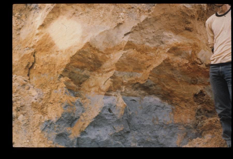
12 High Island Reservoir damsites excavation Before M1 T1?T2 After West Dam T1 Palaeo-desiccated crust East Dam M2


13 Sea-floor excavation of Victoria Harbour for the Western Harbour Crossing Radiocarbon dated 7,000-year old oyster shells Corals


14 Excavation of the Sheung Wan Station, Island Line, MTR MTR construction Radiocarbon age ~30 ka Uranium-series age ~130 ka Oyster shells from the M2 layer


15 Offshore drilling for marine sand A drill barge Drilling in action A continuous 60-m core


16 Drillhole in the West Lamma Channel for the Western Harbour Development Study M1 + WB7 Samples at about 0.5 m Intervals in Borehole WB7 + WB7 M2 T2 M3 T3 M4 M1 T2 M3 T3 T5 M5 M2 M4 M5 T5 Residual soil Simplified logsheet
17 Offshore geological model of Hong Kong Unit Age Estimated age (ka) Maximum thickness (m) M1 Postglacial < T1 Last glacial M2 Last interglacial T2 2 nd last glacial M3 2 nd last interglacial T3 3 rd last glacial M4 3 rd last interglacial T4 4 th last glacial M5 4 th last interglacial T5 5 th last glacial > M marine T terrestrial
18 Main differences of marine & terrestrial deposits Feature Marine deposits Terrestrial deposits Fossils Marine fossils may be Terrestrial fossils may be present e.g. corals, present e.g. plant remains, clams, snails, etc. pollen, etc. Colour Usually darker [R] Usually paler [O] Grain size Usually finer Usually coarser Compaction Usually softer Usually firmer Water content Usually higher Usually lower Iron content Usually lower Usually higher
19 How is age determined? (1) Order of marine and terrestrial deposits (2) Dating of suitable samples Methods used - Radiocarbon (reliable when younger than 8.2 ka) Uranium-series (up to 500 ka) Luminescence (up to 1000 ka) Cosmogenic nuclides (up to 5000 ka) (3) Correlation with other parts of the world with ice cores, deep sea cores, loess deposits, etc. (4) Use of indirect methods e.g. fossils, engineering properties, etc.

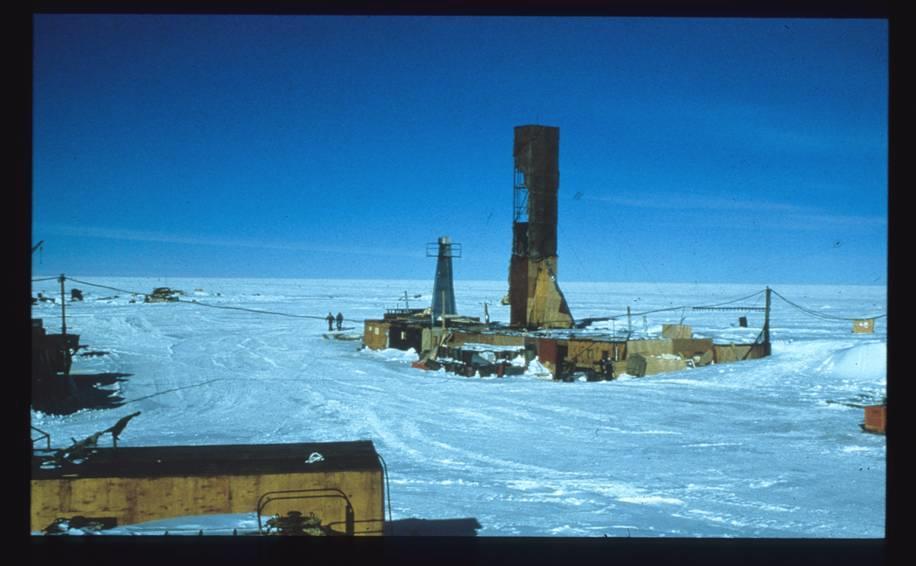

20 Vostok ice core in Antarctica Vostok Station Annual layers

21 Temperature Lags temperature rise by 800 years (present level over 400 ppm) M1 M2 M3 M4 M5 Hong Kong seafloor M- marine; T- terrestrial T1 T2 T3 T4 T5 Present Past


22 East Ping Chau How high was sea levels during past interglacial periods? 3-m high wave-cut notch Sea cave in Ap Chau 48-m high sea cliff Wave-cut platform

23 Raised beach deposits at Po Chu Tam, Lantau Island Quaternary alluvial deposits Quaternary raised beach deposits Tai O Formation bedrock

24 How low was sea levels during glacial periods? ~ 120 m How low was sea levels during glacial periods? ~120 m Hong Kong +
25 Sea-level measurement records since 1954
26 Location of tide gauges of the Hong Kong Observatory + CHI MA WAN ( )

27 Diagram of a mechanical float tide gauge Source: NOAA


28 Mechanical float tide gauge Tide data recoding equipment Tide chart for Quarry Bay Tide Gauge Station

29 North Point Tide Gauge

30 Quarry Bay Tide Gauge present
31 Changes in height of sea level in Victoria Harbour Source: HK Observatory
32 Changes in height of sea level in Victoria Harbour tide gauge relocated from North Point to Quarry Bay Source: HK Observatory
33 Changes in height of sea level in Victoria Harbour Pause in sea-level rise Source: HK Observatory
34 Changes in height of sea level in Victoria Harbour Pause in sea-level rise Abrupt rise of 29 cm Source: HK Observatory
35 Changes in height of sea level in Victoria Harbour Post-1999 pause in sea-level rise Pause in sea-level rise Abrupt rise of 29 cm Source: HK Observatory


36 Comparison between tide gauge records at North Point/Quarry Bay and Tai Po Kau 1963 to 2003 Abrupt rise of 29 cm from Rise of 12 cm from ~17cm difference may be attributed to ground settlement at the Quarry Bay tide gauge

37 Satellite altimetry record available since 1993
38 Rates of sea-level change in Hong Kong and the South China Sea based on different studies Source Area studied Years examined Data analysed Rate of change Wong et al. (2003) Hong Kong Tide gauge data Fall of 2 mm/yr Wong et al. (2003) Hong Kong Tide gauge data Rise of 22.1 mm/yr Wong et al. (2003) Hong Kong Tide gauge data Fall of 21 mm/yr Wong et al. (2003) Hong Kong Tide gauge data Rise of 2.3 mm/yr+ Cheng and Qi (2007) South China Sea Merged altimetry Rise of 11.3 mm/yr Cheng and Qi (2007) South China Sea Merged altimetry Fall of 11.8 mm/yr + The rate of change found is similar to Ding et al. (2002) who studied data
39 Annual mean sea level trend of the North Point tideguage station and annual rainfall of the Hong Kong Observatory Station during (from Yim 1993) Mean sea level trend Moderate positive correlation coefficient between mean sea level and annual precipitation (r = 0.4) suggests regional runoff into the sea or low central mean sea level pressures may be causing sea level to rise
40 Changes in height of sea level in Victoria Harbour high sea level explained by abnormally high river discharges during El Niño year 1963 low sea level explained by severe regional drought year caused by the eruption of the Agung volcano, Bali 1987 tide gauge relocated from North Point to Quarry Bay Source: HK Observatory
41 Comparison of 15-year monthly sea level during at the North Point, Tai Po Kau and Chi Ma Wan tide gauge stations (from Yim 1993) Difference explained by coastal configuration Tai Po Kau highest Chi Ma Wan intermediate North Point lowest
42 Location of tide gauges of the Hong Kong Observatory + CHI MA WAN ( )

43 Global temperature anomalies and 60-year cycles Blue since 1850 Red since 1900 Green since 1950

44 Atlantic Multidecadal Oscillation anomalies with 62-year cycles (Knudsen et al. 2011) Maxima at 1878, 1943 and 2004 Minima at 1912 and 1974

45 Atmospheric carbon dioxide concentrations from ice cores before 1958 and Mauna Loa data after 1958


46 Interferometric Synthetic Aperture Radar INSAR
 The average rate of sea-level rise of 30 mm/decade of the HKO is an overestimate.")
47 Conclusions (1) Tide gauge and satellite remote sensing record are too short at present to be conclusive. (2) Tide gauges must be located on bedrock to eliminate noise caused by ground settlement. (3) The average rate of sea-level rise of 30 mm/decade of the HKO is an overestimate. (4) An estimated 60% of the 29 cm sea-level rise observed during at the Quarry Bay tide gauge may be attributed to ground settlement. (5) Short-term noise in sea level identified include river discharges and the Pacific Decadal Oscillation. (6) Storm surge flooding generated by typhoons is an immediate enemy. Thank you
Continental shelf records of climate change
 Continental shelf records of climate change Wyss W.-S. Yim Guy Carpenter Asia-Pacific Climate Impact Centre, City University of Hong Kong / Department of Earth Sciences, The University of Hong Kong Hong
Coastal flooding in Hong Kong
 Coastal flooding in Hong Kong Wyss W.-S. Yim Department of Earth Sciences, The University of Hong Kong / Guy Carpenter Asia-Pacific Climate Impact Centre, City University of Hong Kong Why is this important?
Reprint 850. Within the Eye of Typhoon Nuri in Hong Kong in C.P. Wong & P.W. Chan
 Reprint 850 Remote Sensing Observations of the Subsidence Zone Within the Eye of Typhoon Nuri in Hong Kong in 2008 C.P. Wong & P.W. Chan 8 th International Symposium on Tropospheric Profiling: Integration
Depositional Environment
 Depositional Environment Sedimentary depositional environment describes the combination of physical, chemical and biological processes associated with the deposition of a particular type of sediment. Types
Oceans and Climate. Caroline Katsman. KNMI Global Climate Division
 Oceans and Climate Caroline Katsman KNMI Global Climate Division Aimée Slangen, Roderik van de Wal (IMAU, Utrecht University) Sybren Drijfhout, Wilco Hazeleger (KNMI, Global Climate) Bert Vermeersen (NIOZ/Delft
6. What has been the most effective erosive agent in the climate system? a. Water b. Ice c. Wind
 Multiple Choice. 1. Heinrich Events a. Show increased abundance of warm-water species of planktic foraminifera b. Show greater intensity since the last deglaciation c. Show increased accumulation of ice-rafted
Semi-enclosed seas. Estuaries are only a particular type of semi-enclosed seas which are influenced by tides and rivers
 Semi-enclosed seas Estuaries are only a particular type of semi-enclosed seas which are influenced by tides and rivers Other semi-enclosed seas vary from each other, mostly by topography: Separated from
Sea level change recent past, present, future
 Sea level change recent past, present, future Anny Cazenave LEGOS-CNES Toulouse, France CCI_Colocation meeting, ESA/ESRIN Global mean sea level rise during the 20 th century (red : tide gauges; blue :
Supplemental Slides. Shore: Junction of Land & Water. Junction of Land & Water. Sea Level Variations. Shore vs. Coast. Sea Level Variations
 Shore: Junction of Land & Water Supplemental Slides Sediments come off land Most get dumped at the beach Sediment interacts with ocean waves and currents Junction of Land & Water Features: Breaking waves,
Shore: Junction of Land & Water. Sediments come off land Most get dumped at the beach Sediment interacts with ocean waves and currents
 Shore: Junction of Land & Water Supplemental Slides Sediments come off land Most get dumped at the beach Sediment interacts with ocean waves and currents Junction of Land & Water Features: Breaking waves,
"2014 Hong Kong Definitive Stamps" Issue Date: 24 July 2014
 "2014 Hong Kong Definitive Stamps" Issue Date: 24 July 2014 Hong Kong is an international metropolis of skyscrapers. On the outskirts of this bustling city, however, there lies a great expanse of countryside
Outline 24: The Holocene Record
 Outline 24: The Holocene Record Climate Change in the Late Cenozoic New York Harbor in an ice-free world (= Eocene sea level) Kenneth Miller, Rutgers University An Ice-Free World: eastern U.S. shoreline
Towards an integrated assessment of coastal flood risk in southern China.
 Towards an integrated assessment of coastal flood risk in southern China. ADAM D. SWITZER EARTH OBSERVATORY OF SINGAPORE ASIAN SCHOOL OF THE ENVIRONMENT NANYANG TECHNOLOGICAL UNIVERSITY http://timeout
Sediment and Sedimentary rock
 Sediment and Sedimentary rock Sediment: An accumulation of loose mineral grains, such as boulders, pebbles, sand, silt or mud, which are not cemented together. Mechanical and chemical weathering produces
Science 8 - Water Systems Test - Chapters 1-2
 Science 8 - Water Systems Test - Chapters 1-2 Multiple Choice (30 marks) Identify the choice that best completes the statement or answers the question. 1. What percentage represents the amount of fresh
TAKE HOME EXAM 8R - Geology
 Name Period Date TAKE HOME EXAM 8R - Geology PART 1 - Multiple Choice 1. A volcanic cone made up of alternating layers of lava and rock particles is a cone. a. cinder b. lava c. shield d. composite 2.
PROJECTIONS OF RELATIVE SEA-LEVEL RISE OVER THE NEXT CENTURY Luca Parlagreco and Sergio Silenzi
 LIFE08 ENV/IT/436 PROJECTIONS OF RELATIVE SEA-LEVEL RISE OVER THE NEXT CENTURY Luca Parlagreco and Sergio Silenzi Rome July 2010 ISPRA Institute for Environmental Protection and Research Climate change
Earth Science Lesson Plan Quarter 2, Week 10, Day 1
 Earth Science Lesson Plan Quarter 2, Week 10, Day 1 Outcomes for Today Standard Focus: PREPARE 1. Background knowledge necessary for today s reading. Beaches are created by the actions of waves, tides,
Prentice Hall: Science Explorer, 16 Book Series 2005 Correlated to: Alabama Science Standards for Earth and Space Science Core (Grade 6)
") Alabama Science Standards for Earth and Space Science Core (Grade 6) 1. Identify global patterns of atmospheric movement, including El Niño, the Gulf Stream, the jet stream, the Coriolis effect, and global
Alabama Science Standards for Earth and Space Science Core (Grade 6) 1. Identify global patterns of atmospheric movement, including El Niño, the Gulf Stream, the jet stream, the Coriolis effect, and global
Sea-level Rise on Cape Cod: How Vulnerable Are We? Rob Thieler U.S. Geological Survey Woods Hole, MA
 Sea-level Rise on Cape Cod: How Vulnerable Are We? Rob Thieler U.S. Geological Survey Woods Hole, MA Outline Sea-level and coastal processes Past sea-level change Predictions for the future Coastal responses
What type of land feature is located at Point A? A Cliff B Delta C Mountain D Valley
 1 What type of land feature is located at Point A? A Cliff B Delta C Mountain D Valley Alfred Wegener s theory of continental drift was 2 not accepted by scientists when the theory was first proposed.
Integrated geological approach to the study of coastal subsidence in Emilia-Romagna. Luisa PERINI Calabrese Lorenzo, Luciani Paolo, Severi Paolo,
 Integrated geological approach to the study of coastal subsidence in Emilia-Romagna Luisa PERINI Calabrese Lorenzo, Luciani Paolo, Severi Paolo, Subsidence hazard of Emilia-Romagna coastal plain Caputo
Tips for Success on a Test
 Number of Incorrect: Final Grade: Parent Signature: Top Tips for Success on a Test 1. Read the following statements at least two times. 2. Circle the key words in each question/ or statement. (*Remember
The surface of the ocean floor is as varied as the land. The five major oceans, from largest to smallest, are
 11.1 Ocean Basins The surface of the ocean floor is as varied as the land. The five major oceans, from largest to smallest, are w the Pacific w the Atlantic w the Indian w the Southern w the Arctic The
Geol 117 Lecture 18 Beaches & Coastlines. I. Types of Coastlines A. Definition:
 I. Types of Coastlines A. Definition: 1. Shore = narrow zone where ocean meets land (e.g. beach) 2. Coast is a broad area where both ocean and land processes act a. Includes onshore marshes, dunes, sea
Sea level change. Eustatic sea level change. Tectono-eustasy. Tectonic control of global sea level. Global signal of sea level change Causes:
 Sea level change Important processes Global vs. local Geologic Modern Current rates of rise Observations, calculations, and models Lessons from the past Projected future changes Eustatic sea level change
What is weathering and how does it change Earth s surface? Answer the question using
 7 th Grade Lesson What is weathering and how does it change Earth s surface? Answer the question using the sentence frame. You have 4 minutes. Weathering is. This changes the Earth s surface because. 1
Lab 7: Sedimentary Structures
 Name: Lab 7: Sedimentary Structures Sedimentary rocks account for a negligibly small fraction of Earth s mass, yet they are commonly encountered because the processes that form them are ubiquitous in the
Name: Period: Date: ID: A. Circle the choice that best completes the statement or answers the question and write the letter on the blank.
 Name: Period: _ Date: _ ID: A Unit 7 Practice Circle the choice that best completes the statement or answers the question and write the letter on the blank. 1. What term describes the movement of rock
The Marine Environment
 The Marine Environment SECTION 16.1 Shoreline Features In your textbook, read about erosional landforms, beaches, estuaries, longshore currents, and rip currents. For each statement below, write or. 1.
The Coast: Beaches and Shoreline Processes
 1 2 3 4 5 6 7 8 9 The Coast: es and Shoreline Processes Trujillo & Thurman, Chapter 10 Oceanography 101 Chapter Objectives Recognize the various landforms characteristic of beaches and coastal regions.
Term Knowledge Using and applying Grade Criteria Autumn 1 Assessment window October Natural hazards pose major risks to people and property.
 Assessment Schedule Year 9 2015/6 Term Knowledge Using and applying Grade Criteria Autumn 1 Assessment window October 2015 3.1.1.2 Tectonic Natural hazards pose major risks to people and property. Definition
The Coast: Beaches and Shoreline Processes Trujillo & Thurman, Chapter 10
 The Coast: es and Shoreline Processes Trujillo & Thurman, Chapter 10 Oceanography 101 Chapter Objectives Recognize the various landforms characteristic of beaches and coastal regions. Identify seasonal
Sea level changes around Thailand
 Final symposium 27 May Bangkok, Thailand Sea level changes around Thailand Marc Naeije Contents GEO2TECDI- SONG: measuring sea level around Thailand Concept of satellite altimetry Concept of tide gauges
Current Climate Science and Climate Scenarios for Florida
 Current Climate Science and Climate Scenarios for Florida Daniel Bader and Vivien Gornitz Water Utilities and Climate Change Workshop Palm Beach County Water Utilities/ Water Research Foundation June 10,
WHAT IS THE EARTH MADE OF? LITHOSPHERE AND HYDROSPHERE
 UNIT 8 WHAT IS THE EARTH MADE OF? LITHOSPHERE AND HYDROSPHERE TABLE OF CONTENTS 1 THE STRUCTURE OF THE EARTH... 2 2 THE FORMATION OF THE RELIEF: INTERNAL AND EXTERNAL FORCES.... 2 2.1 Internal forces:
Foundations of Earth Science, 6e Lutgens, Tarbuck, & Tasa
 Foundations of Earth Science, 6e Lutgens, Tarbuck, & Tasa Oceans: The Last Frontier Foundations, 6e - Chapter 9 Stan Hatfield Southwestern Illinois College The vast world ocean Earth is often referred
The Science of Sea Level Rise and the Impact of the Gulf Stream
 Old Dominion University ODU Digital Commons July 29, 2016: The Latest in Sea Level Rise Science Hampton Roads Sea Level Rise/Flooding Adaptation Forum 7-29-2016 The Science of Sea Level Rise and the Impact
CLIMATE CHANGE, CATASTROPHE AND THE TIDES OF HISTORY. 1. CLIMATE THE LONG VIEW.
 LL Innis / 3ALB 2018 CLIMATE CHANGE, CATASTROPHE AND THE TIDES OF HISTORY. 1. CLIMATE THE LONG VIEW. Climate has controlled our evolution, our spread around the globe, and our social, political, economic
OCN 201 Fall nd mid term Section 1
 Name: Class: _ Date: _ OCN 201 Fall 2013 2nd mid term Section 1 True/False Indicate whether the statement is true or false. 1. The hydrothermal vent sites at Loihi have lots of animals around them. 2.
Geology of Hong Kong A Summary. Prof LS Chan The University of Hong Kong
 Geology of Hong Kong A Summary Prof LS Chan The University of Hong Kong Student Expeditions Geology of HK Eurasia Late Cretaceous Orogen Collapse Eurasia Sunda Early Cenozoic Crustal Extension Jointed
EROSION AND DEPOSITION
 CHAPTER 8 EROSION AND DEPOSITION SECTION 8 1 Changing Earth s Surface (pages 252-255) This section explains how sediment is carried away and deposited elsewhere to wear down and build up Earth s surface.
Current and future climate of the Cook Islands. Pacific-Australia Climate Change Science and Adaptation Planning Program
 Pacific-Australia Climate Change Science and Adaptation Planning Program Penrhyn Pukapuka Nassau Suwarrow Rakahanga Manihiki N o r t h e r n C o o k I s l a nds S o u t h e Palmerston r n C o o k I s l
New GCSE Geography AQA
 Learning Checklist Half Term 1 26 th September 3 rd October 10 th October 17 th October 1.1.1 Tectonic Hazards Plate tectonics theory. Global distribution of earthquakes and volcanic eruptions and their
I CAN DO sheets Southchurch High School
 Rate your confidence in the following topic content and geographical skills by ticking the appropriate column beside each point: Red = Not confident Yellow = Almost there Green = Confident Changing landscapes
Recent Climate History - The Instrumental Era.
 2002 Recent Climate History - The Instrumental Era. Figure 1. Reconstructed surface temperature record. Strong warming in the first and late part of the century. El Ninos and major volcanic eruptions are
2018 Geography Mock Examination
 2018 Geography Mock Examination Your Geography mock examination will test your understanding of Paper 1 (Living with the physical environment) and Section B (Fieldwork) from Paper 2. Attached are the necessary
Global climate change
 Global climate change What is climate change? This winter was really cold! Temp difference ( C): Jan 2004 vs. Jan 2002-2003 Make your own maps at: http://www.giss.nasa.gov/data/update/gistemp/maps/ 1 What
Geography Class XI Fundamentals of Physical Geography Section A Total Periods : 140 Total Marks : 70. Periods Topic Subject Matter Geographical Skills
 Geography Class XI Fundamentals of Physical Geography Section A Total Periods : 140 Total Marks : 70 Sr. No. 01 Periods Topic Subject Matter Geographical Skills Nature and Scope Definition, nature, i)
Relative sea level change across the Forth Estuary. Dr. Victoria Powell University of Chester
 Relative sea level change across the Forth Estuary Dr. Victoria Powell University of Chester v.powell@chester.ac.uk Forth Estuary Forum Annual Conference, 17 th November 2016 Sea Level Change Global sea
Physical Dynamics of the Coastal Zone in the Mediterranean on Annual to Decadal Scales
 Physical Dynamics of the Coastal Zone in the Mediterranean on Annual to Decadal Scales Hans-Peter Plag Nevada Bureau of Mines and Geology and Seismological Laboratory University of Nevada, Reno, Nevada,
Current and future climate of Vanuatu. Pacific-Australia Climate Change Science and Adaptation Planning Program
 Pacific-Australia Climate Change Science and Adaptation Planning Program Hiu Torres Islands Vanua Lava Gaua Banks Islands Espiritu Santo Malekula Ambae Épi Maéwo Pentecost Ambrym Shepherd Islands Éfate
THE EARTH S RELIEF SOCIAL SCIENCES 1º ESO
 THE EARTH S RELIEF SOCIAL SCIENCES 1º ESO 1. THE STRUCTURE OF THE EARTH The Earth is divided into layers: The crust is the surface layer. It is a thin, solid layer made of rock. The Earth s crust has a
Catastrophic Events Impact on Ecosystems
 Catastrophic Events Impact on Ecosystems Hurricanes Hurricanes An intense, rotating oceanic weather system with sustained winds of at least 74 mph and a welldefined eye Conditions for formation: Warm water
Town of Old Orchard Beach: A summary of sea level rise science, storm surge, and some highlighted results from SLAWG work efforts
 Town of Old Orchard Beach: A summary of sea level rise science, storm surge, and some highlighted results from SLAWG work efforts October 15, 2013 Peter A. Slovinsky, Marine Geologist Maine Geological
Ocean and Coastal Processes. Ocean Basins. Chapter 20. Ocean Basins and Plates. Ocean Terms. Sea Arch Bay-mouth Bar Spit Tombolo Coast.
 Chapter 20 Ocean Basins and Plates Ocean and Coastal Processes Tide Wave Height Length Period Base Refraction Tsunami Beach Sea stack Ocean Terms Sea Arch Bay-mouth Bar Spit Tombolo Coast Emergent Submergent
The Marine Environment
 The Marine Environment SECTION 16.1 Shoreline Features In your textbook, read about erosional landforms, beaches, estuaries, longshore currents, and rip currents. For each statement below, write true or
Unit 1: Water Systems on Earth Chapter 2
 Unit 1: Water Systems on Earth Chapter 2 Create a mind map with the driving question, Why are Oceans Important? Remember: Why are oceans so important? Why are oceans so important? Primary water source
Application of GIS and Big Data to Assess Typhoon Impacts
 Application of GIS and Big Data to Assess Typhoon Impacts TECO Ha Noi, Viet Nam, 26 27 Feb 2018 YEUNG Hon-yin, PAN Chi-kin, TONG Yu-fai Introduction Weather forecasts told us how the weather might change
Earth-Space Science 6 12
 Earth-Space Science 6 12 Section 08 1 Knowledge of the nature of science 1. Identify the components of scientific inquiry. 2. Identify the consistent patterns that govern the occurrence of most natural
Geodetic Observing Systems: tools in observing the Glacial Isostatic Adjustment. Markku Poutanen Finnish Geodetic Institute
 Geodetic Observing Systems: tools in observing the Glacial Isostatic Adjustment Markku Poutanen Finnish Geodetic Institute Glacial Isostatic Adjustment Land uplift is just one consequence of the physical
Field Research Facility
 Field Research Facility Sea Level Rise Observations of Sea Level rise Forces driving change Predicting future Sea Level rise Response of land surface Storm inundation coupled with Sea Level Dr. Jesse McNinch
The Niagara Escarpment extends from western New York, through the GTA all the way up to Manitoulin Island and into Michigan and Wisconsin.
 is southern Ontario s most prominent topographic feature, extending more than 500 kilometres from western New York, through Niagara Falls and the western part of the Greater Toronto Area (GTA), and north
Loess and dust. Jonathan A. Holmes Environmental Change Research Centre
 Loess and dust Jonathan A. Holmes Environmental Change Research Centre Why is dust important? Mineral dust is an important constituent of the solid load in Earth's atmosphere, the total atmospheric aerosol
Australian Mean Sea Level Survey 2009 National Tidal Centre Bureau of Meteorology
 Australian Mean Sea Level Survey 2009 National Tidal Centre Bureau of Meteorology Summary There are 39 Australian locations where relative sea levels have been measured for at least 25 years. The average
A~3000 years-old sequence of extreme revealed by marine and shore deposits east of Taiwan Serge Lallemand, Remi Lehu, Fabien Retif, Shu-Kun Hsu,
 A~3000 years-old sequence of extreme revealed by marine and shore deposits east of Taiwan Serge Lallemand, Remi Lehu, Fabien Retif, Shu-Kun Hsu, Nathalie Babonneau, Gueorgui Ratzov, Maria-Angella Basseti,
Chapter 17. Ocean and Coastal Processes
 Chapter 17 Ocean and Coastal Processes Ocean Basins and Plates Ocean Basins Ocean Basins are profoundly different from the continents. Ocean crust is thin and dense and young. New ocean crust is generated
Latest trends in sea level rise and storm surges in Maine Peter A. Slovinsky, Marine Geologist
 Latest trends in sea level rise and storm surges in Maine Peter A. Slovinsky, Marine Geologist Image from Chebeague.org Maine s glacial geology and historic sea level rise trends Current sea level trends
Unit 4 - Water. Earth s Interior. Earth s Interior. Continental Drift. Continental Drift. Continental Drift. Crust. Mantle. Core.
 Unit 4 - Water How did the oceans form? What special adaptations do saltwater organisms have? Where does our water come from? How do humans affect the Earth s water? Crust Rigid outer shell of Earth Oceanic
Unit 7.2 W.E.D. & Topography Test
 Name: Score: Unit 7.2 W.E.D. & Topography Test 1. 2. 3. 4. 5. 6. 7. 8. 9. 10. 11. 12. 13. 14. 15. 16. 17. 18. 19. 20. 21. 22. 23. 24. 25. 1. The formation of mountains is due mainly to while the destruction
Where is all the water?
 Where is all the water? The distribution of water at the Earth's surface % of total Oceans 97.25 Ice caps and glaciers 2.05 Groundwater 0.68 Lakes 0.01 Soils 0.005 Atmosphere (as vapour) 0.001 Rivers 0.0001
ARE YOU READY TO THINK? Look at the first slide THINK PAIR SHARE!
 ARE YOU READY TO THINK? Look at the first slide THINK PAIR SHARE! WHAT PROMINENT FEATURE CAN YOU IDENTIFY IN THIS PICTURE? What do you think the different colors represent? Who might find such a picture
Question #1: What are some ways that you think the climate may have changed in the area where you live over the past million years?
 Reading 5.2 Environmental Change Think about the area where you live. You may see changes in the landscape in that area over a year. Some of those changes are weather related. Others are due to how the
Research on Climate of Typhoons Affecting China
 Research on Climate of Typhoons Affecting China Xu Ming Shanghai Typhoon Institute November,25 Outline 1. Introduction 2. Typhoon disasters in China 3. Climatology and climate change of typhoon affecting
Climate Change and Sea Level Rise: A Challenge to Science and Society
 Climate Change and Sea Level Rise: A Challenge to Science and Society Hans-Peter Plag Nevada Bureau of Mines and Geology & Seismological Laboratory University of Nevada, Reno, USA. Climate Change and Sea
Name. 4. The diagram below shows a soil profile formed in an area of granite bedrock. Four different soil horizons, A, B, C, and D, are shown.
 Name 1. In the cross section of the hill shown below, which rock units are probably most resistant to weathering? 4. The diagram below shows a soil profile formed in an area of granite bedrock. Four different
Mapping of Future Coastal Hazards. for Southern California. January 7th, David Revell, Ph.D. E.
 Mapping of Future Coastal Hazards for Southern California January 7th, 2014 David Revell, Ph.D. drevell@esassoc.com E. Vandebroek, 2012 Outline Coastal erosion hazard zones Flood hazard zones: Coastal
Chapter 3 Erosion and Deposition. The Big Question:
 Chapter 3 Erosion and Deposition The Big Question: 1 Design a way to represent and describe the 4 types of mass movement. You may use pictures, diagrams, list, web, chart, etc 2 Chapter 3: Erosion and
Science 8 Unit 1 Test Review Analyze factors that affect productivity and species distribution in marine and fresh water environments.
 Science 8 Unit 1 Test Review How does water shape our world? 1. Define a water system in your own words 2. What is water important for? (3 things at least) 3. What is water made of? Water in our world
Fresh & Saltwater Systems
 Fresh & Saltwater Systems Topic 1 Need vs. Supply You got it! Water A Dependence! So who needs water? Everyone! Living systems need water to survive Ecosystems depend on it The land is changed by it Industry
Introduction to Global Warming
 Introduction to Global Warming Cryosphere (including sea level) and its modelling Ralf GREVE Institute of Low Temperature Science Hokkaido University Sapporo, 2010.09.14 http://wwwice.lowtem.hokudai.ac.jp/~greve/
A geological perspective on sea-level rise and its impacts
 A geological perspective on sea-level rise and its impacts K.G. Miller, R.E. Kopp, B.H. Horton, J.V. Browning, A.C. Kemp Front Pages November 1, 2012 kgm@rutgers.edu Ship Bottom, Long Beach Island, NJ
Grade 8 Learning Objectives MS-PS2-4.
 MS-PS2-4. Construct and present arguments using evidence to support the claim that gravitational interactions are attractive and depend on the masses of interacting objects. [Clarification Statement: Examples
Oceanography. Oceanography is the study of the deep sea and shallow coastal oceans.
 Oceanography Oceanography is the study of the deep sea and shallow coastal oceans. Studying the Ocean Floor To determine the shape and composition of the ocean floor, scientists use techniques such as
Beach Recovery Processes in Urban Beach Systems : A Study in Hong Kong after an Extreme Storm Event
 Beach Recovery Processes in Urban Beach Systems : A Study in Hong Kong after an Extreme Storm Event LIFE+ FLANDRE international workshop "Management of coastal dunes and sandy beaches" Session 1. Climate
Earth-Space Science 6 12
 Earth-Space Science 6 12 Section 08 1 Knowledge of the nature of science 1. Analyze processes of scientific inquiry. 2. Evaluate models used in science to explain patterns observed in nature (e.g., rock
Marine Science and Oceanography
 Marine Science and Oceanography Marine geology- study of the ocean floor Physical oceanography- study of waves, currents, and tides Marine biology study of nature and distribution of marine organisms Chemical
Sediment and sedimentary rocks Sediment
 Sediment and sedimentary rocks Sediment From sediments to sedimentary rocks (transportation, deposition, preservation and lithification) Types of sedimentary rocks (clastic, chemical and organic) Sedimentary
Sea level rise and coastal morphological changes on tropical islands New Caledonia and French Polynesia (South Pacific)
") Manuel Garcin, Marissa Yates, Goneri Le Cozannet, Patrice Walker, Vincent Donato Sea level rise and coastal morphological changes on tropical islands New Caledonia and French Polynesia (South Pacific)
Manuel Garcin, Marissa Yates, Goneri Le Cozannet, Patrice Walker, Vincent Donato Sea level rise and coastal morphological changes on tropical islands New Caledonia and French Polynesia (South Pacific)
Remote sensing and GIS for multi-hazard risk assessments in the coastal zone: recent applications and challenges in the Pacific Jens Kruger
 Remote sensing and GIS for multi-hazard risk assessments in the coastal zone: recent applications and challenges in the Pacific Jens Kruger Geoscience Division Pacific Community (SPC) The First Pacific
UNIT 1: WATER SYSTEMS ON EARTH CHAPTER 2: OCEANS CONTROL THE WATER CYCLE
 UNIT 1: WATER SYSTEMS ON EARTH CHAPTER 2: OCEANS CONTROL THE WATER CYCLE ORIGINS OF OCEAN WATER OCEANS HAVE FILLED OVER HUNDREDS OF MILLIONS OF YEARS SCIENTISTS BELIEVE THE OCEANS ARE MORE THAN 3 BILLION
Chapter 15 Millennial Oscillations in Climate
 Chapter 15 Millennial Oscillations in Climate This chapter includes millennial oscillations during glaciations, millennial oscillations during the last 8000 years, causes of millennial-scale oscillations,
Climate Change. Unit 3
 Climate Change Unit 3 Aims Is global warming a recent short term phenomenon or should it be seen as part of long term climate change? What evidence is there of long-, medium-, and short- term climate change?
FIG Working Week May, Bulgaria From the wisdom of the ages to the challanges of modern world
 FIG Working Week 17-21 May, Bulgaria From the wisdom of the ages to the challanges of modern world COASTAL RISK ANALYSIS OF THE BLACK SEA UNDER THE SEA LEVEL RISE N e v i n B e t u l A V S A R, S e n o
Tony Pratt, DNREC to The Center for the Inland Bays Scientific and Technical Advisory Committee. August 21, 2009
 Sea Level Rise in Delaware Presented by Tony Pratt, DNREC to The Center for the Inland Bays Scientific and Technical Advisory Committee August 21, 2009 Sea level has been fluctuating ever since there have
The oceans: Sea level rise & gulf stream
 Lecture Climate Change Lesson 10 The oceans: Sea level rise & gulf stream Rene Orth rene.orth@bgc-jena.mpg.de 1 Course webpage https://www.bgc-jena.mpg.de/bgi/index.php/lectures/hydrobioclimclimatechange
Physical Geography: Patterns, Processes, and Interactions, Grade 11, University/College Expectations
 Geographic Foundations: Space and Systems SSV.01 explain major theories of the origin and internal structure of the earth; Page 1 SSV.02 demonstrate an understanding of the principal features of the earth
MISSISSIPPI RIVER DELTA OVERVIEW
 MISSISSIPPI RIVER DELTA OVERVIEW Science and Engineering Special Team Conference Louisiana State University October 9, 2012 Introduction Basics of the Mississippi Delta Natural and Human-Induced Land Loss
Physical Oceanography
 Physical Oceanography SECTION 15.1 The Oceans In your textbook, read about modern oceanography. For each item in Column A, write the letter of the matching item in Column B. Column A 1. German research
STREAM SYSTEMS and FLOODS
 STREAM SYSTEMS and FLOODS The Hydrologic Cycle Precipitation Evaporation Infiltration Runoff Transpiration Earth s Water and the Hydrologic Cycle The Hydrologic Cycle The Hydrologic Cycle Oceans not filling