Data Verification, Analytics and Visualization
|
|
|
- Beverly Norton
- 5 years ago
- Views:
Transcription

1 Data Verification, Analytics and Visualization Wenhui Zhang, Roel Heremans, Christian Debes, Neha Thakre, Alexander Bauer, Manuel Görtz, Aleksandra Kovacevic The 2nd Asia Pacific Water Summit Technical Workshop Chiang Mai, Thailand, 16 May 2013
2 Agenda Smart sensors in water infrastructure Experiments and real-world implementation 3D sensor data visualization Dike stability models Sensor data verification and analytics Future extension 2
3 Smart sensors in water infrastructure Smart sensors in water infrastructure Need for intelligent water infrastructure management Enabling technologies: intelligent sensors Dike failure types and example monitoring Monitoring focus in the breach process Experiments and real-world implementations 3D sensor data visualization Dike stability models Sensor data verification and analytics Future extension 3

4 Dike failure at Wilnis The dikes at Wilnis in The Netherlands failed in August 2003 Most dike breaches are caused by high water levels. However this failure was due to lengthy drought - dry peat is light and adheres weakly to the base resulting in a dike shifting The effects of drought are hard to observe by visual inspection Source: European Water Management Online 4


5 State of the art: manual dike inspection 5


6 Intelligent water infrastructure management Is the technology ready? 6


7 Enabling technologies: intelligent sensors Smart sensors with M2M capability Piezometer Inclinometer Temperature (to locate water flow / seepage) Internet Distributed fiber optic sensors Measuring strain and temperature over tens of kilometers Fiber optic woven into geotextile Improved geotechnical properties, combine monitoring and strengthening 7

8 Dike failure mechanisms Overflow Instability by infiltration and erosion by overflow Piping Heave Marco-instability inwards Marco-instability - outwards Mirco-instability Instability of cover Instability of foreland 8


9 Example dike anomaly monitoring GeoDetect: distributed fiber optic sensors that measure temperature and strain with high spatial resolution GeoBeads multisensor: measures pore water pressure, inclination and temperature in all relevant soil layers GeoDetect GeoBeads multisensor Optional GeoBeads inclinometer array for horizontal displacement measurement Risk of uplift Risk of piping channel formation Risk of macrostability slip surface 9

10 Monitoring focus in the breach process The generic breach outflow hydrograph* Focus Decision Support System to predict failure in near real time T1 T2: Progression of breach initiation T2 T3: Transition to breach formation T0 T5: Covered by AGT Water Management System * Figure source: UrbanFlood project 10
11 Experiments and real-world implementations Smart sensors in water infrastructure Experiments and real-world implementations IJkdijk AIO SVT Yellow River project Livedijk Utrecht project 3D sensor data visualization Dike stability models Sensor data verification and analytics Future extension 11


12 IJkdijk overview 2005: IJkdijk Consortium established to explore and test sensor network technologies for early flood warning : Large scale field experiments on full scale dikes to test concept and evaluate different sensor technologies Results show that sensor technologies provide valuable addition to regular dike inspection 12


13 IJkdijk All-in-one Sensor Validation Test Objective Study the predictive capability of full-service sensor systems Test preformed Three test dikes (East, West, South dike) were built and brought to failure Multiple potential failure types on one dike - exact failure mechanisms were unknown before failure 13

14 First dike failure test Two test dikes failed on August 26th and 27th 2012 Piping Micro-stability 14

15 Second dike failure test Failure on September 8th 2012 Micro-stability Macro-stability 15

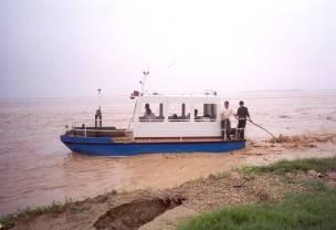
16 Yellow River project location Facts of the Yellow River Length: 5464 km Basin: 790,000 km2 Population: 110 million Runoff: 58 billion m3 Sediment: 1.6 billion ton AGT Yellow River project location 16

17 Yellow River project overview Visual Picture Dike Deformation Reality Check Erosion Prevention Dike Strain Pore Pressure Dike Inclination Water Level Dike Temperature AGT s turnkey solution Utilizes smart sensors Can prediction of failures Enables effective maintenance 17


18 Yellow River project sensor installation 18


19 Livedijk Project in Utrecht Province, Netherlands Customers Provincie Utrecht, Rijkswaterstaat Dienst Utrecht, De Stichtse Rijnlanden Objective Obtain knowledge and experience about sensors in real dikes Locations Grechtdijk Voorhavendijk 19


20 Livedijk Utrecht - Grecht Dike Focus: monitoring the effects of drought on dikes Amsterdam 30 kilometers Grecht canal Actual dike Village of Woerden ( inhabitants) 20

21 Livedijk Utrecht Voorhavendijk Focus: monitoring piping and dike stability Piping Micro-stability Macro-stability 21
22 3D sensor data visualization Smart sensors in water infrastructure Experiments and real-world implementations 3D sensor data visualization Sensor data verification and analytics Smart sensors in water infrastructure Future extension 22


23 3D visualization Intuitive way to observe sensor data and dike anomaly 23
24 Dike stability models Smart sensors in water infrastructure Experiments and real-world implementations 3D sensor data visualization Dike stability models Sensor data verification and analytics Future extension 24
 Proven and are based on years of")

25 Dyke stability models Bishop method (slices) Proven and are based on years of experience Require knowledge of the soil and site survey Only be used in specific situations 25


26 Dike Stability calculation input Calculation 26
27 Dike Stability model output Cross section A Height of river level Pore water pressure Stability factor Relative safety low low % high high % low high % Safety factor: Not safe Safe Relative Safety: 85% 100% 27
28 Sensor data verification and analytics Smart sensors in water infrastructure Experiments and real-world implementations 3D sensor data visualization Dike stability models Sensor data verification and analytics Data Cleansing Data-driven prediction Model-driven prediction Future extension 28
29 Problem statement and approaches Given a heterogeneous sensor setup measuring a variety of physical phenomena related to dike stability: How can we make optimal use of the acquired data to perform early prediction of dike failures? Data cleansing Approach 1 Data-driven prediction Use the available historical sensor data to learn a model for normal behaviour. Test new data against that model and detect anomalies. Approach 2 Model-driven prediction Use an existing theoretical dike model. Test new data against that model and detect anomalies. 29
30 Data pre-processing: Data cleansing 30
31 After correction Before Correction Data Cleansing Data errors in the form of spikes with temperatures as high as 1000 deg C 31
32 Approach 1 Data-driven prediction 32
33 Data-driven anomaly detection Pore pressure Water level Temp Cleansing Learning & Prediction Predicted target variable Statistical Test Measured target variable Anomaly? Some analytics challenges Changing environments Hidden/Unknown dependencies Sensor failure vs. Anomaly Seasonal effects vs. Anomaly and solutions Adaptive learning methods Data driven modelling Advanced sensor data fusion Seasonal models 33
: Ridge Regression")
34 Anomaly detection: Regression to find breakpoint Linear Regression: y = b X Pore Pressure Parameter estimation on training: Water Level DMC 1 Temp DMC 2 Temp DMC 1 Pressure DMC 2 Pressure with For correlated data (singular matrix): Ridge Regression 34
35 Statistical test Severe instability detected (2 days before dike collapse) Early anomaly detected (3 days before dike collapse) 35


36 Approach 2 Model-driven prediction Healthy dike Type1 Failing dike Type2 36
37 Anomaly detection: Geometrical Model rg rg 37

38 Anomaly detection: Geometrical model versus data Correlation water level versus pore pressure Installation depth map: SVT01, SVT02, SVT03, SVT04, SVT05, SVT06,
39 Future extension Smart sensors in water infrastructure Experiments and real-world implementations 3D sensor data visualization Dike stability models Sensor data verification and analytics Future extension 39


40 Extension to other water-related areas Dike overtopping protection and monitoring Landslide protection and monitoring 40


41 Extension to Structural Health Monitoring Photo source: Internet 41
42 Thank you
IJkdijk Calibration Levee/Dike. Ludolph Wentholt On behalf of the IJkdijk Foundation
 IJkdijk 2007 2011 2014 Calibration Levee/Dike Ludolph Wentholt On behalf of the IJkdijk Foundation (Near) disasters, a selection IN THE NETHERLANDS Sea 838 1014 1042 1134 1163 1164 1170 1196 1212 1214
Smart levees a new future for flood management?
 Smart levees a new future for flood management? Experiences from the EU FP7 UrbanFlood project Jonathan Simm David Jordan & Alexandra Topple (HR Wallingford, UK) Ilya Mokhov & Alexander Pyayt (Siemens,
ASSESSMENT OF DAMS AND DIKES BEHAVIOR WITH A FIBRE OPTICS BASED MONITORING SOLUTION
 ASSESSMENT OF DAMS AND DIKES BEHAVIOR WITH A FIBRE OPTICS BASED MONITORING SOLUTION O. Artières TenCate Geosynthetics, Bezons, France Y.L. Beck, A.A. Khan, P. Cunat EDG-DTG, Grenoble, France J.J. Fry,
Thermal monitoring of dams and levees
 Thermal monitoring of dams and levees Krzysztof Radzicki Cracow University of Technology (Poland) Bonelli Stephane - IRSTEA (France) Barcelona, 2016 Statistics of damming structures collapses due to internal
Luca Palmieri Thom Bogaard Miguel Gonzalez-Herraez Alessandro Pasuto. Water JPI WaterWorks2014 Cofunded Call 18 May 2016, Rome
 Luca Palmieri Thom Bogaard Miguel Gonzalez-Herraez Alessandro Pasuto Water JPI WaterWorks2014 Cofunded Call 18 May 2016, Rome Consortium Description ACRONYM TOPIC Coordination Partners DOMINO 3 DIKES AND
Modeling Great Britain s Flood Defenses. Flood Defense in Great Britain. By Dr. Yizhong Qu
 Modeling Great Britain s Flood Defenses AIRCurrents Editor s note: AIR launched its Inland Flood Model for Great Britain in December 2008. The hazard module captures the physical processes of rainfall-runoff
Strong dikes are smart dikes a description of the 2014 knowledge. Prof. Dr. Robert Meijer TNO & University of Amsterdam
 Strong dikes are smart dikes a description of the 2014 knowledge Prof. Dr. Robert Meijer TNO & University of Amsterdam robert.meijer@tno.nl Robert Meijer and robert.meijer@tno.nl 1959 2 x 3 rd National
January 12, 2006 File:
 January 12, 2006 File: 15-85-13 Alberta Infrastructure and Transportation Room 301, Provincial Building 9621-96 Avenue Peace River, Alberta T8S 1T4 Attention: Mr. Ed Szmata PEACE REGION (PEACE HIGH LEVEL
CCR Rule Annual Inspection Report (cont.) 2
 2") The inspection findings consisted of maintenance items and items that were not observed to be signs or potential signs of significant structural weakness. No deficiencies or disrupting conditions that
The inspection findings consisted of maintenance items and items that were not observed to be signs or potential signs of significant structural weakness. No deficiencies or disrupting conditions that
design, construction, operation, and maintenance of the BAP is consistent with recognized and generally accepted good engineering standards.
 design, construction, operation, and maintenance of the BAP is consistent with recognized and generally accepted good engineering standards. In addition to the field inspection, Associated Engineers, Inc.
Programmatic Approaches to Assessing and Mitigating Risk to Pipelines from Natural Forces
 Programmatic Approaches to Assessing and Mitigating Risk to Pipelines from Natural Forces 23 rd International Petroleum Environmental Conference New Orleans, Louisiana November 8-10, 2016 Introduction
Delta Flood Protection Strategy Update. May 16, 2016
 Delta Flood Protection Strategy Update May 16, 2016 Presentation Overview 1. Background 2. Understanding the Dike Reaches/Issues 3. Future Dike Improvements 4. Next Steps Boundary Bay Village March 10,
Combining Data-driven Methods with Finite Element Analysis for Flood Early Warning Systems
 Procedia Computer Science Volume 51, 2015, Pages 1 10 2347 2356 ICCS 2015 International Conference On Computational Science Combining Data-driven Methods with Finite Element Analysis for Flood Early Warning
This report was prepared by Klohn Crippen Consultants Ltd. for Alberta Transportation Central Region under Contract No. CE053/2000.
 Alberta Transportation Central Region #401, 4902 51 Street Red Deer, Alberta T4N 6K8 June 7, 2002 Mr. Melvin Mayfield, P.Eng. Project Engineer Dear Mr. Mayfield: Central Region Landslide Assessment Site
DEPARTMENT OF GEOLOGY AND MINERAL INDUSTRIES WAYS & MEANS SUBCOMMITTEE ON NATURAL RESOURCES MARCH 2, 2017
 DEPARTMENT OF GEOLOGY AND MINERAL INDUSTRIES WAYS & MEANS SUBCOMMITTEE ON NATURAL RESOURCES MARCH 2, 2017 1 ABOUT DOGAMI AGENCY MISSION, VISION & GOALS 2 Lidar image of a stream network along the Umpqua
FLOOD RISK OF REGIONAL FLOOD DEFENCES
 Fina l re port FLOOD RISK OF REGIONAL FLOOD DEFENCES APPENDIX 2015 26 Appendix Flood risk of regional flood defences Technical report 23 24 Flood risk of regional flood defences content Summary 29 1 Introduction
Flash Flood Guidance System On-going Enhancements
 Flash Flood Guidance System On-going Enhancements Hydrologic Research Center, USA Technical Developer SAOFFG Steering Committee Meeting 1 10-12 July 2017 Jakarta, INDONESIA Theresa M. Modrick Hansen, PhD
Implementation Status & Results China CN Integrated Economic Development of Small Towns (P118597)
") losure Authorized Public Disclosure Authorized Public Disclosure Authorized Public Disclosure Authorized The World Bank Implementation Status & Results China CN Integrated Economic Development of Small
losure Authorized Public Disclosure Authorized Public Disclosure Authorized Public Disclosure Authorized The World Bank Implementation Status & Results China CN Integrated Economic Development of Small
What the. Just happened? THOMPSON WATERSHED DISASTER MITIGATION COMMUNITY FORUM FEBRUARY 14, 2018 Dwayne Meredith, P.Ag.
 What the Just happened? THOMPSON WATERSHED DISASTER MITIGATION COMMUNITY FORUM FEBRUARY 14, 2018 Dwayne Meredith, P.Ag. Agenda Historic context and recent events Policy and scientific information Why this
1 PROJECT BACKGROUND. August 14, Alberta Transportation Central Region #401, Street Red Deer, Alberta T4N 6K8
 August 14, 2013 Alberta Transportation Central Region #401, 4902 51 Street Red Deer, Alberta T4N 6K8 Mr. Dennis Grace, P.Eng. Construction Engineer Dear Mr. Grace: Central Region Geohazard Assessment 2013
Stability Analysis of the Red River Dike: The Past to the Present
 Stability Analysis of the Red River Dike: The Past to the Present Pham Quang Tu, P.H.A.J.M van Gelder, Technical University of Delft, The Netherlands Trinh Minh Thub, Hanoi Water Resources University The
1. INTRODUCTION. EXAMPLE OF SECHILIENNE ROCKFALL (France)
") FORM OSE POST-GRADUATE COURSE Landslide vulnerability and risk 1 FORM OSE POST-GRADUATE COURSE Landslide vulnerability and risk 2 FORM OSE POST-GRADUATE COURSE Landslide vulnerability and risk 3 Christophe
FORM OSE POST-GRADUATE COURSE Landslide vulnerability and risk 1 FORM OSE POST-GRADUATE COURSE Landslide vulnerability and risk 2 FORM OSE POST-GRADUATE COURSE Landslide vulnerability and risk 3 Christophe
WP2.1 BREACH FORMATION LARGE SCALE EMBANKMENT FAILURE
 WP2. BREACH FORMATION LARGE SCALE EMBANKMENT FAILURE Kjetil Arne Vaskinn, Sweco Gröner Norway Aslak Løvoll, Norconsult AS Norway Kaare Höeg, Norwegian Geotechnical Institute (NGI), Norway WP2. BREACH FORMATION
Programma. Dikes and Flood Risk Research Symposium. ZXfZ 1. P01 Overzicht gezamenlijke onderzoeksagenda TU Delft - STOWA
 Dikes and Flood Risk Research Symposium Programma Welkomstwoord (Prof. Bert Geerken) P01 Overzicht gezamenlijke onderzoeksagenda TU Delft - STOWA (Joost Buntsma) P02 Begroeide voorlanden in waterveiligheid
Space Application in Support of Land Management for SDG Implementation
 Space Application in Support of Land Management for SDG Implementation Regional Expert Workshop on Land Accounting for SDG Monitoring and Reporting 26 September 2017 Space Application Section Information
WMO Guide on Integrated Urban Weather, Environment and Climate Services for Cities (IUWECS) Hong Kong- an experience from a high-density city
 Hong Kong- an experience from a high-density city") WMO Guide on Integrated Urban Weather, Environment and Climate Services for Cities (IUWECS) Hong Kong- an experience from a high-density city Dr. Chao REN Associate Professor School of Architecture The
WMO Guide on Integrated Urban Weather, Environment and Climate Services for Cities (IUWECS) Hong Kong- an experience from a high-density city Dr. Chao REN Associate Professor School of Architecture The
United States Multi-Hazard Early Warning System
 United States Multi-Hazard Early Warning System Saving Lives Through Partnership Lynn Maximuk National Weather Service Director, Central Region Kansas City, Missouri America s s Weather Enterprise: Protecting
Displacement and Settlement Monitoring in Large Geotechnical Structures with a Novel Approach to Distributed Brillouin Sensing
 Civil Structural Health Monitoring Workshop (CSHM-4) - Poster 18 Displacement and Settlement Monitoring in Large Geotechnical Structures with a Novel Approach to Distributed Brillouin Sensing Nils NÖTHER
Slope stability software for soft soil engineering. D-Geo Stability. Verification Report
 Slope stability software for soft soil engineering D-Geo Stability Verification Report D-GEO STABILITY Slope stability software for soft soil engineering Verification Report Version: 16.2 Revision: 00
HYDRAULIC MODELLING OF NENJIANG RIVER FLOODPLAIN IN NORTHEAST CHINA
 HYDRAULIC MODELLING OF NENJIANG RIVER FLOODPLAIN IN NORTHEAST CHINA Xiao Fei MEE08181 Supervisor: A.W. Jayawardena ABSTRACT In 1998, the worst flood recorded for over 200 years hit the Songhua River Basin
Climate effects on landslides
 GEORAMP ONE DAY SYMPOSIUM Climate effects on landslides E. E. Alonso, M. Sondón, N. M. Pinyol Universitat Politècnica de Catalunya October 14th, 2016. UPC, Barcelona Infiltration (evaporation) and slope
CLIMATE CHANGE ADAPTATION BY MEANS OF PUBLIC PRIVATE PARTNERSHIP TO ESTABLISH EARLY WARNING SYSTEM
 CLIMATE CHANGE ADAPTATION BY MEANS OF PUBLIC PRIVATE PARTNERSHIP TO ESTABLISH EARLY WARNING SYSTEM By: Dr Mamadou Lamine BAH, National Director Direction Nationale de la Meteorologie (DNM), Guinea President,
February 18, 2003 File: NORTH CENTRAL REGION LANDSLIDE ASSESSMENT HWY 43:16 WHITECOURT EAST HILL (NC1) 2002 ANNUAL INSPECTION REPORT
 2002 ANNUAL INSPECTION REPORT") February 18, 2003 File: 15-76-11 Alberta Transportation Room 223, Provincial Building 4709 44 Avenue Stony Plain, Alberta T7Z 1N4 Attention: Mr. Rob Lonson, P.Eng. NORTH CENTRAL REGION LANDSLIDE ASSESSMENT
February 18, 2003 File: 15-76-11 Alberta Transportation Room 223, Provincial Building 4709 44 Avenue Stony Plain, Alberta T7Z 1N4 Attention: Mr. Rob Lonson, P.Eng. NORTH CENTRAL REGION LANDSLIDE ASSESSMENT
Pirai river (Bolivia)
") Pirai river (Bolivia) Confluent of the Amazon river which average discharge is only 6 m3/s, but with peak discharge over 5000 m3/s, a challenge for river basin management and for flood control HYDROEUROPE
Pirai river (Bolivia) Confluent of the Amazon river which average discharge is only 6 m3/s, but with peak discharge over 5000 m3/s, a challenge for river basin management and for flood control HYDROEUROPE
Landslide FE Stability Analysis
 Landslide FE Stability Analysis L. Kellezi Dept. of Geotechnical Engineering, GEO-Danish Geotechnical Institute, Denmark S. Allkja Altea & Geostudio 2000, Albania P. B. Hansen Dept. of Geotechnical Engineering,
1 INTRODUCTION 1.1 General
 #701 475 Howe Street Vancouver, British Columbia V6C 2B3 August 1, 2014 Robin McCall Wolverine Mine Environmental Superintendent Dear Mr. McCall: 1 INTRODUCTION 1.1 General This letter report presents
September 3, 2009 File: NORTH CENTRAL REGION GEOHAZARD ASSESSMENT HWY 40:28 NORTH OF CADOMIN (NC50) 2009 ANNUAL INSPECTION REPORT
 2009 ANNUAL INSPECTION REPORT") GEOTECHNICAL ENVIRONMENTAL MATERIALS September 3, 2009 File: 15-16-226 Alberta Transportation 2 nd Floor, Provincial Building 111 54 Street Edson, Alberta T7E 1T2 Attention: Mr. Cliff Corner NORTH CENTRAL
GEOTECHNICAL ENVIRONMENTAL MATERIALS September 3, 2009 File: 15-16-226 Alberta Transportation 2 nd Floor, Provincial Building 111 54 Street Edson, Alberta T7E 1T2 Attention: Mr. Cliff Corner NORTH CENTRAL
Compact Orifice FlowMeter
 Steam Data Reference Tables IM/OM/SDT Issue 1 Compact Orifice FlowMeter ABB The Company We are an established world force in the design and manufacture of instrumentation for industrial process control,
Design of Safety Monitoring and Early Warning System for Buried Pipeline Crossing Fault
 5th International Conference on Civil Engineering and Transportation (ICCET 2015) Design of Safety Monitoring and Early Warning System for Buried Pipeline Crossing Fault Wu Liu1,a, Wanggang Hou1,b *, Wentao
APPROACH TO THE SPANISH WATER ORGANISATION IMPROVING FLOOD HAZARD MAPPING, LAWS AND AUTHORITIES COORDINATION
 "Workshop On Land Use Planning And Water Management, With Focus On Flood Risk Management Oslo, Norway. Wednesday 31 January and Thursday 1 February 2007 APPROACH TO THE SPANISH WATER ORGANISATION IMPROVING
The National Integrated Drought Information System (NIDIS) Moving the Nation from Reactive to Proactive Drought Risk Management
 Moving the Nation from Reactive to Proactive Drought Risk Management") The National Integrated Drought Information System (NIDIS) Moving the Nation from Reactive to Proactive Drought Risk Management CSG-West Annual Meeting Agriculture & Water Committee Snowbird, UT September
The National Integrated Drought Information System (NIDIS) Moving the Nation from Reactive to Proactive Drought Risk Management CSG-West Annual Meeting Agriculture & Water Committee Snowbird, UT September
International Conference on Mechanics and Civil Engineering (ICMCE 2014)
") International Conference on Mechanics and Civil Engineering (ICMCE 2014) Research on Monitoring Methods of Landslide Based on a Demonstration Project in Zhejiang Province, Southeast of China Mo-Mo ZHI
International Conference on Mechanics and Civil Engineering (ICMCE 2014) Research on Monitoring Methods of Landslide Based on a Demonstration Project in Zhejiang Province, Southeast of China Mo-Mo ZHI
Geoscientific Instrumentation in River Valley Projects
 J. Ind. Geophys. Union ( July 2008 ) Vol.12, No.3, pp.141-147 Geoscientific Instrumentation in River Valley Projects G.C.Pargaien Energy Infratech Private Limited, 145-146, Udyog Vihar, Phase IV, Gurgaon
Landslide Granice in Zagreb (Croatia)
") Landslides and Engineered Slopes Chen et al. (eds) 28 Taylor & Francis Group, London, ISBN 978--415-41196-7 Landslide Granice in Zagreb (Croatia) Z. Mihalinec Civil Engineering Institute of Croatia, Zagreb,
Landslides and Engineered Slopes Chen et al. (eds) 28 Taylor & Francis Group, London, ISBN 978--415-41196-7 Landslide Granice in Zagreb (Croatia) Z. Mihalinec Civil Engineering Institute of Croatia, Zagreb,
Run 028 (Note: error in UKC at start of exercise due incorrect tide input then corrected ok.)
") Run 027 RNZ Full Bridge Simulation Run Plots Final Report Be-Software August 2016 Prepared for Royal Haskoning DHV on behalf of Refining New Zealand Limited 27 Run 028 (Note: error in UKC at start of exercise
Run 027 RNZ Full Bridge Simulation Run Plots Final Report Be-Software August 2016 Prepared for Royal Haskoning DHV on behalf of Refining New Zealand Limited 27 Run 028 (Note: error in UKC at start of exercise
Analysis of soil failure modes using flume tests
 Analysis of soil failure modes using flume tests A. Spickermann & J.-P. Malet CNRS UMR 7516, School and Observatory of Earth Sciences, University of Strasbourg, Strasbourg, France Th.W.J. van Asch, M.C.G.
Tackling urban sprawl: towards a compact model of cities? David Ludlow University of the West of England (UWE) 19 June 2014
 19 June 2014") Tackling urban sprawl: towards a compact model of cities? David Ludlow University of the West of England (UWE) 19 June 2014 Impacts on Natural & Protected Areas why sprawl matters? Sprawl creates environmental,
Tackling urban sprawl: towards a compact model of cities? David Ludlow University of the West of England (UWE) 19 June 2014 Impacts on Natural & Protected Areas why sprawl matters? Sprawl creates environmental,
From micro to macro scale the impact on the sediment discharge after construction of the Three Gorges Dam on Yangtze River (Changjiang)
") From micro to macro scale the impact on the sediment discharge after construction of the Three Gorges Dam on Yangtze River (Changjiang) Aleksandra Dewiszek 9th International SedNet conference Solving societal
From micro to macro scale the impact on the sediment discharge after construction of the Three Gorges Dam on Yangtze River (Changjiang) Aleksandra Dewiszek 9th International SedNet conference Solving societal
Reliability analysis of the Caldicot Levels flood defence system by using Dutch reliability methods for flood defences. Flooding of Caldicot Levels
 Reliability analysis of the Caldicot Levels flood defence system by using Dutch reliability methods for flood defences Flooding of Caldicot Levels Failure of embankment without additional structures Failure
Appendix A Flood Damages in 2013
 Appendix A Flood Damages in 2013 RPT2-2014-07-09-App_A_Highwood_River_Flood_Damage_In_2013.Docx Table of Contents page Sign-Off 1. Flood Damage in 2013... 1 1.1 Background... 1 1.2 Town of High River...
Geo-information and Disaster Risk Reduction in the Hindu Kush-Himalayan region
 Geo-information and Disaster Risk Reduction in the Hindu Kush-Himalayan region Basanta Shrestha, Division Head MENRIS, International Centre for Integrated Mountain Development Kathmandu, Nepal The International
TABLE OF CONTENTS LIST OF TABLES. Page
 TABLE OF CONTENTS Page 11.0 EFFECTS OF THE ENVIRONMENT ON THE PROJECT... 11-1 11.1 Weather Conditions... 11-1 11.2 Flooding... 11-2 11.3 Forest Fires... 11-2 11.4 Permafrost and Subsidence Risk... 11-3
Analysis of soil failure modes using flume tests
 Analysis of soil failure modes using flume tests A. Spickermann & J.-P. Malet Institute of Earth Physics, CNRS UMR 751, University of Strasbourg, Strasbourg, France Th.W.J. van Asch, M.C.G. van Maarseveen,
Chiang Rai Province CC Threat overview AAS1109 Mekong ARCC
 Chiang Rai Province CC Threat overview AAS1109 Mekong ARCC This threat overview relies on projections of future climate change in the Mekong Basin for the period 2045-2069 compared to a baseline of 1980-2005.
Geotechnical & Structural Geology
 @IQ_UK Geotechnical & Structural Geology Institute of Quarrying Phil James BSc (Hons) MSc FCMI MIoD Julian Smallshaw FIQ, FHEA, BSc About The Institute 1917 Quarrying.org @IQ_UK Global extractives industry
The Arctic - A New Frontier The geological, environmental and engineering challenges for submarine telecommunication cables
 The Arctic - A New Frontier The geological, environmental and engineering challenges for submarine telecommunication cables Ryan Wopschall 5 September 2013 Oceanology International China, Shanghai Fugro
Validation of Sellmeijer s model for backward piping under dikes on multiple sand layers. Vera van Beek Qiuling Yao Meindert Van Frans Barends
 Validation of Sellmeijer s model for backward piping under dikes on multiple sand layers Vera van Beek Qiuling Yao Meindert Van Frans Barends Introduction backward erosion Heave Widening Seepage Instability
Smart Flood Risk Management Solutions
 Smart Flood Risk Management Solutions - RHDHV s Experience in the Gulf of Mexico Mathijs van Ledden, Marten Hillen and Ries Kluskens Challenge Extreme weather around the world (hurricanes, cyclones, extratropical
2011 Flood: Technical Review of Lake Manitoba, Lake St. Martin and Assiniboine River Water Levels Summary
 2011 Flood: Technical Review of Lake Manitoba, Lake St. Martin and Assiniboine River Water Levels Summary October 2013 Introduction Manitoba experienced unprecedented flooding in 2011. While flooding was
Themes for Geomatics Conference. Geodesy Themes
 Themes for Geomatics Conference Geodesy Themes Geodynamics o Modeling the Deformation of the Earth s Crust o Recent Advances in Geometric Approaches to Deformation Analysis o Monitoring Systems (Sensors
Science EOG Review: Landforms
 Mathematician Science EOG Review: Landforms Vocabulary Definition Term canyon deep, large, V- shaped valley formed by a river over millions of years of erosion; sometimes called gorges (example: Linville
Geotechnical analysis of slopes and landslides: achievements and challenges
 University of Wollongong Research Online Faculty of Engineering - Papers (Archive) Faculty of Engineering and Information Sciences 2010 Geotechnical analysis of slopes and landslides: achievements and
HYDRAULIC SIMULATION OF THE THIELLE
 HYDRAULIC SIMULATION OF THE THIELLE EXTREME FLOOD EVENT AND CONSEQUENCES OF FAILURE DIKE Quentin Theiler q.theiler@sdplus.ch sd ingénierie dénériaz et pralong sion sa 25.01.2017 1 Location of the project
Sediment Trap. A temporary runoff containment area, which promotes sedimentation prior to discharge of the runoff through a stabilized spillway.
 Sediment Trap SC-15 Source: Caltrans Construction Site Best Management Practices Manual, 2003. Description A temporary runoff containment area, which promotes sedimentation prior to discharge of the runoff
Presented at the FIG Congress 2018, May 6-11, 2018 in Istanbul, Turkey
 Presented at the FIG Congress 2018, May 6-11, 2018 in Istanbul, Turkey GIS Application in Technical and Environmental Safety of Natural Gas Transmission Pipelines, a Case Study Tuncer OZERBIL GEOGIS GIS
EO, Land Motion and Climate Adaptation in Mediterranean Cities June 2014, Athens
 EO, Land Motion and Climate Adaptation in Mediterranean Cities 10-11 June 2014, Athens 1 Context UN Report: Water and Cities Facts and Figures 2 Context UN Report: Water and Cities Facts and Figures 3
Practical aspects of dam break analysis
 Practical aspects of dam break analysis Louis C Hattingh Hattingh Anderson Associates CC Dam break analysis It is a model You need to understand what you model & have an idea of the answers that you expect
Peat Dike Failure in the Netherlands
 S. Van Baars 1 Peat Dike Failure in the Netherlands Abstract In August 2003, after a very dry and warm summer, one of the dikes along a canal in The Netherlands failed at night. Because of this dike breach,
Identifying, Understanding and Addressing Flood-Related Hazards
 Identifying, Understanding and Addressing Flood-Related Hazards Julie Moore, P.E. July 9, 2012 Agenda Traditional approach to river management Understanding flood-related hazards Common flood and flood
A Global Force in Geotechnical Centrifuge Technology
 A Global Force in Geotechnical Centrifuge Technology A new exciting range of geotechnical centrifuges, supported by Cambridge University s Drum IPR is marketed under the Broadbent G-Max Umbrella. Broadbent
URD Cable Fault Prediction Model
 1 URD Cable Fault Prediction Model Christopher Gubala ComEd General Engineer Reliability Analysis 2014 IEEE PES General Meeting Utility Current Practices & Challenges of Predictive Distribution Reliability
3/3/2013. The hydro cycle water returns from the sea. All "toilet to tap." Introduction to Environmental Geology, 5e
 Introduction to Environmental Geology, 5e Running Water: summary in haiku form Edward A. Keller Chapter 9 Rivers and Flooding Lecture Presentation prepared by X. Mara Chen, Salisbury University The hydro
An overview of the applications for early warning and mapping of the flood events in New Brunswick
 Flood Recovery, Innovation and Reponse IV 239 An overview of the applications for early warning and mapping of the flood events in New Brunswick D. Mioc 1, E. McGillivray 2, F. Anton 1, M. Mezouaghi 2,
SDI in Lombardia (Italy(
 SDI in Lombardia (Italy( Italy) Andrea Piccin European SDI Best Practice Awards 2009 - Learning from Best Practices Turin, 26th and 27th November 2009 Lombardia, in Italy, is 4 th Region for territorial
PEACE REGION (PEACE RIVER- HIGH LEVEL AREA) GEOHAZARD ASSESSMENT CALL-OUT PH56: EMBANKMENT FAILURE ON HWY 35:08 SOUTHWEST OF MEIKLE RIVER CROSSING
 GEOHAZARD ASSESSMENT CALL-OUT PH56: EMBANKMENT FAILURE ON HWY 35:08 SOUTHWEST OF MEIKLE RIVER CROSSING") ( (/)...,. - (D
( (/)...,. - (D
FFGS Advances. Initial planning meeting, Nay Pyi Taw, Myanmar February, Eylon Shamir, Ph.D,
 FFGS Advances Initial planning meeting, Nay Pyi Taw, Myanmar 26-28 February, 2018 Eylon Shamir, Ph.D, EShamir@hrcwater.org Hydrologic Research Center San Diego, California FFG System Enhancements The following
Overview of Consequences of the Tsunami in Thailand and Roles and Activities of the Department of Mineral Resources after the 26 December 2004 Tsunami
 Overview of Consequences of the Tsunami in Thailand and Roles and Activities of the after the 26 December 2004 Tsunami By Mr.Worawoot Tantiwanit, Thailand 1 Earthquake in NW of North Sumatra Island 580
Embankment dam seepage assessment by resistivity monitoring
 Embankment dam seepage assessment by resistivity monitoring Dahlin, Torleif; Sjödahl, Pontus; Johansson, Sam 2008 Link to publication Citation for published version (APA): Dahlin, T., Sjödahl, P., & Johansson,
THE SYNERGY OF HISTORY AND EL NIÑO SOUTHERN OSCILLATION FOR ENHANCED DROUGHT AND FLOOD MANAGEMENT
 THE SYNERGY OF HISTORY AND EL NIÑO SOUTHERN OSCILLATION FOR ENHANCED DROUGHT AND FLOOD MANAGEMENT Kamran Emami kkemami@gmail.com Workshop on History of water crisis, old and recent issues (WG HIST) 1 Presentation
Effect of River Levee with Geosynthetic- Reinforced Soil against Overflow Erosion and Infiltration
 Utah State University DigitalCommons@USU International Symposium on Hydraulic Structures Jun 28th, 4:00 PM - 6:00 PM Effect of River Levee with Geosynthetic- Reinforced Soil against Overflow Erosion and
FINAL STREAM. Prepared For: Discharge. Draft Stream. Level Hay Street, Subiaco WA Indiana Street. Golden, CO USA
 Draft Stream Discharge and Water Supply Estimates S F FINAL STREAM DISCHARGE AND WATER SUPPLYS ESTIMATES CITRONEN FJORD F DEVELOPMENT PROJECT Prepared For: Ironbark Zinc Limited Level 1 350 Hay Street,
STRUCTURAL STABILITY ASSESSMENT
 STRUCTURAL STABILITY ASSESSMENT CFR 257.73(d) Bottom Ash Pond Complex Cardinal Plant Brilliant, Ohio October, 2016 Prepared for: Cardinal Operating Company Cardinal Plant Brilliant, Ohio Prepared by: Geotechnical
Floods Lecture #21 20
 Floods 20 Lecture #21 What Is a Flood? Def: high discharge event along a river! Due to heavy rain or snow-melt During a flood, a river:! Erodes channel o Deeper & wider! Overflows channel o Deposits sediment
Modelling Breach Formation through Embankments
 Modelling Breach Formation through Embankments Mohamed A. A. Mohamed, Paul G. Samuels, Mark W. Morris, Gurmel S. Ghataora 2 HR Wallingford Howbery Park, Wallingford, Oxon, OX 8BA, UK 2 School of Civil
AS & A2 Geography for OCR. Tailored Courses. Slapton Ley
 AS & A2 Geography for OCR Tailored Courses Slapton Ley Please visit http://www.field-studies-council.org/outdoorclassroom/geography/aqa/ for alternative A-level AQA programmes OVERVIEW Since the assessment
Dam Safety Aspects of Reservoir-Triggered Seismicity
 Dam Safety Aspects of Reservoir-Triggered Seismicity Dr. Martin Wieland Chairman, Committee on Seismic Aspects of Dam Design, International Commission on Large Dams (ICOLD) Poyry Energy Ltd., Zurich, Switzerland
River Embankment Failure due to Overtopping - In Case of Non-cohesive Sediment -
 Nov 4, 2014 2014 International Workshop on Typhoon and Flood River Embankment Failure due to Overtopping - In Case of Non-cohesive Sediment - Prof. Hajime NAKAGAWA Prof. of Disaster Prevention Research
January 17, 2008 File:
 January 17, 2008 File: 15-85-73 Alberta Infrastructure and Transportation Room 301, Provincial Building 9621-96 Avenue Peace River, Alberta T8S 1T4 Attention: Mr. Ed Szmata PEACE REGION (SWAN HILLS AREA)
Changes in soil deformation and shear strength by internal erosion
 Changes in soil deformation and shear strength by internal erosion C. Chen & L. M. Zhang The Hong Kong University of Science and Technology, Hong Kong, China D. S. Chang AECOM Asia Company Ltd., Hong Kong,
EFFECTIVENESS AND RELIABILITY ANALYSIS OF EMERGENCY MEASURES FOR FLOOD PREVENTION
 EFFECTIVENESS AND RELIABILITY ANALYSIS OF EMERGENCY MEASURES FOR FLOOD PREVENTION K.T.Lendering 1, S.N.Jonkman 1 and M. Kok 1 1 Delft University of Technology, Faculty of Civil Engineering and Geosciences,
WATERCOURSE HARNESSING BANK EROSION AND CONSOLIDATION
 GUVERNUL MINISTERUL POSDRU MUNCII, FAMILIEI ŞI WATERCOURSE HARNESSING BANK EROSION AND CONSOLIDATION PhD. student: ALUPOAE Daniel Gheorghe Asachi Technical University of Iasi, Faculty of Civil Engineering
Innovated Technological Trends in Highways. Flood Modelling & Evaluation of Impacts on Infrastructure
 Innovated Technological Trends in Highways Flood Modelling & Evaluation of Impacts on Infrastructure Dr. Waheed Uddin Professor and Director CAIT University of Mississippi Contributions from: CAIT and
ractical Geomechanics for Oil & Gas Industry
 P ractical Geomechanics for Oil & Gas Industry Practical Geomechanics for Oil and Gas Industry The integrity of the wellbore plays an important role in petroleum operations including drilling, completion
Looking after Lyme Regis
 Looking after Lyme Regis Lyme Regis sits on one of the most unstable stretches of coastline in the country. The highly active and unstable nature of the land which Lyme Regis is built upon can easily be
A Simple Procedure for Estimating Loss of Life from Dam Failure. Wayne J. Graham, P.E. 1
 A Simple Procedure for Estimating Loss of Life from Dam Failure Wayne J. Graham, P.E. 1 INTRODUCTION Evaluating the consequences resulting from a dam failure is an important and integral part of any dam
Progress Report. Flood Hazard Mapping in Thailand
 Progress Report Flood Hazard Mapping in Thailand Prepared By: Mr. PAITOON NAKTAE Chief of Safety Standard sub-beuro Disaster Prevention beuro Department of Disaster Prevention and Mitigation THAILAND E-mail:
Stability Analysis of Hongsa Coal Mine s Pit Walls, Xaignabouli Province, Laos PDR. Thanachot Harnpa* Dr.Schradh Saenton**
 IPMO3-1 Stability Analysis of Hongsa Coal Mine s Pit Walls, Xaignabouli Province, Laos PDR Thanachot Harnpa* Dr.Schradh Saenton** ABSTRACT The slope stability analysis is an important requirement for routine
WMO/WWRP FDP: INCA CE
 WMO/WWRP FDP: INCA CE Yong Wang ZAMG, Austria This project is implemented through the CENTRAL EUROPE Programme co-financed by the ERDF INCA CE: implementation over Central Europe A Nowcasting Initiative
Disaster Management and Spatial Data An Experience of Sri Lanka for Joint project team meeting 2012
 Disaster Management and Spatial Data An Experience of Sri Lanka for Joint project team meeting 2012 1 by Padma Kumara Withana Provincial Surveyor General Uva Province 2 Out line ü Introduction ü Natural
Sustainable and Harmonised Development for Smart Cities The Role of Geospatial Reference Data. Peter Creuzer
 Sustainable and Harmonised Development for Smart Cities The Role of Geospatial Reference Data Peter Creuzer 1. Introduction - Smart Cities and Geodata 2. Geodata in Germany 3. Examples 4. Data and Service