Characteristics and introduction of Earthquake in Asia-Pacific region
|
|
|
- Jeffrey Stanley
- 5 years ago
- Views:
Transcription

1 Characteristics and introduction of Earthquake in Asia-Pacific region 1906 San Francisco 2011 Tohoku 1999 Chi-Chi 1985 Mexico City 2004 Sumatra Chung-Han Chan 詹忠翰 2011 Christchurch To understand the characteristics of earthquakes Application of seismic hazard mitigation
2 The 1906 M7.8 San Francisco, US, earthquake

 >80% of SF was destroyed Most")
3 ... ShakeMap The 1906 M7.8 San Francisco earthquake Fatality: 3,000 Loss: Ca. $400 million ($8.2 billion in 2009 dollars) >80% of SF was destroyed Most of damages are due to fire Development of modern seismology Resulting fire
.")
4 The ShakeMap of the SF earthquake Intensity decays with distance *Mercalli intensity scale (MMI)... finding
5 Findings through the San Francisco earthquake QuickTime?and a JVT/AVC Coding decompressor are needed to see this picture.


6 ... plate boundary Findings through the San Francisco earthquake Elastic rebound theory (Reid, 1908) San Andreas Fault mapping (Lawson, 1908)

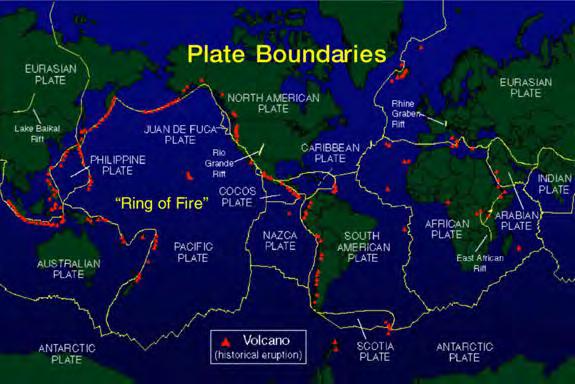
7 Mexico Most of earthquakes occur in the plate boundaries Eurasia Plate Philippine Sea Plate North America Plate Pacific Plate Plate tectonic theory is proposed in the late 1950s
8 The 1985 M8.0 Mexico City, Mexico, earthquake... general information


9 ... movie about site effect The 1985 M8.0 Mexico City earthquake Fatality: ca. 40,000 Loss: 3-4 billion USD Shortage of medical resources Understanding the site effect Collapsed General Hospital Collapsed apartment complex
10 QuickTime?and a JVT/AVC Coding decompressor are needed to see this picture.
11 ... Taipei The ShakeMap of the Mexico City earthquake Site effect in Mexico City

12 Taipei is a basin, which has similar condition as Mexico City After Lee et al., Chi-Chi
13 The 1999 M7.6 Chi-Chi, Taiwan, earthquake earthquake... general information


14 ... GMPE The 1999 M7.6 Chi-Chi earthquake Great amount of seismic records Fatality: ca. 2,400 Loss: 3-4 billion USD Site response spectrum Good seismic records 3-floor building Near the epicenter 12-floor building in Taipei
 Ground motion (gal)")

15 Application of the ground motion prediction equation (GMPE) Ground motion (gal) Epicentral distance (km) building code... Taipei has larger amplitudes due to the basin effect.
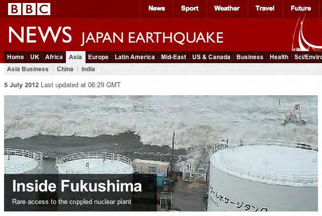
16 Number of damaged structures with respect to construction periods Tsai et al., 2000 Less damages due to the building code revision in Sumatra
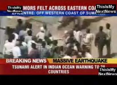
17 The 2004 M9.1 Sumatra, Indonesia, earthquake... general information

18 ... tsunami generation The 2004 M9.1 Sumatra, Indonesia, earthquake Fatality: 230,000 people in 14 countries No regional tsunami warning system in 2004
19 ... tsunami generation The 2004 M9.1 Sumatra, Indonesia, earthquake QuickTime?and a GIF decompressor are needed to see this picture. Fatality: 230,000 people in 14 countries No regional tsunami warning system in 2004


20 Generation of tsunami wave The 2004 tsunami travel time Possibility of tsunami early warning system... TEW system in hour

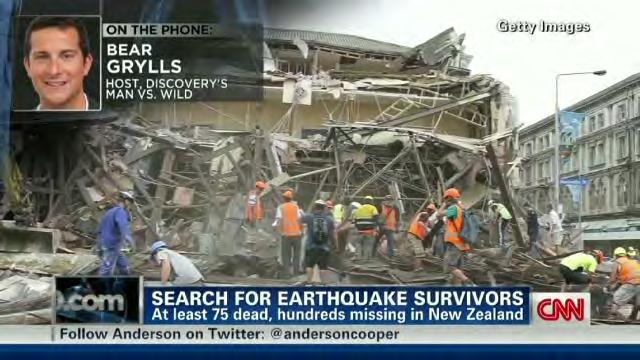
21 Christchurch
22 The 2011 M6.1 Christchurch, New Zealand, earthquake... general information


23 ... importance of aftershock Cathedral of the Blessed Sacrament Any alert before the 2011 Christchurch earthquake? Canterbury TV building ChristChurch Cathedral
24 Christchurch eq. can be regarded as a aftershock in the Darfield sequence Larger ground shaking by aftershock due to shorter epicentral distance Importance of aftershocks to seismic hazard evaluation Tohoku
25 The 2011 M9.0 Tohoku, Japan, earthquake... general information

26 The 2011 M9.0 Tohoku, Japan, earthquake Loss: US $235 billion* Explosion of the nuclear power plant QuickTime?and a GIF decompressor are needed to see this picture. *The most expensive natural disaster in world history.... movie for ground shaking
27 Case of the 2011 Tohoku earthquake QuickTime?and a JVT/AVC Coding decompressor are needed to see this picture.
28 ... eq information acquisition Seismic waveform S-wave P-wave P-wave: primary/pressure wave S-wave: secondary/shear wave
29 Where can we get the information about earthquakes?
30 Acquire earthquake information from news


31 Acquire earthquake information from social networks Could be a method to determine earthquakes locations.

32 Acquire earthquake information from USGS website

33 ... website for tsunami info Acquire earthquake information from CWB website

34 ... a break Acquire earthquake information from PTWC website
35 Seismic hazard mitigation by seismologists eq prediction...


36 only The success earthquake prediction experience: The 1975 Haicheng Earthquake Announcement: The movie will be performed outdoor due to earthquake prediction eq precursor...

37 Index for earthquake precursors From ISEP

38 Christchurch eq. can be regarded as a aftershock in the Darfield sequence It is important to understand earthquake interaction behaviors N Anatonian fault...

39 Animation... Stress changes associated with earthquake evolution in the North Anatolian Fault system in Turkey
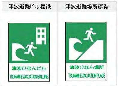
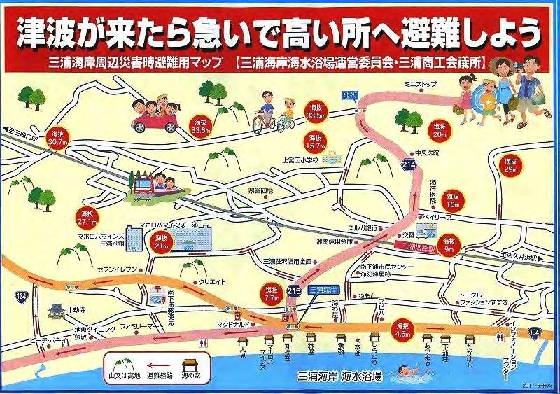
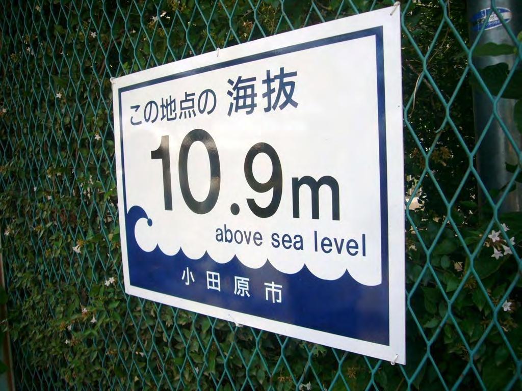
40 Earthquakes take place in the stress increase regions QuickTime?and a h264 decompressor are needed to see this picture.
41 Evolution of the dynamic stress by 2012 east Indian Ocean earthquake
42 Evolution of the dynamic stress by 2012 east Indian Ocean earthquake QuickTime?and a h264 decompressor are needed to see this picture.


43 Worldwide raise of seismicity rate associated with the transient stress triggering After Pollitz et al., 2012 Kanto forecasting...


44 Application of earthquake forecasting - to provide probability/percentage of earthquake After Toda et al., 2011 Tokyo Both observations and forecasting suggest rise of seismicity activity in Tokyo PSHA...

45 Seismic hazard in form of probabilistic of strong ground shaking PGA with a 10% probability of exceedance in 50 years EEW system...

46 The ShakeMap of the Mexico City earthquake Significant Site effect in Mexico City An ideal region for the application of the earthquake early warning system movie about site effect...
47 QuickTime?and a JVT/AVC Coding decompressor are needed to see this picture.
48 Application for the earthquake early warning P-wave S-wave Determine Earthquake magnitude S-wave amplitude chart for site effect...


49 Palert EEW Networking System hyperlink: Introduction of Palert.pptx By Prof. Yih-Min Wu movie for site effect...

50 tsunami signs...

51 Signs for tsunami evacuation in Japan contribution from others...
52 Seismic hazard mitigation by others
53 Earthquakes Don't Kill People?

54 Importance of the building codes Earthquakes Don't Kill People, Buildings Do movie for reinforced building...
55 Important of reinforced building QuickTime?and a h264 decompressor are needed to see this picture.

56 Engineers & policy makers can participate for seismic hazard mitigation To make safer buildings with lower costs. To make building code for mass destruction prevention. Historians...

57 Historians can participate for seismic hazard mitigation Information on the 1736 Tainan earthquake from the memorial to the throne. It provides information on seismic activity in the past. Architects and medical professionals...

58 Architects and medical professionals can participate for seismic hazard mitigation Case of the 1999 Chi-Chi event Structures are safe, but facilities are out of function.many hospitals render useless in disaster loss estimation...

59 recover curve...
60 The impact curves provide information on emergency response & facility restoration Probability of recovery time as a function of ground shaking PGA (g) actuaries...

61 Actuaries can participate for seismic hazard mitigation To determine insurance rate based on seismic hazard and structure type

62 Collaboration through GEM (Global Earthquake Model) Why GEM? A collaborative effort devised and launched by OECD s Global Science Forum, aimed at engaging the global community in the design, development and deployment of state-of-the-art open models and tools for earthquake risk assessment worldwide *OECD: Organisation for Economic Co-operation and Development Link for GEM:

63 Public-Private Partnership

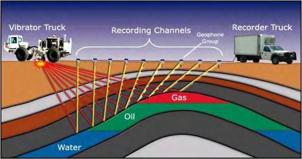
64 Scientific framework of GEM

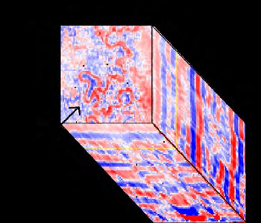
65 You need seismic hazard mitigation; seismic hazard mitigation needs you.
66 Thank you!

67 Demo of the EEW system in Japan
68 Demo of the EEW system in Japan QuickTime?and a h264 decompressor are needed to see this picture.

69 Z-value Blue: seismic quiescence Red: seismic activation The 1999 Chi-Chi epicenter As the behavior of earthquakes, we also need a break to refill our energy. After Wu & Chiao, 2006 Seismicity reduction before the Chi-Chi earthquake near the rupture region
70
71 Benefits of earthquakes


72 Using CT for checking body s interior CT: Computed Tomography Movie for seismic imaging...
73 Introduction of seismic imaging QuickTime?and a JVT/AVC Coding decompressor are needed to see this picture.

74 Application of seismic profile - oil and gas exploratory distinguish faults...

75 Application of seismic profile - faults identification Case near the Japan trench, To understand the rupture behaviors of the 2011 Tohoku earthquake. explore the earth...

76 Understand the earth s interior through seismic waves hazard mitigation...
77 Characteristics and introduction of Earthquake in Asia-Pacific region Chung-Han Chan 詹忠翰 Department of Geosciences, National Taiwan University
")


78 Hazard global component Expert elicitation, 5 Request for Proposals (RfP) drafting and publication International consortia submitted 9 proposals (20+ Institutions) 14 peer reviewers, Scientific Board selection, Governing Board decision. Global Earthquake History Global Instrumental Earthquake Catalogue Global Active Fault and Seismic Source Database Global Ground-Motion Prediction Equations Global Geodetic Strain Rate Model
 drafting, community feedback, RfP review and publication")


79 Exposure/Vulnerability global components Expert elicitation, 5 Request for Proposals (RfP) drafting, community feedback, RfP review and publication International consortia submitted 14 proposals (60+ Institutions) 20 peer reviewers, Scientific Board selection, Governing Board decision. GEM Ontology and Taxonomy Global Exposure Database Global Earthquake Consequences Database Global Vulnerability Estimation Methods Inventory Dara Capture Tools

80 Evolution of the dynamic stress by 2012 east Indian Ocean earthquake
81

82 Plate motions
83 Plate motions QuickTime?and a h264 decompressor are needed to see this picture.

84 Fossil evidence for Pangaea
85 Wave propagation - P wave QuickTime?and a GIF decompressor are needed to see this picture.
86 Wave propagation - S wave QuickTime?and a GIF decompressor are needed to see this picture.
87 Wave propagation - Love wave QuickTime?and a GIF decompressor are needed to see this picture.
88 Wave propagation - Rayleigh wave QuickTime?and a GIF decompressor are needed to see this picture.

89 For both onsite & regional early warning purposes Earthquake magnitudes can be determined in 3 sec.

90 Understand the earth s interior through seismic waves
Earthquakes. Earthquake Magnitudes 10/1/2013. Environmental Geology Chapter 8 Earthquakes and Related Phenomena
 Environmental Geology Chapter 8 Earthquakes and Related Phenomena Fall 2013 Northridge 1994 Kobe 1995 Mexico City 1985 China 2008 Earthquakes Earthquake Magnitudes Earthquake Magnitudes Richter Magnitude
I. Locations of Earthquakes. Announcements. Earthquakes Ch. 5. video Northridge, California earthquake, lecture on Chapter 5 Earthquakes!
 51-100-21 Environmental Geology Summer 2006 Tuesday & Thursday 6-9:20 p.m. Dr. Beyer Earthquakes Ch. 5 I. Locations of Earthquakes II. Earthquake Processes III. Effects of Earthquakes IV. Earthquake Risk
LECTURE #5: Plate Tectonics: Boundaries & Earthquake Science
 GEOL 0820 Ramsey Natural Disasters Spring, 2018 LECTURE #5: Plate Tectonics: Boundaries & Earthquake Science Date: 23 January 2018 I. Reminder: Exam #1 is scheduled for Feb 1st one week from Thursday o
Earthquakes. Pt Reyes Station 1906
 Earthquakes Pt Reyes Station 1906 Earthquakes Ground shaking caused by the sudden release of accumulated strain by an abrupt shift of rock along a fracture in the earth. You Live in Earthquake Country
e-science on Earthquake Disaster Mitigation in Taiwan
 e-science on Earthquake Disaster Mitigation in Taiwan Eric Yen EGI User Forum, April 2011 ~50 earthquakes/day Taiwan Seismicity on Google Earth 0 15 30 70 100 150 km Eurasia Plate S01R Philippine Sea Plate
Disclaimer. This report was compiled by an ADRC visiting researcher (VR) from ADRC member countries.
 from ADRC member countries.") Disclaimer This report was compiled by an ADRC visiting researcher (VR) from ADRC member countries. The views expressed in the report do not necessarily reflect the views of the ADRC. The boundaries and
Disclaimer This report was compiled by an ADRC visiting researcher (VR) from ADRC member countries. The views expressed in the report do not necessarily reflect the views of the ADRC. The boundaries and
EARTHQUAKES. Bruce A. Bolt. Fifth Edition. W. H. Freeman and Company New York. University of California, Berkeley
 EARTHQUAKES Fifth Edition Bruce A. Bolt University of California, Berkeley DS W. H. Freeman and Company New York Preface xi What We Feel in an Earthquake 1 The 1906 Eye-Opening San Francisco Earthquake
Earthquake Hazards. Tsunami
 Earthquake Hazards Tsunami Review: What is an earthquake? Earthquake is the vibration (shaking) and/or displacement of the ground produced by the sudden release of energy. The point inside the Earth where
Earthquake Hazards. Tsunami
 Earthquake Hazards Tsunami Review: What is an earthquake? Earthquake is the vibration (shaking) and/or displacement of the ground produced by the sudden release of energy. The point inside the Earth where
Magnitude 7.9 SE of KODIAK, ALASKA
 A magnitude 7.9 earthquake occurred at 12:31 am local time 181 miles southeast of Kodiak at a depth of 25 km (15.5 miles). There are no immediate reports of damage or fatalities. Light shaking from this
Earthquakes and Earthquake Hazards Earth - Chapter 11 Stan Hatfield Southwestern Illinois College
 Earthquakes and Earthquake Hazards Earth - Chapter 11 Stan Hatfield Southwestern Illinois College What Is an Earthquake? An earthquake is the vibration of Earth, produced by the rapid release of energy.
Earthquakes and Faulting
 Earthquakes and Faulting Crustal Strength Profile Quakes happen in the strong, brittle layers Great San Francisco Earthquake April 18, 1906, 5:12 AM Quake lasted about 60 seconds San Francisco was devastated
M 7.1 EARTHQUAKE 5KM ENE OF RABOSO, MEXICO EXACT LOCATION: N W DEPTH: 51.0KM SEPTEMBER 19, 1:14 LOCAL TIME
 M 7.1 EARTHQUAKE 5KM ENE OF RABOSO, MEXICO EXACT LOCATION: 18.584 N 98.399 W DEPTH: 51.0KM SEPTEMBER 19, 2017 @ 1:14 LOCAL TIME Photo: Eduardo Verdugo / AP Photo: Alfredo Estrella/ Agence France-Presse/
Pacific Catastrophe Risk Assessment And Financing Initiative
 Pacific Catastrophe Risk Assessment And Financing Initiative TIMOR-LESTE September Timor-Leste is expected to incur, on average, 5.9 million USD per year in losses due to earthquakes and tropical cyclones.
22.5 Earthquakes. The tsunami triggered by the 2004 Sumatra earthquake caused extensive damage to coastal areas in Southeast Asia.
 The tsunami triggered by the 2004 Sumatra earthquake caused extensive damage to coastal areas in Southeast Asia. An earthquake is a movement of Earth s lithosphere that occurs when rocks in the lithosphere
Earthquake Hazards. Tsunami
 Earthquake Hazards Tsunami Measuring Earthquakes Two measurements that describe the power or strength of an earthquake are: Intensity a measure of the degree of earthquake shaking at a given locale based
Tectonic Processes and Hazards Enquiry Question 1: Why are some locations more at risk from tectonic hazards?
 Tectonic Processes and Hazards Enquiry Question 1: Why are some locations more at risk from tectonic hazards? Key words Basalt Andesite Rhyolite Benioff Zone Subduction zone Crustal fracturing Definition
Earthquakes and Earth s Interior
 - What are Earthquakes? Earthquakes and Earth s Interior - The shaking or trembling caused by the sudden release of energy - Usually associated with faulting or breaking of rocks - Continuing adjustment
Pacific Catastrophe Risk Assessment And Financing Initiative
 Pacific Catastrophe Risk Assessment And Financing Initiative PALAU September is expected to incur, on average,.7 million USD per year in losses due to earthquakes and tropical cyclones. In the next 5 years,
Important Concepts. Earthquake hazards can be categorized as:
 Lecture 1 Page 1 Important Concepts Monday, August 17, 2009 1:05 PM Earthquake Engineering is a branch of Civil Engineering that requires expertise in geology, seismology, civil engineering and risk assessment.
The Earthquake Cycle Chapter :: n/a
 The Earthquake Cycle Chapter :: n/a A German seismogram of the 1906 SF EQ Image courtesy of San Francisco Public Library Stages of the Earthquake Cycle The Earthquake cycle is split into several distinct
Low-Latency Earthquake Displacement Fields for Tsunami Early Warning and Rapid Response Support
 Low-Latency Earthquake Displacement Fields for Tsunami Early Warning and Rapid Response Support Hans-Peter Plag, Geoffrey Blewitt Nevada Bureau of Mines and Geology and Seismological Laboratory University
Pacific Catastrophe Risk Assessment And Financing Initiative
 Pacific Catastrophe Risk Assessment And Financing Initiative VANUATU September 211 Country Risk Profile: VANUATU is expected to incur, on average, 48 million USD per year in losses due to earthquakes and
Chapter 15. Earthquakes and Plate Tectonics. what s the connection? At the boundaries friction causes plates to stick together.
 Chapter 15 Earthquakes and Plate Tectonics what s the connection? As with volcanoes, earthquakes are not randomly distributed over the globe At the boundaries friction causes plates to stick together.
Dangerous tsunami threat off U.S. West Coast
 Earthquakes Ch. 12 Dangerous tsunami threat off U.S. West Coast Earthquakes What is an Earthquake? It s the shaking and trembling of the Earth s crust due to plate movement. The plates move, rocks along
Magnitude 7.0 N of ANCHORAGE, ALASKA
 A magnitude 7.0 earthquake occurred just before 8:30 am local time 8 miles north of Anchorage at a depth of 40.9 km (25.4 miles). There are reports of major infrastructure damage and damage to many homes
Section 19.1: Forces Within Earth Section 19.2: Seismic Waves and Earth s Interior Section 19.3: Measuring and Locating.
 CH Earthquakes Section 19.1: Forces Within Earth Section 19.2: Seismic Waves and Earth s Interior Section 19.3: Measuring and Locating Earthquakes Section 19.4: Earthquakes and Society Section 19.1 Forces
#13 Earthquake Prediction
 #13 Earthquake Prediction Obvious importance Earthquake Prediction Save lives, reduce damage Earthquake Prediction - Types Long-range prediction - involves EQ probability over long time period (years to
An entire branch of Earth science, called, is devoted to the study of earthquakes.
 Lesson One Essential Question Where do earthquakes take place? What causes earthquakes? What are three different types of faults that occur at plate boundaries? How does energy from earthquakes travels
ShakeAlert Earthquake Early Warning
 ShakeAlert Earthquake Early Warning Doug Given USGS, Pasadena Earthquake Program, Early Warning Coordinator 10 seconds 50 seconds 90 seconds USGS Earthquake Hazard Responsibilities USGS has the lead federal
Three Fs of earthquakes: forces, faults, and friction. Slow accumulation and rapid release of elastic energy.
 Earthquake Machine Stick-slip: Elastic Rebound Theory Jerky motions on faults produce EQs Three Fs of earthquakes: forces, faults, and friction. Slow accumulation and rapid release of elastic energy. Three
GEO-VIII November Geohazard Supersites and Natural Laboratories Progress Report. Document 9
 GEO-VIII 16-17 November 2011 Geohazard Supersites and Natural Laboratories Progress Report Document 9 This document is submitted to GEO-VIII for information. Geohazard Supersites and Natural Laboratories
Earthquakes Chapter 19
 Earthquakes Chapter 19 Does not contain complete lecture notes. What is an earthquake An earthquake is the vibration of Earth produced by the rapid release of energy Energy released radiates in all directions
Natural Disasters Spring, LECTURE #8: Earthquake Disasters: Monitoring & Mitigation. Date: 1 Feb 2018 (lecturer: Dr.
 GEOL 0820 Ramsey Natural Disasters Spring, 2018 LECTURE #8: Earthquake Disasters: Monitoring & Mitigation Date: 1 Feb 2018 (lecturer: Dr. Shawn Wright) I. Exam I - Reminder Feb 6 th next class details:
Tsunami waves swept away houses and cars in northern Japan and pushed ships aground.
 Japan was struck by a magnitude 8.9 earthquake off its northeastern coast Friday. This is one of the largest earthquakes that Japan has ever experienced. In downtown Tokyo, large buildings shook violently
Use this checklist for revision. Combine with textbook, revision websites and revision guide.
 Paper 1: Tectonics Use this checklist for revision. Combine with textbook, revision websites and revision guide. Lesson Title Spec Point Keywords Case Studies/Key skills Practiced Exam Questions Revised?
Magnitude 6.9 GULF OF CALIFORNIA
 A pair of strong earthquakes struck off the coast of Mexico early Thursday only minutes apart. The magnitude 6.9 and 6.2 were centered about 85 miles northeast of Guerrero Negro in the Mexican state of
Earthquakes. Building Earth s Surface, Part 2. Science 330 Summer What is an earthquake?
 Earthquakes Building Earth s Surface, Part 2 Science 330 Summer 2005 What is an earthquake? An earthquake is the vibration of Earth produced by the rapid release of energy Energy released radiates in all
Unit 9 (packet #2): Volcanoes and Earthquakes
: Volcanoes and Earthquakes") Unit 9 (packet #2): Volcanoes and Earthquakes 13. Earthquakes are one of the most destructive natural forces. I can a. Explain what an earthquake is, where they occur and why they occur. b. Describe the
Unit 9 (packet #2): Volcanoes and Earthquakes 13. Earthquakes are one of the most destructive natural forces. I can a. Explain what an earthquake is, where they occur and why they occur. b. Describe the
Earthquakes down under: a rare but real hazard
 University of Wollongong Research Online Faculty of Science, Medicine and Health - Papers Faculty of Science, Medicine and Health 2015 Earthquakes down under: a rare but real hazard Solomon Buckman University
Earthquakes. Earthquakes and Plate Tectonics. Earthquakes and Plate Tectonics. Chapter 6 Modern Earth Science. Modern Earth Science. Section 6.
 Earthquakes Chapter 6 Modern Earth Science Earthquakes and Plate Tectonics Section 6.1 Modern Earth Science Earthquakes and Plate Tectonics Earthquakes are the result of stresses in Earth s s lithosphere.
Seismic Activity and Crustal Deformation after the 2011 Off the Pacific Coast of Tohoku Earthquake
 J-RAPID Symposium March 6-7, 2013 Seismic Activity and Crustal Deformation after the 2011 Off the Pacific Coast of Tohoku Earthquake Y. Honkura Tokyo Institute of Technology Japan Science and Technology
Magnitude 8.2 NORTHWEST OF IQUIQUE, CHILE
 An 8.2-magnitude earthquake struck off the coast of northern Chile, generating a local tsunami. The USGS reported the earthquake was centered 95 km (59 miles) northwest of Iquique at a depth of 20.1km
Earthquakes Earth, 9th edition, Chapter 11 Key Concepts What is an earthquake? Earthquake focus and epicenter What is an earthquake?
 1 2 3 4 5 6 7 8 9 10 Earthquakes Earth, 9 th edition, Chapter 11 Key Concepts Earthquake basics. "" and locating earthquakes.. Destruction resulting from earthquakes. Predicting earthquakes. Earthquakes
Magnitude 7.7 QUEEN CHARLOTTE ISLANDS REGION
 A major 7.7 magnitude earthquake struck at 8:04 PM local time in western British Columbia, Canada. The epicenter is located on Moresby Island, the southern large island in the Queen Charlotte Islands region.
JMA Tsunami Warning Services. Tomoaki OZAKI Senior Coordinator for Tsunami Forecast Modeling Japan Meteorological Agency
 JMA Tsunami Warning Services Tomoaki OZAKI Senior Coordinator for Tsunami Forecast Modeling Japan Meteorological Agency Organization Chart of the Government of Japan Cabinet Office Diet Ministry of Internal
STRESS IN THE SYSTEM? INSIGHTS INTO MODELLING IN THE WAKE OF TOHOKU
 STRESS IN THE SYSTEM? INSIGHTS INTO MODELLING IN THE WAKE OF TOHOKU Aspen Re June 13, 2012 James Few President, Aspen Re Aspen Insurance Holdings Limited AGENDA Do we need near-term quake rates? Lessons
Section Forces Within Earth. 8 th Grade Earth & Space Science - Class Notes
 Section 19.1 - Forces Within Earth 8 th Grade Earth & Space Science - Class Notes Stress and Strain Stress - is the total force acting on crustal rocks per unit of area (cause) Strain deformation of materials
What is an Earthquake?
 Earthquakes What is an Earthquake? Earthquake - sometimes violent shaking of ground caused by movement of Earth s tectonic plates; creates seismic waves Often followed by smaller earthquakes (aftershocks);
JMA Tsunami Warning Services. Takeshi KOIZUMI Senior Coordinator for International Earthquake and Tsunami Information Japan Meteorological Agency
 JMA Tsunami Warning Services Takeshi KOIZUMI Senior Coordinator for International Earthquake and Tsunami Information Japan Meteorological Agency Tectonic Setting of Japan (Headquarters for Earthquake Research
LAB 9: Earthquakes & Seismic Activity
 LAB 9: Earthquakes & Seismic Activity Objectives Identify P, S, and surface waves on a simple seismogram Locate the epicenter of an earthquake using seismograms and travel times curves Describe how the
Indian Ocean Tsunami Warning System: Example from the 12 th September 2007 Tsunami
 Indian Ocean Tsunami Warning System: Example from the 12 th September 2007 Tsunami Charitha Pattiaratchi 1 Professor of Coastal Oceanography, The University of Western Australia Email: chari.pattiaratchi@uwa.edu.au
Predicting Structural Response with On-Site Earthquake Early Warning System Using Neural Networks
 Proceedings of the Ninth Pacific Conference on Earthquake Engineering Building an Earthquake-Resilient Society 14-16 April, 2011, Auckland, New Zealand Predicting Structural Response with On-Site Earthquake
M-8.1 EARTHQUAKE 87KM SW OF PIJIJIAPAN, MEXICO EXACT LOCATION: N W DEPTH: 69.7KM SEPTEMBER 7, 11:49 PST
 M-8.1 EARTHQUAKE 87KM SW OF PIJIJIAPAN, MEXICO EXACT LOCATION: 15.068 N 93.715 W DEPTH: 69.7KM SEPTEMBER 7, 2017 @ 11:49 PST Photo: Luis Alberto Cruz / AP Photo: Carlos Jasso 1 THE 2017 CHIAPAS MEXICO
Earthquake early warning: Adding societal value to regional networks and station clusters
 Earthquake early warning: Adding societal value to regional networks and station clusters Richard Allen, UC Berkeley Seismological Laboratory rallen@berkeley.edu Sustaining funding for regional seismic
Magnitude 8.2 FIJI. A magnitude 8.2 earthquake occurred km (226.7 mi) E of Suva, Fiji at a depth of km (350 miles).
 E of Suva, Fiji at a depth of km (350 miles).") A magnitude 8.2 earthquake occurred 364.8 km (226.7 mi) E of Suva, Fiji at a depth of 563.4 km (350 miles). There is no risk of a tsunami from an earthquake at this depth. Images courtesy of Google The
A magnitude 8.2 earthquake occurred 364.8 km (226.7 mi) E of Suva, Fiji at a depth of 563.4 km (350 miles). There is no risk of a tsunami from an earthquake at this depth. Images courtesy of Google The
Pacific Catastrophe Risk Assessment And Financing Initiative
 Pacific Catastrophe Risk Assessment And Financing Initiative TUVALU is expected to incur, on average,. million USD per year in losses due to earthquakes and tropical cyclones. In the next 5 years, has
Magnitude 7.2 OAXACA, MEXICO
 A magnitude 7.2 earthquake has occurred in Oaxaca, Mexico at a depth of 24.6 km (15 miles). It was felt as far away as Guatemala. There have been no reported deaths directly linked to the earthquake. Emergency
Finding an Earthquake Epicenter Pearson Education, Inc.
 Finding an Earthquake Epicenter Measuring the Size of Earthquakes Two measurements that describe the size of an earthquake are: 1. Intensity a measure of the degree of earthquake shaking at a given locale
Name Date Class. radiate in all directions, carrying some of the. of plate boundaries have different usual patterns of.
 Chapter Outline Earthquakes CHAPTER 6 Lesson 1: Earthquakes and Plate Boundaries A. What is an earthquake? 1. A(n) is the rupture and sudden movement of rocks along a fault. A fault is a fracture surface
The ITSU System in the Pacific Region and Future Upgrades
 The ITSU System in the Pacific Region and Future Upgrades Eddie Bernard Director, Pacific Marine Environmental Laboratory (PMEL) NOAA/USA Pacific Tsunami Warning Center OPERATIONAL ACTIVITIES SEISMIC DATA
THE 2011 TOHOKU EARTHQUAKE IN JAPAN. VSU Lyuben Karavelov, Sofia, Bulgaria. Key words: Tohoku earthquake, strong ground motion, damage
 THE 2011 TOHOKU EARTHQUAKE IN JAPAN Radan Ivanov 1 VSU Lyuben Karavelov, Sofia, Bulgaria Abstract: This earthquake which occurred on March 11, 2011, had a magnitude of 9.0, which places it as the fourth
Initiative. Country Risk Profile: papua new guinea. Better Risk Information for Smarter Investments PAPUA NEW GUINEA.
 Pacific Catastrophe Risk Assessment And Financing Initiative PAPUA NEW GUINEA September 211 Country Risk Profile: papua new is expected to incur, on average, 85 million USD per year in losses due to earthquakes
Real Time Monitoring System for Megathrust Earthquakes and Tsunamis - Cabled Network System and Buoy System in Japan -
 Real Time Monitoring System for Megathrust Earthquakes and Tsunamis - Cabled Network System and Buoy System in Japan - 1 Subduction zones around the world Haiti Italy Turkey Tohoku Sichuan Taiwan Sumatra
Earthquake Source. Kazuki Koketsu. Special Session: Great East Japan (Tohoku) Earthquake. Earthquake Research Institute, University of Tokyo
 Earthquake. Earthquake Research Institute, University of Tokyo") 2012/9/24 17:20-17:35 WCEE SS24.4 Special Session: Great East Japan (Tohoku) Earthquake Earthquake Source Kazuki Koketsu Earthquake Research Institute, University of Tokyo 1 Names and features of the earthquake
2012/9/24 17:20-17:35 WCEE SS24.4 Special Session: Great East Japan (Tohoku) Earthquake Earthquake Source Kazuki Koketsu Earthquake Research Institute, University of Tokyo 1 Names and features of the earthquake
Building up Seismsic Models for Ground Motion Prediction of Taiwan: Problems and Challenges
 Building up Seismsic Models for Ground Motion Prediction of Taiwan: Problems and Challenges Kuo-Fong Ma 馬國鳳 Institute of Geophysics National Central University What approaches we can make toward a reliable
Japan Quake: Why Do Humans Live In Dangerous Places? By Simon Saint
 Japan Quake: Why Do Humans Live In Dangerous Places? By Simon Saint What are some good things that volcanoes do? - Mount Saint Helens; Japan Earthquakes and Volcanoes; Eruptions; Rocks of the countries
M-6.2 EARTHQUAKE NORCIA, ITALY AUGUST 24, 01:36:33 UTC
 M-6.2 EARTHQUAKE NORCIA, ITALY AUGUST 24, 2016 @ 01:36:33 UTC EARTHQUAKE REPORT - NORCIA, ITALY M-6.2, 24 August 2016 The M-6.2 earthquake had a shallow depth (10 km) and struck approximately 10 km SE
26 May 15. Summer Session Horst Rademacher. Lect 1: Earthquakes: The Basics
 26 May 15 Summer Session 2015 Horst Rademacher HH Lect 1: Earthquakes: The Basics Class organization Instructor Horst Rademacher - horst@berkeley.edu Office hours: Tuesday 3-5 pm (after class) Where: 213
Earthquakes = shaking of Earth because of a rapid release of energy
 There are more than 30,000 earthquakes worldwide each year! Earthquakes = shaking of Earth because of a rapid release of energy usually because of movement of tectonic plates Most earthquakes last for
10/18/2011. Chapter 8. Elastic Rebound Theory. Introduction. Earthquakes. and the Earth s Interior. Introduction. Introduction.
 Chapter 8 Introduction Earthquake the sudden release of energy, usually along a fault, that produces shaking or trembling of the ground Earthquakes and the Earth s Interior Fig. 8.1 b, p. 191 Introduction
Agency Vision and Decision- Maker Needs: A USGS Perspective
 Agency Vision and Decision- Maker Needs: A USGS Perspective Connecting Grassroots to Government for Disaster Management David Applegate USGS Associate Director for Natural Hazards September 13, 2012 U.S.
Establishment and Operation of a Regional Tsunami Warning Centre
 Establishment and Operation of a Regional Tsunami Warning Centre Dr. Charles McCreery, Director NOAA Richard H. Hagemeyer Pacific Tsunami Warning Center Ewa Beach, Hawaii USA Why A Regional Tsunami Warning
GEM Faulted Earth. A Global Active Fault and Fault Source Database
 GEM Faulted Earth A Global Active Fault and Fault Source Database Marco Pagani on behalf of GEM Faulted Earth Kelvin Berryman, Carlos Costa, Kerry Sieh Nicola Litchfield, Annemarie Christophersen THIS
What Is an Earthquake? What Is an Earthquake? Earthquake
 Earthquakes Earth,, Chapter 11 Built Earthquakes: on shaky summary ground, in haiku form Memphis, south of New Madrid - whole lotta shakin'... What Is an Earthquake? An earthquake is ground shaking caused
Magnitude 7.5 PALU, INDONESIA
 A magnitude 7.5 earthquake occurred 80.8 km (50.2 mi) north of Palu, Indonesia at a depth of 10 km (6.2 miles). This earthquake triggered a tsunami with wave heights up to 2 m (6.6 ft) that an official
Magnitude 7.6 SOUTH OF IQUIQUE, CHILE
 A powerful aftershock struck off northern Chile prompting an evacuation of the coastal area and raising fears of a tsunami. This magnitude 7.6 earthquake is the largest of a series of aftershocks following
What is an earthquake?
 Earthquakes Definitions Seismology The study of earthquakes dates back almost 2000 years to the Chinese Fault A crack in the Earth along which movement or sliding occurs What is an earthquake? Focus vs.
Lecture notes Bill Engstrom: Instructor Earthquakes GLG 101 Physical Geology
 Lecture notes Bill Engstrom: Instructor Earthquakes GLG 101 Physical Geology Now that we ve seen what faults are and how mountains are built, we can look at what happens when there is movement along those
Plate Tectonics IDEA THAT EARTH S SURFACE IS BROKEN INTO PLATES THAT MOVE AROUND. Fault = fracture in the crust where the movement has occurred
 Warm-up #14 A mountain range found 100 meters above sea level is measured to be 1,000 meters high from its tallest peak. From the top, the first 500 meters are incredibly steep. After this point, the mountain
Earthquakes!! Be sure to fill in your notes sheet as you go through the power point!
 Earthquakes!! Be sure to fill in your notes sheet as you go through the power point! Plate Boundary Review Click on the link below to try some plate boundary movement simulations. The link will take you
Magnitude 7.1 NEAR THE EAST COAST OF HONSHU, JAPAN
 Japan was rattled by a strong aftershock and tsunami warning Thursday night nearly a month after a devastating earthquake and tsunami flattened the northeastern coast. This earthquake can be considered
Earthquake. What is it? Can we predict it?
 Earthquake What is it? Can we predict it? What is an earthquake? Earthquake is the vibration (shaking) and/or displacement of the ground produced by the sudden release of energy. Rocks under stress accumulate
Training System and Information Network for Earthquake Disaster Mitigation. Taiki SAITO. Building Research Institute (BRI)
") 1 Training System and Information Network for Earthquake Disaster Mitigation Taiki SAITO Chief Research Engineer, International Institute of Seismology and Earthquake Engineering (IISEE), Building Research
1 Training System and Information Network for Earthquake Disaster Mitigation Taiki SAITO Chief Research Engineer, International Institute of Seismology and Earthquake Engineering (IISEE), Building Research
Module 2, Investigation 1: Earthquake Hazards
 Module 2, Investigation 1: Earthquake Hazards Introduction Welcome! In the last module, you assumed the role of a volcanologist and learned how volcanoes are described and monitored. You will now assume
4/22/2011. Skill sharing session AVC what makes the ground tremble? What to do before. What to do during. What to do after
 Skill sharing session AVC 2011 Session Objectives what makes the ground tremble? What to do before What to do during What to do after Definition of earthquake Earthquake causes Characteristic of earthquake
Earthquakes. These icons indicate that teacher s notes or useful web addresses are available in the Notes Page.
 Earthquakes These icons indicate that teacher s notes or useful web addresses are available in the Notes Page. This icon indicates the slide contains activities created in Flash. These activities are not
Publishable Summary. Summary Description of the project context and main objectives
 Publishable Summary Summary Description of the project context and main objectives Tsunamis are low frequency but high impact natural disasters. In 2004, the Boxing Day tsunami killed hundreds of thousands
Earthquakes and Tsunamis
 Earthquakes and Tsunamis Kenji Satake Earthquake Research Institute University of Tokyo 1 Part I 2011 Tohoku earthquake and tsunami 2 Fukushima Dai ichi NPP accident Earthquake ground motion Reactors automatically
Word Cards. 2 map. 1 geographic representation. a description or portrayal of the Earth or parts of the Earth. a visual representation of an area
 Name: Date: Hour: Word Cards 1 geographic representation a description or portrayal of the Earth or parts of the Earth Example: A map is a representation of an actual location or place. 2 map a visual
Lecture Outline Wednesday-Monday April 18 23, 2018
 Lecture Outline Wednesday-Monday April 18 23, 2018 Questions? Lecture Final Exam Lecture Section 1 Friday May 4, 8:00-10:00am Lecture Section 2 Friday May 4, 3:10-5:10 pm Final Exam is 70% new material
Southern California Earthquake Center Collaboratory for the Study of Earthquake Predictability (CSEP) Thomas H. Jordan
 Thomas H. Jordan") Southern California Earthquake Center Collaboratory for the Study of Earthquake Predictability (CSEP) Thomas H. Jordan SCEC Director & Professor, University of Southern California 5th Joint Meeting of
Southern California Earthquake Center Collaboratory for the Study of Earthquake Predictability (CSEP) Thomas H. Jordan SCEC Director & Professor, University of Southern California 5th Joint Meeting of
UGRC 144 Science and Technology in Our Lives/Geohazards
 UGRC 144 Science and Technology in Our Lives/Geohazards Session 3 Understanding Earthquakes and Earthquake Hazards Lecturer: Dr. Patrick Asamoah Sakyi Department of Earth Science, UG Contact Information:
Directed Reading. Section: How and Where Earthquakes Happen WHY EARTHQUAKES HAPPEN. Skills Worksheet. 1. Define earthquake.
 Skills Worksheet Directed Reading Section: How and Where Earthquakes Happen 1. Define earthquake. 2. When do earthquakes usually occur? 3. What is a fault? WHY EARTHQUAKES HAPPEN 4. Rocks along both sides
Earthquakes.
 Earthquakes http://thismodernworld.com/comic-archive Elastic rebound http://projects.crustal.ucsb.edu/understanding/elastic/rebound.html Elastic rebound Rocks store energy elastically When stored stress
5. Principles. 1. Malaysia is not free from. Kuala Teriang, Langkawi
 5. Principles 1. Malaysia is not free from seismic-induced geohazards. However, the degree and magnitude of the geohazards are relatively small or minor because Malaysia is located in a stable tectonic
Seismic Source Mechanism
 Seismic Source Mechanism Yuji Yagi (University of Tsukuba) Earthquake Earthquake is a term used to describe both failure process along a fault zone, and the resulting ground shaking and radiated seismic
FROM SCIENCE TO ACTION: THE RISK ANALYST INTERMEDIARY
 FROM SCIENCE TO ACTION: THE RISK ANALYST INTERMEDIARY Gordon Woo Rome, 8 October, 2014 Many natural hazard stakeholders Civil protection, police and military authorities Infrastructure utility and transport
NPTEL Online - IIT Kanpur. Course Name Geotechnical Earthquake Engineering. Department IIT Kanpur
 NPTEL Online - IIT Kanpur Course Name Geotechnical Earthquake Engineering Department Instructor Civil Engineering Department IIT Kanpur Prof. N.R. Patra Module 1 INTRODUCTION TO GEOTECHNICAL ENGINEERING
2/8/2016 Magnitude-6.3 earthquake near Tainan, Taiwan, highlights the danger of blind thrust faults around the world
 Temblor.net Earthquake News & Blog Magnitude-6.3 earthquake near Tainan, Taiwan, highlights the danger of blind thrust faults around the world 6 February 2016 Quake Insight Revised The 5 Feb 2016 M=6.3