Stratigraphy and Petrography of Viking Sandstones in the Bayhurst Area, Southwestern Saskatchewan
|
|
|
- Virginia Anthony
- 5 years ago
- Views:
Transcription
1 Stratigraphy and Petrography of Viking Sandstones in the Bayhurst Area, Southwestern Saskatchewan C.A. Walz 1, P.K. Pedersen 2, and G. Chi 1 Walz, C.A., Pedersen, P.K., and Chi, G. (2005): Stratigraphy and petrography of Viking sandstones in the Bayhurst area, southwestern Saskatchewan; in Summary of Investigations 2005, Volume 1, Saskatchewan Geological Survey, Sask. Industry Resources, Misc. Rep , CD-ROM, Paper A-17, 17p. Abstract The Albian Viking Formation is an eastward prograding, wave-dominated clastic wedge underlain and overlain by marine shales. Oil and gas pools in the Viking Formation consist of stratigraphic and structural traps within linear sandstone bodies, generally oriented northwest-southeast, mimicking the paleoshoreline as it moved landward and seaward with changes in relative sea level. This study focuses on geological characteristics of two Bayhurst gas pools Kindersley/Kerrobert Bayhurst West Viking and Kindersley/Kerrobert Bayhurst Viking located in Townships 23 to 26 and Ranges 24W3 to 28W3 and covering an area of about 225 km 2 (87 square miles). Core and well-log cross sections, together with sedimentary facies maps, illustrate the stratigraphic and reservoir architecture of the Bayhurst gas pools, which are characterized by reservoir units that are separated from each other by flooding surfaces, sequence boundaries, and ravinement surfaces. The reservoirs include sandstones of an incised-valley fill and an older retrograding barrier-island system that unconformably overlies shoreface and shelf deposits. The reservoirs are capped by transgressive marine shales of the Westgate Formation. Preliminary petrographic studies indicate that Viking sandstones are calcareous sublitharenites, and litharenites to lithic wackes. Porosity values range from 1 to 24% based on point counting with the highest porosities found in valley-fill and barrier-washover facies. Porosity is mostly primary although minor dissolution features exist. Cementation (quartz overgrowth and carbonates) is minor throughout, except at the Viking Formation top where massive calcite cement completely occludes porosity. Fluid inclusions in calcite cements are all monophase (liquid-only), indicating early cementation at relatively low temperatures. Keywords: Viking Formation, Lower Cretaceous, siliciclastics, Williston Basin, barrier island, lagoon, incised valley, shoreface sandstones. 1. Introduction The Viking Formation is a sandstone-dominated unit enclosed within marine shales of the Lower Colorado Group in the Western Canadian Sedimentary Basin. It was first discovered to be a gas-producing sandstone in 1917 by S.E. Slipper (Jones, 1961). Since then, the Viking and equivalent sandstones have proven to be prolific oil- and gasbearing units and are still a target of exploratory drilling. Oil production from the Viking is concentrated in southern and central Alberta and southwestern Saskatchewan, and occurs in porous northwest-southeast trending sandstone bodies. Gas production from the Viking is widespread in southern, central, and western Alberta; northeastern B.C; and western Saskatchewan. There are 75 Viking gas fields with initial established marketable gas reserves of over 1000 x 10 6 m 3 (35 Bcf). Of these pools, 69 are in Alberta, four in Saskatchewan (including the Bayhurst Gas Field, Figure 1), and two in British Columbia (Bachu and Burwash, 1994). The Bayhurst Gas Field is made up of two pools, Kindersley/Kerrobert Bayhurst West Viking and Kindersley/Kerrobert Bayhurst Viking. These pools have a combined cumulative production of 332 x 10 6 m 3 (11.63 Bcf) from six wells. Further exploration in the Bayhurst and surrounding areas requires a better understanding of the reservoir architecture and controlling factors. Much research has been conducted on the Viking Formation, especially in Alberta. In Saskatchewan, studies focusing on the Viking Formation include Jones (1961), MacEachern (1994), Reynolds (1994), and MacEachern et al. (1999), and theses by Pozzobon (1987) and Webber (1997). This paper concentrates on the stratigraphy and petrography of the Viking sandstones in the Bayhurst Gas Field in southwestern Saskatchewan, which encompasses Townships 23 to 26 and Ranges 24W3 to 28W3, an area of about 225 km 2 (87 square miles) located northwest of the large Shackleton Gas Field in the Milk River Formation (Figure 1). The purpose of the study is to unravel the stratigraphic and petrographic characteristics of the reservoirs in the Bayhurst pools and relate these to the regional architecture of the Viking Formation in the area. 1 Department of Geology, University of Regina, 3737 Wascana Parkway, Regina, SK S4S 0A2; carrieawalz@yahoo.ca. 2 Currently with Apache Canada Ltd., #1000, 700-9th Avenue SW, Calgary, AB T2P 3V4; perkent@yahoo.com. Saskatchewan Geological Survey 1 Summary of Investigations 2005, Volume 1

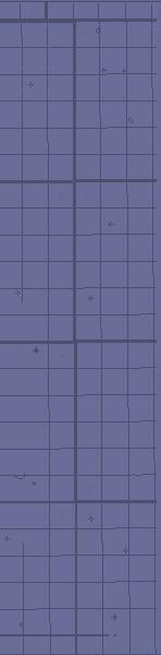
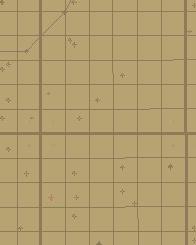
2 30 km (18.6 mi) Figure 1 - Regional map showing the location of the Bayhurst Gas Field in southwestern Saskatchewan. 2. Geological Background The Albian Viking Formation is part of the Lower Colorado Group of the Lower Cretaceous. The Viking and equivalent strata are found throughout most of the Western Canadian Sedimentary Basin (Leckie et al., 1994) forming a coarse clastic wedge that prograded from the Cordilleran orogenic belt eastward into the foreland basin (Reinson et al., 1994). The Viking Formation is mainly made up of coarsening-/sanding-upward successions of predominantly marine sandstones, siltstones and shales, chert-pebble lags, and bentonite marker beds. The eastward pinch-out of individual overall coarsening-/sanding-upward successions suggests an eastward prograding shoreline (Pozzobon and Walker, 1990). The Viking sandstone bodies in the Bayhurst area appear to be the southeastern extension of the Viking shoreline in Alberta (Figure 2). In Saskatchewan, the Viking Formation ranges from 15 to 35 m in thickness, increasing to more than 65 m thick in southwestern Alberta. Within the study area, the thickness of the Viking ranges from 22 to 30 m. It thickens to the southwest and gradually thins to the northeast, fining laterally to silty shale (Figure 3). The Viking Formation is underlain by the Joli Fou Formation, Upper Albian in age, and overlain by marine shale of the Westgate Formation (Figure 4). The Joli Fou is a dark grey, noncalcareous marine shale, approximately 20 m thick, with a small proportion of interbedded fine- to medium-grained sandstone. Minor amounts of nodular phosphorite, bentonite, pelecypod coquinas, and concretions of siderite, calcite and pyrite also occur (Leckie et al., 1994). The Joli Fou Formation is very widespread. In western regions of Alberta and central regions of Alberta and Saskatchewan, it disconformably overlies the Mannville Group where the Basal Colorado/Spinney Hill are absent, and underlies the Viking Formation, disconformably in places. Correlative units of the Viking Formation include the Bow Island Formation in southwestern Alberta (Figure 4), the Newcastle Sandstone in Manitoba, the Pelican Formation in northeastern Alberta, and the Paddy Member (Peace River Formation) in the northwestern Alberta and northeastern British Columbia subsurface. Viking and equivalent units extend over practically the entire Western Canada Sedimentary Basin (Leckie et al., 1994). Saskatchewan Geological Survey 2 Summary of Investigations 2005, Volume 1
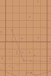
3 55 "PEACE RIVER DELTA" o Cold Lake ALBERTA map area SASK. 54 o o DEFORMED 52 o 110 o CRYSTAL?? BELT 50 o B.C. ALTA. Edmonton JOARCAM GILBY JOFFRE HARMATTAN E. NON-MARINE? Calgary o ? PALEOSHORELINE o EUREKA North Battleford N.E. EDGE OF SAND BAYHURST? STUDY AREA 20 ALTA. SASK. 108 o Figure 2 - Location map of the Viking fields in western Canada, showing the extension of shorelines into southwestern Saskatchewan (modified from Pozzobon and Walker, 1990). The Upper Albian Westgate Member (McNeil and Caldwell, 1981) comprises shale above the Viking Formation and below the Fish Scales Formation, which is a regionally distinct marker bed readily recognizable on geophysical logs. 3. Facies Description Based on careful examination of core from 23 wells scattered throughout the Bayhurst area, seven sedimentary facies have been recognized. Thirteen cores were considered to be good quality, the other nine cores to be poor quality (Figure 5). The term facies is used to summarize the descriptive aspects of the rocks, including the lithology, and physical and biological sedimentary structures. a) Facies A: Bioturbated Sandstones and Mudstones Facies A consists of very fine- to fine-grained sandstone with interbedded mudstones. The mudstone beds are abundant throughout; some are continuous across the width of the core whereas others are discontinuous due to bioturbation. The ratio of sand to mud ranges from 70:30 to 90:10. The mudstones are moderately to intensely bioturbated. Distinct trace fossils include Zoophycus (Z), Teichichnus (T), Terebellina, and Planolites (P) (Figures 6A, B, and C). The orientation of most of the trace fossils is horizontal; a few are vertical. Evidence of hummocky cross-stratification (HCS) or trough cross-bedding is rare, but present, and low-angle planar lamination Saskatchewan Geological Survey 3 Summary of Investigations 2005, Volume 1

4 T27 16 T T25 32 T24 N T23 R28 R27 R26 R25 R24 R23 R22W3 8 km (5 miles) Figure 3 - Isopach map of the Viking Formation in the Bayhurst area. also occurs. The facies is characterized by a sanding-upward trend. Pyrite concretions range in diameter from 1 to 2 cm. Figure 4 - Stratigraphic correlation chart of the Viking Formation and equivalent Bow Island Formation. The muddy sandstones of Facies A are interpreted to have been deposited in lower shoreface to transition-zone settings under fluctuating moderate- to lowenergy conditions. This interpretation is based on the presence of dominant Cruziana ichnofacies (MacEachern, 1994) and of storm deposits, represented by HCS, that are interbedded with bioturbated mudstones (Walker and James, 1992). The Cruziana ichnofacies is most characteristic of subtidal, poorly sorted and unconsolidated substrates. Conditions typically ranged from moderate-energy levels in shallow waters below fair-weather wave base but above storm wave base, to low-energy levels in deeper, quieter waters. Sediment deposition rates ranged from negligible to appreciable, Saskatchewan Geological Survey 4 Summary of Investigations 2005, Volume 1
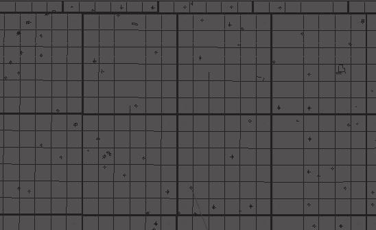
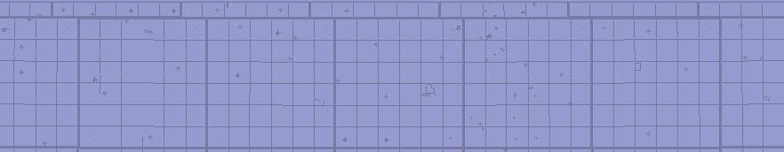
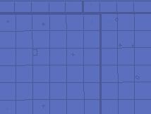
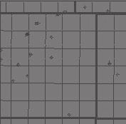
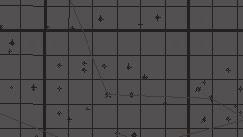
5 but were not normally rapid (Pemberton, 1992a). b) Facies B: Sandstone with Organic-rich Laminations Facies B consists of fine- to medium-grained sandstone interbedded with rare mudstone layers.the sandstone is well to very well sorted with little bioturbation. Recognizable trace fossils include Ophiomorpha burrows approximately 1 to 3 cm in diameter (Figure 6D). Coal and plant fragments a few millimeters to centimetres across are abundant, occurring preferentially in laminations. Chert clasts are rare and are up to 5 mm in diameter. Trough cross-bedding or swaley cross-stratification (SCS) is common (Figure 6E). Facies A and B make up the basal three coarsening-upward parasequences of the basal portion of the Viking Formation. Facies B is interpreted to have been deposited in a high-energy, sandy shoreface environment, based on the presence of trough cross-bedding or SCS (Walker and James, 1992) and of the Skolithos ichnofacies indicated by Ophiomorpha burrows (MacEachern, 1994). The Skolithos ichnofacies is indicative of relatively high levels of wave or current energy, and is typically developed in slightly muddy to clean, well sorted, loose or shifting particulate substrates. Increasing energy levels enhance physical reworking, thus tending to obliterate biogenic structures and preserve physical sedimentary structures. Such conditions commonly occur in the sandy shoreface of beaches, bars, and spits (Pemberton et al., 1992a). 8 km (5 miles) Figure 5 - Map showing locations of a) the 23 cores logged, of which 14 (green) were considered to be of good quality (green) and nine (red) of poor quality; and b) cross-sections A-A' and B-B'. Saskatchewan Geological Survey 5 Summary of Investigations 2005, Volume 1
.")
.")
.")
.")

6 A B C E D Figure 6 - A) Zoophycos (Z) burrows of Facies A ( W3, m [2281 ft]). B) Teichichnus (T) burrows of Facies A ( W3, m [2287 ft]). C) Planolites (P) and Zoophycos (Z) horizontal burrows of Facies A ( W3, m [2368 ft]). D) Ophiomorpha (O) burrow in medium-grained sandstone of Facies B ( W3, m [2339 ft]). E) Evidence of trough cross-bedding or swaley cross-stratification within Facies B ( W3, m [2353 ft]). Saskatchewan Geological Survey 6 Summary of Investigations 2005, Volume 1
7 c) Facies C: Sandstone with Organic-rich Mudstones Facies C consists of very fine-grained sandstone interbedded with organic-rich, dark brown to black mudstones (Figure 7A). Bioturbation, dominated by Planolites and Thalassinoides burrows, is moderate to intense within the mud layers. Sandstones of Facies C are poorly sorted, containing abundant chert pebbles and coal fragments up to 3 cm across. Sandstone-filled syneresis cracks radiating from a central point as discontinuous, sinuous and spindle structures (Plummer and Gostin, 1981) occur within the organic-rich mudstones (Figure 7B). In cross-sectional view, they are V- or U-shaped (Plummer and Gostin, 1981; Figure7B). The lower contact of Facies C is sharp whereas the upper contact is gradational into Facies D. Sandstones with organic-rich mudstones of Facies C are interpreted to have been deposited in a restricted, brackishwater, lagoonal environment behind a barrier. The syneresis cracks indicate fluctuating salinities. De-watering of swelling clays occurs with fluctuations in salinity in a restricted environment and causes the clay lattices to shrink and contract, resulting in the cracking of the mud (Plummer and Gostin, 1981). The cracks are infilled with sand when higher energy sediments are deposited in the lagoon. Brackish-water lagoonal facies are characterized by Planolites and Thalassinoides trace-fossil assemblages. Lagoonal environments support brackish-water trace-fossil assemblages which reflect the stressed ecosystem (Pemberton et al., 1992b). d) Facies D: Massive Sandstone with Coal and Plant Material and Shell Fragments Facies D consists of fine- to medium-grained, clean sandstone with few mudstone interbeds. Bioturbation is rare with scarce Ophiomorpha burrows present. The sandstone has a high content of coal and plant debris (Figure 7C). Shell fragments are also present, ranging from 1to 5 mm across. The sandstone is poorly sorted, containing disseminated chert clasts up to 5 mm in diameter (conglomerate in grain size). It has a sand to mud to coal- and plant-debris ratio of 90:8:2. Calcite concretions occur preferentially around burrows. Facies D lacks depositional sedimentary structures, having no visible bedforms. The lower contact is gradational from Facies C, and the upper contact is preferentially cemented with calcite just below the contact with the Viking chert-pebble lag. This massive sandstone with coal and plant material and shell fragments (Facies D) is interpreted to be a barrierwashover deposit that was formed during a relative sea-level rise. Parts of the barrier were eroded on the seaward side of the lagoon and redeposited over the lagoonal deposits. Ophiomorpha burrows of the Skolithos ichnofacies are indicative of a sandy shoreface environment (MacEachern, 1994). e) Facies E: Sandstone with Calcite Concretions Facies E consists of fine- to medium-grained, clean sandstones (Figure 7D). Bioturbation is rare, with some Ophiomorpha (Skolithos ichnofacies) burrows being present. Coal and plant debris is present throughout the unit, and shell fragments ranging from 1 mm to less than 10 mm across are scattered throughout. The sandstones are poorly sorted, containing abundant chert pebbles up to 1 cm in diameter. Calcite concretions ranging from 0.5 to 1 cm across probably formed preferentially around burrows (Figure 7E). Facies E is similar to Facies D except it contains slight cross-bedding, low-angle planar bedding, and other depositional structures that indicate wavedominated environments. It has an east-west trending orientation, whereas Facies D is oriented northwestsoutheast. The upper 0.8 m (2.5 ft) of the sandstone are completely cemented by calcite below a chert-pebble lag marking the unconformable contact between the Viking Formation and shales of the overlying Westgate Formation (Figures 8A and 8B). Facies E is interpreted as an incised-valley fill; sediments of Facies C and Facies D were eroded during a relative sea-level fall and lowstand; the resulting incised valleys were filled with fine- to medium-grained sandy shoreface deposits (indicated by Skolithos ichnofacies, shell fragments, and chert pebbles) during the subsequent transgression (MacEachern, 1994). f) Facies F: Chert-pebble Conglomeratic Sandstone Facies F is a poorly sorted conglomeratic sandstone. It contains dark chert pebbles ranging in diameter from a few millimetres up to, rarely, 4.5 cm. Its thickness ranges from one-pebble thick layers to accumulations more than 20 cm thick. The chert pebbles of this facies volumetrically make up from 10 to 40% of the rock (Figure 8A). Recognizable trace fossils are absent in the conglomerate facies. The lower contact is sharp with Facies D or E. Its upper contact is sharp with Facies G, fissile grey shale (Figure 8B). Facies F is interpreted as a transgressive pebble lag deposited during a rapid relative sea-level rise. g) Facies G: Fissile Grey Shale Facies G consists of a medium to dark grey shale (Figure 7F). It contains siderite concretions up to 5 cm across and Saskatchewan Geological Survey 7 Summary of Investigations 2005, Volume 1
 behind a")
.")
 (11-14-24-25W3, 687.02 m [2254 ft]).")
.")
.")
.")
8 A B C D E F Figure 7 - A) Syneresis cracks (S) within organic-rich mudstones of Facies C, indicating changing salinities within a restricted lagoonal environment (Facies C) behind a barrier; syneresis cracks are evidence of changing salinities in a restricted environment ( W3, m [2253 ft]). B) Planar view of syneresis cracks (S) within the lagoonal mudstone with a fill of medium-grained sandstone and coal fragments (Facies C) ( W3, m [2254 ft]). C) Poorly sorted sandstone with an abundance of coal and plant debris and chert clasts concentrated in beds within Facies D ( W3, m [2327 ft]). D) Transgressive, incised-valley-fill, fine- to medium-grained reservoir sandstones of Facies E ( W3, to m [2242 to 2257 ft]). E) Nodular calcite concretions in fine- to medium-grained, clean sandstones (Facies E) ( W3, m [2238 ft]). F) Fissile grey shale (Facies G) of the Westgate Formation overlying the Viking sandstone ( W3, to m [2223 to 2235 ft]). Saskatchewan Geological Survey 8 Summary of Investigations 2005, Volume 1
.")
. pyrite concretions up to 2 cm in diameter. Laminated siltstone layers are present, but rare, within the shales.")
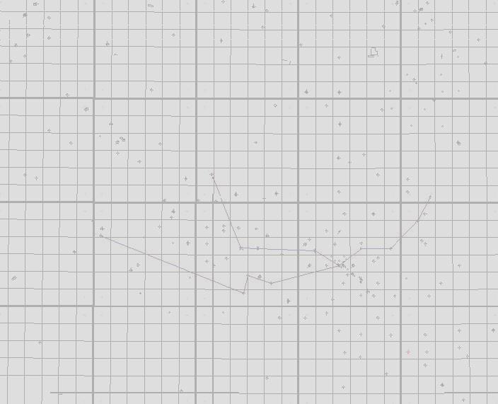
9 A B Figure 8 - A) Viking pebble bed overlying a transgressively reworked sequence boundary and ravinement surface (SB 2 RS) at the contact between the Viking and Westgate formations ( W3, m [2233 ft]). B) Core photograph showing the calcite-cemented sandstone (C) at the top of the Viking Formation in sharp contact with the Viking chert-pebble lag (P) and the overlying Westgate shale (W) ( W3, m [2209 ft]). pyrite concretions up to 2 cm in diameter. Laminated siltstone layers are present, but rare, within the shales. The fissile grey shale of Facies G is interpreted as having been deposited in a relatively deep, offshore, marine environment with rare siltstones representing storm deposits. 4. Sequence Stratigraphic Analysis The lower contact of the Viking Formation (Facies A) is generally gradational from the underlying Joli Fou shale (Facies G) of the Lower Colorado Group, and is the result of a fall in relative sea level that produced a seaward shift in facies. This transition facies (Facies A) is superimposed on an open-marine shelf facies (Facies G). The muddy sandstones of Facies A are interpreted to represent lower shoreface to transition-zone sedimentation under fluctuating moderate- to low-energy conditions that persisted throughout deposition of the lower part of the Viking Formation (Figures 9, 10, 11, and 12A), which consists of three sanding-upward successions. These three successions are progradational parasequences of transition-zone up into shoreface deposits (Facies A and B). Each is capped by a flooding surface (FS-1, -2, and -3) (Figures 9, 10, and 11). The progradational transition-zone to shoreface deposits (Facies A and B) are unconformably overlain by barrierwashover and lagoonal deposits (Facies D and C), reflecting a basinward shift in facies and fall in relative sea level. The sea-level fall resulted in an eastward shift of the shoreline to a location lying to the east of the study area, thereby causing its subaerial exposure and the formation of an unconformity or sequence boundary 1 (SB-1; Figures 9, 10, and 11). During a subsequent rise in sea level, a barrier-island and lagoonal environment developed in the study area, the deposits of which overlie the transgressive reworked sequence boundary (SB 1-FS; Figure 10). As sea level continued to rise, the barrier island migrated landward over the lagoon deposits as indicated by the presence of barrier-washover sandstones (Facies D) above lagoonal facies (Facies C). Almost the entire barrier was eroded during the continued transgression and, in several cores, the only evidence of it is a bed of coarse sandstone overlying the lagoonal mudstone (Figures 11 and 12.3). A subsequent sea-level fall caused incision of valleys (SB 2) up to 12 m deep into the lagoonal (Facies C) and barrier-washover (Facies D) deposits (Figures 10, 11, and 12.4). The shoreline fed by these incised valleys was at least 40 km to the east of the Bayhurst pools, as no lowstand shoreline deposits have been seen within the study area. During a following sea-level rise, the sequence boundary (SB 2) at the base of the incised valleys was reworked and the incised valleys backfilled. Core logging shows that the incised valleys were infilled by marine, wave-dominated, clean sandstones (Facies E) (Figures 10, 11, and 12.5). As the incised valleys were transgressed, they were widened and adjacent coarse sediments were eroded and deposited in them, as indicated by the high abundance of chert pebbles within the incised-valley fill (Figure 11). This transgression continued, leading to complete infilling of the incised valleys. That a significant section was probably eroded during the transgression is indicated by the thick ravinement lag of chert pebbles (Facies F), the Viking grit (Figure 8). On the interfluves outside the incised valleys, SB 2 was eroded during the transgression, and any evidence of subaerial exposure removed. Here, the pebble lag represents the sequence boundary (SB-2) merged with the ravinement surface (RS) (Figure 11). The chert-pebble lag (Facies F) marks a sharp contact between the Viking Formation and the Saskatchewan Geological Survey 9 Summary of Investigations 2005, Volume 1
 followed by a sequence boundary (SB 1)")

10 = 30 m 100 ft Figure 9 - Cross-section A-A' showing the lower Viking sandstones of transition-zone to lower shoreface deposits separated by flooding surfaces (FS-1, FS-2, and FS-3) followed by a sequence boundary (SB 1) and the overlying lagoonal and barrier-washover deposits within the Bayhurst pools. BFS, Base Fish Scales; BFSM, Base Fish Scales marker; and Vss, Viking sandstone. Saskatchewan Geological Survey 10 Summary of Investigations 2005, Volume 1

11 = 30 m (100 ft) Figure 10 - Cross-section B-B' showing an incised valley cut into the lagoonal and overlying barrier-washover deposits. BFS, Base Fish Scales; and Vss, Viking sandstone. Saskatchewan Geological Survey 11 Summary of Investigations 2005, Volume 1
12 691 m m m 674 m m 677 m m 680 m 665 m m 683 m 668 m 707 m 686 m 671 m m 674 m m 677 m m 679 m m m m m Terebellina Skolithos Zoophycos Teichichnus Planolites Ophiomorpha Figure 11 - Core cross-section C-C' showing depositional-facies configuration of the Viking sandstones within the Bayhurst gas pools. Saskatchewan Geological Survey 12 Summary of Investigations 2005, Volume 1


13 Sea-level Curve Fall Rise RS SB S 2-F Facies Map 5 Facies Map 4 SB 1FS Facies Map 3 Facies Map 2 3 FS2 FS1 FS- Facies Map 1 Figure 12 - Facies maps showing the evolution of sedimentary environments in the Bayhurst area. 12.1) Approximate distribution of shoreface and transition-zone sediments of Facies A. 12.2) The distribution of lagoonal and barrier-washover deposits and of adjacent shoreface sediments to the east and subaerial exposure to the west. 12.3) With sea-level rise and resultant transgression, the barrier island was eroded away and barrier-washover sands (Facies D) were deposited over lagoonal sediments of Facies C. 12.4) Distribution of incised valleys up to 12 m deep cut into lagoonal and barrier-washover deposits; the correlative lowstand shoreline was located northeast of the study area. 12.5) Backfilling of the incised valleys by shoreface sands (Facies E) during subsequent rise in sea level. Lower right figure: Relative sea-level curve showing the timing of the sequence stratigraphic surfaces and Facies Maps 1 to 5. Saskatchewan Geological Survey 13 Summary of Investigations 2005, Volume 1
14 overlying marine shales of the Westgate Formation (Facies G) deposited as a result of continued transgression (Figures 9, 10, and 11). 5. Petrographic Studies Sandstones of the Viking Formation in the Bayhurst area can be classified as litharenite, lithic wacke, and calcareous sublitharenite (Figure 13), based on point counting of thin sections. Sandstones of the transition zone to lower shoreface facies (Facies A) and of the barrier-washover facies are lithic wackes. In contrast, the incised-valley fill (Facies E) consists of sublitharenite, litharenite, and lithic wacke, supporting the interpretation of these deposits as lowstand and early transgressive deposits overlying a major unconformity. Porosities estimated from point counting range from 1 to 24%, with the highest values within the incised-valley fill (Facies E) and barrier-washover deposits (Facies D). The lowest porosities occur within the lower shoreface to transition-zone facies (Facies A) and the 0.6 to 0.8 m of massive, calcite-cemented sandstones at the top of the Viking Formation (Figures 8B, and 14A, 14B, and 14C). Porosity is interstitial and is interpreted as mostly primary. Cementation by quartz overgrowths and calcite is minor throughout the Viking except at the top of the formation where massive calcite cement completely occludes the porosity (Figure 14D). The paragenetic sequence as seen in thin section 03-CK-04 (Facies E) includes early calcite cementation successively followed by quartz overgrowth and late calcite cementation. Cements in sample 03-CK-04 are made up of 95% calcite and <5% quartz overgrowths. The edges of the quartz overgrowths are locally euhedral and appear to be in a growth compromise relationship with calcite cements suggesting that either the calcite and quartz were precipitated contemporaneously, or the calcite postdated quartz precipitation (Figure 15). The quartz overgrowths are recognized by the dust lines between the detrital grains and the overgrowths (Figure 14E). Detrital grains are made of 45 to 85% quartz grains, 10 to 55% rock fragments, and less than 5% feldspars so the Viking sandstones are mineralogically immature (45% quartz) to submature (85% quartz) (Figure 13). Based on point counting of 03- CK-04, framework grains are quartz (86.7%) and lithic fragments (13.3%) normalized and, because the sample is made up of 71% calcite cement, it is classified as a calcareous sublitharenite. Fluid-inclusion analysis has been performed on a sample of calcite cement (03-CK-04) within the incised-valley-fill sandstones (Facies E) from well W3 at depth 681 m (2235 ft) (Figure 8B). This interval of calcitecemented sandstones occurs consistently just below the contact between the Viking sandstones and the overlying Westgate shale. The calcite cement is poikilotopic and has occluded almost all of the pore spaces in the sample reducing the primary porosity to less than one per cent (Figure 14D). There is an abundance of monophase inclusions ranging from <2 µm to 3.5 µm occurring mainly in calcite cement and, less commonly, in quartz overgrowths (Figures 14E and 14F). The abundance of monophase all-liquid fluid inclusions indicates early cementation at low temperatures of probably less than 50 C (Chi et al., 2003). 25 FELDSPAR 50 Arkose QUARTZ & CHERT 95 Subarkose 75 Lithic arkose Lithic subarkose Quartzarenite Sublitharenite Feldspathic litharenite Litharenite LEGEND Sample 03-CK-2 Sample 03-CK-3 Sample 03-CK-4 Sample 03-CK-5 Sample 03-CK-6 Arenites Wackes ROCK FRAGMENTS (McBride, 1963) Figure 13 - Petrographic classification of Viking sandstones after McBride (1963). 6. Conclusions The prolific Bayhurst Gas Field occurs within intercalated transitional, shoreface, lagoon, incised-valley, and barrierwashover deposits of the Viking Formation, with barrier-washover and incised-valley sandstones forming the main reservoirs. Within the Bayhurst area, five flooding surfaces, two sequence boundaries, and one ravinement surface have been recognized. The Viking sandstone reservoirs are capped by tight Westgate shales. The Viking sandstones are classified as calcareous sublitharenite, litharenite, and lithic wacke, with the most immature sandstones occurring within the incised-valley fill. Seven lithofacies bioturbated sandstones and mudstones, sandstone with organic-rich Saskatchewan Geological Survey 14 Summary of Investigations 2005, Volume 1
 Lithic wacke from Facies A (bioturbated sandstones and mudstones) with 3.")
, plane polarized light. B) Structureless sandstone (Facies D) with 24% porosity (P), 58.")
, plane polarized light.")
, plane polarized light.")

 Monophase (liquid) fluid inclusions distributed along the dust line between detrital quartz grain and overgrowth")
15 A B 100 µm 100 µm D C 100 µm 100 µm F E 20µm 20µm Figure 14 - Photomicrographs showing various textures and composition of Viking sandstones. A) Lithic wacke from Facies A (bioturbated sandstones and mudstones) with 3.5% porosity, 46% quartz (Q), 6% feldspar, and 48% lithic fragments based on point counting; M, matrix; Sample 03CK-5, W3, m (2299 ft), plane polarized light. B) Structureless sandstone (Facies D) with 24% porosity (P), 58.5% quartz (Q), 4.9% feldspar and 36.6% lithic fragments; M, matrix; Sample 03CK-6, W3, m (2219 ft), plane polarized light. C) Lithic wacke with calcite concretions (Facies E) with 20 to 23% porosity (P), 45% quartz (Q), 3% feldspar and 52% lithic fragments; M, matrix; Sample 03CK-3, W3, m ( ft), plane polarized light. D) Poikilotopic calcite cement (C) in the sandstone near the top of the Viking Formation (Facies E); calcite cement has completely occluded porosity, which is less than 1%; the sandstone can be classified as calcareous sublitharenite; Sample 03CK-4, W3, m (2235 ft). E) Monophase (liquid) fluid inclusions distributed along the dust line between detrital quartz grain and overgrowth cement (Facies E), W3, m (2233 ft). F) Monophase (liquid) fluid inclusions in the calcite cement (Facies E), W3, m (2233 ft). Saskatchewan Geological Survey 15 Summary of Investigations 2005, Volume 1
16 Paragenetic Events Sedimentation Calcite Cementation Quartz Overgrowths laminations, sandstone with organic-rich mudstones, massive sandstone with coal and plant material and shell fragments, sandstone with calcite concretions, chert-pebble conglomeratic sandstone, and fissile grey shale have been recognized within the various depositional environments. Porosity values based on point counting range from 1 to 24%, with highest values in the incised-valley fill (Facies E) and barrierwashover facies (Facies D). Figure 15 - Paragenetic sequence including sedimentation and diagenetic events influencing the Viking sandstones of the Bayhurst gas pools. 7. Acknowledgments We thank Profico Energy, Saskatchewan Industry and Resources, and the National Science and Engineering Research Council of Canada for funding this project. We also thank geologic systems ltd. and M.J. Systems for the use of their programs. We also owe thanks to Melinda Yurkowski for technical help throughout this project. 8. References Bachu, S. and Burwash, R.A. (1994): Chapter 30 Geothermal regime in the Western Canada Sedimentary Basin; in Mossop, G.D. and Shetson, I. (comp.), Geological Atlas of the Western Canada Sedimentary Basin, Can. Soc. Petrol. Geol./Alta. Resear. Counc., Calgary, Alberta, < ATLAS_WWW/ATLAS.shtml> (accessed 25 July 2005). Chi, G., Giles, P.S., Williamson, M.A., Lavoie, D., and Bertrand, R. (2003): Diagenetic history and porosity evolution of Upper Carboniferous sandstones from the Spring Valley #1 well, Maritimes Basin, Canada implications for reservoir development; J. Geochem. Expl., v80, no2-3, p Jones, H.L. (1961): The Viking Formation in Southwestern Saskatchewan; Sask. Min. Resour., Rep. 65, 79p. Leckie, D.A., Bhattacharya, J.P., Bloch, J., Gilboy, C.F., and Norris, B. (1994): Chapter 20 Cretaceous Colorado/Alberta Group of the Western Canada Sedimentary Basin; in Mossop, G.D. and Shetson, I. (comp.), Geological Atlas of the Western Canada Sedimentary Basin, Can. Soc. Petrol. Geol./Alta. Resear. Counc., Calgary, Alberta, < (accessed 25 July 2005). MacEachern, J.A. (1994): Integrated ichnological-sedimentological models: Applications to the sequence stratigraphic and paleoenvironmental interpretation of the Viking and Peace River formations, west-central Alberta; unpubl. Ph.D. thesis, Univ. Alberta, Edmonton, 612p. MacEachern, J.A., Zaitlin, B.A., and Pemberton, S.G. (1999): A sharp-based sandstone of the Viking Formation, Joffre Field, Alberta, Canada: Criteria for recognition of transgressively incised shoreface complexes; J. Sed. Resear., v69, no4, p McBride, E.F. (1963): Classification of common sandstones; J. Sed. Petrol., v33, p McNeil, D.H. and Caldwell, W.G.E. (1981): Cretaceous Rocks and their Foraminifera in the Manitoba Escarpment; Geol. Assoc. Can., Spec. Pap. 21, 439p. Pemberton, S.G., Frey, R.W., Ranger, M.J., and MacEachern, J.A. (1992a): The conceptual framework of Ichnology; in Pemberton, S.G. (ed.), Applications of Ichnology to Petroleum Exploration, Soc. Sed. Geol., SEPM Core Workshop No. 17, Calgary, June 21, p1-32. Pemberton, S.G., Van Wagoner, J.C., and Wach, G.D. (1992b): Ichnofacies of a wave-dominated shoreline; in Pemberton, S.G. (ed.), Applications of Ichnology to Petroleum Exploration, Soc. Sed. Geol., SEPM Core Workshop No. 17, Calgary, June 21, p Plummer, P.S. and Gostin, V.A. (1981): Shrinkage cracks: Desiccation or synaeresis?; J. Sed. Petrol., v51, no4, p Pozzobon, J.G. (1987): Sedimentology and stratigraphy of the Viking Formation, Eureka Field, southwestern Saskatchewan; unpubl. M.Sc. thesis, McMaster Univ., Hamilton, 119p. Saskatchewan Geological Survey 16 Summary of Investigations 2005, Volume 1
17 Pozzobon, J.G. and Walker, R.G. (1990): Viking Formation (Albian) at Eureka, Saskatchewan: A transgressed and degraded shelf sand ridge; AAPG Bull., v74, no8, p Reinson, G.E., Warters, W.J., Cox, J., and Price, P.R. (1994): Chapter 21 Cretaceous Viking Formation of the Western Canada Sedimentary Basin; in Mossop, G.D. and Shetson, I. (comps.), Geological Atlas of the Western Canada Sedimentary Basin, Can. Soc. Petrol. Geol./Alta. Resear. Counc., Calgary, Alberta, < (accessed 25 July 2005). Reynolds, A.D. (1994): Sequence stratigraphy from core and wireline log data: The Viking Formation, Albian, south central Alberta, Canada; Marine Petrol. Geol., v11, no3, p Walker, R.G. and James, N.P. (1992): Facies Models: Response to Sea Level Change; GEOtext 1, Geol. Assoc. Can., 454p. Webber, J.D. (1997): Development of a regional high-resolution stratigraphic framework for the Late Albian Viking Formation in east-central Alberta and west-central Saskatchewan; unpubl. M.Sc. thesis, Univ. Regina, 92p. Saskatchewan Geological Survey 17 Summary of Investigations 2005, Volume 1
Sedimentary and Stratigraphic Analysis of the Viking Sand in the Edgerton/Wainwright Area, Central Alberta* By Russell Walz 1
 Sedimentary and Stratigraphic Analysis of the Viking Sand in the Edgerton/Wainwright Area, Central Alberta* By Russell Walz 1 Search and Discovery Article #50030 (2006) Posted June 25, 2006 *Extended abstract
Viking Lowstand Deposits in West Central Saskatchewan: Depositional Model for the Reservoir Units in Dodsland-Hoosier Area, Saskatchewan, Canada
 Viking Lowstand Deposits in West Central Saskatchewan: Depositional Model for the Reservoir Units in Dodsland-Hoosier Area, Saskatchewan, Canada Hasan Ferdous* PetroSed Geoconsulting Resources, Calgary,
High-resolution Sequence Stratigraphy of the Glauconitic Sandstone, Upper Mannville C Pool, Cessford Field: a Record of Evolving Accommodation
 Page No. 069-1 High-resolution Sequence Stratigraphy of the Glauconitic Sandstone, Upper Mannville C Pool, Cessford Field: a Record of Evolving Accommodation Thérèse Lynch* and John Hopkins, Department
Transgressive Shoreline Deposits of the Lower Cretaceous (Albian) Bluesky Formation in the Boyer and Steen Field Areas of Northwestern Alberta*
 Bluesky Formation in the Boyer and Steen Field Areas of Northwestern Alberta*") Transgressive Shoreline Deposits of the Lower Cretaceous (Albian) Bluesky Formation in the Boyer and Steen Field Areas of Northwestern Alberta* Shaun O Connell 1 Search and Discovery Article #2298 (215)
Transgressive Shoreline Deposits of the Lower Cretaceous (Albian) Bluesky Formation in the Boyer and Steen Field Areas of Northwestern Alberta* Shaun O Connell 1 Search and Discovery Article #2298 (215)
Sediment and sedimentary rocks Sediment
 Sediment and sedimentary rocks Sediment From sediments to sedimentary rocks (transportation, deposition, preservation and lithification) Types of sedimentary rocks (clastic, chemical and organic) Sedimentary
The Clearwater Formation: A Facies Study for SAGD Water Source in the Athabasca Oil Sands
 The Clearwater Formation: A Facies Study for SAGD Water Source in the Athabasca Oil Sands Wallace, J. and Lavigne, J Introduction Water source has become an increasingly important issue recently with the
GeoCanada 2010 Working with the Earth
 Lithofacies Identification and the Implications for SAGD Well Planning in the McMurray Formation, Christina Lake Area, Alberta Travis Shackleton*, Robert Gardner, Sung Youn, Grace Eng and Lori Barth Cenovus
The unknown giants - low-permeability shallow gas reservoirs of southern Alberta and Saskatchewan, Canada.
 The unknown giants - low-permeability shallow gas reservoirs of southern Alberta and Saskatchewan, Canada. Shaun O'Connell* Belfield Resources Inc., Calgary belfield@shaw.ca ABSTRACT The gas reserves contained
Dakota Sandstone. of the Moxa Arch and Surrounding Green River Basin
 Dakota Sandstone of the Moxa Arch and Surrounding Green River Basin Dakota Sandstones of the Green River Basin Overview The Dakota sandstones of the Moxa Arch and surrounding Green River Basin remain attractive
Glauconitic Oil Reservoirs in Southern Alberta Creating the Correct Geological Model to Guide Development Drilling
 Glauconitic Oil Reservoirs in Southern Alberta Creating the Correct Geological Model to Guide Development Drilling Brad Hayes* Petrel Robertson Consulting Ltd, Calgary, AB bhayes@petrelrob.com Lisa Griffith
Facies Analysis Of The Reservoir Rocks In The. Sylhet Trough, Bangladesh. Abstract
 Facies Analysis Of The Reservoir Rocks In The Sylhet Trough, Bangladesh Joyanta Dutta Petroleum Geoscience Program, Department of Geology, Faculty of Science, Chulalongkorn University, Bangkok 10330, Thailand
LOWER GRAND RAPIDS BITUMEN POOLS AT COLD LAKE, ALBERTA VARIATIONS IN STRATIGRAPHIC SETTING AND DEPOSITIONAL ENVIRONMENTS
 RAPIDS BITUMEN POOLS AT COLD LAKE, ALBERTA VARIATIONS IN STRATIGRAPHIC SETTING AND DEPOSITIONAL ENVIRONMENTS Brad J. Hayes, Petrel Robertson Consulting Ltd. Garrett M. Quinn, OSUM Oil Sands Corp. Summary
Facies Analysis of the Lower Cretaceous Wilrich Member (Lower Falher) of the Spirit River Formation.
 of the Spirit River Formation.") Facies Analysis of the Lower Cretaceous Wilrich Member (Lower Falher) of the Spirit River Formation. Kerrie L. Bann, Ichnofacies Analysis Inc. and Daniel J. K. Ross, Tourmaline Oil Corp. Historically,
Facies Analysis of the Lower Cretaceous Wilrich Member (Lower Falher) of the Spirit River Formation. Kerrie L. Bann, Ichnofacies Analysis Inc. and Daniel J. K. Ross, Tourmaline Oil Corp. Historically,
=%REPORT RECONNAISSANCE OF CHISHOLM LAKE PROSPECT. October 25, 1977
 =%REPORT ON FIELD RECONNAISSANCE OF CHISHOLM LAKE PROSPECT October 25, 1977 Bruce D. Vincent Imperial Oil Limited, Minerals - Coal, CALGARY, ALBERTA CHISHOLM LAKE PROSPECT Introduction The Chisholm Lake
Sediment. Weathering: mechanical and chemical decomposition and disintegration of rock and minerals at the surface
 Sediment Some basic terminology Weathering: mechanical and chemical decomposition and disintegration of rock and minerals at the surface Erosion: removal of weathered rock and minerals from one place to
Hydrocarbon Distribution in the Mannville Waseca Member, Edam Oil Field, West-central Saskatchewan
 Hydrocarbon Distribution in the Mannville Waseca Member, Edam Oil Field, West-central Saskatchewan Peter Hill 1 Information from this publication may be used if credit is given. It is recommended that
UNIT 4 SEDIMENTARY ROCKS
 UNIT 4 SEDIMENTARY ROCKS WHAT ARE SEDIMENTS Sediments are loose Earth materials (unconsolidated materials) such as sand which are transported by the action of water, wind, glacial ice and gravity. These
Lab 8: Facies Analysis and Correlations: Sequence Stratigraphy in the Book Cliffs, Utah
 Geology 109L Lab 8: Facies Analysis and Correlations: Sequence Stratigraphy in the Book Cliffs, Utah Goal: In this lab, you will put together your knowledge of near-shore facies and sequence stratigraphy
Paleo Lab #4 - Sedimentary Environments
 Paleo Lab #4 - Sedimentary Environments page - 1. CHARACTERISTICS OF SEDIMENT Grain size and grain shape: The sizes and shapes of sedimentary particles (grains) are modified considerably during their transportation
Sediments and Sedimentary Rocks
 Sediments and Sedimentary Rocks (Shaping Earth s Surface, Part 2) Science 330 Summer 2005 What is a sedimentary rock? Products of mechanical and chemical weathering Account for about 5 percent of Earth
Reservoir Characteristics of the Birdbear Formation in West- Central Saskatchewan
 Reservoir Characteristics of the Birdbear Formation in West- Central Saskatchewan Chao Yang Petroleum Geology Branch Exploration and Geological Services Division Saskatchewan Ministry of Energy and Resources
Sedimentary Rocks. Origin, Properties and Identification. Geology Laboratory GEOL 101 Lab Ray Rector - Instructor
 Sedimentary Rocks Origin, Properties and Identification Geology Laboratory GEOL 101 Lab Ray Rector - Instructor Sedimentary Rock Origin and Identification Lab Pre-Lab Internet Link Resources 1) http://www.rockhounds.com/rockshop/rockkey/index.html
The Wilrich Member, Alberta deep basin: An example of a topsetdominated delta deposited into a low-accommodation shallow sea.
 The Wilrich Member, Alberta deep basin: An example of a topsetdominated delta deposited into a low-accommodation shallow sea. Kerrie Bann & Michael Fawcett Ichnofacies Analysis Inc. & Tourmaline Oil Corp.
6. Cretaceous Zone Play Results
 C H A P T E R S I X 6. Cretaceous Zone Play Results 6. Geological Overview The Mannville Group was deposited as a clastic wedge east of the mountain ranges. This wedge varies in thickness from 7 metres
Sedimentary Rocks. Origin, Properties and Identification. Physical Geology GEOL 101 Lab Ray Rector - Instructor
 Sedimentary Rocks Origin, Properties and Identification Physical Geology GEOL 101 Lab Ray Rector - Instructor Sedimentary Rock Origin and Identification Lab Pre-Lab Internet Link Resources 1) http://www.rockhounds.com/rockshop/rockkey/index.html
Sedimentary Environments Chapter 8
 Sedimentary Environments Chapter 8 Does not contain complete lecture notes. To be used to help organize lecture notes and home/test studies. What is a sedimentary rock? Sedimentary rocks are products of
Sedimentary Rocks. Origin, Properties and Identification. Physical Geology GEOL 100. Ray Rector - Instructor
 Sedimentary Rocks Origin, Properties and Identification Physical Geology GEOL 100 Ray Rector - Instructor Sedimentary Rock Origin and Identification Lab Pre-Lab Internet Link Resources 1) http://www.rockhounds.com/rockshop/rockkey/index.html
Continuity and Compartmentalization of Viking Formation gas production from the Ricinus / Bearberry area of the Rocky Mountain Triangle Zone
 Page No. 001-1 Continuity and Compartmentalization of Formation gas production from the Ricinus / Bearberry area of the Rocky Mountain Triangle Zone David Halwas* (Senior Staff Geologist), Darryl Parry
Depositional Sequences Sequences
 Depositional Sequences Transgressive and Regressive packages can be bound by unconformities Because sediment can only be preserved during net aggradation and progradation All other times there is either
ESC102. Sedimentary Rocks. Our keys to the past. Monday, February 11, 13
 ESC102 Sedimentary Rocks Our keys to the past Sedimentary Rocks Sedimentary rocks are rocks that form through the accumulation of sediment and the process of lithification. Lithification occurs after deposition
Image: G. Parker. Presenters: Henry Chan, Kayla Ireland, Mara Morgenstern, Jessica Palmer, Megan Scott
 Image: G. Parker Presenters: Henry Chan, Kayla Ireland, Mara Morgenstern, Jessica Palmer, Megan Scott Is the Ross Formation a suitable analog for sand-rich turbidite plays in passive margin basins? Play:
Summary. Introduction. Observations and Interpretations
 Lower McMurray Formation sinkholes and their fill fabrics: effects of salt dissolution collapse-subsidence across the northern Athabasca oil sands deposit Paul L. Broughton, Chevron Canada Resources, Calgary,
EPS 50 Lab 4: Sedimentary Rocks
 Name: EPS 50 Lab 4: Sedimentary Rocks Grotzinger and Jordan, Chapter 5 Introduction In this lab we will classify sedimentary rocks and investigate the relationship between environmental conditions and
Sediment and Sedimentary rock
 Sediment and Sedimentary rock Sediment: An accumulation of loose mineral grains, such as boulders, pebbles, sand, silt or mud, which are not cemented together. Mechanical and chemical weathering produces
AAPG Search and Discovery Article #90173 CSPG/CSEG/CWLS GeoConvention 2011, Calgary, Alberta, Canada, May 9-11, 2011
 Use of Image Logs in Differentiating Point Bar and Tidal Bar Deposits in the Leismer Area: Implications for SAGD Reservoir Definition in the Athabasca Oilsands Howard Brekke and Andrew Couch Introduction
Chapter 6 Pages of Earth s Past: Sedimentary Rocks
 Chapter 6 Pages of Earth s Past: Sedimentary Rocks Introduction! Drilling into the bottom of the North Sea, we encounter: " Soft mud and loose sand, silt, pebbles, and shells. Then: " Similar materials
Igneous and Metamorphic Rock Forming Minerals. Department of Geology Mr. Victor Tibane SGM 210_2013
 Igneous and Metamorphic Rock Forming Minerals Department of Geology Mr. Victor Tibane 1 SGM 210_2013 Classification of sedimentary rocks Sedimentary rocks are products of weathered, fragmented or dissolved,
ES120 Sedimentology/Stratigraphy
 Midterm Exam 5/05/08 NAME: 1. List or describe 3 physical processes that contribute to the weathering of rocks (3pts). exfoliation frost wedging many others. roots, thermal expansion/contraction also credit
Lecture Outline Wednesday - Friday February 14-16, 2018
 Lecture Outline Wednesday - Friday February 14-16, 2018 Quiz 2 scheduled for Friday Feb 23 (Interlude B, Chapters 6,7) Questions? Chapter 6 Pages of the Past: Sedimentary Rocks Key Points for today Be
Unbioturbated Marine Mudstones: Environmental Stress or Rapid Deposition? A Worked Example from the Ordovician Beach Formation, Newfoundland, Canada*
 Unbioturbated Marine Mudstones: Environmental Stress or Rapid Deposition? A Worked Example from the Ordovician Beach Formation, Newfoundland, Canada* Dario Harazim 1, Duncan McIlroy 1, Joe Macquaker 1,
Understanding Earth Fifth Edition
 Understanding Earth Fifth Edition Grotzinger Jordan Press Siever Chapter 5: SEDIMENTATION: Rocks Formed by Surface Processes Lecturer: H Mohammadzadeh Assistant professors, Department of Geology, FUM Copyright
Facies Analysis of the Upper Devonian Lower Mississippian Bakken Formation, Southeastern Saskatchewan
 Facies Analysis of the Upper Devonian Lower Mississippian Bakken Formation, Southeastern Saskatchewan Dan Kohlruss and Erik H. Nickel Kohlruss, D. and Nickel, E. (2009): Facies analysis of the Upper Devonian
Abstract. 1. Introduction
 Sedimentary Facies Distribution of the Upper Devonian Lower Mississippian Bakken Formation, Williston Basin, Southeastern Saskatchewan: Implications for Understanding Reservoir Geometry, Paleogeography,
Bulletin of Earth Sciences of Thailand
 Depositional Environments and Stratigraphic Development of the Grand Taman Sari Circuit Outcrop: an Analogue for Transgressive Mahakam Delta Successions Ridha Santika Riadi Petroleum Geoscience Program,
Tim Carr - West Virginia University
 Tim Carr - West Virginia University Exploration s Ultimate Goal is to Answer Four Questions: Where to Drill? What to Expect? How Certain? How Profitable? Location & Depth HC Volumes Chance of Success
Mud Sand Gravel. Clastic Textures
 Sed Rocks Self-Instruction Lab Name Geology 100 Harbor Section Please see the questions online before you begin. Sedimentary rocks are usually identified in the field by their stratification or layering,
The boundary between two formations (or any distinct layers) is called a contact. Sedimentary rocks cover 75% of continents.
 is called a contact. Sedimentary rocks cover 75% of continents.") Sedimentary Rocks Sedimentary rocks form at the Earth s surface through interactions of the hydrologic system and the crust. Fortunately, many of these processes are in operation today, and geologists
Sedimentary Rocks Sedimentary rocks form at the Earth s surface through interactions of the hydrologic system and the crust. Fortunately, many of these processes are in operation today, and geologists
Accommodation. Tectonics (local to regional) Subsidence Uplift
 Subsidence Uplift") Accommodation Accommodation varies over time; it is the distance between a reference horizon and the sea surface (i.e. relative sea level). The space to be filled in with sediments or water What are the
Accommodation Accommodation varies over time; it is the distance between a reference horizon and the sea surface (i.e. relative sea level). The space to be filled in with sediments or water What are the
ROCK CLASSIFICATION AND IDENTIFICATION
 Name: Miramar College Grade: GEOL 101 - Physical Geology Laboratory SEDIMENTARY ROCK CLASSIFICATION AND IDENTIFICATION PRELAB SECTION To be completed before labs starts: I. Introduction & Purpose: The
Geologic influence on variations in oil and gas production from the Cardium Formation, Ferrier Oilfield, west-central Alberta, Canada
 Geologic influence on variations in oil and gas production from the Cardium Formation, Ferrier Oilfield, west-central Alberta, Canada Marco Venieri and Per Kent Pedersen Department of Geoscience, University
Lower Skinner Valley Fill Sandstones: Attractive Exploration Targets on the Northeast Oklahoma Platform*
 Lower Skinner Valley Fill Sandstones: Attractive Exploration Targets on the Northeast Oklahoma Platform* By Jim Puckette 1 Search and Discovery Article #10050 (2003) *Adapted from presentation to Tulsa
Data Repository item
 Data Repository (B25407): Localities and descriptions of measured sections of study areas Table 1. Localities of the measured sedimentary sections in the NW Sichuan Basin Section Number Stratigraphy Locality
ALBERTA S CARDIUM OIL AND THE EVOLUTION OF CUTOFFS AND EVALUATION PROCEDURES IN RESPONSE TO HORIZONTAL DRILLING
 ALBERTA S CARDIUM OIL AND THE EVOLUTION OF CUTOFFS AND EVALUATION PROCEDURES IN RESPONSE TO HORIZONTAL DRILLING Alberta s Cardium Oil and the Evolution of Cutoffs and Evaluation Procedures in Miranda Stoffman,
Sequence Stratigraphic Framework and Reservoir Architecture of the Lingshui-3 Member, Yacheng 13-1 Gas Field, South China Sea
 Sequence Stratigraphic Framework and Reservoir Architecture of the Lingshui-3 Member, Yacheng 13-1 Gas Field, South China Sea David Z. Tang BP China Exploration and Production Company 17/F, Finance Centre,
Facies Cryptic description Depositional processes Depositional environments Very well sorted. Desert dunes. Migration of straight crested mega ripples
 Very well sorted Travelled grate distance, effective sorting 5 medium-grained sandstone with well rounded grains; large scale high angle planar cross-beds. Migration of straight crested mega ripples Desert
Petroleum geology framework, West Coast offshore region
 Petroleum geology framework, West Coast offshore region James W. Haggart* Geological Survey of Canada, Vancouver, BC jhaggart@nrcan.gc.ca James R. Dietrich Geological Survey of Canada, Calgary, AB and
Geology Stratigraphic Correlations (Lab #4, Winter 2010)
") Name: Answers Reg. lab day: Tu W Th Geology 1023 Stratigraphic Correlations (Lab #4, Winter 2010) Introduction Stratigraphic correlation is the process of comparing rocks at one locality with related rocks
Name: Answers Reg. lab day: Tu W Th Geology 1023 Stratigraphic Correlations (Lab #4, Winter 2010) Introduction Stratigraphic correlation is the process of comparing rocks at one locality with related rocks
Burrow-Mottled Carbonates in the Devonian Wabamun Formation, Pine Creek Gas Field, Alberta, Canada
 Page No. 142-1 Burrow-Mottled Carbonates in the Devonian Wabamun Formation, Pine Creek Gas Field, Alberta, Canada Gladys Fong Department of Earth and Atmospheric Sciences University of Alberta, Edmonton,
Mud Sand Gravel. Clastic Textures
 Sed Rocks Self-Instruction Lab Name Geology 100 Harbor Section Read the sedimentary rocks chapter before you start. Sedimentary rocks are usually identified in the field by their stratification or layering,
How to Log Core (With Examples from the Williston Basin of Southeast Saskatchewan)
") How to Log Core (With Examples from the Williston Basin of Southeast Saskatchewan) D.M.Kent ( D.M.Kent Geological Consulting Ltd., Regina, Sask.), and J.H.Lake, (Lake Geological Services Inc, Swift Current,
How to Log Core (With Examples from the Williston Basin of Southeast Saskatchewan) D.M.Kent ( D.M.Kent Geological Consulting Ltd., Regina, Sask.), and J.H.Lake, (Lake Geological Services Inc, Swift Current,
Lab 7: Sedimentary Structures
 Name: Lab 7: Sedimentary Structures Sedimentary rocks account for a negligibly small fraction of Earth s mass, yet they are commonly encountered because the processes that form them are ubiquitous in the
Sedimentary rocks. Mechanical Weathering. Weathering. Chemical weathering. Rates of weathering. Fossil Fuel Resources. Two kinds of weathering
 Sedimentary rocks Fossil Fuel Resources Exam next Tuesday February 14 Bring Scantron and Review Questions About 75% of all rock outcrops on the continents Important to reconstruct much of Earth's history
A Regional Diagenetic and Petrophysical Model for the Montney Formation, Western Canada Sedimentary Basin*
 A Regional Diagenetic and Petrophysical Model for the Montney Formation, Western Canada Sedimentary Basin* Noga Vaisblat 1, Nicholas B. Harris 1, Vincent Crombez 2, Tristan Euzen 3, Marta Gasparrini 2,
Preliminary Investigations of the Hudson Bay Area Coal Deposits
 Preliminary Investigations of the Hudson Bay Area Coal Deposits Jason Berenyi, Arden Marsh and Ron Leray Saskatchewan Ministry of Energy and Resources www.er.gov.sk.ca Introduction Introduction Manville
GEOLOGY MEDIA SUITE Chapter 5
 UNDERSTANDING EARTH, SIXTH EDITION GROTZINGER JORDAN GEOLOGY MEDIA SUITE Chapter 5 Sedimentation Rocks Formed by Surface Processes 2010 W.H. Freeman and Company Mineralogy of sandstones Key Figure 5.12
Sedimentary Rocks. Weathering. Mechanical & Chemical Weathering. Sediments. Lithification. Deposition. Transport. Erosion.
 Lithification Sedimentary Rocks Sediments Deposition Transport Erosion Weathering Weathering The sediments that make up sedimentary rocks are produced by: Mechanical & Chemical Weathering Mechanical Weathering
EARTH SURFACE PROCESSES AND SEDIMENTATION!
 Sed and Strat EARTH SURFACE PROCESSES AND SEDIMENTATION! 2/27 Lecture 7- Exposure: Weathering and the Sediment Factory 3/04 Lecture 8 - Rivers and Landscapes 3/06 Lecture 9 - Waves (not Tides) 3/11 Lecture
Clastic Textures. I. What is the sorting of sample numbers 60, 61, and 62? Answers on last page.
 Sed Rock s Sel f-instruction N ame Geology 100 Harbor Secti on Sedimentary rocks are usually identified in the field by their stratification or layering, which originates by the successive deposition of
Michael D. Hearn* and S. George Pemberton Ichnology Research Group, University of Alberta, Edmonton, AB, T6G 2E3
 Wave and River-Dominated Deltaic Deposits in the Lower Cretaceous (Neocomian) Kamik Formation in the Parsons Lake Gas Field, Mackenzie Delta Region, Northwest Territories Michael D. Hearn* and S. George
David Piper and Atika Karim ABSTRACT
 David Piper and Atika Karim ABSTRACT Hyperpycnal flow deposits, or delta-front turbidites, are becoming increasingly recognised as important components of some deltaic systems. The presence of Bouma Tabce
The Nature of Sedimentary Rocks
 The Nature of Sedimentary Rocks Sedimentary rocks are composed of: Fragments of other rocks Chemical precipitates Organic matter or biochemically produced materials The Nature of Sedimentary Rocks Sedimentary
Sedimentology, Sequence Stratigraphy and Reservoir Quality of the Early Cretaceous Murta Formation, Eromanga Basin, Central Australia
 Sedimentology, Sequence Stratigraphy and Reservoir Quality of the Early Cretaceous Murta Formation, Eromanga Basin, Central Australia Homoud Al-Anzi, BSc. This thesis is submitted in partial fulfilment
The Impact of Parasequence Stacking Patterns on Vertical Connectivity Between Wave-Dominated, Shallow Marine Parasequences, Book Cliffs, Eastern Utah
 The Impact of Parasequence Stacking Patterns on Vertical Connectivity Between Wave-Dominated, Shallow Marine Parasequences, Book Cliffs, Eastern Utah MALCOLM J. ARNOT and TIMOTHY R. GOOD* MALCOLM J. ARNOT
Highstand Stacked Tidal Flat / Standing Water Evaporite Cycles of the Midale Evaporite in Southeast Saskatchewan, Mississippian Williston Basin*
 Highstand Stacked Tidal Flat / Standing Water Evaporite Cycles of the Midale Evaporite in Southeast Saskatchewan, Mississippian Williston Basin* J. H. Lake 1 and D. M. Kent 2 Search and Discovery Article
Anatomy of a Fluvial to Estuarine Valley Fill, North Cactus Lake McLaren Reservoir
 Anatomy of a Fluvial to Estuarine Valley Fill, North Cactus Lake McLaren Reservoir J. Edward Mathison Alethia Geologica, Filling of the north Cactus Lake post Waseca paleovalley, during McLaren sea level
Sedimentary Rocks, Stratigraphy, and Geologic Time
 Sedimentary Rocks, Stratigraphy, and Geologic Time A rock is any naturally formed, nonliving, coherent aggregate mass of solid matter that constitutes part of a planet, asteroid, moon, or other planetary
Have we run out of conventional plays in the WCSB?
 Have we run out of conventional plays in the WCSB? Md S Islam, P.Geo. Summary The Alberta Deep Basin is one of the most productive areas of Western Canadian Sedimentary Basin (WCSB), which contains the
4. Carboniferous Zone Play Results
 C H A P T E R F O U R 4. Carboniferous Zone Play Results 4. Geological Overview In the WCSB, there were two main depositional areas during Carboniferous time the Peace River Embayment in northwestern Alberta,
Modeling Lateral Accretion in McMurray Formation Fluvial- Estuarine Channel Systems: Grizzly Oil Sands May River SAGD Project, Athabasca
 Modeling Lateral Accretion in McMurray Formation Fluvial- Estuarine Channel Systems: Grizzly Oil Sands May River SAGD Project, Athabasca Duncan Findlay, Thomas Nardin, Alex Wright, Raheleh Salehi Mojarad
Evan K. Franseen, Dustin Stolz, Robert H. Goldstein, KICC, Department of Geology, University of Kansas
 Reservoir Character of the Avalon Shale (Bone Spring Formation) of the Delaware Basin, West Texas and Southeast New Mexico: Effect of Carbonate-rich Sediment Gravity Flows Evan K. Franseen, Dustin Stolz,
Calcite Cements in Middle Devonian Dunedin Formation:
 Geochemistry of the Fracture-Filling Dolomite and Calcite Cements in Middle Devonian Dunedin Formation: Implication for the Strata Dolomitization Model Sze-Shan Yip 1, Hairuo Qing 1 and Osman Salad Hersi
Nathan D. Webb and James L. Best
 Nathan D. Webb and James L. Best Background Pennsylvanian oil production Stratigraphy & geologic setting Study area Methods Using geophysical logs & core Results Comparing three channel deposits Implications
GY 402: Sedimentary Petrology
 UNIVERSITY OF SOUTH ALABAMA GY 402: Sedimentary Petrology Lecture 12: Petrology of Immature Siliciclastic Sed. Rocks Instructor: Dr. Douglas W. Haywick Last Time 1. Factors promoting beach development
Sedimentology & Stratigraphy. Thanks to Rob Viens for slides
 Sedimentology & Stratigraphy Thanks to Rob Viens for slides Sedimentology The study of the processes that erode, transport and deposit sediments Sedimentary Petrology The study of the characteristics and
Lithological variation of Middle Bakken reservoirs in SE Saskatchewan: implications for optimizing multi-stage hydraulic fracturing
 Lithological variation of Middle Bakken reservoirs in SE Saskatchewan: implications for optimizing multi-stage hydraulic fracturing Hairuo Qing, Guoxiang Chi, Adam Sturiala Dept of Geology University of
GLG Chapter 7 Sedimentary Environments & Rocks
 GLG 101 - Chapter 7 Sedimentary Environments & Rocks Name Note, Oct 11: I ll be writing this study sheet over the next few days. Each day I will add questions until the entire chapter is done, hopefully
Geology 252, Historical Geology, California State University, Los Angeles - professor: Dr. Alessandro Grippo
 LAB # 1 - CLASTIC ROCKS Background: - Mechanical and Chemical Weathering - Production of Clastic Sediment - Classification of Sediment according to size: Gravel, Sand, Silt, Clay - Erosion, Transportation
Controls on facies distributions in the Charlie Lake Formation, Peace River Arch, Alberta
 Controls on facies distributions in the Charlie Lake Formation, Peace River Arch, Alberta E.L. Percy 12, C. Frostad 2, A. Juska 2, C. Schmidt 2, C. Sitzler 2, and J.P. Zonneveld 3 University of Calgary,
UNIVERSITY OF CALGARY. High Resolution Sequence Stratigraphy and Reservoir Characterization of Shoreline Deposits of
 UNIVERSITY OF CALGARY High Resolution Sequence Stratigraphy and Reservoir Characterization of Shoreline Deposits of the Cardium Formation at West Pembina, Alberta by J. ADAM FRASER A THESIS SUBMITTED TO
Modeling Lateral Accretion in McMurray Formation Fluvial-Estuarine Channel Systems: Grizzly Oil Sands May River SAGD Project, Athabasca*
 Modeling Lateral Accretion in McMurray Formation Fluvial-Estuarine Channel Systems: Grizzly Oil Sands May River SAGD Project, Athabasca* Duncan Findlay 1, Thomas Nardin 1, Alex Wright 1, and Raheleh Salehi
Sup. Mat. 1. Figure DR1. Map showing the distribution of the Vanrhynsdorp Group. 02
 GSA DATA REPOSITORY 2013142 Buatois, Almond and Germs Treptichnus pedum - List of supplementary materials: Sup. Mat. 1. Figure DR1. Map showing the distribution of the Vanrhynsdorp Group. 02 Sup. Mat.
Bowen s Chemical Stability Series
 Lab 5 - Identification of Sedimentary Rocks Page - Introduction Sedimentary rocks are the second great rock group. Although they make up only a small percentage of the rocks in the earth s crust (~5%)
Sedimentology and Stratigraphy of Lower Smackover Tight Oil Carbonates: Key to Predictive Understanding of Reservoir Quality and Distribution
 Integrated Reservoir Solutions Sedimentology and Stratigraphy of Lower Smackover Tight Oil Carbonates: Key to Predictive Understanding of Reservoir Quality and Distribution Roger J. Barnaby Presented at
WAMUNYU EDWARD MUREITHI I13/2358/2007
 WAMUNYU EDWARD MUREITHI I13/2358/2007 Olkaria geothermal area is situated south of Lake Naivasha on the floor of the southern segment of the Kenya rift. The geology of the Olkaria Geothermal area is subdivided
Sand. Sand is any eroded material (igneous, metamorphic or sedimentary) that has a grain size from 1/16 th to 2 millimeters in size.
 that has a grain size from 1/16 th to 2 millimeters in size.") Sedimentology 001 What is sedimentology? Sedimentology...encompasses the study of modern sediments such as sand [1], mud (silt) [2] andclay [3] and understanding the processes that deposit them.[4] It
Sedimentology 001 What is sedimentology? Sedimentology...encompasses the study of modern sediments such as sand [1], mud (silt) [2] andclay [3] and understanding the processes that deposit them.[4] It
SEDIMENTARY ROCKS. Processes, Environments, Structures and Rocks. Sedimentary Processes and Rocks
 SEDIMENTARY ROCKS Processes, Environments, Structures and Rocks Sedimentary Processes and Rocks Origins of Sedimentary Rocks Sediment transport and texture Sedimentary structures Lithification Classifying
Saskatchewan Oil Hot Plays Melinda Yurkowski, P.Geo
 Saskatchewan Oil Hot Plays Melinda Yurkowski, P.Geo Saskatchewan Geological Survey Saskatchewan Ministry of Energy and Resources April 18, 212 www.er.gov.sk.ca ~ 7, km 2 of Phanerozoiccover Total volume
PROCEEDINGS, INDONESIAN PETROLEUM ASSOCIATION Forty-First Annual Convention & Exhibition, May 2017
 IPA17-369-SG PROCEEDINGS, INDONESIAN PETROLEUM ASSOCIATION Forty-First Annual Convention & Exhibition, May 2017 FACIES ANALYSIS OF LATE NEOGENE DEPOSIT: MARINE TO CONTINENTAL ENVIRONMENT OF THE MERAPI
3rd-order sequence stratigraphy and lithostratigraphy of the Bearpaw Horseshoe Canyon transition, Alberta plains
 3rd-order sequence stratigraphy and lithostratigraphy of the Bearpaw Horseshoe Canyon transition, Alberta plains Ben Hathway, Alberta Geological Survey, Alberta Energy Regulator, Edmonton, Alberta, ben.hathway@aer.ca