1 : TOTAL E&P, Technology Centre, CSTJF, Pau France 2 : ENSEGID - Bordeaux INP 3 : TOTAL E&P Qatar
|
|
|
- Pearl Green
- 6 years ago
- Views:
Transcription
. Robinet, J. (1, 2), Razin, P. (2), Grélaud, C. (2), Peyre, M. (2), Caline, B (1), Boichard, R. (1), Poutier, A. (1), Pigeaud, T. (3), Fernagu, J.")
 1 : TOTAL E&P, Technology Centre, CSTJF, Pau France 2 : ENSEGID - Bordeaux INP 3 : TOTAL E&P Qatar In the eastern Arabian Plate, the Middle Cenomanian series correspond to a very extensive inner")
1 Stratigraphy and sedimentology of the middle Cenomanian Natih Formation in the Jabal Shams area (Jabal Akhdar, Sultanate of Oman): An outcrop analogue for reservoir heterogeneity in the Mishrif Formation of Al Khalij field (Qatar). Robinet, J. (1, 2), Razin, P. (2), Grélaud, C. (2), Peyre, M. (2), Caline, B (1), Boichard, R. (1), Poutier, A. (1), Pigeaud, T. (3), Fernagu, J.(3), Al Tamimi, F. (3) 1 : TOTAL E&P, Technology Centre, CSTJF, Pau France 2 : ENSEGID - Bordeaux INP 3 : TOTAL E&P Qatar In the eastern Arabian Plate, the Middle Cenomanian series correspond to a very extensive inner carbonate platform system, which developed between the Arabian Shield in the southeast and the Tethys margin in the north. The assumed large extension of the platform and the regional stratigraphic correlation led to study the Middle Cenomanian Sequence II of the Natih Formation (Natih D and C members) in Oman as a field analogue of the lower part of the upper Mishrif Formation in the Al Khalij field in Qatar. The thorough mapping of more than 20 fifth-order sequences over continuously-exposed outcrops in the Jabal Shams area (SW Jabal Akhdar, Sultanate of Oman) allows the physical correlations of about 100 field-sections calibrated by thin-section analysis. This resulted in a robust, high-resolution, almost 3D, sequence stratigraphic model which records the evolution of the depositional profile and facies distribution of the carbonate system through time. This study allows to define the main factors controlling this evolution, to quantify the geometries and to understand the distribution of geobodies, which show the best reservoir potential. The lower part of the Sequence (Natih D Mb., 45 m-thick) corresponds to homogenous, tabular aggradation of shallow-marine, muddy carbonate platform deposits during a period of an overall increase in the rate of accommodation creation. The upper part of the sequence (Natih C Mb., 15 m- thick) is characterized by more complex stratigraphic geometries, displaying a wide range of dip angles (0 to 30 ) and rapid lateral facies variations. This complexity is the result of the differential aggradation of shallow carbonate platform deposits during the period of maximum increase of accommodation rate, leading to the development of localized depressions (less than 10 m deep) on the platform top. The resulting low-angle dip of the depositional profile had a major influence on the
2 hydrodynamic conditions of the system, as revealed by the progressive development of high-energy grainstone facies on the shallow highs. Improved marine conditions are inferred to have been responsible for palaeoecological change, as shown by the development of rudists and an increase in carbonate production at this time. This inversion of the ratio between accommodation and sedimentation rates resulted in the filling of the small depressions, characterized by a succession of prograding systems tracks of variable angles (5 to 15 ) displaying rapid lateral facies changes. Coarse, high-angle (up to 30 ) rudist rudstone sand-waves of high permeability potential developed locally and repeatedly within this regressive fill unit. The geometries and distribution of significant stratigraphic heterogeneity observed within the overall tabular ( layer cake ) Middle Cenomanian Sequence II of the Natih Formation work provides a well constrained field analogue for the time-equivalent Natih and Mishrif reservoirs in the Middle East.
3 Paper No.1493 Stratigraphy and sedimentology of the middle Cenomanian Natih Formation in the Jabal Shams area (Jabal Akhdar, Sultanate of Oman): An outcrop analogue for reservoir heterogeneity in the Mishrif Formation of Al Khalij field (Qatar). Jérémy ROBINET 1&2, Philippe RAZIN 2,Carine GRELAUD 2, Maxime PEYRE 2, Bruno CALINE 1, Robert BOICHARD 1, Antoine POUTIER 1, Thierry PIGEAUD 3, Fahad AL TAMINI 3, Noureddine BOUNOUA 4 & Tarek GAGIGI 4 1 TOTAL E&P Technology Centre, France 2 ENSEGID, France 3 TOTAL E&P, Qatar 4 QATAR PETROLEUM, Qatar Session 37: Carbonate Stratigraphy and Sedimentology December 9 th, :30 09:00
 Geological constrains on the distribution, extension and geometry of the different facies (Konert et al.")

4 OBJECTIVES Slide 2 Al Khalij Field Studied area Characterization of the reservoir heterogeneities of the Upper Mishrif Formation in the Al Khalij Field (Qatar) Geological constrains on the distribution, extension and geometry of the different facies (Konert et al., 2001) 105 Ma (Albian) Laurasia Albian Cenomanian : Very large platform on the Neo Tethys margin Gondwana Analogies between the Mishrif Formation in Qatar and the Natih Formation in Oman Blakey, 2011 paper n Outcrop study of the Natih Formation in Oman Robinet et al.
 SI")


5 Cretaceous carbonate platform in Oman Natih E Natih D Natih C Natih B & A (undifferentiated) SI 30 m Upper Mishrif Natih Fm. 30 m Sequence SII Sequence SIII STRATIGRAPHY Slide 3 Oman outcrops Al Khalij Field ARUMA Gp. Fiqa eq. Laffan Shales WASIA Gp Seq. III Seq. II SB7 bis SB 7bis? KHAMAH / Seq. I THAMAMAH SB 7 Gp. Nahr Umr Fm. SB6 Lower Mishrif SB 6 SAHTAN Gp. (Razin et al., 2005) Viéban et al., 2006


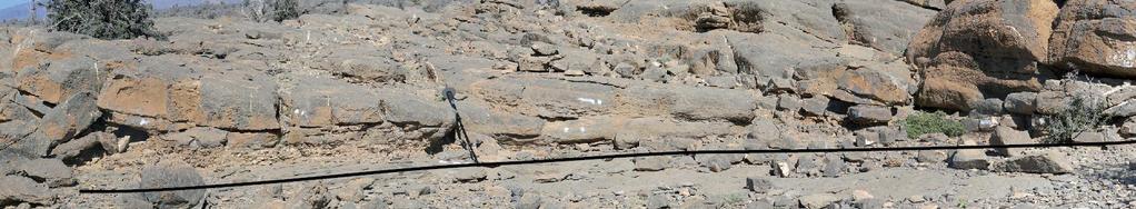
6 N FIELD WORK LOCATION Slide 4 Detailed study in the Jabal Shams area 100 km Sultanate of Oman (Özcan et al., 2015) N Detailed study Jabal Shams Gulf of Oman Jabal Akhdar Reference sedimentological section Al Hamra Al Hoota Top of sequence II Base of sequence II Faults Paper # Paper Title Presenter Name
7 25 m TRANSECTS OF CORRELATION & FACIES DISTRIBUTION B Slide 5 Large scale transect SW NE B S6 S5 S4 S3 Vertical exaggeration : x 250! S2 S1 10 km

8 25 m 15 m Detail transect TRANSECTS OF CORRELATION & FACIES DISTRIBUTION B Slide 6 S6 2 km SW Vertical exaggeration : x 50! NE B S6 S5 S4 S3 Large scale transect S2 S1 10 km


9 Paper # Paper Title Presenter Name FINE-GRAINED MUD DOMINATED FACIES Muddy deposits type 1 Muddy deposits type 2 Slide 7


10 COARSE-GRAINED RUDISTS RICH DEPOSISTS Slide 8 paper n Outcrop study of the Natih Formation in Oman Robinet et al.


11 5m Vertical exageration : x 50

 Bioclastic")


12 15 m NATIH C SW Slide 10 8 km NE Muddy deposits type 1 (MUD 1) Bioclastic grainstone Muddy deposits type 2 (MUD 2) Shallower Deeper Paper # Paper Title Presenter Name 2 mm
13 25 m TRANSECTS OF CORRELATION & GEOMETRIES B Slide 11 SW NE B S6 Sub-horizontal profiles S5 S4 S3 S2 S1 10 km
14 25 m 15 m Medium to very high-angle profiles TRANSECTS OF CORRELATION & GEOMETRIES B Slide 12 SW S6 2 km Vertical exaggeration : x 50! NE B S6 Medium to very high-angle profiles S5 S4 S3 Sub-horizontal profiles S2 S1 10 km


15 B 2. MEDIUM TO VERY HIGH-ANGLE DEPOSITIONAL SYSTEM Slide 13 Sandwaves MUD 1 Rudists MUD 2 MUD 1 Rudists MUD 2 1. SUB-HORIZONTAL DEPOSITIONAL SYSTEM MUD 1 Rudists MUD 2??
 Slide 14 Pure carbonate system Higher")


16 SEQUENCE II (60 m) B STACKING PATTERNS (3 rd order) Slide 14 Pure carbonate system Higher rate of accommodation SLIDE TITLE HERE Top Seq. II Top Seq. II Argillaceous carbonate system Low rate of accommodation Top Seq. I Top Seq. I Paper # Paper Title Presenter Name
 Slide")


17 3 m STACKING PATTERNS (High frequency) Slide 15 Shallow-up sequence Rudists Coarsening-up 10 m Burrows MUD 2 Shallowing-up Deepening-up sequence Rudists Coarsening-up x m MUD 1 Deepening-up
18 SW STRATIGRAPHIC EVOLUTION Slide 16 NE 15 m 1 km Paper # Paper Title Presenter Name Not to scale

19 SW 1. Homogenous aggradation Slide 17 NE 1 km 15 m Paper # Paper Title Presenter Name Not to scale
20 SW 1. Homogenous aggradation Slide 18 NE 1 km 15 m Paper # Paper Title Presenter Name Not to scale
21 SW 2. Differential aggradation Slide 19 NE 1 km 15 m Shoal Swell Paper # Paper Title Presenter Name Not to scale
22 SW 2. Differential aggradation Slide 20 NE 1 km 15 m Shoal Swell Paper # Paper Title Presenter Name Not to scale
23 SW 3. Maximum of accommodation Slide 21 NE 15 m 1 km Shoal Swell Paper # Paper Title Presenter Name Not to scale
24 SW 4. Swell filling : Progradation Slide 22 NE 15 m 1 km Paper # Paper Title Presenter Name Not to scale

25 SW 4. Swell filling : Progradation Slide 23 NE 15 m 1 km Paper # Paper Title Presenter Name Not to scale
26 SW 4. Swell filling : Development of rudists sand waves Slide 24 NE 15 m 1 km Rudists sand waves Paper # Paper Title Presenter Name Not to scale
27 SW 4. Swell filling : Progradation Slide 25 NE 15 m 1 km Paper # Paper Title Presenter Name Not to scale

28 SW 4. Swell filling : development of rudists sandwaves Slide 26 NE 15 m 1 km Rudists sandwaves Paper # Paper Title Presenter Name Not to scale
29 SW 4. Swell filling : Retrogradation Slide 27 NE 15 m 1 km Paper # Paper Title Presenter Name Not to scale

30 SW 5. Swell filling : Progradation & emersion of the system Slide 28 NE 15 m 1 km Paper # Paper Title Presenter Name Not to scale
31 15 m Controlling factors of geometries and facies distribution Slide 29 A/S Tectonic Eustatism Paleoecology Differential aggradation Evolution of the depositional system (Shoal & swell system) Lateral variation of : Paleoecology Sedimentation rate Paper # Paper Title Presenter Name Not to scale

32 CONCLUSIONS Slide 30 Identification of new facies not yet recognized in the Al Khalij Field Depositional geometries and facies models High resolution stratigraphic architecture of Natih sequence II Controlling parameters on sedimentation processes New geological concept to constrain facies distribution in the Al Khalij field See Presentation n Outcrop analogue Al Khalij field - Caline et al. At 12h45 - Room 105 Paper n Outcrop study of the Natih Formation in Oman Robinet et al.

33 The authors would like to thank TOTAL E&P and QATAR PETROLEUM for permission to present this contribution. Slide 31

34 15 m NATIH C 60 m NATIH D NATIH C Geometries & facies distribution A B A Slide 32 C Detailed study NE SW NW B A 40 km C SE B Vertical exaggeration : x 250! 8 km A Paper # Paper Title Presenter Name
35 15 m NATIH C SW Slide 33 8 km NE Muddy deposits type 1 Bioclastic grainstone Muddy deposits type 2 Shallower Deeper Paper # Paper Title Presenter Name 2 mm
36 B 2. MEDIUM TO VERY HIGH-ANGLE DEPOSITIONAL SYSTEM Slide 34 MUD 1 Rudists MUD 2 MUD 1 Rudists MUD 2 1. SUB-HORIZONTAL DEPOSITIONAL SYSTEM MUD 1 Rudists MUD 2?

37 SEQUENCE II (60 m) STACKING PATTERNS (3 rd order) Slide 35 Top Seq. II Pure carbonate system Higher rate of accommodation Argillaceous carbonate system Low rate of accommodation Top Seq. I
38 3 m STACKING PATTERNS (High frequency) Slide 36 Shallow-up sequence Rudists Coarsening-up 10 m Burrows MUD 2 Shallowing-up Deepening-up sequence Rudists Coarsening-up x m MUD 1 Deepening-up


39 25 m 10 m B Deepening-up Vs Shallowing-up sequences A B A B Slide 37 B A C B S6 B A S6 2 km C S5 S4 S3 S2 S1 10 km

40 Paleogeography Slide 38 Paper # Paper Title Presenter Name
41 Implication of two types of mud-dominated deposits Slide 39 Well A Well B? MUD 1 MUD 1 Paper n Outcrop study of the Natih Formation in Oman Robinet et al.


42 Implication of two types of mud-dominated deposits Slide 40 Well A Well B MUD 1 MUD 1 Sub-horizontal sequences? «layer cake» model of correlation? Well A Well B Paper n Outcrop study of the Natih Formation in Oman Robinet et al.


43 Implication of two types of mud-dominated deposits Slide 41 Well A Well B MUD 1? Sub-horizontal sequences? «layer cake» model of correlation?? MUD 2 MUD 1 Paper n Outcrop study of the Natih Formation in Oman Robinet et al.

44 Implication of two types of mud-dominated deposits Slide 42 Well A Well B MUD 1 Filling of a swell Medium to very high-angle depositional profiles High lateral facies variations MUD 2 MUD 1 Well A Well B MUD 1 MUD 2 MUD 1 Paper n Outcrop study of the Natih Formation in Oman Robinet et al.

45 Implication of two types of mud-dominated deposits Slide 43 Well A Well B MUD 1 Filling of a swell Medium to very high-angle depositional profiles High lateral facies variations MUD 2 MUD 1 Well A Well B MUD 1 MUD 2 MUD 1 Paper n Outcrop study of the Natih Formation in Oman Robinet et al.


46 Deepening-up Vs Shallowing-up sequences Slide 44 Landward Landward Paper n Outcrop study of the Natih Formation in Oman Robinet et al.


47 Slide 45 Al-Husseini 2010 Paper n Outcrop study of the Natih Formation in Oman Robinet et al.
Porosity partitioning in sedimentary cycles: implications for reservoir modeling
 Porosity partitioning in sedimentary cycles: implications for reservoir modeling Gregor P. Eberli 1), Langhorne B. Smith 2), Elena Morettini 3), Layaan Al-Kharusi 1) 1) Comparative Sedimentology Laboratory,
Block 65 - Onshore Oman
 Block 65 - Onshore Oman SUMMARY Block 65 is a 1,230 km 2 area located in the interior of Oman. Over its history Block 65 has had several owners and it has also experienced several configuration changes.
Depositional Sequences Sequences
 Depositional Sequences Transgressive and Regressive packages can be bound by unconformities Because sediment can only be preserved during net aggradation and progradation All other times there is either
Aptian/Albian Reservoir Development in the Jeanne d Arc Basin, Offshore Eastern Canada
 Aptian/Albian Reservoir Development in the Jeanne d Arc Basin, Offshore Eastern Canada Jonathan Marshall, Statoil Canada Ltd. Calgary, Alberta, Canada. jomars@statoil.com Introduction: The Jeanne d Arc
Sequence Stratigraphy. Historical Perspective
 Sequence Stratigraphy Historical Perspective Sequence Stratigraphy Sequence Stratigraphy is the subdivision of sedimentary basin fills into genetic packages bounded by unconformities and their correlative
High-resolution Sequence Stratigraphy of the Glauconitic Sandstone, Upper Mannville C Pool, Cessford Field: a Record of Evolving Accommodation
 Page No. 069-1 High-resolution Sequence Stratigraphy of the Glauconitic Sandstone, Upper Mannville C Pool, Cessford Field: a Record of Evolving Accommodation Thérèse Lynch* and John Hopkins, Department
Bulletin of Earth Sciences of Thailand
 Depositional Environments and Stratigraphic Development of the Grand Taman Sari Circuit Outcrop: an Analogue for Transgressive Mahakam Delta Successions Ridha Santika Riadi Petroleum Geoscience Program,
DATA ANALYSIS AND INTERPRETATION
 III. DATA ANALYSIS AND INTERPRETATION 3.1. Rift Geometry Identification Based on recent analysis of modern and ancient rifts, many previous workers concluded that the basic structural unit of continental
The Impact of Parasequence Stacking Patterns on Vertical Connectivity Between Wave-Dominated, Shallow Marine Parasequences, Book Cliffs, Eastern Utah
 The Impact of Parasequence Stacking Patterns on Vertical Connectivity Between Wave-Dominated, Shallow Marine Parasequences, Book Cliffs, Eastern Utah MALCOLM J. ARNOT and TIMOTHY R. GOOD* MALCOLM J. ARNOT
Sequence Stratigraphy as a tool for water resources management in alluvial coastal aquifers: application to the Llobregat delta (Barcelona, Spain)
") Sequence Stratigraphy as a tool for water resources management in alluvial coastal aquifers: application to the Llobregat delta (Barcelona, Spain) Desiré Gàmez Torrent December 2007 CHAPTER 1: Introduction
Sequence Stratigraphy as a tool for water resources management in alluvial coastal aquifers: application to the Llobregat delta (Barcelona, Spain) Desiré Gàmez Torrent December 2007 CHAPTER 1: Introduction
Block 43B - Onshore Oman
 Block 43B - Onshore Oman SUMMARY Block 43B is an 11,967 km 2 area located along the coastal area of Oman north of the Hajar Mountains. This is an unexplored region, both geographically and stratigraphically.
OUTCROP! CHARACTERISATION! OF! TRANSGRESSIVE! SANDSTONE! RESERVOIRS:! QUANTITATIVE!COMPARISON!OF!OUTCROP!ANALOGUES!
 OUTCROP CHARACTERISATION OF TRANSGRESSIVE SANDSTONE RESERVOIRS: QUANTITATIVECOMPARISONOFOUTCROPANALOGUES OLIVER D. JORDAN 1, PETER J. SIXSMITH 2, GARY J. HAMPSON, SANJEEV GUPTA & HOWARDD.JOHNSON DepartmentofEarthScienceandEngineering,ImperialCollegeLondon,SouthKensington
Bulletin of Earth Sciences of Thailand
 Quantitative Seismic Geomorphology of Early Miocene to Pleistocene Fluvial System of Northern Songkhla Basin, Gulf of Thailand Oanh Thi Tran Petroleum Geoscience Program, Department of Geology, Faculty
Reservoir Modelling of a Bioclastic Calcarenite Complex on Favignana, Southern Italy: The Application of Multi-point Statistics*
 Reservoir Modelling of a Bioclastic Calcarenite Complex on Favignana, Southern Italy: The Application of Multi-point Statistics* Robert Kil 1 and Andrea Moscariello 2,3 Search and Discovery Article #50548
Outcrops from Every Continent and 20 Countries in 140 Contributions. Tor H. Nilsen, Roger D. Shew, Gary S. Steffens, and Joseph R.J. Studlick.
 Paper VIII Tor H. Nilsen, Roger D. Shew, Gary S. Steffens, and Joseph R.J. Studlick Editors Outcrops from Every Continent and 20 Countries in 140 Contributions http://bookstore.aapg.org Length ~ 23 m (75.5
Sedimentary and Stratigraphic Analysis of the Viking Sand in the Edgerton/Wainwright Area, Central Alberta* By Russell Walz 1
 Sedimentary and Stratigraphic Analysis of the Viking Sand in the Edgerton/Wainwright Area, Central Alberta* By Russell Walz 1 Search and Discovery Article #50030 (2006) Posted June 25, 2006 *Extended abstract
International Journal of Engineering Research & Science (IJOER) ISSN: [ ] [Vol-3, Issue-12, December- 2017]
![International Journal of Engineering Research & Science (IJOER) ISSN: [ ] [Vol-3, Issue-12, December- 2017]](/thumbs/93/113637537.jpg "International Journal of Engineering Research & Science (IJOER) ISSN: [ ] [Vol-3, Issue-12, December- 2017]") Role of the Cluster Analysis in Logfacies and Depositional Environments Recognition from Well Log Response for Mishrif Formation in Southeast Iraq. Jawad K. Radhy AlBahadily 1*, Medhat E. Nasser 2 Department
Role of the Cluster Analysis in Logfacies and Depositional Environments Recognition from Well Log Response for Mishrif Formation in Southeast Iraq. Jawad K. Radhy AlBahadily 1*, Medhat E. Nasser 2 Department
Seismic Expressions of Submarine Channel - Levee Systems and Their Architectural Elements
 Seismic Expressions of Submarine Channel - Levee Systems and Their Architectural Elements Summary D.V. Ramana, Santanu De* and Kalyanbrata Datta KDMIPE, ONGC, Dehradun E-mail- devvenram@rediffmail.com
NAME: GEL 109 Final Winter 2010
 GEL 109 Final Winter 2010 1. The following stratigraphic sections represents a single event followed by the slow accumulation of background sedimentation of shale. Describe the flows that produced the
Accommodation. Tectonics (local to regional) Subsidence Uplift
 Subsidence Uplift") Accommodation Accommodation varies over time; it is the distance between a reference horizon and the sea surface (i.e. relative sea level). The space to be filled in with sediments or water What are the
Accommodation Accommodation varies over time; it is the distance between a reference horizon and the sea surface (i.e. relative sea level). The space to be filled in with sediments or water What are the
Application of Predictive Modeling to the Lower Cretaceous Sedimentary Sequences of the Central Scotian Basin
 Application of Predictive Modeling to the Lower Cretaceous Sedimentary Sequences of the Central Scotian Basin Christopher R. Sangster 1, Nicolas Hawie 2, Georgia Pe-Piper 1, Francky Saint-Ange 2, David
GeoCanada 2010 Working with the Earth
 Lithofacies Identification and the Implications for SAGD Well Planning in the McMurray Formation, Christina Lake Area, Alberta Travis Shackleton*, Robert Gardner, Sung Youn, Grace Eng and Lori Barth Cenovus
Improving reservoir models of Cretaceous carbonates with digital outcrop modelling (Jabal Madmar, Oman): static modelling and simulating clinoforms
: static modelling and simulating clinoforms") Improving reservoir models of Cretaceous carbonates with digital outcrop modelling (Jabal Madmar, Oman): static modelling and simulating clinoforms Erwin W. Adams 1,3,*, Carine Grélaud 2, Mayur Pal 1,
Improving reservoir models of Cretaceous carbonates with digital outcrop modelling (Jabal Madmar, Oman): static modelling and simulating clinoforms Erwin W. Adams 1,3,*, Carine Grélaud 2, Mayur Pal 1,
Introduction to sequence stratigraphy and its application to reservoir geology
 Introduction to sequence stratigraphy and its application to reservoir geology Massimo Zecchin Istituto Nazionale di Oceanografia e di Geofisica Sperimentale - OGS Historical development Definitions Systems
Sequence Stratigraphy: An Applied Workshop
 Sequence Stratigraphy: An Applied Workshop Instructor: Prof. Octavian Catuneanu Level: Intermediate Duration: 5 days Course Description and Objectives This workshop presents the concepts and practical
IRAQ. Target Exploration. Geodynamic Evolutions of The Sedimentary Basins of. This study is a major reference for Petroleum
 barr Target Exploration Target Exploration Geodynamic Evolutions of The Sedimentary Basins of IRAQ This study is a major reference for Petroleum Explorationists on the tectonics, stratigraphy, sedimentary
Modeling Lateral Accretion in McMurray Formation Fluvial- Estuarine Channel Systems: Grizzly Oil Sands May River SAGD Project, Athabasca
 Modeling Lateral Accretion in McMurray Formation Fluvial- Estuarine Channel Systems: Grizzly Oil Sands May River SAGD Project, Athabasca Duncan Findlay, Thomas Nardin, Alex Wright, Raheleh Salehi Mojarad
Abstract. Introduction. Regional Setting. GCSSEPM to be published December 2003
 Shelf Margin Deltas and Associated Deepwater Deposits: Implications on Reservoir Distribution and Hydrocarbon Entrapment, Block VI-1, Ulleung Basin, East Sea, South Korea Sneider, John S. Sneider Exploration,
The Sequence Stratigraphic and Paleogeograhic Distribution of Reservoir-Quality Dolomite, Madison Formation, Wyoming and Montana
 The Sequence Stratigraphic and Paleogeograhic Distribution of Reservoir-Quality Dolomite, Madison Formation, Wyoming and Montana TAURY SMITH AND GREGOR EBERLI The primary aim of this study is to show the
Reservoir Modeling for Focused-Flow and Dispersed Flow Deepwater Carbonate Systems, Agua Amarga Basin, Southeast Spain
 Reservoir Modeling for Focused-Flow and Dispersed Flow Deepwater Carbonate Systems, Agua Amarga Basin, Southeast Spain Robert H. Goldstein, Evan K. Franseen, Rachel Dvoretsky STATUS: Project in press TIMING:
Evan K. Franseen, Dustin Stolz, Robert H. Goldstein, KICC, Department of Geology, University of Kansas
 Reservoir Character of the Avalon Shale (Bone Spring Formation) of the Delaware Basin, West Texas and Southeast New Mexico: Effect of Carbonate-rich Sediment Gravity Flows Evan K. Franseen, Dustin Stolz,
Southern Songkhla Basin, Gulf of Thailand
 Architecture and Depositional Environment of Fluvial Systems of Southern Songkhla Basin, Gulf of Thailand Toan Manh Do Petroleum Geoscience Program, Department of Geology, Faculty of Science, Chulalongkorn
Applications of Borehole Imaging to Hydrocarbon Exploration and Production
 Applications of Borehole Imaging to Hydrocarbon Exploration and Production Instructor: Philippe MONTAGGION / NExT, Schlumberger Title: Petroleum Geology Consultant Specialty: Borehole Imaging, Petroleum
Reservoir characterization
 1/15 Reservoir characterization This paper gives an overview of the activities in geostatistics for the Petroleum industry in the domain of reservoir characterization. This description has been simplified
Devonian Petroleum Systems and Exploration Potential, Southern Alberta, Part 3 Core Conference
 Devonian Petroleum Systems and Exploration Potential, Southern Alberta, Part 3 Core Conference Andy Mort (1), Leonard Stevens (2), Richard Wierzbicki (2) Abstract Part 1: Devonian Petroleum Systems Dr.
Geologic influence on variations in oil and gas production from the Cardium Formation, Ferrier Oilfield, west-central Alberta, Canada
 Geologic influence on variations in oil and gas production from the Cardium Formation, Ferrier Oilfield, west-central Alberta, Canada Marco Venieri and Per Kent Pedersen Department of Geoscience, University
EARTH SURFACE PROCESSES AND SEDIMENTATION!
 Sed and Strat EARTH SURFACE PROCESSES AND SEDIMENTATION! 2/27 Lecture 7- Exposure: Weathering and the Sediment Factory 3/04 Lecture 8 - Rivers and Landscapes 3/06 Lecture 9 - Waves (not Tides) 3/11 Lecture
Controls on clastic systems in the Angoche basin, Mozambique: tectonics, contourites and petroleum systems
 P2-2-13 Controls on clastic systems in the Angoche basin, Mozambique: tectonics, contourites and petroleum systems Eva Hollebeek, Olivia Osicki, Duplo Kornpihl Schlumberger, London, UK Introduction Offshore
BALOCHISTAN FOLDBELT BASIN
 INTRODUCTION BALOCHISTAN FOLDBELT BASIN The Kharan-3 block is located in the Kharan Trough of Balochistan Basin. GEOLOGICAL SETTING The Balochistan Province is an Upper Cretaceous to Recent structurally
Kilometre-Scale Uplift of the Early Cretaceous Rift Section, Camamu Basin, Offshore North-East Brazil*
 Kilometre-Scale Uplift of the Early Cretaceous Rift Section, Camamu Basin, Offshore North-East Brazil* Iain Scotchman 1 and Dario Chiossi 2 Search and Discovery Article #50183 (2009) Posted May 20, 2009
Fault/Fracture Related Dolomitisation of the Eocene Thebes Formation, Hammam Fauran Fault Block, Gulf of Suez*
 Fault/Fracture Related Dolomitisation of the Eocene Thebes Formation, Hammam Fauran Fault Block, Gulf of Suez* Cathy Hollis 1, Hilary Corlett 2, Jesal Hirani 2, David Hodgetts 2, Robert L. Gawthorpe 3,
Seismic interpretation of carbonate turbidites in Central Luconia
 GeoL. Soc. MaLayaia, BuLLetin 47, December 2005; pp. 77-85 Seismic interpretation of carbonate turbidites in Central Luconia FRANcis Ho, GUENTER JAEGER AND PmT LAMBREGTS Sarawak Shell Berhad SMEP Exploration
Supplementary Material
 GSA Data Repository item 2018118 Brardinoni, F., Picotti, V., Maraio, S., Paolo Bruno, P., Cucato, M., Morelli, C., and Mair, V., 2018, Postglacial evolution of a formerly glaciated valley: Reconstructing
F.H. NADER 1, PETROLEUM SYSTEMS MODELING CHALLENGES OF STRUCTURALLY COMPLEX FRONTIER BASINS: THE CASE OF THE LEVANT (EAST-MED) BASIN
 BASIN") PETROLEUM SYSTEMS MODELING CHALLENGES OF STRUCTURALLY COMPLEX FRONTIER BASINS: THE CASE OF THE LEVANT (EAST-MED) BASIN A PROPOSED INTEGRATED APPROACH F.H. NADER 1, J. Barabasch 2, L. Inati 1, M. Ducros
PETROLEUM SYSTEMS MODELING CHALLENGES OF STRUCTURALLY COMPLEX FRONTIER BASINS: THE CASE OF THE LEVANT (EAST-MED) BASIN A PROPOSED INTEGRATED APPROACH F.H. NADER 1, J. Barabasch 2, L. Inati 1, M. Ducros
Viking Lowstand Deposits in West Central Saskatchewan: Depositional Model for the Reservoir Units in Dodsland-Hoosier Area, Saskatchewan, Canada
 Viking Lowstand Deposits in West Central Saskatchewan: Depositional Model for the Reservoir Units in Dodsland-Hoosier Area, Saskatchewan, Canada Hasan Ferdous* PetroSed Geoconsulting Resources, Calgary,
Sedimentology and Stratigraphy of Lower Smackover Tight Oil Carbonates: Key to Predictive Understanding of Reservoir Quality and Distribution
 Integrated Reservoir Solutions Sedimentology and Stratigraphy of Lower Smackover Tight Oil Carbonates: Key to Predictive Understanding of Reservoir Quality and Distribution Roger J. Barnaby Presented at
Multiattributes and Seismic Interpretation of Offshore Exploratory Block in Bahrain A Case Study
 Multiattributes and Seismic Interpretation of Offshore Exploratory Block in Bahrain A Case Study Suresh Thampi, Aqeel Ahmed, Yahya Al-Ansari, Ali Shehab, Ahmed Fateh, Anindya Ghosh, Ghada Almoulani. The
4.1 Sediment accommodation space principles and controls
 58 The sedimentary record of sea-level change 4. Sediment accommodation space principles and controls Sequence stratigraphy emphasizes the importance of the space that is made available within a basin
An outcrop analogue for the Williston Basin Bakken hybrid play, the Sappington Formation in southwest Montana:
 An outcrop analogue for the Williston Basin Bakken hybrid play, the Sappington Formation in southwest Montana: Facies, stratigraphic architecture, and controls on porosity distribution Michael Hofmann
Integrating Core, Well Logs and Seismic Interpretation to Improve Understanding of Albian Patch Reefs, Maverick Basin, SW Texas * By Enzo S.
 Integrating Core, Well Logs and Seismic Interpretation to Improve Understanding of Albian Patch Reefs, Maverick Basin, SW Texas * By Enzo S. Aconcha 1 Search and Discovery Article #50104 (2008) Posted
Heterogeneity Type Porosity. Connected Conductive Spot. Fracture Connected. Conductive Spot. Isolated Conductive Spot. Matrix.
 Porosity Histogram Porosity Contribution 1.3.3.3 Connected 9.8 ohm.m U R D 9 18 7. 5.25 4.38 3.5 2.63 1.75 48 Heterogeneity Distribution Image Orientation, L U 27 36.4.3 X,X72.5 Depth, ft.3 1 Isolated.3
Figure 1 Extensional and Transform Fault Interaction, Influence on the Upper Cretaceous Hydrocarbon System, Equatorial Margin, West Africa.
 Figure 1 Extensional and Transform Fault Interaction, Influence on the Upper Cretaceous Hydrocarbon System, Equatorial Margin, West Africa. Presented to the 10th PESGB/HGS Conference on Africa E + P September
Buried-valley Aquifers: Delineation and Characterization from Reflection Seismic and Core Data at Caledon East, Ontario
 Buried-valley Aquifers: Delineation and Characterization from Reflection Seismic and Core Data at Caledon East, Ontario Russell, H.A.J. 1, S.E. Pullan 1, J.A. Hunter 1, D.R. Sharpe 1, and S. Holysh 2 1
Calcite Cements in Middle Devonian Dunedin Formation:
 Geochemistry of the Fracture-Filling Dolomite and Calcite Cements in Middle Devonian Dunedin Formation: Implication for the Strata Dolomitization Model Sze-Shan Yip 1, Hairuo Qing 1 and Osman Salad Hersi
Facies Analysis of the Lower Cretaceous Wilrich Member (Lower Falher) of the Spirit River Formation.
 of the Spirit River Formation.") Facies Analysis of the Lower Cretaceous Wilrich Member (Lower Falher) of the Spirit River Formation. Kerrie L. Bann, Ichnofacies Analysis Inc. and Daniel J. K. Ross, Tourmaline Oil Corp. Historically,
Facies Analysis of the Lower Cretaceous Wilrich Member (Lower Falher) of the Spirit River Formation. Kerrie L. Bann, Ichnofacies Analysis Inc. and Daniel J. K. Ross, Tourmaline Oil Corp. Historically,
Modeling Lateral Accretion in McMurray Formation Fluvial-Estuarine Channel Systems: Grizzly Oil Sands May River SAGD Project, Athabasca*
 Modeling Lateral Accretion in McMurray Formation Fluvial-Estuarine Channel Systems: Grizzly Oil Sands May River SAGD Project, Athabasca* Duncan Findlay 1, Thomas Nardin 1, Alex Wright 1, and Raheleh Salehi
Training Venue and Dates Ref # Reservoir Geophysics October, 2019 $ 6,500 London
 Training Title RESERVOIR GEOPHYSICS Training Duration 5 days Training Venue and Dates Ref # Reservoir Geophysics DE035 5 07 11 October, 2019 $ 6,500 London In any of the 5 star hotels. The exact venue
Deterministic, Process Based Modeling of the Deepwater Fill of the Peïra Cava Basin, SE France*
 Deterministic, Process Based Modeling of the Deepwater Fill of the Peïra Cava Basin, SE France* Romain Rouzairol 1, Riccardo Basani 2, Ernst W.M. Hansen 2, John A. Howell 3, and Tor E. Aas 4 Search and
Rivers and Rifting: Evolution of a Fluvial System during Rift Initiation, Central Corinth Rift (Greece)*
*") Rivers and Rifting: Evolution of a Fluvial System during Rift Initiation, Central Corinth Rift (Greece)* Romain Hemelsdaël 1, Mary Ford 1, Fabrice Malartre 2, Robert Gawthorpe 3, Julien Charreau 1, and
Rivers and Rifting: Evolution of a Fluvial System during Rift Initiation, Central Corinth Rift (Greece)* Romain Hemelsdaël 1, Mary Ford 1, Fabrice Malartre 2, Robert Gawthorpe 3, Julien Charreau 1, and
EGAS. Ministry of Petroleum
 EGAS Ministry of Petroleum EGAS Ministry of Petroleum About The Block Location: N. El Arish offshore block is located in the extreme eastern part of the Egypt s economic water border and bounded from the
Sequence Stratigraphy of the Upper Cretaceous Niobrara Formation, A Bench, Wattenberg Field, Denver Julesburg Basin, Colorado*
 Sequence Stratigraphy of the Upper Cretaceous Niobrara Formation, A Bench, Wattenberg Field, Denver Julesburg Basin, Colorado* Lisa E. Remington LaChance 1 and Mark C. Robinson 1 Search and Discovery Article
Facies Analysis Of The Reservoir Rocks In The. Sylhet Trough, Bangladesh. Abstract
 Facies Analysis Of The Reservoir Rocks In The Sylhet Trough, Bangladesh Joyanta Dutta Petroleum Geoscience Program, Department of Geology, Faculty of Science, Chulalongkorn University, Bangkok 10330, Thailand
High Resolution Field-based Studies of Hydrodynamics Examples from the North Sea
 High Resolution Field-based Studies of Hydrodynamics Examples from the North Sea Stephen O Connor 1, Richard Swarbrick 2 and Sam Green 1 1 Ikon GeoPressure, Durham, UK 2 Swarbrick Geopressure Consultancy,
Seismic Attributes and Their Applications in Seismic Geomorphology
 Academic article Seismic Attributes and Their Applications in Seismic Geomorphology Sanhasuk Koson, Piyaphong Chenrai* and Montri Choowong Department of Geology, Faculty of Science, Chulalongkorn University,
Sediment and Sedimentary rock
 Sediment and Sedimentary rock Sediment: An accumulation of loose mineral grains, such as boulders, pebbles, sand, silt or mud, which are not cemented together. Mechanical and chemical weathering produces
Hydrocarbon Potential of the Marginal Fields in Niger Delta Oza Field, a case study*
 Hydrocarbon Potential of the Marginal Fields in Niger Delta Oza Field, a case study* J.N. Sahu 1, C.H.V. Satya Sai 1, V. Chintamani 1 and C. Vishnu Vardhan 1 Search and Discovery Article #20182 (2012)*
Geosciences Career Pathways (Including Alternative Energy)
") Geosciences Career Pathways (Including Alternative Energy) Shale Carbonates Clastics Unconventionals Geology Characterization and Production Properties of Gas Shales Geomechanics in International Shale
Geosciences Career Pathways (Including Alternative Energy) Shale Carbonates Clastics Unconventionals Geology Characterization and Production Properties of Gas Shales Geomechanics in International Shale
Meandering Miocene Deep Sea Channel Systems Offshore Congo, West Africa
 Meandering Miocene Deep Sea Channel Systems Offshore Congo, West Africa S. Baer* (PGS), J. E. Comstock (PGS), K. Vrålstad (PGS), R. Borsato (PGS), M. Martin (PGS), J.P. Saba (SNPC), B. Débi-Obambé (SNPC)
Masila 1: Shallow shelf carbonate facies variability and secondary reservoir development - Saar Formation Masila block, Yemen
 Masila 1: Shallow shelf carbonate facies variability and secondary reservoir development - Saar Formation Masila block, Yemen Kent Wilkinson* Nexen Inc., Calgary, AB kent_wilkinson@nexeninc.com ABSTRACT
Ministry of Oil and Minerals Petroleum Exploration & Production Authority BLOCK 6 (Iryam)
") Ministry of Oil and Minerals Petroleum Exploration & Production Authority BLOCK 6 (Iryam) The Iryam Block (6) occupies an area of 3,911 km 2 in the Sabatayn Basin in the province of Shabwah in central
Ministry of Oil and Minerals Petroleum Exploration & Production Authority BLOCK 6 (Iryam) The Iryam Block (6) occupies an area of 3,911 km 2 in the Sabatayn Basin in the province of Shabwah in central
Modeling Lateral Accretion in the McMurray Formation at Grizzly Oil Sands Algar Lake SAGD Project
 Modeling Lateral Accretion in the McMurray Formation at Algar Lake SAGD Project Duncan Findlay 1, Thomas Nardin 1, Andrew Couch 2, Alex Wright 1 1 ULC, 2 EON Introduction Laterally accreting channel systems
Revised reservoir model for the Paleocene mounds of the Utsira High, North Sea, Norway John Wild (1) & Nowell Briedis (2)
 & Nowell Briedis (2)") Revised reservoir model for the Paleocene mounds of the Utsira High, North Sea, Norway John Wild (1) & Nowell Briedis (2) (1) Mobil North Sea LLC (2) Esso Exploration & Production Norway A/S (ExxonMobil
Revised reservoir model for the Paleocene mounds of the Utsira High, North Sea, Norway John Wild (1) & Nowell Briedis (2) (1) Mobil North Sea LLC (2) Esso Exploration & Production Norway A/S (ExxonMobil
Iraq. Iraq s future oil production: practical issues, pace and sustainability. Dr. Peter R. A. Wells CWC Iraq Conference November 2010
 Iraq Iraq s future oil production: practical issues, pace and sustainability Dr. Peter R. A. Wells CWC Iraq Conference November 21 Neftex Petroleum Consultants Limited What matters? Reservoir geology and
Future giant discovery in the Outeniqua Basin, offshore South Africa. Anongporn Intawong & Neil Hodgson
 Future giant discovery in the Outeniqua Basin, offshore South Africa Anongporn Intawong & Neil Hodgson Spectrum Geoscience 23 February 2017 1 Talk Outlines Structural framework & Evolution of the South
NORTHEAST EL HAMD BLOCK
 NORTHEAST EL HAMD BLOCK NORTHEAST EL HAMD BLOCK LOCATION : The block is locating in the eastern side of the central part of the Gulf of Suez basin west and south of Belayim fields. NORTHEAST EL HAMD BLOCK
PETROLEUM GEOSCIENCES GEOLOGY OR GEOPHYSICS MAJOR
 PETROLEUM GEOSCIENCES GEOLOGY OR GEOPHYSICS MAJOR APPLIED GRADUATE STUDIES Geology Geophysics GEO1 Introduction to the petroleum geosciences GEO2 Seismic methods GEO3 Multi-scale geological analysis GEO4
EGAS. Ministry of Petroleum
 EGAS Ministry of Petroleum EGAS Ministry of Petroleum About The Block Location: N. Thekah offshore block is located at about 56 km to the north of the Mediterranean shore line, 85 km to the north west
Play fairway mapping in the Northeast Atlantic Margin Comparison between mature and immature basins. David Mudge, Joanne Cranswick
 Play fairway mapping in the Northeast Atlantic Margin Comparison between mature and immature basins David Mudge, Joanne Cranswick Contents Ternan North Sea Play fairway mapping Tertiary case study Northeast
PECIKO GEOLOGICAL MODELING: POSSIBLE AND RELEVANT SCALES FOR MODELING A COMPLEX GIANT GAS FIELD IN A MUDSTONE DOMINATED DELTAIC ENVIRONMENT
 IATMI 2005-29 PROSIDING, Simposium Nasional Ikatan Ahli Teknik Perminyakan Indonesia (IATMI) 2005 Institut Teknologi Bandung (ITB), Bandung, 16-18 November 2005. PECIKO GEOLOGICAL MODELING: POSSIBLE AND
Sarah Jane Riordan. Australian School of Petroleum University of Adelaide March 2009
 Managing the Interdisciplinary Requirements of 3D Geological Models Sarah Jane Riordan Australian School of Petroleum University of Adelaide March 2009 Thesis submitted in accordance with the requirements
A Tectonostratigraphic History of Orphan Basin, Offshore Newfoundland, Canada
 A Tectonostratigraphic History of Orphan Basin, Offshore Newfoundland, Canada Lynn T. Dafoe*, Charlotte E. Keen, Graham L. Williams, and Sonya A. Dehler, Geological Survey of Canada, Dartmouth, NS Canada
P026 Outcrop-based reservoir modeling of a naturally fractured siliciclastic CO 2 sequestration site, Svalbard, Arctic Norway
 P026 Outcrop-based reservoir modeling of a naturally fractured siliciclastic CO 2 sequestration site, Svalbard, Arctic Norway K. Senger (University of Bergen / CIPR), K. Ogata* (University Centre in Svalbard),
Dalhousie University- Petroleum Geoscience Field Methods- Trinidad Summary Report
 Dalhousie University- Petroleum Geoscience Field Methods- Trinidad Summary Report Submitted to: Offshore Energy Research Association of Nova Scotia (OERA) To fulfill requirements of the Undergraduate Student
Carboniferous Stoddart Group: An integrated approach
 Carboniferous Stoddart Group: An integrated approach Abu Yousuf*, Department of Geoscience, University of Calgary, Calgary, Alberta yousufabu@hotmail.com and Charles M. Henderson, Department of Geoscience,
Ministry of Oil and Minerals Petroleum Exploration & Production Authority BLOCK 85 (Al Uqlah North)
") Ministry of Oil and Minerals Petroleum Exploration & Production Authority BLOCK 85 (Al Uqlah North) The Al Uqlah North Block (85) occupies an area of 597 km 2 in the Sabatayn Basin in the province of Shabwah
Ministry of Oil and Minerals Petroleum Exploration & Production Authority BLOCK 85 (Al Uqlah North) The Al Uqlah North Block (85) occupies an area of 597 km 2 in the Sabatayn Basin in the province of Shabwah
The Green River and Wasatch formations in the Lake Uinta, and
 DCA ~280m Oil-stained Sandstone Consortium Proposal: Lacustrine Reservoirs from Deep to Shallow: Facies Distribution, Architecture, and Source Rock Formation Green River Formation, Utah & Colorado Microbial
Relinquishment Report. Licence P2016 Block 205/4c
 Relinquishment Report Licence P2016 Block 205/4c September 2016 JX Nippon Exploration and Production (U.K.) Limited Idemitsu Petroleum UK Ltd. Table of Contents 1. Licence Information... 1 2. Licence Synopsis...
Reservoir Rock Properties
 Reservoir Rock Properties From here on, sedimentology and petrophysics are important for a good understanding of the course material. I realize that not everybody has a solid background in these fields,
PROCEEDINGS, INDONESIAN PETROLEUM ASSOCIATION Forty-First Annual Convention & Exhibition, May 2017
 IPA17-369-SG PROCEEDINGS, INDONESIAN PETROLEUM ASSOCIATION Forty-First Annual Convention & Exhibition, May 2017 FACIES ANALYSIS OF LATE NEOGENE DEPOSIT: MARINE TO CONTINENTAL ENVIRONMENT OF THE MERAPI
Kigoma Bay bathymetry, sediment distribution, and acoustic mapping
 Kigoma Bay bathymetry, sediment distribution, and acoustic mapping Student: Gwynneth Smith Mentor: Kiram Lezzar Introduction Echosounding is a method commonly employed for determining the bathymetry of
Sedimentary facies and sequence stratigraphy of the Asmari Formation at Tange Arabi,Zagros Basin, Iran
 Sedimentary facies and sequence stratigraphy of the Asmari Formation at Tange Arabi,Zagros Basin, Iran Atefe Abbasi, Geology student of Shiraz Payam-noor University Abstract The Oligocene Miocene ASMARI
Fluvial-Estuarine and Deltaic Reservoirs, Shelf Margin Delta and Slope Reservoir Characteristics Philip Sedore 2015
 Fluvial-Estuarine and Deltaic Reservoirs, Shelf Margin Delta and Slope Reservoir Characteristics Philip Sedore 2015 Introduction The offshore Columbus Basin and the onshore Southern Basin of Trinidad are
AAPG International Conference: October 24-27, 2004; Cancun, Mexico
 and Seismic Attributes in the Continental Shelf of Eastern Mexico Khaled Fouad, L. Frank Brown, Jr., William A. Ambrose, Dallas Dunlap, Bureau of Economic Geology, Jackson School of Geosciences, The University
Vertical Hydrocarbon Migration at the Nigerian Continental Slope: Applications of Seismic Mapping Techniques.
 ROAR HEGGLAND, Statoil ASA, N-4035 Stavanger, Norway Vertical Hydrocarbon Migration at the Nigerian Continental Slope: Applications of Seismic Mapping Techniques. Summary By the use of 3D seismic data,
Petroleum Geology of. Southern Iraq. Petroleum Geology of. Studied Area. Target Exploration Target Exploration. barr. A Target Exploration Report
 Page1 barr Target Exploration barr Target Exploration Target Exploration Petroleum Geology of Southern Iraq Petroleum Geology of Studied Area Southern A Target Exploration Report Iraq Page2 The Report
Quantitative Seismic Interpretation An Earth Modeling Perspective
 Quantitative Seismic Interpretation An Earth Modeling Perspective Damien Thenin*, RPS, Calgary, AB, Canada TheninD@rpsgroup.com Ron Larson, RPS, Calgary, AB, Canada LarsonR@rpsgroup.com Summary Earth models
Implications of the Rabat Deep 1 exploration well on the prospectivity of the surrounding area
 Transformational Growth Through Exploration Implications of the exploration well on the prospectivity of the surrounding area Morocco Brazil Namibia South Atlantic 100 Ma Reconstruction Growth through
Case Study of the Structural and Depositional-Evolution Interpretation from Seismic Data*
 Case Study of the Structural and Depositional-Evolution Interpretation from Seismic Data* Yun Ling 1, Xiangyu Guo 1, Jixiang Lin 1, and Desheng Sun 1 Search and Discovery Article #20143 (2012) Posted April
SEDIMENTARY PHOSPHORITES: GENESIS, FACIES AND OCCURRENCE. Peter Berger Samantha Dwyer Jessica Hellwig Eric Obrock Kristin Read
 SEDIMENTARY PHOSPHORITES: GENESIS, FACIES AND OCCURRENCE Peter Berger Samantha Dwyer Jessica Hellwig Eric Obrock Kristin Read Introduction Phosphogenesis & Deposystems Facies Case Studies: Western U.S.,
Licence P1368: Relinquishment Report (end of 2 nd term) Hurricane Exploration PLC
 Hurricane Exploration PLC") Licence P1368: Relinquishment Report (end of 2 nd term) Hurricane Exploration PLC March 2012 1. Header Licence Number: P1368 Licence Round: 23 rd Licence Type: Frontier Block Numbers: 202/4, 202/5, 204/30,
Licence P1368: Relinquishment Report (end of 2 nd term) Hurricane Exploration PLC March 2012 1. Header Licence Number: P1368 Licence Round: 23 rd Licence Type: Frontier Block Numbers: 202/4, 202/5, 204/30,