The fieldwork component
|
|
|
- Tyrone Townsend
- 5 years ago
- Views:
Transcription

1 The fieldwork component
2 Context Purpose and value of fieldwork and how it relates to the course Terms Enquiry process Geographical skills
3 Terms Primary data Data collected in the field (by you/your group) Secondary data Data that has already been processed in published materials
4 Quantitative data Terms Data that can be measured and counted and is readily processed using graphs, maps and statistics Qualitative data Data that does not have a numerical value, e.g. opinions, comment, descriptions which is therefore not very easy to process. It is valuable as it can provide a context for quantitative data. It can sometimes be encoded it to make limited processing possible (e.g. by categorising people s views/opinions
5 The Enquiry Process 1. Context & planning identifying/refining questions; choosing suitable locations; deciding on collection methods; risk assessments 2. Data collection acquiring data pertinent to the investigation with an appropriate balance between primary & secondary, and quantitative & qualitative 3. Presentation & display using appropriate methods to enable 4. Analysis & interpretation of findings interrogate data to identify & describe patterns, trends and relationships; apply concepts & processes to understand observed data 5. Conclusion synthesise/summarise findings to draw conclusions relating to original questions 6. Evaluationof the whole investigation critically reflect on every stage of the investigation to appreciate strengths & limitations; consider accuracy, validity & reliability of methodology and findings; suggest improvements for further research
6 Planning the Snowdonia fieldwork
7 Snowdonia Fieldtrip The equivalent of three days of fieldwork: 2 half days + 2 whole days Human Geography: investigations relating to: Changing Places: Re-imaging/rebranding in Blaenau Ffestiniog Importance of tourism in Betws-y-Coed Physical Geography: investigations relating to: Glaciated Landscapes around Llyn Llydaw on Snowdon: Glacial deposition identifying landforms in the field Periglacial slope processes scree development Coastal Landscapes beach management impacts at Dinas Dinlle Ecosystems at the Local Scale sand dunes at Morfa Dinlle ½ day ½ day 1 day 1 day


8 Locations
9 Likert Scale Data collection methods Likert (1932) developed the principle of measuring attitudes by asking people to respond to a series of statements about a topic, in terms of the extent to which they agree with them. ( - 18/04/18) I would like to spend more time here Strongly agree Agree Undecided Disagree Strongly disagree
10 Data collection methods Environmental Quality Assessment bipolar It can be difficult to decide on appropriate opposite descriptions Always make sure you have the descriptions on the correct side of the scale!

11 Data collection methods Environmental Quality Assessment scoring
12 Coding for land use surveys Data collection methods You may need to have sub-groups in order to identify more meaningful patterns but having too many could make it difficult to see any patterns at all! Collecting raw data with a view to encoding later might be the best option


13 Blaenau Ffestiniog

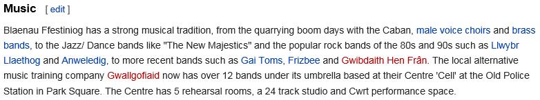
14 Wikipedia entry


15 Betws-y-Coed


16 Glaciated Landscapes -1 Are the depositional landforms around Llyn Llydaw mainly lodgement or ablation in origin?

17 Glaciated Landscapes -1 Are the depositional landforms around Llyn Llydaw mainly lodgement or ablation in origin?
18 Glaciated Landscapes -1 Are the depositional landforms around Llyn Llydaw mainly lodgement or ablation in origin? Expectations? From this, we can make some predictions regarding ablation till features compared to lodgement features: Clasts would be more angular They would not be orientated in the direction of ice flow There would be less fine material in the matrix Deposits would be less compacted What about their appearance?
19 Landform appearance What differences might be apparent? How could the landforms be described? What sort of data is it?


20 Sediment sampling till fabric analysis You can t measure every clast in every landform, so you will need to devise an appropriate sampling method. A useful piece of equipment would be a quadrat: How could this be used to select clasts? How many clasts should you aim to measure? What should be considered in making this decision?
21 Measuring sediment angularity/roundness There are a number of different techniques for describing the characteristics of coarse sediment (finer sediment sand, silt & clay needs to be sieved). The Field Studies Council has some useful details: ( We re only going to consider roundness, for which there are two main methods: Powers Index of Roundness Cailleux s Roundness Index How could such data be presented and analysed?
22 Powers Roundness Pro: quick and easy Con: subjective; data in categories (so less easy to process)

23 CailleuxRoundness


24 CailleuxRoundness Pro: a detailed measurement that produces a broader range of values providing possibilities for more detailed analysis, esp. using statistics Con: more fiddly and therefore time-consuming
25 How might this be measured? How could it be presented? Clast orientation
26 Glaciated Landscapes -1 Are the depositional landforms around Llyn Llydawmainly lodgement or ablation in origin?
27 Sediment size distribution How might this be measured? What difficulties might there be? How could these be overcome? Could this be simply assessed? If so, how?
28 Sediment compaction Can this be measured (in the field)? If so how? Why might any measurements be unreliable here?
29 What evidence might you look for? How would you measure it? How would you record it? Ice flow direction
30 Glaciated Landscapes -2 To what extent is the scree material at Llyn Llydawlarger at the bottom? Accurate and reliable measurements of clast size is critical for this investigation. Sampling is also needed what might be done and how many clasts collected?

31 Measuring coarse sediment size Techniques for measuring sediment size: Equipment needed? Issues?

32 Measuring coarse sediment size Measuring volume by displacement: Equipment? Issues?
33 Glaciated Landscapes -2 To what extent is the scree material at Llyn Llydawlarger at the bottom? Compare data from top with that at bottom possible analysis techniques Mean + standard deviation Dispersion diagrams Box (and whisker) plots Mann Whitney u test (used to determine if two sets of quantitative data are significantly different) sets can be of different sizes but it works best if there is less than 20 in each set Chi-squared (used to determine the degree of difference between observed and expected data) data needs to be in grouped frequencies and you should expect at least 5 in each group
34 Glaciated Landscapes -2 To what extent is the scree material at Llyn Llydaw greatest at the bottom? Mann Whitney u test Is there a significant difference between the two sets of data? (NB only use first 20 pieces of data) Hypothesis, H 1 Null hypothesis, H 0 Calculate the u values for each data set Discard the larger one Compare smaller value against critical values for size of data set to determine the significance of the result Accept/reject null hypothesis
35 The Physical Fieldwork -2 To what extent is the scree material at Llyn Llydaw greatest at the bottom?
36 Glaciated Landscapes -2 To what extent is the scree material at Llyn Llydaw greatest at the bottom? Chi-squared Is there a significant difference between the observed data and what would be expected (i.e. a random distribution in this case)? Hypothesis, H 1 Null hypothesis, H 0 Calculate chi-squared Compare value against critical values for size of data set Accept/reject null hypothesis
37 Glaciated Landscapes -2 To what extent is the scree material at Llyn Llydaw greatest at the bottom? Chi-squared Group the long-axis data there should be at least 5 expected values in each class so if you have 25 stones, have 5 classes. These are your Observed data, O. Size class Row Total Top of scree slope Bottom of scree slope Column Total (Overall Total)
38 Glaciated Landscapes -2 To what extent is the scree material at Llyn Llydaw greatest at the bottom? Calculating chi-squared Calculate the expected value (E) for each cell using the following formula: (row total x column total) / overall total Give values to at least 1 decimal place. For each cell you need to compare the observed data with the expected value: (O-E) 2 / E Add these up to give a chi-squared value Work out the degrees of freedom (don t ask!): (rows-1) * (columns-1) Now compare these in the critical values table
39 Glaciated Landscapes -2 To what extent is the scree material at Llyn Llydaw greatest at the bottom?
40 A brief explanation about significance testing: With some statistical tests (like Chi-squared, Mann Whiney and Spearman s Rank) it is possible that a result could have occurred by chance. Therefore it is necessary to determine what this probability is i.e. the significance of the result. In most cases, a probability of 10% (or 0.1) that a result could have occurred by chance is considered to be too great a risk and so the null hypothesis could not be confidently rejected. The lower probability (e.g. 5% or 0.01, for example) the more significant the outcome and so the greater the confidence that rejecting the null hypothesis would be the right conclusion to draw.


41 Coastal Landscapes To what extent has management affected coastal processes at Dinas Dinlle?
42 Coastal Landscapes To what extent has management affected coastal processes at Dinas Dinlle?

43 Tidal predictions Why important for coastal fieldwork? Free for 7 days in advance E.g. Or UKHO (right) Coastal Landscapes
44 Coastal Landscapes To what extent has management affected coastal processes at Dinas Dinlle? How can longshore drift direction (and speed?) be measured? Why is it important to do this independently and not just from observation? How will these be affected by longshore drift: Clast size and roundness? Beach width and gradient? How to record information about what coastal management is there? What impact would coastal management have on the above and why (expectations)? How can the impacts be determined at this location? Sampling and sample sizes? Locations? Measurement of clast size and roundness? Beach width and gradient? Accuracy and reliability?
45 Ecosystems How typical a psammosere are the dunes at Morfa Dinlle? Expectations?

46 A Psammosere: coastal sand dunes What changes are observable as succession proceeds? Why do these change? Ecosystems, p129, M Gillett, Hodder Education, 2005


47 A Psammosere: coastal sand dunes What changes are observable as succession proceeds? Why do these change? Cross section through dunes from The Functioning and Management of Psammoseres in Studland Bay, Dorset, GeoFile #710, April 2014
48 Ecosystems How typical a psammosere are the dunes at Morfa Dinlle? Data to be collected along a transect going inland from the strandline on the beach Dune profile: How? Equipment? Precautions? Vegetation: What? How? Equipment? Precautions?
49 Ecosystems How typical a psammosere are the dunes at Morfa Dinlle? Soil characteristics: What? How? Equipment? Precautions? Wind speed: What? How? Equipment? Precautions?
50 Ecosystems How typical a psammosere are the dunes at Morfa Dinlle? Secondary data? Statistics based on observations taken between 12/ /2017 daily from 7am to 7pm local time.

51 Ecosystems How typical a psammosere are the dunes at Morfa Dinlle? Statistics based on observations taken between 12/ /2017 daily from 7am to 7pm local time.


52 Ecosystems How typical a psammosere are the dunes at Morfa Dinlle? Data presentation: Kite diagrams
53 Ecosystems How typical a psammosere are the dunes at Morfa Dinlle? Data analysis: Correlation? Are changes expected to be linear?
Integrating skills Practical approaches
 Integrating skills Practical approaches Geographical skills in relation to both an equal weighting of quantitative and qualitative skills are required for A level learners, and the list in Appendix A of
AS & A2 Geography for OCR. Tailored Courses. Slapton Ley
 AS & A2 Geography for OCR Tailored Courses Slapton Ley Please visit http://www.field-studies-council.org/outdoorclassroom/geography/aqa/ for alternative A-level AQA programmes OVERVIEW Since the assessment
Coastal Systems and Landscapes 3 days
 AS Level Geography WJEC Coastal Systems and Landscapes 3 days This course is for Welsh schools. This in-depth course prepares students for the physical fieldwork focusing on the Coastal option, for Section
Landscape Systems: Coasts 3 days
 AS Level Geography Edexcel Landscape Systems: Coasts 3 days Deliver two days of fieldwork within an inspiring physical environment covering all the recommended themes in depth. Prepare AS level students
Topic 6A: Geographical Investigations fieldwork Investigating coastal landscapes
 Topic 6A: Geographical Investigations fieldwork Investigating coastal landscapes Enquiry question When completing a geographical study, it is important to have an aim. We can do this by asking a task question,
Curriculum Links AS and A level Field Studies
 Equipment Includes Human Geography Coastal Management Students examine the conflicts that arise from coastal erosion and the options for coastal management. They investigate different types of coastal
Edexcel 2 Landscape systems, processes and change
 Edexcel 2 Landscape systems, processes and change Area of the Spec Field Site Research areas Primary data collection Secondary data access Statistical analysis High and low Identifying of different Local
General Certificate of Education Advanced Level Examination June 2014
 General Certificate of Education Advanced Level Examination June 2014 Biology BIO6T/Q14/task Unit 6T A2 Investigative Skills Assignment Task Sheet Introduction Investigating populations You will use leaves
2018 Geography Mock Examination
 2018 Geography Mock Examination Your Geography mock examination will test your understanding of Paper 1 (Living with the physical environment) and Section B (Fieldwork) from Paper 2. Attached are the necessary
1. The map below shows a meandering river. A A' is the location of a cross section. The arrows show the direction of the river flow.
 1. The map below shows a meandering river. A A' is the location of a cross section. The arrows show the direction of the river flow. Which cross section best represents the shape of the river bottom at
Topic 2: Landscape Systems, Processes and Change
 Topic 2: Landscape Systems, Processes and Change Option 2A: Glaciated Landscapes and Change Overview Ice sheets and glaciers operate within a landscape system as glacial processes of erosion, transport
GLG Chapter 7 Sedimentary Environments & Rocks
 GLG 101 - Chapter 7 Sedimentary Environments & Rocks Name Note, Oct 11: I ll be writing this study sheet over the next few days. Each day I will add questions until the entire chapter is done, hopefully
Geography Controlled Assessment 2015 GCSE Edexcel A
 Geography Controlled Assessment 2015 GCSE Edexcel A Name: Class:.. Teacher: An introduction to Unit 4 - Controlled assessment: Unit 4 of the specification is different to the other units because you do
Secondary Assessment Framework Geography Living with the physical environment Paper Pupils can
 THE CHALLENGE OF NATURAL HAZARDS 9/8 Discuss in detail, using case studies and examples to support their work, different natural disasters. They must know named examples.. Assess in detail factors affecting
Coastal Systems and Landscapes 3 days
 AS Level Geography Eduqas Coastal Systems and Landscapes 3 days Deliver two days of fieldwork within an inspiring physical environment. Prepare AS level students for Paper 1 Section B: Fieldwork Investigation
PSY 307 Statistics for the Behavioral Sciences. Chapter 20 Tests for Ranked Data, Choosing Statistical Tests
 PSY 307 Statistics for the Behavioral Sciences Chapter 20 Tests for Ranked Data, Choosing Statistical Tests What To Do with Non-normal Distributions Tranformations (pg 382): The shape of the distribution
AS Level Geography: Investigating Places, Landscapes and Change 5 days Specification Links - Coastal
 AS Level Geography: Investigating laces, Landscapes and Change 5 days Specification Links - Coastal Edexcel Subject Content Coastal Landscapes Coastal Fieldwork Methods Formation of Erosional Coastal Landforms
General Certificate of Education Advanced Level Examination June 2013
 General Certificate of Education Advanced Level Examination June 2013 Human Biology HBI6T/P13/task Unit 6T A2 Investigative Skills Assignment Task Sheet Investigation into whether reaction time is different
Coastal Landscapes Case Study 3 days
 GCSE Geography OCR B Coastal Landscapes Case Study 3 days In-depth study of a coastal landscape providing a detailed case study, to ensure students are prepared for Paper 1: Our Natural World. Complete
Edexcel A-Level Geography Course Options For teaching from September 2016
 Edexcel A-Level Geography Course Options For teaching from September 2016 has been an FSC Field Centre since 1957. It is ideally placed to provide access to the distinctive fluvial, coastal and post glacial
The Changing Physical Landscapes of the UK 3 days
 GCSE Geography Edexcel A The Changing Physical Landscapes of the UK 3 days In-depth coverage of fieldwork within a physical environment, required for Topic 7: Geographical Investigations - Fieldwork, enabling
psychological statistics
 psychological statistics B Sc. Counselling Psychology 011 Admission onwards III SEMESTER COMPLEMENTARY COURSE UNIVERSITY OF CALICUT SCHOOL OF DISTANCE EDUCATION CALICUT UNIVERSITY.P.O., MALAPPURAM, KERALA,
Ecosystems. Ecosystems at a local scale
 Ecosystems Ecosystems at a local scale Section outline Succession of one ecosystem The arresting role of physical factors in creating subclimax communities Role of human factors in maintaining plagioclimax
Quantitative Analysis and Empirical Methods
 Hypothesis testing Sciences Po, Paris, CEE / LIEPP Introduction Hypotheses Procedure of hypothesis testing Two-tailed and one-tailed tests Statistical tests with categorical variables A hypothesis A testable
Glossary. The ISI glossary of statistical terms provides definitions in a number of different languages:
 Glossary The ISI glossary of statistical terms provides definitions in a number of different languages: http://isi.cbs.nl/glossary/index.htm Adjusted r 2 Adjusted R squared measures the proportion of the
CHAPTER 17 CHI-SQUARE AND OTHER NONPARAMETRIC TESTS FROM: PAGANO, R. R. (2007)
") FROM: PAGANO, R. R. (007) I. INTRODUCTION: DISTINCTION BETWEEN PARAMETRIC AND NON-PARAMETRIC TESTS Statistical inference tests are often classified as to whether they are parametric or nonparametric Parameter
FROM: PAGANO, R. R. (007) I. INTRODUCTION: DISTINCTION BETWEEN PARAMETRIC AND NON-PARAMETRIC TESTS Statistical inference tests are often classified as to whether they are parametric or nonparametric Parameter
KS3 Step Descriptors
 Steps Step Descriptor KS3 Step Descriptors 1 Pupils depth of understanding of physical and human geography around their local area and the UK increases, and begins to expand to include the wider world.
Marr College Geography Department. Can-Do Checklist for Higher Geography
 Marr College Geography Department Can-Do Checklist for Higher Geography The Higher Geography exam consists of one paper. It is out of a total of 60 marks. The total time for the paper is 2 hours 15 minutes.
POLI 443 Applied Political Research
 POLI 443 Applied Political Research Session 6: Tests of Hypotheses Contingency Analysis Lecturer: Prof. A. Essuman-Johnson, Dept. of Political Science Contact Information: aessuman-johnson@ug.edu.gh College
Edexcel A GCSE Geography Course Options For teaching from September 2016
 Edexcel A GCSE Geography Course Options For teaching from September 2016 lies in a secluded valley at the eastern edge of Exmoor National Park. The house is a striking example of a Tudor and Georgian country
Rama Nada. -Ensherah Mokheemer. 1 P a g e
 - 9 - Rama Nada -Ensherah Mokheemer - 1 P a g e Quick revision: Remember from the last lecture that chi square is an example of nonparametric test, other examples include Kruskal Wallis, Mann Whitney and
Coastal Landscapes Case Study 3 days
 GCSE Geography OCR A Coastal Landscapes Case Study 3 days In-depth study of a coastal landscape providing a detailed case study, to ensure students are prepared for the Paper 1 exam: Living in the UK Today.
Physical Landscapes in the UK 3 days
 GCSE Geography AQA Physical Landscapes in the UK 3 days In-depth coverage of fieldwork within a physical environment, required for 3.3.2 Section B: Fieldwork, enabling students to get the grades they want
Geography. Geography A. Curriculum Planner and Skills Mapping Grid GCSE Version 1 October 2012
 Geography GCSE 2012 Geography A Curriculum Planner and Skills Mapping Grid Version 1 October 2012 www.ocr.org.uk/gcse2012 Year 10 Exam work Controlled Assessment Autumn 1 Autumn 2 Spring 1 Spring 2 Summer
AQA GCSE Geography Course Options For teaching from September 2016
 AQA GCSE Geography Course Options For teaching from September 2016 lies in a secluded valley at the eastern edge of Exmoor National Park. The house is a striking example of a Tudor and Georgian country
Year 10 Geography Curriculum Plan. Geography Edexcel B (9-1) Investigating Geographical Issues (2016)
 Investigating Geographical Issues (2016)") Topic 1: Development Dynamics Paper 1 > Topic 2) Year 10 Geography Curriculum Plan Geography Edexcel B (9-1) Investigating Geographical Issues (2016) Key concept/ Key question Overview of the unit Assessment
Topic 1: Development Dynamics Paper 1 > Topic 2) Year 10 Geography Curriculum Plan Geography Edexcel B (9-1) Investigating Geographical Issues (2016) Key concept/ Key question Overview of the unit Assessment
Edexcel AS Geography Course Options For teaching from September 2016
 Edexcel AS Geography Course Options For teaching from September 2016 has been an FSC Field Centre since 1957. It is ideally placed to provide access to the distinctive fluvial, coastal and post glacial
Sediment and Sedimentary rock
 Sediment and Sedimentary rock Sediment: An accumulation of loose mineral grains, such as boulders, pebbles, sand, silt or mud, which are not cemented together. Mechanical and chemical weathering produces
AQA A-Level Geography
 AQA A-Level Geography At Rhyd-y-creuau we pride ourselves on our flexible approach when designing fieldwork to meet the learning needs of students. The options listed here are popular with our groups and
Give 4 advantages of using ICT in the collection of data. Give. Give 4 disadvantages in the use of ICT in the collection of data
 Give 4 advantages of using ICT in the collection of data can use a handheld GPS to get accurate location information which can be used to show data linked to specific locations within a GIS can collect
Conceptual Framework Fieldwork Enquiry: Rivers, Coasts & Ecosystems 3 days
 GCSE Geography Eduqas B Conceptual Framework Fieldwork Enquiry: Rivers, Coasts & Ecosystems 3 days Fully complete conceptual framework fieldwork enquiry to prepare students for Component 3: Applied Fieldwork
Statistics Handbook. All statistical tables were computed by the author.
 Statistics Handbook Contents Page Wilcoxon rank-sum test (Mann-Whitney equivalent) Wilcoxon matched-pairs test 3 Normal Distribution 4 Z-test Related samples t-test 5 Unrelated samples t-test 6 Variance
Curriculum and Assessment in Geography at KS3
 Curriculum and Assessment in Geography at KS3 Curriculum Statement: Geography The world as we know it is not given and it can and it will change. - Lambert et al. Powerful Knowledge in Geography Geography
Statistics: revision
 NST 1B Experimental Psychology Statistics practical 5 Statistics: revision Rudolf Cardinal & Mike Aitken 29 / 30 April 2004 Department of Experimental Psychology University of Cambridge Handouts: Answers
Geographical knowledge and understanding scope and sequence: Foundation to Year 10
 Geographical knowledge and understanding scope and sequence: Foundation to Year 10 Foundation Year 1 Year 2 Year 3 Year 4 Year 5 Year 6 Year level focus People live in places Places have distinctive features
OCR 2008 AS and A level Geography Specification Mapping Guide
 OCR 2008 AS and A level Geography Specification Mapping Guide Contents Introduction Error! Bookmark not defined. Specification map: 2008 OCR AS and A level Geography 3 What's new? 10 Introduction This
The Agents of Erosion
 The Agents of Erosion 1. Erosion & Deposition 2. Water 3. Wind 4. Ice California Science Project 1 1. Erosion and Deposition Erosion is the physical removal and transport of material by mobile agents such
The UK s Evolving Physical Landscape 3 days
 GCSE Geography Edexcel B The UK s Evolving Physical Landscape 3 days In-depth coverage of the physical fieldwork task required for Topic 6: Geographical Investigations, enabling students to get the grades
Page 1. Name:
 Name: 1) Which event is the best example of erosion? dissolving of rock particles on a limestone gravestone by acid rain breaking apart of shale as a result of water freezing in a crack rolling of a pebble
Studland Overview. Coastal processes and ecosystems Studland Bay Introduction Why is Studland a SSSI and National Nature Reserve?
 Studland Overview Coastal processes and ecosystems Studland Bay Introduction Why is Studland a SSSI and National Nature Reserve? What natural processes affect the beach and dunes? What are the interactions
Climate Change: How it impacts Canadians and what we can do to slow it down.
 Climate Change: How it impacts Canadians and what we can do to slow it down. Lesson Overview This lesson takes stock of how climate change has already affected Canadians in geographic, economic, and cultural
OCR A-Level Geography Course Options
 OCR A-Level Geography Course Options For teaching from September 2016 Juniper Hall is an amazing location for fieldwork, set in a quiet wooded valley in an unspoilt area of the chalk North Downs at the
Chi Square Analysis M&M Statistics. Name Period Date
 Chi Square Analysis M&M Statistics Name Period Date Have you ever wondered why the package of M&Ms you just bought never seems to have enough of your favorite color? Or, why is it that you always seem
FORENSIC GEOLOGY SAND SIZE-DISTRIBUTIONS AS INDICATORS OF CRIME SCENE LOCATIONS
 I. Introduction 89.215 FORENSIC GEOLOGY SAND SIZE-DISTRIBUTIONS AS INDICATORS OF CRIME SCENE LOCATIONS If you think about the world around you sand, and other sediments, occur in many environments. For
Eduqas A GCSE Geography Course Options For 2018 assessment
 Eduqas A GCSE Geography Course Options For 2018 assessment has been an FSC Field Centre since 1957. It is ideally placed to provide access to the distinctive fluvial and post glacial landscapes of Shropshire
GROUPED DATA E.G. FOR SAMPLE OF RAW DATA (E.G. 4, 12, 7, 5, MEAN G x / n STANDARD DEVIATION MEDIAN AND QUARTILES STANDARD DEVIATION
 FOR SAMPLE OF RAW DATA (E.G. 4, 1, 7, 5, 11, 6, 9, 7, 11, 5, 4, 7) BE ABLE TO COMPUTE MEAN G / STANDARD DEVIATION MEDIAN AND QUARTILES Σ ( Σ) / 1 GROUPED DATA E.G. AGE FREQ. 0-9 53 10-19 4...... 80-89
Parametric versus Nonparametric Statistics-when to use them and which is more powerful? Dr Mahmoud Alhussami
 Parametric versus Nonparametric Statistics-when to use them and which is more powerful? Dr Mahmoud Alhussami Parametric Assumptions The observations must be independent. Dependent variable should be continuous
Term Knowledge Using and applying Grade Criteria Autumn 1 Assessment window October Natural hazards pose major risks to people and property.
 Assessment Schedule Year 9 2015/6 Term Knowledge Using and applying Grade Criteria Autumn 1 Assessment window October 2015 3.1.1.2 Tectonic Natural hazards pose major risks to people and property. Definition
Name. 4. The diagram below shows a soil profile formed in an area of granite bedrock. Four different soil horizons, A, B, C, and D, are shown.
 Name 1. In the cross section of the hill shown below, which rock units are probably most resistant to weathering? 4. The diagram below shows a soil profile formed in an area of granite bedrock. Four different
Erosion and Deposition
 CHAPTER 3 LESSON 2 Erosion and Deposition Landforms Shaped by Water and Wind Key Concepts What are the stages of stream development? How do water erosion and deposition change Earth s surface? How do wind
Name: Which rock layers appear to be most resistant to weathering? A) A, C, and E B) B and D
 A, C, and E B) B and D") Name: 1) The formation of soil is primarily the result of A) stream deposition and runoff B) precipitation and wind erosion C) stream erosion and mass movement D) weathering and biological activity 2)
Name: 1) The formation of soil is primarily the result of A) stream deposition and runoff B) precipitation and wind erosion C) stream erosion and mass movement D) weathering and biological activity 2)
Subject: Geography- Grade Descriptors
 Subject Grade s Developing - Secure This is the Grade at that level = 9 There are no s for 9 Exceptional ly in the top 20% at 8 is awarded 9 8 for 8 securely at 8 showing of AO1, A02 AO3 Excellent knowledge
Please bring the task to your first physics lesson and hand it to the teacher.
 Pre-enrolment task for 2014 entry Physics Why do I need to complete a pre-enrolment task? This bridging pack serves a number of purposes. It gives you practice in some of the important skills you will
Edexcel B GCSE Geography Course Options For teaching from September 2016
 Edexcel B GCSE Geography Course Options For teaching from September 2016 lies in a secluded valley at the eastern edge of Exmoor National Park. The house is a striking example of a Tudor and Georgian country
SPECIMEN. Answer one question from Section A based upon geographical research.
 Advanced GCE Geography Unit F764: Geographical Skills Specimen Paper Additional Materials: Answer Booklet (8 pages) Insert INSTRUCTIONS TO CANDIDATES Answer one question from Section A based upon geographical
Curriculum rationale September 2018 Faculty: Geography Lead: C Tarpey
 Tarpey What is your curriculum statement for each key stage? KS3- Students will study a range of Human and Physical themes throughout Year 7 whilst developing a range of key geographical skills. All students
Chapter 7 Comparison of two independent samples
 Chapter 7 Comparison of two independent samples 7.1 Introduction Population 1 µ σ 1 1 N 1 Sample 1 y s 1 1 n 1 Population µ σ N Sample y s n 1, : population means 1, : population standard deviations N
Exercise 3 Texture of siliciclastic sediments
 Exercise 3 Texture of siliciclastic sediments Siliciclastic sediments are derived from the weathering and erosion of preexisting rocks. Once a sedimentary particle is loosened from its parent rock, it
Name: KEY OBJECTIVES HYDROLOGY:
 Name: KEY OBJECTIVES Correctly define: abrasion, capillarity, deposition, discharge, erosion, evapotranspiration, hydrology, impermeable, infiltration, meander, permeable, porosity, water table, weathering,
Course Objectives. School Name: Date:
 Course Objectives Knowledge: Skills:. To identify the characteristics of river courses and the associated landforms. 2. To relate the exogenetic fluvial processes with the characteristics of river courses
What are the different ways rocks can be weathered?
 Romano - 223 What are the different ways rocks can be weathered? Weathering - the breakdown of rocks and minerals at the Earth s surface 1. 2. PHYSICAL WEATHERING Rock is broken into smaller pieces with
Introduction to Survey Analysis!
 Introduction to Survey Analysis! Professor Ron Fricker! Naval Postgraduate School! Monterey, California! Reading Assignment:! 2/22/13 None! 1 Goals for this Lecture! Introduction to analysis for surveys!
Testing Research and Statistical Hypotheses
 Testing Research and Statistical Hypotheses Introduction In the last lab we analyzed metric artifact attributes such as thickness or width/thickness ratio. Those were continuous variables, which as you
iv vi x Using maps 2 Using images and analysing data 6 Using new technologies in geography 8
 Contents Exam board specification map Introduction Topic checker iv vi x Geographical skills Using maps 2 Using images and analysing data 6 Using new technologies in geography 8 Natural hazards Tectonic
OCR A-Level Geography Course Options For teaching from September 2016
 OCR A-Level Geography Course Options For teaching from September 2016 has been an FSC Field Centre since 1957. It is ideally placed to provide access to the distinctive fluvial, coastal and post glacial
Landscapes, Issues and Fieldwork Enquiry 5 days
 GCSE Geography WJEC Landscapes, Issues and Fieldwork Enquiry 5 days Complete the conceptual and methodological fieldwork enquires and prepare students for the Unit 3 fieldwork report. Wide coverage of
SEDIMENTS can have different sizes and we can sort them using standard sieves. What size mesh is each sieve?
 SEDIMENTS can have different sizes and we can sort them using standard sieves What size mesh is each sieve? Streams are the most obvious sculptors of the earth, weathering and eroding the Earth and causing
Themes: To develop map reading skills. Themes: To investigate survival issues in polar landscapes. Assessment: Map skills examination.
 2018-2019 Long-term plans at a glance: Key Stage 3 Year 7 Term 1 (7) Term 2 (7) Term 3 (5) Term 4 (5.5) Term 5 (5) Term 6 (5) Global Passport. Paradise Lost Map Skills Living on the edge: Glaciated landscapes.
Programme of Study and Success Criteria for Key Stage 3 - GEOGRAPHY
 Programme of Study and Success Criteria for Key Stage 3 - GEOGRAPHY Programmes of Study Year 7 Geography Perspectives: This unit will examine the idea of pupils being part of a Global world. Lessons will
Topic 6: Weathering, Erosion and Erosional-Deposition Systems (workbook p ) Workbook Chapter 4, 5 WEATHERING
 Workbook Chapter 4, 5 WEATHERING") Topic 6: Weathering, Erosion and Erosional-Deposition Systems (workbook p. 95-125) Workbook Chapter 4, 5 THE BIG PICTURE: Weathering, erosion and deposition are processes that cause changes to rock material
Topic 6: Weathering, Erosion and Erosional-Deposition Systems (workbook p. 95-125) Workbook Chapter 4, 5 THE BIG PICTURE: Weathering, erosion and deposition are processes that cause changes to rock material
Unit 1 Living with the Physical Environment
 Unit 1 Living with the Physical Environment Topic Example / Case Study Example Tectonic Hazards Chile Nepal Weather Hazards Typhoon Haiyan Somerset Floods Climate Change Ecosystems Tropical Rainforests
Cycles, Systems and Changing Places 5 days
 AS Level Geography AQA Cycles, Systems and Changing Places 5 days Complete the fieldwork requirements for AS level students within physical and human environments. Fieldwork in these locations provides
Essential Maths Skills. for AS/A-level. Geography. Helen Harris. Series Editor Heather Davis Educational Consultant with Cornwall Learning
 Essential Maths Skills for AS/A-level Geography Helen Harris Series Editor Heather Davis Educational Consultant with Cornwall Learning Contents Introduction... 5 1 Understanding data Nominal, ordinal and
Statistical Inference Theory Lesson 46 Non-parametric Statistics
 46.1-The Sign Test Statistical Inference Theory Lesson 46 Non-parametric Statistics 46.1 - Problem 1: (a). Let p equal the proportion of supermarkets that charge less than $2.15 a pound. H o : p 0.50 H
STUDENT NAME. Science Grade 5. Read each question and choose the best answer. Be sure to mark all of your answers.
 FORMATIVE MINI ASSESSMENTS First Grading Period 2010-11 September 21-24 STUDENT NAME DATE Science Grade 5 Read each question and choose the best answer. Be sure to mark all of your answers. 1 Which is
UK Geographical Issues 5 days
 GCSE Geography Edexcel B UK Geographical Issues 5 days Complete all fieldwork requirements. In-depth coverage of both human and physical fieldwork tasks required for Topic 6: Geographical Investigations,
Bell Ringer. Are soil and dirt the same material? In your explanation be sure to talk about plants.
 Bell Ringer Are soil and dirt the same material? In your explanation be sure to talk about plants. 5.3 Mass Movements Triggers of Mass Movements The transfer of rock and soil downslope due to gravity is
DETAILED CONTENTS PART I INTRODUCTION AND DESCRIPTIVE STATISTICS. 1. Introduction to Statistics
 DETAILED CONTENTS About the Author Preface to the Instructor To the Student How to Use SPSS With This Book PART I INTRODUCTION AND DESCRIPTIVE STATISTICS 1. Introduction to Statistics 1.1 Descriptive and
Subject Overview
 Subject Overview 2018 2019 Department Name: Head of Department: Subject Teachers: Accommodation and Resources: Geography Mrs J Thorne Mr D Jinks Miss A Smith Geography is based in 3 main classrooms. Each
Natural Susceptibility to Coastal Erosion: Methodology and Mapping Summary
 Natural Susceptibility to Coastal Erosion: Methodology and Mapping Summary. Introduction The Flood Risk Management (Scotland) Act 2009 (FRM Act) introduced a coordinated and partnership approach to how
Geography Exams. RAG rate The Challenge of Natural Hazards
 Geography Exams You will sit three papers, Paper 1 will last 1 hour 30 minutes and will examine your understanding of The Challenge of Natural Hazards, The Living World and Physical Landscapes in the UK.
The Coast: Beaches and Shoreline Processes
 1 2 3 4 5 6 7 8 9 The Coast: es and Shoreline Processes Trujillo & Thurman, Chapter 10 Oceanography 101 Chapter Objectives Recognize the various landforms characteristic of beaches and coastal regions.
St John s Catholic Primary School. Geography Policy. Mission Statement
 St John s Catholic Primary School Geography Policy Mission Statement We at St John s strive for excellence in education by providing a safe, secure and caring family environment where individuals are valued
Year 11 Geography. Paper 2 UK Geographical Issues. Exam Revision Booklet
 Year 11 Geography Paper 2 UK Geographical Issues Exam Revision Booklet Contents Page Topic Exam Command Words How to structure your answers UK s Physical Landscape Checklist UK s Physical Landscape Key
EDUQAS B GCSE Geography at The Bulmershe School Key Stage 4 Curriculum Plan Year 9. Term 1 Term 2 Term 3 Term 4 Term 5 Term 6
 EDUQAS B GCSE Geography at The Bulmershe School 2018-2019 Key Stage 4 Curriculum Plan Year 9 Term 1 Term 2 Term 3 Term 4 Term 5 Term 6 Shaping the Landscape Rivers and River (processes, landforms and management)
Your teacher will show you a sample or diagram of each, and show you a settling column. Draw these, and label your diagrams (8 pts) Ungraded:
 Ungraded:") From Sand to Stone: How do we recognize and interpret sedimentary rocks in the rock record? (Based closely on the University of Washington ESS 101 Lab 5: Sedimentary Rocks) Introduction: This lab consists
From Sand to Stone: How do we recognize and interpret sedimentary rocks in the rock record? (Based closely on the University of Washington ESS 101 Lab 5: Sedimentary Rocks) Introduction: This lab consists
The Coast: Beaches and Shoreline Processes Trujillo & Thurman, Chapter 10
 The Coast: es and Shoreline Processes Trujillo & Thurman, Chapter 10 Oceanography 101 Chapter Objectives Recognize the various landforms characteristic of beaches and coastal regions. Identify seasonal
Evidence for Permafrost on Long Island
 Evidence for Permafrost on Long Island By Vesna Kundic and Gilbert N. Hanson Department of Geosciences Stony Brook University Permafrost or permanently frozen ground is soil or rock that remains below
General Certificate of Secondary Education Higher Tier June 2011
 Centre Number Surname Candidate Number For Examiner s Use Other Names Candidate Signature Examiner s Initials Geography (Specification A) Unit 1 Physical Geography Monday 13 June 2011 For this paper you
Abbotswood Junior School National Curriculum 2014
 Geography Purpose A high-quality geography education should inspire in pupils a curiosity and fascination about the world and its people that will remain with them for the rest of their lives. Teaching