Seismicity and Fault Segmentation of Bafq-Baghin Fault System (Central Iran)
|
|
|
- Rosamund Riley
- 5 years ago
- Views:
Transcription
1 J. Appl. Environ. Biol. Sci., 1(10) , , TextRoad Publication ISSN: Journal of Applied Environmental and Biological Sciences Seismicity and Fault Segmentation of Bafq-Baghin Fault System (Central Iran) Mehran Arian 1* ; Mohsen Pourkermani 2 ; Ali Sistanipour 3 ; Hamideh Noroozpour 4 1,3 Department of Geology, Science and Research Branch, Islamic Azad University, Tehran, Iran 2 Department of Geology, Islamic Azad University, North Tehran Branch, Iran 4 Young Researchers Club, Science and Research Branch, Islamic Azad University, Tehran, Iran ABSTRACT Bafq- Baghin Mountain extends from northwest to southeast and is situated in Central Iran s southern border. In this region, we can find Quaternary deposits in the form of unfolded layer. The presence of folded rocks of Pliocene shows active stresses in the late Neogene period which is along with other stresses in the late Cenozoic period seems to have had the strongest effect in the present morphology of the region. The main fault of the region is Bafq- Baghin Fault system which holds right-lateral strike slip with a pressure component. Contemporary activities of this fault signify the continuity of stresses up to now. Ancient deposits, older than Quaternary in this region during different periods, have been folded repeatedly through stronger or weaker intensity. These structures are the result of important Alpine tectonic movements, especially, tectonic movements of the late Cenozoic period. The axis of most of the folds in the region is in northwest-southeast direction lying in the form of a belt of folds among sunken basins. Bafq- Baghin fault seems to be the most important factor of deformation in this region. In addition, specific morphotectonic features such as linear valleys, diverted drainages, fault scarps, badly crushed zones and springs are results of active tectonics. Field observations and digital processing of satellite data prove the conformity between the faults which are studied in the area and the expected fractures in shear zone. These fractures include conjugated faults of Riedel and Anti-Riedel(R, R'), normal faults(t), faults parallel with the major fault(y) and faults approximately parallel with the main fault(p).this conformity and existence of right handed En echelon folds indicate the dominance of the convergent strike slip in the region. 60 fault segments have been recognized on Bafq-Baghin fault system. There are several recent epicenters that situated around of a new transverse lineament with NE-SW trending that introduced in this paper as Rafsanjan- Zarand fault system. Keywords: Central Iran, Strike slip, Seismicity, fault segmentation, Bafq-Baghin fault system. 1-INTRODUCTION Our aim in this paper is to segmentation and investigates the seismicity of Bafq-Baghin fault system. The studied area is located in southern border of Central Iran and the main fault in the region is Bafq-Baghin Right lateral strike slip Fault, the mechanism of which is in accordance with the main faults around and inside Central Iran. This fault is located in the southwest and is parallel with Kouh banan active and seismic fault. Probably, these faults are two ancient Central Iran s Faults and have different activities in their geological history. In this paper the digital processing of satellite data is used for a better identification of the fractures in the region and then the general tectonics and geology of this area are dealt with; the structures and the structural analysis of the area are studied. 1-1 Tectonic setting of the study area Some of the Arabia-Eurasia convergences are accommodated in the Zagros Mountains of SW Iran, while most of the rest is taken up in the seismic belts of the Central Caspian, the Alborz and the Kopeh Dag of northern Iran, as Central Iran itself is relatively flat aseismic and probably rigid. Whatever shortening is not taken up in the Zagros must be expressed as N-S right lateral shear between central Iran and Afghanistan. This shear is manifest by major N-S right lateral fault systems on both the west (in Kerman Province) and east (in Sistan) sides of the Dasht-e-Lut, another flat aseismic rigid block (Fig1). The overall Arabia-Eurasia convergence is known from a combination of Africa-Eurasia and Arabia- Eurasia motions to be approximately N-S in Eastern Iran, with rates of about 30 mm/ year at 50 E and 40 mm/year at 60 E ( Jackson, 1992; DeMets et al., 1994; Jestin et al., 1994; Chu and Gordon, 1998). Central Iran is a mosaic of various tectonic blocks once separated by minor ocean basins (Berberian and King, 1981) that started to close in the mid-tertiary (McCall, 1996). Much of the broader collision zone, however, did not start to deform until the Mid-Miocene or even later (Dewey et al., 1986). *Correspondence Author: Mehran Arian, Department of Geology, Science and Research Branch, Islamic Azad University, Tehran, Iran. mehranarian@yahoo.com 382
, which is also the time at which there")
2 Arian et al., 2011 Fig1. Major faulting in Central Iran. The east and west faults of Dasht-e-lut are right lateral Strike slip. In particular, major deformation of the Zagros folded belt appears that doesn't have begun until the Pliocene, approximate 5 Ma years ago or less (Falcon, 1974), which is also the time at which there was a major re-organization of the sedimentation and deformation in the south Caspian Basin (Devlin et al., 1999; Jackson et al., 2002). We suspect this time represents the final closure of any remaining ocean basins and the onset of true intra-continental shortening within Iran. We also expect that the present-day configuration of active faulting dates from roughly this time. Jackson and McKenzie (1984, 1988) and Jackson et al. (1995) suggest that the Zagros accommodates about mm/ year of present-day shortening. This estimation is very dependent on the assumptions they made, but is roughly compatible with approximate 50 km of shortening which have occurred in the folded belt of Zagros over the last 5 Ma (Falcon, 1969 & 1974). Thus we expect that mm/ year remains to be taken up north of the Zagros and to be represented as N-S shear in eastern Iran. This reasoning implies that a total of km of right-lateral slip has occurred on the faults east and west of the Dasht-e-Lut over the last 5 Ma; the total offset may be more if the faults were active before 5 Ma (Jackson and Walker, 2001). After the general retreat of the Seas in Iran at the late Jurassic which is related to tectonic events of late Cimmerian, the big advancement of sea in Barremian-Aptian occurred and the result is the sedimentation of Orbitoline limestone to lower Cretaceous which in the study area is situated on older formations as unconformity (Darakhshani, 1999). Bafq-Baghin fault system has extended parallel to Bafq-Baghin Mountains that is located in the west of Dasht-e-Lut and in parallel with active and seismic fault of Kouhbanan in the northeast and Rafsanjan Fault in the southeast(fig1). This fault is directed from northwest to southeast and is in the west of N-S active fault of Nayband-Gowk. The available evidence is nonetheless sufficient to suggest that the probable slip rates (approximately 1-2 mm/ year) and total offset (approximate 12 km) on the Nayband-Gowk fault system are relatively small, and that most of the N-S shear between central Iran and Afghanistan is taken up on the eastern side of the Dasht-e- Lut (Jackson and Walker, 2001). 2-Remote sensing Most of the regional structures are the faults that the effects of their multi-functional roles as controlling of factor structures and sediment conditions are obvious. The tectonic interface and multi-behaviors of the crushed layers in reaction to events such as circular movements of the blocks, the repeated inversion of turning direction, vertical block movements or the inversion of normal faults mechanism which might have been inverted or repelled in their later periods of activity are among the points which should be paid sufficient attention in order to have a complete analysis of the area. For a better analysis of the region structures, TM Landsat Satellite digital Data has been used. By using Optimum Index Factor (OIF), the most suitable False Color Combination (FCC) (Sheffield, 1985; Chatterjee et al, 1996) was obtained. To select the best possible three-band combination and Optimum Index Factor (OIF) for evaluated bands of TM, we use the following algorithm: OIF= 3 j 1 3 k 1 sk Abs( rj) 383
3 J. Appl. Environ. Biol. Sci., 1(10) , 2011 sk: The resultant of the standard deviation for band K. rj: The correlation co-efficient between two bands of the three-bands combination. Three-band combination with greatest Optimum index factor has the most information (by applying variance in computation) and the least duplication rate (by applying correlation coefficient). In the next stage, different detector filters of edge (Hi pass) and the effect of sun radiation were used. By using these filters, border between different units of Lithology become clearer and linear processes such as faults and important fractures of the region were identified. In the final stage, the picture of the region was put under a layer of vector and the identified structures were shown on the picture. After processing satellite digital data, field studies were carried out to confirm the obtained results. A lot of the regional faults were identified for the first time in this research. Fig2. Strain ellipsoid in convergent right lateral zone with five fractures. 3- Structural Analysis of the study area Studies performed on the digital satellite data from the region and analyzing air photos and field work indicate that regional faults follow five main processes in right lateral shear zone, both in direction and in operation mechanism which may be formed in brittle shear zone (Fig5). The first group of faults in the region is similar to "Y" faults in right lateral shear zone and has right lateral strike slip mechanism. They are formed in parallel direction with the main fault. The second group have the same mechanism to the main fault but they make an angle of ( 2 ) (Ф: Angle of internal friction usually is considered 30 ) with the main fault in direction. The direction of these faults is in accordance with the direction of Riedel group in right lateral shear zone. The third group of faults holds left shear components and has an angle of 60 to 80 (90- fault in direction and they are similar to anti-riedel faults in the right lateral shear zone. ) with the main 2 In the fourth group, the faults are at approximately 10 (- 2 ) angle with the main fault in direction and have a similar mechanism with the main fault. Their direction is in accordance with the faults in group P in the right lateral shear zone. The fifth group of faults, directed at AZ 20º to 0º, show normal mechanism. They are similar to the faults in group T in the right lateral shear zone. These shapes and structures form in brittle shear zones and the complete conformity of regional faults with these fractures proves right lateral simple shear with pressure component which affects the region (Fig2). Shear fractures (R, R') form a complementary system in which R fractures are more extensive in comparison with R' fractures while R' shear with the advancement due to first basement fault operation have a fast rotation in comparison with R fractures and after some degrees of rotation may become locked and inactive. R' fractures form only when R fractures cover each other (Naylor et al., 1986; Tchalenko & Ambraseys, 1970). P fractures are also formed by decrease in shear resistance of R fractures. Since all basement movements are not absorbed by R fractures and between two shears of R, shortage axis inclines toward the fracture of R and also between the two covering R fractures, a small stress field which can be created new shear with an angle of - 2 in relation to the main movement (Naylor et al., 1986). Tension fractures are located in parallel with the shortage axis and they form the semi-angle between R and R'. 384
4 Arian et al., 2011 Another factor which can be taken into account to analyze regional structures is En echelon folds. Folds with strike slip faults are usually En echelon and oblique to the main side of shear. The term En echelon is related to structures arrangement in a linear zone in such a way that folds or faults are parallel with each other with the same inclination towards the linear zone direction (Trace of fold axes in satellite image marked by for anticlines and for synclines.) Naming this type of folds is according to the folds which make movements at strike slip areas. In this region, we can find right handed folds because of the presence of the right lateral strike slip faults in the region (Sheikholeslami, 1994). The direction of folds axis can be useful for the recognition of the direction and displacement of right strike slip zone so that in the right lateral faults, folds incline towards right hand and in the left lateral faults; folds incline towards left hand (Fig 3). By using this method we can find strain geometry in simple shear form and anticipate the direction of R, R' shears, normal (T) and trust faults. In the early stages of deformation, simple En echelon folds are arranged and through the continuation of shear in the basement, they begin to rotate. In this state, the direction of these folds axis which have an angle of 45 as compared with the direction of shear in ideal conditions change to in natural situations to the direction of the main fault. With the increase in displacement on strike slip zone, folds are separated from each other and some parts of folds also move around strike slip faults. With the continuation of block movements, semi-folds located around faults also move far away from the region (Harding & Lowell, 1979). These folds are clearly visible in the center of the highlands. Fig3. (a) Schematic of right handed folds in the right lateral shear zone. (b) Schematic of left handed folds in the left lateral shear zone. 4- Segmentation of Bafq-Baghin fault system 60 fault segments on Bafq-Baghin fault system have been recognized by structural segmentation methods (Table1) (Fig4 to 8). All of the fault segments in this system are right lateral strike slip with pressure component. Seven types of segment terminations have been determined that they have introduced below; 1- "Spurs between mountain and plain" The first type of fault segment termination has been recognized in the borders of: F 8 -F 9, F 9 -F 10, F 13 -F "En echelon with overlap or without overlap" The second type of fault segment termination has been recognized in the borders of: F 1 -F 2, F 21 -F 22, F 24 -F 25, F 32 -F 33, F 41 -F 42, F 48 -F "Cutted by minor fault" The third type of fault segment termination has been recognized in the borders of: F 4 -F 5, F 6 -F 7,F 7 -F 8,F 11 -F 12,F 14 -F 15,F 16 -F 17, F 19 -F 20, F 20 -F 21, F 23 F 24 -F 27 -F 28,F 31 -F 32, F 57 -F 58, F 58 -F 59. F 33 -F 34, F 34 -F 35, F 35 -F 36, F 36 -F 37, F 37 -F 38, F 38 -F 39, F 39 -F 40, F 40 -F 41, F 42 -F 43, F 49 -F 50, F 51-F 52, F 52 -F 53, F 53 -F 54, F 54 -F 55, F 55 -F 56 F 56 -F "Fault Gaps" The forth type fault segment termination has been recognized in the borders of: F 2 -F 3, F 29 -F "Sharp change in mountain front as bending" The fifth type fault segment termination has been recognized in the borders of : F 3 -F 4, F 5 -F 6 F 15 -F 16 F 22 -F 23 F 25 -F 26, F 30 -F 31, F 43 -F 44, F 44 -F 45 F 45 -F 46 F 59 -F "Change of structures, plans and shapes of geology" The sixth type fault segment termination has been recognized in the borders of: F 17 -F 18, F 18 -F 19, F 46 -F 47, F 47 -F "Change of type and resistance of the rocks in borders between mountain and plain" The seventh type fault segment termination has been recognized in the borders of: F 10 -F 11, F 12 -F 13, F 26 -F
5 J. Appl. Environ. Biol. Sci., 1(10) , 2011 Fault segment Length (Km) Table1. Characteristics of Bafq-Baghin fault system Atitude Hanging wall lithology Foot wall lithology F N40W Cretaceous lime stone Quaternary Alluvium F 2 9 N18W70SW Cretaceous lime stone Quaternary Alluvium F 3 2 N40W Cretaceous lime stone Quaternary old fans F 4 2 N10W Cretaceous lime stone Quaternary old fans F N60W Cretaceous lime stone Quaternary old fans F N20W Cretaceous lime stone Quaternary old fans F 7 3 N40W Cretaceous lime stone Quaternary old fans F 8 4 N50W Shemshak Formation(Triassic & Jurassic shale) Quaternary old fans F 9 5 N55W Jurassic granite Quaternary Alluvium and fans F N45W Quaternary old Alluvium Quaternary young Alluvium F N55W Shemshak Formation(Triassic & Jurassic shale) Quaternary old Alluvium F 12 2 N45W Shemshak Formation(Triassic & Jurassic shale) Quaternary old Alluvium F 13 2 N50W Naiband Formation(Triassic lime stone) Quaternary old fans F N35W Naiband Formation(Triassic lime stone) Quaternary old fans F 15 3 N45W Lalun Formation(Cambrian sand stone) Naiband Formation(Triassic lime stone) F 16 8 N30W Quaternary fans Quaternary fans F N40W Quaternary and Tertiary fans Quaternary and Tertiary fans F N60W Tertiary marls Tertiary marls F 19 6 N50W80SW Padeha Formation(Devonian lime stone) Tertiary marls F N40W80SW Lalun Formation(Cambrian sand stone) Quaternary and Tertiary Alluvium F N35W85SW Shotory Formation(Triassic dolomite) Tertiary marls F 22 4 N55W Bahram Formation(Devonian lime stone) Hojedk Formation(Jurassic shale) F N75W Padeha Formation(Devonian lime stone) Cretaceous lime stone F 24 8 N40W Bahram Formation(Devonian lime stone) Hojedk Formation(Jurassic shale) F 25 6 N55W Hojedk Formation(Jurassic shale) Hojedk Formation(Jurassic shale) F 26 6 N60W Hojedk Formation(Jurassic shale) Mila Formation(Cambrian dolomite) F N40W Hojedk Formation(Jurassic shale) Ordovician dolomite F 28 6 N35W Ordovician dolomite Bahram Formation(Devonian lime stone) F N20W Cretaceous lime stone Lower Cretaceous lime stone Middle F N5E Quaternary Alluvium Quaternary Alluvium F N12W Cretaceous lime stone Middle Quaternary old fans F N25W Cretaceous lime stone Middle Quaternary old fans F 33 4 N30W Cretaceous lime stone Middle Quaternary young fans F 34 4 N25W Quaternary old Alluvium Quaternary old Alluvium F 35 4 N35W Cretaceous lime stone Upper Cretaceous lime stone Lower F N40W Cretaceous lime stone Upper Cretaceous lime stone Lower F N45W Cretaceous lime stone Upper Quaternary old fans F 38 4 N40W Quaternary Alluvium Quaternary Alluvium F N55W Quaternary fans Quaternary fans F N25W Cretaceous lime stone Lower Cretaceous lime stone Lower F N50W Cretaceous lime stone Lower Cretaceous lime stone Lower F 42 4 N35W Cretaceous lime stone Lower Quaternary old Alluvium F N40W Cretaceous lime stone Lower Quaternary old fans F 44 5 N35W Cretaceous lime stone Upper Quaternary Alluvium F 45 7 N45W Quaternary young fans Quaternary young fans F N60W Quaternary young fans Quaternary young fans F N25W75NE Shemshak Formation(Triassic & Jurassic shale) Shemshak Formation(Triassic & Jurassic shale) F 48 3 N50W75NE Dezu Formation(Cambrian shale) Quaternary old fans F N45W75NE Shemshak Formation(Triassic & Jurassic shale) Quaternary fans F N50W Hojedk Formation(Jurassic shale) Quaternary fans F 51 6 N50W Ordovician Sand stone Shemshak Formation(Triassic & Jurassic shale) F N25W Niur Formation(Silurian dolomite) Shemshak Formation(Triassic & Jurassic shale) F 53 7 N45W Niur Formation(Silurian dolomite) Shemshak Formation(Triassic & Jurassic shale) F 54 1 N87E Niur Formation(Silurian dolomite) Shemshak Formation(Triassic & Jurassic shale) F N45W80NE Shotory Formation(Triassic dolomite) Shemshak Formation(Triassic & Jurassic shale) F 56 3 N50W80NE Naiband Formation(Triassic lime stone) Shemshak Formation(Triassic & Jurassic shale) F N60W Shotory Formation(Triassic dolomite) Shemshak Formation(Triassic & Jurassic shale) F N75W Sardar Formation(Carbonifer lime stone) Shemshak Formation(Triassic & Jurassic shale) F N55W Shotory Formation(Triassic dolomite) Shemshak Formation(Triassic & Jurassic shale) F 60 3 N35W Jamal Formation(Permian lime stone) Shemshak Formation(Triassic & Jurassic shale) 386


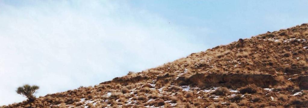
6 Arian et al., 2011 A B C Fig4. Satellite image of NW part of Bafq-Baghin fault system (A,B,C images are following and have same strike) 387


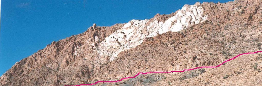


7 J. Appl. Environ. Biol. Sci., 1(10) , 2011 B A C Fig5. Fault scarps of segments F19 (A), F56 (B), F2 (C). 388


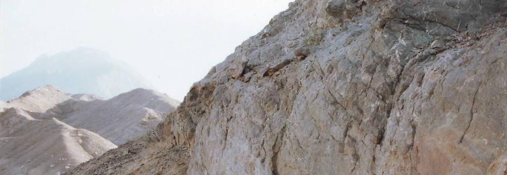
8 Arian et al., 2011 A B Fig6. Satellite image of center part of Bafq-Baghin fault system (A, B images are following and have same strike) 389

382-396,")

 Pass")
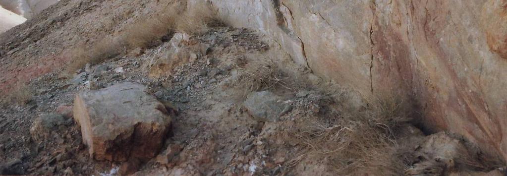
9 J. Appl. Environ. Biol. Sci., 1(10) , 2011 A B Fig7. Fault segments of F20 (A), F19(B) Pass into alluvium fans 390
10 Arian et al., 2011 Fig8. Satellite image of SE part of Bafq-Baghin fault system (A, B images are following and have same strike) 5- The seismicity of study area: The study of the seismicity record in study area(fig 9) shows that some of segments F1,F13,F14,F18,F19,F20,F21,F49,F50,F58,F57,F59,F60 of the Bafgh-Baghin fault system have seismic records. These earthquakes are generally located in almost the depth of 14 kilometer and their magnitude is from small to medium. 391


11 J. Appl. Environ. Biol. Sci., 1(10) , 2011 Fault Topography Epicenter Fig9. Comparisons of the epicenter map of the recent earthquakes in the region with its landsat image. Looking at the sedimentary cover in this region indicates that most of the earthquakes that happened have taken place are related to the upper of continental crust. Therefore, the occurrences of those big earthquakes have been known that there will be a longer returning period is not out of mind. These earthquakes from the tectonic point of view are related to the expansion of a positive flower-like region in the interval of Bafgh-Baghin fault system and currently considering its trend in relation to the main local maximum principle stress (σ1), it also includes right lateral shear. According the occurrence of multiple small earthquakes with a short returning period is referred to in the chart is expected. 392
12 Arian et al., 2011 Meanwhile the maximum seismic potential in the segments of fault system in Bafgh-Baghin has been calculated in the chart. The magnitude of the biggest moment of probable earthquakes (Mw) is based on Wells and Coppersmith equation (1994). Mw=5/08+1/16 log (L) Mw: the magnitude of the moment of the biggest probable earthquakes. L: the length of the fault segment (kilometer) Based on the calculations done in Table2, it will be seen that segments of F 50, F 20, F 49, F 10, F 18, F 21 and F 46 have the highest length and the seismic potential with magnitude of more than 6 too. Meanwhile relative frequency of epicenter of earthquakes has taken place (cross form) in the southeast area of Bafgh-Baghin Mountain. It is related to the concentration of stress at the end of southeast magnetic lineaments F-559, F-557 and F-556(Fig10). In fact, the seismic place in this study area is the intersection of the mentioned lineaments above. According to the studies of Talwani in 1999, shows that these areas are center of accumulations of strains. His study shows that the rate of the accumulation of strains in the intersection of fault regions in the intracontinental area is comparable with the borders of the plates. On the other side, study of the landsat images show that there is a left lateral strike slip fault system with northeast southwest trending in south eastern of study area. For the first time, it was introduced in this paper as Rafsanjan-Zarand lateral fault. The recent earthquakes in the region between Rafsanjan and Zarand are as a result of these fault activities. Comparing the epicenter of the region earthquakes with the landsat images show that most of earthquake epicenters of the region ( ) have northeast-southwest trend interrelated to the Rafsanjan- Zarand fault system (Fig9). A part of this fault system has been intersected the strike of the Bafgh-Baghin Mountain as a cross form has a length of 12 kilometers. The function of this fault is left lateral strike slip that caused apparent movement in the rocky layers of the area. The concentration of epicenters of earthquake in this trend is mostly located at the intersection of this cross fault with the front fault which is on both sides and the center of the mountain and has turned the border between segments F 20 -F 21, F 49 -F 50, and F 58 -F 59 into fault. The existence of epicenters of earthquake in the strikes of Rafsanjan- Zarand fault system in alluviums indicates that the fault system is hidden in strikes of northeast and southeast. It is possible that in the future, there will be more powerful earthquakes, as a result of Rafsanjan-Zarand fault system function in the south and south-east of Zarand and parts of northeast of Rafsanjan. Table2. Maximum seismic potential of Bafq-Baghin fault segments No. segment ( km) length Mw No. segment ( km) length Mw 1 F F F F F F F F F F F F F F F F F F F F F F F F F F F F F F F F F F F F F F F F F F F F F F F F F F F F F F F F F F F F
382-396, 2011 The study of the aerial magnetic map in Rafsanjan indicates that the northeast flank of Bafgh-Baghin Mountain is controlled by the magnetic lineament of F-556")

13 J. Appl. Environ. Biol. Sci., 1(10) , 2011 The study of the aerial magnetic map in Rafsanjan indicates that the northeast flank of Bafgh-Baghin Mountain is controlled by the magnetic lineament of F-556 which conforms to the reaching the surface fault system in the Bafgh- Baghin area. However, three magnetic lineaments, F-559, F-557 and F-558, in the above mentioned southwest flank of the mountain is arranged from the northwest to the southeast. Meanwhile, under the mountain mentioned above, there is a long anti-cline basement called A-65 which based on the morphometrical indexes measurement, it is uplifting (Fig10). Fig10. Lineaments of the study region have been specified on the aerial magnetic map (GSI). 394
14 Arian et al., 2011 Conclusion Bafq-Baghin Right lateral strike slip Fault which can be considered as an important fault in Central Iran with regard to its geometrical position in comparison with the other faults in the region has been considered the major fault of the region and it is the most important cause for the deformation of Rafsanjan northeast heights. High clarity of this fault sediment cut in the present period which is clearly shown in satellite digital data processing and field observation show the activeness of this fault. Other faults in this region have complete conformity with expected fractures in pressure shear zone. These fractures include conjugated faults of Riedel and Anti-Riedel(R, R'), normal faults(t), faults parallel with the major fault(y) and faults approximately parallel with the main fault(p). Also the existence of right handed Enechelon folds prove a dominant transperssion in this region. Besides, the study of joints in a number of stations and with regard to the direction of faults in the study area and the direction of the folds axis, we can obtain the direction of the maximum tension in the region in N20E- N25E direction which is a result of the convergence of Arabia towards Central Iran. 60 fault segments on Bafq-Baghin fault system have been recognized by structural segmentation methods. All of the fault segments in this system are right lateral strike slip with pressure component. Seven types of segment terminations have been determined. There are several recent epicenters that situated around of a new transverse lineament with NE-SW trending that introduced in this paper as left lateral strike slip Rafsanjan- Zarand fault system. Acknowledgements This work is funded by the Department of geology, Islamic Azad University, Science and Research branch, Tehran, Iran. Also, Special thanks to vice-president for research in Science and Research branch, Tehran. REFERENCES -Berberian, M., King, G.C.P., Towards a palaeogeograghy and tectonic evolution of Iran. Canadian Journal of Earth Sciences 18, Chatterjee, R. S., Roy, J. and Bhattacharya, A. K., Mapping geological features of the Jharia colfield from Landsat - 5 TM data, Int. J. Remote Sensing, vol. 17, No. 16, P Chu,D.,Gordon, R.G.,1998. Current plate motions across the Red Sea Geophysical Journal International 135, Darakhshani, R., Structural Analysis of Rafsanjan belt with emphasis morpho tectonical analysis of region, M.Sc. Thesis, University of Shiraz, 189 -Demets,C.,Gordon, R.G., Argus, D.F., Stein, S., Effect of recent revisions to the geomagnetic reversal time scale on estimates of current plate motions, Geophysical Research Letters 21, Devlin, W.J., Cogswell, J.M., Gaskins, G.M., Isaksen, G.H., Pitcher, D.H., Puls, D.P., Stanley, K.O., Wall, G.R.T., south Caspian basin: young, cool, and full of promise. GSA Today 9, Dewey, J.F., Hempton, M.R., Kidd, W.S.F., Saroglu, F., Sengor, A.M.C., 1986, Shortening of continental lithosphere; the neotectonics of eastern Anatolia, a young collision zone. Special Publication of the Geological Society London 19, Falcon, N.L., Problems of the relationship between surface structure and deep displacements illustrated by the Zagros range, Special Publication of the Geological Society London 3, Falcon, N.L., Southern Iran: Zagros Mountains. Special Publication of the Geological Society London 4, GSI, Geology survey of Iran -Harding,T.P. and Lowell,J.D Structural styles, their plate tectonic habitats and hydrocarbon traps in petroleum province, Amer. Ass. Petr. Geol. Bull., Vol.63, Jackson, J.A., 1992, Partitioning of strike-slip and convergent motion between Eurasia and Arabia in Eastern Turkey and the Caucasus. Journal of Geophysical Research 97, 12,471-12,479. -Jackson, J., Haines, J., Holt, W., The accommodation of Arabia-Eurasia plate convergence in Iran. Journal of Geophysical Research 100, 15,205-15,
15 J. Appl. Environ. Biol. Sci., 1(10) , Jackson, J., McKenzie, D., Active tectonics of the Alpine-Himalayan Belt between western Turkey and Pakistan. Geophysical Journal of the Royal Astronomical Society 77, Jackson, J., McKenzie, D., The relationship between plate motions and seismic moment tensors, and the rates of active deformation in the Mediterranean and Middle East. Geophysical Journal 93, Jackson, J., Walker, R., 2001, Offset and evolution of the Gowk fault, S.E. Iran: A major intra-continental strike-slip system, Journal of structural Geology 24 (2002) McCall, G.J.H., The inner Mesozoic to Eocene ocean of south and Central Iran and associated microcontinents, Geotectonics 29, Naylor, M.A., Mandl, G., and Sijpesteijn, C.H.K. 1986, Fault geometries in basement induced wrench faulting under different initial stress states. Jour. Sruct. Geol., Vol.8, PP Sheffield, C., 1985, Selecting band combinations from multispectral data, Photogrametric Engineering and Remote Sensing, Vol. 51, No.6. -Sheikholeslami, M., Analysis of tectonic and seismotectonic in Davaran region (northeast of Rafsanjan). M.Sc. Thesis, Azad university of Tehran north, Tchalenko, J.S., 1970, Similarities between shear zones of different magnitudes, Geol. Soc. Amer. Bull, Vol.81, PP Tchalenko, J.S., and Ambraseys, N.N., Structural analysis of the Dasht-e-Bayaz (Iran) earthquake fractures. Geol. Soc. Amer. Bull., Vol.81, No.1, PP
Earth Science, (Tarbuck/Lutgens) Chapter 10: Mountain Building
 Chapter 10: Mountain Building") Earth Science, (Tarbuck/Lutgens) Chapter 10: Mountain Building 1) A(n) fault has little or no vertical movements of the two blocks. A) stick slip B) oblique slip C) strike slip D) dip slip 2) In a(n) fault,
Earth Science, (Tarbuck/Lutgens) Chapter 10: Mountain Building 1) A(n) fault has little or no vertical movements of the two blocks. A) stick slip B) oblique slip C) strike slip D) dip slip 2) In a(n) fault,
Active Tectonics of Qezel Ozan River Basin, NW Iran
 2011, TextRoad Publication ISSN: 2090-4215 Journal of Applied Environmental and Biological Sciences www.textroad.com Active Tectonics of Qezel Ozan River Basin, NW Iran Mehran Arian *, Ph.D.; Vahid Hosseini
Structural analysis of faults system in the West of Shahrood
 Structural analysis of faults system in the West of Shahrood F. Aarab 1, P. Omidi 2, A. Taheri 3 1) M.Sc. Structural Geology, Email: fa_aarab@yahoo.com 2) PhD. Structural Geology, Department of Earth Science,
Bonn, Germany MOUTAZ DALATI. General Organization for Remote Sensing ( GORS ), Syria Advisor to the General Director of GORS,
, Syria Advisor to the General Director of GORS,") Bonn, Germany Early Warning System is needed for Earthquakes disaster mitigation in Syria Case Study: Detecting and Monitoring the Active faulting zones along the Afro-Arabian-Syrian Rift System MOUTAZ
Bonn, Germany Early Warning System is needed for Earthquakes disaster mitigation in Syria Case Study: Detecting and Monitoring the Active faulting zones along the Afro-Arabian-Syrian Rift System MOUTAZ
Answers: Internal Processes and Structures (Isostasy)
") Answers: Internal Processes and Structures (Isostasy) 1. Analyse the adjustment of the crust to changes in loads associated with volcanism, mountain building, erosion, and glaciation by using the concept
Answers: Internal Processes and Structures (Isostasy) 1. Analyse the adjustment of the crust to changes in loads associated with volcanism, mountain building, erosion, and glaciation by using the concept
Deformation of Rocks. Orientation of Deformed Rocks
 Deformation of Rocks Folds and faults are geologic structures caused by deformation. Structural geology is the study of the deformation of rocks and its effects. Fig. 7.1 Orientation of Deformed Rocks
Rudbar Lorestan Dam Design and local Faults
 Abstract Rudbar Lorestan Dam Design and local Faults Mahdavian Abbas Academic members, Dep. of Civil Eng. Power and Water University of Technology, Tehran, Iran Email: mahdavian@pwut.ac.ir The Rudbar Lorestan
What Causes Rock to Deform?
 Crustal Deformation Earth, Chapter 10 Chapter 10 Crustal Deformation What Causes Rock to Deform? Deformation is a general term that refers to all changes in the shape or position of a rock body in response
Chapter 3. Geology & Tectonics
 Chapter 3 Geology & Tectonics 3.1 Geology The general geological features of Indonesia are shown in Figure 3.1. The basement formation is metamorphic and it is intruded with plutonic formations. They are
Crustal Deformation Earth - Chapter Pearson Education, Inc.
 Crustal Deformation Earth - Chapter 10 Structural Geology Structural geologists study the architecture and processes responsible for deformation of Earth s crust. A working knowledge of rock structures
How to Build a Mountain and other Geologic Structures. But first, questions
 How to Build a Mountain and other Geologic Structures But first, questions Questions your students might ask How were Montana s mountains formed? How old are the mountains? What are the different ways
GEOLOGIC MAPS PART II
 EARTH AND ENVIRONMENT THROUGH TIME LABORATORY - EES 1005 LABORATORY FIVE GEOLOGIC MAPS PART II Introduction Geologic maps of orogenic belts are much more complex than maps of the stable interior. Just
How to Build a Mountain and other Geologic Structures. But first a short review
 How to Build a Mountain and other Geologic Structures But first a short review Where do we see deep earthquakes? What is happening there? What can happen at a plate boundary? 1. Plates can move apart
Structural Analysis and Tectonic Investigation of Chamshir Dam Site, South West Zagros
 Open Journal of Geology, 2015, 5, 136-143 Published Online March 2015 in SciRes. http://www.scirp.org/journal/ojg http://dx.doi.org/10.4236/ojg.2015.53013 Structural Analysis and Tectonic Investigation
Chapter 10: Deformation and Mountain Building. Fig. 10.1
 Chapter 10: Deformation and Mountain Building Fig. 10.1 OBJECTIVES Describe the processes of rock deformation and compare and contrast ductile and brittle behavior in rocks. Explain how strike and dip
Geologic Structures. Changes in the shape and/or orientation of rocks in response to applied stress
 Geologic Structures Changes in the shape and/or orientation of rocks in response to applied stress Figure 15.19 Can be as big as a breadbox Or much bigger than a breadbox Three basic types Fractures >>>
Crustal Deformation. Earth Systems 3209
 Crustal Deformation Earth Systems 3209 Crustal Deformation pg. 415 Refers to all changes in the original form and/or size of a rock body. May also produce changes in the location and orientation of rocks.
Continental Landscapes
 Continental Landscapes Landscape influenced by tectonics, climate & differential weathering Most landforms developed within the last 2 million years System moves toward an equilibrium Continental Landscapes
Paleo and New Earthquakes and Evaluation of North Tabriz Fault Displacement in Relation to Recurrence Interval of Destructive Earthquakes
 Journal of Civil Engineering and Architecture 9 (2015) 1012-1016 doi: 10.17265/1934-7359/2015.08.013 D DAVID PUBLISHING Paleo and New Earthquakes and Evaluation of North Tabriz Fault Displacement in Relation
on the earthquake's strength. The Richter scale is a rating of an earthquake s magnitude based on the size of the
 Earthquakes and Seismic Waves An earthquake is the shaking and trembling that results from the movement of rock beneath Earth's surface. The point beneath Earth s surface where rock under stress breaks
Learning Objectives (LO) What we ll learn today:!
 What we ll learn today:!") Learning Objectives (LO) Lecture 13: Mountain Building Read: Chapter 10 Homework #11 due Tuesday 12pm What we ll learn today:! 1. Define the types of stress that are present in the crust! 2. Define the
Learning Objectives (LO) Lecture 13: Mountain Building Read: Chapter 10 Homework #11 due Tuesday 12pm What we ll learn today:! 1. Define the types of stress that are present in the crust! 2. Define the
IRAQ. Target Exploration. Geodynamic Evolutions of The Sedimentary Basins of. This study is a major reference for Petroleum
 barr Target Exploration Target Exploration Geodynamic Evolutions of The Sedimentary Basins of IRAQ This study is a major reference for Petroleum Explorationists on the tectonics, stratigraphy, sedimentary
How mountains are made. We will talk about valleys (erosion and weathering later)
") How mountains are made We will talk about valleys (erosion and weathering later) http://www.ilike2learn.com/ilike2learn/mountainmaps/mountainranges.html Continent-continent plate convergence Less dense,
How mountains are made We will talk about valleys (erosion and weathering later) http://www.ilike2learn.com/ilike2learn/mountainmaps/mountainranges.html Continent-continent plate convergence Less dense,
Structural Geology of the Mountains
 Structural Geology of the Mountains Clinton R. Tippett Shell Canada Limited, Calgary, Alberta clinton.tippett@shell.ca INTRODUCTION The Southern Rocky Mountains of Canada (Figure 1) are made up of several
Study the architecture and processes responsible for deformation of Earth s crust. Folding and Faulting
 Crustal Deformation AKA Structural geology (adapted from Brunkel, 2012) Study the architecture and processes responsible for deformation of Earth s crust. Folding and Faulting How Rocks Deform: 4 Controls
STRUCTURE AND HOLOCENE SLIP OF THE JID FAULT, MONGOLIA ALTAI
 STRUCTURE AND HOLOCENE SLIP OF THE JID FAULT, MONGOLIA ALTAI LAURA K.O. SMITH AND SARAHTSETSEG PUREDORG Princeton University, Mongolian University of Science and Technology Sponsors: Ramon Gonzalez-Mieres
GLY 155 Introduction to Physical Geology, W. Altermann. Press & Siever, compressive forces. Compressive forces cause folding and faulting.
 Press & Siever, 1995 compressive forces Compressive forces cause folding and faulting. faults 1 Uplift is followed by erosion, which creates new horizontal surface. lava flows Volcanic eruptions cover
Stress and Strain. Stress is a force per unit area. Strain is a change in size or shape in response to stress
 Geologic Structures Geologic structures are dynamically-produced patterns or arrangements of rock or sediment that result from, and give information about, forces within the Earth Produced as rocks change
Active Tectonic Signs of Taftan Mountain (South Eastern of Iran)
") Open Journal of Geology, 2015, 5, 637-648 Published Online September 2015 in SciRes. http://www.scirp.org/journal/ojg http://dx.doi.org/10.4236/ojg.2015.59056 Active Tectonic Signs of Taftan Mountain (South
Open Journal of Geology, 2015, 5, 637-648 Published Online September 2015 in SciRes. http://www.scirp.org/journal/ojg http://dx.doi.org/10.4236/ojg.2015.59056 Active Tectonic Signs of Taftan Mountain (South
4 Deforming the Earth s Crust
 CHAPTER 7 4 Deforming the Earth s Crust SECTION Plate Tectonics BEFORE YOU READ After you read this section, you should be able to answer these questions: What happens when rock is placed under stress?
Structural Modelling of Inversion Structures: A case study on South Cambay Basin
 10 th Biennial International Conference & Exposition P 065 Structural Modelling of Inversion Structures: A case study on South Cambay Basin Dr. Mayadhar Sahoo & S.K Chakrabarti Summary The inversion in
Crustal Deformation. (Building Earth s Surface, Part 1) Science 330 Summer Mapping geologic structures
 Science 330 Summer Mapping geologic structures") Crustal Deformation (Building Earth s Surface, Part 1) Science 330 Summer 2005 Mapping geologic structures When conducting a study of a region, a geologist identifies and describes the dominant rock structures
Crustal Deformation (Building Earth s Surface, Part 1) Science 330 Summer 2005 Mapping geologic structures When conducting a study of a region, a geologist identifies and describes the dominant rock structures
December 21, Chapter 11 mountain building E.notebook. Feb 19 8:19 AM. Feb 19 9:28 AM
 Mountains form along convergent plate boundaries. Typically (usually) if you look at a mountain range, you know that it is at a plate boundary (active continental margin) or has been some time in the past
Chapter 15 Structures
 Chapter 15 Structures Plummer/McGeary/Carlson (c) The McGraw-Hill Companies, Inc. TECTONIC FORCES AT WORK Stress & Strain Stress Strain Compressive stress Shortening strain Tensional stress stretching
Chapter Review USING KEY TERMS. asthenosphere uplift continental drift. known as. tectonic plates move. object. UNDERSTANDING KEY IDEAS
 Skills Worksheet Chapter Review USING KEY TERMS 1. Use the following terms in the same sentence: crust, mantle, and core. Complete each of the following sentences by choosing the correct term from the
KEY CHAPTER 12 TAKE-HOME QUIZ INTERNAL STRUCTURES AND PROCESSES Score Part B = / 55 PART B
 GEOLOGY 12 KEY CHAPTER 12 TAKE-HOME QUIZ INTERNAL STRUCTURES AND PROCESSES Score Part B = / 55 PART B CHAPTER 12 Isostacy and Structural Geology 1. Using the terms below, label the following diagrams and
CRUSTAL DEFORMATION. Chapter 10
 CRUSTAL DEFORMATION and dgeologic Structures t Chapter 10 Deformation Df Deformation involves: Stress the amount of force applied to a given area. Types of Stress: Confining Stress stress applied equally
Landsat TM processing in the investigation of active fault zones, South Lajas Valley Fault Zone and Cerro Goden Fault Zone as an example
 Landsat TM processing in the investigation of active fault zones, South Lajas Valley Fault Zone and Cerro Goden Fault Zone as an example ANTONIO E. CAMERON-GONZÁLEZ 1 1 Department of Geology, University
Cretaceous Tertiary Contraction, Shear and Inversion in the Western Barents Sea
 Cretaceous Tertiary Contraction, Shear and Inversion in the Western Barents Sea Roy H. Gabrielsen,* Jan Inge Faleide*, Karen A. Leever*,** * Department of Geosciences, University of Oslo GeoForschungZentrum
Cenozoic Extensional Basin Development and Sedimentation in SW Montana
 Cenozoic Extensional Basin Development and Sedimentation in SW Montana Robert C. Thomas Department of Environmental Sciences, The University of Montana Western, Dillon, MT 59725, (406) 683-7615, r_thomas@umwestern.edu
Mountains and Mountain Building: Chapter 11
 Mountains and Mountain Building: Chapter 11 Objectives: 1)Explain how some of Earth s major mountain belts formed 2) Compare and contrast active and passive continental margins 3) Explain how compression,
(First Edition: prepared on 29/12/2003)
") (First Edition: prepared on 29/12/2003) Dr Sassan Eshghi 1 and Dr Mehdi Zaré 2 International Institute of Earthquake Engineering and Seismology, Tehran, P.O.Box: 19395/3913, IRAN e-mails: 1)s.eshghi@iiees.ac.ir,
(First Edition: prepared on 29/12/2003) Dr Sassan Eshghi 1 and Dr Mehdi Zaré 2 International Institute of Earthquake Engineering and Seismology, Tehran, P.O.Box: 19395/3913, IRAN e-mails: 1)s.eshghi@iiees.ac.ir,
Name. GEOL.5220 Structural Geology Faults, Folds, Outcrop Patterns and Geologic Maps. I. Properties of Earth Materials
 I. Properties of Earth Materials GEOL.5220 Structural Geology Faults, Folds, Outcrop Patterns and Geologic Maps Name When rocks are subjected to differential stress the resulting build-up in strain can
Crags, Cracks, and Crumples: Crustal Deformation and Mountain Building
 Crags, Cracks, and Crumples: Crustal Deformation and Mountain Building Updated by: Rick Oches, Professor of Geology & Environmental Sciences Bentley University Waltham, Massachusetts Based on slides prepared
Lab 4: Structures and Geologic Maps
 Key Questions: GEOL 1311 Earth Science Lab 4 Structures and Geologic Maps What shapes do rock bodies take in the Earth? How do two-dimensional visualizations of the Earth, such as maps and cross-sections
11.1 Rock Deformation
 Tarbuck Lutgens Mountain Building 11.1 Rock Deformation Factors Affecting Deformation Factors that influence the strength of a rock and how it will deform include temperature, confining pressure, rock
Forces in Earth s Crust
 Forces in Earth s Crust This section explains how stresses in Earth s crust cause breaks, or faults, in the crust. The section also explains how faults and folds in Earth s crust form mountains. Use Target
NATURAL ENVIRONMENT. Geophysics
 NATURAL ENVIRONMENT Geophysics Geodynamics Alpine, Carpathian and Dinaric mountain belts surround the Pannonian (Carpathian) Basin, of Neogene through Quaternary in age. The Cenozoic evolution of the Alpine-Pannonian
Meandering Miocene Deep Sea Channel Systems Offshore Congo, West Africa
 Meandering Miocene Deep Sea Channel Systems Offshore Congo, West Africa S. Baer* (PGS), J. E. Comstock (PGS), K. Vrålstad (PGS), R. Borsato (PGS), M. Martin (PGS), J.P. Saba (SNPC), B. Débi-Obambé (SNPC)
Tectonics and Hydrocarbon System, East Gobi Basin, Mongolia. Gary Prost, ConocoPhillips Canada, Calgary
 Tectonics and Hydrocarbon System, East Gobi Basin, Mongolia Gary Prost, ConocoPhillips Canada, Calgary Project Objectives (a joint project of Gulf Canada and ROC Oil) What structures can be expected in
Chapter Two. Figure 02_02. Geography of the Ocean Basins. The Sea Floor
 Chapter Two The Sea Floor Geography of the Ocean Basins Figure 02_02 The world ocean is the predominant feature on the Earth in total area. In the Northern Hemisphere, 61% of the total area is ocean. In
Directed Reading. Section: How Mountains Form MOUNTAIN RANGES AND SYSTEMS. Skills Worksheet
 Skills Worksheet Directed Reading Section: How Mountains Form 1. How high is Mount Everest? a. about 1980 km above sea level b. more than 8 km below sea level c. more than 8 km above sea level d. more
Course Title: Discipline: Geology Level: Basic-Intermediate Duration: 5 Days Instructor: Prof. Charles Kluth. About the course: Audience: Agenda:
 Course Title: Structural Geology Discipline: Geology Level: Basic-Intermediate Duration: 5 Days Instructor: Prof. Charles Kluth About the course: This course covers the basic ideas of structural geometry
Structural Geology Lab. The Objectives are to gain experience
 Geology 2 Structural Geology Lab The Objectives are to gain experience 1. Drawing cross sections from information given on geologic maps. 2. Recognizing folds and naming their parts on stereoscopic air
Chapter. Mountain Building
 Chapter Mountain Building 11.1 Rock Deformation Factors Affecting Deformation Factors that influence the strength of a rock and how it will deform include temperature, confining pressure, rock type, and
Neotectonic Implications between Kaotai and Peinanshan
 Neotectonic Implications between Kaotai and Peinanshan Abstract Longitudinal Valley was the suture zone between the Philippine Sea plate and the Eurasia plate. Peinanshan was the southest segment of the
Persian Gulf Fault: New Seismotectonic Element on Seabed
 Canadian Journal of Basic and Applied Sciences PEARL publication, 2015 CJBAS Vol. 03(03), 85-92, March 2015 ISSN 2292-3381 Persian Gulf Fault: New Seismotectonic Element on Seabed Hadi Jarahi a, Noushin
Copyright McGraw-Hill Education. All rights reserved. No reproduction or distribution without the prior written consent of McGraw-Hill Education
 Copyright McGraw-Hill Education. All rights reserved. No reproduction or distribution without the prior written consent of McGraw-Hill Education Tibetan Plateau and Himalaya -southern Asia 11.00.a VE 10X
Chapter 16. Mountain Building. Mountain Building. Mountains and Plate Tectonics. what s the connection?
 Chapter 16 Mountains and Plate Tectonics what s the connection? Mountain Building Most crustal deformation occurs along plate margins. S.2 Active Margin Passive Margin Mountain Building Factors Affecting
Prepare by: Pars Geological Research Center (Arian Zamin) August 2012
 August 2012") Prepare by: Pars Geological Research Center (Arian Zamin) August 2012 Position, boundaries and area of Iran Iran is located in southwest of the Continent of Asia like a bridge connecting three continents
Prepare by: Pars Geological Research Center (Arian Zamin) August 2012 Position, boundaries and area of Iran Iran is located in southwest of the Continent of Asia like a bridge connecting three continents
Deformation of the Crust
 Deformation of the Crust Review Choose the best response. Write the letter of that choice in the space provided. 1. The state of balance between the thickness of the crust and the depth at which it rides
Assignment #5-7: Geology
 Assignment #5-7: Geology Name: 1. "Geological processes operating at the present time are the same processes that have operated in the past" is a statement of: A. the Principle of Cross-cutting Relationships
Surface Expression of the Bam Fault Zone in Southeastern Iran: Causative Fault of the 26 December 2003 Bam Earthquake
 Surface Expression of the Bam Fault Zone in Southeastern Iran: Causative Fault of the 26 December 2003 Bam Earthquake Khaled Hessami 1, Hadi Tabassi 1, Mohammad R. Abbassi 1, Takashi Azuma 2, Koji Okumura
Nemaha Strike-Slip Fault Expression on 3-D Seismic Data in SCOOP Trend
 Nemaha Strike-Slip Fault Expression on 3-D Seismic Data in SCOOP Trend June 2018 Satinder Chopra, Kurt Marfurt, Folarin Kolawole, Brett M. Carpenter Fthe meaningful recognition of the faults within the
Name Student ID Exam 2c GEOL 1113 Fall 2009
 Name Student ID Exam 2c GEOL 1113 Fall 2009 1. When a marine geologist collects a core of undeformed ocean-floor sediment, she knows that the youngest layer is on the top of the core and the oldest is
Strike-Slip Faults. ! Fault motion is parallel to the strike of the fault.
 Strike-Slip Faults! Fault motion is parallel to the strike of the fault.! Usually vertical, no hanging-wall/footwall blocks.! Classified by the relative sense of motion. " Right lateral opposite block
GEOL 321 Structural Geology and Tectonics
 GEOL 321 Structural Geology and Tectonics Geology 321 Structure and Tectonics will be given in Spring 2017. The course provides a general coverage of the structures produced by brittle and ductile rock
Orphan Basin, Offshore Newfoundland: New seismic data and hydrocarbon plays for a dormant Frontier Basin
 Orphan Basin, Offshore Newfoundland: New seismic data and hydrocarbon plays for a dormant Frontier Basin Jerry Smee* G&G Exploration Consulting, 301 400-3rd Avenue SW, Calgary, AB, T2P 4H2 Sam Nader, Paul
MAR110 Lecture #5 Plate Tectonics-Earthquakes
 1 MAR110 Lecture #5 Plate Tectonics-Earthquakes Figure 5.0 Plate Formation & Subduction Destruction The formation of the ocean crust from magma that is upwelled into a pair of spreading centers. Pairs
Lab 7: STRUCTURAL GEOLOGY FOLDS AND FAULTS
 Lab 7: STRUCTURAL GEOLOGY FOLDS AND FAULTS This set of labs will focus on the structures that result from deformation in earth s crust, namely folds and faults. By the end of these labs you should be able
GEOLOGY MEDIA SUITE Chapter 13
 UNDERSTANDING EARTH, SIXTH EDITION GROTZINGER JORDAN GEOLOGY MEDIA SUITE Chapter 13 Earthquakes 2010 W.H. Freeman and Company Three different types of seismic waves are recorded by seismographs Key Figure
Unit 4 Lesson 7 Mountain Building
 Indiana Standards 7.2.4 Explain how convection currents in the mantle cause lithospheric plates to move causing fast changes like earthquakes and volcanic eruptions, and slow changes like creation of mountains
A STATIC 3D MODELING OF HYDROCARBONIC RESERVOIR WITH THE HELP OF RMS CASE study: THE SOUTH EAST ANTICLINE OF KHUZESTAN IRAN
 :43-48 www.amiemt.megig.ir A STATIC 3D MODELING OF HYDROCARBONIC RESERVOIR WITH THE HELP OF RMS CASE study: THE SOUTH EAST ANTICLINE OF KHUZESTAN IRAN Hamid reza samadi 1,mohammad hadi Salehi 2 1 PH.D
UNDERSTANDING GEOLOGIC M APS
 Name: Lab Section: work in groups, but each person turns in his/her own GEOSCIENCE 001 L AB UNDERSTANDING GEOLOGIC M APS Geologic maps are colorful and even beautiful, but they also contain an amazing
East Africa Transform Margin The View from Tanzania and Madagascar
 East Africa Transform Margin The View from Tanzania and Madagascar Richard Higgins and Mark Sofield 10 th PESGB/HGS Conference on African E & P, London, September 7-8, 2011 Acknowledgements Legal Notice:
Structure of the western Brooks Range fold and thrust belt, Arctic Alaska
 Trabajos de Geología, Universidad de Oviedo, 29 : 218-222 (2009) Structure of the western Brooks Range fold and thrust belt, Arctic Alaska J. DE VERA 1* AND K. MCCLAY 2 1Now at: Shell, Rijswijk, Netherlands.
Mountains are then built by deforming crust: Deformation & Mountain Building. Mountains form where stresses are high!
 Deformation & Mountain Building Where are mountains located? Deformation and Folding Mountain building Mountains form where stresses are high! Mountains form at all three types of plate boundaries where
Interpretation of Subsurface Geological Structure of Massepe Geothermal Area Using Resistivity Data
 Proceedings World Geothermal Congress 2010 Bali, Indonesia, 25-29 April 2010 Interpretation of Subsurface Geological Structure of Massepe Geothermal Area Using Resistivity Data Ahmad Zarkasyi and Yuanno
10. Paleomagnetism and Polar Wandering Curves.
 Map of ocean floor Evidence in Support of the Theory of Plate Tectonics 10. Paleomagnetism and Polar Wandering Curves. The Earth's magnetic field behaves as if there were a bar magnet in the center of
General Geologic Setting and Seismicity of the FHWA Project Site in the New Madrid Seismic Zone
 General Geologic Setting and Seismicity of the FHWA Project Site in the New Madrid Seismic Zone David Hoffman University of Missouri Rolla Natural Hazards Mitigation Institute Civil, Architectural & Environmental
NORTH OF TEHRAN SITE EFFECT MICROZONATION
 13 th World Conference on Earthquake Engineering Vancouver, B.C., Canada August 1-6, 2004 Paper No. 3423 NORTH OF TEHRAN SITE EFFECT MICROZONATION M.K. Jafari 1, M.Kamalian 2, A.Razmkhah 3, A.Sohrabi 4
6162 Upper Rhine Graben: 3D Seismic - A New Approach to Geothermal Exploration in a Structurally Complex Tectonic Enviroment
 6162 Upper Rhine Graben: 3D Seismic - A New Approach to Geothermal Exploration in a Structurally Complex Tectonic Enviroment C. G. Eichkitz* (Joanneum Research), M.G. Schreilechner (Joanneum Research),
Essentials of Geology, 11e
 Essentials of Geology, 11e Crustal Deformation and Mountain Building Chapter 17 Instructor Jennifer Barson Spokane Falls Community College Geology 101 Stanley Hatfield Southwestern Illinois College Jennifer
SUPPLEMENTARY INFORMATION
 SUPPLEMENTARY INFORMATION doi: 10.1038/ngeo739 Supplementary Information to variability and distributed deformation in the Marmara Sea fault system Tobias Hergert 1 and Oliver Heidbach 1,* 1 Geophysical
In this lab, we will study and analyze geologic maps from a few regions, including the Grand Canyon, western Wyoming, and coastal California.
 Name: Lab Section: work in groups, but each person turns in his/her own GEOSCIENCE 001 LAB UNDERSTANDING GEOLOGIC MAPS Geologic maps are colorful and even beautiful, but they also contain an amazing amount
Geophysical Methods in Tracing Palaeozoic Suture Zones Within the Lithosphere of Uzbekistan. Nurtaev B.S. Institute of geology and geophysics AS RUz
 15-06-23_Nurtaev_ T1.2-O3 Geophysical Methods in Tracing Palaeozoic Suture Zones Within the Lithosphere of Uzbekistan Nurtaev B.S. Institute of geology and geophysics AS RUz The complexity of the region
Lecture Outline Friday March 2 thru Wednesday March 7, 2018
 Lecture Outline Friday March 2 thru Wednesday March 7, 2018 Questions? Lecture Exam Friday March 9, 2018 Same time, Same room Bring Pencils and WSU ID 50 question Multiple Choice, Computer Graded Interlude
Overview of the Seismic Source Characterization for the Palo Verde Nuclear Generating Station
 Overview of the Seismic Source Characterization for the Palo Verde Nuclear Generating Station Scott Lindvall SSC TI Team Lead Palo Verde SSC SSHAC Level 3 Project Tuesday, March 19, 2013 1 Questions from
Name: Date: Use the following to answer question 2.
 Name: Date: 1. Which of the following statements regarding the scientific method is false? A) A hypothesis must be agreed upon by more than one scientist. B) A theory is a hypothesis that has withstood
Geology 300, Physical Geology Spring 2019 Quiz Ch 19, Plate Tectonics Name
 Geology 300, Physical Geology Spring 2019 Quiz Ch 19, Plate Tectonics Name MULTIPLE CHOICE. Choose the one alternative that best completes the statement or answers the question. 1) The portion of a fracture
MUHAMMAD S TAMANNAI, DOUGLAS WINSTONE, IAN DEIGHTON & PETER CONN, TGS Nopec Geological Products and Services, London, United Kingdom
 Geological and Geophysical Evaluation of Offshore Morondava Frontier Basin based on Satellite Gravity, Well and regional 2D Seismic Data Interpretation MUHAMMAD S TAMANNAI, DOUGLAS WINSTONE, IAN DEIGHTON
SEDIMENTARY BASINS Red Sea Coast of Egypt. by Prof. Dr. Abbas Mansour
 SEDIMENTARY BASINS Red Sea Coast of Egypt by Prof. Dr. Abbas Mansour Sedimentary basins Sedimentary basins are, in a very broad sense, all those areas in which sediments can accumulate to considerable
Forces in the Earth s crust
 EARTHQUAKES Forces in the Earth s crust How does stress in the crust change Earth s surface? Where are faults usually found, and why do they form? What land features result from the forces of plate movement?
A) B) C) D) 4. Which diagram below best represents the pattern of magnetic orientation in the seafloor on the west (left) side of the ocean ridge?
 B) C) D) 4. Which diagram below best represents the pattern of magnetic orientation in the seafloor on the west (left) side of the ocean ridge?") 1. Crustal formation, which may cause the widening of an ocean, is most likely occurring at the boundary between the A) African Plate and the Eurasian Plate B) Pacific Plate and the Philippine Plate C)
1. Crustal formation, which may cause the widening of an ocean, is most likely occurring at the boundary between the A) African Plate and the Eurasian Plate B) Pacific Plate and the Philippine Plate C)
Review of Structural Relationship between Salt Domes in Central Zagros with Dena Fault
 28 RESEARCH JOURNAL OF FISHERIES AND HYDROBIOLOGY http://www.aensiweb.com/jasa 2015 AENSI Publisher All rights reserved ISSN:1816-9112 Open Access Journal Review of Structural Relationship between Salt
Forces in Earth s Crust
 Forces in Earth s Crust (pages 180 186) Types of Stress (page 181) Key Concept: Tension, compression, and shearing work over millions of years to change the shape and volume of rock. When Earth s plates
Geology 15 West Valley College. Exam IV: Sierra Nevada
 Geology 15 West Valley College Name Exam IV: Sierra Nevada 1) On the diagram above, where is the Arc- Trench Gap? a. 1 and 3 c. 7 and 8 d. 6 e. 5 and 10 2) On the diagram above, where is the subduction
The Lithosphere and the Tectonic System. The Structure of the Earth. Temperature 3000º ºC. Mantle
 The Lithosphere and the Tectonic System Objectives: Understand the structure of the planet Earth Review the geologic timescale as a point of reference for the history of the Earth Examine the major relief
Structural Style and Tectonic Evolution of the Nakhon Basin, Gulf of Thailand
 Structural Style and Tectonic Evolution of the Nakhon Basin, Gulf of Thailand Piyaphong Chenrai Petroleum Geoscience Program, Department of Geology, Faculty of Science, Chulalongkorn University, Bangkok
EDIMENTARY BASINS. What is a Sedimentary Basin? by Prof. Dr. Abbas Mansour
 EDIMENTARY BASINS What is a Sedimentary Basin? by Prof. Dr. Abbas Mansour WHAT IS A SEDIMENTARY BASIN? A low area on the Earth s surface relative to surroundings e.g. deep ocean basin (5-10 km deep) e.g.