The HSMU approach in CAPRI-DYNASPAT (Homogeneous Spatial Mapping Units)
|
|
|
- Antonia Maxwell
- 5 years ago
- Views:
Transcription
1 CAP Regional Impact Assessment - DYNAmic and SPATial dimension The HSMU approach in CAPRI-DYNASPAT (Homogeneous Spatial Mapping Units) Adrian Leip, Giulio Marchi Climate Change Unit / Joint Research Centre Markus Kempen University of Bonn CAPRI-DYNASPAT Final Meeting February 27 th,
2 Motivation and Objectives HSMU Approach Background CAPRI Interactions between classical goals of agricultural policy and environmental side-effects at aggregate regional level Effect of agricultural activities on the environment is differentiated by differences in soil type, land cover and climate Land cover maps based on satellite images (CORINE, PELCOM) usually do not differentiate crops Link to bio-physical models Bio-physical models require detailed land use information Complex processes linked to politically relevant scenarios Forecast environmental effects on small scale units (1x1 km) 2
3 HSMU Approach Rationale Establish a European wide land use map ( crop level) Detailed forecast of environmental impacts (of political programs) Homogeneous Spatial Mapping Units Assuming similar conditions for crop Ensuring higher precision on linking cultivation practices and environmental conditions Spatial ground resolution of 1km Extent: EU15 + EU10+3 3
4 Homogeneous Spatial Mapping Units Similar environmental conditions (leading to high or low emissions of Green-House Gases or other pollutants) Regions belonging to the same FSS NUTS 2/3 - Farm Structure Survey 2000, Nomenclature of Territorial Units for Statistics (administrative data) CORINE 2000 land cover/use class (land cover data) SMU - Soil Mapping Unit; European Soil Database V2.0 (soil data) Slope class; CCM DEM 250, 2004, Catchment Characterisation and Modelling (slope data) 4


 (SMU) 2000")

5 HSMU Component Layers FSS NUTS CORINE FSS REGIONS SOIL NUTS MAPPING LAND REGIONS SLOPE USE/COVER UNITS (NUTS2/3) (SMU) 2000 (NUTS2/3) + CORINE LAND USE/COVER SOIL MAPPING UNITS (SMU) + SLOPE 5


 SLOPE HSMU")
")
6 HSMU Creation FSS NUTS REGIONS (NUTS2/3) CORINE LAND USE/COVER 2000 SOIL MAPPING UNITS (SMU) SLOPE HSMU 1x1km Year 2000 Slope classes (deg)
7 HSMU Codes Reclassed maps of FSS districts 3 digits CORINE land cover/use 2 digits SMU 3 digits slope class 1 digits HSMU ID ((((((FSSNUTS*100)+LC)*1000)+SOIL)*10)+SLOPE) 9-digit HSMU code N U T L C S M U S 7
8 HSMU Polygons EU15 1,452,014 singlepart 143,535 HSMUs EU ,644 singlepart 63,904 HSMUs One consolidated dataset but bordering geographical issues spatial analysis issues 8


9 Sicily HSMU Example 11,880 singlepart polygons 2,178 multipart HSMUs 9
10 HSMU Class Example and Stats no agricultural use allowed CODE CORINE LAND USE/COVER CLASSES 111 CONTINIOUS URBAN FABRIC 112 DISCONTINUOUS URBAN FABRIC 121 INDUSTRIAL OR COMMERCIAL UNTS 122 ROAD AND RAILNETWORKS AND ASSOCIATED LAND 123 PORT AREAS 124 AIRPORTS 131 MINERAL EXTRACTION SITES 132 DUMP SITES 133 CONSTRUCTION SITES 141 GREEN URBAN AREAS 142 SPORT AND LEISURE FACILITIES 211 NON-IRRIGATED ARABLE LAND 212 PERMANENTLY IRRIGATED LAND 213 RICE FIELDS 221 VINEYARDS 222 FRUIT TREES AND BERRY PLANTATIONS 223 OLIVE GROVES 231 PASTURES 241 ANNUAL CROPS ASSOCIATED WITH PERMANENT CROPS 242 COMPLEX CULTIVATION PATTERNS 243 LAND PRINCIPALLY OCCUPIED BY AGRICULTURE 244 AGRO-FORESTRY AREAS 311 BROAD-LEAVED FOREST 312 CONIFEROUS FOREST 313 MIXED FOREST 321 NATURAL GRASSLAND 322 MOORS AND HEATHLAND 323 SCLEROPHYLLOUS VEGETATION 324 TRANSITIONAL WOODLAND-SHRUB 331 BEACHES, DUNES, AND SAND PLAINS 332 BARE ROCK 333 SPARSELY VEGETATED AREAS 334 BURNT AREAS 335 GLACIERS AND PERPETUAL SNOW 411 INLAND MARSHES 412 PEATBOGS 421 SALT-MARSHES 422 SALINES 423 INTERTIDAL FLATS 511 WATER COURSES 512 WATER BODIES 521 COASTAL LAGOONS 522 ESTUARIES 999 UNCLASSIFIED LAND SURFACES 523 SEA AND OCEAN Nr. of HSMUs Nr. of HSMUs m2 2 km 2 m2 >2-10 km 2 Size class m2 2 km 2 >2-10 km 2 Size class > km 2 EU15 > km 2 m2 m2 m2 > km 2 > km 2 > 1000 > km 2 EU10+3 > km 2 >
11 Land Use/Land Cover Area frame statistical Survey Observation points of the (LUCAS) Main land cover/use survey raster: 18x18 km with 10 subsampling units Field survey at ~100,000 observation points in EU15 First survey in 2001 (UK 2002) 57 land cover classes (including 34 agricultural classes) Data Source: European Commission (2003a): The Lucas survey. European statisticians monitor territory.. Theme 5: Agriculture and fisheries. Series Office for Official Publications of the European Communities, Luxembourg, pp 11
12 LUCAS Variables Parameters calculated per each LUCAS sampling unit (average, minimum and maximum value per HSMU) Set of Soil Type (Clustering according to WRB Soil Code) Drainage (yes/no) Stones (yes/no) Slope (continuous value) Elevation (continuous value) Rainfall (continuous value) Sum of temperature (>5 deg C, continuous value) 12
13 13
14 CAP Regional Impact Assessment - Dynamic and Spatial dimension CAPRI-DYNASPAT Disaggregation Data Validation and Spatial Analysis Adrian Leip, Giulio Marchi Climate Change Unit / Joint Research Centre Markus Kempen University of Bonn CAPRI-DYNASPAT Final Meeting February 27 th,
15 CAPRI Disaggregation Classes TOMA SUGB CITR FODD OVEG ROOF LOLIV CERE FLOW SUNF LTWIN ROOT SWHE LRAPE NURS CER2 DWHE SOYA OCRO DRYC BARL LTEXT GRAS SUPO RYEM TOBA GRAE NEMA OATS OIND GRAI PERM LMAIZ PULS FORR SCRO PARI LFRUI SHRU OARA OCER OFAR OTHER NONA POTA LFALL ARAB UAAR 15

16 Disaggregation Data 16
17 Disaggregation Data 17

18 Disaggregation Data 18

19 Error Assessment: European Scale Disaggregation of NUTS-2 statistics and comparison with NUTS-3 statistics, where available 40 Error in the CAPRINUTS vs. Agricultural area of the CAPRINUTS 35 % of Misclassified Agricultural Area y = x R 2 = % of Agricultural Area in the CAPRINUTS % of Misclassified NUTS 2 Crop Area
20 NUTS-3 Misclassified Area (UAA % in NUTS-2 ES41) Single Crop Soft Wheat Durum Wheat Barley Rye Oats Maize Other Cereal Fallow Land Rice Sunflower Soya Texture Crops Pulses Other Crops Potatoes Sugar Beet Root Crops Rape Nurseries Tobacco Other Industrial Toma. and Other Veg. Flowers Citrus Trees Fruit Trees Olive Trees Vineyards Grassland Fodder production Cereals Fallow Land Group Rice, Oilseeds Root Crops/Rape Industrial Crops Perm. Crops Grassland and Fodder Arable Class Perm. Crops Grassland and Fodder Misclassified at NUTS-2: Single crops: 17% Crop groups: 11% Crop classes: 8% Total UAA: 4% Leveling out within groups Mainly caused by grassland 20


21 Error Assessment: Regional/Local scale Example: Rice in Mortara commune (Pavia province, northern Italy) Location of the Mortara Commune CORINE LC 100m Resolution CORINE LC resampled 1km no rice rice CORINE LC 100 m + Regional Map Disaggr. Result 1km + Regional Map CLC yes ERSAF no CLC yes ERSAF yes 60-70% 70-80% CLC no ERSAF yes CLC no ERSAF no 80-90% % ERSAF: Regional Office for Agriculture and Forestry 21
22 CAPRI-Solagro (France) Solagro: crops diversity indicator (1-10) at farm level Application to CAPRI crop data Aggregation at commune level ( 37,000 polygons) Comparison between Solagro data and Solagrized CAPRI 22
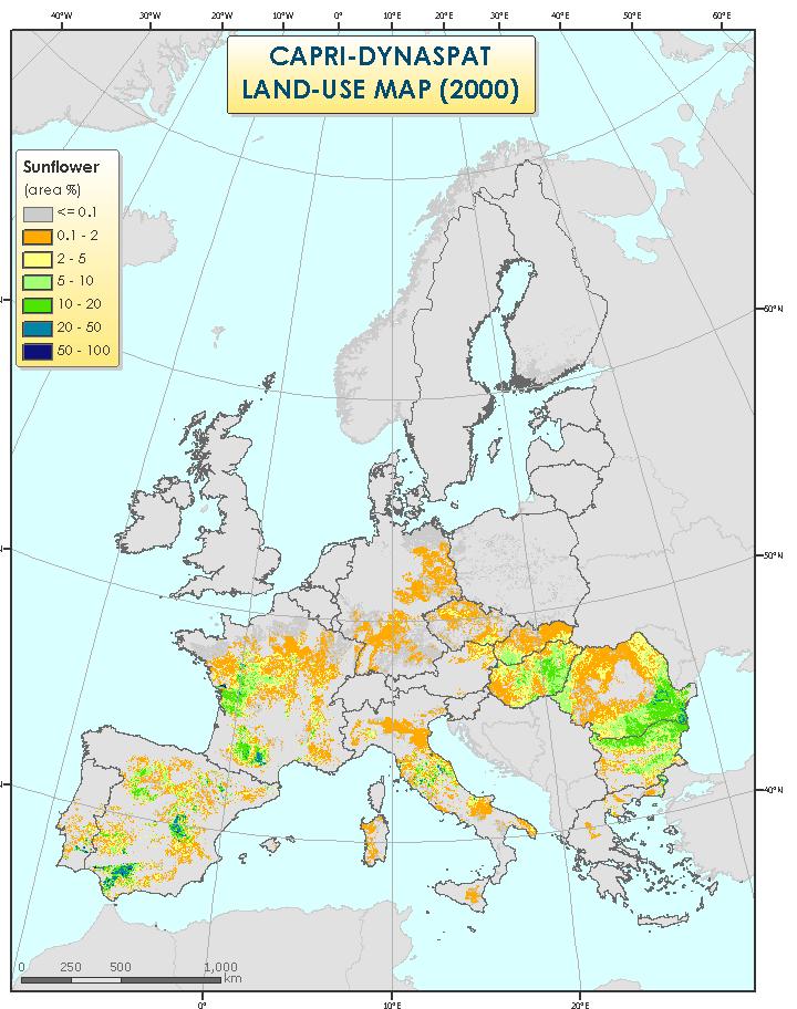
23 Conclusions Output: 1km resolution land use map at EU28 level Extensive land use types list Validations are comforting For many applications: crops aggregation further reduces uncertainties The approach offers good opportunities for expansion 23
24 Thanks Adrian Leip, Giulio Marchi Climate Change Unit / Joint Research Centre Markus Kempen University of Bonn CAPRI-DYNASPAT Final Meeting February 27 th,
Spatial Disaggregation of Land Cover and Cropping Information: Current Results and Further steps
 CAPRI CAPRI Spatial Disaggregation of Land Cover and Cropping Information: Current Results and Further steps Renate Koeble, Adrian Leip (Joint Research Centre) Markus Kempen (Universitaet Bonn) JRC-AL
LAND AREA PREDICTION MODEL (LAPM) Accuracy Assessment
 Accuracy Assessment") LAND AREA PREDICTION MODEL (LAPM) Accuracy Assessment Leip, A., Koeble, R. & Rotllan-Puig, X. 2017 EUR 29066 EN This publication is a Technical report by the Joint Research Centre (JRC), the European Commission
LAND AREA PREDICTION MODEL (LAPM) Accuracy Assessment Leip, A., Koeble, R. & Rotllan-Puig, X. 2017 EUR 29066 EN This publication is a Technical report by the Joint Research Centre (JRC), the European Commission
Geometric and Landcover Signatures of Local Authorities in Peloponnesus
 Geometric and Landcover Signatures of Local Authorities in Peloponnesus GEORGE CH. MILIARESIS Department of Geology University of Patras Geology Department, University of Patras, Rion 265-04 GREECE gmiliar@upatras.gr
CORINE LAND COVER CROATIA
 CORINE LAND COVER CROATIA INTRO Primary condition in making decisions directed to land cover and natural resources management is presence of knowledge and high quality information about biosphere and its
SIF_7.1_v2. Indicator. Measurement. What should the measurement tell us?
 Indicator 7 Area of natural and semi-natural habitat Measurement 7.1 Area of natural and semi-natural habitat What should the measurement tell us? Natural habitats are considered the land and water areas
W I N D R E S O U R C E A S S E S S M E N T
 W I N D R E S O U R C E A S S E S S M E N T Annual Energy Production Project: Hundhammer_WS_Express Layout: Layout1 Customer: WindSim 2014-01-29 WindSim AS Fjordgaten 15, N- 3125 Tønsberg, Norway phone.:
Séminaire de l'umr Economie Publique. Spatial Disaggregation of Agricultural. Raja Chakir. February 21th Spatial Disaggregation.
 Séminaire de l'umr Economie Publique : An : An February 21th 2006 Outline : An 1 2 3 4 : An The latest reform the Common Policy (CAP) aims to encourage environmentally friendly farming practices in order
ESTIMAP: Ecosystem services mapping at European scale. Grazia Zulian, Maria Luisa Paracchini, Joachim Maes, Camino Liquete. Report EUR EN
 ESTIMAP: Ecosystem services mapping at European scale Grazia Zulian, Maria Luisa Paracchini, Joachim Maes, Camino Liquete Report EUR 26474 EN 2013 European Commission Joint Research Centre Institute for
The stability of ecological corridors as illustrated by examples from Poland
 Gerlée A., 11. The stability of ecological corridors as illustrated by examples from Poland. The Problems of Landscape Ecology. Vol. XXX. 371-376. The stability of ecological corridors as illustrated by
Urban-Rural spatial classification of Finland
 Urban-Rural spatial classification of Finland Finnish Environment Institute SYKE The geographical information-based area classification system has been created by the Finnish Environment Institute and
Use of auxiliary information in the sampling strategy of a European area frame agro-environmental survey
 Use of auxiliary information in the sampling strategy of a European area frame agro-environmental survey Laura Martino 1, Alessandra Palmieri 1 & Javier Gallego 2 (1) European Commission: DG-ESTAT (2)
HNV Farming in Italy Context indicator CI37 Land cover approach
 Good Practice Workshop, Bonn 7-8 June 2016 Preparing the assessment of High Nature Value Farming in Rural Development Programmes 2014-2020 HNV Farming in Italy Context indicator CI37 Land cover approach
Copernicus for Statistics
 Copernicus for Statistics Stephan Arnold Areal statistics, Federal Statistical Office Thomas Wiatr Remote sensing, Federal Agency for Cartography and Geodesy Content Requirements and Setting Eurostat s
Comparing CORINE Land Cover with a more detailed database in Arezzo (Italy).
.") Comparing CORINE Land Cover with a more detailed database in Arezzo (Italy). Javier Gallego JRC, I-21020 Ispra (Varese) ITALY e-mail: javier.gallego@jrc.it Keywords: land cover, accuracy assessment, area
Comparing CORINE Land Cover with a more detailed database in Arezzo (Italy). Javier Gallego JRC, I-21020 Ispra (Varese) ITALY e-mail: javier.gallego@jrc.it Keywords: land cover, accuracy assessment, area
LUCAS: current product and its evolutions
 LUCAS: current product and its evolutions Workshop Land Use and Land Cover products: challenges and opportunities Brussels 15 Nov 2017 Eurostat E4: estat-dl-lucas@ec.europa.eu Contents 1) The context 2)
Protocols for spatial allocation of farm types
 System for Environmental and Agricultural Modelling; Linking European Science and Society Protocols for spatial allocation of farm types PD4.7.1 Berien Elbersen, Markus Kempen, Kees van Diepen, Gerard
Geography Teach Yourself Series Topic 4: Global Distribution of Land Cover
 Geography Teach Yourself Series Topic 4: Global Distribution of Land Cover A: Level 14, 474 Flinders Street Melbourne VIC 3000 T: 1300 134 518 W: tssm.com.au E: info@tssm.com.au TSSM 2016 Page 1 of 7 Contents
Land cover types and ecological conditions of the Estonian coast
 Journal of Coastal Conservation 8: 109-117, 2002 EUCC; Opulus Press Uppsala. - Land cover types and ecological conditiond of the Estonian coast - 109 Land cover types and ecological conditions of the Estonian
Land accounting perspective on water resources management
 European Water 60: 161-166, 2017. 2017 E.W. Publications Land accounting perspective on water resources management G.T. Paschos, G.E. Bariamis * and E.A. Baltas Department of Water Resources and Environmental
Sustainability indicators for socio-ecological systems
 Paul Cézanne: Montaigne Sainte-Victoire, 1886-1890 Sustainability indicators for socio-ecological systems Felix Müller Dept. of Ecosystem Management Institute for Natural Resource Conservation University
2.1.2 Land cover data
 2.1.2 Land cover data Land cover data was used as an approximate measure of the different habitat groupings throughout Britain. Land cover data was obtained from three sources The European Environment
Possible links between a sample of VHR images and LUCAS
 EUROPEAN COMMISSION EUROSTAT Directorate E: Sectoral and regional statistics Unit E-1: Farms, agro-environment and rural development CPSA/LCU/08 Original: EN (available in EN) WORKING PARTY "LAND COVER/USE
Extent. Level 1 and 2. October 2017
 Extent Level 1 and 2 October 2017 Overview: Extent account 1. Learning objectives 2. Review of Level 0 (5m) 3. Level 1 (Compilers): Concepts (15m) Group exercise and discussion (15m) 4. Level 2 (Data Providers)
LAND COVER CHANGES IN ROMANIA BASED ON CORINE LAND COVER INVENTORY
 LAND COVER CHANGES IN ROMANIA BASED ON CORINE LAND COVER INVENTORY 1990 2012 JENICĂ HANGANU, ADRIAN CONSTANTINESCU * Key-words: CORINE Land Cover inventory, Land cover changes, GIS. Abstract. From 1990
FOREST CHANGE DETECTION BY MEANS OF REMOTE SENSING TECHNIQUES FROM THE EU PROJECT CORINE LAND COVER
 FORESTRY IDEAS, 2010, vol. 16, 1 (39) FOREST CHANGE DETECTION BY MEANS OF REMOTE SENSING TECHNIQUES FROM THE EU PROJECT CORINE LAND COVER Youlin Tepeliev and Radka Koleva* University of Forestry, Faculty
UK NEA Economic Analysis Report Cultural services: Mourato et al. 2010
 Appendix A Hedonic regressions: Further data description The environmental data used to construct variables for the hedonic regressions come from the Centre for Ecology and Hydrology, the Generalised Land
Simple areal weighting: illustration
 1 Using land over information to map population density Geographial disaggregation of statistial data Tallin, September 25-28, 2001 Spae Appliations Institute Diretorate General Joint Researh Centre European
EAGLE concept, as part of the HELM vision
 EAGLE concept, as part of the HELM vision EAGLE working group Barbara Kosztra (Hungary), Stephan Arnold (Germany), Lena Hallin-Pihlatie & Elise Järvenpää (Finland) 16.06.2014 HELM / EAGLE Workshop - INSPIRE
Treatment of Land-Use and Urbanization
 Treatment of Land-Use and Urbanization LECTURE 9 Alexander Mahura Danish Meteorological Institute, DMI, Copenhagen, Denmark NetFAM Summer School on Integrated Modelling 7-12 July 2008, Zelenogorsk, Russia
CORINE Land Cover 2000: semiautomated updating of CORINE Land Cover in the UK Phase II: Map Production in the UK Final Report
 CENTRE FOR ECOLOGY AND HYDROLOGY (NATURAL ENVIRONMENT RESEARCH COUNCIL) Project. C02041A CORINE Land Cover 2000: semiautomated updating of CORINE Land Cover in the UK Phase II: Map Production in the UK
APPENDIX. Normalized Difference Vegetation Index (NDVI) from MODIS data
 from MODIS data") APPENDIX Land-use/land-cover composition of Apulia region Overall, more than 82% of Apulia contains agro-ecosystems (Figure ). The northern and somewhat the central part of the region include arable lands
APPENDIX Land-use/land-cover composition of Apulia region Overall, more than 82% of Apulia contains agro-ecosystems (Figure ). The northern and somewhat the central part of the region include arable lands
Towards a harmonised land monitoring system: NRC bottom-up activities in EAGLE and HELM H
 B. Kosztra Towards a harmonised land monitoring system: NRC bottom-up activities in EAGLE and HELM H Gebhard Banko Environment Agency Austria Geoland 2 Forum 18.-19. October 2012 Copenhagen 1 1 NRC * opinion
4. Land use database generation
 32 Towards an urban atlas 4. Land use database generation The understanding of urban dynamics is basic for planning the sustainable development of urban areas and the conservation of natural resources.
Identification of Areas With Natural Constraints Case Study Serbia
 Identification of Areas With Natural Constraints Case Study Serbia Dragana Vidojević of the Environmental Protection Agency, Ruže Jovanovića St. 27a, 11160 Belgrade, dragana.vidojevic@sepa.gov.rs; Jovica
LAND USE, LAND COVER AND SOIL SCIENCES - Vol. I - Land Use and Land Cover, Including their Classification - Duhamel C.
 LAND USE AND LAND COVER, INCLUDING THEIR CLASSIFICATION Duhamel Landsis Groupement Européen d Intérêt Economique, Luxembourg Keywords: land cover, land use, classification systems, nomenclature, information
DESCRIPTION OF A HYDROLOGIC DATASET. Department of Environmental Sciences, Wageningen University and. Research Center. Wageningen, The Netherlands
 DESCRIPTION OF A HYDROLOGIC DATASET FOR THE BRISY SUBCATCHMENT R. T. Oosterho? and C. Paniconi y? Department of Environmental Sciences, Wageningen University and Research Center Wageningen, The Netherlands
Problems arising during the implementation of CLC2006
 Problems arising during the implementation of CLC2006 George Büttner, Barbara Kosztra ETC-LUSI / FÖMI (HU) EIONET WG meeting on Land Monitoring IGN Portugal, 10-12 March 2010 Contents of presentation Present
Compact guides GISCO. Geographic information system of the Commission
 Compact guides GISCO Geographic information system of the Commission What is GISCO? GISCO, the Geographic Information System of the COmmission, is a permanent service of Eurostat that fulfils the requirements
Global Land Cover Mapping
 Global Land Cover Mapping and its application in SDGs Prof. Chen Jun 1, Dr. He Chaoying 2 1 National Geomatics Center of China (NGCC) 2 Ministry of Natural Resources, P.R.China May 30, 2018, Copenhagen
PMlab Action 4. Interpolation Tool for Daily PM10 Concentrations in the Euregio Maas-Rhine
 PMlab Action 4 Interpolation Tool for Daily PM10 Concentrations in the Euregio Maas-Rhine Starting Point in the EMR No border crossing information platform for public and local actors on air quality outside
SEEA Experimental Ecosystem Accounting
 SEEA Experimental Ecosystem Accounting Sokol Vako United Nations Statistics Division Training for the worldwide implementation of the System of Environmental Economic Accounting 2012 - Central Framework
Land Cover and Land Use Diversity Indicators in LUCAS 2009 data
 Land Cover and Land Use Diversity Indicators in LUCAS 2009 data A. Palmieri, L. Martino, P. Dominici and M. Kasanko Abstract Landscape diversity and changes are connected to land cover and land use. The
Managing uncertainty when aggregating from pixels to parcels: context sensitive mapping and possibility theory
 Department of Geography Managing uncertainty when aggregating from pixels to parcels: context sensitive mapping and possibility theory Dr Lex Comber ajc36@le.ac.uk www.le.ac.uk/gg/staff/academic_comber.htm
Measuring and Monitoring SDGs in Portugal: Ratio of land consumption rate to population growth rate Mountain Green Cover Index
 Measuring and Monitoring SDGs in Portugal: 11.3.1Ratio of land consumption rate to population growth rate 15.4.2 Mountain Green Cover Index United Nations World Geospatial Information Congress João David
Standardization of the land cover classes using FAO Land Cover Classification System (LCCS)
") Sofia, 17-18 September 2008, LPIS Workshop LPIS applications and quality 1 Standardization of the land cover classes using FAO Land Cover Classification System (LCCS) Pavel MILENOV Agriculture Unit, JRC
Sofia, 17-18 September 2008, LPIS Workshop LPIS applications and quality 1 Standardization of the land cover classes using FAO Land Cover Classification System (LCCS) Pavel MILENOV Agriculture Unit, JRC
Spanish national plan for land observation: new collaborative production system in Europe
 ADVANCE UNEDITED VERSION UNITED NATIONS E/CONF.103/5/Add.1 Economic and Social Affairs 9 July 2013 Tenth United Nations Regional Cartographic Conference for the Americas New York, 19-23, August 2013 Item
I&CLC2000 in support to new policy initiatives (INSPIRE, GMES,..)
") I&CLC2000 in support to new policy initiatives (INSPIRE, GMES,..) Manfred Grasserbauer, Director Joint Research Centre Institute for Environment and Sustainability 1 IMAGE 2000 European mosaic of satellite
I&CLC2000 in support to new policy initiatives (INSPIRE, GMES,..) Manfred Grasserbauer, Director Joint Research Centre Institute for Environment and Sustainability 1 IMAGE 2000 European mosaic of satellite
LUCAS: A possible scheme for a master sampling frame. J. Gallego, MARS AGRI4CAST
 LUCAS: A possible scheme for a master sampling frame. J. Gallego, MARS AGRI4CAST Area frames of square segments Square segments on a classified image 2/16 Sampling farms through points farm a farm b farm
Italian experience with the interpretation of FOCUS surface water scenarios from a regulatory point of view
 Italian experience with the interpretation of FOCUS surface water scenarios from a regulatory point of view G. Azimonti, G. Triacchini, D. Auteri, E. Redolfi, International Centre for Pesticides and Health
THE OVERALL EAGLE CONCEPT
 Sentinel Hub THE OVERALL EAGLE CONCEPT GEBHARD BANKO, 30. MAY 2018, COPENHAGEN ISO TC 211, STANDARDS IN ACTION SEMINAR CONTENT Background and Motivation Criteria and Structure of Data Model Semantic decomposition
Classification of Agricultural Crops and Quality Assessment Using Multispectral and Multitemporal Images
 Classification of Agricultural Crops and Quality Assessment Using Multispectral and Multitemporal Images Bo Ranneby and Jun Yu Research Report Centre of Biostochastics Swedish University of Report 2003:7
JRC MARS Bulletin Crop monitoring in Europe. December 2017 Hardening of winter cereals is delayed
 MARS Bulletin Vol. 25 No 12 18 December 2017 1 JRC MARS Bulletin Vol. 25 No 12 Period covered: 1 November-12 December Issued: 18 December 2017 JRC MARS Bulletin Crop monitoring in Europe December 2017
Sampling scheme for LUCAS 2015 J. Gallego (JRC) A. Palmieri (DG ESTAT) H. Ramos (DG ESTAT)
 A. Palmieri (DG ESTAT) H. Ramos (DG ESTAT)") Sampling scheme for LUCAS 2015 J. Gallego (JRC) A. Palmieri (DG ESTAT) H. Ramos (DG ESTAT) Abstract The sampling design of LUCAS 2015 took into account experience from previous campaigns. While remaining
Sampling scheme for LUCAS 2015 J. Gallego (JRC) A. Palmieri (DG ESTAT) H. Ramos (DG ESTAT) Abstract The sampling design of LUCAS 2015 took into account experience from previous campaigns. While remaining
UK Contribution to the European CORINE Land Cover
 Centre for Landscape andwww.le.ac.uk/clcr Climate Research CENTRE FOR Landscape and Climate Research UK Contribution to the European CORINE Land Cover Dr Beth Cole Corine Coordination of Information on
System of Environmental-Economic Accounting. Advancing the SEEA Experimental Ecosystem Accounting. Extent Account (Levels 1 and 2)
") Advancing the SEEA Experimental Ecosystem Accounting Extent Account (Levels 1 and 2) Overview: The Extent Account 1. Learning objectives 2. Review of Level 0 (5m) What is it? Why do we need it? What does
Advancing the SEEA Experimental Ecosystem Accounting Extent Account (Levels 1 and 2) Overview: The Extent Account 1. Learning objectives 2. Review of Level 0 (5m) What is it? Why do we need it? What does
WGIA7 9th July, Noriko KISHIMOTO
 Utilizing Global Map for addressing Climate Change WGIA7 9th July, 2009 Seoul, Republic of Korea Noriko KISHIMOTO n-kishimoto@gsi.go.jp Geographic Survey Institute, JAPAN Outline of the Global Map What
Land Cover Atlas of Pakistan The Punjab Province
 Land Cover By District Land Cover Atlas of Pakistan The Punjab Province Rahim Yar Khan Rahim Yar Khan district is known for its main crops like cotton, sugarcane and wheat. Most of the orchards are of
LAND USE MAPPING AND MONITORING IN THE NETHERLANDS (LGN5)
") LAND USE MAPPING AND MONITORING IN THE NETHERLANDS (LGN5) Hazeu, Gerard W. Wageningen University and Research Centre - Alterra, Centre for Geo-Information, The Netherlands; gerard.hazeu@wur.nl ABSTRACT
LAND USE MAPPING AND MONITORING IN THE NETHERLANDS (LGN5) Hazeu, Gerard W. Wageningen University and Research Centre - Alterra, Centre for Geo-Information, The Netherlands; gerard.hazeu@wur.nl ABSTRACT
(c) (i) Explain three factors which have influenced the distribution of settlements in the area covered
 (i) Explain three factors which have influenced the distribution of settlements in the area covered") K.C.S.E YEAR 2010 PAPER 1 SECTION A Answer ALL the questions in this section. 1 Give three components of the solar system. 2 (a) Identify two types of high level clouds. (b) Draw a well labelled diagram
K.C.S.E YEAR 2010 PAPER 1 SECTION A Answer ALL the questions in this section. 1 Give three components of the solar system. 2 (a) Identify two types of high level clouds. (b) Draw a well labelled diagram
Presentation of the different land cover mapping activities in the French Guiana
 Presentation of the different land cover mapping activities in the French Guiana LCCS Land Cover Classification System 9 to 13 March 2015 Paramaribo - Suriname INTRODUCTION French Guiana : 8 046 427 ha
Status of soil, climate and digital mapping information in Serbia
 Status of soil, climate and digital mapping information in Serbia Dragana Vidojević of the Republic of Serbia Environmental Protection Agency, Ruže Jovanovića St. 27a, 11160 Belgrade, dragana.vidojevic@sepa.gov.rs;
Land Use and Land cover statistics (LUCAS)
") EUROPEAN COMMISSION EUROSTAT Directorate E: Sectoral and regional statistics Doc. ENV/DIMESA/7.1/2012 Original in EN Agenda point 7.1 Land Use and Land cover statistics (LUCAS) DIMESA Directors' Meeting
EUROPEAN COMMISSION EUROSTAT Directorate E: Sectoral and regional statistics Doc. ENV/DIMESA/7.1/2012 Original in EN Agenda point 7.1 Land Use and Land cover statistics (LUCAS) DIMESA Directors' Meeting
EAGLE Data Model and Outcomes of HELM (Harmonised European Land Monitoring)
") EAGLE Data Model and Outcomes of HELM (Harmonised European Land Monitoring) Contribution towards better land information harmonisation and INSPIRE compliance EAGLE working group Stephan Arnold, Barbara
EAGLE Data Model and Outcomes of HELM (Harmonised European Land Monitoring) Contribution towards better land information harmonisation and INSPIRE compliance EAGLE working group Stephan Arnold, Barbara
PAKISTAN STUDIES 2059/02 The Environment of Pakistan
 PAKISTAN STUDIES 2059/02 The Environment of Pakistan The City School PAF Chapter Prep + Senior 1 Section Name: Section: Date: Time: 1 hour 30 minute Candidates answer on the Question Paper. READ THESE
EUROPEAN COMMISSION Eurostat. Directorate E: Sectoral and regional statistics Unit E-4: Regional statistics and Geographical Information
 .no EUROPEAN COMMISSION Eurostat Directorate E: Sectoral and regional statistics Unit E-4: Regional statistics and Geographical Information GRANT Pilot studies on the provision of harmonized land use/land
Directorate E: Sectoral and regional statistics Unit E-4: Regional statistics and geographical information LUCAS 2018.
 EUROPEAN COMMISSION EUROSTAT Directorate E: Sectoral and regional statistics Unit E-4: Regional statistics and geographical information Doc. WG/LCU 52 LUCAS 2018 Eurostat Unit E4 Working Group for Land
Redesign sample for Land Use/Cover Area frame Survey (LUCAS) 2018
 2018") Redesign sample for Land Use/Cover Area frame Survey (LUCAS) 2018 MARCO BALLIN, GIULIO BARCAROLI, MAURO MASSELLI, MARCO SCARNÓ S TAT I S T I C A L W O R K I N G PA P E R S 2018 edition Redesign sample
Redesign sample for Land Use/Cover Area frame Survey (LUCAS) 2018 MARCO BALLIN, GIULIO BARCAROLI, MAURO MASSELLI, MARCO SCARNÓ S TAT I S T I C A L W O R K I N G PA P E R S 2018 edition Redesign sample
GISCO Working Party Meeting. 8 March 2012 Luxembourg. The ESPON 2013 Programme: State of Affairs. Marjan van Herwijnen project expert in the ESPON CU
 GISCO Working Party Meeting 8 March 2012 Luxembourg The ESPON 2013 Programme: State of Affairs Marjan van Herwijnen project expert in the ESPON CU The ESPON 2013 Programme Role in Structural Funds 2007-2013:
JRC MARS Bulletin global outlook 2017 Crop monitoring European neighbourhood Turkey June 2017
 MARS Bulletin global outlook 2015-06 r JRC MARS Bulletin global outlook 2017 Crop monitoring European neighbourhood Turkey June 2017 Favourable spring conditions, but slight delay Yield forecasts for winter
Agricultural land-use from space. David Pairman and Heather North
 Agricultural land-use from space David Pairman and Heather North Talk Outline Motivation Challenges Different approach Paddock boundaries Classifications Examples Accuracy Issues Data sources Future possibilities
EUROSTAT. Action 2 : Integration of environmental accounts in coastal zones; case study of tourism. Contract n
 1 EUROSTAT Integration of geographical and statistical data in the environmental accounting framework; methodological development based on two case studies Action 2 : Integration of environmental accounts
Sri Lanka has a coastline of km excluding the shoreline of bays and inlets.
 Defining and Demarcating Coastal zones in Sri Lanka Procedure, Challenges and What needs to be done? Dr. Anil Premaratne Director General Coast Conservation Coast Conservation Department Sri Lanka 1 Sri
Accounting Units for Ecosystem Accounts Paper prepared by Alessandra Alfieri, Daniel Clarke, and Ivo Havinga United Nations Statistics Division
 DEPARTMENT OF ECONOMIC AND SOCIAL AFFAIRS STATISTICS DIVISION UNITED NATIONS Expert Meeting on Ecosystem Accounts London, UK 5-7 December 2011 Accounting Units for Ecosystem Accounts Paper prepared by
VENETO REGION PILOT AREA
 VENETO REGION PILOT AREA The pilot area is located in the north-east of Veneto region, located itself in the north-east of Italy. The area borders with Austria are in the northern part and run along high
Copernicus for Coastal Zone Monitoring and Management
 Copernicus for Coastal Zone Monitoring and Management DG-Grow, 29 June 2017 User Requirement Perspective: Monitoring of coastal zones, pressures and impacts on nature and people Courtesy: J. Ekebom storm
Field descriptors for Historic Carpathian Land Use
 Field descriptors for Historic Carpathian Land Use This document describes the dataset that contains historic land use for the Carpathians. The data file contains a total of 91935 data points, arranged
New approach for land use mapping in the Netherlands (LGN6)
") New approach for land use mapping in the Netherlands (LGN6) Gerard Hazeu & Rini Schuiling Content Objectives Background LGN and its history National and European activities (e.g. INSPIRE) Methodology LGN6
New approach for land use mapping in the Netherlands (LGN6) Gerard Hazeu & Rini Schuiling Content Objectives Background LGN and its history National and European activities (e.g. INSPIRE) Methodology LGN6
Raster Spatial Analysis Specific Theory
 RSATheory.doc 1 Raster Spatial Analysis Specific Theory... 1 Spatial resampling... 1 Mosaic... 3 Reclassification... 4 Slicing... 4 Zonal Operations... 5 References... 5 Raster Spatial Analysis Specific
Yaneev Golombek, GISP. Merrick/McLaughlin. ESRI International User. July 9, Engineering Architecture Design-Build Surveying GeoSpatial Solutions
 Yaneev Golombek, GISP GIS July Presentation 9, 2013 for Merrick/McLaughlin Conference Water ESRI International User July 9, 2013 Engineering Architecture Design-Build Surveying GeoSpatial Solutions Purpose
Watershed Classification with GIS as an Instrument of Conflict Management in Tropical Highlands of the Lower Mekong Basin
 Page 1 of 8 Watershed Classification with GIS as an Instrument of Conflict Management in Tropical Highlands of the Lower Mekong Basin Project Abstract The University of Giessen is actually planning a research
Data Fusion and Multi-Resolution Data
 Data Fusion and Multi-Resolution Data Nature.com www.museevirtuel-virtualmuseum.ca www.srs.fs.usda.gov Meredith Gartner 3/7/14 Data fusion and multi-resolution data Dark and Bram MAUP and raster data Hilker
Environmental Impact Assessment Land Use and Land Cover CISMHE 7.1 INTRODUCTION
 7 LAND USE AND LAND COVER 7.1 INTRODUCTION The knowledge of land use and land cover is important for many planning and management activities as it is considered an essential element for modeling and understanding
Spatial Units, Scaling and Aggregation (Level 1) October 2017
 October 2017") Spatial Units, Scaling and Aggregation (Level 1) October 2017 Overview: Spatial Units 1. Learning objectives 2. Review of Level 0 (5m) 3. Level 1 (Compilers): Presentation & group exercise Spatial units
Spatial Units, Scaling and Aggregation (Level 1) October 2017 Overview: Spatial Units 1. Learning objectives 2. Review of Level 0 (5m) 3. Level 1 (Compilers): Presentation & group exercise Spatial units
Land Accounting. Sub-regional Workshop on Environment Statistics for South and South-West Asian Countries. Michael Bordt ESCAP
 Land Accounting Michael Bordt ESCAP bordt@un.org Sub-regional Workshop on Environment Statistics for South and South-West Asian Countries Feb. 6-8, 2017 Bangkok, Thailand Overview: Land Accounting Learning
European River Catchment Updates: Iceland, Malta and Romania
 Final Draft Working Document European River Catchment Updates: Iceland, Malta and Romania Prepared by: Alejandro IGLESIAS-CAMPOS ETC-LUSI / Junta de Andalucía 11.01.2008 Version 2 Project manager: Ana
Topographical catchments of the FOEN hydrometric gauging stations
 Eidgenössisches Departement für Umwelt, Verkehr, Energie und Kommunikations UVEK Bundesamt für Umwelt BAFU Helbling, Andreas 04.05.2016 Topographical catchments of the FOEN hydrometric gauging stations
Modelling the influence of land use and land cover change on ecosystem services
 Modelling the influence of land use and land cover change on ecosystem services Peter Verburg Institute for Environmental Studies VU University Amsterdam With contributions of: Derek van Berkel, Wieteke
Domain Land Use/Cover Data Model Enabling Multiple Use for Turkey
 Domain Land Use/Cover Data Model Enabling Multiple Use for Turkey Key words: Spatial Data Management, LULC, Land Use/Cover SUMMARY Land use/ land cover (LULC) information, one aspect of GI, has huge important
NATIONAL MAPPING EFFORTS: THE PHILIPPINES
 NATIONAL MAPPING EFFORTS: THE PHILIPPINES Dr. RIJALDIA N. SANTOS DENR National Mapping and Resource Information Authority (NAMRIA) May 30, 2018 Land Cover/Land Use Changes (LC/LUC) and Its Impacts on Environment
An internet based tool for land productivity evaluation in plot-level scale: the D-e-Meter system
 An internet based tool for land productivity evaluation in plot-level scale: the D-e-Meter system Tamas Hermann 1, Ferenc Speiser 1 and Gergely Toth 2 1 University of Pannonia, Hungary, tamas.hermann@gmail.com
Comparability of landscape diversity indicators in the European Union
 Comparability of landscape diversity indicators in the European Union F. Javier Gallego, Paula Escribano, Susan Christensen Space Applications Institute, JRC Ispra. SUMMARY: CORINE Land Cover allows landscape
Assessment of land cover change in western Hungarian landscapes
 Assessment of land cover change in western Hungarian landscapes Éva Konkoly-Gyuró 1 ; Dezső Nagy 1 ; Pál Balázs 1 ; Géza Király 2 University of West Hungary, Faculty of Forestry 1 Department of Landscape
Geographical position
 Geographical position Albania is located in South-Western Europe, in the Western of the Balkan peninsula, between the geographical coordinates 39 o 16' N latitude and 42 o 39' E longitude. The Republic
APPLYING THE END FOR LOMBARDY S AIRPORTS
 APPLYING THE END FOR LOMBARDY S AIRPORTS Angela Alberici, Maurizio Bassanino, Paolo Deforza, Nadia Fibbiani, Paola Maggi, Mauro Mussin, Valeria Spirolazzi ARPA Lombardia Via Francesco Restelli 3\1, 20124,
State-of-play... The EAGLE concept conceptual basis for a future European Land Monitoring Framework
 State-of-play... The EAGLE concept conceptual basis for a future European Land Monitoring Framework Stephan Arnold, Geir-H. Strand, Barbara Kosztra, Tomas Soukup, Gebhard Banko, Gerard Hazeu, Geoff Smith,
Validation and verification of land cover data Selected challenges from European and national environmental land monitoring
 Validation and verification of land cover data Selected challenges from European and national environmental land monitoring Gergely Maucha head, Environmental Applications of Remote Sensing Institute of
DROUGHT RISK EVALUATION USING REMOTE SENSING AND GIS : A CASE STUDY IN LOP BURI PROVINCE
 DROUGHT RISK EVALUATION USING REMOTE SENSING AND GIS : A CASE STUDY IN LOP BURI PROVINCE K. Prathumchai, Kiyoshi Honda, Kaew Nualchawee Asian Centre for Research on Remote Sensing STAR Program, Asian Institute
EuroGEOSS Protected Areas Pilot
 EuroGEOSS Protected Areas Pilot Max Craglia European Commission Joint Research Centre Part 1: the present MyNatura2000 Mobile app. Awareness raising & volunteered data collection. Natura2000 covers 18%
How rural the EU RDP is? An analysis through spatial funds allocation
 How rural the EU RDP is? An analysis through spatial funds allocation Beatrice Camaioni, Roberto Esposti, Antonello Lobianco, Francesco Pagliacci, Franco Sotte Department of Economics and Social Sciences
JRC MARS Bulletin Crop monitoring in Europe. February 2018 Frost tolerance remains weak. Winter conditions so far present no threat to winter crops
 JRC MARS Bulletin Vol. 26 No 2 Period covered: 1 January 2018-13 February 2018 Issued: 19 February 2018 JRC MARS Bulletin Crop monitoring in Europe February 2018 Frost tolerance remains weak Winter conditions