Copernicus for Coastal Zone Monitoring and Management
|
|
|
- Camilla Conley
- 6 years ago
- Views:
Transcription


1 Copernicus for Coastal Zone Monitoring and Management DG-Grow, 29 June 2017 User Requirement Perspective: Monitoring of coastal zones, pressures and impacts on nature and people Courtesy: J. Ekebom storm surge in Latvia Markus Erhard & Andrus Meiner, European Environment Agency (EEA)
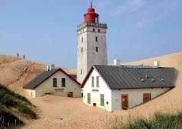
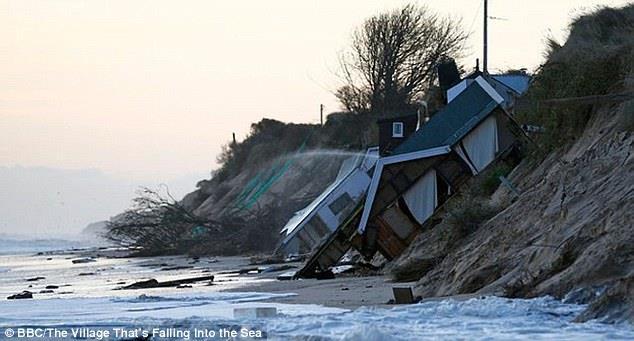
2 High value for nature Why are coasts special? o Habitats of high value for biodiversity but often small spatial extent o High productivity and biodiversity in coastal and transitional waters High value for people o High population density o High value for living and economy (e.g. recreation, trading, etc.) High pressures on natural resources and people o Land/sea cover/use change o Water pollution / Algae blooms o Climate change impacts (SST, SLR, storm surges, coastal erosion...) o Invasive alien species High risks and vulnerability
3 Coastal sustainability issue Coastal development at expense of natural systems that normally act as buffer between the sea and the land... leads to Conflict between protecting socio-economic activity and sustaining the ecological functioning of coastal zones in Europe

4 Selected EU policies and policy instruments related to the land-coast-sea nexus
5 Some coast related environmental policies Nature Directives Favourable status of species and habitats in the Coastal zone (land and sea) Water Framework Directive (WFD) Good ecological and chemical status of transitional and coastal water bodies Floods Directive hazard mapping for coastal floods Marine Strategy Framework Directive (MSFD) - good environmental status across 11 descriptors Procedural regulations: Maritime Spatial Planning Directive, Council decision on Barcelona Convention ICZM (Integrated Coastal Zone Management) Protocol, EU ICZM Recommendation, Climate Change Adaptation, Strategic Environmental Assessment (SEA) Directive
6 Chemical status General applicability of EU policy, Marine and Coastal zone Land Water Framework Directive RBD, Water bodies Inner waters Territorial waters Member States sovereignty or jurisdiction waters Marine Strategy Framework Directive Marine (Sub-)Regions Coastline Baseline 1 nautical mile limit (WFD) Territorial water limit (4-12 nm) High Seas (UN Conventions) EEZ limit Courtesy: ICES, ETC/ICM


7 Coherent policy alliance for sustainable coastal areas


8 Maritime dimension - coastal regions of EU Sea basins Relative size of sea basin catchments Source: Eurostat, GISCO
9 Economic importance and ecological threats In 2011, 41 % (206 mill) of Europe's population lived in the 378 EU coastal regions; Ca 40% of EU s GDP is generated in maritime regions 75% pf EU s foreign trades is conducted by sea Only 13% of coastal species are in favourable conservation status (HD) 73% of the coastal habitats show bad or inadequate conservation status (HD) 80 % of marine species and habitats and 100 % of marine ecosystems being classified as unknown status (MSFD) EEA, 2013: coastal report EEA, 2016: ecosystem condition assessment
10 Specific needs for coastal monitoring Land cover/ habitat change in coastal zones Transitional and coastal waters WFD, MSFD Coastal vulnerability & Eurosion Ecosystem mapping and assessment
11 Specific needs for coastal monitoring Land cover/ habitat change in coastal zones Transitional and coastal waters WFD, MSFD Coastal vulnerability & Eurosion Ecosystem mapping and assessment
12 Net changes in coastal zones land cover (land cover 0-10 km) Artificial areas Arable land & permanent crops Pastures & mosaics Forested land Semi-natural vegetation Open spaces/ bare soils Wetlands Water bodies TOTAL [hundreds ha] 1.1. Land cover 2006 [% of total] 1.2. Net change in land cover [ha] Net change in land cover [% of initial year 2000] 5% 14% 6% 17% % 12% 14% % Land cover Consumption of initial LC Formation of new LC Net Formation of LC Net formation as % of initial year Total turnover of LC Total turnover as % of initial year Land cover
13 Example of Europe s coastal land cover trend monitoring Wetland and water areas


")
14 The importance of spatial and thematic resolution Corine VHRL (urban atlas) Corine Urban Atlas


15 The importance of spatial and thematic resolution Urban extension next to Palma de Mallorca airport Copernicus HRL Imperviousness, 20 m Change mapping, 100 m
16 Specific needs for coastal monitoring Land cover/ habitat change in coastal zones Transitional and coastal waters WFD, MSFD Coastal vulnerability & Eurosion Ecosystem mapping and assessment

17 Coastal and transitional waters of WFD Note: Maritime boundaries outdated!!! For updated version please see URL below Source: BIOMES Marine Ecosystem Services, JRC/IES Ca 3800 reporting water bodies Total area km2 Source: EEA, 2012 based on WFD See also EU-Hydro Maritime boundaries


18 EU Water Framework Directive - river basin districts include coastal waters - status statement: chemical and ecological - status assessments by Member states Figure: Share of water bodies not achieving good chemical status of transitional and coastal waters per river basin district


19 Pressures & impacts MSFD annex III, table 2 8 major groups of pressures and impacts 18 minor groups of pressures and impacts 100+ activities / pressures identified for the North Sea Source: HELCOM HOLAS
20 Specific needs for coastal monitoring Land cover/ habitat change in coastal zones Transitional and coastal waters WFD, MSFD Coastal vulnerability & Eurosion Ecosystem mapping and assessment

21 Vulnerability to coastal floods and need for adaptation population European population below 5 m elevation and inside 1 km coastal zone Coastal regions Mapping vulnerability


22 Updating the current baseline Coastal Erosion: Eurosion project A European initiative for sustainable coastal erosion management Final report Eurosion vision, 4 key recommendations Findings and technical results Shoreline Management Guide Coastal erosion management solutions in Europe, 60 case studies GIS database Update of CORINE Coastal Erosion data 14 data layers for Europe Brochure Living with coastal erosion in Europe PORTAL:
23 Specific needs for coastal monitoring Land cover/ habitat change in coastal zones Transitional and coastal waters WFD, MSFD Coastal vulnerability & Eurosion Ecosystem mapping and assessment


24 Ecosystem mapping and assessment DPSIR approach Ecosystem Mapping Condition assessment Service assessment Integration Policy integration
 freshwater (3) marine (>15) Ecosystem type EUNIS Level 1 EUNIS Level 2 Area (km 2 ) Attributed to sparsely vegetated land Wetlands Marine inlets and transitional waters,")

25 12 Ecosystems Terrestrial (7) freshwater (1) marine (4) Ecosystem Map (GIS database) Ca. 50 Habitats Terrestrial (>40) freshwater (3) marine (>15) Ecosystem type EUNIS Level 1 EUNIS Level 2 Area (km 2 ) Attributed to sparsely vegetated land Wetlands Marine inlets and transitional waters, coastal, shelf, open ocean B Coastal habitats D Mires, bogs and fens A Marine habitats B1 Coastal dunes and sandy shores B2 Coastal shingle B3 Rock, cliffs, ledges and shores, including supralittoral MAES, n/a n/a n/a D1 Raised and blanked bogs D2 Valley mires, poor fens and transition mires D3 Aapa, palsa and polygon mires D4 Base-rich fens and calcareolus spring mires D5 Sedge and reedbeds, normally without free-standing water D6 Inland saline and brackish marshes and reedbeds A1 Littoral rock and other hard substrate A2 Littoral sediment A3 Infralittoral rock and other hard substrate A4 Circalittoral rock and other hard substrate A5 Sub-littoral sediment A6 Deep sea-bed A7 Pelagic water column A8 Ice-associated marine habitats n/a n/a n/a n/a n/a n/a n/a n/a
26 Integrated approach assessment of coastal areas development and pollution pressures that impact coastal and marine areas; services that are provided by ecosystems of the coastal and marine areas; vulnerability to environmental change (incl. climate) and need for adaptation; policy responses and coastal areas management (e.g. ICZM and Maritime spatial planning).

27 Vision of integrative approach: also for coast Reporting Statistics Indicators Proxies for envir. pressures & state Ecosystem maps and assessment Monitoring on accounting frame Source: Adapted from ESRI, EEA/ETC (Manuel Lago, Benjamin Boteler and Alejandro Iglesias-Campos)
28 Conclusions monitoring requirements What is needed? Land/sea cover/use and habitat mapping and monitoring Land sea interaction : coastal erosion/accumulation, sediment transport, wave height, water level, storm surges, flooding Land/sea habitat quality, habtat change, species distribution and migration Water color / chlorophyll biomass, algae blooms Water photic depth / transparency Water/land pollution monitoring including litter
29 Conclusions monitoring requirements Spatial and temporal resolution Very high spatial resolution for land monitoring land/sea cover/use changes delineation of EUNIS coastal habitats terrrestrial and (shallow) sea-bed (tidal areas, dynamics of beaches, sand banks etc.) overlap & consistency existing VHRL layers: urban atlas and riparian zones, N2K Very? high temporal resolution for monitoring seasonal changes coastal erosion, sediment transport, water color / chlorophyll, pollution Overlap monitoring systems land sea e.g. coastal erosion monitoring, (shallow water) sea-beds Spatial coverage Consistency with reporting obligations of Directives Selection of focus areas for cost benefit (e.g.sediment transport, erosion)
30 Thematic refinement Questions monitoring requirements Land cover classification see VHRL layers urban, riparian, N2K Habitat delineation EUNIS classes Coastal erosion dynamics (see also Copernicus Emergency Response Service) from event based assessment to monitoring effects and trends Sediment distribution and transport, river/seabed morphology and dynamics Water color/chlorophyll (transitional and marine productivity) Provider User interaction needed evaluate what is needed (user) versus what is feasible (provider) boundaries core vs. downstream services discussion between providers and users along classifications, modelling approaches, thematic, spatial accuracy etc.
31 Thank you
Mapping and Assessment of Ecosystems and their Services
 Mapping and Assessment of Ecosystems and their Services ALTER-Net Conference 2013: Science underpinning the EU 2020 Biodiversity Strategy. April 2013 Gent Joachim MAES 1 This presentation is based on the
Mapping of marine ecosystems and their services in the Bulgarian Black Sea region. Evaluation of current condition
 Mapping of marine ecosystems and their services in the Bulgarian Black Sea region. Evaluation of current condition V. Karamfilov, D. Berov, V. Biserkov, G. Daskalov, S. Klayn,Y. Biserkov- IBER-BAS V. Todorova,
SWOS (The Satellite-based Wetland Observation Service) Satellite images for peatland monitoring and management Kathrin Weise, Jena-Optronik GmbH
 Satellite images for peatland monitoring and management Kathrin Weise, Jena-Optronik GmbH") This project has received funding from the European Union s Horizon 2020 research and innovation programme under grant agreement No 642088 SWOS (The Satellite-based Wetland Observation Service) Satellite
This project has received funding from the European Union s Horizon 2020 research and innovation programme under grant agreement No 642088 SWOS (The Satellite-based Wetland Observation Service) Satellite
SIF_7.1_v2. Indicator. Measurement. What should the measurement tell us?
 Indicator 7 Area of natural and semi-natural habitat Measurement 7.1 Area of natural and semi-natural habitat What should the measurement tell us? Natural habitats are considered the land and water areas
C o p e r n i c u s L a n d M o n i t o r i n g S e r v i c e
 C o p e r n i c u s L a n d M o n i t o r i n g S e r v i c e Submodule D: stability of protected areas & related pressures: Natura2000 sites Copernicus EU Copernicus EU Copernicus EU www.copernicus.eu
HELSINKI COMMISSION Baltic Marine Environment Protection Commission
 HELSINKI COMMISSION Baltic Marine Environment Protection Commission HELCOM RECOMMENDATION 24/10 Adopted 25 June 2003, having regard to Article 20, Paragraph 1 b) of the 1992 Helsinki Convention IMPLEMENTATION
Land accounting perspective on water resources management
 European Water 60: 161-166, 2017. 2017 E.W. Publications Land accounting perspective on water resources management G.T. Paschos, G.E. Bariamis * and E.A. Baltas Department of Water Resources and Environmental
Natura 2000 in the marine environment: state of implementation and next steps
 Life on the blue planet: biodiversity research and the new European marine policies EPBRS European Platform on Biodiversity Research Strategy Porto, Portugal 7-9 November 2007 Natura 2000 in the marine
Marine Spatial Planning as an important tool for implementing the MSFD
 Marine Spatial Planning as an important tool for implementing the MSFD Risto Kalliola Tallinn, Nov. 16 th 2012 DEPARTMENT OF GEOGRAPHY AND GEOLOGY University of Turku, Finland Ten principles to provide
Australian Coastal Councils Conference
 Australian Coastal Councils Conference 11 March 2015 Estimating Future Coastal Inundation and Erosion Hazards Dr Andrew McCowan Dr Christine Lauchlan-Arrowsmith Warwick Bishop Background Victorian Future
The HELCOM Baltic Sea Action Plan and Marine Spatial Planning
 The HELCOM Baltic Sea Action Plan and Marine Spatial Planning Anne Christine Brusendorff Executive Secretary HELCOM The Baltic Sea Our common responsibility. Workshop on Integrated Sea Use management Stockholm
Motivations, principles and development of a pan-european approach to describe MPA network coherence in Europe s seas
 Motivations, principles and development of a pan-european approach to describe MPA network coherence in Europe s seas G. Mo 1, S. Agnesi 1, J. Reker 2 1 ISPRA (Rome, Italy) & European Topic Center on Inland
EUROSION: Coastal erosion measures, knowledge and results acquired through 60 studies
 Herrier J.-L., J. Mees, A. Salman, J. Seys, H. Van Nieuwenhuyse and I. Dobbelaere (Eds). 2005. p. 421-431 Proceedings Dunes and Estuaries 2005 International Conference on Nature Restoration Practices in
NOAA Nautical Charts and Coastal and Marine Spatial Planning. Meredith Westington Chief Geographer NOAA/NOS/Office of Coast Survey
 NOAA Nautical Charts and Coastal and Marine Spatial Planning Meredith Westington Chief Geographer NOAA/NOS/Office of Coast Survey Ocean Policy Task Force What is CMSP? A comprehensive, adaptive, integrated,
Marine/Maritime Spatial Planning Andrej Abramić
 Marine/Maritime Spatial Planning Andrej Abramić EcoAqua SUMMER SCHOOL: Ecosystem approach to aquaculture 26-29th of October 2015 Research and Technology to enhance excellence in Aquaculture development
Discussion paper on spatial units
 Discussion paper on spatial units for the Forum of Experts in SEEA Experimental Ecosystem Accounting 2018 Version: 8 June 2018 Prepared by: SEEA EEA Revision Working Group 1 on spatial units (led by Sjoerd
Sri Lanka has a coastline of km excluding the shoreline of bays and inlets.
 Defining and Demarcating Coastal zones in Sri Lanka Procedure, Challenges and What needs to be done? Dr. Anil Premaratne Director General Coast Conservation Coast Conservation Department Sri Lanka 1 Sri
INDICATORS FOR INTEGRATED COASTAL ZONE MANAGEMENT (ICZM)
") IOC UNESCO / Leader Task 4.1 Contact Francesca Santoro, Julian Barbiere E-mail: f.santoro@unesco.org, j.barbiere@unesco.org Phone: +33 1 45683952 How to cite this factsheet: PEGASO Consortium. 2013. Area
IOC UNESCO / Leader Task 4.1 Contact Francesca Santoro, Julian Barbiere E-mail: f.santoro@unesco.org, j.barbiere@unesco.org Phone: +33 1 45683952 How to cite this factsheet: PEGASO Consortium. 2013. Area
Coastal Vulnerability and Risk Parameters
 European Water 11/12: 3-7, 2005. 2005 E.W. Publications Coastal Vulnerability and Risk Parameters E. Doukakis National Technical University of Athens-Dept. of Rural and Surveying Engineering, Lab. of Higher
IMA s ROLE IN COASTAL AND OCEAN GOVERNANCE IN TRINIDAD AND TOBAGO
 IMA s ROLE IN COASTAL AND OCEAN GOVERNANCE IN TRINIDAD AND TOBAGO Presented by Rahanna Juman, Deputy Director (Ag.) About the Institute of Marine Affairs Institute of Marine Affairs (IMA) was established,
Methods for assessing coastal vulnerability to climate change Dr. Silvia Torresan CMCC
 Methods for assessing coastal vulnerability to climate change Dr. Silvia Torresan CMCC Milan, 4 February 2016 Lecture OUTLINE: Overview of climate change impacts in coastal zones; Coastal Vulnerability
Resolution XIII.23. Wetlands in the Arctic and sub-arctic
 13th Meeting of the Conference of the Contracting Parties to the Ramsar Convention on Wetlands Wetlands for a Sustainable Urban Future Dubai, United Arab Emirates, 21-29 October 2018 Resolution XIII.23
SEEA Experimental Ecosystem Accounting
 SEEA Experimental Ecosystem Accounting Sokol Vako United Nations Statistics Division Training for the worldwide implementation of the System of Environmental Economic Accounting 2012 - Central Framework
2.- Area of built-up land
 2.- Area of built-up land Key message Over recent decades, built-up areas have been steadily increasing all over Europe. In Western European countries, built-up areas have been increasing faster than the
LUCAS: current product and its evolutions
 LUCAS: current product and its evolutions Workshop Land Use and Land Cover products: challenges and opportunities Brussels 15 Nov 2017 Eurostat E4: estat-dl-lucas@ec.europa.eu Contents 1) The context 2)
Mapping of marine habitats in shallow coastal areas in Denmark
 6 th Workshop Seabed Acoustics, Rostock, November 14/15, 2013 P11-1 Mapping of marine habitats in shallow coastal areas in Denmark Dr. Zyad Al-Hamdani Geological Survey of Denmark and Greenland - GEUS
Mapping ecosystem services provided by benthic habitats in the European Atlantic Ocean
 Mapping and Assessment Ecosystem Services and Links to Good Environmental Status Mapping ecosystem services provided by benthic habitats in the European Atlantic Ocean Ibon Galparsoro, Angel Borja and
Margarita Stancheva Hristo Stanchev & Robert Young 2. MEDCOAST JUBILEE WORKSHOP May 2015, Iberotel Sarigerme Park, Dalaman, Turkey
 Margarita Stancheva Hristo Stanchev & Robert Young 2 INTRODUCTION: Bulgarian Black Sea coast INTRODUCTION: Increasing pressure on Bulgarian coastal zone In 2011, of the 7 364 570 people that lived in Bulgaria,
Accounting Units for Ecosystem Accounts Paper prepared by Alessandra Alfieri, Daniel Clarke, and Ivo Havinga United Nations Statistics Division
 DEPARTMENT OF ECONOMIC AND SOCIAL AFFAIRS STATISTICS DIVISION UNITED NATIONS Expert Meeting on Ecosystem Accounts London, UK 5-7 December 2011 Accounting Units for Ecosystem Accounts Paper prepared by
Note on Definition of Socio-Ecological Landscape Unit, SELU Classification and its Policy Application
 Note on Definition of Socio-Ecological Landscape Unit, SELU Classification and its Policy Application Alessandra Alfieri, Daniel Clarke and Ivo Havinga, United Nations Statistics Division and Jean Louis
Compact guides GISCO. Geographic information system of the Commission
 Compact guides GISCO Geographic information system of the Commission What is GISCO? GISCO, the Geographic Information System of the COmmission, is a permanent service of Eurostat that fulfils the requirements
Shoreline and Climate Change Adaptation Alternatives for The Letter Parcel, Bolinas Lagoon
 Shoreline and Climate Change Adaptation Alternatives for The Letter Parcel, Bolinas Lagoon Scenic shoreline vista of Bolinas Lagoon and ridges, from Letter Parcel, March 2016 Peter Baye, Coastal Ecologist
Coastal Erosion Indicators Study
 Coastal Erosion Indicators Study Coastal Erosion Evaluation of the needs for action Contract No.: B4-3301/2001/329175/MAR/B3 Universitat Autonoma de Barcelona Centre d Estudis Ambientals G.I.M. Geographic
Crustose algae communities on Baltic infralittoral rock and mixed substrata
 European Red List of Habitats Marine: Baltic Habitat Group Crustose algae communities on Baltic infralittoral rock and mixed substrata Summary This benthic habitat is present throughout the Baltic where
CORINE LAND COVER CROATIA
 CORINE LAND COVER CROATIA INTRO Primary condition in making decisions directed to land cover and natural resources management is presence of knowledge and high quality information about biosphere and its
Copernicus Overview and Emergency Management Service
 Copernicus Overview and Emergency Management Service Frédéric BASTIDE European Commission Open informal session of the United Nations Inter-Agency Meeting on Outer Space Activities 12 March 2013, Geneva
Extent. Level 1 and 2. October 2017
 Extent Level 1 and 2 October 2017 Overview: Extent account 1. Learning objectives 2. Review of Level 0 (5m) 3. Level 1 (Compilers): Concepts (15m) Group exercise and discussion (15m) 4. Level 2 (Data Providers)
Vietnam Coastal Erosion - Cause and Challenges -
 Administration of Sea and Islands Center for Oceanography University of Transport and Communications, Hanoi Vietnam Vietnam Coastal Erosion - Cause and Challenges - Presenters: Pham Hoang KIEN Le Van CONG
System of Environmental-Economic Accounting. Advancing the SEEA Experimental Ecosystem Accounting. Extent Account (Levels 1 and 2)
") Advancing the SEEA Experimental Ecosystem Accounting Extent Account (Levels 1 and 2) Overview: The Extent Account 1. Learning objectives 2. Review of Level 0 (5m) What is it? Why do we need it? What does
Advancing the SEEA Experimental Ecosystem Accounting Extent Account (Levels 1 and 2) Overview: The Extent Account 1. Learning objectives 2. Review of Level 0 (5m) What is it? Why do we need it? What does
Introducing the. a partnership of
 Introducing the a partnership of Background Need for online atlas identified by managers and researchers to make coastal data available Shoreline data Ocean and coastal resources Sea-level rise potential
Ms. A. Mormando's Class *
 8 th Grade Science Essential Standard: 8.E.1.1 Explain the structure of the hydrosphere including: Water distribution on Earth; Local river basin and water availability Stream - A stream is a body of water
Evaluation of Spatial Planning as a Tool for Integrated Marine Management Status, Obstacles and Research Gaps
 Evaluation of Spatial Planning as a Tool for Integrated Marine Management Status, Obstacles and Research Gaps Baltic MSP Forum Riga 17.-18. June 2014 A. Morf & A. Grimvall: Swedish Institute for the Marine
Evaluation Model for the Sustainable Development of European Coastal Zones
 Evaluation Model for the Sustainable Development of European Coastal Zones SUMMARY Interreg IIIC - South 2 INDEX 1.- INTRODUCTION... 3 2.- CONTEXT OF DEDUCE... 4 3.- CURRENT SITUATION AND CHALLENGES...
Virginia Shoreline Mapping Tools
 Virginia Shoreline Mapping Tools December 15, 2017 Karen Duhring Center for Coastal Resources Management Virginia Institute of Marine Science College of William & Mary Virginia Shoreline Mapping Tools
16540/14 EE/cm 1 DG E 1A
 Council of the European Union Brussels, 5 December 2014 (OR. en) 16540/14 ENV 965 CULT 139 NOTE From: To: Subject: General Secretariat of the Council Delegations Charter of Rome on Natural and Cultural
Defining the Limit of Regulated Areas. C.1 Defining the River or Stream Flood Hazard 138. C.2 Defining the River or Stream Erosion Hazard 139
 C.1 Defining the River or Stream Flood Hazard 138 C.2 Defining the River or Stream Erosion Hazard 139 C.3 Defining Watercourses 141 C.4 Defining the Lake Ontario Shoreline Flood, Erosion and Dynamic Beach
I CAN DO sheets Southchurch High School
 Rate your confidence in the following topic content and geographical skills by ticking the appropriate column beside each point: Red = Not confident Yellow = Almost there Green = Confident Changing landscapes
EAGLE concept, as part of the HELM vision
 EAGLE concept, as part of the HELM vision EAGLE working group Barbara Kosztra (Hungary), Stephan Arnold (Germany), Lena Hallin-Pihlatie & Elise Järvenpää (Finland) 16.06.2014 HELM / EAGLE Workshop - INSPIRE
Coastal Barrier Island Network (CBIN): Management strategies for the future
: Management strategies for the future") Coastal Barrier Island Network (CBIN): Management strategies for the future Heather Joesting*, Amy Williams**, Rusty Feagin**, and William K. Smith* *Department of Biology, Wake Forest University, Winston
Coastal Barrier Island Network (CBIN): Management strategies for the future Heather Joesting*, Amy Williams**, Rusty Feagin**, and William K. Smith* *Department of Biology, Wake Forest University, Winston
The Socio Economic Development of the Marine Sector in the Atlantic Area. Stephen Hynes
 The Socio Economic Development of the Marine Sector in the Atlantic Area Stephen Hynes Overview SEMRU and its role in Marine Socioeconomic analysis Defining Ocean and Coastal Economies in the Atlantic
CHAPTER 6 & 7 VOCABULARY
 CHAPTER 6 & 7 VOCABULARY 1. Biome 2. Climate 3. Latitude 4. Altitude 5. Emergent layer 6. Epiphyte 7. Understory 8. Permafrost 9. Wetland 10.Plankton 11.Nekton 12.Benthos 13.Littoral zone 14.Benthic zone
Tony Pratt, DNREC to The Center for the Inland Bays Scientific and Technical Advisory Committee. August 21, 2009
 Sea Level Rise in Delaware Presented by Tony Pratt, DNREC to The Center for the Inland Bays Scientific and Technical Advisory Committee August 21, 2009 Sea level has been fluctuating ever since there have
Copernicus Land HRL Imperviousness: 2012 dataset, indicator Title
 Copernicus Land HRL Imperviousness: 2012 dataset, 06-09 indicator and outlook Title 2015+ Tobias LANGANKE First name SURNAME Project manager, Copernicus Position land services Name European of the Environment
ROLE OF SPATIAL PLANNING TOOLS AT MESO-SCALE IN THE MANAGEMENT OF NATURAL RESOURCES, LESSONS LEARNT FROM AFRICAN COUNTRIES
 6th Nov, 2012 ROLE OF SPATIAL PLANNING TOOLS AT MESO-SCALE IN THE MANAGEMENT OF NATURAL RESOURCES, LESSONS LEARNT FROM AFRICAN COUNTRIES Masoom Hamdard Environmental Planning and Assessment for Adaptation
Spatial Units, Scaling and Aggregation (Level 1) October 2017
 October 2017") Spatial Units, Scaling and Aggregation (Level 1) October 2017 Overview: Spatial Units 1. Learning objectives 2. Review of Level 0 (5m) 3. Level 1 (Compilers): Presentation & group exercise Spatial units
Spatial Units, Scaling and Aggregation (Level 1) October 2017 Overview: Spatial Units 1. Learning objectives 2. Review of Level 0 (5m) 3. Level 1 (Compilers): Presentation & group exercise Spatial units
Observations on CSDI/MGDI Data Themes
 Observations on CSDI/MGDI Data Themes Roger Longhorn Secretary-General, GSDI Association - rlonghorn@gsdi.org Member, IHO Marine SDI Working Group ral@alum.mit.edu Member, UNESCO IOC IODE International
Aim and objectives Components of vulnerability National Coastal Vulnerability Assessment 2
 ASSESSING THE UTILITY OF GEOMORPHIC SENSITIVITY MAPPING ON THE ILLAWARRA COAST Pamela Abuodha, Christina Baker, Chris Sharples, Darren Skene and Colin Woodroffe Geoquest Research Centre, University of
Plenary Session 2, part 2 A European shared information system
 3 rd GMES Forum 5 6 June 2003 Athens Plenary Session 2, part 2 A European shared information system Gordon McInnes Deputy Director European Environment Agency 1 I keep six honest serving men. They taught
TOWARDS CLIMATE-RESILIENT COASTAL MANAGEMENT: OPPORTUNITIES FOR IMPROVED ICZM IN BELIZE
 TOWARDS CLIMATE-RESILIENT COASTAL MANAGEMENT: OPPORTUNITIES FOR IMPROVED ICZM IN BELIZE CHANTALLE SAMUELS Coastal Zone Management Authority and Institute The Caribbean Community Climate Change Centre VULNERABILITY
Coastline monitoring. Virginie Lafon Cyril Mallet. S. Capo, A. Dehouck, E. Maneux, A. Michot, C. Proisy, R. Walker
 Coastline monitoring Virginie Lafon Cyril Mallet Doris_Net May 29, 2012 Pessac, France S. Capo, A. Dehouck, E. Maneux, A. Michot, C. Proisy, R. Walker 29/05/2012 Spatial applications for coastal services
UNSD SEEA-EEA revision 2020
 UNSD SEEA-EEA revision 2020 Area 1: Spatial units; introduction Sjoerd Schenau, Patrick Bogaart, Edwin Horlings London group meeting, October 2018 Overview Spatial units in SEEA EEA Main revision issues
The UN-GGIM: Europe core data initiative to encourage Geographic information supporting Sustainable Development Goals Dominique Laurent, France
 INSPIRE conference Strasbourg 6 September 2017 The UN-GGIM: Europe core data initiative to encourage Geographic information supporting Sustainable Development Goals Dominique Laurent, France Introduction
Global Land Cover Mapping
 Global Land Cover Mapping and its application in SDGs Prof. Chen Jun 1, Dr. He Chaoying 2 1 National Geomatics Center of China (NGCC) 2 Ministry of Natural Resources, P.R.China May 30, 2018, Copenhagen
Scenarios for the NI coast in the 21 st Century
 Scenarios for the NI coast in the 21 st Century Prof Julian Orford Geography, Archaeology & Palaeoecology Queen s University, Belfast Challenging perspective Living by the coast is good for your health!
Country Fiche Lithuania
 Country Fiche Lithuania Updated June 2018 1. General information The Lithuanian maritime space is delimited by the Decree of the Government of the Republic of Lithuania of 6 December, 2004, No. 1597 and
Regional-scale understanding of the geologic character and sand resources of the Atlantic inner continental shelf, Maine to Virginia
 Regional-scale understanding of the geologic character and sand resources of the Atlantic inner continental shelf, Maine to Virginia Workshop on Dredging, Beach Nourishment and Bird Conservation Atlantic
Land Accounts - The Canadian Experience
 Land Accounts - The Canadian Experience Development of a Geospatial database to measure the effect of human activity on the environment Who is doing Land Accounts Statistics Canada (national) Component
Current Status of Vietnam Coastal Erosion and Major Measures for Mitigation
 Vietnam Administration of Sea and Islands Center for Oceanography University of Transport and Communications Current Status of Vietnam Coastal Erosion and Major Measures for Mitigation Case Study: Thanh
Sea-level Rise on Cape Cod: How Vulnerable Are We? Rob Thieler U.S. Geological Survey Woods Hole, MA
 Sea-level Rise on Cape Cod: How Vulnerable Are We? Rob Thieler U.S. Geological Survey Woods Hole, MA Outline Sea-level and coastal processes Past sea-level change Predictions for the future Coastal responses
AS & A2 Geography for OCR. Tailored Courses. Slapton Ley
 AS & A2 Geography for OCR Tailored Courses Slapton Ley Please visit http://www.field-studies-council.org/outdoorclassroom/geography/aqa/ for alternative A-level AQA programmes OVERVIEW Since the assessment
WP4: COASTAL PROCESSES
 WP4: COASTAL PROCESSES Coordinator: G. EBERHARDS Faculty of Geography and Earth Sciences, University of Latvia Daugavpils, 2008 Goal: The objective of this study is analysis of coastal changes and forecast
Coastal Inlets Research Program US Army Corps of Engineers Engineering Research and Development Center
 Coastal Inlets Research Program US Army Corps of Engineers Engineering Research and Development Center Site of Moriches Inlet Nov. 1951 Julie Dean Rosati and Nicholas C. Kraus, CIRP Program Manager Shinnecock
Copernicus Today and Tomorrow GEO Week Group on Earth Observation Geneva, 16 January 2014 The Copernicus Space Infrastructure
 Copernicus Today and Tomorrow GEO Week Group on Earth Observation Geneva, 16 January 2014 The Copernicus Space Infrastructure Thomas Beer, Policy Coordinator, Copernicus Space Office, ESA-ESRIN, Frascati
Sea Level Rise in Miami-Dade County Florida Implications for Management of Coastal Wetlands and the Everglades
 Sea Level Rise in Miami-Dade County Florida Implications for Management of Coastal Wetlands and the Everglades Peter W. Harlem Dr. John F. Meeder Florida International University Southeast Environmental
Liana Talaue McManus. Division of Marine Affairs and Policy Rosenstiel School of Marine & Atmospheric Science University of Miami
 Liana Talaue McManus Division of Marine Affairs and Policy Rosenstiel School of Marine & Atmospheric Science University of Miami Outline 1. Coasts as vulnerable & resilient social ecological systems 2.
World Oceans Day 2010 Our oceans: opportunities and challenges
 World Oceans Day 2010 Our oceans: opportunities and challenges Roundtable discussion on the United Nations Convention on the Law of the Sea fifteen years after its entry into force HOW EFFECTIVELY IS UNCLOS
THE USE OF GEOSPATIAL DATA TO SUPPORT VULNERABILITY MAPPING OF THE OREGON COAST. Kelvin Raiford MS Candidate Geography Department of Geosciences
 THE USE OF GEOSPATIAL DATA TO SUPPORT VULNERABILITY MAPPING OF THE OREGON COAST Kelvin Raiford MS Candidate Geography Department of Geosciences INTRODUCTION This study is an outcome of the project Geospatial
SPLAN-Natura Towards an integrated spatial planning approach for Natura th January, 2017 Brussels. Commissioned by DG Environment
 SPLAN-Natura 2000 Towards an integrated spatial planning approach for Natura 2000 Commissioned by DG Environment 17 th January, 2017 Brussels V. Simeonova (Ph.D.) Drivers towards integrating Biodiversity
Maritime Spatial Planning in the Baltic Sea Region
 Maritime Spatial Planning in the Baltic Sea Region Talis Linkaits Head of VASAB Secretariat 20 May 2015 Helsinki A cooperation of ministers of the 11 Baltic Sea Region countries responsible for spatial
Country overview and assessment
 20. SWEDEN This country fiche provides a comprehensive overview and assessment of climate change adaptation in Sweden. After detailing the vulnerability of Sweden s coastal zones, the responsibility and
Current and Future Technology Applications for Coastal Zone Management. Bruce K. Carlisle, Acting Director Office of Coastal Zone Management
 Current and Future Technology Applications for Coastal Zone Management Bruce K. Carlisle, Acting Director Office of Coastal Zone Management The Massachusetts Coastal Zone Management Program Approved in
Storm Surge/Coastal Inundation State of the Union. Jamie Rhome Storm Surge Team Lead NOAA/National Hurricane Center
 Storm Surge/Coastal Inundation State of the Union Jamie Rhome Storm Surge Team Lead NOAA/National Hurricane Center 2 Tampa: Cat 5 Scenario 3 4 The Stakes are High Combination of SLR and increasing coastal
Heather Schlosser Army Corps of Engineers Coastal Studies Group August 28, 2008
 Got sand? Regional Sediment Management in Orange County Heather Schlosser Army Corps of Engineers Coastal Studies Group August 28, 2008 Regional Sediment Management Regional sediment management recognizes
Coastal/Marine Thematic SDIs
 Coastal/Marine Thematic SDIs Roger Longhorn Principal Consultant (SDI), Compass Informatics Ltd Information Policy Advisor, Coastal & Marine Union (EUCC) Information Expert, Intergovernmental Oceanographic
Natural Shoreline Landscapes on Michigan Inland Lakes
 Natural Shoreline Landscapes on Michigan Inland Lakes Excerpts from Chapters 2 and 3 Photo Photo by Jane by Jane Herbert Herbert Did you know? Twenty-four species of amphibians, 25 species of reptiles,
Mediterranean Sea and Territorial Development, Opportunities and Risks
 EESC Hearing Towards an EU Macro-Regional Strategy for the Mediterranean Mediterranean Sea and Territorial Development, Opportunities and Risks Michaela Gensheimer Structure of Intervention Part I: What
Ecological mapping using satellite imagery: an Abu Dhabi case study Middle East Geospatial Forum 16 th February 2015
 Ecological mapping using satellite imagery: an Abu Dhabi case study Middle East Geospatial Forum 16 th February 2015 Richard Flemmings rf@proteusgeo.com About Proteus Formed in UAE 2011 We specialise in
The Coastal Change Analysis Program and the Land Cover Atlas. Rebecca Love NOAA Office for Coastal Management
 The Coastal Change Analysis Program and the Land Cover Atlas Rebecca Love NOAA Office for Coastal Management Natural Infrastructure = Greater Resilience NOAA C-CAP Regional Land Cover and Change coast.noaa.gov/digitalcoast/data/ccapregional
Issue to be addressed
 Climate change impacts in fluvial, coastal and transition zones in Mediterranean environments altered by human activities: Guadalfeo and Adra river mouths Andrea Lira Loarca - aliraloarca@ugr.es Manuel
GIS as a tool in flood management
 GIS for the United Nations and the International Community Conference Panel: GIS and Capacity - How Territorial Planning Benefits from Geospatial Information 3-5 April 2012 Geneva, Switzerland GIS as a
E x a m p l e s o f t o o l s f o r s e a s i t u a t i o n a l a w a r e n e s s u s i n g C M E M S d a t a. Copernicus EU
 E x a m p l e s o f t o o l s f o r s e a s i t u a t i o n a l a w a r e n e s s u s i n g C M E M S d a t a Copernicus EU Copernicus EU Copernicus EU www.copernicus.eu S e a S i t u a t i o n a l A w
EuroGEOSS Protected Areas Pilot
 EuroGEOSS Protected Areas Pilot Max Craglia European Commission Joint Research Centre Part 1: the present MyNatura2000 Mobile app. Awareness raising & volunteered data collection. Natura2000 covers 18%
Cross-border Maritime Spatial Plan for the Black sea - Romania and Bulgaria project
 Cross-border Maritime Spatial Plan for the Black sea - Romania and Bulgaria project in Romania and Bulgaria Plan Presentation A first step in the management of the marine areas of Romania and Bulgaria
OCR 2008 AS and A level Geography Specification Mapping Guide
 OCR 2008 AS and A level Geography Specification Mapping Guide Contents Introduction Error! Bookmark not defined. Specification map: 2008 OCR AS and A level Geography 3 What's new? 10 Introduction This
EO Information Services. Assessing Vulnerability in the metropolitan area of Rio de Janeiro (Floods & Landslides) Project
 Project") EO Information Services in support of Assessing Vulnerability in the metropolitan area of Rio de Janeiro (Floods & Landslides) Project Ricardo Armas, Critical Software SA Haris Kontoes, ISARS NOA World
EO Information Services in support of Assessing Vulnerability in the metropolitan area of Rio de Janeiro (Floods & Landslides) Project Ricardo Armas, Critical Software SA Haris Kontoes, ISARS NOA World
Land Monitoring Core Service Implementation Group (LMCS IG) - Results and Outlook
 - Results and Outlook") Land Monitoring Core Service Implementation Group (LMCS IG) - Results and Outlook Pr. Dietmar Grünreich, President of BKG, Germany Chairman of the GMES LMCS IG Outline 1 Introduction 2 Preparatory Projects
Land Monitoring Core Service Implementation Group (LMCS IG) - Results and Outlook Pr. Dietmar Grünreich, President of BKG, Germany Chairman of the GMES LMCS IG Outline 1 Introduction 2 Preparatory Projects
Baltic Sea Region cooperation in Maritime Spatial Planning - HELCOM/VASAB
 Baltic Sea Region cooperation in Maritime Spatial Planning - HELCOM/VASAB Sten Jerdenius Swedish Ministry of the Environment HELCOM/VASAB MSP Group Baltic Sea Region subregional workshop Espoo 31 March
I. SYRIA I.1. COUNTRY CHARACTERISTICS. Country reports
 Country reports I. SYRIA Disclaimer This document has not been adopted by the European Commission and should therefore not be relied upon as a statement of the European Commission. The purpose of this
Climate Change Impacts and Adaptation for Coastal Transport Infrastructure in Caribbean SIDS
 UNCTAD National Workshop Saint Lucia 24 26 May 2017, Rodney Bay, Saint Lucia Climate Change Impacts and Adaptation for Coastal Transport Infrastructure in Caribbean SIDS LISCoAsT Large Scale Integrated
SedNet: the evolving, European Sediment Network
 SedNet: the evolving, European Sediment Network www.sednet.org June 2016 Content SedNet SedNet development lines : Problem stream Policy stream Political stream SedNet SedNet development lines : Problem