Towards a harmonised land monitoring system: NRC bottom-up activities in EAGLE and HELM H
|
|
|
- Samson McKenzie
- 5 years ago
- Views:
Transcription
1 B. Kosztra Towards a harmonised land monitoring system: NRC bottom-up activities in EAGLE and HELM H Gebhard Banko Environment Agency Austria Geoland 2 Forum October 2012 Copenhagen 1

2 1 NRC * opinion out of 39 NRCs * NRC: national reference centre for land cover 2

3 3

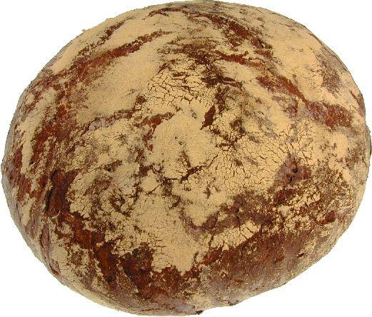
4 Bred: Classification bred = bred Characterisation Outer apperance Weight Length Ingredients salt wheat water yeast E 510, Colour bright dark Other characteristics Organic GMO free 4
5 Question: What is the content of CORINE classes in different countries? same name different content bred bred 112 discontinous urban fabric (DE) 112 discontinous urban fabric (NO) population of CORINE Land Cover classes with independent diagnostic criterias [ G-H. Strand] additional characteristics 5
6 Vision #1: Classification Characterisation Object oriented approach 1 object. many attributes Bred land monitoring object Ingredients Land cover component Wheat, buildings, Intendet use Land use Food/eating industrial Other characteristics other characteristics Organic abandoned 6
7 LEVEL 1 LEVEL 2 LEVEL 3 1. ARTIFICIAL AREAS CORINE nomenclature 1.1. Urban fabric: Continuous urban fabric: Most of the land is covered by structures and transport network. Buildings, roads and artificially surface areas cover more than 80% of the total surface. Non-linear areas of vegetation and bare soil are exceptional Discontinuous urban fabric Most of the land is covered by structures. Buildings, roads and artificially surface areas are associated with vegetated areas and bare soil, which occupy discontinuous but significant surfaces. Between 10% and 80% of the land is covered by residential structures.
8 LEVEL 1 LEVEL 2 LEVEL 3 1. ARTIFICIAL AREAS 1.1. Urban fabric: Continuous urban fabric: Most of the land is covered by structures and transport network. Buildings, roads and artificially surface areas cover more than 80% of the total surface. Non-linear areas of vegetation and bare soil are exceptional Discontinuous urban fabric Most of the land is covered by structures. Buildings, roads and artificially surface areas are associated with vegetated areas and bare soil, which occupy discontinuous but significant surfaces. thresholds Between 10% and 80% of the land is covered by residential structures. Land cover component Land use component Characteristic thresholds intensities SIOSE, A. Arozarena
9 Vision #2: Land Cover & Land Use Conceptually seperate land cover (LC) and land use (LU) LC LU Bare soil agriculture/unused Graminaceous vegetation agriculture/grassland Trees forestry/agriculture Building settlement/industry 9
10 CORINE INSPIRE..and more voluntary mandatory voluntary 25 years ago CORINE Coordinated information on the environment CORINE Air CORINE Biotopes CORINE Land Cover Harmonized/standarized classification system (44 classes) Agreement on standards mandatory.minimum standards (INSPIRE) voluntary.practical standards (EAGLE) 10
11 Vision #3: agree on voluntary standards 11
12 European level National level 1990 CLC
13 European level National level (only some countries) 2000/2006 CLC 2006 national landmonitoring 13
14 European level National level (more countries) 2012 AVOID! CLC HRL national Landmonitoring 14
15 Vision #4: bottom up / top down approach Acknowledge that land monitoring develop on European AND national level Diversity of national land monitoring system (none. fully operational) Tools are necessary semantic transformation EAGLE data model spatial transformation Vector generalization Raster generalization prefered! operational process tbd. 15
16 summary #1: classification > characterisation #2: separation of LC and LU #3: agree on voluntary standards #4: bottom up/top down approach 16
17 Activities EAGLE EiONET Action Group on Land Monitoring in Europe voluntary activity of NRCs Land cover travel cost funded via geoland 2 / HELM HELM Harmonized European Land monitoring FP 7 coordinate action / space call Integration of EAGLE since 6/
18 Results EAGLE Object oriented data model first draft available Agreement on STANDARDIZED lists Flexible adaptation to national/regional needs I. LAND COVER Components Abiotic/Artificial, Biotic/Vegetation, Water II. LAND USE Attributes Agriculture, Forestry, Industry, Transportation etc. III. further CHARACTERISTICS 18 status, spatial pattern, bio-physical parameters, habitat types etc.

19 N. Valcarcel 19
20 EAGLE data model a) As a nomenclature, attaching a single LCC to a point 121 B. Kosztra
21 EAGLE data model a) As a nomenclature, attaching a single LCC to a point B. Kosztra


22 b) Describing the land cover composition of each land surface unit / nomenclature class by attaching more than one LCC to it B. Kosztra

23 c) Describing land surface unit by attaching % values to LCCs LCC polygon count hectar e % Building Open sealed Waste Unsealed artif Bare soil Deciduous trees Shrub Grass Water body Sum B. Kosztra
24 Benefits EEA Conceptual framework for data integration and harmonisation populate CORINE land cover polygons CURRENT status SP CLC HRL = isolated datasets WITH EAGLE data model {CLC 2012, 5 HRL, opt. national LM} = interoperable dataset Defined interface for data integration MC without land monitoring (LM) system Quick reference guide for CORINE class description LM system in development Proposal for standardized elements for national classification system LM system operational Standardized semantic description and transformation of data models European integration and interoperability 24
25 Current Situation of Land Monitoring in Europe European level LUCAS Urban Atlas EEA CLC? HRL National level National HR- CLC / National Land Surveying CLC 25 ha National Land Monitoring S. Arnold
26 Scheme of EAGLE concept European level EEA CLC HRL Urban Atlas BioPhys Par LUCAS European Land Monitoring Framework National level CLC 25 ha National Land Monitoring Regional Land Monitoring S. Arnold
27 HELM themes 27 Harding et al. (1994)
28 Expected HELM results Coordination of national data infrastructure and European data infrastructure High resolution snap shot in time (airborne & satellite based) Multi-temporal coverage (SENTINEL 2) Data integration Data base merging E.g. population grid data Spatial transformation Grid approach generalization into European raster (100*100m) is straightforward compared to vector generalisation Timing issue 28
29 Results II EAGLE: Data model HELM Vision for harmonized land monitoring in Europe expected delivery: end
30 Acknowledgment (selection) EAGLE: Barbara Kosztra, Stephan Arnold Michael Bock, Nuria Valcarcel, Stefan Kleeschulte, Alejandro Simon and all other EAGLE members HELM/EAGLE: Herbert Haubold, Tomas Soukup Geoland 2 forum Copenhagen Oct
THE OVERALL EAGLE CONCEPT
 Sentinel Hub THE OVERALL EAGLE CONCEPT GEBHARD BANKO, 30. MAY 2018, COPENHAGEN ISO TC 211, STANDARDS IN ACTION SEMINAR CONTENT Background and Motivation Criteria and Structure of Data Model Semantic decomposition
State-of-play... The EAGLE concept conceptual basis for a future European Land Monitoring Framework
 State-of-play... The EAGLE concept conceptual basis for a future European Land Monitoring Framework Stephan Arnold, Geir-H. Strand, Barbara Kosztra, Tomas Soukup, Gebhard Banko, Gerard Hazeu, Geoff Smith,
EAGLE Data Model and Outcomes of HELM (Harmonised European Land Monitoring)
") EAGLE Data Model and Outcomes of HELM (Harmonised European Land Monitoring) Contribution towards better land information harmonisation and INSPIRE compliance EAGLE working group Stephan Arnold, Barbara
EAGLE Data Model and Outcomes of HELM (Harmonised European Land Monitoring) Contribution towards better land information harmonisation and INSPIRE compliance EAGLE working group Stephan Arnold, Barbara
EAGLE concept, as part of the HELM vision
 EAGLE concept, as part of the HELM vision EAGLE working group Barbara Kosztra (Hungary), Stephan Arnold (Germany), Lena Hallin-Pihlatie & Elise Järvenpää (Finland) 16.06.2014 HELM / EAGLE Workshop - INSPIRE
The EAGLE concept - first practical implementations. Title. Stephan Arnold. Position Gebhard Banko. Place, Copenhagen, date 20.
 The EAGLE concept - first practical implementations Title Stephan Arnold DeStatis First name SURNAME Position Gebhard Banko Environment Name of the entity Agency Austria Place, Copenhagen, date 20. October2015
The EAGLE Concept - Paving the way for a new European Land Monitoring System
 The EAGLE Concept - Paving the way for a new European Land Monitoring System Stephan Arnold, Barbara Kosztra, Gebhard Banko, Geoff Smith, Christoph Perger, Michael Bock, Geir-Harald Strand, Cesar Martinez,
EAGLE Data Model and Outcomes of HELM (Harmonised European Land Monitoring)
") EAGLE Data Model and Outcomes of HELM (Harmonised European Land Monitoring) Contribution towards better land information harmonisation and INSPIRE compliance EAGLE working group Stephan Arnold, Barbara
EAGLE Data Model and Outcomes of HELM (Harmonised European Land Monitoring) Contribution towards better land information harmonisation and INSPIRE compliance EAGLE working group Stephan Arnold, Barbara
Validation and verification of land cover data Selected challenges from European and national environmental land monitoring
 Validation and verification of land cover data Selected challenges from European and national environmental land monitoring Gergely Maucha head, Environmental Applications of Remote Sensing Institute of
The LISA extension to INSPIRE LC/LU data model: The Austrian experience
 The LISA extension to INSPIRE LC/LU data model: The Austrian experience Gebhard Banko, Environment Agency Austria Roland Grillmayer, Environment Agency Austria Wolfgang Stemberger, GeoVille INSPIRE KEN
EAGLE data model for land monitoring - Use cases and state of play
 EAGLE data model for land monitoring - Use cases and state of play Stephan Arnold, Barbara Kosztra, Gebhard Banko, Geoff Smith, Christoph Perger, Michael Bock, Geir-Harald Strand, Cesar Martinez, Julian
Núria Blanes, Stefan Kleeschulte Geir Harald Strand, Geoff Smith, Gerard Hazeu, Gergely Maucha
 Minutes Projects Activity Participants 1.2 GMES (EEA Subvention) EAGLE Working group meeting Antonio Arozarena (ES), Nuria Valcárcel (ES), Guillermo Villa (ES), Sokol Bezhani (Albania), Geir-Harald Strand
The EAGLE-Concept. A Data Model for Future Land Monitoring
 The EAGLE-Concept A Data Model for Future Land Monitoring Stephan Arnold, Barbara Kosztra, Geir-Harald Strand, Gebhard Banko, Lena Hallin-Pihlatie, Geoff Smith, Chris Perger, Julian Delgado EAGLE Group
Technical specifications for implementation of a new land-monitoring concept based on EAGLE
 EEA/IDM/R0/17/003 Technical specifications for implementation of a new land-monitoring concept based on EAGLE D4: Draft design concept and CLC-Backbone and CLC-Core technical specifications, including
Technical specifications for implementation of a new land-monitoring concept based on EAGLE
 EEA/IDM/R0/17/003 Technical specifications for implementation of a new land-monitoring concept based on EAGLE D4: Draft design concept and CLC-Backbone and CLC-Core technical specifications, including
Applied spatial data for sustainable development strategy in Germany
 Applied spatial data for sustainable development strategy in Germany Stephan Arnold Areal Statistics, Federal Statistical Office, Germany Federal Statistical Office Headquarter: Wiesbaden Branch Office:
Copernicus for Statistics
 Copernicus for Statistics Stephan Arnold Areal statistics, Federal Statistical Office Thomas Wiatr Remote sensing, Federal Agency for Cartography and Geodesy Content Requirements and Setting Eurostat s
Land Monitoring Core Service Implementation Group (LMCS IG) - Results and Outlook
 - Results and Outlook") Land Monitoring Core Service Implementation Group (LMCS IG) - Results and Outlook Pr. Dietmar Grünreich, President of BKG, Germany Chairman of the GMES LMCS IG Outline 1 Introduction 2 Preparatory Projects
Land Monitoring Core Service Implementation Group (LMCS IG) - Results and Outlook Pr. Dietmar Grünreich, President of BKG, Germany Chairman of the GMES LMCS IG Outline 1 Introduction 2 Preparatory Projects
UK Contribution to the European CORINE Land Cover
 Centre for Landscape andwww.le.ac.uk/clcr Climate Research CENTRE FOR Landscape and Climate Research UK Contribution to the European CORINE Land Cover Dr Beth Cole Corine Coordination of Information on
Technical specifications for implementation of a new land-monitoring concept based on EAGLE
 EEA/IDM/R0/17/003 Technical specifications for implementation of a new land-monitoring concept based on EAGLE D3: Draft design concept and CLC-Backbone, CLC-Core technical specifications, including requirements
The EAGLE concept A vision of a future European Land Monitoring Framework
 Towards Horizon 2020 Lasaponara R., Masini N., Biscione M., Editors EARSeL, 2013 The EAGLE concept A vision of a future European Land Monitoring Framework Stephan Arnold 1, Barbara Kosztra 2, Gebhard Banko
Copernicus Land HRL Imperviousness: 2012 dataset, indicator Title
 Copernicus Land HRL Imperviousness: 2012 dataset, 06-09 indicator and outlook Title 2015+ Tobias LANGANKE First name SURNAME Project manager, Copernicus Position land services Name European of the Environment
Spanish national plan for land observation: new collaborative production system in Europe
 ADVANCE UNEDITED VERSION UNITED NATIONS E/CONF.103/5/Add.1 Economic and Social Affairs 9 July 2013 Tenth United Nations Regional Cartographic Conference for the Americas New York, 19-23, August 2013 Item
LAND COVER CHANGES IN ROMANIA BASED ON CORINE LAND COVER INVENTORY
 LAND COVER CHANGES IN ROMANIA BASED ON CORINE LAND COVER INVENTORY 1990 2012 JENICĂ HANGANU, ADRIAN CONSTANTINESCU * Key-words: CORINE Land Cover inventory, Land cover changes, GIS. Abstract. From 1990
System of Environmental-Economic Accounting. Advancing the SEEA Experimental Ecosystem Accounting. Extent Account (Levels 1 and 2)
") Advancing the SEEA Experimental Ecosystem Accounting Extent Account (Levels 1 and 2) Overview: The Extent Account 1. Learning objectives 2. Review of Level 0 (5m) What is it? Why do we need it? What does
Advancing the SEEA Experimental Ecosystem Accounting Extent Account (Levels 1 and 2) Overview: The Extent Account 1. Learning objectives 2. Review of Level 0 (5m) What is it? Why do we need it? What does
SIF_7.1_v2. Indicator. Measurement. What should the measurement tell us?
 Indicator 7 Area of natural and semi-natural habitat Measurement 7.1 Area of natural and semi-natural habitat What should the measurement tell us? Natural habitats are considered the land and water areas
2.1.2 Land cover data
 2.1.2 Land cover data Land cover data was used as an approximate measure of the different habitat groupings throughout Britain. Land cover data was obtained from three sources The European Environment
European Topic Centre on Land Urban and Soil Systems. Green Infrastructure at EEA
 Green Infrastructure at EEA A SPATIAL APPROACH TO MAPPING GI Stefan Kleeschulte, ETC ULS GI and territorial cohesion 2011 first EEA report on Green Infrastructure Underlining the need to develop tools
Country Report of Spain *
 Committee of Experts on Global Geospatial Information Management Second Session New York, United Nations (UN), 13 15 de August de 2012 Country Report of Spain * * Submitted by: Mr. Antonio Arozarena, Deputy
Mapping and Assessment of Ecosystems and their Services
 Mapping and Assessment of Ecosystems and their Services ALTER-Net Conference 2013: Science underpinning the EU 2020 Biodiversity Strategy. April 2013 Gent Joachim MAES 1 This presentation is based on the
Spatial metrics for Greek cities using land cover information from the Urban Atlas
 Spatial metrics for Greek cities using land cover information from the Urban Atlas Poulicos Prastacos IACM-FORTH P.O. Box 1385 Heraklion, Greece poulicos@iacm.forth.gr Nektarios Chrysoulakis IACM-FORTH
INSPIRE Land Cover and Land Use Data Specifications
 INSPIRE Land Cover and Land Use Data Specifications Lena Hallin-Pihlatie Facilitator of the Land Cover and Land Use INSPIRE Thematic Cluster www.jrc.ec.europa.eu Serving society Stimulating innovation
Object based modelling of habitats with EO data: Semantic and technical challenges to achieve interoperability
 Object based modelling of habitats with EO data: Semantic and technical challenges to achieve interoperability Michael Bock, DLR Space Agency 1.07.2010 Folie 1 Vortrag > Autor > Dokumentname > 09.11.2005
Problems arising during the implementation of CLC2006
 Problems arising during the implementation of CLC2006 George Büttner, Barbara Kosztra ETC-LUSI / FÖMI (HU) EIONET WG meeting on Land Monitoring IGN Portugal, 10-12 March 2010 Contents of presentation Present
Plenary Session 2, part 2 A European shared information system
 3 rd GMES Forum 5 6 June 2003 Athens Plenary Session 2, part 2 A European shared information system Gordon McInnes Deputy Director European Environment Agency 1 I keep six honest serving men. They taught
Newsletter. Nr. 5 / June Special Issue HLanData Pilot Projects
 Nr. 5 / June 2012 Newsletter Special Issue HLanData Pilot Projects Pilot 1: Land Use and Land Cover Data Analysis System for Intermediate-Level Users The main objective of PILOT 1 is to demonstrate the
Progress of UN-GGIM: Europe Working Group A on Core Data
 PolicyKEN Budapest 29 November 2016 Progress of UN-GGIM: Europe Working Group A on Core Data François Chirié, Dominique Laurent, IGNF Core data context Background and purpose Aim of Work Group A to propose
LUCAS: current product and its evolutions
 LUCAS: current product and its evolutions Workshop Land Use and Land Cover products: challenges and opportunities Brussels 15 Nov 2017 Eurostat E4: estat-dl-lucas@ec.europa.eu Contents 1) The context 2)
CORINE LAND COVER CROATIA
 CORINE LAND COVER CROATIA INTRO Primary condition in making decisions directed to land cover and natural resources management is presence of knowledge and high quality information about biosphere and its
INSPIREd solutions for Air Quality problems Alexander Kotsev
 INSPIREd solutions for Air Quality problems Alexander Kotsev www.jrc.ec.europa.eu Serving society Stimulating innovation Supporting legislation The European data puzzle The European data puzzle 24 official
Habitats habitat concept, identification, methodology for habitat mapping, organization of mapping
 Habitats habitat concept, identification, methodology for habitat mapping, organization of mapping Rastislav Lasák & Ján Šeffer Training Implementation of Habitats Directive - Habitats and Plants 1 What
The Role of EO Consultants and SMEs within GMES. Geoff Smith
 The Role of EO Consultants and SMEs within GMES Geoff Smith Enable clients to deliver useful, accurate and reliable environmental information from EO. Positioned to bridge the gaps between technology development,
GISCO Working Party Meeting. 8 March 2012 Luxembourg. The ESPON 2013 Programme: State of Affairs. Marjan van Herwijnen project expert in the ESPON CU
 GISCO Working Party Meeting 8 March 2012 Luxembourg The ESPON 2013 Programme: State of Affairs Marjan van Herwijnen project expert in the ESPON CU The ESPON 2013 Programme Role in Structural Funds 2007-2013:
C N E S, U M R I R I S A
 M O N I T O R I N G U R B A N A R E A S W I T H S E N T I N E L - 2. APPLICATION TO THE UPDATE OF THE COPERNICUS HIGH RESOLUTION LAYER IMPERVIOUSNESS DEGREE O c t o b e r 2 5 th 2016, Brussels A n t o
Spatial Disaggregation of Land Cover and Cropping Information: Current Results and Further steps
 CAPRI CAPRI Spatial Disaggregation of Land Cover and Cropping Information: Current Results and Further steps Renate Koeble, Adrian Leip (Joint Research Centre) Markus Kempen (Universitaet Bonn) JRC-AL
Land accounting perspective on water resources management
 European Water 60: 161-166, 2017. 2017 E.W. Publications Land accounting perspective on water resources management G.T. Paschos, G.E. Bariamis * and E.A. Baltas Department of Water Resources and Environmental
EuroGeographics & INSPIRE. Nick Land, Executive Director of EuroGeographics
 EuroGeographics & INSPIRE Nick Land, Executive Director of EuroGeographics EuroGeographics A growing association 49 Members, 42 countries Topographic mapping, cadastre, land registry + Networked organisation
C o p e r n i c u s L a n d M o n i t o r i n g S e r v i c e
 C o p e r n i c u s L a n d M o n i t o r i n g S e r v i c e Integration into existing Snow and Ice Services and draft product specifications Annett BARTSCH b.geos Copernicus High Resolution Snow and
Discussion paper on spatial units
 Discussion paper on spatial units for the Forum of Experts in SEEA Experimental Ecosystem Accounting 2018 Version: 8 June 2018 Prepared by: SEEA EEA Revision Working Group 1 on spatial units (led by Sjoerd
Historical Assessment of Spatial Growth of Built-ups and Metropolitan areas of Delhi and Mumbai in India and Dhaka in Bangladesh
 Historical Assessment of Spatial Growth of Built-ups and Metropolitan areas of Delhi and Mumbai in India and Dhaka in Bangladesh Tomas Soukup, GISAT World Bank HQ, Washington DC Date : 12 April 2011 Introduction
Work Group A «Core Data» Report and Update François Chirié, Dominique Laurent, France
 JOINT UN-GGIM: EUROPE ESS MEETING ON THE INTEGRATION OF STATISTICAL AND GEOSPATIAL INFORMATION LUXEMBOURG 11 MARCH 2016 Work Group A «Core Data» Report and Update François Chirié, Dominique Laurent, France
Common geographies for dissemination of SDG Indicators
 5 th High Level Forum on United Nations GGIM, Mexico 2017 Common geographies for dissemination of SDG Indicators Understanding statistical and geodetic division of territory Janusz Dygaszewicz Central
ESBN. Working Group on INSPIRE
 ESBN Working Group on INSPIRE by Marc Van Liedekerke, Endre Dobos and Paul Smits behalf of the WG members WG participants Marc Van Liedekerke Panos Panagos Borut Vrščaj Ivana Kovacikova Erik Obersteiner
Spatial Units, Scaling and Aggregation (Level 1) October 2017
 October 2017") Spatial Units, Scaling and Aggregation (Level 1) October 2017 Overview: Spatial Units 1. Learning objectives 2. Review of Level 0 (5m) 3. Level 1 (Compilers): Presentation & group exercise Spatial units
Spatial Units, Scaling and Aggregation (Level 1) October 2017 Overview: Spatial Units 1. Learning objectives 2. Review of Level 0 (5m) 3. Level 1 (Compilers): Presentation & group exercise Spatial units
Standardization of the land cover classes using FAO Land Cover Classification System (LCCS)
") Sofia, 17-18 September 2008, LPIS Workshop LPIS applications and quality 1 Standardization of the land cover classes using FAO Land Cover Classification System (LCCS) Pavel MILENOV Agriculture Unit, JRC
Sofia, 17-18 September 2008, LPIS Workshop LPIS applications and quality 1 Standardization of the land cover classes using FAO Land Cover Classification System (LCCS) Pavel MILENOV Agriculture Unit, JRC
UNSD SEEA-EEA revision 2020
 UNSD SEEA-EEA revision 2020 Area 1: Spatial units; introduction Sjoerd Schenau, Patrick Bogaart, Edwin Horlings London group meeting, October 2018 Overview Spatial units in SEEA EEA Main revision issues
Measuring and Monitoring SDGs in Portugal: Ratio of land consumption rate to population growth rate Mountain Green Cover Index
 Measuring and Monitoring SDGs in Portugal: 11.3.1Ratio of land consumption rate to population growth rate 15.4.2 Mountain Green Cover Index United Nations World Geospatial Information Congress João David
Compact guides GISCO. Geographic information system of the Commission
 Compact guides GISCO Geographic information system of the Commission What is GISCO? GISCO, the Geographic Information System of the COmmission, is a permanent service of Eurostat that fulfils the requirements
INSPIRE Directive. Status June 2007
 INSPIRE Directive INfrastructure for SPatial InfoRmation in Europe Status June 2007 European Commission Directorate-General Environment Research, Science and Innovation Unit Rue de la Loi, 200 1049 Brussels
INSPIRE Land Cover and Land Use workshop
 INSPIRE Land Cover and Land Use workshop Opening of the workshop Chair: Lena Hallin-Pihlatie, Facilitator of the Land Cover and Land Use Cluster Copernicus Land products on their way towards INSPIRE Christian
CadasterENV Sweden Time series in support of a multi-purpose land cover mapping system at national scale
 CadasterENV Sweden Time series in support of a multi-purpose land cover mapping system at national scale Mats Rosengren, Camilla Jönsson ; Metria AB Marc Paganini ; ESA ESRIN Background CadasterENV Sweden
Object Oriented Classification Using High-Resolution Satellite Images for HNV Farmland Identification. Shafique Matin and Stuart Green
 Object Oriented Classification Using High-Resolution Satellite Images for HNV Farmland Identification Shafique Matin and Stuart Green REDP, Teagasc Ashtown, Dublin, Ireland Correspondence: shafique.matin@teagasc.ie
Extent. Level 1 and 2. October 2017
 Extent Level 1 and 2 October 2017 Overview: Extent account 1. Learning objectives 2. Review of Level 0 (5m) 3. Level 1 (Compilers): Concepts (15m) Group exercise and discussion (15m) 4. Level 2 (Data Providers)
Possible links between a sample of VHR images and LUCAS
 EUROPEAN COMMISSION EUROSTAT Directorate E: Sectoral and regional statistics Unit E-1: Farms, agro-environment and rural development CPSA/LCU/08 Original: EN (available in EN) WORKING PARTY "LAND COVER/USE
Domain Land Use/Cover Data Model Enabling Multiple Use for Turkey
 Domain Land Use/Cover Data Model Enabling Multiple Use for Turkey Key words: Spatial Data Management, LULC, Land Use/Cover SUMMARY Land use/ land cover (LULC) information, one aspect of GI, has huge important
COMPARING GLOBAL LAND COVER DATASETS THROUGH THE EAGLE MATRIX LAND COVER COMPONENTS FOR CONTINENTAL PORTUGAL. Selçuk Mozak
 COMPARING GLOBAL LAND COVER DATASETS THROUGH THE EAGLE MATRIX LAND COVER COMPONENTS FOR CONTINENTAL PORTUGAL Selçuk Mozak COMPARING GLOBAL LAND COVER DATASETS THROUGH THE EAGLE MATRIX LAND COVER COMPONENTS
Pilot studies on the provision of harmonized land use/land cover statistics: Synergies between LUCAS and the national systems
 1 Pilot studies on the provision of harmonized land use/land cover statistics: Synergies between LUCAS and the national systems Norway Erik Engelien Division for Natural resources and Environmental Statistics,
Progress of UN-GGIM: Europe Working Group A on Core Data
 INSPIRE KEN 13 December 2016 Progress of UN-GGIM: Europe Working Group A on Core Data François Chirié, Dominique Laurent, IGN France Plan Introduction Objectives of the working group with respect to INSPIRE
The contribution of EUREF to Inspire
 EUREF2010 SYMPOSIUM The contribution of EUREF to Inspire J. Torres, V. Bitenc, A. Caporali, P. Cruddace, L. Engberg, B. Garayt and H. Habrich (members of TWG-RS) June 2-4, 2010 Gävle 1 EUREF2010 SYMPOSIUM
Open call for tenders No EEA/MDI/14/001
 1 April 2014 Clarification No 1 Reference: Title: Open call for tenders No EEA/MDI/14/001 Copernicus Initial Operations 2011-2013 - Land Monitoring Service Local Component: riparian zones Question 1 Section
Presentation of the different land cover mapping activities in the French Guiana
 Presentation of the different land cover mapping activities in the French Guiana LCCS Land Cover Classification System 9 to 13 March 2015 Paramaribo - Suriname INTRODUCTION French Guiana : 8 046 427 ha
INSPIRE Thematic Cluster on Land Cover and Land Use & Feedback from implementers
 INSPIRE Thematic Cluster on Land Cover and Land Use & Feedback from implementers Lena Hallin-Pihlatie Facilitator of the LC and LU Thematic Cluster www.jrc.ec.europa.eu Serving society Stimulating innovation
Urban settlements delimitation using a gridded spatial support
 Urban settlements delimitation using a gridded spatial support Rita Nicolau 1, Elisa Vilares 1, Cristina Cavaco 1, Ana Santos 2, Mário Lucas 2 1 - General Directorate for Territory Development DGT, Portugal
DEVELOPMENT OF DIGITAL CARTOGRAPHIC DATABASE FOR MANAGING THE ENVIRONMENT AND NATURAL RESOURCES IN THE REPUBLIC OF SERBIA
 DEVELOPMENT OF DIGITAL CARTOGRAPHIC BASE FOR MANAGING THE ENVIRONMENT AND NATURAL RESOURCES IN THE REPUBLIC OF SERBIA Dragutin Protic, Ivan Nestorov Institute for Geodesy, Faculty of Civil Engineering,
INDICATORS FOR INTEGRATED COASTAL ZONE MANAGEMENT (ICZM)
") IOC UNESCO / Leader Task 4.1 Contact Francesca Santoro, Julian Barbiere E-mail: f.santoro@unesco.org, j.barbiere@unesco.org Phone: +33 1 45683952 How to cite this factsheet: PEGASO Consortium. 2013. Area
IOC UNESCO / Leader Task 4.1 Contact Francesca Santoro, Julian Barbiere E-mail: f.santoro@unesco.org, j.barbiere@unesco.org Phone: +33 1 45683952 How to cite this factsheet: PEGASO Consortium. 2013. Area
Report on the establishment of UN GGIM: Europe Item 14. 4th session of the Committee of Experts on UN-GGIM
 Report on the establishment of UN GGIM: Europe Item 14 1 Why regional European committees of UN GGIM? In the ECOSOC resolution 2011/24 on the UN GGIM: Emphasizes the importance of promoting national, regional
The Combination of Geospatial Data with Statistical Data for SDG Indicators
 Session x: Sustainable Development Goals, SDG indicators The Combination of Geospatial Data with Statistical Data for SDG Indicators Pier-Giorgio Zaccheddu Fabio Volpe 5-8 December2018, Nairobi IAEG SDG
ArcGIS for INSPIRE. Marten Hogeweg
 ArcGIS for INSPIRE Marten Hogeweg Please Take Our Survey on the App Download the Esri Events app and find your event Select the session you attended Scroll down to find the feedback section Complete answers
Change detection for Finnish CORINE land cover classification
 Change detection for Finnish CORINE land cover classification Markus Törmä, Pekka Härmä, Suvi Hatunen, Riitta Teiniranta, Minna Kallio, Elise Järvenpää Finnish Environment Institute SYKE, Mechelininkatu
Turkey s National SDI Implementation
 Onur PAŞAOĞULLARI Head of Department Turkey s National SDI Implementation Presentation Plan NSDI Background General Directorate of Geographic Information Systems NSDI Project INSPIRE Directive Urban Information
a national geological survey perspective François ROBIDA BRGM (French Geological Survey)
") a national geological survey perspective François ROBIDA BRGM (French Geological Survey) Pre-Conference Seminar on Socio-Economic Value of Geospatial for National and Regional Development 21 August 2017,
a national geological survey perspective François ROBIDA BRGM (French Geological Survey) Pre-Conference Seminar on Socio-Economic Value of Geospatial for National and Regional Development 21 August 2017,
Data harmonisation aspects in INSPIRE and beyond : use cases at pan-european level
 Data harmonisation aspects in INSPIRE and beyond : use cases at pan-european level Nathalie Delattre, IGN Email: nathalie.delattre@ngi.be INSPIRE data interoperability setting up common data specifications
LAND USE, LAND COVER AND SOIL SCIENCES - Vol. I - Land Use and Land Cover, Including their Classification - Duhamel C.
 LAND USE AND LAND COVER, INCLUDING THEIR CLASSIFICATION Duhamel Landsis Groupement Européen d Intérêt Economique, Luxembourg Keywords: land cover, land use, classification systems, nomenclature, information
sentinel-2 COLOUR VISION FOR COPERNICUS
 sentinel-2 COLOUR VISION FOR COPERNICUS SATELLITES TO SERVE By providing a set of key information services for a wide range of practical applications, Europe s Copernicus programme is providing a step
Update on INSPIRE; interoperable framework for natural hazards
 Update on INSPIRE; interoperable framework for natural hazards Robert Tomas EC-DG Joint Research Centre 16 th Meeting of Working Group F on Floods 2014, Rome www.jrc.ec.europa.eu Serving society Stimulating
SEEA Experimental Ecosystem Accounting
 SEEA Experimental Ecosystem Accounting Sokol Vako United Nations Statistics Division Training for the worldwide implementation of the System of Environmental Economic Accounting 2012 - Central Framework
Global Land Cover Mapping
 Global Land Cover Mapping and its application in SDGs Prof. Chen Jun 1, Dr. He Chaoying 2 1 National Geomatics Center of China (NGCC) 2 Ministry of Natural Resources, P.R.China May 30, 2018, Copenhagen
ARCH PROJET Activity 1 -Synthesis-
 ARCH PROJET Activity 1 -Synthesis- CONTENT 1 ARCH project context... 3 1.1. General context... 3 1.2. The ARCH Project... 3 1.3. The Project ARCH partners... 3 1.4. The ARCH project content... 4 2 Activity
How proximity to a city influences the performance of rural regions by Lewis Dijkstra and Hugo Poelman
 n 01/2008 Regional Focus A series of short papers on regional research and indicators produced by the Directorate-General for Regional Policy Remote Rural Regions How proximity to a city influences the
TECHNOLOGY TRANSFER : LAND USE & LAND COVER MAPPING projects Case studies and analysis of key factors of success
 CO-039 TECHNOLOGY TRANSFER : LAND USE & LAND COVER MAPPING projects Case studies and analysis of key factors of success DEKEYNE C., JAFFRAIN G. IGN FI, PARIS, FRANCE KEY WORDS Land cover, land use, agriculture
Urban-Rural spatial classification of Finland
 Urban-Rural spatial classification of Finland Finnish Environment Institute SYKE The geographical information-based area classification system has been created by the Finnish Environment Institute and
Supplementary material: Methodological annex
 1 Supplementary material: Methodological annex Correcting the spatial representation bias: the grid sample approach Our land-use time series used non-ideal data sources, which differed in spatial and thematic
L A N D C O P E R N I C U S. Den Haag, Land Monitoring
 C O P E R N I C U S M O N I T O R I N G L A N D S E R V I C E Den Haag, 13.06.2018 hans.dufourmont@eea.europa.eu W A A R O M EEN C O P E R N I C U S L A N D M O N I T O R I N G D I E N S T? C O P E R N
INSPIRE d Land Use Planning Dynamic Indicators to Improve Planning Achievements
 INSPIRE d Land Use Planning Dynamic Indicators to Improve Planning Achievements Maria José Vale, mvale@dgterritorio.pt M. M.Vale, R. R. Saraiva, B. R. Meneses, Rei, P. Patrico R. Reis, INSPIRE INSPIRE
The European Forum for Geospatial Statistics Benefits and challenges of INSPIRE in the field of statistics
 INSPIRE Conference 2016 Barcelona, Spain 26th 30th September 2016 The European Forum for Geospatial Statistics Benefits and challenges of INSPIRE in the field of statistics Janusz Dygaszewicz EFGS President
reviewed paper Information Around Us: Questions Connected to Information and Data Heterogeneities in Planning Activities Otakar Cerba
 reviewed paper Information Around Us: Questions Connected to Information and Data Heterogeneities in Planning Activities Otakar Cerba (Ing. et Mgr. Otakar Cerba, Ph.D, University of West Bohemia, Univerzitni
Application of Topology to Complex Object Identification. Eliseo CLEMENTINI University of L Aquila
 Application of Topology to Complex Object Identification Eliseo CLEMENTINI University of L Aquila Agenda Recognition of complex objects in ortophotos Some use cases Complex objects definition An ontology
Surface area: km 2 National projection System 1970 (for in) Number of sheets at the scale of 1: sheets (40 km x 40 km)
 Number of sheets at the scale of 1: sheets (40 km x 40 km)") TECHNICAL PROPOSAL I. Background The CORINE Land Cover project is intended to provide consistent localized geographical information on the land cover of Bulgaria. And it full its purpose for 20 years.
TECHNICAL PROPOSAL I. Background The CORINE Land Cover project is intended to provide consistent localized geographical information on the land cover of Bulgaria. And it full its purpose for 20 years.
New COST Action: Towards a European Network on Chemical Weather Forecasting and Information Systems
 New COST Action: Towards a European Network on Chemical Weather Forecasting and Information Systems Proposer: Mikhail Sofiev Finnish Meteorological Institute Historical background EUMETNET Workshop on
Hennig, B.D. and Dorling, D. (2014) Mapping Inequalities in London, Bulletin of the Society of Cartographers, 47, 1&2,
 Mapping Inequalities in London, Bulletin of the Society of Cartographers, 47, 1&2,") Hennig, B.D. and Dorling, D. (2014) Mapping Inequalities in London, Bulletin of the Society of Cartographers, 47, 1&2, 21-28. Pre- publication draft without figures Mapping London using cartograms The
Hennig, B.D. and Dorling, D. (2014) Mapping Inequalities in London, Bulletin of the Society of Cartographers, 47, 1&2, 21-28. Pre- publication draft without figures Mapping London using cartograms The
State of the Art. in Spatial Planning Data Harmonisation & Spatial Data Infrastructure (SDI) Julia Neuschmid, CEIT ALANOVA
 Julia Neuschmid, CEIT ALANOVA") INSPIRE Conference, June 2010, Krakow State of the Art in Spatial Planning Data Harmonisation & Spatial Data Infrastructure (SDI) Julia Neuschmid, CEIT ALANOVA Co-funded by the Community programme econtentplus
INSPIRE Conference, June 2010, Krakow State of the Art in Spatial Planning Data Harmonisation & Spatial Data Infrastructure (SDI) Julia Neuschmid, CEIT ALANOVA Co-funded by the Community programme econtentplus