The EAGLE-Concept. A Data Model for Future Land Monitoring
|
|
|
- Amie Nelson
- 6 years ago
- Views:
Transcription

1 The EAGLE-Concept A Data Model for Future Land Monitoring Stephan Arnold, Barbara Kosztra, Geir-Harald Strand, Gebhard Banko, Lena Hallin-Pihlatie, Geoff Smith, Chris Perger, Julian Delgado EAGLE Group
2 Preamble: Who is EAGLE? EAGLE = EIONET Action Group on Land Monitoring in Europe Participants are Land Monitoring experts and Representatives of National Reference Centres (NRC) for Land Cover in the EEA s EIONET (European Environmental Information and Observation Network) Established in 2009 as self-initiative Independent from political interests Open membership based on own commitment Firstly no external funding, meanwhile supported by EEA funding Folie 2
3 Content Background and Motivation Criteria and Structure of Data Model Howtousethematrix Summary Results and Outlook Folie 3
4 Background and Motivation HarmonisationandIntegration ofdifferent datasourceson land cover and land use would require: Comparable or clearly separable definitions Common synchronized time/interval of data capture Comparable minimum mapping units Similar data quality Folie 4
5 Background and Motivation Many applications of LC/LU data lead to various different classification systems Mixture of LC and LU classes Specific fields of work cause fous on thematic categories Lack of comparability between nomenclatures hamper exchange of information between data sets National institutions are surrounded by National requirements Pan-European requirements (Europ. Commission, DGs, EEA, Eurostat) Folie 5
6 Klassifikation / Interpretation: Was war doch gleich... Wald, Gehölz, Baumgruppe? Kronendichte, Anzahl der Bäume, Stammumfang Mindestflächengröße / -breite Nutzung: Forst, Waldweide, Friedwald, Erholung Funktion: Habitat, Lawinenschutz, CO2-Senke Brache? Ehemalige Nutzung (Landwirtschaft, Wohnen, Industrie, etc.) Wie lange ungenutzt, 1 / 2 / 5 / 10 Jahre? Gartenland/Schrebergärten? Nutzung zur Erholung, Freizeit, Landwirtschaft, Selbstversorgung Bergbaufolgelandschaft / Renaturierung Grassland: landwirtschaftl. Nutzung oder Halde? Folie 6
7 Classification and Interpretation Same term different meaning Same content different name + difference in interpreting the class definitions or tolerance of class definition => Comparable/ Non-comparable data? Folie 7
 isa bread(en.")
 é pane(it.")
8 Ein Brot (dt.) isa bread(en.) estunpain(fr.) é pane(it.) es pan(sp.) ist ein Brot? Folie 8


9 Ein Brötchen ist ein Weck ist ein Rundstück ist eine Schrippe ist eine Semmel. Folie 9


10 Folie 10


11 Characterization Ingredients Salt Wheat Water Yiest E 510, Weight 1,5 Kilo 3 pounds Color light darkbrown Other details biocertificated vegan Folie 11


12 Characterization Growth form homogeneous heterogenous Growth density slosed sparcely Soil condition wet dry acidic Use/Funktion Pasture Recreation Sport Air traffic Ecosystem type Wetland, swamp Folie 12

![(2005) 80 60 40 Crown cover density[%]](/docs-images/71/66224834/images/13-3.jpg "20 Minimum tree height in [m] 2 4 6 8")
13 Forest definitions all over the World 100 Source: Comber et al. (2005) Crown cover density[%] 20 Minimum tree height in [m] Folie 13
14 Criteria for data model LC/LU Workshop, INSPIRE Conference 2015, Lisboa Clear separationbetweenlc andlu Scale independent Object-oriented description instead of classification CompletecoverageofthemesLC andlu Modelling of temporal phenomena Applicable on national and European level Folie 14


15 De-Composition of landscape From classification to object-oriented description Fotos: Copyright Ursus Wehrli Folie 15
16 De-Composition of CORINE Land Cover classes LC LU CH Parameter/ Intensität Folie 16
17 Outcome of EAGLE concept EAGLE Matrix Excel Spread Sheet Matrix elements in columns Classes to be analysed in rows EAGLE Model UML model Enterprice Architect Connected to INSPIRE data specs on LC Folie 17
18 Structure of the EAGLE matrix Information on landscape described with three separate blocks: I.) LAND COVER Components LCC Abiotic (Artificial + Natural), Vegetation, Water Surfaces => no classes, but elements II.) LAND USE Attributes LUA Agriculture, Forestry, Residential, Transportation etc. III.) CHARACTERISTICS CH further information on: spatial pattern, bio-physical parameters, ecosystem types, cultivation measures, land management practices etc. Folie 18


19 Structure of the EAGLE matrix I. LCC block II. LUA block III. CH block CLC classes Folie 19


20 Matrix as semantic comparison tool Folie 20


21 INSPIRE LC Data model LC/LU Workshop, INSPIRE Conference 2015, Lisboa Folie 21


22 EAGLE UML model overview Folie 22
 LU Attributes (HILUCS) ABIOTIC LCCs (Artificial/Natural) CH Characteristics BIOTIC LCCs (Vegetation) CH -... -... -... -... WATER LCCs + + + CH -... -... -... -... Folie 23")
23 Structure of the EAGLE data model Description of landscape with Land Cover Components (LCC), Characteristics (CH), Land Use Attributes (LUA) CH LC Unit (1..* LCCs) LU Attributes (HILUCS) ABIOTIC LCCs (Artificial/Natural) CH Characteristics BIOTIC LCCs (Vegetation) CH WATER LCCs CH Folie 23
: Ecosystem type = inland marsh Salinity < 0,1% (fresh water) Water regime = perennial")
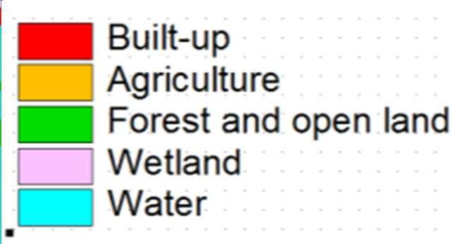
24 Example: wetland Land cover components (LCC): Standing water body Reeds Land use attributes (LUA): none, recreational Reed harvest Barbara Kosztra Further Characteristica(CH): Ecosystem type = inland marsh Salinity < 0,1% (fresh water) Water regime = perennial Folie 24
: Soilsealingdegree=35% Built-up pattern = discontinuous, single houses B. Kosztra Folie 25")
25 Example: rural settlement Land cover components (LCC): Conventional buildings Trees, broad leaved Herbaceous plants Open sealed surfaces Land use attributes (LUA): Permanent residantial Agriculture, own consumption Road network Further characteristics (CH): Soilsealingdegree=35% Built-up pattern = discontinuous, single houses B. Kosztra Folie 25
26 Momentary situation in Europa Mainly bilateral relations and flows of information European Level Urban Atlas EEA CLC HRL LUCAS National Level ATKIS DLM- DE ALKIS LC/LU Stat Agrar Stat Folie 26
27 Vision Implementation ofa multi-variant applicableland Monitoring Concept Data Model: Descriptive characterization of LC/LU Semantic translation between als Übersetzungs- Werkzeug zwischen verschiedenen Klassifikationssystemen Folie 27
28 Integration schema for a future land monitoring framework in Europe [C O P E R N I C U S] European Level CLC Urban Atlas HR Layers LPIS LUCAS EAGLE Konzept National & Sub-National Level National (A) Land Monitoring Regional (a) Land Monitoring National CLC Regional (b) Land Monitoring National (B) Land Monitoring Folie 28


29 Grid-/raster approach Polygon: object-orientied delineation Grid cell: descriptive characterization Folie 29


30 Grid-/Raster approach LC/LU Workshop, INSPIRE Conference 2015, Lisboa Original Raster: Single values per raster cells Grid cell: Multiple information in each grid cell... Folie 30
 as")

31 INSPIRE Pure Land Cover Components (PLCC) as proposed in the LC data specifications final version Folie 31
32 Summary The Eagle concept LC/LU Workshop, INSPIRE Conference 2015, Lisboa Instrument for semantic analysis of class definitions (inconsistencies: overlaps, gaps), not a new classification system, but vehicle for semantic harmonisation and transformation, is INSPIRE compliant, can provide flexible framework for future mapping initiatives, helps to avoid redundant data capture, applicable on raster or polygon data, follows principle of integrating bottom-up/ top-down approach in the European land monitoring process, supported byeea, observed byeurostat Folie 32
33 Results and Outlook LC/LU Workshop, INSPIRE Conference 2015, Lisboa Results: Explanatory documention of EAGLE concept Fine tuning of matrix and model UML data model (incl UML chart) UpcomingEvent: GIO closing event , EEA, Copenhagen Tasks ongoing& ahead: Semantic testing of EAGLE matrix EAGLE matrix population and comparison tool Physical data base Folie 33
34 Literatur on EAGLE LC/LU Workshop, INSPIRE Conference 2015, Lisboa Folie 34
35 Literatur on EAGLE LC/LU Workshop, INSPIRE Conference 2015, Lisboa - Arnold, S., B. Kosztra, G. Banko, G. Smith, G. Hazeu, M. Bock, N. Valcarcel Sanz (2013):The EAGLE concept A vision of a future European Land Monitoring Framework. In: R. Lasaponara, L. Masini and M. Biscione (Eds.), Towards Horizon 2020: Earth Observation and Social Perspectives. 33th EARSeL Symposium Proceedings, S EARSeL and CNR, Matera. - - Arnold, S., Kosztra, B., Banko, G., Milenov, P., Smith, G., Hazeu, G. (2014): Explanatory Documentation of the EAGLE Concept. EEA, Copenhagen. - - Arnold, Smith, Hazeu, Kosztra, Perger, Banko, Strand, Valcarcel-Sanz, Bock (2015 in prep):the EAGLE Concept - A Paradigm Shift in Land Monitoring. In: Ahlqvist, Fritz, Janowicz (Eds.): Land Use and Land Cover Semantics - Principles, Best Practices, and Prospects,Taylor & Francis, CRC Press Folie 35


36 EAGLE data model Richtfest Version 2.3 EAGLE Meeting, Wien, EAGLE Meeting, March 2015, Frankfurt am Main Folie 36


37 Thankyouforyourattention! EAGLE website: Stephan Arnold Telefon: +49 (0) 611 / stephan.arnold@destatis.de
The EAGLE Concept - Paving the way for a new European Land Monitoring System
 The EAGLE Concept - Paving the way for a new European Land Monitoring System Stephan Arnold, Barbara Kosztra, Gebhard Banko, Geoff Smith, Christoph Perger, Michael Bock, Geir-Harald Strand, Cesar Martinez,
EAGLE data model for land monitoring - Use cases and state of play
 EAGLE data model for land monitoring - Use cases and state of play Stephan Arnold, Barbara Kosztra, Gebhard Banko, Geoff Smith, Christoph Perger, Michael Bock, Geir-Harald Strand, Cesar Martinez, Julian
THE OVERALL EAGLE CONCEPT
 Sentinel Hub THE OVERALL EAGLE CONCEPT GEBHARD BANKO, 30. MAY 2018, COPENHAGEN ISO TC 211, STANDARDS IN ACTION SEMINAR CONTENT Background and Motivation Criteria and Structure of Data Model Semantic decomposition
State-of-play... The EAGLE concept conceptual basis for a future European Land Monitoring Framework
 State-of-play... The EAGLE concept conceptual basis for a future European Land Monitoring Framework Stephan Arnold, Geir-H. Strand, Barbara Kosztra, Tomas Soukup, Gebhard Banko, Gerard Hazeu, Geoff Smith,
EAGLE concept, as part of the HELM vision
 EAGLE concept, as part of the HELM vision EAGLE working group Barbara Kosztra (Hungary), Stephan Arnold (Germany), Lena Hallin-Pihlatie & Elise Järvenpää (Finland) 16.06.2014 HELM / EAGLE Workshop - INSPIRE
EAGLE Data Model and Outcomes of HELM (Harmonised European Land Monitoring)
") EAGLE Data Model and Outcomes of HELM (Harmonised European Land Monitoring) Contribution towards better land information harmonisation and INSPIRE compliance EAGLE working group Stephan Arnold, Barbara
EAGLE Data Model and Outcomes of HELM (Harmonised European Land Monitoring) Contribution towards better land information harmonisation and INSPIRE compliance EAGLE working group Stephan Arnold, Barbara
Towards a harmonised land monitoring system: NRC bottom-up activities in EAGLE and HELM H
 B. Kosztra Towards a harmonised land monitoring system: NRC bottom-up activities in EAGLE and HELM H Gebhard Banko Environment Agency Austria Geoland 2 Forum 18.-19. October 2012 Copenhagen 1 1 NRC * opinion
The EAGLE concept - first practical implementations. Title. Stephan Arnold. Position Gebhard Banko. Place, Copenhagen, date 20.
 The EAGLE concept - first practical implementations Title Stephan Arnold DeStatis First name SURNAME Position Gebhard Banko Environment Name of the entity Agency Austria Place, Copenhagen, date 20. October2015
Copernicus for Statistics
 Copernicus for Statistics Stephan Arnold Areal statistics, Federal Statistical Office Thomas Wiatr Remote sensing, Federal Agency for Cartography and Geodesy Content Requirements and Setting Eurostat s
Applied spatial data for sustainable development strategy in Germany
 Applied spatial data for sustainable development strategy in Germany Stephan Arnold Areal Statistics, Federal Statistical Office, Germany Federal Statistical Office Headquarter: Wiesbaden Branch Office:
Validation and verification of land cover data Selected challenges from European and national environmental land monitoring
 Validation and verification of land cover data Selected challenges from European and national environmental land monitoring Gergely Maucha head, Environmental Applications of Remote Sensing Institute of
Núria Blanes, Stefan Kleeschulte Geir Harald Strand, Geoff Smith, Gerard Hazeu, Gergely Maucha
 Minutes Projects Activity Participants 1.2 GMES (EEA Subvention) EAGLE Working group meeting Antonio Arozarena (ES), Nuria Valcárcel (ES), Guillermo Villa (ES), Sokol Bezhani (Albania), Geir-Harald Strand
LAND COVER CHANGES IN ROMANIA BASED ON CORINE LAND COVER INVENTORY
 LAND COVER CHANGES IN ROMANIA BASED ON CORINE LAND COVER INVENTORY 1990 2012 JENICĂ HANGANU, ADRIAN CONSTANTINESCU * Key-words: CORINE Land Cover inventory, Land cover changes, GIS. Abstract. From 1990
SIF_7.1_v2. Indicator. Measurement. What should the measurement tell us?
 Indicator 7 Area of natural and semi-natural habitat Measurement 7.1 Area of natural and semi-natural habitat What should the measurement tell us? Natural habitats are considered the land and water areas
Technical specifications for implementation of a new land-monitoring concept based on EAGLE
 EEA/IDM/R0/17/003 Technical specifications for implementation of a new land-monitoring concept based on EAGLE D4: Draft design concept and CLC-Backbone and CLC-Core technical specifications, including
INSPIRE Land Cover and Land Use Data Specifications
 INSPIRE Land Cover and Land Use Data Specifications Lena Hallin-Pihlatie Facilitator of the Land Cover and Land Use INSPIRE Thematic Cluster www.jrc.ec.europa.eu Serving society Stimulating innovation
INSPIRE Land Cover and Land Use workshop
 INSPIRE Land Cover and Land Use workshop Opening of the workshop Chair: Lena Hallin-Pihlatie, Facilitator of the Land Cover and Land Use Cluster Copernicus Land products on their way towards INSPIRE Christian
Technical specifications for implementation of a new land-monitoring concept based on EAGLE
 EEA/IDM/R0/17/003 Technical specifications for implementation of a new land-monitoring concept based on EAGLE D4: Draft design concept and CLC-Backbone and CLC-Core technical specifications, including
INSPIRE Thematic Cluster on Land Cover and Land Use & Feedback from implementers
 INSPIRE Thematic Cluster on Land Cover and Land Use & Feedback from implementers Lena Hallin-Pihlatie Facilitator of the LC and LU Thematic Cluster www.jrc.ec.europa.eu Serving society Stimulating innovation
Problems arising during the implementation of CLC2006
 Problems arising during the implementation of CLC2006 George Büttner, Barbara Kosztra ETC-LUSI / FÖMI (HU) EIONET WG meeting on Land Monitoring IGN Portugal, 10-12 March 2010 Contents of presentation Present
The EAGLE concept A vision of a future European Land Monitoring Framework
 Towards Horizon 2020 Lasaponara R., Masini N., Biscione M., Editors EARSeL, 2013 The EAGLE concept A vision of a future European Land Monitoring Framework Stephan Arnold 1, Barbara Kosztra 2, Gebhard Banko
Object based modelling of habitats with EO data: Semantic and technical challenges to achieve interoperability
 Object based modelling of habitats with EO data: Semantic and technical challenges to achieve interoperability Michael Bock, DLR Space Agency 1.07.2010 Folie 1 Vortrag > Autor > Dokumentname > 09.11.2005
Standardization of the land cover classes using FAO Land Cover Classification System (LCCS)
") Sofia, 17-18 September 2008, LPIS Workshop LPIS applications and quality 1 Standardization of the land cover classes using FAO Land Cover Classification System (LCCS) Pavel MILENOV Agriculture Unit, JRC
Sofia, 17-18 September 2008, LPIS Workshop LPIS applications and quality 1 Standardization of the land cover classes using FAO Land Cover Classification System (LCCS) Pavel MILENOV Agriculture Unit, JRC
L A N D C O P E R N I C U S. Den Haag, Land Monitoring
 C O P E R N I C U S M O N I T O R I N G L A N D S E R V I C E Den Haag, 13.06.2018 hans.dufourmont@eea.europa.eu W A A R O M EEN C O P E R N I C U S L A N D M O N I T O R I N G D I E N S T? C O P E R N
LUCAS: current product and its evolutions
 LUCAS: current product and its evolutions Workshop Land Use and Land Cover products: challenges and opportunities Brussels 15 Nov 2017 Eurostat E4: estat-dl-lucas@ec.europa.eu Contents 1) The context 2)
Technical specifications for implementation of a new land-monitoring concept based on EAGLE
 EEA/IDM/R0/17/003 Technical specifications for implementation of a new land-monitoring concept based on EAGLE D3: Draft design concept and CLC-Backbone, CLC-Core technical specifications, including requirements
Pilot studies on the provision of harmonized land use/land cover statistics: Synergies between LUCAS and the national systems
 1 Pilot studies on the provision of harmonized land use/land cover statistics: Synergies between LUCAS and the national systems Norway Erik Engelien Division for Natural resources and Environmental Statistics,
Discussion paper on spatial units
 Discussion paper on spatial units for the Forum of Experts in SEEA Experimental Ecosystem Accounting 2018 Version: 8 June 2018 Prepared by: SEEA EEA Revision Working Group 1 on spatial units (led by Sjoerd
COMPARING GLOBAL LAND COVER DATASETS THROUGH THE EAGLE MATRIX LAND COVER COMPONENTS FOR CONTINENTAL PORTUGAL. Selçuk Mozak
 COMPARING GLOBAL LAND COVER DATASETS THROUGH THE EAGLE MATRIX LAND COVER COMPONENTS FOR CONTINENTAL PORTUGAL Selçuk Mozak COMPARING GLOBAL LAND COVER DATASETS THROUGH THE EAGLE MATRIX LAND COVER COMPONENTS
Land Monitoring Core Service Implementation Group (LMCS IG) - Results and Outlook
 - Results and Outlook") Land Monitoring Core Service Implementation Group (LMCS IG) - Results and Outlook Pr. Dietmar Grünreich, President of BKG, Germany Chairman of the GMES LMCS IG Outline 1 Introduction 2 Preparatory Projects
Land Monitoring Core Service Implementation Group (LMCS IG) - Results and Outlook Pr. Dietmar Grünreich, President of BKG, Germany Chairman of the GMES LMCS IG Outline 1 Introduction 2 Preparatory Projects
UK Contribution to the European CORINE Land Cover
 Centre for Landscape andwww.le.ac.uk/clcr Climate Research CENTRE FOR Landscape and Climate Research UK Contribution to the European CORINE Land Cover Dr Beth Cole Corine Coordination of Information on
Measuring and Monitoring SDGs in Portugal: Ratio of land consumption rate to population growth rate Mountain Green Cover Index
 Measuring and Monitoring SDGs in Portugal: 11.3.1Ratio of land consumption rate to population growth rate 15.4.2 Mountain Green Cover Index United Nations World Geospatial Information Congress João David
CORINE LAND COVER CROATIA
 CORINE LAND COVER CROATIA INTRO Primary condition in making decisions directed to land cover and natural resources management is presence of knowledge and high quality information about biosphere and its
Copernicus Land HRL Imperviousness: 2012 dataset, indicator Title
 Copernicus Land HRL Imperviousness: 2012 dataset, 06-09 indicator and outlook Title 2015+ Tobias LANGANKE First name SURNAME Project manager, Copernicus Position land services Name European of the Environment
Contents Introduction... 3 Get the data... 4 Workflow... 7 Test 1: Urban fabric (all)... 8 Test 2: Urban fabric (industrial and commercial)...
... 8 Test 2: Urban fabric (industrial and commercial)...") AAXY tutorial Contents Introduction... 3 Get the data... 4 Workflow... 7 Test 1: Urban fabric (all)... 8 Test 2: Urban fabric (industrial and commercial)... 9 Test 3: Urban fabric (residential)... 10 Test
AAXY tutorial Contents Introduction... 3 Get the data... 4 Workflow... 7 Test 1: Urban fabric (all)... 8 Test 2: Urban fabric (industrial and commercial)... 9 Test 3: Urban fabric (residential)... 10 Test
Global Land Cover Mapping
 Global Land Cover Mapping and its application in SDGs Prof. Chen Jun 1, Dr. He Chaoying 2 1 National Geomatics Center of China (NGCC) 2 Ministry of Natural Resources, P.R.China May 30, 2018, Copenhagen
Supplementary material: Methodological annex
 1 Supplementary material: Methodological annex Correcting the spatial representation bias: the grid sample approach Our land-use time series used non-ideal data sources, which differed in spatial and thematic
Multifunctional theory in agricultural land use planning case study
 Multifunctional theory in agricultural land use planning case study Introduction István Ferencsik (PhD) VÁTI Research Department, iferencsik@vati.hu By the end of 20 th century demands and expectations
The Role of EO Consultants and SMEs within GMES. Geoff Smith
 The Role of EO Consultants and SMEs within GMES Geoff Smith Enable clients to deliver useful, accurate and reliable environmental information from EO. Positioned to bridge the gaps between technology development,
System of Environmental-Economic Accounting. Advancing the SEEA Experimental Ecosystem Accounting. Extent Account (Levels 1 and 2)
") Advancing the SEEA Experimental Ecosystem Accounting Extent Account (Levels 1 and 2) Overview: The Extent Account 1. Learning objectives 2. Review of Level 0 (5m) What is it? Why do we need it? What does
Advancing the SEEA Experimental Ecosystem Accounting Extent Account (Levels 1 and 2) Overview: The Extent Account 1. Learning objectives 2. Review of Level 0 (5m) What is it? Why do we need it? What does
The LISA extension to INSPIRE LC/LU data model: The Austrian experience
 The LISA extension to INSPIRE LC/LU data model: The Austrian experience Gebhard Banko, Environment Agency Austria Roland Grillmayer, Environment Agency Austria Wolfgang Stemberger, GeoVille INSPIRE KEN
Compact guides GISCO. Geographic information system of the Commission
 Compact guides GISCO Geographic information system of the Commission What is GISCO? GISCO, the Geographic Information System of the COmmission, is a permanent service of Eurostat that fulfils the requirements
LAND USE, LAND COVER AND SOIL SCIENCES - Vol. I - Land Use and Land Cover, Including their Classification - Duhamel C.
 LAND USE AND LAND COVER, INCLUDING THEIR CLASSIFICATION Duhamel Landsis Groupement Européen d Intérêt Economique, Luxembourg Keywords: land cover, land use, classification systems, nomenclature, information
GISCO Working Party Meeting. 8 March 2012 Luxembourg. The ESPON 2013 Programme: State of Affairs. Marjan van Herwijnen project expert in the ESPON CU
 GISCO Working Party Meeting 8 March 2012 Luxembourg The ESPON 2013 Programme: State of Affairs Marjan van Herwijnen project expert in the ESPON CU The ESPON 2013 Programme Role in Structural Funds 2007-2013:
Land accounting perspective on water resources management
 European Water 60: 161-166, 2017. 2017 E.W. Publications Land accounting perspective on water resources management G.T. Paschos, G.E. Bariamis * and E.A. Baltas Department of Water Resources and Environmental
UNSD SEEA-EEA revision 2020
 UNSD SEEA-EEA revision 2020 Area 1: Spatial units; introduction Sjoerd Schenau, Patrick Bogaart, Edwin Horlings London group meeting, October 2018 Overview Spatial units in SEEA EEA Main revision issues
Use of auxiliary information in the sampling strategy of a European area frame agro-environmental survey
 Use of auxiliary information in the sampling strategy of a European area frame agro-environmental survey Laura Martino 1, Alessandra Palmieri 1 & Javier Gallego 2 (1) European Commission: DG-ESTAT (2)
High Resolution Land Use Information by combined Analysis of Digital Landscape Models and Statistical Data Sets. Tobias Krüger Gotthard Meinel
 High Resolution Land Use Information by combined Analysis of Digital Landscape Models and Statistical Data Sets Tobias Krüger Gotthard Meinel Agenda Monitoring approach Input Data Data Processing Output
FOREST CHANGE DETECTION BY MEANS OF REMOTE SENSING TECHNIQUES FROM THE EU PROJECT CORINE LAND COVER
 FORESTRY IDEAS, 2010, vol. 16, 1 (39) FOREST CHANGE DETECTION BY MEANS OF REMOTE SENSING TECHNIQUES FROM THE EU PROJECT CORINE LAND COVER Youlin Tepeliev and Radka Koleva* University of Forestry, Faculty
How the science of cities can help European policy makers: new analysis and perspectives
 How the science of cities can help European policy makers: new analysis and perspectives By Lewis Dijkstra, PhD Deputy Head of the Economic Analysis Unit, DG Regional and European Commission Overview Data
Spanish national plan for land observation: new collaborative production system in Europe
 ADVANCE UNEDITED VERSION UNITED NATIONS E/CONF.103/5/Add.1 Economic and Social Affairs 9 July 2013 Tenth United Nations Regional Cartographic Conference for the Americas New York, 19-23, August 2013 Item
Directorate E: Sectoral and regional statistics Unit E-4: Regional statistics and geographical information LUCAS 2018.
 EUROPEAN COMMISSION EUROSTAT Directorate E: Sectoral and regional statistics Unit E-4: Regional statistics and geographical information Doc. WG/LCU 52 LUCAS 2018 Eurostat Unit E4 Working Group for Land
Land Use and Land Cover Semantics - Principles, Best Practices and Prospects. Ola Ahlqvist
 Acknowledgements: Dalia Varanka, USGS; Steffen Fritz, IIASA, Austria; Helle Skånes, Stockholm University-NORDSCAPE; Krzysztof Janowicz, UCSB Land Use and Land Cover Semantics - Principles, Best Practices
Habitats habitat concept, identification, methodology for habitat mapping, organization of mapping
 Habitats habitat concept, identification, methodology for habitat mapping, organization of mapping Rastislav Lasák & Ján Šeffer Training Implementation of Habitats Directive - Habitats and Plants 1 What
2.1.2 Land cover data
 2.1.2 Land cover data Land cover data was used as an approximate measure of the different habitat groupings throughout Britain. Land cover data was obtained from three sources The European Environment
Land Cover and Land Use Diversity Indicators in LUCAS 2009 data
 Land Cover and Land Use Diversity Indicators in LUCAS 2009 data A. Palmieri, L. Martino, P. Dominici and M. Kasanko Abstract Landscape diversity and changes are connected to land cover and land use. The
SEEA Experimental Ecosystem Accounting
 SEEA Experimental Ecosystem Accounting Sokol Vako United Nations Statistics Division Training for the worldwide implementation of the System of Environmental Economic Accounting 2012 - Central Framework
C o p e r n i c u s L a n d M o n i t o r i n g S e r v i c e
 C o p e r n i c u s L a n d M o n i t o r i n g S e r v i c e Submodule D: stability of protected areas & related pressures: Natura2000 sites Copernicus EU Copernicus EU Copernicus EU www.copernicus.eu
Land cover research, applications and development needs in Slovakia
 Land cover research, applications and development needs in Slovakia Andrej Halabuk Institute of Landscape Ecology Slovak Academy of Sciences (ILE SAS) Štefánikova 3, 814 99 Bratislava, Slovakia Institute
Moreton Bay and Key Geographic Concepts Worksheet
 Moreton Bay and Key Geographic Concepts Worksheet The Australian Curriculum: Geography draws on seven key geographic concepts: place scale space environment change interconnection sustainability They are
Classification of ecosystem types: Experiences and perspectives from Statistics Canada
 Classification of ecosystem types: Experiences and perspectives from Statistics Canada Jennie Wang, François Soulard, Mark Henry, Marcelle Grenier Environmental Accounts and Statistics Program Statistics
Spatial metrics for Greek cities using land cover information from the Urban Atlas
 Spatial metrics for Greek cities using land cover information from the Urban Atlas Poulicos Prastacos IACM-FORTH P.O. Box 1385 Heraklion, Greece poulicos@iacm.forth.gr Nektarios Chrysoulakis IACM-FORTH
Spatial Units, Scaling and Aggregation (Level 1) October 2017
 October 2017") Spatial Units, Scaling and Aggregation (Level 1) October 2017 Overview: Spatial Units 1. Learning objectives 2. Review of Level 0 (5m) 3. Level 1 (Compilers): Presentation & group exercise Spatial units
Spatial Units, Scaling and Aggregation (Level 1) October 2017 Overview: Spatial Units 1. Learning objectives 2. Review of Level 0 (5m) 3. Level 1 (Compilers): Presentation & group exercise Spatial units
C N E S, U M R I R I S A
 M O N I T O R I N G U R B A N A R E A S W I T H S E N T I N E L - 2. APPLICATION TO THE UPDATE OF THE COPERNICUS HIGH RESOLUTION LAYER IMPERVIOUSNESS DEGREE O c t o b e r 2 5 th 2016, Brussels A n t o
Extent. Level 1 and 2. October 2017
 Extent Level 1 and 2 October 2017 Overview: Extent account 1. Learning objectives 2. Review of Level 0 (5m) 3. Level 1 (Compilers): Concepts (15m) Group exercise and discussion (15m) 4. Level 2 (Data Providers)
The German GMES extension to support land cover data systems: Status and outlook
 The German GMES extension to support land cover data systems: Status and outlook Bergen, 2nd July 2010 Oliver Buck, EFTAS GmbH Co-Funded by the Federal Ministry of Economics and Technology (BMWi) via the
Accounting Units for Ecosystem Accounts Paper prepared by Alessandra Alfieri, Daniel Clarke, and Ivo Havinga United Nations Statistics Division
 DEPARTMENT OF ECONOMIC AND SOCIAL AFFAIRS STATISTICS DIVISION UNITED NATIONS Expert Meeting on Ecosystem Accounts London, UK 5-7 December 2011 Accounting Units for Ecosystem Accounts Paper prepared by
An Update on Land Use & Land Cover Mapping in Ireland
 An Update on Land Use & Land Cover Mapping in Ireland Progress Towards a National Programme Kevin Lydon k.lydon@epa.ie Office of Environmental Assessment, Environmental Protection Agency, Johnstown Castle,
Spatial Disaggregation of Land Cover and Cropping Information: Current Results and Further steps
 CAPRI CAPRI Spatial Disaggregation of Land Cover and Cropping Information: Current Results and Further steps Renate Koeble, Adrian Leip (Joint Research Centre) Markus Kempen (Universitaet Bonn) JRC-AL
Geography Teach Yourself Series Topic 4: Global Distribution of Land Cover
 Geography Teach Yourself Series Topic 4: Global Distribution of Land Cover A: Level 14, 474 Flinders Street Melbourne VIC 3000 T: 1300 134 518 W: tssm.com.au E: info@tssm.com.au TSSM 2016 Page 1 of 7 Contents
SATELLITE MAPPING OF BULGARIAN LAND COVER CORINE 2012 PROJECT. Abstract
 FORESTRY IDEAS, 2014, vol. 20, No 2 (48): 189 196 SATELLITE MAPPING OF BULGARIAN LAND COVER CORINE 2012 PROJECT Anton Stoimenov 1, Radka Koleva 2*, Ventzeslav Dimitrov 1, Youlin Tepeliev 2, Todor Lubenov
Possible links between a sample of VHR images and LUCAS
 EUROPEAN COMMISSION EUROSTAT Directorate E: Sectoral and regional statistics Unit E-1: Farms, agro-environment and rural development CPSA/LCU/08 Original: EN (available in EN) WORKING PARTY "LAND COVER/USE
Land Use and Land cover statistics (LUCAS)
") EUROPEAN COMMISSION EUROSTAT Directorate E: Sectoral and regional statistics Doc. ENV/DIMESA/7.1/2012 Original in EN Agenda point 7.1 Land Use and Land cover statistics (LUCAS) DIMESA Directors' Meeting
EUROPEAN COMMISSION EUROSTAT Directorate E: Sectoral and regional statistics Doc. ENV/DIMESA/7.1/2012 Original in EN Agenda point 7.1 Land Use and Land cover statistics (LUCAS) DIMESA Directors' Meeting
LAND USE MAPPING AND MONITORING IN THE NETHERLANDS (LGN5)
") LAND USE MAPPING AND MONITORING IN THE NETHERLANDS (LGN5) Hazeu, Gerard W. Wageningen University and Research Centre - Alterra, Centre for Geo-Information, The Netherlands; gerard.hazeu@wur.nl ABSTRACT
LAND USE MAPPING AND MONITORING IN THE NETHERLANDS (LGN5) Hazeu, Gerard W. Wageningen University and Research Centre - Alterra, Centre for Geo-Information, The Netherlands; gerard.hazeu@wur.nl ABSTRACT
Managing uncertainty when aggregating from pixels to parcels: context sensitive mapping and possibility theory
 Department of Geography Managing uncertainty when aggregating from pixels to parcels: context sensitive mapping and possibility theory Dr Lex Comber ajc36@le.ac.uk www.le.ac.uk/gg/staff/academic_comber.htm
reviewed paper 1 ABSTRACT 2 INTRODUCTION
 reviewed paper European Spatial indicators temporal development and quality aspects Klaus STEINNOCHER, Gebhard BANKO, Mario KÖSTL, Frederic PETRINI-MONTEFERRI DI. Dr. Klaus Steinnocher, ARC systems research,
Mapping and Assessment of Ecosystems and their Services
 Mapping and Assessment of Ecosystems and their Services ALTER-Net Conference 2013: Science underpinning the EU 2020 Biodiversity Strategy. April 2013 Gent Joachim MAES 1 This presentation is based on the
Most people used to live like this
 Urbanization Most people used to live like this Increasingly people live like this. For the first time in history, there are now more urban residents than rural residents. Land Cover & Land Use Land cover
Land Accounts in Canada
 Land Accounts in Canada 22 nd meeting of the London Group September 29 th, 2016 Statistics Norway, Oslo Gabriel Gagnon Statistics Canada Land accounts in Canada OVERVIEW Context Strategic direction Latest
Historical Assessment of Spatial Growth of Built-ups and Metropolitan areas of Delhi and Mumbai in India and Dhaka in Bangladesh
 Historical Assessment of Spatial Growth of Built-ups and Metropolitan areas of Delhi and Mumbai in India and Dhaka in Bangladesh Tomas Soukup, GISAT World Bank HQ, Washington DC Date : 12 April 2011 Introduction
Monitoring of Settlement Development Methodological Problems and Solutions in Germany
 Monitoring of Settlement Development Methodological Problems and Solutions in Germany Gotthard Meinel Leibniz Institute for Ecological Urban and Regional Development (IOER), Germany/Dresden Overview LU-Problem
Sustainable and Harmonised Development for Smart Cities The Role of Geospatial Reference Data. Peter Creuzer
 Sustainable and Harmonised Development for Smart Cities The Role of Geospatial Reference Data Peter Creuzer 1. Introduction - Smart Cities and Geodata 2. Geodata in Germany 3. Examples 4. Data and Service
New approach for land use mapping in the Netherlands (LGN6)
") New approach for land use mapping in the Netherlands (LGN6) Gerard Hazeu & Rini Schuiling Content Objectives Background LGN and its history National and European activities (e.g. INSPIRE) Methodology LGN6
New approach for land use mapping in the Netherlands (LGN6) Gerard Hazeu & Rini Schuiling Content Objectives Background LGN and its history National and European activities (e.g. INSPIRE) Methodology LGN6
Urban-rural relations in Europe
 Urban-rural relations in Europe Typology of urban and rural characteristics developed by the ESPON 1.1.2 project Kaisa Schmidt-Thomé 14.12.2006 Sevilla JRC/IPTS Rural typologies -workshop ESPON 2006 Programme
European Regional and Urban Statistics
 European Regional and Urban Statistics Dr. Berthold Feldmann berthold.feldmann@ec.europa.eu Eurostat Structure of the talk Regional statistics in the EU The tasks of Eurostat Regional statistics Urban
Copernicus for Coastal Zone Monitoring and Management
 Copernicus for Coastal Zone Monitoring and Management DG-Grow, 29 June 2017 User Requirement Perspective: Monitoring of coastal zones, pressures and impacts on nature and people Courtesy: J. Ekebom storm
Assessment of Sustainable Land Use within the Town Planning Process Experiences with a Multi Criteria Approach (MCA)
") Assessment of Sustainable Land Use within the Town Planning Process Experiences with a Multi Criteria Approach (MCA) Dipl.-Geogr. Sophie Schetke Dipl.-Ing. Benedikt Frielinghaus, University of Bonn, Germany
Assessment of Sustainable Land Use within the Town Planning Process Experiences with a Multi Criteria Approach (MCA) Dipl.-Geogr. Sophie Schetke Dipl.-Ing. Benedikt Frielinghaus, University of Bonn, Germany
Presentation of the different land cover mapping activities in the French Guiana
 Presentation of the different land cover mapping activities in the French Guiana LCCS Land Cover Classification System 9 to 13 March 2015 Paramaribo - Suriname INTRODUCTION French Guiana : 8 046 427 ha
Regional Plan 4: Integrating Ecosystem Services Mapping into Regional Land Use Planning
 Rural-Urban Outlooks: Unlocking Synergies (ROBUST) ROBUST receives funding from the European Union s Horizon 2020 research and innovation programme under grant agreement No 727988.* October 2018 Natural
Work Group A «Core Data» Report and Update François Chirié, Dominique Laurent, France
 JOINT UN-GGIM: EUROPE ESS MEETING ON THE INTEGRATION OF STATISTICAL AND GEOSPATIAL INFORMATION LUXEMBOURG 11 MARCH 2016 Work Group A «Core Data» Report and Update François Chirié, Dominique Laurent, France
Comparing CORINE Land Cover with a more detailed database in Arezzo (Italy).
.") Comparing CORINE Land Cover with a more detailed database in Arezzo (Italy). Javier Gallego JRC, I-21020 Ispra (Varese) ITALY e-mail: javier.gallego@jrc.it Keywords: land cover, accuracy assessment, area
Comparing CORINE Land Cover with a more detailed database in Arezzo (Italy). Javier Gallego JRC, I-21020 Ispra (Varese) ITALY e-mail: javier.gallego@jrc.it Keywords: land cover, accuracy assessment, area
URBAN LAND COVER AND LAND USE CLASSIFICATION USING HIGH SPATIAL RESOLUTION IMAGES AND SPATIAL METRICS
 URBAN LAND COVER AND LAND USE CLASSIFICATION USING HIGH SPATIAL RESOLUTION IMAGES AND SPATIAL METRICS Ivan Lizarazo Universidad Distrital, Department of Cadastral Engineering, Bogota, Colombia; ilizarazo@udistrital.edu.co
Urban-Rural spatial classification of Finland
 Urban-Rural spatial classification of Finland Finnish Environment Institute SYKE The geographical information-based area classification system has been created by the Finnish Environment Institute and
New Digital Soil Survey Products to Quantify Soil Variability Over Multiple Scales
 2006-2011 Mission Kearney Foundation of Soil Science: Understanding and Managing Soil-Ecosystem Functions Across Spatial and Temporal Scales Progress Report: 2006021, 1/1/2007-12/31/2007 New Digital Soil
Plenary Session 2, part 2 A European shared information system
 3 rd GMES Forum 5 6 June 2003 Athens Plenary Session 2, part 2 A European shared information system Gordon McInnes Deputy Director European Environment Agency 1 I keep six honest serving men. They taught
Land accounting in Québec: Pilot project for a sub-provincial area
 Land accounting in Québec: Pilot project for a sub-provincial area Stéphanie Uhde 8th meeting of the London Group on Environmental Accounting Ottawa, 2 October, 2012 Province of Québec Area: 1 667 441
Alps Results from the ESPON Project. Common spatial perspectives for the Alpine area. Towards a common vision
 Results from the ESPON Project Alps 2050 Common spatial perspectives for the Alpine area. Towards a common vision Tobias Chilla, University of Erlangen Cooperation Alps 2020+ 1 & 2 October 2018 Salzburg
Data harmonisation aspects in INSPIRE and beyond : use cases at pan-european level
 Data harmonisation aspects in INSPIRE and beyond : use cases at pan-european level Nathalie Delattre, IGN Email: nathalie.delattre@ngi.be INSPIRE data interoperability setting up common data specifications
Application of Topology to Complex Object Identification. Eliseo CLEMENTINI University of L Aquila
 Application of Topology to Complex Object Identification Eliseo CLEMENTINI University of L Aquila Agenda Recognition of complex objects in ortophotos Some use cases Complex objects definition An ontology