Students: Michelle (Xue) Li (Michigan State U) Huiqing Huang (Michigan State U)
|
|
|
- Myles Reeves
- 5 years ago
- Views:
Transcription
 Wenze Yue (MSU and Zhejiang U) Nathan Torbick (AGS) Students: Michelle (Xue) Li (Michigan State U) Huiqing Huang (Michigan State")
1 Researchers: Peilei Fan (Michigan State U) Joseph Messina (Michigan State U) Nathan Moore (Michigan State U) Jianjun Ge (Oklahoma State U) Peter Verburg, (VU University Amsterdam) Wenze Yue (MSU and Zhejiang U) Nathan Torbick (AGS) Students: Michelle (Xue) Li (Michigan State U) Huiqing Huang (Michigan State U)

2 Research Background Rapid urbanization in China after the reform Current research gaps in Climate change and cities Local scale climate change impacts, adaptation, and feedbacks remain unclear Regional impacts as cause and consequence of master development plans Rare quantitative assessment for adaptation and mitigation strategies

3 Objective 1. Linkages among urbanization, LULC, and climate change Shanghai A globalizing city largest economic center since 1850 manufacturing center during Maoist period ( ) transition to tertiary sector international prominence Urbanization: 59% (1978) => 86% (2007) Urban sprawl: 76 km 2 (1947) to 1,462 km 2 (2008)
 Major spatial determinants: distance")

4 Shanghai spatial determinants of urban industrial land ( ) Major spatial determinants: distance to CBD, distance to major stations, population density, existing industrial land, and industrial land planning


5 Case 2: Urumqi - Capital of Xinjiang Uyghur Autonomous Region Important trading center Important migration pole exponential economic growth 1990s onward Energy industry Growth in tertiary sector One of ten most polluted cities in the world Water resources are scarce, severely polluted -- available water per capita is ¼ of national average Human impacts - overgrazing, mushroom cultivation


6


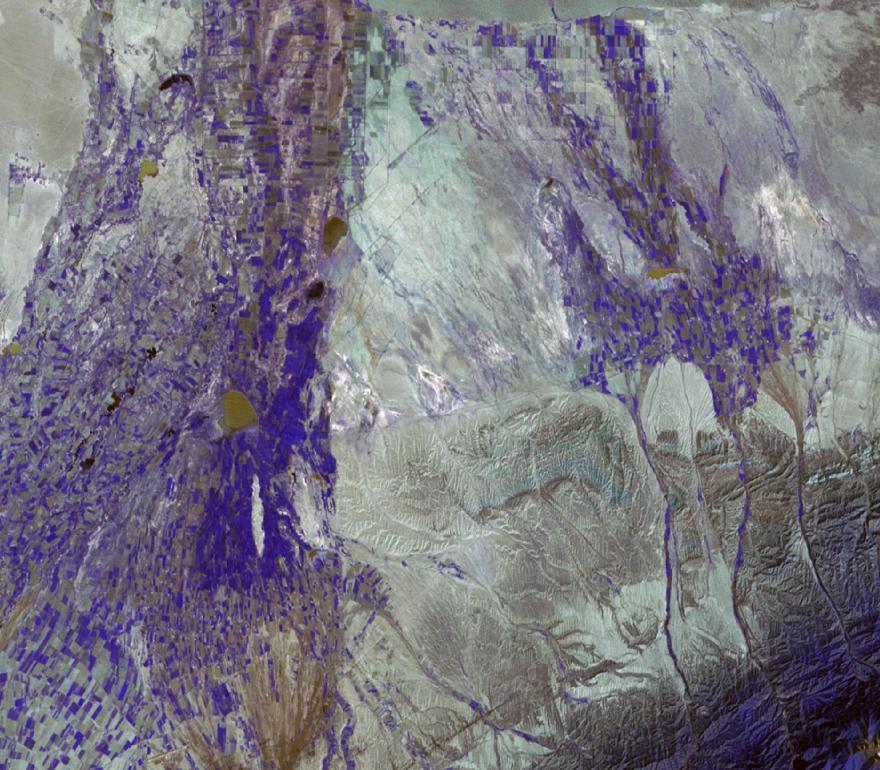
7 ~43º26 N,87º23'E

8
9 Continuing work Objective 2. Simulation of future LULC and regional climate changes, impact of climate change, and adaption and mitigation strategies 2a. Simulation of current and future LULC 2b. Regional climate simulation under IPCC scenarios 2c. Impact of climate change on cities 2d. Adaptation and mitigation strategies


10 Urumqi: Uncertainty via MODIS (MLCT) through RAMS MLCT

11 Objective 2a: Simulation of LULC Shanghai, Impervious surfaces 2000 => 2020


12 Urumqi LULC change simulation (simulated) (simulated)

13 Urumqi - understanding environmental change Modeling Climate Regional Atmospheric Modeling System (RAMS) 6.0 Preliminary results previous work shows region will experience higher temperatures changes in fractional vegetation cover - models show higher wind speeds may better disperse pollutants; may lead to better air quality Urumqi Multiple nested grids (2 and 8 km shown) of the RAMS model, and aggregated land cover classes Moore et al., AGU 2009


14 2c Impact of climate change on cities & 2d Adaptation and mitigation strategies Changing climate in Shanghai max temp increases , hotter summers min temp increases , warmer winters
 (L: 2000, R: 2008) change in intensity of thermal")

15 2c Impact of climate change on cities & 2d Adaptation and mitigation strategies ----Urban Heat Island in Shanghai Shanghai s urban thermal environment (unit: ) (L: 2000, R: 2008) change in intensity of thermal environment at the urban core spread of heat island effects to periphery Findings - leading factors contributing to the urban thermal environment land surface modification, landscape configuration anthropogenic heat release


16 Conclusions, so far Integrated system urbanization, LCLUC, urban environment change and climate change LCLUC: Urban sprawl ++ Different dynamics of different types of urban land urban China in a transitional economy: spatial policy + market forces Climate Change City level: Contribution of LCLUC to CC? Microclimate: significantly affected by landscape configuration Spatial policy plays a critical role ----Shanghai Urban Planning Museum, 03/2010

 Bin Zhao (Fudan")
17 Thank you! Acknowledgement Xi Chen (Geography and Ecology Institute, CAS, Urumqi) Guanghui Lv (Xinjiang University) Bin Zhao (Fudan University) Anxin Mei (East Normal University)
Joseph Messina Nathan Moore Jianjun Ge. Peilei Fan Researchers:
 Peilei Fan Researchers: Joseph Messina Nathan Moore Jianjun Ge Peilei Fan (Michigan State U) Joseph Messina (Michigan State U) Nathan Moore (Michigan State U) Jianjun Ge (Oklahoma State U) Peter Verburg,
Urbanization in China A synthesis of local and regional case studies on land cover change
 Urbanization in China A synthesis of local and regional case studies on land cover change Investigators: Annemarie Schneider (Wisconsin) Peilei Fan (Michigan State) Joseph Messina (Michigan State) Nathan
URBAN TRANSFORMATION AND ENVIRONMENTAL CHANGES OF TRANSITIONAL ECONOMIES: HANOI AFTER DOIMOI ( )
") URBAN TRANSFORMATION AND ENVIRONMENTAL CHANGES OF TRANSITIONAL ECONOMIES: HANOI AFTER DOIMOI (1986-2015) Peilei FAN a*, DUONG Nguyen Dinh b, HANG Nguyen Thi Thuy c, Zutao YANG a, Jiquan CHEN a a*, corresponding
URBAN TRANSFORMATION AND ENVIRONMENTAL CHANGES OF TRANSITIONAL ECONOMIES: HANOI AFTER DOIMOI (1986-2015) Peilei FAN a*, DUONG Nguyen Dinh b, HANG Nguyen Thi Thuy c, Zutao YANG a, Jiquan CHEN a a*, corresponding
INDIANA ACADEMIC STANDARDS FOR SOCIAL STUDIES, WORLD GEOGRAPHY. PAGE(S) WHERE TAUGHT (If submission is not a book, cite appropriate location(s))
 WHERE TAUGHT (If submission is not a book, cite appropriate location(s))") Prentice Hall: The Cultural Landscape, An Introduction to Human Geography 2002 Indiana Academic Standards for Social Studies, World Geography (Grades 9-12) STANDARD 1: THE WORLD IN SPATIAL TERMS Students
Prentice Hall: The Cultural Landscape, An Introduction to Human Geography 2002 Indiana Academic Standards for Social Studies, World Geography (Grades 9-12) STANDARD 1: THE WORLD IN SPATIAL TERMS Students
World Geography. WG.1.1 Explain Earth s grid system and be able to locate places using degrees of latitude and longitude.
 Standard 1: The World in Spatial Terms Students will use maps, globes, atlases, and grid-referenced technologies, such as remote sensing, Geographic Information Systems (GIS), and Global Positioning Systems
GRAAD 12 NATIONAL SENIOR CERTIFICATE GRADE 12
 GRAAD 12 NATIONAL SENIOR CERTIFICATE GRADE 12 GEOGRAPHY P1 FEBRUARY/MARCH 2013 MARKS: 300 TIME: 3 hours This question paper consists of 11 pages and a 12-page annexure. Geography/P1 2 DBE/Feb. Mar. 2013
The Influence of Historical and Projected Land Use and Land Cover Changes on Land Surface Hydrology and Regional Weather and Climate Variability
 The Influence of Historical and Projected Land Use and Land Cover Changes on Land Surface Hydrology and Regional Weather and Climate Variability Research Hypothesis: Land use and land cover changes are
West meets East: Monitoring and modeling urbanization in China Land Cover-Land Use Change Program Science Team Meeting April 3, 2012
 West meets East: Monitoring and modeling urbanization in China Land Cover-Land Use Change Program Science Team Meeting April 3, 2012 Annemarie Schneider Center for Sustainability and the Global Environment,
Dynamical downscaling of future climate change scenarios in urban heat island and its neighborhood in a Brazilian subtropical area
 Dynamical downscaling of future climate change scenarios in urban heat island and its neighborhood in a Brazilian subtropical area Marcos Vinicius Bueno de Morais, Viviana Vanesa Urbina Guerrero, Leila
UNIVERSITY OF NAIROBI COLLEGE OF HUMANITIES AND SOCIAL SCIENCES FACULTY OF ARTS & SCHOOL OF PHYSICAL SCIENCES
 UNIVERSITY OF NAIROBI COLLEGE OF HUMANITIES AND SOCIAL SCIENCES FACULTY OF ARTS & SCHOOL OF PHYSICAL SCIENCES Department of Geography and Environmental Studies TEACHING MODULE CGP/SGP 321: ECONOMIC GEOGRAPHY
A Case Study of Regional Dynamics of China 中国区域动态案例研究
 A Case Study of Regional Dynamics of China 中国区域动态案例研究 Shuming Bao Spatial Data Center & China Data Center University of Michigan 1:00 PM - 2:00 PM, Tue, Feb 6, 2018 EST USA A Case Study of Regional Dynamics
Urban Growth and Transportation Development Patterns for China s Urban Transition
 Urban Growth and Transportation Development Patterns for China s Urban Transition Qisheng Pan Professor and Chair, Department of Urban Planning and Environmental Policy, Texas Southern University President,
Tab.1 The matrix of each factor. xmax. ' xi. xmin
 59 ' xi xmin xi xmax xmin ' xmax xi xi xmax xmin x i x ' i xmaxxx min Tab.1 The matrix of each factor 60 Fig.1 Frequency distribution chart of main factors Fig.2 The level of transformation industrial
ZONING OF CLIMATE IN RIGA CITY
 ZONING OF CLIMATE IN RIGA CITY Anita Kalnina*, Marita Cekule**, Lita Lizuma* *Faculty of Geography and Earth Sciences, University of Latvia, Riga, Latvia ** Institute of Geodesy and Geoinformation, University
Applications of GIS and Remote Sensing for Analysis of Urban Heat Island
 Chuanxin Zhu Professor Peter V. August Professor Yeqiao Wang NRS 509 December 15, 2016 Applications of GIS and Remote Sensing for Analysis of Urban Heat Island Since the last century, the global mean surface
AP Human Geography. Course Outline Geography: Its Nature and Perspectives: Weeks 1-4
 AP Human Geography The Course The AP Human Geography course is designed to provide secondary students with the equivalent of one semester of a college introductory human geography class. The purpose of
Urban Growth in South China and Impacts on Local Precipitation, Fifth Urban Research Symposium 2009
 Urban Growth in South China and Impacts on Local Precipitation Karen C. Seto Associate Professor Yale University School of Forestry and Environmental Studies karen.seto@yale.edu Robert K. Kaufmann Professor
Year 11: Possible Extended Questions. 1. Using examples explain why it is difficult to predict future population growth.
 Year 11: Possible Extended Questions Population Dynamics 1. Using examples explain why it is difficult to predict future population growth. 2. Explain why the future growth of world population is hard
Modern Urban and Regional Economics
 Modern Urban and Regional Economics SECOND EDITION Philip McCann OXFORD UNIVERSITY PRESS Contents List of figures List of tables Introduction xii xiv xvii Part I Urban and Regional Economic Models and
Research Article A Quantitative Assessment of Surface Urban Heat Islands Using Satellite Multitemporal Data over Abeokuta, Nigeria
 International Atmospheric Sciences Volume 2016, Article ID 3170789, 6 pages http://dx.doi.org/10.1155/2016/3170789 Research Article A Quantitative Assessment of Surface Urban Heat Islands Using Satellite
World Geography Fall 2013 Semester Review Project
 Reporting Category RC 1: History, Government and Citizenship Standard WG.1 History. The student understands how geography and processes of spatial exchange (diffusion) influenced events in the past and
The footprint of urban heat island effect in China
 A discussion on the paper The footprint of urban heat island effect in China By Decheng Zhou, Shuqing Zhao, Liangxia Zhang, Ge Sun & Yongqiang Liu Published in SCIENCE REPORRTS Reporter: Mu Qingchen 2015.10.23
Geography - Grade 8. Unit A - Global Settlement: Patterns and Sustainability
 Geography - Grade 8 Geographical Thinking: Spatial Significance Patterns and Trends Interrelationships Geographic Perspective Geographic Inquiry: STEP 1 - Formulate Questions STEP 2 - Gather and Organize
Curriculum Unit. Instructional Unit #1
 Curriculum Unit Name of Course: AP Human Geography Grade Level(s): 9-12 Brief Description (Course Catalog): The purpose of the AP Human Geography course is to introduce students to the systematic study
Subject Area: Geography
 Long Term Planning Overview Key Stage 3 Subject Area: Geography Academic : 08-9 7 Assessment Your Island Home the physical and human geography of the UK and will investigate weather patterns, population
The Impact of Geography in South and East Asia
 The Impact of Geography in South and East Asia Gobi desert, Mongolia Essential Question: How does the geography of SE Asia impact trade and the distribution of population throughout the region? (AKS #52a)
Chapter 10: Location effects, economic geography and regional policy
 Chapter 10: Location effects, economic geography and regional policy the Community shall aim at reducing disparities between the levels of development of the various regions and the backwardness of the
Urbanization and globalization
 Urbanization and globalization Stuart H. Sweeney Department of Geography University of California, Santa Barbara Overview P/D/U/E in the news Urbanization processes (R/U) Settlement systems (single country,
9/19/2018. Dr. Hoch. RGPL 103 Global Cities: Planning and Development.
 Dr. Hoch RGPL 103 Global Cities: Planning and Development Dr. Hoch Email: rhoch@iup.edu 1 2 Earth s Orbit Around Sun Aphelion July 6 (12:00) Perihelion Jan 3 (00:00) EARTH 152.5 Million Km 147.5 Mil. Km
Answers to Saskatchewan Quizzes
 Answers to Saskatchewan Quizzes Test Your Knowledge What do you remember from your review of the Saskatchewan section of the E-Atlas? 1. Saskatchewan and Canada s sunniest city is a) Regina b) Saskatoon
Seaport Status, Access, and Regional Development in Indonesia
 Seaport Status, Access, and Regional Development in Indonesia Muhammad Halley Yudhistira Yusuf Sofiyandi Institute for Economic and Social Research (LPEM), Faculty of Economics and Business, University
Topic 4: Changing cities
 Topic 4: Changing cities Overview of urban patterns and processes 4.1 Urbanisation is a global process a. Contrasting trends in urbanisation over the last 50 years in different parts of the world (developed,
Spatio-temporal dynamics of the urban fringe landscapes
 Spatio-temporal dynamics of the urban fringe landscapes Yulia Grinblat 1, 2 1 The Porter School of Environmental Studies, Tel Aviv University 2 Department of Geography and Human Environment, Tel Aviv University
Desert Museum Trip. Urban Ecology. Saturday Nov 4 th 10 AM COS funds for admission and lunch w/ TRAD: Origins of Human Diversity
 Desert Museum Trip Saturday Nov 4 th 10 AM COS funds for admission and lunch w/ TRAD: Origins of Human Diversity Tuesdays 7PM (Oct 17) UA Centennial Hall http://cos.arizona.edu/climate/ Urban Ecology I.
Alleghany County Schools Curriculum Guide GRADE/COURSE: World Geography
 GRADE/COURSE: World 2013-14 GRADING PERIOD: 1 st Six Weeks Time Frame Unit/SOLs SOL # Strand Resource Assessment 8 days* The student will use maps, globes, satellite images, photographs, or diagrams to
Campus: VALLEY VIEW HIGH SCHOOL Content Area: Social Studies
 Campus: VALLEY VEW HGH SCHOOL : Map Name: Grading Period: 1 1A 21A 21B 21D 21E 22A 22B 22C 22D 3A 3B Description, TEKS Concept and Description analyze the effects of physical and human ggraphic patterns
CORRELATION BETWEEN URBAN HEAT ISLAND EFFECT AND THE THERMAL INERTIA USING ASTER DATA IN BEIJING, CHINA
 CORRELATION BETWEEN URBAN HEAT ISLAND EFFECT AND THE THERMAL INERTIA USING ASTER DATA IN BEIJING, CHINA Yurong CHEN a, *, Mingyi DU a, Rentao DONG b a School of Geomatics and Urban Information, Beijing
Tropical Climates Zone
 Tropical Climates Zone RAIN FOREST CENTRAL AFRICA, SOUTH AMERICA (AMAZON), CENTRAL AMERICA, S.E. ASIA HUMID/WARM ANNUAL RAINFALL 200 CM TYPE #1: TROPICAL DESERT N. AFRICA (SAHARA) & S.W. ASIA < 25 CM
DO WE NEED URBAN PARAMETERIZATION IN HIGH RESOLUTION SIMULATIONS?
 Charles University Faculty of Mathematics and Physics Dept. of Atmospheric Physics V Holešovičkách 2, Prague Czech Republic DO WE NEED URBAN PARAMETERIZATION IN HIGH RESOLUTION SIMULATIONS? Tomáš Halenka,
The Impact of Geography in South and East Asia
 The Impact of Geography in South and East Asia Gobi desert, Mongolia Essential Question: How does the geography of SE Asia impact trade and the distribution of population throughout the region? (AKS #52a)
Geography GCSE. Year 9 Term and Topic Unit Content Homework Opportunities
 Geography GCSE Year 9 Term and Topic Unit Content Homework Opportunities Autumn Term 1: Geographical Skills Autumn Term 2: Tectonic Hazards Spring Term 1: Ecosystems Rainforest Students are required to
Annex I to Target Area Assessments
 Baltic Challenges and Chances for local and regional development generated by Climate Change Annex I to Target Area Assessments Climate Change Support Material (Climate Change Scenarios) SWEDEN September
STUDY ON URBAN TEMPERATURE AND LAND-USE IN GUANGZHOU BASED ON RS AND GIS. Relationship of Urban heat island effect and land-use trends
 M. A. Schnabel (ed.), Cutting Edge: 47 th International Conference of the Architectural Science Association, pp. 301 310. 2013, The Architectural Science Association (ANZAScA), Australia STUDY ON URBAN
AP Human Geography Free Response Questions Categorized
 AP Human Geography Free Response Questions Categorized 2002-2010 2. Population (13-17%) 3. Over the past 150 years, Europe has changed from a source to a destination region for international migration.
GRASS COVER CHANGE MODEL BASED ON CELLULAR AUTOMATA
 GRASS COVER CHANGE MODEL BASED ON CELLULAR AUTOMATA Shuai Zhang *, Jingyin Zhao, Linyi Li Digital Agricultural Engineering Technological Research Center, Shanghai Academy of Agricultural Sciences, Shanghai,
Modelling of the Interaction Between Urban Sprawl and Agricultural Landscape Around Denizli City, Turkey
 Modelling of the Interaction Between Urban Sprawl and Agricultural Landscape Around Denizli City, Turkey Serhat Cengiz, Sevgi Gormus, Şermin Tagil srhtcengiz@gmail.com sevgigormus@gmail.com stagil@balikesir.edu.tr
Multi scale trend analysis for evaluating climatic and anthropogenic effects on the vegetated land surface in Russia
 Multi scale trend analysis for evaluating climatic and anthropogenic effects on the vegetated land surface in Russia Kirsten de Beurs kdebeurs@ou.edu The University of Oklahoma Virginia Tech Students:
The regional distribution characteristics of aerosol optical depth over the Tibetan Plateau
 The regional distribution characteristics of aerosol optical depth over the Tibetan Plateau C. Xu, Y. M. Ma, CAS Center for Excellence in Tibetan Plateau Earth Sciences, Chinese Academy of Sciences xuchao@itpcas.ac.cn
Belfairs Academy GEOGRAPHY Fundamentals Map
 YEAR 12 Fundamentals Unit 1 Contemporary Urban Places Urbanisation Urbanisation and its importance in human affairs. Global patterns of urbanisation since 1945. Urbanisation, suburbanisation, counter-urbanisation,
Coimisiún na Scrúduithe Stáit State Examinations Commission
 2008. M.24 Coimisiún na Scrúduithe Stáit State Examinations Commission LEAVING CERTIFICATE EXAMINATION, 2008 GEOGRAPHY HIGHER LEVEL FRIDAY, 6 JUNE AFTERNOON, 2.00 TO 4.50 Examination Number For the Examiner
Challenges around European cities
 Future Orientation for CIties (FOCI) Moritz Lennert IGEAT-ULB with ETC-LUSI, EUROREG, Géographie-Cités, IGUL, INRETS-LVMT, NTUA, TERSYN ESPON Seminar Malmö, 2 3 December2009 2/25 Challenges around European
European spatial policy and regionalised approaches
 Findings of the ESPON 2006 Programme COMMIN Final Conference 26-27 April 2007 European spatial policy and regionalised approaches by Dr. Kai BöhmeB ! Territory matters Structure of presentation! Territorial
STAAR Vocabulary Words extracted directly from the standard and/or associated with the instruction of the content within the standard.
 STAAR Vocabulary Words extracted directly from the standard and/or associated with the instruction of the content within the standard. READINESS STANDARDS - World Geography (WG.1) History. The student
Simulation studies for Lake Taihu effect on local meteorological environment. Ren Xia
 Simulation studies for Lake Taihu effect on local meteorological environment Ren Xia 2017.05.12 1 Outline Background Experimental design Result and discussion Next work Background Taihu Lake is the largest
Vocabulary. geography. landform. plateau. climate. equator. Lesson Main Ideas What do they think about? What questions do they ask?
 Grade 5 U.S. History Chapter 1: America's Land Lesson 1: Land and Climate Objectives 1. Geography: Describe landforms and other physical features of the United States. 2. Geography: Explain how and why
AP Human Geography Free-response Questions
 AP Human Geography Free-response Questions 2000-2010 2000-preliminary test 1. A student concludes from maps of world languages and religions that Western Europe has greater cultural diversity than the
China-U.S. Collaboration on Rapid Urbanization. Jonathan Fink Vice President for Research and Economic Affairs Arizona State University August, 2004
 China-U.S. Collaboration on Rapid Urbanization Jonathan Fink Vice President for Research and Economic Affairs Arizona State University August, 2004 Why have an urban system science research agenda? More
Spatio-Temporal Trends of Urban Heat Island and Surface Temperature in Izmir, Turkey
 American Journal of Remote Sensing 2017; 5(3): 24-29 http://www.sciencepublishinggroup.com/j/ajrs doi: 0.11648/j.ajrs.20170503.11 ISSN: 2328-5788 (Print); ISSN: 2328-580X (Online) Spatio-Temporal Trends
Together towards a Sustainable Urban Agenda
 Together towards a Sustainable Urban Agenda The City We (Youth) Want Preliminary findings from youth consultations Areas Issue Papers Policy Units 1.Social Cohesion and Equity - Livable Cities 2.Urban
Future Climate Change
 Future Climate Change How do you know whether to trust a prediction about the future? All predictions are based on global circulation models (GCMs, AOGCMs) - model accuracy is verified by its ability to
AAG CENTER FOR GLOBAL GEOGRAPHY EDUCATION Internationalizing the Teaching and Learning of Geography
 Using the CGGE Materials in Advanced Placement Human Geography Classes About the CGGE: The AAG Center for Global Geography Education (CGGE) is a collection of online modules for undergraduate courses in
(2011)
") 31 10 Vol.31 No. 10 2011 10 ECONOMIC GEOGRAPHY Oct. 2011 1000-8462(2011)10-1610 - 08 1 2 1. 100048 2. 100101 1990, K901.2 A 1 1990 [1] 21 [12] [2] 1990 [3] 1990 2009 2 733.6 [4] [5] [6-7] [8-11] 2011-05
31 10 Vol.31 No. 10 2011 10 ECONOMIC GEOGRAPHY Oct. 2011 1000-8462(2011)10-1610 - 08 1 2 1. 100048 2. 100101 1990, K901.2 A 1 1990 [1] 21 [12] [2] 1990 [3] 1990 2009 2 733.6 [4] [5] [6-7] [8-11] 2011-05
A Constrained CA Model to Simulate Urban Growth of the Tokyo Metropolitan Area
 A Constrained CA Model to Simulate Urban Growth of the Tokyo Metropolitan Area Yaolong Zhao 1, 2, Yuji Murayama 2 1 Faculty of Land Resource Engineering, Kunming University of Science and Technology, Kunming,
Content Area: Social Studies Standard: 1. History Prepared Graduates: Develop an understanding of how people view, construct, and interpret history
 Standard: 1. History Develop an understanding of how people view, construct, and interpret history 1. Organize and sequence events to understand the concepts of chronology and cause and effect in the history
Spatial Disparities and Development Policy in the Philippines
 Spatial Disparities and Development Policy in the Philippines Arsenio M. Balisacan University of the Philipppines Diliman & SEARCA Email: arsenio.balisacan@up.edu.ph World Development Report 2009 (Reshaping
TOWARDS STRATEGIC SPATIAL PLANNING IN JAMAICA: THE NATIONAL SPATIAL PLAN
 TOWARDS STRATEGIC SPATIAL PLANNING IN JAMAICA: THE NATIONAL SPATIAL PLAN JIEP 5th Biennial Conference on the Environment: Balancing National Development and Environmental Protection June 6, 2011 Jamaica
LOUISIANA STUDENT STANDARDS FOR SOCIAL STUDIES THAT CORRELATE WITH A FIELD TRIP TO DESTREHAN PLANTATION KINDERGARTEN
 LOUISIANA STUDENT STANDARDS FOR SOCIAL STUDIES THAT CORRELATE WITH A FIELD TRIP TO DESTREHAN PLANTATION KINDERGARTEN Standard 2 Historical Thinking Skills Students distinguish between events, people, and
WORLD GEOGRAPHY INSTRUCTIONAL PACING GUIDE
 FIRST NINE WEEKS Standard USHC-1 Standard WG-1: The student will demonstrate an understanding of the physical and human characteristics of places, including the creation of regions and the ways that culture
Analysis of Industrialization, Urbanization and Land-use Change in East Asia According to the DPSER Framework
 1 Analysis of Industrialization, Urbanization and Land-use Change in East Asia According to the DPSER Framework Hidefumi IMURA*, Jin CHEN*, Shinji KANEKO** and Toru MATSUMOTO* * Institute of Environmental
NATIONAL SENIOR CERTIFICATE GRADE 12
 NATIONAL SENIOR CERTIFICATE GRADE 12 GEOGRAPHY P1 FEBRUARY/MARCH 2015 MARKS: 225 TIME: 3 hours This question paper consists of 12 pages and an annexure of 12 pages. *GEOGE1* Geography/P1 2 INSTRUCTIONS
Use of climate reanalysis for EEA climate change assessment. Blaz Kurnik. European Environment Agency (EEA)
") Use of climate reanalysis for EEA climate change assessment Blaz Kurnik European Environment Agency (EEA) 2016: EEA content priorities Circular economy Climate and Energy Sustainable Development Goals
Use of climate reanalysis for EEA climate change assessment Blaz Kurnik European Environment Agency (EEA) 2016: EEA content priorities Circular economy Climate and Energy Sustainable Development Goals
Considerations of Urban Design and Microclimate in Historical Buildings Environment under Climate Change
 Considerations of Urban Design and Microclimate in Historical Buildings Environment under Climate Change Research team: Dr. Esther H.K. Yung, Mr. Z.N. Tan, Dr. C.K. Chau, Prof. Edwin, H.W. Chan Department
Jiquan Chen The LEES Lab, CGCEO/Geography Michigan State University
 Policy Shifts Influence the Functional Changes of the CNH Systems on Mongolian Plateau Jiquan Chen The LEES Lab, CGCEO/Geography Michigan State University Team members: Dan Brown, Ranjeet John, Changliang
First steps toward a comparison of modelled thermal comfort during a heatwave in Melbourne, Australia
 First steps toward a comparison of modelled thermal comfort during a heatwave in Melbourne, Australia Stephanie Jacobs PhD supervisors: Ailie Gallant and Nigel Tapper Outline of talk Motivation for research
Johns Hopkins University Fall APPLIED ECONOMICS Regional Economics
 Johns Hopkins University Fall 2017 Applied Economics Sally Kwak APPLIED ECONOMICS 440.666 Regional Economics In this course, we will develop a coherent framework of theories and models in the field of
Arizona Educator Proficiency Assessments (AEPA ) FIELD 04: GEOGRAPHY TEST OBJECTIVES
 FIELD 04: GEOGRAPHY TEST OBJECTIVES") Arizona Educator Proficiency Assessments (AEPA ) TEST OBJECTIVES Subarea Range of Objectives Approximate Test Proportions I. Geographic Concepts and Skills 1 6 25% II. World Geography 7 14 34% III. United
Arizona Educator Proficiency Assessments (AEPA ) TEST OBJECTIVES Subarea Range of Objectives Approximate Test Proportions I. Geographic Concepts and Skills 1 6 25% II. World Geography 7 14 34% III. United
Measuring Disaster Risk for Urban areas in Asia-Pacific
 Measuring Disaster Risk for Urban areas in Asia-Pacific Acknowledgement: Trevor Clifford, Intl Consultant 1 SDG 11 Make cities and human settlements inclusive, safe, resilient and sustainable 11.1: By
Chapter 3: Temperature
 Chapter 3: Temperature Elements of WAC (Basic Measurable Properties) 1. Temperature of Air 2. Humidity of Air 3. Cloud Cover (type and amount) 4. Precipitation (type and amount) 5. Air Pressure 6. Wind
HYDERABAD STUDY CIRCLE CIVILS PRELIMS (GS) - TEST SERIES SCHEDULE Ancient India I
 - TEST SERIES SCHEDULE Ancient India I") HYDERABAD STUDY CIRCLE CIVILS PRELIMS (GS) - TEST SERIES SCHEDULE 2018 Date No. 24-02-2018-1 Geography - I India location, Size Structure and Physiography Drainage system + map Pointing (India) Ancient
HYDERABAD STUDY CIRCLE CIVILS PRELIMS (GS) - TEST SERIES SCHEDULE 2018 Date No. 24-02-2018-1 Geography - I India location, Size Structure and Physiography Drainage system + map Pointing (India) Ancient
6. State two factors and explain how each influences the weather in Ohio. Respond in the space provided in your Answer Document.
 6. State two factors and explain how each influences the weather in Ohio. Respond in the space provided in your Answer Document. (4 points) Sample Response for Item 6 (Extended Response): Other Correct
Climate changes in Finland, but how? Jouni Räisänen Department of Physics, University of Helsinki
 Climate changes in Finland, but how? Jouni Räisänen Department of Physics, University of Helsinki 19.9.2012 Outline Some basic questions and answers about climate change How are projections of climate
DEFINING AND MEASURING WORLD-METRO REGIONS FOR INTERNATIONAL COMPARISONS
 DEFINING AND MEASURING WORLD-METRO REGIONS FOR INTERNATIONAL COMPARISONS Mario Piacentini, OECD 27th Scorus Conference, 11-13 August 2010, Latvia Why we need comparable measures of city performance Growing
FROM INDUSTRY DEPENDENT URBAN AGGLOMERATION TO CONTEMPORARY METROPOLITAN AREA TOWARDS THE RENEWED LISBON STRATEGY
 FROM INDUSTRY DEPENDENT URBAN AGGLOMERATION TO CONTEMPORARY METROPOLITAN AREA TOWARDS THE RENEWED LISBON STRATEGY Tomasz Sławiński - architect Deputy Director Mazovian Office for Spatial Planning and Regional
Millennium Ecosystem Assessment
 Millennium Ecosystem Assessment Global Data Challenges from an MA perspective Global Spatial Data and Information User Workshop 21-23 September 2004! What is the MA?! How and what kinds of data does it
SYLLABUS. Credits: 3 Lecture Hours: 3 Lab/Studio Hours:
 Code: ANTH 125 Title: Introduction to Human Ecology Institute: Business and Social Science Department: Anthropology, Human Geography, and Sociology Course Description: Human Ecology is the bridge between
Critical review of the Climate Change Impact on urban areas by assessment of Heat Island effect
 Critical review of the Climate Change Impact on urban areas by assessment of Heat Island effect Case of Pune, India Town Planning, Civil Department Prof. Omkar Parishwad, ogp.civil@coep.ac.in Climate Change
Global warming and Extremes of Weather. Prof. Richard Allan, Department of Meteorology University of Reading
 Global warming and Extremes of Weather Prof. Richard Allan, Department of Meteorology University of Reading Extreme weather climate change Recent extreme weather focusses debate on climate change Can we
Approach of Estimating Tsunami Economic Losses in The. Okinawa Island with Scenario-based of Input-Output Table. and Okinawa Earthquake Sources
 ORIGINAL ARTICLE Approach of Estimating Tsunami Economic Losses in The Okinawa Island with Scenario-based of Input-Output Table and Okinawa Earthquake Sources Kwanchai Pakoksung 1*, Anawat Suppasri 1,
Domestic trade impacts of the expansion of the National Expressway Network in China
 Domestic trade impacts of the expansion of the National Expressway Network in China Chris Bennett, Piet Buys, Wenling Chen, Uwe Deichmann and Aurelio Menendez World Bank EASTE & DECRG Draft June 26, 2007
Context: How does a climate model work?
 www.atmosphere.mpg.de/enid/accenten > Nr. 7 March 2006 > C: Context 1 Context: How does a climate model work? Key words: modelling, scenarios, climate parameters, grid, physical formula Introduction The
Historical and Projected Future Climate Changes in the Great Lakes Region
 Historical and Projected Future Climate Changes in the Great Lakes Region B.J. Baule Great Lakes Integrates Sciences + Assessments University of Michigan Jeffrey A. Andresen Dept. of Geography Michigan
Unit 8 Settlement Geography: Urban and Rural, Cities and City Life
 Unit 8 Settlement Geography: Urban and Rural, Cities and City Life 38:180 Human Geography Settlement Geography Principally urban, but a continuum: Hamlet Village Town City plus rural World is predominantly
Integrated Land Use and Transportation Planning based on Resource and Environmental Constraints: a Case Study on Luohe City in China
 Integrated Land Use and Transportation Planning based on Resource and Environmental Constraints: a Case Study on Luohe City in China Hailong Su, Yi Wang*, Yinghui Tan and Rui Zhou Research Center for Urban
Peoples, Places and Cultures in Africa, Asia and the Southwest Pacific
 GRADE 7 Peoples, Places and Cultures in Africa, Asia and the Southwest Pacific Course 0470-07 Students in seventh grade explore the history, geography, government, economic systems, current issues, and
Department of Geography: Vivekananda College for Women. Barisha, Kolkata-8. Syllabus of Post graduate Course in Geography
 India: Regional Problems and Resource management Module 11 (Full Marks 50) Unit I: Region and Regionalisation 1.1 Various bases of regionalisation of India; problems of identification and delineation.
Geography. Geography A. Curriculum Planner and Skills Mapping Grid GCSE Version 1 October 2012
 Geography GCSE 2012 Geography A Curriculum Planner and Skills Mapping Grid Version 1 October 2012 www.ocr.org.uk/gcse2012 Year 10 Exam work Controlled Assessment Autumn 1 Autumn 2 Spring 1 Spring 2 Summer
Historical and Projected Future Climatic Trends in the Great Lakes Region
 Historical and Projected Future Climatic Trends in the Great Lakes Region Jeffrey A. Andresen Dept. of Geography, Environment, and Spatial Sciences Michigan State University Outline Historical Trends Climatic
The international patterns of spatial planning system and choice of China. Cai yumei China land use planning and surveying institute (China, beijing)
") FIG Working Week, Rome, Italy 6 10 May 2012 The international patterns of spatial system and choice of China Cai yumei China land use and surveying institute (China, beijing) Outline Background Problem
FIG Working Week, Rome, Italy 6 10 May 2012 The international patterns of spatial system and choice of China Cai yumei China land use and surveying institute (China, beijing) Outline Background Problem
World Geography Mid Term Review 2016
 World Geography Mid Term Review 2016 1.Latitude and Longitude Lines of latitude run and. The zero-degree line is the. Line of longitude run and. The zero degree line is called the. 2. Map Projections What
Spatial Dimensions of Growth and Urbanization: Facts, Theories and Polices for Development
 Spatial Dimensions of Growth and Urbanization: Facts, Theories and Polices for Development Sukkoo Kim Washington University in St. Louis and NBER March 2007 Growth and Spatial Inequality Does growth cause