Multi scale trend analysis for evaluating climatic and anthropogenic effects on the vegetated land surface in Russia
|
|
|
- Elfreda Russell
- 6 years ago
- Views:
Transcription


1 Multi scale trend analysis for evaluating climatic and anthropogenic effects on the vegetated land surface in Russia Kirsten de Beurs The University of Oklahoma Virginia Tech Students: Ioannis Kokkinidis Semiha Caliskan With: Dr. Grigory Ioffe, Radford University Tatyana Nefedova, Institute of Geography, Moscow and Dr. Geoffrey Henebry, South Dakota State University
2 Overview Coarse scale analysis: climatic effects Atmospheric Oscillations Vegetation trend Moderate scale analysis: climate & human impacts Fine scale analysis: human impacts

3 de Beurs, K.M., and G.M. Henebry Northern Annular Mode effects on the land surface phenologies of Northern Eurasia. Journal of Climate 21: Rank NDVI correlation data: GIMMS between AVHRR timing of the peak Correlation: of the growing season and winter AO. AGDD data: NCEP NCAR reanalysis Peak timing x AO index Two data principal (2 x 2 spatial hotspots resolution) with significant strong positive correlations &


4 NDVI data: MODIS BRDF AGDD data: created based on MODIS Land Surface Temperature data Please note the color differences!! Rank correlation between NDVI peak timing and summer AO. Analysis based on MODIS data from Encouraging results: despite different datasets and different time periods studied similar correlation patterns. Pattern only deviates in far eastern Russia de Beurs, K.M., Henebry, G.M., A land surface phenology assessment of the northern polar regions using MODIS reflectance time series. Canadian Journal of Remote Sensing, v36, s1, p

5 Multi scale trend analysis for evaluating climatic and anthropogenic effects on the vegetated land surface in Eurasia
. de Beurs, K.M., Wright. C.K., Henebry, G.M. 2009.")
6 To guard against spurious trends, we present only highly significant trends having a p-value of less than We found significant negative trends in 6.1% of the study region ( km 2 ). Highly significant positive trends appeared in only 2.4% of the study area ( km 2 ). de Beurs, K.M., Wright. C.K., Henebry, G.M Dual scale trend analysis distinguishes climatic from anthropogenic effects on the vegetated land surface. Environmental Research Letters, 4,

7 Investigate changes in more detail: 500m MODIS data
8 500m Trend Results Dusting of positive (green) and negative (orange) trends.
 NDVI trends Patches of positive")
9 5.6 km (0.05 ) NDVI trends Patches of positive and negative trends are visible
10 500m NDVI trends Patches of trends disappear and are replaced by dustings.

11 500m trends can easily be related to land cover classes. Yellow outlines: positive trend Underlying image: Landsat TM 30m

12 Widespread negative trends are related to drought conditions. We believe that the positive trends are predominantly related to land cover changes: land abandonment

13 Preliminary Results from field visit May June 2010

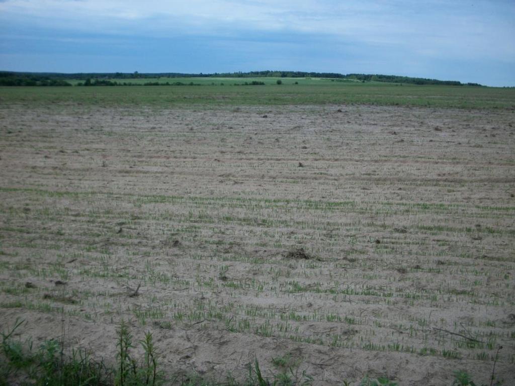
14 Kostroma Samara
15 Regional Scale Heterogeneity Socio-economic analysis Agricultural development for Russia since 2000 reveals large heterogeneity. Rural populations changes are apparent but not negative everywhere and the change rates differ starkly. Changes are not uniform with respect to both crop and livestock developments.


16 Kostroma Lots of abandonment. Many villages are abandoned completely. Others have only a few elderly people left.

17 Kostroma Positive Trend
 5 th + 6 th order neighbors (periphery) 7 th 9 th order neighbors (far periphery).")
18 We grouped the administrative districts by distance from the city. Suburb 2 nd order neighbors (semi-suburbia, Russian style). 3 rd + 4 th order neighbors (semi-periphery) 5 th + 6 th order neighbors (periphery) 7 th 9 th order neighbors (far periphery). Makarievsky and Kologrivsky rayons (periphery) and Manturovsky rayon (far pheriphery) were examined in detail in summer (Nefedova, 2006).
19 In the suburbs the rural population almost did not change since 1950 and in recent years even increased. All other areas are characterized by strong declines with maximum steepness between
20 : Increasing sown areas despite declining population. This only worked well in the suburbs, in the periphery, 100% was never reached. Since 2000: Population in the suburbs has stabilized. Seed dynamics are negative. Periphery population and sowing declined drastically.
21 Kostroma Kostroma city has a population of 270 thousand people and is the only city with a population of more than 100 thousand people. Suburban-peripheral contrasts in population and agricultural economy. Strong differences between the centers (with the zone of influence) and periphery regions The zone of influence of cities in rural areas depends on its population size. (Ioffe, 1990, Nefedova, 2003, Ioffe et al., 2007).

22 Agricultural lands occupy 67% of the territory and arable lands 51%. Samara Agriculture employs roughly 615,000 people. Samara is one of the main grain providers. Relatively favorable natural conditions, but periodic droughts especially in the southern regions.
23 Samara population dynamics Loss of rural population in the twentieth century was far lower than in other areas. By 2009, Samara retained 72% of the rural population of 1959 (Kostroma only retained 40%). In the 1990's Samara region was very attractive to migrants. The maximum inflow in the countryside was in : net migration was 152 people / 10,000 rural population. Migration contributed to the rural population being relatively young, active and easily adapting to changing conditions.
24 Samara Agriculture Since 1997, agriculture is growing (except in 1998). Agriculture area is gradually emerging from the crisis, but it is changing its sectoral and territorial structure. There was a clear shift from livestock to crop farming: the proportion of crop growing in the Samara region rose from 41% in 1991 to 60% in cattle loss from 1,012,000 to 212,000

25 Samara Negative Trend Positive Trend


26 Contrast in ethnic make-up is important: In some areas (mainly northeast), the share of the Russian population is less than half. Highest percentage of Chuvash population and increased proportions of Mordvin and Tatar. In the southern steppes, ethnic Russians predominate, but in some areas there is an increased share of Bashkir and Kazakh.

.")
27 Samara Drought is the main issue. Commercial cattle almost completely disappeared (production costs = sales price). Crop farming appears to grow (slowly). Crops are changing.
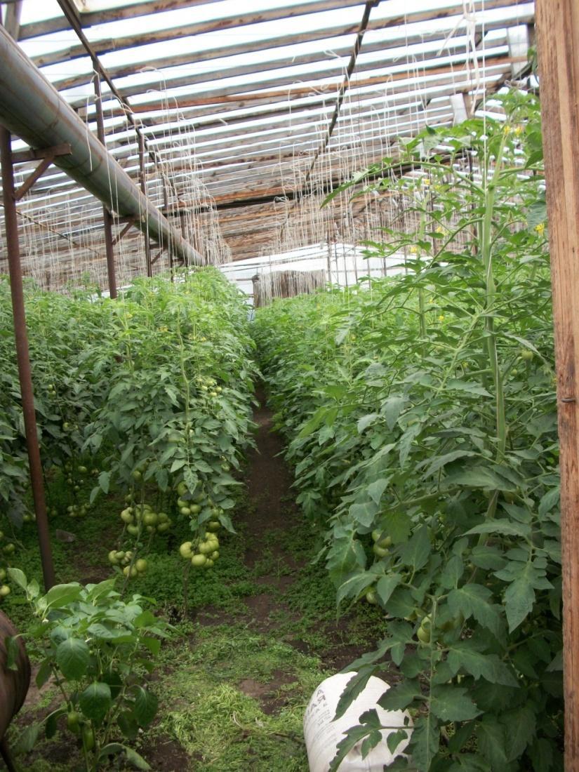

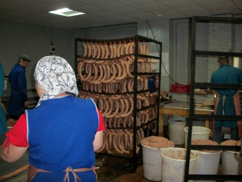
28 Entrepreneurs are active in various areas
29 Conclusions
30 Global Change is an ongoing multifacted phenomenon Change is evident in a range of different changes across the land surface. Over the last two decades, plant responses to climate change appeared somewhat straightforward: increasing temperatures increasing vegetation productivity and longer growing seasons. Recently, reversal of vegetation productivity: increases in disturbance exacerbated by climate change. More than 3 times as many negative NDVI changes than positive NDVI changes since 2000.
31 Dual scale analysis uncovers multiple trends that would be impossible to reveal at a single scale: Finer scale analysis reveals trends that are more relevant to human decision-making and regional economics. Fine scale changes may disappear at the courser scale resolution as a result of mixed pixels. It would NOT be right to argue that these finer scale changes are not relevant or significant.
32 Russia Land Abandonment Russia is often treated as a unified whole, especially with respect to agricultural reform large regional diversity exists. Land abandonment is not occurring randomly or unexpectedly it is preceded by persistently low crop yields declining rural population density.

33 Thank You! Kirsten de Beurs Department of Geography The University of Oklahoma
Environmental Changes, Migration, and Remittances Affect Pastoralist Communities in Montane Central Asia
 Environmental Changes, Migration, and Remittances Affect Pastoralist Communities in Montane Central Asia Geoffrey M. Henebry * Hannah Visiting Professor Center for Global Change & Earth Observations &
DROUGHT ASSESSMENT USING SATELLITE DERIVED METEOROLOGICAL PARAMETERS AND NDVI IN POTOHAR REGION
 DROUGHT ASSESSMENT USING SATELLITE DERIVED METEOROLOGICAL PARAMETERS AND NDVI IN POTOHAR REGION Researcher: Saad-ul-Haque Supervisor: Dr. Badar Ghauri Department of RS & GISc Institute of Space Technology
AP Human Geography Free-response Questions
 AP Human Geography Free-response Questions 2000-2010 2000-preliminary test 1. A student concludes from maps of world languages and religions that Western Europe has greater cultural diversity than the
Reanalysis data underestimate significant changes in growing season weather in Kazakhstan
 Environmental Research Letters Reanalysis data underestimate significant changes in growing season weather in Kazakhstan To cite this article: 2009 Environ. Res. Lett. 4 045020 View the article online
APPENDIX. Normalized Difference Vegetation Index (NDVI) from MODIS data
 from MODIS data") APPENDIX Land-use/land-cover composition of Apulia region Overall, more than 82% of Apulia contains agro-ecosystems (Figure ). The northern and somewhat the central part of the region include arable lands
APPENDIX Land-use/land-cover composition of Apulia region Overall, more than 82% of Apulia contains agro-ecosystems (Figure ). The northern and somewhat the central part of the region include arable lands
Data Fusion and Multi-Resolution Data
 Data Fusion and Multi-Resolution Data Nature.com www.museevirtuel-virtualmuseum.ca www.srs.fs.usda.gov Meredith Gartner 3/7/14 Data fusion and multi-resolution data Dark and Bram MAUP and raster data Hilker
Greening of Arctic: Knowledge and Uncertainties
 Greening of Arctic: Knowledge and Uncertainties Jiong Jia, Hesong Wang Chinese Academy of Science jiong@tea.ac.cn Howie Epstein Skip Walker Moscow, January 28, 2008 Global Warming and Its Impact IMPACTS
Using land surface phenology for spatio-temporal. temporal mining of image time series: a manifesto
 Using land surface phenology for spatio-temporal temporal mining of image time series: a manifesto Geoffrey M. Henebry Kirsten M. de Beurs Geographic Information Science Center of Excellence (GIScCE( GIScCE)
Advanced Placement Human Geography
 Advanced Placement Human Geography Introduction to AP Human Geography The Advanced Placement course in Human Geography is designed to introduce students to the systematic study of the processes that have
Dust Storms of the Canadian Prairies: A Dustier and Muddier Outlook
 Dust Storms of the Canadian Prairies: A Dustier and Muddier Outlook E Wheaton, University of Saskatchewan and Saskatchewan Research Council, and V Wittrock, Saskatchewan Research Council Invited presentation
AGOG 485/585 /APLN 533 Spring Lecture 5: MODIS land cover product (MCD12Q1). Additional sources of MODIS data
. Additional sources of MODIS data") AGOG 485/585 /APLN 533 Spring 2019 Lecture 5: MODIS land cover product (MCD12Q1). Additional sources of MODIS data Outline Current status of land cover products Overview of the MCD12Q1 algorithm Mapping
AGOG 485/585 /APLN 533 Spring 2019 Lecture 5: MODIS land cover product (MCD12Q1). Additional sources of MODIS data Outline Current status of land cover products Overview of the MCD12Q1 algorithm Mapping
Understanding and Measuring Urban Expansion
 VOLUME 1: AREAS AND DENSITIES 21 CHAPTER 3 Understanding and Measuring Urban Expansion THE CLASSIFICATION OF SATELLITE IMAGERY The maps of the urban extent of cities in the global sample were created using
Climate Change and Vegetation Phenology
 Climate Change and Vegetation Phenology Climate Change In the Northeastern US mean annual temperature increased 0.7 C over 30 years (0.26 C per decade) Expected another 2-6 C over next century (Ollinger,
It is clearly necessary to introduce some of the difficulties of defining rural and
 UNIT 2 CHANGING HUMAN ENVIRONMENTS G2 Theme 2 Investigating Settlement Change in MEDCs 2.1 What are the distinctive features of settlements? It is clearly necessary to introduce some of the difficulties
Ganbat.B, Agro meteorology Section
 NATIONAL AGENCY FOR METEOROLOGY, HYDROLOGY AND ENVIRONMENT MONITORING OF MONGOLIA Ganbat.B, Agro meteorology Section OF INSTITUTE OF METEOROLOGY AND HYDROLOGY 2009 YEAR Location Climate Northern Asia,
VISUALIZATION URBAN SPATIAL GROWTH OF DESERT CITIES FROM SATELLITE IMAGERY: A PRELIMINARY STUDY
 CO-439 VISUALIZATION URBAN SPATIAL GROWTH OF DESERT CITIES FROM SATELLITE IMAGERY: A PRELIMINARY STUDY YANG X. Florida State University, TALLAHASSEE, FLORIDA, UNITED STATES ABSTRACT Desert cities, particularly
European spatial policy and regionalised approaches
 Findings of the ESPON 2006 Programme COMMIN Final Conference 26-27 April 2007 European spatial policy and regionalised approaches by Dr. Kai BöhmeB ! Territory matters Structure of presentation! Territorial
Arizona Drought Monitoring Sensitivity and Verification Analyses
 Arizona Drought Monitoring Sensitivity and Verification Analyses A Water Sustainability Institute, Technology and Research Initiative Fund Project Christopher L. Castro, Francina Dominguez, Stephen Bieda
Monthly Overview. Rainfall
 Monthly Overview Rainfall during August occurred mainly over the Western and Eastern Cape provinces, and KwaZulu- Natal. Rain in these provinces were regularly accompanied by cold fronts as they made landfall
Re-assembling Rural Places in the Global Countryside
 Re-imagining Rurality Conference, University of Westminster, 27-28 February 2015 Re-assembling Rural Places in the Global Countryside Michael Woods Aberystwyth University m.woods@aber.ac.uk @globalrural
East Africa The 2015 Season (Long Rains)
") East Africa The 2015 Season (Long Rains) EAST AFRICA SEASONAL ANALYSIS - 2015 HIGHLIGHTS During March 2015, the early stages of the long rains ( Gu ) season, pronounced rainfall deficits were the norm
East Africa The 2015 Season (Long Rains) EAST AFRICA SEASONAL ANALYSIS - 2015 HIGHLIGHTS During March 2015, the early stages of the long rains ( Gu ) season, pronounced rainfall deficits were the norm
Monthly overview. Rainfall
 Monthly overview 1 to 10 April 2018 Widespread rainfall continued to fall over most parts of the summer rainfall region during this period. Unseasonably good rain fell over the eastern half of the Northern
Lecture Topics. 1. Vegetation Indices 2. Global NDVI data sets 3. Analysis of temporal NDVI trends
 Lecture Topics 1. Vegetation Indices 2. Global NDVI data sets 3. Analysis of temporal NDVI trends Why use NDVI? Normalize external effects of sun angle, viewing angle, and atmospheric effects Normalize
Projecting Urban Land Cover on the basis of Population
 Projecting Urban Land Cover on the basis of Population Dan Miller Runfola Postdoctoral Researcher National Center for Atmospheric Research CGD & RAL CU:Boulder Institute of Behavioral Science 1 The Challenge
Perspectives on the Medieval Warm Period and the Little Ice Age. By Matt King
 Perspectives on the Medieval Warm Period and the Little Ice Age By Matt King Sources of Evidence Many different types of evidence Ice cores Human temperature documentation Food prices Tree rings Primary
Topic 4: Changing cities
 Topic 4: Changing cities Overview of urban patterns and processes 4.1 Urbanisation is a global process a. Contrasting trends in urbanisation over the last 50 years in different parts of the world (developed,
UNIVERSITY OF CAMBRIDGE INTERNATIONAL EXAMINATIONS International General Certificate of Secondary Education GEOGRAPHY 0460/01
 UNIVERSITY OF CAMBRIDGE INTERNATIONAL EXAMINATIONS International General Certificate of Secondary Education GEOGRAPHY 0460/01 Paper 1 Additional Materials: Answer Booklet/Paper; Ruler May/June 2005 1 hour
Chapter outline. Reference 12/13/2016
 Chapter 2. observation CC EST 5103 Climate Change Science Rezaul Karim Environmental Science & Technology Jessore University of science & Technology Chapter outline Temperature in the instrumental record
The geography of domestic energy consumption
 The geography of domestic energy consumption Anastasia Ushakova PhD student at CDRC UCL Ellen Talbot PhD student at CDRC Liverpool Some important research questions How can we classify energy consumption
Assessing Drought in Agricultural Area of central U.S. with the MODIS sensor
 Assessing Drought in Agricultural Area of central U.S. with the MODIS sensor Di Wu George Mason University Oct 17 th, 2012 Introduction: Drought is one of the major natural hazards which has devastating
The Physical Geographical Change of the Great Plains during the Dust Bowl (1930 s)
") The Physical Geographical Change of the Great Plains during the Dust Bowl (1930 s) Overview: This lesson shows how the Dust Bowl climate changed the physical geography of the Great Plains and forced the
The Physical Geographical Change of the Great Plains during the Dust Bowl (1930 s) Overview: This lesson shows how the Dust Bowl climate changed the physical geography of the Great Plains and forced the
REMOTELY SENSED INFORMATION FOR CROP MONITORING AND FOOD SECURITY
 LEARNING OBJECTIVES Lesson 4 Methods and Analysis 2: Rainfall and NDVI Seasonal Graphs At the end of the lesson, you will be able to: understand seasonal graphs for rainfall and NDVI; describe the concept
Understanding the role of land cover / land use nexus in malaria transmission under changing socio-economic climate in Myanmar
 Annual Report for Year 1 June, 2017 January, 2018 NASA Land Cover Land Use Change Program Funded under grant # NNX17AI06G: Understanding the role of land cover / land use nexus in malaria transmission
Summary and Implications for Policy
 Summary and Implications for Policy 1 Introduction This is the report on a background study for the National Spatial Strategy (NSS) regarding the Irish Rural Structure. The main objective of the study
Explain the impact of location, climate, natural resources, and population distribution on Europe. a. Compare how the location, climate, and natural
 SS6G10 Explain the impact of location, climate, natural resources, and population distribution on Europe. a. Compare how the location, climate, and natural resources of Germany, the United Kingdom and
1. INTRODUCTION 2. HIGHLIGHTS
 Bulletin Issue January 2017 Issue Number: ICPAC/03/44 IGAD Climate Prediction and Applications Centre Seasonal Bulletin, Review for October to December (OND) Season 2016 For referencing within this bulletin,
THE GEOGRAPHICAL ANALYSIS OF THE TRANS-BOUNDARY TERRITORY (PRIMORSKII AND KHABAROVSKII KRAIS OF RUSSIA HEILONGJIANG PROVINCE OF CHINA)
") THE GEOGRAPHICAL ANALYSIS OF THE TRANS-BOUNDARY TERRITORY (PRIMORSKII AND KHABAROVSKII KRAIS OF RUSSIA HEILONGJIANG PROVINCE OF CHINA) MISHINA NATALIA V. Pacific Geographical Institute, Far Eastern Branch
THE GEOGRAPHICAL ANALYSIS OF THE TRANS-BOUNDARY TERRITORY (PRIMORSKII AND KHABAROVSKII KRAIS OF RUSSIA HEILONGJIANG PROVINCE OF CHINA) MISHINA NATALIA V. Pacific Geographical Institute, Far Eastern Branch
Minnesota K-12 Academic Standards in Social Studies. Grade 4: Geography of North America
 Minnesota K-12 Academic s in Social Studies Grade 4: Geography of North America 4 Describe how people take 1. Democratic government action to influence a depends on informed and decision on a specific
Monthly Overview. Rainfall
 Monthly Overview Weather news during February 2017 was dominated by the arrival of Tropical Cyclone Dineo, the first cyclone to make landfall over southern Africa since cyclone Eline in February 2000.
Progress Report Year 2, NAG5-6003: The Dynamics of a Semi-Arid Region in Response to Climate and Water-Use Policy
 Progress Report Year 2, NAG5-6003: The Dynamics of a Semi-Arid Region in Response to Climate and Water-Use Policy Principal Investigator: Dr. John F. Mustard Department of Geological Sciences Brown University
Use of climate reanalysis for EEA climate change assessment. Blaz Kurnik. European Environment Agency (EEA)
") Use of climate reanalysis for EEA climate change assessment Blaz Kurnik European Environment Agency (EEA) 2016: EEA content priorities Circular economy Climate and Energy Sustainable Development Goals
Use of climate reanalysis for EEA climate change assessment Blaz Kurnik European Environment Agency (EEA) 2016: EEA content priorities Circular economy Climate and Energy Sustainable Development Goals
Anoka Hennepin K 12 Curriculum Unit Plan
 Anoka Hennepin K 12 Curriculum Unit Plan Department: Social Studies Grade Level: 4 Unit Title: Geographic Investigations Trimester: 2 and 3 (16) 55 minute lessons (can be (32) 25 minute lessons) Unit Summary:
LECTURE #14: Extreme Heat & Desertification
 GEOL 0820 Ramsey Natural Disasters Spring, 2018 LECTURE #14: Extreme Heat & Desertification Date: 27 February 2018 (lecturer: Dr. Shawn Wright) I. Start of Part 2 of the Course weather-related disasters
Climate change in the U.S. Northeast
 Climate change in the U.S. Northeast By U.S. Environmental Protection Agency, adapted by Newsela staff on 04.10.17 Word Count 773 Level 800L Killington Ski Resort is located in Vermont. As temperatures
Chapter 24 Southern Africa
 Chapter 24 Southern Africa Section 1 - Physical Geography of Southern Africa Landforms Southern Africa consists of ten mainland countries and four island countries. Most of Southern Africa sits at a high
Monthly overview. Rainfall
 Monthly overview 1-10 May 2018 During the first ten days of May, dry conditions were experienced across the country. Temperatures dropped to below 10 C over the southern half of the country for the first
The study of Geography and the use of geographic tools help us view the world in new ways.
 S How does Geography help us understand our world? What factors shape the Earth s different environments? 7.1.9 7.2.9 BIG IDEAS COMPETENCIES Text pages or The study of Geography and the use of geographic
Weather and climate outlooks for crop estimates
 Weather and climate outlooks for crop estimates CELC meeting 2016-04-21 ARC ISCW Observed weather data Modeled weather data Short-range forecasts Seasonal forecasts Climate change scenario data Introduction
THE ESTIMATE OF THE SPATIAL-TEMPORAL FEATURES OF VEGETATION COVER OF KAZAKHSTAN BASED ON TIME SERIES SATELLITE INDECES IN
 THE ESTIMATE OF THE SPATIAL-TEMPORAL FEATURES OF VEGETATION COVER OF KAZAKHSTAN BASED ON TIME SERIES SATELLITE INDECES IN - I.Vitkovskaya a. M. Batyrbayeva a, L.Spivak b a The National Centre of Space
[NEACOF] Status Report (Survey)
![[NEACOF] Status Report (Survey)](/thumbs/96/126988285.jpg "[NEACOF] Status Report (Survey)") [NEACOF] Status Report (Survey) Annotated Outline Specific Climate features of concerned region In North Eurasian region, wintertime temperature is mainly a result from interplay of advection of the warm
[NEACOF] Status Report (Survey) Annotated Outline Specific Climate features of concerned region In North Eurasian region, wintertime temperature is mainly a result from interplay of advection of the warm
MARS AREA SCHOOL DISTRICT CURRICULUM GRADE: Grade 4
 MARS AREA SCHOOL DISTRICT CURRICULUM GRADE: Grade 4 Course Title: Social Studies Brief Description Overview: Students will explore the history, geography, government, and economy of the United States with
East Africa The 2015 Season (Long Rains)
") East Africa The 2015 Season (Long Rains) EAST AFRICA SEASONAL ANALYSIS - 2015 HIGHLIGHTS The Long Rains season in the Horn of Africa has come to an end in May. With no further rainfall until the Short
East Africa The 2015 Season (Long Rains) EAST AFRICA SEASONAL ANALYSIS - 2015 HIGHLIGHTS The Long Rains season in the Horn of Africa has come to an end in May. With no further rainfall until the Short
VALIDATING A SURVEY ESTIMATE - A COMPARISON OF THE GUYANA RURAL FARM HOUSEHOLD SURVEY AND INDEPENDENT RICE DATA
 VALIDATING A SURVEY ESTIMATE - A COMPARISON OF THE GUYANA RURAL FARM HOUSEHOLD SURVEY AND INDEPENDENT RICE DATA David J. Megill, U.S. Bureau of the Census I. Background While attempting to validate survey
Edexcel Geography Advanced Paper 2
 Edexcel Geography Advanced Paper 2 SECTION B: SHAPING PLACES Assessment objectives AO1 Demonstrate knowledge and understanding of places, environments, concepts, processes, interactions and change, at
What is Climate? Climate Change Evidence & Causes. Is the Climate Changing? Is the Climate Changing? Is the Climate Changing? Is the Climate Changing?
 What is Climate? 1 Climate Change Evidence & Causes Refers to the average environmental conditions (i.e. temperature, precipitation, extreme events) in a given location over many years Climate is what
By: J Malherbe, R Kuschke
 2015-10-27 By: J Malherbe, R Kuschke Contents Summary...2 Overview of expected conditions over South Africa during the next few days...3 Significant weather events (27 October 2 November)...3 Conditions
Chapter 9 Urban Geography (Making questions from notes)
") Chapter 9 Urban Geography (Making questions from notes) Remember that you book is laid out rather neatly in that it divides sections of the chapter into Key Questions. What you want to do is make up questions
Chapter 9 Urban Geography (Making questions from notes) Remember that you book is laid out rather neatly in that it divides sections of the chapter into Key Questions. What you want to do is make up questions
Montserrat Eruption = Monster rat
 Montserrat Eruption 1997 = Monster rat Small island in the Caribbean sea Montserrat is a small... Soufriere Hills volcano Key facts: Date: 25 th June 1997 (small eruptions began in July 1995) Size: 4.5
Curriculum Unit. Instructional Unit #1
 Curriculum Unit Name of Course: AP Human Geography Grade Level(s): 9-12 Brief Description (Course Catalog): The purpose of the AP Human Geography course is to introduce students to the systematic study
Overview on Land Cover and Land Use Monitoring in Russia
 Russian Academy of Sciences Space Research Institute Overview on Land Cover and Land Use Monitoring in Russia Sergey Bartalev Joint NASA LCLUC Science Team Meeting and GOFC-GOLD/NERIN, NEESPI Workshop
DROUGHT RISK EVALUATION USING REMOTE SENSING AND GIS : A CASE STUDY IN LOP BURI PROVINCE
 DROUGHT RISK EVALUATION USING REMOTE SENSING AND GIS : A CASE STUDY IN LOP BURI PROVINCE K. Prathumchai, Kiyoshi Honda, Kaew Nualchawee Asian Centre for Research on Remote Sensing STAR Program, Asian Institute
Drought Impacts in the Southern Great Plains. Mark Shafer University of Oklahoma Norman, OK
 Drought Impacts in the Southern Great Plains Mark Shafer University of Oklahoma Norman, OK Causes of Drought: Large-Scale, Stationary High Pressure Air rotates clockwise around high pressure steers storms
C) Discuss two factors that are contributing to the rapid geographical shifts in urbanization on a global scale.
 Discuss two factors that are contributing to the rapid geographical shifts in urbanization on a global scale.") AP Human Geography Unit VII. Cities and Urban Land Use Free Response Questions FRQ 1 Rapid urbanization in Least Developed Countries (LDCs) has many profound impacts for the world. Answer the following
AP Human Geography Unit VII. Cities and Urban Land Use Free Response Questions FRQ 1 Rapid urbanization in Least Developed Countries (LDCs) has many profound impacts for the world. Answer the following
Droughts are normal recurring climatic phenomena that vary in space, time, and intensity. They may affect people and agriculture at local scales for
 I. INTRODUCTION 1.1. Background Droughts are normal recurring climatic phenomena that vary in space, time, and intensity. They may affect people and agriculture at local scales for short periods or cover
Students: Michelle (Xue) Li (Michigan State U) Huiqing Huang (Michigan State U)
 Li (Michigan State U) Huiqing Huang (Michigan State U)") Researchers: Peilei Fan (Michigan State U) Joseph Messina (Michigan State U) Nathan Moore (Michigan State U) Jianjun Ge (Oklahoma State U) Peter Verburg, (VU University Amsterdam) Wenze Yue (MSU and Zhejiang
Researchers: Peilei Fan (Michigan State U) Joseph Messina (Michigan State U) Nathan Moore (Michigan State U) Jianjun Ge (Oklahoma State U) Peter Verburg, (VU University Amsterdam) Wenze Yue (MSU and Zhejiang
The North Atlantic Oscillation: Climatic Significance and Environmental Impact
 1 The North Atlantic Oscillation: Climatic Significance and Environmental Impact James W. Hurrell National Center for Atmospheric Research Climate and Global Dynamics Division, Climate Analysis Section
Donatas Burneika, Ruta Ubareviciene (Institute of geology and geography, Vilnius)
") The economic crisis and development of Vilnius urban region spatial aspects Donatas Burneika, Ruta Ubareviciene (Institute of geology and geography, Vilnius) Main aim The aim of the presentation is to
The economic crisis and development of Vilnius urban region spatial aspects Donatas Burneika, Ruta Ubareviciene (Institute of geology and geography, Vilnius) Main aim The aim of the presentation is to
Urban Process and Future Development of Colombo Metropolitan Area, Sri Lanka: An Application of Geospatial Techniques
 Urban Process and Future Development of Colombo Metropolitan Area, Sri Lanka: An Application of Geospatial Techniques January 2017 Suwandaralalage Indika Shyamantha SUBASINGHE Urban Process and Future
Christopher L. Castro Department of Atmospheric Sciences University of Arizona
 Spatiotemporal Variability and Covariability of Temperature, Precipitation, Soil Moisture, and Vegetation in North America for Regional Climate Model Applications Christopher L. Castro Department of Atmospheric
(2011)
") 31 10 Vol.31 No. 10 2011 10 ECONOMIC GEOGRAPHY Oct. 2011 1000-8462(2011)10-1610 - 08 1 2 1. 100048 2. 100101 1990, K901.2 A 1 1990 [1] 21 [12] [2] 1990 [3] 1990 2009 2 733.6 [4] [5] [6-7] [8-11] 2011-05
31 10 Vol.31 No. 10 2011 10 ECONOMIC GEOGRAPHY Oct. 2011 1000-8462(2011)10-1610 - 08 1 2 1. 100048 2. 100101 1990, K901.2 A 1 1990 [1] 21 [12] [2] 1990 [3] 1990 2009 2 733.6 [4] [5] [6-7] [8-11] 2011-05
Monthly Overview Rainfall
 Monthly Overview The month of November can be described as having had two parts. The first half of the month was categorised by regular severe weather warnings with large thunderstorms occurring over large
R E SEARCH HIGHLIGHTS
 Canada Research Chair in Urban Change and Adaptation R E SEARCH HIGHLIGHTS Research Highlight No.8 November 2006 THE IMPACT OF ECONOMIC RESTRUCTURING ON INNER CITY WINNIPEG Introduction This research highlight
CHANGES IN THE STRUCTURE OF POPULATION AND HOUSING FUND BETWEEN TWO CENSUSES 1 - South Muntenia Development Region
 TERITORIAL STATISTICS CHANGES IN THE STRUCTURE OF POPULATION AND HOUSING FUND BETWEEN TWO CENSUSES 1 - South Muntenia Development Region PhD Senior Lecturer Nicu MARCU In the last decade, a series of structural
Arizona Educator Proficiency Assessments (AEPA ) FIELD 04: GEOGRAPHY TEST OBJECTIVES
 FIELD 04: GEOGRAPHY TEST OBJECTIVES") Arizona Educator Proficiency Assessments (AEPA ) TEST OBJECTIVES Subarea Range of Objectives Approximate Test Proportions I. Geographic Concepts and Skills 1 6 25% II. World Geography 7 14 34% III. United
Arizona Educator Proficiency Assessments (AEPA ) TEST OBJECTIVES Subarea Range of Objectives Approximate Test Proportions I. Geographic Concepts and Skills 1 6 25% II. World Geography 7 14 34% III. United
Map directions are broken down into 2 main types; Cardinal Directions and Intermediate Directions SW S
 ELEMENTS OF MAPS COMPASS ROSE AND DIRECTIONS When reading a map it s always important to know your directions. The Compass Rose is the tool to help you do that. Map directions are broken down into 2 main
Location Patterns of Manufacturing Industries in Tunisia
 Location Patterns of Manufacturing Industries in Tunisia Wided Mattoussi WIDER development conference: Think development Think WIDER Parallel session Made in Africa Motivation Firms enjoy positive externalities
World Geography Chapter 3
 World Geography Chapter 3 Section 1 A. Introduction a. Weather b. Climate c. Both weather and climate are influenced by i. direct sunlight. ii. iii. iv. the features of the earth s surface. B. The Greenhouse
New average divisional daily temperature normals, shown in Table 2, range. Lawrence A. Schaal
 The New Decade and Changing Normals of Temperature and Precipitation in Indiana Lawrence A. Schaal Department of Agronomy Purdue University, West Lafayette, Indiana 47907 Introduction "Normals" of temperature
c. What is the most distinctive above ground result of high land costs and intensive land use? i. Describe the vertical geography of a skyscraper?
 AP Human Geography Unit 7b Guided Reading: Urban Patterns and Social Issues Mr. Stepek Key Issue #1: Why Do Services Cluster Downtown? (Rubenstein p 404 410) 1. What is the CBD? What does it contain and
CLAREMONT MASTER PLAN 2017: LAND USE COMMUNITY INPUT
 Planning and Development Department 14 North Street Claremont, New Hampshire 03743 Ph: (603) 542-7008 Fax: (603) 542-7033 Email: cityplanner@claremontnh.com www.claremontnh.com CLAREMONT MASTER PLAN 2017:
Impact of vegetation cover estimates on regional climate forecasts
 Impact of vegetation cover estimates on regional climate forecasts Phillip Stauffer*, William Capehart*, Christopher Wright**, Geoffery Henebry** *Institute of Atmospheric Sciences, South Dakota School
Unit 3: Making Geographical Decisions. Do not return the Resource Booklet with the question paper
 Edexcel GCSE Geography B Unit 3: Making Geographical Decisions Sample Assessment Material Resource Booklet Paper 3F and 3H Paper Reference 5GB3F/01 5GB3H/01 Do not return the Resource Booklet with the
Monthly Overview. Rainfall
 Monthly Overview October started off with the first summer thunderstorms over large parts of the summer rainfall region. Many areas reported 10 mm and more during the first 10 days of the month. Some noticeable
Remote sensing technique to monitoring the risk of soil degradation using NDVI
 Remote sensing technique to monitoring the risk of soil degradation using NDVI Ahmed Asaad Zaeen Remote sensing Unit, College of Science, University of Baghdad, Iraq ahmed_a_z@scbaghdad.com Abstract. In
IGAD CLIMATE PREDICTION AND APPLICATIONS CENTRE (ICPAC) UPDATE OF THE ICPAC CLIMATE WATCH REF: ICPAC/CW/NO. 24, AUGUST 2011
 UPDATE OF THE ICPAC CLIMATE WATCH REF: ICPAC/CW/NO. 24, AUGUST 2011") IGAD CLIMATE PREDICTION AND APPLICATIONS CENTRE (ICPAC) UPDATE OF THE ICPAC CLIMATE WATCH REF: ICPAC/CW/NO. 24, AUGUST 2011 SUMMARY Drought conditions have persisted over some parts of the Arid and semi-arid
IGAD CLIMATE PREDICTION AND APPLICATIONS CENTRE (ICPAC) UPDATE OF THE ICPAC CLIMATE WATCH REF: ICPAC/CW/NO. 24, AUGUST 2011 SUMMARY Drought conditions have persisted over some parts of the Arid and semi-arid
Contents. Introduction Study area Data and Methodology Results Conclusions
 Modelling Spatial Changes in Suburban Areas of Istanbul Using Landsat 5 TM Data Şinasi Kaya(Assoc. Prof. Dr. ITU) Elif Sertel(Assoc. Prof. Dr. ITU) Dursun Z. Şeker(Prof. Dr. ITU) 1 Contents Introduction
Drought Estimation Maps by Means of Multidate Landsat Fused Images
 Remote Sensing for Science, Education, Rainer Reuter (Editor) and Natural and Cultural Heritage EARSeL, 2010 Drought Estimation Maps by Means of Multidate Landsat Fused Images Diego RENZA, Estíbaliz MARTINEZ,
Discerning sprawl factors of Shiraz city and how to make it livable
 Discerning sprawl factors of Shiraz city and how to make it livable 1. Introduction: Iran territory has now been directly affected by urban land-uses which are shaping landscapes in cities and around them.
Climate change in the U.S. Northeast
 Climate change in the U.S. Northeast By U.S. Environmental Protection Agency, adapted by Newsela staff on 04.10.17 Word Count 1,109 Killington Ski Resort is located in Vermont. As temperatures increase
Using Land Surface Phenology for Spatio-temporal Mining of Image Time Series: A Manifesto
 1 Using Land Surface Phenology for Spatio-temporal Mining of Image Time Series: A Manifesto Geoffrey M. Henebry, Ph.D., C.S.E. & Kirsten M. de Beurs, Ph.D. Geoffrey.Henebry@sdstate.edu Kirsten.deBeurs@sdstate.edu
Too Close for Comfort
 Too Close for Comfort Overview South Carolina consists of urban, suburban, and rural communities. Students will utilize maps to label and describe the different land use classifications. Connection to
LAND USE, LAND COVER AND SOIL SCIENCES Vol. IV - Land Use and Land Cover Changes in Russia - E.V. Milanova, and M.M. Sennikova
 LAND USE AND LAND COVER CHANGES IN RUSSIA E.V. Milanova, and World Physical Geography and Geoecology Dpt., Faculty of Geography, Moscow State University, Russia Keywords: Land use, land cover, agriculture,
Remote Sensing Geographic Information Systems Global Positioning Systems
 Remote Sensing Geographic Information Systems Global Positioning Systems Assessing Seasonal Vegetation Response to Drought Lei Ji Department of Geography University of Nebraska-Lincoln AVHRR-NDVI: July
(Re-)Assembling Rural Places? Michael Woods
Assembling Rural Places? Michael Woods") (Re-)Assembling Rural Places? Michael Woods Aberystwyth University m.woods@aber.ac.uk Presentation Outline Relational geographies of the rural Assemblage Theory Assemblage Theory and rural places Using
(Re-)Assembling Rural Places? Michael Woods Aberystwyth University m.woods@aber.ac.uk Presentation Outline Relational geographies of the rural Assemblage Theory Assemblage Theory and rural places Using
The New Normal or Was It?
 The New Normal or Was It? by Chuck Coffey The recent drought has caused many to reflect upon the past and wonder what is in store for the future. Just a couple of years ago, few agricultural producers
I C P A C. IGAD Climate Prediction and Applications Centre Monthly Climate Bulletin, Climate Review for September 2017
 Bulletin Issue October 2017 I C P A C IGAD Climate Prediction and Applications Centre Monthly Climate Bulletin, Climate Review for September 2017 1. INTRODUCTION This bulletin reviews the September 2017
Land cover/land use mapping and cha Mongolian plateau using remote sens. Title. Author(s) Bagan, Hasi; Yamagata, Yoshiki. Citation Japan.
 Bagan, Hasi; Yamagata, Yoshiki. Citation Japan.") Title Land cover/land use mapping and cha Mongolian plateau using remote sens Author(s) Bagan, Hasi; Yamagata, Yoshiki International Symposium on "The Imp Citation Region Specific Systems". 6 Nove Japan.
Title Land cover/land use mapping and cha Mongolian plateau using remote sens Author(s) Bagan, Hasi; Yamagata, Yoshiki International Symposium on "The Imp Citation Region Specific Systems". 6 Nove Japan.
West and East Africa The 2014 Rainfall Season
 West and East Africa The 2014 Rainfall Season Highlights SAHEL The pronounced dryness that dominated the earlier stages of the season was alleviated by good rains in August. In September, rainfall was
Percentage of Vegetation Cover Change Monitoring in Wuhan Region Based on Remote Sensing
 Available online at www.sciencedirect.com Procedia Environmental Sciences 10 (2011 ) 1466 1472 2011 3rd International Conference on Environmental Science and Information Conference Application Title Technology
John R. Mecikalski #1, Martha C. Anderson*, Ryan D. Torn #, John M. Norman*, George R. Diak #
 P4.22 THE ATMOSPHERE-LAND EXCHANGE INVERSE (ALEXI) MODEL: REGIONAL- SCALE FLUX VALIDATIONS, CLIMATOLOGIES AND AVAILABLE SOIL WATER DERIVED FROM REMOTE SENSING INPUTS John R. Mecikalski #1, Martha C. Anderson*,