Geo-spatial Statistics with Globalland30
|
|
|
- Emmeline Jackson
- 5 years ago
- Views:
Transcription

")
1 UN International Workshop on Integrating Geospatial and Statistical Information Geo-spatial Statistics with Globalland30 Jun Chen 1,2 Lijun Chen 1, Ran Li 1 1 National Geomatics Center, China 2 International Society of Photogrammetry and Remote Sensing (ISPRS) June 9, 2014, Beijing
2 Contents 1. 43rd W-E Day s News 2. Data and methodology 3. Preliminary results 4. Discussion and Outlook

3 43 rd World Environment Day (June 5th 2014, 世界环境日 ) A Press release on Global Ecological Environment Remote Sensing Monitoring Annual Report 2013
4 Global Ecological Environment RS Monitoring Annual Report 2013 Urban and rural construction land distribution between 2000 and 2010 Terrestrial vegetation growth status Large land surface water area distribution Bulk grain and oil crops production situation


5 Urban and Rural Construction land distribution between 2000 and 2010 English Briefing Chinese English Version
6 Some Highlights The total area of the global urban and rural construction land in 2010 is Million km2, which covers 0.88% of the total area of the global land surface! From , total increase is 57,400km2 with the variation rate of 5.08%. Asia has the highest Increase propotion, 43.55%, and Africa has14.81% USA and China are the largest and 2nd countries with respectively
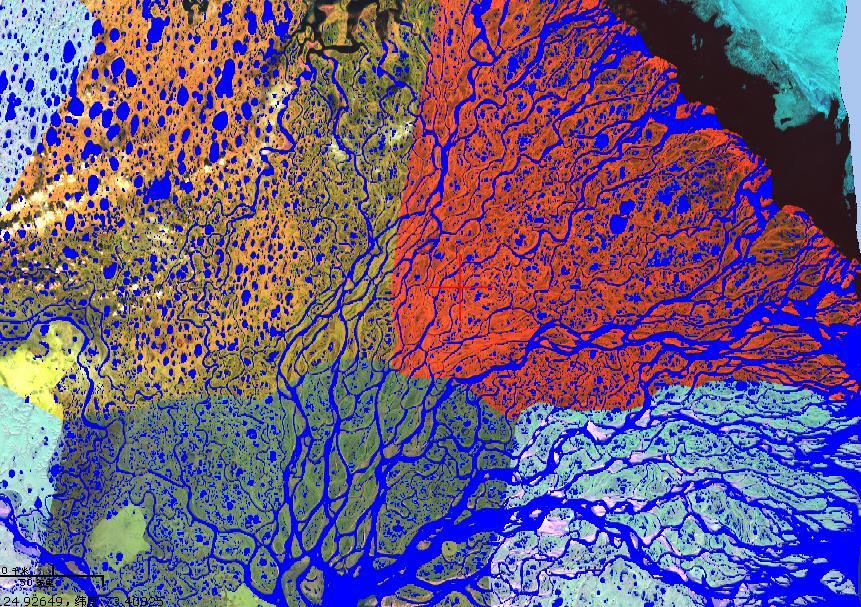
7 Globalland30 -First 30m Global Land Cover Data Set 2010
8 Contents 1. 43rd W-E Day s News 2. Data and methodology 3. Preliminary results 4. Discussion and Outlook

9 Geo-Spatial Data as Fundamental Ones Land Cover Land Cover Land Parcels & Property Transport Serving as authoritative and reliable spatial framework for socioeconomic and other data Elevation & Depth Geocoded Addressing Administrative Boundaries Imagery Place Names Providing critical knowledge about spatial distribution and temporal changes of our planet and environment


10 Biodiversity Impacts Urban Global Land Cover/Weather 2.1 Land Cover and Change Information Tools/Services Agriculture Health Pollution Disasters Data Specific to Global Water/Ocean Water Natural attributes /characteristics of a variety of material types covering the surface of the globe Climate Adaptation Forest Carbon Carbon Energy Requested by all the nine SBAs as identified by GEO Ecosystem/Biodiversity [GEO,2013]
11 Land Cover Data Products Level Global Data Products Spatial Resolution Temporal Resolution USGS 1km One year UMD 1km One year BU 1km One year GLC2000 1km One year GLC m One year Coarse spatial and temporal resolution Low spatial accuracy Regional EU- Corine 1:100,000/ 100m National USGS China Spain 30m 30m and consistency
12 Land Cover Data Products Level Data Products Spatial Resolution Temporal Resolution Global USGS 1km One year UMD 1km One year BU 1km One year GLC2000 1km One year GLC m One year GlobalLand30 30m 2000/2010 Regional EU- Corine 1:100,000/ 100m National USGS GlobalLand30 30m 2000/2010 China Spain 30m 30m Fine resolution Two-time series Higher accuracy

13 Globalland Classes Open Water, Wetland, Artificial Cover, Cropland, Forest, Shrubland, Grassland, Bare Land, Tundra, Perm.snow & Glac
14 Data Validation by international Colleagues Summary of Overall Disagreement - Population only CORINE 1.97 Peng Gong All Peng Gong Minus Cloud etc MODIS Own Validation 0.17 MODIS Geo-Wiki Validation GLC-2000 Own Validation 0.21 GLC-2000 Geo-Wiki Validation GlobCover Own Validation 0.21 GlobCover Geo-Wiki Validation GLC Chen Jun Geo-Wiki No Mixed GLC Chen Jun Geo-Wiki No Mixed + High Confidence GLC Chen Jun Geo-Wiki All + Mixed Pixels KTH, Sweden, (Prof. Yifang Ban) : closer to CORINE Greece (Ioannis Manakos, Centre for R& Techn. Hellas,CERTH): 87% CAS (Chuang Liu): 85% USGS (Zhiliang Zhu) Italy (Maria Antonia Brovelli)


15 Preliminary Validation by 3rd Parties Overall Accuracy Three research institutes from China; Total samples: 139 map sheets (16%), free-collect sample points in each sheet 2010 Accuracy: 83.11%±0.18% 2000 Accuracy 75.33%±0.2%
16 Globalland30 s Applications Globalland30 Global Maps Geospatial statistics Value-added applications Sustainability development Environmental change analysis.
17 2.2 Integrating GLC and Census Data Globe Continent Country Economic Community City Group GlobalLand30 artificial layer 2000 year 2010 year Statistics Administr. units Longitudelatitude grid Climatic Zone Elevation tiers Global pattern and change Integrated analysis Population per area Area Per capita GDP Per Area Continental pattern and change Change analysis Change rate Increase Proportion S Sources of Increasing Comparative diffrences results Census Data Population GDP Reference data Administarive boundary Global DEM Ecological Zones
18 Work Flow for Global Geo-spatial Computing and Analysis Spatial data -Spherical projection -Map sheets boundary area conciliation - Density computing - Statistics Unit - Adminis. Units i - Climate Zone -Ecological zone -Longitude/ latitude Grid -Kilom. Grid Statistics indicators - Area -density -Proportion --Area per capita -GDP per Area Projection area Error Correction -projection area difference correction factor Source data processing Statistical computing Calibration of statistics result Statistics data - Data interpolation - Aggregation with administr. Units - Grid density distribut. - - OO Processing of Statistics Unit -Topology calculation -Coordinates transform Geometric refine. of Statistics zone - Differential arcs/line instead of curve - Mask processing Pixel rounding error correction - Multi-level statistics unit closure
19 Contents 1. 43rd W-E Day s News 2. Data and methodology 3. Preliminary results 4. Discussion and Outlook
20 3.1 Urban and Rural Construction Land Distribution in Change Increased Region Area Area Area Proportion 1,000 km 2 (%) 1,000 km 2 % % 1,000 km2 (%) Global 1, , Asia Europe Africa N. American S. American Oceania Total area of the global urban and rural land in 2010 is Million km 2, which covers 0.88% of the total area of the global land surface Asia, Europe and North America, accounts for 86.83% of that of the global total.
21 Urban and Rural Land Cover in Global Spatial Distribution The total area in the Northern Hemisphere accounts for 90.69% of the global total 82.28% locates between 20 ~ 60 north latitude. distributes mainly on the east and the west coasts of continents Higher concentration in the east coast of North America, and the west and east coast of the Eurasia.
22 Urban and Rural Construction Land -Top Ten Countries, 2010 Area in Area in Variatio Increase Country/ n Rate Proportion Region (10,000 (10,000 (%) (%) km2) km2) China U.S.A Russia Mexico India Brazil Japan France Germany USA and China are the largest and 2nd countries These 10 countries accounts for 61.26% of that of the global total. Ukraine <0.01 <0.01

23 Asia About 414,100 km2 in 2010, accounting for 34.87% of the world, first in all continents, and uneven distribution of space. Mainly distributed in the coastal zone in the east Asia, the Indian Ocean near the bay of Bengal and around the Caspian sea and Lake Issyk-Kul.

24 Africa About 78,200 km2 in 2010, accounting for 6.59% of the world. Suthern African region is the largest in urban and rural resident land in Africa, accounting for 33.09% of Africa total Eastern Africa only accounts for 8.20%.
25 Region 3.2 Change between Area 1,000 km Change Increase (%) Area 1,000 km 2 % Area 1,000 km 2 % Proportion (%) Global 1, Asia Europe Africa N. American S. American Oceania Total increase: 57,400km2 with the variation rate of 5.08%. Change rate: Africa has highest 12.20%, Asia has 6.43% Increase propotion: Asia is highest %, Africa 14.81%
26 Change of the Ten Countries ( ) Country/ Region Area in 2000 (10,000 km2) Area in 2010 (10,000 km2) Variation Rate (%) Increase Proportion (%) China U.S.A Russia Mexico India Brazil Japan France Germany Ukraine <0.01 <0.01 China experienced the rapidly change in 11.17% and made the contribution 28.17% to that of the world Germany and Ukraine remains very little change China and USA account for almost half of the global total
27 3.3 Sources for Increased Urban and Rural Resident Land in Each Continent Asia Europe Africa North America South America Oceania Global Arable land Area(km 2 ) Proportion (%) Forest land Area(km 2 ) Proportion (%) Grassland Area(km 2 ) Proportion (%) Shrub Area(km 2 ) Proportion (%) Wet land Area(km 2 ) Proportion (%) Waters Area(km 2 ) Proportion (%) Bare land Area(km 2 ) Proportion (%) Sub-total Area(km 2 ) Proportion (%)
28 3.4 Utilization Efficiency Analysis Country Population density (persons/km 2 ) Variation rate (%) Per capita land area (m 2 /person) Variation rate (%) GDP/ km 2 (US$ mn/km 2 ) Variation rate (%) Global G BRICs EU CELAC UNASUR S. Asia African Union ASEAN Arab League Northeast Asia
29 Utilization Efficiency- Change Country Population density (persons/km 2 ) Variation rate (%) Per capita land area (m 2 /person) Variation rate (%) GDP/ km 2 (US$ mn/km 2 ) Variation rate (%) Global G BRICs EU CELAC UNASUR S. Asia African Union ASEAN Arab League Northeast Asia

30 Area Per Capita (m2/ Person) Utilization Efficiency Three Different Country Groups Differences the under developing countries, developing countries and industry countries are very obviously GDP in industry countries generally higher than US$60mn/km2, while lower than US$35mn/km2 in under developing countries Area per capita was five times more than that in under developing countries. GDP Per area (mn US$ /km2)
31 Contents 1. 43rd W-E Day s News 2. Data and methodology 3. Preliminary results 4. Discussion and Outlook
32 4.1 Discussion Globalland30 allows us to perform a global analysis about our planet and its change. A cross-disciplinary collaboration is needed to have indepth analysis! 30 m is good, but not enough! More detailed resolution will be needed for further smaller area analysis!
33 4.2 Outlook Sustainable Development Global geo-spatial information Globalland30 Validation and Refinement Geospatial statistics Value-added applications Distributed and Collaborative Inform. Service UN-GGIM Members and POs


34 Thanks Geo-spatial Statistics with GlobalLand30! Chinese English:


35 30-m resolution

36 30m 1km

37 30m 300m
")

38 Cropland in Hilly area (Tyrol, Italy in 2010) on both sides of the river canyon (46.959N, E)

39 Cropland in Arid Region (Koulikoro, Mali in 2000) Coordinate: N, 8.707W 30m permits detection of land change at the scale of most human activity [Loveland, 2010]

40 Artificial Cover Change-Beijing 北京 About 38%

41 Artificial Cover Change- Hefei Almost 100%

42 Artificial Cover Change- New Deli 新德里

43 Urban and Rural Construction land Density Map

44 Urban and Rural Construction land -Asia

45 Urban and Rural Construction land - Europe

46 Urban and Rural Construction land - North America

47 Urban and Rural Construction land - South America

48 Urban and Rural Construction land - Africa

49 Urban and Rural Construction land - Oceania

50 Urban and Rural Construction land China, 2010

51 Urban and Rural Construction land

52 Urban and Rural Construction land

53 Urban and Rural Construction land
Global Land Cover Mapping
 Global Land Cover Mapping and its application in SDGs Prof. Chen Jun 1, Dr. He Chaoying 2 1 National Geomatics Center of China (NGCC) 2 Ministry of Natural Resources, P.R.China May 30, 2018, Copenhagen
Working Together to Create an UN GGIM GlobeLand30 Platform
 3rd UN GGIM High Level Forum Beijing, China, 22 24 October 2014 Working Together to Create an UN GGIM GlobeLand30 Platform Jun Chen 1,2 1 National Geomatics Center, NASG, China 2 ISPRS Oct. 24. 2014, Beijing
Jun Chen 1, 2 National Geomatics Center of China NGCC. International Society for Photogrammetry and Remote Sensing ISPRS May12, 2017, Kunming
 Jun Chen 1, 2 National Geomatics Center of China NGCC 2 International Society for Photogrammetry and Remote Sensing ISPRS May12, 2017, Kunming Contents Introduction GlobeLand30 as Example Role and Utilization
IAEG-SDGs WGGI Task Team Dec. 7, 2017, New York
 IAEG-SDGs WGGI Task Team Dec. 7, 2017, New York Contents What are G/A data? Role of G/A data Utilization Recommendations Outlook National Geospatial Data for SDGs Official data products generated by authoritative
The Geospatial Information Management (GIM) INSPIRE Data Specification and COPERNICUS In situ data
 INSPIRE Data Specification and COPERNICUS In situ data") INSPIRE conference Barcelona 29 September 2016 INSPIRing a sustainable environment The Geospatial Information Management (GIM) INSPIRE Data Specification and COPERNICUS In situ data Antonio Arozarena,
INSPIRE conference Barcelona 29 September 2016 INSPIRing a sustainable environment The Geospatial Information Management (GIM) INSPIRE Data Specification and COPERNICUS In situ data Antonio Arozarena,
Application and impacts of the GlobeLand30 land cover dataset on the Beijing Climate Center Climate Model
 IOP Conference Series: Earth and Environmental Science PAPER OPEN ACCESS Application and impacts of the GlobeLand30 land cover dataset on the Beijing Climate Center Climate Model To cite this article:
Developing a global, peoplebased definition of cities and settlements
 Developing a global, peoplebased definition of cities and settlements By Lewis Dijkstra, Lewis.Dijkstra@ec.europa.eu Head of the Economic Analysis Sector DG for Regional and Urban Policy, Regional & Urban
Climate Outlook for March August 2018
 The APEC CLIMATE CENTER Climate Outlook for March August 2018 BUSAN, 26 February 2018 The synthesis of the latest model forecasts for March to August 2018 (MAMJJA) from the APEC Climate Center (APCC),
World Geography. Test Pack
 World Geography Test Pack WALCH PUBLISHING Table of Contents To the Teacher......... v Testing Students Who Do Not Test Well....... vi Test-Taking Strategies for Power Basics........ vii Pretest.......
AGOG 485/585 /APLN 533 Spring Lecture 5: MODIS land cover product (MCD12Q1). Additional sources of MODIS data
. Additional sources of MODIS data") AGOG 485/585 /APLN 533 Spring 2019 Lecture 5: MODIS land cover product (MCD12Q1). Additional sources of MODIS data Outline Current status of land cover products Overview of the MCD12Q1 algorithm Mapping
AGOG 485/585 /APLN 533 Spring 2019 Lecture 5: MODIS land cover product (MCD12Q1). Additional sources of MODIS data Outline Current status of land cover products Overview of the MCD12Q1 algorithm Mapping
Tropical Moist Rainforest
 Tropical or Lowlatitude Climates: Controlled by equatorial tropical air masses Tropical Moist Rainforest Rainfall is heavy in all months - more than 250 cm. (100 in.). Common temperatures of 27 C (80 F)
Land Accounts - The Canadian Experience
 Land Accounts - The Canadian Experience Development of a Geospatial database to measure the effect of human activity on the environment Who is doing Land Accounts Statistics Canada (national) Component
Map Skills Unit. Note taking unit
 Map Skills Unit Note taking unit Introduction To learn about the Earth, we are going to learn about two geographic tools you can use.globes and maps. Globe A globe is a round model of the planet Earth
Expert Meeting: for Preparedness and Emergency Reponse. Land cover, land grabbing and. crowdsourcing
 Expert Meeting: Crowdsource Mapping for Preparedness and Emergency Reponse Land cover, land grabbing and drought: opportunities for crowdsourcing Why is it so important to improve global land cover? Originally
GCSE 4231/01 GEOGRAPHY (Specification A) FOUNDATION TIER UNIT 1: Core Geography
 FOUNDATION TIER UNIT 1: Core Geography") Surname Centre Number Candidate Number Other Names 0 GCSE 4231/01 GEOGRAPHY (Specification A) FOUNDATION TIER UNIT 1: Core Geography S16-4231-01 P.M. TUESDAY, 24 May 2016 1 hour 45 minutes For s use Question
Surname Centre Number Candidate Number Other Names 0 GCSE 4231/01 GEOGRAPHY (Specification A) FOUNDATION TIER UNIT 1: Core Geography S16-4231-01 P.M. TUESDAY, 24 May 2016 1 hour 45 minutes For s use Question
EU collaborations with NASA LCLUC Program & Current Priorities
 & Current Priorities ioannis Manakos, Dr. Centre for Research and Technology Hellas Information Technologies Institute Visual Analytics, Virtual & Augmented Reality Laboratory European Association of Remote
The Combination of Geospatial Data with Statistical Data for SDG Indicators
 Session x: Sustainable Development Goals, SDG indicators The Combination of Geospatial Data with Statistical Data for SDG Indicators Pier-Giorgio Zaccheddu Fabio Volpe 5-8 December2018, Nairobi IAEG SDG
Population And Settlement Part I
 Population And Settlement Part I 0011 0010 1010 1101 0001 0100 1011 4 12 Think of the earth as a living organism that is being attacked by billions of bacteria whose numbers double every forty years. Either
2008 SIVECO Romania. All Rights Reserved. Geography. AeL econtent Catalogue
 2008 SIVECO Romania. All Rights Reserved. Geography AeL econtent Catalogue The Earth's Movements Recommended for two hours of teaching. AeL Code: 352. 2. The Earth Rotation Movement in 24 hours 3. The
CHAPTER 1. Geo Challenges 1A to 1D. & World Map Activity
 CHAPTER 1 Geo Challenges 1A to 1D & World Map Activity SELECT YOUR CHALLENGE World Map Activity Challenge 1A Challenge 1B Challenge 1C Challenge 1D Challenge 1A WS PG. 2 STEP #1 Label the largest continent
Holy Trinity 3-16 School. Geography Overview (Primary)
") Holy Trinity 3-16 School Key Stage 1 Geography Overview (Primary) Year Autumn 1 Autumn 2 Spring1 Spring 2 Summer 1 Summer 2 Y1 Dear Zoo Castles Gadgets and Gizmos (UK) Name, locate and identify characteristics
Holy Trinity 3-16 School Key Stage 1 Geography Overview (Primary) Year Autumn 1 Autumn 2 Spring1 Spring 2 Summer 1 Summer 2 Y1 Dear Zoo Castles Gadgets and Gizmos (UK) Name, locate and identify characteristics
1. Match the words in the first column to the meaning in the second column. [5]
![1. Match the words in the first column to the meaning in the second column. [5]](/thumbs/96/126839765.jpg "1. Match the words in the first column to the meaning in the second column. [5]") Exercise 1: [40 POINTS] 1. Match the words in the first column to the meaning in the second column. [5] Equator Around earth between the Equator and the Poles. Greenwich meridian Half of earth. Longitude
Exercise 1: [40 POINTS] 1. Match the words in the first column to the meaning in the second column. [5] Equator Around earth between the Equator and the Poles. Greenwich meridian Half of earth. Longitude
SDG s and the role of Earth Observation
 SDG s and the role of Earth Observation Christian Heipke IPI - Institute for Photogrammetry and GeoInformation Leibniz Universität Hannover Germany Secretary General, ISPRS 1. No Poverty 2. Zero Hunger
Measuring and Monitoring SDGs in Portugal: Ratio of land consumption rate to population growth rate Mountain Green Cover Index
 Measuring and Monitoring SDGs in Portugal: 11.3.1Ratio of land consumption rate to population growth rate 15.4.2 Mountain Green Cover Index United Nations World Geospatial Information Congress João David
Population Density and Growth. Distribution of people on Earth
 Population Density and Growth Distribution of people on Earth Population Density! Terminology!! Population density is a measure of how compact or concentrated a population is. It takes area of land into
Developing a global, people-based definition of cities and settlements
 Developing a global, people-based definition of cities and settlements Cooperation between: Directorate General for Regional and, Joint Research Centre, EUROSTAT (European Commission, European Union) OECD,
Discovering the World of Geography
 Discovering the World of Geography Grades 7 8 By MYRL SHIREMAN COPYRIGHT 2003 Mark Twain Media, Inc. ISBN 10-digit: 1-58037-230-9 13-digit: 978-1-58037-230-5 Printing No. CD-1576 Mark Twain Media, Inc.,
Projecting Urban Land Cover on the basis of Population
 Projecting Urban Land Cover on the basis of Population Dan Miller Runfola Postdoctoral Researcher National Center for Atmospheric Research CGD & RAL CU:Boulder Institute of Behavioral Science 1 The Challenge
Unit 1 Test - Version A
 Unit 1 Test - Version A 1. Approximately, how many degrees of longitude equal one time zone change? a. 5 b. 10 c. 15 d. 20 e. 25 2. The city of Lewisville has a population of 1,000 people living in 100
September 14, 2013 Objective: How does geography impact history? What important features exist that have shaped societies?
 Lowenhaupt 1 September 14, 2013 Objective: How does geography impact history? What important features exist that have shaped societies? Warm-Up: In your binder, answer the following question: Imagine you
The World of Geography Pre-Test/Study Guide Chapter 1 Test
 Read each statement or question. On the lines below write the letter of the best answer. 1. Geographers look at the Earth 5. What are the two specific A. by studying cities first. measurements of Earth
Word Cards. 2 map. 1 geographic representation. a description or portrayal of the Earth or parts of the Earth. a visual representation of an area
 Name: Date: Hour: Word Cards 1 geographic representation a description or portrayal of the Earth or parts of the Earth Example: A map is a representation of an actual location or place. 2 map a visual
Group on Earth Observations (GEO) Cold Regions Work Plan Item WA-01-C3
 Cold Regions Work Plan Item WA-01-C3") EC Panel of Experts on Polar Observations, Research and Services Group on Earth Observations (GEO) Cold Regions Work Plan Item WA-01-C3 Barbara J. Ryan Secretariat Director Lanzhou, China 13 March 2013
EC Panel of Experts on Polar Observations, Research and Services Group on Earth Observations (GEO) Cold Regions Work Plan Item WA-01-C3 Barbara J. Ryan Secretariat Director Lanzhou, China 13 March 2013
Final report for the Expert Group on the Integration of Statistical and Geospatial Information, May 2015
 Final report for the Expert Group on the Integration of Statistical and Geospatial Information, May 2015 Global geographic classification and geocoding practices Executive summary This final report was
Overview on Land Cover and Land Use Monitoring in Russia
 Russian Academy of Sciences Space Research Institute Overview on Land Cover and Land Use Monitoring in Russia Sergey Bartalev Joint NASA LCLUC Science Team Meeting and GOFC-GOLD/NERIN, NEESPI Workshop
Paper Two - Optional Themes for Standard and Higher Level
 Paper Two - Optional Themes for Standard and Higher Level Timing: Approximately 40 minutes for each question (each is worth 20 marks). Choice: Higher Level candidates must answer three questions and Standard
... Asia. Based on Bloom s Taxonomy. Human & Movement. Location Place. Regions. Environment. Interactions
 ... Asia Location Place Human & Environment Interactions Movement Regions LEVEL 1 Knowledge Match Show or Label List Information Recall Details (5Ws + H) Find Information LEVEL 2 Comprehension LEVEL 3
Compact guides GISCO. Geographic information system of the Commission
 Compact guides GISCO Geographic information system of the Commission What is GISCO? GISCO, the Geographic Information System of the COmmission, is a permanent service of Eurostat that fulfils the requirements
LEARNING OUTCOMES SST (G1-G12)
") LEARNING OUTCOMES SST (G1-G12) Grade 1 Learning Outcomes Students will be expected to: - demonstrate an understanding of the importance of interactions between people - demonstrate an understanding of
LEARNING OUTCOMES SST (G1-G12) Grade 1 Learning Outcomes Students will be expected to: - demonstrate an understanding of the importance of interactions between people - demonstrate an understanding of
Our climate system is based on the location of hot and cold air mass regions and the atmospheric circulation created by trade winds and westerlies.
 CLIMATE REGIONS Have you ever wondered why one area of the world is a desert, another a grassland, and another a rainforest? Or have you wondered why are there different types of forests and deserts with
LUCAS: current product and its evolutions
 LUCAS: current product and its evolutions Workshop Land Use and Land Cover products: challenges and opportunities Brussels 15 Nov 2017 Eurostat E4: estat-dl-lucas@ec.europa.eu Contents 1) The context 2)
Important Developments in International Coke Markets
 Important Developments in International Coke Markets Andrew Jones Resource-Net South Africa China Coke Market Congress Xuzhou, Jiangsu September 2018 Introduction to Presentation Resource-Net produces
UN-GGIM: An Overview Stefan Schweinfest, Director (UNSD) Bangkok, 27 March 2015
 Bangkok, 27 March 2015") UN-GGIM: An Overview Stefan Schweinfest, Director (UNSD) Bangkok, 27 March 2015 ggim.un.org UN-GGIM: A global initiative Formal inter-governmental UN Committee of Experts to: Discuss, enhance and coordinate
UN-GGIM: An Overview Stefan Schweinfest, Director (UNSD) Bangkok, 27 March 2015 ggim.un.org UN-GGIM: A global initiative Formal inter-governmental UN Committee of Experts to: Discuss, enhance and coordinate
Unit 1: Geography. For additional information, refer to this website: 1 G e o g r a p h y
 Unit 1: Geography For additional information, refer to this website: http://mryoungtms.weebly.com/ 1 G e o g r a p h y Continents and Oceans SOL USI. 2a Essential Understanding: Continents are large land
Climate Outlook for December 2015 May 2016
 The APEC CLIMATE CENTER Climate Outlook for December 2015 May 2016 BUSAN, 25 November 2015 Synthesis of the latest model forecasts for December 2015 to May 2016 (DJFMAM) at the APEC Climate Center (APCC),
UNITED NATIONS E/CONF.97/6/IP. 33
 UNITED NATIONS E/CONF.97/6/IP. 33 ECONOMIC AND SOCIAL COUNCIL Seventeenth United Nations Regional Cartographic Conference for Asia and the Pacific Bangkok, 18-22 September 2006 Item 7 of the provisional
How the science of cities can help European policy makers: new analysis and perspectives
 How the science of cities can help European policy makers: new analysis and perspectives By Lewis Dijkstra, PhD Deputy Head of the Economic Analysis Unit, DG Regional and European Commission Overview Data
Geography Long Term Plan 2018
 Geography Long Term Plan 2018 Geography Co-ordinator: Megan Frost A high-quality geography education should inspire in pupils a curiosity and fascination about the world and its people that will remain
Gozo College Boys Secondary Victoria Gozo, Malta Ninu Cremona
 Gozo College Boys Secondary Victoria Gozo, Malta Ninu Cremona Half Yearly Examination 2010 2011 Form 3 J.L. GEOGRAPHY (Option) Time: 1½ Hours Name: Class: Answer all questions in the space provided. Write
Climate Outlook for October 2017 March 2018
 The APEC CLIMATE CENTER Climate Outlook for October 2017 March 2018 BUSAN, 25 September 2017 The synthesis of the latest model forecasts for October 2017 to March 2018 (ONDJFM) from the APEC Climate Center
UNIT 1: Pa-erns in Human Geography. Chapter 1: Where people live.
 UNIT 1: Pa-erns in Human Geography Chapter 1- Where people live. Chapter 2- How they live. Chapter 3- How we use the Earth Chapter 4- How we work. Chapter 5- Consequences. Chapter 1: Where people live.
EU-level landslide susceptibility assessment
 in the context t of the Soil Thematic Strategy t Andreas Günther 1, Miet Van Den Eeckhaut 2, Paola Reichenbach h 3, Javier Hervás 2 & Jean-Philippe Malet 4 1 Federal Institute for Geosciences and Natural
Explain the impact of location, climate, natural resources, and population distribution on Europe. a. Compare how the location, climate, and natural
 SS6G10 Explain the impact of location, climate, natural resources, and population distribution on Europe. a. Compare how the location, climate, and natural resources of Germany, the United Kingdom and
Downloaded from
 GIST OF THE LESSON: General patternsof population distribution in the world, density of population, factors influencing the distribution of population, population growth, trends in population growth, doubling
MULTIPLE CHOICE. Choose the one alternative that best completes the statement or answers the question.
 Exam Name MULTIPLE CHOICE. Choose the one alternative that best completes the statement or answers the question. 1) One important feature of the world's population with the most significant future implications
Physical Geography. Ariel view of the Amazon Rainforest. A Look at the Seven Continents
 Physical Geography In this unit you will learn about general physical geography. The study of the Earth s surface features provides the setting for the human-environmental interactions and for the human
Module 11: Meteorology Topic 3 Content: Climate Zones Notes
 Introduction Latitude is such an important climate factor that you can make generalizations about a location's climate based on its latitude. Areas near the equator or the low latitudes are generally hot
The Combination of Geospatial Data with Statistical Data for SDG Indicators
 Session 3: Sustainable Development Goals, SDG indicators The Combination of Geospatial Data with Statistical Data for SDG Indicators Pier-Giorgio Zaccheddu (with the assistance of Francisco Vala & Cátia
Introduction of the Asia-Oceania Global Earth Observation System of Systems (AOGEOSS) GEO Initiative(GI-22 )
 GEO Initiative(GI-22 )") Introduction of the Asia-Oceania Global Earth Observation System of Systems (AOGEOSS) GEO Initiative(GI-22 ) Prof. Xiang ZHOU Institute of Remote Sensing and Digital Earth, CAS 11 May 2017 Kunming, China
Introduction of the Asia-Oceania Global Earth Observation System of Systems (AOGEOSS) GEO Initiative(GI-22 ) Prof. Xiang ZHOU Institute of Remote Sensing and Digital Earth, CAS 11 May 2017 Kunming, China
Aerosol Optical Depth Variation over European Region during the Last Fourteen Years
 Aerosol Optical Depth Variation over European Region during the Last Fourteen Years Shefali Singh M.Tech. Student in Computer Science and Engineering at Meerut Institute of Engineering and Technology,
Social Studies: The World Post Test Study Guide
 Name: Period: Social Studies: The World Post Test Study Guide Map and Globe Skills: Label the continents and oceans on the lines below the map. 1 11 3 4 5 8 2 9 10 8 6 7 1. 8. 2. 9. 3. 10. 4. 11. 5. 6.
World Geography Fall 2013 Semester Review Project
 Reporting Category RC 1: History, Government and Citizenship Standard WG.1 History. The student understands how geography and processes of spatial exchange (diffusion) influenced events in the past and
Foundation Geospatial Information to serve National and Global Priorities
 Foundation Geospatial Information to serve National and Global Priorities Greg Scott Inter-Regional Advisor Global Geospatial Information Management United Nations Statistics Division UN-GGIM: A global
Range of Opportunities
 Geograhy Curriculum Cropwell Bishop Primary School Range of Opportunities Year 1 Year 2 Year 3 Year 4 Year 5 Year 6 All Key Stage 1 Key Stage 2 Investigate the countries and capitals of the United Kingdom.
1 Study the map of Cornwall below. Answer the question that follows.
 Distance and direction 1 Study the map of Cornwall below. Answer the question that follows. five statements that are correct. Lanreath is about 22 km from Plymouth Lanreath is about 28 km from Plymouth
Map List. 560 World World Physical World Physical-Pacific & Atlantic Region World Landforms World Ocean Floor 10
 Map List CategoryName Map# MapName Thumb nail Page # 560 World 2 561 World Physical 4 562 World Physical-Pacific & Atlantic Region 6 563 World Landforms 8 564 World Ocean Floor 10 565 North Polar Region
Mapping Global Urban Area from DMSP/OLS Nightlights using a Cluster-based Method
 Mapping Global Urban Area from DMSP/OLS Nightlights using a Cluster-based Method Y. ZHOU, S. SMITH, A. THOMSON, B. BOND-LAMBERTY, M. IMHOFF K. ZHAO, C. ELVIDGE, J. EOM, K. CLARKE Joint Global Change Research
Earth Observation & GeoSpatial Information for Monitoring Urban SDG Indicators. Global Urbanization Trend
 Earth Observation & GeoSpatial Information for Monitoring Urban SDG Indicators Yifang Ban, Professor Director, Division of Geoinformatics Vice Chair, Department for Urban Planning and Environment KTH Royal
Prentice Hall. World Explorer: People, Places, Cultures Grade 7. Oklahoma Priority Academic Student Skills (PASS) for Grade 7 World Geography
 for Grade 7 World Geography") Prentice Hall World Explorer: People, Places, Cultures 2007 Grade 7 C O R R E L A T E D T O for Grade 7 1. Locate, gather, analyze, and apply information from primary and secondary sources. WORLD GEOGRAPHY
Prentice Hall World Explorer: People, Places, Cultures 2007 Grade 7 C O R R E L A T E D T O for Grade 7 1. Locate, gather, analyze, and apply information from primary and secondary sources. WORLD GEOGRAPHY
I&CLC2000 in support to new policy initiatives (INSPIRE, GMES,..)
") I&CLC2000 in support to new policy initiatives (INSPIRE, GMES,..) Manfred Grasserbauer, Director Joint Research Centre Institute for Environment and Sustainability 1 IMAGE 2000 European mosaic of satellite
I&CLC2000 in support to new policy initiatives (INSPIRE, GMES,..) Manfred Grasserbauer, Director Joint Research Centre Institute for Environment and Sustainability 1 IMAGE 2000 European mosaic of satellite
Year 34 B2 Geography - Continents and Oceans 2018 Key Skills to be covered: Taken from Level 3 Taken from Level 4
 Key Skills to be covered: Taken from Level 3 Taken from Level 4 Geographical Enquiry: I ask, Which PHYSICAL features does this place have? I ask, Which HUMAN features does this place have? I give reasons
The Global Fundamental Geospatial Data Themes Journey. April Clare Hadley WG Chair
 The Global Fundamental Geospatial Data Themes Journey April 2018 Clare Hadley WG Chair The Road to here Why Global? Why Geospatial? Why Fundamental? Why Themes? The route we took Where does the road go
By Geri Flanary To accompany AP Human Geography: A Study Guide 3 rd edition By Ethel Wood
 Session 1 By Geri Flanary To accompany AP Human Geography: A Study Guide 3 rd edition By Ethel Wood WHAT IS DEMOGRAPHY? It is the scientific or statistical study of population. It comes from the Greek
Cambridge International Examinations Cambridge International General Certificate of Secondary Education
 Cambridge International Examinations Cambridge International General Certificate of Secondary Education *2660755211* GEOGRAPHY 0460/12 Paper 1 May/June 2018 Candidates answer on the Question Paper. Additional
URBAN CHANGE DETECTION OF LAHORE (PAKISTAN) USING A TIME SERIES OF SATELLITE IMAGES SINCE 1972
 USING A TIME SERIES OF SATELLITE IMAGES SINCE 1972") URBAN CHANGE DETECTION OF LAHORE (PAKISTAN) USING A TIME SERIES OF SATELLITE IMAGES SINCE 1972 Omar Riaz Department of Earth Sciences, University of Sargodha, Sargodha, PAKISTAN. omarriazpk@gmail.com ABSTRACT
URBAN CHANGE DETECTION OF LAHORE (PAKISTAN) USING A TIME SERIES OF SATELLITE IMAGES SINCE 1972 Omar Riaz Department of Earth Sciences, University of Sargodha, Sargodha, PAKISTAN. omarriazpk@gmail.com ABSTRACT
Advanced Image Analysis in Disaster Response
 Advanced Image Analysis in Disaster Response Creating Geographic Knowledge Thomas Harris ITT The information contained in this document pertains to software products and services that are subject to the
Analysis of Industrialization, Urbanization and Land-use Change in East Asia According to the DPSER Framework
 1 Analysis of Industrialization, Urbanization and Land-use Change in East Asia According to the DPSER Framework Hidefumi IMURA*, Jin CHEN*, Shinji KANEKO** and Toru MATSUMOTO* * Institute of Environmental
Geography Progression
 Geography Progression This document aims to track expectations for History within George Grenville Academy. What the National Curriculum says: KS1: Locational Knowledge: Name and locate the world s 7 continents
forest tropical jungle swamp marsh prairie savanna pampas Different Ecosystems (rainforest)
") Different Ecosystems forest A region of land that is covered with many trees and shrubs. tropical jungle (rainforest) swamp A region with dense trees and a variety of plant life. It has a tropical climate.
Different Ecosystems forest A region of land that is covered with many trees and shrubs. tropical jungle (rainforest) swamp A region with dense trees and a variety of plant life. It has a tropical climate.
Urban areas & climate change
 Urban areas & climate change Paolo Gamba University of Pavia University of Pavia The UNIPV TLC & RS Lab is a dynamic research group developing in the past years many techniques devoted to the analysis
* * GEOGRAPHY 2217/02. Paper 2 Geographical Skills For examination from 2020
 Cambridge O Level *0123456789* GEOGRAPHY 2217/02 Paper 2 Geographical Skills For examination from 2020 SPECIMEN PAPER You must answer on the question paper. You will need: Insert (enclosed) Plain paper
Geography. Programmes of study for Key Stages 1-3
 Geography Programmes of study for Key Stages 1-3 February 2013 Contents Purpose of study 3 Aims 3 Attainment targets 3 Subject content 4 Key Stage 1 4 Key Stage 2 5 Key Stage 3 6 2 Purpose of study A high-quality
New National Curriculum Geography Skills Planning KS1
 New National Curriculum Geography Skills Planning KS1 Enquiry Question Objective-essential knowledge skills or understanding Locational Knowledge Standards /Success Criteria Lesson progression over half
Spanish national plan for land observation: new collaborative production system in Europe
 ADVANCE UNEDITED VERSION UNITED NATIONS E/CONF.103/5/Add.1 Economic and Social Affairs 9 July 2013 Tenth United Nations Regional Cartographic Conference for the Americas New York, 19-23, August 2013 Item
Geography Route Planner
 Geography Route Planner Introduction to Route Planners Route Planners outline the Key Stages 1-3 curriculum to be taught within each campus of the Bury St Edmunds Trust. Each Route Planner has been designed
National Remote Sensing Center of China. Space Technology for Sustainable Development in China Status, Achievements and Futures.
 National Remote Sensing Center of China Space Technology for Sustainable Development in China Status, Achievements and Futures Jing Li National Remote Sensing Center of China Ministry of Science and Technology,
Central Valley School District Social Studies Curriculum Map Grade 7. August - September
 August - September Geographical/Historical Skills Identify and analyze timelines. Construct and use cause and effect charts. Differentiate between fact and opinion. Use of word webs, flip charts, outlines
CURRICULUM COURSE OUTLINE
 CURRICULUM COURSE OUTLINE Course Name(s): World Area Studies Grade(s): 9-11 Department: Social Studies Course Length: 1 Semester Pre-requisite: None Textbook/Key Resource: No Primary Textbook Course Description:
World Geography to ALL Students book (teacher book).
.") Sample Pages are from the What I Need to Know to Successfully Teach World Geography to ALL Students book (teacher book). This book contains the content in the student book, the reformatted Standards for
Sample Pages are from the What I Need to Know to Successfully Teach World Geography to ALL Students book (teacher book). This book contains the content in the student book, the reformatted Standards for
The Coordinate System
 5 The Coordinate System Key Words: latitude, degrees, longitude, prime meridian, absolute location You can locate any place on Earth by using a special set of numbers. These numbers are part of a set of
Greening of Arctic: Knowledge and Uncertainties
 Greening of Arctic: Knowledge and Uncertainties Jiong Jia, Hesong Wang Chinese Academy of Science jiong@tea.ac.cn Howie Epstein Skip Walker Moscow, January 28, 2008 Global Warming and Its Impact IMPACTS
Social Studies Tools (Maps & Sources) Test Study Guide
 Test Study Guide") Social Studies Tools (Maps & Sources) Test Study Guide Name: ANSWER KEY Date: Period: Directions: Complete this study guide as a way to prepare for your test on our Social Studies Tools unit about maps
Social Studies Tools (Maps & Sources) Test Study Guide Name: ANSWER KEY Date: Period: Directions: Complete this study guide as a way to prepare for your test on our Social Studies Tools unit about maps
Understanding Projections
 GEOGRAPHY SKILLS 1 Understanding Projections The earth is a sphere and is best shown as a globe. For books and posters, though, the earth has to be represented as a flat object. To do this, mapmakers create
World geography 3200/3202 Unit 2 review
 World geography 3200/3202 Unit 2 review 1. Does this statement use the terms revolve & rotate correctly? "Saturn revolves on its axis while several moons rotate around it." 2. Does this statement use the
Generation and analysis of Digital Elevation Model (DEM) using Worldview-2 stereo-pair images of Gurgaon district: A geospatial approach
 using Worldview-2 stereo-pair images of Gurgaon district: A geospatial approach") 186 Generation and analysis of Digital Elevation Model (DEM) using Worldview-2 stereo-pair images of Gurgaon district: A geospatial approach Arsad Khan 1, Sultan Singh 2 and Kaptan Singh 2 1 Department
186 Generation and analysis of Digital Elevation Model (DEM) using Worldview-2 stereo-pair images of Gurgaon district: A geospatial approach Arsad Khan 1, Sultan Singh 2 and Kaptan Singh 2 1 Department
ACCURACY ASSESSMENT OF ASTER GLOBAL DEM OVER TURKEY
 ACCURACY ASSESSMENT OF ASTER GLOBAL DEM OVER TURKEY E. Sertel a a ITU, Civil Engineering Faculty, Geomatic Engineering Department, 34469 Maslak Istanbul, Turkey sertele@itu.edu.tr Commission IV, WG IV/6
Introduction to Geography
 Introduction to Geography ropic of Cancer 3½ N Arctic Circle 90 N Prime Meridian 0 Arctic Ocean Mississippi R. Appalachian Mts. Europe Rocky Mountains N. America Atlantic Gulf of Ocean Mexico Caribbean
The Spatial Information Corridor Contributes to UNISPACE+50. JIANG HUI Director of Internation Cooperation Department
 The Spatial Information Corridor Contributes to UNISPACE+50 JIANG HUI Director of Internation Cooperation Department 01 02 03 What is Belt & Road Spatial Information Corridor? China put forward the "Belt
LandScan Global Population Database
 LandScan Global Population Database The World s Finest Population Distribution Data Uncommon information. Extraordinary places. LandScan Global Population Database East View Cartographic is now offering
Name three countries in Europe.
 Name three countries in Europe. I will be able to identify the 5 themes of geography for Europe and locate the countries and capitals of Europe and the major physical features. People: Past: Through the