CLC in Iceland. Kolbeinn Árnason. SEIS COUNTRY VISIT ICELAND 03 June 2010
|
|
|
- Kenneth Daniels
- 5 years ago
- Views:
Transcription


1 CLC in Iceland Kolbeinn Árnason SEIS COUNTRY VISIT ICELAND 03 June 2010
 responsible for the CLC implementation CLC2006 finished Dec.")
2 General remarks I Iceland joined the CORINE programme in 2007 Grant agreements for CLC2006, CLC2000 and CLC-Change with EEA signed in July 2007 National Land Survey of Iceland (NLSI) responsible for the CLC implementation CLC2006 finished Dec CLC2000 and CLC-Change completed June 2009 Database Technical Acceptance issued June 26th 2009
 Then: General support Comparison with other countries possible A tool for monitoring LU/LC changes An umbrella for more detailed")
3 General remarks II First: Apparent scepticism CLC classes defined for S- and Central-Europe Classes partly not fitting to Icelandic nature Not detailed enough (1: , 25 ha, 100m) Then: General support Comparison with other countries possible A tool for monitoring LU/LC changes An umbrella for more detailed classifications
4 Difficulties/Problems Pastures are composed of hayfields and grazing areas. Whereas this class is easily mappable at the outset the mapping of its changes is problematic. CLC definitions of classes 331 and 332 is contradictory with regard to Iceland. Volcanic ash and lapilli fields of recent volcanic eruptions fit better to class 331 than 332 and therefore included in class 331. Several types of mires or bogs in Iceland besides peat bogs. These are all included in class 412 (except 411) Min. tree height for classes 31x is 2m (as used by IFS) Class 322 includes moss and lychen covered areas All problems discussed and settled with the CLC T.T.
5 Data and support from many parties Many institutions and communes provided data and information: The National Land Survey of Iceland, NLSI The Agricultural University of Iceland, AUI Iceland Forestry Service, IFS The Icelandic Institute of Natural History, IINH National Energy Authority, NEA University of Iceland, UI The Icelandic Coast Guard, ICG The Farmers Association, FA Institute of Freshwater Fisheries, IFF The National Power Company, NPC Planning officers of all municipalites (79) > Widespread cooperation and support

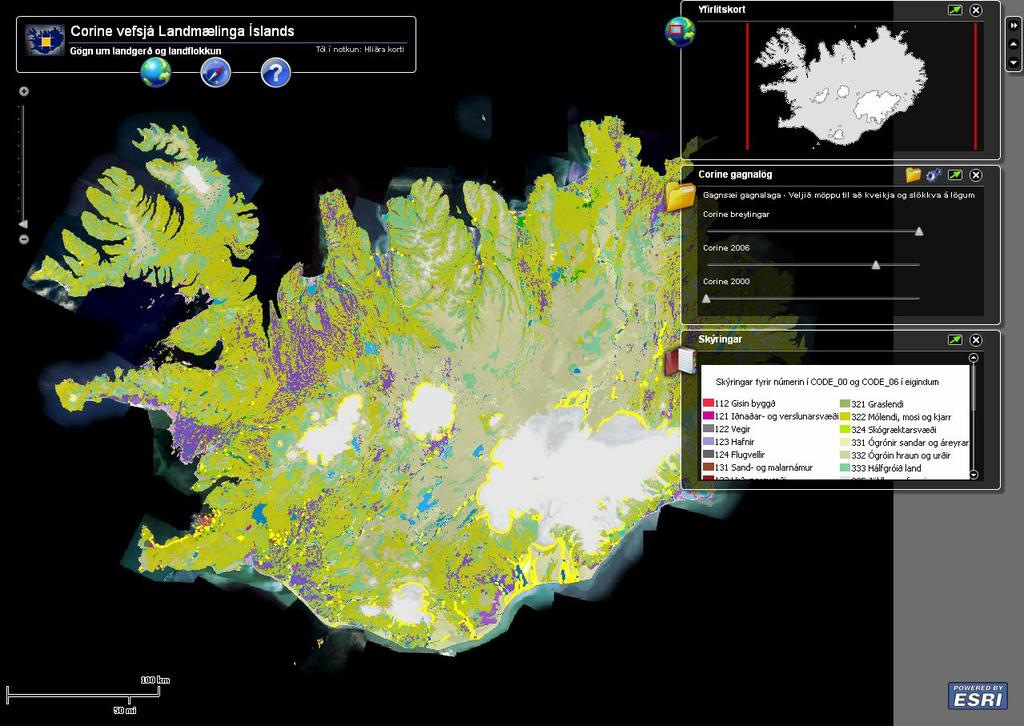
6 CLC2006 results

7 CORINE classification results for CLC2006

8 CLC Changes


9 Absolute CLC Changes (hectares)
: 81%.")
10 Relative changes Enlargement of 133 (construction areas): 1055%!!, 132 (dump sites): 81%. Class 121 (industrial and commercial units) enlarge by 20%.

 Austurríki Belgía")


11 Comparison with other countries CLC2000 Level 1 classes of some European countries (% of national territory) Austurríki Belgía Búlgaría Danmörk Eistland Frakkland Grikkland Holland Írland Ísland Ítalía Króatía Lettland Litháen Lúxemborg Portúgal Pólland Manngert yfirborð Landbúnaðarland Skógar og náttúruleg svæði Votlendi Vötn Rúmenía San Marínó Slóvakía Slóvenía Spánn Stóra Bretland Tékkland Ungverjaland Þýskaland 0% 20% 40% 60% 80% 100%

12 Comparison between Class 3. Forests and semi-natural areas in Iceland and several other European countries 35% 3.1.x. Forests 30% Laufskógar Barrskógar Blandaðir skógar 25% 20% 15% 10% 5% 0% Austurríki Belgía Búlgaría Danmörk Eistland Ísland Króatía Pólland Slóvakía Tékkland
13 Comparison between Class 3. Forests and semi-natural areas in Iceland and several other European countries 40% 3.2.x Shrub and/or herbaceous vegetation associations 35% 30% Graslendi Mólendi, mosi og kjarr 25% Skógræktar- og skógarhöggssvæði 20% 15% 10% 5% 0%
14 Comparison between Class 3. Forests and semi-natural areas in Iceland and several other European countries 25% 3.3.x. Open spaces with little or no vegetation 20% Ógrónir sandar Ógróin hraun og urðir Hálfgróið land Jöklar og fannir 15% 10% 5% 0% Austurríki Belgía Búlgaría Danmörk Eistland Ísland Króatía Pólland Slóvakía Tékkland
15 Yearly urban residential sprawl Urban residential sprawl (yearly % of urban areas in 2000) LCF2norm AL CY IE BA IS KV EE PT DK NL MK FR RS ME CZ PL AT CR RO LU HU LV LT BE BG SK SI MT
16 Yearly sprawl of economic sites and infrastructure Sprawl of economic sites and infrastructure (yealy % of economic&infastructure sites in 2000) LCF3norm PT CR IE IS NL CY HU AT AL MK CZ BA FR ME SI EE RS PL LU SK DK LT KV LV BG BE RO MT
17 Forest creation and management Forest creation and management (yearly % of forests in 2000) LCF7norm IE PT HU IS CY LV LT EE SK DK LU CZ BE FR PL MK BG CR AL KV NL BA RO RS
18 Future plans in Iceland related to CLC CORINE was the first step, other databases will be based on or connected to the CLC Higher spatial resolution (~5ha, 10m) Some classes (i.e. 322, 332, 412) split up in level 4 or even level 5 sub-classes Generalisation according to EEA needs Continuing cooperation between institutions Discussions (how and what) are pending
19 Spatial HiRes mapping for inland use (CLC compatible) Data/information for most CLC classes already exist for HiRes mapping (5ha, 10m) Of 32 CLC classes in Iceland 23 available in HiRes (~5ha, 10m): 1xx, 2xx, 31x, 324, 421, 5xx (except 522). 4 can be mapped: 411, 412, 423, will not be mapped in HiRes: 321, 322, 331, 332, 333 (except maybe in limited areas)

20 Reykjavík capital area, SPOT-5, NIR,(2007)

21 CLC Classification (25 ha, 100m)

22 HiRes Classification for class 1 (+ data from IFS)

23 Reykjanes, CLC classification
24 Reykjanes, HiRes classes (Artificial areas)
25 Presentation and dissemination of the CLC results PPT-presentations and posters at various GISand RS- based meetings and confereces Printed report, distributed to all partners More detailed reports (english and icelandic) on the NLSI-web Map viewer on the NLSI-web (comparison with maps and satellite imagery)
26
27

28
29
30 Thank you
Problems arising during the implementation of CLC2006
 Problems arising during the implementation of CLC2006 George Büttner, Barbara Kosztra ETC-LUSI / FÖMI (HU) EIONET WG meeting on Land Monitoring IGN Portugal, 10-12 March 2010 Contents of presentation Present
Country
 Total EU-12 89,6 89,4 85,7 82,9 85,9 86,9 87,4 EU-15 89,6 85,7 83,1 86,2 87,0 87,5 EU-25 87,9 A 95,1 90,2 88,0 90,8 88,2 93,7 B 80,7 91,1 84,6 84,3 86,3 89,6 85,8 D 95,1 94,1 86,1 86,3 88,0 86,4 89,4 D-W
Overview of numbers submitted for Statistics on Pending Mutual Agreement Procedures (MAPs) under the Arbitration Convention (AC) at the End of 2017
 under the Arbitration Convention (AC) at the End of 2017") EUROPEAN COMMISSION DIRECTORATE-GENERAL TAXATION AND CUSTOMS UNION Direct taxation, Tax Coordination, Economic Analysis and Evaluation Direct Tax Policy & Cooperation Brussels, September 2018 Taxud/D2
EUROPEAN COMMISSION DIRECTORATE-GENERAL TAXATION AND CUSTOMS UNION Direct taxation, Tax Coordination, Economic Analysis and Evaluation Direct Tax Policy & Cooperation Brussels, September 2018 Taxud/D2
Country
 Total A 36,3 31,1 B 33,8 36,9 37,4 D 41,4 D-W 41,6 37,7 40,7 42,4 D-E 28,2 36,9 36,8 DK 55,8 49,1 48,8 E 33,2 39,5 33,2 28,9 F 44,4 33,1 36,3 FIN 62,2 30,9 50,6 54,6 GB 26,1 26,2 27,1 GR 14,5 I 34,5 32,1
Resource efficiency and Geospatial data What EUROSTAT does. What could do.
 Resource efficiency and Geospatial data What EUROSTAT does. What could do. Pedro Díaz Muñoz Director Sectoral and Regional Statistics, Eurostat 29/06/2011 Statements - Large amount of information to understand
EU JOINT TRANSFER PRICING FORUM
 EUROPEAN COMMISSION DIRECTORATE-GENERAL TAXATION AND CUSTOMS UNION Direct taxation, Tax Coordination, Economic Analysis and Evaluation Company Taxation Initiatives Brussels, December 2013 Taxud/D1/ DOC:
Land Cover and Land Use Diversity Indicators in LUCAS 2009 data
 Land Cover and Land Use Diversity Indicators in LUCAS 2009 data A. Palmieri, L. Martino, P. Dominici and M. Kasanko Abstract Landscape diversity and changes are connected to land cover and land use. The
CLC2006, CLC2000 and CLC-Changes in ICELAND Grant agreements: 3601/B2007.EEA53004 and 3601/RO/CLC/B2007.EEA52971
 CLC2006, CLC2000 and CLC-Changes in ICELAND Grant agreements: 3601/B2007.EEA53004 and 3601/RO/CLC/B2007.EEA52971 Final report National Land Survey of Iceland / Landmælingar Íslands. October 2009 FINAL
Presentation of the different land cover mapping activities in the French Guiana
 Presentation of the different land cover mapping activities in the French Guiana LCCS Land Cover Classification System 9 to 13 March 2015 Paramaribo - Suriname INTRODUCTION French Guiana : 8 046 427 ha
Copernicus Land HRL Imperviousness: 2012 dataset, indicator Title
 Copernicus Land HRL Imperviousness: 2012 dataset, 06-09 indicator and outlook Title 2015+ Tobias LANGANKE First name SURNAME Project manager, Copernicus Position land services Name European of the Environment
Weekly price report on Pig carcass (Class S, E and R) and Piglet prices in the EU. Carcass Class S % + 0.3% % 98.
 and Piglet prices in the EU. Carcass Class S % + 0.3% % 98.") Weekly price report on Pig carcass (Class S, E and R) and Piglet prices in the EU Disclaimer Please note that EU prices for pig meat, are averages of the national prices communicated by Member States weighted
Weekly price report on Pig carcass (Class S, E and R) and Piglet prices in the EU Disclaimer Please note that EU prices for pig meat, are averages of the national prices communicated by Member States weighted
Statistics on Pending Mutual Agreement Procedures (MAPs) under the Arbitration Convention at the End of 2015
 under the Arbitration Convention at the End of 2015") EUROPEAN COMMISSION DIRECTORATE-GENERAL TAXATION AND CUSTOMS UNION Direct taxation, Tax Coordination, Economic Analysis and Evaluation Direct Tax Policy and Cooperation Brussels, October 2016 Taxud/D2
EUROPEAN COMMISSION DIRECTORATE-GENERAL TAXATION AND CUSTOMS UNION Direct taxation, Tax Coordination, Economic Analysis and Evaluation Direct Tax Policy and Cooperation Brussels, October 2016 Taxud/D2
Land Use and Land cover statistics (LUCAS)
") EUROPEAN COMMISSION EUROSTAT Directorate E: Sectoral and regional statistics Doc. ENV/DIMESA/7.1/2012 Original in EN Agenda point 7.1 Land Use and Land cover statistics (LUCAS) DIMESA Directors' Meeting
EUROPEAN COMMISSION EUROSTAT Directorate E: Sectoral and regional statistics Doc. ENV/DIMESA/7.1/2012 Original in EN Agenda point 7.1 Land Use and Land cover statistics (LUCAS) DIMESA Directors' Meeting
GIS Reference Layers on UWWT Directive Sensitive Areas. Technical Report. Version: 1.0. ETC/Water task:
 GIS Reference Layers on UWWT Directive Sensitive Areas Technical Report Version: 1.0 ETC/Water task: 1.4.1.3 Prepared by / compiled by: Jiri Kvapil, ETC/W Organisation: CENIA EEA Project Manager: Bo Jacobsen
Statistics on Pending Mutual Agreement Procedures (MAPs) under the Arbitration Convention at the End of 2014
 under the Arbitration Convention at the End of 2014") EUROPEAN COMMISSION DIRECTORATE-GENERAL TAXATION AND CUSTOMS UNION Direct taxation, Tax Coordination, Economic Analysis and Evaluation Direct Tax Policy and Cooperation Brussels, October 2015 Taxud/D2
EUROPEAN COMMISSION DIRECTORATE-GENERAL TAXATION AND CUSTOMS UNION Direct taxation, Tax Coordination, Economic Analysis and Evaluation Direct Tax Policy and Cooperation Brussels, October 2015 Taxud/D2
Sampling scheme for LUCAS 2015 J. Gallego (JRC) A. Palmieri (DG ESTAT) H. Ramos (DG ESTAT)
 A. Palmieri (DG ESTAT) H. Ramos (DG ESTAT)") Sampling scheme for LUCAS 2015 J. Gallego (JRC) A. Palmieri (DG ESTAT) H. Ramos (DG ESTAT) Abstract The sampling design of LUCAS 2015 took into account experience from previous campaigns. While remaining
Sampling scheme for LUCAS 2015 J. Gallego (JRC) A. Palmieri (DG ESTAT) H. Ramos (DG ESTAT) Abstract The sampling design of LUCAS 2015 took into account experience from previous campaigns. While remaining
SIF_7.1_v2. Indicator. Measurement. What should the measurement tell us?
 Indicator 7 Area of natural and semi-natural habitat Measurement 7.1 Area of natural and semi-natural habitat What should the measurement tell us? Natural habitats are considered the land and water areas
EAGLE concept, as part of the HELM vision
 EAGLE concept, as part of the HELM vision EAGLE working group Barbara Kosztra (Hungary), Stephan Arnold (Germany), Lena Hallin-Pihlatie & Elise Järvenpää (Finland) 16.06.2014 HELM / EAGLE Workshop - INSPIRE
LUCAS 2009 (Land Use / Cover Area Frame Survey)
") EUROPEAN COMMISSION EUROSTAT Directorate E: Sectoral and regional statistics Unit E-1: Farms, agro-environment and rural development LUCAS 2009 (Land Use / Cover Area Frame Survey) M3 - Non sampling error
EUROPEAN COMMISSION EUROSTAT Directorate E: Sectoral and regional statistics Unit E-1: Farms, agro-environment and rural development LUCAS 2009 (Land Use / Cover Area Frame Survey) M3 - Non sampling error
2.- Area of built-up land
 2.- Area of built-up land Key message Over recent decades, built-up areas have been steadily increasing all over Europe. In Western European countries, built-up areas have been increasing faster than the
COMMISSION OF THE EUROPEAN COMMUNITIES COMMISSION STAFF WORKING DOCUMENT. Annexes accompanying the
 EN EN EN COMMISSION OF THE EUROPEAN COMMUNITIES Brussels, 20.5.2009 SEC(2009) 684 COMMISSION STAFF WORKING DOCUMENT Annexes accompanying the REPORT FROM THE COMMISSION TO THE EUROPEAN PARLIAMENT AND THE
Restoration efforts required for achieving the objectives of the Birds and Habitats Directives
 In association with Restoration efforts required for achieving the objectives of the Birds and Habitats Directives Database notes and guidelines Prepared for the European Commission DG ENV Contents 1.
5. Atmospheric Supply of Mercury to the Baltic Sea in 2015
 Atmospheric Supply of Mercury to the Baltic Sea in 2015 69 5. Atmospheric Supply of Mercury to the Baltic Sea in 2015 In this chapter the results of model evaluation of mercury atmospheric input to the
GRIPs. Overview Andrea Ćirlićová Business Area Manager, System Development
 GRIPs Overview 2013 Andrea Ćirlićová Business Area Manager, System Development 6 th TYNDP Workshop, Brussels -- 15 November 2012 GRIPs GRIPs are the regional interlink between Union-wide TYNDP and national
Spanish national plan for land observation: new collaborative production system in Europe
 ADVANCE UNEDITED VERSION UNITED NATIONS E/CONF.103/5/Add.1 Economic and Social Affairs 9 July 2013 Tenth United Nations Regional Cartographic Conference for the Americas New York, 19-23, August 2013 Item
"Transport statistics" MEETING OF THE WORKING GROUP ON RAIL TRANSPORT STATISTICS. Luxembourg, 25 and 26 June Bech Building.
 Document: Original: Rail/2007/9/EN English "Transport statistics" MEETING OF THE WORKING GROUP ON RAIL TRANSPORT STATISTICS Luxembourg, 25 and 26 June 2007 Bech Building Room BECH Ampere Beginning 10:00
Preparatory Signal Detection for the EU-27 Member States Under EU Burden Sharing Advanced Monitoring Including Uncertainty ( )
") International Institute for Applied Systems Analysis Schlossplatz 1 A-2361 Laxenburg, Austria Tel: +43 2236 807 342 Fax: +43 2236 71313 E-mail: publications@iiasa.ac.at Web: www.iiasa.ac.at Interim Report
International Institute for Applied Systems Analysis Schlossplatz 1 A-2361 Laxenburg, Austria Tel: +43 2236 807 342 Fax: +43 2236 71313 E-mail: publications@iiasa.ac.at Web: www.iiasa.ac.at Interim Report
Evolution Strategies for Optimizing Rectangular Cartograms
 Evolution Strategies for Optimizing Rectangular Cartograms Kevin Buchin 1, Bettina Speckmann 1, and Sander Verdonschot 2 1 TU Eindhoven, 2 Carleton University September 20, 2012 Sander Verdonschot (Carleton
ANNEXES. to the REPORT FROM THE COMMISSION TO THE EUROPEAN PARLIAMENT AND THE COUNCIL
 EUROPEAN COMMISSION Brussels, 6..5 COM(5) 5 final ANNEXES to 4 ANNEXES to the REPORT FROM THE COMMISSION TO THE EUROPEAN PARLIAMENT AND THE COUNCIL European Union Solidarity Fund Annual Report 4 EN EN
Plan4all (econtentplus project)
") Plan4all (econtentplus project) Karel CHARVAT 1, Tomáš MILDORF 2 1 Help service remote sensing, Ltd., Černoleská 1600, 256 01 Benešov u Prahy, Czech Republic charvat@bnhelp.cz 2 Department of Mathematics
Plan4all (econtentplus project) Karel CHARVAT 1, Tomáš MILDORF 2 1 Help service remote sensing, Ltd., Černoleská 1600, 256 01 Benešov u Prahy, Czech Republic charvat@bnhelp.cz 2 Department of Mathematics
Mapping and Assessment of Ecosystems and their Services
 Mapping and Assessment of Ecosystems and their Services ALTER-Net Conference 2013: Science underpinning the EU 2020 Biodiversity Strategy. April 2013 Gent Joachim MAES 1 This presentation is based on the
System of Environmental-Economic Accounting. Advancing the SEEA Experimental Ecosystem Accounting. Extent Account (Levels 1 and 2)
") Advancing the SEEA Experimental Ecosystem Accounting Extent Account (Levels 1 and 2) Overview: The Extent Account 1. Learning objectives 2. Review of Level 0 (5m) What is it? Why do we need it? What does
Advancing the SEEA Experimental Ecosystem Accounting Extent Account (Levels 1 and 2) Overview: The Extent Account 1. Learning objectives 2. Review of Level 0 (5m) What is it? Why do we need it? What does
Variance estimation on SILC based indicators
 Variance estimation on SILC based indicators Emilio Di Meglio Eurostat emilio.di-meglio@ec.europa.eu Guillaume Osier STATEC guillaume.osier@statec.etat.lu 3rd EU-LFS/EU-SILC European User Conference 1
CORINE LAND COVER CROATIA
 CORINE LAND COVER CROATIA INTRO Primary condition in making decisions directed to land cover and natural resources management is presence of knowledge and high quality information about biosphere and its
Assessment and Improvement of Methodologies used for GHG Projections
 Assessment and Improvement of Methodologies used for GHG Projections Jan Duerinck Etsap workshop 3 July 2008 Paris Who is using Markal and how Jan Duerinck Etsap workshop 3 July 2008 Paris 1 Outline of
1. Demand for property on the coast
 1. Demand for property on the coast Key message Irrespective of density and location, population in Europe in general tends to concentrate in coastal areas. Detailed spatial elaboration of processes shows
Sharing soil information with the help of INSPIRE, key challenges with soil data management
 Sharing soil information with the help of INSPIRE, key challenges with soil data management Katharina Feiden e-mail: gssoil@portalu.de GS Soil: project outline GS Soil: Assessment and strategic development
Land Use Planning and Agriculture: Austrian Experiences and Challenges I
 Land Use Planning and Agriculture: Austrian Experiences and Challenges I SULANET Summer School 2016 Walter Seher BOKU Vienna 1 Land Use Planning and Agriculture 2 Land Use Planning and Agriculture Agriculture
LAND COVER CHANGES IN ROMANIA BASED ON CORINE LAND COVER INVENTORY
 LAND COVER CHANGES IN ROMANIA BASED ON CORINE LAND COVER INVENTORY 1990 2012 JENICĂ HANGANU, ADRIAN CONSTANTINESCU * Key-words: CORINE Land Cover inventory, Land cover changes, GIS. Abstract. From 1990
Carpathians Unite mechanism of consultation and cooperation for implementation of the Carpathian Convention
 Carpathians Unite mechanism of consultation and cooperation for implementation of the Carpathian Convention Zbigniew Niewiadomski, UNEP/GRID-Warsaw Centre First Joint Meeting of the Carpathian Convention
Directorate C: National Accounts, Prices and Key Indicators Unit C.3: Statistics for administrative purposes
 EUROPEAN COMMISSION EUROSTAT Directorate C: National Accounts, Prices and Key Indicators Unit C.3: Statistics for administrative purposes Luxembourg, 17 th November 2017 Doc. A6465/18/04 version 1.2 Meeting
GIS Reference Layers on UWWT Directive Sensitive Areas Description of dataset and processing
 EEA/NSV/10/002 ETC/ICM GIS Reference Layers on UWWT Directive Sensitive Areas Description of dataset and processing Version: 5.0 Date: 21/08/2013 EEA activity: 1.4.1.b ETC/ICM task, milestone:3 Prepared
EUROINDICATORS WORKING GROUP THE IMPACT OF THE SEASONAL ADJUSTMENT PROCESS OF BUSINESS TENDENCY SURVEYS ON TURNING POINTS DATING
 EUROINDICATORS WORKING GROUP 11 TH MEETING 4 & 5 DECEMBER 2008 EUROSTAT D1 DOC 239/08 THE IMPACT OF THE SEASONAL ADJUSTMENT PROCESS OF BUSINESS TENDENCY SURVEYS ON TURNING POINTS DATING ITEM 6.2 ON THE
TEPZZ A_T EP A1 (19) (11) EP A1. (12) EUROPEAN PATENT APPLICATION published in accordance with Art.
 (11) EP A1. (12) EUROPEAN PATENT APPLICATION published in accordance with Art.") (19) TEPZZ 988 79A_T (11) EP 2 988 279 A1 (12) EUROPEAN PATENT APPLICATION published in accordance with Art. 13(4) EPC (43) Date of publication: 24.02.16 Bulletin 16/08 (21) Application number: 1478028.3
(19) TEPZZ 988 79A_T (11) EP 2 988 279 A1 (12) EUROPEAN PATENT APPLICATION published in accordance with Art. 13(4) EPC (43) Date of publication: 24.02.16 Bulletin 16/08 (21) Application number: 1478028.3
GMES Initial Operations / Copernicus Land monitoring services Validation of products
 GMES Initial Operations / Copernicus Land monitoring services Validation of products Validation Services for the geospatial products of the Copernicus land Continental and local components including in-situ
Towards a harmonised land monitoring system: NRC bottom-up activities in EAGLE and HELM H
 B. Kosztra Towards a harmonised land monitoring system: NRC bottom-up activities in EAGLE and HELM H Gebhard Banko Environment Agency Austria Geoland 2 Forum 18.-19. October 2012 Copenhagen 1 1 NRC * opinion
Standardization of the land cover classes using FAO Land Cover Classification System (LCCS)
") Sofia, 17-18 September 2008, LPIS Workshop LPIS applications and quality 1 Standardization of the land cover classes using FAO Land Cover Classification System (LCCS) Pavel MILENOV Agriculture Unit, JRC
Sofia, 17-18 September 2008, LPIS Workshop LPIS applications and quality 1 Standardization of the land cover classes using FAO Land Cover Classification System (LCCS) Pavel MILENOV Agriculture Unit, JRC
Flexible Top Trading Cycles and Chains Mechanism: Maintaining Diversity in Erasmus Student Exchange
 1/52 Flexible Top Trading Cycles and Chains Mechanism: Maintaining Diversity in Erasmus Student Exchange Umut Dur Onur Kesten Utku Ünver Econometric Society World Congress'15 New Market-Old Mechanism 2/52
Land Accounting. Sub-regional Workshop on Environment Statistics for South and South-West Asian Countries. Michael Bordt ESCAP
 Land Accounting Michael Bordt ESCAP bordt@un.org Sub-regional Workshop on Environment Statistics for South and South-West Asian Countries Feb. 6-8, 2017 Bangkok, Thailand Overview: Land Accounting Learning
LUCAS: current product and its evolutions
 LUCAS: current product and its evolutions Workshop Land Use and Land Cover products: challenges and opportunities Brussels 15 Nov 2017 Eurostat E4: estat-dl-lucas@ec.europa.eu Contents 1) The context 2)
I&CLC2000 in support to new policy initiatives (INSPIRE, GMES,..)
") I&CLC2000 in support to new policy initiatives (INSPIRE, GMES,..) Manfred Grasserbauer, Director Joint Research Centre Institute for Environment and Sustainability 1 IMAGE 2000 European mosaic of satellite
I&CLC2000 in support to new policy initiatives (INSPIRE, GMES,..) Manfred Grasserbauer, Director Joint Research Centre Institute for Environment and Sustainability 1 IMAGE 2000 European mosaic of satellite
Land accounting perspective on water resources management
 European Water 60: 161-166, 2017. 2017 E.W. Publications Land accounting perspective on water resources management G.T. Paschos, G.E. Bariamis * and E.A. Baltas Department of Water Resources and Environmental
TEPZZ A_T EP A1 (19) (11) EP A1 (12) EUROPEAN PATENT APPLICATION. (51) Int Cl.: G01J 5/62 ( ) G01J 3/28 (2006.
 (11) EP A1 (12) EUROPEAN PATENT APPLICATION. (51) Int Cl.: G01J 5/62 ( ) G01J 3/28 (2006.") (19) TEPZZ 9474 A_T (11) EP 2 947 43 A1 (12) EUROPEAN PATENT APPLICATION (43) Date of publication: 2.11.1 Bulletin 1/48 (1) Int Cl.: G01J /62 (06.01) G01J 3/28 (06.01) (21) Application number: 1164674.2
(19) TEPZZ 9474 A_T (11) EP 2 947 43 A1 (12) EUROPEAN PATENT APPLICATION (43) Date of publication: 2.11.1 Bulletin 1/48 (1) Int Cl.: G01J /62 (06.01) G01J 3/28 (06.01) (21) Application number: 1164674.2
Copernicus Overview and Emergency Management Service
 Copernicus Overview and Emergency Management Service Frédéric BASTIDE European Commission Open informal session of the United Nations Inter-Agency Meeting on Outer Space Activities 12 March 2013, Geneva
Newsletter. Nr. 5 / June Special Issue HLanData Pilot Projects
 Nr. 5 / June 2012 Newsletter Special Issue HLanData Pilot Projects Pilot 1: Land Use and Land Cover Data Analysis System for Intermediate-Level Users The main objective of PILOT 1 is to demonstrate the
TEPZZ A_T EP A1 (19) (11) EP A1 (12) EUROPEAN PATENT APPLICATION. (51) Int Cl.:
 (11) EP A1 (12) EUROPEAN PATENT APPLICATION. (51) Int Cl.:") (19) TEPZZ 6 6697A_T (11) EP 2 626 697 A1 (12) EUROPEAN PATENT APPLICATION (43) Date of publication: 14.08.2013 Bulletin 2013/33 (1) Int Cl.: G01N 30/32 (2006.01) G01N 30/20 (2006.01) (21) Application
(19) TEPZZ 6 6697A_T (11) EP 2 626 697 A1 (12) EUROPEAN PATENT APPLICATION (43) Date of publication: 14.08.2013 Bulletin 2013/33 (1) Int Cl.: G01N 30/32 (2006.01) G01N 30/20 (2006.01) (21) Application
State-of-play... The EAGLE concept conceptual basis for a future European Land Monitoring Framework
 State-of-play... The EAGLE concept conceptual basis for a future European Land Monitoring Framework Stephan Arnold, Geir-H. Strand, Barbara Kosztra, Tomas Soukup, Gebhard Banko, Gerard Hazeu, Geoff Smith,
n j ) of this company and the average a as follows:
 of this company and the average a as follows:") Appendix Appendix 1: Estimation of Missing Variables If the number of employees (costs of employees) is not given for a company j, this number n j (costs c j ) is estimated by the ratio n ˆ j and the product
Appendix Appendix 1: Estimation of Missing Variables If the number of employees (costs of employees) is not given for a company j, this number n j (costs c j ) is estimated by the ratio n ˆ j and the product
Extent. Level 1 and 2. October 2017
 Extent Level 1 and 2 October 2017 Overview: Extent account 1. Learning objectives 2. Review of Level 0 (5m) 3. Level 1 (Compilers): Concepts (15m) Group exercise and discussion (15m) 4. Level 2 (Data Providers)
FOREST CHANGE DETECTION BY MEANS OF REMOTE SENSING TECHNIQUES FROM THE EU PROJECT CORINE LAND COVER
 FORESTRY IDEAS, 2010, vol. 16, 1 (39) FOREST CHANGE DETECTION BY MEANS OF REMOTE SENSING TECHNIQUES FROM THE EU PROJECT CORINE LAND COVER Youlin Tepeliev and Radka Koleva* University of Forestry, Faculty
Policy Research Corporation
 Policy Research Corporation SOUND SOLUTIONS BASED ON SCIENTIFIC RESEARCH EC DG Mare study The role of Maritime Clusters to enhance the strength and development of maritime sectors Dr. Harry Webers Rome,
Land Monitoring Core Service Implementation Group (LMCS IG) - Results and Outlook
 - Results and Outlook") Land Monitoring Core Service Implementation Group (LMCS IG) - Results and Outlook Pr. Dietmar Grünreich, President of BKG, Germany Chairman of the GMES LMCS IG Outline 1 Introduction 2 Preparatory Projects
Land Monitoring Core Service Implementation Group (LMCS IG) - Results and Outlook Pr. Dietmar Grünreich, President of BKG, Germany Chairman of the GMES LMCS IG Outline 1 Introduction 2 Preparatory Projects
TEPZZ A T EP A2 (19) (11) EP A2 (12) EUROPEAN PATENT APPLICATION. (51) Int Cl.: H02M 7/483 ( )
 (11) EP A2 (12) EUROPEAN PATENT APPLICATION. (51) Int Cl.: H02M 7/483 ( )") (19) TEPZZ 7849 6A T (11) EP 2 784 926 A2 (12) EUROPEAN PATENT APPLICATION (43) Date of publication: 01..14 Bulletin 14/40 (1) Int Cl.: H02M 7/483 (07.01) (21) Application number: 14162389.2 (22) Date
(19) TEPZZ 7849 6A T (11) EP 2 784 926 A2 (12) EUROPEAN PATENT APPLICATION (43) Date of publication: 01..14 Bulletin 14/40 (1) Int Cl.: H02M 7/483 (07.01) (21) Application number: 14162389.2 (22) Date
European Topic Centre on Land Urban and Soil Systems. Green Infrastructure at EEA
 Green Infrastructure at EEA A SPATIAL APPROACH TO MAPPING GI Stefan Kleeschulte, ETC ULS GI and territorial cohesion 2011 first EEA report on Green Infrastructure Underlining the need to develop tools
Global Land Cover Mapping
 Global Land Cover Mapping and its application in SDGs Prof. Chen Jun 1, Dr. He Chaoying 2 1 National Geomatics Center of China (NGCC) 2 Ministry of Natural Resources, P.R.China May 30, 2018, Copenhagen
C O P E R N I C U S F O R G I P R O F E S S I O N A L S
 C O P E R N I C U S F O R G I P R O F E S S I O N A L S Downstream Applications MALTA 2017-06-26 Pascal Lory, EUROGI EU EU EU www.copernicus.eu S c o p e Identifying urban housing density: Stella Ofori-Ampofo,
An Update on Land Use & Land Cover Mapping in Ireland
 An Update on Land Use & Land Cover Mapping in Ireland Progress Towards a National Programme Kevin Lydon k.lydon@epa.ie Office of Environmental Assessment, Environmental Protection Agency, Johnstown Castle,
RESOLUTION FOR THE THIRD PARTY PROGRAMME ON EUMETSAT ACTIVITIES IN SUPPORT OF COPERNICUS IN THE PERIOD
 Council Resolution EUM/C/78/13/Res. I RESOLUTION FOR THE THIRD PARTY PROGRAMME ON EUMETSAT ACTIVITIES IN SUPPORT OF COPERNICUS IN THE PERIOD 2014-2020 adopted at the 78 th Meeting of the EUMETSAT Council
CLLD Cooperation OFFER
 Title of the proposed project (English) CLLD Cooperation OFFER PARKS PROTECTION III - Management, Protection and Economic Development in Protected Areas Type of project (select as many as you want) Cooperation
Pilot studies on the provision of harmonized land use/land cover statistics: Synergies between LUCAS and the national systems
 1 Pilot studies on the provision of harmonized land use/land cover statistics: Synergies between LUCAS and the national systems Norway Erik Engelien Division for Natural resources and Environmental Statistics,
TEPZZ 95785_A_T EP A1 (19) (11) EP A1 (12) EUROPEAN PATENT APPLICATION
 (11) EP A1 (12) EUROPEAN PATENT APPLICATION") (19) TEPZZ 978_A_T (11) EP 2 97 81 A1 (12) EUROPEAN PATENT APPLICATION (43) Date of publication: 23.12. Bulletin /2 (21) Application number: 14172928. (1) Int Cl.: F28F 3/04 (06.01) F28F 3/08 (06.01) F28F
(19) TEPZZ 978_A_T (11) EP 2 97 81 A1 (12) EUROPEAN PATENT APPLICATION (43) Date of publication: 23.12. Bulletin /2 (21) Application number: 14172928. (1) Int Cl.: F28F 3/04 (06.01) F28F 3/08 (06.01) F28F
The Road to Data in Baltimore
 Creating a parcel level database from high resolution imagery By Austin Troy and Weiqi Zhou University of Vermont, Rubenstein School of Natural Resources State and local planning agencies are increasingly
Ecosystem Accounting in Canada
 Ecosystem Accounting in Canada François Soulard Environment, Energy and Transportation Statistics Division Statistics Canada A Community on Ecosystem Services: Linking Science, Practice and Decision Making
TRANSFORMATION THROUGH CLC WITH THE CONTINUOUS RESEARCH TECHNIQUES - GIS (OPEN CODE) AND RS (GEO-WEB SERVICES)
 AND RS (GEO-WEB SERVICES)") DOI 10.2478/pesd-2018-0036 PESD, VOL. 12, no. 2, 2018 TRANSFORMATION THROUGH CLC WITH THE CONTINUOUS RESEARCH TECHNIQUES - GIS (OPEN CODE) AND RS (GEO-WEB SERVICES) Florim Isufi 1, Shpejtim Bulliqi 2,
DOI 10.2478/pesd-2018-0036 PESD, VOL. 12, no. 2, 2018 TRANSFORMATION THROUGH CLC WITH THE CONTINUOUS RESEARCH TECHNIQUES - GIS (OPEN CODE) AND RS (GEO-WEB SERVICES) Florim Isufi 1, Shpejtim Bulliqi 2,
RURBANCE Project Territorial System Factsheet
 Territorial System Identification data Name: Zurich Main urban center: Zurich Country: Switzerland State / Region: Canton of Zurich Map 1: A Zurich Metropolitan Area Zurich (Zurich and greater surroundings)
EAGLE Data Model and Outcomes of HELM (Harmonised European Land Monitoring)
") EAGLE Data Model and Outcomes of HELM (Harmonised European Land Monitoring) Contribution towards better land information harmonisation and INSPIRE compliance EAGLE working group Stephan Arnold, Barbara
EAGLE Data Model and Outcomes of HELM (Harmonised European Land Monitoring) Contribution towards better land information harmonisation and INSPIRE compliance EAGLE working group Stephan Arnold, Barbara
Axel Ssymank. Bundesamt für Naturschutz
 Experiences of the analysis of Natura 2000 sites and conclusions regarding coherence on EU-level Axel Ssymank Vilm, May 10 th 2005 Coherence on EU-level... Natura 2000 in the EU Site fragmentation Conservation
sentinel-2 COLOUR VISION FOR COPERNICUS
 sentinel-2 COLOUR VISION FOR COPERNICUS SATELLITES TO SERVE By providing a set of key information services for a wide range of practical applications, Europe s Copernicus programme is providing a step
MAPPING LAND COVER OF EUROPE FOR 2006 UNDER GMES
 Proceedings of the 2 nd Workshop of the EARSeL SIG on Land Use and Land Cover MAPPING LAND COVER OF EUROPE FOR 2006 UNDER GMES Chris Steenmans 1 and George Büttner 2 1. European Environment Agency, Kongens
THE OVERALL EAGLE CONCEPT
 Sentinel Hub THE OVERALL EAGLE CONCEPT GEBHARD BANKO, 30. MAY 2018, COPENHAGEN ISO TC 211, STANDARDS IN ACTION SEMINAR CONTENT Background and Motivation Criteria and Structure of Data Model Semantic decomposition
TEPZZ 89955_A T EP A2 (19) (11) EP A2 (12) EUROPEAN PATENT APPLICATION. (51) Int Cl.: G01R 15/20 ( )
 (11) EP A2 (12) EUROPEAN PATENT APPLICATION. (51) Int Cl.: G01R 15/20 ( )") (19) TEPZZ 899_A T (11) EP 2 899 1 A2 (12) EUROPEAN PATENT APPLICATION (43) Date of publication: 29.07.201 Bulletin 201/31 (1) Int Cl.: G01R 1/20 (2006.01) (21) Application number: 111708.3 (22) Date of
(19) TEPZZ 899_A T (11) EP 2 899 1 A2 (12) EUROPEAN PATENT APPLICATION (43) Date of publication: 29.07.201 Bulletin 201/31 (1) Int Cl.: G01R 1/20 (2006.01) (21) Application number: 111708.3 (22) Date of
Change detection for Finnish CORINE land cover classification
 Change detection for Finnish CORINE land cover classification Markus Törmä, Pekka Härmä, Suvi Hatunen, Riitta Teiniranta, Minna Kallio, Elise Järvenpää Finnish Environment Institute SYKE, Mechelininkatu
Directorate F: Social Statistics and information Society UnitF-3: Living conditions and social protection statistics. Working Group SOCIAL PROTECTION
 EUROPEAN COMMISSION EUROSTAT Directorate F: Social Statistics and information Society UnitF-3: Living conditions and social protection statistics Room Document 1 Working Group SOCIAL PROTECTION 28 th June
- World-wide cities are growing at a rate of 2% annually (UN 1999). - (60,3%) will reside in urban areas in 2030.
. - (60,3%) will reside in urban areas in 2030.") THE EFFECTIVENESS OF NEW TECHNOLOGIES FOR URBAN LAND MANAGEMENT BAHAAEDDINE I. AL HADDAD Centro de Política de Suelo y Valoraciones Universidad Politécnica de Cataluña Barcelona, España www.upc.es/cpsv
THE EFFECTIVENESS OF NEW TECHNOLOGIES FOR URBAN LAND MANAGEMENT BAHAAEDDINE I. AL HADDAD Centro de Política de Suelo y Valoraciones Universidad Politécnica de Cataluña Barcelona, España www.upc.es/cpsv
Copernicus for Statistics
 Copernicus for Statistics Stephan Arnold Areal statistics, Federal Statistical Office Thomas Wiatr Remote sensing, Federal Agency for Cartography and Geodesy Content Requirements and Setting Eurostat s
Visualisation of Indicators in the AMELI Project
 Die Informationsmanager Visualisation of Indicators in the AMELI Project Matthias Templ, Andreas Alfons, Alexander Kowarik, Bernhard Meindl, Peter Filzmoser, Beat Hulliger, Daniela Lussmann Pooda STA TISTIK
INTEROPERABILITY AND SPATIAL PLANNING
 INSPIRE Conference 2011 Edimburgh, July 1st, 2011 INTEROPERABILITY AND SPATIAL PLANNING Franco Vico AMFM GIS Italia Flavio Camerata - DipSU, Università Roma Tre European Network of Best Practices for Interoperability
Territorial evidence for a European Urban Agenda TOWN in Europe
 Territorial evidence for a European Urban Agenda TOWN in Europe Loris Servillo Brussels, 25 November 2014 Outline 1. SMSTs in the EU territory 2. General vs specific trends? 3. Evidences for more appropriated
ARCH PROJET Activity 1 -Synthesis-
 ARCH PROJET Activity 1 -Synthesis- CONTENT 1 ARCH project context... 3 1.1. General context... 3 1.2. The ARCH Project... 3 1.3. The Project ARCH partners... 3 1.4. The ARCH project content... 4 2 Activity
UK Contribution to the European CORINE Land Cover
 Centre for Landscape andwww.le.ac.uk/clcr Climate Research CENTRE FOR Landscape and Climate Research UK Contribution to the European CORINE Land Cover Dr Beth Cole Corine Coordination of Information on
Urban-rural relations in Europe
 Urban-rural relations in Europe Typology of urban and rural characteristics developed by the ESPON 1.1.2 project Kaisa Schmidt-Thomé 14.12.2006 Sevilla JRC/IPTS Rural typologies -workshop ESPON 2006 Programme
Managing uncertainty when aggregating from pixels to parcels: context sensitive mapping and possibility theory
 Department of Geography Managing uncertainty when aggregating from pixels to parcels: context sensitive mapping and possibility theory Dr Lex Comber ajc36@le.ac.uk www.le.ac.uk/gg/staff/academic_comber.htm
CORINE Land Cover 2006 for Continental Portugal
 CORINE Land Cover 2006 for Continental Portugal Mário Caetano, Vasco Nunes and António Nunes July 2009 European Environmental Agency This report should be cited as Caetano, M., V. Nunes and A. Nunes,
THE USE OF CSISZÁR'S DIVERGENCE TO ASSESS DISSIMILARITIES OF INCOME DISTRIBUTIONS OF EU COUNTRIES
 QUANTITATIVE METHODS IN ECONOMICS Vol. XV, No. 2, 2014, pp. 167-176 THE USE OF CSISZÁR'S DIVERGENCE TO ASSESS DISSIMILARITIES OF INCOME DISTRIBUTIONS OF EU COUNTRIES Jarosław Oczki 1, Ewa Wędrowska 2 Nicolaus
Háskóli Íslands Hugvísindasvið. Samstarf árið 2014
 Háskóli Íslands Hugvísindasvið Samstarf árið 2014 Háskólar: Háskóli Land Fjöldi Universidad de Buenos Aires Argentína 1 Universidad del Salvador Argentína 1 University of Sydney Ástralía 1 Brandeis University
Introduction. Elevation Data Strategy. Status and Next Steps
 1 2 Introduction Elevation Data Strategy Status and Next Steps 3 Canada is the 2nd largest country in the world - 9.9 million sq km Surrounded by 3 oceans with 202 000 km of coastline Population over 35
The stability of ecological corridors as illustrated by examples from Poland
 Gerlée A., 11. The stability of ecological corridors as illustrated by examples from Poland. The Problems of Landscape Ecology. Vol. XXX. 371-376. The stability of ecological corridors as illustrated by
Work Packages. RECROS Project development workshop. Prague, 30 th April 2015
 Work Packages Prague, 30 th April 2015 Main principles - remarks Protected areas, regions, cities, not only comparison cities/rural areas HU most of cities have their climate strategies good contacts to
The Combination of Geospatial Data with Statistical Data for SDG Indicators
 Session x: Sustainable Development Goals, SDG indicators The Combination of Geospatial Data with Statistical Data for SDG Indicators Pier-Giorgio Zaccheddu Fabio Volpe 5-8 December2018, Nairobi IAEG SDG
Public data underlying the figures of Annual Report on the Results of Monitoring the Internal Electricity and Natural Gas Markets in 2015
 Public data underlying the figures of Annual Report on the Results of Monitoring the Internal Electricity and Natural Gas Markets in 2015 Electricity Wholesale Market Volume January 2017 Legal notice This