Terrain Attributes Aid Soil Mapping on Low-Relief Indiana
|
|
|
- Antonia Andrews
- 5 years ago
- Views:
Transcription
1 Terrain Attributes Aid Soil Mapping on Low-Relief Indiana Landscapes Zamir Libohova 12 1,2 Edwin Winzeler 1 Phillip R. Owens 1 1 Agronomy, Purdue University, West Lafayette, IN 2 USDA/NRCS, Indianapolis, IN
2 Other Cooperators USDA-NRCS, Soil Survey Program, Indiana Travis Neely State Soil Scientist; Kevin Norwood MLRA Leader; Norm Stephens Soil Scientist; John Allen Soil Scientist. USDA-NRCS Field Office Howard County Cary Smith District Conservationist; Calvin Hartman District Conservationist Technician. USDA-ARS, National Soil Erosion Laboratory (Carbon Pool Stability) Diane Stott Research Scientist
3 Rationale and Background Soil map units are the lowest category of the national soil classification system that t provides spatial soil data with discrete boundaries and unique values; Soil series as part of the soil map unit is: the most homogeneous classes in the system of taxonomy; however, it uses ranges for most of the soil characteristics without providing a spatial characterization of these ranges in terms of their spatial distribution or occurrence on the landscape and/or catchment scale. While, ranges in soil properties are useful for characterizing soil heterogeneity and diversity, certain soil properties can be represented spatially on a continuum basis within soil map units when used in conjunction with other spatial data;


4 Rationale and Background Traditional Soil Map SSURGO with discrete boundaries and unique values for each polygon Continuum Fuzzy Soil Map based on terrain attributes


5 Northern Indiana Landscape Loess over till/outwash; Low relief; Corn and Soybean; Tile drained. Southern Indiana Landscape Loess over sandstone/shale; High relief; Forest and pasture; Not tile drained.
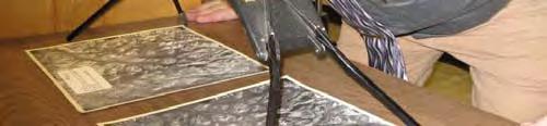
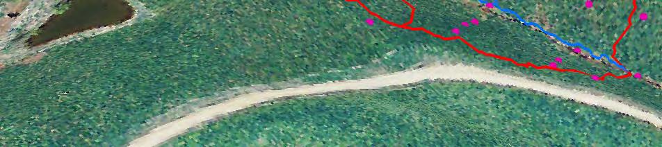
6 WeC2- Wellston 6-12% slope Catchment GID3-Gilpin Gil i 12-18% 18% slope Detailed Field Soil Survey Soil Pits SSURGO Transect Southern Indiana Landscape
7 WeC2- Wellston 6-12% slope Southern Indiana Landscape
8 SSURGO - Soil Information Wellston Gilpin Wellston cm 46 cm 140 cm 81 cm 81 cm 140 cm Soil Surface Minimum Solum Thickness Maximum Solum Thickness Predicted Water Table 91 Ranges for Solum Thickness
9 SSURGO - Soil Information 69 Gilpin Wellston Zanesville Deuchars Apalona Solum Thickness (cm) O l i R f l thi k d i l ( ) Overlapping Ranges for solum thickness and unique values (mean) for each polygon based on the Traditional Soil Map SSURGO


10 Predicted Soil Moisture Temporal Distribution A, AE and E Horizons Bt and Btx Horizons BC, C and Cr Horizons Precipitation Minimum range for horizon thickness Maximum range for horizon thickness


11 Loess Thickness Field Soil Survey
12 Field Soil Survey A p B t A p B t 2Bt x 2Bt x 3Bt C r C r 3Bt Soil Surface A p Surface Bt x Surface Predicted Water Table Lithic/paralithic Surface Paleosol Surface R/C r 3Bt
13 Materials and Methods
14 SSURGO - Soil Information 152 cm 102 cm Fincasle Brookston Cyclone/ Kokomo Brookston Fincasle 102 cm 152 cm 178 cm 91 cm 91 cm Soil Surface Minimum Depth to Dense Till Maximum Depth to Dense Till Predicted Water Table Ranges for Depth to Dense Till
15 SSURGO - Soil Information Thickness (cm) Depth to (cm) Soil Series Loess Argillic Epipedon Dense Till Carbonates Texture Fincastle SiCL Brookston SiCL Pewamo SiCL/CL/SiC/C Blount SiCL/CL/SiC/C Crosby SiCL/SiL/CL/SiC Kokomo SiCL/CL Depth to Carbonates a 200 a a a cm a a 40 0 Fincastle Brookston Pewamo Blount Crosby Kokomo Soil Series
16 Field Soil Survey 75 cm Fincasle 60 cm Brookston Cyclone/ Kokomo Brookston 60 cm Fincasle 125 cm 135 cm 75 cm 125 cm 78 cm 78 cm Soil Surface Depth to Dense Till Predicted Water Table Ranges for Depth to Dense Till


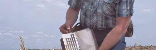
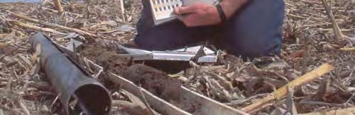
17 Traditional Soil Survey Tools Slope Survey Soil Property Data Collection Source: Stereo scoping Source: Source:
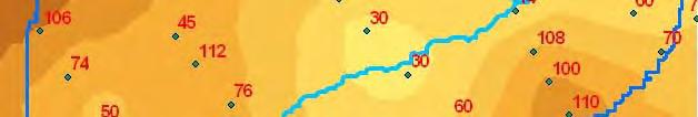
18 Legend counties DEM_5M Value High: Kilometers Low : : Northern Indiana Landscape


19 Legend counties DEM_5M Value High : Low : soilmu_a_in067 1: Kilometers Northern Indiana Landscape


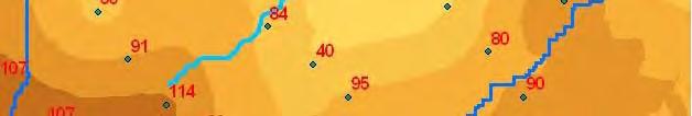
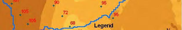
20 Legend DEM_5M Value counties High : : Kilometers Low : Southern Indiana Landscape


21 Legend DEM_5M Value counties High : Low : : Kilometers Southern Indiana Landscape


22 Legend DEM_5M Value counties High : Low : : soilmu_a_in037 Southern Indiana Landscape Kilometers


23 Legend DEM_5M Value counties High : Low : : soilmu_a_in037 Southern Indiana Landscape Kilometers

24 Soil Development Water Soil Properties Soil-Landscape Southern Indiana Landscape Northern Indiana Landscape
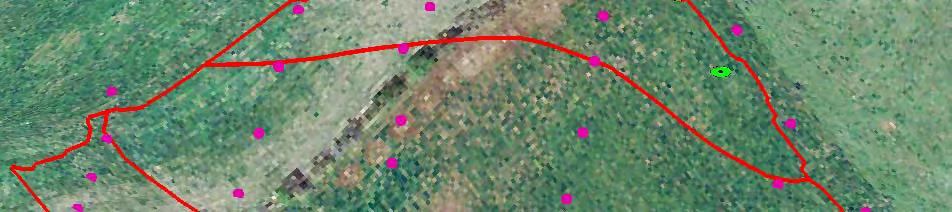
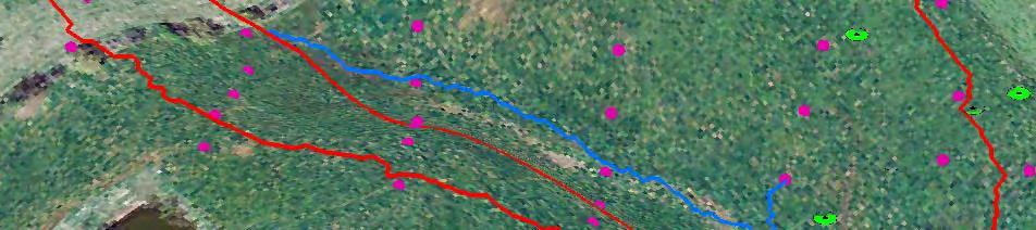
25 Study Area Soils in Howard County Over 9300 soil polygons 18 series 3 major parent material regions 5 soils cover 80% of the land in Howard County
26 Soils in Howard County Fincastle/Brookston Region Blount/Pewamo Region Crosby/Brookston Region Are there relationships between these 5 soils and terrain attributes? p Can we use those relationships to generate continuum soil property maps (raster based)?
27 Soil Information Materials and Methods SSURGO Soil Map 1:20,000 Field observations Digital Elevation Model DEM Indiana DEM 1.5 m resolution Terrain analysis SAGA (System for Automated Geoscientific Analysis) software Topographical wetness index calculated with variations in Holmgren exponent values (Holmgren, 1994) Slope, altitude above channel network, other terrain attributes. Fuzzy logic inference Soil Landscape Interface Model (SoLIM V 1.5) A-Xing Zhu, Xun Shi, James E. Burt, Fei Du. Carbon and Nitrogen Total C and N by dry combustion
28 Topographic Wetness Index TWI TWI is a measure of the potential for water to accumulate in certain landscape positions: Where: a = the upslope area in m 2, per unit contour length, contributing flow to a pixel, and b = slope angle acting on a cell measured in radians (Quinn et al., 1995);
29 Procedures Establish soil-landscape relationships (data mining); Derive terrain attributes from DEM: Topographic Wetness Index (TWI); Altitude Above Channel; Curvature; Slope; Elevation; Soil parent material zone. Use these relationships to Create Rule Based Cases with SoLIM; Compare to field data. Materials and Methods


30 Soil Frequency Distributions vs. Terrain Attributes Terrain attribute: Altitude above channel network Terrain attribute: Curvature Potentially useful Probably not useful Brookston Fincastle Brookston Fincastle We observe the separation between peaks of the histograms Frequen ncy ABCN Frequen ncy Curvature
31 Soil Frequency Distribution vs. TWI Terrain attribute: Wetness Index TWI = 10 TWI = 13 Fincastle Brookston Frequency Potentially Very useful! Wetness index


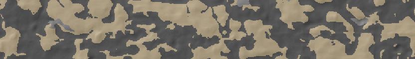
32 Shaded Relief Elevation Model, 242 to 248 meters Wetness Index, 8 to 20 Slope, 0 to 4% SSURGO Miles Brookston Fincastle
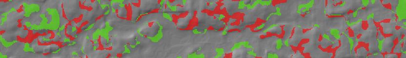
33 Hardened Map Brookston Fincastle 97% 5%

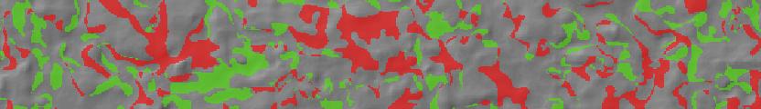
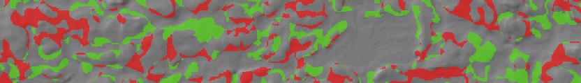
34 Brookston/Fincastle Difference SSURGO SoLIM Mapp Brookston according to SSURGO but Fincastle according to SoLIM Fincastle according to SSURGO but Brookston according to SoLIM km
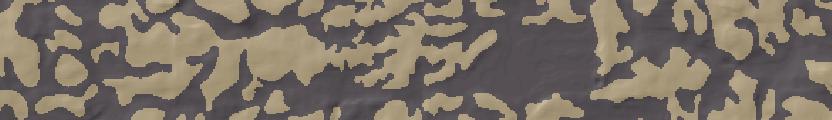
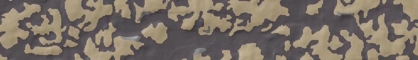
35 Terrain-Soil Matching for Brookston Fuzzy membership values (from 0 to 100%) 2% 100% km
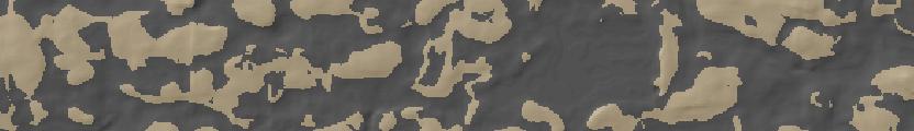
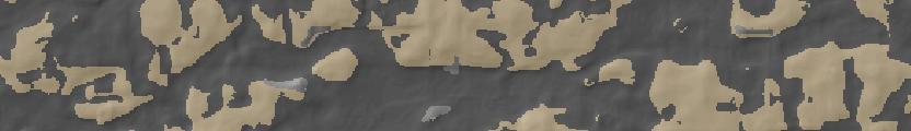
36 Terrain-Soil Matching for Fincastle Fuzzy membership values (from 0 to 100%) 97% 5% km
; S k ij: the fuzzy membership value for kth soil at (i, j); D k : the representative property value for kth soil.")
37 Create Property Map with SoLIM To estimate the soil property p SoLIM uses: We already have S k ij the fuzzy membership value used to make the hardened soil map. D ij : the estimated soil property value at (i, j); S k ij: the fuzzy membership value for kth soil at (i, j); D k : the representative property value for kth soil. So we only need to specify D k, the representative values of the property of interest for each soil In this case, let s assign values to carbonate depth for Fincastle and Brookston in the east section of the county. Fincastle: 100 cm (low range of OSD) Brookston: 170 cm (high range of OSD)
38 Predicted depth to carbonates 100 to 170 cm km


39 Validation and Accuracy Assessment Randomly sample a number of points (~300) to develop baseline data for SoLim and check current soil series; Create a map of predicted soil properties and compare the field values with the predicted; Create confidence Create confidence intervals for predicted properties.
40 Validation and Accuracy Assessment Field Measured Loess Thickness vs. TASM/SoLIM and SSURGO SAMPLE_ID TASM/ SSURGO Field TASM/ SSURGO Field vs Field vs TASM vs SoLIM Measured SoLIM TASM SUURGO SSURGO EZ_111 Fincastle Fincastle EZ_115 Fincastle Brookston n Number of Matches Total Number Matches (%) Field vs TASM Field vs SSURGO TASM vs SSURGO % Loess Argillic Epipedon Dense Till Carbonate Texture Soil Property
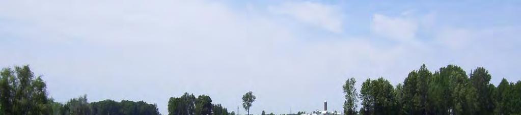
41 Aerial Photography of Howard County
42 Total C by sample location vs. TWI Total C (%)
43 Total C by sample location vs. TWI Legend Total C(%) TWI <VALUE>
 Total C (% %) 12 10 y = 0.2283e 0.148x R 2 = 0.")
 Legend TWI <VALUE> 0-10 10.1-15 15.1-30 17.26 17.24 17.22 10.")
44 TWI vs. Total Soil Carbon Total C vs. Topographic Wetnes Index (TWI) Total C (% %) y = e 0.148x R 2 = TWI Total C (%) Legend TWI <VALUE> m
45 Advantages to fuzzy approach After collecting a number of random data points we can observe the difference between the predicted and actual values to document our error in terms of confidence intervals. Example statement: these predictions have been shown to be accurate within X cm 95% of the time in field trials. Each point in the soilscape is given a single estimated value rather than a range of values. We can publish formal terrain/soil relationships (histogram relationships) to help make our knowledge more accessible (less tacit). The process, though tedious, is less tedious than hand-drawing polygons Higher accuracy and consistency of soil mapping (we think!) Maps more compatible with other raster-based geospatial data
46 What is next? C stability on different landscape positions; Incubation of soil samples; Using stable isotope ratios 12 C/ 13 C to determine age of soil C at key landscape positions; Generating maps of spatial distribution of C stability; Nutrient Management Plans for P in collaboration with Brad Joern at Purdue.
47 Soil CO 2 Incubation Preliminary results
48 Soil CO 2 Incubation Preliminary results TWI Sample CO ug g -1 High TWI soil Low TWI 900 EZ_111 0 Day_3 Day_7 Day_10 Day_14 Time EZ_112 EZ_113 EZ_114 EZ_115 EZ_116 EZ_117 EZ_118 EZ_119 EZ_ EZ_1110-2

49 Thank You
The Future of Soil Mapping using LiDAR Technology
 The Future of Soil Mapping using LiDAR Technology Jessica Philippe Soil Scientist/GIS Specialist March 24, 2016 Natural Resources Conservation Service Helping People Help the Land Area 12-STJ covers parts
Prediction of Soil Properties Using Fuzzy Membership
 Prediction of Soil Properties Using Fuzzy Membership Zhu, A.X. 1,2 ; Moore, A. 3 ; Burt, J. E. 2 1 State Key Lab of Resources and Environmental Information System, Institute of Geographical Sciences and
SoLIM: A new technology for soil survey
 SoLIM: A new technology for soil survey Soil Mapping Using GIS, Expert Knowledge & Fuzzy Logic September 25, 2002 Department of Geography, University of Wisconsin-Madison http://solim.geography.wisc.edu
Watershed Application of WEPP and Geospatial Interfaces. Dennis C. Flanagan
 Watershed Application of WEPP and Geospatial Interfaces Dennis C. Flanagan Research Agricultural Engineer USDA-Agricultural Research Service Adjunct Professor Purdue Univ., Dept. of Agric. & Biol. Eng.
Overview and Recent Developments
 SoLIM: An Effort Moving DSM into the Digital Era Overview and Recent Developments A-Xing Zhu 1,2 1 Department of Geography University of Wisconsin-Madison azhu@wisc.edu 2 Institute of Geographical Sciences
identify tile lines. The imagery used in tile lines identification should be processed in digital format.
 Question and Answers: Automated identification of tile drainage from remotely sensed data Bibi Naz, Srinivasulu Ale, Laura Bowling and Chris Johannsen Introduction: Subsurface drainage (popularly known
An examination of geographic patterns of soil climate and its classification in the U.S. system of soil taxonomy
 Purdue University Purdue e-pubs Open Access Dissertations Theses and Dissertations 12-2016 An examination of geographic patterns of soil climate and its classification in the U.S. system of soil taxonomy
Development of Webbased. Tool for Tennessee
 Development of Webbased Farm Mapping Tool for Tennessee Southern Region Water Quality Conference, Oct. 24 2005 Forbes Walker and Alan Jolly Biosystems Engineering and SOIL SCIENCE Nutrient Management Planning
GIS APPLICATIONS IN SOIL SURVEY UPDATES
 GIS APPLICATIONS IN SOIL SURVEY UPDATES ABSTRACT Recent computer hardware and GIS software developments provide new methods that can be used to update existing digital soil surveys. Multi-perspective visualization
USING A KNOWLEDGE-BASED SYSTEM TO TEST THE TRANSFERABILITY OF A SOIL-LANDSCAPE MODEL IN NORTHEASTERN VERMONT
 USING A KNOWLEDGE-BASED SYSTEM TO TEST THE TRANSFERABILITY OF A SOIL-LANDSCAPE MODEL IN NORTHEASTERN VERMONT By JESSICA MCKAY A THESIS PRESENTED TO THE GRADUATE SCHOOL OF THE UNIVERSITY OF FLORIDA IN PARTIAL
APPLICATION OF FUZZY SETS FUNCTION FOR LAND ATTRIBUTES MAPPING. Dwi Putro Tejo Baskoro ABSTRACT
 Application Jurnal Tanah of dan fuzzy Lingkungan, sets function Vol. (D.P.T. 10 No.1, Baskoro) April 2008:20-26 ISSN 1410-7333 APPLICATION OF FUZZY SETS FUNCTION FOR LAND ATTRIBUTES MAPPING Dwi Putro Tejo
Floodplain modeling. Ovidius University of Constanta (P4) Romania & Technological Educational Institute of Serres, Greece
 Romania & Technological Educational Institute of Serres, Greece") Floodplain modeling Ovidius University of Constanta (P4) Romania & Technological Educational Institute of Serres, Greece Scientific Staff: Dr Carmen Maftei, Professor, Civil Engineering Dept. Dr Konstantinos
Floodplain modeling Ovidius University of Constanta (P4) Romania & Technological Educational Institute of Serres, Greece Scientific Staff: Dr Carmen Maftei, Professor, Civil Engineering Dept. Dr Konstantinos
A Help Guide for Using gssurgo to Find Potential Wetland Soil Landscapes
 A Help Guide for Using gssurgo to Find Potential Wetland Soil Landscapes Wetland Mapping Consortium Webinar September 17, 2014 Dr. John M. Galbraith Crop & Soil Environmental Sciences Virginia Tech Wetland
Custom Soil Resource Report Soil Map
 121 3' 56'' W Custom Soil Resource Report Soil Map 121 2' 49'' W 45 16' 39'' N 5013800 5014000 5014200 5014400 5014600 5014800 5015000 5015200 5015400 5015600 651800 652000 652200 652400 652600 652800
The Road to Data in Baltimore
 Creating a parcel level database from high resolution imagery By Austin Troy and Weiqi Zhou University of Vermont, Rubenstein School of Natural Resources State and local planning agencies are increasingly
GeoWEPP Tutorial Appendix
 GeoWEPP Tutorial Appendix Chris S. Renschler University at Buffalo - The State University of New York Department of Geography, 116 Wilkeson Quad Buffalo, New York 14261, USA Prepared for use at the WEPP/GeoWEPP
Review Using the Geographical Information System and Remote Sensing Techniques for Soil Erosion Assessment
 Polish J. of Environ. Stud. Vol. 19, No. 5 (2010), 881-886 Review Using the Geographical Information System and Remote Sensing Techniques for Soil Erosion Assessment Nuket Benzer* Landscape Architecture
Custom Soil Resource Report for Forrest County, Mississippi
 United States Department of Agriculture Natural Resources Conservation Service A product of the National Cooperative Soil Survey, a joint effort of the United States Department of Agriculture and other
A GIS-based Approach to Watershed Analysis in Texas Author: Allison Guettner
 Texas A&M University Zachry Department of Civil Engineering CVEN 658 Civil Engineering Applications of GIS Instructor: Dr. Francisco Olivera A GIS-based Approach to Watershed Analysis in Texas Author:
Waterborne Environmental, Inc., Leesburg, VA, USA 2. Syngenta Crop Protection, LLC, North America 3. Syngenta Crop Protection, Int.
 Application of High Resolution Elevation Data (LiDAR) to Assess Natural and Anthropogenic Agricultural Features Affecting the Transport of Pesticides at Multiple Spatial Scales Josh Amos 1, Chris Holmes
Governing Rules of Water Movement
 Governing Rules of Water Movement Like all physical processes, the flow of water always occurs across some form of energy gradient from high to low e.g., a topographic (slope) gradient from high to low
Geoderma 155 (2010) Contents lists available at ScienceDirect. Geoderma. journal homepage:
 Contents lists available at ScienceDirect. Geoderma. journal homepage:") Geoderma 155 (2010) 164 174 Contents lists available at ScienceDirect Geoderma journal homepage: www.elsevier.com/locate/geoderma Construction of membership functions for predictive soil mapping under
Geoderma 155 (2010) 164 174 Contents lists available at ScienceDirect Geoderma journal homepage: www.elsevier.com/locate/geoderma Construction of membership functions for predictive soil mapping under
Regionalization Methods for Watershed Management - Hydrology and Soil Erosion from Point to Regional Scales
 This paper was peer-reviewed for scientific content. Pages 1062-1067. In: D.E. Stott, R.H. Mohtar and G.C. Steinhardt (eds). 2001. Sustaining the Global Farm. Selected papers from the 10th International
Lidar-derived Hydrography as a Source for the National Hydrography Dataset
 Lidar-derived Hydrography as a Source for the National Hydrography Dataset Lidar-Derived Hydrography, Bathymetry, and Topobathymetry in the National Hydrography Dataset and 3-Dimensional Elevation Program
Pierce Cedar Creek Institute GIS Development Final Report. Grand Valley State University
 Pierce Cedar Creek Institute GIS Development Final Report Grand Valley State University Major Goals of Project The two primary goals of the project were to provide Matt VanPortfliet, GVSU student, the
Soil Map Boulder County Area, Colorado (Planet Blue Grass) Web Soil Survey National Cooperative Soil Survey
 Web Soil Survey National Cooperative Soil Survey") 475910 476000 476090 476180 476270 476360 105 16' 21'' W 476450 476540 476630 476720 476810 4453350 4453440 4453260 4453350 4453170 4453260 4453080 4453170 4453080 475820 475910 4452990 476000 476090 476180
475910 476000 476090 476180 476270 476360 105 16' 21'' W 476450 476540 476630 476720 476810 4453350 4453440 4453260 4453350 4453170 4453260 4453080 4453170 4453080 475820 475910 4452990 476000 476090 476180
RANCHO de DOS PALMAS DAVIS, California, AC +/-
 RANCHO de DOS PALMAS DAVIS, California, 507.28 AC +/- Boundary Transmission Line Pond / Tank Well SCOTT STONE P: (530) 662-4094 sastone57@gmail.com 37874 County Road 28, Woodland, Ca. 95695 The information
Outline. GIS, Spatial Analysis & Spatial Thinking: Essential Tools for the Modern Geoscientist s Toolbox. Mapping & classification (2)
") GIS, Spatial Analysis & Spatial Thinking: Essential Tools for the Modern Geoscientist s Toolbox John Wilson 26 April 21 Outline My work Mapping & classification Digital terrain analysis Fuzzy logic & classification
GIS, Spatial Analysis & Spatial Thinking: Essential Tools for the Modern Geoscientist s Toolbox John Wilson 26 April 21 Outline My work Mapping & classification Digital terrain analysis Fuzzy logic & classification
Lecture 3. Data Sources for GIS in Water Resources
 Lecture 3 Data Sources for GIS in Water Resources GIS in Water Resources Spring 2015 http://www.data.gov/ 1 USGS GIS data for Water http://water.usgs.gov/maps.html Watersheds of the US 2-digit water resource
Watershed concepts for community environmental planning
 Purpose and Objectives Watershed concepts for community environmental planning Dale Bruns, Wilkes University USDA Rural GIS Consortium May 2007 Provide background on basic concepts in watershed, stream,
Remote Sensing and Geospatial Application for Wetlands Mapping, Assessment, and Mitigation
 Remote Sensing and Geospatial Application for Wetlands Mapping, Assessment, and Mitigation Hydrology Soils MSU Seminar Series Remote Sensing and Geospatial Applications September 4, 2002 Vegetation NEPA
Distinct landscape features with important biologic, hydrologic, geomorphic, and biogeochemical functions.
 1 Distinct landscape features with important biologic, hydrologic, geomorphic, and biogeochemical functions. Have distinguishing characteristics that include low slopes, well drained soils, intermittent
Esri Image & Mapping Forum 9 July 2017 Geiger-Mode for Conservation Planning & Design by USDA NRCS NGCE
 Esri Image & Mapping Forum 9 July 2017 Geiger-Mode for Conservation Planning & Design by USDA NRCS NGCE For over 75 years, the Natural Resources Conservation Service has been a pioneer in conservation,
Sampling Populations limited in the scope enumerate
 Sampling Populations Typically, when we collect data, we are somewhat limited in the scope of what information we can reasonably collect Ideally, we would enumerate each and every member of a population
GIS in Water Resources Midterm Exam Fall 2012 There are five questions on this exam. Please do all five.
 Page 1 of 6 Name: Key GIS in Water Resources Midterm Exam Fall 2012 There are five questions on this exam. Please do all five. Question 1 (a) You have worked with the location of Utah State University
PROANA A USEFUL SOFTWARE FOR TERRAIN ANALYSIS AND GEOENVIRONMENTAL APPLICATIONS STUDY CASE ON THE GEODYNAMIC EVOLUTION OF ARGOLIS PENINSULA, GREECE.
 PROANA A USEFUL SOFTWARE FOR TERRAIN ANALYSIS AND GEOENVIRONMENTAL APPLICATIONS STUDY CASE ON THE GEODYNAMIC EVOLUTION OF ARGOLIS PENINSULA, GREECE. Spyridoula Vassilopoulou * Institute of Cartography
USING HYPERSPECTRAL IMAGERY
 USING HYPERSPECTRAL IMAGERY AND LIDAR DATA TO DETECT PLANT INVASIONS 2016 ESRI CANADA SCHOLARSHIP APPLICATION CURTIS CHANCE M.SC. CANDIDATE FACULTY OF FORESTRY UNIVERSITY OF BRITISH COLUMBIA CURTIS.CHANCE@ALUMNI.UBC.CA
Four Soil Orders on a Vermont mountaintop One-third of the world s soil orders in a 2500 square meter research plot
 Four Soil Orders on a Vermont mountaintop One-third of the world s soil orders in a 2500 square meter research plot Thomas R. Villars, Scott W. Bailey, Donald S. Ross 38% of world s soils are in these
Steve Pye LA /22/16 Final Report: Determining regional locations of reference sites based on slope and soil type. Client: Sonoma Land Trust
 Steve Pye LA 221 04/22/16 Final Report: Determining regional locations of reference sites based on slope and soil type. Client: Sonoma Land Trust Deliverables: Results and working model that determine
Precision Ag. Technologies and Agronomic Crop Management. Spatial data layers can be... Many forms of spatial data
 Components of Precision Agriculture Precision Ag. Technologies and Agronomic Crop Management R.L. (Bob) Nielsen Purdue Univ, Agronomy Dept. West Lafayette, Indiana Equipment control Equipment monitoring
Abstracts - Technical Presentations 1 st Joint LiDAR Workshop 29 June 2016
 Abstracts - Technical Presentations 1 st Joint LiDAR Workshop 29 June 2016 10:30 AM Title: The Finer details: Processing algorithm adjustment and point cloud/survey data statistics in wetlands. Authors:
Application of an Enhanced, Fine-Scale SWAT Model to Target Land Management Practices for Maximizing Pollutant Reduction and Conservation Benefits
 Application of an Enhanced, Fine-Scale SWAT Model to Target Land Management Practices for Maximizing Pollutant Reduction and Conservation Benefits Amanda Flynn, Todd Redder, Joe DePinto, Derek Schlea Brian
Spatial Survey of Surface Soil Moisture in a Sub-alpine Watershed Colloquium Presentation, University of Denver, Department of Geography
 Thank you all for coming today. I will be talking about my thesis work concerning the spatial distribution of soil moisture in an alpine catchment. But first we need some background in soil moisture. Why
Big Rivers Electric Corporation Disposal of Coal Combustion Residuals (CCR) from Electric Utilities Final Rule CCR Impoundment Liner Assessment Report
 from Electric Utilities Final Rule CCR Impoundment Liner Assessment Report") Big Rivers Electric Corporation Disposal of Coal Combustion Residuals (CCR) from Electric Utilities Final Rule CCR Impoundment Liner Assessment Report CCR Surface Impoundment Information Name: Operator:
Big Rivers Electric Corporation Disposal of Coal Combustion Residuals (CCR) from Electric Utilities Final Rule CCR Impoundment Liner Assessment Report CCR Surface Impoundment Information Name: Operator:
Exhibit RMP-4. Foote Creek Geology and Topography
 Exhibit RMP-4 Foote Creek Geology and Topography Memorandum To: From: CC: Travis Brown, PacifiCorp Daria Drago, P.E., PMP Dr. Deb Luchsinger Date: January 9, 2019 Re: Foote Creek Rim 1 - Geologic Conditions
Web Soil Survey National Cooperative Soil Survey
 122 14' 27'' W () 122 13' 37'' W 40 8' 40'' N 564700 564800 564900 565000 565100 565200 565300 565400 565500 565600 565700 565800 40 8' 40'' N 4443400 4443500 4443600 4443700 4443800 4443900 4444000 4443400
Madison, WI, USA c School of Environmental and Life Sciences, Kean University, Union, NJ, USA. Available online: 28 Feb 2012
 This article was downloaded by: [Institute of Geographic Sciences & Natural Resources Research] On: 05 March 2012, At: 22:25 Publisher: Taylor & Francis Informa Ltd Registered in England and Wales Registered
Fuzzy soil mapping based on prototype category theory
 Geoderma 136 (2006) 774 787 www.elsevier.com/locate/geoderma Fuzzy soil mapping based on prototype category theory Feng Qi a,, A-Xing Zhu b,c, Mark Harrower c, James E. Burt c a Department of Political
Phase One Development of a Comprehensive GIS for the Mentor Marsh and its Proximal Watershed
 FINAL REPORT Phase One Development of a Comprehensive GIS for the Mentor Marsh and its Proximal Watershed Lake Erie Protection Fund SG 120-99 Ohio State University Research Foundation RF 738027 December
ABSTRACT The first chapter Chapter two Chapter three Chapter four
 ABSTRACT The researches regarding this doctoral dissertation have been focused on the use of modern techniques and technologies of topography for the inventory and record keeping of land reclamation. The
Using the Web Soil Survey Resilience and Resistance Score Sheet Soils Report
 Using the Resilience and Resistance Score Sheet Soils Report 1. Go to http://websoilsurvey.nrcs.usda.gov/app/ and click on the Start WSS button. 2. Create an Area of Interest (AOI) using any of the available
THE ROLE OF GEOCOMPUTATION IN THE HYDROLOGICAL SCIENCES
 INTERNATIONAL SYMPOSIUM ON GEOCOMPUTATION AND ANALYSIS THE ROLE OF GEOCOMPUTATION IN THE HYDROLOGICAL SCIENCES JOHN P. WILSON UNIVERSITY OF SOUTHERN CALIFORNIA GIS RESEARCH LABORATORY Outline Background
Fatmagül Batuk, Ozan Emem Department of Geodesy and Photogrammetry Engineering Tolga Görüm, Erkan Gökaan Natural Sciences Research Center
 Fatmagül Batuk, Ozan Emem Department of Geodesy and Photogrammetry Engineering Tolga Görüm, Erkan Gökaan Natural Sciences Research Center Landforms Landform term as used to denote a portion of the earth
Object Based Imagery Exploration with. Outline
 Object Based Imagery Exploration with Dan Craver Portland State University June 11, 2007 Outline Overview Getting Started Processing and Derivatives Object-oriented classification Literature review Demo
Digital Elevation Models. Using elevation data in raster format in a GIS
 Digital Elevation Models Using elevation data in raster format in a GIS What is a Digital Elevation Model (DEM)? Digital representation of topography Model based on scale of original data Commonly a raster
SoilView: Development of a Custom GIS Application for Publishing Soil Surveys
 SoilView: Development of a Custom GIS Application for Publishing Soil Surveys Allan Johnson and Mike Wigginton Abstract Currently, digital soils information can be obtained from many sources. Numerous
Handling Raster Data for Hydrologic Applications
 Handling Raster Data for Hydrologic Applications Prepared by Venkatesh Merwade Lyles School of Civil Engineering, Purdue University vmerwade@purdue.edu January 2018 Objective The objective of this exercise
Geological control in 3D stratigraphic modeling, Oak Ridges Moraine, southern Ontario. Logan, C., Russell, H. A. J., and Sharpe, D. R.
 Geological control in 3D stratigraphic modeling, Oak Ridges Moraine, southern Ontario Logan, C., Russell, H. A. J., and Sharpe, D. R. Rationale Increasing urbanization in the Greater Toronto Area is creating
Remote Sensing and GIS Applications for Hilly Watersheds SUBASHISA DUTTA DEPARTMENT OF CIVIL ENGINEERING IIT GUWAHATI
 Remote Sensing and GIS Applications for Hilly Watersheds SUBASHISA DUTTA DEPARTMENT OF CIVIL ENGINEERING IIT GUWAHATI Deciding Alternative Land Use Options in a Watershed Using GIS Source: Anita Prakash
Multi-scale Soil Moisture Model Calibration and Validation: Evan Coopersmith & Michael Cosh, USDA-ARS, Dept. of Hydrology and Remote Sensing
 Multi-scale Soil Moisture Model Calibration and Validation: Evan Coopersmith & Michael Cosh, USDA-ARS, Dept. of Hydrology and Remote Sensing An Ideal Location: Three Types of Similarity Hydro-climatic
Scientific registration n : 2180 Symposium n : 35 Presentation : poster MULDERS M.A.
 Scientific registration n : 2180 Symposium n : 35 Presentation : poster GIS and Remote sensing as tools to map soils in Zoundwéogo (Burkina Faso) SIG et télédétection, aides à la cartographie des sols
Pipeline Routing Using Geospatial Information System Analysis
 Pipeline Routing Using Geospatial Information System Analysis Mahmoud Reza 1 Delavar and Fereydoon 2 Naghibi 1-Assistance Professor, Dept. of Surveying and Geomatic Eng., Eng. Faculty, University of Tehran,
Basin characteristics
 Basin characteristics From hydrological processes at the point scale to hydrological processes throughout the space continuum: point scale à river basin The watershed characteristics (shape, length, topography,
Solum depth spatial prediction comparing conventional with knowledge-based digital soil mapping approaches
 36 Scientia Soil-attribute Agricolaspatial prediction http://dx.doi.org/0.590/003-906-203-046 Solum depth spatial prediction comparing conventional with nowledge-based digital soil mapping approaches Michele
Name NRS 509 Exam I. Right Map
 Read every question carefully. You may use a calculator if you wish. Conversion tables are provided at the end of the exam. If you have any questions, raise your hand. Be sure to show your work on computational
THE TRANSECTS. Oldenburger,F.H.F. & Norde,R.* Online publication 2009 Correspondence author.
 THE TRANSECTS By Oldenburger,F.H.F. & Norde,R.* Online publication 2009 Correspondence author. Email r.norde@kpnplanet.nl Apart from the floristic inventarisation, the syn-ecological and syn-systematic
Title: High resolution geographical information system for assessing vineyard site suitability
 Title: High resolution geographical information system for assessing vineyard site suitability Progress Report Grant Code: 2009-16 Name(s), mailing and email address(s) of principal investigators: Principle
Biosphere. All living things, plants, animals, (even you!) are part of the zone of the earth called the biosphere.
 are part of the zone of the earth called the biosphere.") Unit 1 Study Guide Earth s Spheres Biosphere All living things, plants, animals, (even you!) are part of the zone of the earth called the biosphere. Hydrosphere Water covers ¾ of the earth, made up mostly
Unit 1 Study Guide Earth s Spheres Biosphere All living things, plants, animals, (even you!) are part of the zone of the earth called the biosphere. Hydrosphere Water covers ¾ of the earth, made up mostly
12- TOL MLRA Soil Survey Area Approximately 15,000,000 Acres
 !@ 12- TOL MLRA Soil Survey Area Approximately 15,000,000 Acres Office Location: Tolland, Connecticut Staff: Donald Parizek Acting Soil Survey Office Party Leader Jacob Isleib Soil Scientist Marissa Theve
Custom Soil Resource Report Soil Map
 78 10' 44'' W Custom Soil Resource Report Soil Map 78 9' 40'' W 40 37' 18'' N 738700 738800 738900 739000 739100 739200 739300 739400 739500 739600 739700 739800 739900 740000 740100 40 37' 18'' N 4499700
Existing NWS Flash Flood Guidance
 Introduction The Flash Flood Potential Index (FFPI) incorporates physiographic characteristics of an individual drainage basin to determine its hydrologic response. In flash flood situations, the hydrologic
Soil Taxonomy Classification Osage County, Kansas. Web Soil Survey National Cooperative Soil Survey
 95 45' 5'' W Soil Taxonomy Classification Osage County, Kansas 95 44' 3'' W 260300 260400 260500 260600 260700 260800 260900 261000 261100 261200 261300 261400 261500 261600 261700 38 33' 4'' N 38 32'
Ecological Site Descriptions ESDs : NRCS Site-based Approach to Land Classification and Evaluation. Nels Barrett, NRCS Ecologist SSSSNE 20
 Ecological Site Descriptions ESDs : NRCS Site-based Approach to Land Classification and Evaluation Nels Barrett, NRCS Ecologist SSSSNE 20 Overview Definition of Ecological Sites, ES Content of Ecological
SPATIAL AND TEMPORAL ANALYSIS OF THE DEGRADATION OF NATURAL RESOURCES IN RIVER LIKODRA WATERSHED
 Soil Erosion Modelling JRC Ispra 20-21-22 March 2017 University of Belgrade, Faculty of Forestry Department for Ecological Engineering in Protection of Soil and Water Resources SPATIAL AND TEMPORAL ANALYSIS
Digital Elevation Models (DEM)
") Digital Elevation Models (DEM) Digital representation of the terrain surface enable 2.5 / 3D views Rule #1: they are models, not reality Rule #2: they always include some errors (subject to scale and data
Digital Elevation Models (DEM) Digital representation of the terrain surface enable 2.5 / 3D views Rule #1: they are models, not reality Rule #2: they always include some errors (subject to scale and data
Wetland Mapping. Wetland Mapping in the United States. State Wetland Losses 53% in Lower US. Matthew J. Gray University of Tennessee
 Wetland Mapping Caribbean Matthew J. Gray University of Tennessee Wetland Mapping in the United States Shaw and Fredine (1956) National Wetlands Inventory U.S. Fish and Wildlife Service is the principle
Custom Soil Resource Report for Gem County Area, Idaho
 United States Department of Agriculture Natural Resources Conservation Service A product of the National Cooperative Soil Survey, a joint effort of the United States Department of Agriculture and other
Climates of NYS. Definitions. Climate Regions of NYS. Storm Tracks. Climate Controls 10/13/2011. Characteristics of NYS s Climates
 Definitions Climates of NYS Prof. Anthony Grande 2011 Weather and Climate Weather the state of the atmosphere at one point in time. The elements of weather are temperature, air pressure, wind and moisture.
Pedometric Techniques in Spatialisation of Soil Properties for Agricultural Land Evaluation
 Bulletin UASVM Agriculture, 67(1)/2010 Print ISSN 1843-5246; Electronic ISSN 1843-5386 Pedometric Techniques in Spatialisation of Soil Properties for Agricultural Land Evaluation Iuliana Cornelia TANASĂ
GIS Topographic Wetness Index (TWI) Exercise Steps
 Exercise Steps") GIS Topographic Wetness Index (TWI) Exercise Steps October 2016 Jeffrey L. Zimmerman, Jr. GIS Analyst James P. Shallenberger Manager, Monitoring & Protection Susquehanna River Basin Commission Table of
GIS Topographic Wetness Index (TWI) Exercise Steps October 2016 Jeffrey L. Zimmerman, Jr. GIS Analyst James P. Shallenberger Manager, Monitoring & Protection Susquehanna River Basin Commission Table of
Figure 0-18: Dendrogeomorphic analysis of streambank erosion and floodplain deposition (from Noe and others, 2015a)
") Appendix 9A: Stream to River During the development of the Phase 6 Watershed Model, multiple methods for determining coefficients were often attempted. In some cases, the methods are averaged or otherwise
Appendix 9A: Stream to River During the development of the Phase 6 Watershed Model, multiple methods for determining coefficients were often attempted. In some cases, the methods are averaged or otherwise
Great Lakes Online Watershed Interface W. Elliot, Research Engineer USDA Forest Service Rocky Mountain Research Station, Moscow, ID March, 2016
 Great Lakes Online Watershed Interface W. Elliot, Research Engineer USDA Forest Service Rocky Mountain Research Station, Moscow, ID March, 2016 Guidelines for using the Web WEPP Watershed Tool to Support
MAPPING POTENTIAL LAND DEGRADATION IN BHUTAN
 MAPPING POTENTIAL LAND DEGRADATION IN BHUTAN Moe Myint, Geoinformatics Consultant Rue du Midi-8, CH-1196, Gland, Switzerland moemyint@bluewin.ch Pema Thinley, GIS Analyst Renewable Natural Resources Research
INTRODUCTION TO ARCGIS 10
 Department of Irrigation, Drainage and Landscape Engineering, Faculty of Civil Engineering, CTU Prague Institute of Hydraulics and Rural Water Management BOKU Vienna INTRODUCTION TO ARCGIS 10 MAIN WINDOW
Scientific registration number: 1347 Symposium N o : 17 Presentation: Oral
 Scientific registration number: 147 Symposium N o : 17 Presentation: Oral The use of integrated AVHRR and DEM data for small scale soil mapping Utilisation intégrée de données AVHRR et MNT pour la cartographie
ESTIMATION OF LANDFORM CLASSIFICATION BASED ON LAND USE AND ITS CHANGE - Use of Object-based Classification and Altitude Data -
 ESTIMATION OF LANDFORM CLASSIFICATION BASED ON LAND USE AND ITS CHANGE - Use of Object-based Classification and Altitude Data - Shoichi NAKAI 1 and Jaegyu BAE 2 1 Professor, Chiba University, Chiba, Japan.
GIS feature extraction tools in diverse landscapes
 CE 394K.3 GIS in Water Resources GIS feature extraction tools in diverse landscapes Final Project Anna G. Kladzyk M.S. Candidate, Expected 2015 Department of Environmental and Water Resources Engineering
GIS Application in Landslide Hazard Analysis An Example from the Shihmen Reservoir Catchment Area in Northern Taiwan
 GIS Application in Landslide Hazard Analysis An Example from the Shihmen Reservoir Catchment Area in Northern Taiwan Chyi-Tyi Lee Institute of Applied Geology, National Central University, No.300, Jungda
Positional accuracy of the drainage networks extracted from ASTER and SRTM for the Gorongosa National Park region - Comparative analysis
 Positional accuracy of the drainage networks extracted from ASTER and SRTM for the Gorongosa National Park region - Comparative analysis Tiago CARMO 1, Cidália C. FONTE 1,2 1 Departamento de Matemática,
Presentation given at Smithsonian National Air and Space Museum October 2006
 Presentation given at Smithsonian National Air and Space Museum October 2006 The Science and Art of Mapping Martian Valley Networks Using a Computer Algorithm Tomasz F. Stepinski Lunar and Planetary Institute
HYDROLOGIC AND WATER RESOURCES EVALUATIONS FOR SG. LUI WATERSHED
 HYDROLOGIC AND WATER RESOURCES EVALUATIONS FOR SG. LUI WATERSHED 1.0 Introduction The Sg. Lui watershed is the upper part of Langat River Basin, in the state of Selangor which located approximately 20
Paper N National Soil Erosion Research Lab
 Paper N. 11137 National Soil Erosion Research Lab Carlos R. Mello Federal University of Lavras (UF, Lavras, MG, Brazil) crmello@deg.ufla.br Marcelo R. Viola (UF, Brazil) Samuel Beskow Federal University
StreBanD DSS: A Riparian Buffer Decision Support System for Planners
 StreBanD DSS: A Riparian Buffer Decision Support System for Planners Dharmendra Saraswat Assoc. Prof,/Ext. Engineer- Geospatial 501-681-5987 (mobile) dsaraswat@uaex.edu Acknowledgment Project Team: Dr.
AN ASSESSMENT OF THE IMPACT OF RETENTION PONDS
 AN ASSESSMENT OF THE IMPACT OF RETENTION PONDS FOR SEDIMENT TRAPPING IN THE ADA CREEK AND LONGWOOD COVE USING REMOTELY SENSED DATA AND GIS ANALYSIS Sudhanshu Sekhar Panda Associate Professor, GIS/Env.
RESEARCH ON KNOWLEDGE-BASED PREDICTIVE NATURAL RESOURCE MAPPING SYSTEM
 RESEARCH ON KNOWLEDGE-BASED PREDICTIVE NATURAL RESOURCE MAPPING SYSTEM Fei Du a, b, *, A-Xing Zhu a, c a State Key Laboratory of Resources and Environmental Information System, Institute of Geographical
Spatial Survey of Surface Soil Moisture in a Sub-alpine Watershed
 Spatial Survey of Surface Soil Moisture in a Sub-alpine Watershed Katherine E. Williams M.S. GISc Candidate Department of Geography, University of Denver October 7, 2010 Purpose 2 Introduction to Soil
Accuracy and Uncertainty
 Accuracy and Uncertainty Accuracy and Uncertainty Why is this an issue? What is meant by accuracy and uncertainty (data vs rule)? How things have changed in a digital world. Spatial data quality issues
Web Soil Survey National Cooperative Soil Survey
 95 27' 24'' W Soil Taxonomy Classification Franklin County, Kansas 95 26' 23'' W 285800 285900 286000 286100 286200 286300 286400 286500 286600 286700 286800 286900 287000 287100 287200 38 29' 34'' N 38
Appendix D. Sediment Texture and Other Soil Data
 5 6 7 8 Appendix D. Sediment Texture and Other Soil Data This appendix describes the sediment texture of the aquifer system in the Restoration Area. The contents of this appendix describe the: Importance
Custom Soil Resource Report for Victoria County, Texas
 United States Department of Agriculture Natural Resources Conservation Service A product of the National Cooperative Soil Survey, a joint effort of the United States Department of Agriculture and other