Integrating Conservation and Transportation Planning Through Decision Support Software Or The Missing Link Between Geodatabase & STEP UP?
|
|
|
- Oswin Phelps
- 5 years ago
- Views:
Transcription
1 Integrating Conservation and Transportation Planning Through Decision Support Software Or The Missing Link Between Geodatabase & STEP UP?

2 What is a Decision Support System? Helps you do specific activities vs general tools Guides you through a process Incorporates expert knowledge/models AND user values Provides automation and documentation of the process
3 Some Uses of DSS for Integration Conservation & Transportation Guiding least-conflict routing of transportation Rapid evaluation of multiple route options Integrating multiple objectives (e.g., transportation, development, conservation) for long-term plans or short-term projects Predicting and evaluating long-term cumulative effects Revealing areas needed (irreplaceable) for any particular objectives Revealing options for achieving objectives to mitigate conflicts
4 Example Process of Cumulative Regional Assessment & Planning Develop regional conservation database Finalize plan and establish mitigation Develop transportation needs and database Develop conservation cost surface to guide road routing Model secondary growth effects & integrate into scenario for cumulative assessment Create optional corridors, evaluate, & refine into transportation scenario
5 Tool/Process Integration Demo Method: Integration of Three Planning Tools NatureServe Vista used to identify high conservation value areas Transportation planning tool Quantm used to suggest transportation routes Land use planning tool CommunityViz used to predict resulting urban growth NatureServe Vista used to evaluate impacts of land use on conservation goals
6 About the Tools Quantm: transportation route optimization tool applied through a service contract CommunityViz: land use planning framework tool applied as desktop software NatureServe Vista: conservation framework tool applied as desktop software None of these tools are required to do this analysis or any can be used in any combination with other tools. NatureServe Vista has no formal relationship or linkage to any of these tools.
7 What is Quantm? Worlds first advanced planning system for corridor and route optimization developed over 15 years by Australian Government and Quantm. Addresses complex route planning issues, investigating millions of alignment options. A tool that empowers Planning Engineers with the ability to consider all reasonable alternatives, upfront and equally. Quantm provides training, support and system access the system is applied by the agency or appointed consultant
8 Facilitating integration of all planning aspects in a single analysis Engineering Environmental (NEPA) Cost Community
9 Inputs to QUANTM Terrain model (DEM and/or DTM) Geology and Earthworks costs Geometry Structure Costs Constraints Linear engineering criteria Zone environmental, biological, cultural, resource, mitigation, ROW, etc.

10 3-Dimensional analysis throughout


11 Alternative showing earthworks and constraints Sensitive canyon Bridge Stream crossing Study area limit Click on Extra Costs for Restoration area Environmental impacts Bridge - Grade separation

12 About CommunityViz GIS-based tool for geographic decisions Uses ArcGIS technology Formula-driven indicator charts update dynamically Ready-made or custom analyses Real-world 3D models Interactive scenario analysis Interactive 3D models Intuitive, powerful, and flexible Made available to the public at very low cost by the Orton Family Foundation Multiple scenarios can be studied side by side Dashboard for changing assumptions and settings


13 CommunityViz Growth Modeling Hypothetical build-out capacity for each scenario: Road Proposal 11 shown here. Note that Avoidance areas are constrained from building. Scenario A: Large-lot residential development Scenario B: Commercial and mixed-use zones Land Use Scenario A Land Use Scenario B


14 CommunityViz Growth Modeling Results are available for all 4 scenarios. Potential changes to policies and assumptions can still be tested and explored.


15 CommunityViz Growth Modeling CommunityViz also estimates a wide variety of economic, environmental, and social impacts for each of the 4 scenarios: Just a sample of the many impacts available, all variable by year and other assumptions, are shown here.

16 NatureServe s Conservation Planning Support System

17 About Vista Custom GIS application based as an extension of ESRI s ArcMap 9 with spatial analyst Licensed software with full integrated help manual, live technical support, available training Supports both conservation experts & planners/managers Incorporates expert knowledge/models AND user values Commercial grade design and engineering Provides automation, documentation, & repeatability of the process
18 Basic Vista Extension Components Input to User Decision Process User Planners Planners Managers Managers GIS GIS analysts analysts Ecologists Ecologists NGOs NGOs Custom Interface Desktop Desktop and and web web Analytical models Framework Data Data handling, handling, metadata,project metadata,project tracking, tracking, etc. etc. Technology Platform ESRI ESRI ArcMap ArcMap 9.0, 9.0, MS MS Access, Access, Windows Windows.NET.NET Output Visualization and and Reporting Data Spatial Spatial Extent Extent Spatial Spatial Attributes Attributes Non-spatial Non-spatial data data Expert Expert Knowledge Knowledge Social Social Values Values DSS Components

19 Vista Status & Support Software Versions Released Version 1.0 on March 1, 2005 Version 1.3 released Mar , 2.0 under development with possible release Mar Development Sponsors: ~$3.4M versions SURDNA FOUNDATION Development Partners Environmental Systems Research Institute (ESRI) University of California Santa Barbara US Geological Survey Florida and Wyoming Heritage Programs Endowment ~$1.6M permanent maintenance and support Doris Duke Charitable Foundation The Nature Conservancy Centex


20 Applications So Far 20+ permanent licenses 100+ trial downloads 10+ direct NatureServe projects spanning: Industry, government, NGOs 30 k acres 12M acres Forestry, Conservation, Land Use Planning, Public Land Management County Government 4% Other 7% Environmental NGO 7% Federal Agency 8% Heritage Programs 4% Industry 4% Environmental Consultant 10% Land Trust 13% University 25% Unknown 18%


21 Regional Context for Site Decisions How to get from here to here And from site decisions to roll-up of progress toward regional goals
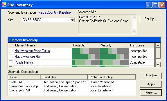
22 Some Jargon Conservation Elements: the features you wish to conserve representing biodiversity & other conservation values Element viability/integrity requirements: representing the site or population needs for proper condition and minimum size Element conservation goals: representing the requirements for metapopulation persistence or ecosystem functioning in the planning region Compatibility: representing analysis of current or alternative futures to meet element requirements while maximizing options to meet other land use objectives Scenario: any mapped features representing land use or management practices, infrastructure, natural or human-caused disturbance, invasive species, pests, disease, etc.


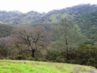
23 Conservation Elements Representing Composition, Structure, and Function of Regional Landscapes Species Imperiled, Declining, Vulnerable, Endemic Management Indicator Species Ecological Communities Rare plant communities Rare aquatic communities Unique environments Ecosystems Groups of communities interconnected on land and waterscapes; Natural pattern and process at local scales useful for management and monitoring Non-Biological Elements Scenic views Historic & cultural sites Valuable agriculture soils Natural hazard zones
24 Defining Goal Achievement Version 1: Adequate number of element occurrences or area in project region (metapopulation viability, ecosystem processes) Adequate size of occurrences (population potential, ecological functioning) Occurring in areas of compatible land use supported by reliable policies Version 2: Same as version 1 plus: Adequate condition of occurrences (habitat quality)
25 Three Analytical Approaches Increasing data requirements, complexity, integration Define High Value Areas Reduce Conflict Create Solutions Select Select important important values values (elements (elements & characteristics) characteristics) Import Import baseline baseline and and evaluate evaluate scenarios scenarios Select Select elements, elements, set set conservation conservation goals goals and and design design rules rules Overlay Overlay maps maps of of elements elements Identify Identify conflicts conflicts and and opportunities opportunities Integrate Integrate data data on on threats threats and and cost cost Identify Identify general general places places to to conserve conserve or or avoid avoid development development Reduce Reduce conflict/generate conflict/generate mitigation mitigation plans plans Generate Generate optimal optimal solutions solutions for for meeting meeting goals goals Conservation Strategies
26 Data & Expert Knowledge Inputs Intermediate Processes & Products Outputs Element Distribution & Confidence Data Join and rasterize Element Conservation Layer Aggregation and Weighting How Vista Works Aggregated Conservation Value Current Land use, infrastructure, pollution, etc Landscape Integrity Index Conflict Intensity Indices Scenario Evaluation Alternative Land Use/ Activity Scenario Evaluation Report Element Conservation Goals Scenario Optimization Scenario Modification Element Response To Land Use/Activity Site Land Use/Mgmt Specification


27 Where Does the Data Come From? Spatial distribution maps of each element come from: Heritage data land cover maps modeled distributions museum collections local information sources Ecological systems Each element occurrence has: A viability/integrity score A confidence score Modeled distributions Species and community occurrences

28 Modeling Condition Landscape Integrity Indices Combines land use, roads, infrastructure, pollution, etc. Model weights effects, adds distance effect Can be elementspecific Greater Yellowstone Area
29 Tool Interoperability Model Diagram indicates interactions among Vista, Quantm, and CommunityViz. Bold lined boxes and arrows indicate primary path of information to be demonstrated. Vista Quantm New Tool CViz Element Distribution Element Condition Model Secondary Land Use & other indicators Element Conservation Layer Scenario Import Scenario Evaluation Conservation Value Summary Road Corridor Generation Site Explorer

30 Case Study Objective: Plan new tech corridor and mixed use while respecting natural resources Innovation Way Technology Corridor Orange Co, FL 33,884 acres

31 Three day charette process involving: Planners and decision makers Citizens and stakeholder groups Civic engagement facilitators Tool providers and planning consultants 1. Evaluated 5 existing scenarios 2. Determined strengths & weaknesses 3. Revised scenarios & re-evaluated 4. Identified best scenarios


32 Habitat Planning Charette Objectives Understand the habitat content and its value to the region and Florida Understand the areas of importance, conflict, and compatibility with the scenario Develop policy recommendations regarding what should be protected and where


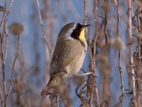
33 The Conservation Elements Selected Elements scrub sandhill gopher frog red-cockaded woodpecker celestial lily wood stork bald eagle Florida sandhill crane flatwoods eastern indigo snake wetlands watersheds

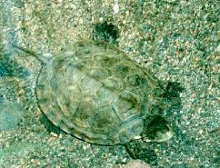
34 Red Cockaded Woodpecker A Federal Endangered Species with required protection Distribution based on potential habitat Ground surveys required to verify Development restrictions and/or HCP may be required Blue occurrences meet adequate size requirements, red areas are below minimum size but still may provide habitat.


35 Summary of Conservation Value Overlays elements to show importance by richness and habitat condition Most valuable area is within core of proposed development Upland habitats are often undervalued for conservation in Florida
36 Demonstration Live Vista w/existing inputs from Quantm & CommunityViz
37 Conclusions & Recommendations Goals are more appropriately set and are more flexibly met over large regions Optimization of conservation solutions saves time and facilitates focus on implementation but must be done iteratively with transportation and land use tools
38 FL Demo Level of Effort Activity Input conservation data into NatureServe Vista Identify high conservation value areas Source Florida Natural Areas Inventory NatureServe Vista Approx. Time 2 weeks <2 hours Generate proposed highway routes Quantm 1 week Generate secondary growth effects Identify areas of conflict between proposed transportation routes and conservation values Community Viz NatureServe Vista 1.5 weeks 1 day Create optimal plan via alternative land use decisions and mitigation efforts NatureServe Vista 4 hours TOTAL ~4 weeks
 User-defined element response to land use Assisted import from heritage Biotics system")
39 Planned Features for Vista 2.0 Multiple uses per land unit (for compatibility/conflict mapping) User-defined element response to land use Assisted import from heritage Biotics system Tools for modeling landscape condition Calculating sub-region goals Aquatic analysis support? N-SPECT integration under evaluation
40 Getting Started Start analysis early enough to make a difference Appropriate definition of the regional context Public process for establishing values Investigation of existing studies, plans, priorities for conservation Discipline experts required Ecological scientists Conservation planners GIS specialists
41 EBM Tools Program Program Objectives Identify available tools that may be useful for performing ecosystembased management. Characterize the tools in a knowledge base Prioritize the tools for further description and investigation for investment Develop and coordinate a network of tool providers and practitioners Conduct outreach and training Tools Science Projects
42 Acknowledgments & Questions FHWA Quantm Placeways/Orton Family Foundation (CommunityViz)
43 Screenshots in lieu of Demo

44 Building Element Information Each element has: A name A weight A conservation unit Categories A quantitative goal Compatibility to land use types A spatial distribution map *

45 Setting Goals and Weights Weight elements for relative importance Establish goals for protection Used in scenario evaluation Typically assign minimum retention vs preferred goalsets A single scenario can be evaluated against multiple goalsets Goals based on % of habitat, % of occurrences, absolute amount of habitat, or absolute # of occurrences *

46 Element Report Shows all attributes of an individual element Written in XML Presented in browser using HTML *
 Integrated Cons.")
47 Indices of Conservation Value Allows the user to: Select elements to be included. Select the factors to be included such as quality, confidence, and weight. Each combination reveals different information (e.g.) Integrated Cons. Value Element richness Viability Ave. confidence

48 Scenario Evaluation Report Land Use Conflict Map Red areas indicate elements with unmet goals and incompatible land use intent. Darker shades indicate richness of elements in conflict. *

49 Scenario Evaluation Report Policy Conflict Map Red areas indicate elements with unmet goals and unreliable protection policies. Darker shades indicate richness of elements in conflict. *
50 Scenario Evaluation Report *

51 Site Explorer Select unit of interest View site and element information Propose alternative use Select implementation mechanism Build mitigation plan


52 Scenario Generation Prepare inputs for MARXAN and SPOT Provide policy context for refining optimized output

53 Create Solutions, Identify Irreplaceable Sites Identify a set of locations that can meet conservation goals at least cost or conflict with production objectives Calculate the relative irreplaceability of sites for meeting conservation goals
An Introduction to Day Two. Linking Conservation and Transportation Planning Lakewood, Colorado August 15-16, 16, 2006
 An Introduction to Day Two Linking Conservation and Transportation Planning Lakewood, Colorado August 15-16, 16, 2006 1 Agenda Day One Transportation Planning Heritage Program State Wildlife Action Plan
3/29/11. Why bother with tools? Incorporating Decision Support Tools into Climate Adaptation Planning. A Simplified Planning Process
 Incorporating Decision Support Tools into Climate Adaptation Planning Why bother with tools? Tools don t eliminate complexity but they can help deal with it" Tools can:"! Help incorporate science into
Summary Description Municipality of Anchorage. Anchorage Coastal Resource Atlas Project
 Summary Description Municipality of Anchorage Anchorage Coastal Resource Atlas Project By: Thede Tobish, MOA Planner; and Charlie Barnwell, MOA GIS Manager Introduction Local governments often struggle
A Comprehensive Inventory of the Number of Modified Stream Channels in the State of Minnesota. Data, Information and Knowledge Management.
 A Comprehensive Inventory of the Number of Modified Stream Channels in the State of Minnesota Data, Information and Knowledge Management Glenn Skuta Environmental Analysis and Outcomes Division Minnesota
Spatial Data Availability Energizes Florida s Citizens
 NASCIO 2016 Recognition Awards Nomination Spatial Data Availability Energizes Florida s Citizens State of Florida Agency for State Technology & Department of Environmental Protection Category: ICT Innovations
LAND CHANGE MODELER SOFTWARE FOR ARCGIS
 LAND CHANGE MODELER SOFTWARE FOR ARCGIS The Land Change Modeler is revolutionary land cover change analysis and prediction software which also incorporates tools that allow you to analyze, measure and
Key Points Sharing fosters participation and collaboration Metadata has a big role in sharing Sharing is not always easy
 Sharing Resources Geoff Mortson esri, Inc. SDI Solutions Team Key Points Sharing fosters participation and collaboration Metadata has a big role in sharing Sharing is not always easy Data Sharing is Good
GEOGRAPHIC INFORMATION SYSTEMS AND IT SOLUTIONS FOR THE ENVIRONMENT
 GEOGRAPHIC INFORMATION SYSTEMS AND IT SOLUTIONS FOR THE ENVIRONMENT Mission We focus on Solutions is a worldwide operating business offering Geographic Information Systems and IT solutions to assist environmental
An Introduction to NatureServe Linking Conservation and Transportation Planning Phoenix, Arizona November 8 & 9, 2006
 An Introduction to NatureServe Linking Conservation and Transportation Planning Phoenix, Arizona November 8 & 9, 2006 1 NatureServe in Brief An independent, non-profit conservation organization Provides
Assessment and valuation of Ecosystem Services for decision-makers
 Assessment and valuation of Ecosystem Services for decision-makers An introduction to the ARIES approach Ferdinando Villa *, Ken Bagstad Gary Johnson, Marta Ceroni *Basque Center for Climate Change, Bilbao,
A TOOLKIT FOR MARINE SPATIAL PLANNING Version: 17 July, 2009
 A TOOLKIT FOR MARINE SPATIAL PLANNING Version: 17 July, 2009 NEED FOR MARINE SPATIAL PLANNING The health of marine ecosystems is declining, and use conflicts in the marine environment are increasing, in
EcoServ-GIS. EcoServ GIS Stage I. Why EcoServ GIS? 17/12/2012
 EcoServ-GIS Ecosystem Services Mapping: A Wildlife Trust GIS Toolkit to map ecosystem services at a county scale Dr Jonathan Winn Living Landscape Coordinator Durham Wildlife Trust Dr Chloe Bellamy Ecosystem
NOAA s OCM: Services, tools and collaboration opportunities & Puerto Rico s NE Marine Corridor as a case study
 NOAA s OCM: Services, tools and collaboration opportunities & Puerto Rico s NE Marine Corridor as a case study Dr. Antares Ramos Álvarez NOAA s Office of Coastal Management September 15 th, 2016 Conservation
Tools for Climate Change Adaptation Planning
 Adaptation base for Planning Tool (ADAPT) CRiSTAL (Community-based Risk Screening Tool Adaptation and Livelihoods) NOAA CSC Coastal Inundation Toolkit NOAA CSC Roadmap Ecosystem-Based Managment Tools Network
Landscape Planning and Habitat Metrics
 Landscape Planning and Habitat Metrics Frank W. Davis National Center for Ecological Analysis and Synthesis UC Santa Barbara (Tools for Landscape Biodiversity Planning) Jimmy Kagan Institute for Natural
GIS in Community & Regional Planning
 GIS in Community & Regional Planning The The role role of of GIS GIS in in Re-writing the the Zoning Bylaw for for the the City City of of Vernon LandInfo Technologies Presentation Overview The GIS Initiative
Geospatial Data Solutions: Site and Corridor Siting Projects. Rachel Turney-Work
 Geospatial Data Solutions: Site and Corridor Siting Projects Rachel Turney-Work Agenda GIS-based Corridor Routing Definition Major Components Uses and Functionality Geospatial Data Sources Data Accuracy
Designing Networks of Marine Protected Areas in DFO s Three Atlantic Bioregions
 Designing Networks of Marine Protected Areas in DFO s Three Atlantic Bioregions Presentation for Indigenous Protected Areas Workshop Max Westhead, DFO and Adrian Gerhartz-Abraham, Dalhousie March 29, 2017
Technical Drafting, Geographic Information Systems and Computer- Based Cartography
 Technical Drafting, Geographic Information Systems and Computer- Based Cartography Project-Specific and Regional Resource Mapping Services Geographic Information Systems - Spatial Analysis Terrestrial
AUTOMATED ONLINE ECOLOGICAL MODELING AND EVALUATION FOR EVERGLADES MANAGEMENT AND RESTORATION
 AUTOMATED ONLINE ECOLOGICAL MODELING AND EVALUATION FOR EVERGLADES MANAGEMENT AND RESTORATION Leonard Pearlstine 1 Suresh Goldconda 2 Kevin Suir 3 Alicia LoGalbo 1 Craig Conzelmann 3 Janice Parsons 1 1
STEREO ANALYST FOR ERDAS IMAGINE Stereo Feature Collection for the GIS Professional
 STEREO ANALYST FOR ERDAS IMAGINE Stereo Feature Collection for the GIS Professional STEREO ANALYST FOR ERDAS IMAGINE Has Your GIS Gone Flat? Hexagon Geospatial takes three-dimensional geographic imaging
Chapter 6. Fundamentals of GIS-Based Data Analysis for Decision Support. Table 6.1. Spatial Data Transformations by Geospatial Data Types
 Chapter 6 Fundamentals of GIS-Based Data Analysis for Decision Support FROM: Points Lines Polygons Fields Table 6.1. Spatial Data Transformations by Geospatial Data Types TO: Points Lines Polygons Fields
Presented by: Bryan Bloch GIS Specialist DNREC Division of Watershed Stewardship
 Presented by: Bryan Bloch GIS Specialist DNREC Division of Watershed Stewardship Bryan Hall, AICP Sussex County Circuit Rider Planner, Office of State Planning Coordination, OMB November 19, 2012 UD Sustainable
1.1 What is Site Fingerprinting?
 Site Fingerprinting Utilizing GIS/GPS Technology 1.1 What is Site Fingerprinting? Site fingerprinting is a planning tool used to design communities where protection of natural resources is the primary
A Regional Database Tracking Fire Footprint Each Year within the South Atlantic Region: Current Database Description and Future Directions
 A Regional Database Tracking Fire Footprint Each Year within the South Atlantic Region: Current Database Description and Future Directions Last Updated on September 30, 2018 Contributors: NatureServe,
ArcGIS Urban: An Introduction. Lisa Staehli ArcGIS Urban Team Product Development Brooks Patrick ArcGIS Urban Team Business Development
 ArcGIS Urban: An Introduction Lisa Staehli ArcGIS Urban Team Product Development Brooks Patrick ArcGIS Urban Team Business Development Our Cities Are Facing Massive Challenges Our Cities Are Facing Massive
Oakland County Parks and Recreation GIS Implementation Plan
 Oakland County Parks and Recreation GIS Implementation Plan TABLE OF CONTENTS 1.0 Introduction... 3 1.1 What is GIS? 1.2 Purpose 1.3 Background 2.0 Software... 4 2.1 ArcGIS Desktop 2.2 ArcGIS Explorer
EnviroAtlas: An Atlas about Ecosystems and their Connection with People
 EnviroAtlas: An Atlas about Ecosystems and their Connection with People Annie Neale, Megan Mehaffey & Atlas Team ASWM Webinar October, 17 th, 2012 What is it? The Atlas is an online decision support tool
Application of GIS Technology in Watershed-based Management and Decision Making
 Application of GIS Technology in Watershed-based Management and Decision Making U. Sunday Tim Iowa State University Department of Agricultural and Biosystems Engineering 100 Davidson Hall Email:
Dr.Sinisa Vukicevic Dr. Robert Summers
 Dr.Sinisa Vukicevic Dr. Robert Summers "Planning" means the scientific, aesthetic, and orderly disposition of land, resources, facilities and services with a view to securing the physical, economic and
Louisiana Transportation Engineering Conference. Monday, February 12, 2007
 Louisiana Transportation Engineering Conference Monday, February 12, 2007 Agenda Project Background Goal of EIS Why Use GIS? What is GIS? How used on this Project Other site selection tools I-69 Corridor
Planning Road Networks in New Cities Using GIS: The Case of New Sohag, Egypt
 Planning Road Networks in New Cities Using GIS: The Case of New Sohag, Egypt Mostafa Abdel-Bary Ebrahim, Egypt Ihab Yehya Abed-Elhafez, Kingdom of Saudi Arabia Keywords: Road network evaluation; GIS, Spatial
BROADBAND DEMAND AGGREGATION: PLANNING BROADBAND IN RURAL NORTHERN CALIFORNIA
 BROADBAND DEMAND AGGREGATION: PLANNING BROADBAND IN RURAL NORTHERN CALIFORNIA Steven J. Steinberg, Ph.D a,b, *, Rebecca Degagne a, M.S., Michael Gough a a Institute for Spatial Analysis, Humboldt State
Land Use in the context of sustainable, smart and inclusive growth
 Land Use in the context of sustainable, smart and inclusive growth François Salgé Ministry of sustainable development France facilitator EUROGI vice president AFIGéO board member 1 Introduction e-content+
WELCOME & INTRODUCTION
 MPA Management Capacity Building Training Module 1: WELCOME & INTRODUCTION Participants Distinguished Guests Welcome Site Overviews of MPAs represented Overview of Training Program What are Today s Objectives?
GIS AND REMOTE SENSING FOR OPEN SPACE PROTECTION ENVIRONMENTAL MANAGEMENT DEPARTMENT
 GIS AND REMOTE SENSING FOR OPEN SPACE PROTECTION ENVIRONMENTAL MANAGEMENT DEPARTMENT 22 nd May 2009 1 Introduction It is said that more than 80% of the City s activities throughout the world are spatially
Spatial Data Management of Bio Regional Assessments Phase 1 for Coal Seam Gas Challenges and Opportunities
 Spatial Data Management of Bio Regional Assessments Phase 1 for Coal Seam Gas Challenges and Opportunities By Dr Zaffar Sadiq Mohamed-Ghouse Principal Consultant, Spatial & IT, GHD zaffar.sadiq@ghd.com
Partnering with LANDFIRE, NatureServe, and Heritage Programs. Utilizing Legacy Data for Ecological Site Concept Development and Descriptions
 Partnering with LANDFIRE, NatureServe, and Heritage Programs Utilizing Legacy Data for Ecological Site Concept Development and Descriptions Content LANDFIRE: BpS vs. EVT LANDFIRE: Disturbance Models NatureServe:
ArcGIS. for Server. Understanding our World
 ArcGIS for Server Understanding our World ArcGIS for Server Create, Distribute, and Manage GIS Services You can use ArcGIS for Server to create services from your mapping and geographic information system
National Land Use Policy and National Integrated Planning Framework for Land Resource Development
 Title National Land Use Policy and National Integrated Planning Framework for Land Resource Development Duration: 32 Weeks Objective: Adoption of appropriate land use planning approaches to: Maintain the
GIS-Based Sediment Quality Database for the St. Louis River Area of Concern (AOC): Overview Presentations and Demonstration
: Overview Presentations and Demonstration") GIS-Based Sediment Quality Database for the St. Louis River Area of Concern (AOC): Overview Presentations and Demonstration Judy L. Crane 1 and Dawn E. Smorong 2 1 Minnesota Pollution Control Agency, St.
GIS-Based Sediment Quality Database for the St. Louis River Area of Concern (AOC): Overview Presentations and Demonstration Judy L. Crane 1 and Dawn E. Smorong 2 1 Minnesota Pollution Control Agency, St.
The Arctic Landscape Conservation Cooperative Conservation Goals
 The Arctic Landscape Conservation Cooperative Conservation Goals Adopted by the Arctic LCC Steering Committee, 24 August 2010 Background : Landscape Conservation Cooperatives and Climate Science Centers
Project Primary Contact: Gregg Servheen, Idaho Department of Fish and Game, PO Box 25 Boise, ID ,
 Project Title: Idaho Montana Divide Project Objective: Pilot the conceptualization and coordination of a transboundary Decision Support System(DSS) for fish, wildlife, and habitats along the Idaho Montana
EcoServ-GIS. Ecosystem Services Mapping: A Wildlife Trust GIS Toolkit to map ecosystem services at a county scale
 EcoServ-GIS Ecosystem Services Mapping: A Wildlife Trust GIS Toolkit to map ecosystem services at a county scale Dr Jonathan Winn Living Landscape Coordinator Durham Wildlife Trust Dr Chloe Bellamy Ecosystem
GIS Technology and Tools for Long Range Transportation Planning in the National Park Service
 GIS Technology and Tools for Long Range Transportation Planning in the National Park Service Geospatial Information Systems for Transportation Symposium Loveland, Colorado April 16, 2012 Nell Blodgett
Biodiversity Conservation Planning
 Biodiversity Conservation Planning it s all about methods, data, and tools Pat Comer, Chief Terrestrial Ecologist Land Trust Alliance Rally October 5, 2007 Biodiversity Conservation Planning Seems like
Planning for Sea Level Rise in the Matanzas Basin
 Planning for Sea Level Rise in the Matanzas Basin Appendix E: Matanzas Future Development Scenarios June, 2015 Prepared by: Dr. Paul Zwick University of Florida Department of Urban and Regional Planning
Discovery and Access of Geospatial Resources using the Geoportal Extension. Marten Hogeweg Geoportal Extension Product Manager
 Discovery and Access of Geospatial Resources using the Geoportal Extension Marten Hogeweg Geoportal Extension Product Manager DISCOVERY AND ACCESS USING THE GEOPORTAL EXTENSION Geospatial Data Is Very
DP Project Development Pvt. Ltd.
 Dear Sir/Madam, Greetings!!! Thanks for contacting DP Project Development for your training requirement. DP Project Development is leading professional training provider in GIS technologies and GIS application
Desktop GIS for Geotechnical Engineering
 Desktop GIS for Geotechnical Engineering Satya Priya Deputy General Manager (Software) RMSI, A-7, Sector 16 NOIDA 201 301, UP, INDIA Tel: +91-120-2511102 Fax: +91-120-2510963 Email: Satya.Priya@rmsi.com
Esri and GIS Education
 Esri and GIS Education Organizations Esri Users 1,200 National Government Agencies 11,500 States & Regional Agencies 30,800 Cities & Local Governments 32,000 Businesses 8,500 Utilities 12,600 NGOs 11,000
ENV208/ENV508 Applied GIS. Week 1: What is GIS?
 ENV208/ENV508 Applied GIS Week 1: What is GIS? 1 WHAT IS GIS? A GIS integrates hardware, software, and data for capturing, managing, analyzing, and displaying all forms of geographically referenced information.
Atlas of the Upper Gila River Watershed
 Atlas of the Upper Gila River Watershed Katie Banister, David Chan, Jessica M. Driscoll, Christopher Fullerton, Aaron Lien and Kelly Mott Lacroix January 2014 The University of Arizona Water Resources
Participatory GIS (PGIS)
") Participatory GIS (PGIS) Join public opinions as an information source into environmental decision-making ESRM 250. May, 29 th, 2012 Mu-Ning Wang wang0209@uw.edu GIS is... A Mapping Tool An Analysis Tool
Participatory GIS (PGIS) Join public opinions as an information source into environmental decision-making ESRM 250. May, 29 th, 2012 Mu-Ning Wang wang0209@uw.edu GIS is... A Mapping Tool An Analysis Tool
Decision-making support tool for promotion policies of abandoned mine areas
 2013 Esri International User Conference July 8 12, 2013 San Diego, California Decision-making support tool for promotion policies of abandoned mine areas Son, Jin Seoul National University Esri UC2013.
Least-Cost Transportation Corridor Analysis Using Raster Data.
 Least-Cost Transportation Corridor Analysis Using Raster Data What is GeoMedia Grid: Key Grid Concepts Vector Model Vector based systems show data by means of a series of points, lines, and polygons. Each
Section 2. Indiana Geographic Information Council: Strategic Plan
 Section 2. Indiana Geographic Information Council: Strategic Plan Introduction A geographic information system (GIS) is an automated tool that allows the collection, modification, storage, analysis, and
How GIS based Visualizations Support Land Use and Transportation Modeling
 How GIS based Visualizations Support Land Use and Transportation Modeling ESRI International Users Conference San Diego, CA - July 23, 2015 Prepared by: Troy Hightower Introduction This presentation will
EBA Engineering Consultants Ltd. Creating and Delivering Better Solutions
 EBA Engineering Consultants Ltd. Creating and Delivering Better Solutions ENHANCING THE CAPABILITY OF ECOSYSTEM MAPPING TO SUPPORT ADAPTIVE FOREST MANAGEMENT Prepared by: EBA ENGINEERING CONSULTANTS LTD.
City of Manitou Springs
 March 2018 City of Manitou Springs Implementing Land Use tools to reduce and mitigate natural hazard risk Context & History Past Present Historic homes Older infrastructure Hillside development Creekside
Native species (Forbes and Graminoids) Less than 5% woody plant species. Inclusions of vernal pools. High plant diversity
 Less than 5% woody plant species. Inclusions of vernal pools. High plant diversity") WILLAMETTE VALLEY WET-PRAIRIE RESTORATION MODEL WHAT IS A WILLAMETTE VALLEY WET-PRAIRIE Hot Spot s Native species (Forbes and Graminoids) Rare plant species Less than 5% woody plant species Often dominated
WILLAMETTE VALLEY WET-PRAIRIE RESTORATION MODEL WHAT IS A WILLAMETTE VALLEY WET-PRAIRIE Hot Spot s Native species (Forbes and Graminoids) Rare plant species Less than 5% woody plant species Often dominated
Continental Divide National Scenic Trail GIS Program
 CDNST Vision Statement: Provide the most accurate geospatial locational information of the Continental Divide Trail and nearby resources to the public as well as help provide internal management information
Introducing the. a partnership of
 Introducing the a partnership of Background Need for online atlas identified by managers and researchers to make coastal data available Shoreline data Ocean and coastal resources Sea-level rise potential
An Internet-Based Integrated Resource Management System (IRMS)
") An Internet-Based Integrated Resource Management System (IRMS) Third Quarter Report, Year II 4/1/2000 6/30/2000 Prepared for Missouri Department of Natural Resources Missouri Department of Conservation
An Internet-Based Integrated Resource Management System (IRMS) Third Quarter Report, Year II 4/1/2000 6/30/2000 Prepared for Missouri Department of Natural Resources Missouri Department of Conservation
CHAPTER 22 GEOGRAPHIC INFORMATION SYSTEMS
 CHAPTER 22 GEOGRAPHIC INFORMATION SYSTEMS PURPOSE: This chapter establishes the administration and use of to improve the quality and accessibility of Department s spatial information and support graphical
Creating a Staff Development Plan with Esri
 Creating a Staff Development Plan with Esri Michael Green David Schneider Guest Presenter: Shane Feirer, University of California Esri UC 2014 Technical Workshop Agenda What is a Staff Development Plan?
Introduction. Project Summary In 2014 multiple local Otsego county agencies, Otsego County Soil and Water
 Introduction Project Summary In 2014 multiple local Otsego county agencies, Otsego County Soil and Water Conservation District (SWCD), the Otsego County Planning Department (OPD), and the Otsego County
Statewide Topographic Mapping Program
 Statewide Topographic Mapping Program February 28, 2018 www.dotd.la.gov Outline Purpose of the Statewide Topographic Mapping Program History Breakdown of R.S. 48:36 - Topographic Mapping Statewide Topographic
AS INTEGRATIVE PLATFORMS FOR CLIMATE CHANGE IMPACT AND ADAPTATION ANALYSIS
 10 PAPER GEOGRAPHIC INFORMATION SYSTEMS AS INTEGRATIVE PLATFORMS FOR CLIMATE CHANGE IMPACT AND ADAPTATION ANALYSIS ROBIN BING RONG 1 and ADAM FENECH 1 1 Adaptation and Impacts Research Division, Environment
The Road to Data in Baltimore
 Creating a parcel level database from high resolution imagery By Austin Troy and Weiqi Zhou University of Vermont, Rubenstein School of Natural Resources State and local planning agencies are increasingly
Tools for Climate Change Adaptation Planning
 Adaptation base for Planning Tool (ADAPT) An online database that guides users through ICLEI's 5 Milestones for Climate Adaptation planning framework. ADAPT walks you through the process of assessing your
Getting Biodiversity Data
 Getting Biodiversity Data NatureServe Canada Douglas Hyde Executive Director Value of biodiversity data to business? Reasons vary depending on the business Reduce development uncertainty Integrated views
Transactions on Information and Communications Technologies vol 18, 1998 WIT Press, ISSN
 STREAM, spatial tools for river basins, environment and analysis of management options Menno Schepel Resource Analysis, Zuiderstraat 110, 2611 SJDelft, the Netherlands; e-mail: menno.schepel@resource.nl
Finding Common Ground Through GIS
 Finding Common Ground Through GIS Matthew Stone, MPH Special Unit for Technical Assistance Chronic Disease and Injury Control California Department of Public Health ESRI Health GIS Conference Scottsdale,
Is Ignoring Evolution Intelligent Design for Conservation? Mark Reynolds, Gretchen LeBuhn, Dick Cameron, and Rebecca Shaw
 Is Ignoring Evolution Intelligent Design for Conservation? Mark Reynolds, Gretchen LeBuhn, Dick Cameron, and Rebecca Shaw Outline Evolution and Conservation Practice Biodiversity Pattern and Process Global
ICAN Great Lakes 2010 Workshop
 ICAN Great Lakes 2010 Workshop Chris Cortina Maryland s Chesapeake & Coastal Program MD Department of Natural Resources Maryland s Coastal Atlas: What is it? The Coastal Atlas is an online mapping and
Strategies for biodiversity conservation
 Institute of Earth Systems University of Malta Strategies for biodiversity conservation Louis F. Cassar PhD Elisabeth Conrad PhD The conservation imperative: perspective Biodiversity hotspot High endemism
What is a watershed or landscape perspective?
 What is a watershed or landscape perspective? -remove sediment -add sediment -add wood, riparian manipulation -alter (engineer) channel/floodplain morphology -restore/abandon roads You are here What is
Geospatial Assessment in Support of Urban & Community Forestry Programs
 Geospatial Assessment in Support of Urban & Community Forestry Programs Funded by the USDA Forest Service, State and Private Forestry, under Cooperative Agreement # 06-CA-112244225-338 with the University
Introducing GIS analysis
 1 Introducing GIS analysis GIS analysis lets you see patterns and relationships in your geographic data. The results of your analysis will give you insight into a place, help you focus your actions, or
Features and Benefits
 Autodesk LandXplorer Features and Benefits Use the Autodesk LandXplorer software family to help improve decision making, lower costs, view and share changes, and avoid the expense of creating physical
Proposed Scope of Work Village of Farmingdale Downtown Farmingdale BOA Step 2 BOA Nomination Study / Draft Generic Environmental Impact Statement
 Proposed Scope of Work Village of Farmingdale Downtown Farmingdale BOA Step 2 BOA Nomination Study / Draft Generic Environmental Impact Statement The scope of work that follows incorporates and covers
StreamStats: Delivering Streamflow Information to the Public. By Kernell Ries
 StreamStats: Delivering Streamflow Information to the Public By Kernell Ries U.S. Department of the Interior U.S. Geological Survey MD-DE-DC District 410-238-4317 kries@usgs.gov StreamStats Web Application
Overview. Project Background Project Approach: Content and Application Development Application Demonstration Future Developments
 Overview Project Background Project Approach: Content and Application Development Application Demonstration Future Developments Southeast Pressures: Continued Population Growth Transportation Corridors
Innovation. The Push and Pull at ESRI. September Kevin Daugherty Cadastral/Land Records Industry Solutions Manager
 Innovation The Push and Pull at ESRI September 2004 Kevin Daugherty Cadastral/Land Records Industry Solutions Manager The Push and The Pull The Push is the information technology that drives research and
Flood Hazard Zone Modeling for Regulation Development
 Flood Hazard Zone Modeling for Regulation Development By Greg Lang and Jared Erickson Pierce County GIS June 2003 Abstract The desire to blend current digital information with government permitting procedures,
Urban Spatial Scenario Design Modelling (USSDM) in Dar es Salaam: Background Information
 in Dar es Salaam: Background Information") Urban Spatial Scenario Design Modelling (USSDM) in Dar es Salaam: Background Information Modelling urban settlement dynamics in Dar es Salaam Revision: 2 (July 2013) Prepared by: Katja Buchta TUM team
Urban Spatial Scenario Design Modelling (USSDM) in Dar es Salaam: Background Information Modelling urban settlement dynamics in Dar es Salaam Revision: 2 (July 2013) Prepared by: Katja Buchta TUM team
Bentley Map Advancing GIS for the World s Infrastructure
 Bentley Map Advancing GIS for the World s Infrastructure Presentation Overview Why would you need Bentley Map? What is Bentley Map? Where is Bentley Map Used? Why would you need Bentley Map? Because your
GIS Workshop Data Collection Techniques
 GIS Workshop Data Collection Techniques NOFNEC Conference 2016 Presented by: Matawa First Nations Management Jennifer Duncan and Charlene Wagenaar, Geomatics Technicians, Four Rivers Department QA #: FRG
Employing a Suitability Model to Support Local Land-Use Decisions
 Employing a Suitability Model to Support Local Land-Use Decisions A Report to the Minnesota Department of Natural Resources by 1000 Friends of Minnesota Table of contents INTRODUCTION AND PURPOSE...3 THE
LandScan Global Population Database
 LandScan Global Population Database The World s Finest Population Distribution Data Uncommon information. Extraordinary places. LandScan Global Population Database East View Cartographic is now offering
Geospatial Decision Support Tools for Planning of Marine Protected Areas in California
 Geospatial Decision Support Tools for Planning of Marine Protected Areas in California WILL MCCLINTOCK (UNIVERSITY OF CALIFORNIA SANTA BARBARA), MATT MERRIFIELD (THE NATURE CONSERVANCY), SOPHIE DE BEUKELAER
ESRI Delivering geographic information systems to millions of users
 Using Web GIS to Track Government Spending and Performance Eric Floss - ESRI April 12, 2010 ESRI Delivering geographic information systems to millions of users GIS Is Changing Everything How We Reason
Preliminary Calculation of Landscape Integrity in West Virginia Based on Distance from Weighted Disturbances
 Preliminary Calculation of Landscape Integrity in West Virginia Based on Distance from Weighted Disturbances Michael Dougherty and Elizabeth Byers Technical Support and Wildlife Diversity Units, Wildlife
United States Department of the Interior NATIONAL PARK SERVICE Northeast Region
 United States Department of the Interior NATIONAL PARK SERVICE Northeast Region June 17, 2017 REQUEST FOR STATEMENTS OF INTEREST and QUALIFICATIONS Project Title: ASSESSMENT OF NATURAL RESOURCE CONDITION
Geospatial SDI Portal for effective Governance of Pune METROPOLIS region
 Geospatial SDI Portal for effective Governance of Pune METROPOLIS region Mr. Praveen Gautam Senior Manager 19 th January 2018 PMRDA Overview Provide a Spatial Framework for the entire region with various
GIS Data, Technology, and Models. to Integrate Information and Improve Transportation Decision-Making. within the Eco-Logical* Framework for Oregon
 GIS Data, Technology, and Models to Integrate Information and Improve Transportation Decision-Making within the Eco-Logical* Framework for Oregon GIS-T 2009, Oklahoma City, OK April 8, 2009, Session 5..2.2
Historical background
 Space Technology for Disaster Management in Sri Lanka: Country profile, national perspectives & vision. Professor Ranjith Premalal De Silva Vice Chancellor Uva Wellassa University of Sri Lanka October
Spatial data interoperability and INSPIRE compliance the platform approach BAGIS
 Spatial data interoperability and INSPIRE compliance the platform approach BAGIS BAGIS Voluntary, independent, public, non-profit organization; Organization with main mission to promote the growth of the
A Vision for ArcGIS Applying Geography Everywhere
 A Vision for ArcGIS Applying Geography Everywhere WELCOME PURPOSE A Network of GIS Professionals Are Awakening the World to the Power of Web GIS You Your WORK Making a Difference Your Work Open Maps and