Metro-North Railroad s Enterprise GIS Program: Yesterday, Today, and Tomorrow
|
|
|
- Silvia Russell
- 6 years ago
- Views:
Transcription

1 Metro-North Railroad s Enterprise GIS Program: Yesterday, Today, and Tomorrow Xiaojing Wei, Alex Lu, and David Fogel GIS in Transit Conference Washington, D.C. September 2, 2015

2 Metro-North Railroad Three states, twelve county service area, 2,701 square miles. Five lines, three branches, 384 route miles, and 775 track miles. 1,072 bridges, 119 grade crossings, 77 substations. 124 stations, 1,258 railcars, 711 weekday departures carrying 284k customers. Full service commuter railroad with engineering responsibility for track, signals, power, structures, stations, and railcars. Metro-North Railroad 1
3 Business Case Use company-wide survey instrument to generate interest in GIS GIS Need % Respondents Describing a location (at least monthly) 90% Communicating a location (e.g. geocodes) to an outside entity 66% Locate a fixed asset in the field 62% Plot a map for sharing, reporting, etc. 34% Count features within a geographic area 62%-66% Metro-North Railroad 2
 Real-time train location Emergency access to ROW Fire/EMS jurisdictions Milepost/catenary")

4 Trigger Events Identified GIS Needs Real-time incident management Post-event reconstruction Green s Farms Station Westport 1532 ( ) Real-time train location Emergency access to ROW Fire/EMS jurisdictions Milepost/catenary pole/ street address correlation Hurricane Sandy ( ) Real-time storm tracking Elevation of key rail assets Post-event insurance claims Mapping recovery efforts Flood proofing future design Hudson Line Milepost 31 Metro-North Railroad 3


5 Hudson Line: Water Level Route Kemeys Cove MP 29.7 Scarborough MP 29 Metro-North Railroad 4

6 Hudson Line: Water Level Route Sandy Surge MP 25 Metro-North Railroad 5


7 Early Action Inventory Existing Condition Hardware and Software Data Sources Past projects (e.g., Positive Train Control LiDAR) Publicly available Existing Systems Business Processes User base and skills Bridge Management System Grand Central Terminal (GCT ) Building Model Metro-North Railroad 6

8 Early Action Policies Human Capital: GIS/CAD as preferred skill in job qualifications Software: Push users towards GIS web viewers; limit desktops Procurement (Boilerplates): Require GIS deliverable in all capital projects, i.e. As-built and other drawings, database outputs (track defect measurement system) Data Security: 3 levels of GIS Data Data Hygiene: Check-in/check-out, quality control procedures, etc. Data Ownership and Update: Working with ongoing Enterprise Asset Management (EAM) effort Metro-North Railroad 7


9 Concept of Operations (ConOps) Study Goals and Objectives Meetings Support from senior management Loosely define user requirements Find possible use cases Data Inventory and Gap Analysis: Fishing expedition to discover more data and resources Business & Operational Processes: Institutionalization of GIS Straight Line Diagrams (SLD) Viewer Integrated Property Boundary GIS (Yardi) Plan Room Drawing Retrieval (CPRDRM) Visual train tracking replacement Ridership & Demographics Visualization Staffing: Who s doing what? Add new staff if nobody there! Metro-North Railroad 8

 Early Products: use 3D visualization, heat maps, BigData, etc.")
10 Marketing Portal: at a glance GIS resources webpage Open REST Services Directory Blasts: exec. level this is what GIS can do Infomercial Videos: like home shopping Roadshows: visit regular departmental meetings or set up special targeted sessions Ask Project Manager to Approve: when receiving data, always circle back to PM (more for education than for review) Early Products: use 3D visualization, heat maps, BigData, etc., and circulate example map to generate interest Metro-North Railroad 9

11 Employee Residences Early Map Products To estimate employee commute time Employee Residences Metro-North Railroad 10

12 Early Map Products Station Catchment Mail & Ride by Zip Codes to track parking demand at specific station Station Catchment Metro-North Railroad 11

13 Early Map Products MudSpot to track weekly Mudspot maintenance Mudspots Metro-North Railroad 12

14 Early Map Products Third Rail Burner showing locations of third Rail brackets burning issue 3 rd Rail Burners Metro-North Railroad 13

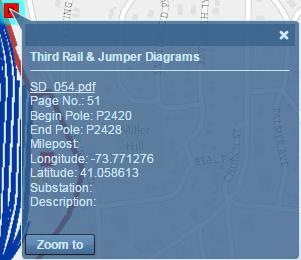
15 Enterprise GIS Web Viewers Map railroad features on web application to improve data access Publicly available GIS layers overlaid with railroad locations Census Demographics Environmental features FEMA flood information; Public and Quasi-Public facilities, etc. Link existing PDF maps into viewer as repository of drawings Signal block plans, Power sectionalizing diagrams, Val maps, etc. Avoids labor intensive Georeferencing for now Google Maps and Street View Integration at critical points Metro-North Railroad 14
 File geodatabase on server Migrating to Oracle Effectively read-only for now Power users on Desktops GIS Manager is")
16 Enterprise GIS Architecture ESRI ArcGIS for Server 10.2 with Web Adaptor Access via web viewers and REST services (intranet only) File geodatabase on server Migrating to Oracle Effectively read-only for now Power users on Desktops GIS Manager is gatekeeper Mobile access via tablets with AirWatch software Inter-agency (MTA, LIRR, NYCT) access via selected opening in the firewall Metro-North Railroad 15

17 Metro-North Enterprise GIS Web Viewers Enterprise GIS 16

18 Metro-North Enterprise GIS Web Viewers Environmental Features 17

19 Metro-North Enterprise GIS Web Viewers U.S. Census Demographics 18

20 Metro-North Enterprise GIS Web Viewers Public Facilities 19

21 Metro-North Enterprise GIS Web Viewers Track Sensor Data 20

22 Metro-North Enterprise GIS Web Viewers West of Hudson Signal Project 21

23 Metro-North Enterprise GIS Web Viewers Topographical Contours 22

24 Metro-North Enterprise GIS Web Viewers Limited English Proficiency 23

25 Metro-North EGIS: Asset Locations Enterprise GIS 24


26 Charts, Plans, Val Maps, and Power Diagram Metro-North Railroad 25


27 Metro-North EGIS Tools: Search Metro-North Railroad 26

28 Enterprise GIS Tools: Measure Distance Metro-North Railroad 27


29 Enterprise GIS Tools: Google Street View 28

30 Enterprise GIS Base Map Choices 29

31 EGIS Next Steps Migration Issues ArcGIS 10.2 to 10.3 Dev/Prod Resiliency Implement Five Baseline Applications GIS Staffing Roles SLD Engineer Licensed Surveyor Drawing Archivist/CAD GIS App Developer Demographer In House Training Other Applications GIS Viewer for Security Management Sustainability Initiative - Green GIS GIS Viewer for Emergency Management Application Metro-North Railroad 30

32 Questions? Data Request? Ms. Xiaojing Wei, GISP GIS Manager MTA Metro-North Railroad 420 Lexington Avenue, 12th Floor, New York, N.Y or Alex Lu Metro-North Railroad 31
33 Metro-North Railroad s Enterprise GIS Program: Yesterday, Today, and Tomorrow EXTRA CONOPS SLIDES Xiaojing Wei, Alex Lu, and David Fogel GIS in Transit Conference Washington, D.C. September 2, 2015


34 Straight Line Diagrams Plot GPS coordinates, milepost, locations on a straight line diagram (SLD) like track chart Overlay data on marked-up track chart: slow orders, outages, tonnages, track geometry, signal/power/buried utility, etc. Replaces current laborious process of producing track charts Enables interdisciplinary information & intelligence sharing Improved capability & speed in identifying defects Track Chart Surfacing History Vastly improve field data accessibility over paper Metro-North Railroad 33 Track Geometry


35 Property Management GIS Integration Provide accurate, surveyed property lines of Metro-North rights of way, yards, leases, etc. Integrate with proprietary tenant management system Supports capital project planning, asset maintenance, operations, and emergency management Support entry permit process Support rent collection process and lease requests from utilities Metro-North Railroad 34


36 Virtual Train Tracking System Replacement Display live train locations in near real-time on a diagrammatic map, line chart, as a colorized delay diagram, and allowing drill-downs into additional and historical data Display train movements relative to location features & infrastructure Delay visualization on mobile devices More accurate prediction of delays Better data for trainmasters making real-time assignments due to tight integration with crew and consist management systems Metro-North Railroad 35


37 Plan Room Drawing Retrieval Mapper Recently scanned 100,000+ as-built drawings to PDF Allow user to visually look for drawings by map self service drawing retrieval Geo-reference and improve indices by keyword/discipline Strikes balance between fully digitizing versus text-based location descriptions only Allows archivist to focus on minority of exception cases Metro-North Railroad 36

 Supports demand/revenue forecasts, contingency planning, outage assessment, risk assessment, etc.")
38 Ridership & Demographics GIS Visualization Construct a database to capture, house, and display maps of automated and manually collected data sources: Ridership, loads, capacity, train counts, on/offs, demographics, and surveys New computerized database platform: Migrating existing data from mainframe Store, process, and query automatically collected data (ticket sales, load weigh sensor/automated passenger counter (APC), automated station counts, etc.) Supports demand/revenue forecasts, contingency planning, outage assessment, risk assessment, etc. Metro-North Railroad 37
Integrating Origin and Destination (OD) Study into GIS in Support of LIRR Services and Network Improvements
 Study into GIS in Support of LIRR Services and Network Improvements") Integrating Origin and Destination (OD) Study into GIS in Support of LIRR Services and Network Improvements GIS In Transit Conference, Washington, DC Long Island Rail Road Pyung ho Kim Date: September
Integrating Origin and Destination (OD) Study into GIS in Support of LIRR Services and Network Improvements GIS In Transit Conference, Washington, DC Long Island Rail Road Pyung ho Kim Date: September
Maryland Transit Administration (MTA) Bus Accident Mapping and Analysis Application
 Bus Accident Mapping and Analysis Application") Maryland Transit Administration (MTA) Bus Accident Mapping and Analysis Application Ralign Wells, MTA Administrator Bernadette Bridges, MTA Chief Safety Officer Office of Safety, Quality Assurance, and
Maryland Transit Administration (MTA) Bus Accident Mapping and Analysis Application Ralign Wells, MTA Administrator Bernadette Bridges, MTA Chief Safety Officer Office of Safety, Quality Assurance, and
IMPLEMENTING GOVERNMENT-WIDE ENTERPRISE GIS; THE FEDERATED MODEL
 IMPLEMENTING GOVERNMENT-WIDE ENTERPRISE GIS; THE FEDERATED MODEL James E. Mitchell, Ph. D. IT GIS Manager Louisiana Department of Transportation and Development presented at the ESRI International Users
Corporate. Information. Railway Infrastructure Administrator. Year indracompany.com
 geospatial and mobility Corporate Geographic Information System of ADIF Railway Infrastructure Administrator. Year 2009-2010 Corporate Geographic Information System of ADIF ADIF. Spanish Administrator
Oakland County Parks and Recreation GIS Implementation Plan
 Oakland County Parks and Recreation GIS Implementation Plan TABLE OF CONTENTS 1.0 Introduction... 3 1.1 What is GIS? 1.2 Purpose 1.3 Background 2.0 Software... 4 2.1 ArcGIS Desktop 2.2 ArcGIS Explorer
Empowering water/wastewater network management with GIS
 Empowering water/wastewater network management with GIS Ioannis Kavouras_GIS Manager Surveying Engineer, MSc, MBA The Company responsible for fresh water distribution & sanitation serving 1.500.000 citizens
FIRE DEPARMENT SANTA CLARA COUNTY
 DEFINITION FIRE DEPARMENT SANTA CLARA COUNTY GEOGRAPHIC INFORMATION SYSTEM (GIS) ANALYST Under the direction of the Information Technology Officer, the GIS Analyst provides geo-spatial strategic planning,
GIS-T 2010 Building a Successful Geospatial Data Sharing Framework: A Ohio DOT Success Story
 GIS-T 2010 Building a Successful Geospatial Data Sharing Framework: A Ohio DOT Success Story ODOT District 2 GIS John Puente District 1 GIS Coordinator\ Planning Administrator 2 Interoperability 3 District
ArcGIS. for Server. Understanding our World
 ArcGIS for Server Understanding our World ArcGIS for Server Create, Distribute, and Manage GIS Services You can use ArcGIS for Server to create services from your mapping and geographic information system
Enabling Success in Enterprise Asset Management: Case Study for Developing and Integrating GIS with CMMS for a Large WWTP
 Enabling Success in Enterprise Asset Management: Case Study for Developing and Integrating GIS with CMMS for a Large WWTP Allison Blake, P.E. 1*, Matthew Jalbert, P.E. 2, Julia J. Hunt, P.E. 2, Mazen Kawasmi,
JOB DESCRI PTI ON. GIS Administrator
 JOB DESCRI PTI ON JOB GRADE: GS-0 Cla ss Code : Office - 8 8 0 DEPARTMENT: 2 0 - FLSA: EXEMPT JOB NO: 6-0 9-2 7 SALARY: To Be De t e rm in e d Job description statements are intended to describe the general
Working with ArcGIS Online
 Esri International User Conference San Diego, CA Technical Workshops July 12, 2011 Working with ArcGIS Online Bern Szukalski, Deane Kensok Topics for this Session ArcGIS Online Overview ArcGIS Online Content
GIS Integration to Maximo
 GIS Integration to Maximo Tuesday 15 th January 2008 Mahmoud Jaafar Systems Director GISTEC Agenda Introduction Why AMS & GIS Integration? ESRI GIS Enabling Technology. Integrating GIS & Maximo. What do
Are You Maximizing The Value Of All Your Data?
 Are You Maximizing The Value Of All Your Data? Using The SAS Bridge for ESRI With ArcGIS Business Analyst In A Retail Market Analysis SAS and ESRI: Bringing GIS Mapping and SAS Data Together Presented
Write a report (6-7 pages, double space) on some examples of Internet Applications. You can choose only ONE of the following application areas:
 on some examples of Internet Applications. You can choose only ONE of the following application areas:") UPR 6905 Internet GIS Homework 1 Yong Hong Guo September 9, 2008 Write a report (6-7 pages, double space) on some examples of Internet Applications. You can choose only ONE of the following application
UPR 6905 Internet GIS Homework 1 Yong Hong Guo September 9, 2008 Write a report (6-7 pages, double space) on some examples of Internet Applications. You can choose only ONE of the following application
GIS TECHNICIAN I GIS TECHNICIAN II
 GIS TECHNICIAN I GIS TECHNICIAN II CITY OF ROSEVILLE DEFINITION To perform a variety of technical office and field work duties related to the creation and maintenance of maps, tables, graphs and other
Village of Algonquin Geographic Information Systems. Village of Algonquin. Development Plan of Geographic Information Systems
 Village of Algonquin Development Plan of Geographic Information Systems 014-019 10/1/013 1 GIS Development Plan A. Purpose The purpose of this document is to outline a strategic plan for Geographic Information
Enterprise GIS: Realizing a Return on Investment. EGUG Coeur D Alene, ID Tuesday, October 15, 2002
 Enterprise GIS: Realizing a Return on Investment EGUG 2002 - Coeur D Alene, ID Tuesday, October 15, 2002 Technology Technology is great fun, but we can drown in our technology. The fog of information can
Production Line Tool Sets
 Production Line Tool Sets Tools for high-quality database production and cartographic output Production Line Tool Sets Production Line Tool Sets (PLTS) by ESRI are a collection of software applications
ESRI Survey Summit August Clint Brown Director of ESRI Software Products
 ESRI Survey Summit August 2006 Clint Brown Director of ESRI Software Products Cadastral Fabric How does Cadastral fit with Survey? Surveyors process raw field observations Survey measurements define high-order
GIS ADMINISTRATOR / WEB DEVELOPER EVANSVILLE-VANDERBURGH COUNTY AREA PLAN COMMISSION
 GIS ADMINISTRATOR / WEB DEVELOPER EVANSVILLE-VANDERBURGH COUNTY AREA PLAN COMMISSION SALARY RANGE INITIATION $43,277 SIX MONTHS $45,367 POSITION GRADE PAT VI The Evansville-Vanderburgh County Area Plan
Office of Technology Partnerships GIS Collaboration
 Office of Technology Partnerships GIS Collaboration State GIS Update April 21, 2017 Mark Holmes, GISP Outline MGF Upgrade Project Census Programs Imagery Update LiDAR Update Open Discussion 2 MGF Background
June 19 Huntsville, Alabama 1
 June 19 Huntsville, Alabama 1 Real-Time Geospatial Data: The Fusion of PI and ArcGIS Enabling Smarter Facilities Management OSIsoft and Esri Mapping and Location Analytics Platform Supporting Your Use
Crime Analysis. GIS Solutions for Intelligence-Led Policing
 Crime Analysis GIS Solutions for Intelligence-Led Policing Applying GIS Technology to Crime Analysis Know Your Community Analyze Your Crime Use Your Advantage GIS aids crime analysis by Identifying and
Map your way to deeper insights
 Map your way to deeper insights Target, forecast and plan by geographic region Highlights Apply your data to pre-installed map templates and customize to meet your needs. Select from included map files
The University of Arizona Enterprise GIS. CFTA 2016 Facilities Geospatial Technologies Showcase
 The University of Arizona Enterprise GIS CFTA 2016 Facilities Geospatial Technologies Showcase Main Campus: Tucson, Arizona Founded: 1885 Number of Buildings: 227 GSF: 9.4 million Acres: 393 Total Students:
Enhance Security, Safety and Efficiency With Geospatial Visualization
 Areas within 10 minutes of an exit are emphasized on this map, to give an indication of how accessible neighborhoods are by highway. The colors represent 1, 3, 5 and 10 minute increments from the exits.
GIS. in the City of Lewiston Maine
 GIS in the City of Lewiston Maine The purpose of this slideshow is to provide an overview of the city GIS and how it is used, maintained and accessed in-house as well as by the public. Please simply hit
An online data and consulting resource of THE UNIVERSITY OF TOLEDO THE JACK FORD URBAN AFFAIRS CENTER
 An online data and consulting resource of THE JACK FORD URBAN AFFAIRS CENTER THE CENTER FOR GEOGRAPHIC INFORMATION SCIENCE AND APPLIED GEOGRAPHICS DEPARTMENT OF GEOGRAPHY AND PLANNING THE UNIVERSITY OF
A GIS TOUR OF DES MOINES PRESENTED BY ANNA WHIPPLE, GIS MANAGER APRIL 20, 2015
 A GIS TOUR OF DES MOINES PRESENTED BY ANNA WHIPPLE, GIS MANAGER APRIL 20, 2015 Welcome to Des Moines! Capital of Iowa Among 100 largest metropolitan areas Insurance, biotech, healthcare, and entertainment
Building an Enterprise GIS for Chicago s Water Reclamation District
 Building an Enterprise GIS for Chicago s Water Reclamation District Presenters Presented at the 2010 ESRI User Conference Authored and Presented By Sanjay Patel, PE, CEM, CMRP Metropolitan Water Reclamation
Climate Risk Visualization for Adaptation Planning and Emergency Response
 Climate Risk Visualization for Adaptation Planning and Emergency Response NCR Flood Fact Finding Workshop Ricardo Saavedra ricardo@vizonomy.com Social Media, Mobile, and Big Data St. Peter s Basilica,
Information. Information Technology. Geographic. Services (GIS) 119 W Indiana Ave Deland, FL 32720
 119 W Indiana Ave Deland, FL 32720") Information Technology Geographic Information Services (GIS) 119 W Indiana Ave Deland, FL 32720 A GIS consists of 5 primary components: Hardware Software People Data Methods or Business Processes --- Hardware
Information Technology Geographic Information Services (GIS) 119 W Indiana Ave Deland, FL 32720 A GIS consists of 5 primary components: Hardware Software People Data Methods or Business Processes --- Hardware
Office of Enterprise Technology
 Office of Enterprise Technology Transforming the Maricopa Department of Transportation (MCDOT) GIS-based Transportation Asset Inventory System January 21, 2016 Presented By Steve Hossack, GIS Database
Portal for ArcGIS: An Introduction. Catherine Hynes and Derek Law
 Portal for ArcGIS: An Introduction Catherine Hynes and Derek Law Agenda Web GIS pattern Product overview Installation and deployment Configuration options Security options and groups Portal for ArcGIS
GIS = Geographic Information Systems;
 What is GIS GIS = Geographic Information Systems; What Information are we talking about? Information about anything that has a place (e.g. locations of features, address of people) on Earth s surface,
MODERNIZATION OF THE MUNICIPAL MAPPING USING HIGH END GNSS SYSTEM AND GIS SOFTWARE
 MODERNIZATION OF THE MUNICIPAL MAPPING USING HIGH END GNSS SYSTEM AND GIS SOFTWARE Mr. R. A. R. Khan Assistant Engineer, Sewerage Utility Management Centre (SUMC) Municipal Corporation Of Greater Mumbai
Law Enforcement Solutions and Applications
 ArcGIS for Solutions and Applications Solutions and Applications ArcGIS for Platform ArcGIS for Collection of solutions and applications for law enforcement. Built on the ArcGIS platform. For any named
Google Maps and Beyond
 Google Maps and Beyond Aaron Paul First American Title apaul@firstam.com 2015 APRA Symposium Association of Professional Reserve Analysts May 2 nd, 2015 Google Maps and Beyond - Overview Business case
The Emerging Role of Enterprise GIS in State Forest Agencies
 The Emerging Role of Enterprise GIS in State Forest Agencies Geographic Information System (GIS) A geographic information system (GIS) is a computer software system designed to capture, store, manipulate,
IH 35 at Blanco River May 2015
 IH 35 at Blanco River May 2015 Presentation Objectives Background of historical damage assessment processes Introduction to Collector App ( Mat Peck) Collector App and Flood Damage Assessment (Katie Steele)
Web GIS Administration: Tips and Tricks
 EdUC 2017 July 8 th, 2017 Web GIS Administration: Tips and Tricks Geri Miller Agenda Concerns Acknowledged User Management Content Management Monitoring Licensing and logins Sophistication of IT support
RESOLUTION NO
 RESOLUTION NO. 09-2017 Adopting Job Descriptions for Engineering and GIS Manager and GIS Analyst and Amending the Pay Resolution to Accommodate Said Positions and Amending the Staffing Chart to Accommodate
GIS ANALYSIS METHODOLOGY
 GIS ANALYSIS METHODOLOGY No longer the exclusive domain of cartographers, computer-assisted drawing technicians, mainframes, and workstations, geographic information system (GIS) mapping has migrated to
ArcGIS Online Routing and Network Analysis. Deelesh Mandloi Matt Crowder
 ArcGIS Online Routing and Network Analysis Deelesh Mandloi Matt Crowder Introductions Who are we? - Members of the Network Analyst development team Who are you? - Network Analyst users? - ArcGIS Online
Steve Pietersen Office Telephone No
 Steve Pietersen Steve.Pieterson@durban.gov.za Office Telephone No. 031 311 8655 Overview Why geography matters The power of GIS EWS GIS water stats EWS GIS sanitation stats How to build a GIS system EWS
Bridging the Gap between Engineering and GIS
 Bridging the Gap between Engineering and GIS Presented by: Karen Stewart, B.Tech, GISP Manager of Geomatics Township of Langley February 13, 2006 Agenda Introduction History Goals Implementation Benefits
Introduction to Portal for ArcGIS
 Introduction to Portal for ArcGIS Derek Law Product Management March 10 th, 2015 Esri Developer Summit 2015 Agenda Web GIS pattern Product overview Installation and deployment Security and groups Configuration
Mapping Historical Information Using GIS
 Mapping Historical Information Using GIS David Yun, GISP Troy Lawson ABSTRACT The City of San Luis Obispo, California, is rich with history. It is one of California s oldest communities that began with
Esri Overview for Mentor Protégé Program:
 Agenda Passionate About Helping You Succeed Esri Overview for Mentor Protégé Program: Northrop Grumman CSSS Jeff Dawley 3 September 2010 Esri Overview ArcGIS as a System ArcGIS 10 - Map Production - Mobile
Transforming the Maricopa County Department of Transportation (MCDOT) GIS-based Transportation Asset Inventory System June 30, 2016
 GIS-based Transportation Asset Inventory System June 30, 2016") Transforming the Maricopa County Department of Transportation (MCDOT) GIS-based Transportation Asset Inventory System June 30, 2016 Presented By Steve Hossack, GIS Database Administrator 2016 Esri User
Transforming the Maricopa County Department of Transportation (MCDOT) GIS-based Transportation Asset Inventory System June 30, 2016 Presented By Steve Hossack, GIS Database Administrator 2016 Esri User
Techniques for Science Teachers: Using GIS in Science Classrooms.
 Techniques for Science Teachers: Using GIS in Science Classrooms. After ESRI, 2008 GIS A Geographic Information System A collection of computer hardware, software, and geographic data used together for
GIS Geographical Information Systems. GIS Management
 GIS Geographical Information Systems GIS Management Difficulties on establishing a GIS Funding GIS Determining Project Standards Data Gathering Map Development Recruiting GIS Professionals Educating Staff
Demystifying ArcGIS Online. Karen Lizcano Esri
 Demystifying ArcGIS Online Karen Lizcano Esri An Integrated Web GIS Platform Desktop Web Device Powered by Services Managed via Portal Access from any Device Portal Server Online Content and Services ArcGIS
REPORT ON INVESTMENTS
 REPORT ON INVESTMENTS D.T2.3.3 Investments for technical equipment for the implementation of Web-GIS platform in Mantova 1 Local support group designing Mantova Web-GIS platform. Picture by Maria Giulia
Exploit your geodata to enable smart cities and countries
 Exploit your geodata to enable smart cities and countries Carsten Rönsdorf, Head of Advisory Services Middle East Practice Manager Future Cities, standards and 3D 24 November 2014 Importance of Standards
BOWIE SENIORS COMPUTER CLUB
 BOWIE SENIORS COMPUTER CLUB Meeting Minutes for May 5, 2016 Through the efforts of Program Chairman Dan Lee, we had Patrick T. Callahan, GIS Manager of the Prince George's County Office of Information
ArcGIS Deployment Pattern. Azlina Mahad
 ArcGIS Deployment Pattern Azlina Mahad Agenda Deployment Options Cloud Portal ArcGIS Server Data Publication Mobile System Management Desktop Web Device ArcGIS An Integrated Web GIS Platform Portal Providing
Introduction to Portal for ArcGIS. Hao LEE November 12, 2015
 Introduction to Portal for ArcGIS Hao LEE November 12, 2015 Agenda Web GIS pattern Product overview Installation and deployment Security and groups Configuration options Portal for ArcGIS + ArcGIS for
Your web browser (Safari 7) is out of date. For more security, comfort and. the best experience on this site: Update your browser Ignore
 is out of date. For more security, comfort and. the best experience on this site: Update your browser Ignore") Your web browser (Safari 7) is out of date. For more security, comfort and Activityengage the best experience on this site: Update your browser Ignore Introduction to GIS What is a geographic information
Your web browser (Safari 7) is out of date. For more security, comfort and Activityengage the best experience on this site: Update your browser Ignore Introduction to GIS What is a geographic information
Demographic Data in ArcGIS. Harry J. Moore IV
 Demographic Data in ArcGIS Harry J. Moore IV Outline What is demographic data? Esri Demographic data - Real world examples with GIS - Redistricting - Emergency Preparedness - Economic Development Next
The Changing Face of Geospatial Technology
 The Changing Face of Geospatial Technology Vincent A. DiNoto, Jr. Director of GeoTech Center Vince.dinoto@kctcs.edu Based upon work supported by the National Science Foundation under Grant DUE ATE 1304591.
Data Aggregation with InfraWorks and ArcGIS for Visualization, Analysis, and Planning
 Data Aggregation with InfraWorks and ArcGIS for Visualization, Analysis, and Planning Stephen Brockwell President, Brockwell IT Consulting, Inc. Join the conversation #AU2017 KEYWORD Class Summary Silos
Imagery and the Location-enabled Platform in State and Local Government
 Imagery and the Location-enabled Platform in State and Local Government Fred Limp, Director, CAST Jim Farley, Vice President, Leica Geosystems Oracle Spatial Users Group Denver, March 10, 2005 TM TM Discussion
Geo-enabling a Transactional Real Estate Management System A case study from the Minnesota Dept. of Transportation
 Geo-enabling a Transactional Real Estate Management System A case study from the Minnesota Dept. of Transportation Michael Terner Executive Vice President Co-author and Project Manager Andy Buck Overview
Building a National Data Repository
 Building a National Data Repository Mladen Stojic, Vice President - Geospatial 1/30/2013 2012 Intergraph Corporation 1 Information has meaning and gives power only when shared and distributed. Information,
Maricopa County Department of Transportation (MCDOT) GIS Innovations in Transportation Asset Management
 GIS Innovations in Transportation Asset Management") Maricopa County Department of Transportation (MCDOT) GIS Innovations in Transportation Asset Management Presented By Steve Hossack, GIS Database Administrator 2018 ITE/IMSA Spring Conference Maricopa County
Maricopa County Department of Transportation (MCDOT) GIS Innovations in Transportation Asset Management Presented By Steve Hossack, GIS Database Administrator 2018 ITE/IMSA Spring Conference Maricopa County
Using ArcGIS Server to Bring Geospatial Analysis
 Using ArcGIS Server to Bring Geospatial Analysis and Mapping to non-gis Analysts ESRI Health User Conference September 22, 2009 Jim Laramie, Altarum Institute Sam Wang, Altarum Institute Agenda Agenda
BROOKINGS May
 Appendix 1. Technical Methodology This study combines detailed data on transit systems, demographics, and employment to determine the accessibility of jobs via transit within and across the country s 100
Geospatial natural disaster management
 Geospatial natural disaster management disasters happen. are you ready? Natural disasters can strike almost anywhere at any time, with no regard to a municipality s financial resources. These extraordinarily
Providing Public Access to King County GIS Data. Presented by: Michael Jenkins King County GIS Center Seattle, WA
 Providing Public Access to King County GIS Data Presented by: Michael Jenkins King County GIS Center Seattle, WA King County, Washington Microsoft Boeing Amazon.Com Starbucks Port of Seattle Weyerhauser
EMMA : ECDC Mapping and Multilayer Analysis A GIS enterprise solution to EU agency. Sharing experience and learning from the others
 EMMA : ECDC Mapping and Multilayer Analysis A GIS enterprise solution to EU agency. Sharing experience and learning from the others Lorenzo De Simone, GIS Expert/ EMMA Project Manager 2014 GIS Workshop,
Arcgis Enterprise Performance And Scalability Best Practices
 Arcgis Enterprise Performance And Scalability Best Practices We have made it easy for you to find a PDF Ebooks without any digging. And by having access to our ebooks online or by storing it on your computer,
GIS Needs Assessment. for. The City of East Lansing
 GIS Needs Assessment for The City of East Lansing Prepared by: Jessica Moy and Richard Groop Center for Remote Sensing and GIS, Michigan State University February 24, 2000 Executive Summary At the request
Leveraging Web GIS: An Introduction to the ArcGIS portal
 Leveraging Web GIS: An Introduction to the ArcGIS portal Derek Law Product Management DLaw@esri.com Agenda Web GIS pattern Product overview Installation and deployment Configuration options Security options
BUILDING AN ASSET MANAGEMENT GEODATABASE FOR RANCHING. Matt Crawford, GISP
 BUILDING AN ASSET MANAGEMENT GEODATABASE FOR RANCHING Matt Crawford, GISP Introduction East Foundation Formed in 2007 Mission Research Education Outreach Properties Six ranches ~ 215,000 acres San Antonio
Key Questions and Issues. What is GIS? GIS is to geographic analysis as: What is GIS? 9/3/2013. GEO 327G/386G, UT Austin 1
 What is GIS? Key Questions and Issues Geology Elevation Transportation Hydrography Imagery What is GIS? What are the applications of GIS? How is the real world represented in GIS? What analyses can GIS
ArcGIS Pro 3D Workflows. Zena Pelletier
 ArcGIS Pro 3D Workflows Zena Pelletier 3D as a GIS capability Core part of the platform Desktop Web Device Combine 2D and 3D in the same web GIS architecture Reuse dynamic services across clients Securely
Using GIS Online for tracking development of roadway construction plans. Tom Cox Viraj Perera
 Using GIS Online for tracking development of roadway construction plans Tom Cox Viraj Perera 9 Districts District 6 Located in the Capital City Springfield, IL LAND OF LINCOLN Home to: Abraham Lincoln
Case Study: Orange County, California. Overview. Context
 Case Study: Orange County, California Overview The Orange County Transportation Authority (OCTA) provides transit service in a generally automobile-oriented part of southern California. Consequently, OCTA
How GIS can support the Production
 How GIS can support the Production of Local Development Plans ESRI User Conference 2017 Mandy Maas ARUP Who we are Shaping a better world We are an independent firm of designers, planners, engineers, consultants
Network Analysis with ArcGIS Online. Deelesh Mandloi Dmitry Kudinov
 Deelesh Mandloi Dmitry Kudinov Introductions Who are we? - Network Analyst Product Engineers Who are you? - Network Analyst users? - ArcGIS Online users? - Trying to figure out what is ArcGIS Online? Slides
Enabling ENVI. ArcGIS for Server
 Enabling ENVI throughh ArcGIS for Server 1 Imagery: A Unique and Valuable Source of Data Imagery is not just a base map, but a layer of rich information that can address problems faced by GIS users. >
Evaluating e-government : implementing GIS services in Municipality
 Evaluating e-government : implementing GIS services in Municipality Municipality of Thessaloniki - G.I.S. Unit Misirloglou Symeon Head of the GIS Unit ESRI UC - 2016 The GIS Section - subset of the department
Construction in my Neighborhood - Communication with Stakeholder and Public -
 Construction in my Neighborhood - Communication with Stakeholder and Public - Presented by: Navneet Virk East Bay Municipal Utility District, Oakland, CA 0 Mission at EBMUD To manage the natural resources
That s Why We Did That! A MicroStation to ArcGIS Conversion Story
 GIS- April 2016 That s Why We Did That! A MicroStation to ArcGIS Conversion Story Michael Herrmann (mherrmann1@ncdot.gov) NC : County Road and Bridge Maps 3 Lenoir County Bridge Map Back In the Old Days.
Continental Divide National Scenic Trail GIS Program
 CDNST Vision Statement: Provide the most accurate geospatial locational information of the Continental Divide Trail and nearby resources to the public as well as help provide internal management information
CENSUS MAPPING WITH GIS IN NAMIBIA. BY Mrs. Ottilie Mwazi Central Bureau of Statistics Tel: October 2007
 CENSUS MAPPING WITH GIS IN NAMIBIA BY Mrs. Ottilie Mwazi Central Bureau of Statistics E-mail: omwazi@npc.gov.na Tel: + 264 61 283 4060 October 2007 Content of Presentation HISTORICAL BACKGROUND OF CENSUS
Portal for ArcGIS: An Introduction
 Portal for ArcGIS: An Introduction Derek Law Esri Product Management Esri UC 2014 Technical Workshop Agenda Web GIS pattern Product overview Installation and deployment Security and groups Configuration
ArcGIS for Desktop. ArcGIS for Desktop is the primary authoring tool for the ArcGIS platform.
 ArcGIS for Desktop ArcGIS for Desktop ArcGIS for Desktop is the primary authoring tool for the ArcGIS platform. Beyond showing your data as points on a map, ArcGIS for Desktop gives you the power to manage
GIS Resources for Local Governments
 ISSUE PAPER SERIES GIS Resources for Local Governments February 2018 NEW YORK STATE TUG HILL COMMISSION DULLES STATE OFFICE BUILDING 317 WASHINGTON STREET WATERTOWN, NY 13601 (315) 785-2380 WWW.TUGHILL.ORG
GIS for Crime Analysis. Building Better Analysis Capabilities with the ArcGIS Platform
 GIS for Crime Analysis Building Better Analysis Capabilities with the ArcGIS Platform Crime Analysis The Current State One of the foundations of criminological theory is that three things are needed for
DP Project Development Pvt. Ltd.
 Dear Sir/Madam, Greetings!!! Thanks for contacting DP Project Development for your training requirement. DP Project Development is leading professional training provider in GIS technologies and GIS application
SOLUTIONS ADVANCED GIS. TekMindz are developing innovative solutions that integrate geographic information with niche business applications.
 ADVANCED GIS SOLUTIONS TekMindz are developing innovative solutions that integrate geographic information with niche business applications. TEK INDZ TM GIS Services Overview At the leading edge of geospatial
GIS CONCEPTS Part I. GIS ON THE WEB Part II
 Week 2 GIS CONCEPTS Part I GIS ON THE WEB Part II topics of the week part I GIS functions and GIS data Spatial relationships Organizing convention for spatial data Store Information by thematic layers
GIS Solutions for Surveying. Building New Opportunities
 GIS Solutions for Surveying Building New Opportunities GIS Solutions for Surveying Building New Opportunities Surveyors depend on a variety of software and technology to gather existing information, collect
Iowa Department of Transportation Office of Transportation Data GIS / CAD Integration
 Iowa Department of Transportation Office of Transportation Data GIS / CAD Integration From GIS data to CAD graphics - Iowa DOT's workflow utilizing GeoMedia and MicroStation to develop map products. Mark
Counter-trafficking Integrated Display System (CIDS): A GIS-Based Command & Control Environment for Coalition Nations
: A GIS-Based Command & Control Environment for Coalition Nations") 9 th International Command and Control Research and Technology Symposium Counter-trafficking Integrated Display System (CIDS): A GIS-Based Command & Control Environment for Coalition Nations Elizabeth
9 th International Command and Control Research and Technology Symposium Counter-trafficking Integrated Display System (CIDS): A GIS-Based Command & Control Environment for Coalition Nations Elizabeth
Understanding Geographic Information System GIS
 Understanding Geographic Information System GIS What do we know about GIS? G eographic I nformation Maps Data S ystem Computerized What do we know about maps? Types of Maps (Familiar Examples) Street Maps