How GIS can support the Production
|
|
|
- Elaine Eaton
- 5 years ago
- Views:
Transcription
1 How GIS can support the Production of Local Development Plans ESRI User Conference 2017 Mandy Maas ARUP
2 Who we are Shaping a better world We are an independent firm of designers, planners, engineers, consultants and technical specialists working across every aspect of today s built environment. 2

3 Introduction UK housing pressure - Overall decline of house building in the UK - Steady population growth - Increasing house prices Increasing demand Limited supply Source: Office for National Statistics, The Telegraph 3

4 Introduction National Planning Policy Framework Local Plan must allocate sufficient land to meet housing requirements Site selection methodology Staged approach Implementation using GIS 4
5 Site Selection Methodology Spatial analysis Spatial analysis Stage 1 Major policy constraints Stage 2 Quantitative and qualitative assessment 800 sites 50 criteria Assessment Proforma Stage 3 Identify candidate preferred sites Spatial analysis Stage 4 Deliverability assessment Assessment Proforma Portfolio of site allocations 5
6 Site Selection Methodology Spatial analysis Stage 1 Major policy constraints Qualitative assessment Spatial analysis Stage 2 Quantitative and qualitative assessment Assessment Proforma Moderation workshop Stage 3 Identify candidate preferred sites Officer workshop Member workshop Qualitative assessment Spatial analysis Stage 4 Deliverability assessment Assessment Proforma Officer workshop Member workshop Portfolio of site allocations 6
7 GIS Requirements / Challenges Central data store Flexible spatial analysis - Data updates - Changes in methodology Webmap editing Mobile data collection Visualisation of results - Summary of assessment results in Proformas - Maps 7


8 Central Data Store Central Data Store SQL database ESRI Enterprise Geodatabase Multiuser editing Hosted in own network Single source of truth Security/access levels Domains ensure data quality Desktop Users ArcGIS Server/Portal Mobile Data Webmap Users 8

 (+) 0 (-)")
9 Flexible Spatial Analysis 30 GIS assessments across stages: - Standard spatial analysis - Network analysis - Raster analysis Each assessment results in a score for each site Examples of criteria are: - Flood risk - Air quality - Open space - Distance to public transport Sites GIS Assessment Score Criteria (++) (+) 0 (-) (--) 9


10 Flexible Spatial Analysis Automation using Python (arcpy) Consistency in methodology 10

11 Webmap Editing ArcGIS Server / Portal Data edited by different stakeholders User-friendly No GIS software required Removed redundancy Live updated data Greater transparency in sharing of information Topic specific maps 11


12 12 Webmap Editing ArcGIS Server / Portal


13 Mobile Data Collection ArcGIS Collector ios / Android devices Data synced on central data store Pre-defined input forms to assess attribute information - Dropdowns - Date fields Drawing of polygons Photo attachments 13

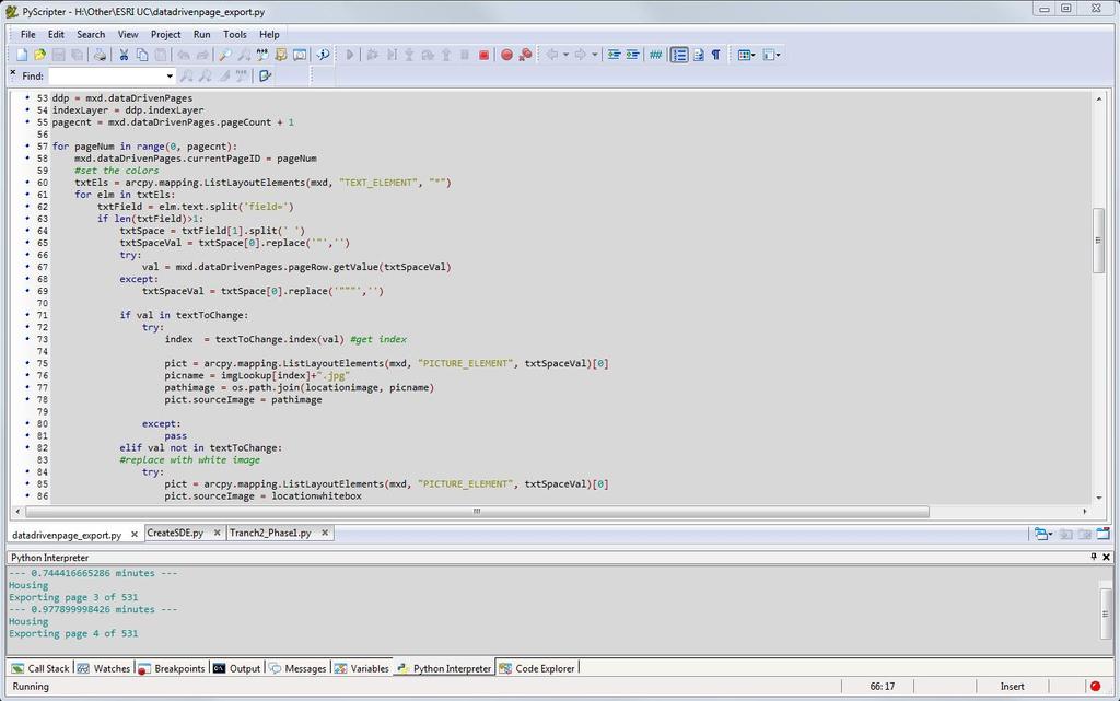
14 Visualisation of Results - Proformas 500 sites for Stage 2 Data driven pages Overview and zoom maps Dynamic table using attribute information Rule-based text fields Color-coded boxes (-) (--) Site is not located within or adjacent to Ancient Woodland. Site lies outside of areas identified as being poor of air quality. Site is more than 4000m from the nearest rail or tube station. Majority of the site is greenfield land that is neither within nor adjacent to a settlement.

15 15 Visualisation of Results - Proformas

16 16 Visualisation of Results - Proformas

17 Benefits GIS enables to assess a wide number of sites (800 88) Consistency in methodology Proformas help to visualise complicated data in an easy way Provides higher efficiency and quality Repeatable method 17
18 Thank you! Questions? Mandy Maas GIS Consultant
What s New in Collector for ArcGIS (Aurora)
") What s New in Collector for ArcGIS (Aurora) Derek Law (dlaw@esri.com) Esri Apps Product Management @GIS_Bandit Oct 10 th, 2018 Agenda Product overview Use cases Preparing data for Collector for ArcGIS
What s New in Collector for ArcGIS (Aurora) Derek Law (dlaw@esri.com) Esri Apps Product Management @GIS_Bandit Oct 10 th, 2018 Agenda Product overview Use cases Preparing data for Collector for ArcGIS
GPS Mapping with Esri s Collector App. What We ll Cover
 GPS Mapping with Esri s Collector App Part 1: Overview What We ll Cover Part 1: Overview and requirements Part 2: Preparing the data in ArcGIS for Desktop Part 3: Build a web map in ArcGIS Online Part
ArcGIS is Advancing. Both Contributing and Integrating many new Innovations. IoT. Smart Mapping. Smart Devices Advanced Analytics
 ArcGIS is Advancing IoT Smart Devices Advanced Analytics Smart Mapping Real-Time Faster Computing Web Services Crowdsourcing Sensor Networks Both Contributing and Integrating many new Innovations ArcGIS
Innovation. The Push and Pull at ESRI. September Kevin Daugherty Cadastral/Land Records Industry Solutions Manager
 Innovation The Push and Pull at ESRI September 2004 Kevin Daugherty Cadastral/Land Records Industry Solutions Manager The Push and The Pull The Push is the information technology that drives research and
The Emerging Role of Enterprise GIS in State Forest Agencies
 The Emerging Role of Enterprise GIS in State Forest Agencies Geographic Information System (GIS) A geographic information system (GIS) is a computer software system designed to capture, store, manipulate,
No. of Days. ArcGIS 3: Performing Analysis ,431. Building 3D cities Using Esri City Engine ,859
 What s New? Creating Story Maps with ArcGIS Field Data Collection and Management Using ArcGIS Get Started with Insights for ArcGIS Introduction to GIS Using ArcGIS & ArcGIS Pro: Essential Workflow Migrating
No. of Days. ArcGIS Pro for GIS Professionals ,431. Building 3D cities Using Esri City Engine ,859
 What s New? Creating Story Maps with ArcGIS Field Data Collection and Management Using ArcGIS Get Started with Insights for ArcGIS Introduction to GIS Using ArcGIS & ArcGIS Pro: Essential Workflow Migrating
Esri Overview for Mentor Protégé Program:
 Agenda Passionate About Helping You Succeed Esri Overview for Mentor Protégé Program: Northrop Grumman CSSS Jeff Dawley 3 September 2010 Esri Overview ArcGIS as a System ArcGIS 10 - Map Production - Mobile
Road Ahead: Linear Referencing and UPDM
 Road Ahead: Linear Referencing and UPDM Esri European Petroleum GIS Conference November 7, 2014 Congress Centre, London Your Work Making a Difference ArcGIS Is Evolving Your GIS Is Becoming Part of an
DP Project Development Pvt. Ltd.
 Dear Sir/Madam, Greetings!!! Thanks for contacting DP Project Development for your training requirement. DP Project Development is leading professional training provider in GIS technologies and GIS application
Empowering water/wastewater network management with GIS
 Empowering water/wastewater network management with GIS Ioannis Kavouras_GIS Manager Surveying Engineer, MSc, MBA The Company responsible for fresh water distribution & sanitation serving 1.500.000 citizens
ArcGIS. for Server. Understanding our World
 ArcGIS for Server Understanding our World ArcGIS for Server Create, Distribute, and Manage GIS Services You can use ArcGIS for Server to create services from your mapping and geographic information system
Introduction to Portal for ArcGIS. Hao LEE November 12, 2015
 Introduction to Portal for ArcGIS Hao LEE November 12, 2015 Agenda Web GIS pattern Product overview Installation and deployment Security and groups Configuration options Portal for ArcGIS + ArcGIS for
Geodatabase Replication for Utilities Tom DeWitte Solution Architect ESRI Utilities Team
 Geodatabase Replication for Utilities Tom DeWitte Solution Architect ESRI Utilities Team 1 Common Data Management Issues for Utilities Utilities are a distributed organization with the need to maintain
What Would John Snow Do (Today)? Part 1
? Part 1") What Would John Snow Do (Today)? Part 1 Tanya Bigos and Derek Law @Tanyabigos @GIS_Bandit Thurs Oct 19 th, 2017 Outline Overview of the ArcGIS Platform Whiteboard discussion Summary Questions A Whole New
What Would John Snow Do (Today)? Part 1 Tanya Bigos and Derek Law @Tanyabigos @GIS_Bandit Thurs Oct 19 th, 2017 Outline Overview of the ArcGIS Platform Whiteboard discussion Summary Questions A Whole New
ArcGIS Deployment Pattern. Azlina Mahad
 ArcGIS Deployment Pattern Azlina Mahad Agenda Deployment Options Cloud Portal ArcGIS Server Data Publication Mobile System Management Desktop Web Device ArcGIS An Integrated Web GIS Platform Portal Providing
SHOW ME THE DATA. FEMA Region 6 Community Assistance Visits Findings Collector
 SHOW ME THE DATA FEMA Region 6 Community Assistance Visits Findings Collector Roberto Ramirez, CFM / ASFPM June 4, 2015 Topics of Discussion Overview of CAV Findings Collection project Why a GIS Based
Among various open-source GIS programs, QGIS can be the best suitable option which can be used across partners for reasons outlined below.
 Comparison of Geographic Information Systems (GIS) software As of January 2018, WHO has reached an agreement with ESRI (an international supplier of GIS software) for an unlimited use of ArcGIS Desktop
Arcgis Enterprise Performance And Scalability Best Practices
 Arcgis Enterprise Performance And Scalability Best Practices We have made it easy for you to find a PDF Ebooks without any digging. And by having access to our ebooks online or by storing it on your computer,
Karsten Vennemann, Seattle. QGIS Workshop CUGOS Spring Fling 2015
 Karsten Vennemann, Seattle 2015 a very capable and flexible Desktop GIS QGIS QGIS Karsten Workshop Vennemann, Seattle slide 2 of 13 QGIS - Desktop GIS originally a GIS viewing environment QGIS for the
No. of Days. Building 3D cities Using Esri City Engine ,859. Creating & Analyzing Surfaces Using ArcGIS Spatial Analyst 1 7 3,139
 Q3 What s New? Creating and Editing Data with ArcGIS Pro Editing and Maintaining Parcels Using ArcGIS Spatial Analysis Using ArcGIS Pro User Workflows for ArcGIS Online Organizations Q3-2018 ArcGIS Desktop
FIRE DEPARMENT SANTA CLARA COUNTY
 DEFINITION FIRE DEPARMENT SANTA CLARA COUNTY GEOGRAPHIC INFORMATION SYSTEM (GIS) ANALYST Under the direction of the Information Technology Officer, the GIS Analyst provides geo-spatial strategic planning,
Experiences and Directions in National Portals"
 FIG Seminar on e-land Administration Innsbruck/Austria 2-4 June 2004 "ESRI's Experiences and Directions in National Portals" Kevin Daugherty Cadastral/Land Records Manager ESRI Topic Points Technology
GIS Lecture 4: Data. GIS Tutorial, Third Edition GIS 1
 GIS Lecture 4: Data GIS 1 Outline Data Types, Tables, and Formats Geodatabase Tabular Joins Spatial Joins Field Calculator ArcCatalog Functions GIS 2 Data Types, Tables, Formats GIS 3 Directly Loadable
EEOS 381 -Spatial Databases and GIS Applications
 EEOS 381 -Spatial Databases and GIS Applications Lecture 5 Geodatabases What is a Geodatabase? Geographic Database ESRI-coined term A standard RDBMS that stores and manages geographic data A modern object-relational
ArcGIS Runtime: Migrating from ArcGIS Engine. Rex Hansen
 ArcGIS Runtime: Migrating from ArcGIS Engine Rex Hansen Thank You to Our Sponsors Migrating from ArcGIS Engine to ArcGIS Runtime ArcGIS Runtime API: new and evolved workflows on all platforms Windows Linux
Geog 469 GIS Workshop. Data Analysis
 Geog 469 GIS Workshop Data Analysis Outline 1. What kinds of need-to-know questions can be addressed using GIS data analysis? 2. What is a typology of GIS operations? 3. What kinds of operations are useful
Maricopa County Department of Transportation (MCDOT) GIS Innovations in Transportation Asset Management
 GIS Innovations in Transportation Asset Management") Maricopa County Department of Transportation (MCDOT) GIS Innovations in Transportation Asset Management Presented By Steve Hossack, GIS Database Administrator 2018 ITE/IMSA Spring Conference Maricopa County
Maricopa County Department of Transportation (MCDOT) GIS Innovations in Transportation Asset Management Presented By Steve Hossack, GIS Database Administrator 2018 ITE/IMSA Spring Conference Maricopa County
Geodatabase An Introduction
 2013 Esri International User Conference July 8 12, 2013 San Diego, California Technical Workshop Geodatabase An Introduction David Crawford and Jonathan Murphy Session Path The Geodatabase What is it?
Corporate. Information. Railway Infrastructure Administrator. Year indracompany.com
 geospatial and mobility Corporate Geographic Information System of ADIF Railway Infrastructure Administrator. Year 2009-2010 Corporate Geographic Information System of ADIF ADIF. Spanish Administrator
Leveraging Web GIS: An Introduction to the ArcGIS portal
 Leveraging Web GIS: An Introduction to the ArcGIS portal Derek Law Product Management DLaw@esri.com Agenda Web GIS pattern Product overview Installation and deployment Configuration options Security options
ArcGIS 10.1 An Overview of the System
 ArcGIS 10.1 An Overview of the System ArcGIS 10.1 An Overview of the System Damian Spangrud Director of Solutions, Esri Redlands, CA USA ArcGIS 10.1 Web Cloud Online Mobile Enterprise Desktop ArcGIS 10.1
Arboretum Explorer: Using GIS to map the Arnold Arboretum
 Arboretum Explorer: Using GIS to map the Arnold Arboretum Donna Tremonte, Arnold Arboretum of Harvard University 2015 Esri User Conference (UC), July 22, 2015 http://arboretum.harvard.edu/explorer Mission
Oakland County Parks and Recreation GIS Implementation Plan
 Oakland County Parks and Recreation GIS Implementation Plan TABLE OF CONTENTS 1.0 Introduction... 3 1.1 What is GIS? 1.2 Purpose 1.3 Background 2.0 Software... 4 2.1 ArcGIS Desktop 2.2 ArcGIS Explorer
Web GIS: Architectural Patterns and Practices. Shannon Kalisky Philip Heede
 Web GIS: Architectural Patterns and Practices Shannon Kalisky Philip Heede Web GIS Transformation of the ArcGIS Platform Desktop Apps Server GIS Web Maps Web Scenes Layers Web GIS Transformation of the
How GIS based Visualizations Support Land Use and Transportation Modeling
 How GIS based Visualizations Support Land Use and Transportation Modeling ESRI International Users Conference San Diego, CA - July 23, 2015 Prepared by: Troy Hightower Introduction This presentation will
Esri UC2013. Technical Workshop.
 Esri International User Conference San Diego, California Technical Workshops July 9, 2013 CAD: Introduction to using CAD Data in ArcGIS Jeff Reinhart & Phil Sanchez Agenda Overview of ArcGIS CAD Support
October 2011 ArcGIS 10 for Server Functionality Matrix
 October 2011 ArcGIS 10 for Server Functionality Matrix Esri, 380 New York St., Redlands, CA 92373-8100 USA TEL 909-793-2853 FAX 909-793-5953 E-MAIL info@esri.com WEB www.esri.com Copyright 2011 Esri All
Web GIS Patterns and Practices
 FedGIS Conference February 24 25, 2016 Washington, DC Web GIS Patterns and Practices Philip Heede Jay Theodore Witt Mathot Web GIS Transformation of the ArcGIS Platform Desktop Apps Web Maps Web Scenes
Introduction to Portal for ArcGIS
 Introduction to Portal for ArcGIS Derek Law Product Management March 10 th, 2015 Esri Developer Summit 2015 Agenda Web GIS pattern Product overview Installation and deployment Security and groups Configuration
esri.com/apps Copyright 2017 Esri. All rights reserved.
 ArcGIS Apps esri.com/apps Copyright 2017 Esri. All rights reserved. 159913 G79379 ArcGIS Apps Survey123 for ArcGIS Included with ArcGIS Survey123 for ArcGIS Create survey style forms to capture accurate
Portal for ArcGIS: An Introduction
 Portal for ArcGIS: An Introduction Derek Law Esri Product Management Esri UC 2014 Technical Workshop Agenda Web GIS pattern Product overview Installation and deployment Security and groups Configuration
Reducing Complex Spatial Data Management Needs in and Upstream Oil and Gas Operations Team. Jason Wilson GIS Business Analyst SM Energy
 Reducing Complex Spatial Data Management Needs in and Upstream Oil and Gas Operations Team Jason Wilson GIS Business Analyst SM Energy Agenda About Myself and SM Energy The Challenge The Goal Solution
NR402 GIS Applications in Natural Resources
 NR402 GIS Applications in Natural Resources Lesson 1 Introduction to GIS Eva Strand, University of Idaho Map of the Pacific Northwest from http://www.or.blm.gov/gis/ Welcome to NR402 GIS Applications in
HIGH RESOLUTION BASE MAP: A CASE STUDY OF JNTUH-HYDERABAD CAMPUS
 HIGH RESOLUTION BASE MAP: A CASE STUDY OF JNTUH-HYDERABAD CAMPUS K.Manjula Vani, Abhinay Reddy, J. Venkatesh, Ballu Harish and R.S. Dwivedi ABSTRACT The proposed work High Resolution Base map: A Case study
ArcGIS Runtime: Migrating Your Apps from ArcGIS Engine. Eric Bader Lucas Danzinger Mike Branscomb
 ArcGIS Runtime: Migrating Your Apps from ArcGIS Engine Eric Bader Lucas Danzinger Mike Branscomb Migrating to ArcGIS Runtime ArcGIS Engine ArcGIS Runtime AppStudio for ArcGIS Apps: Collector, Workforce,
Data Aggregation with InfraWorks and ArcGIS for Visualization, Analysis, and Planning
 Data Aggregation with InfraWorks and ArcGIS for Visualization, Analysis, and Planning Stephen Brockwell President, Brockwell IT Consulting, Inc. Join the conversation #AU2017 KEYWORD Class Summary Silos
GIS Workshop Data Collection Techniques
 GIS Workshop Data Collection Techniques NOFNEC Conference 2016 Presented by: Matawa First Nations Management Jennifer Duncan and Charlene Wagenaar, Geomatics Technicians, Four Rivers Department QA #: FRG
Strategies for Integrating CAD and BIM in ArcGIS. Don Kuehne Esri 3D Product Manager: CAD/BIM/AEC
 Strategies for Integrating CAD and BIM in ArcGIS Don Kuehne Esri 3D Product Manager: CAD/BIM/AEC CAD Digital Drawing CAD in ArcGIS Desktop CAD in Desktop CAD as Data CAD as a Map EXPORT TO CAD Create and
Transforming the Maricopa County Department of Transportation (MCDOT) GIS-based Transportation Asset Inventory System June 30, 2016
 GIS-based Transportation Asset Inventory System June 30, 2016") Transforming the Maricopa County Department of Transportation (MCDOT) GIS-based Transportation Asset Inventory System June 30, 2016 Presented By Steve Hossack, GIS Database Administrator 2016 Esri User
Transforming the Maricopa County Department of Transportation (MCDOT) GIS-based Transportation Asset Inventory System June 30, 2016 Presented By Steve Hossack, GIS Database Administrator 2016 Esri User
Lecture 2. Introduction to ESRI s ArcGIS Desktop and ArcMap
 Lecture 2 Introduction to ESRI s ArcGIS Desktop and ArcMap Outline ESRI What is ArcGIS? ArcGIS Desktop ArcMap Overview Views Layers Attribute Tables Help! Scale Tips and Tricks ESRI Environmental Systems
IH 35 at Blanco River May 2015
 IH 35 at Blanco River May 2015 Presentation Objectives Background of historical damage assessment processes Introduction to Collector App ( Mat Peck) Collector App and Flood Damage Assessment (Katie Steele)
Driving efficiencies across in-field and centralised. Collector for ArcGIS. Georges River Council. NSW Department of Education
 This image will be updated Driving efficiencies across in-field and centralised operations Bushfire using Risk Collector for ArcGIS Georges River Council NSW Department of Education About Cardno About
Administering your Enterprise Geodatabase using Python. Jill Penney
 Administering your Enterprise Geodatabase using Python Jill Penney Assumptions Basic knowledge of python Basic knowledge enterprise geodatabases and workflows You want code Please turn off or silence cell
ArcGIS for Desktop. ArcGIS for Desktop is the primary authoring tool for the ArcGIS platform.
 ArcGIS for Desktop ArcGIS for Desktop ArcGIS for Desktop is the primary authoring tool for the ArcGIS platform. Beyond showing your data as points on a map, ArcGIS for Desktop gives you the power to manage
SCAUG Community Maps Building a Living Atlas of the World
 SCAUG Community Maps Building a Living Atlas of the World Mark Stewart Topics: SCAUG ArcGIS Online Overview Community Maps Overview Community Maps Workflow Update Process Utilizing Your Contribution Community
Evaluating e-government : implementing GIS services in Municipality
 Evaluating e-government : implementing GIS services in Municipality Municipality of Thessaloniki - G.I.S. Unit Misirloglou Symeon Head of the GIS Unit ESRI UC - 2016 The GIS Section - subset of the department
Geog 469 GIS Workshop. Managing Enterprise GIS Geodatabases
 Geog 469 GIS Workshop Managing Enterprise GIS Geodatabases Outline 1. Why is a geodatabase important for GIS? 2. What is the architecture of a geodatabase? 3. How can we compare and contrast three types
GIS Boot Camp for Education June th, 2011 Day 1. Instructor: Sabah Jabbouri Phone: (253) x 4854 Office: TC 136
 x 4854 Office: TC 136") GIS Boot Camp for Education June 27-30 th, 2011 Day 1 Instructor: Sabah Jabbouri Phone: (253) 833-9111 x 4854 Office: TC 136 Email: sjabbouri@greenriver.edu http://www.instruction.greenriver.edu/gis/ Summer
GIS Boot Camp for Education June 27-30 th, 2011 Day 1 Instructor: Sabah Jabbouri Phone: (253) 833-9111 x 4854 Office: TC 136 Email: sjabbouri@greenriver.edu http://www.instruction.greenriver.edu/gis/ Summer
What s New. August 2013
 What s New. August 2013 Tom Schwartzman Esri tschwartzman@esri.com Esri UC2013. Technical Workshop. What is new in ArcGIS 10.2 for Server ArcGIS 10.2 for Desktop Major Themes Why should I use ArcGIS 10.2
Development of a Web-Based GIS Management System for Agricultural Authorities in Iraq
 Development of a Web-Based GIS Management System for Agricultural Authorities in Iraq USCID Water Management Conference Phoenix, Arizona April 18, 2013 Gabriele Bonaiti Extension Program Specialist David
Exelis and Esri Technologies for Defense and National Security. Cherie Muleh
 Exelis and Esri Technologies for Defense and National Security Cherie Muleh Cherie.Muleh@exelisinc.com ENVI IMAGERY AND DATA BECOME KNOWLEDGE > Add information from imagery to your GIS > Automated workflows
Esri Training by Microcenter Prepare to Innovate. Microcenter Course Catalog
 Esri Training by Microcenter Prepare to Innovate 2015 Instructor-Led Courses Microcenter Course Catalog ArcGIS Foundational Courses Designed to meet the learning needs of professionals whose GIS experience
Migrating Defense Workflows from ArcMap to ArcGIS Pro. Renee Bernstein and Jared Sellers
 Migrating Defense Workflows from ArcMap to ArcGIS Pro Renee Bernstein and Jared Sellers ArcGIS Desktop Desktop Web Device ArcMap ArcCatalog ArcScene ArcGlobe ArcGIS Pro portal Server Online Content and
Administering Your Enterprise Geodatabase using Python. Gerhard Trichtl
 Administering Your Enterprise Geodatabase using Python Gerhard Trichtl What is the Geodatabase What is the Geodatabase A physical store of geographic data - Scalable storage model supported on different
The Impact of GIS Implementation on Increasing Business Efficiency
 The Impact of GIS Implementation on Increasing Business Efficiency Marko Maric Vladimir Stojanovic 1 July 15, 2014 San Diego Convention Center 2014 ESRI International User Conference Introduction GIS Implementation
Geodatabase: Best Practices. Robert LeClair, Senior Instructor
 Geodatabase: Best Practices Robert LeClair, Senior Instructor Agenda Geodatabase Creation Data Ownership Data Model Data Configuration Geodatabase Behaviors Data Validation Extending Performance Geodatabase
Law Enforcement Solutions and Applications
 ArcGIS for Solutions and Applications Solutions and Applications ArcGIS for Platform ArcGIS for Collection of solutions and applications for law enforcement. Built on the ArcGIS platform. For any named
Web GIS Deployment for Administrators. Vanessa Ramirez Solution Engineer, Natural Resources, Esri
 Web GIS Deployment for Administrators Vanessa Ramirez Solution Engineer, Natural Resources, Esri Agenda Web GIS Concepts Web GIS Deployment Patterns Components of an On-Premises Web GIS Federation of Server
Web GIS Administration: Tips and Tricks
 EdUC 2017 July 8 th, 2017 Web GIS Administration: Tips and Tricks Geri Miller Agenda Concerns Acknowledged User Management Content Management Monitoring Licensing and logins Sophistication of IT support
How does ArcGIS Server integrate into an Enterprise Environment? Willy Lynch Mining Industry Specialist ESRI, Denver, Colorado USA
 How does ArcGIS Server integrate into an Enterprise Environment? Willy Lynch Mining Industry Specialist ESRI, Denver, Colorado USA wlynch@esri.com ArcGIS Server Technology Transfer 1 Agenda Who is ESRI?
The Platform Generation. Derek Law and Ebony Wicks
 The Platform Generation Derek Law and Ebony Wicks GIS Provides the Framework and Process For Applying Geography Analysis and Interpretation Design and Planning Creating Understanding Modeling and Predicting
Integrating ArcGIS Server and Flex: Highlighting the Trees in Washington, DC. Holli Howard and Mike Alonzo Casey Trees Washington, DC
 Integrating ArcGIS Server and Flex: Highlighting the Trees in Washington, DC Holli Howard and Mike Alonzo Casey Trees Washington, DC Presentation overview Casey Trees Our ESRI partnership: The Casey Trees
Enabling the Image Analyst (IA) to use the geodatabase
 to use the geodatabase") Enabling the Image Analyst (IA) to use the geodatabase Rick Racine, BAE Systems, Reston, VA Stewart Walker, BAE Systems, San Diego, CA 2008 ESRI Federal User Conference, Washington, D.C., 21 February 2610020508
Enabling the Image Analyst (IA) to use the geodatabase Rick Racine, BAE Systems, Reston, VA Stewart Walker, BAE Systems, San Diego, CA 2008 ESRI Federal User Conference, Washington, D.C., 21 February 2610020508
Portal for ArcGIS: An Introduction. Catherine Hynes and Derek Law
 Portal for ArcGIS: An Introduction Catherine Hynes and Derek Law Agenda Web GIS pattern Product overview Installation and deployment Configuration options Security options and groups Portal for ArcGIS
The File Geodatabase API. Craig Gillgrass Lance Shipman
 The File Geodatabase API Craig Gillgrass Lance Shipman Schedule Cell phones and pagers Please complete the session survey we take your feedback very seriously! Overview File Geodatabase API - Introduction
Google Maps and Beyond
 Google Maps and Beyond Aaron Paul First American Title apaul@firstam.com 2015 APRA Symposium Association of Professional Reserve Analysts May 2 nd, 2015 Google Maps and Beyond - Overview Business case
Canadian Board of Examiners for Professional Surveyors Core Syllabus Item C 5: GEOSPATIAL INFORMATION SYSTEMS
 Study Guide: Canadian Board of Examiners for Professional Surveyors Core Syllabus Item C 5: GEOSPATIAL INFORMATION SYSTEMS This guide presents some study questions with specific referral to the essential
GIS ADMINISTRATOR / WEB DEVELOPER EVANSVILLE-VANDERBURGH COUNTY AREA PLAN COMMISSION
 GIS ADMINISTRATOR / WEB DEVELOPER EVANSVILLE-VANDERBURGH COUNTY AREA PLAN COMMISSION SALARY RANGE INITIATION $43,277 SIX MONTHS $45,367 POSITION GRADE PAT VI The Evansville-Vanderburgh County Area Plan
Lecture 9: Geocoding & Network Analysis
 Massachusetts Institute of Technology - Department of Urban Studies and Planning 11.520: A Workshop on Geographic Information Systems 11.188: Urban Planning and Social Science Laboratory Lecture 9: Geocoding
June 19 Huntsville, Alabama 1
 June 19 Huntsville, Alabama 1 Real-Time Geospatial Data: The Fusion of PI and ArcGIS Enabling Smarter Facilities Management OSIsoft and Esri Mapping and Location Analytics Platform Supporting Your Use
The Evolution of NWI Mapping and How It Has Changed Since Inception
 The Evolution of NWI Mapping and How It Has Changed Since Inception Some Basic NWI Facts: Established in 1974 Goal to create database on characteristics and extent of U.S. wetlands Maps & Statistics In
Big Data Discovery and Visualisation Insights for ArcGIS
 Big Data Discovery and Visualisation Insights for ArcGIS Create Enrich - Collaborate Lee Kum Cheong GIS CONVERSATIONS At Esri, we believe people can do amazing things with applied geography. GIS CONVERSATIONS
ArcGIS Enterprise: What s New. Philip Heede Shannon Kalisky Melanie Summers Shreyas Shinde
 ArcGIS Enterprise: What s New Philip Heede Shannon Kalisky Melanie Summers Shreyas Shinde ArcGIS Enterprise is the new name for ArcGIS for Server ArcGIS Enterprise Software Components ArcGIS Server Portal
Houston Plat Tracker puts the GIS in Land Development
 Houston Plat Tracker puts the GIS in Land Development Abstract: The Plat Tracker supports Houston's land development approval process. This home grown web-based system includes GIS research tools and a
An ESRI Technical Paper June 2007 An Overview of Distributing Data with Geodatabases
 An ESRI Technical Paper June 2007 An Overview of Distributing Data with Geodatabases ESRI 380 New York St., Redlands, CA 92373-8100 USA TEL 909-793-2853 FAX 909-793-5953 E-MAIL info@esri.com WEB www.esri.com
Introduction to ArcGIS Server - Creating and Using GIS Services. Mark Ho Instructor Washington, DC
 Introduction to ArcGIS Server - Creating and Using GIS Services Mark Ho Instructor Washington, DC Technical Workshop Road Map Product overview Building server applications GIS services Developer Help resources
Making spatial data available on the desktop
 Making spatial data available on the desktop Loch Lomond and The Trossachs National Park Authority (LLTNPA) Sally Newton GIS Manager Francis Corbett GIS Systems Officer Where we were in 2010 What we wanted
Workshop and Session Descriptions
 MONDAY, SEPTEMBER 14 Workshops (Full-day) Workshop and Session Descriptions 1. Bridging the surveyed gap: How land surveying data works with GIS GIS professionals use a myriad of data to construct their
Features and Benefits
 Autodesk LandXplorer Features and Benefits Use the Autodesk LandXplorer software family to help improve decision making, lower costs, view and share changes, and avoid the expense of creating physical
REPORT ON INVESTMENTS
 REPORT ON INVESTMENTS D.T2.3.3 Investments for technical equipment for the implementation of Web-GIS platform in Mantova 1 Local support group designing Mantova Web-GIS platform. Picture by Maria Giulia
ArcGIS Enterprise: Administration Workflows STUDENT EDITION
 ArcGIS Enterprise: Administration Workflows STUDENT EDITION Copyright 2019 Esri All rights reserved. Course version 1.1. Version release date April 2019. Printed in the United States of America. The information
Network Analysis with ArcGIS Online. Deelesh Mandloi Dmitry Kudinov
 Deelesh Mandloi Dmitry Kudinov Introductions Who are we? - Network Analyst Product Engineers Who are you? - Network Analyst users? - ArcGIS Online users? - Trying to figure out what is ArcGIS Online? Slides
ArcGIS Enterprise: What s New. Philip Heede Shannon Kalisky Melanie Summers Sam Williamson
 ArcGIS Enterprise: What s New Philip Heede Shannon Kalisky Melanie Summers Sam Williamson ArcGIS Enterprise is the new name for ArcGIS for Server What is ArcGIS Enterprise ArcGIS Enterprise is powerful
ArcGIS Online Routing and Network Analysis. Deelesh Mandloi Matt Crowder
 ArcGIS Online Routing and Network Analysis Deelesh Mandloi Matt Crowder Introductions Who are we? - Members of the Network Analyst development team Who are you? - Network Analyst users? - ArcGIS Online
Discovery and Access of Geospatial Resources using the Geoportal Extension. Marten Hogeweg Geoportal Extension Product Manager
 Discovery and Access of Geospatial Resources using the Geoportal Extension Marten Hogeweg Geoportal Extension Product Manager DISCOVERY AND ACCESS USING THE GEOPORTAL EXTENSION Geospatial Data Is Very
ESRI educational site license in Bahir Dar University. Tegegn Molla Abebe Mengaw Geospatial Data and Technology Center, BDU
 ESRI educational site license in Bahir Dar University Tegegn Molla Abebe Mengaw Geospatial Data and Technology Center, BDU September, 2016 Mission, Vision Purpose and Values of the GDTC Mission of GDTC
Available online at Analele Stiintifice ale Universitatii Al. I. Cuza din Iasi Seria Geologie 58 (1) (2012) 53 58
 (2012) 53 58") Available online at http://geology.uaic.ro/auig/ Analele Stiintifice ale Universitatii Al. I. Cuza din Iasi Seria Geologie 58 (1) (2012) 53 58 AUI GEOLOGIE GIS database for mineral resources: case study
Available online at http://geology.uaic.ro/auig/ Analele Stiintifice ale Universitatii Al. I. Cuza din Iasi Seria Geologie 58 (1) (2012) 53 58 AUI GEOLOGIE GIS database for mineral resources: case study
Town of Taos Request for Proposal Historic Preservation GIS Geodatabase Project April 2007
 Town of Taos Request for Proposal Historic Preservation GIS Geodatabase Project April 2007 1. Background The Town of Taos is requesting proposals from qualified firms or a team of firms who can develop
Geodatabase Management Pathway
 Geodatabase Management Pathway Table of Contents ArcGIS Desktop II: Tools and Functionality 3 ArcGIS Desktop III: GIS Workflows and Analysis 6 Building Geodatabases 8 Data Management in the Multiuser Geodatabase