3D Cadastre Web Map: Prospects and Developments
|
|
|
- Erika Rose
- 6 years ago
- Views:
Transcription

1 3D Cadastre Web Map: Prospects and Developments Trias Aditya, Febri Iswanto, Ade Irawan, Dany Laksono Dept. of Geodesy and Geomatics Engineering Universitas Gadjah Mada (UGM) UGM
 map.bpn.go.")
 - Survey and mapping activities intensified")
 -other 3D")
2 Why doing 3D Survey & Mapping services for LA? (Indonesian case) map.bpn.go.id Up to 2009 land registration: -Only up to 40% out of parcels (2D) - Survey and mapping activities intensified Vertical/3D constructions with rights: - growing interest - limited legal foundations (only for apartments) -other 3D constructions and uses above and below land parcels not yet defined


3 Why doing 3D Survey & Mapping services for LA? (Indonesian case) In line with the plan to renew Land Administration Law, registration services to 3D property objects will be accomodated Courtesy: flickr
4 Motivation for 3D Cadastre Web Map From Surveying to Modeling - current survey and photogrammetry technologies offer full support to generate 3D data model in the format of CAD drawings - More possibilities to convert CAD data into geometries in geospatial databases


5 Terestrial laser scanner

6 Non topographic photogrametry measurements

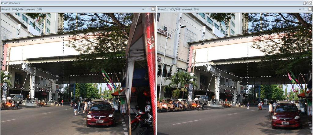
7 Total Station Measurements T1 Jln 1 Jln B S A 1 B 1 B 2 A 2 B 3 A 3 A 4 B 4 B 5 T10 T9 T8 T 7 T 6 T5 T4 T4 2 Jln T2 3 T 3 Jln 4
8 Motivation for 3D Cadastre Web Map From Modeling to Rendering/Visualization - Need a proper yet consistent system to facilitate the use of resources (database, survey plans, documents) for supporting land registration activities (incl. 3D property registration) & spatial planning through web-based solutions efficiency coordinated actions - National land information policy: Integrated Land Information and more toward distributed services - Needs for collaborative uses of Cadastre Data


9 From Survey to CAD data: Example 1


10 From Survey to CAD data: Example 2 Lantai 2 Lantai 1
11 Needs -Visualize 2D and 3D data together through geospatial web browsers -Possible formats: VRML/GeoVRML(?), X3D, KML... -Exchange 3D data (together with 2D) -Possible formats: Collada, GML, CityGML, KML... For planning and disaster management applications, online access and visualization of (geometric) 3D cadastral data are often required in order to support data sharing and data communication.
12 Possibilities - Opportunities - Store CAD data as geometries in geospatial DB limited possibilities exist: e.g. Not all support volumetric representation limited topological definition - Go forth and back from CAD visualization to DB storage (with strict connectivity between CAD system and DB system) - Convert 3D data separately and get them ready in specific 3D browsers - Possible integrated visualization of X3D objects and attributes through web browsers utilizing X3D plug-in

13 Case Study 1: 3D Cadastre Web Map for Space Management


14 Case Study 1: 3D Cadastre Web Map for Space Management

15 Case Study 2: 3D visualization of affected land parcels of flood hazard post Mt. Merapi eruption


16 Data Topography from SF Aerial Photogrammetry Flood map Impacted Parcels
17 Case Study 2 workflow for VRML and X3D format
18 Case Study 2 workflow for ArcGIS Vis


")
19 Findings Despite current conversion tools provide promising opportunities in creating standardized format of X3D: - some digital surface data, which is originally in *.WRL format, appears to be corrupt - texture mapping of the digital surface are finished successfully, while some others failed -3D polygon of land parcels seemed to be corrupt, while the case didn t seem to be happened in its VRML format -Data exchange/interoperability still low (ArcGIS case) -User Interaction problems
20 Concluding Remarks 3D visualization options using open source 3D formats and browsers are still limited. Regardless the limitation of the existing geo DBMS in storing 3D geometries, the presented solution that proposes the use of KML and PostGIS is considered to be sufficient to extend 2D cadastre geodatabase into 3D hybrid cadastre geodatabase The use of X3D in web cadastre has a promising future to present 3D cadastre data along with the earth s terrain surface, yet some obstacles and constraints must firstly be considered. More opportunities for 3D formats and services needed to support full interoperability


21

22
GIS-based Smart Campus System using 3D Modeling
 GIS-based Smart Campus System using 3D Modeling Smita Sengupta GISE Advance Research Lab. IIT Bombay, Powai Mumbai 400 076, India smitas@cse.iitb.ac.in Concept of Smart Campus System Overview of IITB Campus
Developing 3D Geoportal for Wilayah Persekutuan Iskandar
 Developing 3D Geoportal for Wilayah Persekutuan Iskandar Dionnald Beh BoonHeng and Alias Abdul Rahman Department of Geoinformatics, Faculty of Geoinformation Engineering and Sciences, Universiti Teknologi
<Insert Picture Here> Oracle Spatial 11g. Dr. Siva Ravada
 Oracle Spatial 11g Dr. Siva Ravada New in Oracle Spatial 11g 3D Support Spatial Web Services Network Data Model GeoRaster Performance Improvements 3D Applications Location-based services
Imagery and the Location-enabled Platform in State and Local Government
 Imagery and the Location-enabled Platform in State and Local Government Fred Limp, Director, CAST Jim Farley, Vice President, Leica Geosystems Oracle Spatial Users Group Denver, March 10, 2005 TM TM Discussion
"GIS-Sofia" Ltd. geospatial data integration in SOFCAR geographic information system and providing services March 2018, Sofia
 "GIS-Sofia" Ltd. geospatial data integration in SOFCAR geographic information system and providing services Geographical Information System Sofia " Ltd....the beginning... Established in 1999, as a Sofia
Features and Benefits
 Autodesk LandXplorer Features and Benefits Use the Autodesk LandXplorer software family to help improve decision making, lower costs, view and share changes, and avoid the expense of creating physical
Data Conversion to I3S for 3D Modeling from CityGML. Christian Dahmen (con terra GmbH) Satish Sankaran (Esri)
 Satish Sankaran (Esri)") Data Conversion to I3S for 3D Modeling from CityGML Christian Dahmen (con terra GmbH) Satish Sankaran (Esri) 3D Across the ArcGIS Platform Manage Multiscale 3D Models 3D Geodesign ArcGIS for 3D Cities
Data Conversion to I3S for 3D Modeling from CityGML Christian Dahmen (con terra GmbH) Satish Sankaran (Esri) 3D Across the ArcGIS Platform Manage Multiscale 3D Models 3D Geodesign ArcGIS for 3D Cities
3D City/Landscape Modeling Non-Building Thematic: Vegetation
 3D City/Landscape Modeling Non-Building Thematic: Vegetation Presenter: Shafarina Wahyu Trisyanti shafarina.wahyu@gmail.com Co-Author: Deni Suwardhi, Agung Budi Harto dsuwardhi@kk-insig.org, agung@gd.itb.ac.id
Modular Web Framework for the BRANDENBURGVIEWER
 Modular Web Framework for the BRANDENBURGVIEWER Geoinformation System (GIS) 2 GIS = geo + information + system + + Survey of data Organization of data Processing and Analysis Presentation geodata infrastructure
Innovation. The Push and Pull at ESRI. September Kevin Daugherty Cadastral/Land Records Industry Solutions Manager
 Innovation The Push and Pull at ESRI September 2004 Kevin Daugherty Cadastral/Land Records Industry Solutions Manager The Push and The Pull The Push is the information technology that drives research and
IMPERIAL COUNTY PLANNING AND DEVELOPMENT
 IMPERIAL COUNTY PLANNING AND DEVELOPMENT GEODATABASE USER MANUAL FOR COUNTY BUSINESS DEVELOPMENT GIS June 2010 Prepared for: Prepared by: County of Imperial Planning and Development 801 Main Street El
Geospatial capabilities, spatial data and services provided by Military Geographic Service
 Geospatial capabilities, spatial data and services provided by Military Geographic Service LtC Mariyan Markov PhD CONTENTS 1. INTRODUCTION - Workflow - Data sources remote sensing, direct field observation.
Free and Open Source Software for Cadastre and Land Registration : A Hidden Treasure? Gertrude Pieper Espada. Overview
 Free and Open Source Software for Cadastre and Land Registration : A Hidden Treasure? Gertrude Pieper Espada Overview FLOSS concepts Digital Land Administration systems FLOSS Database alternatives FLOSS
Bentley Map V8i (SELECTseries 3)
") Bentley Map V8i (SELECTseries 3) A quick overview Why Bentley Map Viewing and editing of geospatial data from file based GIS formats, spatial databases and raster Assembling geospatial/non-geospatial data
Bentley Map V8i (SELECTseries 3) A quick overview Why Bentley Map Viewing and editing of geospatial data from file based GIS formats, spatial databases and raster Assembling geospatial/non-geospatial data
ESRI educational site license in Bahir Dar University. Tegegn Molla Abebe Mengaw Geospatial Data and Technology Center, BDU
 ESRI educational site license in Bahir Dar University Tegegn Molla Abebe Mengaw Geospatial Data and Technology Center, BDU September, 2016 Mission, Vision Purpose and Values of the GDTC Mission of GDTC
GIS-based Smart Campus System using 3D Modeling
 GIS-based Smart Campus System using 3D Modeling Hardik Panchal & Rizwan Khan, Smita Sengupta, GISE Advance Lab, Indian Institute of Technology, Bombay, India N.L. Sarda, Dept. Of Computer Science, Indian
ESRI Survey Summit August Clint Brown Director of ESRI Software Products
 ESRI Survey Summit August 2006 Clint Brown Director of ESRI Software Products Cadastral Fabric How does Cadastral fit with Survey? Surveyors process raw field observations Survey measurements define high-order
Spread over a central peninsula and its surroundings, Split's greater area includes the surrounding seaside towns as well.
 Split is a Mediterranean city on the eastern shores of the Adriatic Sea, centered around the ancient Roman Palace of the Emperor Diocletian and its bay and port. With a population of 178,192 citizens,
CityGML in Detail Part 2
 CityGML in Detail Part 2 Prof. Dr. Thomas H. Kolbe Institute for Geodesy and Geoinformation Science Berlin University of Technology kolbe@igg.tu-berlin.de May 2008 EduServ6 Course on CityGML Copyright
March 2007 The Survey Department of Sri Lanka
 Contribution of Survey Department of Sri Lanka for Mitigation of Disasters in Sri Lanka K.A.U.N.Kasthuri Deputy Surveyor General (Information Technology) March 2007 The Survey Department of Sri Lanka 1
Experiences and Directions in National Portals"
 FIG Seminar on e-land Administration Innsbruck/Austria 2-4 June 2004 "ESRI's Experiences and Directions in National Portals" Kevin Daugherty Cadastral/Land Records Manager ESRI Topic Points Technology
The File Geodatabase API. Craig Gillgrass Lance Shipman
 The File Geodatabase API Craig Gillgrass Lance Shipman Schedule Cell phones and pagers Please complete the session survey we take your feedback very seriously! Overview File Geodatabase API - Introduction
Managing Parcels in ArcGIS 10
 Managing Parcels in ArcGIS 10 ArcGIS Geodatabase Editing Workflows Editing Maps Tim Hensley Esri Solution Engineer Karen Lowrey Esri Geospatial Analyst Basemaps Public Access Value Analysis ArcGIS 10 Parcel
Overview of CityGML. Dave Capstick, Ordnance Survey Research Department
 Overview of CityGML Dave Capstick, Ordnance Survey Research Department Introduction Why is citygml necessary CityGML development who is responsible? Ordnance Surveys interest 3D modelling basic concepts
Web 3D Service & CityGML Update
 Technische Universität Berlin Web 3D Service & CityGML Update Thomas H. Kolbe Institute for Geodesy and Geoinformation Science Berlin University of Technology kolbe@igg.tu-berlin.de 2nd of November, 2007
Canadian Board of Examiners for Professional Surveyors Core Syllabus Item C 5: GEOSPATIAL INFORMATION SYSTEMS
 Study Guide: Canadian Board of Examiners for Professional Surveyors Core Syllabus Item C 5: GEOSPATIAL INFORMATION SYSTEMS This guide presents some study questions with specific referral to the essential
The Next Generation GIS/LIS A Surveys Information System Integrated within a GIS
 The Next Generation GIS/LIS A Surveys Information System Integrated within a GIS Michael F. WEIR, USA Key words: Linking, Snapping, GIS, Measurements, Measurement Data, GIS Features, Spatial Quality. SUMMARY
Integration Activities in Indonesia: The Integration of Land and Marine Spatial Data Sets as Part of Indonesian SDI Development
 Integration Activities in Indonesia: The Integration of Land and Marine Spatial Data Sets as Part of Indonesian SDI Development M. Arief Syafi i National Coordination Agency for Surveys and Mapping (B
RESOURCES DEVELOPMENT GEOSPATIAL DATA USING THE DIGITAL TOPOGRAPHIC PLAN OF ROMANIA- TOPRO5
 C. C-tin Muşat, F. M. Brebu, A. C. Bălă, I. S. Herban Resources Development Digital Geospatial Data Using the Digital Topographic Plan of Romania - TOPRO5 RESOURCES DEVELOPMENT GEOSPATIAL DATA USING THE
E14- Integrating Civil Design, Mapping and Geospatial Data
 www.bentley.com E14- Integrating Civil Design, Mapping and Geospatial Data Lisa Whitson, Transportation and Local Infrastructure Professional Services, Bentley Systems USA GIS and Engineering Data Integration
Data Origin. Ron van Lammeren CGI-GIRS 0910
 Data Origin Ron van Lammeren CGI-GIRS 0910 How to obtain geodata? Geo data initiative Executive Order 12906, "Coordinating Geographic Data Acquisition and Access: The National Spatial Data Infrastructure,"
Geog 469 GIS Workshop. Managing Enterprise GIS Geodatabases
 Geog 469 GIS Workshop Managing Enterprise GIS Geodatabases Outline 1. Why is a geodatabase important for GIS? 2. What is the architecture of a geodatabase? 3. How can we compare and contrast three types
NC Geospatial Data Archiving Project
 NC Geospatial Data Archiving Project 1. Frequency of Capture of Geospatial Data We seek your advice and experience in creating geospatial data snapshots for your archives -- versions of vector data and
Themes for Geomatics Conference. Geodesy Themes
 Themes for Geomatics Conference Geodesy Themes Geodynamics o Modeling the Deformation of the Earth s Crust o Recent Advances in Geometric Approaches to Deformation Analysis o Monitoring Systems (Sensors
GIS ADMINISTRATOR / WEB DEVELOPER EVANSVILLE-VANDERBURGH COUNTY AREA PLAN COMMISSION
 GIS ADMINISTRATOR / WEB DEVELOPER EVANSVILLE-VANDERBURGH COUNTY AREA PLAN COMMISSION SALARY RANGE INITIATION $43,277 SIX MONTHS $45,367 POSITION GRADE PAT VI The Evansville-Vanderburgh County Area Plan
Working with the Geodatabase
 Working with the Geodatabase Agenda What is the geodatabase? Benefits of the geodatabase Inside the geodatabase Geodatabase rules Demos Additional resources and training Q & A The Geodatabase is the foundation
DATA SOURCES AND INPUT IN GIS. By Prof. A. Balasubramanian Centre for Advanced Studies in Earth Science, University of Mysore, Mysore
 DATA SOURCES AND INPUT IN GIS By Prof. A. Balasubramanian Centre for Advanced Studies in Earth Science, University of Mysore, Mysore 1 1. GIS stands for 'Geographic Information System'. It is a computer-based
GEOMATICS. Shaping our world. A company of
 GEOMATICS Shaping our world A company of OUR EXPERTISE Geomatics Geomatics plays a mayor role in hydropower, land and water resources, urban development, transport & mobility, renewable energy, and infrastructure
ArcGIS for Desktop. ArcGIS for Desktop is the primary authoring tool for the ArcGIS platform.
 ArcGIS for Desktop ArcGIS for Desktop ArcGIS for Desktop is the primary authoring tool for the ArcGIS platform. Beyond showing your data as points on a map, ArcGIS for Desktop gives you the power to manage
ESRI Quality Solution
 ESRI Quality Solution Paul Hardy Business Development Consultant (NMCAs) ESRI Europe phardy@esri.com ESRI Quality Solution Geodatabase Integrity Schema constraints (Attribute Domains etc) Rich data types
Leveraging Geospatial Technology for Cadastral Surveys
 Matthew Delano, LS Geospatial World Forum January 2017 Leveraging Geospatial Technology for Cadastral Surveys Fit-for-Purpose Simple to start Can improve over time whenever necessary Meet the needs of
Why GIS & Why Internet GIS?
 Why GIS & Why Internet GIS? The Internet bandwagon Internet mapping (e.g., MapQuest) Location-based services Real-time navigation (e.g., traffic) Real-time service dispatch Business Intelligence Spatial
The Integrated Ge spatial Information Framework to the strengthening of NSDI, Mongolia
 Young Geospatial Professionals Summit 21 NOV 2018 The Integrated Ge spatial Information Framework to the strengthening of NSDI, Mongolia BAYARMAA ENKHTUR Geospatial information and technology department
INSTITUTE OF AERONAUTICAL ENGINEERING (Autonomous) Dundigal, Hyderabad
 Dundigal, Hyderabad") INSTITUTE OF AERONAUTICAL ENGINEERING (Autonomous) Dundigal, Hyderabad -00 0 CIVIL ENGINEERING TUTORIAL QUESTION BANK Course Name : Remote Sensing and GIS Course Code : A00 Class : IV B. Tech I Semester
INSTITUTE OF AERONAUTICAL ENGINEERING (Autonomous) Dundigal, Hyderabad -00 0 CIVIL ENGINEERING TUTORIAL QUESTION BANK Course Name : Remote Sensing and GIS Course Code : A00 Class : IV B. Tech I Semester
INDONESIA S S UPDATE: GEOSPATIAL INFORMATION FOR SUSTAINABLE DEVELOPMENT RELATED TO INA SDI Dr. Asep Karsidi, M.Sc
 INDONESIA S S UPDATE: GEOSPATIAL INFORMATION FOR SUSTAINABLE DEVELOPMENT RELATED TO INA SDI Dr. Asep Karsidi, M.Sc GEOSPATIAL INFORMATION AGENCY 08 August, 2012 OUTLINE 1. Transformation Bakosurtanal into
These modules are covered with a brief information and practical in ArcGIS Software and open source software also like QGIS, ILWIS.
 Online GIS Training and training modules covered are: 1. ArcGIS, Analysis, Fundamentals and Implementation 2. ArcGIS Web Data Sharing 3. ArcGIS for Desktop 4. ArcGIS for Server These modules are covered
Steve Pietersen Office Telephone No
 Steve Pietersen Steve.Pieterson@durban.gov.za Office Telephone No. 031 311 8655 Overview Why geography matters The power of GIS EWS GIS water stats EWS GIS sanitation stats How to build a GIS system EWS
Bentley Map Advancing GIS for the World s Infrastructure
 Bentley Map Advancing GIS for the World s Infrastructure Presentation Overview Why would you need Bentley Map? What is Bentley Map? Where is Bentley Map Used? Why would you need Bentley Map? Because your
June 19 Huntsville, Alabama 1
 June 19 Huntsville, Alabama 1 Real-Time Geospatial Data: The Fusion of PI and ArcGIS Enabling Smarter Facilities Management OSIsoft and Esri Mapping and Location Analytics Platform Supporting Your Use
Data Origin. How to obtain geodata? Ron van Lammeren CGI-GIRS 0910
 Data Origin How to obtain geodata? Ron van Lammeren CGI-GIRS 0910 Spatial Data interest Improvement of policy making. ± 90% of all information used by government has spatial characteristics SPATIAL INFORMATION
Geospatial Products V8i (SELECTseries 1)
") Geospatial Products V8i (SELECTseries 1) Keith Raymond Product Manager Geospatial Desktop Products Presentation Overview What are the various products? Why would you need them? Demonstrations 2 WWW.BENTLEY.COM
Geospatial Products V8i (SELECTseries 1) Keith Raymond Product Manager Geospatial Desktop Products Presentation Overview What are the various products? Why would you need them? Demonstrations 2 WWW.BENTLEY.COM
Integration of Historic Building Information Modeling (HBIM) and 3D GIS for Recording and Managing Cultural Heritage Sites
 and 3D GIS for Recording and Managing Cultural Heritage Sites") Dublin Institute of Technology ARROW@DIT Conference papers School of Surveying and Construction Management 2012 Integration of Historic Building Information Modeling (HBIM) and 3D GIS for Recording and
Dublin Institute of Technology ARROW@DIT Conference papers School of Surveying and Construction Management 2012 Integration of Historic Building Information Modeling (HBIM) and 3D GIS for Recording and
Strategies for Integrating CAD and BIM in ArcGIS. Don Kuehne Esri 3D Product Manager: CAD/BIM/AEC
 Strategies for Integrating CAD and BIM in ArcGIS Don Kuehne Esri 3D Product Manager: CAD/BIM/AEC CAD Digital Drawing CAD in ArcGIS Desktop CAD in Desktop CAD as Data CAD as a Map EXPORT TO CAD Create and
Geoinformation Science at TU Berlin
 Technische Universität Berlin Department of Geoinformation Science Geoinformation Science at TU Berlin Prof. Dr. Thomas H. Kolbe Institute for Geodesy and Geoinformation Science Berlin University of Technology
SDI Implementation at the Local
 SDI Implementation at the Local Administration Level of Germany Hartmut Müller and Stephan von St. Vith FIG Working Week 2009 Surveyors Key Role in Accelerated Development, Eilat, Israel, 3-8 May 2009
Creating synergies between Statistical and Geospatial information for better policy outputs: The case of Mexico
 Creating synergies between Statistical and Geospatial information for better policy outputs: The case of Mexico Geospatial & Statistics Integration for Informed Decision Making Geospatial World Forum 2017
Exelis and Esri Technologies for Defense and National Security. Cherie Muleh
 Exelis and Esri Technologies for Defense and National Security Cherie Muleh Cherie.Muleh@exelisinc.com ENVI IMAGERY AND DATA BECOME KNOWLEDGE > Add information from imagery to your GIS > Automated workflows
Esri UC2013. Technical Workshop.
 Esri International User Conference San Diego, California Technical Workshops July 9, 2013 CAD: Introduction to using CAD Data in ArcGIS Jeff Reinhart & Phil Sanchez Agenda Overview of ArcGIS CAD Support
Exploring the boundaries of your built and natural world. Geomatics
 Exploring the boundaries of your built and natural world Geomatics Before the Luxor brought magic to the Las Vegas strip and before the South LRT extension in Edmonton gave residents a new route to travel,
Getting Started with Community Maps
 Esri International User Conference San Diego, California Technical Workshops July 24, 2012 Getting Started with Community Maps Shane Matthews and Tamara Yoder Topics for this Session ArcGIS is a complete
The Integration of Land and Marine Spatial Data Set As Part of Indonesian Spatial Data Infrastructure Development
 UNITED NATIONS E/CONF.97/6/IP. 46 ECONOMIC AND SOCIAL COUNCIL Seventeenth United Nations Regional Cartographic Conference for Asia and the Pacific Bangkok, 18-22 September 2006 Item 7 of the provisional
Integrated application of Land Surveying and Mappipng. Data on Web-GIS
 Integrated application of Land Surveying and Mappipng Data on Web-GIS Abstract The data system of the land surveying and drawing is the core of the land information system. It includes the following contents:
ArcGIS for INSPIRE. Marten Hogeweg
 ArcGIS for INSPIRE Marten Hogeweg Please Take Our Survey on the App Download the Esri Events app and find your event Select the session you attended Scroll down to find the feedback section Complete answers
Using CAD data in ArcGIS
 Using CAD data in ArcGIS Phil Sanchez and Jeff Reinhart Esri UC 2014 Technical Workshop Agenda Overview of ArcGIS CAD Support Using CAD Datasets in ArcMap Georeferencing CAD data for ArcGIS Loading CAD
May 2011 Oracle Spatial User Conference
 May 2011 Oracle Spatial User Conference Oracle Spatial User Conference! May 19, 2011 Ronald Reagan Building and International Trade Center Washington, DC USA May 2011 Oracle Spatial User Conference Francois
Use of geo-referenced data for DRM in Central Asia, problems and prospective
 Use of geo-referenced data for DRM in Central Asia, problems and prospective Dr. Akylbek Chymyrov Director, Kyrgyz Center of Geoinformation Systems Member of the Public Supervisory Board MES KR KSUCTA,
Generating and Caching 3D-Tiles for Large-Scale 3D-Visualization GeoSharing , Bern, Switzerland
 Generating and Caching 3D-Tiles for Large-Scale 3D-Visualization GeoSharing 02.11.2013, Bern, Switzerland Martin Christen, Robert Wüest, Benjamin Loesch, Stephan Nebiker FHNW University of Applied Sciences
State of Israel Ministry of Housing and Construction Survey of Israel. The Hydrological project case
 State of Israel Ministry of Housing and Construction Survey of Israel The Hydrological project case Survey of Israel Content Introduction To the Survey of Israel The operation assumptions The main responsibilities
Chapter 10: BIM for Facilitation of Land Administration Systems in Australia
 Chapter 10: BIM for Facilitation of Land Administration Systems in Australia Sam Amirebrahimi Introduction With the introduction of the concept of 3D Cadastre and extensive efforts in this area, currently
What is GIS and How Can It Help Me?
 esri European User Conference Madrid 2011 What is GIS and How Can It Help Me? Jaime Nieves Ignacio Vázquez esri spain «Knowing where things are, and why, is essential to rational decision making.» Jack
Enabling ENVI. ArcGIS for Server
 Enabling ENVI throughh ArcGIS for Server 1 Imagery: A Unique and Valuable Source of Data Imagery is not just a base map, but a layer of rich information that can address problems faced by GIS users. >
Bridging the Gap between Engineering and GIS
 Bridging the Gap between Engineering and GIS Presented by: Karen Stewart, B.Tech, GISP Manager of Geomatics Township of Langley February 13, 2006 Agenda Introduction History Goals Implementation Benefits
3D City GIS. Agenda. Why 3D City GIS? What does 3D City GIS mean?
 3D City GIS 1 of 60 WWW.BENTLEY.COM Ben Fredericque, Product Manager, Geospatial Agenda Why 3D City GIS? What does 3D City GIS mean? 2 of 60 WWW.BENTLEY.COM Sydney, Australia, 11 16 April 2010 1 Why 3D
Enabling the Image Analyst (IA) to use the geodatabase
 to use the geodatabase") Enabling the Image Analyst (IA) to use the geodatabase Rick Racine, BAE Systems, Reston, VA Stewart Walker, BAE Systems, San Diego, CA 2008 ESRI Federal User Conference, Washington, D.C., 21 February 2610020508
Enabling the Image Analyst (IA) to use the geodatabase Rick Racine, BAE Systems, Reston, VA Stewart Walker, BAE Systems, San Diego, CA 2008 ESRI Federal User Conference, Washington, D.C., 21 February 2610020508
ISO Series Standards in a Model Driven Architecture for Landmanagement. Jürgen Ebbinghaus, AED-SICAD
 ISO 19100 Series Standards in a Model Driven Architecture for Landmanagement Jürgen Ebbinghaus, AED-SICAD 29.10.2003 The Company 100% SIEMENS PTD SIEMENS Business Services Shareholder & Strategic Business
E-Government and SDI in Bavaria, Germany
 135 E-Government and SDI in Bavaria, Germany Wolfgang STOESSEL, Germany Key words: GDI-BY, Bavaria, Spatial Data Infrastructure SUMMARY Spatial Data Infrastructure (SDI) is an important part of the e-government
NR402 GIS Applications in Natural Resources
 NR402 GIS Applications in Natural Resources Lesson 1 Introduction to GIS Eva Strand, University of Idaho Map of the Pacific Northwest from http://www.or.blm.gov/gis/ Welcome to NR402 GIS Applications in
ArcGIS Platform For NSOs
 ArcGIS Platform For NSOs Applying GIS and Spatial Thinking to Official Statistics Esri UC 2014 Demo Theater Applying GIS at the NSO Generic Statistical Business Process Model (GSBPM) 1 Specify Needs 2
POSSIBILITY FOR APPLICATION OF GIS TECHNOLOGIES IN RTB BOR GROUP
 MINING AND METALLURGY INSTITUTE BOR UDK: 622 ISSN: 2334-8836 (Štampano izdanje) ISSN: 2406-1395 (Online) UDK: 681.33:622.343(045)=111 doi:10.5937/mmeb1603021v Nenad Vušović *, Marko Vuković **, Igor Svrkota
Chapter 6: Conclusion
 Chapter 6: Conclusion As stated in Chapter 1, the aim of this study is to determine to what extent GIS software can be implemented in order to manage, analyze and visually illustrate an IT-network between
Sustainable and Harmonised Development for Smart Cities The Role of Geospatial Reference Data. Peter Creuzer
 Sustainable and Harmonised Development for Smart Cities The Role of Geospatial Reference Data Peter Creuzer 1. Introduction - Smart Cities and Geodata 2. Geodata in Germany 3. Examples 4. Data and Service
Developing An Application For M-GIS To Access Geoserver Through Mobile For Importing Shapefile
 Developing An Application For M-GIS To Access Geoserver Through Mobile For Importing Shapefile Ritik Sharma,A,1, Shubhangi Garg B,2, Yogesh Kumar c,3, Jeevash Mutreja d,4 a ABES Engg.College Ghaziabad
Bentley Map Advancing GIS for the World s Infrastructure
 Bentley Map Advancing GIS for the World s Infrastructure Presentation Overview Why would you need Bentley Map? What is Bentley Map? Where is Bentley Map Used? Red text signifies new things in Bentley Map
Data Aggregation with InfraWorks and ArcGIS for Visualization, Analysis, and Planning
 Data Aggregation with InfraWorks and ArcGIS for Visualization, Analysis, and Planning Stephen Brockwell President, Brockwell IT Consulting, Inc. Join the conversation #AU2017 KEYWORD Class Summary Silos
Discovery and Access of Geospatial Resources using the Geoportal Extension. Marten Hogeweg Geoportal Extension Product Manager
 Discovery and Access of Geospatial Resources using the Geoportal Extension Marten Hogeweg Geoportal Extension Product Manager DISCOVERY AND ACCESS USING THE GEOPORTAL EXTENSION Geospatial Data Is Very
ABSTRACT The first chapter Chapter two Chapter three Chapter four
 ABSTRACT The researches regarding this doctoral dissertation have been focused on the use of modern techniques and technologies of topography for the inventory and record keeping of land reclamation. The
UBGI and Address Standards
 Workshop on address standards UBGI and Address Standards 2008. 5.25 Copenhagen, Denmark Sang-Ki Hong Convenor, WG 10 1 Evolution of Geographic Information Visualization Feature (Contents) Context Accessibility
SUPPORTS SUSTAINABLE GROWTH
 DDSS BBUUN NDDLLEE G E O S P AT I A L G O V E R N A N C E P A C K A G E SUPPORTS SUSTAINABLE GROWTH www.digitalglobe.com BRISBANE, AUSTRALIA WORLDVIEW-3 30 CM International Civil Government Programs US
Compression Techniques for 3D SDI
 Compression Techniques for 3D SDI Bernad S. ChengXi and Alias Abdul Rahman 3D GIS Research Lab Faculty of Geoinformation and Real Estate Universiti Teknologi Malaysia Outline Introduction Background of
GIS = Geographic Information Systems;
 What is GIS GIS = Geographic Information Systems; What Information are we talking about? Information about anything that has a place (e.g. locations of features, address of people) on Earth s surface,
GIS Building Communities beyond National Borders (Building Successful Spatial Data Infrastructures) Nick Land, ESRI Europe
 Nick Land, ESRI Europe") GIS Building Communities beyond National Borders (Building Successful Spatial Data Infrastructures) Nick Land, ESRI Europe UK worst flooding in the last 60 years 350,000 households without drinking water
GIS Building Communities beyond National Borders (Building Successful Spatial Data Infrastructures) Nick Land, ESRI Europe UK worst flooding in the last 60 years 350,000 households without drinking water
CityGML OGC Standard for Photogrammetry?
 Kolbe, Nagel, Stadler 1 CityGML OGC Standard for Photogrammetry? THOMAS H. KOLBE, CLAUS NAGEL, ALEXANDRA STADLER, Berlin ABSTRACT Virtual 3D city models are an important data source for an increasing number
GIS for 3D Object Generation, Modelling, and Exploitation. Paul Hardy Esri
 GIS for 3D Object Generation, Modelling, and Exploitation Paul Hardy Esri ArcGIS has long understood 3D Multipatch data type in geodatabase - 3D volumetric objects - Collection of triangles, strips, fans,
Geospatial Policy Development and Institutional Arrangements *
 HIGH LEVEL FORUM ON GLOBAL GEOSPATIAL MANAGEMENT INFORMATION WORKING PAPER No. 13 First Forum Seoul, Republic of Korea, 24-26 October 2011 Geospatial Policy Development and Institutional Arrangements *
Building a National Data Repository
 Building a National Data Repository Mladen Stojic, Vice President - Geospatial 1/30/2013 2012 Intergraph Corporation 1 Information has meaning and gives power only when shared and distributed. Information,
Esri Training by Microcenter Prepare to Innovate. Microcenter Course Catalog
 Esri Training by Microcenter Prepare to Innovate 2015 Instructor-Led Courses Microcenter Course Catalog ArcGIS Foundational Courses Designed to meet the learning needs of professionals whose GIS experience
This Week is All About GIS, Geography and Sharing Our Knowledge
 Stockholm 2007 1 This Week is All About GIS, Geography and Sharing Our Knowledge Technology Methods Organization Data Processes Standards Projects Visualization And About You Applications Mapping Data
Tools to Assess Local Health Needs. Richard Leadbeater, Esri NACo 2011 Healthy Counties Forum December 1, 2011
 Tools to Assess Local Health Needs Richard Leadbeater, Esri NACo 2011 Healthy Counties Forum December 1, 2011 Richard Leadbeater currently holds the position of Industry Solutions Manager with Esri. He
Mapping a Nation in 3D Singapore s Journey. Bryan Chew Registrar of Titles Assistant Chief Executive Singapore Land Authority
 Mapping a Nation in 3D Singapore s Journey Bryan Chew Registrar of Titles Assistant Chief Executive Singapore Land Authority Singapore Size - 719 sq km Population - 5.5 million Density 7,600/sq km Singapore
Geographic Information Systems (GIS) in Environmental Studies ENVS Winter 2003 Session III
 in Environmental Studies ENVS Winter 2003 Session III") Geographic Information Systems (GIS) in Environmental Studies ENVS 6189 3.0 Winter 2003 Session III John Sorrell York University sorrell@yorku.ca Session Purpose: To discuss the various concepts of space,
Geographic Information Systems (GIS) in Environmental Studies ENVS 6189 3.0 Winter 2003 Session III John Sorrell York University sorrell@yorku.ca Session Purpose: To discuss the various concepts of space,