Session 33: Future of GIS Minnesota GIS 2006, 2007 and Beyond
|
|
|
- Theresa Lucas
- 5 years ago
- Views:
Transcription
1 Session 33: Future of GIS Minnesota GIS 2006, 2007 and Beyond David Arbeit, Office of Geographic and Demographic Analysis John Lally Office of Enterprise Technology Fred Logman Land Management Information Center Robert Maki Department of Natural Resources Jim Dickerson Land Management Information Center Presented at the GIS/LIS Consortium Conference October 6, 2006
2 On Common Ground: Towards a Statewide Geospatial Infrastructure David Arbeit, Office of Geographic and Demographic Analysis John Lally Office of Enterprise Technology Fred Logman Land Management Information Center Robert Maki Department of Natural Resources Jim Dickerson Land Management Information Center Presented at the GIS/LIS Consortium Conference October 6, 2006
3 On Common Ground: Shared Geospatial Services Inventory Session Overview State enterprise technology vision and strategy Strategic planning for geospatial technology The geospatial technology architecture concept New! Shared services survey and catalog Available Now! WMS Image Shared Service
4 On Common Ground: Towards a Statewide Geospatial Infrastructure The Minnesota Enterprise Information Management Master Plan John Lally Director of Strategic Planning Office of Enterprise Technology
5 The Role of OET Enterprise-level planning and leadership Business, Information and Technical Architecture Portfolio Management assets, applications, projects Oversight Policy, practices and standards Enterprise services Security EGS foundations 5
6 Who is the enterprise State agencies, boards and commissions, of course but also... Local government (counties, cities & towns, STDs) Higher education K-12 education Business partners and vendors 6
7 What defines the enterprise Responsibilities, authority and relationships differ, but we all share Public purpose Public funding Common customers and stakeholders Commitment to serving the best interests of our citizens 7
8 Change Drivers Our customers and their expectations Demand for on-line services Inefficient workflow and outdated business processes Economic considerations Δ in information infrastructure and technology Our workforce Cyber security considerations 8
9 Guiding principles of enterprise IM An enterprise view Future orientation Federated model Collaboration Shared responsibility for stewardship of public resources budget, data, technology A commitment to customer service An enterprise architecture Business case discipline Learning from others 9
10 Our Blueprint: The Federated Governance Model Agency-specific Services Shared Services Utility Services The federated enterprise model balances three ways of managing IT business for the state 10
11 Purpose of master planning To guide policy and investments through: Coordination Cooperation Convergence Lay the foundation for effective management of information data, technology, resources Provide the context for transformation of state government programs Improve performance of IT-supported business activities 11
12 Strategy Study Teams 1: Business Process Redesign 2: Shared Services & Agency centers of excellence* 3: Consolidation of utility functions* 4: Electronic Government Services 5: Funding Mechanisms 6: IT Portfolio Management* 7: Integration of financial, payroll and purchasing 8: Information Security 9: Comprehensive Telecommunication Planning 11: Workforce 12: Data Practices *LMIC involvement 12
13 Service Types Agency- Specific Services Shared Service Utility Services Applications and services of a highly specialized nature for which there are no opportunities to add value through central management. Services and applications required by more than one enterprise partner, and managed by one entity to improve service and efficiency. Services and applications common to all enterprise partners, and managed by one entity for all agencies and jurisdictions to improve service and/or reduce costs. 13
14 Why is OET interested in GIS? Investment in data and applications is significant and growing Opportunities for sharing data and applications are obvious Value to citizens and government has been demonstrated in many areas of interest economic development and analysis, land use, public safety, environment, services distribution, tax administration, benefit management and many more Need for standards is apparent 14

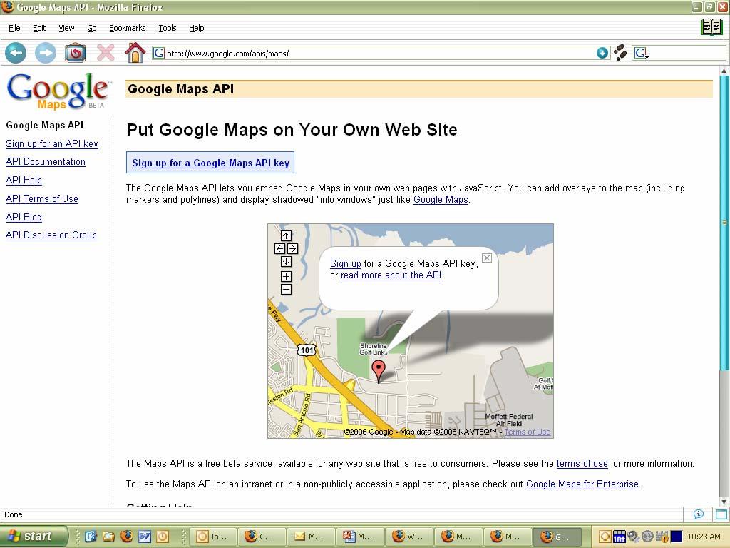
15 How might Shared Services work for GIS? 4. Specialized applications and thematic data at individual agencies 3. Common applications and tools 2. Baseline map info, standards and general data 1. Infrastructure (and hosting?) at OET Agency COE Utility 15
16 On Common Ground: Towards a Statewide Geospatial Infrastructure Strategic Planning for Geospatial Technology Fred Logman Strategic Planning Project Coordinator Land Management Information Center
17 Strategic Planning for Geospatial Technology Building on decades of informal collaboration, Minnesota s s GIS community now needs to collaborate on a strategy that will bring the benefits of GIS to the entire state. Governor s Council on Geographic Information Strategic Plan (2004) National States Geographic Information Council and Federal Geographic Data Committee 50 States Initiative (2006) A new strategic plan to build common ground
18 Governor s s Council on Geographic Information Mission To provide leadership and direction in the development, management and use of geographic information in Minnesota. Strategic Plan: A Foundation for Coordinated GIS (2004) Conceptual Architecture for Enterprise GIS (2005) Second Generation Strategic Plan (2006/2007)
19 A Foundation for Coordinated GIS Minnesota s s Spatial Data Infrastructure Supports the National Spatial Data Infrastructure

20 A Foundation for Coordinated GIS Minnesota s s Spatial Data Infrastructure Initially focused on foundation data

21 A Foundation for Coordinated GIS Minnesota s s Spatial Data Infrastructure Inclusive of whole Minnesota geospatial community Local Governments State Agencies Regional Agencies Federal Agencies Tribal Governments Academic Institutions Non-Profit Organizations Private Businesses
22 A Foundation for Coordinated GIS Minnesota s s Spatial Data Infrastructure Organizational Issues Explicit authority and responsibility for overseeing the development and implementation of the MSDI should be assigned to a state cabinet level agency Adequate resources should be provided to support the sustained development and implementation of the MSDI, including necessary funding to sustain the coordination effort GIS implementation by state agencies should be coordinated within guidelines established for the state s IT architecture framework and consistent with policies of the state s Office of Technology and Department of Finance
23 A Foundation for Coordinated GIS Minnesota s s Spatial Data Infrastructure Organizational Issues GIS implementation by state, local and regional agencies should be coordinated with similar efforts by state and federal agencies as they relate to the MSDI Emphasis should be placed on identifying emerging opportunities for effectively using GIS, identifying opportunities for joint projects and leveraging private and federal resources not otherwise available to Minnesota The continued development of the MN Geographic Data Clearinghouse should be supported emphasizing e- government solutions for distributing geospatial data
24 Working Towards a Nationwide Infrastructure Federal agencies and state coordinators continue to work towards developing a common National Spatial Data Infrastructure. FGDC Future Directions 50 States Initiative Program emphasizing strategic and business planning Target implementation grants Minnesota among 11 states to receive planning grant National States Geographic Information Council Worked with FGDC to promote 50 States Initiative Identified criteria, characteristics and activities for success

25 National States Geographic Information Council Coordination Criteria A 2005 study revealed that Minnesota had recently regressed and was lacking some important criteria for success!
26 Council National States Geographic Information Council 9 Coordination Criteria 1. A full-time, paid coordinator position is designated and has authority to implement the state s business and strategic plans 26 of 48 states Not Minnesota 2. A clearly defined authority exists for statewide coordination of geospatial information technologies and data production 20 of 48 states Not Minnesota 3. The statewide coordination office has a formal relationship with the State s CIO 28 of 48 states Not Minnesota
27 National States Geographic Information Council 9 Coordination Criteria 4. A Champion (political or executive decision maker) is aware and involved in the process of coordination 16 of 48 states Not Minnesota 5. Responsibilities for developing the NSDI and State Clearinghouse are assigned 29 of 48 states Includes Minnesota 6. The ability exists to work and coordinate with local governments, academia, and the private sector 41 of 48 states Includes Minnesota
28 National States Geographic Information Council 9 Coordination Criteria 7. Sustainable funding sources exist to meet projected needs 12 of 48 states Not Minnesota 8. Coordinators have the authority to enter into contracts and become capable of receiving and expending funds 20 of 48 states Includes Minnesota 9. The Federal government works through the statewide coordinating authority 27 of 48 states Includes Minnesota
29 Current Strategic Planning Project Will produce a second generation strategic plan Focuses on State agencies while recognizing the larger Minnesota geospatial community Mainly looking at organizational and operational issues Working toward a Web based shared services environment Geospatial center(s) of excellence Conceptual Architecture Shared Services Survey Implementing shared services Recognizes the need to optimize available resources while increasing productivity and availability
30 Strategic Planning Project Process Governor s Council on Geographic Information Strategic Planning Committee serves as steering committee State agency staff interviews help focus effort Research coordination strategies in other states Facilitate strategic planning workshop with stakeholders Early adopters Late adopters Emerging users Strategic planning workshop will identify: Issues faced by agencies Existing and anticipated needs Areas for collaboration Key recommendations
31 Strategic Planning Project Products Strategic Plan Organizational recommendations Governance components Resource optimization opportunities Relationship to traditional IT Components of Web based shared services environment On-going Shared Services Catalog Business Plan Organizational and fiscal recommendations Legislature Completed no later than March 2007
32 On Common Ground: Towards a Statewide Geospatial Infrastructure Minnesota State GIS Enterprise Architecture Robert Maki Chief Information Officer Department of Natural Resources Governor s Council on Geographic Information Geospatial Architecture Committee
33 Shared Services Concept Government Entity 3 Government Entity 1 Government Business Application B Government Entity 2 Government Business Application C Hosted Services Government Business Application A Hosted Services Hosted Services Commercial Service Provider Service Provider
34 Services and Consumers GIS Desktop User Government Business Application User Public Web Application User Consumer Result Request Service Provider Any internet-based service capable of accepting a request and delivering a result in an agreed upon format
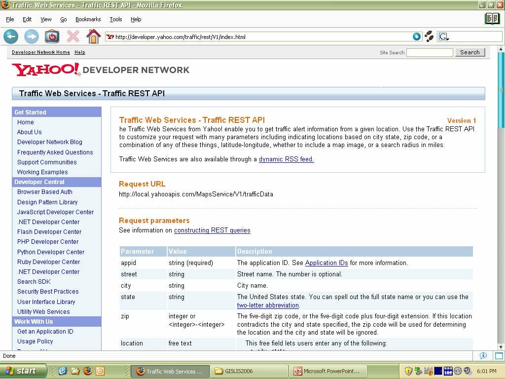
35 Example Services Name Request Description Result Image Area of Interest Image file suitable for viewing Geocoding Street Address Coordinate Location Lake Buffer Lake ID Buffer Distance Area feature (in GML format) Floodplain Test Coordinate Location 0 Not in Floodplain 1 In Floodplain Projection Service GIS data file Input Projection Output Projection Reprojected data file
36 Application-Data Services Consumer Result App-Data Service 1 App-Data Service 3 App-Data Service 2 App-Data Service N Succinct Atomic Non-dependent Focused Request Hosted by business entities (including private entities) Conformant to enterprise communication protocol and data format (results) standards Service Provider
37 Enterprise Overview Coordinating Organization Broker Services Suite Service providers work with the Coordinating Organization to ensure proper functioning of the enterprise Service Provider Service Consumers learn about services through a broker catalog Access Application Consumer applications interact directly with Service Providers GIS Software Business Apps Public Access Apps Consumer
38 Coordinating Organization (Enterprise Broker) Role Coordinating Organization Broker Services Suite Provide services that facilitate data discovery and describe fitness for use Provide services that supply server connection information Provide some role in authentication process (security) Host a source-services catalog (a registry database) Ensure compliance with enterprise standards Monitor services access-reliability Provide support to application developers seeking to work within the system, including documentation type validation services Host application objects that connect the broker to client applications
39 Minnesota State GIS Enterprise Example Case Hypothetically Department of Transportation planning staff are considering a new transportation corridor alignment And they require the following information: the latest information on: impaired waters and sites of known environmental contamination from Pollution Control Agency (PCA); protected wetland locations and conservation easements from Board of Soil and Water Resources (BWSR); protected lakes and watercourses, trout streams, endangered species occurrence, recreation easements, and statemanaged natural resource lands from Department of Natural Resources (DNR); known cultural resource locations from the State Archaeologist Office How would this work be currently performed?
40 Minnesota State GIS Enterprise How does a next generation architecture address this circumstance? MnDOT Corridor Assessment Application This approach enables access to the most up to date resources available and reduces the amount of data that the client needs to handle Begin Evaluation Process PCA DNR Preliminary Assessment BWSR SAO
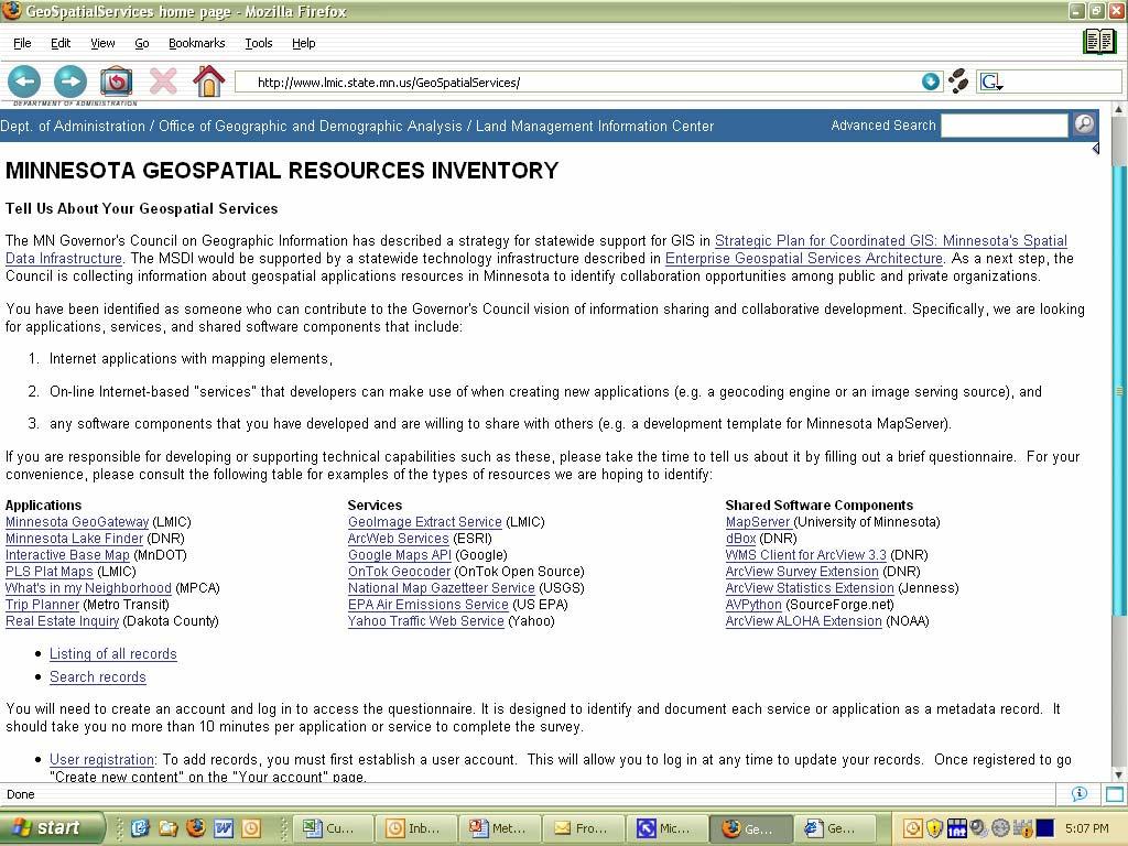
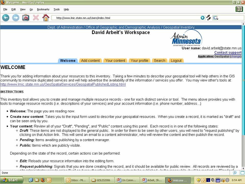
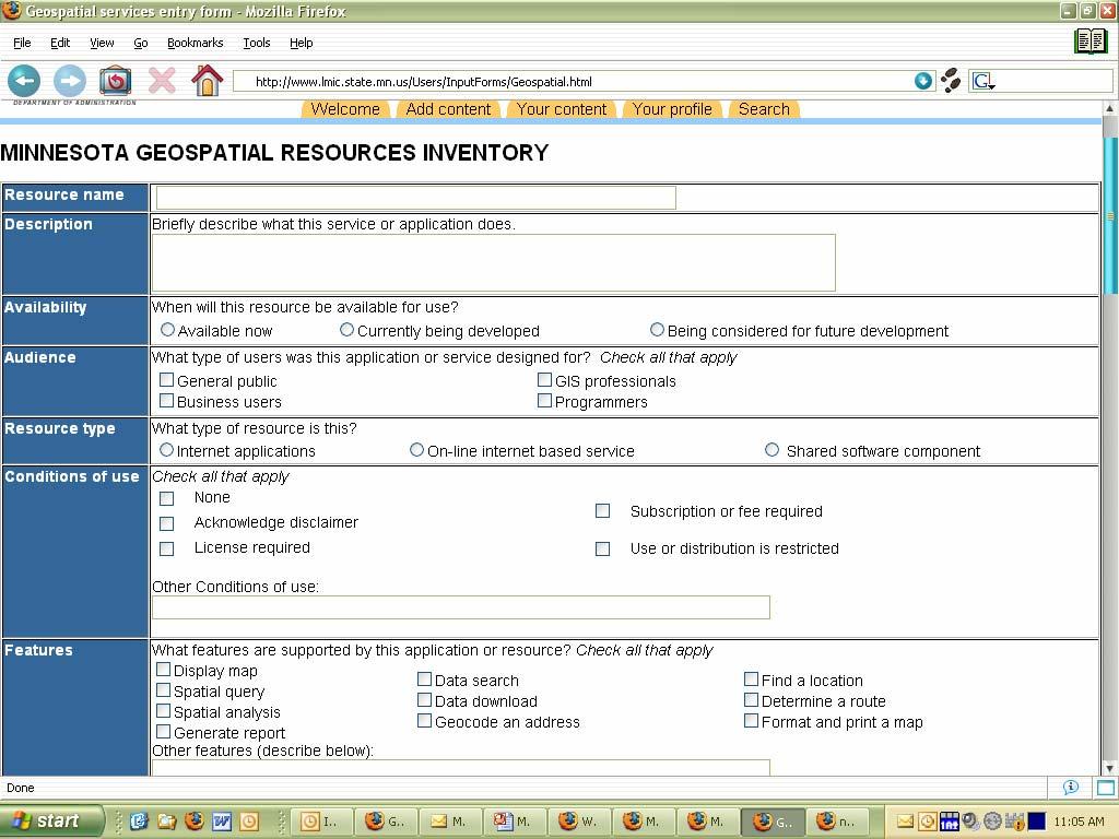
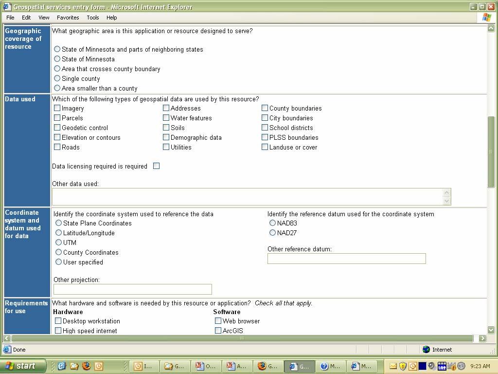
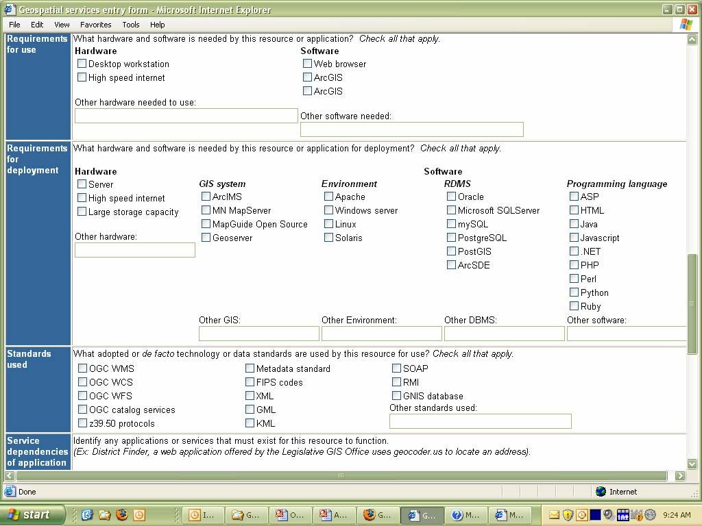
41 On Common Ground: Towards a Statewide Geospatial Infrastructure Identifying Shared Opportunities: The MN Shared Geospatial Services Inventory David Arbeit Director Office of Geographic & Demographic Analysis Department of Administration
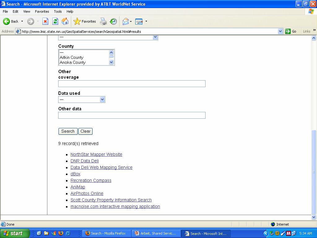
42 Identifying Shared Opportunities: The MN Shared Geospatial Services Inventory By building on a shared service architecture, organizations can more productively develop a GIS applications that serve their business needs, at greatly reduced cost. Illustrate shared service and broker concept Describe value of service inventory Show examples of shared geospatial services Walk through MN Geospatial Resources Inventory Invite community to document their stuff
43 Enterprise Geospatial Services Architecture Broker Organization Service providers identify & document services Catalog Service Provider Service Support Services Consumers learn about services through a broker catalog service Query Access for Service Consumer applications interact directly with Service Providers Consumer
44
45
46
47
48
49
50
51
52
53
54
55
56
57
58
59
60
61
62
63 OpenMNND Collaboration Open Source software project Coop. with Dakota Co.(MN), Richland Co. (ND) and others FGDC CAP grant $75,000 Meet common development needs parcel look-up geocoding Reduce cost Provide more uniform user experience
64 OpenMNND Collaboration Using GeoMOOSE as starting point (City of St. Paul) Uses MapServer for core Services-Oriented Architecture Multi-layer management Make easy to customize interface (See talk by Randy Knipple)

65 OpenMNND Prototype
66
67
68
69
70
71
72

73
74 Identifying Shared Opportunities: The MN Shared Geospatial Services Inventory Seen Enough! Tell us about your services...
75 Identifying Shared Opportunities: The MN Shared Geospatial Services Inventory Seen Enough!
76
77
78
79
80

81

82
83
84
85
86

87
88
89 Identifying Shared Opportunities: The MN Shared Geospatial Services Inventory
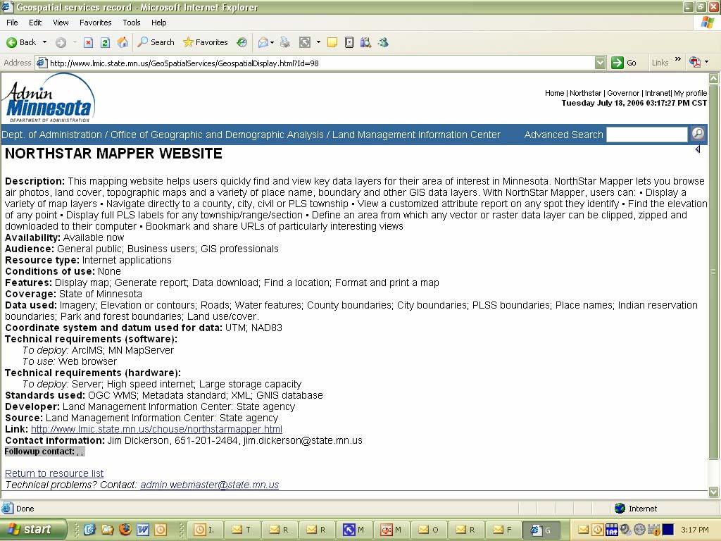
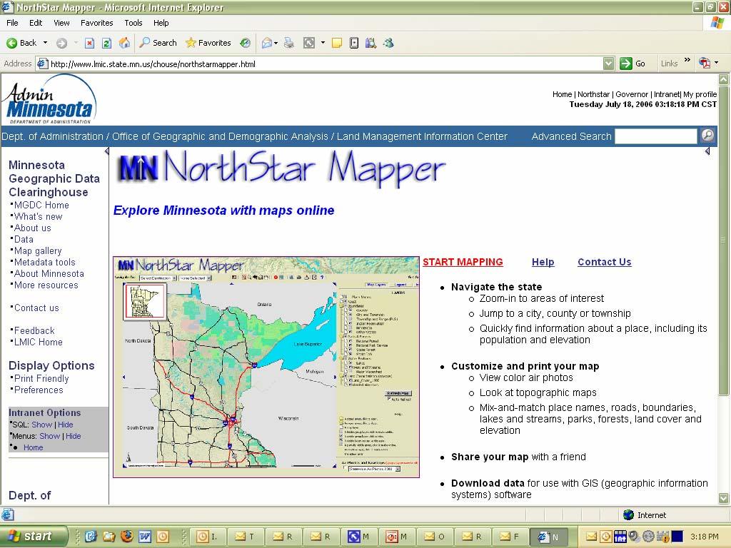
90 On Common Ground: Towards a Statewide Geospatial Infrastructure Shared Services in Action: Minnesota s WMS Image Service Jim Dickerson Geospatial Technology Specialist Land Management Information Center
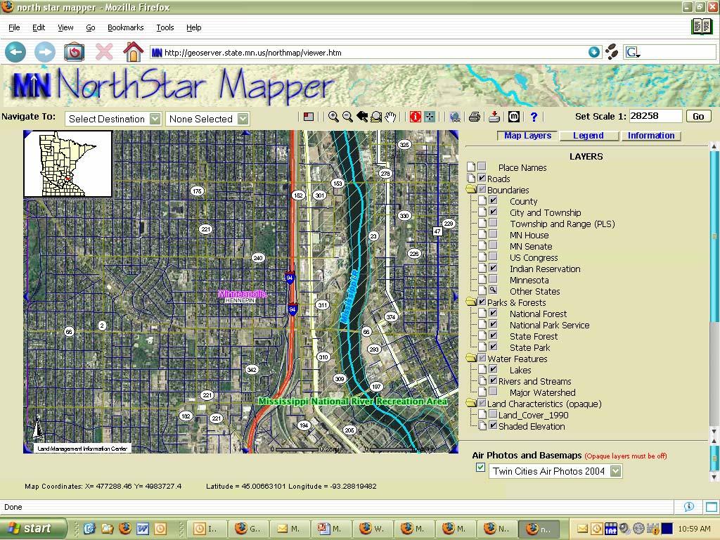
91 What is WMS? The Open GIS Consortium, (OGC) created a standard interface called the Web Mapping Service (WMS). Allows access WMS compatible map servers using a standard set of requests and parameters.
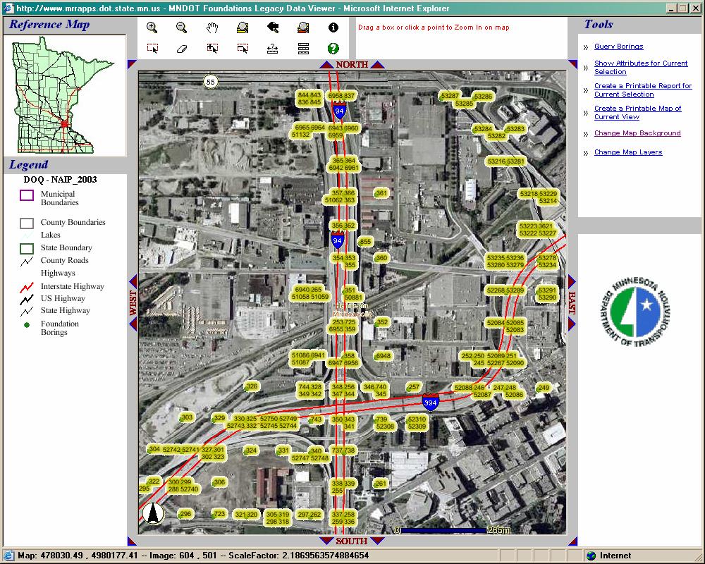
92 WMS Requests GetCapabilities Allows a Map Server to describe itself Responds with information about service and available map layers GetMap Returns a map image with defined geospatial and dimensional parameters GetFeatureInfo Returns information about particular features on a map
93 Get_Map Request Parameters REQUEST=GetMap VERSION=1.1.0 LAYERS= BBOX= WIDTH= HEIGHT= FORMAT=PNG BGCOLOR=0xFF55FF TRANSPARENT=TRUE SRS= (4326 is Lat/Long) (26915 is UTM Zone 15)
94 What services are available? In Minnesota, several agencies host WMS services for general use. LMIC MN DNR MN DOT Metro GIS
95 LMIC Shared Services LMIC WMS Image Server Statewide Imagery 2003 FSA, 1991 USGS DOQ, USGS DRG Metro NGA 2005 Metro Infrared LMIC WMS Services ISO categorized base layers
96
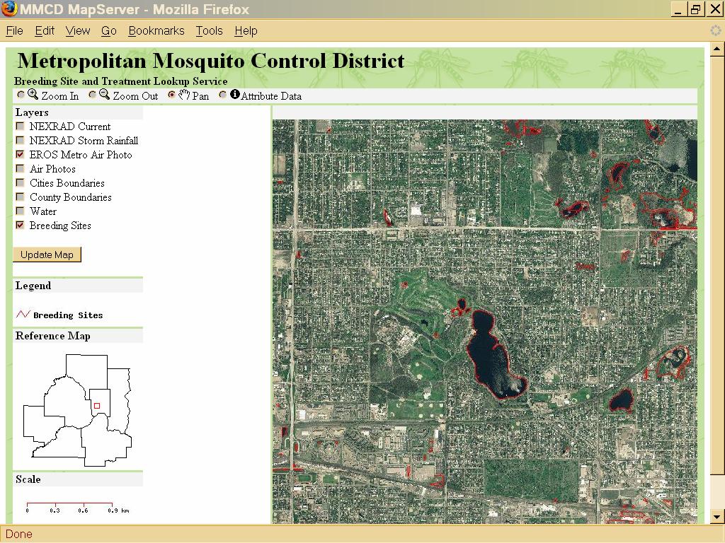
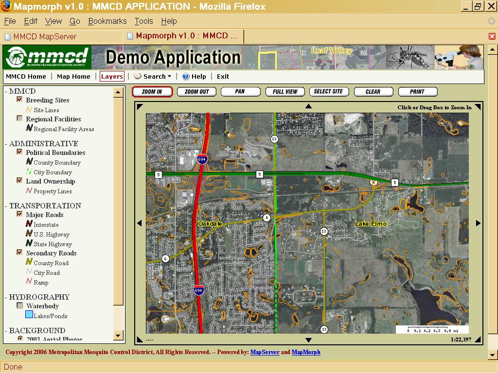
97 Who Uses WMS Image Server? LMIC - NorthStar Mapper MN DOT-Boring Sites MN Dept. of Agriculture - Weed Mapping MN DNR- Firewise program U of MN - Swine Disease Mapping Project U of MN Natural Resources Research Institute Private companies Houston Engineering The Lawrence Group Riverside Companies

98 LMIC NorthStar Mapper

99 MN DOT Boring Sites

100 MN Dept. of Agriculture Weed Mapping

101 U of MN Natural Resources Research Institute

102 Duluth Township Land Use Permit

103 MN DNR ArcView WMS Extension
104 Web Mapping Resources GeoSpatial Resources Inventory GeoSpatial Image Server LMIC WMS Catalog
105 On Common Ground: Towards a Statewide Geospatial Infrastructure Now What?
D2E GIS Coordination Initiative Functional Transformation Kick-Off Meeting
 D2E GIS Coordination Initiative Functional Transformation Kick-Off Meeting GIS Functional Transformation Kick-Off Meeting May 13, 2008 D2E GIS Coordination Initiative Functional Transformation Kick-Off
A Foundation for Coordinated GIS Minnesota s Spatial Data Infrastructure. A Strategic Plan
 A Foundation for Coordinated GIS Minnesota s Spatial Data Infrastructure A Strategic Plan Adopted by the MN Governor s Council on Geographic Information June, 2004 The Minnesota Governor's Council on Geographic
Section 2. Indiana Geographic Information Council: Strategic Plan
 Section 2. Indiana Geographic Information Council: Strategic Plan Introduction A geographic information system (GIS) is an automated tool that allows the collection, modification, storage, analysis, and
Ministry of Health and Long-Term Care Geographic Information System (GIS) Strategy An Overview of the Strategy Implementation Plan November 2009
 Strategy An Overview of the Strategy Implementation Plan November 2009") Ministry of Health and Long-Term Care Geographic Information System (GIS) Strategy An Overview of the Strategy Implementation Plan November 2009 John Hill, Health Analytics Branch Health System Information
Ministry of Health and Long-Term Care Geographic Information System (GIS) Strategy An Overview of the Strategy Implementation Plan November 2009 John Hill, Health Analytics Branch Health System Information
CHAPTER 22 GEOGRAPHIC INFORMATION SYSTEMS
 CHAPTER 22 GEOGRAPHIC INFORMATION SYSTEMS PURPOSE: This chapter establishes the administration and use of to improve the quality and accessibility of Department s spatial information and support graphical
STATE GEOGRAPHIC INFORMATION DATABASE
 STATE GEOGRAPHIC INFORMATION DATABASE Data Information and Knowledge Management STATE GEOGRAPHIC INFORMATION DATABASE EXECUTIVE SUMMARY Utah has developed one of the most comprehensive statewide GIS resources
State Geographic Information Consolidation Implementation Plan
 State Geographic Information Consolidation Implementation Plan As Directed by Session Law 2008-0107 Section 6.13 Prepared By: State Chief Information Officer Geographic Information Coordinating Council
What s the problem? A Modern Odyssey in Search of Relevance. The search for relevance. Some current drivers for new services. Some Major Applications
 A Modern Odyssey in Search of Relevance FIG Working Week, Athens, 24 May 2004 Paul Kelly ANZLIC Executive Director The search for relevance 1. New expectations for spatial services 2. Are we ready to meet
State GIS Officer/GIS Data
 State GIS Officer/GIS Data This Act creates the position of state Geographic Information Systems (GIS) officer. The Act: requires the state GIS officer to adopt or veto the GIS data standards and a statewide
California GIS Strategic Plan Phase 2: Regional Participation. Generic All Workshops CA
 California GIS Strategic Plan Phase 2: Regional Participation Generic All Workshops CA Collaboratives Represented Today? Bay Area Regional GIS Council Central Coast Joint Data Committee Channel Islands
Report from the Geographic Information Coordinating Council
 Report from the Geographic Information Coordinating Council Presented by: Dr. Lee Mandell, Chair North Carolina Geographic Information Coordinating Council What is GIS? Geography plays a role in nearly
The purpose of this report is to recommend a Geographic Information System (GIS) Strategy for the Town of Richmond Hill.
 Strategy for the Town of Richmond Hill.") Staff Report for Committee of the Whole Meeting Department: Division: Subject: Office of the Chief Administrative Officer Strategic Initiatives SRCAO.18.12 GIS Strategy Purpose: The purpose of this report
Staff Report for Committee of the Whole Meeting Department: Division: Subject: Office of the Chief Administrative Officer Strategic Initiatives SRCAO.18.12 GIS Strategy Purpose: The purpose of this report
Spatial Data Infrastructure Concepts and Components. Douglas Nebert U.S. Federal Geographic Data Committee Secretariat
 Spatial Data Infrastructure Concepts and Components Douglas Nebert U.S. Federal Geographic Data Committee Secretariat August 2009 What is a Spatial Data Infrastructure (SDI)? The SDI provides a basis for
Creating a Staff Development Plan with Esri
 Creating a Staff Development Plan with Esri Michael Green David Schneider Guest Presenter: Shane Feirer, University of California Esri UC 2014 Technical Workshop Agenda What is a Staff Development Plan?
Strategic Plan
 2013-2015 Strategic Plan April 23, 2014 Introduction The Indiana Geographic Information Council's (IGIC) 2013-2015 Strategic Plan establishes a path of action to meet opportunities and challenges of applying
Realizing benefits of Spatial Data Infrastructure A user s perspective from Environment Agency - Abu Dhabi
 Realizing benefits of Spatial Data Infrastructure A user s perspective from Environment Agency - Abu Dhabi Anil Kumar Director, Environment Information Management 26 April 2012 Geospatial World Forum,
UTAH S STATEWIDE GEOGRAPHIC INFORMATION DATABASE
 UTAH S STATEWIDE GEOGRAPHIC INFORMATION DATABASE Data Information and Knowledge Management NASCIO Awards 2009 STATE GEOGRAPHIC INFORMATION DATABASE B. EXECUTIVE SUMMARY Utah has developed one of the most
Oman NSDI Business Values and Future Directions. Hassan Alawi Alghazali Acting Director General National Spatial Data Infrastructure
 Oman NSDI Business Values and Future Directions Hassan Alawi Alghazali Acting Director General National Spatial Data Infrastructure Presentation Outline Geospatial Maturity Current Challenges NCSI s Role
IMPLEMENTING GOVERNMENT-WIDE ENTERPRISE GIS; THE FEDERATED MODEL
 IMPLEMENTING GOVERNMENT-WIDE ENTERPRISE GIS; THE FEDERATED MODEL James E. Mitchell, Ph. D. IT GIS Manager Louisiana Department of Transportation and Development presented at the ESRI International Users
URISA QUESTIONNAIRE DRAFT MUNICIPAL GIS CAPABILITY MATURITY MODEL
 URISA DRAFT MUNICIPAL GIS CAPABILITY MATURITY MODEL QUESTIONNAIRE G. BABINSKI, GISP, KING COUNTY GIS CENTER JULY 29, 2010 Participant Identification: Name of Municipal GIS Organization: Name of Participant:
GIS Building Communities beyond National Borders (Building Successful Spatial Data Infrastructures) Nick Land, ESRI Europe
 Nick Land, ESRI Europe") GIS Building Communities beyond National Borders (Building Successful Spatial Data Infrastructures) Nick Land, ESRI Europe UK worst flooding in the last 60 years 350,000 households without drinking water
GIS Building Communities beyond National Borders (Building Successful Spatial Data Infrastructures) Nick Land, ESRI Europe UK worst flooding in the last 60 years 350,000 households without drinking water
Creation of an Internet Based Indiana Water Quality Atlas (IWQA)
") Department of Environmental Management Creation of an Internet Based Water Quality Atlas (IWQA) May 4, 2005 IUPUI 1200 Waterway Blvd., Suite 100 polis, 46202-5140 Water Quality Atlas John Buechler, Neil
Department of Environmental Management Creation of an Internet Based Water Quality Atlas (IWQA) May 4, 2005 IUPUI 1200 Waterway Blvd., Suite 100 polis, 46202-5140 Water Quality Atlas John Buechler, Neil
Finding Common Ground Through GIS
 Finding Common Ground Through GIS Matthew Stone, MPH Special Unit for Technical Assistance Chronic Disease and Injury Control California Department of Public Health ESRI Health GIS Conference Scottsdale,
Army Installation Geospatial Information and Services (IGI&S) Program Overview
 Program Overview") Army Installation Geospatial Information and Services (IGI&S) Program Overview Joshua Delmonico Geospatial Information Officer OACSIM IGI&S Program 703-602-2851 Joshua.Delmonico@hqda.army.mil 1of 11 221400
Army Installation Geospatial Information and Services (IGI&S) Program Overview Joshua Delmonico Geospatial Information Officer OACSIM IGI&S Program 703-602-2851 Joshua.Delmonico@hqda.army.mil 1of 11 221400
Standards in Action: The Canadian Geospatial Data Infrastructure (CGDI)
") Standards in Action: The Canadian Geospatial Data Infrastructure (CGDI) Craig Stewart ISO/TC211 Standards in Action Workshop, September 14, 2005 Presentation Outline Overview of SDIs Overview of Canada
Standards in Action: The Canadian Geospatial Data Infrastructure (CGDI) Craig Stewart ISO/TC211 Standards in Action Workshop, September 14, 2005 Presentation Outline Overview of SDIs Overview of Canada
Spatially Enabled Society
 International Seminar on Land Administration Trends and Issues in Asia and the Pacific Region Spatially Enabled Society Abbas Rajabifard Vice Chair PCGIAP-WG3 Vice-President (President Elect), GSDI Association
UN-GGIM: Strengthening Geospatial Capability
 Fifth Plenary Meeting of UN-GGIM: Europe Brussels, 6-7 June 2018 UN-GGIM: Strengthening Geospatial Capability Walking the talk to leave no one behind Greg Scott, UN-GGIM Secretariat Environmental Statistics
Technical Specifications. Form of the standard
 Used by popular acceptance Voluntary Implementation Mandatory Legally enforced Technical Specifications Conventions Guidelines Form of the standard Restrictive Information System Structures Contents Values
Oregon Department of Transportation. Geographic Information Systems Strategic Plan
 Oregon Department of Transportation Geographic Information Systems Strategic Plan Adopted May, 2000 By the GIS Steering Committee Last printed 10/2/2012 4:20:00 PM Page Geographic Information Systems Strategic
Statewide Topographic Mapping Program
 Statewide Topographic Mapping Program February 28, 2018 www.dotd.la.gov Outline Purpose of the Statewide Topographic Mapping Program History Breakdown of R.S. 48:36 - Topographic Mapping Statewide Topographic
Proposed Scope of Work Village of Farmingdale Downtown Farmingdale BOA Step 2 BOA Nomination Study / Draft Generic Environmental Impact Statement
 Proposed Scope of Work Village of Farmingdale Downtown Farmingdale BOA Step 2 BOA Nomination Study / Draft Generic Environmental Impact Statement The scope of work that follows incorporates and covers
2018/1 The integration of statistical and geospatial information. The Regional Committee of UN-GGIM: Americas:
 The following are the conclusions and recommendations of the Regional Committee of the United Nations on Global Geospatial Information Management for the Americas, during its Fifth Session, Thursday 8
Economic and Social Council
 United Nations Economic and Social Council Distr.: General 18 July 2016 Original: English Committee of Experts on Global Geospatial Information Management Sixth session New York, 3-5 August 2016 Item 2
Data Aggregation with InfraWorks and ArcGIS for Visualization, Analysis, and Planning
 Data Aggregation with InfraWorks and ArcGIS for Visualization, Analysis, and Planning Stephen Brockwell President, Brockwell IT Consulting, Inc. Join the conversation #AU2017 KEYWORD Class Summary Silos
The future of SDIs. Ian Masser
 The future of SDIs Ian Masser Presentation Considers two questions relating to the future development of SDIs throughout the world Where have we got to now? Where should we go from here? Identifies four
David Lanter PhD GISP. Information Security Risks and Controls of Public Geospatial Datasets July 17, 2014
 David Lanter PhD GISP Information Security Risks and Controls of Public Geospatial Datasets July 17, 2014 This Presentation CDM Smith applies GIS and develops custom applications producing, deploying and
GIS Geographical Information Systems. GIS Management
 GIS Geographical Information Systems GIS Management Difficulties on establishing a GIS Funding GIS Determining Project Standards Data Gathering Map Development Recruiting GIS Professionals Educating Staff
Water Data Sharing an Update
 Water Data Sharing an Update By David R. Maidment Leader, CUAHSI Hydrologic Information System Project and Director, Center for Research in Water Resources, University of Texas at Austin Prepared for Subcommittee
Ministry of ICT of I.R.IRAN
 The ECO 8/6 mill km 2 10 Slamic countries ~330 mill people Oil, Gas, Industries,Tourism 2 Issue transformation in last decade Problem solving needs more integrated approach More interaction &complexity
E-Government and SDI in Bavaria, Germany
 135 E-Government and SDI in Bavaria, Germany Wolfgang STOESSEL, Germany Key words: GDI-BY, Bavaria, Spatial Data Infrastructure SUMMARY Spatial Data Infrastructure (SDI) is an important part of the e-government
Esri and GIS Education
 Esri and GIS Education Organizations Esri Users 1,200 National Government Agencies 11,500 States & Regional Agencies 30,800 Cities & Local Governments 32,000 Businesses 8,500 Utilities 12,600 NGOs 11,000
GIS at UCAR. The evolution of NCAR s GIS Initiative. Olga Wilhelmi ESIG-NCAR Unidata Workshop 24 June, 2003
 GIS at UCAR The evolution of NCAR s GIS Initiative Olga Wilhelmi ESIG-NCAR Unidata Workshop 24 June, 2003 Why GIS? z z z z More questions about various climatological, meteorological, hydrological and
CLICK HERE TO KNOW MORE
 CLICK HERE TO KNOW MORE GeoSpace for Singapore s Whole-of-Government Data Sharing Asia GeoSpatial Forum 17 19 Oct 2011 Lee Kim Haw Singapore Land Authority Introducing Singapore Land Authority Limited
Observation (EO) & Geomatics in Canada
 & Geomatics in Canada") Innovating to Increase the Impact of Earth Observation (EO) & Geomatics in Canada Natural Resources Canada February 25, 2014 Prashant Shukle, Director General Canada Centre for Mapping and Earth Observation
Innovating to Increase the Impact of Earth Observation (EO) & Geomatics in Canada Natural Resources Canada February 25, 2014 Prashant Shukle, Director General Canada Centre for Mapping and Earth Observation
GIS Monroe Geographic Information System March 14, 2018
 GIS Monroe Geographic Information System March 14, 2018 Goals Maintain Enterprise/County-wide geo-database Increase spatial accuracy of data Build and acquire more data layers Increase use of GIS; as another
Oman NSDI Supporting Economic Development. Saud Al-Nofli Director of Spatial Data Directorate General of NSDI, NCSI
 Oman NSDI Supporting Economic Development 2017 Saud Al-Nofli Director of Spatial Data Directorate General of NSDI, NCSI "It s critical to make correct decisions the first time to optimize the Investments
Key Points Sharing fosters participation and collaboration Metadata has a big role in sharing Sharing is not always easy
 Sharing Resources Geoff Mortson esri, Inc. SDI Solutions Team Key Points Sharing fosters participation and collaboration Metadata has a big role in sharing Sharing is not always easy Data Sharing is Good
US National Spatial Data Infrastructure A Spatial Framework for Governance and Policy Development to Enable a Location-Based Digital Ecosystem
 GeoPlatform Workshop 7 Dec 2016, Department of the Interior Washington, D.C. US National Spatial Infrastructure A Spatial Framework for Governance and Policy Development to Enable a Location-Based Digital
GIS for the Beginner on a Budget
 GIS for the Beginner on a Budget Andre C. Bally, RLA, GIS Coordinator, Harris County Public Infrastructure Department Engineering Division This presentation, GIS for Beginners on a Budget. will briefly
Building a National Data Repository
 Building a National Data Repository Mladen Stojic, Vice President - Geospatial 1/30/2013 2012 Intergraph Corporation 1 Information has meaning and gives power only when shared and distributed. Information,
OC Enterprise GIS. Kevin Hills, PLS Cameron Smith, GISP. OC Survey
 OC Enterprise GIS Kevin Hills, PLS Cameron Smith, GISP OC Survey Discussion Points Background & Organizational Structure of OCPW Past practices prior to Enterprise Wide GIS License (ELA) Participating
USEPA's Comprehensive Geospatial Information Sharing Framework
 USEPA's Comprehensive Geospatial Information Sharing Framework An Overview ESRI Federal User Conference February 22, 2008 Agenda Background What is EPA s Geospatial Information Sharing Framework? Why was
Arctic Spatial Data Infrastructure Enabling Access to Arctic Location-Based Information
 Arctic Spatial Data Infrastructure Enabling Access to Arctic Location-Based Information Arctic SDI Side Event Co-Chairs: Arvo Kokkonen Arctic SDI Board Chair & Director General, National Land Survey of
Nebraska Geospatial Extension Program Karisa Vlasek Geospatial Extension & Research Specialist
 Nebraska Geospatial Extension Program Karisa Vlasek Geospatial Extension & Research Specialist A NASA Nebraska Space Grant Consortium & EPSCoR Sponsored Research Endeavor Nebraska s Geospatial Extension
Nomination Form. Clearinghouse. New York State Office for Technology. Address: State Capitol-ESP, PO Box
 NASIRE 2001 RECOGNITION AWARDS Recognizing Outstanding Achievement in the Field of Innovative Use of Technology Nomination Form Title of Nomination: Manager/Job Title: Agency: NYS Geographic Information
An Internet-Based Integrated Resource Management System (IRMS)
") An Internet-Based Integrated Resource Management System (IRMS) Third Quarter Report, Year II 4/1/2000 6/30/2000 Prepared for Missouri Department of Natural Resources Missouri Department of Conservation
An Internet-Based Integrated Resource Management System (IRMS) Third Quarter Report, Year II 4/1/2000 6/30/2000 Prepared for Missouri Department of Natural Resources Missouri Department of Conservation
Oregon Department of Transportation. Geographic Information Systems. Implementation Plan. Adopted November, 2000 By the GIS Steering Committee
 Oregon Department of Transportation Geographic Information Systems Implementation Plan Adopted November, 2000 By the GIS Steering Committee Introduction The Oregon Department of Transportation (ODOT) GIS
The Use of Geographic Information Systems (GIS) by Local Governments. Giving municipal decision-makers the power to make better decisions
 by Local Governments. Giving municipal decision-makers the power to make better decisions") The Use of Geographic Information Systems (GIS) by Local Governments Giving municipal decision-makers the power to make better decisions Case Study: Examples of GIS Usage by Local Governments in North
The Use of Geographic Information Systems (GIS) by Local Governments Giving municipal decision-makers the power to make better decisions Case Study: Examples of GIS Usage by Local Governments in North
Proposal for a DIRECTIVE OF THE EUROPEAN PARLIAMENT AND OF THE COUNCIL. establishing an infrastructure for spatial information in the Community
 Proposal for a DIRECTIVE OF THE EUROPEAN PARLIAMENT AND OF THE COUNCIL establishing an infrastructure for spatial information in the Community INSPIRE http://inspire.jrc.it/ Alessandro Annoni 1 EU Commission
EXPECTATIONS OF TURKISH ENVIRONMENTAL SECTOR FROM INSPIRE
 EXPECTATIONS OF TURKISH ENVIRONMENTAL SECTOR FROM INSPIRE June, 2010 Ahmet ÇİVİ Tuncay DEMİR INSPIRE in the Eyes of MoEF Handling of Geodata by MoEF Benefits Expected TEIEN First Steps for INSPIRE Final
June 19 Huntsville, Alabama 1
 June 19 Huntsville, Alabama 1 Real-Time Geospatial Data: The Fusion of PI and ArcGIS Enabling Smarter Facilities Management OSIsoft and Esri Mapping and Location Analytics Platform Supporting Your Use
The Indiana Data Sharing Initiative and the IndianaMap. Cross-Boundary Collaboration and Partnerships. State of Indiana
 The Indiana Data Sharing Initiative and the IndianaMap Cross-Boundary Collaboration and Partnerships State of Indiana Brian Arrowood, CIO James Sparks, GIO EXECUTIVE SUMMARY Under the collaboration oriented
GIS Capability Maturity Assessment: How is Your Organization Doing?
 GIS Capability Maturity Assessment: How is Your Organization Doing? Presented by: Bill Johnstone Principal Consultant Spatial Vision Group November 8, 2018 1. Motivation for Capability Maturity Models
Exploring GIS Potential for Northwestern Ontario Land Information Ontario
 Exploring GIS Potential for Northwestern Ontario Land Information Ontario May 13, 2015 The LIO Vision LIO Vision: That all geographic information about Ontario is fully integrated and accessible LIO Goal:
Overview. Project Background Project Approach: Content and Application Development Application Demonstration Future Developments
 Overview Project Background Project Approach: Content and Application Development Application Demonstration Future Developments Southeast Pressures: Continued Population Growth Transportation Corridors
THE ROLE OF GEOSPATIAL AT THE WORLD BANK
 THE ROLE OF GEOSPATIAL AT THE WORLD BANK INSPIRE Conference Barcelona, Spain September 26, 2016 Kathrine Kelm Senior Land Administration Specialist Global Land and Geospatial Unit The World Bank Group
2007 / 2008 GeoNOVA Secretariat Annual Report
 2007 / 2008 GeoNOVA Secretariat Annual Report Prepared for: Assistant Deputy Minister and Deputy Minister of Service Nova Scotia and Municipal Relations BACKGROUND This report reflects GeoNOVA s ongoing
Spatial Data Availability Energizes Florida s Citizens
 NASCIO 2016 Recognition Awards Nomination Spatial Data Availability Energizes Florida s Citizens State of Florida Agency for State Technology & Department of Environmental Protection Category: ICT Innovations
Using MAGIC to Access Spatial Imagery: Putting ER Mapper Image Web Server, ArcIMS and MrSID to work in your Library
 Using MAGIC to Access Spatial Imagery: Putting ER Mapper Image Web Server, ArcIMS and MrSID to work in your Library Patrick McGlamery Shirley Quintero University of Connecticut Libraries Building the Connecticut
Council Workshop on Neighbourhoods Thursday, October 4 th, :00 to 4:00 p.m. Burlington Performing Arts Centre
 Council Workshop on Neighbourhoods Thursday, October 4 th, 2012 1:00 to 4:00 p.m. Burlington Performing Arts Centre Agenda Introductions Warm-Up Exercise Presentation Exercise Neighbourhood Planning Break
8 th Arctic Regional Hydrographic Commission Meeting September 2018, Longyearbyen, Svalbard Norway
 8 th Arctic Regional Hydrographic Commission Meeting 11-13 September 2018, Longyearbyen, Svalbard Norway Status Report of the Arctic Regional Marine Spatial Data Infrastructures Working Group (ARMSDIWG)
Spatial data interoperability and INSPIRE compliance the platform approach BAGIS
 Spatial data interoperability and INSPIRE compliance the platform approach BAGIS BAGIS Voluntary, independent, public, non-profit organization; Organization with main mission to promote the growth of the
2003 INNOVATIONS AWARDS PROGRAM Application Form
 2003 INNOVATIONS AWARDS PROGRAM Application Form 1. Program Name: GeoStor 2. Administering Agency Arkansas Geographic Information Office 3. Contact Person (Name & Title) Shelby Johnson, Arkansas Geographic
Economic and Social Council
 United Nations Economic and Social Council Distr.: General 2 July 2012 E/C.20/2012/10/Add.1 Original: English Committee of Experts on Global Geospatial Information Management Second session New York, 13-15
Open spatial data infrastructure
 Open spatial data infrastructure a backbone for digital government Thorben Hansen Geomatikkdagene 2018 Stavanger 13.-15. mars Spatial Data Infrastructure definition the technology, policies, standards,
Local Government. VALOR GIS Specialist South Georgia RDC
 Lw Low Cost GIS Sl Solutions for Local Government By: Joe Bendis VALOR GIS Specialist South Georgia RDC SERUG 2008 GIS success through cooperation $ $ VALOR Today: 5 staff members dedicated to VALOR innovations,
GIS in Community & Regional Planning
 GIS in Community & Regional Planning The The role role of of GIS GIS in in Re-writing the the Zoning Bylaw for for the the City City of of Vernon LandInfo Technologies Presentation Overview The GIS Initiative
USGS National Geospatial Program Understanding User Needs. Dick Vraga National Map Liaison for Federal Agencies July 2015
 + USGS National Geospatial Program Understanding User Needs Dick Vraga National Map Liaison for Federal Agencies July 2015 + Topics 2 Background Communities of Use User Surveys National Map Liaisons Partnerships
CHARTING SPATIAL BUSINESS TRANSFORMATION
 CHARTING SPATIAL BUSINESS TRANSFORMATION An in-depth look at the business patterns of GIS and location intelligence adoption in the private sector EXECUTIVE SUMMARY The global use of geographic information
DEPARTMENT OF GEOLOGY AND MINERAL INDUSTRIES WAYS & MEANS SUBCOMMITTEE ON NATURAL RESOURCES MARCH 2, 2017
 DEPARTMENT OF GEOLOGY AND MINERAL INDUSTRIES WAYS & MEANS SUBCOMMITTEE ON NATURAL RESOURCES MARCH 2, 2017 1 ABOUT DOGAMI AGENCY MISSION, VISION & GOALS 2 Lidar image of a stream network along the Umpqua
Non-Governmental Organizations for Spatial Data Infrastructure. Environmental Democracy Case
 Non-Governmental Organizations for Spatial Data Infrastructure Environmental Democracy Case L.Jovičić, S.Vrečar, V.Cetl, K.Ristovski GSDI Small Grant Program Award 2011-2012 Non-Governmental Organisations
Aboriginal communities strengthen governance with location-based tools in the 21st century
 Aboriginal communities strengthen governance with location-based tools in the 21st century Today, Aboriginal communities are taking advantage of the geomatics technologies that underpin popular online
ONSDI Services Enabling GeoSmart Oman
 ONSDI Services Enabling GeoSmart Oman Oman National Spatial Data Infrastructure Enabling GeoSmart Oman Majid AlBusaidi Section Head Technology & Operations, Directorate General of National Spatial Data
Update to the Association of Ontario Land Surveyors February 27, 2015 Deerhurst, Ontario
 1 Update to the Association of Ontario Land Surveyors February 27, 2015 Deerhurst, Ontario Peter Sullivan CLS, ALS, MBA Director General, Surveyor General Branch Earth Sciences Sector, Natural Resources
Kansas Next Generation 911
 Kansas Next Generation 911 Kansas Next Generation 911 the largest IT project in state history* the largest GIS project in state history* * could be...has not been fact checked Project overview Primary
THE SEVILLE STRATEGY ON BIOSPHERE RESERVES
 THE SEVILLE STRATEGY ON BIOSPHERE RESERVES 1 VISION FOR BIOSPHERE RESERVES IN THE 21 ST CENTURY The international Seville Conference on Biosphere Reserves, organised by UNESCO, adopted a two-pronged approach,
EuroSDR (European Spatial Data Research)
") EuroSDR (European Spatial Data Research) ROLLING RESEARCH PLAN 2015-2018 EuroSDR Secretariat Public Governance Institute KU Leuven Parkstraat 45 bus 3609 3000 Leuven Belgium Tel.: +32 16 32 31 80 Fax:
EuroSDR (European Spatial Data Research) ROLLING RESEARCH PLAN 2015-2018 EuroSDR Secretariat Public Governance Institute KU Leuven Parkstraat 45 bus 3609 3000 Leuven Belgium Tel.: +32 16 32 31 80 Fax:
Geospatial SDI Portal for effective Governance of Pune METROPOLIS region
 Geospatial SDI Portal for effective Governance of Pune METROPOLIS region Mr. Praveen Gautam Senior Manager 19 th January 2018 PMRDA Overview Provide a Spatial Framework for the entire region with various
Oakland County Parks and Recreation GIS Implementation Plan
 Oakland County Parks and Recreation GIS Implementation Plan TABLE OF CONTENTS 1.0 Introduction... 3 1.1 What is GIS? 1.2 Purpose 1.3 Background 2.0 Software... 4 2.1 ArcGIS Desktop 2.2 ArcGIS Explorer
Imagery and the Location-enabled Platform in State and Local Government
 Imagery and the Location-enabled Platform in State and Local Government Fred Limp, Director, CAST Jim Farley, Vice President, Leica Geosystems Oracle Spatial Users Group Denver, March 10, 2005 TM TM Discussion
Building a national spatial data infrastructure. Thorben Hansen, Head of Division Danish Agency for Data Supply and Efficiency
 Building a national spatial data infrastructure Thorben Hansen, Head of Division Danish Agency for Data Supply and Efficiency About Spatial Data Infrastructure Spatial data come from many sources and is
Roadmap to interoperability of geoinformation
 Roadmap to interoperability of geoinformation and services in Europe Paul Smits, Alessandro Annoni European Commission Joint Research Centre Institute for Environment and Sustainability paul.smits@jrc.it
A Comprehensive Inventory of the Number of Modified Stream Channels in the State of Minnesota. Data, Information and Knowledge Management.
 A Comprehensive Inventory of the Number of Modified Stream Channels in the State of Minnesota Data, Information and Knowledge Management Glenn Skuta Environmental Analysis and Outcomes Division Minnesota
A Summary of State DOT GIS Activities. Presented at the 2000 AASHTO GIS-T Symposium Minneapolis, MN
 A Summary of State DOT GIS Activities Presented at the 2000 AASHTO GIS-T Symposium Minneapolis, MN Information Sources E-mail survey of state DOT GIS managers 49 State DOTs responded in 2000 Results compared
INSPIRE - A Legal framework for environmental and land administration data in Europe
 INSPIRE - A Legal framework for environmental and land administration data in Europe Dr. Markus Seifert Bavarian Administration for Surveying and Cadastre Head of the SDI Office Bavaria Delegate of Germany
The GIS Path Forward Saskatchewan s Geomatics Strategic Plan
 The GIS Path Forward Saskatchewan s Geomatics Strategic Plan John Potter, SK Ministry of Central Services Office of Geomatics Coordination Sept.17/13 Table of Contents 1. 2011-2016, Geomatics Strategic
ArcGIS for INSPIRE. Marten Hogeweg
 ArcGIS for INSPIRE Marten Hogeweg Please Take Our Survey on the App Download the Esri Events app and find your event Select the session you attended Scroll down to find the feedback section Complete answers
Creating A-16 Compliant National Data Theme for Cultural Resources
 Creating A-16 Compliant National Data Theme for Cultural Resources Cultural Resource GIS Facility National Park Service John J. Knoerl Deidre McCarthy Paper 169 Abstract OMB Circular A-16 defines a set
National Spatial Data Infrastructure International workshop 9 th June, 2015 Terelj Hotel, Mongolia
 1 st session: NSDI policy, planning and the legal framework Formation of NSDI policy and legal framework in Mongolia Khurelshagai Ayurzana, Director General, Administration of Land Affairs, Geodesy and
Missouri Spatial Data Information Service (MSDIS) Mark Duewell MSDIS Program Manager/ GIS Specialist Sr.
 Mark Duewell MSDIS Program Manager/ GIS Specialist Sr.") Missouri Spatial Data Information Service (MSDIS) Mark Duewell MSDIS Program Manager/ GIS Specialist Sr. duewellm@missouri.edu Missouri Spatial Data Information Service (MSDIS) http://msdis.missouri.edu/
Missouri Spatial Data Information Service (MSDIS) Mark Duewell MSDIS Program Manager/ GIS Specialist Sr. duewellm@missouri.edu Missouri Spatial Data Information Service (MSDIS) http://msdis.missouri.edu/