SIGMA thematic map validation
|
|
|
- Thomasina Little
- 5 years ago
- Views:
Transcription
1 LPVE

2 LPVE SIGMA GIS validation tools Thematic map validation plugin with 3 tools: Estimate sample size tool Estimate sample size using map class accuracies tool Build confusion matrix - tool

3 LPVE LPVE, Frascati / Italy, on New understanding of thematic Land Cover validation on basis of the SIGMA validation protocol and QGIS Plug-in Carsten Haub, Luca Kleinewillinghöfer & Sven Gilliams
4 LPVE SIGMA Stimulating Innovation for Global Monitoring of Agriculture EU contibution to GEOGLAM / GEOSS , ca. 11 mio Globale partner network led by VITO Focussing at the montoring of: o Agricultural land use change, intensification, and production versus o environmental impacts zum
5 LPVE Aim Aims of WP 33: Better integration of geographic information and statistics Improving the methodology for using remote sensing Supporting officers and operators in charge to organise relevant recent and reliable geospatial information for administration and decision making Through the collation of common principles and guidelines Objectives Therefore this SIGMA project component aimed to: Setting the scene through a data collection and validation protocol In order to provide practical guidelines that are in compliance with the requirements for sound statistical analysis of accuracy parameters of Earth observation derived thematic maps And to connecting this to dedicated GIS tools to support planning, surveying and analyzing in a convenient way
6 LPVE Initial problem Deficits between recent state of the science and technology related to appropriate validation techniques and principles versus the degree and appropriateness of validation in operational applications (Foody, 2002; Olofsson, 2013) Lack of systematic consideration during planning stages of EO applications, which might be possibly linked to limited resources, awareness or instruments In view of an increasing availability of EO data, products and services, e.g. via Copernicus
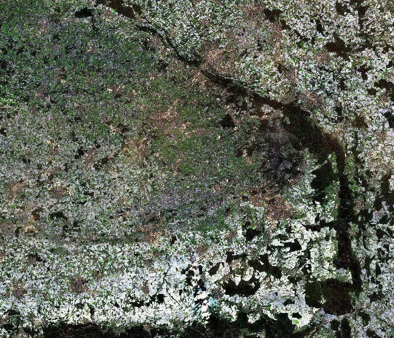
7 SIGMA thematic land cover validation LPVE Approach 1. Survey on common practice and approaches in EO data validation in frame of JECAM sites 2. Elaboration of a protocol and the collation of practical guidelines for appropriate field data collection for remote sensing applications in agriculture (and other land cover mapping activities) with dedicated accuracy requirements validation and accuracy assessment of land cover classification products 3. Development of applied Open Source GIS validation tools 4. Elaboration of applied training manual and practical guide

8 SIGMA thematic land cover validation LPVE Data collection and validation protocol Systematic collation and elaboration of the current state of science and technique with respect to: Commonly applied classic EO accuracy assessment approaches Required statistical measurements and an Outlook to modern object based classification methods Elaborated by JRC, FAO & EFTAS
9 SIGMA thematic land cover validation LPVE International standards for validation of remote sensing products. No clear standard for validation defined, different initiatives to standardize validation. Stages of validation from the Land Product Validation (LPV) sub-group of the CEOS Working Group on Calibration and Validation (WGCV) Stage 1 Validation Stage 2 Validation Stage 3 Validation Stage 4 Validation Product accuracy is assessed from a small (typically < 30) set of locations and time periods by comparison with in situ or other suitable reference data. Product accuracy is estimated over a significant set of locations and time periods by comparison with reference in situ or other suitable reference data. Spatial and temporal consistency of the product and with similar products has been evaluated over globally representative locations and time periods. Results are published in the peer-reviewed literature. Uncertainties in the product and its associated structure are well quantified from comparison with reference in situ or other suitable reference data. Uncertainties are characterised in a statistically robust way over multiple locations and time periods representing global conditions. Spatial and temporal consistency of the product and with similar products has been evaluated over globally representative locations and periods. Results are published in the peer-reviewed literature. Validation results for stage 3 are systematically updated when new product versions are released and as the time-series expands.
10 LPVE SIGMA GIS validation tools


11 LPVE Aims of WP 33: Better integration of geographic SIGMA WP 33 Task 3: Data collection and validation protocol information and statistics Improving the methodology for using remote sensing Area Frame Sampling Sampling design Validation Thematic Land cover Validation Collect Data Send Data Analysis Data Database GeoODK & GeoWiki Data collection
12 LPVE Validation tools Development of tools and routines to support thematic map validation based on open source technologies and on basis of DLV33.2 [Land cover validation protocol] Basic functionalities: Sample size estimation for probability sampling for validation with or without using a priori information Analysis of map and map class accuracies in confusion matrix General requirements: Open source technologies Offline environment Standard data formats User friendly and easy handling (for non statisticians)
13 LPVE Tools to estimate sample size Aim to provide a starting point to test and to plan reference data collection efficiently Calculator function to compare results, number of samples or expected accuracies under different scenarios How many samples to choose for statistical sound validation? Depends on: proportion (size) and number of the different map classes predefined (contractual) precision (confidence bounds) for accuracy measures available resources for reference data collection a priori information about map class accuracies
 Sample calculator Total number of samples to reach predefined precision Expected precision of OA with predefined number of samples *Precision = margin of error under selected confidence")
14 LPVE Estimate sample size tool Required input: Map classes and proportions (from raster / vector / manual entry) Desired confidence level concept of multinomial distribution (Congalton & Green 2009) Sample calculator Total number of samples to reach predefined precision Expected precision of OA with predefined number of samples *Precision = margin of error under selected confidence level
 Required input: Map classes and proportions Desired confidence level Targeted precision of OA Expected map class accuracies (user s accuracy) 1.")
15 LPVE Estimate sample size using map class accuracies tool The tool builds on per class accuracies as input to estimate number of samples per class approach presented in (Olofsson et al., 2014) Required input: Map classes and proportions Desired confidence level Targeted precision of OA Expected map class accuracies (user s accuracy) 1. Output Total number of samples to reach predefined precision of OA
16 LPVE Estimate sample size using map class accuracies tool Assign samples to class Calculate expected precision of user s accuracy (margin of error) Fine tune per class sample size allocation Expected precisions of per class accuracies under sampling scenario Expected precision of OA Additional functions: Random stratified sampling from vector layer (sampling frame) Sampling plan output to csv


17 LPVE Build confusion matrix - tool Provide class related accuracies including its related confidence intervals Required input: ground truthing results, reference and map data at samples Map classes and proportions Output as.csv Confusion matrix, proportional matrix, Overall / user s / producer s accuracies, variances, standard errors, confidence bounds for 90, 95 and 99% interval

18 LPVE Build confusion matrix - tool Ensures: Full transparency on accuracy assessment Objective evaluation of the map product And ultimately the opportunities to explore how far decisions can be built on given map products.
19 LPVE Examples
20 LPVE Example 1: SIGMA Global crop map
 Achievements: Overall accuracy: 83,73% No.")
21 LPVE Eaxample 1: SIGMA crop map (UCL) Assessments have been applied to: UCL crop/no-crop maps (based on GLC, Globecover 30) SIGMA global validation experiment (based on systematic stratified sampling) Achievements: Overall accuracy: 83,73% No. samples: 629 Confidence bounds: +/- 2,53%
22 LPVE
23 LPVE

24 LPVE SIGMA thematic validation - tests Adaptations where applied to: Accept slightly wider confidence intervals Increase targeted precisions Reduce no. of samples Outcomes: Confidence interval: <5% Related No. samples: 186 Confidence interval: ~1% Related No. samples: Related No. samples: 300 Confidence interval: ~3,6%

25 LPVE Example 2: Crop type classification NRW


26 LPVE

27 LPVE
28 LPVE Example 3: Sen2Agri Czech demonstrator
29 LPVE Example: EFTAS SIGMA validation plugin Class Proportion* Expected uers accuracy** Margin of error* Sample size ESA Czech Crop type map 2015, Czech Agriculture from space. Processed by UCL and validated by gisat** winter rapeseed 14.9% 95% +/- 4.3% 175 winter cereals 52.5% 89% +/- 3.9% 50 spring cereals 2.0% 85% +/- 8.3% 50 sugarbeet 2.4% 89% +/- 7.3% 50 maize 4.4% 84% +/- 8.6% 50 potatoes 0.9% 85% +/- 8.3% 50 fodder crops 0.9% 55% +/- 11.7% 50 other annual crops 21.8% 44% +/- 0.8% 105 Total 100% 87% +/- 2.8% 600 Source: *) Agricultural statistics of Czech Republic ( **) Validation results by GISAT s.r.o. (ESA Final report: Czech Agriculture National Demonstrator (CzechAgri) from ).
30 LPVE Current applications


31 LPVE IACS Monitoring pilot 2018


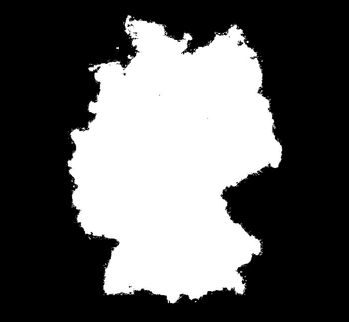


32 LPVE BfN Quantification of Grasland in Germany


33 LPVE EEA Copernicus Natura 2000 Habitate mapping
34 LPVE Conclusion

35 LPVE Legend and cartographic standard Sampling unit Analysis of the data Sampling design Data processing & documentation Survey guidelines


36 SIGMA thematic land cover validation LPVE Applied checklists Legend or land cover classification scheme Questions to be raised: Is there a clearly pre defined legend, which ensures: Sampling units o Full thematic match between map and reference data? Questions to be raised: o Clear rules for survey observations? Is there Sampling a clear design definition of the sampling unit which adequately suites the Questions most coarse to input be raised: data? Is this applicable Is there a clear for a field predefined data collection sampling in scheme, terms of which costs, accessibility feasibility Survey in terms guidelines Ensures of representative work load? and sufficient allocation of samples? Is it open to Questions also suite to other be raised: Allows to verify input the representativeness data in terms of data of gaps? the validation results? Are the clear observation rules and a defined field form which allow to: Documents a sound validation planning? odata Collect processing precise and and documentation complete field observations? Helps guiding the surveyors itinerary planning? oquestions Transparently to be raised: document the particular observation and the sample Is unit s there level? a dedicated digital data entry and digitization interface which allows to Analysis completely of the collate data the collected field results in a digital format for further Questions processing to be raised: and back up? Is there Is a there clear data a clear flow analysis mechanism functionality in order which to ensure is defined completeness on basis of the data transmission? previously defined parameters? Is it ensured Are the to explore results and data calculation loss at any steps processing transparently level? documented? Is it possible to provide access to the both data, field data and mapping product in order to allow independent assessments?
37 LPVE Conclusion We did not invent anything new but introduced well established concepts (see above) via R and shiny into an open source GIS environment Overall an interesting contribution to thematic map validations in order to facilitate planning and evaluation of mapping products Hopefully an opportunity to increase and maintain user acceptance Positive feedbacks from users in various countries Current limitations Performance limits of QGIS and the plugin (e.g. limited number of classes, data size,... to be further developed) Limited sampling design options current version targets random stratified sampling User friendliness and installation require additional development

38 LPVE Do you have questions? ESA, Frascati, EFTAS Fernerkundung Technologietransfer GmbH ı Oststr ı Münster ı Germany ı ı Tel.: +49 (0) ı Fax: +49 (0)
FAO GAEZ Data Portal
 FAO GAEZ Data Portal www.fao.org/nr/gaez Renato Cumani Environment Officer Land and Water Division Natural Resources Management and Environment Department Food and Agriculture Organization of the UN October
Building a validation database for land cover products from high spatial resolution images
 Building a validation database for land cover products from high spatial resolution images The Land Cover project of the ESA Climate Change Initiative Bontemps Sophie 1, Achard Frédéric 2, Lamarche Céline
Compact guides GISCO. Geographic information system of the Commission
 Compact guides GISCO Geographic information system of the Commission What is GISCO? GISCO, the Geographic Information System of the COmmission, is a permanent service of Eurostat that fulfils the requirements
CentropeSTATISTICS Working Interactively with Cross-Border Statistic Data Clemens Beyer, Walter Pozarek, Manfred Schrenk
 Clemens Beyer, Walter Pozarek, Manfred Schrenk (Dipl.-Ing. Clemens Beyer, CEIT ALANOVA, Concorde Business Park 2/F, 2320 Schwechat, Austria, c.beyer@ceit.at) (Dipl.-Ing. Walter Pozarek, PGO Planungsgemeinschaft
Use of auxiliary information in the sampling strategy of a European area frame agro-environmental survey
 Use of auxiliary information in the sampling strategy of a European area frame agro-environmental survey Laura Martino 1, Alessandra Palmieri 1 & Javier Gallego 2 (1) European Commission: DG-ESTAT (2)
Overview. Everywhere. Over everything.
 Cadenza Desktop Cadenza Web Cadenza Mobile Cadenza Overview. Everywhere. Over everything. The ultimate GIS and reporting suite. Provide, analyze and report data efficiently. For desktop, web and mobile.
One platform for desktop, web and mobile
 One platform for desktop, web and mobile Search and filter Get access to all data thematically filter data in context factually and spatially as well as display it dynamically. Export a selection or send
GEOMATICS. Shaping our world. A company of
 GEOMATICS Shaping our world A company of OUR EXPERTISE Geomatics Geomatics plays a mayor role in hydropower, land and water resources, urban development, transport & mobility, renewable energy, and infrastructure
VCS MODULE VMD0018 METHODS TO DETERMINE STRATIFICATION
 VMD0018: Version 1.0 VCS MODULE VMD0018 METHODS TO DETERMINE STRATIFICATION Version 1.0 16 November 2012 Document Prepared by: The Earth Partners LLC. Table of Contents 1 SOURCES... 2 2 SUMMARY DESCRIPTION
Land Use and Land cover statistics (LUCAS)
") EUROPEAN COMMISSION EUROSTAT Directorate E: Sectoral and regional statistics Doc. ENV/DIMESA/7.1/2012 Original in EN Agenda point 7.1 Land Use and Land cover statistics (LUCAS) DIMESA Directors' Meeting
EUROPEAN COMMISSION EUROSTAT Directorate E: Sectoral and regional statistics Doc. ENV/DIMESA/7.1/2012 Original in EN Agenda point 7.1 Land Use and Land cover statistics (LUCAS) DIMESA Directors' Meeting
Training on national land cover classification systems. Toward the integration of forest and other land use mapping activities.
 Training on national land cover classification systems Toward the integration of forest and other land use mapping activities. Guiana Shield 9 to 13 March 2015, Paramaribo, Suriname Background Sustainable
ESBN. Working Group on INSPIRE
 ESBN Working Group on INSPIRE by Marc Van Liedekerke, Endre Dobos and Paul Smits behalf of the WG members WG participants Marc Van Liedekerke Panos Panagos Borut Vrščaj Ivana Kovacikova Erik Obersteiner
Status of implementation of the INSPIRE Directive 2016 Country Fiches. COUNTRY FICHE Netherlands
 Status of implementation of the INSPIRE Directive 2016 Country Fiches COUNTRY FICHE Netherlands Introduction... 1 1. State of Play... 2 1.1 Coordination... 2 1.2 Functioning and coordination of the infrastructure...
Newsletter. Nr. 5 / June Special Issue HLanData Pilot Projects
 Nr. 5 / June 2012 Newsletter Special Issue HLanData Pilot Projects Pilot 1: Land Use and Land Cover Data Analysis System for Intermediate-Level Users The main objective of PILOT 1 is to demonstrate the
COMBINING ENUMERATION AREA MAPS AND SATELITE IMAGES (LAND COVER) FOR THE DEVELOPMENT OF AREA FRAME (MULTIPLE FRAMES) IN AN AFRICAN COUNTRY:
 FOR THE DEVELOPMENT OF AREA FRAME (MULTIPLE FRAMES) IN AN AFRICAN COUNTRY:") COMBINING ENUMERATION AREA MAPS AND SATELITE IMAGES (LAND COVER) FOR THE DEVELOPMENT OF AREA FRAME (MULTIPLE FRAMES) IN AN AFRICAN COUNTRY: PRELIMINARY LESSONS FROM THE EXPERIENCE OF ETHIOPIA BY ABERASH
COMBINING ENUMERATION AREA MAPS AND SATELITE IMAGES (LAND COVER) FOR THE DEVELOPMENT OF AREA FRAME (MULTIPLE FRAMES) IN AN AFRICAN COUNTRY: PRELIMINARY LESSONS FROM THE EXPERIENCE OF ETHIOPIA BY ABERASH
Landslide Hazard Assessment Methodologies in Romania
 A Scientific Network for Earthquake, Landslide and Flood Hazard Prevention SciNet NatHazPrev Landslide Hazard Assessment Methodologies in Romania In the literature the terms of susceptibility and landslide
Geological information for Europe : Towards a pan-european Geological Data Infrastructure
 Geological information for Europe : Towards a pan-european Geological Data Infrastructure Integrating geoscientific information for EU competitiveness Co-funded by the European Union European societal
Adding value to Copernicus services with member states reference data
 www.eurogeographics.org Adding value to Copernicus services with member states reference data Neil Sutherland neil.sutherland@os.uk GIS in the EU 10 November 2016 Copyright 2016 EuroGeographics 61 member
LUCAS: current product and its evolutions
 LUCAS: current product and its evolutions Workshop Land Use and Land Cover products: challenges and opportunities Brussels 15 Nov 2017 Eurostat E4: estat-dl-lucas@ec.europa.eu Contents 1) The context 2)
Hydrologic Modelling of the Upper Malaprabha Catchment using ArcView SWAT
 Hydrologic Modelling of the Upper Malaprabha Catchment using ArcView SWAT Technical briefs are short summaries of the models used in the project aimed at nontechnical readers. The aim of the PES India
Possible links between a sample of VHR images and LUCAS
 EUROPEAN COMMISSION EUROSTAT Directorate E: Sectoral and regional statistics Unit E-1: Farms, agro-environment and rural development CPSA/LCU/08 Original: EN (available in EN) WORKING PARTY "LAND COVER/USE
Deriving Uncertainty of Area Estimates from Satellite Imagery using Fuzzy Land-cover Classification
 International Journal of Information and Computation Technology. ISSN 0974-2239 Volume 3, Number 10 (2013), pp. 1059-1066 International Research Publications House http://www. irphouse.com /ijict.htm Deriving
Among various open-source GIS programs, QGIS can be the best suitable option which can be used across partners for reasons outlined below.
 Comparison of Geographic Information Systems (GIS) software As of January 2018, WHO has reached an agreement with ESRI (an international supplier of GIS software) for an unlimited use of ArcGIS Desktop
CARTOGRAPHIC INFORMATION MANAGEMENT IN COLOMBIA REACH A LEVEL OF PERFECTION
 CARTOGRAPHIC INFORMATION MANAGEMENT IN COLOMBIA REACH A LEVEL OF PERFECTION Jaime Alberto Duarte Castro 1 Carrera 30 No. 48 51 Bogotá - Colombia, jduarte@igac.gov.co Claudia Inés Sepúlveda Fajardo 2 Carrera
The Combination of Geospatial Data with Statistical Data for SDG Indicators
 Session x: Sustainable Development Goals, SDG indicators The Combination of Geospatial Data with Statistical Data for SDG Indicators Pier-Giorgio Zaccheddu Fabio Volpe 5-8 December2018, Nairobi IAEG SDG
Historical Assessment of Spatial Growth of Built-ups and Metropolitan areas of Delhi and Mumbai in India and Dhaka in Bangladesh
 Historical Assessment of Spatial Growth of Built-ups and Metropolitan areas of Delhi and Mumbai in India and Dhaka in Bangladesh Tomas Soukup, GISAT World Bank HQ, Washington DC Date : 12 April 2011 Introduction
Swedish examples on , and
 Swedish examples on 11.2.1, 11.3.1 and 11.7.1 Marie Haldorson, Director Seminar in Nairobi 7 Dec 2018 SDG Indicator Tests by Countries in Europe GEOSTAT 3: ESS Project with a purpose to guide countries
Proposal for a DIRECTIVE OF THE EUROPEAN PARLIAMENT AND OF THE COUNCIL. establishing an infrastructure for spatial information in the Community
 Proposal for a DIRECTIVE OF THE EUROPEAN PARLIAMENT AND OF THE COUNCIL establishing an infrastructure for spatial information in the Community INSPIRE http://inspire.jrc.it/ Alessandro Annoni 1 EU Commission
EO4SEE - THE PATHFINDER OF OPERATIONAL SATELLITE MONITORING FOR THE REGION OF THE BLACK SEA AND CENTRAL EUROPE
 EO4SEE: Pathfinder assessment for regional high volume data access, processing and information service delivery platforms - South East Region EO4SEE - THE PATHFINDER OF OPERATIONAL SATELLITE MONITORING
LAND USE MAPPING AND MONITORING IN THE NETHERLANDS (LGN5)
") LAND USE MAPPING AND MONITORING IN THE NETHERLANDS (LGN5) Hazeu, Gerard W. Wageningen University and Research Centre - Alterra, Centre for Geo-Information, The Netherlands; gerard.hazeu@wur.nl ABSTRACT
LAND USE MAPPING AND MONITORING IN THE NETHERLANDS (LGN5) Hazeu, Gerard W. Wageningen University and Research Centre - Alterra, Centre for Geo-Information, The Netherlands; gerard.hazeu@wur.nl ABSTRACT
Model Generalisation in the Context of National Infrastructure for Spatial Information
 Model Generalisation in the Context of National Infrastructure for Spatial Information Tomas MILDORF and Vaclav CADA, Czech Republic Key words: NSDI, INSPIRE, model generalization, cadastre, spatial planning
CHAPTER 3 RESEARCH METHODOLOGY
 CHAPTER 3 RESEARCH METHODOLOGY 3.1 INTRODUCTION The research methodology plays an important role in implementing the research and validating the results. Therefore, this research methodology is derived
Copernicus Relays. Roles and responsibilities of the Copernicus Relays. user uptake
 Copernicus Relays user uptake Roles and responsibilities of the Copernicus Relays The European Commission has launched two Networks, the Copernicus Relays and the Copernicus Academy, to contribute to spreading
FIRE DEPARMENT SANTA CLARA COUNTY
 DEFINITION FIRE DEPARMENT SANTA CLARA COUNTY GEOGRAPHIC INFORMATION SYSTEM (GIS) ANALYST Under the direction of the Information Technology Officer, the GIS Analyst provides geo-spatial strategic planning,
Land Monitoring Core Service Implementation Group (LMCS IG) - Results and Outlook
 - Results and Outlook") Land Monitoring Core Service Implementation Group (LMCS IG) - Results and Outlook Pr. Dietmar Grünreich, President of BKG, Germany Chairman of the GMES LMCS IG Outline 1 Introduction 2 Preparatory Projects
Land Monitoring Core Service Implementation Group (LMCS IG) - Results and Outlook Pr. Dietmar Grünreich, President of BKG, Germany Chairman of the GMES LMCS IG Outline 1 Introduction 2 Preparatory Projects
GEOGRAPHIC INFORMATION SYSTEMS Session 8
 GEOGRAPHIC INFORMATION SYSTEMS Session 8 Introduction Geography underpins all activities associated with a census Census geography is essential to plan and manage fieldwork as well as to report results
Open data integration: from satellite to UAV for protection of built environment. The archaeological site in the Centa River bed in Albenga
 Open data integration: from satellite to UAV for protection of built environment. The archaeological site in the Centa River bed in Albenga L. Barazzetti a, R. Brumana a, B. Cuca a,b, M. Previtali a, R.
EuroGEOSS Protected Areas Pilot
 EuroGEOSS Protected Areas Pilot Max Craglia European Commission Joint Research Centre Part 1: the present MyNatura2000 Mobile app. Awareness raising & volunteered data collection. Natura2000 covers 18%
Roadmap to interoperability of geoinformation
 Roadmap to interoperability of geoinformation and services in Europe Paul Smits, Alessandro Annoni European Commission Joint Research Centre Institute for Environment and Sustainability paul.smits@jrc.it
COLLABORATIVE GI BASED APPROACH: Discussing GI relevance towards monitoring EU Legal Framework. Maria José VALE Raquel SARAIVA Rui REIS
 COLLABORATIVE GI BASED APPROACH: Discussing GI relevance towards monitoring EU Legal Framework Maria José VALE Raquel SARAIVA Rui REIS Summary INSPIRE directive and Spatial Data Infrastructure Data availability
Copernicus Academy. Roles and responsibilities of the Copernicus Academy. user uptake. Focus Data uptake, capacity building and skills development
 Copernicus Academy user uptake Roles and responsibilities of the Copernicus Academy The European Commission has launched two Networks, the Copernicus Relays and the Copernicus Academy, to contribute on
Contents Introduction... 3 Get the data... 4 Workflow... 7 Test 1: Urban fabric (all)... 8 Test 2: Urban fabric (industrial and commercial)...
... 8 Test 2: Urban fabric (industrial and commercial)...") AAXY tutorial Contents Introduction... 3 Get the data... 4 Workflow... 7 Test 1: Urban fabric (all)... 8 Test 2: Urban fabric (industrial and commercial)... 9 Test 3: Urban fabric (residential)... 10 Test
AAXY tutorial Contents Introduction... 3 Get the data... 4 Workflow... 7 Test 1: Urban fabric (all)... 8 Test 2: Urban fabric (industrial and commercial)... 9 Test 3: Urban fabric (residential)... 10 Test
Watershed Sciences 4930 & 6920 GEOGRAPHIC INFORMATION SYSTEMS
 Watershed Sciences 4930 & 6920 GEOGRAPHIC INFORMATION SYSTEMS WEEK TWELVE UNCERTAINTY IN GIS Joe Wheaton HOUSEKEEPING Labs Do you need extended Quinney Lab hours? Okay with Lab 9? Geoprocessing worked?
LUCAS Technical reference document U1 LUCAS Survey data user guide. (Land Use / Cover Area Frame Survey)
") Regional statistics and Geographic Information Author: E4.LUCAS (ESTAT) TechnicalDocuments 2015 LUCAS 2015 (Land Use / Cover Area Frame Survey) Technical reference document U1 LUCAS Survey data user guide
Regional statistics and Geographic Information Author: E4.LUCAS (ESTAT) TechnicalDocuments 2015 LUCAS 2015 (Land Use / Cover Area Frame Survey) Technical reference document U1 LUCAS Survey data user guide
An Update on Land Use & Land Cover Mapping in Ireland
 An Update on Land Use & Land Cover Mapping in Ireland Progress Towards a National Programme Kevin Lydon k.lydon@epa.ie Office of Environmental Assessment, Environmental Protection Agency, Johnstown Castle,
Earth Observation and GEOSS in Horizon Copernicus for Raw Material Workshop 5 th September 2016
 Earth Observation and GEOSS in Horizon 2020 Copernicus for Raw Material Workshop 5 th September 2016 Gilles OLLIER Head of Sector -Earth observation Directorate Environment Unit I.4 Climate Actions and
Digitization in a Census
 Topics Connectivity of Geographic Data Sketch Maps Data Organization and Geodatabases Managing a Digitization Project Quality and Control Topology Metadata 1 Topics (continued) Interactive Selection Snapping
Efficiencies in Data Acquisition and Transformation
 Efficiencies in Data Acquisition and Transformation Andrew LEYZACK Canada Key words: Hydrography, IHO S-57, Nautical Chart SUMMARY For many hydrographic offices, the introduction of electronic nautical
Monitoring of Settlement Development Methodological Problems and Solutions in Germany
 Monitoring of Settlement Development Methodological Problems and Solutions in Germany Gotthard Meinel Leibniz Institute for Ecological Urban and Regional Development (IOER), Germany/Dresden Overview LU-Problem
Directorate E: Sectoral and regional statistics Unit E-4: Regional statistics and geographical information LUCAS 2018.
 EUROPEAN COMMISSION EUROSTAT Directorate E: Sectoral and regional statistics Unit E-4: Regional statistics and geographical information Doc. WG/LCU 52 LUCAS 2018 Eurostat Unit E4 Working Group for Land
IAEG SDGs WG GI, , Mexico City
 IAEG SDGs WG GI, 12-14.12.2016, Mexico City UN-GGIM:Europe s perspective and activities to support better integration of geospatial information and statistics and the UN SDG monitoring Pier-Giorgio Zaccheddu,
Copernicus Land HRL Imperviousness: 2012 dataset, indicator Title
 Copernicus Land HRL Imperviousness: 2012 dataset, 06-09 indicator and outlook Title 2015+ Tobias LANGANKE First name SURNAME Project manager, Copernicus Position land services Name European of the Environment
Land Administration and Cadastre
 Geomatics play a major role in hydropower, land and water resources and other infrastructure projects. Lahmeyer International s (LI) worldwide projects require a wide range of approaches to the integration
The German GMES extension to support land cover data systems: Status and outlook
 The German GMES extension to support land cover data systems: Status and outlook Bergen, 2nd July 2010 Oliver Buck, EFTAS GmbH Co-Funded by the Federal Ministry of Economics and Technology (BMWi) via the
ESA-GLOBCOVER - A Global Land Cover Service at 300 m from ENVISAT MERIS Time Series
 October 15, 2008 (Jena Germany) ESA-GLOBCOVER - A Global Land Cover Service at 300 m from ENVISAT MERIS Time Series Defourny P.1, Bontemps S., Vancutsem C.1, Pekel J.F.1,, Vanbogaert E.1, Bicheron P.2,
Government GIS and its Application for Decision Support
 Government GIS and its Application for Decision Support Zhang Qingpu (Chinese Academy of Surveying and Mapping, Email: zhangqp@casm.ac.cn) Abstract: Application of GIS in government agencies is called
GLOBAL SYMPOSIUM ON SOIL ORGANIC CARBON, Rome, Italy, March 2017
 GLOBAL SYMPOSIUM ON SOIL ORGANIC CARBON, Rome, Italy, 21-23 March 2017 Strength and weaknesses of a bottom up approach in estimating soil organic carbon: an experience in the varied Italian scenery I.
REGIONAL SDI DEVELOPMENT
 REGIONAL SDI DEVELOPMENT Abbas Rajabifard 1 and Ian P. Williamson 2 1 Deputy Director and Senior Research Fellow Email: abbas.r@unimelb.edu.au 2 Director, Professor of Surveying and Land Information, Email:
Urban areas & climate change
 Urban areas & climate change Paolo Gamba University of Pavia University of Pavia The UNIPV TLC & RS Lab is a dynamic research group developing in the past years many techniques devoted to the analysis
C N E S, U M R I R I S A
 M O N I T O R I N G U R B A N A R E A S W I T H S E N T I N E L - 2. APPLICATION TO THE UPDATE OF THE COPERNICUS HIGH RESOLUTION LAYER IMPERVIOUSNESS DEGREE O c t o b e r 2 5 th 2016, Brussels A n t o
MANUAL ON THE BSES: LAND USE/LAND COVER
 6. Environment Protection, Management and Engagement 2. Environmental Resources and their Use 5. Human Habitat and Environmental Health 1. Environmental Conditions and Quality 4. Disasters and Extreme
Status of implementation of the INSPIRE Directive 2016 Country Fiches. COUNTRY FICHE Czech Republic
 Status of implementation of the INSPIRE Directive 2016 Country Fiches COUNTRY FICHE Czech Republic Introduction... 1 1. State of Play... 2 1.1 Coordination... 2 1.2 Functioning and coordination of the
Open Data meets Big Data
 Open Data meets Big Data Max Craglia, Sven Schade, Anders Friis European Commission Joint Research Centre www.jrc.ec.europa.eu Serving society Stimulating innovation Supporting legislation JRC is Technical
Supplementary material: Methodological annex
 1 Supplementary material: Methodological annex Correcting the spatial representation bias: the grid sample approach Our land-use time series used non-ideal data sources, which differed in spatial and thematic
CAWa Central Asian Water. Training Course Geographical Information Systems in Hydrology
 CAWa Central Asian Water Training Course Geographical Information Systems in Hydrology 1 Place & Time Place to hold the workshop: Helmholtz Centre Potsdam GFZ German Research Center for Geosciences, Germany
New COST Action: Towards a European Network on Chemical Weather Forecasting and Information Systems
 New COST Action: Towards a European Network on Chemical Weather Forecasting and Information Systems Proposer: Mikhail Sofiev Finnish Meteorological Institute Historical background EUMETNET Workshop on
GIS FOR MAZOWSZE REGION - GENERAL OUTLINE
 GIS FOR MAZOWSZE REGION - GENERAL OUTLINE S. Bialousz 1), K Mączewski 2), E. Janczar 2), K. Osinska-Skotak 1) 1) Warsaw University of Technology, Warsaw, Poland 2) Office of the Surveyor of the Mazowieckie
CLICK HERE TO KNOW MORE
 CLICK HERE TO KNOW MORE Geoinformatics Applications in Land Resources Management G.P. Obi Reddy National Bureau of Soil Survey & Land Use Planning Indian Council of Agricultural Research Amravati Road,
ASSESSING THEMATIC MAP USING SAMPLING TECHNIQUE
 1 ASSESSING THEMATIC MAP USING SAMPLING TECHNIQUE University of Tehran, Faculty of Natural Resources, Karaj-IRAN E-Mail: adarvish@chamran.ut.ac.ir, Fax: +98 21 8007988 ABSTRACT The estimation of accuracy
C o p e r n i c u s L a n d M o n i t o r i n g S e r v i c e
 C o p e r n i c u s L a n d M o n i t o r i n g S e r v i c e Integration into existing Snow and Ice Services and draft product specifications Annett BARTSCH b.geos Copernicus High Resolution Snow and
Spanish national plan for land observation: new collaborative production system in Europe
 ADVANCE UNEDITED VERSION UNITED NATIONS E/CONF.103/5/Add.1 Economic and Social Affairs 9 July 2013 Tenth United Nations Regional Cartographic Conference for the Americas New York, 19-23, August 2013 Item
Framework on reducing diffuse pollution from agriculture perspectives from catchment managers
 Framework on reducing diffuse pollution from agriculture perspectives from catchment managers Photo: River Eden catchment, Sim Reaney, Durham University Introduction This framework has arisen from a series
A Method to Improve the Accuracy of Remote Sensing Data Classification by Exploiting the Multi-Scale Properties in the Scene
 Proceedings of the 8th International Symposium on Spatial Accuracy Assessment in Natural Resources and Environmental Sciences Shanghai, P. R. China, June 25-27, 2008, pp. 183-188 A Method to Improve the
USE OF RADIOMETRICS IN SOIL SURVEY
 USE OF RADIOMETRICS IN SOIL SURVEY Brian Tunstall 2003 Abstract The objectives and requirements with soil mapping are summarised. The capacities for different methods to address these objectives and requirements
Access to global land cover reference datasets and their suitability for land cover mapping activities
 Access to global land cover reference datasets and their suitability for land cover mapping activities Brice Mora, N.E.Tsendbazar, M.Herold LPVE meeting, Frascati, January 29, 2014 Outlook 1. Background
United Nations Group Of Experts On Geographical Names
 Rudolph MATINDAS, Indonesia or William WATT, Australia Key words: place names, UNGEGN SUMMARY UNGEGN Discussing the strategic aims of UNGEGN and its divisional structure, future direction, and the benefits
"GIS-Sofia" Ltd. geospatial data integration in SOFCAR geographic information system and providing services March 2018, Sofia
 "GIS-Sofia" Ltd. geospatial data integration in SOFCAR geographic information system and providing services Geographical Information System Sofia " Ltd....the beginning... Established in 1999, as a Sofia
Monitoring of grass cutting with Sentinel-1 time series
 Monitoring of grass cutting with Sentinel-1 time series pilot results and vision for operational service based on big data tools and cloud computing Kaupo Voormansik 21st MARS Conference November 25, 2015
Desktop GIS for Geotechnical Engineering
 Desktop GIS for Geotechnical Engineering Satya Priya Deputy General Manager (Software) RMSI, A-7, Sector 16 NOIDA 201 301, UP, INDIA Tel: +91-120-2511102 Fax: +91-120-2510963 Email: Satya.Priya@rmsi.com
Can Measurement of Nitrate, Oxygen, and Boron isotopes be useful for your nitrate problem? A guideline. Problem. Measures. November 2009.
 δ 18 O NO3 NO3 Problem O O N δ 11 B δ 15 N NO3 O Measures Can Measurement of Nitrate, Oxygen, and Boron isotopes be useful for your nitrate problem? November 2009 Content 1 Introduction: ISONITRATE project...
Space research. Horizon Work Programme. "Countdown to Horizon 2020 Space" Earth Observation topics. Brussels, 12 December 2013
 Space research Horizon 2020 - Work Programme "Countdown to Horizon 2020 Space" Earth Observation topics Brussels, 12 December 2013 richard.gilmore@ec.europa.eu Table of contents FP/Copernicus - general
GEO Geohazards Community of Practice
 GEO Geohazards Community of Practice 1) Co-Chair of GHCP With input from: Stuart Marsh, GHCP Co-Chair Francesco Gaetani, GEO Secretariat and many GHCP contributors 1) Nevada Bureau of Mines and Geology
Watershed Classification with GIS as an Instrument of Conflict Management in Tropical Highlands of the Lower Mekong Basin
 Page 1 of 8 Watershed Classification with GIS as an Instrument of Conflict Management in Tropical Highlands of the Lower Mekong Basin Project Abstract The University of Giessen is actually planning a research
Egypt Public DSS. the right of access to information. Mohamed Ramadan, Ph.D. [R&D Advisor to the president of CAPMAS]
![Egypt Public DSS. the right of access to information. Mohamed Ramadan, Ph.D. [R&D Advisor to the president of CAPMAS]](/thumbs/89/98483713.jpg "Egypt Public DSS. the right of access to information. Mohamed Ramadan, Ph.D. [R&D Advisor to the president of CAPMAS]") Egypt Public DSS ì the right of access to information Central Agency for Public Mobilization and Statistics Arab Republic of Egypt Mohamed Ramadan, Ph.D. [R&D Advisor to the president of CAPMAS] Egypt
Egypt Public DSS ì the right of access to information Central Agency for Public Mobilization and Statistics Arab Republic of Egypt Mohamed Ramadan, Ph.D. [R&D Advisor to the president of CAPMAS] Egypt
HIGH RESOLUTION GLOBAL LAND COVER/LAND USE MAPPING CURRENT STATUS AND UPCOMING TRENDS
 HIGH RESOLUTION GLOBAL LAND COVER/LAND USE MAPPING CURRENT STATUS AND UPCOMING TRENDS Klaus U. Komp President of the Advisory Board, EFTAS Remote Sensing, Muenster, Germany klaus.komp@eftas.com Commission
Test and implementation of DATR system in Hungary
 Test and implementation of DATR system in Hungary Zsuzsanna Ferencz Institute of Geodesy, Cartography & Remote Sensing (FÖMI) Department of Geoinformation Developments HUNGARY 13 April 2010 Institute of
INSPIRing Geospatial Framework For Local Administrations
 This project is financed by the European Union and the Republic of Turkey Presented at the FIG Congress 2018, May 6-11, 2018 in Istanbul, Turkey National Programme for Turkey 2010 Instrument for Pre-Accession
Spatial Disaggregation of Land Cover and Cropping Information: Current Results and Further steps
 CAPRI CAPRI Spatial Disaggregation of Land Cover and Cropping Information: Current Results and Further steps Renate Koeble, Adrian Leip (Joint Research Centre) Markus Kempen (Universitaet Bonn) JRC-AL
Reference Database and Validation Concept for Remote Sensing based Forest Cover Change Products in Fiji INTERNATIONAL CLIMATE INITIATIVE
 INTERNATIONAL CLIMATE INITIATIVE Regional project Climate Protection through Forest Conservation in Pacific Island Countries Reference Database and Validation Concept for Remote Sensing based Forest Cover
MeteoSwiss acceptance procedure for automatic weather stations
 MeteoSwiss acceptance procedure for automatic weather stations J. Fisler, M. Kube, E. Grueter and B. Calpini MeteoSwiss, Krähbühlstrasse 58, 8044 Zurich, Switzerland Phone:+41 44 256 9433, Email: joel.fisler@meteoswiss.ch
Geospatial workflows and potential applications to the Sustainable Development Goals of countries in West Asia
 Geospatial workflows and potential applications to the Sustainable Development Goals of countries in West Asia Ameer Abdulla, PhD Senior Advisor, European Topic Center for Spatial Analysis, Spain Associate
Sharing soil information with the help of INSPIRE, key challenges with soil data management
 Sharing soil information with the help of INSPIRE, key challenges with soil data management Katharina Feiden e-mail: gssoil@portalu.de GS Soil: project outline GS Soil: Assessment and strategic development
GLP Workshop on. The design of integrative models of natural and social systems in land change science
 The Global land Project Nodal Office on Integration and Modelling, Aberdeen, UK GLP Workshop on The design of integrative models of natural and social systems in land change science Introduction Post Workshop
COMMISSION 3 SPATIAL INFORMATION MANAGEMENT WORK PLAN
 Appendix to item 34.3 FIG Congress in Washington, 19-26 April 2002 COMMISSION 3 SPATIAL INFORMATION MANAGEMENT WORK PLAN 2002 2006 1. Title Spatial Information Management. 2. Terms of Reference - Management
IAEG-SDGs WGGI Task Team Dec. 7, 2017, New York
 IAEG-SDGs WGGI Task Team Dec. 7, 2017, New York Contents What are G/A data? Role of G/A data Utilization Recommendations Outlook National Geospatial Data for SDGs Official data products generated by authoritative
Production Line Tool Sets
 Production Line Tool Sets Tools for high-quality database production and cartographic output Production Line Tool Sets Production Line Tool Sets (PLTS) by ESRI are a collection of software applications
Geospatial SDI Portal for effective Governance of Pune METROPOLIS region
 Geospatial SDI Portal for effective Governance of Pune METROPOLIS region Mr. Praveen Gautam Senior Manager 19 th January 2018 PMRDA Overview Provide a Spatial Framework for the entire region with various
Module Name Module Code
 Module Name Module Code Digital Spatial Analysis - Practical Exercises AEF-EM013 Module Coordinator Dr. agr. Georg Hörmann Organizer Institute for Natural Resource Conservation - Hydrology and Water Resources
The Road to Improving your GIS Data. An ebook by Geo-Comm, Inc.
 The Road to Improving your GIS Data An ebook by Geo-Comm, Inc. An individual observes another person that appears to be in need of emergency assistance and makes the decision to place a call to 9-1-1.
Using OGC standards to improve the common
 Using OGC standards to improve the common operational picture Abstract A "Common Operational Picture", or a, is a single identical display of relevant operational information shared by many users. The