Geospatial Information for United Nations
|
|
|
- Sabrina Bailey
- 5 years ago
- Views:
Transcription


1 Geospatial Information for United Nations 28 th Session of UN Group of Experts on Geographical Names 30 April 2014 Cartographic Section/DGITT Department of Field Support United Nations UN Cartographic Section UNHQ, New York Page 1

.")

2 UN Cartographic Section Cartographic Section provides geospatial information support to the full range of United Nations operations Principal duties include: 1. Provide accurate and timely geospatial information in support of the decision-making and operational needs of. UN Security Council. UN Secretariat. UN Peace Operations (DPKO, DPA, DFS). UN Operations & Crisis Centre (UNOCC) 2. Programme management of field mission GIS operations 3. Provide technical assistance on International Boundary issues 4. Co-Secretariat (with SD/DESA) of UN Committee of Experts on Global Geospatial Information Management (UN-GGIM) UN Cartographic Section UNGEGN-2014, New York Page 2
3 Geospatial information Requirements for UN Operations UN Cartographic Section UNGEGN-2014, New York Page 3


4 Geospatial Visualisation Communicating Complex Information. UN Cartographic Section UNGEGN-2014, New York Page 4


5 Geospatial Analysis Analyzing Relationships, Patterns, Processes... Helping Understand Complex Situations and Make Decisions UN Cartographic Section UNGEGN-2014, New York Page 5


6 Security Council Provide Geo-information during the daily Council s consultations & meetings Provide Geo-information & analysis to the Council s Panels of Experts UN Cartographic Section UNGEGN-2014, New York Page 6


7 Secretary General s Report Map production for UN official briefing and publication UN Cartographic Section UNGEGN-2014, New York Page 7


8 UN Secretariat UNHQ Offices requiring regular support: DPKO/DFS/DPA DSS (existing SLA) OCHA, DESA, OLA (DOALOS and Treaty Section) DPI, ODA, OSAPG, etc UN Cartographic Section UNGEGN-2014, New York Page 8


9 UN Secretariat Web-Map services for pattern analysis, etc UN Cartographic Section UNGEGN-2014, New York Page 9


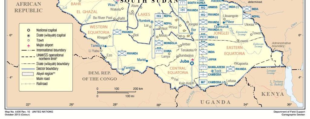
10 UN Peace Operations UN Cartographic Section UNGEGN-2014, New York Page 10


11 UN Peace Operations Personnel PKO PBO Current operations Uniformed personnel 90, International civilian 5,084 1,280 Local civilian 11,730 2,429 UN Volunteers 2, Total: 109,247 4,261 Peacekeeping Budgets Jul Jun 2014: Jul Jun 2013: Jul Jun 2012: $7.2 billions $7.2 billions $7.8 billions (source: UN fact sheets) UN Cartographic Section UNGEGN-2014, New York Page 11


12 UN Field Operations Mapping & Geo-Databases UN Cartographic Section UNGEGN-2014, New York Page 12


13 UN Field Operations Underground Water Exploration in Darfur UN Cartographic Section UNGEGN-2014, New York Page 13


14 UN Field Operations Underground Water Exploration in Mali High success rate using modern geospatial technology Water found in 6 towns (Tombouctou, Gao, Kidal, Almoustarat, Aguelhoc, Tessalit) UN Cartographic Section UNGEGN-2014, New York Page 14


15 UN Field Operations Terrain Analysis for Trafficability Field movement challenges UN Cartographic Section UNGEGN-2014, New York Page 15


16 UN Field Operations Geo Analysis for Damage Assessment in Haiti UN Cartographic Section UNGEGN-2014, New York Page 16


17 UN Field Operations Web-mapping for Haiti Earthquake UN Cartographic Section UNGEGN-2014, New York Page 17


18 UN Field Operations Web-mapping for Security Warden (UNIFIL) UN Cartographic Section UNGEGN-2014, New York Page 18
 Security incidents Analysis")

19 UN Field Operations Security Incident Report (UNAMID) Security incidents Analysis and Reporting information System (SARS) UN Cartographic Section UNGEGN-2014, New York Page 19
 &")

20 UN Field Operations Security Incident Report (UNIFIL) & Tasking Plan (MONUSCO) UN Cartographic Section UNGEGN-2014, New York Page 20
 & Situational Awareness")

21 UN Field Operations Dashboard (UNHQ) & Situational Awareness (MONUSCO) UN Cartographic Section UNGEGN-2014, New York Page 21


22 UN Field Operations ERP Resource Management (MONUSCO) UN Cartographic Section UNGEGN-2014, New York Page 22
 - Technical assistance. AU Border Programme. N-S Sudan Border demarcation - Capacity building. Boundary Information System.")
23 International Boundaries - Border demarcation. EEBC (Eritrea-Ethiopia). CNMC (Cameroon-Nigeria). IKBMP (Iraq-Kuwait). Blue Line (Lebanon-Israel). Green Line (Cyprus) - Technical assistance. AU Border Programme. N-S Sudan Border demarcation - Capacity building. Boundary Information System. Cooperation with major players UN Cartographic Section UNGEGN-2014, New York Page 23


.")


.")


.")
 judgment")


24 International Boundary Projects - Iraq-Kuwait Boundary Maintenance Project (IKBMP). IKBDC recommendation and Security Council Resolution 833 (1993). Initiated in September 2005 entrenchment in October Reactivation in May 2012, followed by Quick field assessment in June IKBMP boundary maintenance completed in March Cameroon-Nigeria Mixed Commission (CNMC). International Court of Justice s (ICJ) judgment on the boundary in Initiated in Watershed workshop in August Final mapping request in 2013 Workshop session in June 2013 UN Cartographic Section UNGEGN-2014, New York Page 24
25 Challenges to effectively support UN Operations UN Cartographic Section UNGEGN-2014, New York Page 25
26 Challenges and Constraints Critical shortfall of Map & Geo-data for - Relevant briefing to support the Security Council decision making process - Effective mission planning - Supporting UN field operations. No base map. Outdated and/or inappropriate scale. Digitization of paper maps required. Ad-hoc solutions not satisfactory Constraints - Urgency: limited time between authorization and deployment - Insufficient resources to respond to urgent demand Observations - Needs further cooperation/collaboration with Member States on base map productions (i.e., MGCP) - Geospatial technology underutilized due to lack of appropriate Geo-data UN Cartographic Section UNGEGN-2014, New York Page 26
27 Typical Challenges Gap analysis Requirement Overview Strategic plan Strategic & operational Operational Map scale 1:1,000,000 1:500,000 1:200,000 1:250,000 Tactical 1:100,000 Paper maps ONC available - outdated TPC & Russian maps outdated JOG & Russian maps - outdated. US & Russian maps partially avail, outdated. MilObs/CivPol 1:50,000 Not existence. Data Availability Vector data Vmap-0 avail, outdated Not available. Vmap-1 partially available Vmap-2 Not available MGCP data Not available Digital elevation DEM/DTED-0 available DEM/DTED-1 available DEM meter City & Street 1:20,000 Not existence. Not available Satellite imagery LandSat NaturalVue SRTM, SPOT, etc EROS, etc QuickBird IKONOS, etc UN Cartographic Section UNGEGN-2014, New York Page 27
28 Support Framework and Capacity Building UN Cartographic Section UNGEGN-2014, New York Page 28
29 UN-GGIM - Asia Pacific - America - Europe - Africa - Middle East WFP USAID UNEP UNHCR FAO/UNDP ECHO/JRC GIS Operational Concept UNSD/UNCS UNGIWG OCHA GIST Security Council UNLB-GSC GIS Centre Cartographic Section/DGITT GIS UN Field Missions Common Operating Picture UN Secretariat DPKO/DPA/DFS Departments Offices Decision-making & Operations Partners EUSC, JRC G-NEXT Planning BGI, DGC,.. NGA, DoS CIESIN UN Cartographic Section UNGEGN-2014, New York Page 29


 4.")

30 Global GIS infrastructure Cartographic Section UNHQ Strategic Guidance Policy & Planning Collaboration International Boundary 3-tier: UNHQ UNLB/GSC Missions MINURSO UNFICYP UNIFIL UNDOF GIS Centre UNLB/GSC Map Production Geo-Analysis & Services Data Repository GIS Training UNAMA MINUSTAH MINUSMA UNAMID UNMIL UNOCI MONUSCO UNMISS BINUB UNSOA 1. Enterprise GIS system 2. UN Earth 3. UN Geo-database (UNmap) 4. UN Gazetteer 5. Satellite image database Mission GIS Day-to-Day Operations Customized services Data Collection Terrain Analysis UN Cartographic Section UNGEGN-2014, New York Page 30
31 UNmap is the institutional backbone of our daily cartographic and geographic operations Vector Geo-Database Developed by UNCS & UN Peace Operations GIS community Various Scales to meet the operational needs Name Scale UNmap-X 1:10,000,000 UNmap-V 1:5,000,000 UNmap-0 1:1,000,000 UNmap-1 1:250,000 UNmap-2 1:50,000 UNmap-3 1:25,000 UNmap-4 1:12,500 UNmap-5 1:5,000 UN Cartographic Section UNGEGN-2014, New York Page 31


32 Where we want to go? Base for various scale mapping Web applications Serve UN specific needs Dissemination within UN-System Updated by UN users UN Cartographic Section UNGEGN-2014, New York Page 32


33 International Boundary Information System Historical map Negotiated boundary between Lebanon and Israel Ortho-imagery (QuickBird) UN Cartographic Section UNGEGN-2014, New York Page 33


34 International Boundary Information System Satellite Imagery Treaty Text GIS data Visualisation Treaty Maps Treaty Coordinates UN Cartographic Section UNGEGN-2014, New York Page 34
.")
 Seamless administrative boundary maps and data since 2000 Coded historic changes of administrative boundary Contact")
35 SALB initiated by World Health Organization (WHO) under the UNGIWG in As of 2011, the function has been transferred to UN Secretariat (Statistics Division & Cartographic Section). Objectives of SALB: collect, manage and disseminate administrative boundary data and information in coordination with National Mapping Agencies (NMAs) Seamless administrative boundary maps and data since 2000 Coded historic changes of administrative boundary Contact information of NMAs UN Cartographic Section UNGEGN-2014, New York Page 35

36 UN Earth UN Cartographic Section UNGEGN-2014, New York Page 36


37 UN Gazetteer UN Cartographic Section UNGEGN-2014, New York Page Page 37 37
38 Collaboration & Partnership - Member States (France, Germany, Italy, Netherlands, Romania, Spain, UK, USA, etc.) - UN Global Geospatial Information Management (UN-GGIM) - African Union (AU) - European Union (EU) - EU Satellite Centre (EUSC) - EC Joint Research Center (JRC) - Multinational Geospatial Co-production Program (MGCP) - GMES/Copernicus projects (G-MOSAIC, G-NEXT) - NATO - UN secretariat & agencies (UNGIWG), including UNITAR/UNOSAT - International professional organizations (ICA, DGIWG, OGC, WWHGD, etc.) - Academia & Research Institutes (CIESIN, IBRU, ITC, etc.) UN Cartographic Section UNGEGN-2014, New York Page 38
 Italy for UNSOA (2012)")


39 Strategic Partnerships Member States France for MINURCAT (2008) Italy for UNSOA (2012) France, Spain, USA for MINUSMA ( ) 27 cells 432 1:50, cells 544 1:100, cells 312 1:100,000 UN Cartographic Section UNGEGN-2014, New York Page 39


 UN Cartographic")
40 Strategic Partnerships European Union G-MOSAIC ( ) G-NEXT (start April 2013) EU Satellite Centre ( cont.) UN Cartographic Section UNGEGN-2014, New York Page 40


41 UN-GGIM: A Global Initiative Formal inter-governmental Committee of Experts to: Discuss, enhance and coordinate Global Geospatial Information Management activities by involving Member States at the highest level as key participants Make joint decisions and set directions on the use of geospatial information within national and global policy frameworks Work with Governments to improve policy, institutional arrangements, and legal frameworks Address global issues and contribute collective knowledge as a community with shared interests and concerns Develop effective strategies to build geospatial capacity in developing countries UN Cartographic Section UNGEGN-2014, New York Page 41
42 Thank you Kyoung-Soo Eom Chief Cartographic Section +1 (212) Guillaume Criloux Ayako Kagawa Chief GeoOps Unit Chief Geo Support Unit +1 (917) (917) UN Cartographic Section UNGEGN-2014, New York Page 42
Geospatial Support for UN Operations *
 UNITED NATIONS E/CONF.100/IP.20 ECONOMIC AND SOCIAL COUNCIL Eighteenth United Nations Regional Cartographic Conference for Asia and the Pacific Bangkok, 26-29 October 2009 Item 7(b) of the provisional
UN Open GIS Initiative
 Challenge & Opportunity Kyoung-Soo Eom Co-Chair of UN Open GIS Chief UNGIS FOSS4G 2018 Dar es Salaam @UNopenGIS Page 2 United Nations We the people of the United Nations determined to save succeeding generations
Inventory of United Nations Resolutions on Cartography Coordination, Geographic Information and SDI 1
 Inventory of United Nations Resolutions on Cartography Coordination, Geographic Information and SDI I. Resolutions on Cartography Coordination and Establishment of United Nations Regional Cartographic
Economic and Social Council
 United Nations Economic and Social Council Distr.: General 18 July 2016 Original: English Committee of Experts on Global Geospatial Information Management Sixth session New York, 3-5 August 2016 Item 2
Second Administrative Level Boundaries (SALB) initiative & geographic names in cartography. Geospatial Information Section
 initiative & geographic names in cartography. Geospatial Information Section") Second Administrative Level Boundaries (SALB) initiative & geographic names in cartography Geospatial Information Section Introduction Goals Global agenda How does SALB work? Latest News on geographic
Second Administrative Level Boundaries (SALB) initiative & geographic names in cartography Geospatial Information Section Introduction Goals Global agenda How does SALB work? Latest News on geographic
The UN discusses Global Geospatial Information Management
 The UN discusses Global Geospatial Information Management Just like statistics, every country must have authoritative, trusted, maintained, definitive mapping data Professor Paul Cheung, Director, United
Coordination of United Nations Activities related to Geospatial Information Management
 Coordination of United Nations Activities related to Geospatial Information Management UNGIWG UNITED NATIONS GEOGRAPHIC INFORMATION WORKING GROUP THE UNITED NATIONS COMMITTEE OF EXPERTS ON GLOBAL GEOSPATIAL
A/AC.105/C.1/2012/CRP.10
 A/AC.105/C.1/2012/CRP.10 1 February 2012 English only Committee on the Peaceful Uses of Outer Space Scientific and Technical Subcommittee Forty-ninth session Vienna, 6-17 February 2012 Item 6 of the provisional
2018/1 The integration of statistical and geospatial information. The Regional Committee of UN-GGIM: Americas:
 The following are the conclusions and recommendations of the Regional Committee of the United Nations on Global Geospatial Information Management for the Americas, during its Fifth Session, Thursday 8
NOMAD Workshop Linking Humanitarian Organizations with Mobile Data Collection Tool Providers, 15 th -17 th May, Paris!
 NOMAD Workshop Linking Humanitarian Organizations with Mobile Data Collection Tool Providers, 15 th -17 th May, Paris! Their Work is Contributing to build a Better World... IAEA UNODC Public Health Global
UN GGIM and National SDI Strategy
 MSDI Open Forum on 26 th January 2016 Contributing to the successful delivery of MSDI UN GGIM and National SDI Strategy Hiroshi Murakami Deputy Administrator Geospatial Information Authority of Japan Geospatial
Background Document: Report of the Regional Committee of United Nations Global Geospatial Information Management for Asia and the Pacific
 Background Document: Report of the Regional Committee of United Nations Global Geospatial Information Management for Asia and the Pacific 1. Summary 1. This report highlights the activities carried out
E/CONF.105/158/CRP.158
 E/CONF.105/158/CRP.158 14 July 2017 Original: English Eleventh United Nations Conference on the Standardization of Geographical Names New York, 8-17 August 2017 Item 8 of the provisional agenda* Measures
Economic and Social Council
 United Nation E/C.20/2012/4/Add.1 Economic and Social Council Distr.: General 2 July 2012 Original: English Committee of Experts on Global Geospatial Information Management Second session New York, 13-15
Activities relating to the Working Group on Toponymic Data Files and Gazetteers*
 UNITED NATIONS WORKING PAPER GROUP OF EXPERTS NO. 10 ON GEOGRAPHICAL NAMES Twenty-seventh session 30 July and 10 August 2012, New York Item 3 of the Provisional Agenda Reports of the working groups Activities
The Global Statistical Geospatial Framework and the Global Fundamental Geospatial Themes
 The Global Statistical Geospatial Framework and the Global Fundamental Geospatial Themes Sub-regional workshop on integration of administrative data, big data and geospatial information for the compilation
UN-GGIM:Africa Caucus Meeting
 UN-GGIM:Africa Caucus Meeting United Nations Economic Commission for Africa UN-GGIM: Africa Andre Nonguierma UN-GGIM.7 New York, 01 August 2017 UN-GGIM:Africa Driving Africa to become more spatially enabled
UN-GGIM: An Overview Stefan Schweinfest, Director (UNSD) Bangkok, 27 March 2015
 Bangkok, 27 March 2015") UN-GGIM: An Overview Stefan Schweinfest, Director (UNSD) Bangkok, 27 March 2015 ggim.un.org UN-GGIM: A global initiative Formal inter-governmental UN Committee of Experts to: Discuss, enhance and coordinate
UN-GGIM: An Overview Stefan Schweinfest, Director (UNSD) Bangkok, 27 March 2015 ggim.un.org UN-GGIM: A global initiative Formal inter-governmental UN Committee of Experts to: Discuss, enhance and coordinate
1) United Nations Committee of Experts on Global Geospatial Information Management (UN-GGIM)
 United Nations Committee of Experts on Global Geospatial Information Management (UN-GGIM)") International Workshop on Legal and Policy Frameworks for Geospatial Information Management Licensing of Geospatial Information 7 9 November 2017 Tianjin Zhengxie Club Hotel Tianjin, China Outline of presentation
International Workshop on Legal and Policy Frameworks for Geospatial Information Management Licensing of Geospatial Information 7 9 November 2017 Tianjin Zhengxie Club Hotel Tianjin, China Outline of presentation
Proposal for a DIRECTIVE OF THE EUROPEAN PARLIAMENT AND OF THE COUNCIL. establishing an infrastructure for spatial information in the Community
 Proposal for a DIRECTIVE OF THE EUROPEAN PARLIAMENT AND OF THE COUNCIL establishing an infrastructure for spatial information in the Community INSPIRE http://inspire.jrc.it/ Alessandro Annoni 1 EU Commission
GSDI Global Spatial Data Infrastructure. Convergences between Geo Spatial Communities: key decision for decision making
 GSDI Global Spatial Data Infrastructure Convergences between Geo Spatial Communities: key decision for decision making April 14 th 2010 Bas Kok GSDI Past-President Director of International Affairs, Dutch
Sharthi Laldaparsad Statistics South Africa, Policy Research & Analysis. Sub-regional workshop on integration of administrative data,
 Sub-regional workshop on integration of administrative data, big data and geospatial information for the compilation of SDG indicators and International Workshop on Global Fundamental Geospatial Data Themes
Current Status of the Standardization of Geographical Names in Cambodia
 1 Current Status of the Standardization of Geographical Names in Cambodia His Excellency Ith Sotha, Under Secretary of States, MLMUPC Mr Chharom Chin, Deputy Director, Geography Department, MLMUPC Mr Narith
Implementing the Sustainable Development Goals: The Role of Geospatial Technology and Innovation
 Fifth High Level Forum on UN Global Geospatial Information Management Implementing the Sustainable Development Goals: The Role of Geospatial Technology and Innovation 28-30 November 2017 Sheraton Maria
Bengt Kjellson Chair of the Executive Committee UN-GGIM: Europe. 2 nd Joint UN-GGIM: Europe ESS Meeting 11 th March 2016, Luxembourg
 Bengt Kjellson Chair of the Executive Committee UN-GGIM: Europe 2 nd Joint UN-GGIM: Europe ESS Meeting 11 th March 2016, Luxembourg A global geospatial mandate At its 47th plenary in July 2011, ECOSOC,
AAG Partnerships for. Sustainable Development in Africa: Geospatial Science & Technology for. Partnerships and Applications
 AAG Partnerships for Sustainable Development in Africa Geospatial Science & Technology for Sustainable Development in Africa: Partnerships and Applications Harvard University John F. Kennedy School of
UNITED NATIONS GEOGRAPHIC INFORMATION WORKING GROUP
 UNGIWG UNITED NATIONS GEOGRAPHIC INFORMATION WORKING GROUP New York, May 2014 UNSPACE & UNGIWG 14 INTRO. The United Nations Geographic Information Working Group (UNGIWG) is a voluntary network of UN professionals
Economic and Social Council 2 July 2015
 ADVANCE UNEDITED VERSION UNITED NATIONS E/C.20/2015/11/Add.1 Economic and Social Council 2 July 2015 Committee of Experts on Global Geospatial Information Management Fifth session New York, 5-7 August
Resolutions from the Tenth United Nations Conference on the Standardization of Geographical Names, 2012, New York*
 UNITED NATIONS GROUP OF EXPERTS ON GEOGRAPHICAL NAMES Twenty-eighth session New York, 28 April 2 May 2014 GEGN/28/9 English Resolutions from the Tenth United Nations Conference on the Standardization of
Economic and Social Council
 United Nations Economic and Social Council Distr.: General 2 July 2012 E/C.20/2012/10/Add.1 Original: English Committee of Experts on Global Geospatial Information Management Second session New York, 13-15
I&CLC2000 in support to new policy initiatives (INSPIRE, GMES,..)
") I&CLC2000 in support to new policy initiatives (INSPIRE, GMES,..) Manfred Grasserbauer, Director Joint Research Centre Institute for Environment and Sustainability 1 IMAGE 2000 European mosaic of satellite
I&CLC2000 in support to new policy initiatives (INSPIRE, GMES,..) Manfred Grasserbauer, Director Joint Research Centre Institute for Environment and Sustainability 1 IMAGE 2000 European mosaic of satellite
IAEG SDGs WG GI, , Mexico City
 IAEG SDGs WG GI, 12-14.12.2016, Mexico City UN-GGIM:Europe s perspective and activities to support better integration of geospatial information and statistics and the UN SDG monitoring Pier-Giorgio Zaccheddu,
Fundamental Geospatial Datasets in Africa. Andre Nonguierma New York, 03 August 2015
 Fundamental Geospatial Datasets in Africa United Nations Economic Commission for Africa Geoinformation & Spatial Statistics Andre Nonguierma New York, 03 August 2015 Core Data : Lack of consistency Infrastructure
Geographical Names Activities in Africa The Gaborone Action Plan
 United Nations Group of Experts on Geographical Names Geographical Names Activities in Africa The Gaborone Action Plan 6 th Meeting of the Committee of Director -Generals of National Statistics Offices
KUNMING FORUM ON UNITED NATIONS GLOBAL GEOSPATIAL INFORMATION MANAGEMENT CITIES OF THE FUTURE: SMART, RESILIENT
 KUNMING FORUM ON UNITED NATIONS GLOBAL GEOSPATIAL INFORMATION MANAGEMENT CITIES OF THE FUTURE: SMART, RESILIENT and SUSTAINABLE Yunnan Zhenzhuang Guest House, Kunming, China 10 12 May 2017 BACKGROUND CONCEPT
Spatially Enabled Society
 International Seminar on Land Administration Trends and Issues in Asia and the Pacific Region Spatially Enabled Society Abbas Rajabifard Vice Chair PCGIAP-WG3 Vice-President (President Elect), GSDI Association
The Efforts of Building GIS Infrastructure in a Newly Independent State: The case of Timor Leste *
 UNITED NATIONS E/CONF.100/IP.12 ECONOMIC AND SOCIAL COUNCIL Eighteenth United Nations Regional Cartographic Conference for Asia and the Pacific Bangkok, 26-29 October 2009 Item 7(b) of the provisional
Roadmap to interoperability of geoinformation
 Roadmap to interoperability of geoinformation and services in Europe Paul Smits, Alessandro Annoni European Commission Joint Research Centre Institute for Environment and Sustainability paul.smits@jrc.it
ECONOMIC AND SOCIAL COUNCIL
 UNITED NATIONS E/CONF.102/3 ECONOMIC AND SOCIAL COUNCIL Nineteenth United Nations Regional Cartographic Conference for Asia and the Pacific Bangkok, 29 October 1 November 2012 Item 4 of the provisional
Core Geo-Database. Task Group 1. Core Geo-Database. Task Group Breakouts. Steeve Ebener (WHO) Fabio Grita on behalf of John Latham (FAO)
 Fabio Grita on behalf of John Latham (FAO)") Task Group 1 Task Group Breakouts Steeve Ebener (WHO) Fabio Grita on behalf of John Latham (FAO) UN Geographic Information Working Group (UNGIWG) Eighth Plenary Meeting Bangkok, 28-30 November 2007 Agenda
Task Group 1 Task Group Breakouts Steeve Ebener (WHO) Fabio Grita on behalf of John Latham (FAO) UN Geographic Information Working Group (UNGIWG) Eighth Plenary Meeting Bangkok, 28-30 November 2007 Agenda
Spanish national plan for land observation: new collaborative production system in Europe
 ADVANCE UNEDITED VERSION UNITED NATIONS E/CONF.103/5/Add.1 Economic and Social Affairs 9 July 2013 Tenth United Nations Regional Cartographic Conference for the Americas New York, 19-23, August 2013 Item
National Spatial Data Infrastructures (NSDIs): North American Experience
: North American Experience") National Spatial Data Infrastructures (NSDIs): North American Experience Henry Tom International Symposium on NSDI (National Spatial Data Infrastructure) Center for Spatial Information Science University
National Spatial Data Infrastructures (NSDIs): North American Experience Henry Tom International Symposium on NSDI (National Spatial Data Infrastructure) Center for Spatial Information Science University
Final report for the Expert Group on the Integration of Statistical and Geospatial Information, May 2015
 Final report for the Expert Group on the Integration of Statistical and Geospatial Information, May 2015 Global geographic classification and geocoding practices Executive summary This final report was
Economic and Social Council
 United Nations Economic and Social Council Distr.: General 21 May 2012 Original: English E/CONF.101/91 Tenth United Nations Conference on the Standardization of Geographical Names New York, 31 July 9 August
RESAP Progress Report
 RESAP Progress Report December 2016 to October 2017 Presentation to the Twenty-first session of the Intergovernmental Consultative Committee on the Regional Space Applications Programme for Sustainable
SDG s and the role of Earth Observation
 SDG s and the role of Earth Observation Christian Heipke IPI - Institute for Photogrammetry and GeoInformation Leibniz Universität Hannover Germany Secretary General, ISPRS 1. No Poverty 2. Zero Hunger
COPUOS and the UN Development Agenda. Niklas Hedman, UNOOSA
 COPUOS and the UN Development Agenda Niklas Hedman, UNOOSA 2 Committee on the Peaceful Uses of Outer Space Established 1959. In 1961 establishment of two Subcommittees Scientific and Technical Subcommittee
Arctic Spatial Data Infrastructure Enabling Access to Arctic Location-Based Information
 Arctic Spatial Data Infrastructure Enabling Access to Arctic Location-Based Information Arctic SDI Side Event Co-Chairs: Arvo Kokkonen Arctic SDI Board Chair & Director General, National Land Survey of
Development of Global Map for GEOSS SBAs US-09-03a
 Development of Global Map for GEOSS SBAs US-09-03a UIC User Engagement Session 2 November, 2010 Yoshikazu FUKUSHIMA Secretariat General of International Steering Committee for Global Mapping Geospatial
8 th Arctic Regional Hydrographic Commission Meeting September 2018, Longyearbyen, Svalbard Norway
 8 th Arctic Regional Hydrographic Commission Meeting 11-13 September 2018, Longyearbyen, Svalbard Norway Status Report of the Arctic Regional Marine Spatial Data Infrastructures Working Group (ARMSDIWG)
African requirements for SDI standardization Antony Cooper Operating Unit Fellow Built Environment CSIR PO Box 395, Pretoria, 0001, South Africa
 ISO/TC 211 workshop on spatial data infrastructures (SDIs) African requirements for SDI standardization Antony Cooper Operating Unit Fellow Built Environment CSIR PO Box 395, Pretoria, 0001, South Africa
Report on the establishment of UN GGIM: Europe Item 14. 4th session of the Committee of Experts on UN-GGIM
 Report on the establishment of UN GGIM: Europe Item 14 1 Why regional European committees of UN GGIM? In the ECOSOC resolution 2011/24 on the UN GGIM: Emphasizes the importance of promoting national, regional
Overview of Technical Advisory Missions
 Expert Group Meeting (EGM) on Georeferenced Information Systems for Disaster Risk Management (Geo-DRM) and sustaining the Community of Practice (COP) 23-25 April 2014 Bangkok Overview of Technical Advisory
Report of the Working Group 2 Data Sharing and Integration for Disaster Management *
 UNITED NATIONS E/CONF.104/6 ECONOMIC AND SOCIAL COUNCIL Twentieth United Nations Regional Cartographic Conference for Asia and the Pacific Jeju, 6-9 October 2015 Item 5 of the provisional agenda Report
COMMISSION 3 SPATIAL INFORMATION MANAGEMENT WORK PLAN
 Appendix to item 34.3 FIG Congress in Washington, 19-26 April 2002 COMMISSION 3 SPATIAL INFORMATION MANAGEMENT WORK PLAN 2002 2006 1. Title Spatial Information Management. 2. Terms of Reference - Management
Project EuroGeoNames (EGN) Results of the econtentplus-funded period *
 Results of the econtentplus-funded period *") UNITED NATIONS Working Paper GROUP OF EXPERTS ON No. 33 GEOGRAPHICAL NAMES Twenty-fifth session Nairobi, 5 12 May 2009 Item 10 of the provisional agenda Activities relating to the Working Group on Toponymic
UNITED NATIONS Working Paper GROUP OF EXPERTS ON No. 33 GEOGRAPHICAL NAMES Twenty-fifth session Nairobi, 5 12 May 2009 Item 10 of the provisional agenda Activities relating to the Working Group on Toponymic
UN-GGIM: Strengthening Geospatial Capability
 Fifth Plenary Meeting of UN-GGIM: Europe Brussels, 6-7 June 2018 UN-GGIM: Strengthening Geospatial Capability Walking the talk to leave no one behind Greg Scott, UN-GGIM Secretariat Environmental Statistics
JOINT BRIEFING TO THE MEMBERS. El Niño 2018/19 Likelihood and potential impact
 JOINT BRIEFING TO THE MEMBERS El Niño 2018/19 Likelihood and potential impact CURRENT EL NIÑO OUTLOOK (SEPTEMBER 2018) CPC/IRI ENSO Forecast from September. Red bars denote probability of an El Nino developing
Geospatial Information and Services for Disasters (GIS4D)
") Geospatial Information and Services for Disasters (GIS4D) 31 July 2017 Tae Hyung KIM ICT and Disaster Risk Reduction Division (IDD) UNESCAP 1 About ESCAP Who is ESCAP? United Nations Economic and Social
Geospatial Information and Services for Disasters (GIS4D) 31 July 2017 Tae Hyung KIM ICT and Disaster Risk Reduction Division (IDD) UNESCAP 1 About ESCAP Who is ESCAP? United Nations Economic and Social
GSDI: Towards a Spatially Enabled Society
 GSDI: Towards a Spatially Enabled Society Dr. David J. Coleman, President Global Spatial Data Infrastructure Association UN Regional Cartographic Conference for the Americas, United Nations, New York,
Infrastructure for Spatial Information in Europe (INSPIRE) Steve Peedell
 Steve Peedell") Infrastructure for Spatial Information in Europe (INSPIRE) Steve Peedell European Commission DG Joint Research Centre Institute for Environment and Sustainability ESDI Action Overview JRC, European Commission
Infrastructure for Spatial Information in Europe (INSPIRE) Steve Peedell European Commission DG Joint Research Centre Institute for Environment and Sustainability ESDI Action Overview JRC, European Commission
U.S. Army Topographic Engineering Center (TEC) Alexandria, VA. Army Geo-Referenced PDF (GeoPDF) Project
 Alexandria, VA. Army Geo-Referenced PDF (GeoPDF) Project") U.S. Army Topographic Engineering Center (TEC) Alexandria, VA Army Geo-Referenced PDF (GeoPDF) Project June 2006 Ray Caputo Geospatial Information and Imagery Requirements Branch Operations Division The
U.S. Army Topographic Engineering Center (TEC) Alexandria, VA Army Geo-Referenced PDF (GeoPDF) Project June 2006 Ray Caputo Geospatial Information and Imagery Requirements Branch Operations Division The
RETA 6422: Mainstreaming Environment for Poverty Reduction Category 2 Subproject
 RETA 6422: Mainstreaming Environment for Poverty Reduction Category 2 Subproject A. Basic Data 1. Subproject Title: Poverty-Environment Mapping to Support Decision Making 2. Country Director: Adrian Ruthenberg
International Workshop on Legal and Policy Frameworks for Geospatial Information Management: Licensing of Geospatial Information
 United Nations Committee of Experts on Global Geospatial Information Management International Workshop on Legal and Policy Frameworks for Geospatial Information Management: Licensing of Geospatial Information
Major Opportunities in Spatial Data Infrastructure Communities
 Major Opportunities in Spatial Data Infrastructure Communities Bas Kok President GSDI June 17 th 2008 FIG Working Week: Integrating Generations 14-19 June 2008 Stockholm, Sweden http://www.gsdi.org 1 GSDI
United Nations Group Of Experts On Geographical Names
 Rudolph MATINDAS, Indonesia or William WATT, Australia Key words: place names, UNGEGN SUMMARY UNGEGN Discussing the strategic aims of UNGEGN and its divisional structure, future direction, and the benefits
INSPIRE Basics. Vlado Cetl European Commission Joint Research Centre. https://ec.europa.eu/jrc/
 INSPIRE Basics Vlado Cetl European Commission Joint Research Centre https://ec.europa.eu/jrc/ Serving society Stimulating innovation Supporting legislation Outline SDI? Why European SDI? INSPIRE Policy
The International Society for Photogrammetry and Remote Sensing Study on the Status of Mapping on the World
 Joint ISPRS Project with the United Nations Committee of Experts on Geospatial Information Management UN GGIM Secretariat, New York The International Society for Photogrammetry and Remote Sensing Study
Data Origin. Ron van Lammeren CGI-GIRS 0910
 Data Origin Ron van Lammeren CGI-GIRS 0910 How to obtain geodata? Geo data initiative Executive Order 12906, "Coordinating Geographic Data Acquisition and Access: The National Spatial Data Infrastructure,"
Georeferencing and Satellite Image Support: Lessons learned, Challenges and Opportunities
 Georeferencing and Satellite Image Support: Lessons learned, Challenges and Opportunities Shirish Ravan shirish.ravan@unoosa.org UN-SPIDER United Nations Office for Outer Space Affairs (UNOOSA) UN-SPIDER
The Process of Spatial Data Harmonization in Italy. Geom. Paola Ronzino
 The Process of Spatial Data Harmonization in Italy Geom. Paola Ronzino ISSUES Geospatial Information in Europe: lack of data harmonization the lack of data duplication of data CHALLENGES Challenge of INSPIRE:
ECONOMIC AND SOCIAL COUNCIL 13 July 2007
 UNITED NATIONS E/CONF.98/CRP.34 ECONOMIC AND SOCIAL COUNCIL 13 July 2007 Ninth United Nations Conference on the Standardization of Geographical Names New York, 21-30 August 2007 Item 17(b) of the provisional
Data Origin. How to obtain geodata? Ron van Lammeren CGI-GIRS 0910
 Data Origin How to obtain geodata? Ron van Lammeren CGI-GIRS 0910 Spatial Data interest Improvement of policy making. ± 90% of all information used by government has spatial characteristics SPATIAL INFORMATION
From PCGIAP to UN GGIM AP: A Regional Perspective on GGIM
 Regional Committee of United Nations Global Geospatial Information Management for Asia and the Pacific (UN-GGIM-AP) Established by a United Nations Resolution From PCGIAP to UN GGIM AP: A Regional Perspective
Geospatial capabilities, spatial data and services provided by Military Geographic Service
 Geospatial capabilities, spatial data and services provided by Military Geographic Service LtC Mariyan Markov PhD CONTENTS 1. INTRODUCTION - Workflow - Data sources remote sensing, direct field observation.
Challenges and Potentials of Place Based Information Management in Nepal"
 Nineteenth United Nations Regional Cartographic Conference for Asia and the Pacific, Bangkok, Thailand, 29 October 1 November 2012 Challenges and Potentials of Place Based Information Management in Nepal"
SDI Development in Georgia. Mari Khardziani Head of International Relations Unit National Agency of Public Registry
 SDI Development in Georgia Mari Khardziani Head of International Relations Unit National Agency of Public Registry Kehl, Germany September 5, 2017 2 National Agency of Public Registry Legal Entity of Public
IRDAT Fvg, evolving a regional Spatial Data Infrastructure according to INSPIRE
 IRDAT Fvg, evolving a regional Spatial Data Infrastructure according to INSPIRE Tutti i diritti riservati. Proprietà INSIEL SpA. A. Benvenuti, A. Chiarandini Insiel (Italy) M. Lunardis - Friuli Venezia
The Combination of Geospatial Data with Statistical Data for SDG Indicators
 Session 3: Sustainable Development Goals, SDG indicators The Combination of Geospatial Data with Statistical Data for SDG Indicators Pier-Giorgio Zaccheddu (with the assistance of Francisco Vala & Cátia
European Spatial Data Research. EuroSDR. Prof. Dr. Ir. Joep Crompvoets. General Assembly CLGE Tirana 18 March
 EuroSDR Prof. Dr. Ir. Joep Crompvoets General Assembly CLGE - 2016 Tirana 18 March 2016 INTRODUCTORY QUESTIONS Who knows what is EuroSDR? Who does NOT know what is EuroSDR? Who is employed at mapping agencies?
EuroSDR (European Spatial Data Research)
") EuroSDR (European Spatial Data Research) ROLLING RESEARCH PLAN 2015-2018 EuroSDR Secretariat Public Governance Institute KU Leuven Parkstraat 45 bus 3609 3000 Leuven Belgium Tel.: +32 16 32 31 80 Fax:
EuroSDR (European Spatial Data Research) ROLLING RESEARCH PLAN 2015-2018 EuroSDR Secretariat Public Governance Institute KU Leuven Parkstraat 45 bus 3609 3000 Leuven Belgium Tel.: +32 16 32 31 80 Fax:
The future of SDIs. Ian Masser
 The future of SDIs Ian Masser Presentation Considers two questions relating to the future development of SDIs throughout the world Where have we got to now? Where should we go from here? Identifies four
Compact guides GISCO. Geographic information system of the Commission
 Compact guides GISCO Geographic information system of the Commission What is GISCO? GISCO, the Geographic Information System of the COmmission, is a permanent service of Eurostat that fulfils the requirements
The AMGI project: A Brief Overview
 The AMGI project: A Brief Overview World Bank Group (Energy & Extractives Global Practice) GEEDR Francisco Igualada (figualada@worldbank.org) Presented by Ash Johnson, Geosoft Inc. The AMGI Project: Vision
UN-GGIM:Americas Regional Report
 UN-GGIM:Americas Regional Report 2016-2017 Seventh Session of UN-GGIM 2-4 August 2017, United Nations Headquarters, New York. Rolando Ocampo President of UN-GGIM: Americas Content Activities, Areas of
National Geographic Institute (IGN)
") (IGN) National Centre of Geographic Information (CNIG) Tenth United Nations Regional Cartographic Conference of the Americas New York, 19-23 August 2013 Spanish National Land Observation Program (PNOT)
(IGN) National Centre of Geographic Information (CNIG) Tenth United Nations Regional Cartographic Conference of the Americas New York, 19-23 August 2013 Spanish National Land Observation Program (PNOT)
The Pan American Institute of Geography and History (PAIGH) North America National Mapping Meeting May 10, 2018
 North America National Mapping Meeting May 10, 2018") The Pan American Institute of Geography and History (PAIGH) North America National Mapping Meeting May 10, 2018 Pan American Institute of Geography and History (PAIGH) PAIGH was founded in 1928 and their
The Pan American Institute of Geography and History (PAIGH) North America National Mapping Meeting May 10, 2018 Pan American Institute of Geography and History (PAIGH) PAIGH was founded in 1928 and their
INSPIRE - A Legal framework for environmental and land administration data in Europe
 INSPIRE - A Legal framework for environmental and land administration data in Europe Dr. Markus Seifert Bavarian Administration for Surveying and Cadastre Head of the SDI Office Bavaria Delegate of Germany
Journey of supporting CSNs to establish Geo-DRM
 Regional Workshop on Geo-referenced Information Systems for Disaster Risk Management (Geo-DRM) 26-27 June 2014 Bangkok, Thailand Journey of supporting CSNs to establish Geo-DRM Keran Wang Chief, Space
Combining Geospatial and Statistical Data for Analysis & Dissemination
 Combining Geospatial and Statistical Data for Analysis & Dissemination (with Special Reference to Qatar Census 2010) Presentation by Mansoor Al Malki, Director of IT Department Qatar Statistics Authority
Thematic Session: IT Innovations Geospatial Approaches to Damage Assessment: The Example of Haiti Earthquake
 Thematic Session: IT Innovations Geospatial Approaches to Damage Assessment: The Example of Haiti Earthquake Date: 10/05/2011 Location: Geneva, Switzerland Name: Luca Dell Oro Title: Research Associate
Geospatial Information and Sustainable Development (Rio+20) A Belgian perspective
 A Belgian perspective") Geospatial Information and Sustainable Development (Rio+20) A Belgian perspective In the resolution adopted by the General Assembly, The future we want World leaders acknowledged the need to further mainstream
Geospatial Information and Sustainable Development (Rio+20) A Belgian perspective In the resolution adopted by the General Assembly, The future we want World leaders acknowledged the need to further mainstream
Report of Uruguay The National Spatial Data Infrastructure
 Report of Uruguay The National Spatial Data Infrastructure Prepared for High-Level Forum on Global Geospatial Information Management (GGIM) and Inaugural Session of the UN Committee of Experts on GGIM
Geographical Names: Relevance and place within the UN-GGIM framework
 Geographical Names: Relevance and place within the UN-GGIM framework Greg Scott Inter-Regional Advisor Global Geospatial Information Management United Nations Statistics Division UN-GGIM: A global initiative
Funding models for institutional arrangements in the context of a national SDI: the case of Chile
 Funding models for institutional arrangements in the context of a national SDI: the case of Chile Alvaro Monett Hernández Executive Secretary SNIT Chile Vice-President UN-GGIM Américas Fifth Meeting of
KARI Activation for the International Disasters
 KARI Activation for the International Disasters 5 th Joint Project Team Meeting for Sentinel Asia STEP2 (JPTM2012) 14 th Nov 2012 Boyeol Yoon Senior Researcher, Satellite Information Research Center (SIRC)
NGIAs' roles in successful disaster response
 The Second UN-GGIM-AP Plenary Meeting NGIAs' roles in successful disaster response Japan Teheran Iran 28 October 2013 Shin-ichi SAKABE, Director of International Affairs Division Geospatial Information
UN COPUOS 52 nd session of the Scientific and Technical Subcommittee. COPERNICUS - an European Achievement. S. Jutz Head, ESA Copernicus Space Office
 UN COPUOS 52 nd session of the Scientific and Technical Subcommittee COPERNICUS - an European Achievement S. Jutz Head, ESA Copernicus Space Office 11 Feb 2015, Vienna 1 2 What is Copernicus? European
Boston, 16 August 2017 The UN Open GIS Initiative
 Boston, 16 August 2017 The UN Open GIS Initiative Kyoung-Soo Eom, UN Ricardo Arias, U.S. Africa Command (USAFRICOM) Maria Antonia Brovelli, OSGeo and Politecnico di Milano, Italy Ki-Joune Li, Pusan National
Turkey National Report
 UNITED NATIONS Working Paper GROUP OF EXPERTS ON No. 26 GEOGRAPHICAL NAMES Twenty-third Session Vienna, 28 March 4 April 2006 Item 5 of the Provisional Agenda: Reports of the division Turkey National Report