Current Status of the Standardization of Geographical Names in Cambodia
|
|
|
- Steven Norton
- 5 years ago
- Views:
Transcription
1 1 Current Status of the Standardization of Geographical Names in Cambodia His Excellency Ith Sotha, Under Secretary of States, MLMUPC Mr Chharom Chin, Deputy Director, Geography Department, MLMUPC Mr Narith Ro, Chief of the Geographic Information Systems Office, MLMUPC
2 2 Historical Background The Gazetteer of the Cambodia was published by Geographic Names Division of the US Army Topographic Command in 1971 and The majority of the geographic names in this gazetteer represent local spelling Romanized from Khmer script in accordance with the BGN/PCGN 1962 system with modification to The 1971 edition was derived from 1:50,000 topographic maps, and the 2002 edition published by National Imagery and Mapping Agency which was derived from 1:250,000 JOG map. All of those have only names in Romanization with the approval of the United States Board on Geographic Names.
3 3 Historical Background (Cont n) The Geography Department (GD) was established in 1991 under the Council of Ministers, then in 1999, it had been transferred to newly established Ministry of Land Management, Urban Planning and Construction (MLMUPC). One of its mandates is to produce, manage and publish topographic maps as well as geographic based data for the Kingdom of Cambodia. In 1995, GD published its first edition: The Gazetteer of Cambodian villages, in two volumes. The names presented in that Gazetteer are in Khmer and Romanized and have referenced to place names existing on December 31, 1994, that was extracted from the field sheets of the Cartographic Unit of the UN Transitional Authority in Cambodia (UNTAC) and local Authority. The names in Romanized have been provided based on BGN/PCGN 1962 system with minor modification. In 1996, GD released second edition of its Gazetteer. Generally, the Khmer system and its content were not many changes. However, the Romanized based on transcription system has been used instead of the transliteration.
4 4 The Current Status of Standardization of Geographical Names
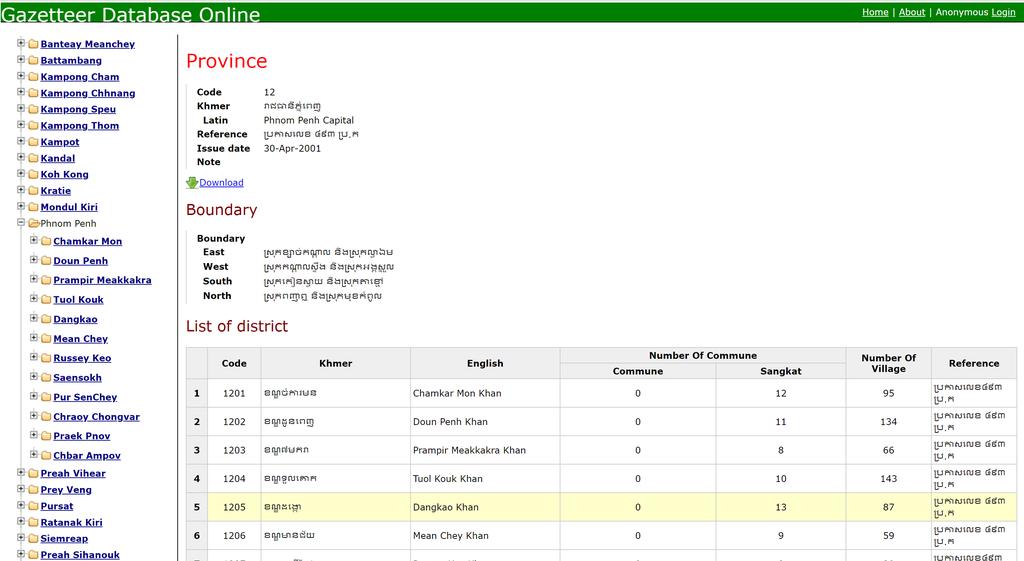
5 5 1. The Standard Geographic Code Geography Department has developed a geographical coding system which has been used within its published Gazetteer. The code system represents of all villages, communes, districts and provinces. Even though it is still not officially yet, but this Geographical Coding System was accepted as the standard for data producing and sharing among the geographical information systems (GIS) users. As of March 31, 2012, the Kingdom of Cambodia has 1 capital, 24 provinces, 198 cities/districts, 1646 communes and 14,096 villages.
6 6
7 7 2. Laws and Regulations Governing the Geographical Naming Government Decision No. 56 issued on 28th August 2000 established National Commission on Geographical names (13 ministries are membered). The main tasks of NCGN are: To review all documentations and histories related to geographical names in Cambodia; To conduct research and study on geographical names in meaning and writing in Khmer and translate to Romanized based on Khmer Grammar; To review and approve those Romanized names in a unique system with the international standard; and To distribute the approved geographical names and update as needed. Sub-decree No. 17 issued on 1 st February 2016, administer and guides the topographic mapping activities, including the tasks for the unity of geographical naming as well as its Romanization.

8 On 17 November 2000, the NCGN approved the standardization/romanization of the 24 names of city/provinces in Cambodia using the old writing system. 8
9 9 3. The Romanization system There are two major Romanization systems have been used in Cambodia. 1. The system prepared by US Board on Geographic Names and British Permanent Committee on Geographical Names (called BGN/PCGN system) in 1962, based on Service Geographique Khmer system of 1959 using transliteration method. This system was used in the topographic map at scale of 1:50,000 publish by US DMA in decade of 1960 and Those maps now are out of date, but still using in Cambodia, at the present. This system has been recommended to be accepted as the Standard international system for the writing of Khmer geographic names in the Roman alphabet by the second UN conference on the standardization of Geographical Names, in its resolution of This system used in the first edition published Gazetteer by Geography Department in This system based on BGN/PCGN 1962 system with few modifications.
10 10 Khmer Consonants There are 33 consonants in Cambodian.
11 11 Subscript consonant characters
12 12
13 13 The Khmer Vowels and Diphthong
14 14

15 15 Bing Map
16 16 3. The Romanization system (Cont n) 2. The system used in the second edition published Gazetteer by Geography Department in This system is based on the system used by the Foreign Broadcast Information Service of the U.S. Government. The system refers to the transcription method rather than transliteration one. Widely use in Cambodia by all users including Census database, Google map and other GIS databases. For detail differences of both systems, please see UNGEGN Technical reference manual for the standardization of geographical names, page 29-34
17 17
18 UN system Vs Provisional system by Geography Department. 18

19 19 Google Map
20 20 4. Topographic Database Since 1995 with the support of international partners, Geography Department has developed the national topographic database at a scale of 1:100,000 (for whole country), 1:5,000; 1:10,000 and 1:25,000 (on specific area) with detailed mapping features showing hydrography, contours and spot elevations, vegetation, road network, building and administrative boundaries. The attribute information include feature properties such as geographical names (geographical-political units, streets, mountains, rivers, lakes, etc.), names of schools, hospitals and other prominent buildings, road width, type and surface, and other information. The mapping features are derived from aerial photographs and high resolution satellite imageries. The attribute information is field-validated in coordination with local authorities.
21 21 Summary The progress in administering of the geographical names by the National Commission on Geographical Names is slow, while some other government agencies have their own programs on geographical names. The Geographic Code system(gcs), that has been developed since 1994, but is still not been standardized, yet. However, GCS is updated constantly to account for changes in the geographical-political subdivisions. The Department of Geography, as the national mapping agency of the country over the past few years has collected, organized and made geospatial information more accessible to all types and levels of users. Currently, GD is working on a nationwide inventory of geographical features, build-up of a national topographic database and working toward updating the transcription Romanization system in UN.

22 22 Thank you for your attention!
Turkey National Report
 UNITED NATIONS Working Paper GROUP OF EXPERTS ON No. 26 GEOGRAPHICAL NAMES Twenty-third Session Vienna, 28 March 4 April 2006 Item 5 of the Provisional Agenda: Reports of the division Turkey National Report
D.N.D. Hettiarachchi (Hetti) Survey Department, Sri Lanka.
 Survey Department, Sri Lanka.") ADMINISTRATION OF GEOGRAPHICAL NAMES IN SRI LANKA D.N.D. Hettiarachchi (Hetti) Survey Department, Sri Lanka. hettiarachchidnd@gmail.com Country: Sri Lanka What is the official language(s)? Sinhala and
ADMINISTRATION OF GEOGRAPHICAL NAMES IN SRI LANKA D.N.D. Hettiarachchi (Hetti) Survey Department, Sri Lanka. hettiarachchidnd@gmail.com Country: Sri Lanka What is the official language(s)? Sinhala and
Economic and Social Council
 United Nations Economic and Social Council Distr.: General 23 May 2012 Original: English E/CONF.101/100 Tenth United Nations Conference on the Standardization of Geographical Names New York, 31 July 9
E/CONF.105/115/CRP.115***
 E/CONF.105/115/CRP.115*** 30 June 2017 Original: English 11 th United Nations Conference on the Standardization of Geographical Names New York, 8-17 August 2017 Item 9a) of the provisional agenda* National
ADMINISTRATION OF GEOGRAPHICAL NAMES IN URUGUAY
 ADMINISTRATION OF GEOGRAPHICAL NAMES IN URUGUAY 1st. Lt. Julio C. Teixeira Executive Officer Geodesy & Topography Division Military Geographic Service Av. 8 de Octubre 3255. Montevideo, URUGUAY Telph.:
Funding systems used in Mexico to support institutional arrangements: INEGI case
 Funding systems used in Mexico to support institutional arrangements: INEGI case Sistemas de financiamiento usados en México, para soportar arreglos institucionales: Caso INEGI United Nations Committee
UNITED NATIONS E/CONF.96/CRP. 5
 UNITED NATIONS E/CONF.96/CRP. 5 ECONOMIC AND SOCIAL COUNCIL Eighth United Nations Regional Cartographic Conference for the Americas New York, 27 June -1 July 2005 Item 5 of the provisional agenda* COUNTRY
Utilization and Provision of Geographical Name Information on the Basic Map of Japan*
 UNITED NATIONS WORKING PAPER GROUP OF EXPERTS NO. 1/9 ON GEOGRAPHICAL NAMES Twenty-eight session 28 April 2 May 2014 Item 9 of the Provisional Agenda Activities relating to the Working Group on Toponymic
The Efforts of Building GIS Infrastructure in a Newly Independent State: The case of Timor Leste *
 UNITED NATIONS E/CONF.100/IP.12 ECONOMIC AND SOCIAL COUNCIL Eighteenth United Nations Regional Cartographic Conference for Asia and the Pacific Bangkok, 26-29 October 2009 Item 7(b) of the provisional
* E/C ONF * "Prepared by the Directorate of Geodesy and Cartography, Ministry of Regional Development and Public Works.
 3 September 2002 Original: Engiish Eighth United Nations Conference on the Standardization of Geographical Names Berlín, 27 August-5 September 2002 Item 4 of the provisional agenda" REPORTS BY GOVERNMENTS
E/CONF.105/75/CRP.75. Report of the Republic of Belarus
 E/CONF.105/75/CRP.75 23 June 2017 Original: Russian 11 th United Nations Conference on the Standardization of Geographical Names New York, 8-17 August 2017 Item 5 of the provisional agenda* Reports by
Group of Experts on Geographical Names Sixteenth Session New York, June 1994
 Group of Experts on Geographical Names Sixteenth Session New York, 13-24 June 1994 Provisional Agenda Item 6 NAMES IN ANTARCTICA, UNITED STATES OF AMERICA Submitted by Roger L. Payne, Executive Secretary
Report of the United Kingdom Division
 UNITED NATIONS GROUP OF EXPERTS WORKING PAPER ON GEOGRAPHICAL NAMES NO. 41/4 Twenty-ninth session Bangkok, Thailand, 25 29 April 2016 Item 4 of the Provisional Agenda Report of the Divisions Report of
2013 Cartographic Country Report Uruguay **
 ADVANCE UNEDITED VERSION UNITED NATIONS _ STATISTICS DIVISION E/CONF.103/IP.5 Tenth United Nations Regional Cartographic Conference for the Americas New York, 19-23, August 2013 Item 6(b) of the provisional
Economic and Social Council
 United Nations Economic and Social Council Distr.: General 15 May 2012 Original: English E/CONF.101/4 Tenth United Nations Conference on the Standardization of Geographical Names New York, 31 July 9 August
Key Elements of the Geographical Information System of Mexico *
 UNITED NATIONS E/CONF.99/IP.1 ECONOMIC AND SOCIAL COUNCIL Ninth United Nations Regional Cartographic Conference for the Americas New York, 10-14 August 2009 Item 7(a) of the provisional agenda Strategy,
March 2007 The Survey Department of Sri Lanka
 Contribution of Survey Department of Sri Lanka for Mitigation of Disasters in Sri Lanka K.A.U.N.Kasthuri Deputy Surveyor General (Information Technology) March 2007 The Survey Department of Sri Lanka 1
MALDIVES. Regional Expert Workshop On Land Accounting For SDG Monitoring & Reporting (25-27 th Sept 2017) - Fathimath Shanna, Aishath Aniya -
 - Fathimath Shanna, Aishath Aniya -") MALDIVES Regional Expert Workshop On Land Accounting For SDG Monitoring & Reporting (25-27 th Sept 2017) - Fathimath Shanna, Aishath Aniya - ABOUT MALDIVES Approximately 860 km long and 120 km wide Consists
MALDIVES Regional Expert Workshop On Land Accounting For SDG Monitoring & Reporting (25-27 th Sept 2017) - Fathimath Shanna, Aishath Aniya - ABOUT MALDIVES Approximately 860 km long and 120 km wide Consists
Statewide Topographic Mapping Program
 Statewide Topographic Mapping Program February 28, 2018 www.dotd.la.gov Outline Purpose of the Statewide Topographic Mapping Program History Breakdown of R.S. 48:36 - Topographic Mapping Statewide Topographic
Digitization in a Census
 Topics Connectivity of Geographic Data Sketch Maps Data Organization and Geodatabases Managing a Digitization Project Quality and Control Topology Metadata 1 Topics (continued) Interactive Selection Snapping
Identification of Islands and Standardization of Their Names
 Identification of Islands and Standardization of Their Names Submitted by INDONESIA UNITED NATIONS GROUP OF EXPERTS ON GEOGRAPHICAL NAMES Eleventh United Nations Conference on the Standardization of Geographical
ECONOMIC AND SOCIAL COUNCIL 13 July 2007
 UNITED NATIONS E/CONF.98/CRP.34 ECONOMIC AND SOCIAL COUNCIL 13 July 2007 Ninth United Nations Conference on the Standardization of Geographical Names New York, 21-30 August 2007 Item 17(b) of the provisional
Economic and Social Council
 United Nations Economic and Social Council Distr.: General 6 June 2012 Original: English E/CONF.101/138 Tenth United Nations Conference on the Standardization of Geographical Names New York, 31 July 9
CENSUS MAPPING WITH GIS IN NAMIBIA. BY Mrs. Ottilie Mwazi Central Bureau of Statistics Tel: October 2007
 CENSUS MAPPING WITH GIS IN NAMIBIA BY Mrs. Ottilie Mwazi Central Bureau of Statistics E-mail: omwazi@npc.gov.na Tel: + 264 61 283 4060 October 2007 Content of Presentation HISTORICAL BACKGROUND OF CENSUS
Country Report on SDI Activities in Singapore *
 UNITED NATIONS E/CONF.100/CRP.9 ECONOMIC AND SOCIAL COUNCIL Eighteenth United Nations Regional Cartographic Conference for Asia and the Pacific Bangkok, 26-29 October 2009 Item 7(a) of the provisional
National Cartographic Center
 National Cartographic Center NCC activities and accomplishments Activities of national organizations, institutions and universities in field of geomatics Large scale maps Medium scale maps Small scale
Funding models for institutional arrangements in the context of a national SDI: the case of Chile
 Funding models for institutional arrangements in the context of a national SDI: the case of Chile Alvaro Monett Hernández Executive Secretary SNIT Chile Vice-President UN-GGIM Américas Fifth Meeting of
Pierce Cedar Creek Institute GIS Development Final Report. Grand Valley State University
 Pierce Cedar Creek Institute GIS Development Final Report Grand Valley State University Major Goals of Project The two primary goals of the project were to provide Matt VanPortfliet, GVSU student, the
Spanish national plan for land observation: new collaborative production system in Europe
 ADVANCE UNEDITED VERSION UNITED NATIONS E/CONF.103/5/Add.1 Economic and Social Affairs 9 July 2013 Tenth United Nations Regional Cartographic Conference for the Americas New York, 19-23, August 2013 Item
Toponymic guidelines of Poland for map editors and other users. Fourth revised edition. Submitted by Poland*
 UNITED NATIONS Working Paper GROUP OF EXPERTS ON No. 27 GEOGRAPHICAL NAMES Twenty-sixth session Vienna, 2-6 May 2011 Item 19 of the provisional agenda Toponymic guidelines for map editors and other editors
GIS ADMINISTRATOR / WEB DEVELOPER EVANSVILLE-VANDERBURGH COUNTY AREA PLAN COMMISSION
 GIS ADMINISTRATOR / WEB DEVELOPER EVANSVILLE-VANDERBURGH COUNTY AREA PLAN COMMISSION SALARY RANGE INITIATION $43,277 SIX MONTHS $45,367 POSITION GRADE PAT VI The Evansville-Vanderburgh County Area Plan
State of Israel Ministry of Housing and Construction Survey of Israel. The Hydrological project case
 State of Israel Ministry of Housing and Construction Survey of Israel The Hydrological project case Survey of Israel Content Introduction To the Survey of Israel The operation assumptions The main responsibilities
Preparing the GEOGRAPHY for the 2011 Population Census of South Africa
 Preparing the GEOGRAPHY for the 2011 Population Census of South Africa Sharthi Laldaparsad Statistics South Africa; E-mail: sharthil@statssa.gov.za Abstract: Statistics South Africa (Stats SA) s Geography
Report on the UNGEGN liaison with the Scientific Committee on Antarctic Research *
 UNITED NATIONS Working Paper GROUP OF EXPERTS ON No. 63 GEOGRAPHICAL NAMES Twenty-fifth session Nairobi, 5 12 May 2009 Item 6 of the provisional agenda Reports of the liaison officers and international
GENERAL COMMAND OF MAPPING TURKEY
 GENERAL COMMAND OF MAPPING (HARİTA GENEL KOMUTANLIĞI) TURKEY NATIONAL REPORT (2007-2011) 15 th General Assembly International Cartographic Conference Paris FRANCE, 03-08 July 2011 NATIONAL REPORT (2007-2011)
CARTOGRAPHIC INFORMATION MANAGEMENT IN COLOMBIA REACH A LEVEL OF PERFECTION
 CARTOGRAPHIC INFORMATION MANAGEMENT IN COLOMBIA REACH A LEVEL OF PERFECTION Jaime Alberto Duarte Castro 1 Carrera 30 No. 48 51 Bogotá - Colombia, jduarte@igac.gov.co Claudia Inés Sepúlveda Fajardo 2 Carrera
Combining Geospatial and Statistical Data for Analysis & Dissemination
 Combining Geospatial and Statistical Data for Analysis & Dissemination (with Special Reference to Qatar Census 2010) Presentation by Mansoor Al Malki, Director of IT Department Qatar Statistics Authority
Geographical Names: Detailing Map and Enhancing GIS
 Geographical Names: Detailing Map and Enhancing GIS Zainal A MAJEED, MALAYSIA Keywords: geographical names, GIS, geographic name standardization, toponymy SUMMARY The necessity of having geographical names
STUDY ON URGENT ESTABLISHMENT OF TOPOGRAPHIC MAPPING IN EAST TIMOR CREATION OF TOPOGRAPHIC INFORMATION FOR ESTABLISHMENT OF CADASTRE IN EAST TIMOR
 STUDY ON URGENT ESTABLISHMENT OF TOPOGRAPHIC MAPPING IN EAST TIMOR CREATION OF TOPOGRAPHIC INFORMATION FOR ESTABLISHMENT OF CADASTRE IN EAST TIMOR Toru WATANABE, Japan The first digital topographic mapping
Use of Geospatial Data: Philippine Statistics Authority 1
 Use of Geospatial Data: Philippine Statistics Authority 1 1 Presentation by Lisa Grace S. Bersales at the UNSC 2016 side event on Geospatial information and earth observations: supporting official statistics
Towards National Geographic Information System in Nepal
 2 nd High Level Forum on Global Geospatial Information Management, Qatar National Convention Centre, Doha, Qatar, 4 6 February, 2013 Towards National Geographic Information System in Nepal Krishna Raj
Use of administrative registers for strengthening the geostatistical framework of the Census of Agriculture in Mexico
 Use of administrative registers for strengthening the geostatistical framework of the Census of Agriculture in Mexico Susana Pérez INEGI, Dirección de Censos y Encuestas Agropecuarias. Avenida José María
The efforts building GIS infrastructure in a newly independent state The case of Timor Leste
 The efforts building GIS infrastructure in a newly independent state The case of Timor Leste Paulino da Cruz Ministry of Justice National Directorate of Land and Property and Cadastral Services (DNTPSC)
THE COLLECTION AND STANDARDIZATION OF GEOGRAPHICAL NAMES
 Distr.: LIMITED ECA/NRD/CART.9/ETH.4 October 1996 Original: ENGLISH Ninth United Nations Regional Cartographic Conference for Africa Addis Ababa, Ethiopia 11-15 November 1996 THE COLLECTION AND STANDARDIZATION
Second Administrative Level Boundaries (SALB) initiative & geographic names in cartography. Geospatial Information Section
 initiative & geographic names in cartography. Geospatial Information Section") Second Administrative Level Boundaries (SALB) initiative & geographic names in cartography Geospatial Information Section Introduction Goals Global agenda How does SALB work? Latest News on geographic
Second Administrative Level Boundaries (SALB) initiative & geographic names in cartography Geospatial Information Section Introduction Goals Global agenda How does SALB work? Latest News on geographic
Qatar Statistical Geospatial Integration
 Qatar Statistical Geospatial Integration A Presentation by the Ministry of Development Planning & Statistics (MDPS), State of Qatar http://www.mdps.gov.qa (Fourth UN-GGIM Arab States Committee Meeting,
Status and Challenges on Geo-DRM Information Systems in Tonga
 Name: Mafua- i-vai utukakau Maka Status and Challenges on Geo-DRM Information Systems in Tonga 1 Roles and Relationships Land and Geographic Information Systems (LGIS) Unit: Establish updated high-resolution
Geographical Names Activities in Africa The Gaborone Action Plan
 United Nations Group of Experts on Geographical Names Geographical Names Activities in Africa The Gaborone Action Plan 6 th Meeting of the Committee of Director -Generals of National Statistics Offices
Qatar s Nation-Wide GIS Cooperation on Local and Regional Levels
 Qatar s Nation-Wide GIS Cooperation on Local and Regional Levels Dr. Mohammad Abd El-Wahab Hamouda GIS Consultant & Chairman of GIS Coordinators Group The Center for GIS State of Qatar Second High Level
Challenges and Potentials of Place Based Information Management in Nepal"
 Nineteenth United Nations Regional Cartographic Conference for Asia and the Pacific, Bangkok, Thailand, 29 October 1 November 2012 Challenges and Potentials of Place Based Information Management in Nepal"
Integrating Official Statistics and Geospatial Information NBS Experience
 Integrating Official Statistics and Geospatial Information NBS Experience Presented by Eng. Reda AL Sabbagh Director of IT Dept. Prepared by Eng. Adham Makky GIS Specialist Topics to be covered: Background
TOPONYMIC DATA FILES AND GAZETTEERS COUNTRY NAMES TOPONYMIC GUIDELINES FOR MAP AND OTHER EDITORS EXONYMS STANDARDIZATION IN MULTILINGUAL AREAS
 United Nations Group of Experts on Geographical Names Seventeenth Session New York, 13-24 June 1994 Items 9, 12, 14, 15, 16 of the Provisional Agenda Working No. 28 Paper 9 12 14 15 16 TOPONYMIC DATA FILES
Report of Eastern Europe, Northern and Central Asia Division
 UNITED NATIONS GROUP OF EXPERTS WORKING PAPER ON GEOGRAPHICAL NAMES NO. 24/4 Twenty-ninth session Bangkok, Thailand, 25 29 April 2016 English Item 4 of the Provisional Agenda Report of the Divisions Report
Resolutions from the Tenth United Nations Conference on the Standardization of Geographical Names, 2012, New York*
 UNITED NATIONS GROUP OF EXPERTS ON GEOGRAPHICAL NAMES Twenty-eighth session New York, 28 April 2 May 2014 GEGN/28/9 English Resolutions from the Tenth United Nations Conference on the Standardization of
 Boone County GIS has the right to inquire about and investigate the use of any requested products and deny access to anyone based on concerns relating to privacy, security, public health, public safety,
Helen Kerfoot. Former Chair, UNGEGN / Emeritus Scientist, Natural Resources Canada
 Geographic names authorities, standardization and international cooperation Helen Kerfoot Former Chair, UNGEGN / Emeritus Scientist, Natural Resources Canada BGN at 100 years In recognition of international
United Nations Group Of Experts On Geographical Names
 Rudolph MATINDAS, Indonesia or William WATT, Australia Key words: place names, UNGEGN SUMMARY UNGEGN Discussing the strategic aims of UNGEGN and its divisional structure, future direction, and the benefits
Turkey s National SDI Implementation
 Onur PAŞAOĞULLARI Head of Department Turkey s National SDI Implementation Presentation Plan NSDI Background General Directorate of Geographic Information Systems NSDI Project INSPIRE Directive Urban Information
GEOGRAPHIC INFORMATION SYSTEMS Session 8
 GEOGRAPHIC INFORMATION SYSTEMS Session 8 Introduction Geography underpins all activities associated with a census Census geography is essential to plan and manage fieldwork as well as to report results
Utilizing GIS Technology for Rockland County. Rockland County Planning Department Douglas Schuetz & Scott Lounsbury
 Utilizing GIS Technology for Rockland County Rockland County Planning Department Douglas Schuetz & Scott Lounsbury Presentation Agenda Introduction What is GIS What can GIS do GIS Efforts for BOE Resources
Brazil Paper for the. Second Preparatory Meeting of the Proposed United Nations Committee of Experts on Global Geographic Information Management
 Brazil Paper for the Second Preparatory Meeting of the Proposed United Nations Committee of Experts on Global Geographic Information Management on Data Integration Introduction The quick development of
1. Which agency in your state is PRIMARILY responsible for archiving geospatial data and managing archived geo records? (choose one) nmlkj.
 nmlkj.") Survey Intro Kentucky, North Carolina, and Utah are partnering with the Library of Congress as part of the National Digital Information Infrastructure and Preservation Program (NDIIPP) to examine the current
Survey Intro Kentucky, North Carolina, and Utah are partnering with the Library of Congress as part of the National Digital Information Infrastructure and Preservation Program (NDIIPP) to examine the current
IAEG SDGs WG GI, , Mexico City
 IAEG SDGs WG GI, 12-14.12.2016, Mexico City UN-GGIM:Europe s perspective and activities to support better integration of geospatial information and statistics and the UN SDG monitoring Pier-Giorgio Zaccheddu,
Illustrator: Vector base Each line/point store some sort of information Mapping Representation of the world
 Illustrator: Vector base Each line/point store some sort of information Mapping Representation of the world Photoshop Raster base Images can be overlaid Pixel vector data model: [data models] A representation
GIS Visualization: A Library s Pursuit Towards Creative and Innovative Research
 GIS Visualization: A Library s Pursuit Towards Creative and Innovative Research Justin B. Sorensen J. Willard Marriott Library University of Utah justin.sorensen@utah.edu Abstract As emerging technologies
LIST OF DOCUMENTS* GROUP OF EXPERTS ON GEOGRAPHICAL NAMES. Twenty-seventh session 15 June 2016 New York, 28 April 2 May 2014
 UNITED NATIONS GROUP OF EXPERTS ON GEOGRAPHICAL NAMES GEGN/29/5/Rev.4 Twenty-seventh session 15 June 2016 New York, 28 April 2 May 2014 LIST OF DOCUMENTS* * Prepared by the UNGEGN Secretariat Symbol Title/Country
A Method for Mapping Settlement Area Boundaries in the Greater Golden Horseshoe
 A Method for Mapping Settlement Area Boundaries in the Greater Golden Horseshoe Purpose This paper describes a method for mapping and measuring the lands designated for growth and urban expansion in the
GIS Solutions in Natural Resource Management: Balancing the Technical- Political Equation
 GIS Solutions in Natural Resource Management: Balancing the Technical- Political Equation Stan Morain, Editor SUB Gdttlngen 7 208 520 309 98 A14447 0NW0RD PRESS V? % \
Designing GIS Databases to Support Mapping and Map Production Charlie Frye, ESRI Redlands Aileen Buckley, ESRI Redlands
 Designing GIS Databases to Support Mapping and Map Production Charlie Frye, ESRI Redlands Aileen Buckley, ESRI Redlands 1 Designing GIS Databases to Support Mapping and Map Production Charlie Frye, ESRI
E/CONF.105/69/CRP.69. China s Campaign to Clean up and Standardize Non-standard Geographical Names
 E/CONF.105/69/CRP.69 23 June 2017 Original: Chinese 11 th United Nations Conference on the Standardization of Geographical Names New York, 8-17 August 2017 Item 9 of the provisional agenda* National standardization
McHenry County Property Search Sources of Information
 Disclaimer: The information in this system may contain inaccuracies or typographical errors. The information in this system is a digital representation of information derived from original documents; as
GIS Monroe Geographic Information System March 14, 2018
 GIS Monroe Geographic Information System March 14, 2018 Goals Maintain Enterprise/County-wide geo-database Increase spatial accuracy of data Build and acquire more data layers Increase use of GIS; as another
Article: National Geographic Department
 Article: National Geographic Department A glimpse of the organization and its activities in brief June 2016 By: Mr. Khachonesack DOUANGPHOUTHA 1. Introduction Lao People s Democratic Republic or Laos is
Evolution and development of National Spatial Data Infrastructure in Republic of Moldova
 Agency for Land Relations and Cadastre of the Republic of Moldova Evolution and development of National Spatial Data Infrastructure in Republic of Moldova Alexandru Morcov Deputy general director ALRC
UNCERTAINTY IN THE POPULATION GEOGRAPHIC INFORMATION SYSTEM
 UNCERTAINTY IN THE POPULATION GEOGRAPHIC INFORMATION SYSTEM 1. 2. LIU De-qin 1, LIU Yu 1,2, MA Wei-jun 1 Chinese Academy of Surveying and Mapping, Beijing 100039, China Shandong University of Science and
LAND INFORMATION SYSTEM A TOOL TO KEEP THE REGISTRY OF PLANNING PERMISSION. CASE STUDY OF THE SZCZUTOWO COMMUNE
 INFRASTRUKTURA I EKOLOGIA TERENÓW WIEJSKICH INFRASTRUCTURE AND ECOLOGY OF RURAL AREAS Nr 2/IV/2013, POLSKA AKADEMIA NAUK, Oddział w Krakowie, s. 15 27 Komisja Technicznej Infrastruktury Wsi LAND INFORMATION
Spatial Statistical Information Services in KOSTAT
 Distr. GENERAL WP.30 12 April 2010 ENGLISH ONLY UNITED NATIONS ECONOMIC COMMISSION FOR EUROPE (UNECE) CONFERENCE OF EUROPEAN STATISTICIANS EUROPEAN COMMISSION STATISTICAL OFFICE OF THE EUROPEAN UNION (EUROSTAT)
Data Quality and Uncertainty. Accuracy, Precision, Data quality and Errors
 Data Quality and Uncertainty The power of GIS analysis is based on the assembly of layers of data, but as data layers increase, errors multiply (and quality decreases). Garbage in, garbage out. High quality
Presented to Sub-regional workshop on integration of administrative data, big data and geospatial information for the compilation of SDG indicators
 Presented to Sub-regional workshop on integration of administrative data, big data and geospatial information for the compilation of SDG indicators 23-25 April,2018 Addis Ababa, Ethiopia By: Deogratius
Preparation of Database for Urban Development
 Preparation of Database for Urban Development By PunyaP OLI, 1. Chairman, ERMC (P) Ltd., Kathmandu, Nepal. Email: punyaoli@ermcnepal.com 2. Coordinator, Himalayan College of Geomatic Engineering and Land
Regional Centre for Mapping of Resources for Development (RCMRD), Nairobi, Kenya
, Nairobi, Kenya") Regional Centre for Mapping of Resources for Development (RCMRD), Nairobi, Kenya Introduction to GIS (2 weeks: 10 days) Intakes: 8 th January, 6 th February, 5th March, 3 rd. April 9 th, May 7 th, June
Regional Centre for Mapping of Resources for Development (RCMRD), Nairobi, Kenya Introduction to GIS (2 weeks: 10 days) Intakes: 8 th January, 6 th February, 5th March, 3 rd. April 9 th, May 7 th, June
GEOGRAPHICAL NAMES AS PART OF THE GLOBAL, REGIONAL AND NATIONAL SPATIAL DATA INFRASTRUCTURES
 GEOGRAPHICAL NAMES AS PART OF THE GLOBAL, REGIONAL AND NATIONAL SPATIAL DATA INFRASTRUCTURES Željko HEĆIMOVIĆ, Željka JAKIR, Zvonko ŠTEFAN, Danijela KUKIĆ zeljko.hecimovic@cgi.hr, zeljka.jakir@cgi.hr,
E/CONF.105/158/CRP.158
 E/CONF.105/158/CRP.158 14 July 2017 Original: English Eleventh United Nations Conference on the Standardization of Geographical Names New York, 8-17 August 2017 Item 8 of the provisional agenda* Measures
State GIS Officer/GIS Data
 State GIS Officer/GIS Data This Act creates the position of state Geographic Information Systems (GIS) officer. The Act: requires the state GIS officer to adopt or veto the GIS data standards and a statewide
DATA DEVELOPMENT IN BRUNEI DARUSSALAM. Submitted by Survey Department, Brunei Darussalam **
 UNITED NATIONS E/CONF.97/6/IP. 45 ECONOMIC AND SOCIAL COUNCIL Seventeenth United Nations Regional Cartographic Conference for Asia and the Pacific Bangkok, 18-22 September 2006 Item 7 of the provisional
Integration of Geo spatial and Statistical Information: The Nepelese Experience
 Integration of Geo spatial and Statistical Information: The Nepelese Experience Krishna Raj B.C. Joint Secretary Ministry of Land Reform and Management, Nepal 11 June, 2014 Presentation Outline The Country
The list of Polish geographical names of the world. Maciej Zych
 The list of Polish geographical names of the world Maciej Zych 21st Session of the East Central and South-East Europe Division of the United Nations Group of Experts on Geographical Names Ljubljana, 26th
Bengt Kjellson Chair of the Executive Committee UN-GGIM: Europe. 2 nd Joint UN-GGIM: Europe ESS Meeting 11 th March 2016, Luxembourg
 Bengt Kjellson Chair of the Executive Committee UN-GGIM: Europe 2 nd Joint UN-GGIM: Europe ESS Meeting 11 th March 2016, Luxembourg A global geospatial mandate At its 47th plenary in July 2011, ECOSOC,
Country Report On Sdi Activities In Singapore ( )
") UNITED NATIONS E/CONF.102/IP.4 ECONOMIC AND SOCIAL COUNCIL Nineteenth United Nations Regional Cartographic Conference for Asia and the Pacific Bangkok, 29 October 1 November 2012 Item 6(b) of the provisional
UNITED NATIONS E/CONF.102/IP.4 ECONOMIC AND SOCIAL COUNCIL Nineteenth United Nations Regional Cartographic Conference for Asia and the Pacific Bangkok, 29 October 1 November 2012 Item 6(b) of the provisional
Fundamental Geospatial Datasets in Africa. Andre Nonguierma New York, 03 August 2015
 Fundamental Geospatial Datasets in Africa United Nations Economic Commission for Africa Geoinformation & Spatial Statistics Andre Nonguierma New York, 03 August 2015 Core Data : Lack of consistency Infrastructure
Creating a Definitive Place Name Layer (Gazetteer) for Scotland. Bruce M. Gittings Panos Terzis The University of Edinburgh
 for Scotland. Bruce M. Gittings Panos Terzis The University of Edinburgh") Creating a Definitive Place Name Layer (Gazetteer) for Scotland Bruce M. Gittings Panos Terzis The University of Edinburgh Some Definitions Short-form gazetteers: often used in conjunction with computer
Creating a Definitive Place Name Layer (Gazetteer) for Scotland Bruce M. Gittings Panos Terzis The University of Edinburgh Some Definitions Short-form gazetteers: often used in conjunction with computer
McHenry County Property Search Sources of Information
 Disclaimer: The information in this system may contain inaccuracies or typographical errors. The information in this system is a digital representation of information derived from original documents; as
NCAVES - Global initiative and national pilots
 NCAVES - Global initiative and national pilots Kavita Sharma UN Environment Pretoria, March 2018 Outline 1. Global initiative > Introduction > Objectives and deliverables >Activities in 2017 and 2018 2.
HertfordshireCC GIS Standards (draft) Contents
 Contents") Standards for Geographic Information Systems Contents Requirements for the procurement of systems with mapping/gis functionality...2 Background...2 System Requirements...2 HCC Corporate Standard for Spatial
Standards for Geographic Information Systems Contents Requirements for the procurement of systems with mapping/gis functionality...2 Background...2 System Requirements...2 HCC Corporate Standard for Spatial
GIS FOR MAZOWSZE REGION - GENERAL OUTLINE
 GIS FOR MAZOWSZE REGION - GENERAL OUTLINE S. Bialousz 1), K Mączewski 2), E. Janczar 2), K. Osinska-Skotak 1) 1) Warsaw University of Technology, Warsaw, Poland 2) Office of the Surveyor of the Mazowieckie
Compact guides GISCO. Geographic information system of the Commission
 Compact guides GISCO Geographic information system of the Commission What is GISCO? GISCO, the Geographic Information System of the COmmission, is a permanent service of Eurostat that fulfils the requirements
Improvement of the National Hydrography Dataset for US Forest Service Region 3 in Cooperation with the National Forest Service
 Improvement of the National Hydrography Dataset for US Forest Service Region 3 in Cooperation with the National Forest Service Christian L. DeCasas California State University, Northridge November 7 th,
ABSTRACT The first chapter Chapter two Chapter three Chapter four
 ABSTRACT The researches regarding this doctoral dissertation have been focused on the use of modern techniques and technologies of topography for the inventory and record keeping of land reclamation. The
Submitted by ECSEE Division Chairman*
 UNITED NATIONS Working Paper GROUP OF EXPERTS ON No. 3 GEOGRAPHICAL NAMES Twenty-sixth session Vienna, 6-11 May 2011 Item 4 of the provisional agenda Reports of the divisions Report of the East Central
Merging statistics and geospatial information
 Merging statistics and geospatial information Demography / Commuting / Spatial planning / Registers Mirosław Migacz Chief GIS Specialist Janusz Dygaszewicz Director Central Statistical Office of Poland