Geographical Names: Relevance and place within the UN-GGIM framework
|
|
|
- Clement Merritt
- 6 years ago
- Views:
Transcription
1 Geographical Names: Relevance and place within the UN-GGIM framework Greg Scott Inter-Regional Advisor Global Geospatial Information Management United Nations Statistics Division


2 UN-GGIM: A global initiative Formal inter-governmental UN Committee of Experts to: Discuss, enhance and coordinate Global Geospatial Information Management activities by involving Member States at the highest level. Reports to ECOSOC Make joint decisions and set directions on the use of geospatial information within national and global policy frameworks Work with Governments to improve policy, institutional arrangements, and legal frameworks Address global issues and contribute collective knowledge as a community with shared interests and concerns Develop effective strategies to build geospatial capacity in developing countries


3 UN-GGIM: Why a global mechanism? Significant gap in the recognition and management of geospatial information globally Lack of a global consultative and decision-making mechanism among Member States in: setting global norms on geospatial information; developing common tools; and bringing geospatial information to bear on global policy issues This gap is increasingly being filled by the private sector, reducing the role and influence of Governments Governments, not the private sector, have the mandate and accountability to maintain and deliver the national geospatial information base and related policy
, and: Requested the Committee to present to ECOSOC in 2016 a comprehensive review of all aspects of its work and operations, in order to allow Member States to assess")
4 UN-GGIM: A global geospatial mandate At its 47 th plenary in July 2011, ECOSOC, recognizing the importance of global geospatial information, established the Committee of Experts on Global Geospatial Information Management (UN-GGIM), and: Requested the Committee to present to ECOSOC in 2016 a comprehensive review of all aspects of its work and operations, in order to allow Member States to assess its effectiveness. Encouraged Member States to hold regular high-level, multi-stakeholder discussions on global geospatial information, including through the convening of global forums, with a view to promoting a comprehensive dialogue with all relevant actors and bodies.


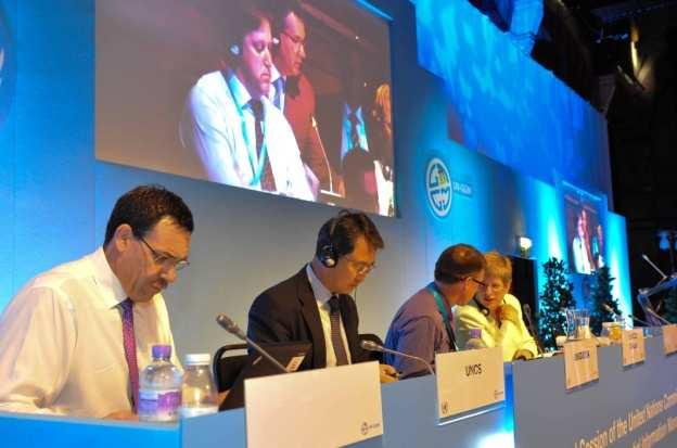


5 Third Session of the Committee of Experts July 2013


6 Cambridge Conference/UN-GGIM Ministerial Session


7 Geospatial Information: its importance to governments In Namibia a country in which water is a scarce resource spatial data is only below water in significance Minister Alpheus G.!Naruseb, Minister of Lands and Resettlement, Namibia We envisage a dynamic Pacific if we can be assisted in implementing the UN-GGIM Resolutions for geospatial information. We need to put in place a solid framework from local to national then regional level Tevita Boseiwaqa, Permanent Secretary for Lands and Mineral Resources, Fiji

8 Second Session of the Committee of Experts August 2012 building effective geospatial infrastructures and promoting greater use of geospatial information are part of a new frontier in harnessing science and technology for advancing sustainable development Wu Hongbo Under-Secretary-General for Economic and Social Affairs August 2012
9 UNGEGN and UN-GGIM Geographical names and Geospatial information

10 What s in a name? Geographical Names Accurate, knowledgeable, consistent, sustained, reliable, standardized, transparent, enduring, agreed, official


11 What s in a place? Building any National Spatial Data Infrastructure requires authoritative national framework data themes. Geographical Names bring context and understanding to the data. They provide place to location Geospatial Information Geographical Names Address Property Administrative Hydrology Transport Geodetic Bathymetry Land Use Elevation Imagery


12 What s the problem? Geographical names or geospatial information the challenges, implications and considerations are the same place and location Lack of understanding by users geonames, geography, maps, education interface changing Traditional use of maps and data points, lines, polygons, names no longer conforms Implications and Considerations We are used to order and structure.but the world is becoming less ordered and less structured!! Need to move in terms of thinking, institutional arrangements, data usage, dissemination, etc. Data is not being fully utilized. New forms of integration and dissemination required Conversely, data is being integrated and used in ways we never imagined
13 UN-GGIM Activities Significant relevance to UNGEGN
14 UN-GGIM: Areas of activity 1. Establishment of regional UN-GGIM entities 2. Future trends in geospatial information management 3. The global geodetic reference frame 4. Determining global fundamental geospatial data themes 5. Trends in national institutional arrangements in geospatial information management 6. Development of a global map for sustainable development 7. Legal and policy frameworks, including critical issues related to authoritative data 8. Implementation and adoption of standards for the global geospatial information community 9. Linking of geospatial information to statistics and other data 10. Developing a shared statement of principles on the management of geospatial information 11. Activities related to sustainable development and the post-2015 development agenda 12. Development of a knowledge base for geospatial information 13. Coordination of UN activities in geospatial information management
15 Linking geospatial information to statistics A growing continuum of user needs Academic Research Human Services Education Local Govt. Natural Resources Infra. and Transport National Security Socio- Economic Information Geospatial Information Policy Analysts Business Intel. Emergency Services Health Agriculture Economics Land Admin


16 Statistical Community Socio-economic datasets Core NSO datasets Census, Demographics, Agriculture, Building, Labour Force, etc. Tax Income and business tax Creating the bridge Geospatial Data Frameworks Fundamental Elements Themes: Geospatial Community Admin. & statistical boundaries Health Services Medicare, Pharmaceuticals, Medical workforce Electoral Role Land Valuation and Land Use Addressing, Place Names Transport, Water Land and Property Elevation and Depth Social Welfare Services Unemployment, Disability, Family Support Others Imagery Positioning
17

")
 Water")

")


18 Global fundamental geospatial data themes Positioning (Geodetic) Address (Buildings) Cadastre (Tenure) Names (Gazetteer) Water (Hydrology) Administrative Boundaries Transport Bathymetry (Hydrography) Land cover (Vegetation) Elevation Geographical names Cadastre, Topographic, Natural Resources and Climate Data Land, Island and Submarine Relief Coastal, International, State and Municipal Limits Geodetic Reference Frame Imagery (Satellite & Photo)
19 UN-GGIM Committee of Experts UN-GGIM Asia-Pacific UN-GGIM Africa UN-GGIM Arab States UN-GGIM Americas UN-GGIM Europe China Rep. of Korea Japan South Africa UN ECA Member States to be elected Mexico Chile Mexico Member States to be elected WG 1 Geodetic Reference Frame for SD CODIST-Geo To be determined Working Groups & Region Vocals European Commission + Eurostat WG 2 Data Sharing & Integration for Disaster Mmnt. WG 3 Place-Based Information for Economic Growth AFREF African Reference Frame UN ECA: Geoinfo merged with Statistics. 3/2013 CODIST meeting recommended CODIST-Geo become UN-GGIM Africa. Yet to be ratified. UN-GGIM Arab States placed on UN ESCWA Commission Agenda for First meeting in Jordan convened February PAIGH Pan Amer. Inst. of Geography and History SIRGAS Geocentric Reference System for Americas GeoSUR Geo. Network for Latin America & Caribbean Euro Geographics European Environment Agency WG1: France WG2: Sweden WG3: Italy
20 UNGEGN, UNGIWG, UNRCC, etc. UN-GGIM Asia-Pacific China Rep. of Korea Japan WG 1 Geodetic Reference Frame for SD WG 2 Data Sharing & Integration for Disaster Mmnt. WG 3 Place-Based Information for Economic Growth UN-GGIM Committee of Experts UN-GGIM Africa South Africa UN ECA CODIST-Geo AFREF African Reference Frame UN ECA: Geoinfo merged with Statistics. 3/2013 CODIST meeting recommended CODIST-Geo become UN-GGIM Africa. Yet to be ratified. UN-GGIM Arab States Member States to be elected To be determined UN-GGIM Arab States placed on UN ESCWA Commission Agenda for First meeting in Jordan convened February UN-GGIM Americas Mexico Chile Mexico Working Groups & Region Vocals PAIGH Pan Amer. Inst. of Geography and History SIRGAS Geocentric Reference System for Americas GeoSUR Geo. Network for Latin America & Caribbean UN-GGIM Europe Member States to be elected European Commission + Eurostat Euro Geographics European Environment Agency WG1: France WG2: Sweden WG3: Italy
21 Future trends in geospatial information management: the 5-10 year vision
22 Future Trends Five broad themes identified Trends in technology and the future direction of data creation, maintenance and management; Legal and policy developments; Skills requirements and training mechanisms; The role of the private sector and nongovernmental sectors; and The future role of governments in data provision and management.

23 The future role of governments in geospatial data provision and management End-users should be able to consume government-assured geospatial data with the level of trust in quality as they do when they get water from the tap they are going to get what they expect.
24 International geospatial standards Countries and Governments do not understand and/or appreciate the value of standards. Educate decision-makers of the value of standards at the policy level. Look at the high level economic value of geospatial infrastructure, standards and interoperability, and the economic benefit. OGC/ISO/IHO Standards Guide. The core essential standards. White Paper titled National Mapping Perspective: International Geospatial Standards
25


26 Legal and policy frameworks

27 National institutional arrangements
28 Suggested Fundamental Principles INNOVATING GOVERNING COMPLYING Geospatial advocacy Collaboration and coordination Continuous development and recognition of work Agile and adaptive Use of and adherence to geospatial standards Ownership and accountability Transparency Respect and confidentiality Standards of service Sovereignty of Member States Adherence to Law


29 How can you measure and monitor sustainable development without location and geography

30 Monitoring Sustainable Development: Why Location Matters?


31 The Future We Want: 19 th June 2012


32 Responsible Governance and Sustainable Development
33

34 Chengdu Forum on Global Geospatial Information Management October 2013, Chengdu, China Development and Applications in Urban Hazard Mapping


35 there will be a consensus on the vital role of geospatial information in all phases of hazard and disaster risk management and reduction. This will extend the ability for nations to not only map their geography and topography, but also those areas that are vulnerable to natural hazards, particularly in urban environments. It will also provide better understanding to decision-makers and emergency responders Wu Hongbo Under-Secretary-General for Economic and Social Affairs Chengdu Forum
36 Chengdu Forum Main Conclusions 1. GI needs to contribute to the post-2015 sustainable development agenda: disaster risk reduction; sustainable development; and the global trend towards urbanization. 2. Provide leadership in raising the awareness and importance of GI in disaster preparedness, mitigation, response and recovery, sustainable development and safeguarding life. 3. Recognize the important role of standards and interoperability when using GI in disaster phases. Need for standardization and terminologies across countries. 4. DRR requires a data driven and a geospatial approach risk, hazard, exposure, vulnerability, communities, infrastructure at risk, etc. It is also a statistical approach populations, addresses, postcode, census, village, etc. Need definitive population and economic data to understand exposure and vulnerability. 5. New requirements for combining authoritative information, including access and coordination, with response information from the crowd and citizens, particularly as it applies in rapid response situations. 6. Institutional and policy barriers to data sharing fall away in response to disasters. At other times there are data silos and security concerns. These concerns need to be balanced with the need to make more data available.

37 7 th Session of the Open Working Group on Sustainable Development Goals The SDGs will depend on human and physical geography. In order to measure and monitor change and progress you must have access to fundamental and consistent geospatial information geography. Not all targets will be equal and will require different means of measure. Indicators will need to be linked to the targets and be well defined, measurable over time, cost effective and clearly and easily communicated. There will be a need to create a network of consistent global data reliable geospatial information to measure and monitor trends, change and progress over time in a standardized manner.
38 7 th Session of the Open Working Group on Sustainable Development Goals Concluding Remarks: Climate change and disaster risk reduction The inter-connected nature of risks posed by climate change and natural disasters was recognized. Strong actions on climate change mitigation and adaptation are among the most effective means of reducing disaster risks. Without such actions, the frequency and intensity of, and the vulnerability to, disasters will only intensify in coming years and decades. There is a need for a range of solutions, including access to technology and early warning systems for disaster management, and enhanced stakeholder capacities at all levels. The role of good governance and incorporation of lessons learned from indigenous knowledge was also recognized.
39 3 rd High Level Forum on Global Geospatial Information Management October 2014, Beijing, China The contribution of geospatial information to the post-2015 development agenda

40 4 th Session of Committee of Experts 6-8 August 2014, UN Headquarters, New York
UN-GGIM: An Overview Stefan Schweinfest, Director (UNSD) Bangkok, 27 March 2015
 Bangkok, 27 March 2015") UN-GGIM: An Overview Stefan Schweinfest, Director (UNSD) Bangkok, 27 March 2015 ggim.un.org UN-GGIM: A global initiative Formal inter-governmental UN Committee of Experts to: Discuss, enhance and coordinate
UN-GGIM: An Overview Stefan Schweinfest, Director (UNSD) Bangkok, 27 March 2015 ggim.un.org UN-GGIM: A global initiative Formal inter-governmental UN Committee of Experts to: Discuss, enhance and coordinate
Implementing the Sustainable Development Goals: The Role of Geospatial Technology and Innovation
 Fifth High Level Forum on UN Global Geospatial Information Management Implementing the Sustainable Development Goals: The Role of Geospatial Technology and Innovation 28-30 November 2017 Sheraton Maria
Foundation Geospatial Information to serve National and Global Priorities
 Foundation Geospatial Information to serve National and Global Priorities Greg Scott Inter-Regional Advisor Global Geospatial Information Management United Nations Statistics Division UN-GGIM: A global
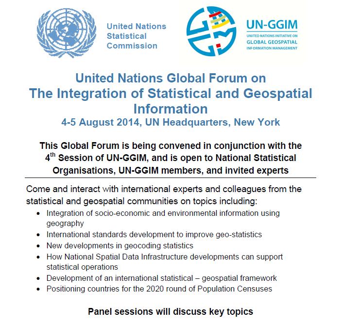
2018/1 The integration of statistical and geospatial information. The Regional Committee of UN-GGIM: Americas:
 The following are the conclusions and recommendations of the Regional Committee of the United Nations on Global Geospatial Information Management for the Americas, during its Fifth Session, Thursday 8
UN GGIM and National SDI Strategy
 MSDI Open Forum on 26 th January 2016 Contributing to the successful delivery of MSDI UN GGIM and National SDI Strategy Hiroshi Murakami Deputy Administrator Geospatial Information Authority of Japan Geospatial
1) United Nations Committee of Experts on Global Geospatial Information Management (UN-GGIM)
 United Nations Committee of Experts on Global Geospatial Information Management (UN-GGIM)") International Workshop on Legal and Policy Frameworks for Geospatial Information Management Licensing of Geospatial Information 7 9 November 2017 Tianjin Zhengxie Club Hotel Tianjin, China Outline of presentation
International Workshop on Legal and Policy Frameworks for Geospatial Information Management Licensing of Geospatial Information 7 9 November 2017 Tianjin Zhengxie Club Hotel Tianjin, China Outline of presentation
Bengt Kjellson Chair of the Executive Committee UN-GGIM: Europe. 2 nd Joint UN-GGIM: Europe ESS Meeting 11 th March 2016, Luxembourg
 Bengt Kjellson Chair of the Executive Committee UN-GGIM: Europe 2 nd Joint UN-GGIM: Europe ESS Meeting 11 th March 2016, Luxembourg A global geospatial mandate At its 47th plenary in July 2011, ECOSOC,
Disaster Management & Recovery Framework: The Surveyors Response
 Disaster Management & Recovery Framework: The Surveyors Response Greg Scott Inter-Regional Advisor Global Geospatial Information Management United Nations Statistics Division Department of Economic and
Policy and Legal Frameworks: The journey so far
 International Forum on Policy and Legal Frameworks for Geospatial Information, 18-19 October 2016, Kuala Lumpur, Malaysia Policy and Legal Frameworks: The journey so far Greg Scott Global Geospatial Information
Inventory of United Nations Resolutions on Cartography Coordination, Geographic Information and SDI 1
 Inventory of United Nations Resolutions on Cartography Coordination, Geographic Information and SDI I. Resolutions on Cartography Coordination and Establishment of United Nations Regional Cartographic
Economic and Social Council
 United Nations Economic and Social Council Distr.: General 18 July 2016 Original: English Committee of Experts on Global Geospatial Information Management Sixth session New York, 3-5 August 2016 Item 2
The Global Statistical Geospatial Framework and the Global Fundamental Geospatial Themes
 The Global Statistical Geospatial Framework and the Global Fundamental Geospatial Themes Sub-regional workshop on integration of administrative data, big data and geospatial information for the compilation
UN-GGIM: Strengthening Geospatial Capability
 Fifth Plenary Meeting of UN-GGIM: Europe Brussels, 6-7 June 2018 UN-GGIM: Strengthening Geospatial Capability Walking the talk to leave no one behind Greg Scott, UN-GGIM Secretariat Environmental Statistics
Economic and Social Council
 United Nations Economic and Social Council Distr.: General 2 July 2012 E/C.20/2012/10/Add.1 Original: English Committee of Experts on Global Geospatial Information Management Second session New York, 13-15
From PCGIAP to UN GGIM AP: A Regional Perspective on GGIM
 Regional Committee of United Nations Global Geospatial Information Management for Asia and the Pacific (UN-GGIM-AP) Established by a United Nations Resolution From PCGIAP to UN GGIM AP: A Regional Perspective
Report of the Regional Committee of UN-GGIM for Asia and the Pacific (UN-GGIM-AP)
") Report of the Regional Committee of UN-GGIM for Asia and the Pacific (UN-GGIM-AP) At the Eighth Session of UN-GGIM UN Headquarters, New York, 1 3 August 2018 About UN-GGIM-AP One of the five regional committees
Report of the Regional Committee of UN-GGIM for Asia and the Pacific (UN-GGIM-AP) At the Eighth Session of UN-GGIM UN Headquarters, New York, 1 3 August 2018 About UN-GGIM-AP One of the five regional committees
Economic and Social Council
 United Nation E/C.20/2012/4/Add.1 Economic and Social Council Distr.: General 2 July 2012 Original: English Committee of Experts on Global Geospatial Information Management Second session New York, 13-15
International Workshop on Legal and Policy Frameworks for Geospatial Information Management: Licensing of Geospatial Information
 United Nations Committee of Experts on Global Geospatial Information Management International Workshop on Legal and Policy Frameworks for Geospatial Information Management: Licensing of Geospatial Information
Geospatial Information Management in the Americas: Lessons for the Post-2015 development agenda
 Geospatial Information Management in the Americas: Lessons for the Post-2015 development agenda Rolando Ocampo President, UN-GGIM: Americas October 2014 The integration of statistical and geographical
PAN AMERICAN INSTITUTE OF GEOGRAPHY AND HISTORY Specialized Organization of the OAS
 PAN AMERICAN INSTITUTE OF GEOGRAPHY AND HISTORY Specialized Organization of the OAS 10 th UNRCC Americas United Nations, New York, 20 August 2013 PAIGH, SIRGAS, PC-IDEA and GeoSUR 2013-2015 Joint Action
Background Document: Report of the Regional Committee of United Nations Global Geospatial Information Management for Asia and the Pacific
 Background Document: Report of the Regional Committee of United Nations Global Geospatial Information Management for Asia and the Pacific 1. Summary 1. This report highlights the activities carried out
Geographical Names Activities in Africa The Gaborone Action Plan
 United Nations Group of Experts on Geographical Names Geographical Names Activities in Africa The Gaborone Action Plan 6 th Meeting of the Committee of Director -Generals of National Statistics Offices
Report on the establishment of UN GGIM: Europe Item 14. 4th session of the Committee of Experts on UN-GGIM
 Report on the establishment of UN GGIM: Europe Item 14 1 Why regional European committees of UN GGIM? In the ECOSOC resolution 2011/24 on the UN GGIM: Emphasizes the importance of promoting national, regional
Progress on the Development of the Strategic Framework on Geospatial Information and Services for Disasters
 Progress on the Development of the Strategic Framework on Geospatial Information and Services for Disasters Dr. Peter N. Tiangco Administrator, NAMRIA, Philippines Co-chair, Working Group on Geospatial
Economic and Social Council 2 July 2015
 ADVANCE UNEDITED VERSION UNITED NATIONS E/C.20/2015/11/Add.1 Economic and Social Council 2 July 2015 Committee of Experts on Global Geospatial Information Management Fifth session New York, 5-7 August
Second Administrative Level Boundaries (SALB) initiative & geographic names in cartography. Geospatial Information Section
 initiative & geographic names in cartography. Geospatial Information Section") Second Administrative Level Boundaries (SALB) initiative & geographic names in cartography Geospatial Information Section Introduction Goals Global agenda How does SALB work? Latest News on geographic
Second Administrative Level Boundaries (SALB) initiative & geographic names in cartography Geospatial Information Section Introduction Goals Global agenda How does SALB work? Latest News on geographic
KUNMING FORUM ON UNITED NATIONS GLOBAL GEOSPATIAL INFORMATION MANAGEMENT CITIES OF THE FUTURE: SMART, RESILIENT
 KUNMING FORUM ON UNITED NATIONS GLOBAL GEOSPATIAL INFORMATION MANAGEMENT CITIES OF THE FUTURE: SMART, RESILIENT and SUSTAINABLE Yunnan Zhenzhuang Guest House, Kunming, China 10 12 May 2017 BACKGROUND CONCEPT
The UN discusses Global Geospatial Information Management
 The UN discusses Global Geospatial Information Management Just like statistics, every country must have authoritative, trusted, maintained, definitive mapping data Professor Paul Cheung, Director, United
The UN-GGIM: Europe core data initiative to encourage Geographic information supporting Sustainable Development Goals Dominique Laurent, France
 INSPIRE conference Strasbourg 6 September 2017 The UN-GGIM: Europe core data initiative to encourage Geographic information supporting Sustainable Development Goals Dominique Laurent, France Introduction
Use of registers in statistical geospatial integration
 Use of registers in statistical geospatial integration Trevor Sutton Deputy Australian Statistician Statistical Business Transformation Australian Bureau of Statistics March 2016 Role of registers in the
Integration for Informed Decision Making
 Geospatial and Statistics Policy Intervention: Integration for Informed Decision Making Greg Scott Global Geospatial Information Management United Nations Statistics Division Department of Economic and
CONFERENCE STATEMENT
 Final draft CONFERENCE STATEMENT We, the elected representatives of Canada, Denmark/Greenland, the European Parliament, Finland, Iceland, Norway, Russia, Sweden and the United States of America; In collaboration
Fundamental Geospatial Datasets in Africa. Andre Nonguierma New York, 03 August 2015
 Fundamental Geospatial Datasets in Africa United Nations Economic Commission for Africa Geoinformation & Spatial Statistics Andre Nonguierma New York, 03 August 2015 Core Data : Lack of consistency Infrastructure
Cooperation is the key, FIG can facilitate
 Cooperation is the key, FIG can facilitate Mikael Lilje Vice President 2017-2020 Head, Geodetic infrastructure, Swedish mapping, cadastral and land registration authority Presented at the GIS/RS Conference
UN-GGIM:Americas Regional Report
 UN-GGIM:Americas Regional Report 2016-2017 Seventh Session of UN-GGIM 2-4 August 2017, United Nations Headquarters, New York. Rolando Ocampo President of UN-GGIM: Americas Content Activities, Areas of
UN-GGIM:Africa Caucus Meeting
 UN-GGIM:Africa Caucus Meeting United Nations Economic Commission for Africa UN-GGIM: Africa Andre Nonguierma UN-GGIM.7 New York, 01 August 2017 UN-GGIM:Africa Driving Africa to become more spatially enabled
Strategic Framework on Geospatial Information and Services for Disasters
 Strategic Framework on Geospatial Information and Services for Disasters Case Studies for the Caribbean and the Philippines --- Kunming Forum on United Nations Global Geospatial Information Management
E/CONF.105/158/CRP.158
 E/CONF.105/158/CRP.158 14 July 2017 Original: English Eleventh United Nations Conference on the Standardization of Geographical Names New York, 8-17 August 2017 Item 8 of the provisional agenda* Measures
THE ROLE OF GEOSPATIAL AT THE WORLD BANK
 THE ROLE OF GEOSPATIAL AT THE WORLD BANK INSPIRE Conference Barcelona, Spain September 26, 2016 Kathrine Kelm Senior Land Administration Specialist Global Land and Geospatial Unit The World Bank Group
The Global Fundamental Geospatial Data Themes Journey. April Clare Hadley WG Chair
 The Global Fundamental Geospatial Data Themes Journey April 2018 Clare Hadley WG Chair The Road to here Why Global? Why Geospatial? Why Fundamental? Why Themes? The route we took Where does the road go
Report of the Working Group 2 Data Sharing and Integration for Disaster Management *
 UNITED NATIONS E/CONF.104/6 ECONOMIC AND SOCIAL COUNCIL Twentieth United Nations Regional Cartographic Conference for Asia and the Pacific Jeju, 6-9 October 2015 Item 5 of the provisional agenda Report
Principle 3: Common geographies for dissemination of statistics Poland & Canada. Janusz Dygaszewicz Statistics Poland
 Principle 3: Common geographies for dissemination of statistics Poland & Canada Janusz Dygaszewicz Statistics Poland Reference materials Primary: Ortophotomap, Cadastral Data, Administrative division borders,
Fundamental Geospatial Data Themes
 Fundamental Geospatial Data Themes April 2016 Workshop Agenda Background why and how What is our objective? Fundamental data what are they? What are the candidate themes? Breakout Session Conclusion Background
Geospatial Information and Services for Disasters (GIS4D)
") Geospatial Information and Services for Disasters (GIS4D) 31 July 2017 Tae Hyung KIM ICT and Disaster Risk Reduction Division (IDD) UNESCAP 1 About ESCAP Who is ESCAP? United Nations Economic and Social
Geospatial Information and Services for Disasters (GIS4D) 31 July 2017 Tae Hyung KIM ICT and Disaster Risk Reduction Division (IDD) UNESCAP 1 About ESCAP Who is ESCAP? United Nations Economic and Social
Spatially Enabled Society
 International Seminar on Land Administration Trends and Issues in Asia and the Pacific Region Spatially Enabled Society Abbas Rajabifard Vice Chair PCGIAP-WG3 Vice-President (President Elect), GSDI Association
Economic and Social Council
 United Nations E/CN.3/2019/31 Economic and Social Council Distr.: General 19 December 2018 Original: English Statistical Commission Fiftieth session 5-8 March 2019 Item 4(i) of the provisional agenda*
Building Institutional Capacity for Multi-Hazard Early Warning in Asia and the Pacific Subtitle
 Building Institutional Capacity for Multi-Hazard Early Warning in Asia and the Pacific Subtitle Title Keran Wang Chief, Space Applications Section ICT and Disaster Risk Reduction Division 22 May 2018 Pillar
Brazil Paper for the. Second Preparatory Meeting of the Proposed United Nations Committee of Experts on Global Geographic Information Management
 Brazil Paper for the Second Preparatory Meeting of the Proposed United Nations Committee of Experts on Global Geographic Information Management on Data Integration Introduction The quick development of
A/AC.105/C.1/2012/CRP.10
 A/AC.105/C.1/2012/CRP.10 1 February 2012 English only Committee on the Peaceful Uses of Outer Space Scientific and Technical Subcommittee Forty-ninth session Vienna, 6-17 February 2012 Item 6 of the provisional
Swedish Spatial Data Infrastructure and the National Geodata Strategy
 Submitted to the United Nations Committee of Experts on Global Geospatial Information Management Seventh Session New York, August 2018 Registration number 519-2018/4327 Country Report, Sweden Swedish Spatial
Challenges and Successes in Sharing Geospatial Data in Africa
 Challenges and Successes in Sharing Geospatial Data in Africa 2018 GeoNode Summit Torino, Italy March 26-28, 2018 Bernard Justus Muhwezi Manager, Geo-Information Services Uganda Bureau of Statistics, Kampala,
Disaster Management in Republic of Korea
 The Third UN-GGIM-AP Plenary Meeting Disaster Management in Republic of Korea ~Coordination among NGIA & Other Related Organizations and Recommendations~ Bali Indonesia 10 November 2014 Sanghoon Lee, Ph.D.
Integrating geography and statistics, but what about earth observation?
 Integrating geography and statistics, but what about earth observation? 8 0 0 y 2 2 3 0 9 x 6 3 9 1 9 n 1 8 3 7 3 9 7 2 2 4 8 8 7 8 4 7 5 Ola Nordbeck Senior Advisor Ola.nordbeck@spacecentre.no Bridging
Spatial Enablement in Australian Government
 Spatial Enablement in Australian Government Chris Pigram and Greg Scott Geoscience Australia Government is facing a number of key issues and challenges today and into the future Australian Government context
Report of PCGIAP to the 18 th United Nations Regional Cartographic Conference for Asia and the Pacific (UNRCC-AP) for the period
 for the period") Permanent Committee on GIS Infrastructure for Asia and the Pacific (PCGIAP) Established in 1995 by a United Nations Resolution Report of PCGIAP to the 18 th United Nations Regional Cartographic Conference
Permanent Committee on GIS Infrastructure for Asia and the Pacific (PCGIAP) Established in 1995 by a United Nations Resolution Report of PCGIAP to the 18 th United Nations Regional Cartographic Conference
United Nations Group Of Experts On Geographical Names
 Rudolph MATINDAS, Indonesia or William WATT, Australia Key words: place names, UNGEGN SUMMARY UNGEGN Discussing the strategic aims of UNGEGN and its divisional structure, future direction, and the benefits
Development Of Common Frameworks And Methodologies *
 HIGH LEVEL FORUM ON GLOBAL GEOSPATIAL MANAGEMENT INFORMATION WORKING PAPER No. 9 First Forum Seoul, Republic of Korea, 24-26 October 2011 Development Of Common Frameworks And Methodologies * * Submitted
COEX CONVENTION AND EXHIBITION CENTRE SEOUL REPUBLIC OF KOREA
 REPUBLIC OF NAMIBIA SPEECH BY ALPHEUS G.!NARUSEB, (MP) MINISTER OF LANDS AND RESETTLEMENT IN THE REPUBLIC OF NAMIBIA AT THE HIGH LEVEL GLOBAL GEOSPATIAL INFORMATION MANAGEMENT FORUM ORGANISED BY THE UNITED
SDG s and the role of Earth Observation
 SDG s and the role of Earth Observation Christian Heipke IPI - Institute for Photogrammetry and GeoInformation Leibniz Universität Hannover Germany Secretary General, ISPRS 1. No Poverty 2. Zero Hunger
Building Institutional Capacity for Multi-Hazard Early Warning in Pacific Countries Subtitle
 Building Institutional Capacity for Multi-Hazard Early Warning in Pacific Countries Subtitle Title Keran Wang Chief, Space Applications Section ICT and Disaster Risk Reduction Division 30 March 2018 Slide
Realizing benefits of Spatial Data Infrastructure A user s perspective from Environment Agency - Abu Dhabi
 Realizing benefits of Spatial Data Infrastructure A user s perspective from Environment Agency - Abu Dhabi Anil Kumar Director, Environment Information Management 26 April 2012 Geospatial World Forum,
RESAP Progress Report
 RESAP Progress Report December 2016 to October 2017 Presentation to the Twenty-first session of the Intergovernmental Consultative Committee on the Regional Space Applications Programme for Sustainable
Prof Chryssy Potsiou, FIG President
 THE VALUE OF GEOSPATIAL DATA AND ROLE OF SURVEYORS IN SUSTAINABLE DEVELOPMENT Prof Chryssy Potsiou, FIG President National Technical University of Athens School of Rural and Surveying Engineering, Greece
Key Elements of the Geographical Information System of Mexico *
 UNITED NATIONS E/CONF.99/IP.1 ECONOMIC AND SOCIAL COUNCIL Ninth United Nations Regional Cartographic Conference for the Americas New York, 10-14 August 2009 Item 7(a) of the provisional agenda Strategy,
ACTION PLAN FOR WORLD HERITAGE IN LATIN AMERICA AND THE CARIBBEAN ( )
") Annex ACTION PLAN FOR WORLD HERITAGE IN LATIN AMERICA AND THE CARIBBEAN (2014-2024) The current Regional Action Plan for Latin America and the Caribbean for 2014-2024 has been elaborated by the State Parties
Annex ACTION PLAN FOR WORLD HERITAGE IN LATIN AMERICA AND THE CARIBBEAN (2014-2024) The current Regional Action Plan for Latin America and the Caribbean for 2014-2024 has been elaborated by the State Parties
GEOGRAPHIC INFORMATION SYSTEMS Session 8
 GEOGRAPHIC INFORMATION SYSTEMS Session 8 Introduction Geography underpins all activities associated with a census Census geography is essential to plan and manage fieldwork as well as to report results
A Presenta*on to the Interna*onal Workshop on Global Fundamental Geospa*al Data Themes for Africa By Sultan Mohammed Alya Chairman of UN-GGIM: Africa
 A Presenta*on to the Interna*onal Workshop on Global Fundamental Geospa*al Data Themes for Africa By Sultan Mohammed Alya Chairman of UN-GGIM: Africa Execu*ve Bureau and Director General of Ethiopian Geospa*al
GENERAL RECOMMENDATIONS. Session 7. Breakout discussion. discuss on regional and interregional. proposals 1. COLLABORATION BETWEEN PROGRAMMES
 Session 7 24 July 2016, 9.00-11.00 Breakout discussion on regional and interregional joint project proposals Mr Shahbaz Khan summarized the two days of presentations and exchanges and requested the participants
IAEG SDGs WG GI, , Mexico City
 IAEG SDGs WG GI, 12-14.12.2016, Mexico City UN-GGIM:Europe s perspective and activities to support better integration of geospatial information and statistics and the UN SDG monitoring Pier-Giorgio Zaccheddu,
A proposal for building an infrastructure for European geospatial statistics
 A proposal for building an infrastructure for European geospatial statistics Marie Haldorson, Statistics Sweden Ekkehard Petri, Eurostat What is geospatial statistics? The location, extent or spatial relations
The Pan American Institute of Geography and History (PAIGH) North America National Mapping Meeting May 10, 2018
 North America National Mapping Meeting May 10, 2018") The Pan American Institute of Geography and History (PAIGH) North America National Mapping Meeting May 10, 2018 Pan American Institute of Geography and History (PAIGH) PAIGH was founded in 1928 and their
The Pan American Institute of Geography and History (PAIGH) North America National Mapping Meeting May 10, 2018 Pan American Institute of Geography and History (PAIGH) PAIGH was founded in 1928 and their
Integrating Official Statistics and Geospatial Information NBS Experience
 Integrating Official Statistics and Geospatial Information NBS Experience Presented by Eng. Reda AL Sabbagh Director of IT Dept. Prepared by Eng. Adham Makky GIS Specialist Topics to be covered: Background
Proposal for a DIRECTIVE OF THE EUROPEAN PARLIAMENT AND OF THE COUNCIL. establishing an infrastructure for spatial information in the Community
 Proposal for a DIRECTIVE OF THE EUROPEAN PARLIAMENT AND OF THE COUNCIL establishing an infrastructure for spatial information in the Community INSPIRE http://inspire.jrc.it/ Alessandro Annoni 1 EU Commission
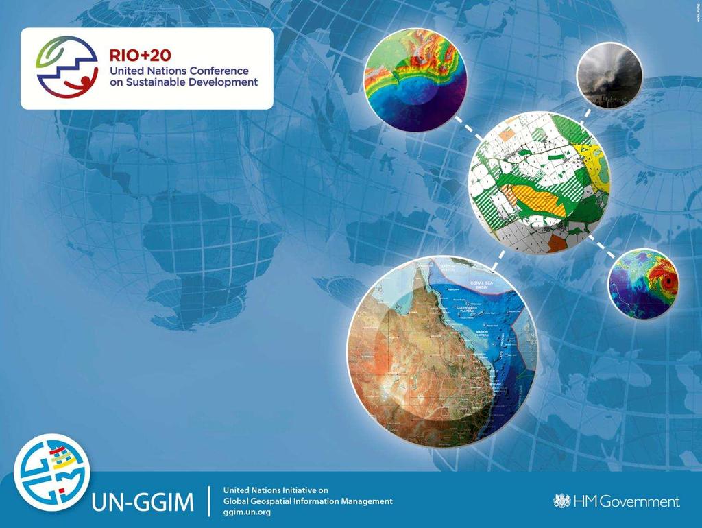
Geospatial Information and Sustainable Development (Rio+20) A Belgian perspective
 A Belgian perspective") Geospatial Information and Sustainable Development (Rio+20) A Belgian perspective In the resolution adopted by the General Assembly, The future we want World leaders acknowledged the need to further mainstream
Geospatial Information and Sustainable Development (Rio+20) A Belgian perspective In the resolution adopted by the General Assembly, The future we want World leaders acknowledged the need to further mainstream
Colin Bray, OSi CEO. Collaboration to develop a data platform for geospatial and statistical information in Ireland
 Colin Bray, OSi CEO Collaboration to develop a data platform for geospatial and statistical information in Ireland Organisations Ireland s National Mapping Agency Established in 1824 Operates under the
Georeferencing and Satellite Image Support: Lessons learned, Challenges and Opportunities
 Georeferencing and Satellite Image Support: Lessons learned, Challenges and Opportunities Shirish Ravan shirish.ravan@unoosa.org UN-SPIDER United Nations Office for Outer Space Affairs (UNOOSA) UN-SPIDER
ESCAP Promotes Geo-referenced Information System for Disaster Risk Management in Asia and the Pacific
 Third High Level Forum on UNGGIM 22-24 October 2014 Beijing, China ESCAP Promotes Geo-referenced Information System for Disaster Risk Management in Asia and the Pacific Keran Wang Space Applications Section,
ECONOMIC AND SOCIAL COUNCIL
 UNITED NATIONS E/CONF.102/3 ECONOMIC AND SOCIAL COUNCIL Nineteenth United Nations Regional Cartographic Conference for Asia and the Pacific Bangkok, 29 October 1 November 2012 Item 4 of the provisional
A proposal for building an infrastructure for European geospatial statistics. Marie Haldorson, Statistics Sweden Ekkehard Petri, Eurostat
 A proposal for building an infrastructure for European geospatial statistics Marie Haldorson, Statistics Sweden Ekkehard Petri, Eurostat What is geospatial statistics? The location, extent or spatial relations
GIS Building Communities beyond National Borders (Building Successful Spatial Data Infrastructures) Nick Land, ESRI Europe
 Nick Land, ESRI Europe") GIS Building Communities beyond National Borders (Building Successful Spatial Data Infrastructures) Nick Land, ESRI Europe UK worst flooding in the last 60 years 350,000 households without drinking water
GIS Building Communities beyond National Borders (Building Successful Spatial Data Infrastructures) Nick Land, ESRI Europe UK worst flooding in the last 60 years 350,000 households without drinking water
Coordination of United Nations Activities related to Geospatial Information Management
 Coordination of United Nations Activities related to Geospatial Information Management UNGIWG UNITED NATIONS GEOGRAPHIC INFORMATION WORKING GROUP THE UNITED NATIONS COMMITTEE OF EXPERTS ON GLOBAL GEOSPATIAL
GIS (GEOGRAPHICAL INFORMATION SYSTEMS) AS A FACILITATION TOOL FOR SUSTAINABLE DEVELOPMENT IN AFRICA
 AS A FACILITATION TOOL FOR SUSTAINABLE DEVELOPMENT IN AFRICA") GIS (GEOGRAPHICAL INFORMATION SYSTEMS) AS A FACILITATION TOOL FOR SUSTAINABLE DEVELOPMENT IN AFRICA a presentation by Elizabeth Hicken GDEST Conference on Geospatial Sciences for Sustainable Development
GIS (GEOGRAPHICAL INFORMATION SYSTEMS) AS A FACILITATION TOOL FOR SUSTAINABLE DEVELOPMENT IN AFRICA a presentation by Elizabeth Hicken GDEST Conference on Geospatial Sciences for Sustainable Development
FIG Asia Pacific Capacity Development Network
 FIG Asia Pacific Capacity Development Network Report to the 41th General Assembly FIG Congress 2018, Istanbul - Turkey Rob Sarib Chair FIG Asia Pacific Capacity Development Network (AP CDN) Story of the
FINDINGS OF THE ARCTIC METEOROLOGY SUMMIT
 FINDINGS OF THE ARCTIC METEOROLOGY SUMMIT 2018 WWW.FMI.FI CHAIR S SUMMARY: 1 2 3 We need to be curious to explore the known unknowns. Meteorology is an elemental part of international collaboration in
8th FIG Regional Conference November 2012 Montevideo, Uruguay
 8th FIG Regional Conference 26 29 November 2012 Montevideo, Uruguay Platinum Sponsors: Member Associations; Affiliate Members; Academic Members; Corporate Members & Correspondents 120 Countries 1 FIG Foundation
NSDI as a tool for Secure land tenure
 NSDI as a tool for Secure land tenure General Overview To look at the progress in SDI development and its application in policy formulation and impact on land tenure. INTEGRATION OF INFORMATION POLICIES
National Spatial Data Infrastructure International workshop 9 th June, 2015 Terelj Hotel, Mongolia
 1 st session: NSDI policy, planning and the legal framework Formation of NSDI policy and legal framework in Mongolia Khurelshagai Ayurzana, Director General, Administration of Land Affairs, Geodesy and
Resolution adopted by the General Assembly. [on the report of the Second Committee (A/67/440/Add.2)]
![Resolution adopted by the General Assembly. [on the report of the Second Committee (A/67/440/Add.2)]](/thumbs/94/121301610.jpg "Resolution adopted by the General Assembly. [on the report of the Second Committee (A/67/440/Add.2)]") United Nations General Assembly Distr.: General 3 April 2013 Sixty-seventh session Agenda item 23 (b) Resolution adopted by the General Assembly [on the report of the Second Committee (A/67/440/Add.2)]
United Nations General Assembly Distr.: General 3 April 2013 Sixty-seventh session Agenda item 23 (b) Resolution adopted by the General Assembly [on the report of the Second Committee (A/67/440/Add.2)]
Standards in support of UN-GGIM and sustainable development
 2 nd High 2Level nd High Forum Level on GGIM, Forum QNCC, on GGIM Doha, Qatar, 6 February 2013 QNCC, Doha, Qatar, 6 February 2013 Standards in support of UN-GGIM and sustainable development Olaf Østensen
Integration of Geo spatial and Statistical Information: The Nepelese Experience
 Integration of Geo spatial and Statistical Information: The Nepelese Experience Krishna Raj B.C. Joint Secretary Ministry of Land Reform and Management, Nepal 11 June, 2014 Presentation Outline The Country
Faatasi Malologa (PGSC Chair) Director Department of Lands & Survey, Tuvalu
 Director Department of Lands & Survey, Tuvalu") Seventh Session of the United Nations Committee of Experts on Global Geospatial Information Management (UN-GGIM) - 31 July -4 August 2017 Faatasi Malologa (PGSC Chair) Director Department of Lands & Survey,
Seventh Session of the United Nations Committee of Experts on Global Geospatial Information Management (UN-GGIM) - 31 July -4 August 2017 Faatasi Malologa (PGSC Chair) Director Department of Lands & Survey,
Spatial Enablement Current Activities and Future Directions Abbas Rajabifard, Jude Wallace and Andrew Binns
 Spatial Enablement Current Activities and Future Directions Abbas Rajabifard, Jude Wallace and Andrew Binns This chapter presents and summarises the outcomes of the two major events which have been recently
UN-GGIM: Europe ExCom 1 June 2016 Francfort Work Group A «Core Data» Status and Progress François Chirié, France
 UN-GGIM: Europe ExCom 1 June 2016 Francfort Work Group A «Core Data» Status and Progress François Chirié, France Plan The Core Data Scope Deliverable 7-8 June 2016 WGA workshop to investigate work plans
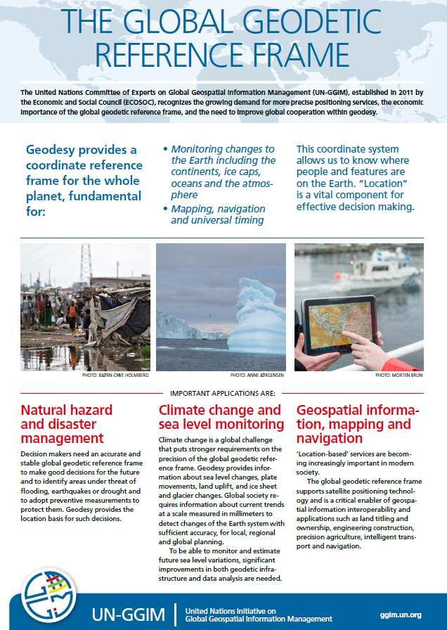
Global Geodetic Reference Frame GGRF & Implications for GNSS
 Global Geodetic Reference Frame GGRF & Implications for GNSS On behalf of Gary Johnston Chair GIAC, Ruth Neilan Vice Chair, Global Geodetic Observing System ICG-9 Prague, 10 November 2014 UN GGRF Working
CONFERENCE STATEMENT
 CONFERENCE STATEMENT We, the elected representatives from Canada, Denmark/Greenland, Finland, Iceland, Norway, Russia, Sweden and the United States of America; In collaboration with the indigenous peoples
Emerging issues to use geospatial initiatives in the societal context of disaster managing **
 ADVANCE UNEDITED VERSION UNITED NATIONS E/CONF.103/3/Add.1 ECONOMIC AND SOCIAL COUNCIL Tenth United Nations Regional Cartographic Conference for the Americas New York, 19-23, August 2013 Item 6 (a) of
The Geospatial Information Management (GIM) INSPIRE Data Specification and COPERNICUS In situ data
 INSPIRE Data Specification and COPERNICUS In situ data") INSPIRE conference Barcelona 29 September 2016 INSPIRing a sustainable environment The Geospatial Information Management (GIM) INSPIRE Data Specification and COPERNICUS In situ data Antonio Arozarena,
INSPIRE conference Barcelona 29 September 2016 INSPIRing a sustainable environment The Geospatial Information Management (GIM) INSPIRE Data Specification and COPERNICUS In situ data Antonio Arozarena,
Urban Climate Resilience
 Urban Climate Resilience in Southeast Asia Partnership Project Introduction Planning for climate change is a daunting challenge for governments in the Mekong Region. Limited capacity at the municipal level,
The Global Statistical Geospatial Framework. Martin Brady Director Geospatial Solutions Australian Bureau of Statistics Australia
 The Global Statistical Geospatial Framework Martin Brady Director Geospatial Solutions Australian Bureau of Statistics Australia Outline 1. Origins of the Global Statistical Geospatial Framework 2. Global
The Integrated Ge spatial Information Framework to the strengthening of NSDI, Mongolia
 Young Geospatial Professionals Summit 21 NOV 2018 The Integrated Ge spatial Information Framework to the strengthening of NSDI, Mongolia BAYARMAA ENKHTUR Geospatial information and technology department