CHAPTER 3 STUDY AREA
|
|
|
- Elwin Henry
- 5 years ago
- Views:
Transcription
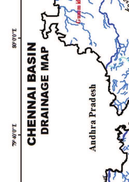
1 35 CHAPTER 3 STUDY AREA 3.1 GENERAL There are 34 river basins in Tamil Nadu, and they are grouped into 17 major river basins. Chennai basin is one among them. The Chennai Basin is located between latitudes 12 40' N and 13 40' N and longitudes 79 10' E and 80 25' E at the North East corner of Tamil Nadu. Andhra Pradesh lies on the North side; Palar River basin lies on West and South and the Bay of Bengal on the East which are the main boundaries of Chennai basin. The total area of the basin is 7282 sq km. Out of that 5542 sq km lies in Tamil Nadu, and the rest is in Andhra Pradesh. Araniyar, Kosathalayar, Cooum and Adyar are the four rivers of the Chennai basin group (Figure 3.1). This basin covers partly or fully 26 blocks of Tiruthani, Thiruvallore, Saidapet, Tambaram, Ponneri, Sriperumbudur, Arakonam, and Walajapet taluks (blocks) of Thiruvallore, Kanjeepuram, Chennai and Vellore districts. The major part of the basin area comes under Thiruvallore and entire Chennai districts, and only a few areas fall in Vellore and Kanjeepuram districts. Adyar River collects surplus water from about 200 tanks (artificial ponds) and lakes, small streams and the rainwater drains in the city. The river is almost stagnant except during the rainy season. Rapid industrialization and urbanization directly contribute to waste generation; most of which is discharged into the Adyar River. The Cooum River serves as storm water drainage system within the Chennai city, and has been polluted by untreated sewage and industrial effluents.


2 36
3 37 Population trend and population dynamics are important indicators of future water requirement. Chennai city is trisected by two rivers namely the Adyar and the Cooum. These rivers have their own catchment area to drain the surface runoff. Adyar watershed is a combination of both rural and urban watersheds; 39 % of this watershed falls under Chennai metropolis, and the remaining 61 % falls in Kancheepuram and Tiruvallur districts. It was chosen as one of the study areas. Another study area Nemam watershed is located in Poonamallee taluk (block) of Thiruvallur district, Tamil Nadu. This contributes the surplus to Chembarambakkam tank. 3.2 STUDY AREA India Meteorological Department (IMD) has installed one S-band Doppler Weather Radar (DWR) at Cyclone Detection Radar centre (CDR), Chennai. The DWR derived products such as Surface Rainfall Intensity (SRI) and Precipitation Accumulation (PAC) are available at reliable precision for 100 km radius from the DWR station, Chennai. The Adyar and Nemam watersheds are within 100 km radius from DWR station, hence they had been chosen as the study areas. Satellite data such as Cartosat-1 with 30 m x 30 m resolution, ASTER (Advanced Spaceborne Thermal Emission and Reflection Radiometer) with 30 m x 30 m resolution and SRTM (Shuttle Radar Topography Mission) with 90 m x 90 m resolution provide the Digital Elevation Model (DEM) for the watersheds, and are available on the respective websites. These DEMs are useful in developing drainage network and slope map for the watersheds and could also be utilized for watershed parameter estimation. Watershed delineation and parameter estimation were done using the Indian Remote Sensing (IRS) satellite Cartosat-1 with 30 m DEM and GIS tools for the study areas. The aerial extent of Adyar and Nemam watersheds are sq km and sq km respectively. Figure 3.2 exhibits the study area map with Doppler weather radar station location. Figure 3.3 and Figure 3.4 present the Thiessen polygons for Nemam and Adyar watersheds. The hydrological elements and their connectivity with
4 38 gridded area for Adyar and Nemam watersheds are shown in Figure 3.5 and Figure 3.6 respectively. Figure 3.2 Map of Adyar and Nemam watersheds
5 Figure 3.3 Nemam watershed with Thiessen polygon 39
6 Figure 3.4 Adyar watershed with Thiessen polygon 40
7 Figure 3.5 Adyar gridded watershed with hydrological elements 41
8 42 Table 3.1 Locations of rain gauge stations proximate to the study areas S. No. Rain gauge station Latitude Longitude 1 Nungambakkam 13 04'05" 80 14'46" 2 Chengalpattu 12 42'03" 79 58'41" 3 Sriperumpudur 12 58'01" 79 56'37" 4 Tambaram 12 56'06" 80 07'37" 5 Chembarambakkam 13 00'30" 80 05'05" 6 Meenambakkam 12 59'24" 80 10'53" 7 Thiruvallur 13 08'23" 79 54'24" 8 Korattur Dam 13 05'19" 80 00'39" 9 Anna University Campus 13 00'30'' 80 14'06'' 10 Tharamani 12 59'30'' 80 14'55'' Figure 3.6 Nemam gridded watershed with hydrological elements
9 CLIMATE AND RAINFALL Adyar and Nemam watersheds are relatively at, and slightly undulating terrains. The study areas fall under the semi-arid tropical region. Average monthly minimum and maximum temperatures are about 19º C and 42º C respectively. The mean relative humidity is about %, while the mean wind velocity is 4.84 km/hour. Average sunshine hours/day is 7.25, and the average annual rainfall is about 1200 mm (IWS Report 2007). The locations of the rain gauge stations are given in Table 3.1. Out of the ten rain gauges; nine rain gauges influence the Adyar watershed, and three rain gauges influence the Nemam watershed. The climate of the region is dominated by two monsoons caused by the land-sea thermal contrast. In Chennai, the weather patterns are dominated by the Northeast monsoon, which normally occurs during October-December months. Most of the heavy rainfall in the Northeast monsoon is associated with a clear synoptic system of depression and cyclones, with night time rainfall being most common. Diurnal variations in temperature are moderated by coastal influences. The study areas receive a significant amount of rainfall from cyclonic storms. Cyclonic storm brings heavy rains to the Bay of Bengal and the South-Eastern coast of India, particularly to Chennai during November and December. Three post monsoon cyclonic storm events, namely, Nisha, Phyan and Jal that occurred in the year 2008, 2009 and 2010 respectively were selected for the study. The daily rain gauge rainfall data was collected from the State Ground and Surface Water Resources Data Centre, Tharamani, Chennai. India Meteorological Department (IMD) empirical reduction formula (Rashid et al 2012) was used to estimate the hourly rainfall data from everyday rainfall data for the rain gauge stations of Adyar and Nemam watersheds.
10 SOIL CHARACTERISTICS Hydrologic part is much controlled by different types of soils. Soils are classified by taking their color, texture, fertility and chemical combinations include salts, minerals and the solution effect over them. These soils are generally poor in soil nutrients, medium to high permeability and low water-holding capacity except in patches of clayey soils. These soils do not pose problems for cropping. The Adyar alluvium is m thick and depth of granular zones varies in different places. However, due to indiscriminate withdrawal and use of groundwater along the seacoast, seawater intrusion has been observed (Ramesh 1994). Taxonomies of soils in the study areas are presented in Table 3.2. As far as the agricultural and groundwater point of view, the soil types of the study areas are described based on the thematic maps collected. The hydrological soil maps of Adyar and Nemam watersheds are depicted in Figure 3.7 and Figure 3.8 respectively Alfisols This is a special type of soil, which has a peculiar color shade varying from one area to another area. These red sandy and red loamy soils, deep to very deep, coarse loamy to fine loamy are found near the seashore Entisols These are alluvial soils comprising sand and sandy materials occurring on the beaches and at the confluence of rivers and by the side of the rivers and channels. These are found along the coastal belt in small strips, Easterly part of Ponneri taluk (block), and South of Pulicat lake to Ennore creek, South of Cooum confluence to Adyar Estuary and Thiruvanmiyur - Covelong stretch and throughout the length of beach of the Eastern coast.
11 Vertisols The Vertisols are clayey in nature with high specific water retention capacity but poor in supporting agriculture. These are found as ground mass in extreme Northern portion around Gummidipoondi, Ponneri, Minjur, Madhavaram, and Manali and in the Western portion of the East Coast Road (ECR) around Thiruporur. Hydrogeologically vertisols is grouped under Aquitard. The Valudhavoor patches of clay and the Manali, Mathur clayey soils are the significant members of this type of soil. Vertisols are exclusively used for dwelling and industrial units only. The rate of infiltration varies from 1 to 3 cm/hr for fine red sandy clay, clayey sand, sandy clay, sand fine to medium, sand medium to coarse and very coarse and gravel and for weathered rock, fractured and jointed rock it varies from 0.2 to 0.5 cm/hr, which normally occur in the study areas. Table 3.2 Taxonomy of the soils Sl No Order Sub order Great group Sub group Haplustalfs Udichaplustalfs 1 Alfisols Ustalfs Ultichaplustalfs Paleustalfs 2 Entisols Orthents Ustorthents Oxyaquicpaleustalfs Lithic ustorthents Typicustorthents 3 Vertisols Usterts Chromusterts Enticchromusterts 4 Inceptisols Ochrepts Ustochrepts Udicustochrepts Verticustochrepts
12 Inceptisols This major soil group consists of the red sandy to brownish clayey soil fragments derived from parent rock and is spread all along the Westward side of the ECR. These are suitable for agriculture and hold moderate groundwater reserves. Systematic water bearing rocks are bordering this type and percolate more water into these soil formations for effective agriculture. The agricultural pattern in this type of soil is intensive. Figure 3.7 Hydrological soil map of Adyar watershed
13 47 Figure 3.8 Hydrological soil map of Nemam watershed 3.5 DRAINAGE Adyar River is one of the four main rivers that drain the Chennai basin. It is a small river of 40 km length from its origin to the confluence point with the Bay of Bengal. It usually carries flood water during rainy days. This river finds its source from the Guduvancheri hills and receives the surplus from Manimagalam tank, Nandivanam tank and Chembarambakkam tank (tanks are artificial ponds). This river empties into Bay of Bengal at Adyar estuary in the Eastern part of the Chennai basin area. Due to urbanization this river is polluted by both domestic drains and industrial effluents.
14 LAND USE PATTERN The IRS P6 False Color Composite (FCC) image was used to prepare the land use map of the study areas by Institute for Water Studies (IWS), Tharamani. The land use map was prepared adopting existing classification system developed by National Remote Sensing Centre (NRSC), Hyderabad. This map consists of categories like built-up land, agricultural land, forest land, wasteland and water bodies. A primary occupation in the Nemam watershed is agriculture; and the main agricultural crop is paddy, cultivated on an area of about sq km. Subsidiary crop is groundnut, banana, coconut. The land use of Nemam and Adyar watersheds are portrayed in Figure 3.9 and Figure 3.10 respectively. Figure 3.9 Land use map of Nemam watershed
15 49 Figure 3.10 Land use map of Adyar watershed 3.7 SUMMARY Rainfall-runoff modeling for gauged and ungauged watersheds is essential for water resource projects. The Adyar watershed experienced major flooding in Adyar River, which runs through the city, during the years 1976, 1985, 2005 and Adyar and Nemam watersheds consist of agricultural and urban sector and hence suitable methodology should be opted for runoff estimation. Hence, this research endeavors to simulate rainfall-runoff processes for these two watersheds. The computed runoff values were compared with the observed runoff for the gauged watershed.
TABLE OF CONTENTS CHAPTER NO. TITLE PAGE NO. LIST OF TABLES LIST OF FIGURES LIST OF SYMBOLS AND ABBREVIATIONS
 ix TABLE OF CONTENTS CHAPTER NO. TITLE PAGE NO. ABSTRACT LIST OF TABLES LIST OF FIGURES LIST OF SYMBOLS AND ABBREVIATIONS iii xiii xiv xx 1 INTRODUCTION 1 1.1 GENERAL 1 1.2 THE PROBLEM STATEMENT 3 1.3
CHAPTER 3 STUDY AREA
 48 CHAPTER 3 STUDY AREA 3.1 GENERAL Chennai, the capital city of Tamil Nadu, is located in the North Eastern corner of Tamilnadu. The Chennai Metropolitan Area (CMA) comprises the city of Chennai, 16 municipalities,
Study of Hydrometeorology in a Hard Rock Terrain, Kadirischist Belt Area, Anantapur District, Andhra Pradesh
 Open Journal of Geology, 2012, 2, 294-300 http://dx.doi.org/10.4236/ojg.2012.24028 Published Online October 2012 (http://www.scirp.org/journal/ojg) Study of Hydrometeorology in a Hard Rock Terrain, Kadirischist
Dr. S.SURIYA. Assistant professor. Department of Civil Engineering. B. S. Abdur Rahman University. Chennai
 Hydrograph simulation for a rural watershed using SCS curve number and Geographic Information System Dr. S.SURIYA Assistant professor Department of Civil Engineering B. S. Abdur Rahman University Chennai
CHAPTER 1 INTRODUCTION
 1 CHAPTER 1 INTRODUCTION 1.1 GENERAL Precipitation is the primary input to a watershed system. Hydrologic analysis cannot be performed with confidence until the precipitation input is adequately measured
CHAPTER 3 STUDY AREA
 25 CHAPTER 3 STUDY AREA 3.1 GENERAL The South-Eastern peninsular Rivers are affected by monsoon rains and physiographic characteristics. Chennai Basin is one such area which comprises of ephemeral to intermittent
CHAPTER 3 DESCRIPTION OF THE STUDY AREA
 42 CHAPTER 3 DESCRIPTION OF THE STUDY AREA 3.1 INTRODUCTION The Gadilam river sub basin is located in the northern part of Tamilnadu. It is one of the sub basin of Ponnaiyar river basins. The sub basin
Effect of land use/land cover changes on runoff in a river basin: a case study
 Water Resources Management VI 139 Effect of land use/land cover changes on runoff in a river basin: a case study J. Letha, B. Thulasidharan Nair & B. Amruth Chand College of Engineering, Trivandrum, Kerala,
URBAN WATERSHED RUNOFF MODELING USING GEOSPATIAL TECHNIQUES
 URBAN WATERSHED RUNOFF MODELING USING GEOSPATIAL TECHNIQUES DST Sponsored Research Project (NRDMS Division) By Prof. M. GOPAL NAIK Professor & Chairman, Board of Studies Email: mgnaikc@gmail.com Department
GIS Based Delineation of Micro-watershed and its Applications: Mahendergarh District, Haryana
 Kamla-Raj 2012 J Hum Ecol, 38(2): 155-164 (2012) GIS Based Delineation of Micro-watershed and its Applications: Mahendergarh District, Haryana Gulshan Mehra and Rajeshwari * Department of Geography, Kurukshetra
Comparison of GIS based SCS-CN and Strange table Method of Rainfall-Runoff Models for Veeranam Tank, Tamil Nadu, India.
 International Journal of Scientific & Engineering Research, Volume 3, Issue 10, October-2012 1 Comparison of GIS based SCS-CN and Strange table Method of Rainfall-Runoff Models for Veeranam Tank, Tamil
Hydrologic Modelling of the Upper Malaprabha Catchment using ArcView SWAT
 Hydrologic Modelling of the Upper Malaprabha Catchment using ArcView SWAT Technical briefs are short summaries of the models used in the project aimed at nontechnical readers. The aim of the PES India
Remote Sensing and GIS Applications for Hilly Watersheds SUBASHISA DUTTA DEPARTMENT OF CIVIL ENGINEERING IIT GUWAHATI
 Remote Sensing and GIS Applications for Hilly Watersheds SUBASHISA DUTTA DEPARTMENT OF CIVIL ENGINEERING IIT GUWAHATI Deciding Alternative Land Use Options in a Watershed Using GIS Source: Anita Prakash
UNIT 11 SOUTH ASIA SG 1 - PHYSICAL GEOGRAPHY & THE ENVIRONMENT
 UNIT 11 SOUTH ASIA SG 1 - PHYSICAL GEOGRAPHY & THE ENVIRONMENT I. PHYSICAL GEOGRAPHY TAKE OUT YOUR PHYSICAL MAP OF SOUTH ASIA A. The Himalayan Mountains form the northern boundary of the region (color
HYDROLOGICAL MODELLING OF COOUM RIVER BASIN USING GIS AND SWAT MODEL
 HYDROLOGICAL MODELLING OF COOUM RIVER BASIN USING GIS AND SWAT MODEL Sravani Duvvuri Assistant Professor in Civil Engineering Rajiv Gandhi University of Knowledge Technologies, IIIT Nuzvid, Quarter No:
3. HYDROMETEROLOGY. 3.1 Introduction. 3.2 Hydro-meteorological Aspect. 3.3 Rain Gauge Stations
 3. HYDROMETEROLOGY 3.1 Introduction Hydrometeorology is a branch of meteorology and hydrology that studies the transfer of water and energy between the land surface and the lower atmosphere. Detailed hydrological
Outline. Remote Sensing, GIS and DEM Applications for Flood Monitoring. Introduction. Satellites and their Sensors used for Flood Mapping
 Outline Remote Sensing, GIS and DEM Applications for Flood Monitoring Prof. D. Nagesh Kumar Chairman, Centre for Earth Sciences Professor, Dept. of Civil Engg. Indian Institute of Science Bangalore 560
Soil Erosion Calculation using Remote Sensing and GIS in Río Grande de Arecibo Watershed, Puerto Rico
 Soil Erosion Calculation using Remote Sensing and GIS in Río Grande de Arecibo Watershed, Puerto Rico Alejandra M. Rojas González Department of Civil Engineering University of Puerto Rico at Mayaguez.
STUDY AREA AND METHODOLOGY
 . CHAPTER 2 STUDY AREA AND METHODOLOGY 26 CHAPTER 2 STUDY AREA AND METHODOLOGY Kundalika is a major river in konkan region of Maharashtra. River originates in Western Ghats at an altitude of 820 m ASL
CHAPTER VII FULLY DISTRIBUTED RAINFALL-RUNOFF MODEL USING GIS
 80 CHAPTER VII FULLY DISTRIBUTED RAINFALL-RUNOFF MODEL USING GIS 7.1GENERAL This chapter is discussed in six parts. Introduction to Runoff estimation using fully Distributed model is discussed in first
MODELING RUNOFF RESPONSE TO CHANGING LAND COVER IN PENGANGA SUBWATERSHED, MAHARASHTRA
 MODELING RUNOFF RESPONSE TO CHANGING LAND COVER IN PENGANGA SUBWATERSHED, MAHARASHTRA Abira Dutta Roy*, S.Sreekesh** *Research Scholar, **Associate Professor Centre for the Study of Regional Development,
THE STUDY OF NUMBERS AND INTENSITY OF TROPICAL CYCLONE MOVING TOWARD THE UPPER PART OF THAILAND
 THE STUDY OF NUMBERS AND INTENSITY OF TROPICAL CYCLONE MOVING TOWARD THE UPPER PART OF THAILAND Aphantree Yuttaphan 1, Sombat Chuenchooklin 2 and Somchai Baimoung 3 ABSTRACT The upper part of Thailand
The AIR Tropical Cyclone Model for India
 The AIR Tropical Cyclone Model for India Tropical cyclones have caused millions, and even billions, of dollars in damage in India. The growing number of properties on the coast, together with growing insurance
variation analysis of Vattamalaikarai sub basin, Tamil Nadu, India.
 A Study on the Rainfall Changes of Orathanadu Taluk Thanjavur District Tamil Nadu Using GIS P. Sujatha 1, Dr. R Baskaran 2 1 Research Scholar, Department of Industries and Earth Sciences, Tamil University,
Effect of rainfall and temperature on rice yield in Puri district of Odisha in India
 2018; 7(4): 899-903 ISSN (E): 2277-7695 ISSN (P): 2349-8242 NAAS Rating: 5.03 TPI 2018; 7(4): 899-903 2018 TPI www.thepharmajournal.com Received: 05-02-2018 Accepted: 08-03-2018 A Baliarsingh A Nanda AKB
EFFECT OF WATERSHED DEVELOPMENT PROGRAMME IN GUDHA GOKALPURA VILLAGE, BUNDI DISTRICT, RAJASTHAN - A REMOTE SENSING STUDY
 EFFECT OF WATERSHED DEVELOPMENT PROGRAMME IN GUDHA GOKALPURA VILLAGE, BUNDI DISTRICT, RAJASTHAN - A REMOTE SENSING STUDY G. Sajeevan, C. P. Johnson, D. J. Pal and B. K. Kakade* C-DAC, Pune University Campus,
Chapter-3 GEOGRAPHICAL LOCATION, CLIMATE AND SOIL CHARACTERISTICS OF THE STUDY SITE
 Chapter-3 GEOGRAPHICAL LOCATION, CLIMATE AND SOIL CHARACTERISTICS OF THE STUDY SITE Chapter-3 GEOGRAPHICAL LOCATION, CLIMATE AND SOIL CHARACTERISTICS OF THE STUDY SITE Assam, the eastern most state of
International Journal Of Scientific & Engineering Research, Volume 7, Issue 7, July ISSN
 International Journal Of Scientific & Engineering Research, Volume 7, Issue 7, July-2016 709 FLOOD MITIGATION STUDY IN ADAYAR RIVER USING MIKE-FLOOD Vidyapriya.V a and Ramalingam. M b a Research scholar,
Report for Area Drainage Studies for 1320 MW (2x660 MW) THERMAL POWER PROJECT AT MIRZAPUR, U.P.
 THERMAL POWER PROJECT AT MIRZAPUR, U.P.") Report for Area Drainage Studies for 1320 MW (2x660 MW) THERMAL POWER PROJECT AT MIRZAPUR, U.P. 1. Introduction M/s Welspun Energy Uttar Pradesh Ltd. (WEUPL) is putting up 1320 MW (2 x 660 MW) coal fired
Report for Area Drainage Studies for 1320 MW (2x660 MW) THERMAL POWER PROJECT AT MIRZAPUR, U.P. 1. Introduction M/s Welspun Energy Uttar Pradesh Ltd. (WEUPL) is putting up 1320 MW (2 x 660 MW) coal fired
Which map shows the stream drainage pattern that most likely formed on the surface of this volcano? A) B)
 B)") 1. When snow cover on the land melts, the water will most likely become surface runoff if the land surface is A) frozen B) porous C) grass covered D) unconsolidated gravel Base your answers to questions
1. When snow cover on the land melts, the water will most likely become surface runoff if the land surface is A) frozen B) porous C) grass covered D) unconsolidated gravel Base your answers to questions
Australian Journal of Basic and Applied Sciences. Application of Remote Sensing and GIS for the Assessment of Groundwater Quality
 AENSI Journals Australian Journal of Basic and Applied Sciences Journal home page: www.ajbasweb.com Application of Remote Sensing and GIS for the Assessment of Groundwater Quality 1 Colins Johnny J and
VILLAGE INFORMATION SYSTEM (V.I.S) FOR WATERSHED MANAGEMENT IN THE NORTH AHMADNAGAR DISTRICT, MAHARASHTRA
 FOR WATERSHED MANAGEMENT IN THE NORTH AHMADNAGAR DISTRICT, MAHARASHTRA") VILLAGE INFORMATION SYSTEM (V.I.S) FOR WATERSHED MANAGEMENT IN THE NORTH AHMADNAGAR DISTRICT, MAHARASHTRA Abstract: The drought prone zone in the Western Maharashtra is not in position to achieve the agricultural
VILLAGE INFORMATION SYSTEM (V.I.S) FOR WATERSHED MANAGEMENT IN THE NORTH AHMADNAGAR DISTRICT, MAHARASHTRA Abstract: The drought prone zone in the Western Maharashtra is not in position to achieve the agricultural
INTERNATIONAL JOURNAL OF PURE AND APPLIED RESEARCH IN ENGINEERING AND TECHNOLOGY
 INTERNATIONAL JOURNAL OF PURE AND APPLIED RESEARCH IN ENGINEERING AND TECHNOLOGY A PATH FOR HORIZING YOUR INNOVATIVE WORK SPECIAL ISSUE FOR NATIONAL LEVEL CONFERENCE "SUSTAINABLE TECHNOLOGIES IN CIVIL
Chapter- Three GEOMORPHOLOGY AND RAINFALL PATTERN
 Chapter- Three GEOMORPHOLOGY AND RAINFALL PATTERN 3.1 INTRODUCTION Geomorphology and its slope as a basic and applied science in general and as tool for searching groundwater resources in efficient geomorphological
A Study on Storm Water Drainage System of Annanagara and Ashokanagara of Shimoga City Karnataka India
 A Study on Storm Water Drainage System of Annanagara and Ashokanagara of Shimoga City Karnataka India Veena D Savanth Lecturer, Department of Civil Engineering Jain Institute of Technology, Davanagere,
Abstract. Introduction. International Journal of Remote Sensing & Geoscience (IJRSG)
") ANALYSIS ON SPATIAL VARIATION OF RAINFALL AND GROUNDWATER FLUCTUATION IN KODAYAR SUB BASIN,TAMILNADU, INDIA Danee Joycee C.S Research Scholar Faculty of Building and Environment, Sathyabama University,
ANALYSIS ON SPATIAL VARIATION OF RAINFALL AND GROUNDWATER FLUCTUATION IN KODAYAR SUB BASIN,TAMILNADU, INDIA Danee Joycee C.S Research Scholar Faculty of Building and Environment, Sathyabama University,
1.0 Introduction 1.1 Geographic Location 1.2 Topography 1.3 Climate and Rainfall 1.4 Geology and Hydrogeology 1.5 Water Availability 1.
 1.0 1.1 Geographic Location 1.2 Topography 1.3 Climate and Rainfall 1.4 Geology and Hydrogeology 1.5 Water Availability 1.6 Demography 1.0 1.1 Geographic Location St. Lucia forms part of an archipelago
Climatic Change Implications for Hydrologic Systems in the Sierra Nevada
 Climatic Change Implications for Hydrologic Systems in the Sierra Nevada Part Two: The HSPF Model: Basis For Watershed Yield Calculator Part two presents an an overview of why the hydrologic yield calculator
International Journal of Advance Engineering and Research Development
 Scientific Journal of Impact Factor (SJIF): 4.72 International Journal of Advance Engineering and Research Development Volume 4, Issue 5, May -2017 Watershed Delineation of Purna River using Geographical
IMPACT OF CLIMATE CHANGE OVER THE ARABIAN PENINSULA
 IMPACT OF CLIMATE CHANGE OVER THE ARABIAN PENINSULA By: Talal Alharbi June, 29 2017 1 Motivation: In arid and semi-arid regions of the world the demand for fresh water resources is increasing due to: increasing
Watershed concepts for community environmental planning
 Purpose and Objectives Watershed concepts for community environmental planning Dale Bruns, Wilkes University USDA Rural GIS Consortium May 2007 Provide background on basic concepts in watershed, stream,
Rainfall Analysis in Sri Kalahasti Mandal, Chittoor District, Andhra Pradesh, South India Using Statistical Technique
 IOSR Journal of Engineering (IOSRJEN) ISSN (e): 2250-3021, ISSN (p): 2278-8719 Vol. 08, Issue 8 (August. 2018), V (I) 43-50 www.iosrjen.org Analysis in Sri Kalahasti Mandal, Chittoor District, Andhra Pradesh,
Report. Developing a course component on disaster management
 Report Developing a course component on disaster management By Chira Prangkio Tawee Chaipimonplin Department of Geography, Faculty of Social Sciences, Chiang Mai University Thailand Presented at Indian
[Penumaka, 7(1): January-March 2017] ISSN Impact Factor
![[Penumaka, 7(1): January-March 2017] ISSN Impact Factor](/thumbs/95/124653515.jpg "[Penumaka, 7(1): January-March 2017] ISSN Impact Factor") INTERNATIONAL JOURNAL OF ENGINEERING SCIENCES &MANAGEMENT HYDROGEOMORPHOLOGY OF CHEVELLA BASIN, RANGA REDDY DISTRICT, TELANGANA STATE Penumaka Ramesh* 1 & Podila Sankara Pitchaiah 2 * 1&2 Department of
INTERNATIONAL JOURNAL OF ENGINEERING SCIENCES &MANAGEMENT HYDROGEOMORPHOLOGY OF CHEVELLA BASIN, RANGA REDDY DISTRICT, TELANGANA STATE Penumaka Ramesh* 1 & Podila Sankara Pitchaiah 2 * 1&2 Department of
GROUNDWATER CONFIGURATION IN THE UPPER CATCHMENT OF MEGHADRIGEDDA RESERVOIR, VISAKHAPATNAM DISTRICT, ANDHRA PRADESH
 GROUNDWATER CONFIGURATION IN THE UPPER CATCHMENT OF MEGHADRIGEDDA RESERVOIR, VISAKHAPATNAM DISTRICT, ANDHRA PRADESH Prof.P.Jagadeesara Rao Department of Geo-Engineering and Centre for Remote Sensing, College
Occurrence of heavy rainfall around the confluence line in monsoon disturbances and its importance in causing floods
 Occurrence of heavy rainfall around the confluence line in monsoon disturbances and its importance in causing floods GNAGESWARA RAO Department of Meteorology & Oceanography, Andhra University, Visakhapatnam
Analyzing spatial and temporal variation of water balance components in La Vi catchment, Binh Dinh province, Vietnam
 Analyzing spatial and temporal variation of water balance components in La Vi catchment, Binh Dinh province, Vietnam Nguyen Duy Liem, Vo Ngoc Quynh Tram, Nguyen Le Tan Dat, Nguyen Kim Loi Nong Lam University-
ENGRG Introduction to GIS
 ENGRG 59910 Introduction to GIS Michael Piasecki March 17, 2014 Lecture 08: Terrain Analysis Outline: Terrain Analysis Earth Surface Representation Contour TIN Mass Points Digital Elevation Models Slope
ESTIMATION OF MORPHOMETRIC PARAMETERS AND RUNOFF USING RS & GIS TECHNIQUES
 ESTIMATION OF MORPHOMETRIC PARAMETERS AND RUNOFF USING RS & GIS TECHNIQUES Shrudha. V. K¹, Hafeezunnisa² 1 Assistant Professor, Rajarajeshwari College of Engineering Bangalore 2 Assistant Engineer, WRDO
Delineation of Groundwater Potential Zone on Brantas Groundwater Basin
 Delineation of Groundwater Potential Zone on Brantas Groundwater Basin Andi Rachman Putra 1, Ali Masduqi 2 1,2 Departement of Environmental Engineering, Sepuluh Nopember Institute of Technology, Indonesia
ENGINEERING HYDROLOGY
 ENGINEERING HYDROLOGY Prof. Rajesh Bhagat Asst. Professor Civil Engineering Department Yeshwantrao Chavan College Of Engineering Nagpur B. E. (Civil Engg.) M. Tech. (Enviro. Engg.) GCOE, Amravati VNIT,
INTERNATIONAL JOURNAL OF GEOMATICS AND GEOSCIENCES Volume 4, No 4, 2014
 INTERNATIONAL JOURNAL OF GEOMATICS AND GEOSCIENCES Volume 4, No 4, 2014 Copyright 2010 All rights reserved Integrated Publishing services Research article ISSN 0976 4380 Land use/land cover change detection:
INTERNATIONAL JOURNAL OF GEOMATICS AND GEOSCIENCES Volume 6, No 2, 2015
 INTERNATIONAL JOURNAL OF GEOMATICS AND GEOSCIENCES Volume 6, No 2, 2015 Copyright by the authors - Licensee IPA- Under Creative Commons license 3.0 Research article ISSN 0976 4380 An Analysis of Land use
Rainfall is the major source of water for
 RESEARCH PAPER: Assessment of occurrence and frequency of drought using rainfall data in Coimbatore, India M. MANIKANDAN AND D.TAMILMANI Asian Journal of Environmental Science December, 2011 Vol. 6 Issue
Geographical location and climatic condition of the
 Geographical location and climatic condition of the study sites North eastern region of India is comprised of eight states namely; Arunachal Pradesh, Assam, Manipur, Meghalaya, Mizoram, Nagaland, Sikkim
CHAPTER 9 SUMMARY AND CONCLUSIONS
 CHAPTER 9 SUMMARY AND CONCLUSIONS The following are the important conclusions and salient features of the present study. 1. The evaluation of groundwater potential is a prerequisite for any kind of planning
Frequency analysis of rainfall deviation in Dharmapuri district in Tamil Nadu
 Indian Journal of Geo Marine Sciences Vol.46 (8), August 217, pp. 171-1714 Frequency analysis of rainfall deviation in Dharmapuri district in Tamil Nadu V. Rajendran 1* & R. Venkatasubramani 2 1 Department
3. The map below shows an eastern portion of North America. Points A and B represent locations on the eastern shoreline.
 1. Most tornadoes in the Northern Hemisphere are best described as violently rotating columns of air surrounded by A) clockwise surface winds moving toward the columns B) clockwise surface winds moving
ESTIMATING SNOWMELT CONTRIBUTION FROM THE GANGOTRI GLACIER CATCHMENT INTO THE BHAGIRATHI RIVER, INDIA ABSTRACT INTRODUCTION
 ESTIMATING SNOWMELT CONTRIBUTION FROM THE GANGOTRI GLACIER CATCHMENT INTO THE BHAGIRATHI RIVER, INDIA Rodney M. Chai 1, Leigh A. Stearns 2, C. J. van der Veen 1 ABSTRACT The Bhagirathi River emerges from
DROUGHT RISK EVALUATION USING REMOTE SENSING AND GIS : A CASE STUDY IN LOP BURI PROVINCE
 DROUGHT RISK EVALUATION USING REMOTE SENSING AND GIS : A CASE STUDY IN LOP BURI PROVINCE K. Prathumchai, Kiyoshi Honda, Kaew Nualchawee Asian Centre for Research on Remote Sensing STAR Program, Asian Institute
Flood hazard mapping in Urban Council limit, Vavuniya District, Sri Lanka- A GIS approach
 International Research Journal of Environment Sciences E-ISSN 2319 1414 Flood hazard mapping in Urban Council limit, Vavuniya District, Sri Lanka- A GIS approach Abstract M.S.R. Akther* and G. Tharani
Impact of the Danube River on the groundwater dynamics in the Kozloduy Lowland
 GEOLOGICA BALCANICA, 46 (2), Sofia, Nov. 2017, pp. 33 39. Impact of the Danube River on the groundwater dynamics in the Kozloduy Lowland Peter Gerginov Geological Institute, Bulgarian Academy of Sciences,
MORPHOMETRIC ANALYSIS OF ADYAR WATERSHED
 MORPHOMETRIC ANALYSIS OF ADYAR WATERSHED A.K.Bharadwaj 1,Pradeep.C 2,D.Thirumalaivasan 3,C.P.Shankar 4, N.Madhavan 5 1,2,3,4,5 Institute of Remote Sensing, Anna University, Guindy, Chennai, India- 600025.
Year 6. Geography. Revision
 Year 6 Geography Revision November 2017 Rivers and World knowledge How the water cycle works and the meaning of the terms evaporation, condensation, precipitation, transpiration, surface run-off, groundwater
ENGRG Introduction to GIS
 ENGRG 59910 Introduction to GIS Michael Piasecki November 17, 2017 Lecture 11: Terrain Analysis Outline: Terrain Analysis Earth Surface Representation Contour TIN Mass Points Digital Elevation Models Slope
Block Level Micro Watershed Prioritization Based on Morphometric and Runoff Parameters
 Cloud Publications International Journal of Advanced Remote Sensing and GIS 2016, Volume 5, Issue 11, pp. 1981-1987 ISSN 2320-0243, Crossref: 10.23953/cloud.ijarsg.76 Research Article Open Access Block
Uncertainty in the SWAT Model Simulations due to Different Spatial Resolution of Gridded Precipitation Data
 Uncertainty in the SWAT Model Simulations due to Different Spatial Resolution of Gridded Precipitation Data Vamsi Krishna Vema 1, Jobin Thomas 2, Jayaprathiga Mahalingam 1, P. Athira 4, Cicily Kurian 1,
Analysis of Rainfall and Other Weather Parameters under Climatic Variability of Parbhani ( )
") International Journal of Current Microbiology and Applied Sciences ISSN: 2319-7706 Volume 7 Number 06 (2018) Journal homepage: http://www.ijcmas.com Original Research Article https://doi.org/10.20546/ijcmas.2018.706.295
International Journal of Current Microbiology and Applied Sciences ISSN: 2319-7706 Volume 7 Number 06 (2018) Journal homepage: http://www.ijcmas.com Original Research Article https://doi.org/10.20546/ijcmas.2018.706.295
The elevations on the interior plateau generally vary between 300 and 650 meters with
 11 2. HYDROLOGICAL SETTING 2.1 Physical Features and Relief Labrador is bounded in the east by the Labrador Sea (Atlantic Ocean), in the west by the watershed divide, and in the south, for the most part,
Chiang Rai Province CC Threat overview AAS1109 Mekong ARCC
 Chiang Rai Province CC Threat overview AAS1109 Mekong ARCC This threat overview relies on projections of future climate change in the Mekong Basin for the period 2045-2069 compared to a baseline of 1980-2005.
Wastelands Analysis and Mapping of Bhiwani District, Haryana
 Wastelands Analysis and Mapping of Bhiwani District, Haryana Virender Sihag Research Scholar, Department of Geography, OPJS University, Churu, Rajasthan ABSTRACT This study aimed at monitoring, mapping,
Integrated GIS based approach in mapping the groundwater potential zones in Kota Kinabalu, Sabah, Malaysia
 Integrated GIS based approach in mapping the groundwater potential zones in Kota Kinabalu, Sabah, Malaysia Zulherry Isnain and Juhari Mat Akhir Faculty of Science and Natural Resources, Universiti Malaysia
Delimiting the Flood Risk Zones in Cuddalore District, Tamil Nadu, India
 Delimiting the Flood Risk Zones in Cuddalore District, Tamil Nadu, India P. Ravikumar 1, Dr. G. Baskaran 2 1 Research Scholar, 2 Assistant Professor, Department of Geography, University of Madras, Chennai
Impacts of precipitation interpolation on hydrologic modeling in data scarce regions
 Impacts of precipitation interpolation on hydrologic modeling in data scarce regions 1, Shamita Kumar, Florian Wilken 1, Peter Fiener 1 and Karl Schneider 1 1 Hydrogeography and Climatology Research Group,
EFFICIENCY OF THE INTEGRATED RESERVOIR OPERATION FOR FLOOD CONTROL IN THE UPPER TONE RIVER OF JAPAN CONSIDERING SPATIAL DISTRIBUTION OF RAINFALL
 EFFICIENCY OF THE INTEGRATED RESERVOIR OPERATION FOR FLOOD CONTROL IN THE UPPER TONE RIVER OF JAPAN CONSIDERING SPATIAL DISTRIBUTION OF RAINFALL Dawen YANG, Eik Chay LOW and Toshio KOIKE Department of
Hurricane Floyd Symposium. Satellite Precipitation as a Tool to Reanalyze Hurricane Floyd and Forecast Probabilities of Extreme Rainfall
 Sept. 18, 2009 Hurricane Floyd Symposium Scott Curtis, East Carolina Universtiy Satellite Precipitation as a Tool to Reanalyze Hurricane Floyd and Forecast Probabilities of Extreme Rainfall What was the
HYDRO-METEOROLOGICAL INVESTIGATION OF 2015 FLASH FLOOD IN EASTERN HILL BASIN BANGLADESH
 HYDRO-METEOROLOGICAL INVESTIGATION OF 2015 FLASH FLOOD IN EASTERN HILL BASIN BANGLADESH M.S. Hossain 1*, G. M. T. Islam 2, S. U. Raihan 1, S. M. Q. Hassan 3 & R. H. Khan 4 1 Flood Forecasting and Warning
Geospatial Data Mining to Explore Watershed Development in Rainfed Regions
 Geospatial Data Mining to Explore Watershed Development in Rainfed Regions S. Nallan 1, L. Armstrong 1, Andreas Neuhaus 1,2, B. Croke 3, N. Dunstan 1,4 1 School of Computer and Security Science, Edith
Evidence for Weakening of Indian Summer Monsoon and SA CORDEX Results from RegCM
 Evidence for Weakening of Indian Summer Monsoon and SA CORDEX Results from RegCM S K Dash Centre for Atmospheric Sciences Indian Institute of Technology Delhi Based on a paper entitled Projected Seasonal
Geography Class XI Fundamentals of Physical Geography Section A Total Periods : 140 Total Marks : 70. Periods Topic Subject Matter Geographical Skills
 Geography Class XI Fundamentals of Physical Geography Section A Total Periods : 140 Total Marks : 70 Sr. No. 01 Periods Topic Subject Matter Geographical Skills Nature and Scope Definition, nature, i)
Flood management in Namibia: Hydrological linkage between the Kunene River and the Cuvelai Drainage System: Cuvelai-Etosha Basin
 Flood management in Namibia: Hydrological linkage between the Kunene River and the Cuvelai Drainage System: Cuvelai-Etosha Basin By: Leonard Hango Department of Water Affairs and Forestry Ministry of Agriculture
Spatial and Temporal Analysis of Rainfall Variation in Yadalavagu Hydrogeological unit using GIS, Prakasam District, Andhra Pradesh, India
 International Research Journal of Environment Sciences ISSN 2319 1414 Spatial and Temporal Analysis of Rainfall Variation in Yadalavagu Hydrogeological unit using GIS, Prakasam District, Andhra Pradesh,
SUB CATCHMENT AREA DELINEATION BY POUR POINT IN BATU PAHAT DISTRICT
 SUB CATCHMENT AREA DELINEATION BY POUR POINT IN BATU PAHAT DISTRICT Saifullizan Mohd Bukari, Tan Lai Wai &Mustaffa Anjang Ahmad Faculty of Civil Engineering & Environmental University Tun Hussein Onn Malaysia
4. THE HBV MODEL APPLICATION TO THE KASARI CATCHMENT
 Application of HBV model to the Kasari River, 1994 Page 1 of 6 Application of the HBV model to the Kasari river for flow modulation of catchments characterised by specific underlying features by R. Vedom,
Pilot area description Tissoe
 Pilot area description Tissoe October 2014 Mette V. Odgaard, department of Agroecology, Aarhus University Camilla Vestergaard, Knowledge Center for Agriculture P/S (eds.) 1 Content 1. General pilot area
Application of Geographical Information System (GIS) tools in watershed analysis
 tools in watershed analysis") Application of Geographical Information System (GIS) tools in watershed analysis Paritosh Gupta 1, Damanjit S Minhas 2, Rajendra M Tamhane 1, A K Mookerjee 2 1.ESRI India New Delhi 2. LEA Associates South
Application of Geographical Information System (GIS) tools in watershed analysis Paritosh Gupta 1, Damanjit S Minhas 2, Rajendra M Tamhane 1, A K Mookerjee 2 1.ESRI India New Delhi 2. LEA Associates South
Summary and Conclusions
 241 Chapter 10 Summary and Conclusions Kerala is situated in the southern tip of India between 8 15 N and 12 50 N latitude and 74 50 E and 77 30 E longitude. It is popularly known as Gods own country.
DROUGHT A WATER SCARCITY CASE STUDY BY STATISTICAL APPROACH
 DROUGHT A WATER SCARCITY CASE STUDY BY STATISTICAL APPROACH V.VENKATESAN Assistant Professor, Department of Civil Engineering, University College of Engineering, Ariyalur Abstract In spite of the technological
MODULE 8 LECTURE NOTES 2 REMOTE SENSING APPLICATIONS IN RAINFALL-RUNOFF MODELLING
 MODULE 8 LECTURE NOTES 2 REMOTE SENSING APPLICATIONS IN RAINFALL-RUNOFF MODELLING 1. Introduction The most common application of the remote sensing techniques in the rainfall-runoff studies is the estimation
UGRC 144 Science and Technology in Our Lives/Geohazards
 UGRC 144 Science and Technology in Our Lives/Geohazards Flood and Flood Hazards Dr. Patrick Asamoah Sakyi Department of Earth Science, UG, Legon College of Education School of Continuing and Distance Education
INTERNATIONAL JOURNAL OF GEOMATICS AND GEOSCIENCES Volume 2, No 3, 2012
 INTERNATIONAL JOURNAL OF GEOMATICS AND GEOSCIENCES Volume 2, No 3, 2012 Copyright 2010 All rights reserved Integrated Publishing services Research article ISSN 0976 4380 Computation of watershed parameters
Advanced Hydrology. (Web course)
") Advanced Hydrology (Web course) Subhankar Karmakar Assistant Professor Centre for Environmental Science and Engineering (CESE) Indian Institute of Technology Bombay Powai, Mumbai 400 076 Email: skarmakar@iitb.ac.in
Advanced Hydrology (Web course) Subhankar Karmakar Assistant Professor Centre for Environmental Science and Engineering (CESE) Indian Institute of Technology Bombay Powai, Mumbai 400 076 Email: skarmakar@iitb.ac.in
Verification of the Seasonal Forecast for the 2005/06 Winter
 Verification of the Seasonal Forecast for the 2005/06 Winter Shingo Yamada Tokyo Climate Center Japan Meteorological Agency 2006/11/02 7 th Joint Meeting on EAWM Contents 1. Verification of the Seasonal
INTERNATIONAL JOURNAL OF GEOMATICS AND GEOSCIENCES Volume 3, No 1, 2012
 INTERNATIONAL JOURNAL OF GEOMATICS AND GEOSCIENCES Volume 3, No 1, 2012 Copyright by the authors - Licensee IPA- Under Creative Commons license 3.0 Research article ISSN 0976 4380 Geo-Hydrological study
INTERNATIONAL JOURNAL OF GEOMATICS AND GEOSCIENCES Volume 1, No 1, 2010
 An Integrated Approach with GIS and Remote Sensing Technique for Landslide Hazard Zonation S.Evany Nithya 1 P. Rajesh Prasanna 2 1. Lecturer, 2. Assistant Professor Department of Civil Engineering, Anna
KUALA LUMPUR MONSOON ACTIVITY CENT
 T KUALA LUMPUR MONSOON ACTIVITY CENT 2 ALAYSIAN METEOROLOGICAL http://www.met.gov.my DEPARTMENT MINISTRY OF SCIENCE. TECHNOLOGY AND INNOVATIO Introduction Atmospheric and oceanic conditions over the tropical
COUNTRY PRESENTATION ON MR JAYNAL ABEDIN JOINT SECRETARY ( WORKS & DEVELOPMENT ) MINISTRY OF DEFENCE
 MINISTRY OF DEFENCE") COUNTRY PRESENTATION ON By MR JAYNAL ABEDIN JOINT SECRETARY ( WORKS & DEVELOPMENT ) MINISTRY OF DEFENCE Bangladesh Geographical Location of Bangladesh Bangladesh Country at a Glance Physical Features 1,230
COUNTRY PRESENTATION ON By MR JAYNAL ABEDIN JOINT SECRETARY ( WORKS & DEVELOPMENT ) MINISTRY OF DEFENCE Bangladesh Geographical Location of Bangladesh Bangladesh Country at a Glance Physical Features 1,230
Rainfall variation and frequency analysis study of Salem district Tamil Nadu
 Indian Journal of Geo Marine Sciences Vol. 46 (1), January 217, pp. 213-218 Rainfall variation and frequency analysis study of Salem district Tamil Nadu Arulmozhi.S 1* & Dr. Prince Arulraj.G 2 1 Department
Civil Engineering Journal
 Available online at www.civilejournal.org Civil Engineering Journal Vol. 1, No. 2, December, 2015 Comparative Study of Landsat and Aster Data by Morphometric Analysis Sujit Kumar a*, Tapasi Bhandary b
Description DESCRIPTION
 DESCRIPTION The location of the Upper James Watershed is located in northeastern South Dakota as well as southeastern North Dakota. It includes the following counties located in North Dakota Barnes, Dickey,