and soils characterizing would be defined.
|
|
|
- Eileen Gallagher
- 6 years ago
- Views:
Transcription
1 Working out of the basic network for monitoring of natural and climatic processes in Siberia M.V. Kabanov, V.V. Zuev, V.А. Krutikov Institute of Monitoring of Climatic and Ecological Systems SB RAS, Tomsk, Russia
2 Major factors of a state of natural and climatic systems The state of natural and climatic systems are defined by set of dynamic meteorological and hydrological characteristics. It is necessary to spend a complex of measurements of parameters on the points of supervision distributed in space in which parameters atmospheres, hydrospheres and soils characterizing would be defined. At complex realization of measurements of atmospheric parameters really to receive indexes which would reflect all factors influencing development of natural and climatic processes.
3 Monitoring of natural and climatic processes Creation of a basic network of tool monitoring of a dynamic status of atmosphere, hydrospheres, soils and vegetation. Creation of the distributed network of off-line and field independent information-measuring systems of monitoring for maintenance of the landscape analysis of processes. Development of physical, geochemical, hydrological and bioindicator methods of the landscape analysis of natural and climatic processes in the present and the past. Creation of information-modelling system for monitoring, the analysis, modelling and the forecast of natural and climatic processes.


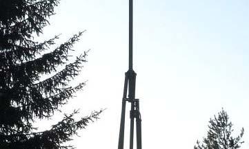
4 The basic network Typical station for the network of monitoring of natural-climatic processes Platform for remote sounding of atmosphere Pole mast with sensors for gradient measurements Platform for standard meteorological measurements Pavilion for placing of systems of registration, communication and technical maintenance Platform for aerosol & radiation measurements Platform for ecosystem supervision
5 The basic network Typical station for the network of monitoring of natural-climatic processes Standard meteorological station (the international certificate, Vaisala, Finland) for the control of meteorological conditions in a ground layer of atmosphere and а binding to network meteorological supervision as a part of a world network. 30-metre pole mast with sensors for gradient measurements (sensors AWS, the departmental certificate, t IMCES, Russia) for gradient measurements of wind speed, temperature, pressure, humidity and calculations of vertical transfer of heat and moisture in a ground layer of atmosphere.
6 The basic network Typical station for the network of monitoring of natural-climatic processes Platform for remote sounding of atmosphere: aerosol lidar (IAO & IMCES) for the control of transfrontier transport of an aerosol; minisodar (IMCES) for the control of turbulent characteristics in an atmosphere boundary layer; station of aerologic radio sounding (the international certificate, Vaisala, Finland) for the control of profiles of a wind, temperature and humidity to heights about 30 km. Addition: the automated laser measuring instrument of characteristics of overcast.
7 The basic network Typical station for the network of monitoring of natural-climatic processes Platform for aerozolno-radiating radiating measurements: UV-radiometers (the international certificate, NILU Products, Norway); aerosol spectrometers (the international certificate, Grimm Aerosol Technik, Germany) - for the control of photochemical and photosynthetic processes; solar spectrophotometer (IAO) - for the control of the maintenance atmospheric aerosol in all thickness of atmosphere.
8 The basic network Typical station for the network of monitoring of natural-climatic processes Reference platform for ecosystems supervision: gas analyzers greenhouse and others significant gases for the control of photosynthetic and soil processes; measuring instruments t for a precipitations, it ti a soil moisture and a snow cover for the control of soil processes.
9 The basic network Factors of natural processes ХХХХХ The climatic factor ХХХХХ The atmospheric block The soil block Wind Soil moisture Humidity Temperature Temperature Radiation Aerosol Bioindication Clouds
10 Wind Ultrasonic anemometer Sounding balloon Doppler lidar Ozone lidar Microwave radar Pole mast Н ~ 30 м Н ~ м Н ~ 7000 м Н ~ м Н ~ 300 м First stage Second stage Long-range goal The basic network


11 Wind WindTraser System


12 Wind Yankee Environmental Systems


13 Wind The control of vertical transfer of ozone lidar
14 Humidity Radiometer Hygrometer Sounding balloon Raman lidar DIAL lidar Integral criterion Pole mast Н ~ 30 м Н ~ м Н ~ 2000 м Н ~ 6000 м First stage Second stage Long-range goal The basic network


,")
")


15 Humidity Remote control of water vapor profiles by Raman and DIAL lidars Water vapor vertical Ratio of integrated t Time height ht cross section profiles, measured by radiosonde (dotted), Raman lidar (dashed), DIAL Ti:Sa-0.72 μ (solid) water vapor measured by Raman lidar and DIAL for five 12-hours periods during Intercomparison of the water vapor density. Temporal resolution is 10 s, vertical resolution is 60 m. campaign
16 Temperature Ultrasonic anemometer Sounding balloon Microwave radiometer Raman lidar Pole mast Н ~ 30 м Н ~ м Н ~ 300 м Н ~ 2000 м First stage Second stage Long-range goal The basic network
17 Temperature Tem mperature e, o C Raman lidar Radiosonde Altitude, m Aeros sol lidar s re esponse, nu umber of ph hotons Profiles of temperature of the atmosphere received by means of Raman lidar and radiosonde
18 Radiation IR-radiometer Radiation balance UV-radiometer Ozonometer gauge First stage Second stage Long-range goal The basic network
19 Aerosol Counter Pole mast Н ~ 30 м Spectrophotometer p Aerosol depth Lidar Н ~ м First stage Second stage Long-range goal The basic network
20 Clouds Panoramic photometer Extent & speed of the clouds Lidar Clouds height 2 wave weather radar Liquid water content in clouds First stage Second stage Long-range goal The basic network


21 Off-line and field monitoring of natural and climatic processes Field information-measuring measuring systems for monitoring of atmosphere Portable automatic weather station Measurable Measurement Accuracy parameter range Horizontal wind speed m/s < 0.37 m/s Vertical wind speed -15 to +15 m/s <037m/s 0.37 Horizontal wind direction Air temperature -50 to +55 C < 0.37 С Relative air humidity % 2.5% at Т > 0 C; 5% at Т 0 C Atmospheric pressure mm Hg 1mmHg


22 Off-line and field monitoring of natural and climatic processes Off-line information-measuring measuring systems for monitoring Independent measuring instrument of a profile of temperature Parameter Value Range of measured temperature, C Absolute error measurement of temperature, C 0.1 Source voltage, V Maximum quantity of sensors in a measuring instrument, units 16 Volume of non-volatile memory, Mb 2 Consumption current in a radio exchange mode, ма 5 10 Consumption current in a mode of interrogation of gauges and radio reception, ма 1 2 Consumption current in a dream mode, ма 0,02 Average time of off-line operation with a regular battery supply, months 12
23 Monitoring of processes of desertification Information-measuring measuring systems for monitoring of a status of soil Soil Moisture Sensors: TRIME-PICO64 sensor with internal TDR-electronics TRIME (Time domain Reflectometry t with Intelligent MicroElements) is based on the TDRtechnique (Time- Domain-Reflectometry), and was developed to measure the dielectric constant of a material.
24 Bioindication Taxonomical analysis of fossil pollen and diatoms
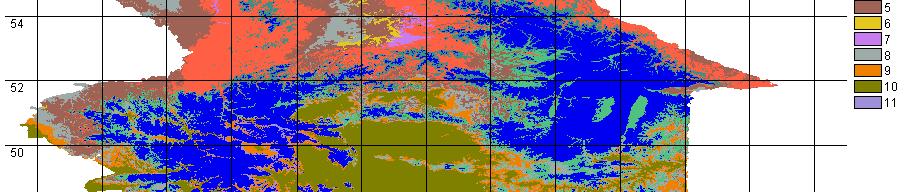
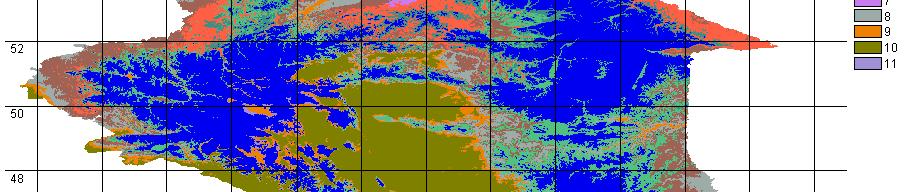
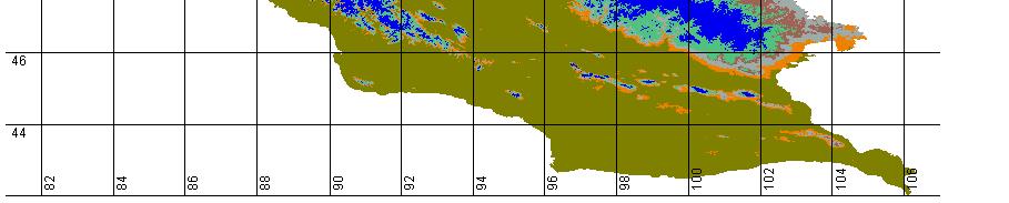
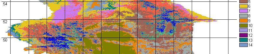
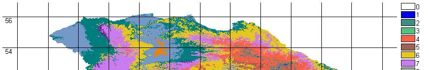
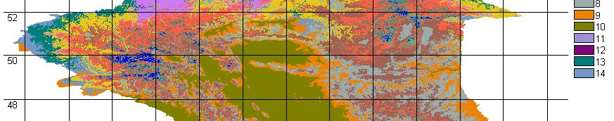
25 Bioindication and landscape modelling of processes in the past 3200 BP 5300 BP 8000 BP BP
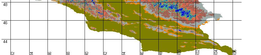

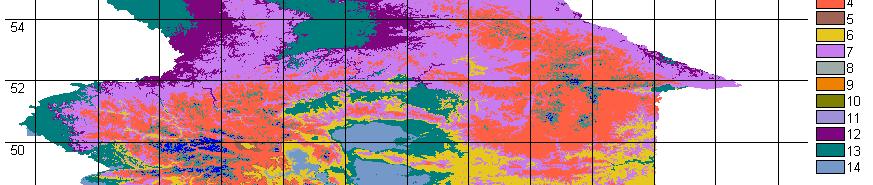
26 Bioindication and landscape modelling of processes in the future Contemporary climate
27 Bioindication
28 Monitoring of natural and climatic processes Instrumental provision of monitoring stations (on the basis of SB RAS stations) located in characteristic climatic zones to monitor glacial processes in mountains and desertification processes in southern latitudes, for monitor processes in forest-bog ecosystems in middle latitudes and cryosphere processes in the north of Siberia. Provision of new ground monitoring stations with modern information technologies for monitoring, modeling and management of natural and climatic systems in stationary, mobile and remote observations (ac. Yu. Shokin). Methodical provision of unified set of measuring devices, regulations and formats for the main measured parameters which will be applied at monitoring stations network. This network will have status of spatially distributed Center of Corporate Use (leading organization: IMCES SB RAS).
29 Thanks for your attention! Web:
Quality assurance for sensors at the Deutscher Wetterdienst (DWD)
") Quality assurance for sensors at the Deutscher Wetterdienst (DWD) Quality assurance / maintenance / calibration Holger Dörschel, Dr Tilman Holfelder WMO International Conference on Automatic Weather Stations
Quality assurance for sensors at the Deutscher Wetterdienst (DWD) Quality assurance / maintenance / calibration Holger Dörschel, Dr Tilman Holfelder WMO International Conference on Automatic Weather Stations
Climate & Earth System Science. Introduction to Meteorology & Climate. Chapter 05 SOME OBSERVING INSTRUMENTS. Instrument Enclosure.
 Climate & Earth System Science Introduction to Meteorology & Climate MAPH 10050 Peter Lynch Peter Lynch Meteorology & Climate Centre School of Mathematical Sciences University College Dublin Meteorology
Observational Needs for Polar Atmospheric Science
 Observational Needs for Polar Atmospheric Science John J. Cassano University of Colorado with contributions from: Ed Eloranta, Matthew Lazzara, Julien Nicolas, Ola Persson, Matthew Shupe, and Von Walden
NATIONAL HYDROMETEOROLOGICAL SERVICE OF REPUBLIC KAZAKHSTAN
 KAZHYDROMET- NATIONAL HYDROMETEOROLOGICAL SERVICE OF REPUBLIC KAZAKHSTAN ASTANA, 2010 The ministry of preservation of the environment of Republic Kazakhstan The republican State Enterprise «Kazhydromet»
Chapter 12: Meteorology
 Chapter 12: Meteorology Section 1: The Causes of Weather 1. Compare and contrast weather and climate. 2. Analyze how imbalances in the heating of Earth s surface create weather. 3. Describe how and where
CGMS Baseline. Sustained contributions to the Global Observing System. Endorsed by CGMS-46 in Bengaluru, June 2018
 CGMS Baseline Sustained contributions to the Global Observing System Best Practices for Achieving User Readiness for New Meteorological Satellites Endorsed by CGMS-46 in Bengaluru, June 2018 CGMS/DOC/18/1028862,
VISION FOR THE GOS IN 2025 ( Approved by CBS-XIV and Adopted by EC LXI in June 2009)
") WORLD METEOROLOGICAL ORGANIZATION Weather Climate Water VISION FOR THE GOS IN 2025 ( Approved by CBS-XIV and Adopted by EC LXI in June 2009) PREAMBLE This Vision provides high-level goals to guide the
WORLD METEOROLOGICAL ORGANIZATION Weather Climate Water VISION FOR THE GOS IN 2025 ( Approved by CBS-XIV and Adopted by EC LXI in June 2009) PREAMBLE This Vision provides high-level goals to guide the
Abstract. Introduction
 Advanced Microwave System For Measurement of ABL Thermal Stratification in Polar Region V.V. Folomeev*, E.N. Kadygrov*, E.A. Miller*, V.V. Nekrasov*, A.N. Shaposhnikov*, A.V. Troisky** * Central aerological
WP11 PHYSICAL ACCESS TO RIs
 WP11 PHYSICAL ACCESS TO RIs ENVRIplus multi-disciplinary test platforms SMEAR II-Hyytiälä, Univ of Helsinki, Finland Boreal landscape, rural site: mixed/conifer forest, peatlands and lakes Co-located activities
LAUNCH Concept. Lindenberg Observatory
 Concept Lindenberg Observatory LAUNCH-2005 International Lindenberg Campaign for Assessment of Humidity- and Cloud- Profiling Systems and its Impact on High-Resolution Modelling Objectives Basic Techniques
Observing Weather: Making the Invisible Visible. Dr. Michael J. Passow
 Observing Weather: Making the Invisible Visible Dr. Michael J. Passow What Is Weather? Weather refers to the conditions of the atmosphere at a certain place and time. Weather differs from Climate, which
Climate vs. Weather. Weather: Short term state of the atmosphere. Climate: The average weather conditions in an area over a long period of time
 Weather and Climate Climate vs. Weather Weather: Short term state of the atmosphere. Temperature, humidity, cloud cover, precipitation, winds, visibility, air pressure, air pollution, etc Climate: The
Interpretation of Polar-orbiting Satellite Observations. Atmospheric Instrumentation
 Interpretation of Polar-orbiting Satellite Observations Outline Polar-Orbiting Observations: Review of Polar-Orbiting Satellite Systems Overview of Currently Active Satellites / Sensors Overview of Sensor
Introductions to RIC-Beijing. NAN Xuejing, CUI Xiai Meteorological Observation Center China Meteorological Administration March,2018
 Introductions to RIC-Beijing NAN Xuejing, CUI Xiai China Meteorological Administration March,2018 Contents 1. China Meteorological Administration (CMA) Organization 2. (MOC) Functional Structure Responsibilities
Complex Terrain (EDUCT) experiment, conducted by the National Center for Atmospheric
 experiment, conducted by the National Center for Atmospheric") Alex Ameen Shenandoah Trip Paper I visited Shenandoah National Park on April 11, 2009 to investigate the Education in Complex Terrain (EDUCT) experiment, conducted by the National Center for Atmospheric
Alex Ameen Shenandoah Trip Paper I visited Shenandoah National Park on April 11, 2009 to investigate the Education in Complex Terrain (EDUCT) experiment, conducted by the National Center for Atmospheric
25.1 Air Masses. Section 25.1 Objectives
 Section 25.1 Objectives Explain how an air mass forms. List the four main types of air masses. Describe how air masses affect the weather of North America. Air Masses 25.1 Air Masses Differences in air
Chapter 12 Section 12.1 The causes of weather
 Chapter 12 Section 12.1 The causes of weather Main Idea: Air masses have different temperatures and amounts of moisture because of the uneven heating of earth's surface. What is Meteorology The study of
REVISION OF THE STATEMENT OF GUIDANCE FOR GLOBAL NUMERICAL WEATHER PREDICTION. (Submitted by Dr. J. Eyre)
") WORLD METEOROLOGICAL ORGANIZATION Distr.: RESTRICTED CBS/OPAG-IOS (ODRRGOS-5)/Doc.5, Add.5 (11.VI.2002) COMMISSION FOR BASIC SYSTEMS OPEN PROGRAMME AREA GROUP ON INTEGRATED OBSERVING SYSTEMS ITEM: 4 EXPERT
WORLD METEOROLOGICAL ORGANIZATION Distr.: RESTRICTED CBS/OPAG-IOS (ODRRGOS-5)/Doc.5, Add.5 (11.VI.2002) COMMISSION FOR BASIC SYSTEMS OPEN PROGRAMME AREA GROUP ON INTEGRATED OBSERVING SYSTEMS ITEM: 4 EXPERT
Weather Forecasts and Climate AOSC 200 Tim Canty. Class Web Site: Lecture 27 Dec
 Weather Forecasts and Climate AOSC 200 Tim Canty Class Web Site: http://www.atmos.umd.edu/~tcanty/aosc200 Topics for today: Climate Natural Variations Feedback Mechanisms Lecture 27 Dec 4 2018 1 Climate
Series tore word. Acknowledgements
 Series tore word p. xi Preface p. xiii Acknowledgements p. xv Disclaimer p. xvii Introduction p. 1 The instrumental age p. 2 Measurements and the climate record p. 2 Clouds and rainfall p. 3 Standardisation
Course outline, objectives, workload, projects, expectations
 Course outline, objectives, workload, projects, expectations Introductions Remote Sensing Overview Elements of a remote sensing observing system 1. platform (satellite, surface, etc) 2. experimental design
CGMS Baseline In response to CGMS action/recommendation A45.01 HLPP reference: 1.1.8
 Prepared by WGIII Agenda Item: 7.1 Discussed in WGIII CGMS Baseline In response to CGMS action/recommendation A45.01 HLPP reference: 1.1.8 In CGMS-45, Working Group III agreed to hold a review of the CGMS
Weather vs. Climate. Tucson NWS homepage:
 Weather vs. Climate Tucson NWS homepage: www.nws.noaa.gov/twc/ A Weather Forecaster? Betty claims to know exactly when it s going to rain because her knee starts to hurt. Ms. Betty Martin of Newburgh,
Instrument Cross-Comparisons and Automated Quality Control of Atmospheric Radiation Measurement Data
 Instrument Cross-Comparisons and Automated Quality Control of Atmospheric Radiation Measurement Data S. Moore and G. Hughes ATK Mission Research Santa Barbara, California Introduction Within the Atmospheric
Module 11: Meteorology Topic 3 Content: Weather Instruments Notes
 Introduction In order for meteorologists to accurately predict the weather, they take thousands of different weather measurements each day. Meteorologists need to use many tools in order to draw an accurate
Progress and Plan of China Xilinhot GRUAN works. Zhao Peitao Meteorological Observation Center (MOC) of CMA
 of CMA") Progress and Plan of China Xilinhot GRUAN works Zhao Peitao Email: peitaozhao@163.com Meteorological Observation Center (MOC) of CMA 2017-6-14 1 Strategic work plan 2 Operation level progress 3 Technical
Progress and Plan of China Xilinhot GRUAN works Zhao Peitao Email: peitaozhao@163.com Meteorological Observation Center (MOC) of CMA 2017-6-14 1 Strategic work plan 2 Operation level progress 3 Technical
* * * Table (1) Table (2)
 Table (2)") A step Forward to Atomize the Sudan Meteorological Authority (SMA) Net work Y.S. Odan Surface Instruments Department Tel: 00249 912220246 E-mail yaseen@ersad.gov.sd Abstract AWS has been introduced to
A step Forward to Atomize the Sudan Meteorological Authority (SMA) Net work Y.S. Odan Surface Instruments Department Tel: 00249 912220246 E-mail yaseen@ersad.gov.sd Abstract AWS has been introduced to
PAM-Station Land-Owner Information Guide Project: CuPIDO, Tucson AZ, Jul/Aug 2006
 PAM-Station Land-Owner Information Guide Project: CuPIDO, Tucson AZ, Jul/Aug 2006 PropVane Anemometer mounted at 10-m Lightning Spike Two-Way radio antenna Sonic Anemometer Solar and Net Radiation sensors.
What are Aerosols? Suspension of very small solid particles or liquid droplets Radii typically in the range of 10nm to
 What are Aerosols? Suspension of very small solid particles or liquid droplets Radii typically in the range of 10nm to 10µm Concentrations decrease exponentially with height N(z) = N(0)exp(-z/H) Long-lived
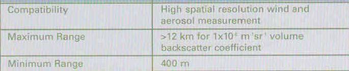
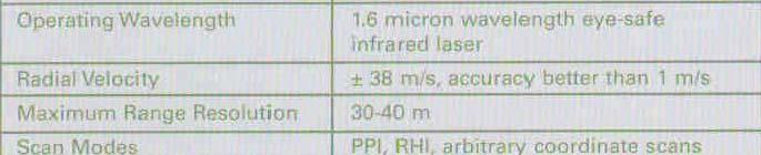
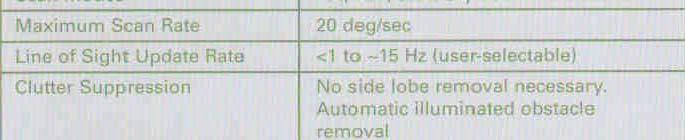
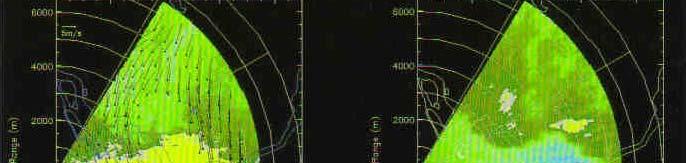
WLS70: A NEW COMPACT DOPPLER WIND LIDAR FOR BOUNDARY LAYER DYNAMIC STUDIES.
 WLS70: A NEW COMPACT DOPPLER WIND LIDAR FOR BOUNDARY LAYER DYNAMIC STUDIES. VALIDATION RESULTS AND INTERCOMPARISON IN THE FRAME OF THE 8TH CIMO-WMO CAMPAIGN. S. Lolli 1, L.Sauvage 1, M. Boquet 1, 1 Leosphere,
Quality assurance for sensors at the Deutscher Wetterdienst (DWD)
") Paper submitted to ICAWS 2017: Topic 3 Sustainability of the measurements: Calibration, intercomparisons, laboratory and field performance tests, quality assurance and control assessment for traceable
Paper submitted to ICAWS 2017: Topic 3 Sustainability of the measurements: Calibration, intercomparisons, laboratory and field performance tests, quality assurance and control assessment for traceable
BIAN ZEQIANG Senior Engineer National Center for Meteorological Metrology Meteorological Observation Cent China Meteorological Administration
 Introduction of RIC-Beijing BIAN ZEQIANG Senior Engineer National Center for Meteorological Metrology Meteorological Observation Cent China Meteorological Administration Outline 1. China Meteorology Administration
A new lidar for water vapor and temperature measurements in the Atmospheric Boundary Layer
 A new lidar for water vapor and temperature measurements in the Atmospheric Boundary Layer M. Froidevaux 1, I. Serikov 2, S. Burgos 3, P. Ristori 1, V. Simeonov 1, H. Van den Bergh 1, and M.B. Parlange
Figure 1. Daily variation of air temperature
 Comparative analysis of the meteorological data acquired on standard equipment and by automatic weather station of CAMPBELL SCIENTIFIC, INC Company Kudekov T.K. Director-General of the KAZHYDROMET 050022
5.3 INVESTIGATION OF BOUNDARY LAYER STRUCTURES WITH CEILOMETER USING A NOVEL ROBUST ALGORITHM. Christoph Münkel * Vaisala GmbH, Hamburg, Germany
 5. INVESTIGATION OF BOUNDARY LAYER STRUCTURES WITH CEILOMETER USING A NOVEL ROBUST ALGORITHM Christoph Münkel * Vaisala GmbH, Hamburg, Germany Reijo Roininen Vaisala Oyj, Helsinki, Finland 1. INTRODUCTION
REMOTE SENSING SYSTEM FOR URBAN HEAT ISLAND STUDY
 REMOTE SENSING SYSTEM FOR URBAN HEAT ISLAND STUDY Ivanov A., Kadygrov E., Miller E. Central Aerological Observatory, Federal Service of Russia for Hydrometeorology and Environmental Monitoring 3 Pervomayskaya
WWRP RDP COPS Coordination Structure Science Questions Status Outlook
 WWRP RDP COPS Volker Wulfmeyer Institute of Physics and Meteorology University of Hohenheim Stuttgart, Germany, the COPS International Science Steering Committee, and the D-PHASE Steering Committee Coordination
Site Report: Lauder, New Zealand
 WMO/IOC/UNEP/ICSU GLOBAL CLIMATE OBSERVING SYSTEM (GCOS) 3rd GRUAN Implementation- Coordination Meeting (ICM-3) Queenstown, New Zealand 28 February 4 March 2011 Doc. 5.8 (21.II.2011) Session 5 Site Report:
Deputatskaya st.1; e Institution of Russian Academy of Sciences Dorodnicyn Computing Centre of RAS, , Moscow, Russia, Vavilov st.
 Testing results of remote sensing method by using microwave temperature profiler for detection of icing conditions aloft in Novosibirsk and Tomsk International Airports Vladimir V. Zuev a,b,c, Daria P.
Fun with Weather Maps! (no, really stop laughing) AOSC 200 Tim Canty
 AOSC 200 Tim Canty") Fun with Weather Maps! (no, really stop laughing) AOSC 200 Tim Canty Class Web Site: http://www.atmos.umd.edu/~tcanty/aosc200 Topics for today: Observations Station Model Temperature Maps Pressure Maps
Fun with Weather Maps! (no, really stop laughing) AOSC 200 Tim Canty Class Web Site: http://www.atmos.umd.edu/~tcanty/aosc200 Topics for today: Observations Station Model Temperature Maps Pressure Maps
North pole drifting stations A presentation for the GCW CryoNet Implementation Meeting, First Session
 North pole drifting stations A presentation for the GCW CryoNet Implementation Meeting, First Session Vienna, Austria, 20-22 November 2012 Vasily Smolyanitsky Arctic and Antarctic Research Institute (AARI)
Remote Sensing Observations AOSC 200 Tim Canty
 Remote Sensing Observations AOSC 200 Tim Canty Class Web Site: http://www.atmos.umd.edu/~tcanty/aosc200 Topics for today: Maps Radar Satellite Observations Lecture 04 Feb 7 2019 1 Today s Weather Map http://www.wpc.ncep.noaa.gov/sfc/namussfcwbg.gif
Aviation Weather Hazards Nowcasting Based on Remote Temperature Sensing Data
 Aviation Weather Hazards Nowcasting Based on Remote Temperature Sensing Data Mikhail Kanevsky*, Evgeny Miller**, Nikolay Baranov*** *International Aeronavigation Systems, kanevsky@ians.aero, **RPO ATTEX,
Inaugural University of Michigan Science Olympiad Tournament
 Inaugural University of Michigan Science Olympiad Tournament The test may be taken apart. Ties will be broken based on predetermined questions and quality of response. Remote Sensing Test length: 50 Minutes
The current status of FY-3D. (Submitted by Xiang Fang, CMA) Summary and Purpose of Document
 Summary and Purpose of Document") WORLD METEOROLOGICAL ORGANIZATION COMMISSION FOR BASIC SYSTEMS OPEN PROGRAMME AREA GROUP ON INTEGRATED OBSERVING SYSTEMS INTER-PROGRAMME EXPERT TEAM ON SATELLITE UTILIZATION AND PRODUCTS FOURTH SESSION
WORLD METEOROLOGICAL ORGANIZATION COMMISSION FOR BASIC SYSTEMS OPEN PROGRAMME AREA GROUP ON INTEGRATED OBSERVING SYSTEMS INTER-PROGRAMME EXPERT TEAM ON SATELLITE UTILIZATION AND PRODUCTS FOURTH SESSION
Chapter 5: Weather. Only Section 1: What is Weather?
 Chapter 5: Weather Only Section 1: What is Weather? Find the definitions of: Meteorology, meteorologist, weather, climate Not in book? Use the dictionaries **Meteorology - Meteorology is the study of the
EUMETSAT STATUS AND PLANS
 1 EUM/TSS/VWG/15/826793 07/10/2015 EUMETSAT STATUS AND PLANS François Montagner, Marine Applications Manager, EUMETSAT WMO Polar Space Task Group 5 5-7 October 2015, DLR, Oberpfaffenhofen PSTG Strategic
Gathering Weather Data
 1 Section 12. 2.3 3 Objectives State the importance of accurate weather data. Summarize the instruments used to collect weather data from Earth s surface. Analyze the strengths and weaknesses of weather
Atmosphere and Weather Revision Notes
 Atmosphere and Weather Revision Notes Atmosphere The blanket of gases that surrounds the Earth is called the atmosphere. The main gases are nitrogen (78 %), oxygen (21 %), water vapour, ozone and carbon
The Study of the Atmosphere
 1 The Study of the Atmosphere Learning Goals After studying this chapter, students should be able to distinguish between weather and climate (pp. 2 5); describe how the various components of the climate
Climate & Earth System Science. Introduction to Meteorology & Climate CHAPTER 1 LECTURE 1. Question: Introduction to the Atmosphere
 Climate & Earth System Science Introduction to Meteorology & Climate MAPH 10050 Peter Lynch Peter Lynch Meteorology & Climate Centre School of Mathematical Sciences University College Dublin Meteorology
Progress on GCOS-China CMA IOS Development Plan ( ) PEI, Chong Department of Integrated Observation of CMA 09/25/2017 Hangzhou, China
 PEI, Chong Department of Integrated Observation of CMA 09/25/2017 Hangzhou, China") Progress on GCOS-China CMA IOS Development Plan (2016-2020) PEI, Chong Department of Integrated Observation of CMA 09/25/2017 Hangzhou, China 1. Progress on GCOS-China 1 Organized GCOS-China GCOS-China
Progress on GCOS-China CMA IOS Development Plan (2016-2020) PEI, Chong Department of Integrated Observation of CMA 09/25/2017 Hangzhou, China 1. Progress on GCOS-China 1 Organized GCOS-China GCOS-China
Steve Colwell. British Antarctic Survey
 Global Climate Observing System (GCOS) Steve Colwell British Antarctic Survey Goal and Structure of GCOS The Goal of GCOS is to provide continuous, reliable, comprehensive data and information on the state
Arctic observational network
 Arctic observational network Alexander Makshtas Arctic and Antarctic Research Institute Russian drifting stations in XX and XXI centures 003-013 195-1991 Lidar Echo-sounder Echo-sounder emitter Radiation
AUTOMATIC MONITORING OF BOUNDARY LAYER STRUCTURES WITH CEILOMETER ABSTRACT
 AUTOMATIC MONITORING OF BOUNDARY LAYER STRUCTURES WITH CEILOMETER Christoph Münkel 1, Reijo Roininen 1 Vaisala GmbH, Schnackenburgallee 1d, 55 Hamburg, Germany Phone +9 89 1, Fax +9 89 11, E-mail christoph.muenkel@vaisala.com
17 August 2016: Russian Aircraft Laboratory available for Arctic Environmental Studies
 17 August 2016: Russian Aircraft Laboratory available for Arctic Environmental Studies A Russian aircraft laboratory is available for scientific use during the Year of Polar Prediction to carry out meteorological
Torben Königk Rossby Centre/ SMHI
 Fundamentals of Climate Modelling Torben Königk Rossby Centre/ SMHI Outline Introduction Why do we need models? Basic processes Radiation Atmospheric/Oceanic circulation Model basics Resolution Parameterizations
Chapter Introduction. Weather. Patterns. Forecasts Chapter Wrap-Up
 Chapter Introduction Lesson 1 Lesson 2 Lesson 3 Describing Weather Weather Patterns Weather Forecasts Chapter Wrap-Up How do scientists describe and predict weather? What do you think? Before you begin,
AUTOMATION OF OBSERVING NETWORK IN BMKG
 Agency for Meteorology, Climatology, and Geophysics of the Republic of Indonesia AUTOMATION OF OBSERVING NETWORK IN BMKG Agung Saifulloh Majid, G.S. Budhi Dharmawan, Damianus Tri Heryanto, Untung Merdijanto
THE METEOROLOGICAL DATA QUALITY MANAGEMENT OF THE ROMANIAN NATIONAL SURFACE OBSERVATION NETWORK
 THE METEOROLOGICAL DATA QUALITY MANAGEMENT OF THE ROMANIAN NATIONAL SURFACE OBSERVATION NETWORK Ioan Ralita, Ancuta Manea, Doina Banciu National Meteorological Administration, Romania Ionel Dragomirescu
5. General Circulation Models
 5. General Circulation Models I. 3-D Climate Models (General Circulation Models) To include the full three-dimensional aspect of climate, including the calculation of the dynamical transports, requires
Climate Modeling Research & Applications in Wales. John Houghton. C 3 W conference, Aberystwyth
 Climate Modeling Research & Applications in Wales John Houghton C 3 W conference, Aberystwyth 26 April 2011 Computer Modeling of the Atmosphere & Climate System has revolutionized Weather Forecasting and
Thermal / Solar. When air is warmed it... Rises. Solar Energy. Evaporation. Condensation Forms Clouds
 Thermal / Solar Light from the Sun is transformed into what type of energy when it hits Earth's surface? Rises When air is warmed it... Solar Energy Water moves through the water cycle using what type
The Challenge of. Guy Brasseur
 The Challenge of Monitoring and Predicting Chemical Weather Guy Brasseur Introduction: What is Chemical Weather? What is Chemical Weather? Local, regional, and global distributions of important trace gases
WIRE: Weather Intelligence for Renewable Energies
 WIRE: Weather Intelligence for Renewable Energies Alain Heimo 1, René Cattin 1, Bertrand Calpini 2 1 Meteotest, Fabrikstrasse 14, CH-3012 Bern alain.heimo@meteotest.ch rene.cattin@meteotest.ch 2 MeteoSwiss,
ARM Climate Research Facility: Goals and Objectives
 ARM Climate Research Facility: Goals and Objectives Provide the national and international scientific community with the infrastructure needed for scientific research on global change Global change research
Maps and Remote Sensing AOSC 200 Tim Canty
 Maps and Remote Sensing AOSC 200 Tim Canty Class Web Site: http://www.atmos.umd.edu/~tcanty/aosc200 Topics for today: Weather Maps Radar Satellite Observations Lecture 04 Feb 7 2019 1 Today s Weather Map
Guided Notes: Atmosphere Layers of the Atmosphere
 Guided Notes: Atmosphere Layers of the Atmosphere Atmosphere: Absorbs solar radiation, Burns up meteors, transports and recycles water, and other chemicals, and moderates climate Main Components: o Meteorology
Science Chapter 13,14,15
 Science 1206 Chapter 13,14,15 1 Weather dynamics is the study of how the motion of water and air causes weather patterns. Energy from the Sun drives the motion of clouds, air, and water. Earth s tilt at
The Causes of Weather
 Meteorology The Causes of Weather Where does the weather in our country come from? * Which air masses determine the weather in our country? * Weather or Climate? *The current state of the atmosphere *
ATMOSPHERIC SCIENCE-ATS (ATS)
") Atmospheric Science-ATS (ATS) 1 ATMOSPHERIC SCIENCE-ATS (ATS) Courses ATS 150 Science of Global Climate Change Credits: 3 (3-0-0) Physical basis of climate change. Energy budget of the earth, the greenhouse
Atmospheric Science-ATS (ATS) 1 ATMOSPHERIC SCIENCE-ATS (ATS) Courses ATS 150 Science of Global Climate Change Credits: 3 (3-0-0) Physical basis of climate change. Energy budget of the earth, the greenhouse
PRESENT STATE OF METEOROLOGICAL INSTRUMENTS IN MONGOLIA
 JMA/WMO TRAINING WORKSHOP ON CALIBRATION AND MAINTENANCE OF METEOROLOGICAL INSTRUMENTS IN RA II (ASIA) PRESENT STATE OF METEOROLOGICAL INSTRUMENTS IN MONGOLIA Tseveenravdan DOVCHIN NAMEM-CLEM Mongolia
Retrieval of atmospheric profiles and surface parameters from METEOR - 3M IR- and MW- sounders data
 The 19th International TOVS Study Conference (ITSC-19) Retrieval of atmospheric profiles and surface parameters from METEOR - 3M IR- and MW- sounders data Polyakov, Alexander 1, Kostsov, Vladimir 1, Timofeyev,
Atmospheric Boundary Layer over Land, Ocean, and Ice. Xubin Zeng, Michael Brunke, Josh Welty, Patrick Broxton University of Arizona
 Atmospheric Boundary Layer over Land, Ocean, and Ice Xubin Zeng, Michael Brunke, Josh Welty, Patrick Broxton University of Arizona xubin@email.arizona.edu 24 October 2017 Future of ABL Observations Workshop
The Earth Explorer Missions - Current Status
 EOQ N 66 July 2000 meteorology earthnet remote sensing solid earth future programmes Earth Observation Quarterly The Earth Explorer Missions - Current Status G. Mégie (1) and C.J. Readings (2) (1) Institut
GEOGRAPHY EYA NOTES. Weather. atmosphere. Weather and climate
 GEOGRAPHY EYA NOTES Weather and climate Weather The condition of the atmosphere at a specific place over a relatively short period of time Climate The atmospheric conditions of a specific place over a
Temperature (T) degrees Celsius ( o C) arbitrary scale from 0 o C at melting point of ice to 100 o C at boiling point of water Also (Kelvin, K) = o C
 degrees Celsius ( o C) arbitrary scale from 0 o C at melting point of ice to 100 o C at boiling point of water Also (Kelvin, K) = o C") 1 2 3 4 Temperature (T) degrees Celsius ( o C) arbitrary scale from 0 o C at melting point of ice to 100 o C at boiling point of water Also (Kelvin, K) = o C plus 273.15 0 K is absolute zero, the minimum
1 2 3 4 Temperature (T) degrees Celsius ( o C) arbitrary scale from 0 o C at melting point of ice to 100 o C at boiling point of water Also (Kelvin, K) = o C plus 273.15 0 K is absolute zero, the minimum
Windcube TM Pulsed lidar wind profiler Overview of more than 2 years of field experience J.P.Cariou, R. Parmentier, M. Boquet, L.
 Windcube TM Pulsed lidar wind profiler Overview of more than 2 years of field experience J.P.Cariou, R. Parmentier, M. Boquet, L.Sauvage 15 th Coherent Laser Radar Conference Toulouse, France 25/06/2009
Performance of Radar Wind Profilers, Radiosondes, and Surface Flux Stations at the Southern Great Plains (SGP) Cloud and Radiation Testbed (CART) Site
 Cloud and Radiation Testbed (CART) Site") Performance of Radar Wind Profilers, Radiosondes, and Surface Flux Stations at the Southern Great Plains (SGP) Cloud and Radiation Testbed (CART) Site R. L. Coulter, B. M. Lesht, M. L. Wesely, D. R. Cook,
Performance of Radar Wind Profilers, Radiosondes, and Surface Flux Stations at the Southern Great Plains (SGP) Cloud and Radiation Testbed (CART) Site R. L. Coulter, B. M. Lesht, M. L. Wesely, D. R. Cook,
2.5 COMPARING WATER VAPOR VERTICAL PROFILES USING CNR-IMAA RAMAN LIDAR AND CLOUDNET DATA
 2.5 COMPARING WATER VAPOR VERTICAL PROFILES USING CNR-IMAA RAMAN LIDAR AND CLOUDNET DATA Lucia Mona*, 1, Aldo Amodeo 1, Carmela Cornacchia 1, Fabio Madonna 1, Gelsomina Pappalardo 1 and Ewan O Connor 2
78% : component of atmosphere! 21% : 1% : Changes depending on origin of air: - originated over - originated over Ozone = O 3 Definition:
 Unit 6 Part 1 Meteorology Name: Composition and Structure of the Atmosphere SWBAT: Describe the composition of the atmosphere. Diagram/describe the layers of the earth s atmosphere. Weather Climate Atmospheric
INTRODUCTION OPERATIONS
 IASI EOF and ANN Retrieved Total Columnar Amounts Ozone, Compared to Ozone Sonde and Brewer Spectrometer Measurements from the Lindenberg and Sodankylä Validation Campaigns Olusoji O. Oduleye, Thomas August,
Remote sensing of meteorological conditions at airports for air quality issues
 Remote sensing of meteorological conditions at airports for air quality issues Stefan Emeis, Klaus Schäfer Institute for Meteorology and Climate Research Atmospheric Environmental Research (IMK-IFU) Forschungszentrum
Report of CoreTemp2017: Intercomparison of dual thermistor radiosonde (DTR) with RS41, RS92 and DFM09 radiosondes
 with RS41, RS92 and DFM09 radiosondes") Report of CoreTemp2017: Intercomparison of dual thermistor radiosonde (DTR) with RS41, RS92 and DFM09 radiosondes Yong-Gyoo Kim *, Ph.D and GRUAN Lead center *Upper-air measurement team Center for Thermometry
Report of CoreTemp2017: Intercomparison of dual thermistor radiosonde (DTR) with RS41, RS92 and DFM09 radiosondes Yong-Gyoo Kim *, Ph.D and GRUAN Lead center *Upper-air measurement team Center for Thermometry
The lesson essential questions that will guide our investigations are:
 Properties of the Atmosphere: Understanding Patterns Through Observation and Data Collection that Lead to Prediction of Local and Global Weather and Climate. Up until this point in class you have learned
STUDY OF ATMOSPHERIC BOUNDARY LAYER TERMAL REGIME DURING TOTAL ECLIPSE OF THE SUN
 STUDY OF ATMOSPHERIC BOUNDARY LAYER TERMAL REGIME DURING TOTAL ECLIPSE OF THE SUN Kadygrov E.N., Miller E.A., Shaposhnikov A.N. Central Aerological Observatory, Federal Service of Russia for Hydrometerology
Mountain Snowpacks, Climate Change and the Silver Solution
 Mountain Snowpacks, Climate Change and the Silver Solution Climate Change Seminar Series University of Nevada Las Vegas 11 July 2012 Arlen Huggins Desert Research Institute Reno, Nevada Climate, snow and
LAUNCH Concept. Lindenberg Observatory
 Concept Lindenberg Observatory LAUNCH-2005 International Lindenberg Campaign for Assessment of Humidity- and Cloud- Profiling Systems and its Impact on High-Resolution Modelling Objectives Basic Techniques
Observatory of Environmental Safety Resource Center, Research Park. St.Petersburg. Russia.
 Correct atmospheric optics modelling: Theory and Experiment Irina Melnikova Observatory of Environmental Safety Resource Center, Research Park St.Petersburg State University St.Petersburg. Russia. irina.melnikova@pobox.spbu.ru
Chapter 6: Modeling the Atmosphere-Ocean System
 Chapter 6: Modeling the Atmosphere-Ocean System -So far in this class, we ve mostly discussed conceptual models models that qualitatively describe the system example: Daisyworld examined stable and unstable
CONTENTS CHAPTER 1: PROLOGUE The Local Environment... 1 Observation, Inference, Classification Properties of the Environment...
 CONTENTS CHAPTER 1: PROLOGUE The Local Environment... 1 Observation, Inference, Classification Properties of the Environment... 3 Measurement, Percent Deviation From Accepted Value Density... 6 Density
4 Forecasting Weather
 CHAPTER 16 4 Forecasting Weather SECTION Understanding Weather BEFORE YOU READ After you read this section, you should be able to answer these questions: What instruments are used to forecast weather?
Surface Processes and the Hydrosphere Unit Heating the Earth s Atmosphere Chapter 11 (pg )
") Name: Block: Surface Processes and the Hydrosphere Unit Heating the Earth s Atmosphere Chapter 11 (pg. 352 385) 11.1: Focus on the Atmosphere: Weather and Climate What is the difference between the weather
Name: Block: Surface Processes and the Hydrosphere Unit Heating the Earth s Atmosphere Chapter 11 (pg. 352 385) 11.1: Focus on the Atmosphere: Weather and Climate What is the difference between the weather
4 Forecasting Weather
 CHAPTER 2 4 Forecasting Weather SECTION Understanding Weather BEFORE YOU READ After you read this section, you should be able to answer these questions: What instruments are used to forecast weather? How
The Atmosphere. Topic 3: Global Cycles and Physical Systems. Topic 3: Global Cycles and Physical Systems. Topic 3: Global Cycles and Physical Systems
 The Atmosphere 1 How big is the atmosphere? Why is it cold in Geneva? Why do mountaineers need oxygen on Everest? 2 A relatively thin layer of gas over the Earths surface Earth s radius ~ 6400km Atmospheric
Specifications for a Reference Radiosonde for the GCOS Reference. Upper-Air Network (GRUAN)
") Specifications for a Reference Radiosonde for the GCOS Reference Upper-Air Network (GRUAN) By the Working Group on Atmospheric Reference Observations (WG-ARO) Final Version, October 2008 1. Introduction
Specifications for a Reference Radiosonde for the GCOS Reference Upper-Air Network (GRUAN) By the Working Group on Atmospheric Reference Observations (WG-ARO) Final Version, October 2008 1. Introduction
Regional Activities and Perspectives on GCW: Relevant FMI Activities at Northern Finland and Suggestions for GCW Monitoring Site Requirements
 Regional Activities and Perspectives on GCW: Relevant FMI Activities at Northern Finland and Suggestions for GCW Monitoring Site Requirements Jouni Pulliainen 21 November 2011 Suggestions for GCW monitoring
Opportunities provided by fine-scale meteorological sensor array
 Opportunities provided by fine-scale meteorological sensor array R.M. Randall, C.M Hocut, D.K. Knapp, B.T. MacCall, & J.A. Smith MSA Program Overview Army Challenge Research gaps exist which challenge
Real-time PBL analysis system using profilers observations from The New York State Mesonet
 Real-time PBL analysis system using profilers observations from The New York State Mesonet Sarah Lu University at Albany State University of New York Outline Background System description and progress
GEOGRAPHY AND HISTORY
 GEOGRAPHY AND HISTORY YEAR 1, PART 1 www.vicensvives.es Contents 01 Our planet Earth 02 The representation of the Earth: maps 03 The Earth s relief 04 Rivers and seas 05 Weather and climate 06 Climates