Is Your Community StormReady? Emergency Management Track
|
|
|
- Adelia Porter
- 6 years ago
- Views:
Transcription
1 Is Your Community StormReady? Emergency Management Track Pat Vesper Warning Coordination Meteorologist WFO Midland, TX Patrick Repman, EMC, City of Midland Dale Little, EMC, Midland County

2 What is StormReady? A grass roots program focusing on improving communication and severe weather preparedness. It helps community leaders and emergency managers strengthen local safety programs. It prepares communities for severe weather and other disasters. It provides guidance on how to improve warning and preparedness programs.
3 The History of StormReady Back in 1999, the Warning Coordination Meteorologist and the Meteorologist-in- Charge of the Tulsa office There must be someway to recognize those emergency managers that are going the extra mile. Together they came up with the concept of StormReady.
4 The History of StormReady On Feb. 22, 1999, Latimer County and the county seat Wilburton became the first StormReady county and community in America. On June 4, 1999, Claremore, Oklahoma and Rogers County became the second community and county to become StormReady.
5 The History of StormReady On June 10, 1999, Siloam Springs, Arkansas became the first community outside of Oklahoma to become StormReady. On June 24, 1999, Tulsa and Tulsa County became the first highly populated locations to become StormReady.
6 The History of StormReady StormReady became a national program of the National Weather Service in TsunamiReady program - a sister program followed thereafter.

7 StormReady Across the Nation As of February 10, 2010 there were 1559 StormReady Sites in 49 states: 801 Counties 651 Communities 48 Universities 7 Indian Nation 28 Commercial Sites 12 Military Sites 12 Governmental Sites 73 TsunamiReady Sites 111 StormReady Supporters Gold counties are StormReady Light Blue dots are TsunamiReady communities Blue dots are StormReady Communities/Towns/Cities Red dots are StormReady Commercial Sites Green dots are StormReady Indian Nations Purple dots are StormReady Universities Brown dots are StormReady Military/Government Sites
8 Why do we need StormReady? Americans cope with an average of 10,000 thunderstorms, 2,500 floods, 1,000 tornadoes, as well as an average of 6 deadly hurricanes each year.
9 Why do we need StormReady? Approximately 90% of all Presidentially declared disasters are weather related On average there are 500 weather related deaths each year across America Severe weather causes nearly $14 billion in property damage each year
10 StormReady Incentives Improves timeliness of hazardous weather warning reception and dissemination in communities Helps local Emergency Managers justify costs of hazardous weather-related programs Provides an image incentive to communities Encourages surrounding areas to improve their hazardous weather preparedness programs Receives 25 Community Rating System Points to possibly lower National Flood Insurance Plan premiums
11 So why do you want to be StormReady? You want to organize your community effort in advance for potential disasters. You want the Community Rating Preparedness System points assigned by the National Flood Insurance Program (NFIP) You want to become recognized as StormReady to enhance community pride.

12 So why do you want to be StormReady? Lamar Elementary May 24, 1957 Lamar Elementary Nov. 20, 2009

13 So why do you want to be StormReady? It doesn t matter who you are or where you re located, your critical time will come. We only have one chance to be ready.
14 Understanding StormReady Becoming StormReady is not about one person making a commitment. StormReady is not about checking required boxes. StormReady is more about an active partnership between your local National Weather Service office and the emergency management community.
15 Understanding StormReady In 2002, Van Wert County, Ohio placed warning alert systems in public locations as they achieved StormReady recognition. One of those locations was a local movie theatre. Later that year, a tornado touched down in Van Wert County. Warnings were issued 28 minutes prior to the theatre being struck.
16 Understanding StormReady The theatre manager moved adults and kids into safer hallways and bathrooms in advance of the approaching storm. When the tornado struck, the theatre roof was torn off and cars were tossed into the theatre seats that were previously occupied. The end result was 50 lives were saved. StormReady involves everyone.
17 How does StormReady work? Complete the application. Submit to your NWS office Application reviewed by Advisory Board Team visits your facilities Advisory Board votes to approve Ceremony held to formally recognize your program


18 How does StormReady work? Recognition letter from local NWS Office Two StormReady signs Authorization to use the StormReady logo Instructions for acquiring additional signs Information on how to notify the ISO for possible flood insurance rate adjustments Listing on the National StormReady Website
19 How does a community become StormReady? Establish Communication and Coordination Plans 24-Hour Warning Point Emergency Operations Center Receive Critical Warning Information NOAA Weather Radio - All Hazards NOAA Weather Wire Emergency Managers Weather Information Network Radio/TV Internet Pagers, cell phones, etc.
 Disseminate Warnings Emergency Alert")
20 How does a community become StormReady? Monitor Evolving Weather Weather instruments River gage monitoring Radar access (Internet, local providers) Disseminate Warnings Emergency Alert System Cable Override NOAA Weather Radio in public buildings Outdoor Warning Sirens Other local warning systems

21 How does a community become StormReady? Increase Community Preparedness Spotter and dispatcher severe weather training Public weather safety presentations Enhance Internal Operational Procedures Hazardous weather action plan

22 StormReady Guidelines Communication NWS Information Reception Administrative Hydrometeorological Monitoring Community Preparedness Local Warning Dissemination
23 StormReady Guideline 1: Communications & Coordination Center Guidelines 24-hour Warning Point To be recognized as StormReady, an agency must have a 24-hour warning point to receive NWS information and provide local reports and advice. Law Enforcement Fire Department Dispatch Point County Agency Operates 24 hour a day Has warning reception capability Offers warning dissemination capability Has the ability and authority to activate local warning system(s) EOC ( > 2,500 people*) Activated based on guidelines related to NWS information or weather events Assumes weather-related duties of warning point when staffed Must be staffed with emergency management director or designee Offer warning reception capability Communicate with adjacent Warning Points/ EOCs Link to the NWS to relay real-time weather information to support the warning decision making process
24 StormReady Guideline 2: National Weather Service Warning Reception Guidelines Warning points and EOCs each need multiple ways to receive NWS warnings. The StormReady program guidelines for receiving NWS warnings in an EOC/WP require a combination of the following, based on population: NOAA Weather Radio (Tone preferred) if within range of transmitter EMWIN Receiver Satellite feed and/or VHF radio transmission of NWS products Commercial Data Services Amateur Radio Transceiver Pagers not directly tied to a local system Television local network or cable television Local Radio (Emergency Alert System: LP1/LP2) National Warning System Drop NAWAS NOAA Weather Wire Drop Satellite downlink data feed from NWS Other For example, active participation in a state-run warning network

25 StormReady Guideline 2: National Weather Service Warning Reception Guidelines EMWIN Vendors Page Commercial Vendors Page


26 StormReady Guideline 3: Hydrometeorological Monitoring Guidelines To obtain StormReady recognition, each EOC/WP should have some combination of the following recommended means of gathering ancillary weather information: Access to radar data via Internet, TV, etc. Instruments to provide a measure of local hydrologic conditions. These instruments cannot be the sole means of hydrometeorological monitoring (i.e. wind equipment, river gages, etc.) Locally owned and operated weather radar.
27 StormReady Guideline 4: Warning Dissemination Guidelines Receiving StormReady recognition will be contingent upon having one or more of the following means of ensuring timely warning dissemination to citizens: NOAA All-Hazards Radio in governmentowned buildings assessed by the public Required locations: 24-hour warning point Emergency Operations Center City Hall School Superintendent office Recommended locations: Courthouses, Public libraries, Hospitals, Schools, Fairgrounds, Parks and recreation areas, Public utilities, Sports arenas, Departments of Transportation Cable television audio/video overrides. Local Flood warning systems with no single point of failure. Other locally-controlled methods like a local broadcast system or sirens on emergency vehicles. Outdoor warning sirens Counties Only: A county-wide communications network that ensures the flow of information between all cities and towns within its borders. This would include acting as a warning point for the smaller towns.
28 StormReady Guideline 5: Community Preparedness Guidelines Public education is vital in preparing citizens to respond properly to weather threats. An educated public is more likely to take steps to receive weather warnings, recognize potentially threatening weather situations, and act appropriately. The StormReady Program requires applicants to: Conduct or facilitate safety talks for schools, hospitals, nursing homes and industries. These may be a part of multi-hazard presentations affecting local communities/regions, such as flood, wildfire, tsunami Conduct weather-related safety campaigns which publicize NOAA Weather Radio All-Hazards where coverage exists. Send EOC/WP staff to free NWS storm spotter training at least every other year. All jurisdictions larger than 40,000 people will need to host/co-host a spotter training session every year.
29 StormReady Guideline 6: Administrative Guidelines To be recognized in the StormReady program, an approved hazardous weather action plan needs to be in place. This plans needs to address, at a minimum, the following: Warning point procedures relating to natural hazards EOC activation criteria and procedures if applicable Storm spotter activation criteria and reporting procedures if applicable Storm spotter roster and training record if applicable.
30 StormReady Guideline 6: Administrative Guidelines Criteria and procedures for activation of sirens, cable television override, and/or local systems activation in accordance with state Emergency Alert System (EAS) plans Annual exercises relating to natural hazard. To facilitate close working relationships, the community/ county emergency management program leader must visit the supporting NWS office at least every other year. NWS officials will commit to visit accredited counties, cities, and towns annually to tour EOCs/Warning points and meet with key officials
31 Becoming StormReady Items to consider
32 What is NWSChat? NWSChat is a special chat software program that is loaded on a PC. It s maintained by the NWS. It s designed with the specific goal of helping our partners. It s free.
33 How is NWSChat different? NWSChat is secure and limited to our partners. NWSChat is used specifically to provide NWS information to those involved with both weather and non-weather related emergencies. NWSChat has a special feature called NWSbot that automatically places all warning information into the chatroom for your viewing.

34 NWSChat An Overview Started as IEMChat (2006) Transitioned to SRHChat (2008) Became NWSChat (2009) Provides an opportunity for EMs, media, Skywarn coordinators, and NWS forecasters to exchange information during an event Displays all event products issued by you local NWS office, SPC, and more Shows potential as a decision support tool for other core partners.

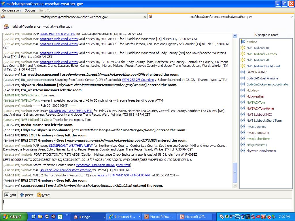
35 NWSChat

36 NWSChat
37 How do I sign-up for NWSChat? First, go to
38 How do I sign-up for NWSChat? Next, request an account as an NWS Partner
39

40 Next, fill out this form
41 CoCoRaHS - Community Collaborative Rain, Hail and Snow Network As of 2/12/ sites in Texas
42 Other Ideas Develop a weather-related website that uses NWS information to inform the community of current and impending weather, and provides multi-hazard preparedness information. Use social media like Twitter that can utilize data monitoring feed to help disseminate both warning and safety information to the county or community.
43 Other Ideas Utilize newer technologies (i.e. viaradio, CODE RED, etc.) to enhance communication and target specific groups (i.e. schools, public venues, etc.) Set up a real-time weather network for your county and place information in a central location (website) for viewing.
44 Does StormReady Work? Several SR communities struck by severe weather Brandon, MS April 24, 2003 F3 tornado moved through the center of well populated area 30 Million in damage Only 6 minor injuries The reason The community was well prepared.
45 Yes, StormReady Works! Spotters were watching the storm; communicating with NWS The community had resources for warning notification (sirens, pagers, NWR) The population was educated and knew what to do.

46 The StormReady Application

47 The StormReady Application

48 The StormReady Application

49 The StormReady Application

50 The StormReady Application

51 The StormReady Application

52 The StormReady Application

53 The StormReady Application
54 Questions?
The Nuts and Bolts of These Community Preparedness Recognition Programs
 The Nuts and Bolts of These Community Preparedness Recognition Programs Bill Sammler Warning Coordination Meteorologist NOAA s National Weather Service, Wakefield VA http://weather.gov/akq Why is StormReady
National Weather Service 1
 National Weather Service 1 National Weather Service Source: FEMA 2 The Need for a Robust/Diverse Severe Weather Plan Presidential Disaster Declarations 2015 Kentucky Disaster Declarations DR-4216 (Feb
Unit 5: NWS Hazardous Weather Products. Hazardous Weather and Flooding Preparedness
 Unit 5: NWS Hazardous Weather Products Objectives Describe the mission of the NWS Describe the basic organizational structure of the NWS Explain the purpose of various NWS products Explain how Probability
Information Reception: Decision Support Standards: Public Notification Plan: Protection Program: Education:
 The National Weather Service (NWS) has implemented a voluntary recognition program to help large outdoor venues, including those on university campuses, better protect staff and patrons from the dangers
StormReady Supporter Application Form updated by NWS Chanhassen on April 7, Name of Applying Entity: Point of Contact: Title:
 NATIONAL WEATHER SERVICE 1733 Lake Drive West Chanhassen, Minnesota www.weather.gov/twincities www.stormready.noaa.gov 952-361-6671, todd.krause@noaa.gov StormReady Supporter Application Form updated by
United States Multi-Hazard Early Warning System
 United States Multi-Hazard Early Warning System Saving Lives Through Partnership Lynn Maximuk National Weather Service Director, Central Region Kansas City, Missouri America s s Weather Enterprise: Protecting
NOAA s National Weather Service. National Weather Service
 NOAA s National Weather Service Serving the Nation s Environmental Forecasting Needs Lynn Maximuk Regional Director National Weather Service Central Region Headquarters Kansas City, Missouri America s
Building A Weather-Ready Nation
 Building A Weather-Ready Nation Steve Runnels National Weather Service Springfield, MO` Photo Credit: Tim Marshall 122 National Weather Service Offices NWS Offices Service Missouri and Warning Coordination
THE IMPACT OF WEATHER
 The United States is the most severe weather prone country in the world. Each year, people in this country cope with an average of 10,000 thunderstorms, 5,000 floods, 1,200 tornadoes and two landfalling
 STATE OF WISCONSIN/ DEPARTMENT OF MILITARY AFFAIRS WISCONSIN EMERGENCY MANAGEMENT 2400 WRIGHT STREET P.O. BOX 7865 MADISON, WISCONSIN 53707-7865 608-242-3232 February 22, 2007 Re: Tornado and Severe Weather
Emergency Action Guidelines for NH 4-H Animal Events
 Emergency Action Guidelines for NH 4-H Animal Events Purpose: This plan outlines guidelines designed to help ensure NH 4-H Animal Events and Shows are prepared for emergencies and severe weather conditions.
POCOLA DEPARTMENT OF EMERGENCY MANAGEMENT STANDARD OPERATING GUIDELINE
 POCOLA DEPARTMENT OF EMERGENCY MANAGEMENT STANDARD OPERATING GUIDELINE SUBJECT EMERGENCY ALERT SYSTEM ACTIVATION NUMBER: 7.000 EFFECTIVE DATE: SCHEDULED REVIEW DATE: DATE REVIEWED: ISSUE DATE: REVISION
Severe Weather Hazards Are Real
 Severe Weather Hazards Are Real In the past 10 years, more than 40 people have died and dozens more injured as a result of weatherrelated events in Minnesota (not including motor vehicles.) The top severe
State Of Wisconsin Department of Military Affairs
 State Of Wisconsin Department of Military Affairs Division of Emergency Management Brian M. Satula Administrator Scott Walker Governor For more information contact: Tod Pritchard Office: 608-242-3324 Cell:
NWS Resources For School Districts
 NWS Resources For School Districts January 23rd, 2017 Shawn DeVinny shawn.devinny@noaa.gov Meteorologist National Weather Service Twin Cities/Chanhassen, MN Outline Watches/Warnings/Advisories Example
Charles Kuster Leadville, CO. Personal Overview
 Charles Kuster Leadville, CO Personal Overview Personal Overview Charles Kuster Leadville, CO OU to study meteorology Charles Kuster Leadville, CO Personal Overview OU to study meteorology Graduated in
Table G - 6. Mitigation Actions Identified for Implementation by the City of Kent ( ) (From Wilkin County Master Mitigation Action Chart)
 (From Wilkin County Master Mitigation Action Chart)") Table G - 6. Actions Identified by the () (From Master Action Chart) Multi-Hazard Plan, 2017 Action Comments 5 All-Hazards Local Planning & Regulations Update the Operations Plan on an annual basis. Work
Table G - 6. Actions Identified by the () (From Master Action Chart) Multi-Hazard Plan, 2017 Action Comments 5 All-Hazards Local Planning & Regulations Update the Operations Plan on an annual basis. Work
The Integrated Warning Partnership: Opportunities for Improved Community-Level Benefits. Dale Morris Oklahoma Climatological Survey April 18, 2006
 The Integrated Warning Partnership: Opportunities for Improved Community-Level Benefits Dale Morris Oklahoma Climatological Survey April 18, 2006 My Personal Motivation Sunday Evening, September 5, 1992
Kane County Amateur Radio Emergency Service
 This script is to be used when severe weather is approaching or has reached Kane County. The script is divided into three parts. Part One is for use when the National Weather Service has issued a WATCH
P1.25 OK-WARN: OKLAHOMA WEATHER ALERT REMOTE NOTIFICATION. Vincent T. Wood NOAA/OAR/National Severe Storms Laboratory Norman, Oklahoma
 P1.25 OK-WARN: OKLAHOMA WEATHER ALERT REMOTE NOTIFICATION Vincent T. Wood NOAA/OAR/National Severe Storms Laboratory Norman, Oklahoma 1. INTRODUCTION OKlahoma Weather Alert Remote Notification (OK-WARN)
NWS Resources For Public Works
 NWS Resources For Public Works August 28th, 2016 Shawn DeVinny shawn.devinny@noaa.gov Meteorologist National Weather Service Twin Cities/Chanhassen, MN 1 APWA 2016 PWX 8/28/2016 National Weather Service
Tornado Drill Exercise Plan (EXPLAN)
") Tornado Drill Exercise Plan (EXPLAN) As part of the National Weather Service s (NWS) Severe Weather Preparedness Week in Indiana Purdue University March 19, 2019 As of Feb 19, 2019 TABLE OF CONTENTS Introduction...
Tornado Drill Exercise Plan (EXPLAN) As part of the National Weather Service s (NWS) Severe Weather Preparedness Week in Indiana Purdue University March 19, 2019 As of Feb 19, 2019 TABLE OF CONTENTS Introduction...
TORNADO PREPAREDNESS AND INFORMATION MANUAL
 TORNADO PREPAREDNESS AND INFORMATION MANUAL What is a Tornado? A tornado is defined as a violently rotating column of air extending from a thunderstorm to the ground. The most violent tornadoes are capable
BROWARD COLLEGE COMMUNITY & INCIDENT COMMAND TEAMS
 BROWARD COLLEGE COMMUNITY & INCIDENT COMMAND TEAMS Types of Severe Weather Communications about Severe Weather Preparedness Actions Initial Response Actions Community & Incident Command Teams Severe Thunderstorms
CASA DFW Urban Demonstration Network
 CASA DFW Urban Demonstration Network Cedar League, University of Colorado Colorado Springs Brenda Philips University of Massachusetts Integrated Warning Team Meeting March 6, 2013 Cutting Edge Radars for
Weather can change quickly...are you on top of the changes?
 Weather Access Bob Glancy NOAA National Weather Service, Boulder, CO Near Cedar Point, CO May 9, 2004 Weather can change quickly...are you on top of the changes? National Weather Service Local offices:
Extreme Temperature Protocol in Middlesex-London
 Clean Air Partnership Webinar March 17, 2009 Extreme Temperature Protocol in Middlesex-London Presented by Iqbal Kalsi, MBA, CPHI(C), CCEP iqbal.kalsi@mlhu.on.ca 1 History Informal monitoring, tracking
Annex B Natural No-Notice Event
 Annex B Natural No-Notice Event Version: 1.0 Effective: 10/01/2015 Revision Date: 10/01/2015 Approved By: John Pitcher Purpose The purpose of Natural No-Notice Event Annex is to ensure the safety of BHCC
2013 Tornado and Severe Weather Awareness Drill
 2013 Tornado and Severe Weather Awareness Drill Scheduled for Thursday April 18, 2013 The 2013 Tornado Drill will consist of a mock tornado watch and a mock tornado warning for all of Wisconsin. This is
National Weather Service. Building a Weather Ready Nation
 National Weather Service Building a Weather Ready Nation The NWS is a federal agency Department of Commerce National Oceanic and Atmospheric Administration National Weather Service Today s National Weather
Tippecanoe County ARES Net Formats NET 1-4. Net Formats
 1. Introduction Net Formats To provide a basis for carrying out the mission of the Tippecanoe County, Indiana, Amateur Radio Emergency Service (ARES ), guidelines must be in place to meet the communications
GWINNETT COUNTY GEORGIA AMATEUR RADIO EMERGENCY SERVICE. Operations Plan
 GWINNETT COUNTY GEORGIA AMATEUR RADIO EMERGENCY SERVICE Operations Plan National Weather Service Support Plan 100 (Operation SKYWARN) September 21, 2002 (Revised July 14, 2003) National Weather Service
Nurture Nature Center Receives Grant From National Oceanic and Atmospheric Administration To Study Flood Forecast and Warning Tools
 Nurture Nature Center Receives Grant From National Oceanic and Atmospheric Administration To Study Flood Forecast and Warning Tools One of four national awards by National Weather Service to advance weather
May 31, Flood Response Overview
 May 31, 2013 Flood Response Overview Suppression 867 Personnel on three (3) shifts 289 Red Shift (A) 289 Blue Shift (B) 289 Green Shift (C) Department Overview Department Overview EMS: 40,934 False Alarm:
State Of Wisconsin. Department of Military Affairs. Division of Emergency Management
 State Of Wisconsin Department of Military Affairs Division of Emergency Management Brian M. Satula Administrator Scott Walker Governor For more information contact: Tod Pritchard Office: 608-242-3324 Cell:
Tornadoes Student Activity Book
 Tornadoes Student Activity Book I. Introduction Have you ever seen a tornado? Hopefully, it was in a video on television. Each year as many as 1000 tornadoes may occur in the United States. Their destruction
Southeast and Northeast Region After Action Report April 22, 2010 Severe Weather Events
 Southeast and Northeast Region After Action Report April 22, 2010 Severe Weather Events Bent County ISSUE: Utilizing Webeoc on fast-paced incidents in a rural setting. DISCUSSION: National weather service
TORNADO/high winds *
 TORNADO/high winds * WATCH Bring people inside. Secure outside objects. Clear window ledges & wall hangings Close drapes Protect windows Assemble and check supplies Call in applicable staff Pre-Storm:
National Weather Service
 National Weather Service Performance and Challenges Warning Systems Kenneth E. Graham Meteorologist-in-Charge New Orleans Busy 2008 Number of Tornadoes Number of Tornado Fatalities *Preliminary So Far
SPEARFISH FIRE DEPARTMENT POLICIES AND PROCEDURES
 SPEARFISH FIRE DEPARTMENT POLICIES AND PROCEDURES Page 1 of 5 Volume: Operation Section: 20.00 Number: 20.09 Subject: Weather Watches, Warnings, Advisory s and Spotter Activation Date Issued: 28 March
SEVERE WEATHER PROCEDURES & EMERGENCY PREPAREDNESS CHECKLIST REVISED 3/6/2017
 SEVERE WEATHER PROCEDURES & EMERGENCY PREPAREDNESS CHECKLIST REVISED 3/6/2017 The weather is monitored on a daily basis by Campus Operations, Environmental Health & Safety (EH&S), and ECU Police Department
SURVIVING THE STORM: A Severe Weather Safety Guide for West Texans
 SURVIVING THE STORM: A Severe Weather Safety Guide for West Texans National Weather Service Weather Forecast Office Midland, Texas www.weather.gov/midland Fundamental Definitions WATCH Conditions are favorable
Denton County SKYWARN Guidelines
 Emergency traffic, tornadic activity or weather that is an imminent threat to life and/or property has top priority. Repeater Operations during a Skywarn Net: NOTE: When the repeater announces WEATHER
Building a Weather-Ready Wisconsin
 National Weather Service Session: Building a Weather-Ready Wisconsin WEMA Conference October 11, 2017 Jeff Last National Weather Service Green Bay Today s Presentation NWSChat in EM Operations The June
Inclement Weather Preparedness. Tornadoes and Severe Thunderstorms
 Inclement Weather Preparedness Tornadoes and Severe Thunderstorms Let s find out How do we prepare ahead of time? What is the difference between a watch and a warning? What are the severe weather communications
Hurricane Readiness for Coastal Communities
 Hurricane Readiness for Participant Guide Developed for: Federal Emergency Management Agency Emergency Management Institute 16825 South Seton Avenue Emmitsburg, MD 21727-8998 Developed by: C² Technologies,
Emergency Alerting Policy NOAA s National Weather Service
 Emergency Alerting Policy NOAA s National Weather Service OASIS, ITU, WMO, Environment Canada, Public Safety Canada, Centre for Security Sciences (Canada) Common Alerting Protocol (CAP) Emergency Alerting
Standard Operating Procedure
 Standard Operating Procedure Procedure: Emergency Weather Plan - Events Department/Division: Section: Date Originated: Culture & Recreation April 30, 2013 Approval: Approval: Date Revised: Reference: HUR130-016
Tornadoes. Tornadoes COMMUNITY EMERGENCY RESPONSE TEAM TORNADOES
 Tornadoes Tornadoes Tell the participants that tornadoes are powerful, circular windstorms that may be accompanied by winds in excess of 200 miles per hour. Tornadoes typically develop during severe thunderstorms
Impact Based Warning Tornado - Infrastructure
 National Weather Service Impact Based Warning Tornado - Infrastructure Jim Kramper Warning Coordination Meteorologist St. Louis, MO NOAA s National Weather Service 2011 was a devastating year for tornado
H Hazardous Weather ANNEX (1.0)
") H Hazardous Weather ANNEX (1.0) DCCCD Emergency Management Approval and Implementation Dallas County Community College District Annex H Hazardous Weather This Emergency Operations Plan Annex is hereby
H Hazardous Weather ANNEX (1.0) DCCCD Emergency Management Approval and Implementation Dallas County Community College District Annex H Hazardous Weather This Emergency Operations Plan Annex is hereby
Weather Preparedness 2016
 Messages of the Day February 2016 Monday, February 1, 2016 Weather Preparedness 2016 As part of NOAA s Weather Ready Nation, NOAA encourages you to Be a Force of Nature when it comes to extreme weather
Tornado Safety: 2013 Practical Steps for Weather-Related Emergencies
 Tornado Safety: 2013 Practical Steps for Weather-Related Emergencies Campbell County Public Safety One County, One Mission, One Call Away Tornado Preparedness Day March 12, 2013 As 62 tornadoes struck
LOS ANGELES UNIFIED SCHOOL DISTRICT REFERENCE GUIDE
 TITLE: NUMBER: ISSUER: School Procedures During Inclement Weather Conditions REF-5706.2 Earl R. Perkins, Assistant Superintendent School Operations Thelma Meléndez de Santa Ana, Ph.D. Chief Executive Officer
2/20/2015. Mutual Benefits to the Insurance Industry and Weather Enterprise. Technology rapidly evolved in the 90s. Natural Disaster Survey Report
 John Utech @johnutechwx Severe Weather Operations Director, Oklahoma Steve Piltz @SPiltz Meteorologist in Charge National Weather Service Tulsa Forecast Office Mutual Benefits to the Insurance Industry
50 th Anniversary of the Oak Lawn Tornado
 50 th Anniversary of the Oak Lawn Tornado 2017 DuPage County Advanced Severe Weather Seminar National Weather Service Chicago Mike Bardou Stephen Rodriguez Outline 1967 Belvidere, Lake Zurich, and Oak
EVALUATION AND VERIFICATION OF PUBLIC WEATHER SERVICES. Pablo Santos Meteorologist In Charge National Weather Service Miami, FL
 EVALUATION AND VERIFICATION OF PUBLIC WEATHER SERVICES Pablo Santos Meteorologist In Charge National Weather Service Miami, FL WHAT IS THE MAIN DIFFERENCE BETWEEN A GOVERNMENT WEATHER SERVICE FORECAST
TORNADOES. DISPLAY VISUAL A Tornado Is... Tornadoes can: Rip trees apart. Destroy buildings. Uproot structures and objects.
 TORNADOES Introduce tornadoes by explaining what a tornado is. DISPLAY VISUAL A Tornado Is... A powerful, circular windstorm that may be accompanied by winds in excess of 250 miles per hour. Tell the participants
STORM COWBOY. FANNIN COUNTY A.R.E.S. and R.A.C.E.S. Reference Manual SKYWARN MISSION
 FANNIN COUNTY A.R.E.S. and R.A.C.E.S. STORM COWBOY Reference Manual SKYWARN MISSION TO LOCATE POSSIBLE THREATS TO LIFE AND PROPERTY AND PROVIDE INFORMATION FROM WHICH WARNINGS CAN ISSUED TABLE OF CONTENTS
FANNIN COUNTY A.R.E.S. and R.A.C.E.S. Reference Manual SKYWARN MISSION TO LOCATE POSSIBLE THREATS TO LIFE AND PROPERTY. And
 FANNIN COUNTY A.R.E.S. and R.A.C.E.S. STORM COWBOY Reference Manual SKYWARN MISSION TO LOCATE POSSIBLE THREATS TO LIFE AND PROPERTY And PROVIDE INFORMATION FROM WHICH WARNINGS CAN ISSUED TABLE OF CONTENTS
We Had No Warning An Overview of Available Forecast Products Before and During Severe Weather Events
 We Had No Warning An Overview of Available Forecast Products Before and During Severe Weather Events Two main sources for severe weather info NOAA/NWS Storm Prediction Center (SPC) Convective Outlooks
VISIT MISSISSIPPI GULF COAST CRISIS COMMUNICATION MANUAL 2016
 VISIT MISSISSIPPI GULF COAST CRISIS COMMUNICATION MANUAL 2016 This manual was prepared for Visit Mississippi Gulf Coast staff in the event of a crisis, and will help to distinguish the appropriate course
WINTER STORM Annex II
 WINTER STORM Annex II I. PURPOSE A. This annex has been prepared to ensure a coordinated response by state agencies to requests from local jurisdictions to reduce potential loss of life and to ensure essential
THE SKYWARN NET SCRIPT FOLLOWS SEVERE STORM-SUMMER
 WATCH mode READ EVERY 15 MINUTES on 146.94 Repeater Is the frequency in use? (to break into a conversation, use the Proword SKYWARN ) National Weather Service San Antonio/Austin. All SKYWARN spotters are
Coordinated Safety Messaging: An Integrated Approach. Matt Moreland FLGHC: Effective Messaging and Decision Support Services May 16, 2017
 Coordinated Safety Messaging: An Integrated Approach Matt Moreland FLGHC: Effective Messaging and Decision Support Services May 16, 2017 Question According to most meteorologists, how long should a weather
Situation Manual Protective Actions
 Situation Manual Protective Actions 175 Minutes Situation Manual Tabletop Exercise 1 Disaster Resistant Communities Group www.drc-group.com Tallahassee Twister Start Exercise No Image During the exercise
MUNICIPALITY OF ANCHORAGE PUBLIC TRANSPORTATION DEPARTMENT AnchorRIDES TRANSPORTATION SYSTEM
 Purpose: The Public Transportation Department and contracted provider will provide safe transportation for AnchorRIDES customers and employees during severe weather or emergency conditions. AnchorRIDES
Net Control Workshop. W9TN Planning AEC 3/12/11
 Net Control Workshop W9TN Planning AEC 3/12/11 Net Control 101 You and Your Station Anyone should be able to figure out which station is the NCS just by listening to the net for a few minutes. Station
IN VEHICLES: Do not try to outrun a tornado. Abandon your vehicle and hide in a nearby ditch or depression and cover your head.
 TORNADO SAFETY TORNADO! The very word strikes fear in many people. While a tornado is perhaps nature's most destructive storm, deaths and injuries can be prevented. By following Tornado Safety Rules, lives
WHAT HAPPENS WHEN A TORNADO STRIKES THE COMMUNITY? Carroll County Sheriff s Office Emergency Management
 WHAT HAPPENS WHEN A TORNADO STRIKES THE COMMUNITY? Carroll County Sheriff s Office Emergency Management WHAT IS EMERGENCY MANAGEMENT? Carroll County Sheriff s Office Emergency Management Agency is responsible
The General Public s Weather Information-Seeking and Decision-Making Behavior during Tornado Outbreaks in the Oklahoma City Metroplex in May 2013
 The General Public s Weather Information-Seeking and Decision-Making Behavior during Tornado Outbreaks in the Oklahoma City Metroplex in May 2013 Chen Ling, Michelle Madison, Jessica Adams, Kevin Warren,
CoCoRaHS. Community Collaborative Rain, Hail, & Snow Network. Ashley Wolf Meteorologist NWS Green Bay Northeast Wisconsin CoCoRaHS Coordinator
 CoCoRaHS Community Collaborative Rain, Hail, & Snow Network Ashley Wolf Meteorologist NWS Green Bay Northeast Wisconsin CoCoRaHS Coordinator What is CoCoRaHS Who, What, Where and Whys of CoCoRaHS What?
Complete Weather Intelligence for Public Safety from DTN
 Complete Weather Intelligence for Public Safety from DTN September 2017 White Paper www.dtn.com / 1.800.610.0777 From flooding to tornados to severe winter storms, the threats to public safety from weather-related
 Hazard Warnings GE 4150 Natural Hazards September 17, 2007 http://www.sdr.gov/ndis_rev_oct27.pdf Sorensen, J.H. (2000) Hazard warning systems: Review of 20 years of progress. Natural Hazards Review, May,
Preparing For Winter Weather At Home & In The Workplace. Brandon Peloquin, Warning Coordination Meteorologist NWS Wilmington OH
 Preparing For Winter Weather At Home & In The Workplace Brandon Peloquin, Warning Coordination Meteorologist NWS Wilmington OH What We Will Talk About Introduction to the National Weather Service How we
PUBLIC SAFETY POWER SHUTOFF POLICIES AND PROCEDURES
 PACIFIC GAS AND ELECTRIC COMPANY PUBLIC SAFETY POWER SHUTOFF POLICIES AND PROCEDURES SEPTEMBER 2018 1 PACIFIC GAS AND ELECTRIC COMPANY PUBLIC SAFETY POWER SHUTOFF POLICIES AND PROCEDURES SEPTEMBER 2018
UNIVERSITY OF WISCONSIN-PARKSIDE TORNADO WARNINGS AND ALERT POLICY ADMINISTRATIVE POLICY NUMBER 39 TABLE OF CONTENTS
 UNIVERSITY OF WISCONSIN-PARKSIDE TORNADO WARNINGS AND ALERT POLICY ADMINISTRATIVE POLICY NUMBER 39 TABLE OF CONTENTS Page 1. PURPOSE 2 2. DEFINITIONS 2 3. GENERAL OVERVIEW 2 4. SPECIFIC PROCEDURES 3 4.1
Paul Rooney 5/31/16 Paul Rooney Assistant Vice President of Operations Valencia College
 Section: VSP 2 Valencia Security Policy Title: Severe Weather Policy Date: May 24, 2016 Page Number: 1 of 9 SEVERE WEATHER POLICY Security Department Valencia College REVIEWED BY: Robert Pigman Bill Macauley
Tahlequah Public Schools Inclement Weather Transportation Plan
 Tahlequah Public Schools Inclement Weather Transportation Plan Inclement Weather with Ice and Snow From time to time throughout the school year, weather may force a change in the District s normal operating
National Weather Service Greenville-Spartanburg, Forecast Office
 National Weather Service Greenville-Spartanburg, Forecast Office CoCoRaHS Presentation: NC CERT Conference May, 2017 Introduction- who we are. Federal Agency Within the U.S. Dept. of Commerce Introduction-
WMO. Key Elements of PWS and Effective EWS. Haleh Haleh Kootval Chief, PWS Programme
 WMO Key Elements of PWS and Effective EWS Haleh Haleh Kootval Chief, PWS Programme Workshop Objectives This workshop is all about Service Delivery and becoming excellent at it through: Sharing experiences
Page G Crow Wing County Multi-Hazard Mitigation Plan, 2017
 Table G - 10. s Identified by the () (From Crow Wing County Master Chart) 1 5 All- Hazards All- Hazards Work to ensure that all Crow Wing County residents are aware of and sign-up for the County s Emergency
Tornadoes pose a high risk because the low atmospheric pressure, combined with high wind velocity, can:
 Tornadoes are powerful, circular windstorms that may be accompanied by winds in excess of 200 miles per hour. Tornadoes typically develop during severe thunderstorms and may range in width from several
tornadoes in oklahoma Christi HAgen
 tornadoes in oklahoma Christi HAgen 17 Introduction Tornadoes are some of the world s most severe phenomena. They can be miles long, with wind speeds over two hundred miles per hour, and can develop in
Des Moines County Emergency Management
 Des Moines County Emergency Management 2014 Volunteer Award Celebration DMC SKYWARN Why are we amazing? DMC SKYWARN SKYWARN storm spotters are part of the ranks of citizens who form the Nation s first
Weather Information for Surface Transportation (WIST): Update on Weather Impacts and WIST Progress
: Update on Weather Impacts and WIST Progress") Weather Information for Surface Transportation (WIST): Update on Weather Impacts and WIST Progress Samuel P. Williamson Office of the Federal Coordinator for Meteorological Services and Supporting Research
Weather Information for Surface Transportation (WIST): Update on Weather Impacts and WIST Progress Samuel P. Williamson Office of the Federal Coordinator for Meteorological Services and Supporting Research
CASA WX DFW URBAN DEMONSTRATION NETWORK
 CASA WX DFW URBAN DEMONSTRATION NETWORK Goals Background on Regional CASA WX Project Explain the capabilities, structure of the Radar Network Present the CASA WX DFW Test Bed will be rolled out Describe
Hazardous Weather and Flooding Preparedness. Hazardous Weather and Flooding Preparedness
 Hazardous Weather and Flooding Preparedness 1 A Cooperative Effort 2 Administrative Information Emergency exits and procedures Location of restrooms Mobile devices Procedure for questions Course materials
6TH ANNUAL BUILDING EMERGENCY PLAN SUMMIT
 CAMPUS EMERGENCY PREPAREDNESS TRAINING SERIES 6TH ANNUAL BUILDING EMERGENCY PLAN SUMMIT Ron Wright, Director Jefferson Howells, Asst Director Campus Emergency Preparedness & Planning Office 205 South Martin
Midwestern Higher Education Compact Preparing Colleges/Universities StormReady/Decision Support Services
 Midwestern Higher Education Compact Preparing Colleges/Universities StormReady/Decision Support Services Jim Kramper Warning Coordination Meteorologist National Weather Service, St. Louis, MO Extreme Weather
Mark Fox Meteorologist NWS Fort Worth, TX
 Mark Fox Meteorologist NWS Fort Worth, TX Mark Fox Meteorologist NWS Fort Worth, TX What does severe really mean? Heavy Rain? Hail? Flooding? Wind? Lightning? What does severe really mean? Photo: Mike
COMMUNITY EMERGENCY RESPONSE TEAM TORNADOES
 Tornadoes are powerful, circular windstorms that may be accompanied by winds in excess of 200 miles per hour. Tornadoes typically develop during severe thunderstorms and may range in width from several
Allen County SKYWARN Net Operations Manual
 Allen County SKYWARN Net Operations Manual This page is intentionally blank Allen County SKYWARN Net Ops. Manual Page 2 of 11 24 January 2017 Table of Contents Table of Contents... 3 Purpose... 5 About
Storm Spotting Operating Procedure
 Storm Spotting Operating Procedure OVERVIEW Volunteer severe storm spotters serve an important function in the system of severe storm warning in the Kansas City area. Dedicated ham operators, with their
While all thunderstorms are dangerous, the National Weather Service (NWS) defines a severe thunderstorm as one that:
 defines a severe thunderstorm as one that:") While all thunderstorms are dangerous, the National Weather Service (NWS) defines a severe thunderstorm as one that: Produces hail at least three-quarters of an inch in diameter. Has winds of 58 miles
While all thunderstorms are dangerous, the National Weather Service (NWS) defines a severe thunderstorm as one that: Produces hail at least three-quarters of an inch in diameter. Has winds of 58 miles
Lightning Safety for Fairs
 Lightning Safety for Fairs St. Augustine, FL, Thursday, May 12 th, 2016 Shocking Statistics Motivation Recognition Programs Safety Plan Toolkit Recognition WRN Ambassador Program Lightning delay at Williams-Brice
Timeframe. Crow Wing County, Baxter, Brainerd, Breezy Point, Crosby, Crosslake, Cuyuna, Deerwood, Emily, Fifty
 Table G - 13. s Identified for by the () (From Crow Wing County Master Chart) 1 5 9 All- Hazards All- Hazards Winter Work to ensure that all Crow Wing County residents are aware of and sign-up for the
HISTORY OF HEAVY RAINFALL DISASTER INFORMATION IN JAPAN
 transmission, for a state-of-the-art review. In addition, issues expected to arise in the future are discussed. HISTORY OF HEAVY RAINFALL DISASTER INFORMATION IN JAPAN Progress of Rainfall Observation
Steps to Reduce the Risk of Tornado Damage in Commercial Structures
 Hanover Risk Solutions Steps to Reduce the Risk of Tornado Damage in Commercial Structures About 1,000 tornadoes occur each year in the United States, causing an average of $1.1 billion in property damage