Measurements by SIPRE in 1955 on the Accumulation Markers of Expeditions Polaires Francaises in Central Greenland
|
|
|
- Morgan Watkins
- 6 years ago
- Views:
Transcription
1
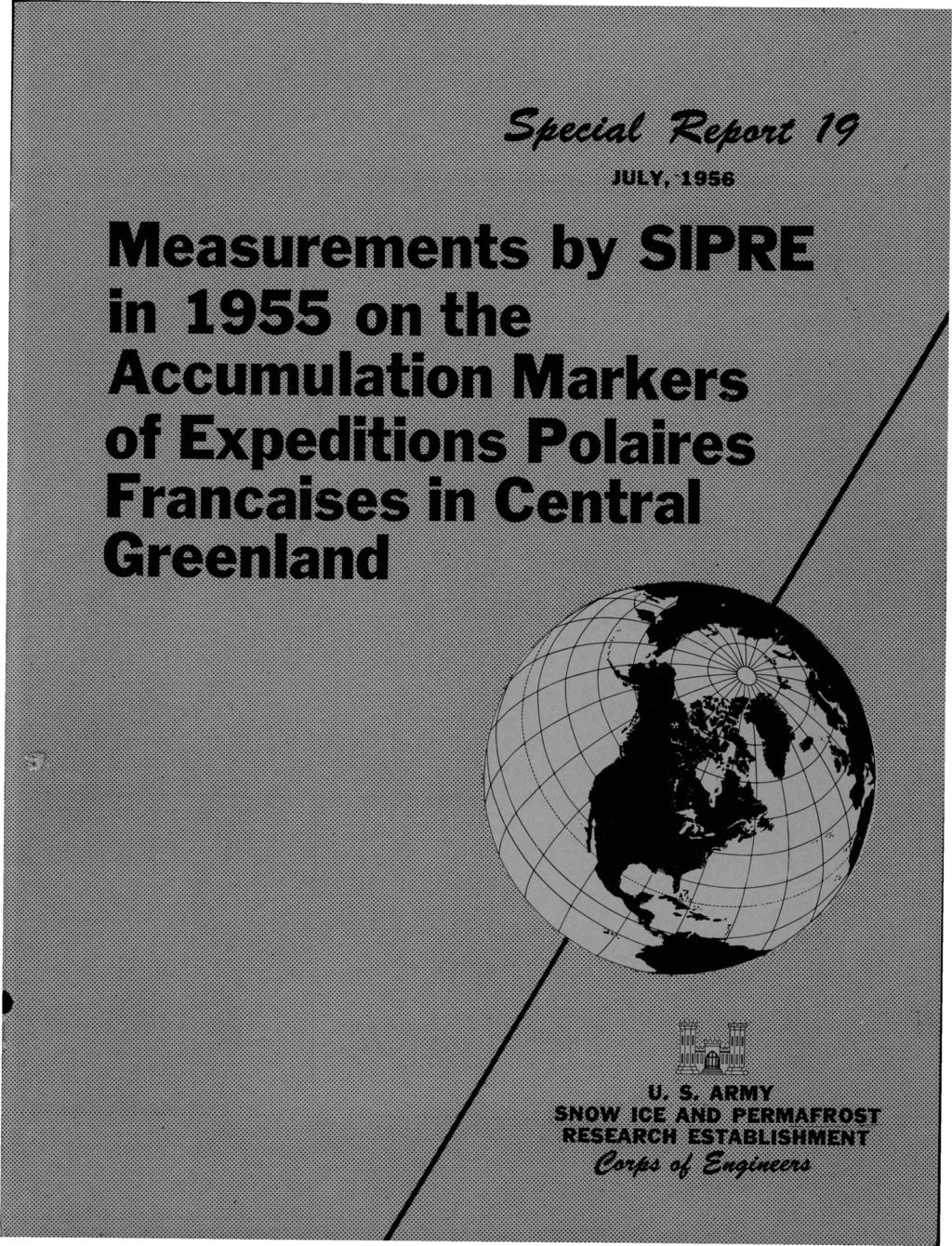
2 . Speetat il<efuj!et 19 JULY, 1956 Measurements by SIPRE in 1955 on the Accumulation Markers of Expeditions Polaires Francaises in Central Greenland by C. S. Benson and R. H. Ragle U. S. ARMY SNOW ICE AND PERMAFROST RESEARCH ESTABLISHMENT Corps of Engineers Wilmette, Illinois ARNY-NRC VICKSBURG, MISS.
3 MEASUREMENTS BY SIPRE IN 1955 ON THE ACCUMULATION MARKERS OF EXPEDITIONS POLAIRES FRANCAISES IN CENTRAL GREENLAND by C. S. Benson and R. H. Ragle ABSTRACT Some of the activities of SIPRE 's Expedition JELLO, which in part extended previous work done by Expeditions Polaires Francaises in central Greenland, are summarized. JELLO reached the French "Station Centrale" on 21 July The original station and deep pit (Puit Benoto) were visited; a 2-ft tower was erected; and all prominent markers were extended before JELLO departed on 1 August Expedition JELLO then followed the course westward that had been traversed by the French 4 and 5 years earlier, in an attempt to locate, measure, and lengthen the French accumulation markers which still showed above the 1955 snow surface. Fourteen of a possible nineteen or twenty markers were found. Measurements of the relative displacement of snow surface on the French markers over a 4-yr period ( ), together with the 1-yr measurements ( ) by the French, indicate a decrease in accumulation toward the higher elevations of the interior. This, in general, appears to check fairly well with stratigraphic observations in the snow, although the stratigraphic data have not been completely analyzed as yet. I. INTRODUCTION 1. Expedition JELLO of the Snow Ice and Permafrost Research Establishment (SIPRE) visited the French "Station Centrale" of Expeditions Polaires Francaises during July and August of "JELLO" was the field designation of a 6-man research expedition: Carl S. Benson, Glaciologist, Party Leader (SIPRE) Richard H. Ragle, Glaciologist, Assistant Party Leader (SIPRE) Robert W. Christy, M. D. (Dartmouth Medical School) James B. Holston, Radioman (Northwestern University) Alan C. Skinrood, Mechanic (Northwestern University) G orge Wallerstein, Navigator (California Institute of Technology). Four modified weasels (M29C Cargo Carriers) and six sleds provided transportation and living quarters. The main object of the expedition was glaciological research. A stratigraphic correlation in the snow on the ice sheet in northwestern Greenland has resulted from work during The 1955 expedition extended the stratigraphic control from the northwest to the central portion of Greenland along the route indicated in Figure 1. The time en route was 1 days. In Figure 1, the small circles on the trail indicate glaciological stations where 4-m-deep pit studies were made. They are numbered, e.g., 2-15, 2-175, 4-5, etc. The first number indicates the course heading; the number after the dash indicates the number of miles from the origin of the course. The small tick marks every 5 miles indicate the positions of ram hardness tests. Accumulation poles and plywood accumulation boards were placed at these points. The terminal point of the expedition (5-32) is approximately 18 miles from Sondrestrom Air Base. At this point the vehicles and sleds were winterized and cached for future use, and personnel

4 2 MEASUREMENTS ON ACCUMULATION MARKERS, EXPEDITIONS POLAIRES FRANCAISES Figure 1. Project "JELLO" route 13 May-22 August 1955.
, which was last occupied in August 1951.")
5 MEASUREMENTS ON ACCUMULATION MARKERS, EXPEDITIONS POLAIRES FRANCAISES 3 were picked up by ski-equipped aircraft from Sondrestromfjord on August In addition to the glaciological program, it was planned that Expedition JELLO would locate the French Station Centrale (5-4), which was last occupied in August This station (indicated by a large star in Fig. 1) is 4 miles west of the origin of the last course-heading taken by JELLO (5-), and noted as glaciological test station 5-4 on the expedition's network of stations. Plans also included an attempt to locate, measure, and extend the accumulation markers placed by the French in 195 and This report is concerned only with these aspects of the work. The glaciological research will be treated in a separate report. II. STATION CENTRALE 2. Expedition JELLO arrived at Station Centrale on 21 July and departed on 1 August The station was easily located by surface navigation. Prior attempts to locate it by aerial search had been unsuccessful. Many markers were well above the surface; most prominent were the three meteorological masts, the four poles around the main entrance, and four poles marking a food and material cache 2 m southwest of the main entrance. Access to the station was gained by excavation of the main entrance. (The examination of the tunnels and rooms of the station will be reported in a separate paper.) As the tripod at the deep glaciological pit (Puit Benoto) was nearly buried, it was encircled by a ring of bamboo poles, after the pit had been opened and internal measurements completed. Two markers east-southeast of the main entrance were barely visible on 21 July and a length of 3.66 m was added to each of them. ft was thought that these located the end of the French Geodetic Survey but it has been learned subsequently that this is not true. The survey markers were northwest of the. main entrance but were not visible in 1955 (see Table III). Similar extensions were made on other prominent markers, and a 3-ft steel tower was erected approximately 5 m northnorthwest of the main entrance (Fig. 2); 2 of the 3 ft are above the snow surface. The tower has its base located on the August 1951 surface, which is here approximately 3 em below the August --- APPRO X. 5M---- SNOW BACKFIL LED IN TRENCH Figure 2. Relationship of steel tower to the main entrance into Station Centrale.

6 4 MEASUREMENTS ON ACCUMULATION MARKERS, EXPEDITIONS POLAIRES FRANCAISES 1955 surface. This surface was easily identified because it was the first "dirty" layer uncoveredit warps upward over the main entrance. When found, the top of the pole was 36 em below the snow surface with only the tip of the wooden flagstaff visible. The tower was erected for two purposes: (1) as a marker for the station, and (2) as a support for meteorological and other instruments for future expeditions. It was built without the use of guy wires in an effort to avoid excessive stress caused by settling snow. It is anchored at the base by two 4- x 8-in. timbers (Fig. 2). Trenches were dug to 3 em to receive the timber footing, and backfilled after the tower was built up to the level of the 1955 surface. The structural members are 2-in.-diam steel pipes. Vertical and horizontal elements are 5 and 6 ft long respectively and are joined at the corners by Nu-Rail aluminum fittings and secured with Allen-Head screws. Details of the construction are shown in Figure 2. A cover was placed over the 1955 excavation of the main entrance. It is composed of 2- x 6-in. and 2- x 4-in. timbers with their longer dimension vertical; a plywood and board cover over the timber supports; and a tarpaulin covering the whole assembly. This cover will take some load off the already strained cover left by the French in 1951 and will facilitate future entrance (Fig. 2). III. WESTWARD TRAVERSE The sleeve has been secured to the French marker and the extension is ready to be added. The wooden plug with short flagstaff fits into the top of the aluminum tube. Note the weather-beaten remains of the original flag. -- Typical markers as the JELLO party left them. Figure 3. French accumulation marker at mile 141 (see Tables I and II). 3. In 195 the Expeditions Polaires Francaises set up a series of poles along their trail from Camp VI to Station Centrale (5-4). (Camp VI is located very near the JELLO End Point at 5-23 in Fig. 1.) Of this series, 4 were standing in the fall of It was expected that about half of these would be buried by the time our 1955 expedition traversed the region and that only four or five would be visible in The majority of those that should have been visible in 1955 were concentrated between mile 1 (French ''Milcent" or JELLO "5-14") and Station Centrale (see Table I). Fourteen of the poles were found, their height above the snow surface measured, and an extension of m made to each (see Fig. 1). The French marker poles are aluminum tubes of 6.3-cm outside diameter. Specifications were obtained from Expeditions Polaires Francaises and similar material was procured by SIPRE for Expedition JELLO. Aluminum sleeves were made to join the lengths of tubing, and fastened with hose clamps (see Fig. 3). New flags were placed on all
7 Table I. Location and Accumulation Measurements, Poles Placed by Expeditions Polaires Francaises (Excerpt from the marker-identification chart of Expeditions Polaires Francaises, with 1955 measurements added) Number and Location Distance and Distance from Camp from Camp VI (Stat- VI (km) ute Miles) Latitude North Height above Accumulation Last Height Snow Surface (m) Measured after Height above the Longitude (m From From Lengthening Pole Snow Surface West At Time of In June-July 195 July 1951 to end at the end of in August 195S Implantation June-July to of August August 19S1 (m) June June-July (m) Accumulation from Pole Measurements, over the 4-yr Period 19S (m) Geodetic Altitude at the Foot of the Pole* in June-July 19SO (m) A '4" (Mil cent) A A A A A A A 21S A A A A A 248 1S OS A 2S '3" 44 33'13" S S O.S7 - - S.S S.33 O.S9 43 4S 2.SO l.s S.21 o.ss S.26.68S 42 so S6 42 3S 2.3S S S S ' S.9S S2 2 4SO S S S S S S S 2 7SO S * At snow surface. (.)1
 by digging to the marker on the pole.")
8 6 MEASUREMENTS ON ACCUMULATION MARKERS, EXPEDITIONS POLAIRES FRANCAISES of the poles that had "flagstaffs" (Fig. 3). Identity of the poles was established by comparing our positions with the ones given in Table I and in one case (mile 16) by digging to the marker on the pole. The marker consisted of a piece of white adhesive tape with an inked number about 6 ft below the 1955 snow surface. The number was nearly illegible because of its exposure to two years of weather before burial. Its resistance to weather was low, and it appeared to have been written with washable ink. Table I is an excerpt from the marker-identification chart from Expeditions Polaires Francaises. Table II summarizes the information obtained from the poles found in In Table II the accumulation, as measured by differences in pole heights over the 4-yr period , is Table II. Average Accumulation as Obtained from the 1- and 4-yr Measurements on the French Poles between Milcent and Mile 16 Distance from French Camp VI (Statute Miles)* Height of Original Height Height of Top of Pole Change in of Top of Top of Pole Average Change in Deviation above Snow Height of Pole above above Snow Change Per Height of from 4-yr Surface Top of Pole Snow Surface Surface Year in 4 Years Top of Pole Average August 1951 August 1955 August (em) (m) (m) (m) (m) (m) (m) Deviation from 1-yr Average (em) Average: * Camp VI no longer exists, but was located approximately 3 miles from JELLO's terminal point reduced to values of average accumulation per year. The average of the 14 average values is 1.14 m per yr. This compares closely with the 1.18 m per yr average obtained by the French in the same trail interval during the period. The above figures are not strictly comparable, of course, because of differences in the amount of settling in the snow during the two time intervals. The significant information to be obtained from these data is a knowledge of how much snow is added each year in this region to within reasonable limits of approximately ± 1 or 2 em. Keeping in mind the limitations imposed by the method employed, it is very interesting to note that the data check as closely as they do and, equally important, that the yearly accumulation increments are as nearly constant as they are. The average density in the upper 3 rp of snow over this region indicates that 45 em of water equivalent are added each year. This is approximately 5 to 1 em more than the annual accumulation at similar elevations in the vicinity of Thule, Greenland (approximately 6 lat to the north). These results
9 MEASUREMENTS ON ACCUMULATION MARKERS, EXPEDITIONS POLAIRES FRANCAISES 7 are to be interpreted as preliminary; they will be more fully treated in a separate report. One of the poles which was not found in 1955 should be visible in the summer of It is located within 4 miles of Station Centrale. It was 6.35 m above the August 1951 snow surface and is estimated to have been about 2.35 m above the August 1955 surface. It should be approximately 1.35 m above the August 1956 snow surface. The values of accumulation as measured on the French poles are shown in Figure 4. Three sets of values are shown: A. The accumulation thickness, from the pole measurements, over the 1-yr period (Expeditions Polaires Francaises); B. The accumulation, from pole measurements, over the 4-yr period ; and C. The cumulative accumulation, from pole measurements, over the 5-yr period , C =A+ B. It is emphasized that these values were obtained from differences in the height of a reference point (the top) on poles in the snow. Settlement of the snow around the pole will influence accumulation values obtained in this manner. It is believed that the apparent decrease in accumulation toward the west coast, as shown in the 1-yr measurements (A in Fig. 4), is caused by more rapid settlement of snow at lower elevations. This phenomenon has been observed in northern Greenland by the writers. Stratigraphic measurements made by JELLO in 1955 along the course where these markers were found indicate that the decrease in accumulation toward higher elevations from Milcent (5-14) is a real one. However, toward the coast from Milcent, the accumulation seems to remain nearly constant, although the data have not been completely worked out yet. Figure 4 also clearly shows the marked clustering of the poles which were found in It is unfortunate that markers were not detectable at the lower elevations. 6 'E 4 z en IJ._ 3 :r: 1- a. w k.:.. 2 B --E>--- p_-- -;-(;)-qw-.e_"--q.. A MILCENT MILES FROM Q I 1 1 FRENCH CAMP VI "JELLO" STATION 5-23 NUMBERS t t 5-14 c STATION A () =ACCUMULATION FROM POLE MEASUREMENTS OVER THE 1-YR PERIOD 19&>-51. B (A) =ACCUMULATI ON FROM POLE MEASUREMENTS OVER THE 4-YR PERIOD C (G)= CUMULATIVE ACCUMULATION FROM POLE MEASUREMENTS OVER THE 5-YR PERIOD ; C = A + B. Figure 4. Accumulation values obtained from measurements on the French poles.
10 8 MEASUREMENTS ON ACCUMULATION MARKERS, EXPEDITIONS POLAIRES FRANCAISES The deviation from mean value of the 4- and 1-yr accumulation values is plotted in Figure 5. The 4-yr accumulation values show less scattering. The approximate eastward rate of decrease of 5 em per 2 miles appears to check with the 1955 stratigraphic measurements fro Milcent to JELLO 's turning point 14 miles farther east (5-). t 14 E z 11 <1: w 1 ::::;! ::::;! 9 :: 8 u. 7 w :: 6 ::J 5 :: 4 <1:.. 3 w 2 + MEAN E z 2 <1: w. 3 ::::;! 4 ::::;! 5 :: 6 u. 7 w :: 8 ::J 9 :: <1: 1.. w I "' MILCENT 1 e do =VALUES FROM H (195-51) e = VALUES FROM H ( ) MAXIMUM DETERMINED DEVIATION t t MAXIMUM DETERMINED DEVIATION MILES FROM FRENCH CAMP VI MEAN FOR THE 4 YR PERIOD = 144 CM/ YR. MEAN FOR THE 1- YR PERIOD = 118 CM/ YR. Figure 5. Departure from me an value of pole measurements. Expedition JELLO added to the usable network of markers by placing a new pole at each of its test stations from Milc;ent to the end of the trail (5-23). The locations and heights of these poles are listed in Table III. At Milcent, JELLO lengthened the French marker and also erected a second pole 6.16 m high approximately 6 m to the south. This was done because a test pit was dug close to the first pole and may cause some doming. The effect of such doming may be noticed for 2 or 3 years, as was observed at Station Centrale (5-4). Also, this is the only position at which two poles were placed and will serve as an extra check on location for future navigators in the region. It should be emphasized that vehicles, sleds, and other objects on the snow surface (including pits) should never be placed near accumulation markers. Their effect will invalidate measurements for two or more years. The expedition's navigator obtained accurate positions by sunsights with a Wild T-2 theodolite at Station Centrale and at Milcent. These positions, and also mile 16, had been located using the same method by the French. An attempt in 1955 to obtain an accurate position at mile 16 was unsuccessful because of inclement weather. The accuracy of the 1955 positions is included in
11 MEASUREMENTS ON ACCUMULATION MARKERS, EXPEDITIONS POLAIRES FRANCAISES 9 Table III. Location and Height above the August 1955 Snow Surface of the Tops of the Poles Placed by Expedition JELLO, with Limits of Error in 1955 Positional Work Station Latitude N Longitude W Error Error Height of Top of Pole above in Lat in Long. August 1955 Surface (m) '25" 4 37'57" 3" 12" 3.76 ±.5 J * ±.5 ** " 4" 4" 6.16 ±.1 *** ' o ±.1t " 45 22'11 4 " 4" 2.9 ±.1t " 45 43'12" 4" 3" 2.75 ±.1t " " 6" 4" 3.2 ± " 46 31' 55" 5" 3" 2.83 ±.1 I '59" 46 55'5" 5'' 6" 2.67 ± '8" " 5" 3" 3.2 ± " " 5" 6" '55" 48 4'5" 5" 3" 6.2 ±.1 * These 2 mark'ers were found e ast-southeast of the mai n entrance at the French Station Centrale. They were barely visible on arrival. We learned of their possible location by radio contact with P. E. Victor on 25 July 1955 while he was at Sondrestrom, Greenland. ** At Station 5-14 (French Milcent) JELLO placed a second pole which is approximately SO ft south of the original French pole. (Measurements on the French markers are listed in Table II.) *** At Station 5-15 a pole was place d but no extensive sunsights were made. t At these Stations the pole hei ghts were not measured with a tape but were estimated from the depth of a h ard subsurface l ayer. The limits of accuracy are estimated but are generous. Note: At all 1955 stations, acc umulation boards are placed on the snow surface on the south side of the foot of the marker p oles to facilitate measuring future accumulations. Table III. The accuracy of the French position determinations is approximately equal to ours at Station Centrale and is superior to ours at Milcent. The program of accurate positional work was undertaken in an attempt to observe flow movement and will be presented in a separate paper.
Resupply of Ice-Cap Expeditions by Air Drop
 / NOVEMBER, 1955 Resupply of ce-cap Expeditions by Air Drop by Carl S. Benson. U. S. ARMY SNOW CE AND PERMAFROST RESEARCH ESTABLSHMENT Corps of Engineers Wilmette, llinois. ARMY MRC VCKSBURG, MSS. RESUPPLY
LOCATING THE WASHINGTON MONUMENT GEODETIC BASE IN THE ISLAND OF GRAND CANARY MEASURED BY THE HYDROGRAPHIC EXPEDITION OF THE ARCHIPELAGO
 LOCATING THE WASHINGTON MONUMENT (Reproduced from. Geodetic Letter N 2, published in February 1935 by U. S. Coast and Geodetic Survey). On November 19, 1934, work was begun to permanently and accurately
Brita Horlings
 Knut Christianson Brita Horlings brita2@uw.edu https://courses.washington.edu/ess431/ Natural Occurrences of Ice: Distribution and environmental factors of seasonal snow, sea ice, glaciers and permafrost
MOMURDO-POLE TRAVERSE (See Bulletin, Volume II, Number 4, pages 21-22; Number 5, pages 24-25)
") MOMURDO-POLE TRAVERSE (See Bulletin, Volume, Number 4, pages 21-22; Number 5, pages 24-25) On the afternoon of 12 February, Dr. Albert P. Crary and Sveneld Evteev drove their 743 Sno-Cat up to the Amundsen-Soott
MOMURDO-POLE TRAVERSE (See Bulletin, Volume, Number 4, pages 21-22; Number 5, pages 24-25) On the afternoon of 12 February, Dr. Albert P. Crary and Sveneld Evteev drove their 743 Sno-Cat up to the Amundsen-Soott
GLACIOLOGY LAB SNOW Introduction Equipment
 GLACIOLOGY LAB SNOW Introduction The objective of this lab is to achieve a working knowledge of the snowpack. This includes descriptions and genetic analysis of features that can be observed on the surface
OF A SNOW COVER. B. E. Holtsmarkt
 INSULAT-ING EFFECT ON THE OF A SNOW COVER GROWTH OF YOUNG SEA ICE* B. E. Holtsmarkt I N THE spring of 1949 members of the U.S. Navy Electronics Laboratory stationed at the Arctic Research Laboratory of
POLAR WEEKEND SHRINKING ICE SHEETS AND RISING SEA LEVEL
 POLAR WEEKEND SHRINKING ICE SHEETS AND RISING SEA LEVEL TOPIC: Shrinking Ice Sheets and Rising Sea Levels PROJECT PERSONNEL: Dr. Robert Bindschadler, Glaciologist, NASA Scientists provide information on
INTRODUCTION. Hiromu SHIMIZU *
 NTRODUCTON Hiromu SHMZU * The 1th and 1th Japanese Antarctic Research Expenditions, JARE-1 (1971-197) and. JARE-1 097-197), carried out glaciological researches in Syowa Station area, Soya Coast, Mizuho
CA1 2.11: Designing an Equatorial Sundial Activity
 Purpose: To design an equatorial sundial and learn about motions of the sun and earth that have a bearing on its design. Materials: poster board, length of stiff wire or dowel rod, tape, protractor, ruler,
Choose a goal ANSWERS
 Choose a goal In order to help you focus on a topic, you will need to determine what your main goal will be. Whilst there may be some overlap in your purpose, some important main goals include: : entertain
Husky Oil Operations Limited
 Husky Oil Operations Limited 707 8th Avenue S.W. Bus: (403) 298-6111 Box 6525, Station D Fax: (403) 298-6378 Calgary, Alberta, Canada T2P 3G7 October 31, 2014 Sahtu Land &Water Board SLWB File: S13L1-005
THE LOSMANDY G-11 MOUNT
 Checking the parts THE LOSMANDY G-11 MOUNT Depending on which accessories you ordered, your G-11 mount was shipped in four or more boxes. The contents of each box are as follows: Equatorial Mount Adjustable
Surveying Prof. Bharat Lohani Indian Institute of Technology, Kanpur. Module 5 Lecture 1
 Surveying Prof. Bharat Lohani Indian Institute of Technology, Kanpur (Refer Slide Time: 00:20) Module 5 Lecture 1 Welcome to this another lecture on basic surveying. Today we are going to start a new module.
Investigating snow accumulation variability on the Antarctic Peninsula using Ground Penetrating Radar. - A tool for interpreting ice core records
 Investigating snow accumulation variability on the Antarctic Peninsula using Ground - A tool for interpreting ice core records Elizabeth R. Thomas June 2008 Scientific Report in support of Loan 824 Identifying
Motions of the Earth
 Motions of the Earth Our goals for learning: What are the main motions of the Earth in space? How do we see these motions on the ground? How does it affect our lives? How does the orientation of Earth's
Evolution of a Station Executing the Long Range Plan
 Evolution of a Station Executing the Long Range Plan Polar Technology Conference US Naval Academy Annapolis Maryland April 4, 2013 Jay Burnside & Jen Mercer Summit: A Unique Location Facts about Summit
Sub. Code:
 (ISO/IEC - 700-005 Certified) Model Answer: Summer 08 Code: 05 Important Instructions to examiners: ) The answers should be examined by key words and not as word-to-word as given in the model answer scheme.
During August 18 to 21, 1962, James A, Fdilliams, Director. Mining Engineer, made a trip to the Chandalar District, where the Little
 REPORT ON EXPLORATION IN THE CHANDALAR DISTRICT, 1962 During August 18 to 21, 1962, James A, Fdilliams, Director of the Division of Mines Minerals, and Robert H. Saunders, State Mining Engineer, made a
OBSERVATIONS OF PERMAFROST-LANDSCAPE DYNAMICS RELATED TO ANTHROPOGENIC DISTURBANCES, YUKECHI STUDY SITE, CENTRAL YAKUTIA
 OBSERVATIONS OF PERMAFROST-LANDSCAPE DYNAMICS RELATED TO ANTHROPOGENIC DISTURBANCES, YUKECHI STUDY SITE, CENTRAL YAKUTIA A.N. Fedorov, P.Ya. Konstantinov, I.S. Vassiliev, N.P. Bosikov, Ya.I. Torgovkin,
Erosional Features. What processes shaped this landscape?
 Have you ever looked at the land around you and wondered what processes shaped what you see? Perhaps you see mountains, valleys, rivers, or canyons. Do you know how long these geologic features have been
Leveling. 3.1 Definitions
 Leveling 3.1 Definitions Leveling is the procedure used to determine differences in elevation between points that are remote from each other. Elevation is a vertical distance above or below a reference
TEK: P.3E Use trigonometry in mathematical and real-world problems, including directional bearing
 Precalculus Notes 4.8 Applications of Trigonometry Solving Right Triangles TEK: P.3E Use trigonometry in mathematical and real-world problems, including directional bearing Page 1 link: http://www.schooltube.com/video/d0e919b807644adaa500
Section 2. Locating Astronomical Objects in the Night Sky What Do You See? What Do You See? Think About It. Investigate.
 Section 2 Locating Astronomical Objects in the Night Sky Section 2 Locating Astronomical Objects in the Night Sky What Do You See? What Do You See? Learning Outcomes In this section, you will Construct
Forecasts include: Temperature. Barometric (air) Pressure. Wind direction/speed Humidity
 Pressure. Wind direction/speed Humidity") Meteorology I Intro. to Weather 1. What is Weather? A) Weather is the state of the atmosphere at a given time and place. B) Weather changes on a regular basis. C) Meteorologists forecast weather conditions
Meteorology I Intro. to Weather 1. What is Weather? A) Weather is the state of the atmosphere at a given time and place. B) Weather changes on a regular basis. C) Meteorologists forecast weather conditions
3 - Celestial Sphere
 3 - Celestial Sphere Purpose: To construct and use a celestial sphere to show the motion of the Sun and stars in the sky. There are six questions, Q1 Q6, to answer on a separate piece of paper. Due: in
Seismic measurement of the propagation speed of a fracture through a weak snowpack layer
 Seismic measurement of snow fracture Seismic measurement of the propagation speed of a fracture through a weak snowpack layer Ben Johnson 1, Bruce Jamieson 1,2, and Robert R. Stewart 2 ABSTRACT Weak layers
Issue 1 1st October Contents. MONDO - All the time in the world [05] Installation and Adjustment...[08] Use of the MONDO...
![Issue 1 1st October Contents. MONDO - All the time in the world [05] Installation and Adjustment...[08] Use of the MONDO...](/thumbs/81/83426404.jpg "Issue 1 1st October Contents. MONDO - All the time in the world [05] Installation and Adjustment...[08] Use of the MONDO...") MONDO - Manual Issue 1 1st October 2004 Contents MONDO - All the time in the world [05] Installation and Adjustment.....[08] Use of the MONDO............[13] [03] [04] ILLUSTRATION 1: MONDO MONDO All
MONDO - Manual Issue 1 1st October 2004 Contents MONDO - All the time in the world [05] Installation and Adjustment.....[08] Use of the MONDO............[13] [03] [04] ILLUSTRATION 1: MONDO MONDO All
CHAPTER IV THE RELATIONSHIP BETWEEN OCEANOGRAPHY AND METEOROLOGY
 CHAPTER IV THE RELATIONSHIP BETWEEN OCEANOGRAPHY AND METEOROLOGY THE relationship between oceanography and meteorology is of an order different from that between it and geology or biology, because meteorologic
EROSIONAL FEATURES. reflect
 reflect Have you ever looked at the land around you and wondered what processes shaped what you see? Perhaps you see mountains, valleys, rivers, or canyons. Do you know how long these geologic features
Modern Navigation. Thomas Herring
 12.215 Modern Navigation Thomas Herring Review of Last Class Almanacs: Paper and electronics Paper Almanacs: Nautical Almanac Electronic: Available on many web sites Homework #1 solutions 10/17/2006 12.215
INTRODUCTION FOREWORD
 FOREWORD The Sight Reduction Tables for Air Navigation consist of three volumes of comprehensive tables of altitude and azimuth designed for the rapid reduction of astronomical sights in the air. This
INTRODUCTION. As you look out the window, you. What Is Geography?
 fm.qxd 10/18/01 1:09 PM Page 1 INTRODUCTION What Is Geography? As you look out the window, you may see rolling hills, broad plains, mountains, a river valley, or perhaps the ocean. You also may notice
EARTH SCIENCE KEY UNIT 2-H
 EARTH SCIENCE KEY UNIT 2-H UNIT 2 MODELS & DIMENSIONS OF EARTH I. Model = ANYTHING THAT REPRESENTS THE PROPERTIES OF AN OBJECT OR SYSTEM A. Types and examples of models: 1. PHYSICAL Provides us with information
Latitude and Longitude Pre Test
 Name Date Latitude and Longitude Pre Test Multiple Choice Directions: For questions, 1 10 circle the answer that letter that best answers the question. Each question is worth 1 point each. 1. To locate
WEST FROM WASHINGTON
 SEPTEMBER 2018 WEST FROM WASHINGTON Hemisphere GNSS A visit to headquarters Thought Leader Bloomberg out of touch Flood Info Ensure it s correct West from Washington Establishing the 25th and 27th Meridians
SENSOR PLACEMENT FOR SNOW & ICE MELT APPLICATIONS
 networketi.com SENSOR PLACEMENT FOR SNOW & ICE MELT APPLICATIONS By: Dave Mays A great number of service calls come in with the common problem of the heaters not coming on even though it is snowing outside
Finding the Size of the Earth using GPS
 Finding the Size of the Earth using GPS Around 240 BC Eratosthenes found the circumference of the Earth by observing shadow from high noon sun in the cities of Alexandria and Syene. His final value for
Bedrock Associated with the Ranch House at the Tallgrass Prairie National Preserve, Chase County, Kansas
 Bedrock Associated with the Ranch House at the Tallgrass Prairie National Preserve, Chase County, Kansas KGS OPEN-FILE REPORT 2008-10 KANSAS GEOLOGICAL SURVEY 1930 Constant Ave. - Campus West Lawrence,
Aviation Maps: Aviation Maps: Chapter Ten. Chapter Ten. The Art of the Chart. The Art of the Chart. Page J1. The Lambert Conformal Conic Projection
 Page J1 Chapter Ten Chapter Ten viation Maps: viation Maps: The rt of the Chart The rt of the Chart The Lambert Conformal Conic Projection 1. [J2/Figure 1] When drawing lines on a Lambert Conformal Conic
Summit Station, Greenland. Science on the Ice Sheet
 Summit Station, Greenland Science on the Ice Sheet Where is Greenland? Facts About Greenland - Independent country within the Kingdom of Denmark - Population of ~56,000 people - Least populated country
PAM-Station Land-Owner Information Guide Project: CuPIDO, Tucson AZ, Jul/Aug 2006
 PAM-Station Land-Owner Information Guide Project: CuPIDO, Tucson AZ, Jul/Aug 2006 PropVane Anemometer mounted at 10-m Lightning Spike Two-Way radio antenna Sonic Anemometer Solar and Net Radiation sensors.
Before you Sit. Please Pick-up: Blue Information Sheet for Evening Observing. 1 Red and 1 Blue ticket for Observing/ Planetarium
 Before you Sit Please Pick-up: Blue Information Sheet for Evening Observing. 1 Red and 1 Blue ticket for Observing/ Planetarium Evening Observing Observing at the Brooks Observatory: Three different weeks
Whistler Mountain is located at about 50 0 North latitude by 123 0
 - 24 - WHISTLER MOUNTAIN AVALANCHE CONTROL PROGRAMME C. Stethem and J. Hetherington Introduction Whistler Mountain is located at about 50 0 North latitude by 123 0 longitude, in the Pacific Coast Range
Cloud Forms of the Jet Stream'
 Cloud Forms of the Jet Stream' By VINCENT J. SCHAEFER z, General Electric Research Laboratory (Manuscript received October IS. 1952) Abstract A combination of four cloud types including specific forms
AS REVEALED IN GREENLAND ICE CORES FROM 11 LOCATIONS
 Annals of Glaciology 1988 International Glaciological Society THE LAKI AND TAMBORA ERUPTIONS AS REVEALED IN GREENLAND ICE CORES FROM 11 LOCATIONS by H.B. Clausen and C.U. Hammer (Department of Glaciology,
Acquisition of Multi-Function Equipment at DIA: Conditions, Factors, Considerations & Integration. Presented by Mike Carlson September 20, 2012
 Acquisition of Multi-Function Equipment at DIA: Conditions, Factors, Considerations & Integration Presented by Mike Carlson September 20, 2012 1 Denver International Airport 5 Runways 12,000 /. (3,658m)
1 What Is Climate? TAKE A LOOK 2. Explain Why do areas near the equator tend to have high temperatures?
 CHAPTER 17 1 What Is Climate? SECTION Climate BEFORE YOU READ After you read this section, you should be able to answer these questions: What is climate? What factors affect climate? How do climates differ
Module 2: Mapping Topic 2 Content: Determining Latitude and Longitude Notes
 Introduction In order to more easily locate points on a globe or map, cartographers designed a system of imaginary vertical lines (also called parallels) and horizontal lines (also called meridians) that
CHAPTER 20 SIGHT REDUCTION
 CHAPTER 20 SIGHT REDUCTION BASIC PRINCIPLES 2000. Introduction Reducing a celestial sight to obtain a line of position consists of six steps: 1. Correcting sextant altitude (hs) to obtain observed altitude
StoneHenge. (Neolithic-Period)
") StoneHenge (Neolithic-Period) Stonehenge, England Stonehenge, the most visited and well known of the British stone rings, is a composite structure built during three distinct periods. In Period I (radiocarbon-dated
StoneHenge (Neolithic-Period) Stonehenge, England Stonehenge, the most visited and well known of the British stone rings, is a composite structure built during three distinct periods. In Period I (radiocarbon-dated
3. The map below shows an eastern portion of North America. Points A and B represent locations on the eastern shoreline.
 1. Most tornadoes in the Northern Hemisphere are best described as violently rotating columns of air surrounded by A) clockwise surface winds moving toward the columns B) clockwise surface winds moving
The Following was Noted: US Army Corps of Engineers Philadelphia District Geotechnical Section, CENAP-EN-DG
 US Army Corps of Engineers Philadelphia District Geotechnical Section, CENAP-EN-DG Wanamaker Bldg, 7th Floor 100 Penn Square East Philadelphia, PA 19107-3396,USA Site Visit Report Date: Tuesday, Nov. 6,
SPQ Module 20 Ice Flows
 SPQ Module 20 Ice Flows When Ray, Richard & Kevin received their sleds in Southern Chili they opened them with excitement, and Kevin remarked they look like little canoes. It is perhaps appropriate that
ESS 431 Principles of Glaciology ESS 505 The Cryosphere
 MID-TERM November 9, 2015 ESS 431 Principles of Glaciology ESS 505 The Cryosphere Instructions: Please answer the following 5 questions. [The actual 5 questions will be selected from these 12 questions
Byrd Station, Antarctica, Operation Deep Freeze 1966 (October 1965-October 1966) Gordon W. Callender, CDR USN, Ret.
 Gordon W. Callender, CDR USN, Ret.") Byrd Station, Antarctica, Operation Deep Freeze 1966 (October 1965-October 1966) by Gordon W. Callender, CDR USN, Ret. Dedicated to the memory of LT Robert B. Hunt, MC, USNR (1940-2004) BACKGROUND During
Byrd Station, Antarctica, Operation Deep Freeze 1966 (October 1965-October 1966) by Gordon W. Callender, CDR USN, Ret. Dedicated to the memory of LT Robert B. Hunt, MC, USNR (1940-2004) BACKGROUND During
Red Star Navigation. Bearings:
 Red Star Navigation Bearings: The main focus in Red Star Navigation is how to use a compass and in particular compass bearings. It is important for cadets to describe bearings as this will assist them
Vigyan Pratibha Learning Unit (Teacher version) Shadows
 Shadows") Shadows Take a look around and you will notice that all things form shadows. You must have played in the ground on a bright sunny day and seen that shadow formed by your body runs around with you. Have
Shadows Take a look around and you will notice that all things form shadows. You must have played in the ground on a bright sunny day and seen that shadow formed by your body runs around with you. Have
APPENDIX A GLOSSARY. Appendix A.1
 APPENDIX A GLOSSARY Appendix A.1 Appendix A.2 Back Bearing A back bearing is measured from the object to your position. It is the exact opposite of a direct bearing. Base Line An imaginary line on the
PHY222 Lab 8 - Magnetic Fields and Right Hand Rules Magnetic forces on wires, electron beams, coils; direction of magnetic field in a coil
 PHY222 Lab 8 - Magnetic Fields and Right Hand Rules Magnetic forces on wires, electron beams, coils; direction of magnetic field in a coil Print Your Name Print Your Partners' Names You will return this
EARLY-TIME, MULTI-COMPONENT MOBILE TEM FOR DEEP METAL DETECTION. Abstract
 EARLY-TIME, MULTI-COMPONENT MOBILE TEM FOR DEEP METAL DETECTION Norman R. Carlson and Kenneth L. Zonge Zonge Engineering & Research Organization, Inc., Tucson, AZ. Abstract Data examples from a recent
Florida Panhandle and Alabama Beaches Welcome Spring Break: Free of Tar Balls at Last
 Florida Panhandle and Alabama Beaches Welcome Spring Break: Free of Tar Balls at Last Ping Wang, James H. Kirby III, and Jun Cheng Coastal Research Laboratory, Department of Geology, University of South
C13^COMMONWEALTH OF AUSTRALIA
 tal C13^COMMONWEALTH OF AUSTRALIA DEPARTMENT OF NATIONAL DEVELOPMENT BUREAU OF MINERAL RESOURCES, GEOLOGY AND GEOPHYSICS 44 1 NE/41 RECORD No. 1963/22 l^' it Ril R y#11, 1 zz^g M^ P3 C3 rn 00 GEOPHYSICAL
8.9 Observing Celestial Objects from Earth
 8.9 Observing Celestial Objects from Earth Celestial objects are visible from Earth both by day and by night. In the daytime you can see the Sun and, sometimes, the Moon. Looking up at the night sky on
PROSPECTING REPORT. re. Minera.1 C laims
 PROSPECTING REPORT re. Minera.1 C laims P R 1 Record #3052 (6) P R 2 Record #3053 (6) p R 3 Record #3054 (6) at Ilong.129, Latt. 58 20' in the Two Mile Creek area of Turnagain River drainage system in
NAVIGATION THEORY QUESTIONS Basics of Navigation
 NAVIGATION THEORY QUESTIONS Basics of Navigation Q610065 look at it The angle between the plane of the ecliptic and the plane of equator is approx? 23.5 degrees In which two months of the year is the difference
Introduction to Navigation
 Feb 21: Navigation--Intro Introduction to Navigation Definition: The process of finding the way to a goal Note: this is a broader definition than some scientists use Questions about navigation How do they
Surveying I. Unit - I. Different methods and instruments are being used to facilitate the work of
 Surveying I Unit - I Definition of Survey Surveying is the art of determining the relative positions of different objects on the surface of the earth by measuring the horizontal distances between them,
NAME: Given Formulae: Law of Cosines: Law of Sines:
 NME: Given Formulae: Law of Cosines: EXM 3 PST PROBLEMS (LESSONS 21 TO 28) 100 points Thursday, November 16, 2017, 7pm to 9:30, Room 200 You are allowed to use a calculator and drawing equipment, only.
Landslides and Ground Water Permeability with Respect to the. Contact Point of Glacial Lake Vermont and the Champlain Sea
 Landslides and Ground Water Permeability with Respect to the Contact Point of Glacial Lake Vermont and the Champlain Sea Sediments at Town Line Brook, Winooski, VT Michala Peabody Lara Vowles Abstract:
Bio-monitoring Air Quality Using Lichen
 Bio-monitoring Air Quality Using Lichen An Expedition to the Gaoligong Mountains of Western Yunnan Provence, China June July 2011 Explorers Club Flag # 60 Expedition Leader: Lawrence Glacy, FN 09 Biomonitoring
Earth & Space Science, Interpreting Data DURATION Preparation: 5 minutes Activity: 40 minutes (total over one day)
") Objectives In this activity students will: 1. Observe how the position of the sun in the sky changes during the course of the day 2. Discover the cardinal directions by tracking the motion of the sun Materials
Objectives In this activity students will: 1. Observe how the position of the sun in the sky changes during the course of the day 2. Discover the cardinal directions by tracking the motion of the sun Materials
Applications. Remote Weather Station with Telephone Communications. Tripod Tower Weather Station with 4-20 ma Outputs
 Tripod Tower Weather Station with 4-20 ma Outputs Remote Weather Station with Telephone Communications NEMA-4X Enclosure with Two Translator Boards and Analog Barometer Typical Analog Output Evaporation
Prepared by Dongchen E Chinese Antarctic Center of Surveying and Mapping Chinese representative to SCAR WG-GGI
 SCAR XXVI Tokyo,Japan July, 2000 Report of Current Activities of China for 1998-2000 Prepared by Dongchen E Chinese Antarctic Center of Surveying and Mapping Chinese representative to SCAR WG-GGI Chinese
Alabama Karst Variability Study
 Alabama Karst Variability Study James L. McNees and Susan H. Roberts Alabama Radon Program Introduction Beginning with the FY 2001 grant year, EPA Region IV imposed Special Karst Conditions on three of
Town of Chino Valley. Survey Control Network Report. mgfneerhg mc N. Willow Creek Road Prescott AZ
 Town of Chino Valley Survey Control Network Report mgfneerhg mc. 2050 N. Willow Creek Road Prescott AZ 86301 928-771-2376 Page 1 of 70 Table of Contents Town of Chino Valley Survey Datum Outline A short
Maps. 3. Which altitude of Polaris could be observed in New York State?
 Name: Date: 1. For an observer in New York State, the altitude of Polaris is 43 above the northern horizon. This observer s latitude is closest to the latitude of A. New York City B. Utica 3. Which altitude
Elementary Social Studies Content Area Assessment Task. Winter 2010 EDUC 203
 1 Elementary Social Studies Content Area Assessment Task Winter 2010 EDUC 203 Students: Fourth grade class in Watsonville, CA. Approximately 90% Latino, primarily of Mexicandescent. About 80% participate
AIR MASSES. Large bodies of air. SOURCE REGIONS areas where air masses originate
 Large bodies of air AIR MASSES SOURCE REGIONS areas where air masses originate Uniform in composition Light surface winds Dominated by high surface pressure The longer the air mass remains over a region,
APPENDIX B PHYSICAL BASELINE STUDY: NORTHEAST BAFFIN BAY 1
 APPENDIX B PHYSICAL BASELINE STUDY: NORTHEAST BAFFIN BAY 1 1 By David B. Fissel, Mar Martínez de Saavedra Álvarez, and Randy C. Kerr, ASL Environmental Sciences Inc. (Feb. 2012) West Greenland Seismic
Daily Motions. Daily Motions. Solar and Sidereal Days. Annual Motions of the Sun. Coordinate system on Earth. Annual Motion of the Stars.
 Sun: rises in the east sets in the west travels on an arc across the sky 24 hours Daily Motions Solar Day = 24 hours Stars: stars travel on arcs in the sky moving from east to west. some stars rise and
P1.15 DECADAL WIND TRENDS AT THE SAVANNAH RIVER SITE
 1. INTRODUCTION P1.15 DECADAL WIND TRENDS AT THE SAVANNAH RIVER SITE Allen H. Weber, Robert L. Buckley, and Matthew J. Parker Savannah River National Laboratory, Aiken, South Carolina One possible consequence
NT10-09 Cruise Report KUMANO-NADA DONET Node Installation & Observatory Construction
 NT10-09 Cruise Report KUMANO-NADA DONET Node Installation & Observatory Construction June 2010 Table of Contents 1. Overview 2. Schedule 3. Dive Summary 4. Concluding Remarks 1. Overview DONET is a program
1,836 people die and 136,309 people are injured every year from icy roads in the US.
 Winter Driving The United States Department of Transportation (USDOT) Federal Highway Administration reports that 1,836 people die and 136,309 people are injured every year from icy roads in the US. 2
2/23/ WIND PRESSURE FORMULA 2. PERCENT OF ALLOWABLE STRESS 3. FATIGUE DESIGN
 Original Title Presented by Northwest Signal copyright 2010 Designing & Building Structural Steel Products since 1976 Primary Users Traffic Signal Strain & Mast Arm Poles Cantilever & Bridge Sign Structures
CHAPTER 24 THE SAILINGS
 CHAPTER 24 THE SAILINGS INTRODUCTION 2400. Introduction Dead reckoning involves the determination of one s present or future position by projecting the ship s course and distance run from a known position.
ORIENTEERING. The challenge is to use the map to decide the best route to complete the course in the quickest time. Orienteering Map. Compass.
 ORIENTEERING Orienteering is similar to a cross-country race but you navigate using a map instead of following a set course. It is an outdoor sport where competitors navigate their own way, you can run,
Lab 2: Angles and other needed math (or the history of astronomy)
") Astronomy 101 Name(s): Lab 2: Angles and other needed math (or the history of astronomy) Purpose: This lab is an overview of much of the math skills you will need for this course. As I hope you will see
Astronomy 101 Name(s): Lab 2: Angles and other needed math (or the history of astronomy) Purpose: This lab is an overview of much of the math skills you will need for this course. As I hope you will see
Surveying Prof. Bharat Lohani Department of Civil Engineering Indian Institute of Technology, Kanpur. Module - 11 Lecture No. # 01 Project surveys
 Surveying Prof. Bharat Lohani Department of Civil Engineering Indian Institute of Technology, Kanpur Module - 11 Lecture No. # 01 Project surveys (Refer Slide Time: 00:24) Welcome to this video lecture,
ESC 3704 Spring 2012 In-Class Exercise #1 KEY
 ESC 3704 Spring 2012 In-Class Exercise #1 KEY The video On Thin Ice, narrated by Martin Atkin, will be shown in class. Answer the questions as the movie progresses, then write answers to the discussion
Seismic Recording Station TA_109C Summary Report
 Seismic Recording Station TA_109C Summary Report Thank you for hosting station TA_109C on your property. We hope that you find the enclosed report interesting. Your station is one of the 2000 USArray seismic
MAPPING BEDROCK: Verifying Depth to Bedrock in Calumet County using Seismic Refraction
 MAPPING BEDROCK: Verifying Depth to Bedrock in Calumet County using Seismic Refraction Revised December 13, 2011 Dave Hart Wisconsin Geological and Natural History Survey INTRODUCTION Seismic refraction
December 13, Kirk Shields Green Mountain Power 163 Acorn Lane Colchester, VT 05446
 December 13, 2017 Kirk Shields Green Mountain Power 163 Acorn Lane Colchester, VT 05446 RE: End of Field Letter for Archaeological Phase II Site Evaluation at Site VT-CH-1218 within the Proposed Milton
THE HISTORY OF WEATHER OBSERVING IN CHEYENNE, WYOMING,
 THE HISTORY OF WEATHER OBSERVING IN CHEYENNE, WYOMING, 1870-2004 Downtown Cheyenne, Wyoming, circa 1890 From Wyoming State Archives, Department of State Parks and Cultural Resources Current as of January
Lessons Learned from 40 Years of Grid-Sampling in Illinois D.W. Franzen, North Dakota State University, Fargo, ND
 Introduction Lessons Learned from 4 Years of Grid-Sampling in Illinois D.W. Franzen, North Dakota State University, Fargo, ND In 1961 a quietly radical soil sampling project was initiated by Drs. Sig Melsted
The Earth is a Rotating Sphere
 The Earth is a Rotating Sphere The Shape of the Earth Earth s Rotation ( and relative movement of the Sun and Moon) The Geographic Grid Map Projections Global Time The Earth s Revolution around the Sun
STUDY OF ICE FABRICS, THULE AREA, GREENLAND
 STUDY OF CE FABRCS, THULE AREA, GREENLAND by George P. Rigsby ABSTRACT Crystal fabric studies were made on glacier ice taken from 11 locations on the Nuna Ramp at:td three locations on the Moltke Glacier,
Self-Testing Prevectron 2 Millenium Lightning Conductor Set-up and Installation Manual
 Self testing Prevectron 2 Millenium Lightning Conductor ENGLISH Self-Testing Prevectron 2 Millenium Lightning Conductor Set-up and Installation Manual S6.60T S4.50T S3.40T N.B. : Information and Specifications
Astronomy 120 Winter 2005 Highlights of Astronomy. First Midterm Examination
 Astronomy 120 Winter 2005 Highlights of Astronomy First Midterm Examination Name: MULTIPLE CHOICE: Choose the one best answer from among the five choices for each of the following 6 questions. Each correct
Report of the 2013 BE expedition to observe climate change in the Himalayas
 Report of the 2013 BE expedition to observe climate change in the Himalayas Introduction scientific leader, John Griffiths (Meteogroup) In the summer of 2013 British Exploring (BE) organised and ran a
WEATHER SYSTEMS IMPACTING THE CAYMAN ISLANDS Prepared by the staff of the Cayman Islands National Weather Service
 WEATHER SYSTEMS IMPACTING THE CAYMAN ISLANDS 2008 Prepared by the staff of the Cayman Islands National Weather Service TROPICAL STORM DOLLY Formed 194 miles west of Grand Cayman July 19 th. The tropical