WordPress and CRM. Match Made In Heaven... or Hell?
|
|
|
- Nora Perkins
- 6 years ago
- Views:
Transcription

1
2 WordPress and CRM Match Made In Heaven... or Hell?

3 Who Am I? Colin Pizarek Product Manager, NeonCRM Board Member, Ridgeville Foundation Alumnus, Idealware
4 Disclaimer: I m opinionated.
5 Moving data from one place to another

6 Your website and your CRM are two different things.

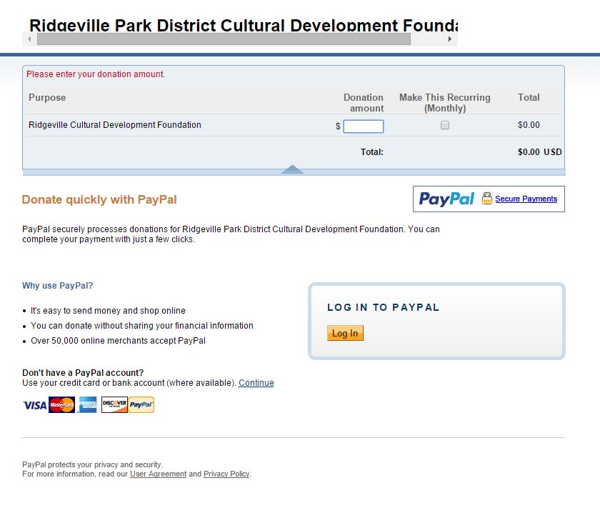
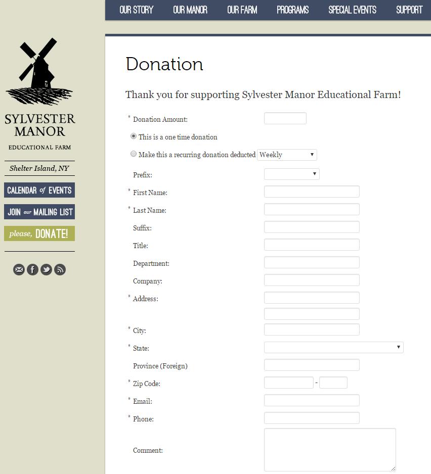
7 Import / Export
8 CRM-Provided Solution
9 API Connection API
10 Projects and Solutions
11 Projects Web Forms Restricted Access Directories Analytics
12 Format To what end? What are your options? What can go wrong?


13 Web Forms


14 Example: Not integrated

15 Example: Integrated
16 Integrated Web Forms: To what end? Your forms should be consistent with your website. Increase giving Reduce friction
17 Option 1: Import / Export Makes sense if: Time-sensitive events or campaigns Few users Does not make sense if: Ongoing campaigns or events Lots of users
18 Option 2: CRM-Provided Forms Makes sense if: Priority is toward speedy implementation and reliability Doesn t make sense if: Priority is toward a highly optimized user experience
19 Option 3: API-Connected Forms Makes sense if: Developers for building and support are available Custom user experience is high priority High volume of payment processing Doesn t make sense if: Budget is a concern Low tolerance for risk or failure Lower technology experience on-site
20 What can go wrong? Duplicates Spam / Fraudulant submissions Payment processing security


21 Donor / Member Portals
22 Donor Portals: To what end? Constituents log in to: Update their contact information View restricted content Manage recurring donations
23 Option 1: CRM-Provided Portals Makes sense if: Your CRM provides what you need Doesn t make sense if: You already have a lot of users used to logging in elsewhere
24 Option 2: Host it in WordPress / Elsewhere Makes sense if: Your users are already there You need to provide a very specific functionality You need total control over user experience Doesn t make sense if: You don t have the resources to implement and maintain
25 What can go wrong? Constituents may not adopt it. Supporting constituents
26 What if you have multiple? Example: An association of cancer researchers Discussion Forum CRM Online Journal, subscription
27 Single Sign-On Makes sense if: You have constituents logging in to multiple unique services Doesn t make sense if: Budget is a concern You lack the resources to implement and maintain
28 What can go wrong? Constituents may not adopt it. Supporting constituents

29 Directories and Lookups
30 Directories, Lookups: To what end? Search for people or businesses directly from your CRM Campaign progress Event feeds
31 Example: Fair Trade Federation Searches for businesses from CRM Displays contact information
32 Directories and Lookups Makes sense if: The CRM is the best place for the data to be stored The data is valuable to your constituents Doesn t make sense if: The data isn t really appropriately stored in the CRM
33 What can go wrong? Accidental exposure of sensitive data Displaying wrong information Slow performance

34 Website Analytics
35 Website Analytics: To what end? Target website content to improve desired results Learn about preferences of constituents Fine-tune content to your constituents
36 Option 1: Anonymous Tracking Makes sense if: You want to improve your website s effectiveness. Doesn t make sense if: You need this data stored in your CRM.
37 Option 2: Non-Anonymous Tracking Makes sense if: You have a very specific reason for collecting the data Doesn t make sense if: You lack a specific reason for needing this data. You lack the resources to take action on this data
38 What can go wrong? Trust and privacy concerns Information overload
39 Let s wrap this up.
40 Add value. For staff For constituents
41 Data is messy. Fail gracefully. Account for the unexpected. Know your data.
42 CRMs are not created equally. Knowing one CRM does not mean knowing all CRMs. Everyone involved needs to know the data structure.
43 It s over. Many images courtesy of Freepik.com
44
Enabling Web GIS. Dal Hunter Jeff Shaner
 Enabling Web GIS Dal Hunter Jeff Shaner Enabling Web GIS In Your Infrastructure Agenda Quick Overview Web GIS Deployment Server GIS Deployment Security and Identity Management Web GIS Operations Web GIS
How to Increase the Significance of your GIS
 How to Increase the Significance of your GIS Wade Kloos, GIS Director, Utah Department of Natural Resources wkloos@utah.gov 2014 Esri International User Conference July 17 How to Increase the Significance
ArcGIS Deployment Pattern. Azlina Mahad
 ArcGIS Deployment Pattern Azlina Mahad Agenda Deployment Options Cloud Portal ArcGIS Server Data Publication Mobile System Management Desktop Web Device ArcGIS An Integrated Web GIS Platform Portal Providing
Leveraging Web GIS: An Introduction to the ArcGIS portal
 Leveraging Web GIS: An Introduction to the ArcGIS portal Derek Law Product Management DLaw@esri.com Agenda Web GIS pattern Product overview Installation and deployment Configuration options Security options
Portal for ArcGIS: An Introduction
 Portal for ArcGIS: An Introduction Derek Law Esri Product Management Esri UC 2014 Technical Workshop Agenda Web GIS pattern Product overview Installation and deployment Security and groups Configuration
Introduction to Portal for ArcGIS. Hao LEE November 12, 2015
 Introduction to Portal for ArcGIS Hao LEE November 12, 2015 Agenda Web GIS pattern Product overview Installation and deployment Security and groups Configuration options Portal for ArcGIS + ArcGIS for
Introduction to Portal for ArcGIS
 Introduction to Portal for ArcGIS Derek Law Product Management March 10 th, 2015 Esri Developer Summit 2015 Agenda Web GIS pattern Product overview Installation and deployment Security and groups Configuration
Wireless Network Security Spring 2015
 Wireless Network Security Spring 2015 Patrick Tague Class #20 IoT Security & Privacy 1 Class #20 What is the IoT? the WoT? IoT Internet, WoT Web Examples of potential security and privacy problems in current
ARGUS.net IS THREE SOLUTIONS IN ONE
 OVERVIEW H i g h l y c o n f i g u r a b l e s o f t w a r e a c c o m m o d a t e s a w i d e r a n g e o f c o l l e c t i o n s T h r e e s o l u t i o n s c o v e r P o r t a l s, C o l l e c t i o
CHAPTER 22 GEOGRAPHIC INFORMATION SYSTEMS
 CHAPTER 22 GEOGRAPHIC INFORMATION SYSTEMS PURPOSE: This chapter establishes the administration and use of to improve the quality and accessibility of Department s spatial information and support graphical
Demystifying ArcGIS Online. Karen Lizcano Esri
 Demystifying ArcGIS Online Karen Lizcano Esri An Integrated Web GIS Platform Desktop Web Device Powered by Services Managed via Portal Access from any Device Portal Server Online Content and Services ArcGIS
R E A D : E S S E N T I A L S C R U M : A P R A C T I C A L G U I D E T O T H E M O S T P O P U L A R A G I L E P R O C E S S. C H.
 R E A D : E S S E N T I A L S C R U M : A P R A C T I C A L G U I D E T O T H E M O S T P O P U L A R A G I L E P R O C E S S. C H. 5 S O F T W A R E E N G I N E E R I N G B Y S O M M E R V I L L E S E
Portal for ArcGIS: An Introduction. Catherine Hynes and Derek Law
 Portal for ArcGIS: An Introduction Catherine Hynes and Derek Law Agenda Web GIS pattern Product overview Installation and deployment Configuration options Security options and groups Portal for ArcGIS
Web GIS Deployment for Administrators. Vanessa Ramirez Solution Engineer, Natural Resources, Esri
 Web GIS Deployment for Administrators Vanessa Ramirez Solution Engineer, Natural Resources, Esri Agenda Web GIS Concepts Web GIS Deployment Patterns Components of an On-Premises Web GIS Federation of Server
HISTORY OF GIS AND ESRI
 HISTORY OF GIS AND ESRI First Developed by Dr. Roger Tomlinson in Canada 1960 (CGIS Canadian geographic system) The system was designed to inventory land use and assist in the management of natural resources
Web GIS: Architectural Patterns and Practices. Shannon Kalisky Philip Heede
 Web GIS: Architectural Patterns and Practices Shannon Kalisky Philip Heede Web GIS Transformation of the ArcGIS Platform Desktop Apps Server GIS Web Maps Web Scenes Layers Web GIS Transformation of the
DP Project Development Pvt. Ltd.
 Dear Sir/Madam, Greetings!!! Thanks for contacting DP Project Development for your training requirement. DP Project Development is leading professional training provider in GIS technologies and GIS application
Making spatial data available on the desktop
 Making spatial data available on the desktop Loch Lomond and The Trossachs National Park Authority (LLTNPA) Sally Newton GIS Manager Francis Corbett GIS Systems Officer Where we were in 2010 What we wanted
Catchment Guide Appendix 2: Case Studies
 Catchment Guide Appendix 2: Case Studies List of Case Studies 1. Ribble Catchment Online Information 2. Upper Thames Catchment Integrated Local Delivery The Ribble Catchment Question 8: What information
A.C.R.E and. C3S Data Rescue Capacity Building Workshops. December 4-8, 2017 Auckland, New Zealand. Session 3: Rescue of Large Format and Analog Data
 A.C.R.E and C3S Data Rescue Capacity Building Workshops December 4-8, 2017 Auckland, New Zealand Dr. Rick Crouthamel, D.Sc. Executive Director Session 3: Rescue of Large Format and Analog Data 4 December
Approximate Inference
 Approximate Inference Simulation has a name: sampling Sampling is a hot topic in machine learning, and it s really simple Basic idea: Draw N samples from a sampling distribution S Compute an approximate
2:40 PM Park County Animal Shelter. 07/11/18 Balance Sheet Accrual Basis As of June 30, 2018
 2:40 PM Park County Animal Shelter 07/11/18 Balance Sheet Accrual Basis As of June 30, 2018 Jun 30, 18 ASSETS Current Assets Checking/Savings 1010 First Bank of Wyoming-Operating Spay/Neuter Acct. 5,369.81
Geo-Enabling Mountain Bike Trail Maintenance:
 Title Slide Geo-Enabling Mountain Bike Trail Maintenance: Enhanced Stewardship of the Fountainhead Mountain Bike Trail through GIS Technology Ruthann Ligon Follow the Trail Fountainhead Mountain Bike
Web GIS & ArcGIS Pro. Zena Pelletier Nick Popovich
 Web GIS & ArcGIS Pro Zena Pelletier Nick Popovich Web GIS Transformation of the ArcGIS Platform Desktop Apps GIS Web Maps Web Scenes Layers Evolution of the modern GIS Desktop GIS (standalone GIS) GIS
OFWIM 2017 Annual Conference What Does Web GIS Really Mean for Fish and Wildlife Agencies?
 Content Open Mapping OFWIM 2017 Annual Conference What Does Web GIS Really Mean for Fish and Wildlife Agencies? Imagery Spatial Analysis Mike Bialousz, Esri 3D Data Exploration Real-Time Apps Visualization
Quantum Computing: it s the end of the world as we know it? Giesecke+Devrient Munich, June 2018
 Quantum Computing: it s the end of the world as we know it? Giesecke+Devrient Munich, June 2018 What drives a company s digital strategy in 2020 and beyond? Quantum Computing it s the end of the world
VT STATEWIDE PROPERTY PARCEL MAPPING PROJECT & PROGRAM
 VT STATEWIDE PROPERTY PARCEL MAPPING PROJECT & PROGRAM BUILDING A FOUNDATIONAL MAPPING DATA LAYER Leslie Pelch, VCGI April 2017 WHAT ARE THE STATEWIDE PROPERTY PARCEL MAPPING PROJECT & PROGRAM? A project
The Future of the USAP Antarctic Internet Data Distribution System
 The Future of the USAP Antarctic Internet Data Distribution System A discussion on LDM Efforts at ASC with Satellite Ground Stations update Andrew B. Archer Antarctic Support Contract Matthew A. Lazzara
Arcgis Enterprise Performance And Scalability Best Practices
 Arcgis Enterprise Performance And Scalability Best Practices We have made it easy for you to find a PDF Ebooks without any digging. And by having access to our ebooks online or by storing it on your computer,
DEPARTMENT OF GEOLOGY AND MINERAL INDUSTRIES WAYS & MEANS SUBCOMMITTEE ON NATURAL RESOURCES MARCH 2, 2017
 DEPARTMENT OF GEOLOGY AND MINERAL INDUSTRIES WAYS & MEANS SUBCOMMITTEE ON NATURAL RESOURCES MARCH 2, 2017 1 ABOUT DOGAMI AGENCY MISSION, VISION & GOALS 2 Lidar image of a stream network along the Umpqua
Compensation Planning Application
 Compensation Planning Application Why Physician Compensation? More and more organizations are formally aligning with physicians. These organizations require large support structures to effectively manage
USEPA's Comprehensive Geospatial Information Sharing Framework
 USEPA's Comprehensive Geospatial Information Sharing Framework An Overview ESRI Federal User Conference February 22, 2008 Agenda Background What is EPA s Geospatial Information Sharing Framework? Why was
Welcome! Power BI User Group (PUG) Copenhagen
 Copenhagen") Welcome! Power BI User Group (PUG) Copenhagen Making Maps in Power BI Andrea Martorana Tusa BI Specialist Welcome to Making maps in Power BI Who am I? First name: Andrea. Last name: Martorana Tusa. Italian,
Welcome! Power BI User Group (PUG) Copenhagen Making Maps in Power BI Andrea Martorana Tusa BI Specialist Welcome to Making maps in Power BI Who am I? First name: Andrea. Last name: Martorana Tusa. Italian,
Thank you for your interest in the Support Resistance Strength Analyzer!
 This user manual refer to FXCM s Trading Station version of the indicator Support Resistance Strength Analyzer Thank you for your interest in the Support Resistance Strength Analyzer! This unique indicator
Simplified Trips-on-Project Software (STOPS): Strategies for Successful Application
: Strategies for Successful Application") Simplified Trips-on-Project Software (STOPS): Strategies for Successful Application presented to Transit Committee Florida Model Task Force presented by Cambridge Systematics, Inc. John (Jay) Evans, AICP
Simplified Trips-on-Project Software (STOPS): Strategies for Successful Application presented to Transit Committee Florida Model Task Force presented by Cambridge Systematics, Inc. John (Jay) Evans, AICP
Spatial Statistical Information Services in KOSTAT
 Distr. GENERAL WP.30 12 April 2010 ENGLISH ONLY UNITED NATIONS ECONOMIC COMMISSION FOR EUROPE (UNECE) CONFERENCE OF EUROPEAN STATISTICIANS EUROPEAN COMMISSION STATISTICAL OFFICE OF THE EUROPEAN UNION (EUROSTAT)
Hypothesis testing I. - In particular, we are talking about statistical hypotheses. [get everyone s finger length!] n =
![Hypothesis testing I. - In particular, we are talking about statistical hypotheses. [get everyone s finger length!] n =](/thumbs/86/94764601.jpg "Hypothesis testing I. - In particular, we are talking about statistical hypotheses. [get everyone s finger length!] n =") Hypothesis testing I I. What is hypothesis testing? [Note we re temporarily bouncing around in the book a lot! Things will settle down again in a week or so] - Exactly what it says. We develop a hypothesis,
Hypothesis testing I I. What is hypothesis testing? [Note we re temporarily bouncing around in the book a lot! Things will settle down again in a week or so] - Exactly what it says. We develop a hypothesis,
Data Aggregation with InfraWorks and ArcGIS for Visualization, Analysis, and Planning
 Data Aggregation with InfraWorks and ArcGIS for Visualization, Analysis, and Planning Stephen Brockwell President, Brockwell IT Consulting, Inc. Join the conversation #AU2017 KEYWORD Class Summary Silos
Construction in my Neighborhood - Communication with Stakeholder and Public -
 Construction in my Neighborhood - Communication with Stakeholder and Public - Presented by: Navneet Virk East Bay Municipal Utility District, Oakland, CA 0 Mission at EBMUD To manage the natural resources
Better Topographic Map Production Using ArcGIS. A Comprehensive Solution for Mapping Organizations
 Better Topographic Map Production Using ArcGIS A Comprehensive Solution for Mapping Organizations The World Is Always Changing As a member of a national mapping organization, you know this is true. You
Oregon Department of Transportation. Geographic Information Systems Strategic Plan
 Oregon Department of Transportation Geographic Information Systems Strategic Plan Adopted May, 2000 By the GIS Steering Committee Last printed 10/2/2012 4:20:00 PM Page Geographic Information Systems Strategic
Google Adwords. 8WEB Google Adwords. Capture leads & make sales. Y o u r P a r t n e r s I n O n l i n e S a l e s
 8WEB Google Adwords Capture leads & make sales 8WEB Google Adwords Y o u r P a r t n e r s I n O n l i n e S a l e s 0407 924 368 8web.com.au PO BOX 8, Callala Beach, NSW 2540 W H A T I S G O O G L E A
New York State. Electronic Certificate of Need. HCS Coordinator. Overview. Version 1.0
 New York State Electronic Certificate of Need (NYSE-CON) New York State Electronic Certificate of Need HCS Coordinator Overview Version 1.0 HCS Coordinator Overview 1 2/17/2011 NYS Department of Health
GeoComply Overview. 666 Burrard Street, Suite 1530, Vancouver BC V6C 2X8
 GeoComply Overview 666 Burrard Street, Suite 1530, Vancouver BC V6C 2X8 EXECUTIVE SUMMARY GeoComply is a global leader in geolocation technology. Since launching in 2011, GeoComply has quickly become the
Lecture 27: Theory of Computation. Marvin Zhang 08/08/2016
 Lecture 27: Theory of Computation Marvin Zhang 08/08/2016 Announcements Roadmap Introduction Functions Data Mutability Objects This week (Applications), the goals are: To go beyond CS 61A and see examples
Working with ArcGIS Online
 Esri International User Conference San Diego, CA Technical Workshops July 12, 2011 Working with ArcGIS Online Bern Szukalski, Deane Kensok Topics for this Session ArcGIS Online Overview ArcGIS Online Content
Marquette University Effective: 5/21/02 Hazard Communication Program Updated: 03/11/09 Revision No.: 1 Page: 1
 Marquette University Effective: 5/21/02 Hazard Communication Program Updated: 03/11/09 Revision No.: 1 Page: 1 Introduction: The Occupational Safety & Health Administration (OSHA) Hazard Communication
2007 / 2008 GeoNOVA Secretariat Annual Report
 2007 / 2008 GeoNOVA Secretariat Annual Report Prepared for: Assistant Deputy Minister and Deputy Minister of Service Nova Scotia and Municipal Relations BACKGROUND This report reflects GeoNOVA s ongoing
Windchill Quality Solutions 2011 (formerly Relex 2011) Curriculum Guide
 Curriculum Guide") Windchill Quality Solutions 2011 (formerly Relex 2011) Curriculum Guide Web Based Curriculum Guide Update to Windchill Quality Solutions (Formerly Relex 2011) Windchill Quality Solutions (Formerly Relex
Windchill Quality Solutions 2011 (formerly Relex 2011) Curriculum Guide Web Based Curriculum Guide Update to Windchill Quality Solutions (Formerly Relex 2011) Windchill Quality Solutions (Formerly Relex
Lesson 3-1: Solving Linear Systems by Graphing
 For the past several weeks we ve been working with linear equations. We ve learned how to graph them and the three main forms they can take. Today we re going to begin considering what happens when we
Spatial Data Infrastructure Concepts and Components. Douglas Nebert U.S. Federal Geographic Data Committee Secretariat
 Spatial Data Infrastructure Concepts and Components Douglas Nebert U.S. Federal Geographic Data Committee Secretariat August 2009 What is a Spatial Data Infrastructure (SDI)? The SDI provides a basis for
ELF products in the ArcGIS platform
 ELF products in the ArcGIS platform Presentation to: Author: Date: NMO Summit 2016, Dublin, Ireland Clemens Portele 18 May 2016 The Building Blocks 18 May, 2016 More ELF users through affiliated platforms
NOAA s Big Data Project: Vision and Approach
 NOAA s Big Data Project: Vision and Approach Andy Bailey, BDP Technical Lead NOAA Office of the Chief Information Officer What is NOAA? United States Government Agency NOAA ~ National Oceanic and Atmospheric
Update and Modernization of Sales Tax Rate Lookup Tool for Public and Agency Users. David Wrigh
 Update and Modernization of Sales Tax Rate Lookup Tool for Public and Agency Users David Wrigh GIS at the Agency Introduction Who we are! George Alvarado, David Wright, Marty Parsons and Bob Bulgrien make
Web GIS Patterns and Practices
 FedGIS Conference February 24 25, 2016 Washington, DC Web GIS Patterns and Practices Philip Heede Jay Theodore Witt Mathot Web GIS Transformation of the ArcGIS Platform Desktop Apps Web Maps Web Scenes
The impacts of Open Government initiatives on SDIs
 The impacts of Open Government initiatives on SDIs Martin Seiler Coordination Office SDI Germany INSPIRE Conference 2013 Florence, 27 June 2013 Outline (Open) Government in Germany GDI-DE-architecture
No. of Days. ArcGIS 3: Performing Analysis ,431. Building 3D cities Using Esri City Engine ,859
 What s New? Creating Story Maps with ArcGIS Field Data Collection and Management Using ArcGIS Get Started with Insights for ArcGIS Introduction to GIS Using ArcGIS & ArcGIS Pro: Essential Workflow Migrating
No. of Days. ArcGIS Pro for GIS Professionals ,431. Building 3D cities Using Esri City Engine ,859
 What s New? Creating Story Maps with ArcGIS Field Data Collection and Management Using ArcGIS Get Started with Insights for ArcGIS Introduction to GIS Using ArcGIS & ArcGIS Pro: Essential Workflow Migrating
Introducing Spatial IQ
 Introducing Spatial IQ TM A Managed Services Approach to Enterprise GIS Let AppGeo be your bridge to the future. The Magic of Location AppGeo believes that information plus geography changes how we work
MAPPS 2012 Geospatial Products and Services Excellence Awards Awards Entry Form
 MAPPS 2012 Geospatial Products and Services Excellence Awards 2012 Awards Entry Form Please include a copy of this document with the project/product submission Entry Information Submission Number: 1741558
Data quality assessment and metadata Workshop on Travel and Tourism Statistics for the CARICOM countries Roseau, Dominica, May 2013
 assessment and metadata Workshop on Travel and Tourism Statistics for the CARICOM countries Roseau, Dominica, 14 17 May 2013 United Nations Statistics Division Statistics of International Trade in Services
Jeffrey D. Ullman Stanford University
 Jeffrey D. Ullman Stanford University We ve had our first HC cases. Please, please, please, before you do anything that might violate the HC, talk to me or a TA to make sure it is legitimate. It is much
D2D SALES WITH SURVEY123, OP DASHBOARD, AND MICROSOFT SSAS
 D2D SALES WITH SURVEY123, OP DASHBOARD, AND MICROSOFT SSAS EDWARD GAUSE, GISP DIRECTOR OF INFORMATION SERVICES (ENGINEERING APPS) HTC (HORRY TELEPHONE COOP.) EDWARD GAUSE, GISP DIRECTOR OF INFORMATION
THE NAME SAYS IT ALL.
 THE NAME SAYS IT ALL. pzazz n. Informal 1. Dazzling style, flair, design 2. Vigorous spirit, energy or excitement Welcome to a whole new way of building a building business. Why joining Pzazz Building
Frequently Asked Questions
 Frequently Asked Questions Can I still get paid via direct deposit? Can I use e- wallet to pay for USANA auto ship orders? Can I use e- wallet to pay for USANA products? Can I use e- wallet to pay for
Summary of Main Checking Account
 December 31, 2014 Summary of Main Checking Account Cash In Cash Out Net Change Prior Month Current Pre-Paid Sub Total Current Pre-Paid Sub Total Current Pre-Paid Total Year October 34,667.52 20,265.00
esri.com/apps Copyright 2017 Esri. All rights reserved.
 ArcGIS Apps esri.com/apps Copyright 2017 Esri. All rights reserved. 159913 G79379 ArcGIS Apps Survey123 for ArcGIS Included with ArcGIS Survey123 for ArcGIS Create survey style forms to capture accurate
The Data Sentry. Sharing Information Through Collaboration Sites. TECHBriefs 2005 No. 1 4 Burns & McDonnell. By Phil Ledgerwood
 The Data Sentry Sharing Information Through Collaboration Sites By Phil Ledgerwood Sentries of all kinds are valuable to society as they keep vital locations and items protected and secure. While security
Global Plant Name data online: their relevance to horticulture (Part 1) Alan Paton, Rafaël Govaerts, Bob Allkin
 Alan Paton, Rafaël Govaerts, Bob Allkin") Global Plant Name data online: their relevance to horticulture (Part 1) Alan Paton, Rafaël Govaerts, Bob Allkin Overview Brief overview of some global resources Focus on the issues these resources face
Global Plant Name data online: their relevance to horticulture (Part 1) Alan Paton, Rafaël Govaerts, Bob Allkin Overview Brief overview of some global resources Focus on the issues these resources face
Changes in Esri GIS, practical ways to be ready for the future
 Changes in Esri GIS, practical ways to be ready for the future John Sharrard, Esri April 16, 2015 The only thing that is constant is change. Heraclitus, ca. 500 B.C. My story (of experiencing change) Changes
Internal Audit Report
 Internal Audit Report Right of Way Mapping TxDOT Internal Audit Division Objective To determine the efficiency and effectiveness of district mapping procedures. Opinion Based on the audit scope areas reviewed,
ArcGIS Enterprise: Administration Workflows STUDENT EDITION
 ArcGIS Enterprise: Administration Workflows STUDENT EDITION Copyright 2019 Esri All rights reserved. Course version 1.1. Version release date April 2019. Printed in the United States of America. The information
LECTURE 15: SIMPLE LINEAR REGRESSION I
 David Youngberg BSAD 20 Montgomery College LECTURE 5: SIMPLE LINEAR REGRESSION I I. From Correlation to Regression a. Recall last class when we discussed two basic types of correlation (positive and negative).
EMMA : ECDC Mapping and Multilayer Analysis A GIS enterprise solution to EU agency. Sharing experience and learning from the others
 EMMA : ECDC Mapping and Multilayer Analysis A GIS enterprise solution to EU agency. Sharing experience and learning from the others Lorenzo De Simone, GIS Expert/ EMMA Project Manager 2014 GIS Workshop,
What Every Programmer Should Know About Floating-Point Arithmetic DRAFT. Last updated: November 3, Abstract
 What Every Programmer Should Know About Floating-Point Arithmetic Last updated: November 3, 2014 Abstract The article provides simple answers to the common recurring questions of novice programmers about
A Governance Framework for Geographic Data, Services, and Applications. Colin MacDonald Esri UC 2017
 A Governance Framework for Geographic Data, Services, and Applications Colin MacDonald Esri UC 2017 Some Context Nova Scotia, Canada Population ~1,000,000 Photos copyright Province of Nova Scotia Geomatics
ArcGIS Pro Q&A Session. NWGIS Conference, October 11, 2017 With John Sharrard, Esri GIS Solutions Engineer
 ArcGIS Pro Q&A Session NWGIS Conference, October 11, 2017 With John Sharrard, Esri GIS Solutions Engineer jsharrard@esri.com ArcGIS Desktop The applications ArcGIS Pro ArcMap ArcCatalog ArcScene ArcGlobe
Herschel Space Observatory and The NASA Herschel Science Center at IPAC. April, u George Helou. u Implementing Portals to the Universe Report
 Herschel Space Observatory and The NASA Herschel Science Center at IPAC u George Helou u Implementing Portals to the Universe Report April, 2012 Implementing Portals to the Universe, April 2012 Herschel/NHSC
Integrated Electricity Demand and Price Forecasting
 Integrated Electricity Demand and Price Forecasting Create and Evaluate Forecasting Models The many interrelated factors which influence demand for electricity cannot be directly modeled by closed-form
Quick Reference Manual. Ver. 1.3
 Quick Reference Manual Ver. 1.3 1 EXASITE Voyage EXSITE Voyage is a web-based communication tool designed to support the following users; Ship operators who utilize Optimum Ship Routing (OSR) service in
Collaborative Forecasts Implementation Guide
 Collaborative Forecasts Implementation Guide Version 1, Summer 18 @salesforcedocs Last updated: August 21, 2018 Copyright 2000 2018 salesforce.com, inc. All rights reserved. Salesforce is a registered
7 GEOMATICS BUSINESS SOLUTIONS - ANNUAL REPORT 2006
 7 GEOMATICS BUSINESS SOLUTIONS - ANNUAL REPORT 2006 The Planning and Economic Development Committee recommends the adoption of the recommendation contained in the following report November 30, 2006, from
GIS Capability Maturity Assessment: How is Your Organization Doing?
 GIS Capability Maturity Assessment: How is Your Organization Doing? Presented by: Bill Johnstone Principal Consultant Spatial Vision Group November 8, 2018 1. Motivation for Capability Maturity Models
ArcGIS for Desktop. ArcGIS for Desktop is the primary authoring tool for the ArcGIS platform.
 ArcGIS for Desktop ArcGIS for Desktop ArcGIS for Desktop is the primary authoring tool for the ArcGIS platform. Beyond showing your data as points on a map, ArcGIS for Desktop gives you the power to manage
Weather Company Energy and Power Products
 Service Weather Company Energy and Power Products This Service (SD) describes the Cloud Service IBM provides to Client. Client means the company and its authorized users and recipients of the Cloud Service.
Embracing ArcGIS Server Technology A City s Balanced Approach
 Embracing ArcGIS Server Technology A City s Balanced Approach Sridhar Katragadda Virginia Johnston Esri UC2013. About the City Virginia Beach Metropolitan Statistical Area (MSA) is the 38th largest in
Bridging the Gap between Engineering and GIS
 Bridging the Gap between Engineering and GIS Presented by: Karen Stewart, B.Tech, GISP Manager of Geomatics Township of Langley February 13, 2006 Agenda Introduction History Goals Implementation Benefits
GIS and Information Management. Steve Cooper Chief Communications Officer PPDM Association
 GIS and Information Management Steve Cooper Chief Communications Officer PPDM Association GIS and Information Management The traditional role of GIS in the oil and gas industry GIS as part of the Information
Experiences and Directions in National Portals"
 FIG Seminar on e-land Administration Innsbruck/Austria 2-4 June 2004 "ESRI's Experiences and Directions in National Portals" Kevin Daugherty Cadastral/Land Records Manager ESRI Topic Points Technology
Integration of ArcFM UT with SCADA, SAP, MAXIMO and Network Calculation
 Integration of ArcFM UT with SCADA, SAP, MAXIMO and Network Calculation Peter Harabin (VSE) Martin Mydliar (ArcGEO) July 9, 2013 Esri International User Conference Agenda > Business/process part = WHAT
Collaborative Forecasts Implementation Guide
 Collaborative Forecasts Implementation Guide Version 1, Winter 18 @salesforcedocs Last updated: November 2, 2017 Copyright 2000 2017 salesforce.com, inc. All rights reserved. Salesforce is a registered
The Development of Historical Data Visualization a spatiotemporal web application supporting teaching and learning at the Harvard Business School
 The Development of Historical Data Visualization a spatiotemporal web application supporting teaching and learning at the Harvard Business School Giovanni Zambotti Benjamin Lewis Weihe Wendy Guan* Center
ArcGIS is Advancing. Both Contributing and Integrating many new Innovations. IoT. Smart Mapping. Smart Devices Advanced Analytics
 ArcGIS is Advancing IoT Smart Devices Advanced Analytics Smart Mapping Real-Time Faster Computing Web Services Crowdsourcing Sensor Networks Both Contributing and Integrating many new Innovations ArcGIS
TRANSPORT CHALLENGES AND OPPORTUNITIES FOR LANDLOCKED COUNTRIES FOR ACHIEVING SUSTAINABLE DEVELOPMENT GOALS
 TRANSPORT CHALLENGES AND OPPORTUNITIES FOR LANDLOCKED COUNTRIES FOR ACHIEVING SUSTAINABLE DEVELOPMENT GOALS Robert Earley, consultant 11 th Intergovernmental Regional Environmentally Sustainable Transport
Menu. Lecture 2: Orders of Growth. Predicting Running Time. Order Notation. Predicting Program Properties
 CS216: Program and Data Representation University of Virginia Computer Science Spring 2006 David Evans Lecture 2: Orders of Growth Menu Predicting program properties Orders of Growth: O, Ω Course Survey
Against the F-score. Adam Yedidia. December 8, This essay explains why the F-score is a poor metric for the success of a statistical prediction.
 Against the F-score Adam Yedidia December 8, 2016 This essay explains why the F-score is a poor metric for the success of a statistical prediction. 1 What is the F-score? From Wikipedia: In statistical
Rural Louisiana. A quarterly publication of the Louisiana Tech Rural Development Center
 Rural Louisiana A quarterly publication of the Louisiana Tech Rural Development Center Volume 4, No. 1, Fall 2009 Editor: Aaron K. Lusby Director, Asst. Professor Newsletter design: Stephanie Tidwell Student
Role of the forecaster
 Role of the forecaster Anything new? Robert Mureau Why me? Answer : yes and no Historic perspective technology gap and the angry (white) forecaster Role of NVBM The two roles: guidance forecaster and communicator
Maanmittauspäivät 2018 Helsinki Maanmittauspäivät 2018 The Danish initiatives regarding open and free basic data including effect studies
 Maanmittauspäivät 2018 The Danish initiatives regarding open and free basic data including effect studies 22.03.2018 Agenda 1. Intro overall frame / selfie 2. Data Infrastructure 3. The Danish Digital
Link Analysis. Reference: Introduction to Information Retrieval by C. Manning, P. Raghavan, H. Schutze
 Link Analysis Reference: Introduction to Information Retrieval by C. Manning, P. Raghavan, H. Schutze 1 The Web as a Directed Graph Page A Anchor hyperlink Page B Assumption 1: A hyperlink between pages