Evaluation of Map Symbols by Screen Resolution and File Format Through Scale
|
|
|
- Georgina Walsh
- 5 years ago
- Views:
Transcription

1 Evaluation of Map Symbols by Screen Resolution and File Format Through Scale Cynthia Brewer and Chelsea Hanchett, Penn State Barbara Buttenfield, Boulder Lawrence Stanislawski, CEGIS Penn State Research Assistants: Stephen Butzler and Halina Sundy
2 Multiscale topographic map design Supports hydrographic generalization evaluation Draft design for mapping from TNM data Suited to multiple formats and resolutions 91 ppi (desktop), 120 ppi (laptop), print PDF, ArcView plan to test cached tile web Preview (ArcGIS 10)
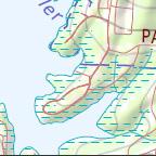
3 Scale series by subbasin Humid Flat: Upper Suwannee, FL-GA Hilly: Pomme de Terre, MO Mountainous: South Branch Potomac, W V Dry Flat: Lower Beaver, UT Hilly: Lower Prairie Dog Town Fork Red, TX Mountainous: Piceance-Yellow, CO Urban St. Louis, MO: STL Atlanta, GA: ATL New Haven, CT: HVN (in production)

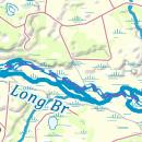
4 FL-GA 1:24K

5 FL-GA 1:50K
6 FL-GA 1:100K

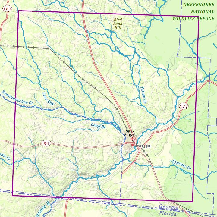
7 FL-GA 1:250K

8 FL-GA 1:500K

9 FL-GA 1:1M
10 Scale series by subbasin Humid Flat: Upper Suwannee, FL-GA Hilly: Pomme de Terre, MO Mountainous: South Branch Potomac, W V Dry Flat: Lower Beaver, UT Hilly: Lower Prairie Dog Town Fork Red, TX Mountainous: Piceance-Yellow, CO Urban St. Louis, MO: STL Atlanta, GA: ATL New Haven, CT: HVN (in production)
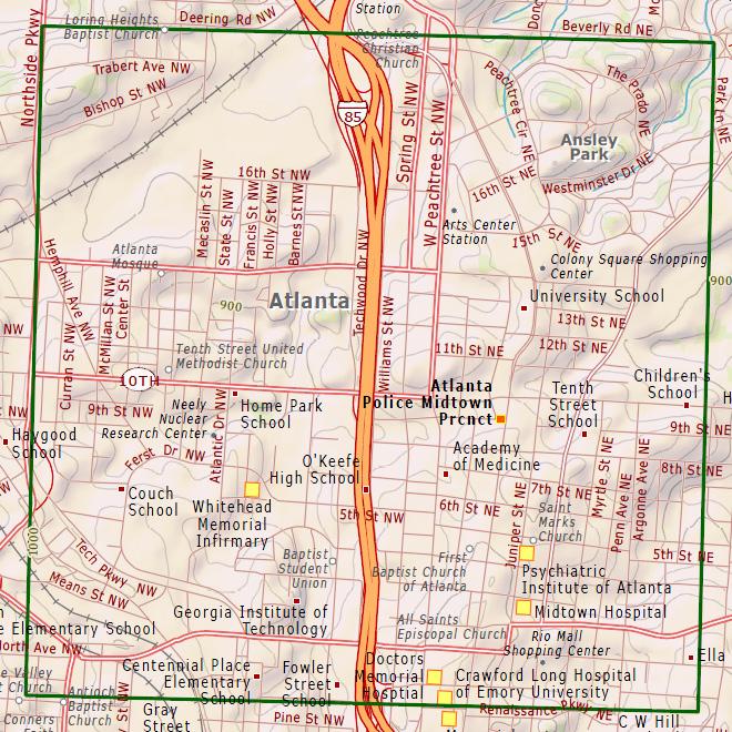
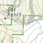
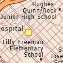
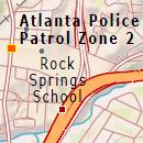
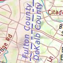
11 ATL 1:24K
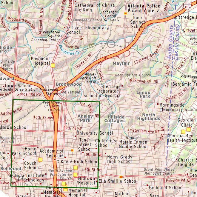
12 ATL 1:50K

13 ATL 1:100K

14 ATL 1:250K

15 ATL 1:500K
16 ATL 1:1M
17 Scale series by subbasin Humid Flat: Upper Suwannee, FL-GA Hilly: Pomme de Terre, MO Mountainous: South Branch Potomac, W V Dry Flat: Lower Beaver, UT Hilly: Lower Prairie Dog Town Fork Red, TX Mountainous: Piceance-Yellow, CO Urban St. Louis, MO: STL Atlanta, GA: ATL New Haven, CT: HVN (in production)
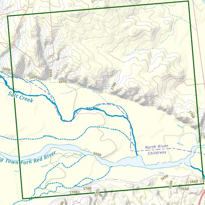
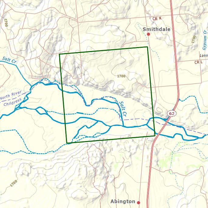
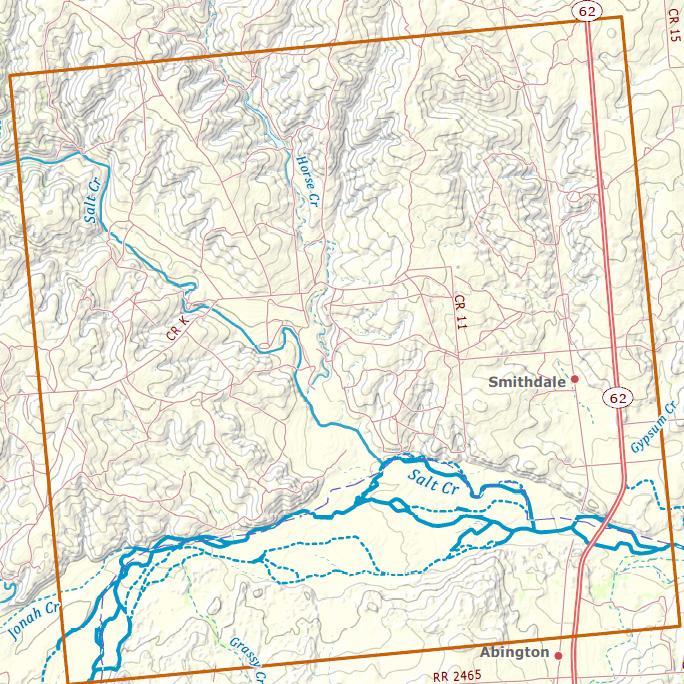
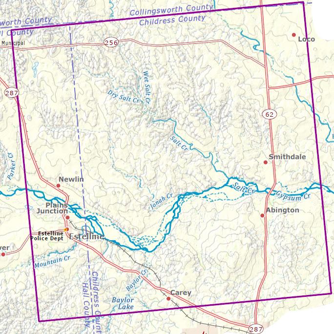
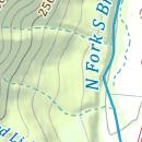
18 TX 1:24K
19 TX 1:50K
20 TX 1:100K
21 TX 1:250K
22 TX 1:500K
23 TX 1:1M
24 Scale series by subbasin Humid Flat: Upper Suwannee, FL-GA Hilly: Pomme de Terre, MO Mountainous: South Branch Potomac, W V Dry Flat: Lower Beaver, UT Hilly: Lower Prairie Dog Town Fork Red, TX Mountainous: Piceance-Yellow, CO Urban St. Louis, MO: STL Atlanta, GA: ATL New Haven, CT: HVN (in production)
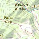
25 CO 1:24K

26 CO 1:50K
27 CO 1:100K
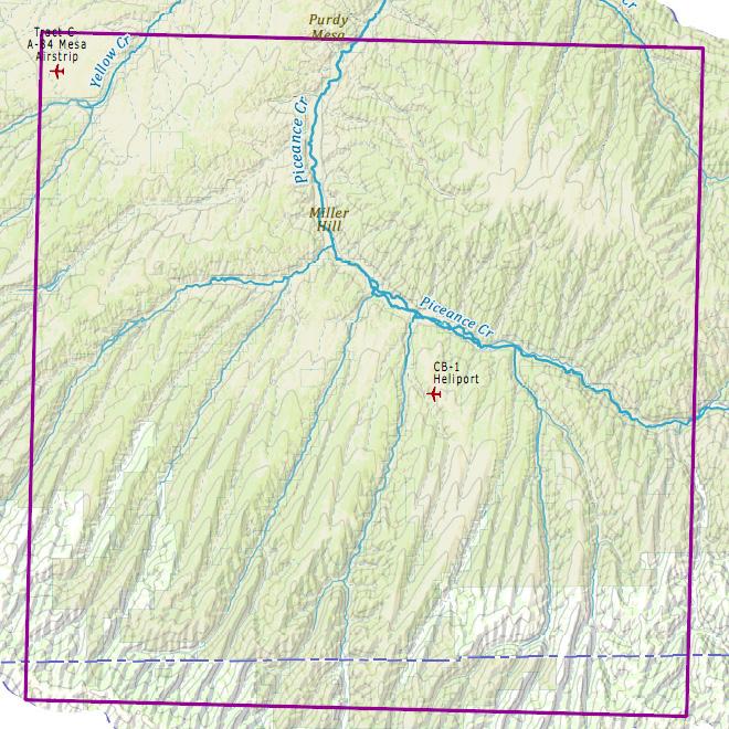
28 CO 1:250K
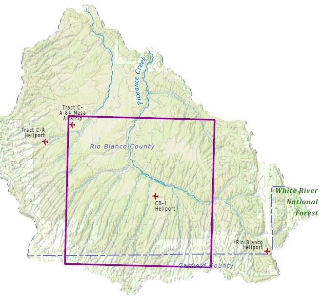
29 CO 1:500K
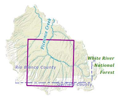
30 CO 1:1M
31 Quality rating categories A - Label appearance and readability B - Label positioning and generalization C - Point symbol appearance D - Point generalization E - Line symbol appearance F - Line generalization G - Area symbol appearance H - Area generalization I - Terrain appearance J - Terrain generalization K - Vertical integration between layers L - Overall appearance of map (Goldilocks)
32
33 Quality rating categories A - Label appearance and readability Too small or large Letter forms corrupted (at angle) Too light or dark Styling poor (too narrow, italic, bold, letter spaced) Individual characters unaligned (uneven) Letter form is jagged (due to rendering) Different case would better suit feature (change to lower case) Leading too close or far within a label Poor font choice
34 Quality rating categories H - Area generalization Areas too small to suit scale (outline closes in on area fill) Too many area features (cluttered) Area shapes too complex (or too simple or unrealistic) Gaps between areas too thin Hierarchy of area symbols would better suit feature type More categories of area symbols would better suit feature type Category or hierarchy of symbols is not clear
35 Quality rating categories K - Vertical integration between layers Boundaries misregistered (e.g., county and state line do not align) Flowlines not in valleys within terrain Water bodies not in flat areas of terrain Suspect road routings in relation to ridges and valleys Boundaries miss road or water features that likely guide position Points in middle of major roads Land features located in water and water features on land
36 Systematic color categories for symbols Human themes: points: emergency hospitals schools transportation built-up areas Rd Or Pu admin reserves hillshade Br Gy Yl YG Cy Gn Natural themes: wooded areas forest reserves parks boundaries Bu hydrography
37 Systematic color categories for symbols Human themes: points: emergency hospitals schools transportation built-up areas Rd Or Pu admin reserves hillshade Br Gy Yl YG Cy Gn Natural themes: wooded areas forest reserves parks boundaries Bu hydrography
38 Four related Penn State talks Cindy, Progress on Electronic Topo Map Design Decisions Chelsea, Multiscale Design: ScaleMaster Decisions and MXD Settings for Symbol Evaluation Cindy, Evaluation of Map Symbols by Screen Resolution and File Format Through Scale Andy, Tapered Symbols for NHD Flowlines Systematically Adjusted for Dry Versus Humid Zones
Evaluating Generalizations of Hydrography in Differing Terrains for The National Map of the United States
 Evaluating Generalizations of Hydrography in Differing Terrains for The National Map of the United States Cynthia Brewer, Pennsylvania State University Barbara Buttenfield, University of Colorado Boulder
Performance of Map Symbol and Label Design with Format and Display Resolution Options Through Scale for The National Map
 Performance of Map Symbol and Label Design with Format and Display Resolution Options Through Scale for The National Map Follow-up on AutoCarto 2011 talk Cynthia A. Brewer, Pennsylvania State University
Performance of Map Symbol and Label Design with Format and Display Resolution Options Through Scale for The National Map
 Performance of Map Symbol and Label Design with Format and Display Resolution Options Through Scale for The National Map Cynthia A. Brewer, Pennsylvania State University Chelsea L. Hanchett, Penn State
Place Still Matters: Generalizing the NHD by Local Terrain and Climate
 Place Still Matters: Generalizing the NHD by Local Terrain and Climate Barbara Buttenfield, Geography, CU-Boulder Cynthia Brewer, Geography, Penn State E. Lynn Usery, USGS-CEGIS Research Assistants: Chris
Design for multiscale topographic mapping with minimal generalization
 Design for multiscale topographic mapping with minimal generalization Cynthia A. Brewer Department of Geography, Pennsylvania State University, University Park, PA, 16802, USA cbrewer@psu.edu Extended
Multiple Representations of Geospatial Data: A Cartographic Search for the Holy Grail?
 Multiple Representations of Geospatial Data: A Cartographic Search for the Holy Grail? Barbara P. Buttenfield University of Colorado Boulder Research Faculty Affiliate, USGS-CEGIS babs@colorado.edu 13
Establishing Classification and Hierarchy in Populated Place Labeling for Multiscale Mapping for The National Map
 Establishing Classification and Hierarchy in Populated Place Labeling for Multiscale Mapping for The National Map Wesley Stroh, Stephen Butzler and Cynthia Brewer Gould Center, Geography Pennsylvania State
Introduction. Background
 Multi-resolution Multi-scale Topographic Map Design: Toward a New Look for The National Map Cynthia A. Brewer and Mamata K. Akella ABSTRACT: The pilot study reported here examined the effects on map readability
COMPARISON OF TOPOGRAPHIC MAP DESIGNS FOR OVERLAY ON ORTHOIMAGE BACKGROUNDS
 CO-475 COMPARISON OF TOPOGRAPHIC MAP DESIGNS FOR OVERLAY ON ORTHOIMAGE BACKGROUNDS RAPOSO P.J., BREWER C.A. Penn State University, STATE COLLEGE, UNITED STATES INTRODUCTION This paper reports the findings
Multiscale Representations of Water: Tailoring Generalization Sequences to Specific Physiographic Regimes
 Multiscale Representations of Water: Tailoring Generalization Sequences to Specific Physiographic Regimes Barbara P. Buttenfield 1, Lawrence V. Stanislawski 2, Cynthia A. Brewer 3 1 Department of Geography,
ScaleMaster characterization of types of design change through scale for mapping from multi-resolution databases
 ScaleMaster characterization of types of design change through scale for mapping from multi-resolution databases Cynthia A. Brewer, Pennsylvania State University Jessica Acosta, Penn State ESRI Barbara
Assessment of a Rapid Approach for Estimating Catchment Areas for Surface Drainage Lines
 Assessment of a Rapid Approach for Estimating Catchment Areas for Surface Drainage Lines U.S. Geological Survey Center of Excellence for Geospatial Information Science 1400 Independence Road, Rolla Missouri,
Multiple Representations of Geospatial Data: A Cartographic Search for the Holy Grail
 Multiple Representations of Geospatial Data: A Cartographic Search for the Holy Grail Barbara P. Buttenfield University of Colorado, Boulder babs@colorado.edu Collaboration with Cindy Brewer, Penn State
Establishing Classification and Hierarchy in Populated Place Labeling for Multiscale Mapping for The National Map
 Establishing Classification and Hierarchy in Populated Place Labeling for Multiscale Mapping for The National Map Stephen Butzler, Cynthia Brewer and Jim Thatcher RA: Doug Minnigh Gould Center, Geography
Mastering Map Scale: Formalizing Guidelines for Multi-Scale Map Design
 Mastering Map Scale: Formalizing Guidelines for Multi-Scale Map Design Cynthia A. Brewer Pennsylvania State University Barbara P. Buttenfield University of Colorado Boulder a.k.a. Cindy and babs Collaborators
Local Government Basemaps using ArcGIS
 Local Government Basemaps using ArcGIS Steve Grisé Scott Oppmann Tuesday, July 14, 10:15-11:30am SDCC 30B Topics Basemaps for Local Government Essential Application-Driven New Ideas Design Strategies Discussion
DATA APPLIANCE FOR ARCGIS
 DATA APPLIANCE FOR ARCGIS Data Appliance for ArcGIS Provides Access to Multi-Scale Basemaps Down to Medium Scale Levels Worldwide And Large Scale for Most of the World The Data Appliance includes Several
Hydrologically Consistent Pruning of the High- Resolution National Hydrography Dataset to 1:24,000-scale
 Hydrologically Consistent Pruning of the High- Resolution National Hydrography Dataset to 1:24,000-scale Lawrence V. Stanislawski 1, Ariel Doumbouya 2, Barbara P. Buttenfield 3, 1 Center for Excellence
An Information Model for Maps: Towards Cartographic Production from GIS Databases
 An Information Model for s: Towards Cartographic Production from GIS Databases Aileen Buckley, Ph.D. and Charlie Frye Senior Cartographic Researchers, ESRI Barbara Buttenfield, Ph.D. Professor, University
Aileen Buckley, Ph.D. and Charlie Frye
 An Information Model for Maps: Towards Production from GIS Databases Aileen Buckley, Ph.D. and Charlie Frye Researchers, ESRI GIS vs. cart GIS Outline of the presentation Introduction Differences between
Geospatial Data Sources. SLO GIS User Group June 8, 2010
 Geospatial Data Sources SLO GIS User Group June 8, 2010 Presenters Drew Decker USGS Southern California Geospatial Liaison Kelly Bobbitt Mike Bobbitt & Associates Joe Larson Cal Fire Peter Meertens Regional
Proceedings - AutoCarto Columbus, Ohio, USA - September 16-18, 2012
 Automated Metric Assessment of Line Simplification in Humid Landscapes Lawrence V. Stanislawski 1, Paulo Raposo 2, Michael Howard 1, and Barbara P. Buttenfield 3 1 Center for Excellence in Geospatial Information
Topographic Maps. Take Notes as you view the slides
 Topographic Maps Take Notes as you view the slides Lesson Objectives Define a topographic map and state its uses. Describe how contour lines show the elevations, shape, and slope of the land. Identify
Different types of maps and how to read them.
 Different types of maps and how to read them. A map is a picture or representation of the Earth's surface, showing how things are related to each other by distance, direction, and size. Maps have been
MODULE 12: MAPPING. Key Concepts: Maps for Master Plans
 MODULE 12: MAPPING 237 237 237 217 217 217 200 200 200 80 119 27 Key Concepts: 255 0 163 131 239 110 Maps for Master Plans 255 0 163 132 65 135 255 0 163 122 53 120 Cost Effective Data and Software Map
GTECH 380/722 Analytical and Computer Cartography Hunter College, CUNY Department of Geography
 GTECH 380/722 Analytical and Computer Cartography Hunter College, CUNY Department of Geography Fall 2014 Mondays 5:35PM to 9:15PM Instructor: Doug Williamson, PhD Email: Douglas.Williamson@hunter.cuny.edu
Notes and Summary pages:
 Topographic Mapping 8.9C Interpret topographical maps and satellite views to identify land and erosional features and predict how these shapes may be reshaped by weathering ATL Skills: Communication taking
Map Reading & Compass Use
 Spring 2013 Kestrel Land Trust Page 2 / 10 Contents Map Basics... 3 Map Types... 3 Terrain Association... 4 Estimating Distance: Pacing... 4 Contour Lines... 5 Navigating with a Compass... 6 Compass Types...
1/28/16. EGM101 Skills Toolbox. Map types. Political Physical Topographic Climate Resource Road. Thematic maps (use one of the above as backdrop)
") EGM101 Skills Toolbox Map types Political Physical Topographic Climate Resource Road Thematic maps (use one of the above as backdrop) Map Types Deriving information from maps Hydrographic Geological Soils
EGM101 Skills Toolbox Map types Political Physical Topographic Climate Resource Road Thematic maps (use one of the above as backdrop) Map Types Deriving information from maps Hydrographic Geological Soils
Ladder versus star: Comparing two approaches for generalizing hydrologic flowline data across multiple scales. Kevin Ross
 Ladder versus star: Comparing two approaches for generalizing hydrologic flowline data across multiple scales Kevin Ross kevin.ross@psu.edu Paper for Seminar in Cartography: Multiscale Hydrography GEOG
Welcome to NR502 GIS Applications in Natural Resources. You can take this course for 1 or 2 credits. There is also an option for 3 credits.
 Welcome to NR502 GIS Applications in Natural Resources. You can take this course for 1 or 2 credits. There is also an option for 3 credits. The 1st credit consists of a series of readings, demonstration,
Base Maps: Creating, Using & Participating
 Base Maps: Creating, Using & Participating Michael Fashoway & Erin Geraghty Montana Base Map Service Center 2010 MAGIP Technical Session October 28, 2010 What is a Base Map? Using a Base Map Creating a
Leveraging Interactive AJAX Web Tools for Online Maps
 Leveraging Interactive AJAX Web Tools for Online Maps Presentation at GeoWeb 2009 Academic Track Steven Romalewski CUNY Mapping Service The Graduate Center / City University of New York July 2009 1 The
Esri s Living Atlas of the World Community Maps
 Esri s Living Atlas of the World Community Maps Seth Sarakaitis Wednesday May 7, 2014 ArcGIS Living Atlas Concept Living Atlas Content Tour Contributing to the Living Atlas (Community Maps) Seth Sarakaitis
Introduction to Cartography Part I
 Introduction to Cartography Part I Introduction to Cartography Maps vs. Globes General Types of Maps Standard Map Features Maps versus Globes Map: a representation of the world, or part of it, in two dimensions
Introduction to Contour Maps
 Your web browser (Safari 7) is out of date. For more security, comfort and Activityengage the best experience on this site: Update your browser Ignore Introduction to Contour Maps What information does
Medical GIS: New Uses of Mapping Technology in Public Health. Peter Hayward, PhD Department of Geography SUNY College at Oneonta
 Medical GIS: New Uses of Mapping Technology in Public Health Peter Hayward, PhD Department of Geography SUNY College at Oneonta Invited research seminar presentation at Bassett Healthcare. Cooperstown,
USGS POD implementation in USGS Cloud to Support US Topo Production
 USGS POD implementation in USGS Cloud to Support US Topo Production 2017 Esri User Conference 16 June 2017 Bob Davis lrdavis@usgs.gov 573-308-3554 William J. Marken, GSP wmarken@usgs.gov 573-308-3532 U.S.
Studying Topography, Orographic Rainfall, and Ecosystems (STORE)
") Introduction Studying Topography, Orographic Rainfall, and Ecosystems (STORE) Lesson: Using ArcGIS Explorer to Analyze the Connection between Topography, Tectonics, and Rainfall GIS-intensive Lesson This
Introduction Studying Topography, Orographic Rainfall, and Ecosystems (STORE) Lesson: Using ArcGIS Explorer to Analyze the Connection between Topography, Tectonics, and Rainfall GIS-intensive Lesson This
ArcGIS Tools for Professional Cartography
 ArcGIS Tools for Professional Cartography By Makram Murad-al-shaikh M.S. Cartography Senior instructor ESRI Educational Services ICC - A Coruña - Spain, 9-16 July, 2005 Overview Overview of the ArcGIS
USGS Community Engagement and its Role in Improving The National Map
 USGS Community Engagement and its Role in Improving The National Map ESRI User Conference, 2014 Bob Davis Carol Ostergren Drew Decker USGS Strategic Direction Provides a sharpened focus on our topographic
Objectives: After completing this assignment, you should be able to:
 Data Analysis Assignment #1 Evaluating the effects of watershed land use on storm runoff Assignment due: 21 February 2013, 5 pm Objectives: After completing this assignment, you should be able to: 1) Calculate
Map image from the Atlas of Oregon (2nd. Ed.), Copyright 2001 University of Oregon Press
, Copyright 2001 University of Oregon Press") Map Layout and Cartographic Design with ArcGIS Desktop Matthew Baker ESRI Educational Services Redlands, CA Education UC 2008 1 Seminar overview General map design principles Working with map elements
Map Layout and Cartographic Design with ArcGIS Desktop Matthew Baker ESRI Educational Services Redlands, CA Education UC 2008 1 Seminar overview General map design principles Working with map elements
Outline. Chapter 1. A history of products. What is ArcGIS? What is GIS? Some GIS applications Introducing the ArcGIS products How does GIS work?
 Outline Chapter 1 Introducing ArcGIS What is GIS? Some GIS applications Introducing the ArcGIS products How does GIS work? Basic data formats The ArcCatalog interface 1-1 1-2 A history of products Arc/Info
ROAD SEDIMENT ASSESSMENT & MODELING: KOOTENAI-FISHER TMDL PLANNING AREA ROAD GIS LAYERS & SUMMARY STATISTICS
 ROAD SEDIMENT ASSESSMENT & MODELING: KOOTENAI-FISHER TMDL PLANNING AREA ROAD GIS LAYERS & SUMMARY STATISTICS Prepared by: ATKINS Water Resources Group 820 North Montana Avenue Helena, MT 59601 November
Brand Standards & Packaging Style Guide
 Brand Standards & Packaging Style Guide Table of Contents Introduction....................................................... 3 Black Magic Logo Approved Usage.................................................
Watershed Analysis of the Blue Ridge Mountains in Northwestern Virginia
 Watershed Analysis of the Blue Ridge Mountains in Northwestern Virginia Mason Fredericks December 6, 2018 Purpose The Blue Ridge Mountain range is one of the most popular mountain ranges in the United
NR402 GIS Applications in Natural Resources
 NR402 GIS Applications in Natural Resources Lesson 1 Introduction to GIS Eva Strand, University of Idaho Map of the Pacific Northwest from http://www.or.blm.gov/gis/ Welcome to NR402 GIS Applications in
Map My Property User Guide
 Map My Property User Guide Map My Property Table of Contents About Map My Property... 2 Accessing Map My Property... 2 Links... 3 Navigating the Map... 3 Navigating to a Specific Location... 3 Zooming
ArcGIS Data Models: Multiscale Topographic Maps. Charlie Frye Aileen Buckley
 ArcGIS Data Models: Multiscale Topographic Maps Charlie Frye Aileen Buckley Other cartography sessions ArcGIS ArcMap: Introduction to ArcMap Wed 1:30 PM, 6F ArcGIS Cartography: Map Design and Page Layout
ENVI Tutorial: Vegetation Analysis
 ENVI Tutorial: Vegetation Analysis Vegetation Analysis 2 Files Used in this Tutorial 2 About Vegetation Analysis in ENVI Classic 2 Opening the Input Image 3 Working with the Vegetation Index Calculator
Within this document, the term NHDPlus is used when referring to NHDPlus Version 2.1 (unless otherwise noted).
.") Exercise 7 Watershed Delineation Using ArcGIS Spatial Analyst Last Updated 4/6/2017 Within this document, the term NHDPlus is used when referring to NHDPlus Version 2.1 (unless otherwise noted). There
Exercise 7 Watershed Delineation Using ArcGIS Spatial Analyst Last Updated 4/6/2017 Within this document, the term NHDPlus is used when referring to NHDPlus Version 2.1 (unless otherwise noted). There
USGS QUADRANGLES IN GOOGLE EARTH
 USGS QUADRANGLES IN GOOGLE EARTH By Thomas G. Davis 1, PhD, PE, PLS and Rollins Turner 2, PhD INTRODUCTION QUADS (http://www.metzgerwillard.us/quads/) is a web-based service for visualizing USGS quadrangle
B. Topographic maps are also called. contour maps
 Topographic Maps Introduction A. Topographic maps are essential tools in geologic and engineering studies because they show the configuration of Earth's surface in remarkable detail and permit one to measure
Summary Description Municipality of Anchorage. Anchorage Coastal Resource Atlas Project
 Summary Description Municipality of Anchorage Anchorage Coastal Resource Atlas Project By: Thede Tobish, MOA Planner; and Charlie Barnwell, MOA GIS Manager Introduction Local governments often struggle
56H. This system allows definition of points on the Earth s surface to within 100 meters. Page 20. Navigation Systems Basics of Maps
 Grid References Many maps are provided with the standard grid overlaying them. This provides a simple and accurate method for finding features on the map. It is a network of intersecting parallel lines
Designing GIS Databases to Support Mapping and Map Production Charlie Frye, ESRI Redlands Aileen Buckley, ESRI Redlands
 Designing GIS Databases to Support Mapping and Map Production Charlie Frye, ESRI Redlands Aileen Buckley, ESRI Redlands 1 Designing GIS Databases to Support Mapping and Map Production Charlie Frye, ESRI
Outcrop suitability analysis of blueschists within the Dry Lakes region of the Condrey Mountain Window, North-central Klamaths, Northern California
 Outcrop suitability analysis of blueschists within the Dry Lakes region of the Condrey Mountain Window, North-central Klamaths, Northern California (1) Introduction: This project proposes to assess the
Cartography: Modeling GIS data for Mapmaking. Aileen Buckley, Ph.D. Senior Cartographic Researcher, ESRI. Barbara Buttenfield, Ph.D.
 Slide 1 Cartography: Modeling GIS data for Mapmaking Aileen Buckley, Ph.D. Senior Cartographic Researcher, ESRI Barbara Buttenfield, Ph.D. Professor, University of Colorado-Boulder Thank you coming to
Map Reading 101: Using and Reading Maps and Plans
 Map Reading 101: Using and Reading Maps and Plans A Key Skill for Land Use Commissioners Paula Stahl, LLA, ASLA, AICP Land Use Educator Green Valley Institute Land Use Academy 1 How most of us react to
Topographic Maps and Landforms Geology Lab
 Topographic Maps and Landforms Geology Lab Ray Rector: Instructor Today s Lab Activities 1) Discussion of Last Week s Lab 2) Lecture on Topo Maps and Elevation Contours 3) Construct Topographic Maps and
Software requirements * : Part III: 2 hrs.
 Title: Product Type: Developer: Target audience: Format: Software requirements * : Data: Estimated time to complete: Mapping snow cover using MODIS Part I: The MODIS Instrument Part II: Normalized Difference
Exercise 6: Working with Raster Data in ArcGIS 9.3
 Exercise 6: Working with Raster Data in ArcGIS 9.3 Why Spatial Analyst? Grid query Grid algebra Grid statistics Summary by zone Proximity mapping Reclassification Histograms Surface analysis Slope, aspect,
Geographer s Toolkit. Geography of Canada
 Geographer s Toolkit Geography of Canada www.craigmarlatt.com/school Geographer s Toolkit 1. Parts of a Map Map Symbols Mapping Your Location 2. Types of Maps 3. Political Map of Canada 4. Drainage Map
Gis Unit TropMed Mahidol U.
 Gis Unit TropMed Mahidol U. Database Information System Database Concepts 1. Non-Spatial Database table, document.. 2. Spatial Database locational databases (geographic) + attribute databases Gis Unit
National Hydrography Dataset (NHD) Update Project for US Forest Service Region 3
 Update Project for US Forest Service Region 3") National Hydrography Dataset (NHD) Update Project for US Forest Service Region 3 Allison Moncada California State University, Northridge February 2017 July 2017 Advisor: Joel Osuna Center for Geographical
National Hydrography Dataset (NHD) Update Project for US Forest Service Region 3 Allison Moncada California State University, Northridge February 2017 July 2017 Advisor: Joel Osuna Center for Geographical
Geography and Earth Science. Unit 5
 Geography and Earth Science Unit 5 Chapter 1 Map Skills Lesson 2 Introduction to Maps Key Terms What You Will Learn to Do Use map reading skills bar scale contrast elevation intermittent landforms legend
Working with Digital Elevation Models in ArcGIS 8.3
 Working with Digital Elevation Models in ArcGIS 8.3 The homework that you need to turn in is found at the end of this document. This lab continues your introduction to using the Spatial Analyst Extension
NAME DATE TOPOGRAPHIC MAPS. Activity 1: Topographic Map Investigation I: More Than a Road Map
 NAME DATE PARTNER(S) TOPOGRAPHIC MAPS Now you have seen how topographic maps can be generated to present the elevation of a terrain. Let s look at some topographic maps and learn how to interpret them.
TECHNICAL DOCUMENT R 2 OF THE SPANISH BRAILLE COMMISSION GENERAL CRITERIA FOR PREPARING ADAPTED MAPS FOR VISUALLY IMPAIRED PERSONS
 TECHNICAL DOCUMENT R 2 OF THE SPANISH BRAILLE COMMISSION GENERAL CRITERIA FOR PREPARING ADAPTED MAPS FOR VISUALLY IMPAIRED PERSONS Updated on December 2013 (Version 1) First edition in English, March 2015
Photographs to Maps Using Aerial Photographs to Create Land Cover Maps
 Aerial photographs are an important source of information for maps, especially land cover and land use maps. Using ArcView, a map composed of points, lines, and areas (vector data) can be constructed from
Flooding on the Somerset Levels. ArcGIS Online
 Flooding on the Somerset Levels ArcGIS Online Using this resource This resource has been written to help teachers make use of the ArcGIS Online program. It provides; guidance on how to use the program
MAP STUDY: INTERPRETATION OF SURVEY MAPS
 MAP STUDY: INTERPRETATION OF SURVEY MAPS Types and Elements of Maps Maps are drawn to represent the Earth on a piece of paper. Maps are used widely to represent the Earth. Maps use signs and symbols in
Write a report (6-7 pages, double space) on some examples of Internet Applications. You can choose only ONE of the following application areas:
 on some examples of Internet Applications. You can choose only ONE of the following application areas:") UPR 6905 Internet GIS Homework 1 Yong Hong Guo September 9, 2008 Write a report (6-7 pages, double space) on some examples of Internet Applications. You can choose only ONE of the following application
UPR 6905 Internet GIS Homework 1 Yong Hong Guo September 9, 2008 Write a report (6-7 pages, double space) on some examples of Internet Applications. You can choose only ONE of the following application
Basic principles of cartographic design. Makram Murad-al-shaikh M.S. Cartography Esri education delivery team
 Basic principles of cartographic design Makram Murad-al-shaikh M.S. Cartography Esri education delivery team Cartographic concepts Cartography defined The communication channel - Why maps fail Objectives
AILEEN 15 MINUTES ABSTRACT
 AILEEN 15 MINUTES Welcome to our session on Web map design. My name is Aileen Buckley, and I m here with my colleagues Andrew Skinner, Jim Herries, Kenny Ling and Mamata Akella. We all work on the Mapping
APC PART I WORKSHOP MAPPING AND CARTOGRAPHY
 APC PART I WORKSHOP MAPPING AND CARTOGRAPHY 5 June 2015 MAPPING The act or process of making a map. A matching process where the points of one set are matched against the points of another set. Graphical
MAPS AND THEIR CLASSIFICATION
 MAPPING MAPS AND THEIR CLASSIFICATION WHAT IS A MAP? A map is representation of the Earth's surface, showing how things are related to each other by distance, direction, and size. Maps are a way of showing
NATIONAL HYDROGRAPHY DATASET (NHD) UPDATE PROJECT FOR US FOREST SERVICE REGION 3
 UPDATE PROJECT FOR US FOREST SERVICE REGION 3") NATIONAL HYDROGRAPHY DATASET (NHD) UPDATE PROJECT FOR US FOREST SERVICE REGION 3 Allison Moncada California State University, Northridge February 2018 July 2018 Advisor: Joel Osuna Center for Geospatial
NATIONAL HYDROGRAPHY DATASET (NHD) UPDATE PROJECT FOR US FOREST SERVICE REGION 3 Allison Moncada California State University, Northridge February 2018 July 2018 Advisor: Joel Osuna Center for Geospatial
That s Why We Did That! A MicroStation to ArcGIS Conversion Story
 GIS- April 2016 That s Why We Did That! A MicroStation to ArcGIS Conversion Story Michael Herrmann (mherrmann1@ncdot.gov) NC : County Road and Bridge Maps 3 Lenoir County Bridge Map Back In the Old Days.
Surveying I. Unit - I. Different methods and instruments are being used to facilitate the work of
 Surveying I Unit - I Definition of Survey Surveying is the art of determining the relative positions of different objects on the surface of the earth by measuring the horizontal distances between them,
USGS Hydrography Overview. May 9, 2018
 + 1 USGS Hydrography Overview May 9, 2018 + 2 The National Geospatial Program Provides the geospatial baseline of the Nation s topography, natural landscape and built environment through The National Map,
Topo Map Tidbits. Adapted from: An original Creek Connections activity. Creek Connections, Box 10, Allegheny College, Meadville, Pennsylvania, 16335
 Topo Map Tidbits Adapted from: An original Creek Connections activity. Creek Connections, Box 10, Allegheny College, Meadville, Pennsylvania, 16335 Introduction to Topographic Maps Grade Level: Basic Duration:
Adventure Racing Navigation Supplies. Table Top Adventure Race & Navigation Challenge. Preview
 Adventure Racing Navigation Supplies Table Top Adventure Race & Navigation Challenge 12 Navigation Challenges for Map and Compass Navigation Volume 1. June 2009 Presented by AR Navigation Supplies, Inc.
CREATING A REPORT ON FIRE (April 2011)
") CREATING A REPORT ON FIRE (April 2011) The Fire Report feature on the NAFI website lets you create simple summaries of fire activity for areas of land in far northern Australia (north of 20 degrees where
CREATING A REPORT ON FIRE (April 2011) The Fire Report feature on the NAFI website lets you create simple summaries of fire activity for areas of land in far northern Australia (north of 20 degrees where
Mapping Your Land and Introduction to Web Soil Survey. Elizabeth Cook GIS Specialist USDA-NRCS (retired)
") Mapping Your Land and Introduction to Web Soil Survey Elizabeth Cook GIS Specialist USDA-NRCS (retired) Using Geographic Information Systems (GIS), Global Positioning System (GPS), digital aerial photography
Mapping Your Land and Introduction to Web Soil Survey Elizabeth Cook GIS Specialist USDA-NRCS (retired) Using Geographic Information Systems (GIS), Global Positioning System (GPS), digital aerial photography
Living in a Watershed
 Living in a Watershed Department of Ecosystem Science and Ma... http://ecosystems.psu.edu/youth/sftrc/lesson-plans/water/k-5/watershed Department of Ecosystem Science and Management Youth Living in a Watershed
Indiana GIS Local Resolution NHD Applications. Indiana State GIS Conference
 Indiana GIS Local Resolution NHD Applications Indiana State GIS Conference May 7, 2013 Agenda Topics I. Indiana s National Hydrography y Data II. Accessing NHD Data III. Demonstrations Using Local NHD
ArcGIS Mapping of Beach Eligibility for State of Florida Local Government Funding Requests (LGFR)
") ArcGIS Mapping of Beach Eligibility for State of Florida Local Government Funding Requests (LGFR) John E. Bishop, Ph.D Pinellas County Natural Resources FSBPA September 14-17, 2014 Andrew P. Squires, M.S.
ArcGIS Mapping of Beach Eligibility for State of Florida Local Government Funding Requests (LGFR) John E. Bishop, Ph.D Pinellas County Natural Resources FSBPA September 14-17, 2014 Andrew P. Squires, M.S.
Maps and Data Types in GIS
 Lecture 3 Maps and Data Types in GIS Tomislav Sapic GIS Technologist Faculty of Natural Resources Management Lakehead University Data Types In GIS, data types and data models are forms of attribute representation
Spatial Web Technology for Urban Green Society (A Case of Tsukuba City)
") The 5th Japan-Korea-China Joint Conference on Geography (Green Society in East Asia: A Geographical Contribution) Spatial Web Technology for Urban Green Society (A Case of Tsukuba City) Ko Ko Lwin and
The 5th Japan-Korea-China Joint Conference on Geography (Green Society in East Asia: A Geographical Contribution) Spatial Web Technology for Urban Green Society (A Case of Tsukuba City) Ko Ko Lwin and
CHAPTER 9 DATA DISPLAY AND CARTOGRAPHY
 CHAPTER 9 DATA DISPLAY AND CARTOGRAPHY 9.1 Cartographic Representation 9.1.1 Spatial Features and Map Symbols 9.1.2 Use of Color 9.1.3 Data Classification 9.1.4 Generalization Box 9.1 Representations 9.2
GEOGRAPHY. Maps. n2y.com. n2y Encyclopedia
 n2y Encyclopedia GEOGRAPHY n2y.com Gg Maps W E s A map is a drawing of what a place looks like from above. A map can help you find places you want to visit. There are many different kinds of maps. All
Income Inequality in Missouri 2000
 Through the growth in global media, people around the world are becoming more aware of and more vocal about the gap between the rich and the poor. Policy makers, researchers and academics are also increasingly
USGS National Geospatial Program Understanding User Needs. Dick Vraga National Map Liaison for Federal Agencies July 2015
 + USGS National Geospatial Program Understanding User Needs Dick Vraga National Map Liaison for Federal Agencies July 2015 + Topics 2 Background Communities of Use User Surveys National Map Liaisons Partnerships
Topographic Maps. More than a Road Map
 Topographic Maps More than a Road Map What is a Topographic Map? Scaled representation of features on the surface of the Earth such as roads, rivers, and plains Provides information about land elevations
GRAPEVINE LAKE MODELING & WATERSHED CHARACTERISTICS
 GRAPEVINE LAKE MODELING & WATERSHED CHARACTERISTICS Photo Credit: Lake Grapevine Boat Ramps Nash Mock GIS in Water Resources Fall 2016 Table of Contents Figures and Tables... 2 Introduction... 3 Objectives...
Web (Java, ArcGIS Server [WebADF, flex, silverlight]) Mobile (ArcGIS Mobile, ArcPad, Windows Mobile) Deskt
![Web (Java, ArcGIS Server [WebADF, flex, silverlight]) Mobile (ArcGIS Mobile, ArcPad, Windows Mobile) Deskt](/thumbs/96/129284052.jpg "Web (Java, ArcGIS Server [WebADF, flex, silverlight]) Mobile (ArcGIS Mobile, ArcPad, Windows Mobile) Deskt") GIS Services company in Lincoln, NE Custom GIS database design and build (for local, county, state and private corporations) Custom (ESRI and non-esri) application design and build in Java, C++, C#,.Net
GIS Services company in Lincoln, NE Custom GIS database design and build (for local, county, state and private corporations) Custom (ESRI and non-esri) application design and build in Java, C++, C#,.Net
UNIT 1C. USING TOPOGRAPHIC MAPS WHERE IN THE WORLD... ARE YOU?
 UNIT 1C. USING TOPOGRAPHIC MAPS WHERE IN THE WORLD... ARE YOU? TIME 60-90 minutes LEVEL All BENCHMARKS Next Generation Science Standards MS-LS1.D Science & Engineering Practices Developing and Using Models
INSPIRE Thematic Cluster on Topographic and Cadastral Reference data
 INSPIRE Thematic Cluster on Topographic and Cadastral Reference data Anja Hopfstock - facilitator www.jrc.ec.europa.eu Serving society Stimulating innovation Supporting legislation Status of Thematic cluster