Pre 18 Karoo magmatism and Continental breakup. FIELD TRIP LEADER: Michael Watkeys
|
|
|
- Peter Johnson
- 5 years ago
- Views:
Transcription


1 Pre 18 Karoo magmatism and Continental breakup FIELD TRIP LEADER: Michael Watkeys
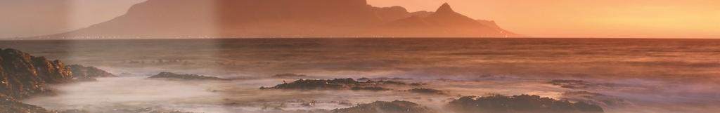
2 The record of sedimentation, volcanism and continental breakup in the Lebombo Mountains and the Kruger National Park where Karoo sediments and volcanics are beautifully exposed in river sections. These provide evidence of the earliest break-up of the Gondwana continent in the form of dyke swarms and faults. This field trip will require short walks to choice geosites in the company of an armed ranger and expert guides. The inextricable link between the abiotic and biotic (earth /life link) is better revealed in Kruger than perhaps anywhere else in South Africa. The Lebombo developed during formation of the ca. 180 Ma Karoo Igneous Province and subsequent break-up of Gondwana. This field trip travels along the Lebombo from south to north, commencing in Durban, KwaZulu-Natal, going through Swaziland and into the Kruger National Park. The trip will visit outcrops of Karoo sedimentary rocks, volcanic rocks, sills and dykes as well as exposures of faulting related to Gondwana break-up. It offers the opportunity of undertaking traverses across the southern Lebombo and the northern Lebombo. The walks to outcrops are not strenuous and in the Kruger National Park will be accompanied by an armed game guard. Field Trip Leader: Mike Watkeys Start: Durban End: Johannesburg Dates: 8 days, Saturday 19th to Saturday 27th August ITINERARY DATE ROUTING 19 AUGUST SALT ROCK HOTEL FOR OWN ACCOUNT AND BOOKED INDIVIDUALLY 20 AUGUST GHOST MOINTAIN INN, MKHUZE (Breakfast, Packed lunch and Dinner) 21 AUGUST GHOST MOINTAIN INN, MKHUZE (Breakfast, Packed lunch and Dinner) 22 AUGUST LOWER SABIE REST CAMP, KRUGER NATIONAL PARK (KNP) (Breakfast, Packed lunch and Dinner) 23 AUGUST LOWER SABIE REST CAMP, KNP (Breakfast, Packed lunch and Dinner) 24 AUGUST OLIFANTS RIVER LODGE?? Olifant River Lodge is in Middelburg! OLIFANTS REST CAMP, KNP (Breakfast, Packed lunch and Dinner) 25 AUGUST OLIFANTS REST CAMP, KNP (Breakfast, Packed lunch and Dinner) 26 AUGUST LETABA REST CAMP, KNP (Breakfast, Packed lunch and Dinner) 27 AUGUST DEPART LETABA REST CAMP AND TRAVEL TO O.R. TAMBO INTERNATIONAL AIRPORT, JOHANNESBERG (Breakfast and Packed lunch). END OF TOUR
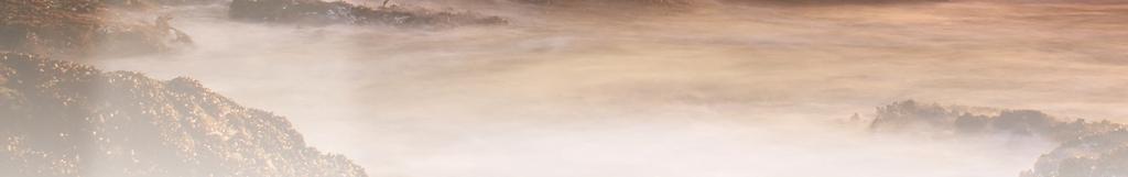
3 19 AUGUST 20 AUGUST Field trip participants arrive in Durban and transferred to the Salt Rock Hotel, Salt Rock on the KwaZulu-Natal North Coast. Accommodation at the Salt Rock Hotel, Salt Rock is not included in the field trip costs. This day will involve examining beach and cliff outcrops of the KwaZulu-Natal North Coast near Salt Rock before travelling to Mkhuze in northern KwaZulu- Natal. The coastal outcrops expose Karoo Supergroup Permian sedimentary rocks that are intruded by Jurassic dolerite sills of the Karoo Igneous Province. A variety of intrusive features are exposed, including magma flow indicators, as are faults related to the break-up of Gondwana and the extraction of the Falkland Plateau that formed the offshore Natal Valley. For the first half of the journey to Mkhuze, the landscape comprises rolling hills underlain by the Karoo Supergroup beneath which the basement rocks are Mesoproterozoic in age. At about halfway there is a zone where this Mesoproterozoic basement is thrust northwards over the Archaean Kaapvaal craton. North of this the landscape changes with a coastal plain to the E of the road underlain by Cretaceous and Tertiary sedimentary rocks. These are overlain by Quaternary sediments that include the high coastal dunes mined at Richards Bay while inland there are coal mines in the Karoo Supergroup. The road then follows a flat region underlain by Karoo basalts between the hills of the Rooi Rand to the W and the southern Lebombo to the E. Accommodation for two nights will be at the Ghost Mountain Inn, Mkhuze. 21 AUGUST This day will be spent undertaking a traverse across the southern Lebombo. The term Lebombo is used here in its geological sense where it is often called the Lebombo monocline. This refers to the whole N-S province along the eastern margin of the Kaapvaal craton that is related to Jurassic volcanism, extension and continental break-up. However Lebombo (sensu stricto) refers to a range of ridges, up to 800m high, that extends from northern KwaZulu- Natal northwards through Swaziland and along the border between South Africa and Mozambique. The positive topography is formed by the Karoo rhyolites, one of the World s largest rhyolite provinces. The traverse across the southern Lebombo follows the road from Pongola to Jozini. In the W, exposures of flat-lying Karoo Supergroup sedimentary rocks with dolerite sills are intruded by vertical MORB-like Rooi Rand dykes. Further E the sedimentary rocks and sills progressively dip more steeply eastwards with an accompanying decrease of dip of the Rooi Rand dykes towards the W. This change in dip is the result of domino-style faulting. The Rooi Rand dykes become closer spaced and eventually become a multiple dyke swarm just W of the contact of the Karoo basalts. Further E the overlying Jozini rhyolites are exposed along the west-facing Lebombo scarp slopes. These high temperature ash flows are intruded by Cretaceous dykes and unconformably overlain to the E by early Cretaceous sedimentary rocks. Accommodation for the night will be at the Ghost Mountain Inn, Mkhuze.
4 22 AUGUST This day will involve travelling northwards parallel to the Lebombo through Swaziland, back into South Africa and then into the southern Kruger National Park. The trip will enter Swaziland via the Golela border post and continue along the road following the area underlain by Karoo basalts. Here the flat topography is interrupted by small ridges formed by the appropriately named TwIn Ridge rhyolites that are interlayered with the basalts. The Rooi Rand dyke swarm to the W peters out in central Swaziland while in the E the Jozini rhyolites become overlain by the Mbululzi rhyolites. The trip will exit Swaziland at the Mananga border post, travel to Komatiport and then enter Kruger National Park through Crocodile Bridge and continue to Lower Sabie Rest Camp. Accommodation for two nights will be at Lower Sabie Rest Camp, Kruger National Park 23 AUGUST This day will be spent in southern Kruger Park between the Lower Sabie Rest Camp and Crocodile Bridge. This is the area in which the low-ti tholeiitic basalts are overlain by the high-ti tholeiitic basalts. A variety of volcanogenic features are preserved while the upper part of the sequence is intruded by the Komatipoort Complex. Accommodation for the night will be at Lower Sabie Rest Camp. 24 AUGUST This day will be taken up with the drive north from Lower Sabie Rest Camp to Olifants Rest Camp. For most of this trip the road follows the Karoo basalt. There is an occasional deviation onto the aeolian Clarens sandstone that underlies the basalts. Accommodation for two nights will be at Olifants Rest Camp. 25 AUGUST This day will be spent on a traverse across the northern Lebombo following the Olifants River. This is the most complete preserved stratigraphic sequence of the Karoo Igneous Province. The traverse will commence in the W where the Clarens Formation is overlain by a thin pyroclastic sequence and then by the Mashikiri nephelinites. These are succeeded by the Letaba picrite basalts and then by the Sabie River tholeiitic basalts, the uppermost of which are trachybasalts. Interlayered with the tholeiitic basalts are the Olifants Beds rhyolites. The basalts are intruded by the N-S trending Balule dolerite dyke swarm and by rhyolite dykes. In the E the Lebombo ridge is formed of rhyolites and granophyres. Accommodation for the night will be at Olifants Rest Camp.
5 26 AUGUST 27 AUGUST This day will involve travelling north to Letaba Rest Camp. The basalts in this area are intruded by a variety of mafic dykes exposed along the banks of the Letaba River. In addition there are composite dykes varying from felsic rhyolitic to mafic across the dyke. Accommodation for the night will be at Letaba Rest Camp. This day will be spent travelling from Letaba to Johannesburg. The trip will leave Kruger National Park through the Phalaborwa gate by which time the Archaean Kaapvaal craton is exposed. This is intruded by the 2060 Ma Palaborwa alkaline igneous complex which has been mined for copper, phosphate and vermiculite. The trip will then travel parallel to the Murchison greenstone belt, notable for the Antimony Line and emeralds, to the Drakensberg escarpment that is formed by the Palaeoproterozoic Transvaal Supergroup. Beyond the escarpment the road passes over the eastern portion of the 2052 Ma Bushveld Complex and then onto Karoo Supergroup sedimentary rocks. The approach to Johannesburg is marked by waste dumps associated with gold mining of the 3.1 Ga Witwatersrand Supergroup. The field trip will end at O.R. Tambo International Airport, Johannesburg. Meal Key BB DBB DBB+ DBB++ FB FB+ FB++ FI Bed and Breakfast Dinner, Bed and Breakfast Dinner, Bed and Breakfast plus one additional activity Dinner, Bed and Breakfast plus two additional activities Full Board (includes 3 meals per day) Full Board (includes 3 meals per day) plus one additional service Full Board (includes 3 meals per day) plus two additional services Fully Inclusive (includes all meals and local drinks), plus all activities NOTES: This field trip leaves South Africa, travels through Swaziland and then enters South Africa again. Each participant must check whether he or she will require a re-entry visa for South Africa and/or a visa for Swaziland, and be in possession of those visas prior to the field trip departure. Vehicles: This quote is based on 15-seater vehicle (or similar) depending on availability.
6 MINIMUM NUMBERS 20 MAXIMUM NUMBERS 30 COST INCLUDES: 2 Nights accommodation at the Ghost Mountain Inn on a BB basis 2 Nights accommodation at Lower Sabie Rest Camp on a BB basis 2 Nights accommodation at Olifants Rest Camp on a BB basis 1 Night accommodation at Letaba Rest camp on a BB basis 8 x lunch 8 x dinner 2 x 500ml bottled water per passenger per day Transport in private touring vehicles Local English speaking driver on all transfers Local English speaking guide on all sightseeing excursions Guide and Driver meals & accommodation where necessary Entrance fees to sightseeing venues as stated in the itinerary above Porterage at airports and hotels (1 x standard piece of luggage per person) COST EXCLUDES All airfares, air reservations and airport taxes All other accommodation All other meals All other transport All other sightseeing Personal expenses such as tips for meals, gratuities for guides & drivers, all alcoholic and other beverages, telephone calls and laundry Any other services not mentioned above.
PRE 8. Craton Traverse: A transect through ~2.7Ga of South African history. Field Trip Leader: Herman van Niekerk
 PRE 8 Craton Traverse: A transect through ~2.7Ga of South African history Field Trip Leader: Herman van Niekerk This field trip is a great traverse that covers a large part of the geology of South Africa,
TRIP LEADER: Michael Daly (in partnership with the Geological Survey of Zambia)
") ExSA-Pre 7 The Bangweulu block and Irumide belt: a Traverse across the SE margin of the Congo Craton TRIP LEADER: Michael Daly (in partnership with the Geological Survey of Zambia) ITINERARY IN BRIEF The
ExSA-Pre 7 The Bangweulu block and Irumide belt: a Traverse across the SE margin of the Congo Craton TRIP LEADER: Michael Daly (in partnership with the Geological Survey of Zambia) ITINERARY IN BRIEF The
PRE 11. Cape Fold Belt. FIELD TRIP LEADERS: Coenie de Beer and Gideon Brunsdon
 PRE 11 Cape Fold Belt FIELD TRIP LEADERS: Coenie de Beer and Gideon Brunsdon The field trip will cover the Permo-Triassic CFB, with stops along the lesser deformed western branch on the first day, across
Geology of the Barberton Greenstone Belt: Processes on the early Earth
 PRE 16 Geology of the Barberton Greenstone Belt: Processes on the early Earth FIELD TRIP LEADERS: Christoph Heubeck, Gary Byerly and Don Lowe = Due to its excellent exposure, low-grade metamorphic overprint
The Karoo Supergroup Drakensberg Group Stormberg Group Beaufort Group Ecca Group Dwyka Group THEME 11: The Karoo Supergroup
 THEME 11: The Karoo Supergroup The Karoo Supergroup Drakensberg Group Stormberg Group Beaufort Group Ecca Group Dwyka Group The Cape Supergroup and Karoo Supergroup record 300 Ma of changing environments
J U S T W R A V E L M C L E O D G A N J C A M P I N G A N D T R E K T O T R I U N D
 J U S T W R A V E L M C L E O D G A N J C A M P I N G A N D T R E K T O T R I U N D D I G I T A L B R O C H U R E & G U I D E C O P Y R I G H T S R E S E R V E D W W W. J U S T W R A V E L. C O M T H E
Continental Landscapes
 Continental Landscapes Landscape influenced by tectonics, climate & differential weathering Most landforms developed within the last 2 million years System moves toward an equilibrium Continental Landscapes
UNIVERSITY OF PRETORIA Department of Geology HISTORICAL GEOLOGY - GLY 161 SEMESTER EXAM
 UNIVERSITY OF PRETORIA Department of Geology HISTORICAL GEOLOGY - GLY 161 SEMESTER EXAM Internal examiner: Dr A.J. Bumby. External examiner: Prof. P.G. Eriksson Copyright Reserved 20 th November 2009 Time:
IMSG Post-conference Field Guide
 IMSG 2017 - Post-conference Field Guide Jérémie Lehmann, Marlina Elburg and Trishya Owen-Smith The purpose of this short field excursion on Wednesday 18 January is to show a variety of rocks that make
GLY 155 Introduction to Physical Geology, W. Altermann. Press & Siever, compressive forces. Compressive forces cause folding and faulting.
 Press & Siever, 1995 compressive forces Compressive forces cause folding and faulting. faults 1 Uplift is followed by erosion, which creates new horizontal surface. lava flows Volcanic eruptions cover
Module 10: Resources and Virginia Geology Topic 4 Content: Virginia Geology Notes
 Virginia is composed of a very diverse landscape that extends from the beaches and barrier islands all of the way to the highly elevated Appalachian Plateau. Geologists have discovered ancient shallow
Chapter 3. Geology & Tectonics
 Chapter 3 Geology & Tectonics 3.1 Geology The general geological features of Indonesia are shown in Figure 3.1. The basement formation is metamorphic and it is intruded with plutonic formations. They are
The Mesozoic. Wednesday, November 30, 11
 The Mesozoic Periods of the Mesozoic Triassic- First period of the Mesozoic era Jurassic Cretaceous- Last period of the Mesozoic era Breakup of Pangaea Stage one (Triassic) Rifting and volcanism, normal
2019/20 Rack Rates. 1 March 2019 to 29 February Updated: 08 March CHEM CHEM LODGE RATES PAGE 2 - LITTLE CHEM CHEM RATES PAGE 2
 1 March 2019 to 29 February 2020 Updated: 08 March 2018 - CHEM CHEM LODGE RATES PAGE 2 - LITTLE CHEM CHEM RATES PAGE 2 - FOREST CHEM CHEM RATES PAGE 2 - INCLUSIONS & EXCLUSIONS PAGE 3 - SPECIAL OFFERS,
The Building of the NYC Region
 The Building of the NYC Region Definitions Fall Line marks the area where an upland region (continental bedrock) and a coastal plain meet Piedmont the plateau region of the eastern United States which
3/5/05 Dr. Stewart 1
 I. Physiography of Appalachian Mountains A. Introduction 1. These mountains extend from NE Canada to Georgia 2. They are the remains of a deeply eroded, ancient mountain chain once larger than the Himalayans
Preconference field trip (FT2) - Southern South Island Gold Fields
 - Southern South Island Gold Fields") Preconference field trip (FT2) - Southern South Island Gold Fields OVERVIEW: This field trip to the Otago and Southland goldfields, visits historic sites, and active mines and prospects. The trip will
Preconference field trip (FT2) - Southern South Island Gold Fields OVERVIEW: This field trip to the Otago and Southland goldfields, visits historic sites, and active mines and prospects. The trip will
Pre-conference field trip (FT1) Geology and mineral deposits of New Caledonia
 Geology and mineral deposits of New Caledonia") Pre-conference field trip (FT1) Geology and mineral deposits of New Caledonia OVERVIEW: This trip is a rare opportunity to visit New Caledonia in northern Zealandia, a tropical paradise, and explore key
Pre-conference field trip (FT1) Geology and mineral deposits of New Caledonia OVERVIEW: This trip is a rare opportunity to visit New Caledonia in northern Zealandia, a tropical paradise, and explore key
Taming the Soutpansberg SACMA Presentation - Exxaro Tshikondeni Coal November 2011
 Taming the Soutpansberg SACMA Presentation - Exxaro Tshikondeni Coal November 2011 0 BRIEF OVERVIEW 1 Located some 140 km east of Musina in Limpopo province, this underground mine employs 770 people and
3. GEOLOGY. 3.1 Introduction. 3.2 Results and Discussion Regional Geology Surficial Geology Mine Study Area
 3. GEOLOGY 3.1 Introduction This chapter discusses the baseline study of the geology and mineralization characteristics of the mine study area. The study consolidates existing geological data and exploration
Landforms and Rock Structure
 Landforms and Rock Structure Rock Structure as a Landform Control Landforms of Horizontal Strata and Coastal Plains Landforms of Warped Rock Layers Landforms Developed on Other Land-Mass Types Landforms
Structural Geology Lab. The Objectives are to gain experience
 Geology 2 Structural Geology Lab The Objectives are to gain experience 1. Drawing cross sections from information given on geologic maps. 2. Recognizing folds and naming their parts on stereoscopic air
Field Trip 1 Tunnel Mill, Vernon, Indiana: Waldron Shale
 Geol G308 Paleontology and Geology of Indiana Name: Field Trip 1 Tunnel Mill, Vernon, Indiana: Waldron Shale On this trip we will visit Tunnel Mill, which is located just south of Vernon, Indiana in the
I know that dinosaurs were not very big at the time of the end Triassic extinction, but this graphic from the National Science Foundation website
 I know that dinosaurs were not very big at the time of the end Triassic extinction, but this graphic from the National Science Foundation website sets the theme of mass extinction by fissure volcanism.
Ore Deposits and Mantle Plumes
 Ore Deposits and Mantle Plumes by Franco Pirajno Geological Survey of Western Australia, Perth, Australia KLUWER ACADEMIC PUBLISHERS DORDRECHT / BOSTON / LONDON CONTENTS PREFACE ACKNOWLEDGEMENTS INTRODUCTION
Mesozoic Earth History
 Mesozoic Earth History The Mesozoic Era 251-66 MYA Breakup of Pangea Changes in air and oceanic currents Evolution of new terrestrial and marine life Opening of the Atlantic Ocean Basin Rocky Mountains
=%REPORT RECONNAISSANCE OF CHISHOLM LAKE PROSPECT. October 25, 1977
 =%REPORT ON FIELD RECONNAISSANCE OF CHISHOLM LAKE PROSPECT October 25, 1977 Bruce D. Vincent Imperial Oil Limited, Minerals - Coal, CALGARY, ALBERTA CHISHOLM LAKE PROSPECT Introduction The Chisholm Lake
Name. 4. The diagram below shows a soil profile formed in an area of granite bedrock. Four different soil horizons, A, B, C, and D, are shown.
 Name 1. In the cross section of the hill shown below, which rock units are probably most resistant to weathering? 4. The diagram below shows a soil profile formed in an area of granite bedrock. Four different
A journey through the earth history of Australia s Coastal Wilderness Part 3 The backdrop - a 70 million year old plain
 A journey through the earth history of Australia s Coastal Wilderness Part 3 The backdrop - a 70 million year old plain Monaro Plain 3. The Cretaceous Plain The western horizon behind Moruya is dominated
Characteristics and processes associated with the development of Hilly Landscapes
 GRADE 11 GEOGRAPHY SESSION 1: GEOMORPHOLOGY I (TOPOGRAPHY) Key Concepts In this lesson we will focus on summarising what you need to know about: Topography associated with Horizontally Layered Rocks Topography
Geology 12 FINAL EXAM PREP. Possible Written Response Exam Questions
 Geology 12 FINAL EXAM PREP Possible Written Response Exam Questions Use this study guide to prepare for the written response portion of the final exam. Name FINAL EXAM - POSSIBLE WRITTEN RESPONSE QUESTIONS
The Pine Creek AEM Survey, Northern Territory
 The Pine Creek AEM Survey, Northern Territory (Data acquisition, processing, delivery and interpretation) M.A. Craig, M.T. Costelloe, S. Liu, S. Jaireth Onshore Energy and Minerals Division, Geoscience
Geologic Trips San Francisco and the Bay Area
 Excerpt from Geologic Trips San Francisco and the Bay Area by Ted Konigsmark ISBN 0-9661316-4-9 GeoPress All rights reserved. No part of this book may be reproduced without written permission in writing,
The Copperstone Project: Operational update October 2015
 The Copperstone Project: Operational update October 2015 Work Programme Completed Since the last operational update, the following work has been carried out for the Copperstone project: Detailed geological
NAMAQUA METAMORPHIC PROVINCE FIELD TRIP
 - 2016 NAMAQUA METAMORPHIC PROVINCE FIELD TRIP Theme: GEOLOGY AND ORIGIN OF A VERY LARGE HOT OROGEN - THE HIGH-T-LOW-P NAMAQUA METAMORPHIC PROVINCE 21-27 August 2016 Pre-conference field trip Geology to
In the Realm of the Polar Bear
 In the Realm of the Polar Bear Experience the incredible scenery of Svalbard s most remote regions. On this circumnavigation of Spitsbergen you will be able to view the low-hanging Midnight Sun creating
GEOLOGIC MAPS PART II
 EARTH AND ENVIRONMENT THROUGH TIME LABORATORY - EES 1005 LABORATORY FIVE GEOLOGIC MAPS PART II Introduction Geologic maps of orogenic belts are much more complex than maps of the stable interior. Just
David Gold Hiking Tours
 David Gold Hiking Tours Join us for a West Texas Active Adventure Tour February 14 21, 2017 Led by David Gold and Ulrike Porat The Big Bend area of West Texas is one of the most remote, and least visited
FIRST YEAR ASSESSMENT REPORT PROSPECTING LICENCE 16512M MARYSTOWN AREA, BURIN PENINSULA NTS 1M/3
 FIRST YEAR ASSESSMENT REPORT OF PROSPECTING ON LICENCE 16512M MARYSTOWN AREA, BURIN PENINSULA NTS 1M/3 BY NATHANIEL NOEL MSc. FOR E. MICHELE NOEL MINERAL LICENCES: 16512 M WORK CONDUCTED: MID-SEPTEMBER
Convergent plate boundary.
 Crustal Deformation Convergent plate boundary http://my.execpc.com/~acmelasr/mountains/geogramsnf.html Plate Tectonic Settings and Magma Where plates CONVERGE, water is driven off the subducting plate,
Geology, People, Environment and Sustainable Resources Development of Ladakh
 Field Excursions: Geology, People, Environment and Sustainable Resources Development of Ladakh Friday 27 th to Monday 30 th June/ Tuesday 1 st July to Friday 4 th July 2014 Leh and the Ladakh Batholith
Copyright McGraw-Hill Education. All rights reserved. No reproduction or distribution without the prior written consent of McGraw-Hill Education
 Copyright McGraw-Hill Education. All rights reserved. No reproduction or distribution without the prior written consent of McGraw-Hill Education Tibetan Plateau and Himalaya -southern Asia 11.00.a VE 10X
The Welsh Borderland. Geologically recent surface deposits. The Welsh Borderland
 The Welsh Borderland This account provides a broad perspective of the geology of the Welsh Borderland region which comprises the southeast of Powys, southern Shropshire, northern Gwent, the western half
NOA ASSESSMENT HARRIS QUARRY MENDOCINO COUNTY, CALIFORNIA TABLE OF CONTENTS
 NOA ASSESSMENT HARRIS QUARRY MENDOCINO COUNTY, CALIFORNIA TABLE OF CONTENTS Introduction... 1 Scope of Services... 1 Project Location and Description... 1 Geologic Setting... 1 Regional Geology... 1 Site
From Rodinia to Pangea: Geodynamics, Life and Climate
 IGCP 648 2018 Field Symposium in south China From Rodinia to Pangea: Geodynamics, Life and Climate Place: Yichang, Three Gorges region in South China Time: 2018, November 1-9 General information South
Maars associated with fracture-and/or conduit-controlled aquifers in folded limestones in San Luis Potosí. Aranda-Gómez, J. J.1, Dávila-Harris, P.
 Maars associated with fracture-and/or conduit-controlled aquifers in folded limestones in San Luis Potosí Aranda-Gómez, J. J.1, Dávila-Harris, P.2 1 Centro de Geociencias, Campus UNAM Juriquilla, Querétaro,
THEME 8: The Mokolian Era. Namaqualand Metamorphic Complex. This is a granite-gneiss complex. Includes folded and metamorphosed volcanosedimentary
 THEME 8: The Mokolian Era This runs from 2050 Ma (end of Bushveld Complex) to 1080 Ma (start of Pan African) Includes: Namaqualand metamorphic Complex, Natal metamorphic Complex, sedimenatery sequences
GEOL 220A Geologic Field Experiences: West Virginia Spring Term, 2008
 GEOL 220A Geologic Field Experiences: West Virginia Spring Term, 2008 Dr. Fred Soster Office: 216 Julian S&M e-mail: fsoster@depauw.edu Phone: 658-4670 Meeting Times: 2:15-3:15 p.m., Monday & Wednesday;
depression above scarp scarp
 1 LAB 1: FIELD TRIP TO McKINLEYVILLE AND MOUTH OF THE MAD RIVER OBJECTIVES: a. to look at geomorphic and geologic evidence for large scale thrust-faulting of young sediments in the Humboldt Bay region
Blocks offered in Sri Lanka s Second Licensing Round
 Blocks offered in Sri Lanka s Second Licensing Round Sri Lankan Main Basins Cauvery Basin Cauvery Deep Water sub-basin Mannar Basin 2 Structural Framework Sri Lanka Basins Cauvery & Mannar Basins were
Threat to the Surface Water Resources
 4.10 WMA OVERVIEW The Breede Gouritz WMA comprises the Breede, Overberg, the Karoo and Klein Karoo and Outeniqua Coastal Area (Stilbaai to Plettenberg Bay) catchments. The WMA is located in south-western
Chapter Two. Figure 02_02. Geography of the Ocean Basins. The Sea Floor
 Chapter Two The Sea Floor Geography of the Ocean Basins Figure 02_02 The world ocean is the predominant feature on the Earth in total area. In the Northern Hemisphere, 61% of the total area is ocean. In
Geohistory Review. Things you need to know:
 Geohistory Review Things you need to know: a) The earth and the solar system are 4.5 billion years old (4.5 X 10 9 ) b) Law of original horizontality: Sedimentary rock layers are always deposited as horizontal
Palaeontological Desktop Study Scheding Chrome Mine, Capricorn District
 Email: bruce.rubidge@wits.ac.za 7 September 2013 Ms Zoe Gebhardt Environmental Consultant Prime Resources PO Box 2316 Parklands 2121 E-Mail: zoe@resources.co.za Dear Ms Gebhardt, Palaeontological Desktop
SITE 1. The Manilla River Bridge.
 The rocks of the Barraba area are split into two major geological belts by a regionally extensive fault, the Peel Fault (see tour map, page 4). This major fracture of the crust is developed for several
Bradbury Mountain, Pownal, Maine
 Maine Geologic Facts and Localities August, 2008 Bradbury Mountain, Pownal, Maine 43 o 53 56.56 N, 70 o 10 45.11 W Text by Henry N. Berry IV, Department of Agriculture, Conservation & Forestry 1 Introduction
Geology of the Batemans Bay region. Geological evolution. The Lachlan Orogen
 Australian Journal of Earth Sciences 1 The word orogen is derived from the ancient Greek language word for mountain building. The Lachlan Orogen The rocks exposed in the Batemans Bay are part of the geological
Part 3 Layered metamorphosed sedimentary rock worldwide
 Turning history on its head Massive evidence of a global flood What does it all mean? Part 3 Layered metamorphosed sedimentary rock worldwide End Time Issue Ministries Dr James A Robertson PrEng Turning
Structural Geology Lab. The Objectives are to gain experience
 Geology 2 Structural Geology Lab The Objectives are to gain experience 1. Drawing cross sections from information given on geologic maps. 2. Recognizing folds and naming their parts on stereoscopic air
AEOLIAN PROCESSES AND DUNES OF MOROCCO
 Field trip program: ICAR 2018 post-conference field trip AEOLIAN PROCESSES AND DUNES OF MOROCCO 30 of June 5 of July, 6 days DAY 1 (30.06) Meeting at Bordeaux Airport, fly to Marrakech Eolianites of Atlantic
Section 7. Reading the Geologic History of Your Community. What Do You See? Think About It. Investigate. Learning Outcomes
 Chapter 3 Minerals, Rocks, and Structures Section 7 Reading the Geologic History of Your Community What Do You See? Learning Outcomes In this section, you will Goals Text Learning Outcomes In this section,
Unconformities are depositional contacts that overlie rocks distinctly older than they are. They are often called gaps in the sedimentary record.
 UNCONFORMITIES Unconformities are depositional contacts that overlie rocks distinctly older than they are. They are often called gaps in the sedimentary record. The contact represents time when no sediment
Geological development of the Durban Basin
 Basin-scale assessment of the potential CO 2 storage of the offshore Durban Basin, KwaZulu-Natal, South Africa Geological development of the Durban Basin N. Hicks (MSc) (PhD Candidate) Senior Scientist
Rivers. Regents Earth Science Weathering & Erosion
 Regents Earth Science Weathering & Erosion Name: Rivers Use your notes, the handout Weathering and Erosion and your review book to answer the following questions on Rivers. Be sure to read the information
EXISTING GEOLOGICAL INFORMATION
 CHAPER 3 EXISTING GEOLOGICAL INFORMATION 3-1 General Geology of the Surrounding Area (1) General geology and ore deposits in Mongolia Geographically, Mongolia is a country located between Russia to the
Maine Geologic Facts and Localities October, Lobster Lake, Maine. Text by Robert G. Marvinney. Maine Geological Survey
 Maine Geologic Facts and Localities October, 1998 Lobster Lake, Maine 45 o 51 7.91 N, 69 o 30 53.88 W Text by Robert G. Marvinney, Department of Agriculture, Conservation & Forestry 1 Map by Introduction
Numerical modeling of mine dewatering and flooding in the Evander Gold Basin, South Africa
 Numerical modeling of mine dewatering and flooding in the Evander Gold Basin, South Africa Abstract K.T. Witthüser 1, M. Holland 1, T. Seidel 2, and C.M. König 2 1 Delta-H Water Systems Modelling Pretoria,
The High Lava Plains Project: Understanding the Causes of Continental Intraplate Tectonomagmatism
 The High Lava Plains Project: Understanding the Causes of Continental Intraplate Tectonomagmatism The High Lava Plains (HLP) of the northwestern USA is one of the most accessible yet least understood examples
Field trip 1 Ultramafic-mafic intrusions, volcanic rocks and PGE-Cu-Ni deposits of the Noril sk Province, Polar Siberia
 Field trip 1 Ultramafic-mafic intrusions, volcanic rocks and PGE-Cu-Ni deposits of the Noril sk Province, Polar Siberia Duration 8 days + travels Tour starts August 31/07/2014 in Noril sk, the end 7/08/2014
Magma. Objectives. Describe factors that affect the formation of magma. Compare and contrast the different types of magma. Vocabulary.
 Magma Objectives Describe factors that affect the formation of magma. Compare and contrast the different types of magma. Vocabulary viscosity Magma Magma The ash that spews from some volcanoes can form
Hiking the Bold Coast, Cutler, Maine
 Maine Geologic Facts and Localities June, 2010 Hiking the Bold Coast, Cutler, Maine 44 o 39 36.34 N, 67 o 12 46.99 W Text by Robert A. Johnston, Department of Agriculture, Conservation & Forestry 1 Map
General Geology Lab #7: Geologic Time & Relative Dating
 General Geology 89.101 Name: General Geology Lab #7: Geologic Time & Relative Dating Purpose: To use relative dating techniques to interpret geological cross sections. Procedure: Today we will be interpreting
Geology of the Golden Gate National Recreation Area in the Marin Headlands, and Ring Mountain, Tiburon
 Geology of the Golden Gate National Recreation Area in the Marin Headlands, and Ring Mountain, Tiburon May 9, 2006 Field trip guide compiled by Mary Leech Name: Submit this guide with the Subduction lab
Chapter 6, Part Colonizers arriving in North America found extremely landscapes. It looked different to region showing great.
 Social Studies 9 Unit 1 Worksheet Chapter 6, Part 1. 1. Colonizers arriving in North America found extremely landscapes. It looked different to region showing great. 2. The Earth is years old and is composed
Seismic Reflection Imaging across the Johnson Ranch, Valley County, Idaho
 Seismic Reflection Imaging across the Johnson Ranch, Valley County, Idaho Report Prepared for the Skyline Corporation Lee M. Liberty Center for Geophysical Investigation of the Shallow Subsurface (CGISS)
THEME 6: The Transvaal Supergroup
 THEME 6: The Transvaal Supergroup The Ventersdorp Supergroup represents rifting of the Kaapvaal Craton. However the craton did not break-up, and after a period of stability, renewed stretching and rifting
For personal use only
 Kaili Resources Limited (formerly Omnitech Holdings Limited) ABN 39 077 559 525 7 Darley Street, Darlinghurst Sydney NSW 2010, Australia T: +61 2 9267 5988 F: +612 9283 7166 E: contact@kailigroup.com.au
Field Trip Workbook G200 Field Studies Sec 001 (Mt St. Helens north) Fall, 2018 Professor in charge: Alex Ruzicka TA : Secana Goudy
 Fall, 2018 Professor in charge: Alex Ruzicka TA : Secana Goudy") Field Trip Workbook NAME: G200 Field Studies Sec 001 (Mt St. Helens north) Fall, 2018 Professor in charge: Alex Ruzicka TA : Secana Goudy Use this workbook to answer the following questions about the geology
Field Trip Workbook NAME: G200 Field Studies Sec 001 (Mt St. Helens north) Fall, 2018 Professor in charge: Alex Ruzicka TA : Secana Goudy Use this workbook to answer the following questions about the geology
FINAL EXAM Crustal Deformation CONVERGE DIVERGENT PLATES MANTLE PLUMES FLUX BASALTIC GRANITIC
 Crustal Deformation Reading: Chapter 10 Pages 283-294 FINAL EXAM 8 to 10 AM, THURSDAY DEC. 6 HERE: Natural Science 101 BRING A SCAN TRON TURN IN YOUR REVIEW QUESTIONS BEFORE THE TEST, PICK UP WHEN YOU
8 km radius demarcated Study Area
 SG Code Farm No. Portion No. Farm Name T0IS00000000037500001 375 1 SPIOEN KOP 375 IS T0IS00000000037500002 375 2 SPIOEN KOP 375 IS T0IS00000000037600001 376 1 MOOIMEISJESFONTEIN 376 IS T0IS00000000037600002
FINAL EXAM Crustal Deformation CONVERGE DIVERGENT PLATES MANTLE PLUMES FLUX BASALTIC GRANITIC
 Crustal Deformation Reading: Chapter 10 Pages 283-304 Review Questions 4, 6, 7, 10, 12, 15, 18, 20 FINAL EXAM NOON TO 2 PM, TUESDAY DEC. 5 HERE: Natural Science 101 BRING A SCAN TRON TURN IN YOUR REVIEW
Section 10.1 The Nature of Volcanic Eruptions This section discusses volcanic eruptions, types of volcanoes, and other volcanic landforms.
 Chapter 10 Section 10.1 The Nature of Volcanic Eruptions This section discusses volcanic eruptions, types of volcanoes, and other volcanic landforms. Reading Strategy Previewing Before you read the section,
Announcing a New Field-trip Seminar (TarT-7)
") Announcing a New Field-trip Seminar (TarT-7) Date: 28 November 2018 Starts & Ends at: Al-Nawras Hotel, Dubai, UAE Instructor: Dr. Mohammad Warrak, PhD. Organised by: Target Exploration Consultants Page
Announcing a New Field-trip Seminar (TarT-7) Date: 28 November 2018 Starts & Ends at: Al-Nawras Hotel, Dubai, UAE Instructor: Dr. Mohammad Warrak, PhD. Organised by: Target Exploration Consultants Page
ARGENTINE FRONTIER RESOURCES INC (AFRI) SALTA EXPLORACIONES SA (SESA)
 SALTA EXPLORACIONES SA (SESA)") ARGENTINE FRONTIER RESOURCES INC (AFRI) SALTA EXPLORACIONES SA (SESA) LA SARITA IOCG-Porphyry Copper-Gold August 2006 La Sarita Cateo 2 La Sarita - bleached center is Taca Taca Arriba. The hematite zone
ARGENTINE FRONTIER RESOURCES INC (AFRI) SALTA EXPLORACIONES SA (SESA) LA SARITA IOCG-Porphyry Copper-Gold August 2006 La Sarita Cateo 2 La Sarita - bleached center is Taca Taca Arriba. The hematite zone
For personal use only
 2 May 2018 METEORIC SECURES FURTHER HIGHLY PROSPECTIVE CANADIAN COBALT PROJECT Meteoric has secured the Beauchamp Cobalt Project 40km north of the Cobalt Camp, Ontario Beauchamp comprises 33.5km 2 being
Your web browser (Safari 7) is out of date. For more security, comfort and the best experience on this site: Update your browser Ignore
 is out of date. For more security, comfort and the best experience on this site: Update your browser Ignore") Your web browser (Safari 7) is out of date. For more security, comfort and the best experience on this site: Update your browser Ignore ISTHMU S tombolo For the complete encyclopedic entry with media resources,
Your web browser (Safari 7) is out of date. For more security, comfort and the best experience on this site: Update your browser Ignore ISTHMU S tombolo For the complete encyclopedic entry with media resources,
Backroads to Beaufort
 Exploring Hidden South Carolina Backroads to Beaufort November 13 16 November is a great month to explore South Carolina s hidden Low Country, featuring one of the US s finest coastal gems Beaufort. We
PLATE TECTONICS THEORY
 PLATE TECTONICS THEORY Continental drift Sea floor spreading CONTINENTAL DRIFT CONTINENTAL DRIFT 1. The fitness of continents and Continental Reconstruction Earth ~200 million years ago 1.1 Geometrical
Chapter 10: Volcanoes and Other Igneous Activity Section 1: The Nature of Volcanic Eruptions I. Factors Affecting Eruptions Group # Main Idea:
 Chapter 10: Volcanoes and Other Igneous Activity Section 1: The Nature of Volcanic Eruptions I. Factors Affecting Eruptions Group # A. Viscosity Group # B. Dissolved Gases Group # II. Volcanic Material
SEDIMENTARY BASINS BASIN TYPES ACCORDING TO TECTONIC. by Prof. Dr. Abbas Mansour
 SEDIMENTARY BASINS BASIN TYPES ACCORDING TO TECTONIC by Prof. Dr. Abbas Mansour B. Convergent plate margins 10. STABLE CONTINENTAL INTERIOR BASIN E.g. Lake Eyre Basin Intracratonic (= within stable continental
GEOLOGICAL INVESTIGATION IN THE ISLAND LAKE GREENSTONE BELT, NORTHWESTERN SUPERIOR PROVINCE, MANITOBA (PARTS OF NTS 53E/15 & 16) GS-18
 GS-18") GS-18 GEOLOGICAL INVESTIGATION IN THE ISLAND LAKE GREENSTONE BELT, NORTHWESTERN SUPERIOR PROVINCE, MANITOBA (PARTS OF NTS 53E/15 & 16) by S. Lin, H.D.M. Cameron, E.C. Syme and F. Corfu 1 Lin, S., Cameron,
GS-18 GEOLOGICAL INVESTIGATION IN THE ISLAND LAKE GREENSTONE BELT, NORTHWESTERN SUPERIOR PROVINCE, MANITOBA (PARTS OF NTS 53E/15 & 16) by S. Lin, H.D.M. Cameron, E.C. Syme and F. Corfu 1 Lin, S., Cameron,
Late 20 th Century Tests of the Continental Drift Hypothesis
 Late 20 th Century Tests of the Continental Drift Hypothesis 5 Characteristics of the Ocean Trenches Unless otherwise noted the artwork and photographs in this slide show are original and by Burt Carter.
Questions for the Edwards formation
 Name: Professor name: Class Time: The Virtual Field trip is to be completed by your self. You should not work with a partner. This is not group work. Nor should you search for answers on the internet.
Geomorphology Final Exam Study Guide
 Geomorphology Final Exam Study Guide Geologic Structures STRUCTURAL GEOLOGY concerned with shapes, arrangement, interrelationships of bedrock units & endogenic (within) forces that cause them. Tectonic
Magma. Objectives. Describe factors that affect the formation of magma. Compare and contrast the different types of magma. Vocabulary.
 Magma Objectives Describe factors that affect the formation of magma. Compare and contrast the different types of magma. Vocabulary viscosity Magma Magma The ash that spews from some volcanoes can form
PHYSIOGRAPHY AND GEOLOGY OF
 BRITISH COLUMBIA DEPARTMENT OF MINES HON. W. K. KIERNAN, Minister P. J. MULCAHY, Deputy Minister NOTES ON PHYSIOGRAPHY AND GEOLOGY OF BRITISH COLUMBIA (Bli b OFFICERS OF THE DEPARTMENT VICTCRIA, 1961 B.C.
Field Trip Overview Map
 CEETEP Field Trip Guide October 11, 2014 Cascadia Subduction Zone CASCADE VOLCANOES COAST RANGE North American Plate get Pu Juan De Fuca Ridge & tte Locked Zone Earthquake me MID-OCEAN RIDGE lla Pacific
Evolution of Continents Chapter 20
 Evolution of Continents Chapter 20 Does not contain complete lecture notes. Mountain belts Orogenesis the processes that collectively produce a mountain belt Includes folding, thrust faulting, metamorphism,
PROSPECTING REPORT THE WALLACE CLAIM OMENICA MINING DIVISION. 54" x6" 3.d d. for. Reako Exlorat ions Ltd. Wallace Rev. C.G.
 PROSPECTING REPORT ON THE WALLACE CLAIM OMENICA MINING DIVISION 54"44 14 1x6" 3.d d by David A. Howard P.Eng. for Reako Exlorat ions Ltd. Claim Locat ion Wallace Rev. C.G. #1560 Dome Mountain Area 9 3
Your web browser (Safari 7) is out of date. For more security, comfort and the best experience on this site: Update your browser Ignore
 is out of date. For more security, comfort and the best experience on this site: Update your browser Ignore") Your web browser (Safari 7) is out of date. For more security, comfort and the best experience on this site: Update your browser Ignore BEDRO CK For the complete encyclopedic entry with media resources,
Your web browser (Safari 7) is out of date. For more security, comfort and the best experience on this site: Update your browser Ignore BEDRO CK For the complete encyclopedic entry with media resources,