GEOTECHNICAL INVESTIGATION MULTIPLE STREETS AND ROADS F18-INF CITY OF CLARENCE-ROCKLAND
|
|
|
- Dominic Hodges
- 5 years ago
- Views:
Transcription

1 GEOTECHNICAL INVESTIGATION MULTIPLE STREETS AND ROADS F18-INF CITY OF CLARENCE-ROCKLAND Prepared for: The City of Clarence-Rockland Attn: Mr. Alain Beaulieu, Coordinator, Capital Projects 1560 rue Laurier Street Rockland, Ontario K4K 1P7 By: Lascelles Engineering & Associates Limited 870 James Street Hawkesbury, Ontario K6A 2W8 Lascelles File No: August 2018
2 Geotechnical Investigation - Multiple Streets and Roads Lascelles File Number: F18-INF August 2018 City of Clarence-Rockland i TABLE OF CONTENTS 1 INTRODUCTION PROJECT AND SITE PROCEDURE SUBSURFACE SOIL CONDITIONS AND RECOMMENDATIONS Road-Street Rehabilitation Laurier Street from Poupart Road to Giroux Street Laurier Street from Simoneau to County Road Bouvier Road from Russell Road to 200m past St-Felix Road Butler Road from recreational trail to Legault Road Minor Areas Needing Full Reconstruction Watermain Rehabilitation Laurier Street from Giroux Street to Simoneau Street Wallace, Gareau and Pouliotte Street Edwards Street from Laurier Street to County Road GEOTECHNICAL CONSIDERATIONS General EXCAVATION AND GROUNDWATER CONTROL Open Cut Excavations Groundwater Control Pipe Bedding Requirements Trench Backfill POTENTIAL OF CORROSIVE ENVIRONMENT Sulphate Attack on Buried Concrete Corrosivity Analysis for Buried Steel REUSE OF ON-SITE SOILS PAVEMENT DESIGN Paved Areas and Subgrade Preparation CONSTRUCTION CONSIDERATION REPORT CONDITIONS AND LIMITATIONS...31 Lascelles Engineering & Associates Ltd.
3 Geotechnical Investigation - Multiple Streets and Roads Lascelles File Number: F18-INF August 2018 City of Clarence-Rockland ii TABLES Table 1 Table 2 Table 3 Table 4 Table 5 Table 6 Table 7 Table 8 Table 9 Pavement Structure Summary - Laurier Street from Poupart Road to Giroux Street...5 Pavement Structure Summary - Laurier Street from Simoneau to County Road Pavement Structure Summary - Bouvier Road from Russell Road to St-Felix Road Pavement Structure Summary - Butler Road from recreational trail to Legault Road...11 Pavement Structure Summary - Laurier Street from Giroux Street to Simoneau Street...13 Pavement Structure Summary - Wallace, Gareau and Pouliotte Street...15 Pavement Structure Summary - Edwards Street from Laurier Street to County Road...18 Material Properties for Shoring and Permanent Wall Design (Static) Material Properties for Shoring and Permanent Wall Design (Seismic) APPENDICES Appendix A Appendix B Appendix C Appendix D Borehole Location Sketch Borehole Logs Laboratory Report Physical Analysis Laboratory Certificate of Analysis Chemical Analysis Lascelles Engineering & Associates Ltd.
4 Geotechnical Investigation - Multiple Streets and Roads Lascelles File Number: F18-INF August 2018 City of Clarence-Rockland Page 1 of 32 1 INTRODUCTION The City of Clarence-Rockland (The City) retained the services of Lascelles Engineering & Associates Ltd. (Lascelles) to conduct a geotechnical investigation for multiple streets and roads that will be subjected to upcoming reconstruction or rehabilitation. The purpose of the investigation was to identify the subsurface soil conditions within specific sections of streets/roads by means of a limited number of boreholes, and based on the factual information obtained, provide guidelines on the geotechnical engineering aspects of the reconstruction and/or rehabilitation of the street/road. Should there be any changes in the design features, which may relate to the guidelines provided in the report, Lascelles Engineering & Associates Ltd. should be advised in order to review the report recommendations. 2 PROJECT AND SITE As outlined in the request of proposal (RFP) provided by the City of Clarence-Rockland, the following Streets/Roads had been selected for geotechnical investigation. 1. Laurier Street approximately 1,750km from Poupart road to Giroux Street - road rehabilitation; 2. Laurier Street approximately 850m from Giroux Street to Simoneau Street - watermain rehabilitation; 3. Laurier Street approximately 1,650km from Simoneau Street to County Road 17 - road rehabilitation; 4. Gareau Street approximately 190m from Laurier Street to Wallace Street - watermain rehabilitation; 5. Pouliotte Street approximately 280m from Laurier Street to the dead end - watermain rehabilitation. 6. Edwards Street approximately 400m from Laurier Street to County Road 17 - watermain rehabilitation. Lascelles Engineering & Associates Ltd.
5 Geotechnical Investigation - Multiple Streets and Roads Lascelles File Number: F18-INF August 2018 City of Clarence-Rockland Page 2 of Bouvier Road approximately 200m from Russell Road to 200m past St-Felix Road ±1.4km) - road rehabilitation. 8. Butler Road - approximately km from recreational trail to Legault Road - road rehabilitation. 9. Wallace Street - approximately 275m from Edwards Street to Pouliotte Street - watermain rehabilitation. 3 PROCEDURE The fieldwork for this investigation was carried out between June 19 and 28, The number of boreholes per street/road were predetermined by the City of Clarence-Rockland s RFP, while the location of the boreholes was established by Lascelles technical staff. A total of forty-six (46) boreholes were evenly spaced along the noted street/road section to characterise the occurring soil conditions at their given location. Prior to any fieldwork, the borehole locations were cleared for the presence of any underground services and utilities. Traffic control during the drilling of the borehole was maintained in accordance with the Ministry of Transportation s Book 7. The boreholes were advanced using a truck mounted drill rig equipped with continuous flight hollow stem augers supplied and operated by George Downing Estate Drilling Inc. A two man crew experienced with geotechnical drilling operated the drill rig and equipment. The boreholes were advanced by auguring through the pavement structure and overburden down to the minimum specified depth outlined in the RFP. In general, the depth of road rehabilitation was established at 1.5m below the surface of the street, while for the watermain rehabilitation, the depth was 2.5m. Sampling of the pavement structure was carried out using 140mm diameter drive open PW split spoon sampler. The overburden materials encountered in the boreholes was carried out using a 50mm diameter drive open conventional split spoon sampler in conjunction with standard penetration testing ( N value). All soil samples collected from the split spoons were placed and sealed in plastic bags to prevent the evaporation of their moisture content. All soil samples were visually examined, described, logged and stored before being transported to our office for further examination by our geotechnical engineer. Lascelles Engineering & Associates Ltd.
6 Geotechnical Investigation - Multiple Streets and Roads Lascelles File Number: F18-INF August 2018 City of Clarence-Rockland Page 3 of 32 The fieldwork was supervised throughout by a member of our engineering staff who supervised the drilling of the boreholes, coordinated the testing of the materials, cared for the samples collected and logged the subsurface conditions encountered at each location. All samples collected during this project will be kept in storage for a period of six (6) months at which time, they will be disposed of, unless a written or verbal notice is received, requesting otherwise. Upon completion, the boreholes were backfilled with soil cuttings brought up by the augers and compacted; additional sand soil was also added where needed. Two (2) shallow (2.74m deep) monitoring wells were installed in BH-29 and BH-31 on Edwards Street prior to backfilling to allow for measurement of the static groundwater level. The monitoring wells consisted of 20mm diameter PVC piping equipped with a 1.5m long slotted screen placed at the base of the borehole. The annular space around the screen was backfilled with pre-washed and graded silica sand up to 300mm above the screened portion of the PVC screen. The remaining annular space was backfilled with bentonite close to the ground surface to form a seal and avoid cross contamination with surface water infiltration. A steel protective flush mount casing was installed over the PVC riser and grouted within the pavement structure. The remaining boreholes were topped with a minimum of 125mm of cold patch asphalt or gravel depending on its existing surface. All boreholes were surveyed and located using a GPS (Global Positioning System) receiver using NAD 83 (North American Datum). Using these GPS coordinates, the borehole locations were plotted on a Google Earth aerial image, which has been included as part of Appendix A for each street. Furthermore, a relative station was provided for each borehole drilled. The station is referenced to adjacent street intersection. In addition, the offset measurement from the centreline of the street was provided for each borehole. The station and offset are provided within the report and on the borehole logs presented in Appendix B. 4 SUBSURFACE SOIL CONDITIONS AND RECOMMENDATIONS The subsurface conditions encountered in the boreholes were classified based on visual and tactile examination of the materials recovered from the test holes and the results of the in-situ testing and field observations. The soil descriptions presented in this report are based on commonly accepted methods of classification and identification of soil employed in geotechnical practice. Classification and identification of soil involves judgement and Lascelles does not Lascelles Engineering & Associates Ltd.
7 Geotechnical Investigation - Multiple Streets and Roads Lascelles File Number: F18-INF August 2018 City of Clarence-Rockland Page 4 of 32 guarantee descriptions as exact, but infers accuracy to the extent that is common in current geotechnical practice. The subsurface soil conditions encountered at each borehole location are given in the Borehole Logs presented in Appendix B. These logs indicate the subsurface conditions encountered at specific test locations only. Boundaries between zones on the logs are often not distinct, but are rather transitional and have been interpreted. As part of this investigation several soil samples were submitted to Stantec Laboratories for gradation analysis, where the laboratory reports are presented in Appendix C. 4.1 Road-Street Rehabilitation Laurier Street from Poupart Road to Giroux Street Street Description: This section of Laurier Street is about 1,750km long and slated for road rehabilitation. Laurier Street is a major arterial road within the Town of Rockland and subjected to high traffic volumes. It is an urban street with full municipal services and fronted by mostly commercial properties with some residential properties or a mixture of both. The first portion of Laurier Street being investigated as part of this study is from Poupart Road to Laporte Street and consists of a two-lane urban street. There is one area just east of Poupart road (approximately 250m) and on the south of Laurier Street that has not been urbanized and still contains a roadside shoulder and ditch. The street has an approximate paved width of 8.45m and with curbs and sidewalks on both sides, except for the first 250m from Poupart Road, where a gravel shoulder is found on the south side. From Laporte Street to Heritage Drive, Laurier becomes a 4-lane urban street. The street has an approximate paved width of 14.20m and with curbs on both sides. From Heritage Drive to Giroux Street, Laurier becomes a 2-lane urban street. The street has an approximate paved width of 13.60m with as well as parking on both sides. This section of street exhibits intermittent to frequent loss of sections with potholes and ravelling. In addition, extensive transversal and longitudinal wheel and edge cracking, especially along the section with the gravel shoulder was also observed. The street was Lascelles Engineering & Associates Ltd.
8 Geotechnical Investigation - Multiple Streets and Roads Lascelles File Number: F18-INF August 2018 City of Clarence-Rockland Page 5 of 32 subjected to several patch works in the past. appears to be in a bit better condition. The section from Heritage Drive to Giroux Geological Settings: A review of the surficial geology maps for this area suggests that from Poupart Road heading east, the street would be underlain by Erosional Terraces (clay), changing to Fluvial Terraces (sand) near Laporte Street. From Laviolette to Giroux, the surficial soil would consist of glacial till deposits resting over shallow bedrock. Findings: As requested in the RFP, ten (10) boreholes were drilled along this section of Laurier Street. The following table presents a summary of the pavement structure and subgrade soil encountered. Table 1: Pavement Structure Summary - Laurier Street from Poupart Road to Giroux Street Depth of soil interface (mm) Item BH-1 BH-2 BH-3 BH-4 BH-5 Station (m) Offset from centreline (m) 2.20 south 1.50 south 1.80 south 4.50 south 1.40 south Asphalt Concrete Granular Crushed Stone 810 1, , Subgrade Condition Silty Clay Silty Clay Silty Clay Sand Disturbed Till Depth of soil interface (m) Item BH-6 BH-7 BH-8 BH-9 BH-10 Station Offset from centreline (m) 0.70 south north 4.20 north 5.20 north Asphalt concrete Granular Crushed Stone Subgrade Condition Till Sand Sand fill Sand Inferred bedrock = Centreline of intersection with Poupart and Laurier Street The asphalt layer was measured to range from 50mm to 140mm with an average of 111mm. The granular base was measured to range from 370mm to 1,200mm with an average of 775mm. Two (2) samples collected from the granular base layer were submitted to Stantec Laboratories for a gradation analysis. The samples were collected from BH-1 and BH-5. The result of the gradation shows that the granular crushed stone is well graded and would meet the gradation requirements of an OPSS Granular B Type II, except at the 0.075mm sieve, where percent passing was 10.2% and 13.1%, which suggests that the crushed stone contains slightly too much fine content. Lascelles Engineering & Associates Ltd.
9 Geotechnical Investigation - Multiple Streets and Roads Lascelles File Number: F18-INF August 2018 City of Clarence-Rockland Page 6 of 32 The subgrade soil underlying the pavement structure varies along this section of Laurier Street, where starting at Poupart Street and heading east, it consists of clay (BH -1 to BH-3) either native or disturbed with some traces of organics, sand and gravel. It is greyish brown to dark brown in colour with a hard to very stiff consistency. A sand subgrade was encountered in BH- 4, BH7 to BH-9. The sand is either native or fill and described as medium grained and compact. Where described as fill, it contained debris such as bricks, wood and organics, but was found to be dense. Finally, the subgrade soil found in BH-5 and BH-6 can be described as glacial till or disturbed glacial till fill. It is described as being a mixture of sand, silt, clay and gravel with presence of stones and cobbles. It is noted that BH-8 and BH-10 obtained auger refusal over inferred bedrock at a depth of 1.47m and 1.49m below the street surface. BH-10 first encountered inferred bedrock at a depth of 0.88m. Recommendation: It is our understanding that the City is looking for a shave and pave rehabilitation program along this section of Laurier Street. The pavement design was calculated using the Ministry of Transportation of Ontario (MTO) pavement design manual and based on an assumed daily traffic volume of more than 4000 vehicles per day (assuming 5 percent heavy traffic). The Granular Base Equivalency (GBE) thickness required based on the design manual was calculated to be about 750mm. Based on the established existing pavement structure, the existing granular base appears to be adequate. Therefore, it is recommended that a new asphaltic concrete layer be applied following the shaving (minimum 50mm) of the existing layer. The asphaltic concrete should consist of two (2) lifts of 40mm HL3 overlaying 40mm of HL8. Please refer to the general recommendations provided in the following sections that are applicable to street/road rehabilitation Laurier Street from Simoneau to County Road 17 Street Description: This section is about 1.65 km long and slated for road rehabilitation. Laurier Street is a major arterial road within the Town of Rockland and subjected to high traffic volumes. It is an urban street with full municipal services and fronted by mostly residential properties with some commercial properties. This section of Laurier Street consists of a two-lane urban street. The street has an approximate paved width that varies between 11.25m to 1m and with curbs and sidewalks on both sides up to Montee Outaouais. The last 150m approaching Count Road 17 has a paved Lascelles Engineering & Associates Ltd.
10 Geotechnical Investigation - Multiple Streets and Roads Lascelles File Number: F18-INF August 2018 City of Clarence-Rockland Page 7 of 32 width of 6.5m with gravel shoulders. Parking is provided on both side of Laurier Street, except within the last 150m up to Count Road 17. This section of street exhibits intermittent loss of sections with potholes and ravelling. In addition, extensive transversal and longitudinal wheel and edge cracking, especially along the section with gravel shoulder were observed. The street was subjected to several patch works in the past and recent municipal service installation from Montee Outaouais to County Road 17. The section from Simoneau Street to Caron Street appears to be in a bit better condition. Geological Settings: A review of the surficial geology maps for this area suggest that from County Road 17 heading west, the street would be underlain by Erosional Terraces (clay), changing to Fluvial Terraces (sand) midway between Montee Outaouais and Caron Street. Finally, on approaching Simoneau Street, the surficial soil would consist of glacial till deposits resting over shallow bedrock. Findings: A requested in the RFP, eight (8) boreholes were drilled along this section of Laurier Street. The following table presents a summary of the pavement structure and subgrade soil encountered. Table 2: Pavement Structure Summary - Laurier Street from Simoneau to County Road 17 Depth of soil interface (mm) Item BH-16 BH-17 BH-18 BH-19 Station (m) Offset from centreline (m) 1.20 south 2.30 north 2.90 north 1.80 south Asphalt Concrete Granular Crushed Stone Subgrade Condition Sand Fill Sand Fill Sand Fill Sand Fill Depth of soil interface (mm) Item BH-20 BH-21 BH-22 BH-23 Station (m) Offset from centreline (m) 2.40 north 3.50 south 2.50 south 1.70 south Asphalt Concrete Granular Crushed Stone ,520 Subgrade Condition Silty Clay Fill Silty Clay Fill Silty Clay Fill NE = Centreline of intersection with Simoneau and Laurier Street The asphalt layer was measured to range from 50mm to 140mm with an average of 117mm. The granular base was measured to range from 280mm to 360mm with an average of 313m for BH-16 to BH-18, which would be a bit thin, however, the subgrade soil was identified as sand, Lascelles Engineering & Associates Ltd.
11 Geotechnical Investigation - Multiple Streets and Roads Lascelles File Number: F18-INF August 2018 City of Clarence-Rockland Page 8 of 32 which may have been accounted as part of the pavement structure. For the remaining of the street, the granular base was measured to be between 400mm to 500mm (average 450mm), which the subgrade soil was found to be silty clay. It is noted that we did not account for BH-23, where crushed stone was found over the entire depth of the borehole. Two (2) sam ples collected from the granular crushed stone layer were submitted to Stantec Laboratories for a gradation analysis. The samples were collected from BH-16 and BH-20. The result of the gradation shows that the granular crushed stone is well graded and would meet the gradation requirements of an OPSS Granular B Type II, except at the 0.075mm and 4.75mm sieves for one sample, where percent passing was 10.2% and 51.3%, which suggest that the crushed stone contains slightly too much fines. However, the sample was collected from a PW spoon and is provided as an indication on the quality of the existing granular crushed stone. It is very likely that if the sample was collected using other techniques (i.e. large surficial window), the sample s gradation would meet the gradation requirements. The subgrade soil underlying the pavement structure varies along this section of Laurier, where starting at Simoneau heading east, it consists of sand fill (BH-16 to BH-19), which has some traces of clay, gravel and asphalt. It is assumed that the sand originated from the native sand deposit of this area and was reused and compacted at the subgrade level. The sand is brown in colour and compact. It was found to be moist to wet near the end of the borehole. A silty clay subgrade was encountered in BH-20 to 22. The clay is described as fill and contains some sand and gravel and traces of organics in areas. It is greyish brown in colour and has a very stiff consistency. The clay fill was found resting over native undisturbed clay in BH-21 and BH-22. It is assumed that the clay fill originated from the native clay deposit of this area and was reused and compacted at the subgrade level. Recommendation: It is our understanding that the City is looking for a shave and pave rehabilitation program along this section of Laurier Street. The pavement design was calculated using the Ministry of Transportation of Ontario (MTO) pavement design manual and based on an assumed daily traffic volume of over 4000 vehicles per day (assuming 5 percent heavy traffic). The Granular Base Equivalency (GBE) thickness required for this was calculated at to be 750mm. Lascelles Engineering & Associates Ltd.
12 Geotechnical Investigation - Multiple Streets and Roads Lascelles File Number: F18-INF August 2018 City of Clarence-Rockland Page 9 of 32 Based on the established existing pavement structure, the existing granular based appears to be too thin in the area of BH-16 to BH-18, but adequate elsewhere. BH-16 to BH-18 would represent the street section between Henri Crescent to Caron Street. Additional boreholes or windows could be carried out to better define the area. For this section, the granular base would need to be increased. In order to increase the granular based, it is anticipated that the street would need to be sub-excavated considering the existing curbs and sidewalks. The new pavement structure should consist of the following; 40 millimetres of hot mix asphaltic concrete surface layer (HL3 PG 58-34), over 80 millimetres, placed in two lifts, of hot mix asphaltic concrete binder layer (HL8 PG 58-34), over 150 millimetres of OPSS Granular A base, over 450 millimetres of OPSS Granular B, Type II subbase For the remaining of the section, it is recommended that a new asphaltic concrete layer be applied following the shaving (minimum 50mm) of the existing layer. The asphaltic concrete should consist of two (2) lifts of 40mm HL3 overlaying 40mm of HL8. Please refer to the general recommendations provided in the following sections that are applicable to street/road rehabilitation Bouvier Road from Russell Road to 200m past St-Felix Road Street Description: This section is about 1.40km long and slated for road rehabilitation. Bouvier Road is a low traffic rural road bordered by a few residential dwelling and agricultural fields. It is a rural gravel road and has no municipal services and ditches on both sides. It has a bridge crossing the Bear Brook near its middle. This section of Bouvier Road has an approximate gravelled width that varies between 7.5m to 8.5m. Geological Settings: A review of the surficial geology maps for this area suggest that this section of Bouvier Road would be underlain by Erosional Terraces (clay/silt) with some Fluvial Terraces (sand) bisecting the road near Russell Road and Saint-Felix intersections. Findings: A requested in the RFP, five (5) boreholes were drilled along this section of Bouvier Road. The following table presents a summary of the pavement structure and subgrade soil encountered. Lascelles Engineering & Associates Ltd.
13 Geotechnical Investigation - Multiple Streets and Roads Lascelles File Number: F18-INF August 2018 City of Clarence-Rockland Page 10 of 32 Table 3: Pavement Structure Summary - Bouvier Road from Russell Road to St-Felix Road Depth of soil interface (mm) Item BH-37 BH-38 BH-39 BH-40 BH-41 Station (m) Offset from centreline (m) 2.20 west 1.80 west 2.10 west 2.2m west 1.80 west Granular Crushed Stone Subgrade Condition Sand Fill Clay Fill Sand Fill Sand Fill Sand Fill /Peat = Centreline of intersection with Russell and Bouvier Road The granular base of the road was measured to range from 360mm to 510mm with an average of 452mm. A composite sample collected from the granular crushed stone base was submitted to Stantec Laboratories for a gradation analysis. The samples were collected from BH-39 and BH-40. The result of the gradation shows that the granular crushed stone is well graded but does not meet the gradation requirements of an OPSS Granular B Type II as it is too fine and contains 20.5% fine content. This is common for old gravel roads which have been subjected to years of traffic, whereby the stone has degraded over the years. Additionally, fine grained material is pumped from the subgrade during high water condition and especially when the subgrade consist of silty to clayey soil types, which is the case for Bouvier Road. The subgrade soil underlying the granular base varies along this section of Bouvier Road but generally consist of fill descripted as fine grained silty sand. The fill contains some clay, gravel, and organics. It is brown in colour and in a compact state. BH37 and BH-38 were terminated within the fill layer at depth of 1.5m bgs. The fill was found resting over a native silt deposit described as being clayey with some sand, greyish brown and moist to wet. It is noted that in BH-41, a layer (150mm) of peat was encountered between the fill and the silt deposit. Recommendation: It is our understanding that the City is looking to carry out a double surface treatment rehabilitation program along this section of Bouvier Road. This a low traffic (l500 to 1000 vehicles per day) rural road. Based on the subgrade soil, it is recommended that the total thickness of the granular base should be 450mm. Based on the boreholes drilled along this section of Bouvier Road, the existing granular based appears to be adequate, except in the area of BH-41, which would be 90mm too thin. BH-41 represents the area near the intersection of Bouvier and Saint-Felix Road. In addition, that peat was encountered underlying the fill material in this area, which if not sub-excavated could affect the long-term performance of the rehabilitation program. Lascelles Engineering & Associates Ltd.
14 Geotechnical Investigation - Multiple Streets and Roads Lascelles File Number: F18-INF August 2018 City of Clarence-Rockland Page 11 of 32 It is further noted that existing granular base no longer conforms to OPSS gradation requirements, being too fine and is likely frost susceptible, and could affect the long-term performance of the rehabilitation program. Ideally, the granular base should be removed and replace with new crushed stone meeting OPSS gradation requirements. However, this would be costly. Please refer to the general recommendations provided in the following sections that are applicable to street/road rehabilitation Butler Road from recreational trail to Legault Road. Street Description: This section is about km long and slated for road rehabilitation. Butler Road is a low traffic rural road (200 to 500 vpd) bordered by a few residential dwelling and agricultural fields. It is a rural gravel road and has no municipal services and ditches on both sides. This section of Butler Road has an approximate gravelled width that varies between 7.5m to 8.5m. Geological Settings: A review of the surficial geology maps for this area suggest that this section of Butler Road would be underlain by Fluvial Terraces (sand). Findings: A requested in the RFP, five (5) boreholes were drilled along this section of Butler Road. The following table presents a summary of the pavement structure and subgrade soil encountered. Table 4: Pavement Structure Summary - Butler Road from recreational trail to Legault Road. Depth of soil interface (mm) Item BH-42 BH-43 BH-44 BH-45 BH-46 Station (m) Offset from centreline (m) 1.40 south 2.90 north 2.50 north 2.90m east 1.70 east Granular Crushed Stone Subgrade Condition Granular Fill Mixed Fill Sand Fill Sand Fill Sandy topsoil = Centreline of intersection with Legault and Butler Road The granular base of the road was measured to range from 230mm to 500mm with an average of 418mm. A composite sample collected from the granular crushed stone base was submitted to Stantec Laboratories for a gradation analysis. The samples were collected from BH-43 and BH-44. The result of the gradation shows that the granular crushed stone is well graded but Lascelles Engineering & Associates Ltd.
15 Geotechnical Investigation - Multiple Streets and Roads Lascelles File Number: F18-INF August 2018 City of Clarence-Rockland Page 12 of 32 does not meet the gradation requirements of an OPSS Granular B Type II as it is too fine and contains 18.2% fine content. This is common for old gravel roads which have been subjected to years of traffic, whereby the stone has degraded over the years. Additionally, fine grained material is pumped from the subgrade during high water condition and especially when the subgrade consist of silty soil types, which is the case for Butler Road. The subgrade soil underlying the granular base varies along this section of Butler Road but generally consist of fill descripted as granular crushed stone mixed with sand and organics for BH-42; mixture of silt, and a clay with some organics for BH-43; fine grained silty sand with organics, becoming clayey with depth for BH-44 and BH-45; sandy topsoil for BH-46. BH-42 was terminated within a fill layer at depth of 1.5m. The fill a layer for the remaining boreholes extends between 0.74m to 0.91m bgs and rest over a native sand deposit. The sand deposit is described as fined grained with traces of silt to silty, brown in colour, compact and moist. Recommendation: It is our understanding that the City is looking to carry out a double surface treatment rehabilitation program along this section of Butler Road. This a low traffic (200 to 500 vpd) rural road. Based on the subgrade soil, it is recommended that the total thickness of the granular base should be 450mm. Based on the boreholes drilled along this section of Bouvier Road, the existing granular based appears to be adequate, except in the area of BH-46, which would be 220mm too thin. BH-46 represents the area near the recreational trail. It is further noted that a layer (680mm) of topsoil was encountered underlying the granular base in this area, which if not sub-excavated could affect the long-term performance of the rehabilitation program. Additionally, the existing granular base no longer conforms to OPSS gradation requirements, being too fine and is likely frost susceptible, and could affect the long-term performance of the rehabilitation program. Ideally, the granular base should be removed and replace with new crushed stone meeting OPSS gradation requirements. However, this would be costly. Please refer to the general recommendations provided in the following sections that are applicable to street/road rehabilitation. Lascelles Engineering & Associates Ltd.
16 Geotechnical Investigation - Multiple Streets and Roads Lascelles File Number: F18-INF August 2018 City of Clarence-Rockland Page 13 of Minor Areas Needing Full Reconstruction There are some minor areas encountered during the investigation for resurfacing (namely Butler Road and Bouvier Road) where some areas were found to have inadequate subgrade materials containing peat. In order to ensure long term quality of these section, the peat should be removed and a full re-construction should be completed. The pavement structure for these two roads in the scenario where full reconstruction is required should match the recommendations given in section of this report. Any additional material needed for backfilling subexcavation should consist of select subgrade material compacted to 95% SPMDD. Finally the pavement structure should include a Type 2, non-woven geotextile between the new pavement structure and the subgrade to prevent the movement of fine materials into the crushed stone. The anticipated length along Bouvier Road where this may be applicable would be the southernmost 200m (approximately), prior to reaching Saint-Felix Road. The anticipated length along Butler Road where this may be applicable would be the easternmost 100m (approximately) prior to reaching Legault Road. Lascelles Engineering & Associates Ltd.
17 Geotechnical Investigation - Multiple Streets and Roads Lascelles File Number: F18-INF August 2018 City of Clarence-Rockland Page 14 of Watermain Rehabilitation Laurier Street from Giroux Street to Simoneau Street Street Description: This section of Laurier Street is about 850m long and slated for watermain rehabilitation. Laurier Street is a major arterial street within the Town of Rockland and subjected to high traffic volumes. It is an urban street with full municipal services and fronted by mostly commercial properties with some residential properties. This section of Laurier Street consists of a two-lane urban street. The street has an approximate paved width of 10.0m with curbs and sidewalks on both sides. Parking is provided on the north side of Laurier Street only. Geological Settings: A review of the surficial geology maps for this area suggest that this section of Laurier Road would be underlain by shallow bedrock. It is noted that the shallow bedrock would transition northerly into Fluvial Terraces (sand). Findings: A requested in the RFP, five (5) boreholes were drilled along this section of Laurier Street to a depth of 2.75m below street level. The following table presents a summary of the pavement structure and subgrade soil encountered. Table 5: Pavement Structure Summary - Laurier Street from Giroux Street to Simoneau Street Depth of soil interface (mm) Item BH-11 BH-12 BH-13 BH-14 BH-15 Station (m) Offset from centreline (m) 2.80 north 2.80 north 1.40 north 4.30m south 4.50 north Asphalt Concrete Granular Crushed Stone Subgrade Condition Sand Fill Sand Fill Sand Fill Sand Fill Sand Fill = Centreline of intersection with Giroux and Laurier Street The asphalt layer was measured to range from 45mm to 140mm with an average of 105mm. The granular base was measured to range from 280mm to 630mm with an average of 382mm. For all boreholes, the subgrade soil was identified as sand fill. Lascelles Engineering & Associates Ltd.
18 Geotechnical Investigation - Multiple Streets and Roads Lascelles File Number: F18-INF August 2018 City of Clarence-Rockland Page 15 of 32 The fill is described as sand with mixed with gravel, crushed stone, some organics in areas and presence of some cobbles. It is dark brown to brown in colour, compact to loose, and moist. BH-11 and BH-15 were terminated within the sand fill layer, while the fill was found resting over a native sand deposit in BH-12 and BH-13 and over glacial till in BH-14. The sand is described as medium to fine grained with some silt, light brown in colour and loose. A composite sample of the sand deposit was submitted to Stantec Laboratories for a gradation analysis. The samples were collected from BH-12 and BH-13. The result of the gradation shows that the sand contains no gravel and 15.2 percent of silt. The glacial till encountered in BH-14 was described as a mix of sand and gravel with presence of cobbles, greyish brown in colour, compact and dry. Finally, wet soil conditions were only encountered near the end of BH- 15 suggesting that the water table would be located near the depth of 2.2m below street level in that area. No distinct water table was encountered with the depth investigated by the other boreholes. Recommendation: It is our understanding that as part of the watermain rehabilitation, the City will be looking for a full street reconstruction. The pavement design was calculated using the Ministry of Transportation of Ontario (MTO) pavement design manual and ba sed on an assumed daily traffic volume of over 4000 vehicles per day (assuming 5 percent heavy traffic). The Granular Base Equivalency (GBE) thickness required for this was calculated at to be at minimum 750mm, but should also meet the minimum standards of the City of Clarence- Rockland. Consequently, the recommended new pavement structure should consist of the following; 40 millimetres of hot mix asphaltic concrete surface layer (HL3 PG 58-34), over 80 millimetres, placed in two lifts, of hot mix asphaltic concrete binder layer (HL8 PG 58-34), over 150 millimetres of OPSS Granular A base, over 450 millimetres of OPSS Granular B, Type II subbase Please refer to the general recommendations provided in the following sections that are applicable to watermain rehabilitation. Lascelles Engineering & Associates Ltd.
19 Geotechnical Investigation - Multiple Streets and Roads Lascelles File Number: F18-INF August 2018 City of Clarence-Rockland Page 16 of Wallace, Gareau and Pouliotte Street Street Description: Wallace Street is located between Edwards Street and Pouliotte and has an approximate length of 275m. Gareau Street is located between Laurier Street and Wallace Street and has an approximate length 190m. Pouliotte Street is located between Laurier Street and a dead end and cul-de-sac and has an approximate length 280m. The streets are located within a sloped area, where a significant change in ground surface elevation occurs; Elev. 55m (Laurier Street) to Elev. 45m (near County Road 17). All of these streets are low traffic streets located in an older part of the Town of Rockland. These are two-lane urban streets with full municipal services that are fronted by mostly residential properties with some commercial properties. The streets have an approximate paved width varying between 5m to 8m with no curbs or sidewalks. The condition of the asphalt pavement is in very poor condition for all of these streets. Geological Settings: A review of the surficial geology maps for this area suggest that these streets would be underlain by Fluvial Terraces (sand). Findings: A requested in the RFP, eight (8) boreholes were drilled along these streets to a depth of 2.75m below street level. The following table presents a summary of the pavement structure and subgrade soil encountered on each street. Table 6: Pavement Structure Summary - Wallace, Gareau and Pouliotte Street Gareau Street Item Depth of soil interface (mm) BH-24 BH-25 Station (m) Offset from centreline (m) 0 west 0 west Asphalt Concrete Granular Crushed Stone Subgrade Condition Sand Fill Sand Fill = Centreline of intersection with Wallace and Gareau Street Lascelles Engineering & Associates Ltd.
20 Geotechnical Investigation - Multiple Streets and Roads Lascelles File Number: F18-INF August 2018 City of Clarence-Rockland Page 17 of 32 Item Pouliotte Street Depth of soil interface (mm) BH-26 BH-27 BH-28 Station (m) Offset from centreline (m) 1.50 east Asphalt Concrete Granular Crushed Stone Subgrade Condition Sand Fill Sand Fill Sand-gravel Fill = Centreline of intersection with Rochelandaise Ave. and Pouliotte Street Item Wallace Street Depth of soil interface (mm) BH-34 BH-35 BH-36 Station (m) Offset from centreline (m) east Asphalt Concrete Granular Crushed Stone Subgrade Condition Sand Fill Sand Fill Sand Fill = Centreline of intersection with Pouliotte and Wallace Street The asphalt layer was measured to range from 40mm to 80mm with an average of 55mm. The granular base was measured to range from 100mm to 380mm with an average of 205mm. For all boreholes, the subgrade soil was identified as sand fill. The fill is described as medium to fine grained sand with mixed with crushed stone and gravel, some organics in areas. It is noted that in BH-28 that pieces of concrete (50mm in diameter) were encountered as well as cobbles. The fill is dark brown to brown in colour, compact to loose, and moist to wet. BH-28 was terminated within the fill layer at a depth of 2.75m. All other boreholes found the fill resting over a sand deposit. In addition, BH-25 was also terminated within the sand due to concerns of underground services and limited spaces to drill on the street. The sand is described as medium to fine grained with traces to some silt, becoming coarser with depth in areas, light brown in colour and loose to compact. Two sand samples were submitted to Stantec Laboratories for a gradation analysis. The samples were collected from BH-26 and BH-27/36 (composite). The result of the gradation shows that the sand contains 0.0 to 1.5 percent gravel and between 2.4 to 3.9 percent of silt and clay. All boreholes were terminated within the sand deposit. Lascelles Engineering & Associates Ltd.
21 Geotechnical Investigation - Multiple Streets and Roads Lascelles File Number: F18-INF August 2018 City of Clarence-Rockland Page 18 of 32 Finally, wet soil conditions were only encountered near the end of BH-27, BH-28 and BH-36 suggesting that the water table would be located near the depth of 1.8m below street level in these areas; which are all located near intersection of Pouliotte and Wallace Street. Recommendation: It is our understanding that as part of the watermain rehabilitation, the City will be looking for a full street reconstruction. The pavement design was calculated using the Ministry of Transportation of Ontario (MTO) pavement design manual and based on an assumed daily traffic volume of less than 200 vehicles per day (assuming less than 1 percent heavy traffic). The Granular Base Equivalency (GBE) thickness required for this was calculated at to be at minimum 350mm, but should also meet the minimum standards of the City of Clarence-Rockland. Consequently, the recommended new pavement structure should consist of the following; 40 millimetres of hot mix asphaltic concrete surface layer (HL3 PG 58-34), over 40 millimetres of hot mix asphaltic concrete binder layer (HL8 PG 58-34), over 150 millimetres of OPSS Granular A base, over 400 millimetres of OPSS Granular B, Type II subbase Please refer to the general recommendations provided in the following sections that are applicable to watermain rehabilitation Edwards Street from Laurier Street to County Road 17 Street Description: This section of Edward Street is about 400m long and slated for watermain rehabilitation. Edwards Street is a major arterial street within the Town of Rockland and subjected to high traffic volumes. It is an urban street with full municipal services and fronted by mostly residential properties with some commercial properties closer to Laurier Street. This section of Edwards Street consists of a two-lane urban street. The street has an approximate paved width of 10.0m with curbs and sidewalks on both sides with no parking allow along the side of the street. The street is located within a sloped area, where a significant change in ground surface elevation occurs; Elev. 65m (Laurier Street) to Elev. 45m (near Coun ty Road 17). Lascelles Engineering & Associates Ltd.
22 Geotechnical Investigation - Multiple Streets and Roads Lascelles File Number: F18-INF August 2018 City of Clarence-Rockland Page 19 of 32 Geological Settings: A review of the surficial geology maps for this area suggest that Edwards Street would be underlain by Fluvial Terraces (sand) and with organics deposit near County Road 17 intersection. Findings: A requested in the RFP, five (5) boreholes were drilled along this section of Edwards Street to a depth of 2.75m below street level. The following table presents a summary of the pavement structure and subgrade soil encountered. Table 7: Pavement Structure Summary - Edwards Street from Laurier Street to County Road 17 Depth of soil interface (mm) Item BH-29 BH-30 BH-31 BH-32 BH-15 Station (m) Offset from centreline (m) 4.20 west 4.40 west 2.50 west 3.20 west 4.50 east Asphalt Concrete Granular Crushed Stone 380 1, Subgrade Condition Sand Fill Sand Sand Fill Sand Fill/Peat Mixed Fill = Centreline of intersection with Laurier and Edwards Street The asphalt layer was measured to range from 65mm to 130mm with an average of 103mm. The granular base was measured to range from 280mm to 1,070mm with an average of 524mm. For most of the boreholes, the subgrade soil was identified as sand fill. In BH-29, BH-31 and BH-32, the fill is described as medium to fine grained sand with traces of gravel and organics, dark brown to brown in colour, compact and dry. The fill extends between 0.86m to 1.83m below the street surface. In BH-33, the fill is described as a crushed stone mixed with sand with traces of asphalt and some organics. It is dark brown to brown in colour and compact to loose and wet below 1.2m. The fill extends to 2.13m below the street surface and rest over sand fill. This sand fill is fine grained with some silt, greyish brown in colour and very loose and wet. BH-33 was terminated within this fill layer at a depth of 2.75m. In BH-32, the fill layer was found resting over a peat deposit described as high organic containing pieces of wood and traces of sand, black in colour and compressed. BH-32 was terminated in this peat layer at a depth of 2.74m below street level. In BH-30, the pavement structure was found resting over a native sand deposit. This sand deposit was also encountered underlying the fill in BH-29 and BH-31 and below the pavement structure in BH-30. Lascelles Engineering & Associates Ltd.
23 Geotechnical Investigation - Multiple Streets and Roads Lascelles File Number: F18-INF August 2018 City of Clarence-Rockland Page 20 of 32 The sand is described as medium to fine grained with traces to some silt, becoming coarser with depth in areas, brown in colour and loose to compact. A composite sample of the sand deposit was collected from BH-30 and BH-31 and submitted to Stantec Laboratories for a gradation analysis. The result of the gradation shows that the sand contains 1.3 percent of gravel and 3.9 percent of silt and clay. BH-29 to BH-31 were terminated within the sand deposit at a depth of 2.75m below the street level. Finally, wet soil conditions were only encountered in BH-32 and BH-33 near the depths of 1.2 to 1.5m below street level. These boreholes are located at the base on the hill. Small monitoring wells were installed in BH-29 and BH-31. The static water level in the monitoring wells was measured on July 16, The wells were found to be dry suggesting that the water table is located deeper than 2.75m below the street level in these areas. It should be noted that this groundwater table can easily fluctuate with seasonal weather conditions (i.e.: rainfall, droughts and spring thawing). In addition, it can be locally affected by the presence of existing ditches and underground services trenches at or in the vicinity of the site. Recommendation: It is our understanding that as part of the watermain rehabilitation, the City will be looking for full street reconstruction. The pavement design was calculated using the Ministry of Transportation of Ontario (MTO) pavement design manual and based on an assumed daily traffic volume of over 4000 vehicles per day (assuming 5 percent heavy traffic). The Granular Base Equivalency (GBE) thickness required for this was calculated at to be at minimum 750mm, but should also meet the minimum standards of the City of Clarence- Rockland. Consequently, the recommended new pavement structure should consist of the following; 40 millimetres of hot mix asphaltic concrete surface layer (HL4 PG 58-34), over 80 millimetres, placed in two lifts, of hot mix asphaltic concrete binder layer (HL8 PG 58-34), over 150 millimetres of OPSS Granular A base, over 450 millimetres of OPSS Granular B, Type II subbase Lascelles Engineering & Associates Ltd.
24 Geotechnical Investigation - Multiple Streets and Roads Lascelles File Number: F18-INF August 2018 City of Clarence-Rockland Page 21 of 32 It is noted that the peat was found below the street as well as very loose fill material along with a high water table in BH-32 and BH-33. Furthermore in this area, the streets exhibits significant signs of distress due to these soil conditions. It is our understanding that the watermain crossing County Road 17 was recently placed on small steel pile supports as it was continuously sustaining breaks from the stress and movement of the street. At present time, the vertical or horizontal extent of the organic deposit underlying the street has not been identified. From past studies in the area, we know that the loose sand fill and organic deposit can extend upwards of 6.0m below ground surface. Consequently, it is uncertain if it is even feasible or financially viable to attempt to excavate the peat and/or compact the loose sand fill to prevent ongoing movement of the street. It is therefore recommended as an alternative and to help the long-term performance of the pavement structure that the subgrade be reinforced using high performance geogrid to provide support and spread the loading. Please refer to the general recommendations provided in the following sections that are applicable to watermain rehabilitation. 5 GEOTECHNICAL CONSIDERATIONS 5.1 General This section of the report provides general engineering guidelines on the geotechnical design aspects of the project based on our interpretation and review of the information obtained from the boreholes and the project requirements. It is our understanding that the project will consist in the road/street rehabilitation and watermain rehabilitation of various streets and roads within the City of Clarence-Rockland. 6 EXCAVATION AND GROUNDWATER CONTROL The predominant soil type underlying the streets slated for watermain rehabilitation consist of various granular fill, medium to fine grained sand, organics and some glacial till. Furthermore, the streets where the watermain will be replaced are within an urban setting. Consequently, the replacement of the watermain should be carried out using conventional open cut excavation. Lascelles Engineering & Associates Ltd.
25 Geotechnical Investigation - Multiple Streets and Roads Lascelles File Number: F18-INF August 2018 City of Clarence-Rockland Page 22 of Open Cut Excavations The excavations for the replacement of the watermain would not exceed 2.7m below the existing street level based on information provided by the client. Based on the subsurface soil conditions encountered along the proposed section of street to be reconstructed, and according to the Ontario s Occupational Health and Safety Act (OHSA), O. Reg. 213/91 and its amendments, surficial shallow temporary excavation can be classified as Type 3 for fully drained excavations. Therefore, shallow temporary excavation in the overburden soil classified as Type 3 can be cut at 1 horizontal to 1 vertical for a fully drained excavation starting at the base of the excavation and as per requirements of the OHSA regulations. The listed slopes are for fully drained excavations. Gentler slopes could be required under undrained excavations or below the water table, where localised water infiltrations can occur and where the excavations are exposed for a prolonged period of time. Rock excavation as part of this project is not anticipated, however, large boulders (greater than 1m in size) within the glacial deposit could be encountered, which may need to be broken with the use of high energy hoe-rams. A condition survey of any nearby structures and services should be undertaken prior to any excavation or hoe ramming operations. Any excavated material stockpiled near a trench or open excavation should be stored at a distance equal to or greater than the depth of the excavated soil within the trench or open excavation and equipment circulation should be restricted away from the top of the slope excavation. In the event that the aforementioned slopes are not possible to achieve due to space restrictions, the excavation should be shored according to OHSA O. Reg. 213/91 and its amendments. A geotechnical engineer should design and approve the shoring and establish the shoring depth under the excavation profile. Refer to the parameters provided in Tables 8 and 9 for use in the design of any shoring structures. The excavation for the underground services could be carried out within tightly fitting, braced steel trench boxes, approved by a professional engineer. Lascelles Engineering & Associates Ltd.
26 Geotechnical Investigation - Multiple Streets and Roads Lascelles File Number: F18-INF August 2018 City of Clarence-Rockland Page 23 of 32 The following Table 8 below provides the suggested soil parameters for the design of retaining wall and/or shoring systems. coefficient of earth pressure at rest (K o) should be used. For excavations near existing services and structures, the Table 8: Material Properties for Shoring and Permanent Wall Design (Static) Pressure Coefficient Type of Material Bulk Density (kg/m 3 ) Active (Ka) At Rest (Ko) Clay Sand Till Granular B Type I Granular B Type II Granular A The above values are for a flat surface behind the wall, a straight wall and a wall friction angle of 0 degrees. The designer should consider any difference between these coefficients, and make appropriate corrections for a sloped surface behind the wall, angled wall or wall friction as required. The bearing capacity for the design of a retaining wall founded over native soil or properly prepared and approved structural fill would be 100 kpa. Retaining walls should also be designed to resist the earth pressures produces under seismic conditions. Lascelles recommends the use of combined coefficients of static and seismic earth pressure, referred to as K AE for active conditions and K PE for passive conditions for routine design purposes. The total active and passive loads under seismic conditions can be calculated using the following two equations; P AE = ½ K AE γ H 2 (1-k V) P PE = ½ K PE γ H 2 (1-k V) Where; K AE = Combined Static and Seismic Active Earth Pressure Coefficient K PE = Combined static and seismic passive earth pressure coefficient H = Total Height of the Wall (m) Lascelles Engineering & Associates Ltd.
27 Geotechnical Investigation - Multiple Streets and Roads Lascelles File Number: F18-INF August 2018 City of Clarence-Rockland Page 24 of 32 K h = horizontal acceleration coefficient K v = vertical acceleration coefficient γ = bulk density (kg/m 3 ) These equations are based on a horizontal slope behind the wall and a vertical back of the retaining wall and zero wall friction. For this site, the following design parameters were used to develop the recommended K AE and K PE values. A = Zonal acceleration ratio = 0.2 K h = Horizontal acceleration coefficient = 0.1 K V = Horizontal acceleration coefficient = The above value of K h corresponds to ½ of the A value and the value K V of corresponds to 0.67 of the K h value. The angle of friction between the soil and the wall has been set at 0 o to provide a conservative estimate. The following Table 8 provides the parameters for seismic design of retaining structures. Table 9: Material Properties for Shoring and Permanent Wall Design (Seismic) OPSS Granular A and Parameter OPSS Granular B Type I Granular B Type II Bulk Unit Weight, γ (kn/m 3 ) Effective Friction Angle (degrees) Angle of Internal Friction Between wall and Backfill (degrees) 0 0 Yielding Wall Active Seismic Earth Pressure Coefficient (KAE) Height of the Application of PAE from the base of the wall as a ration of its height (H) Passive Seismic Earth Pressure Coefficient (KPE) Height of the Application of PPE from the base of the wall as a ration of its height (H) Groundwater Control Groundwater seepage or infiltration into shallow and temporary excavations performed within the overburden encountered on the streets subjected to watermain rehabilitation should be mitigated by pumping from sumps installed in the excavation. Surface water runoff into the excavation should be avoided and diverted away from the excavation. Lascelles Engineering & Associates Ltd.
28 Geotechnical Investigation - Multiple Streets and Roads Lascelles File Number: F18-INF August 2018 City of Clarence-Rockland Page 25 of 32 It should be noted that large volume pumps may be required in the more pervious sand deposit (K: 10-3 ) found in the lower areas of Edwards Street, Wallace and Pouliotte. This would also apply for excavations located near existing wetlands/drains, where the excavation for the watermain would extend below the bed of said watercourse. It is recommended that any excavations near existing watercourses and wetlands be carried out in the dry summer months (if possible) to benefit from the low water levels. 6.3 Pipe Bedding Requirements Bedding, thickness of cover material and compaction requirements for the underground municipal services should conform to the manufacturers design requirements and to the requirements and detailed installations outlined in the Ontario Provincial Standard Specifications (OPSS) and any applicable standards or requirements from the City of Clarence-Rockland. It is recommended that the bedding for any underground service be placed over native material or structural fill only. Consequently, any fill or organic material should be removed from the loading influence of the proposed underground service or special support should be provided (i.e. steel piles) if these soils cannot be properly removed such as on Edwards Street. It is anticipated that the watermain will be founded below the established groundwater table in some areas such as the lower areas of Edwards Streets. Where sand or glacial till will constitute the founding soil and is located below the groundwater, it may be sensitive to disturbances and may also be susceptible to piping and scouring from water pressure at the base of the excavation. Therefore, special precautions should be taken in these areas to stabilize and confine the base of the excavation such as using recompression (thicker bedding) and/or dewatering methods (pre-pumping). In order to properly compact the bedding, the water table should be kept at least 0.15m below the base of the excavation at all time during the installation of the watermain. As an alternative to Granular A bedding and only where wet conditions are encountered, the use of clear stone bedding, such as 19mm clear stone (OPSS 1004) may be considered only in conjunction with a suitable geotextile filter. Without proper filtering, there may be entry of fines from native soils and trench backfill into the bedding, which could result in loss of support to the pipes and possible surface settlements. Lascelles Engineering & Associates Ltd.
29 Geotechnical Investigation - Multiple Streets and Roads Lascelles File Number: F18-INF August 2018 City of Clarence-Rockland Page 26 of 32 The sub-bedding, bedding and cover materials should be compacted in maximum 200mm thick lifts to at least 95 percent of the standard Proctor maximum dry density (SPMDD) using suitable vibratory compaction equipment. 6.4 Trench Backfill Acceptable and compactable native materials should be used as trench backfill between the roadway subgrade level and the depth of seasonal frost penetrations (i.e. 1.7m below finished grade). In order to reduce the potential for differential frost heaving between the new excavated trench and the adjacent section of roadway, the selected trench backfill material should match, as best as possible, the existing soil exposed on the trench walls. Any boulders larger than 300mm in size should not be used as trench backfill. Where there is lack of backfill material and it would need to be imported, it should conform to OPSS Granular B Type I or approved equivalent. Where two different frost susceptible soil types are used in the trench backfill, frost tapers should be provided. The minimum frost taper should consist of cutting back the side slope of the trench to 3 horizontal to 1 vertical profile starting at 1.2m below the finish grade. To minimize future settlement of the backfill and achieve an acceptable subgrade for the roadway, the trench should be compacted in maximum 300mm thick lifts to at least 95 percent of the SPMDD. Thrust blocks, where required, should be designed according to OPSD 1101 and using the allowable soil bearing capacities given hereafter. It is anticipated that thrust blocks would be located within 2.4m below ground surface. An allowable bearing pressure of 150kPa may be used for the design of thrust blocks located in glacial till or compacted fill and 100kPa for those in loose fill or native sand. The bearing pressure of the soil should be verified on-site at the time of construction. Lascelles Engineering & Associates Ltd.
30 Geotechnical Investigation - Multiple Streets and Roads Lascelles File Number: F18-INF August 2018 City of Clarence-Rockland Page 27 of 32 7 POTENTIAL OF CORROSIVE ENVIRONMENT 7.1 Sulphate Attack on Buried Concrete Samples of the native soil from various streets that will be subjected to watermain rehabilitation were submitted to Paracel Laboratories Ltd., an accredited chemical analysis laboratory, for analysis of sulphate content within the overburden. The samples were collected from BH-12 (Laurier Street), BH-26 and BH-27 (Pouliotte Street), and BH-31 (Edwards Street). The results of the analysis revealed that the till has a sulphate content of 18 to 87 µg/g ( % to %). The laboratory Certificates of Analysis is presented in Appendix D. Based on the CAN/CSA - A23.1 standards (Concrete Materials and Methods of Concrete Construction), a sulphate concentration of 0.1% (1000 µg/g) or less in soil, falls within the negligible category for sulphate attack on buried concrete. As such, buried concrete pipes and manholes will not require any special additive to resist sulphate attack and the use of normal Portland cement is acceptable. 7.2 Corrosivity Analysis for Buried Steel Samples of the native soil from various streets that will be subjected to watermain rehabilitation was submitted to Paracel Laboratories Ltd., an accredited chemical analysis laboratory, for chemical analysis that included ph, Chloride, Resistivity and Redox Potential. The samples were collected from BH-12 (Laurier Street), BH -26 and BH-27 (Pouliotte Street), and BH -31 (Edwards Street). The purpose of this testing was to assess the potential for a corrosive environment on any buried steel. The laboratory Certificates of Analysis are presented in Appendix D. The potential for an aggressive corrosive soil environment was established in reviewing the above measured parameters and according to standard provided by the American Water Works Association (AWWA) C-105/A Based on the noted standard, corrosion protection for buried steel is only required where a corrosivity index of 10 or greater is encountered. Based on the results, the calculated corrosivity index was found to be below 10. As such, any buried steel as part of this project would not require any special or specific corrosion protection measures with respect to cast iron pipes. Lascelles Engineering & Associates Ltd.
31 Geotechnical Investigation - Multiple Streets and Roads Lascelles File Number: F18-INF August 2018 City of Clarence-Rockland Page 28 of 32 8 REUSE OF ON-SITE SOILS Most of the existing overburden material found above the water table, except any organic deposits and the asphaltic concrete, could be reused for service trench backfill, if the material can be compacted according to the guidelines outlined herein at the time of construction. The asphaltic concrete should be removed and sent to be recycled. It could also be pulverised and used as general backfill material above the water table. Any boulders larger than 300mm in size should not be used as service trench backfill. The reuse of the overburden found below the water table will depend on its water content at the time of construction, its ability to be properly compacted and if it can be dried sufficiently. Any imported material should conform to OPSS Granular B- Type I. It should be noted that the adequacy of a material for reuse as backfill will primarily depend on the water content of the material at the time of use and on weather conditions at that time. Any excavated materials proposed for reuse should be stockpiled in a manner to promote drying and should be inspected and approved for reuse by a geotechnical engineer. 9 PAVEMENT DESIGN For predictable performance of the new pavement structure, any organic, soft or deleterious materials should be removed from the proposed pavement areas to expose native undisturbed soil or a properly compacted subgrade. The exposed subgrade should be inspected and approved by geotechnical personnel and any evidently loose and unstable areas should be subexcavated and replaced with suitable earth borrow approved by the geotechnical engineer. The subgrade should be shaped and crowned to promote drainage of the roadway. Following approval of the preparation of the subgrade, the granular subbase may be placed. The recommended pavement structures for each street was provided in the previous sections. Lascelles Engineering & Associates Ltd.
32 Geotechnical Investigation - Multiple Streets and Roads Lascelles File Number: F18-INF August 2018 City of Clarence-Rockland Page 29 of 32 The base and subbase granular materials should conform to OPSS Form 1010 material specifications. Prior to importing any granular material onto the site, it should be tested and approved by a geotechnical engineer prior to delivery to the site and should be compacted to 100% SPMDD. Compaction of the granular pavement materials should be carried out in maximum 200mm thick loose lifts to 100% of its SPMDD using suitable vibratory compaction equipment. The Job Mix Formula (JMF) of the asphaltic concrete should be in accordance with OPSS 1150 for Material Specification for Hot Mix Asphalt. The asphaltic concrete should be placed in accordance to OPSS 310 for Construction Specification for Hot Mix Asphalt. The asphaltic concrete should compacted to a minimum of 92% of the Maximum Relative Density. The JMF and its constituents should be reviewed, tested and approved by a geotechnical engineer prior to delivery to the site. 9.1 Paved Areas and Subgrade Preparation The footprint of the proposed municipal streets should be stripped of any organics, debris and other obvious objectionable material. Following the backfilling and satisfactory compaction of any underground service trenches up to the subgrade level, the subgrade should be shaped, crowned and proof-rolled using heavy roller with any resulting soft areas sub-excavated down to an adequate bearing layer and replaced with approved backfill. Following approval of the preparation of the subgrade, the pavement structure may be placed. Any materials used as select subgrade should be approved by the geotechnical engineer before placement within the roadway. These materials should be placed in maximum 300mm thick loose lifts and be compacted to at least 95 % of its SPMDD using suitable compaction equipment. If the roadway subgrade is disturbed or wetted due to construction operations or precipitation, the granular thicknesses given above may not be adequate and it may be necessary to increase the thickness of the Granular B Type II subbase and/or incorporate a non-woven geotextile separator between the roadway subgrade surface and the granular subbase material. Lascelles Engineering & Associates Ltd.
33 Geotechnical Investigation - Multiple Streets and Roads Lascelles File Number: F18-INF August 2018 City of Clarence-Rockland Page 30 of 32 The preparation of subgrade should be scheduled and carried out in such a manner that a protective cover of overlying granular material is placed as quickly as possible in order to avoid unnecessary circulation by heavy equipment over the subgrade. Frost protection of the surface should be implemented (i.e. insulated tarps, etc.), if works are carried out during the winter months. Transitions should be constructed between new and existing pavement structures where the new street will meet with the existing street. In areas where the new pavement structure will abut existing pavement structure, the depths of granular materials should be tapered up or down at 5 horizontal to 1 vertical, or flatter, to match the depths of the granular material(s) exposed in the existing pavement. The performance of the pavement structure is highly dependent on the subsurface groundwater conditions and maintaining the subgrade and pavement structure in a dry condition. To intercept excess subsurface water within the pavement structure granular materials, sub-drains with suitable outlets should be installed below the pavement structure subgrade, if adequate overland flow drainage is not provided (i.e. ditches). The surface of t he pavement should be properly graded to direct runoff water towards suitable drainage features. It is recommended that the lateral extent of the subbase and base layers not be terminated vertically, immediately behind any proposed curb/edge of pavement line but be extended beyond the curb. 10 CONSTRUCTION CONSIDERATION The engagement of the services of the geotechnical consultant during construction is recommended to confirm that the subsurface conditions throughout the proposed construction do not materially differ from those given in the report and that the construction activities do not adversely affect the intent of the design. The subgrade for the pavement areas, watermains and sewers should be inspected and approved by geotechnical personnel. In-situ density testing should be carried out on the pavement granular materials, pipe bedding and backfill to ensure the materials meets the specifications from a compaction point of view. Lascelles Engineering & Associates Ltd.
34 Geotechnical Investigation - Multiple Streets and Roads Lascelles File Number: F18-INF August 2018 City of Clarence-Rockland Page 31 of REPORT CONDITIONS AND LIMITATIONS It is stressed that the information presented in this report is provided for the guidance of the designers and is intended for this project only. The use of this report as a construction document is neither intended nor authorized by Lascelles Engineering & Associates Ltd. Contractors bidding on or undertaking the works should examine the factual results of the investigation, satisfy themselves as to the adequacy of the information for construction, and make their own interpretation of the factual data as it affects their construction techniques, schedule, safety and equipment capabilities. The professional services for this project include only the geotechnical aspects of the subsurface conditions at this site. The presence or implications of possible subsurface contamination resulting from previous uses or activities at this site or adjacent properties, and/or resulting from the introduction onto the site of materials from off-site sources are outside the terms of reference for this report. The recommendations provided in this report are based on subsurface data obtained at the specific test locations only. Experience indicates that the subsurface soil and groundwater conditions can vary significantly between and beyond the test locations. For this reason, the recommendations given in this report are subject to a field verification of the subsurface soil conditions at the time of construction. The report recommendations are applicable only to the project described in the report. Any changes to the project will require a review by Lascelles Engineering & Associates Ltd., to ensure compatibility with the recommendations contained in this project. Any changes to the project will require a review by Lascelles Engineering & Associates Ltd., to insure compatibility with the recommendations contained in this report. Lascelles Engineering & Associates Ltd.

35 Geotechnical Investigation - Multiple Streets and Roads Lascelles File Number: F18-INF August 2018 City of Clarence-Rockland Page 32 of 32 We trust this report provides sufficient information for your present purposes. If you have any questions concerning this report or if we may be of further services to you, please do not hesitate to contact our office. Yours truly, Lascelles Engineering & Associates Ltd. Mario Elie, Senior Technologist Project Manager Will Ball, P. Eng. Geotechnical Engineer Lascelles Engineering & Associates Ltd.
36 Geotechnical Investigation - Multiple Streets and Roads Lascelles File Number: F18-INF August 2018 City of Clarence-Rockland Appendix A Appendix A Borehole Location Sketch Lascelles Engineering & Associates Ltd.

37 Appendix A Borehole Location Legend Borehole Page 1 of 7 N 2018 Google 400 m

38 Appendix A Borehole Location Legend Borehole Page 2 of 7 N 2018 Google 200 m

39 Appendix A Borehole Location Legend Borehole Page 3 of Google 400 m N

40 Appendix A Borehole Location Legend Borehole Page 4 of Google 400 m N

41 Appendix A Borehole Location Legend Borehole Page 5 of 7 N 2018 Google 100 m

42 Appendix A Borehole Location Legend Borehole Location Page 6 of 7 N 2018 Google 500 m

43 Appendix A Borehole Location Legend Borehole Location Page 7 of 7 Page 7 of 7 N 2018 Google 200 m
44 Geotechnical Investigation - Multiple Streets and Roads Lascelles File Number: F18-INF August 2018 City of Clarence-Rockland Appendix B Appendix B Borehole Logs Lascelles Engineering & Associates Ltd.
45 RECORD OF BOREHOLE: BH-1 PROJECT: Geotechnicial Investigation - Road/Street Rehabilitation CLIENT: City of Clearence-Rockland LOCATION: Laurier Street - ST.: ; Offset: 2.2m South DATE: June 26, 2018 PROJECT No.: LOGGED BY: Shuang Chang DRILLER: Downing Drilling DRILLING EQUIPMENT: Truck-mounted CME-75 DRILLING METHOD: Hollow Stem Auger DEPTH (m) ft m SOIL PROFILE DESCRIPTION Ground Surface Pavement Structure: 150mm of asphaltic concrete over 810mm of granular crushed stone. ELEV SAMPLES NUMBER TYPE N-VALUE / RQD RECOVERY 25 SHEAR STRENGTH (kpa) STANDARD PENETRATION TEST RESISTANCE PLOT WATER CONTENT (%) WATER LEVEL >100 SS % Fill: Silty clay with traces of organics (roots and wood fragments), sand and gravel, greyish brown in colour with dark brown to black beds, very hard consistency, moist SS % End of Borehole Easting: Northing: Site Datum: NA Groundsurface Elev.: NA Top of Casing Elev.: NA Top of Riser Elev.: NA Borehole Diameter: 200mm Monitoring Well Diameter: NA COMMENTS:
46 RECORD OF BOREHOLE: BH-2 PROJECT: Geotechnicial Investigation - Road/Street Rehabilitation CLIENT: City of Clearence-Rockland LOCATION: Laurier Street - ST.: 0+168; Offset: 1.5m South DATE: June 26, 2018 PROJECT No.: LOGGED BY: Shuang Chang DRILLER: Downing Drilling DRILLING EQUIPMENT: Truck-mounted CME-75 DRILLING METHOD: Hollow Stem Auger DEPTH (m) ft m SOIL PROFILE DESCRIPTION Ground Surface Pavement Structure: 50mm of asphaltic concrete over 1060mm of granular crushed stone. ELEV SAMPLES NUMBER TYPE N-VALUE / RQD RECOVERY 25 SHEAR STRENGTH (kpa) STANDARD PENETRATION TEST RESISTANCE PLOT WATER CONTENT (%) WATER LEVEL >100 SS % > Fill: Silty clay mix with sand with traces of organics and gravel, grey to brown in colour, very stiff consistency, moist SS2 8 46% End of Borehole Easting: Northing: Site Datum: NA Groundsurface Elev.: NA Top of Casing Elev.: NA Top of Riser Elev.: NA Borehole Diameter: 200mm Monitoring Well Diameter: NA COMMENTS:
47 RECORD OF BOREHOLE: BH-3 PROJECT: Geotechnicial Investigation - Road/Street Rehabilitation CLIENT: City of Clearence-Rockland LOCATION: Laurier Street - ST.: 0+359; Offset: 1.80m south DATE: June 26, 2018 PROJECT No.: LOGGED BY: Shuang Chang DRILLER: Downing Drilling DRILLING EQUIPMENT: Truck-mounted CME-75 DRILLING METHOD: Hollow Stem Auger DEPTH (m) ft m SOIL PROFILE DESCRIPTION Ground Surface Pavement Structure: 110mm of asphaltic concrete over 710mm of granular crushed stone. ELEV SAMPLES NUMBER TYPE N-VALUE / RQD RECOVERY 25 SHEAR STRENGTH (kpa) STANDARD PENETRATION TEST RESISTANCE PLOT WATER CONTENT (%) WATER LEVEL >100 SS % 78 Clay: Silty with traces of silt, sand and organic at the surface, greyish brown with reddish bands, hard stiff consistency, moist SS % End of Borehole Easting: Northing: Site Datum: NA Groundsurface Elev.: NA Top of Casing Elev.: NA Top of Riser Elev.: NA Borehole Diameter: 200mm Monitoring Well Diameter: NA COMMENTS:
48 RECORD OF BOREHOLE: BH-4 PROJECT: Geotechnicial Investigation - Road/Strret Rehabilitation CLIENT: City of Clearence-Rockland LOCATION: Laurier Street - ST.: 0+583; Offset: 4.50m south. DATE: June 26, 2018 PROJECT No.: LOGGED BY: Shuang Chang DRILLER: Downing Drilling DRILLING EQUIPMENT: Truck-mounted CME-75 DRILLING METHOD: Hollow Stem Auger DEPTH (m) ft m SOIL PROFILE DESCRIPTION Ground Surface Pavement Structure: 120mm of asphaltic concrete over 1200mm of granular crushed stone. ELEV SAMPLES NUMBER TYPE N-VALUE / RQD RECOVERY 25 SHEAR STRENGTH (kpa) STANDARD PENETRATION TEST RESISTANCE PLOT WATER CONTENT (%) WATER LEVEL >100 SS % > % 5.0 Sand: Medium grained, brown in colour, compact, moist SS End of Borehole Easting: Northing: Site Datum: NA Groundsurface Elev.: NA Top of Casing Elev.: NA Top of Riser Elev.: NA Borehole Diameter: 200mm Monitoring Well Diameter: NA COMMENTS:
49 RECORD OF BOREHOLE: BH-5 PROJECT: Geotechnicial Investigation - Road/Street Rehabilitation CLIENT: City of Clearence-Rockland LOCATION: Laurier Street - ST.: 0+740; Offset: 1.40m south. DATE: June 26, 2018 PROJECT No.: LOGGED BY: Shuang Chang DRILLER: Downing Drilling DRILLING EQUIPMENT: Truck-mounted CME-75 DRILLING METHOD: Hollow Stem Auger DEPTH (m) ft m SOIL PROFILE DESCRIPTION Ground Surface Pavement Structure: 130mm of asphaltic concrete over 910mm of granular crushed stone. ELEV SAMPLES NUMBER TYPE N-VALUE / RQD RECOVERY 25 SHEAR STRENGTH (kpa) STANDARD PENETRATION TEST RESISTANCE PLOT WATER CONTENT (%) WATER LEVEL >100 SS % > Fill: Clayey silt with trace of sand and some gravels, greyish brown in colour, very hard consistency, moist. 4 SS % End of Borehole Easting: Northing: Site Datum: NA Groundsurface Elev.: NA Top of Casing Elev.: NA Top of Riser Elev.: NA Borehole Diameter: 200mm Monitoring Well Diameter: NA COMMENTS:
50 RECORD OF BOREHOLE: BH-6 PROJECT: Geotechnicial Investigation - Road/Street Rehabilitation CLIENT: City of Clearence-Rockland LOCATION: Laurier Street - ST.: ; Offset: 0.70m south. DATE: June 26, 2018 PROJECT No.: LOGGED BY: Shuang Chang DRILLER: Downing Drilling DRILLING EQUIPMENT: Truck-mounted CME-75 DRILLING METHOD: Hollow Stem Auger DEPTH (m) ft m SOIL PROFILE DESCRIPTION Ground Surface Pavement Structure: 100mm of asphaltic concrete over 910mm of granular crushed stone. ELEV SAMPLES NUMBER TYPE N-VALUE / RQD RECOVERY 25 SHEAR STRENGTH (kpa) STANDARD PENETRATION TEST RESISTANCE PLOT WATER CONTENT (%) WATER LEVEL >100 SS % > Gracial Till: Mix of silt, sand and gravel with some rock fragments (weathered bedrock), dense and dry. 2 SS % End of Borehole Easting: Northing: Site Datum: NA Groundsurface Elev.: NA Top of Casing Elev.: NA Top of Riser Elev.: NA Borehole Diameter: 200mm Monitoring Well Diameter: NA COMMENTS:
51 RECORD OF BOREHOLE: BH-7 PROJECT: Geotechnicial Investigation - Road/Street Rehabilitation CLIENT: City of Clearence-Rockland LOCATION: Laurier Street - ST.: 1+113; Offset: 0.00m. DATE: June 26, 2018 PROJECT No.: LOGGED BY: Shuang Chang DRILLER: Downing Drilling DRILLING EQUIPMENT: Truck-mounted CME-75 DRILLING METHOD: Hollow Stem Auger DEPTH (m) ft m SOIL PROFILE DESCRIPTION Ground Surface Pavement Structure: 140mm of asphaltic concrete over 370mm of granular crushed stone. ELEV SAMPLES NUMBER TYPE N-VALUE / RQD RECOVERY 25 SHEAR STRENGTH (kpa) STANDARD PENETRATION TEST RESISTANCE PLOT WATER CONTENT (%) WATER LEVEL 88 Sand: Medium grained, brown in colour, compact, moist SS % > SS % End of Borehole Easting: Northing: Site Datum: NA Groundsurface Elev.: NA Top of Casing Elev.: NA Top of Riser Elev.: NA Borehole Diameter: 200mm Monitoring Well Diameter: NA COMMENTS:
52 RECORD OF BOREHOLE: BH-8 PROJECT: Geotechnicial Investigation - Road/Street Rehabilitation CLIENT: City of Clearence-Rockland LOCATION: Laurier Street - ST.: 1+278; Offset: 3.40 north. DATE: June 26, 2018 PROJECT No.: LOGGED BY: Shuang Chang DRILLER: Downing Drilling DRILLING EQUIPMENT: Truck-mounted CME-75 DRILLING METHOD: Hollow Stem Auger DEPTH (m) ft m SOIL PROFILE DESCRIPTION Ground Surface Pavement Structure: 100mm of asphaltic concrete over 560mm of granular crushed stone. ELEV SAMPLES NUMBER TYPE N-VALUE / RQD RECOVERY 25 SHEAR STRENGTH (kpa) STANDARD PENETRATION TEST RESISTANCE PLOT WATER CONTENT (%) WATER LEVEL >100 SS % Fill: Sand mixed with debris (bricks, wood, organics), some gravel and trace of clay, dark brown in colour, dense and dry SS2 >100 25% > End of Borehole (Auger refusal over inferred bedrock) Easting: Northing: Site Datum: NA Groundsurface Elev.: NA Top of Casing Elev.: NA Top of Riser Elev.: NA Borehole Diameter: 200mm Monitoring Well Diameter: NA COMMENTS:
53 RECORD OF BOREHOLE: BH-9 PROJECT: Geotechnicial Investigation - Road/Street Rehabilitation CLIENT: City of Clearence-Rockland LOCATION: Laurier Street - ST ; Offset: 4.20m north. DATE: June 26, 2018 PROJECT No.: LOGGED BY: Shuang Chang DRILLER: Downing Drilling DRILLING EQUIPMENT: Truck-mounted CME-75 DRILLING METHOD: Hollow Stem Auger DEPTH (m) ft m SOIL PROFILE DESCRIPTION Ground Surface Pavement Structure: 100mm of asphaltic concrete over 460mm of granular crushed stone. ELEV SAMPLES NUMBER TYPE N-VALUE / RQD RECOVERY 25 SHEAR STRENGTH (kpa) STANDARD PENETRATION TEST RESISTANCE PLOT WATER CONTENT (%) WATER LEVEL 38 Sand: Medium grained, brown in colour, compact to loose, moist SS % SS2 4 83% End of Borehole Easting: Northing: Site Datum: NA Groundsurface Elev.: NA Top of Casing Elev.: NA Top of Riser Elev.: NA Borehole Diameter: 200mm Monitoring Well Diameter: NA COMMENTS:
54 RECORD OF BOREHOLE: BH-10 PROJECT: Geotechnicial Investigation - Road/Street Rehabilitation CLIENT: City of Clearence-Rockland LOCATION: Laurier Street - ST.: 1+627; Offset: 5.20m north DATE: June 26, 2018 PROJECT No.: LOGGED BY: Shuang Chang DRILLER: Downing Drilling DRILLING EQUIPMENT: Truck-mounted CME-75 DRILLING METHOD: Hollow Stem Auger DEPTH (m) ft m SOIL PROFILE DESCRIPTION Ground Surface Pavement Structure: 110mm of asphaltic concrete over 760mm of granular crushed stone. ELEV SAMPLES NUMBER TYPE N-VALUE / RQD RECOVERY 25 SHEAR STRENGTH (kpa) STANDARD PENETRATION TEST RESISTANCE PLOT WATER CONTENT (%) WATER LEVEL SS % >100 Bedrock: Weathered bedrock SS2 >100 5% > End of Borehole (Auger refusal over inferred bedrock) Easting: Northing: Site Datum: NA Groundsurface Elev.: NA Top of Casing Elev.: NA Top of Riser Elev.: NA Borehole Diameter: 200mm Monitoring Well Diameter: NA COMMENTS:
55 RECORD OF BOREHOLE: BH-11 PROJECT: Geotechnicial Investigation - Watermain Rehabilitation CLIENT: City of Clearence-Rockland LOCATION: Laurier Street - ST.: 0+034; Offset: 2.8m north DATE: June 26, 2018 PROJECT No.: LOGGED BY: Shuang Chang DRILLER: Downing Drilling DRILLING EQUIPMENT: Truck-mounted CME-75 DRILLING METHOD: Hollow Stem Auger DEPTH (m) ft m SOIL PROFILE DESCRIPTION Ground Surface Pavement Structure: 45mm of asphaltic concrete over 430mm of granular crushed stone. ELEV SAMPLES NUMBER TYPE N-VALUE / RQD SS1 35 RECOVERY 75% 25 SHEAR STRENGTH (kpa) STANDARD PENETRATION TEST RESISTANCE PLOT WATER CONTENT (%) WATER LEVEL 4.0 Fill: Mix of sand and gravel with some organics and clay and presence of cobbles, dark brown to brown in colour, compact to loose, and moist SS % SS3 4 54% SS4 4 58% End of Borehole Easting: Northing: Site Datum: NA Groundsurface Elev.: NA Top of Casing Elev.: NA Top of Riser Elev.: NA Borehole Diameter: 200mm Monitoring Well Diameter: NA COMMENTS:
56 RECORD OF BOREHOLE: BH-12 PROJECT: Geotechnicial Investigation - Watermain Rehabilitation CLIENT: City of Clearence-Rockland LOCATION: Laurier Street - ST.: 0+195; Offset: 2.8m north DATE: June 27, 2018 PROJECT No.: LOGGED BY: Shuang Chang DRILLER: Downing Drilling DRILLING EQUIPMENT: Truck-mounted CME-75 DRILLING METHOD: Hollow Stem Auger DEPTH (m) ft m SOIL PROFILE DESCRIPTION Ground Surface Pavement Structure: 140mm of asphaltic concrete over 280mm of granular crushed stone. Fill: Medium grained sand with some crushed stone, brown in colour, compact to loose, and dry. ELEV SAMPLES NUMBER SS1 TYPE N-VALUE / RQD RECOVERY 88% 25 SHEAR STRENGTH (kpa) STANDARD PENETRATION TEST RESISTANCE PLOT WATER CONTENT (%) WATER LEVEL 4.0 SS % SS3 4 88% Sand: Medium to fine grained, with some silt, light brown in colour, loose, and moist SS4 4 88% End of Borehole Easting: Northing: Site Datum: NA Groundsurface Elev.: NA Top of Casing Elev.: NA Top of Riser Elev.: NA Borehole Diameter: 200mm Monitoring Well Diameter: NA COMMENTS:
57 RECORD OF BOREHOLE: BH-13 PROJECT: Geotechnicial Investigation - Watermain Rehabilitation CLIENT: City of Clearence-Rockland LOCATION: Laurier Street - ST.: 0+363; Offset: 1.4m north DATE: June 27, 2018 PROJECT No.: LOGGED BY: Shuang Chang DRILLER: Downing Drilling DRILLING EQUIPMENT: Truck-mounted CME-75 DRILLING METHOD: Hollow Stem Auger DEPTH (m) ft m SOIL PROFILE DESCRIPTION Ground Surface Pavement Structure: 130mm of asphalt concrete over 630mm of granular crushed stone. ELEV SAMPLES NUMBER TYPE N-VALUE / RQD SS1 17 RECOVERY 75% 25 SHEAR STRENGTH (kpa) STANDARD PENETRATION TEST RESISTANCE PLOT WATER CONTENT (%) WATER LEVEL 4.0 Fill: Medium grained sand with some crushed stone, brown in colour, loose, and dry SS % Sand: Medium to fine grained, with some silt, light brown in colour, loose, and dry to moist SS3 6 54% SS4 8 58% End of Borehole Easting: Northing: Site Datum: NA Groundsurface Elev.: NA Top of Casing Elev.: NA Top of Riser Elev.: NA Borehole Diameter: 200mm Monitoring Well Diameter: NA COMMENTS:
58 RECORD OF BOREHOLE: BH-14 PROJECT: Geotechnicial Investigation - Watermain Rehabilitation CLIENT: City of Clearence-Rockland LOCATION: Laurier Street - ST.: 0+638; Offset: 4.3m south DATE: June 27, 2018 PROJECT No.: LOGGED BY: Shuang Chang DRILLER: Downing Drilling DRILLING EQUIPMENT: Truck-mounted CME-75 DRILLING METHOD: Hollow Stem Auger DEPTH (m) ft m SOIL PROFILE DESCRIPTION Ground Surface Pavement Structure: 110mm of asphaltic concrete over 230mm of granular crushed stone. Fill: Silty sand mixed with crushed stone, brown in colour, compact, moist. ELEV SAMPLES NUMBER TYPE N-VALUE / RQD SS1 37 SS2 17 RECOVERY 83% 88% 25 SHEAR STRENGTH (kpa) STANDARD PENETRATION TEST RESISTANCE PLOT WATER CONTENT (%) WATER LEVEL Till: Mix of sand and gravel with presence of cobbles, greyish brown in colour, compact and dry SS % SS % End of Borehole Easting: Northing: Site Datum: NA Groundsurface Elev.: NA Top of Casing Elev.: NA Top of Riser Elev.: NA Borehole Diameter: 200mm Monitoring Well Diameter: NA COMMENTS:
59 RECORD OF BOREHOLE: BH-15 PROJECT: Geotechnicial Investigation - Watermain Rehabilitation CLIENT: City of Clearence-Rockland LOCATION: Laurier Street - ST.: 0+791; Offset: 4.5m north DATE: June 27, 2018 PROJECT No.: LOGGED BY: Shuang Chang DRILLER: Downing Drilling DRILLING EQUIPMENT: Truck-mounted CME-75 DRILLING METHOD: Hollow Stem Auger DEPTH (m) ft m SOIL PROFILE DESCRIPTION Ground Surface Pavement Structure: 100mm of asphalt concrete over 340mm of granular crushed stone. Fill: Medium grained sand with some gravels, compact, moist to wet. ELEV SAMPLES NUMBER TYPE N-VALUE / RQD SS1 28 RECOVERY 83% 25 SHEAR STRENGTH (kpa) STANDARD PENETRATION TEST RESISTANCE PLOT WATER CONTENT (%) WATER LEVEL 4.0 SS % SS % SS % End of Borehole Easting: Northing: Site Datum: NA Groundsurface Elev.: NA Top of Casing Elev.: NA Top of Riser Elev.: NA Borehole Diameter: 200mm Monitoring Well Diameter: NA COMMENTS:
60 RECORD OF BOREHOLE: BH-16 PROJECT: Geotechnicial Investigation - Road/Street Rehabilitation CLIENT: City of Clearence-Rockland LOCATION: Laurier Street - ST.: 0+268; Offset 1.20m south DATE: June 27, 2018 PROJECT No.: LOGGED BY: Shuang Chang DRILLER: Downing Drilling DRILLING EQUIPMENT: Truck-mounted CME-75 DRILLING METHOD: Hollow Stem Auger DEPTH (m) ft m SOIL PROFILE DESCRIPTION Ground Surface Pavement Structure: 90mm of asphaltic concrete over 360mm of granular crushed stone. ELEV SAMPLES NUMBER TYPE N-VALUE / RQD RECOVERY 25 SHEAR STRENGTH (kpa) STANDARD PENETRATION TEST RESISTANCE PLOT WATER CONTENT (%) WATER LEVEL >100 Fill: Fine to medium grained sand with traces of gravel, brown in colour, compact to loose, moist SS % SS % 5.0 End of Borehole Easting: Northing: Site Datum: NA Groundsurface Elev.: NA Top of Casing Elev.: NA Top of Riser Elev.: NA Borehole Diameter: 200mm Monitoring Well Diameter: NA COMMENTS:
61 RECORD OF BOREHOLE: BH-17 PROJECT: Geotechnicial Investigation - Road/Street Rehabilitation CLIENT: City of Clearence-Rockland LOCATION: Laurier Street - ST.: 0+491: Offset: 2.30m north. DATE: June 27, 2018 PROJECT No.: LOGGED BY: Shuang Chang DRILLER: Downing Drilling DRILLING EQUIPMENT: Truck-mounted CME-75 DRILLING METHOD: Hollow Stem Auger DEPTH (m) ft m SOIL PROFILE DESCRIPTION Ground Surface Pavement Structure: 140mm of asphaltic concrete over 300mm of granular crushed stone. ELEV SAMPLES NUMBER TYPE N-VALUE / RQD RECOVERY 25 SHEAR STRENGTH (kpa) STANDARD PENETRATION TEST RESISTANCE PLOT WATER CONTENT (%) WATER LEVEL Fill: Medium grained sand with traces of clay and gravel, brown in colour, compact to loose, moist SS % SS2 7 79% End of Borehole Easting: Northing: Site Datum: NA Groundsurface Elev.: NA Top of Casing Elev.: NA Top of Riser Elev.: NA Borehole Diameter: 200mm Monitoring Well Diameter: NA COMMENTS:
62 RECORD OF BOREHOLE: BH-18 PROJECT: Geotechnicial Investigation - Road/Street Rehabilitation CLIENT: City of Clearence-Rockland LOCATION: Laurier Street - ST.: 0+787; Offset: 2.9m north. DATE: June 27, 2018 PROJECT No.: LOGGED BY: Shuang Chang DRILLER: Downing Drilling DRILLING EQUIPMENT: Truck-mounted CME-75 DRILLING METHOD: Hollow Stem Auger DEPTH (m) ft m SOIL PROFILE DESCRIPTION Ground Surface Pavement Structure: 100mm of asphaltic concrete over 280mm of granular crushed stone. ELEV SAMPLES NUMBER TYPE N-VALUE / RQD RECOVERY 25 SHEAR STRENGTH (kpa) STANDARD PENETRATION TEST RESISTANCE PLOT WATER CONTENT (%) WATER LEVEL Fill: Medium grained sand with traces of clay and gravel, pieces of asphalt, brown in colour, compact to loose, moist to wet near the end SS % SS2 7 88% End of Borehole Easting: Northing: Site Datum: NA Groundsurface Elev.: NA Top of Casing Elev.: NA Top of Riser Elev.: NA Borehole Diameter: 200mm Monitoring Well Diameter: NA COMMENTS:
63 RECORD OF BOREHOLE: BH-19 PROJECT: Geotechnicial Investigation - Road/Street Rehabilitation CLIENT: City of Clearence-Rockland LOCATION: Laurier Street - ST: 0+066; Offset: 1.8m south DATE: June 27, 2018 PROJECT No.: LOGGED BY: Shuang Chang DRILLER: Downing Drilling DRILLING EQUIPMENT: Truck-mounted CME-75 DRILLING METHOD: Hollow Stem Auger DEPTH (m) ft m SOIL PROFILE DESCRIPTION Ground Surface Pavement Structure: 110mm of asphaltic concrete over 740mm of granular crushed stone. ELEV SAMPLES NUMBER TYPE N-VALUE / RQD RECOVERY 25 SHEAR STRENGTH (kpa) STANDARD PENETRATION TEST RESISTANCE PLOT WATER CONTENT (%) WATER LEVEL SS % > Fill: Medium grained sand with traces of gravel, brown in colour, compact, and moist SS % End of Borehole Easting: Northing: Site Datum: NA Groundsurface Elev.: NA Top of Casing Elev.: NA Top of Riser Elev.: NA Borehole Diameter: 200mm Monitoring Well Diameter: NA COMMENTS:
64 RECORD OF BOREHOLE: BH-20 PROJECT: Geotechnicial Investigation - Road/Street Rehabilitation CLIENT: City of Clearence-Rockland LOCATION: Laurier Street - ST: 1+040; Offset: 2.4m north DATE: June 27, 2018 PROJECT No.: LOGGED BY: Shuang Chang DRILLER: Downing Drilling DRILLING EQUIPMENT: Truck-mounted CME-75 DRILLING METHOD: Hollow Stem Auger DEPTH (m) ft m SOIL PROFILE DESCRIPTION Ground Surface Pavement Structure: 140mm of asphaltic concrete over 430mm of granular crushed stone. ELEV SAMPLES NUMBER TYPE N-VALUE / RQD RECOVERY 25 SHEAR STRENGTH (kpa) STANDARD PENETRATION TEST RESISTANCE PLOT WATER CONTENT (%) WATER LEVEL SS % >100 Fill: Silty clay with some sand and traces of gravel and organics, greyish brown to dark brown in colour, very stiff consistency, and moist SS2 3 92% End of Borehole Easting: Northing: Site Datum: NA Groundsurface Elev.: NA Top of Casing Elev.: NA Top of Riser Elev.: NA Borehole Diameter: 200mm Monitoring Well Diameter: NA COMMENTS:
65 RECORD OF BOREHOLE: BH-21 PROJECT: Geotechnicial Investigation - Road/Street Rehabilitation CLIENT: City of Clearence-Rockland LOCATION: Laurier Street - ST.: 1+210; Offset: 3.5m south. DATE: June 27, 2018 PROJECT No.: LOGGED BY: Shuang Chang DRILLER: Downing Drilling DRILLING EQUIPMENT: Truck-mounted CME-75 DRILLING METHOD: Hollow Stem Auger DEPTH (m) ft m SOIL PROFILE DESCRIPTION Ground Surface Pavement Structure: 50mm of asphaltic concrete over 500mm of granular crushed stone. ELEV SAMPLES NUMBER TYPE N-VALUE / RQD RECOVERY 25 SHEAR STRENGTH (kpa) STANDARD PENETRATION TEST RESISTANCE PLOT WATER CONTENT (%) WATER LEVEL >100 SS % Fill: Silty clay with some sand and traces of gravel, greyish brown to dark brown in colour, very stiff consistency, and moist. Clay: Silty with thin beds of silt and traces of sand, grey in colour, very stiff consistency and moist SS % 5.0 End of Borehole Easting: Northing: Site Datum: NA Groundsurface Elev.: NA Top of Casing Elev.: NA Top of Riser Elev.: NA Borehole Diameter: 200mm Monitoring Well Diameter: NA COMMENTS:
66 RECORD OF BOREHOLE: BH-22 PROJECT: Geotechnicial Investigation - Road/Street Rehabilitation CLIENT: City of Clearence-Rockland LOCATION: Laurier Street - ST.: 1+467; Offset: 2.5m south. DATE: June 27, 2018 PROJECT No.: LOGGED BY: Shuang Chang DRILLER: Downing Drilling DRILLING EQUIPMENT: Truck-mounted CME-75 DRILLING METHOD: Hollow Stem Auger DEPTH (m) ft m SOIL PROFILE DESCRIPTION Ground Surface Pavement Structure: 140mm of asphaltic concrete over 400mm of granular crushed stone. ELEV SAMPLES NUMBER TYPE N-VALUE / RQD RECOVERY 25 SHEAR STRENGTH (kpa) STANDARD PENETRATION TEST RESISTANCE PLOT WATER CONTENT (%) WATER LEVEL >100 Fill: Silty clay with some sand and gravel, greyish brown in colour, very stiff consistency, and moist SS % 33 Clay: Silty traces of sand, grey in colour, stiff consistency and moist SS % End of Borehole Easting: Northing: Site Datum: NA Groundsurface Elev.: NA Top of Casing Elev.: NA Top of Riser Elev.: NA Borehole Diameter: 200mm Monitoring Well Diameter: NA COMMENTS:
67 RECORD OF BOREHOLE: BH-23 PROJECT: Geotechnicial Investigation - Road/Street Rehabilitation CLIENT: City of Clearence-Rockland LOCATION: Laurier Street - ST.: 1+621; Offset: 1.7m south. DATE: June 27, 2018 PROJECT No.: LOGGED BY: Shuang Chang DRILLER: Downing Drilling DRILLING EQUIPMENT: Truck-mounted CME-75 DRILLING METHOD: Hollow Stem Auger DEPTH (m) ft m SOIL PROFILE DESCRIPTION Ground Surface Pavement Structure: 165mm of asphaltic concrete overlain 1520mm of granular stone. ELEV SAMPLES NUMBER TYPE N-VALUE / RQD RECOVERY 25 SHEAR STRENGTH (kpa) STANDARD PENETRATION TEST RESISTANCE PLOT WATER CONTENT (%) WATER LEVEL >100 SS % SS % End of Borehole Easting: Northing: Site Datum: NA Groundsurface Elev.: NA Top of Casing Elev.: NA Top of Riser Elev.: NA Borehole Diameter: 200mm Monitoring Well Diameter: NA COMMENTS:
68 RECORD OF BOREHOLE: BH-24 PROJECT: Geotechnicial Investigation - Watermain Rehabilitation CLIENT: City of Clearence-Rockland LOCATION: Gareau Street - ST.: 0+073; Offset: m west DATE: June 20, 2018 PROJECT No.: LOGGED BY: Shuang Chang DRILLER: Downing Drilling DRILLING EQUIPMENT: Truck-mounted CME-75 DRILLING METHOD: Hollow Stem Auger DEPTH (m) ft m SOIL PROFILE DESCRIPTION Ground Surface Pavement Structure: 75mm of asphalt concrete over 100mm of granular crushed stone. Fill: Medium to fine grained sand, brown in colour, compact, and dry. Sand: Medium to fine grained, becoming coarser with depth, light brown in colour, compact, dry to moist. ELEV SAMPLES NUMBER TYPE N-VALUE / RQD SS1 15 SS2 12 RECOVERY 83% 92% 25 SHEAR STRENGTH (kpa) STANDARD PENETRATION TEST RESISTANCE PLOT WATER CONTENT (%) WATER LEVEL 6.0 SS3 9 83% SS % End of Borehole Easting: Northing: Site Datum: NA Groundsurface Elev.: NA Top of Casing Elev.: NA Top of Riser Elev.: NA Borehole Diameter: 200mm Monitoring Well Diameter: NA COMMENTS:
69 RECORD OF BOREHOLE: BH-25 PROJECT: Geotechnicial Investigation - Watermain Rehabilitation CLIENT: City of Clearence-Rockland LOCATION: Gareau Street - ST.: 0+115; Offset: m west DATE: June 20, 2018 PROJECT No.: LOGGED BY: Shuang Chang DRILLER: Downing Drilling DRILLING EQUIPMENT: Hand auger DRILLING METHOD: Hand Digging DEPTH (m) ft m SOIL PROFILE DESCRIPTION Ground Surface Structure Pavement: 60mm of asphaltic concrete over 140mm of granular crushed stone. Fill: Medium to fine grained sand, brown in colour, compact, and dry. End of Borehole ELEV SAMPLES NUMBER TYPE N-VALUE / RQD RECOVERY 25 SHEAR STRENGTH (kpa) STANDARD PENETRATION TEST RESISTANCE PLOT WATER CONTENT (%) WATER LEVEL Borehole was advanced by hand auger and terminated at depth of 0.27m due to the concern of potential underground services Easting: Northing: Site Datum: NA Groundsurface Elev.: NA Top of Casing Elev.: NA Top of Riser Elev.: NA Borehole Diameter: 200mm Monitoring Well Diameter: NA COMMENTS:
70 RECORD OF BOREHOLE: BH-26 PROJECT: Geotechnicial Investigation - Watermain Rehabilitation CLIENT: City of Clearence-Rockland LOCATION: Pouliotte Street - ST.: 0+237; Offset: 1.5m east DATE: June 20, 2018 PROJECT No.: LOGGED BY: Shuang Chang DRILLER: Downing Drilling DRILLING EQUIPMENT: Truck-mounted CME-75 DRILLING METHOD: Hollow Stem Auger DEPTH (m) ft m SOIL PROFILE DESCRIPTION Ground Surface Pavement Structure: 40mm of asphalt concrete over 100mm granular crushed stone. Fill: Medium to fine grained sand with traces of gavels, brown in colour, compact, and dry. ELEV SAMPLES NUMBER TYPE N-VALUE / RQD SS1 16 RECOVERY 92% 25 SHEAR STRENGTH (kpa) STANDARD PENETRATION TEST RESISTANCE PLOT WATER CONTENT (%) WATER LEVEL 4.0 Sand: Medium grained, light brown in colour, compact, and dry to moist SS % SS % SS % End of Borehole Easting: Northing: Site Datum: NA Groundsurface Elev.: NA Top of Casing Elev.: NA Top of Riser Elev.: NA Borehole Diameter: 200mm Monitoring Well Diameter: NA COMMENTS:
71 RECORD OF BOREHOLE: BH-27 PROJECT: Geotechnicial Investigation - Watermain Rehabilitation CLIENT: City of Clearence-Rockland LOCATION: Pouliotte Street - ST.: 0+118; Offset: 0.00m DATE: June 19, 2018 PROJECT No.: LOGGED BY: Shuang Chang DRILLER: Downing Drilling DRILLING EQUIPMENT: Truck-mounted CME-75 DRILLING METHOD: Hollow Stem Auger DEPTH (m) ft m SOIL PROFILE DESCRIPTION Ground Surface Pavement Structure: 45mm of asphaltic concrete over 200mm of granular crushed stone. Fill: Medium to fine grained sand with some crushed stone and organics, dark brown in colour, compact, and dry. ELEV SAMPLES NUMBER TYPE N-VALUE / RQD SS1 14 SS2 12 RECOVERY 75% 100% 25 SHEAR STRENGTH (kpa) STANDARD PENETRATION TEST RESISTANCE PLOT WATER CONTENT (%) WATER LEVEL Sand: Medium grained, brwon in colour, loose, and moist to wet below 1.8m SS3 4 54% SS4 4 58% End of Borehole Easting: Northing: Site Datum: NA Groundsurface Elev.: NA Top of Casing Elev.: NA Top of Riser Elev.: NA Borehole Diameter: 200mm Monitoring Well Diameter: NA COMMENTS:
72 RECORD OF BOREHOLE: BH-28 PROJECT: Geotechnicial Investigation - Watermain Rehabilitation CLIENT: City of Clearence-Rockland LOCATION: Pouliotte Street - ST.: 0+00; Offset: 0.00m DATE: June 19, 2018 PROJECT No.: LOGGED BY: Shuang Chang DRILLER: Downing Drilling DRILLING EQUIPMENT: Truck-mounted CME-75 DRILLING METHOD: Hollow Stem Auger DEPTH (m) ft m SOIL PROFILE DESCRIPTION Ground Surface Pavement Structure; 80mm of asphaltic concrete over 330mm of granular crushed stone. Fill: Mix of sand and gravel with presence of debris (concrete pieces - greater than 50mm in diameter), presence of cobbles and organics, dark brown in colour, compact to dense, and moist to wet below 1.8m. ELEV SAMPLES NUMBER PW1 SS2 TYPE N-VALUE / RQD RECOVERY 94% 83% 25 SHEAR STRENGTH (kpa) STANDARD PENETRATION TEST RESISTANCE PLOT > WATER CONTENT (%) WATER LEVEL SS % SS % End of Borehole Easting: Northing: Site Datum: NA Groundsurface Elev.: NA Top of Casing Elev.: NA Top of Riser Elev.: NA Borehole Diameter: 200mm Monitoring Well Diameter: NA COMMENTS:
73 RECORD OF BOREHOLE: BH-29 PROJECT: Geotechnicial Investigation - Watermain Rehabilitation CLIENT: City of Clearence-Rockland LOCATION: Edwards Street - ST.: 0+050; Offset: 4.2m west DATE: June 28, 2018 PROJECT No.: LOGGED BY: Shuang Chang DRILLER: Downing Drilling DRILLING EQUIPMENT: Truck-mounted CME-75 DRILLING METHOD: Hollow Stem Auger DEPTH (m) ft m SOIL PROFILE DESCRIPTION Ground Surface Pavement Structure: 130mm of asphaltic concrete over 380mm of granular crushed stone. Fill: Medium to fine grained sand with trace of gravel and organics, dark brown to brown in colour, compact to loose, and dry. ELEV SAMPLES NUMBER TYPE N-VALUE / RQD SS1 18 SS2 8 RECOVERY 96% 92% 25 SHEAR STRENGTH (kpa) STANDARD PENETRATION TEST RESISTANCE PLOT WATER CONTENT (%) WATER LEVEL Sand: Medium to fine grained, with trace of silt and gravel, brown in colour, loose to compact, and dry to moist SS3 2 92% SS % 10 Dry End of Borehole 2.74 Below 2.75m was dry (July 16, 2018) Easting: Northing: Site Datum: NA Groundsurface Elev.: NA Top of Casing Elev.: NA Top of Riser Elev.: NA Borehole Diameter: 200mm Monitoring Well Diameter: 20mm COMMENTS:
74 RECORD OF BOREHOLE: BH-30 PROJECT: Geotechnicial Investigation - Watermain Rehabilitation CLIENT: City of Clearence-Rockland LOCATION: Edwards Street - ST.: 0+138; Offset: 4.4m west DATE: June 28, 2018 PROJECT No.: LOGGED BY: Shuang Chang DRILLER: Downing Drilling DRILLING EQUIPMENT: Truck-mounted CME-75 DRILLING METHOD: Hollow Stem Auger DEPTH (m) ft m SOIL PROFILE DESCRIPTION Ground Surface Pavement Structure: 90mm of asphaltic concrete over 1070mm granular crushed stone. ELEV SAMPLES NUMBER TYPE N-VALUE / RQD SS1 95 RECOVERY 96% 25 SHEAR STRENGTH (kpa) STANDARD PENETRATION TEST RESISTANCE PLOT WATER CONTENT (%) WATER LEVEL Sand: Medium to fine grained, with trace of silt and gravel, light brown to brown in colour, compact, and dry to moist SS % SS % SS % End of Borehole Easting: Northing: Site Datum: NA Groundsurface Elev.: NA Top of Casing Elev.: NA Top of Riser Elev.: NA Borehole Diameter: 200mm Monitoring Well Diameter: NA COMMENTS:
75 RECORD OF BOREHOLE: BH-31 PROJECT: Geotechnicial Investigation - Watermain Rehabilitation CLIENT: City of Clearence-Rockland LOCATION: Edwards Street - ST.: 0+275; Offset: 2.5m west DATE: June 28, 2018 PROJECT No.: LOGGED BY: Shuang Chang DRILLER: Downing Drilling DRILLING EQUIPMENT: Truck-mounted CME-75 DRILLING METHOD: Hollow Stem Auger DEPTH (m) ft m SOIL PROFILE DESCRIPTION Ground Surface Pavement Structure: 100mm of asphaltic concrete over 280mm granular crushed stone. Fill: Medium to fine grained sand with trace of gravel, brown in colour, compact, and dry. Sand: Medium to fine grained, with trace of silt and gravel, brown in colour, compact, and dry to moist. ELEV SAMPLES NUMBER TYPE N-VALUE / RQD SS1 35 SS2 18 RECOVERY 96% 88% 25 SHEAR STRENGTH (kpa) STANDARD PENETRATION TEST RESISTANCE PLOT WATER CONTENT (%) WATER LEVEL 6.0 SS % SS4 9 92% 9 Dry End of Borehole 2.74 Below 2.75m was dry (July 16, 2018) Easting: Northing: Site Datum: NA Groundsurface Elev.: NA Top of Casing Elev.: NA Top of Riser Elev.: NA Borehole Diameter: 200mm Monitoring Well Diameter: 20mm COMMENTS:
76 RECORD OF BOREHOLE: BH-32 PROJECT: Geotechnicial Investigation - Watermain Rehabilitation CLIENT: City of Clearence-Rockland LOCATION: Edwards Street - ST.: 0+302; Offset: 3.2m west DATE: June 28, 2018 PROJECT No.: LOGGED BY: Shuang Chang DRILLER: Downing Drilling DRILLING EQUIPMENT: Truck-mounted CME-75 DRILLING METHOD: Hollow Stem Auger DEPTH (m) ft m SOIL PROFILE DESCRIPTION Ground Surface Pavement Structure: 130mm of asphaltic concrete over 280mm granular crushed stone. Fill: Medium to fine grained sand with trace of gravel, brown in colour, compact, and moist to wet. ELEV SAMPLES NUMBER TYPE N-VALUE / RQD SS1 36 RECOVERY 67% 25 SHEAR STRENGTH (kpa) STANDARD PENETRATION TEST RESISTANCE PLOT WATER CONTENT (%) WATER LEVEL 4.0 SS % m 5.0 (June 28, 2018) Peat: High organic with some wood and sand, black in colour and compressed, wet SS % SS4 5 80% End of Borehole Easting: Northing: Site Datum: NA Groundsurface Elev.: NA Top of Casing Elev.: NA Top of Riser Elev.: NA Borehole Diameter: 200mm Monitoring Well Diameter: NA COMMENTS:
77 RECORD OF BOREHOLE: BH-33 PROJECT: Geotechnicial Investigation - Watermain Rehabilitation CLIENT: City of Clearence-Rockland LOCATION: Edwards Street - ST.: 0+391; Offset: 4.5m east DATE: June 28, 2018 PROJECT No.: LOGGED BY: Shuang Chang DRILLER: Downing Drilling DRILLING EQUIPMENT: Truck-mounted CME-75 DRILLING METHOD: Hollow Stem Auger DEPTH (m) ft m SOIL PROFILE DESCRIPTION Ground Surface Pavement Structure: 65mm of asphalt concrete over 610mm of granular crushed stone. ELEV SAMPLES NUMBER TYPE N-VALUE / RQD SS1 59 RECOVERY 83% 25 SHEAR STRENGTH (kpa) STANDARD PENETRATION TEST RESISTANCE PLOT WATER CONTENT (%) WATER LEVEL 4.0 Fill: Crushed stone mix with some sand and trace of asphalt and some organics, brown to dark brown in colour, compact, and moist to wet SS % m (June 28, 2018) SS3 6 25% Fill: Fine grained sand with some silt, greyish brown in colour, loose and wet SS4 1 21% End of Borehole Easting: Northing: Site Datum: NA Groundsurface Elev.: NA Top of Casing Elev.: NA Top of Riser Elev.: NA Borehole Diameter: 200mm Monitoring Well Diameter: NA COMMENTS:
78 RECORD OF BOREHOLE: BH-34 PROJECT: Geotechnicial Investigation - Watermain Rehabilitation CLIENT: City of Clearence-Rockland LOCATION: Wallace Street - ST.: 0+253; Offset: 0.00m DATE: June 20, 2018 PROJECT No.: LOGGED BY: Shuang Chang DRILLER: Downing Drilling DRILLING EQUIPMENT: Truck-mounted CME-75 DRILLING METHOD: Hollow Stem Auger DEPTH (m) ft m SOIL PROFILE DESCRIPTION Ground Surface Pavement Structure: 45mm of asphaltic concrete over 190mm of granular crushed stone. Fill: Medium to fine grained sand with some crushed stone, brown in colour with some oxidation, compact to loose, and dry. ELEV SAMPLES NUMBER TYPE N-VALUE / RQD SS1 15 RECOVERY 96% 25 SHEAR STRENGTH (kpa) STANDARD PENETRATION TEST RESISTANCE PLOT WATER CONTENT (%) WATER LEVEL 4.0 SS % Sand: Medium grained, light brown in colour, compact, and moist SS % SS % End of Borehole Easting: Northing: Site Datum: NA Groundsurface Elev.: NA Top of Casing Elev.: NA Top of Riser Elev.: NA Borehole Diameter: 200mm Monitoring Well Diameter: NA COMMENTS:
79 RECORD OF BOREHOLE: BH-35 PROJECT: Geotechnicial Investigation - Watermain Rehabilitation CLIENT: City of Clearence-Rockland LOCATION: Wallace Street - ST.: 0+138; Offset: 0.00m DATE: June 20, 2018 PROJECT No.: LOGGED BY: Shuang Chang DRILLER: Downing Drilling DRILLING EQUIPMENT: Truck-mounted CME-75 DRILLING METHOD: Hollow Stem Auger DEPTH (m) ft m SOIL PROFILE DESCRIPTION Ground Surface Pavement Structure: 45mm of asphalt concrete over 200mm granular crushed stone. Fill; Medium to fine grained sand with some crushed stone, brown in colour with some oxidation, compact, and dry. ELEV SAMPLES NUMBER TYPE N-VALUE / RQD SS1 35 SS2 21 RECOVERY 96% 100% 25 SHEAR STRENGTH (kpa) STANDARD PENETRATION TEST RESISTANCE PLOT WATER CONTENT (%) WATER LEVEL Sand: Medium grained, light brown in colour, loose, and moist SS3 8 96% SS4 8 92% End of Borehole Easting: Northing: Site Datum: NA Groundsurface Elev.: NA Top of Casing Elev.: NA Top of Riser Elev.: NA Borehole Diameter: 200mm Monitoring Well Diameter: NA COMMENTS:
80 RECORD OF BOREHOLE: BH-36 PROJECT: Geotechnicial Investigation - Watermain Rehabilitation CLIENT: City of Clearence-Rockland LOCATION: Wallace Street - ST.: 0+026; Offset: 2.2m east DATE: June 20, 2018 PROJECT No.: LOGGED BY: Shuang Chang DRILLER: Downing Drilling DRILLING EQUIPMENT: Truck-mounted CME-75 DRILLING METHOD: Hollow Stem Auger DEPTH (m) ft m SOIL PROFILE DESCRIPTION Ground Surface Pavement Structure: 50mm of asphaltic concrete over 380mm of granular crushed stone. Fill: Medium to fine grained sand with some crushed stone and organics, dark brown in colour, compact to loose, and dry. Sand: Medium grained, brown in colour, loose, and moist to wet below 1.8m. ELEV SAMPLES NUMBER TYPE N-VALUE / RQD SS1 19 SS2 8 RECOVERY 79% 83% 25 SHEAR STRENGTH (kpa) STANDARD PENETRATION TEST RESISTANCE PLOT WATER CONTENT (%) WATER LEVEL 6.0 SS3 6 75% SS4 6 79% End of Borehole Easting: Northing: Site Datum: NA Groundsurface Elev.: NA Top of Casing Elev.: NA Top of Riser Elev.: NA Borehole Diameter: 200mm Monitoring Well Diameter: NA COMMENTS:
81 RECORD OF BOREHOLE: BH-37 PROJECT: Geotechnicial Investigation - Road/Street Rehabilitation CLIENT: City of Clearence-Rockland LOCATION: Bouvier Road - ST.: 0+089; Offset: 2.2m west DATE: June 19, 2018 PROJECT No.: LOGGED BY: Shuang Chang DRILLER: Downing Drilling DRILLING EQUIPMENT: Truck-mounted CME-75 DRILLING METHOD: Hollow Stem Auger DEPTH (m) ft m SOIL PROFILE DESCRIPTION Ground Surface Granular Base: 460mm of granular crushed stone. ELEV SAMPLES NUMBER TYPE N-VALUE / RQD RECOVERY 25 SHEAR STRENGTH (kpa) STANDARD PENETRATION TEST RESISTANCE PLOT WATER CONTENT (%) WATER LEVEL >100 Fill Fine grained to silty sand, brown in colour with some oxidation, compact, moist to wet SS SS End of Borehole Easting: Northing: Site Datum: NA Groundsurface Elev.: NA Top of Casing Elev.: NA Top of Riser Elev.: NA Borehole Diameter: 200mm Monitoring Well Diameter: NA COMMENTS:
82 RECORD OF BOREHOLE: BH-38 PROJECT: Geotechnicial Investigation - Road/Street Rehabilitation CLIENT: City of Clearence-Rockland LOCATION: Bouvier Road - ST.: 0+383; Offset: 1.8m west DATE: June 19, 2018 PROJECT No.: LOGGED BY: Shuang Chang DRILLER: Downing Drilling DRILLING EQUIPMENT: Truck-mounted CME-75 DRILLING METHOD: Hollow Stem Auger DEPTH (m) ft m SOIL PROFILE DESCRIPTION Ground Surface Granular Base: 740mm of granular crushed stone. ELEV SAMPLES NUMBER TYPE N-VALUE / RQD RECOVERY 25 SHEAR STRENGTH (kpa) STANDARD PENETRATION TEST RESISTANCE PLOT WATER CONTENT (%) WATER LEVEL >100 SS % Fill Sandy clay with traces of gravel and organics, greyish brown in colour, hard consistency, moist SS % End of Borehole Easting: Northing: Site Datum: NA Groundsurface Elev.: NA Top of Casing Elev.: NA Top of Riser Elev.: NA Borehole Diameter: 200mm Monitoring Well Diameter: NA COMMENTS:
83 RECORD OF BOREHOLE: BH-39 PROJECT: Geotechnicial Investigation - Road/Street Rehabilitation CLIENT: City of Clearence-Rockland LOCATION: Bouvier Road - ST.: 0+605; Offset: 2.1m west DATE: June 19, 2018 PROJECT No.: LOGGED BY: Shuang Chang DRILLER: Downing Drilling DRILLING EQUIPMENT: Truck-mounted CME-75 DRILLING METHOD: Hollow Stem Auger DEPTH (m) ft m SOIL PROFILE DESCRIPTION Ground Surface Granular Base: 510mm of granular crushed stone. ELEV SAMPLES NUMBER TYPE N-VALUE / RQD RECOVERY 25 SHEAR STRENGTH (kpa) STANDARD PENETRATION TEST RESISTANCE PLOT WATER CONTENT (%) WATER LEVEL >100 Fill: Fine grained to silty sand, some clay and gravel, brown in colour, compact, wet SS % 50 Silt: Clayey with some sand, greyish brown, firm and wet SS2 3 96% End of Borehole Easting: Northing: Site Datum: NA Groundsurface Elev.: NA Top of Casing Elev.: NA Top of Riser Elev.: NA Borehole Diameter: 200mm Monitoring Well Diameter: NA COMMENTS:
84 RECORD OF BOREHOLE: BH-40 PROJECT: Geotechnicial Investigation - Road/Street Rehabilitation CLIENT: City of Clearence-Rockland LOCATION: Bouvier Road - ST.: 0+885; Offset: 2.2m west DATE: June 19, 2018 PROJECT No.: LOGGED BY: Shuang Chang DRILLER: Downing Drilling DRILLING EQUIPMENT: Truck-mounted CME-75 DRILLING METHOD: Hollow Stem Auger DEPTH (m) ft m SOIL PROFILE DESCRIPTION Ground Surface Granular Base: 460mm of granular crushed stone. ELEV SAMPLES NUMBER TYPE N-VALUE / RQD RECOVERY 25 SHEAR STRENGTH (kpa) STANDARD PENETRATION TEST RESISTANCE PLOT WATER CONTENT (%) WATER LEVEL 57 Fill: Fine grained to silty sand to siltsand, some clay and organics, dark brown in colour, compact, moist. Silt: Sandy with trace of clay,greyish brown, firm and moist to wet SS % SS2 4 75% End of Borehole Easting: Northing: Site Datum: NA Groundsurface Elev.: NA Top of Casing Elev.: NA Top of Riser Elev.: NA Borehole Diameter: 200mm Monitoring Well Diameter: NA COMMENTS:
85 RECORD OF BOREHOLE: BH-41 PROJECT: Geotechnicial Investigation - Road/Street Rehabilitation CLIENT: City of Clearence-Rockland LOCATION: Bouvier Road - ST.: 1+155; Offset: 1.8m west DATE: June 19, 2018 PROJECT No.: LOGGED BY: Shuang Chang DRILLER: Downing Drilling DRILLING EQUIPMENT: Truck-mounted CME-75 DRILLING METHOD: Hollow Stem Auger DEPTH (m) ft m SOIL PROFILE DESCRIPTION Ground Surface Granular Base: 360mm of granular crushed stone. ELEV SAMPLES NUMBER TYPE N-VALUE / RQD RECOVERY 25 SHEAR STRENGTH (kpa) STANDARD PENETRATION TEST RESISTANCE PLOT WATER CONTENT (%) WATER LEVEL >100 Fill: Fine grained to silty sand to siltsand, some clay and organics, greyish brown in colour, compact, moist to wet SS % 38 Peat: Fully decomposed, black and compressed, moist. Silt: Sandy, greyish brown, firm and wet Water infiltration observed at 0.9m. SS % End of Borehole Easting: Northing: Site Datum: NA Groundsurface Elev.: NA Top of Casing Elev.: NA Top of Riser Elev.: NA Borehole Diameter: 200mm Monitoring Well Diameter: NA COMMENTS:
86 RECORD OF BOREHOLE: BH-42 PROJECT: Geotechnicial Investigation - Road/Street Rehabilitation CLIENT: City of Clearence-Rockland LOCATION: Butler Road - ST.: 0+100; Offset: 1.4m south DATE: June 19, 2018 PROJECT No.: LOGGED BY: Shuang Chang DRILLER: Downing Drilling DRILLING EQUIPMENT: Truck-mounted CME-75 DRILLING METHOD: Hollow Stem Auger DEPTH (m) ft m SOIL PROFILE DESCRIPTION Ground Surface Granular Base: 460mm of granular crushed stone. ELEV SAMPLES NUMBER TYPE N-VALUE / RQD RECOVERY 25 SHEAR STRENGTH (kpa) STANDARD PENETRATION TEST RESISTANCE PLOT WATER CONTENT (%) WATER LEVEL >100 Fill: Granular crushed stone mixed with sand and organic, dark brown in colour, compact, and moist SS % > Fill: Fine grained to silty sand, with some gravel and organic, dark brown in colour, compact, and moist SS % End of Borehole Easting: Northing: Site Datum: NA Groundsurface Elev.: NA Top of Casing Elev.: NA Top of Riser Elev.: NA Borehole Diameter: 200mm Monitoring Well Diameter: NA COMMENTS:
87 RECORD OF BOREHOLE: BH-43 PROJECT: Geotechnicial Investigation - Road/Street Rehabilitation CLIENT: City of Clearence-Rockland LOCATION: Butler Road - ST.: 0+326; Offset: 2.9m north DATE: June 19, 2018 PROJECT No.: LOGGED BY: Shuang Chang DRILLER: Downing Drilling DRILLING EQUIPMENT: Truck-mounted CME-75 DRILLING METHOD: Hollow Stem Auger DEPTH (m) ft m SOIL PROFILE DESCRIPTION Ground Surface Granular Base: 500mm of granular crushed stone. ELEV SAMPLES NUMBER TYPE N-VALUE / RQD RECOVERY 25 SHEAR STRENGTH (kpa) STANDARD PENETRATION TEST RESISTANCE PLOT WATER CONTENT (%) WATER LEVEL >100 Fill: Mix of silt, sand and clay with some organic, dark brown in colour, compact, and moist SS % 56 Sand: Fine grained, trace to some silt, brown in colour, compact, and moist SS % End of Borehole Easting: Northing: Site Datum: NA Groundsurface Elev.: NA Top of Casing Elev.: NA Top of Riser Elev.: NA Borehole Diameter: 200mm Monitoring Well Diameter: NA COMMENTS:
88 RECORD OF BOREHOLE: BH-44 PROJECT: Geotechnicial Investigation - Road/Street Rehabilitation CLIENT: City of Clearence-Rockland LOCATION: Butler Road - ST.: 0+563; Offset: 2.5m north DATE: June 19, 2018 PROJECT No.: LOGGED BY: Shuang Chang DRILLER: Downing Drilling DRILLING EQUIPMENT: Truck-mounted CME-75 DRILLING METHOD: Hollow Stem Auger DEPTH (m) ft m SOIL PROFILE DESCRIPTION Ground Surface Granular Base: 430mm of granular crushed stone. ELEV SAMPLES NUMBER TYPE N-VALUE / RQD RECOVERY 25 SHEAR STRENGTH (kpa) STANDARD PENETRATION TEST RESISTANCE PLOT WATER CONTENT (%) WATER LEVEL >100 Fill: Fine grained to silty sand becoming clayey sand with depth with some organic, dark brown in colour, compact, and moist SS % 87 Sand: Fine grained, trace to some silt, brown in colour, compact, and moist SS % End of Borehole Easting: Northing: Site Datum: NA Groundsurface Elev.: NA Top of Casing Elev.: NA Top of Riser Elev.: NA Borehole Diameter: 200mm Monitoring Well Diameter: NA COMMENTS:
89 RECORD OF BOREHOLE: BH-45 PROJECT: Geotechnicial Investigation - Road/Street Rehabilitation CLIENT: City of Clearence-Rockland LOCATION: Butler Road - ST.: 0+837; Offset: 2.9m east DATE: June 19, 2018 PROJECT No.: LOGGED BY: Shuang Chang DRILLER: Downing Drilling DRILLING EQUIPMENT: Truck-mounted CME-75 DRILLING METHOD: Hollow Stem Auger DEPTH (m) ft m SOIL PROFILE DESCRIPTION Ground Surface Granular Base: 470mm of granular crushed stone. ELEV SAMPLES NUMBER TYPE N-VALUE / RQD RECOVERY 25 SHEAR STRENGTH (kpa) STANDARD PENETRATION TEST RESISTANCE PLOT WATER CONTENT (%) WATER LEVEL >100 Fill: Fine grained to silty sand becoming clayey sand with depth with some organic, dark brown in colour, compact, and moist SS % 57 Sand: Fine grained, trace to some silt, brown in colour, compact to loose, and moist SS2 9 92% End of Borehole Easting: Northing: Site Datum: NA Groundsurface Elev.: NA Top of Casing Elev.: NA Top of Riser Elev.: NA Borehole Diameter: 200mm Monitoring Well Diameter: NA COMMENTS:
 ft m 0.0 0.")
90 RECORD OF BOREHOLE: BH-46 PROJECT: Geotechnicial Investigation - Road/Street Rehabilitation CLIENT: City of Clearence-Rockland LOCATION: Butler Road - ST.: 1+105; Offset: 1.7m east DATE: June 28, 2018 PROJECT No.: LOGGED BY: Shuang Chang DRILLER: Downing Drilling DRILLING EQUIPMENT: Truck-mounted CME-75 DRILLING METHOD: Hollow Stem Auger DEPTH (m) ft m SOIL PROFILE DESCRIPTION Ground Surface Granular Base: 230mm of granular crushed stone. ELEV SAMPLES NUMBER TYPE N-VALUE / RQD RECOVERY 25 SHEAR STRENGTH (kpa) STANDARD PENETRATION TEST RESISTANCE PLOT WATER CONTENT (%) WATER LEVEL Topsoil: Dark brown sandy loam SS % 58 Sand: Fine grained, trace to some silt, brown in colour, compact to loose, and moist SS % End of Borehole Easting: Northing: Site Datum: NA Groundsurface Elev.: NA Top of Casing Elev.: NA Top of Riser Elev.: NA Borehole Diameter: 200mm Monitoring Well Diameter: NA COMMENTS:
91 Geotechnical Investigation - Multiple Streets and Roads Lascelles File Number: F18-INF August 2018 City of Clarence-Rockland Appendix C Appendix C Laboratory Reports Physical Analysis Lascelles Engineering & Associates Ltd.

92
93 BH-1

94 BH-5


95 BH-16
96 BH-20
97
98
99
100
101 BH-30-31
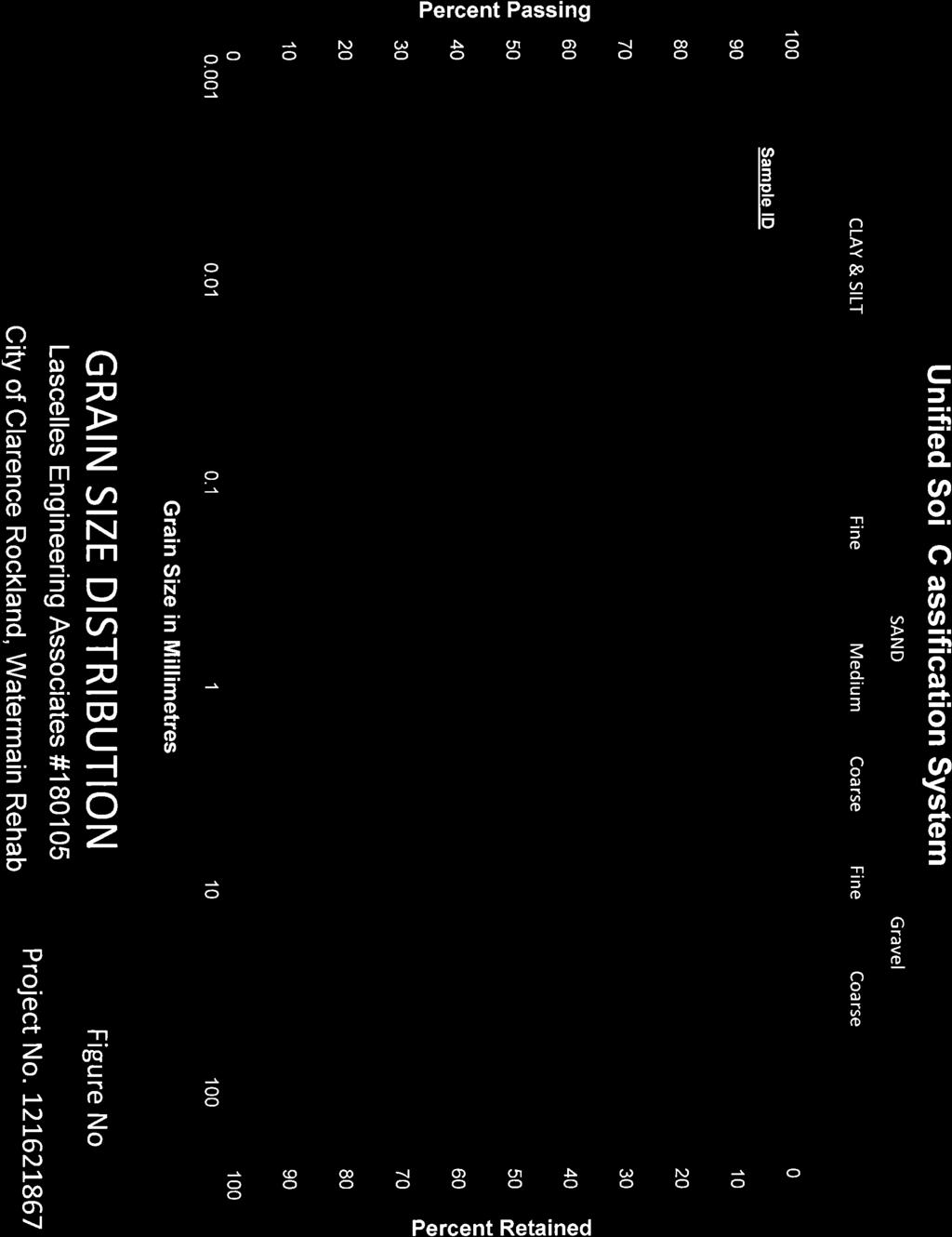
102
February 22, 2016 AG File No
 Ainley Graham & Associates Limited 1-50 Grant Timmins Drive, Kingston, Ontario, K7M 8N2 Tel: (343) 266-0002 Fax: (343) 266-0028 E-mail Kingston@ainleygroup.com February 22, 2016 AG File No. 15062-1 Ministry
General. DATE December 10, 2013 PROJECT No TO Mary Jarvis Urbandale/Riverside South Development Corporation
 DATE December 10, 201 PROJECT No. 10-1121-0260- TO Mary Jarvis Urbandale/Riverside South Development Corporation CC Justin Robitaille, Urbandale Jonathan Párraga, J.L. Richards & Associates Limited FROM
Preliminary Geotechnical Evaluation Gooseberry Point Pedestrian Improvements Whatcom County, Washington SITE AND PROJECT DESCRIPTION
 File No. 12-100 Geotechnical & Earthquake Engineering Consultants Mr. Kevin Brown, P.E. Gray & Osborne, Inc. 3710 168 th Street NE, Suite B210 Arlington, Washington 98223 Subject: Draft Report Preliminary
Updated Subsurface Investigation Block A Heritage Hills Development 124 Battersea Crescent Ottawa, Ontario
 Updated Subsurface Investigation Block A Heritage Hills Development 124 Battersea Crescent Ottawa, Ontario Submitted to: Brigil Homes 98 rue Lois Gatineau, Quebec J8Y 3R7 Updated Subsurface Investigation
Eastgate Parking Lot Geotechnical Investigation
 Eastgate Parking Lot Geotechnical Investigation Cambium Reference No.: 336- March 4, 24 Prepared for: City of Peterborough Cambium Inc. P.O. Box 325 52 Hunter Street East, Peterborough Ontario, K9H G5
M E M O R A N D U M. Mr. Jonathan K. Thrasher, P.E., Mr. Ian Kinnear, P.E. (FL) PSI
 PSI") M E M O R A N D U M TO: FROM: Mr. Mark Schilling Gulf Interstate Engineering Mr. Jonathan K. Thrasher, P.E., Mr. Ian Kinnear, P.E. (FL) PSI DATE: November 11, 2014 RE: Summary of Findings Geotechnical
M E M O R A N D U M TO: FROM: Mr. Mark Schilling Gulf Interstate Engineering Mr. Jonathan K. Thrasher, P.E., Mr. Ian Kinnear, P.E. (FL) PSI DATE: November 11, 2014 RE: Summary of Findings Geotechnical
Civil Engineering, Surveying and Environmental Consulting WASP0059.ltr.JLS.Mich Ave Bridge Geotech.docx
 2365 Haggerty Road South * Canton, Michigan 48188 P: 734-397-3100 * F: 734-397-3131 * www.manniksmithgroup.com August 29, 2012 Mr. Richard Kent Washtenaw County Parks and Recreation Commission 2330 Platt
Hydro One (Sept 2014) Hydro One (Sept 2014) Hydro One (Sept 2014)
 Hydro One (Sept 2014) Hydro One (Sept 2014)") TABLE 1 WELL CONSTRUCTION DETAILS MOE WWR No Well ID Location Installation Date Status Easting Coordinates Northing Source Elevation Screened Interval Screened Material Borehole Well Stick-up Ground Top
TABLE 1 WELL CONSTRUCTION DETAILS MOE WWR No Well ID Location Installation Date Status Easting Coordinates Northing Source Elevation Screened Interval Screened Material Borehole Well Stick-up Ground Top
ATTACHMENT A PRELIMINARY GEOTECHNICAL SUMMARY
 ATTACHMENT A PRELIMINARY GEOTECHNICAL SUMMARY Kevin M. Martin, P.E. KMM Geotechnical Consultants, LLC 7 Marshall Road Hampstead, NH 0384 603-489-6 (p)/ 603-489-8 (f)/78-78-4084(m) kevinmartinpe@aol.com
June 9, R. D. Cook, P.Eng. Soils Engineer Special Services Western Region PUBLIC WORKS CANADA WESTERN REGION REPORT ON
 PUBLIC WORKS CANADA WESTERN REGION REPORT ON GEOTECHNICAL INVESTIGATION PROPOSED MARTIN RIVER BRIDGE MILE 306.7 MACKENZIE HIGHWAY Submitted by : R. D. Cook, P.Eng. Soils Engineer Special Services Western
GEOTECHNICAL REPORT CBSA Facility Redevelopment Thousand Islands International Crossing Lansdowne, Ontario
 GEOTECHNICAL REPORT CBSA Facility Redevelopment Thousand Islands International Crossing Lansdowne, Ontario Prepared For: The Federal Bridge Corporation Limited SPL Project No.: 10001084 Report Date: January
 Photo 1 - Southerly view across 2700 parking lot toward existing building. Multi-residential building borders western side of property in upper right of view. Photo 2 - Southerly view across 2750 parking
patersongroup memorandum 1.0 Field Investigation consulting engineers
 consulting engineers memorandum to: KDSA Development Corporation - Ms. Susan Anglin - susananglin6@gmail.com re: Pavement Structure Recommendations - Shady Maple Road Proposed Braeburn Estates Residential
patersongroup 1.0 Geotechnical Desktop Review Consulting Engineers April 18, 2017 PG4080-LET.01
 patersongroup April 18, 2017 PG080-LET.01 2015-2017 RR Ltd 311 Richmond Road, Suite 203 Ottawa, ON K1Z 6X3 Attention: Subject: Mr. Jonah Bonn Geotechnical Desktop Review Proposed Drive-Thru Lanes 2015-2017
patersongroup Mineral Aggregate Assessment 3119 Carp Road Ottawa, Ontario Prepared For Mr. Greg LeBlanc March 7, 2014 Report: PH2223-REP.
 Geotechnical Engineering Environmental Engineering group Hydrogeology Geological Engineering Archaeological Studies Materials Testing 3119 Carp Road Prepared For Mr. Greg LeBlanc March 7, 2014 Paterson
DRAFT GEOTECHNICAL INVESTIGATION REPORT
 DRAFT GEOTECHNICAL INVESTIGATION REPORT PROPOSED NEW SEWER INSTALLATION CITY OF CLARENCE-ROCKLAND, ONTARIO Prepared for: City of Clarence-Rockland 151-03483-00 Date: July 2015 WSP Canada Inc. 500 Greber
B-1 BORE LOCATION PLAN. EXHIBIT Drawn By: 115G BROOKS VETERINARY CLINIC CITY BASE LANDING AND GOLIAD ROAD SAN ANTONIO, TEXAS.
 N B-1 SYMBOLS: Exploratory Boring Location Project Mngr: BORE LOCATION PLAN Project No. GK EXHIBIT Drawn By: 115G1063.02 GK Scale: Checked By: 1045 Central Parkway North, Suite 103 San Antonio, Texas 78232
Subsurface Investigation Proposed Commercial Building 528 March Road Ottawa, Ontario
 Subsurface Investigation Proposed Commercial Building 8 March Road Ottawa, Ontario Houle Chevrier Engineering Ltd. 80 Wescar Lane Ottawa, Ontario K0A L0 www.hceng.ca Submitted to: Broccolini Construction
APPENDIX C HYDROGEOLOGIC INVESTIGATION
 Figure B-5.7 Figure B-5.8 Preliminary Geotechnical and Environmental Report Appendix C Hydrogeologic Investigation APPENDIX C HYDROGEOLOGIC INVESTIGATION December 21, 2011 WESTSIDE SUBWAY EXTENSION PROJECT
ROCK EXCAVATION (GRADING) OPSS 206 INDEX
 OPSS 206 INDEX") 206-2 - OPSS 206 INDEX 206-2.1 GENERAL 206-2.1.1 Classification of Rock Materials 206-2.1.2 Tender Items 206-2.1.3 Other Excavation Tender Items 206-2.1.4 Specifications 206-2.1.5 Special Provisions 206-2.1.6
206-2 - OPSS 206 INDEX 206-2.1 GENERAL 206-2.1.1 Classification of Rock Materials 206-2.1.2 Tender Items 206-2.1.3 Other Excavation Tender Items 206-2.1.4 Specifications 206-2.1.5 Special Provisions 206-2.1.6
APPENDIX A GEOTECHNICAL REPORT
 The City of Winnipeg Bid Opportunity No. 529-2017 Template Version: C420170317 - RW APPENDIX A GEOTECHNICAL REPORT Quality Engineering Valued Relationships KGS Group 2017 Industrial Street Rehabilitation
FROST HEAVE. GROUND FREEZING and FROST HEAVE
 FROST HEAVE The temperature of soils near the ground surface reflects the recent air temperatures. Thus, when the air temperature falls below 0 C (32 F) for extended periods, the soil temperature drops
ENCE 3610 Soil Mechanics. Site Exploration and Characterisation Field Exploration Methods
 ENCE 3610 Soil Mechanics Site Exploration and Characterisation Field Exploration Methods Geotechnical Involvement in Project Phases Planning Design Alternatives Preparation of Detailed Plans Final Design
How & Where does infiltration work? Summary of Geologic History Constraints/benefits for different geologic units
 June 26, 2007: Low Impact Development 1 Associated Earth Sciences, Inc. Associated Earth Sciences, Inc. Presented by: Matthew A. Miller, PE April 24, 2012 How & Where does infiltration work? Summary of
Geotechnical Investigation Report
 Geotechnical Investigation Report Proposed Salt Storage Shed Majestic Hills Drive Hamilton Township, Ontario Hamilton Township 7 Pido Road Peterborough Ontario K9J 6X7 Canada 568 0 Report No June 08 Table
Hydrogeological Assessment for Part of Lots 2 and 3, Concession 5, Township of Thurlow, County of Hastings 1.0 INTRODUCTION. 1.
 February 10,2017 25506400 Ontario Ltd. Foxboro, ON Attention: Brad Newbatt Re: Hydrogeological Assessment for Part of Lots 2 and 3, Concession 5, Township of Thurlow, County of Hastings 1.0 INTRODUCTION
Depth (ft) USCS Soil Description TOPSOIL & FOREST DUFF
 USCS Soil Description TOPSOIL & FOREST DUFF") Test Pit No. TP-6 Location: Latitude 47.543003, Longitude -121.980441 Approximate Ground Surface Elevation: 1,132 feet Depth (ft) USCS Soil Description 0 1.5 1.5 5.0 SM 5.0 8.0 SM Loose to medium dense,
Test Pit No. TP-6 Location: Latitude 47.543003, Longitude -121.980441 Approximate Ground Surface Elevation: 1,132 feet Depth (ft) USCS Soil Description 0 1.5 1.5 5.0 SM 5.0 8.0 SM Loose to medium dense,
GEOTECHNICAL REPORT. Matanuska-Susitna Borough. Parks Highway Connections Museum Drive. Matanuska-Susitna Borough, Alaska.
 Matanuska-Susitna Borough GEOTECHNICAL REPORT Parks Highway Connections Museum Drive Matanuska-Susitna Borough, Alaska March 2, 20 Prepared By: John Thornley, PE Geotechnical Engineer 333 Arctic Blvd.,
Prepared for. Mr. Denis A. Verdon 445, Wilson Road Rockland, Ontario K4K 1K7
 GEOTECHNICAL INVESTIGATION Proposed Verdon Subdivision Part of Lot 16, Concession I (Old Survey) Geographic Township of Clarence Now City of Clarence-Rockland Prepared for Mr. Denis A. Verdon 445, Wilson
PAVEMENT REPORT. Submitted to: Lee Jablonski, P.Eng. J.L. Richards & Associates Limited 864 Lady Ellen Place Ottawa, ON K1Z 5M2
 PAVEMENT REPORT GEOTECHNICAL INVESTIGATION FOR THE REHABILITATION OF LOUIS HEBERT STREET, VAUDREUIL STREET, MARQUELLE STREET AND LASALLE STREET, ROCKLAND, ONTARIO Submitted to: Lee Jablonski, P.Eng. J.L.
PRELIMINARY GEOTECHNICAL ENGINEERING REPORT. Proposed Re-Development 44 Old Worcester Road Charlton, Massachusetts. Prepared For:
 PRELIMINARY GEOTECHNICAL ENGINEERING REPORT Proposed Re-Development 44 Old Worcester Road Charlton, Massachusetts Prepared For: Meridian Associates, Inc. 500 Cummings Center, Suite 5950 Beverly, Massachusetts
 Project: ITHACA-TOMPKINS REGIONAL AIRPORT EXPANSION Project Location: ITHACA, NY Project Number: 218-34 Key to Soil Symbols and Terms TERMS DESCRIBING CONSISTENCY OR CONDITION COARSE-GRAINED SOILS (major
CENTRAL REGION GEOHAZARDS RISK ASSESSMENT SITE INSPECTION FORM
 SITE NUMBER AND NAME C55 H861:02 Slide LEGAL DESCRIPTION NW 14-40-14-W4 CENTRAL REGION GEOHAZARDS RISK ASSESSMENT SITE INSPECTION FORM HIGHWAY & KM NAD 83 COORDINATES N 5811217 E 437291 PREVIOUS INSPECTION
Northern Colorado Geotech
 PRELIMINARY GEOTECHNICAL ENGINEERING REPORT PROPOSED CECIL FARMS DEVELOPMENT WELD COUNTY ROAD 7, BETWEEN ROADS 7 AND 7 SEVERANCE, COLORADO NORTHERN COLORADO GEOTECH PROJECT NO. 0-6 APRIL 0, 06 Prepared
SOIL AND AGGREGATE FUNDAMENTALS STUDENT GUIDE AMRC April, 2006 AREA MANAGER ROADS CERTIFICATION PROGRAM FOR EDUCATIONAL PURPOSES ONLY
 AREA MANAGER ROADS CERTIFICATION PROGRAM AMRC 2011 SOIL AND AGGREGATE FUNDAMENTALS STUDENT GUIDE FOR EDUCATIONAL PURPOSES ONLY April, 2006 WPC #28013 07/09 2009 by British Columbia Institute of Technology
Geotechnical Investigation Juneau Seawalk - Taku Fisheries to Miner s Wharf Juneau, Alaska DM&A Job No
 Duane Miller & Associates 5821 Arctic Boulevard, Suite A Anchorage, AK 99518-1654 (907) 644-3200 Fax 644-0507 Arctic & Geotechnical Engineering May 4, 2006 Tetra Tech/KCM, Inc. 1971 First Avenue Seattle,
Geotechnical Engineering Study, Conifer Senior High School Football Field Improvements, Conifer, Colorado
 2390 South Lipan Street Denver, CO 80223 phone: (303) 742-9700 fax: (303) 742-9666 email: kadenver@kumarusa.com www.kumarusa.com Office Locations: Denver (HQ), Colorado Springs, Fort Collins, and Frisco,
Boreholes. Implementation. Boring. Boreholes may be excavated by one of these methods: 1. Auger Boring 2. Wash Boring 3.
 Implementation Boreholes 1. Auger Boring 2. Wash Boring 3. Rotary Drilling Boring Boreholes may be excavated by one of these methods: 4. Percussion Drilling The right choice of method depends on: Ground
Limited Geotechnical Engineering Evaluation Classroom Additions Albany County Campus Laramie, Wyoming
 Limited Geotechnical Engineering Evaluation Classroom Additions Albany County Campus 2300 Missile Drive, Cheyenne, Wyoming 82001 Phone 307-635-0222 www.stratageotech.com Limited Geotechnical Engineering
Reference No S072 APRIL 2012
 A REPORT TO SOLMAR DEVELOPMENT CORP. A PRELIMINARY SOIL INVESTIGATION FOR PROPOSED SUBDIVISION DEVELOPMENT NORTHEAST OF SIDEROAD 5 AND 0 LINE TOWN OF ERIN Reference No. 202-S072 APRIL 202 DISTRIBUTION
Geotechnical Investigation Proposed Retirement Residence Goulbourn Forced Road Ottawa, Ontario
 REPORT February 205 REPORT ON Geotechnical Investigation Proposed Retirement Residence Goulbourn Forced Road Ottawa, Ontario Submitted to: Dan Roach, AIA Hawthorne Development LLC c/o Lenity Architecture
REPORT OF PRELIMINARY GEOTECHNICAL EXPLORATION
 REPORT OF PRELIMINARY GEOTECHNICAL EXPLORATION ENKA INTERMEDIATE SCHOOL Sand Hill Road Candler, North Carolina Prepared For: BUNCOMBE COUNTY SCHOOLS Prepared By: AMEC ENVIRONMENT & INFRASTRUCTURE, INC.
KDOT Geotechnical Manual Edition. Table of Contents
 KDOT Geotechnical Manual 2007 Edition The KDOT Geotechnical Manual is available two volumes. Both volumes are very large electronic (pdf) files which may take several minutes to download. The table of
CONQUEST ENGINEERING LTD.
 CONQUEST ENGINEERING LTD. Geotechnical and Materials Engineers Concrete Technology, Blasting Consultants Construction Quality Assurance / Quality Control 8 Bluewater Road, Bedford, NS BB J6 Phone (9)85-7
CITY OF CAPE CORAL NORTH 2 UTILITIES EXTENSION PROJECT CONTRACT 3
 GEOTECHNICAL REPORT CITY OF CAPE CORAL NORTH UTILITIES EXTENSION PROJECT CONTRACT City of Cape Coral Procurement Division Cultural Park Boulevard, nd Floor Cape Coral, FL ISSUED FOR BID VOLUME of GEOTECHNICAL
Final Geotechnical Report Multi-Level Building at 159, 163 and 167 Parkdale Ave. Ottawa, ON
 Final Geotechnical Report Multi-Level Building at 159, 163 and 167 Parkdale Ave. Ottawa, ON Prepared for: Richcraft Group of Companies 2280 St. Laurent Blvd, Ottawa, ON K1G 4K1 Prepared by: Stantec Consulting
Report of Preliminary Geotechnical Exploration. CSO-012 Sewer Separation Cincinnati, Hamilton County, Ohio. February, 2011
 11242843_GeoTech_Preliminary - Feburary 2011_1/40 Report of Preliminary Geotechnical Exploration CSO-012 Sewer Separation Cincinnati, Hamilton County, Ohio February, 2011 11242843_GeoTech_Preliminary -
Converse Consultants Geotechnical Engineering, Environmental & Groundwater Science, Inspection & Testing Services
 Converse Consultants Geotechnical Engineering, Environmental & Groundwater Science, Inspection & Testing Services Ms. Rebecca Mitchell Mt. San Antonio College Facilities Planning & Management 1100 North
Geotechnical Investigation Proposed Retirement Residence Timberwalk Ottawa, Ontario
 September 6 REPORT ON Geotechnical Investigation Proposed Retirement Residence Timberwalk Ottawa, Ontario Submitted to: Claridge Homes Corporation - Gladstone Avenue Ottawa, ON KP Y6 REPORT Report Number:
Groundwater Investigation SOUTHGATE GRAVEL PIT Part of Lot 15, Concession 15 (formerly Township of Proton), Township of Southgate.
, Township of Southgate.") Groundwater Investigation SOUTHGATE GRAVEL PIT Part of Lot 15, Concession 15 (formerly Township of Proton), Township of Southgate County of Grey October, 2014 Prepared for: Drysdale Aggregate Consulting
Groundwater Investigation SOUTHGATE GRAVEL PIT Part of Lot 15, Concession 15 (formerly Township of Proton), Township of Southgate County of Grey October, 2014 Prepared for: Drysdale Aggregate Consulting
APPENDIX E SOILS TEST REPORTS
 Otsego County, NY Site Work Specifications APPENDIX E SOILS TEST REPORTS Blue Wing Services, Inc. July 1, 2010 Blue Wing Services May 20, 2010 Page 2 the site, was not made available to Empire at this
DATA REPORT GEOTECHNICAL INVESTIGATION GALVESTON CRUISE TERMINAL 2 GALVESTON, TEXAS
 DATA REPORT GEOTECHNICAL INVESTIGATION GALVESTON CRUISE TERMINAL 2 GALVESTON, TEXAS SUBMITTED TO PORT OF GALVESTON 123 ROSENBERG AVENUE, 8TH FLOOR GALVESTON, TEXAS 77553 BY HVJ ASSOCIATES, INC. HOUSTON,
File: Highway 1 Admirals/McKenzie Interchange, Saanich, BC Pavement Drilling / Coring Geotechnical Investigation
 TECHNICAL MEMO To: Mr. Salem Bahamdun, P.Eng. Date: February 2, 2017 c: Memo No.: From: Ms. Susanne Ouellet, E.I.T. Mr. Andrew Walker, P.Eng. File: 704TRN.PAVE0303807 ISSUED FOR USE Subject: Highway 1
Slope Stability Assessment Proposed Development 4401 Fallowfield Road Lands Ottawa, Ontario Rev-02
 REPORT August 2014 REPORT ON Slope Stability Assessment Proposed Development 4401 Fallowfield Road Lands Ottawa, Ontario Submitted to: DCR Phoenix Homes 18 Bentley Avenue Ottawa, Ontario K2E 6T8 Report
GEOTECHNICAL INVESTIGATION REPORT
 GEOTECHNICAL INVESTIGATION REPORT DH 1404-05 ACCOMODATE SPECIALIZED EQUIPMENT, DWYER HILL TRAINING CENTRE RICHMOND, ONTARIO Prepared for: Defence Construction Canada (DCC) Date: February 2016 Report No.:
LIMITED SUPPLEMENTARY GEOTECHNICAL INVESTIGATION REPORT FOR PROPOSED ROAD, DRAINAGE, AND SIDEWALK IMPROVEMENTS IN THE VILLAGE OF NEWBURY, ONTARIO
 LIMITED SUPPLEMENTARY GEOTECHNICAL INVESTIGATION REPORT FOR PROPOSED ROAD, DRAINAGE, AND SIDEWALK IMPROVEMENTS IN THE VILLAGE OF NEWBURY, ONTARIO Prepared for: CIMA+ #900, 101 Frederick Street Kitchener,
Appendix C Benchmarking Cost Estimates
 REPORT Appendix C Benchmarking Cost Estimates C-1 Table C-1 Permits, Notifications & Location Services Notes: Costs associated with delays in construction have not been included in this estimate OneCall
Geotechnical Data Report
 Geotechnical Data Report Downtown Greenville Future Conveyance Study December 1, 2015 Terracon Project No. 86155032 Prepared for: Prepared by: Terracon Consultants, Inc. December 1, 2015 561 Mauldin Road
SITE INVESTIGATION 1
 SITE INVESTIGATION 1 Definition The process of determining the layers of natural soil deposits that will underlie a proposed structure and their physical properties is generally referred to as site investigation.
Geotechnical Investigation Proposed Richmond Home Hardware Addition 6379 Perth Street Richmond, Ontario
 Geotechnical Investigation Proposed Richmond Home Hardware Addition 6379 Perth Street Richmond, Ontario Houle Chevrier Engineering Ltd. 180 Wescar Lane Ottawa, Ontario K0A 1L0 www.hceng.ca Submitted to:
Final Geotechnical Report Proposed Tower B Multi-Level Building at the Corner of Parkdale Avenue and Bullman Street Ottawa, ON
 Final Geotechnical Report Proposed Tower B Multi-Level Building at the Corner of Parkdale Avenue and Bullman Street Ottawa, ON Prepared for: Richcraft Group of Companies 2280 St. Laurent Blvd, Ottawa,
APPENDIX D GEOTECHNICAL ENGINEERING RECOMMENDATIONS
 APPENDIX D GEOTECHNICAL ENGINEERING RECOMMENDATIONS USKH Juneau International Runway 8/26 Rehabilitation Prepared For: Prepared By: 11/27/2013 PND No. 132070.02 November 2013 TABLE OF CONTENTS Page No.
Geotechnical Engineering Report
 Geotechnical Engineering Report Turner Turnpike Widening Polecat Creek Bridge (Bridge A) June 1, 2016 Terracon Project No. 04155197 Prepared for: Garver, LLC Prepared by: Terracon Consultants, Inc. TABLE
14 Geotechnical Hazards
 Volume 2: Assessment of Environmental Effects 296 14 Geotechnical Hazards Overview This Chapter provides an assessment of the underlying geotechnical conditions to identify: any potential liquefaction
REPORT ON SUPPLEMENTAL GEOTECHNICAL INVESTIGATION ABBOTT FERNBANK HOLDINGS INC. PROPERTY FERNBANK ROAD OTTAWA, ONTARIO.
 8 escar Lane R.R. Carp, Ontario, KA L Tel: (6) 86- Fax: (6) 86-97 www.hceng.ca REPT ON SUPPLEMENTAL GEOTECHNICAL INVESTIGATION ABBOTT FERNBANK HOLDINGS INC. PROPERTY FERNBANK ROAD OTTAA, ONTARIO Submitted
IV. ENVIRONMENTAL IMPACT ANALYSIS G. GEOLOGY AND SOILS
 IV. ENVIRONMENTAL IMPACT ANALYSIS G. GEOLOGY AND SOILS The following section is a summary of the geotechnical report conducted for the proposed project. The Report of Geotechnical Investigation Proposed
Early Exploration Permit Activity Information
 Early Exploration Permit Activity Information Activities That Require an Early Exploration Permit: Line cutting that is a width greater than 1.5 metres Mechanized stripping of a total surface area of greater
ENGINEERING ASSOCIATES
 July 16, 211 Vista Design, Inc. 11634 Worcester Highway Showell, Maryland 21862 Attention: Reference: Dear Mr. Polk: Mr. Richard F. Polk, P.E. Geotechnical Engineering Report Charles County RFP No. 11-9
APPENDIX C. Borehole Data
 APPENDIX C Borehole Data MAJOR DIVISIONS SOIL CLASSIFICATION CHART SYMBOLS GRAPH LETTER TYPICAL DESCRIPTIONS ADDITIONAL MATERIAL
APPENDIX B DISTRESSES
 144 APPENDIX B DISTRESSES 145 INTRODUCTION The purpose of this appendix is not to provide a detailed discussion of the various descriptions and causes of distresses that may occur in any given pavement
This report was prepared by Klohn Crippen Consultants Ltd. for Alberta Transportation Central Region under Contract No. CE053/2000.
 Alberta Transportation Central Region #401, 4902 51 Street Red Deer, Alberta T4N 6K8 June 7, 2002 Mr. Melvin Mayfield, P.Eng. Project Engineer Dear Mr. Mayfield: Central Region Landslide Assessment Site
Date: April 2, 2014 Project No.: Prepared For: Mr. Adam Kates CLASSIC COMMUNITIES 1068 E. Meadow Circle Palo Alto, California 94303
 City of Newark - 36120 Ruschin Drive Project Draft Initial Study/Mitigated Negative Declaration Appendix C: Geologic Information FirstCarbon Solutions H:\Client (PN-JN)\4554\45540001\ISMND\45540001 36120
3.0 SUMMARY OF FINDINGS
 AECOM 500 W Jefferson St. Suite 1600 Louisville, KY 40202 www.aecom.com 502-569-2301 tel 502-569-2304 fax October 17, 2018 Big Rivers Electric Corporation Sebree Generating Station 9000 Highway 2096 Robards,
Geotechnical Investigation Bow Ridge Subdivision Phase 3 Cochrane, Alberta
 Geotechnical Investigation Bow Ridge Subdivision Phase 3 Cochrane, Alberta FINAL Prepared for: The Town of Cochrane 101 Ranchehouse Road Cochrane, Alberta Prepared by: Stantec Consulting Ltd. Calgary,
REPORT OF SUBSURFACE EXPLORATION
 REPORT OF SUBSURFACE EXPLORATION GRAND RIVER DAM AUTHORITY HULBERT 69 KV SWITCHING STATION S. 440 Road Hulbert, Cherokee County, Oklahoma ENERCON PROJECT NO. GRDA006 MARCH 7, 2012 PREPARED FOR: C/O ENERCON
Chapter 12 Subsurface Exploration
 Page 12 1 Chapter 12 Subsurface Exploration 1. The process of identifying the layers of deposits that underlie a proposed structure and their physical characteristics is generally referred to as (a) subsurface
Safe bearing capacity evaluation of the bridge site along Syafrubesi-Rasuwagadhi road, Central Nepal
 Bulletin of the Department of Geology Bulletin of the Department of Geology, Tribhuvan University, Kathmandu, Nepal, Vol. 12, 2009, pp. 95 100 Safe bearing capacity evaluation of the bridge site along
R.M.HARW & ASSOCIATES LTD. GEOTECHNICAL INVESTIGATION PROPOSED BRIDGE SITE. HELAVA CREEKl MILE MACKENZIE HIGHWAY E-2510 OCTOBER 16, 1973
 El R.M.HARW & ASSOCIATES LTD. GEOTECHNICAL INVESTIGATION PROPOSED BRIDGE SITE HELAVA CREEKl MILE 616.4 MACKENZIE HIGHWAY E-2510 OCTOBER 16, 1973 R,M,HARDV & ASSOCIATES LTD. CONSULTING ENGINEERING & TESTING
16 January 2018 Job Number: RICHARD NEWMAN C\- CLARK FORTUNE MCDONALD AND ASSOCIATES PO BOX 553 QUEENSTOWN
 16 January 2018 Job Number: 50595 RICHARD NEWMAN C\- CLARK FORTUNE MCDONALD AND ASSOCIATES PO BOX 553 QUEENSTOWN CHANSEN@CFMA.CO.NZ STORMWATER DISPOSAL ASSESSMENT Dear Richard, RDAgritech were requested
Geotechnical Investigation. Trent University Arena Complex Nassau Mills Road and Pioneer Road Peterborough, Ontario. City of Peterborough
 Geotechnical Investigation Trent University Arena Complex Nassau Mills Road and Pioneer Road Peterborough, Ontario City of Peterborough September, 0 Pido Road, Unit, Peterborough, Ontario, Canada KJ X
GEOTECHNICAL INVESTIGATION. Proposed Douglas Street Bus Lane
 May, 0 GEOTECHNICAL INVESTIGATION Proposed Douglas Street Bus Lane Submitted to: Greg Smith P.Eng. Senior Transportation Engineer Urban Systems Ltd. 0- Homer Street Vancouver, BC V6B W9 REPORT Report Number:
Ardaman & Associates, Inc. Geotechnical, Environmental and Materials Consultants
 SUBSURFACE SOIL EXPLORATION 42-INCH FORCE MAIN REPLACEMENT CHIQUITA BOULEVARD S AND SW 34 TH STREET CAPE CORAL, LEE COUNTY, FLORIDA Ardaman & Associates, Inc. Geotechnical, Environmental and Materials
Geotechnical Engineering Report
 Geotechnical Engineering Report Turner Turnpike Widening Bridge B Bridge Crossing: South 257 th West Avenue Creek County, Oklahoma June 1, 2016 Terracon Project No. 04155197 Prepared for: Garver, LLC Tulsa,
Gotechnical Investigations and Sampling
 Gotechnical Investigations and Sampling Amit Prashant Indian Institute of Technology Gandhinagar Short Course on Geotechnical Investigations for Structural Engineering 12 14 October, 2017 1 Purpose of
Table of Contents. Description
 Table of Contents Description Page A. Introduction... 1 A.1. Project Description... 1 A.2. Site Conditions and History... 2 A.3. Purpose... 3 A.4. Background Information and Reference Documents... 4 A.5.
An Introduction to Field Explorations for Foundations
 An Introduction to Field Explorations for Foundations J. Paul Guyer, P.E., R.A. Paul Guyer is a registered mechanical engineer, civil engineer, fire protection engineer and architect with over 35 years
TIERRA. Florida License No Florida License No
 March 9, 208 TIERRA AECOM 7650 West Courtney Campbell Cswy Tampa, FL 33607 Attn: RE: Mr. Edgar Figueroa, P.E. Geotechnical Engineering Services Report Purchase Order No.: 9532 AECOM Project Number: 6055499
1 PROJECT BACKGROUND. August 14, Alberta Transportation Central Region #401, Street Red Deer, Alberta T4N 6K8
 August 14, 2013 Alberta Transportation Central Region #401, 4902 51 Street Red Deer, Alberta T4N 6K8 Mr. Dennis Grace, P.Eng. Construction Engineer Dear Mr. Grace: Central Region Geohazard Assessment 2013
APPENDICES. Appendix A City Standard Details Appendix B Engineering Geology Report
 APPENDICES Appendix A City Standard Details Appendix B Engineering Geology Report APPENDIX A CITY STANDARDS DETAILS APPENDIX B ENGINEERING GEOLOGY REPORT ENGINEERING GEOLOGY REPORT WATER
CONQUEST ENGINEERING LTD.
 CONQUEST ENGINEERING LTD. Geotechnical and Materials Engineers Concrete Technology, Blasting Consultants Construction Quality Assurance / Quality Control 8 Bluewater Road, Bedford, NS BB J6 Phone (9)85-7
REPORT ON SLOPE STABILITY INVESTIGATION DON MILLS ROAD AND EGLINTON AVENUE EAST TORONTO, ONTARIO. Prepared for:
 REPORT ON SLOPE STABILITY INVESTIGATION DON MILLS ROAD AND EGLINTON AVENUE EAST TORONTO, ONTARIO Prepared for: TORONTO AND REGION CONSERVATION AUTHORITY Prepared By: SIRATI & PARTNERS CONSULTANTS LIMITED
LEGEND BUSINESS ZONE NORTH OF AGRESEARCH BOREHOLE CPT SEISMIC CPT AUGER SCALE. Powells Road TEST PIT AGRESEARCH INNOVATION PARK. Hamilton Ring Road
 LEGEND ra R aku Ru BUSINESS ZONE NORTH OF Powells Road oad AGRESEARCH BOREHOLE CPT SEISMIC CPT AUGER SCALE 3 mm TEST PIT AS121 SCPT12 TP18 BH13 TP15 2 AS125 AS126 TP14 BH12 AGRESEARCH CPT13 TP17 INNOVATION
Impact : Changes to Existing Topography (Less than Significant)
") 4.2 Land Resources 4.2.1 Alternative A Proposed Action Impact 4.2.1-1: Changes to Existing Topography (Less than Significant) Development of the project site would involve grading and other earthwork as
4.2 Land Resources 4.2.1 Alternative A Proposed Action Impact 4.2.1-1: Changes to Existing Topography (Less than Significant) Development of the project site would involve grading and other earthwork as
Early Exploration Plan Activity Information
 Early Exploration Plan Activity Information Activities That Require an Early Exploration Plan: Line cutting that is a width of 1.5 metres or less; Geophysical surveys on the ground requiring the use of
Geotechnical Engineering Report
 Geotechnical Engineering Report Turner Turnpike Widening Bridge D Bridge Crossing: South 209 th West Avenue Creek County, Oklahoma June 1, 2016 Terracon Project No. 04155197 Prepared for: Garver, LLC Tulsa,
GEOTECHNICAL SITE INVESTIGATION REPORT SUBDIVISION - SELECTED LOTS AKISQNUK FIRST NATION WINDERMERE, BC
 GEOTECHNICAL SITE INVESTIGATION REPORT SUBDIVISION - SELECTED LOTS AKISQNUK FIRST NATION WINDERMERE, BC Prepared For: Akisqnuk First Nation Windermere, BC Box 688 Fernie, BC V0B 1M0 250 423 4829 August
SLOPE STABILITY ASSESSMENT PROPOSED RESIDENTIAL SUBDIVISION 161 LAKESHORE ROAD EAST TOWN OF THE BLUE MOUNTAINS, ONTARIO
 SLOPE STABILITY ASSESSMENT PROPOSED RESIDENTIAL SUBDIVISION 161 LAKESHORE ROAD EAST TOWN OF THE BLUE MOUNTAINS, ONTARIO PETO MacCALLUM LTD. 19 CHURCHILL DRIVE BARRIE, ONTARIO L4N 8Z5 PHONE: (705) 734-3900
Pierce County Department of Planning and Land Services Development Engineering Section
 Page 1 of 7 Pierce County Department of Planning and Land Services Development Engineering Section PROJECT NAME: DATE: APPLICATION NO.: PCDE NO.: LANDSLIDE HAZARD AREA (LHA) GEOLOGICAL ASSESSMENT REPORT
patersongroup Geotechnical Investigation Proposed Industrial Building 1670 Comstock Road Ottawa, Ontario Prepared For Simluc Contractors Limited
 Geotechnical Engineering Environmental Environmental Engineering Engineering Hydrogeology Hydrogeology Geological Engineering Geological Engineering Materials Testing Materials Testing Building Science
GEOTECHNICAL INVESTIGATION REPORT
 GEOTECHNICAL INVESTIGATION REPORT SOIL INVESTIGATION REPORT FOR STATIC TEST FACILITY FOR PROPELLANTS AT BDL, IBRAHIMPATNAM. Graphics Designers, M/s Architecture & Engineering 859, Banjara Avenue, Consultancy