Tactical Urbanism 24
|
|
|
- Chester White
- 5 years ago
- Views:
Transcription

1 23

2 Tactical Urbanism 24

3 4.0 TACTICAL URBANISM Figure 4.1a: Tactical Urbanism Example, Photo courtesy: INTRODUCTION Tactical Urbanism is a strategy utilized in community planning that applies small-scale, low-cost improvements to revitalize a community. Tactical Urbanism strategies can be temporary or semi-permanent and always respond to a particular local need or situation. Because these strategies are small-scale and low-cost they have the ability to be implemented quickly without much permitting, fundraising, and design or construction demands. This leads to immediate change that can excite residents and maintain community momentum between the time it takes to implement larger-scale, higher-cost projects. Ideas include a community garden at a vacant and underutilized street corner; a volleyball net or basketball hoop set-up in a temporarily closed street in a neighborhood where these amenities aren t common; or a ping-pong table and trees displayed in a parallel parking space to create an outdoor play area. These strategies allow for ideas and concepts to be tested and temporarily applied to a community before a substantial 25 political or financial commitment is made. Refer to figures 4.1a and 4.1b. 4.1 Tactical Urbanism interventions are most successful when they are implemented by or in partnership with the local community. Residents have the knowledge of local challenges and needs and have the presence to continue implementing Tactical Urbanism strategies yearround. Engaging local residents also allows them to see the potential that their community has and leads to a community involved in and excited about making change to revitalize their local spaces. These small-scale strategies are the first step in making lasting change in a community, as long-range planning and redevelopment can take significant amounts of time and effort to implement. Coupling these strategies with long-term planning efforts, however, is imperative. Tactical Urbanism strategies are most beneficial and can have a greater impact when they address community


4 visions and goals that are part of a longer term planning effort. 4.2 TACTICAL URBANISM LITHONIA Lithonia is an ideal place to utilize the techniques of Tactical Urbanism. In recent years, this small community has seen many planning initiatives with little implementation and residents are ready to see action. With little public funding to implement redevelop efforts now, these small-scale, low-cost strategies allow for change to begin. Lithonia s supportive and engaged residents and community partners, such as the Arabia Mountain Heritage Area Alliance, also make this city a great place to implement these ideas. As Tactical Urbanism needs the support and engagement of local citizens to continue the efforts, Lithonia s active residents and partners can champion these ideas into the future TACTICAL URBANISM GOALS The Tactical Urbanism strategies as discussed in the remainder of this chapter were generated in response to the local assets and challenges that were identified throughout the Blueprints process and are further discussed in Chapter 3. The particular assets, challenges and goals set out for these strategies are outlined in Figure 4.2a. These challenges include addressing the lack of programmed public/open space for people to gather, an undocumented Lithonia history, a lack of signage denoting assets throughout the city, and an inactive downtown streetscape. Additionally, stakeholders expressed concern that visitors were not coming into their town because Lithonia holds a negative perception due to past political issues. Figure 4.1b: Examples of Tactical Urbanism The assets that the Tactical Urbanism strategies are 26
5 rocess Diagram Steps 1-3 Research into Community; Define preliminary ideas on Community Challenges; Identify Stakeholders; Steps 4-5 Identify Assets & Challenges defined by conversations with community and LCI Plan Step 6 Analysis of Assets & Challenges into Social, Economical & Environmental Categories Step 7 Define Project Goals based on the input of Stakeholders Steps 8-12 Create design responses to address challenges; Create initial design proposals; Discuss design ideas with clients & stakeholders; Refine designs and test; More client feedback Stakeholders Assets Project Goals Project Proposals Each house is different Local Materials - Granite History Affordable Barbara Deborah Mary Small Town Feel Proximity to Surroundings - Stone Mountain, Downtown ATL, Mall/Shopping, Arabia Mountain Uniqueness In Arabia Mountain Heritage Area Social Environmental Economic Railroad Corridor Landscaping Storefront Installations Memory Wall [cemeteries] City of Lithonia Georgia Conservancy Dekalb County Dekalb Schools Strong sense of community Access to Public Transit MARTA Walkable Community Lack of programmed use in open space Lack of Historical Documentation Isolated from surroundings Lack of Tourism & Destinations Negative Perception of Lithonia Poor sense of arrival Small tax base Challenges Social Economic f Enhance Perception of Lithonia Create Identity & Ownership Accentuate Sense of Community Improve Aesthetics of Plaza Encourage Public Communication Improve Pedestrian Mobility Compliment & Actively Support LCI Plan Main Street Banners Stromwater [bucket (watershed)] Lights in Trees Furniture Bike Program: -Bike Lanes -Bike Con. Trails -Bike Racks -Public Use Bikes -Bike Awareness Wifi Spots / Pop-Up Cafe Historical Markers Yes Signs Branding Lithonia Frozen Yogurt Lack of faith in positive change Neglected Buildings Skepticism in Leadership Environmental M Storm Water Management & Rain Water Retention Lack of Signage Beautification Figure 4.2a: Project Strategy Chart responding to include: Lithonia s rich history, Lithonia s strong sense of community and engaged population, Lithonia s many amenities including access to Arabia and Panola Mountains and the nearby Big Ledge Quarry, and Lithonia s Main Street with its historic buildings, walkable sidewalks, and small town character. In response to these identified challenges and assets the following goals were identified: Enhance the perception of Lithonia to encourage citizens and visitors to enjoy Lithonia s many nearby assets and excite them about future amenities and development; create an identity for Lithonia that builds on its rich history and small town character; accentuate the sense of community by engaging citizens in the process of implementing Tactical Urbanism strategies; improve the aesthetics of the Lithonia Plaza so that citizens and visitors will come and enjoy downtown; create awareness about Lithonia s history and assets; improve non-automotive mobility and access to surrounding amenities; and compliment ideas 27


6 and recommendations that were identified within the 2003 Livable Centers Initiative report TACTICAL URBANISM STRATEGIES To address the identified goals, five Tactical Urbanism projects are proposed within this chapter: 1. Historic Marker, an installation to identify and communicate the lost history of Lithonia; 2. Bike Lithonia, a program to direct bicyclists to downtown Lithonia and to surrounding amenities; 3. Pop-Up Cafe, a wooden platform that provides seating and signage for businesses along Main Street; 4. Story-Telling Bench, an installation that provides a gathering space for community members to share their stories of Lithonia; and 5. Project Lithonia, an event to engage and excite the community about the future of Lithonia and showcase examples of how the above four installations could be implemented. Bike Lithonia The Project Lithonia Event, held on December 4th, 2011, included the installation of examples of the proposed Tactical Urbanism projects along Main Street. This important street represents Lithonia s historic downtown as it was once the heart of the community. To this day portions of it still hold the character of the small town Main Street it once was with several historic buildings. Placing the example Tactical Urbanism projects here, as well as encouraging the community to install future Tactical Urbanism projects along Main Street, attempts to address the challenge of revitalizing downtown and reviving Main Street as the heart of the community. Pop-Up Cafe Historical Marker The remainder of this chapter further describes the four proposed installations and the Project Lithonia event. The recommended partnerships to implement these ideas can be found in Chapter 7: Recommendations. Story-Telling Bench Figure 4.2b: Tactical Urbanism Proposals 28
 Would you come back? 24 0 2.) Do you think these projects have helped improve the perception of Lithonia? 9 9 3.")
7 Figure 4.3a: Urban Projection event flyer Visitors help us carry forward our plans Residents we value your feedback Yes No Yes No )Did you come to any of the Blueprints Meetings? ) Would you come back? ) Do you think these projects have helped improve the perception of Lithonia? ) Were you aware there is a PATH bike trail to Arabia Mountain that starts in Lithonia? Historical Markers 14 Main Street Furniture 16 Bike Program 18 Public Art 0 3.) Which of the following do you wish to see continued? 16 1 Figure 4.3b: Attendee Poll 4.) If the PATH trail (from Atlanta to Sone Mountian) extended to Lithonia, would you be more likely to come to Lithonia? ) Are you excited about the future of Lithonia? 4.3 PROJECT LITHONIA On December 4, 2011, the Blueprints Team hosted the Project Lithonia event on Main Street in downtown Lithonia (refer to Figure 4.3a for the event flyer). This event had several purposes: 1. To showcase examples of the Tactical Urbanism interventions - Bike Lithonia, Pop- Up Cafe, Historical Marker, and Story-telling Bench (refer to Figure 4.3c for locations of these installations); 2. To engage and excite the community about the future of Lithonia through these installations and a projection that displayed images of the recommendations presented within this report; and 3. To combat the negative perception of Lithonia with a positive event that highlights the ideas for future change in Lithonia. This Sunday evening event was a great success, with over 75 people in attendance. The active use of Main Street was successful in showcasing the downtown core as an asset and its potential as a great space to gather. Attendees were polled to evaluate reactions to the installations and overall excitement for Lithonia s future - the results can be found in Figure 4.3b. A video documenting the event was also created and uploaded to YouTube.com (www. youtube.com/watch?v=vytzmtxuiui). It is recommended that the Lithonia community continue to showcase downtown with future events, festivals and parades. A Lithonia website should be created to advertise these events and also share Lithonia s rich history and stories. 29


8 A B C D Figure 4.3c: Showcase Locations 30


.")


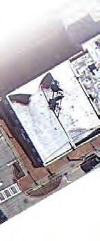
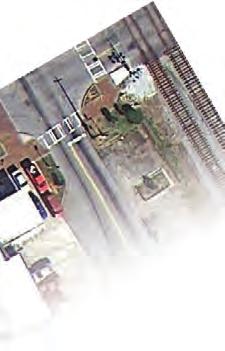
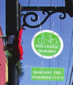
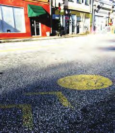
9 Figure 4.4a: Bicycle Signage Installed during Project Lithonia 4.4 BIKE LITHONIA Bike Lithonia is a Tactical Urbanism strategy that aims to utilize Lithonia s access to the PATH Foundation s Arabia Mountain Trail that extends from Arabia and Panola Mountain into Lithonia, ending blocks short of downtown at Johnson Street. The objectives of this strategy are to direct people who are utilizing this existing trail system into downtown Lithonia and to promote bicycle awareness within the community. In the long-term, a bicycle trail could move through Lithonia, to the Big Ledge Quarry, and on to the Stone Mountain Trail, completing a trail system that would connect Lithonia to Atlanta SHORT-TERM To achieve the short-term objectives of directing people into downtown from the Arabia Mountain Trail and creating bicycle awareness in Lithonia, several installations are recommended. First, signage will be needed to direct cyclists into downtown from the existing Arabia Mountain Trail that ends abruptly at Johnson Street. Most cyclists unfamiliar with the area are unaware that Main Street is only 2 blocks away (a 1 minute bike ride). By directing riders into downtown, Lithonia will gain the opportunity to draw these visitors to restaurants, retail and other amenities in downtown. Temporary paint can be painted on the street with stencils to direct riders to Main Street, and temporary sharrows (a marking that indicates a roadway is shared by both automobiles and bicyclist) along Main Street will alert drivers to share the road with cyclist. Refer to Figure 4.4c. Bright bicycle signage and brightly painted bikes could then be installed on the sidewalks along Main Street. This signage will identify Lithonia as a bike-friendly community and can identify and direct riders to places of interest near Lithonia - such as Arabia Mountain and Big Ledge Quarry. This recommended signage and bike installation was installed along Main Street during the December 4th Project Lithonia event. Please refer to Figure 4.4a and 4.4b for images from this installation. 31


10 4.4.1 LONG-TERM Bike Lithonia, in the long-term, is aimed at connecting the Arabia Mountain Trail through Lithonia, to Big Ledge Quarry and all the way to the Stone Mountain Trail, which currently connects Stone Mountain to Atlanta. This trail extension could ultimately connect Lithonia all the way to Atlanta, completing a 46-mile bike path. Refer to Figure 4.4d for a diagram of these connections. Figure 4.4b: Brightly Painted Bicycles Installed during Project Lithonia It is recommended to continue the PATH Foundation trail from Johnson Street in two directions. The first, which diverts from downtown and provides direct access to a trail that wraps around the Big Ledge Quarry and continues on to connect with the Stone Mountain Trail. The second draws cyclists into downtown Lithonia and to places of interest through out the City - such as Main Street, the Stewart Amphitheater, the Lithonia City Park, and historic sites - and ultimately connects back to a new Big Ledge Quarry trail that continues on to the Stone Mountain Trail. Refer to Figure 4.4e for a diagram of these two trail connections. ATLANTA Figure 4.4c: Temporary Paint Stenciled on Street to Direct Cyclist to Main Street DECATUR CLARKSTON STONE MTN [CITY] STONE MTN BIG LEDGE QUARRY A new trail around the Big Ledge Quarry could take advantage of this beautiful amenity, which has the potential to draw people to the area. This path is further described in Chapter 6: Long-Term Redevelopment but is identified on the maps within this section. LITHONIA ARABIA MTN EXISTING PATH TRAIL PROPOSED PATH TRAIL PANOLA MTN Figure 4.4d: Map of Existing and Proposed PATH trails 32


11 Sharrows and directional street signage will be an important component of these pathways and will need to be a priority in implementation. Signage on I-20 for the new bicycle paths will also help to advertise this great amenity. Recommended locations for signage along this proposed interconnected trail system is represented on Figure 4.4f. Coordination between the community, the PATH Foundation, and Arabia Mountain Heritage Area Alliance will be crucial to determine the exact trail locations and to achieve implementation. Some stakeholders expressed concern with potential locations of the trail on residential streets where they own property. Alternative trail locations can be identified with support from the community and coordinated efforts with partner organizations. The City of Lithonia Cemetery Lithonia Middle School Post Office Bruce Street School Lithonia African American Cemetery Lithonia City Park Stewart Amphitheatre Antioch Baptist Church Lithonia Methodist Episcopal Church Lithonia Library Baptist Church Railroad Depot Historic Main Street Park Union Church Lucious Sanders Recreation Center/East DeKalb Bruce Street Senior Center Kelly Memorial Park The Seminary Lithonia Woman s Club Magnolia Street House St. Paul African Methodist Episcopal Church Figure 4.4e: Map of Proposed Lithonia Bike Paths EXISTING PATH PROPOSED PATH EXTENSION PROPOSED BIKE LANES/SHARROWS 33


12 Stone Mountain Lithonia Arabia Mtn Quarry Stone Mountain Lithonia Arabia Mtn Quarry Loop Amphiteater Lithonia Main Street Amphiteater Lithonia Park/Pool Amphiteater Lithonia Park/Pool Lithonia Middle School Library Stone Mountain Quarry Main Street Bruce Street Woman s Club Lucious Sanders Recreation Center/ East DeKalb Bruce Street Senior Center Amphiteater Lithonia Park/Pool Quarry Stone Mountain Arabia Mtn Arabia Mtn Main Street Amphitheater Woman s Club To Lithonia Figure 4.4f: Map of Proposed Trail Signage 34

13 Figure 4.5a: Pop-up Cafe 4.5 POP-UP CAFE The Pop-Up Cafe is a wooden platform structure placed within a parallel parking space outside of a restaurant, cafe or retailer that provides outdoor seating and signage. This installation provides a place for gathering and socializing, ultimately, activating the streetscape in Lithonia. Refer to Figures 4.5a to 4.5e. Signage is provided within the platform that is visible to passing automobiles and pedestrians to further promote the business with which it is associated. Signage can be changed daily (if desired) in accordance with items on the menus, daily specials, and/or hours of operation. At the December 4th Project Lithonia event, an example pop-up cafe was placed in a parallel spot outside of Fannie Cakes Bakery Cafe on Main Street. This installation provided signage for the cafe, making passersby aware of this new downtown business. The built-in planter/bench and high-top bar provide additional objects to gather around, sit on, and place food, drinks, or merchandise. Tables and chairs take up the remainder of the platform to provide a comfortable, yet temporary, option for consuming goods or relaxing. An exercise bike was also installed on the platform to further encourage and promote the Bike Lithonia campaign, as described in Section 4.4. The Pop-Up Cafe idea has the potential to be expanded throughout Lithonia. Restaurants, cafes and retail shops could take advantage of the advertising and seating that this installation offers. Community organizations, such as school groups, social clubs, and/or religious organizations could also sponsor a Pop-Up Cafe to advertise their events and provide public seating along sidewalks, near parks, or near public transit stops throughout the City. The Pop-Up Cafe also has the potential to draw visitors and residents into downtown Lithonia to see and utilize this platform as it is a unique way to activate the street, generating a positive buzz about Lithonia. 35


14 Figure 4.5b: Pop-Up Cafe Outside of Fannie Cakes Bakery Cafe Figure 4.5c: Pop-Up Cafe Signage Figure 4.5d: Pop-Up Cafe Seating Figure 4.5e: Pop-Up Cafe Signage 36

15 Figure 4.6a: Storytelling Bench 4.6 STORYTELLING BENCH The Storytelling Bench is an interactive piece of public street furniture that attempts to tell the stories of Lithonia s history through text and imagery. Visitors are encouraged to write in the blank spaces on the bench back to express their stories of Lithonia. The hope is that visitors and residents will sit and relax on the bench and read, write, and share their stories. An example of the Storytelling Bench was installed during the December 4th Project Lithonia event on Main Street. This bench shares the story of one Lithonia resident who grew up attending the Bruce Street School, DeKalb County s first African American elementary school. The cut-out figures on the bench back were inspired by artist Kara Walker, who references the complex relationship between races in her work. During the event one Lithonia resident also wrote on the bench back to express his/ her story of growing up in Lithonia. This bench allowed for conversations and dialogue to begin in regards to Lithonia s history and what it was like to grow up in this small town. Refer to Figures 4.6a to 4.6f. Storytelling Benches and similar public art that expresses Lithonia s history could be installed throughout the City in places where public interaction is encouraged and dialogue can happen, such as within parks, near the Lithonia Middle School, the Stewart Amphitheater, the Lithonia Library, cemeteries, or historic site. These installations will allow for the continued expression of Lithonia s history. 37


16 Figure 4.6b: Storytelling Bench Figure 4.6c: Lithonian Whose Story Inspired the Bench Figure 4.6e: Story and Recorded Interaction Figure 4.6d: Interaction with the Bench Figure 4.6f: Story and Recorded Interaction 38

17 Figure 4.7a: Lithonia Baptist Church Historic Marker 4.7 HISTORIC LITHONIA Historic Lithonia is a proposed program that recognizes and displays Lithonia s rich history by placing historic markers throughout the community that identify historic buildings and spaces both past and present. Historic Lithonia would allow Lithonia s history to be expressed in a creative way, drawing visitors and residents around town to view and learn about important sites, buildings and spaces throughout Lithonia. An example historic marker was placed at the site of the former Lithonia Baptist Church on Main Street during the December 4th Project Lithonia event. This church was a one hundred and five year staple on Main Street that was demolished to make way for the Lithonia Plaza in the 1960s. The historical marker was placed facing the church s original site to recognize the historical importance of this building to the community. With the use of translucent acrylic panels, a focal point was created to demonstrate where the church would have been. The oculus of the historic marker allows for viewers to see a transparent ghosted image of the old church over the expansive asphalt parking lot that is currently there. Text is also displayed at the bottom of the marker to tell the story of this historic site. Refer to figures 4.7a to 4.7f. Such low-cost, eye-catching historic markers could be placed throughout the City of Lithonia to indicate and tell the story of historic places, both past and present. Figure 4.7g identifies many of the historic places that could be locations for historic markers. Further research needs to be conducted to identify historic places, people and events that could be represented with these historic markers. Once markers are installed, Lithonia can promote a tour of Historic Lithonia as an economic development tool that draws visitors into Lithonia to enjoy all the amenities this city has to offer. 39


18 Figure 4.7b: Former Lithonia Baptist Church Overlaid on the Current Shopping Center Figure 4.7c: Historic Marker Construction As of the writing of this report, the Arabia Mountain Heritage Area Alliance was sponsoring a National Register of Historic Places application that would designate Lithonia as a national historic district. If approved, all buildings that are more than fifty years old, that retain their architectural integrity, and are located within the district boundary - the city limits plus the Davidson Road and Circle residential community - would be included on the register and, therefore, would not need to be Figure 4.7d: Historic Marker Construction separately submitted to the National Register of Historic Places. If the application does not pass, it is recommended that the community support the Alliance in any future resubmission of the application and/or work with the Alliance to submit individual structures for historic designation. However, it is this report s recommendation that the Historic District designation be the priority vehicle for protecting Lithonia s historic character. 40


19 Figure 4.7e: Descriptive Text of the Historic Lithonia Baptist Church Figure 4.7f: Lithonia Baptist Church Historic Marker 41


20 oad corridor historical markers P D O W N T O W N The City of Lithonia Cemetery Lithonia African American Cemetery Bruce Street School Lithonia First United Methodist Church + Antioch Baptist Church The Seminary P L A C E S Lithonia Woman s Club Torn-Down Church Magnolia Street House R O A D S T R A N S Union Church Railroad Depot M A J O R P U B L I C H I S p T O a R I C A L St. Paul African Methodist Episcopal Church Figure 4.7g: Historical Landmarks in Lithonia In order to truly protect the architectural integrity Based Code adoption by the City to protect the historic of a historic district, it is recommended that the City integrity of Lithonia, as well as, lay the groundwork for implement local historic preservation regulations and scale-appropriate redevelopment concepts as discussed zoning. Such an approach is compatible with thelithonia Form City of in Chapters 5 and 6. The Atlanta Regional Commission Based Code recommendations discussed in Chapter 6. and DeKalb County Planning can work with the City to As of the writing of this report, a Georgia State University appropriately meld the historic preservation work and Heritage Preservation class was working with the City the sample Form Based Code information, as detailed of Lithonia and the Arabia Mountain Heritage Area in Appendix A, into a code that the City of Lithonia can Ruins and Cemetary Alliance to develop proposed local district regulations. adopt. Cemetary Bruce Street School Bruce Street Community Center Lithonia It is the recommendation of this report that the historic Community preservation work as a contributor to a Form Amphitheatre Parkbe considered Playground Vietnam 42 G R E E N S P A C E S
Committee Meeting November 6, 2018
 Committee Meeting November 6, 2018 Agenda Where we are in the process Land Use Plan Transportation Element Housing & Neighborhoods Elements Next Steps Schedule November 6: Plan Elements December: Plan
CLAREMONT MASTER PLAN 2017: LAND USE COMMUNITY INPUT
 Planning and Development Department 14 North Street Claremont, New Hampshire 03743 Ph: (603) 542-7008 Fax: (603) 542-7033 Email: cityplanner@claremontnh.com www.claremontnh.com CLAREMONT MASTER PLAN 2017:
King City URA 6D Concept Plan
 King City URA 6D Concept Plan King City s Evolution Among the fastest growing cities 2000 Census 1,949 2010 Census 3,111 60% increase 2016 Census estimate 3,817 23% increase Average annual rate 4.3% Surpassing
Proposed Scope of Work Village of Farmingdale Downtown Farmingdale BOA Step 2 BOA Nomination Study / Draft Generic Environmental Impact Statement
 Proposed Scope of Work Village of Farmingdale Downtown Farmingdale BOA Step 2 BOA Nomination Study / Draft Generic Environmental Impact Statement The scope of work that follows incorporates and covers
East Bay BRT. Planning for Bus Rapid Transit
 East Bay BRT Planning for Bus Rapid Transit Regional Vision Draper Prison The Bottleneck is a State-Level issue, Salt Lake County 2050 Population: 1.5M Draper Prison hopefully with some State-Level funding!
CITY OF CEDAR FALLS D O W N T O W N PA R K I N G S T U D Y P U B L I C W O R K S H O P D E C E M B E R 5,
 CITY OF CEDAR FALLS D O W N T O W N PA R K I N G S T U D Y P U B L I C W O R K S H O P D E C E M B E R 5, 2 0 1 8 PA R K I N G S T U D Y S C O P E O F W O R K Parking study methodology Parking inventory
KETCHUM ARTS COMMISSION INTERACTIVE ART CALL FOR ARTISTS Request for Qualifications
 KETCHUM ARTS COMMISSION INTERACTIVE ART CALL FOR ARTISTS Request for Qualifications I N T R O D U C T I O N The City of Ketchum, Idaho, invites professional artists, architects or designers to apply for
Wiarton Revitalization Committee (WRC) Supporting Economic Opportunities for our Town
 Supporting Economic Opportunities for our Town") Wiarton Revitalization Committee (WRC) Supporting Economic Opportunities for our Town Continued Brand Development From Gateway where people are passing through Wiarton Generalist being all things to all
Wiarton Revitalization Committee (WRC) Supporting Economic Opportunities for our Town Continued Brand Development From Gateway where people are passing through Wiarton Generalist being all things to all
Nollen Plaza design charette open house
 design charette open house? image courtesy of absolutedsm.com sponsored by: Cowles Foundation, Civic Center of Greater Des Moines, City of Des Moines, and Des Moines Art Center design charette: workshop
An Assessment of People, Place and Business on Syracuse s Near Northside
 An Assessment of People, Place and Business on Syracuse s Near Northside May 2013 Report produced by Jon Glass, Kelly Montague and Mark Pawliw Edited by Jon Glass and Jonnell Robinson Syracuse Community
BENBROOK ECONOMIC DEVELOPMENT CORPORATION COME GROW WITH US.
 BENBROOK ECONOMIC DEVELOPMENT CORPORATION COME GROW WITH US www.benbrook-tx.gov Introduction: Who Are We Video included 04 Benbrook Demographics Click for larger image of aerial 05 Retail Opportunites
Neighborhood Locations and Amenities
 University of Maryland School of Architecture, Planning and Preservation Fall, 2014 Neighborhood Locations and Amenities Authors: Cole Greene Jacob Johnson Maha Tariq Under the Supervision of: Dr. Chao
Council Workshop on Neighbourhoods Thursday, October 4 th, :00 to 4:00 p.m. Burlington Performing Arts Centre
 Council Workshop on Neighbourhoods Thursday, October 4 th, 2012 1:00 to 4:00 p.m. Burlington Performing Arts Centre Agenda Introductions Warm-Up Exercise Presentation Exercise Neighbourhood Planning Break
Mapping and Health Equity Advocacy
 Mapping and Health Equity Advocacy Sarah Treuhaft PolicyLink November 7, 2008 About us PolicyLink National research and action institute that advances policies to achieve economic and social equity Center
Application for Geotourism Charter
 Application for Geotourism Charter Thank you for the interest in geotourism as a long-term strategy to foster wisely managed tourism and enlightened destination stewardship. National Geographic s Center
NEW WATERFRONT METROPARK. P u b l i c O p e n H o u s e, J u n e 2 1,
 NEW WATERFRONT METROPARK P u b l i c O p e n H o u s e, J u n e 2 1, 2 0 1 7 U N D E R S T A N D I N G YO U R P E R S P E C T I V E PUBLIC OPEN HOUSE Welcome/Introductions Project Presentation Project
TOD Priority Tool Executive Summary
 TOD Priority Tool Executive Summary A Resource for Identifying TOD Opportunities to Support High-Capacity Transit Capital Metropolitan Transportation Authority Austin, Texas 3 TOD PRIORITY TOOL THE TOD
Parrhasian Heritage Park Vision Plan
 Parrhasian Heritage Park Vision Plan The purpose of this document is to guide the creation and management of the Parrhasian Heritage Park. A heritage park is unique in the Greek park terminology and legislation
CITY OF CAMBRIDGE Growth & Intensification Study Secondary Plan Stakeholder Session June 26th, 2017
 CITY OF CAMBRIDGE Growth & Intensification Study Secondary Plan Stakeholder Session June 26th, 2017 Dillon Consulting Limited Watson & Associates Economists Curtis Planning Inc. Tim Welch Consulting Inc.
A Comparison of the Accessibility of Three Neighborhoods Institutions and Amenities in Frederick, MD
 A Comparison of the Accessibility of Three Neighborhoods Institutions and Amenities in Frederick, MD Elizabeth Hampton Christopher Johansson Yana Demireva Albert Engel Table of Contents EXECUTIVE SUMMARY...
Date: June 19, 2013 Meeting Date: July 5, Consideration of the City of Vancouver s Regional Context Statement
 Section E 1.5 To: From: Regional Planning and Agriculture Committee Lee-Ann Garnett, Senior Regional Planner Planning, Policy and Environment Department Date: June 19, 2013 Meeting Date: July 5, 2013 Subject:
Haida Gwaii Queen Charlotte Islands
 Haida Gwaii Queen Charlotte Islands H E R I T A G E T O U R I S M STRATE GY January 2003 Haida Gwaii/Queen Charlotte Islands Heritage Tourism Strategy Working Group The Haida Gwaii/Queen Charlotte Islands
Br anding Recommendations 5.
 Waynesboro Downtown Revitalization Plan Br anding Recommendations 5. 5.1 Introduction An important part of this project is the evaluation of Waynesboro s existing logo and tag line. The goals were to assess
Local Area Key Issues Paper No. 13: Southern Hinterland townships growth opportunities
 Draft Sunshine Coast Planning Scheme Review of Submissions Local Area Key Issues Paper No. 13: Southern Hinterland townships growth opportunities Key Issue: Growth opportunities for Southern Hinterland
Acknowledgements. Mayor of Seattle: Gregory Nickels. Prepared for:
 Acknowledgements Mayor of Seattle: Gregory Nickels Prepared for: City of Seattle Department of Planning and Development Diane Sugimura, Director John Rahaim, Planning Director Tom Hauger, Manager of Comprehensive
Historic Cultural Properties Inventory (HCPI) Base Form (FORM 1)
 Base Form (FORM 1)") Historic Cultural Properties Inventory (HCPI) Base Form (FORM 1) Historic Preservation Division, New Mexico Office of Cultural Affairs For HPD Office use only: HCPI No. District No. NRHP: SRCP: Criteria:
Historic Cultural Properties Inventory (HCPI) Base Form (FORM 1) Historic Preservation Division, New Mexico Office of Cultural Affairs For HPD Office use only: HCPI No. District No. NRHP: SRCP: Criteria:
A GIS TOUR OF DES MOINES PRESENTED BY ANNA WHIPPLE, GIS MANAGER APRIL 20, 2015
 A GIS TOUR OF DES MOINES PRESENTED BY ANNA WHIPPLE, GIS MANAGER APRIL 20, 2015 Welcome to Des Moines! Capital of Iowa Among 100 largest metropolitan areas Insurance, biotech, healthcare, and entertainment
New Partners for Smart Growth: Building Safe, Healthy, and Livable Communities Mayor Jay Williams, Youngstown OH
 New Partners for Smart Growth: Building Safe, Healthy, and Livable Communities Mayor Jay Williams, Youngstown OH The City of Youngstown Youngstown State University Urban Strategies Inc. Youngstown needed
Towards a City Model for Heritage-Led Regeneration and Tourism Development
 Towards a City Model for Heritage-Led Regeneration and Tourism Development Brian Smith, Secretary General European Association of Historic Towns and Regions Summary of Presentation Objective Background
USER PARTICIPATION IN HOUSING REGENERATION PROJECTS
 USER PARTICIPATION IN HOUSING REGENERATION PROJECTS Dr. Hatice Sadıkoğlu Bahçeşehir University, Faculty of Architecture and Design Prof. Dr. Ahsen Özsoy Istanbul Technical University, Faculty of Architecture
[Leveraging & Improving Neighborhood Connections] Area E Cedar Creek
![[Leveraging & Improving Neighborhood Connections] Area E Cedar Creek](/thumbs/86/93508963.jpg "[Leveraging & Improving Neighborhood Connections] Area E Cedar Creek") Community Charrette LINC Dallas [Leveraging & Improving Neighborhood Connections] Area E Cedar Creek 06.02.12 LINC Workshop Area E Area E has the unique distinction of at-grade frontage to the Trinity
Community Charrette LINC Dallas [Leveraging & Improving Neighborhood Connections] Area E Cedar Creek 06.02.12 LINC Workshop Area E Area E has the unique distinction of at-grade frontage to the Trinity
Foreword. Vision and Strategy
 GREATER MANCHESTER SPATIAL FRAMEWORK Friends of Walkden Station Consultation Response January 2017 Foreword Friends of Walkden Station are a group of dedicated volunteers seeking to raise the status and
Haslemere Design Statement
 For Beacon Hill, Critchmere, Grayswood, Haslemere, Hindhead and Shottermill Ensuring new development takes account of local character Contents Overview 3 1. Introduction 4 2. What makes Haslemere Special
James J. Hill Center and Rondo Community Outreach Library: An Investigation of the Library As We Know It
 James J. Hill Center and Rondo Community Outreach Library: An Investigation of the Library As We Know It ARCH 3711W, F2016 James Wheeler, Julia Robinson 1 INTRODUCTION: The Rondo Community Outreach Library
Dublin Chamber submission on Dublin City Development Plan : Outdoor Advertising Strategy
 Dublin Chamber submission on Dublin City Development Plan 2011 2017: Outdoor Advertising Strategy January 2012 Key Points: Sustainable and appropriate advertising can play an important positive role in
Group: Leaders of Registered Student Organizations. SPT Partners: Dr. Robbie Steward and Dr. Adam Peck
 Engagement and Data Gathering Sessions Group: Leaders of Registered Student Organizations SPT Partners: Dr. Robbie Steward and Dr. Adam Peck Date: October 6, 2014 Design: S.W.O.T. Carousel Attendees: 50
STAGE 3 WHITEBRIDGE STATION TO COWLISHAW ST REDHEAD
 STAGE 3 WHITEBRIDGE STATION TO COWLISHAW ST REDHEAD 3.1 Whitebridge Station This location currently displays a traditional station sign on a mound where the former platform was sited. The fettlers hut
Urban Planning Word Search Level 1
 Urban Planning Word Search Level 1 B C P U E C O S Y S T E M P A R E U O E U R B A N P L A N N E R T N S T D H E C O U N T Y G E R E R D W R E N I C I T Y C O U N C I L A A A S U G G C I L A G P R I R
Henrico County Public Library (HCPL) first partnered with the Richmond Astronomical Society
 first partnered with the Richmond Astronomical Society") Page 1 1. Program Overview Henrico County Public Library (HCPL) first partnered with the Richmond Astronomical Society to present Observe the Moon Night in 2015 at Twin Hickory Library. The program aimed
Page 1 1. Program Overview Henrico County Public Library (HCPL) first partnered with the Richmond Astronomical Society to present Observe the Moon Night in 2015 at Twin Hickory Library. The program aimed
Chapter 1: Introduction to Safety and Ethics
 Core Curriculum Standards Met by Each Chapter On the Right Trail meets Utah s Social Studies Core Curriculum Standards for grades 3-7. Each chapter has specific standard objectives, which are met by the
Transnational SWOT Analysis
 Transnational SWOT Analysis THETRIS PROJECT WP3.4.1 PP6 - LAMORO Development Agency This project is implemented through the CENTRAL EUROPE Programme co-financed by the ERDF 1 Table of Contents Introduction:
The CRP stresses a number of factors that point to both our changing demographics and our future opportunities with recommendations for:
 Plan Overview The CRP represents the first broad planning initiative covering Lake, Porter and LaPorte counties. Unlike previous plans released by NIRPC, which focused primarily on transportation, the
GOVERNMENT MAPPING WORKSHOP RECOVER Edmonton s Urban Wellness Plan Mapping Workshop December 4, 2017
 GOVERNMENT MAPPING WORKSHOP 12.4.17 RECOVER Edmonton s Urban Wellness Plan Mapping Workshop December 4, 2017 In July of 2017, City Council directed administration to develop RECOVER, Edmonton s Urban Wellness
Historic Cultural Properties Inventory (HCPI) Base Form (FORM 1)
 Base Form (FORM 1)") Historic Cultural Properties Inventory (HCPI) Base Form (FORM 1) Historic Preservation Division, New Mexico Office of Cultural Affairs For HPD Office use only: HCPI No. District No. NRHP: SRCP: Criteria:
Historic Cultural Properties Inventory (HCPI) Base Form (FORM 1) Historic Preservation Division, New Mexico Office of Cultural Affairs For HPD Office use only: HCPI No. District No. NRHP: SRCP: Criteria:
Module 3 Educator s Guide Overview
 Module 3 Educator s Guide Overview Human footprints on Earth as seen by NASA scientists Module Overview This module draws upon NASA images and research to introduce students to the various ways humans
Shaping Your Neighbourhood
 Shaping Your Neighbourhood Building a Core Sustainable Neighbourhood Action Plan Nov. 25 & 26, 2006 Welcome! Peter Russell Planner, Holland Barrs Planning Group Inc. Role in this project: Work with the
Environmental Analysis, Chapter 4 Consequences, and Mitigation
 Environmental Analysis, Chapter 4 4.17 Environmental Justice This section summarizes the potential impacts described in Chapter 3, Transportation Impacts and Mitigation, and other sections of Chapter 4,
CHAPTER 4: INVENTORY & LEVEL OF SERVICE ANALYSIS
 CHAPTER 4: INVENTORY & LEVEL OF SERVICE ANALYSIS A. Introduction This section provides an overview and analysis of the parks, recreation, trails, and open space system in Cary, North Carolina. First, the
Exhibit IV-1: Initiation of Zoning Map Amendments Case Report HEARING DATE: MAY 3, 2012
 Exhibit IV-1: Initiation of Zoning Map Amendments Case Report HEARING DATE: MAY, 01 Case No.: 00.0MTZU Transit Center District Plan Amendments to Zoning Map Staff Contact: Joshua Switzky - (1) -1 joshua.switzky@sfgov.org
CERTIFIED RESOLUTION. introduction: and dated May 29, 2017, as attached, as appropriate
 15322 Buena Vista Avenue, White Rock BC, Canada V4B 1Y6 www.whiterockcity.ca City of White Rock P: 604.541.22121 F: 604.541.9348 /2tC% City Clerk s Office IT E ROC K June 13,2017 Stephanie Lam, Deputy
GIS Analysis of Crenshaw/LAX Line
 PDD 631 Geographic Information Systems for Public Policy, Planning & Development GIS Analysis of Crenshaw/LAX Line Biying Zhao 6679361256 Professor Barry Waite and Bonnie Shrewsbury May 12 th, 2015 Introduction
Strategic Framework Executive Summary JANUARY 2018
 Strategic Framework Executive Summary JANUARY 2018 LETTER FROM OUR BOARD For the people of Los Angeles and the world beyond, the Natural History Family of Museums explores connections between nature, culture,
Figure 8.2a Variation of suburban character, transit access and pedestrian accessibility by TAZ label in the study area
 Figure 8.2a Variation of suburban character, transit access and pedestrian accessibility by TAZ label in the study area Figure 8.2b Variation of suburban character, commercial residential balance and mix
PIONEERING A NEW FRONTIER IN PEACHTREE CORNERS 3550ENGINEERING.COM
 PIONEERING A NEW FRONTIER IN PEACHTREE CORNERS Project Snapshot Recently acquired by Icarus Alternative Investments and Scipio Ventures, 3550 Engineering Drive is a 4-story, 101,809 square foot suburban
SUMMER SOLSTICE CELEBRATION. I n t e r n a t i o n a l A r t, M u s i c & C u l t u r e F e s t i v a l
 SUMMER SOLSTICE CELEBRATION I n t e r n a t i o n a l A r t, M u s i c & C u l t u r e F e s t i v a l Parade: June 23 Solstice Festival June 22-24, 2018 Open to the Public MAY 3-8 Wed-Fri Sat-Sun 12-6
Wayland s Future Character
 s Future Preview WAYLAND PAST PRESENT FUTURE How to manage s future character. Introduction Finnerty s Corner New Town Center Septic Treatment Site Coach Grill Site Lee s Farm Site Whole Foods Site Rte.
Appendix C Final Methods and Assumptions for Forecasting Traffic Volumes
 Fairview Ave. and Main St. Improvements and Local Streets Plan Appendices Ada County Highway District Appendix C Final Methods and Assumptions for Forecasting Traffic Volumes January 3, 207 Appendices
255 UNION BLVD. ST. LOUIS, MO FULLY BUILT OUT RESTAURANT AND PUB SPACE FOR LEASE IN THE HIGHLY SOUGHT AFTER CENTRAL WEST END TRADE AREA OF ST. LOUIS.
 255 UNION BLVD. ST. LOUIS, MO FULLY BUILT OUT RESTAURANT AND PUB SPACE FOR LEASE IN THE HIGHLY SOUGHT AFTER CENTRAL WEST END TRADE AREA OF ST. LOUIS. MARKET OVERVIEW POPULATION 1 MI 3 MI 5 MI 16,135 157,095
Lakeway s first 300 homes / Old Lakeway Neighborhood Project
 Lakeway s first 300 homes / Old Lakeway Neighborhood Project Preserving Lakeway s history through its homes and forming a neighborhood known as Old Lakeway Today Brief backgrounder on the Project Updates:
Sustainable Urban Regeneration in Taiwanese Old Urban Districts: From a User s Perspective
 Sustainable Urban Regeneration in Taiwanese Old Urban Districts: From a User s Perspective Chao-Chih Lin 1, a, Hsien-Hsin Cheng 2, b 1 Dept. of Urban Planning, National Cheng Kung University, Tainan, Taiwan,
REQUEST FOR EXPRESSION OF INTEREST RETAIL OPPORTUNITIES GEORGE R. BROWN CONVENTION CENTER GREATER HOUSTON PARTNERSHIP BUILDING HOUSTON, TEXAS
 RETAIL OPPORTUNITIES GEORGE R. BROWN CONVENTION CENTER AND GREATER HOUSTON PARTNERSHIP BUILDING HOUSTON, TEXAS MARCH 3, 2015 Error! Unknown document property name. Retail Opportunities in the George R.
A Framework for Incorporating Community Benefits Agreements into. 14 July
 A Framework for Incorporating Community Benefits Agreements into Brownfield Redevelopm ent Projects: The Case of Chelsea, Massachusetts I. Introduction to the Project 2010 ESRI User Conference 14 July
Too Close for Comfort
 Too Close for Comfort Overview South Carolina consists of urban, suburban, and rural communities. Students will utilize maps to label and describe the different land use classifications. Connection to
The Urbana Free Library Parking and Transportation Study
 CHAMPAIGN COUNTY REGIONAL PLANNING COMMISSION The Urbana Free Library Parking and Transportation Study Final Report 7/18/2013 Champaign Urbana Urbanized Area Transportation Study (CUUATS) TABLE OF CONTENTS
Application #: TEXT
 TOWN OF FORT MYERS BEACH 2008 PROPOSED COMPREHENSIVE PLAN AMENDMENTS Application #: 2008-13-TEXT Description: Modify the Coastal Management and Future Land Use Elements to reflect the state s new definition
Study Overview. the nassau hub study. The Nassau Hub
 Livable Communities through Sustainable Transportation the nassau hub study AlternativeS analysis / environmental impact statement The Nassau Hub Study Overview Nassau County has initiated the preparation
Economic Activity Economic A ctivity
 5 Economic Economic Activity Activity ECONOMIC ACTIVITY 5.1 EMPLOYMENT... 5-7 5.1.1 OBJECTIVE... 5-7 5.1.2 POLICIES... 5-7 5.2 PROTECTING THE AREA OF EMPLOYMENT... 5-9 5.2.1 OBJECTIVE... 5-9 5.2.2 POLICIES...
Southwest Partnership Project Economic Development Team
 Southwest Partnership Project Economic Development Team Andrea Haller, Emma Prindle, Matt Rausch Under the supervision of Professor Chao Liu URSP688L: Planning Technologies The University of Maryland College
Community Engagement in Cultural Routes SiTI Higher Institute on Territorial Systems for Innovation Sara Levi Sacerdotti
 Transnational Workshop Wroclaw, 7th-8th December 2016 Community Engagement in Cultural Routes SiTI Higher Institute on Territorial Systems for Innovation Sara Levi Sacerdotti levi@siti.polito.it TAKING
Al Ain Cultural Heritage Management Strategy 1/102
 AL AIN CULTURAL HERITAGE MANAGEMENT STRATEGY EXECUTIVE SUMMARY The cultural heritage of Al Ain is rich and varied; it consists of tangible and intangible resources and incorporates archaeological sites,
Introduction and Project Overview
 Greater New Orleans Regional Land Use Modeling GIS Techniques in a P olitical C ontext Louisiana Remote Sensing and GIS Workshop Wednesday, April 24, 2013 Working Towards a Shared Regional Vision Introduction
A new type of RICEPOTS
 A new type of RICEPOTS Alan Parkinson Geography teaching resource College Crown Copyright and Database Right 2014. Ordnance Survey (Digimap Licence) This is one of a series of teaching resources for use
Social Studies Grade 2 - Building a Society
 Social Studies Grade 2 - Building a Society Description The second grade curriculum provides students with a broad view of the political units around them, specifically their town, state, and country.
Evaluation Survey - Results
 Evaluation Survey - Results GFMD Civil Society Days Goals, Compacts, Action: Human Mobility That Works for Migrants and Society 4- December 8, Marrakesh, Morocco Made Network #GFMD @Madenetworking http://madenetwork.org/
Miami s Brand: The next chapter
 Miami s Brand: The next chapter OBJECTIVE Further position Miami as a major global destination, with more visitors, more heads in hotel beds, and longer average trips to Miami. 2 We set out to understand,
Alternatives Analysis
 Alternatives Analysis Prepared for: Metropolitan Atlanta Rapid Transit Authority Prepared by: AECOM/Jacobs-JJG Joint Venture Atlanta, GA November 2012 Page Left Intentionally Blank ii TABLE OF CONTENTS
About Visualizing Density
 About Visualizing Density Visualizing Density is a pilot project created by the Canadian Urban Institute to help planners, designers, elected officials, residents groups, and private sector builders design
Ellis County-Midlothian to Waxahachie Trail Corridor Research
 Ellis County- to Trail Corridor Research The University of Texas at Arlington Program in Landscape Architecture, School of Architecture and The Institute of Urban Studies, The School of Urban and Public
Historic Cultural Properties Inventory (HCPI) Base Form (FORM 1)
 Base Form (FORM 1)") Historic Cultural Properties Inventory (HCPI) Base Form (FORM 1) Historic Preservation Division, New Mexico Office of Cultural Affairs For HPD Office use only: HCPI No. District No. NRHP: SRCP: Criteria:
Historic Cultural Properties Inventory (HCPI) Base Form (FORM 1) Historic Preservation Division, New Mexico Office of Cultural Affairs For HPD Office use only: HCPI No. District No. NRHP: SRCP: Criteria:
The Community Maps Project Craig Roland! The University of Florida! January 2002!
 Preliminary map by a 4th grader Community Map by Four Art Buddies The Community Maps Project Craig Roland! The University of Florida! January 2002! The Community Maps Project represents a collaborative
Solar Open House Toolkit
 A Solar Open House is an informal meet and greet at a solar homeowner s home. It is an opportunity for homeowners who are considering going solar to see solar energy at work, ask questions about the process
Kemmerer Parks and Recreation Department Community Survey
 Kemmerer Parks and Recreation Department Community Survey Please take a moment to fill out the questionnaire and return to Kemmerer City Hall by March 27, 2015 1. Listed below are programs and activities
Module 4 Educator s Guide Overview
 Module 4 Educator s Guide Overview Paths Module Overview This module looks at many different kinds of paths and considers why paths are where they are and how they look from space. Paths are usually not
Understanding Land Use and Walk Behavior in Utah
 Understanding Land Use and Walk Behavior in Utah 15 th TRB National Transportation Planning Applications Conference Callie New GIS Analyst + Planner STUDY AREA STUDY AREA 11 statistical areas (2010 census)
Crow River Plaza - Retail Development South Diamond Lake Rd. Rogers, MN FOR LEASE 1,024 SF Retail Space. Lease Rate: $16.
 FEATURES: - Available in Rogers, MN Lease Rate: $16.00 / psf NNN - Excellent location with freeway signage on I-94! - Near large retailers such as Target, Kohls, & Applebees. Taxes $3.65 / psf Cam $3.20
ArcGIS Urban: An Introduction. Lisa Staehli ArcGIS Urban Team Product Development Brooks Patrick ArcGIS Urban Team Business Development
 ArcGIS Urban: An Introduction Lisa Staehli ArcGIS Urban Team Product Development Brooks Patrick ArcGIS Urban Team Business Development Our Cities Are Facing Massive Challenges Our Cities Are Facing Massive
Recovery Renewal Rebuilding
 Recovery Renewal Rebuilding Federal Reserve Foreclosure Series Washington, D.C. October 20, 2008 Mayor Jay Williams, Youngstown OH The City of Youngstown Youngstown State University Urban Strategies Inc.
Attachment E: CADP Design Shadow Analysis
 Attachment E: CADP Design Shadow Analysis June 6, 2016 TO: Don Lewis San Francisco Planning Department 1650 Mission Street, Suite 400 San Francisco, CA 94103 SUBJECT: 2060 Folsom Street 17 th & Folsom
2267 N o r t h 1500 W C l i n t o n U T 84015
 P l a n n i n g C o m m i s s i o n M e m b e r s C h a i r J a c o b B r i g g s V i c e C h a i r G a r y T y l e r T o n y T h o m p s o n J o l e n e C r e s s a l l A n d y H a l e D e r e c k B a
Community and Infrastructure Services Committee
 REPORT TO: DATE OF MEETING: November 7, 2016 Community and Infrastructure Services Committee SUBMITTED BY: Cynthia Fletcher, Interim Executive Director INS 519-741- PREPARED BY: WARD(S) INVOLVED: 2600
California Urban Infill Trip Generation Study. Jim Daisa, P.E.
 California Urban Infill Trip Generation Study Jim Daisa, P.E. What We Did in the Study Develop trip generation rates for land uses in urban areas of California Establish a California urban land use trip
GIS Needs Assessment. for. The City of East Lansing
 GIS Needs Assessment for The City of East Lansing Prepared by: Jessica Moy and Richard Groop Center for Remote Sensing and GIS, Michigan State University February 24, 2000 Executive Summary At the request
DOWNTOWN SUB-AREA. Final Parking Study. Prepared for: City of Bellingham. March Prepared by:
 Final Parking Study DOWNTOWN SUB-AREA Prepared for: City of Bellingham March 2013 Prepared by: 11730 118 th Avenue NE, Suite 600 Kirkland, WA 98034-7120 Phone: 425-821-3665 Fax: 425-825-8434 www.transpogroup.com
City of Roswell, GA GIS VIEWER USER GUIDE
 City of Roswell, GA GIS VIEWER USER GUIDE Version 1.0 06/27/2018 GIS VIEWER USER GUIDE This user guide will introduce and outline the various tools available through the City of Roswell s Public GIS Viewer.
Crow River Plaza - Retail Development South Diamond Lake Rd. Rogers, MN FOR LEASE 2,066 SF Retail Space. Lease Rate: $16.
 FEATURES: - 2,066 SF End Cap Retail Space Available in Rogers, MN - Excellent location with freeway signage on I-94! - Near large retailers such as Target, Kohls, & Applebees. - Convenient location off
Susan Clark NRS 509 Nov. 29, 2005
 Susan Clark NRS 509 Nov. 29, 2005 The original intent of this project was to look at the role of GIS in the inventory of bicycle and pedestrian facilities. The research, however, indicates a different
Declaration Population and culture
 Declaration Population and culture The ministers of the parties to the Alpine Convention regard the socio-economic and socio-cultural aspects mentioned in Article 2, Paragraph 2, Item a., as being central
Density and Walkable Communities
 Density and Walkable Communities Reid Ewing Professor & Chair City and Metropolitan Planning University of Utah ewing@arch.utah.edu Department of City & Metropolitan Planning, University of Utah MRC Research
The 3V Approach. Transforming the Urban Space through Transit Oriented Development. Gerald Ollivier Transport Cluster Leader World Bank Hub Singapore
 Transforming the Urban Space through Transit Oriented Development The 3V Approach Gerald Ollivier Transport Cluster Leader World Bank Hub Singapore MDTF on Sustainable Urbanization The China-World Bank