Haslemere Design Statement
|
|
|
- Lorraine Norman
- 5 years ago
- Views:
Transcription


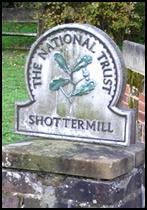


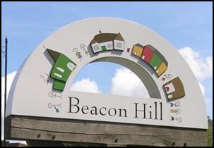


1 For Beacon Hill, Critchmere, Grayswood, Haslemere, Hindhead and Shottermill Ensuring new development takes account of local character

2 Contents Overview 3 1. Introduction 4 2. What makes Haslemere Special and Distinctive 9 3. Geography of the area 12 4 Landscape and Natural Environment Transport and Access Design and Architectural Guidance Designs for your neighbourhood Haslemere Town Conservation Area Haslemere South of Town Centre Haslemere North of Town Centre Grayswood Shottermill and Critchmere Special Green Areas Industrial Areas Hindhead and Beacon Hill 45 Appendices 1. National Sustainability Design Guidelines WBC Shopfront Policy Abbreviations Acknowledgements 52 Haslemere War Memorial 5. Glossary of terms Bibliography Index of road names in the Haslemere area Complete set of Design Guidelines 58 2


3 Overview The overall aim of the Haslemere Design Statement (HDS) is to produce a set of Design Guidelines to be adopted by Waverley Borough Council (WBC) as a material consideration when planning applications are considered for the Haslemere area. The Introduction to the HDS outlines its context, subject matter, intended audience and community involvement. This is followed by a resumé of what makes the Haslemere area distinctive and a snapshot of Haslemere today. The next section, 3, provides a description of the geography of the area, whilst Section 4 continues with a general description of the area s landscape and natural environment, plus related Design Guidelines. Section 5 provides the context for Transport and Access in the area and associated Guidelines. Section 6 sets out the generic Design Guidelines for all building developments, which should be applied to the whole of the Haslemere area and particularly emphasises those which relate to the local vernacular. The section concludes with some notes about sustainability and related Design Guidelines. Haslemere Town Hall Section 7 has divided Haslemere into eight discrete areas (the headings are coloured to match the areas on the map on page 26). After providing a brief history, the characteristics of each area are listed. Where appropriate, additional specific and relevant guidelines for each area are set out. However, it is essential that these are always used in conjunction with the generic design guidelines set out in context in sections 4, 5 and 6. The complete set of guidelines are brought together in Appendix 8. The HDS concludes with a number of Appendices which give added details relating to the preparation and drawing up of the document. It should be noted that when the HDS was presented to WBC for adoption, it was accompanied by a second document which set out an audit of the informal and statutory consultations which had taken place. Finally, it is hoped that the HDS will be adhered to as a point of reference by all those who have an interest in undertaking any development in the area. Haslemere High Street 3 Overview

4 1. Introduction N The administrative boundaries of Haslemere Town Council as covered by this document Crown copyright and database right 2011 Ordnance Survey LA


5 Background In 2000 the former Countryside Agency (now Natural England) launched the Market Town Initiative. This was in response to growing public concern about the widespread deterioration of such towns due to altered lifestyles, new patterns of mass retailing and other social changes. It proposed that each town should carry out a health check with the involvement of the community. This would identify strengths and weaknesses, threats and opportunities which would enable the town to achieve an overall vision for its improvement. The Haslemere Initiative organised the town s first health check in 2003 and in the following five years it achieved many of its targets. It was subsequently decided that a second health check to review where we are at should be carried out in The main outcome of this was that a Design Statement should be drawn up for Haslemere Town (including Shottermill and Critchmere) and the surrounding villages (Grayswood, Hindhead and Beacon Hill). The first meeting of the Haslemere Design Statement (HDS) team took place in mid-may The Project has been initiated and funded jointly by the Haslemere Town Council (HTC) and the Haslemere Initiative. The overall aims of the Design Statement are to: develop guidelines which have a positive influence on development throughout Haslemere and the surrounding area, and ensure a sustainable and attractive environment for future generations. What does the Haslemere Design Statement do? Identifies the key design elements that should be taken forward to influence all new developments including affordable housing Helps developers to achieve quality designs which are appropriate to the location in which they are proposed Reflects the separate characters of the different neighbourhoods as they relate to design matters Shows how this local character can be protected and enhanced in new developments Creates partnerships between different groups in the community, acting as a catalyst for new initiatives and speeding up the development process By being adopted by Waverley Borough Council (WBC) to supplement statutory planning policies, it becomes a material consideration in future planning decisions. Haslemere High Street, looking north Haslemere from Swan Barn Community Orchard, just a short distance from the High Street, showing how wooded it is close to the town centre 5


6 What does the Haslemere Design Statement look at? Character Diversity Local distinctiveness Harmony of individual buildings, of groups of buildings, and their setting in the wider landscape Design and materials used in buildings Spaces between buildings Housing Density General sense of place throughout Haslemere and the surrounding villages. Haslemere Design Statement Who is the Haslemere Design Statement meant for? People considering development which could change the appearance of some part of the Haslemere area, no matter what the size i.e. developers, property owners, householders and businesses Architects, urban designers, landscape architects and other professionals acting on behalf of clients commissioning such work Staff and Councillors of the local planning committee responsible for development decisions and investment in the public realm Those consulted on proposed developments e.g. Haslemere Town Council, Highway Authorities, The Haslemere Society, local community groups, residents and businesses. Verandah Cottage The document seeks to ensure that when new development takes place it takes account of the local character of the area. Shepherds Hill 6

 by describing the local character of the town and setting out a number of design guidelines")


7 Status and Planning Context This Haslemere Design Statement (HDS) has been adopted by WBC as non-statutory planning guidance. This means that the design guidelines stated here are a material consideration when proposals for new development in the Haslemere area are being considered by the planning authorities. The HDS also accords with the National Planning Policy Framework (NPPF - March 2012) by describing the local character of the town and setting out a number of design guidelines which will support good design for Haslemere. This HDS stands alone, however reference should be made to the other official documents, such as: WBC Haslemere Local Plan Supplementary Planning Guidance, 1995 Saved policies of the WBC Local Plan 2002 WBC Local Development Framework Consultation Draft Document 2011 The latest National Policy. The HDS supports and expands local planning policies and proposals for the Haslemere area. In particular it adds detail to, and complements, Policies D4 Design & Layout, D14 Planning Benefits, C3 Surrey Hills Area of Outstanding Natural Beauty (AONB) & Area of Great Landscape Value (AGLV), BE4 Haslemere Hillsides, and BE6 Low Density Residential Areas in the saved policies of the WBC Local Plan Any policy document demands regular review and it is recommended that the statement be the subject of a thorough review at least every five years. Haslemere Design Statement 7
. Extensive public awareness, consultation and participation have been a priority throughout.")


8 Community Involvement The HDS has been written and produced by a Steering Group of committed and enthusiastic people for the benefit of the community who have been consulted and invited to express their views (reference the separate, supporting Consultation Document). Extensive public awareness, consultation and participation have been a priority throughout. This has involved a wide variety of different approaches including: Drawing on valuable research carried out for the Haslemere Health Check 2002/3 and the follow-up document in 2008 Continued information sharing with WBC, HTC, Haslemere Society, Transition Town Haslemere, Haslemere Initiative and the Haslemere Chamber of Trade and Commerce Proactive involvement and promotion of HDS through the Town Council s publication Haslemere Happenings Informal consultations: three public, interactive work shops, Autumn 2010 culminating in over 4,400 comments Media information and coverage, posters, flyers, articles in the Haslemere Herald and The Messenger Formal public consultation on the draft HDS which took place between 16th January and 29th February This included three open exhibitions, website and media coverage National and local organisations were sent individual letters explaining the HDS and giving them the internet link to enable them to comment and to cascade the consultation to their members. Full details of the many ways in which the community was involved in the drafting of this guidance can be found in the supporting Consultation Statement, which stands alongside the HDS. Full regard was given to the requirements of the current WBC Statement of Community Involvement (SCI) Haslemere Fringe Festival and Classic Car Show 2010, Lion Green 8
Neighbourhood Planning in Haringey. Myddleton Road Strategic Group 7 th November 2013
 Neighbourhood Planning in Haringey Myddleton Road Strategic Group 7 th November 2013 What is Neighbourhood Planning? Neighbourhood Planning, introduced through the Localism Act 2011, offers an opportunity
Dublin Chamber submission on Dublin City Development Plan : Outdoor Advertising Strategy
 Dublin Chamber submission on Dublin City Development Plan 2011 2017: Outdoor Advertising Strategy January 2012 Key Points: Sustainable and appropriate advertising can play an important positive role in
NATURE AND EXTENT OF PROPOSED DEVELOPMENT. Amount of Development Development Zones Distribution of Density Policies
 NATURE AND EXTENT OF PROPOSED DEVELOPMENT Amount of Development Development Zones Distribution of Density Policies DRAFT POOLBEG PLANNING SCHEME Amount of Development 78 4.1 The rationale for the overall
Local Area Key Issues Paper No. 13: Southern Hinterland townships growth opportunities
 Draft Sunshine Coast Planning Scheme Review of Submissions Local Area Key Issues Paper No. 13: Southern Hinterland townships growth opportunities Key Issue: Growth opportunities for Southern Hinterland
Proposed Scope of Work Village of Farmingdale Downtown Farmingdale BOA Step 2 BOA Nomination Study / Draft Generic Environmental Impact Statement
 Proposed Scope of Work Village of Farmingdale Downtown Farmingdale BOA Step 2 BOA Nomination Study / Draft Generic Environmental Impact Statement The scope of work that follows incorporates and covers
Section 2. Indiana Geographic Information Council: Strategic Plan
 Section 2. Indiana Geographic Information Council: Strategic Plan Introduction A geographic information system (GIS) is an automated tool that allows the collection, modification, storage, analysis, and
The Governance of Land Use
 The planning system The Governance of Land Use United Kingdom Levels of government and their responsibilities The United Kingdom is a unitary state with three devolved governments in Northern Ireland,
Council Workshop on Neighbourhoods Thursday, October 4 th, :00 to 4:00 p.m. Burlington Performing Arts Centre
 Council Workshop on Neighbourhoods Thursday, October 4 th, 2012 1:00 to 4:00 p.m. Burlington Performing Arts Centre Agenda Introductions Warm-Up Exercise Presentation Exercise Neighbourhood Planning Break
have been a number of high level and expert reviews including the most recent, the Marmot review.
 QUESTIONS 5. Role of GPs and GP practices in public health: Are there additional ways in which we can ensure that GPs and GP practices will continue to play a key role in areas for which Public Health
Growth Management: Analysis of Comments Received and Responses Comments received as of October 16, 2017
 Growth Management: Analysis of Comments Received and s Comments received as of October 16, Comments informing the Region of Peel s growth management work have been summarized with responses below. These
Tourism. April State Planning Policy state interest guideline. Department of Infrastructure, Local Government and Planning
 Department of Infrastructure, Local Government and Planning State Planning Policy state interest guideline Tourism April 2016 Great state. Great opportunity. Preface Using this state interest guideline
Ministry of Health and Long-Term Care Geographic Information System (GIS) Strategy An Overview of the Strategy Implementation Plan November 2009
 Strategy An Overview of the Strategy Implementation Plan November 2009") Ministry of Health and Long-Term Care Geographic Information System (GIS) Strategy An Overview of the Strategy Implementation Plan November 2009 John Hill, Health Analytics Branch Health System Information
Ministry of Health and Long-Term Care Geographic Information System (GIS) Strategy An Overview of the Strategy Implementation Plan November 2009 John Hill, Health Analytics Branch Health System Information
Catchment Guide Appendix 2: Case Studies
 Catchment Guide Appendix 2: Case Studies List of Case Studies 1. Ribble Catchment Online Information 2. Upper Thames Catchment Integrated Local Delivery The Ribble Catchment Question 8: What information
Date: March 31, 2014 PATE; fyril 2.3,2 >H
 aj BRAMPTON fifs Rower City XH-l-f r.t "»* City Council The Corporation of the City of Brampton SRAMPTON CITY COUNCIL Date: March 31, 2014 PATE; fyril 2.3,2 >H File: POO GR VisWhtoJed ^t'th-meeh'^a Subject:
Briefing. H.E. Mr. Gyan Chandra Acharya
 Briefing by H.E. Mr. Gyan Chandra Acharya Under-Secretary-General and High Representative for the Least Developed Countries, Landlocked Developing Countries and Small Island Developing States Briefing
submission to plan melbourne
 submission to plan melbourne prepared by hansen partnership pty ltd december 2013 submission to plan melbourne hansen partnership pty ltd contents 1 introduction... 2 2 key issues facing melbourne...
Legal problems of environmental management. Spatial planning and space management. M. Gajewski 2014 / 2015
 Legal problems of environmental management Spatial planning and space management M. Gajewski 2014 / 2015 Course contents (in brief) Constitutional basis of the environment protection system. General principles
D2E GIS Coordination Initiative Functional Transformation Kick-Off Meeting
 D2E GIS Coordination Initiative Functional Transformation Kick-Off Meeting GIS Functional Transformation Kick-Off Meeting May 13, 2008 D2E GIS Coordination Initiative Functional Transformation Kick-Off
Alluvium Consulting Australia Senior integrated water management specialist Position Description March 2018
 Alluvium Consulting Australia Senior integrated water management specialist Position Description March 2018 Overview of Alluvium We are an employee-owned consulting firm founded in 2006 to provide advice
The purpose of this report is to recommend a Geographic Information System (GIS) Strategy for the Town of Richmond Hill.
 Strategy for the Town of Richmond Hill.") Staff Report for Committee of the Whole Meeting Department: Division: Subject: Office of the Chief Administrative Officer Strategic Initiatives SRCAO.18.12 GIS Strategy Purpose: The purpose of this report
Staff Report for Committee of the Whole Meeting Department: Division: Subject: Office of the Chief Administrative Officer Strategic Initiatives SRCAO.18.12 GIS Strategy Purpose: The purpose of this report
A Note on Methods. ARC Project DP The Demand for Higher Density Housing in Sydney and Melbourne Working Paper 3. City Futures Research Centre
 A Note on Methods ARC Project DP0773388 The Demand for Higher Density Housing in Sydney and Melbourne Working Paper 3 City Futures Research Centre February 2009 A NOTE ON METHODS Dr Raymond Bunker, Mr
OREGON POPULATION FORECAST PROGRAM
 OREGON POPULATION FORECAST PROGRAM PROGRAM OVERVIEW BACKGROUND Beginning in 1973 with the passage of Senate Bill (SB) 100, Oregon s growth management system has relied on population forecasts as the primary
THE SEVILLE STRATEGY ON BIOSPHERE RESERVES
 THE SEVILLE STRATEGY ON BIOSPHERE RESERVES 1 VISION FOR BIOSPHERE RESERVES IN THE 21 ST CENTURY The international Seville Conference on Biosphere Reserves, organised by UNESCO, adopted a two-pronged approach,
Modelling Community Preferences for a Dispersed Rural Settlement Pattern: Insights from the western shores of Lough Neagh
 Introduction Modelling Community Preferences for a Dispersed Rural Settlement Pattern: Insights from the western shores of Lough Neagh Michael Murray, David Houston, Brendan Murtagh and Sarah McCann School
It is clearly necessary to introduce some of the difficulties of defining rural and
 UNIT 2 CHANGING HUMAN ENVIRONMENTS G2 Theme 2 Investigating Settlement Change in MEDCs 2.1 What are the distinctive features of settlements? It is clearly necessary to introduce some of the difficulties
OPEN INFORMATION ITEM
 Wolverhampton City Council OPEN INFORMATION ITEM Committee/Panel PLANNING COMMITTEE Date: 2nd November 2010 Originating Service Group(s) Contact Officer(s) REGENERATION AND NEIGHBOURHOODS Ian Culley/Carolle
CHAPTER 4 HIGH LEVEL SPATIAL DEVELOPMENT FRAMEWORK (SDF) Page 95
 Page 95") CHAPTER 4 HIGH LEVEL SPATIAL DEVELOPMENT FRAMEWORK (SDF) Page 95 CHAPTER 4 HIGH LEVEL SPATIAL DEVELOPMENT FRAMEWORK 4.1 INTRODUCTION This chapter provides a high level overview of George Municipality s
CHAPTER 4 HIGH LEVEL SPATIAL DEVELOPMENT FRAMEWORK (SDF) Page 95 CHAPTER 4 HIGH LEVEL SPATIAL DEVELOPMENT FRAMEWORK 4.1 INTRODUCTION This chapter provides a high level overview of George Municipality s
GIS in Community & Regional Planning
 GIS in Community & Regional Planning The The role role of of GIS GIS in in Re-writing the the Zoning Bylaw for for the the City City of of Vernon LandInfo Technologies Presentation Overview The GIS Initiative
Intimate Infrastructures
 Intimate Infrastructures A social and spatial strategy for high-density design at a human scale By Natasha Reid Intimate Infrastructures Intimate Infrastructures A social and spatial strategy for high-density
St. James C of E Primary School
 St. James C of E Primary School Geography Policy St. James C of E Primary School Geography Policy Written by: Lisa Harford Written: April 2016 Reviewed: April 2018 1. Introduction Geography is concerned
Declaration Population and culture
 Declaration Population and culture The ministers of the parties to the Alpine Convention regard the socio-economic and socio-cultural aspects mentioned in Article 2, Paragraph 2, Item a., as being central
KEELE UNIVERSITY SNOW AND SEVERE WEATHER MANAGEMENT PLAN
 1.0 Introduction 1.1 It is recognised that severe weather conditions, particularly snow and ice, can make it difficult for people to travel. However, as a residential campus, even during severe weather
Global Geoparks focus on developing their regions as Sustainable Tourism Destinations.
 The Burren & Cliffs of Moher region has achieved UNESCOsupported Global Geopark Status in recognition of the region s significant geological, ecological and cultural value, as well as its sustainable tourism
Geographic information strategy
 Department for Environment, Food and Rural Affairs Geographic information strategy Methodology JULY 2011 2 Geographic information strategy Methodology This document provides a detailed description of the
Dark Sky Initiative Draft Terms of Reference
 Dark Sky Initiative Draft Terms of Reference July 2008 Table of Contents 1.0 Introduction 2 2.0 Initiative intent 2-3 3.0 Initiative goals 3 4.0 Legislation 3 5.0 Municipal Development Plan 3 6.0 Land
CORPORATION OF THE CITY OF COURTENAY COUNCIL MEETING AGENDA
 CORPORATION OF THE CITY OF COURTENAY COUNCIL MEETING AGENDA DATE: Monday, January 14, 2013 PLACE: City Hall Council Chambers TIME: 4:00 p.m. 1.00 ADOPTION OF MINUTES 1. Adopt January 7, 2013 Regular Council
Economic and Social Council 2 July 2015
 ADVANCE UNEDITED VERSION UNITED NATIONS E/C.20/2015/11/Add.1 Economic and Social Council 2 July 2015 Committee of Experts on Global Geospatial Information Management Fifth session New York, 5-7 August
Protocol between London MAPPA Strategic Management Board (SMB) and (Name of Borough) Local Safeguarding Children Board
 and (Name of Borough) Local Safeguarding Children Board") LONDON MULTI-AGENCY PUBLIC PROTECTION ARRANGEMENTS (MAPPA) Protocol between London MAPPA Strategic Management Board (SMB) and (Name of Borough) Local Safeguarding Children Board This protocol has been
LONDON MULTI-AGENCY PUBLIC PROTECTION ARRANGEMENTS (MAPPA) Protocol between London MAPPA Strategic Management Board (SMB) and (Name of Borough) Local Safeguarding Children Board This protocol has been
Social Studies Grade 2 - Building a Society
 Social Studies Grade 2 - Building a Society Description The second grade curriculum provides students with a broad view of the political units around them, specifically their town, state, and country.
Edexcel Geography Advanced Paper 2
 Edexcel Geography Advanced Paper 2 SECTION B: SHAPING PLACES Assessment objectives AO1 Demonstrate knowledge and understanding of places, environments, concepts, processes, interactions and change, at
Response to the Local Government Boundary Commission for England proposals for new electoral arrangements for Leeds City Council
 Response to the Local Government Boundary Commission for England proposals for new electoral arrangements for Leeds City Council This is the Leeds Liberal Democrat response to the Draft Recommendations
CERTIFIED RESOLUTION. introduction: and dated May 29, 2017, as attached, as appropriate
 15322 Buena Vista Avenue, White Rock BC, Canada V4B 1Y6 www.whiterockcity.ca City of White Rock P: 604.541.22121 F: 604.541.9348 /2tC% City Clerk s Office IT E ROC K June 13,2017 Stephanie Lam, Deputy
State initiative following up the 2006 national planning report
 18 ness districts and public institutions, should be integrated with the opportunities for public transport services. State initiative following up the 2006 national planning report The Ministry of the
Safety Guidelines for the Chemistry Professional: Understanding Your Role and Responsibilities
 Safety Guidelines for the Chemistry Professional: Understanding Your Role and Responsibilities Kenneth P. Fivizzani Committee on Chemical Safety/ Division of Chemical Health & Safety August 22, 2017 Introduction
UNITED NATIONS ECONOMIC COMMISSION FOR EUROPE. Road Maps for Mainstreaming Ageing
 UNITED NATIONS ECONOMIC COMMISSION FOR EUROPE Population Unit www.unece.org/pau Road Maps for Mainstreaming Ageing Fiona Willis Núñez fiona.willis nunez@unece.org Sub-Regional Capacity Development Workshop
Date: June 19, 2013 Meeting Date: July 5, Consideration of the City of Vancouver s Regional Context Statement
 Section E 1.5 To: From: Regional Planning and Agriculture Committee Lee-Ann Garnett, Senior Regional Planner Planning, Policy and Environment Department Date: June 19, 2013 Meeting Date: July 5, 2013 Subject:
REGIONAL SDI DEVELOPMENT
 REGIONAL SDI DEVELOPMENT Abbas Rajabifard 1 and Ian P. Williamson 2 1 Deputy Director and Senior Research Fellow Email: abbas.r@unimelb.edu.au 2 Director, Professor of Surveying and Land Information, Email:
GeoparkLIFE: Tourism for Conservation. Reviewing Policy towards the Integration of Sustainable Tourism and Conservation Management Executive Summary
 Reviewing Policy towards the Integration of Sustainable Tourism and Conservation Management Executive Summary Gabriel Cooney and Joanne Gaffrey UCD School of Archaeology GeoparkLIFE: Tourism for Conservation
The role of community in urban regeneration: mixed use areas approach in USA
 The role of community in urban regeneration: mixed use areas approach in USA Outline 1. Thesis 2. Main topics 3. Urban regeneration and community 4. Community involvement methods 5. Policies: EU vs USA
The National Spatial Strategy
 Purpose of this Consultation Paper This paper seeks the views of a wide range of bodies, interests and members of the public on the issues which the National Spatial Strategy should address. These views
GOVERNMENT MAPPING WORKSHOP RECOVER Edmonton s Urban Wellness Plan Mapping Workshop December 4, 2017
 GOVERNMENT MAPPING WORKSHOP 12.4.17 RECOVER Edmonton s Urban Wellness Plan Mapping Workshop December 4, 2017 In July of 2017, City Council directed administration to develop RECOVER, Edmonton s Urban Wellness
Parrhasian Heritage Park Vision Plan
 Parrhasian Heritage Park Vision Plan The purpose of this document is to guide the creation and management of the Parrhasian Heritage Park. A heritage park is unique in the Greek park terminology and legislation
Foreword. Vision and Strategy
 GREATER MANCHESTER SPATIAL FRAMEWORK Friends of Walkden Station Consultation Response January 2017 Foreword Friends of Walkden Station are a group of dedicated volunteers seeking to raise the status and
Flood Map. National Dataset User Guide
 Flood Map National Dataset User Guide Version 1.1.5 20 th April 2006 Copyright Environment Agency 1 Contents 1.0 Record of amendment... 3 2.0 Introduction... 4 2.1 Description of the Flood Map datasets...4
Geography. Programme of study for key stage 3 and attainment target (This is an extract from The National Curriculum 2007)
") Geography Programme of study for key stage 3 and attainment target (This is an extract from The National Curriculum 2007) Crown copyright 2007 Qualifications and Curriculum Authority 2007 Curriculum aims
Geography Programme of study for key stage 3 and attainment target (This is an extract from The National Curriculum 2007) Crown copyright 2007 Qualifications and Curriculum Authority 2007 Curriculum aims
National Spatial Strategy for Ireland
 National Spatial Strategy for Ireland 2002-2020 People, Places and Potential Printed on recycled paper BAILE ÁTHA CLIATH ARNA FHOILSIÚ AG OIFIG AN TSOLÁTHAIR Le ceannach díreach ón OIFIG DHÍOLTA FOILSEACHÁN
New Partners for Smart Growth: Building Safe, Healthy, and Livable Communities Mayor Jay Williams, Youngstown OH
 New Partners for Smart Growth: Building Safe, Healthy, and Livable Communities Mayor Jay Williams, Youngstown OH The City of Youngstown Youngstown State University Urban Strategies Inc. Youngstown needed
Towards a City Model for Heritage-Led Regeneration and Tourism Development
 Towards a City Model for Heritage-Led Regeneration and Tourism Development Brian Smith, Secretary General European Association of Historic Towns and Regions Summary of Presentation Objective Background
Accessibility as an Instrument in Planning Practice. Derek Halden DHC 2 Dean Path, Edinburgh EH4 3BA
 Accessibility as an Instrument in Planning Practice Derek Halden DHC 2 Dean Path, Edinburgh EH4 3BA derek.halden@dhc1.co.uk www.dhc1.co.uk Theory to practice a starting point Shared goals for access to
CEMAT results - over the years
 CEMAT results - over the years Technical Conference on Functional Areas capitalization of local potential within the territorial development policies in Europe European Conference of Ministers responsible
TOWARDS STRATEGIC SPATIAL PLANNING IN JAMAICA: THE NATIONAL SPATIAL PLAN
 TOWARDS STRATEGIC SPATIAL PLANNING IN JAMAICA: THE NATIONAL SPATIAL PLAN JIEP 5th Biennial Conference on the Environment: Balancing National Development and Environmental Protection June 6, 2011 Jamaica
Management Planning & Implementation of Communication Measures for Terrestrial Natura 2000 Sites in the Maltese Islands Epsilon-Adi Consortium
 Management Planning & Implementation of Communication Measures for Terrestrial Natura 2000 Sites in the Maltese Islands Epsilon-Adi Consortium Briefing Meetings, February 2013 CT3101/2011, MEPA, Malta
Economic and Social Council
 United Nation E/C.20/2012/4/Add.1 Economic and Social Council Distr.: General 2 July 2012 Original: English Committee of Experts on Global Geospatial Information Management Second session New York, 13-15
National Land Use Policy and National Integrated Planning Framework for Land Resource Development
 Title National Land Use Policy and National Integrated Planning Framework for Land Resource Development Duration: 32 Weeks Objective: Adoption of appropriate land use planning approaches to: Maintain the
City of Manitou Springs
 March 2018 City of Manitou Springs Implementing Land Use tools to reduce and mitigate natural hazard risk Context & History Past Present Historic homes Older infrastructure Hillside development Creekside
NEPAL: FCPF READINESS GRANT FCPFR - FOREST CARBON PARTNERSHIP FACILITY
 Assignment: TF094724 NEPAL: FCPF READINESS GRANT FCPFR - FOREST CARBON PARTNERSHIP FACILITY Task Team Leader: 00000011824 Approving Manager: 00000253690 - William B. Magrath - Valerie Hickey Summary Information
Transport Planning in Large Scale Housing Developments. David Knight
 Transport Planning in Large Scale Housing Developments David Knight Large Scale Housing Developments No longer creating great urban spaces in the UK (Hall 2014) Transport Planning Transport planning processes
SHADOW IMPACT STUDY REPORT
 SHADOW IMPACT STUDY REPORT 175 Zoo Park Road Town of Wasaga Beach Date: September 2017 Prepared for: Simcoe County Housing Corporation Prepared by: MacNaughton Hermsen Britton Clarkson Planning Limited
Marking Scheme Field Work. 6 International Geography Olympiad. Brisbane
 Marking Scheme Field Work th 6 International Geography Olympiad Brisbane June 2006 Question - Map - 7 Marks Mark out of 4 and divide by 2 at the end. (Sample map was provided to markers.) Shading according
Economic and Social Council
 United Nations Economic and Social Council Distr.: General 18 July 2016 Original: English Committee of Experts on Global Geospatial Information Management Sixth session New York, 3-5 August 2016 Item 2
A proposal for building an infrastructure for European geospatial statistics. Marie Haldorson, Statistics Sweden Ekkehard Petri, Eurostat
 A proposal for building an infrastructure for European geospatial statistics Marie Haldorson, Statistics Sweden Ekkehard Petri, Eurostat What is geospatial statistics? The location, extent or spatial relations
PART A Project summary
 PART A Project summary A.1 Project identification Project title Project acronym Name of the lead partner organisation in English Specific objective Demonstrattion AF DAF Partner 1.1. Improving innovation
Annual PHA Plan. Effective July 1, 2017 June 30, Decatur Housing Authority
 Decatur Housing Authority Annual PHA Plan Effective July 1, 2017 June 30, 2018 Decatur Housing Authority 7315 Hanna Street Fort Wayne, IN 46816 Phone: (260) 267-9300 Website: www.fwha.org PHA Plan Attachments
HSC Geography. Year 2013 Mark Pages 10 Published Jul 4, Urban Dynamics. By James (97.9 ATAR)
") HSC Geography Year 2013 Mark 92.00 Pages 10 Published Jul 4, 2017 Urban Dynamics By James (97.9 ATAR) Powered by TCPDF (www.tcpdf.org) Your notes author, James. James achieved an ATAR of 97.9 in 2013 while
HSC Geography Year 2013 Mark 92.00 Pages 10 Published Jul 4, 2017 Urban Dynamics By James (97.9 ATAR) Powered by TCPDF (www.tcpdf.org) Your notes author, James. James achieved an ATAR of 97.9 in 2013 while
Derogation Criteria for the Requirements for Generators Network Code
 Derogation Criteria for the Requirements for Generators Network Code Decision Paper Reference: CER/17/084 Date Published: 13/04/2017 Closing Date: 0 Executive Summary Commission Regulation (EU) 2016/631
Geospatial framework for monitoring SDGs/Sendai targets By Shimonti Paul Sr. Assistant Editor Geospatial Media & Communications
 Geospatial framework for monitoring SDGs/Sendai targets By Shimonti Paul Sr. Assistant Editor Geospatial Media & Communications Outline 1. Introduction to Geospatial Media and Communications 2. Geospatial
Images in this report are reproduced, with permission ACC Andy Coventry Darren Wright Forestry Commission Scotland
 The SURF Aberdeen project is being led by Aberdeen City Council s Sustainable Development Team. We are working in partnership with a range of partners from across the Council and City, including: Scottish
NEPAL: FCPF READINESS GRANT FCPFR - FOREST CARBON PARTNERSHIP FACILITY
 Assignment: TF094724 NEPAL: FCPF READINESS GRANT FCPFR - FOREST CARBON PARTNERSHIP FACILITY Task Team Leader: 00000240969 Approving Manager: 00000082671 - Abdelaziz Lagnaoui - Kseniya Lvovsky Summary Information
INTERNATIONAL CULTURAL TOURISM CHARTER Managing Tourism at Places of Heritage Significance (1999)
") INTERNATIONAL CULTURAL TOURISM CHARTER Managing Tourism at Places of Heritage Significance (1999) Adopted by ICOMOS at the 12th General Assembly in Mexico, October 1999. INTRODUCTION The Charter Ethos
INTERNATIONAL CULTURAL TOURISM CHARTER Managing Tourism at Places of Heritage Significance (1999) Adopted by ICOMOS at the 12th General Assembly in Mexico, October 1999. INTRODUCTION The Charter Ethos
Noise Maps, Report & Statistics, Dublin City Council Noise Mapping Project Roads and Traffic Department
 Noise Maps, Report & Statistics, Dublin City Council Noise Mapping Project Roads and Traffic Department Produced by Traffic Noise & Air Quality Unit November 2007 Contact: brian.mcmanus@dublincity.ie Ph;
A proposal for building an infrastructure for European geospatial statistics
 A proposal for building an infrastructure for European geospatial statistics Marie Haldorson, Statistics Sweden Ekkehard Petri, Eurostat What is geospatial statistics? The location, extent or spatial relations
CONFERENCE STATEMENT
 Final draft CONFERENCE STATEMENT We, the elected representatives of Canada, Denmark/Greenland, the European Parliament, Finland, Iceland, Norway, Russia, Sweden and the United States of America; In collaboration
Draft Model Memorandum of Understanding to promote voluntary cooperation between Government and Chemical Industry to enhance Precursors Chemicals
 Draft Model Memorandum of Understanding to promote voluntary cooperation between Government and Chemical Industry to enhance Precursors Chemicals Control 1 Introduction There has been growing recognition
Integration for Informed Decision Making
 Geospatial and Statistics Policy Intervention: Integration for Informed Decision Making Greg Scott Global Geospatial Information Management United Nations Statistics Division Department of Economic and
Gedney Church End and Lutton St Nicholas Federated Primary Schools. Geography Policy
 Gedney Church End and Lutton St Nicholas Federated Primary Schools Geography Policy Contents: Introduction Expectations in Key Stage 1 Expectations in Key Stage 2 Aims Teaching and Learning Key Skills
Jordan's Strategic Research Agenda in cultural heritage
 Jordan's Strategic Research Agenda in cultural heritage Analysis of main results Alessandra Gandini Amman, Jordan 3 rd November 2013 Main objectives The work performed had the main objective of giving
Tackling urban sprawl: towards a compact model of cities? David Ludlow University of the West of England (UWE) 19 June 2014
 19 June 2014") Tackling urban sprawl: towards a compact model of cities? David Ludlow University of the West of England (UWE) 19 June 2014 Impacts on Natural & Protected Areas why sprawl matters? Sprawl creates environmental,
Tackling urban sprawl: towards a compact model of cities? David Ludlow University of the West of England (UWE) 19 June 2014 Impacts on Natural & Protected Areas why sprawl matters? Sprawl creates environmental,
Explore. history landscapes family.
 Explore history landscapes family www.explorethepast.co.uk Contents From the team Section 1 Researching Worcestershire Section 2 Local Studies & Archaeology Reference Library Section 3 Maps and plans Accessing
GCSE Subject Criteria for Geography
 September 2011 Ofqual/11/5014 Contents The criteria... 3 Introduction... 3 Aims and learning outcomes... 3 Subject content... 4 Assessment objectives... 5 Scheme of assessment... 6 Ofqual 2011 2 The criteria
National planning report for Denmark
 National planning report for Denmark from the Minister for Environment and Energy Local identity and new challenges Summary 2000 1 CONTENTS 4 PREFACE: REGIONAL DEVELOPMENT AND SPATIAL PLANNING 6 1. BALANCED
Bengt Kjellson Chair of the Executive Committee UN-GGIM: Europe. 2 nd Joint UN-GGIM: Europe ESS Meeting 11 th March 2016, Luxembourg
 Bengt Kjellson Chair of the Executive Committee UN-GGIM: Europe 2 nd Joint UN-GGIM: Europe ESS Meeting 11 th March 2016, Luxembourg A global geospatial mandate At its 47th plenary in July 2011, ECOSOC,
50 th GEF Council Meeting June 07 09, 2016 Washington, D.C. GEF/C.50/Inf.07 May 11, 2016 PROGRESS REPORT ON THE GENDER EQUALITY ACTION PLAN
 50 th GEF Council Meeting June 07 09, 206 Washington, D.C. GEF/C.50/Inf.07 May, 206 PROGRESS REPORT ON THE GENDER EQUALITY ACTION PLAN TABLE OF CONTENTS Background on the Gender Equality Action Plan (GEAP)...
DRAFT PROGRAM Registration of participants, welcome coffee, exhibition tour
 DRAFT PROGRAM 20 Feb 2018 09.00-10.00 Registration of participants, welcome coffee, exhibition tour 10.00 12.00 ROUND TABLE: INTERNATIONAL COOPERATION IN THE ARCTIC PROJECTS: CHALLENGES AND OPPORTUNITIES
Regional stakeholders strategy of Donegal County Council
 Regional stakeholders strategy of Donegal County Council Table of contents The template comprised five steps in the creation of this communication strategy: 1 Starting point. Communication objectives...
GIS Geographical Information Systems. GIS Management
 GIS Geographical Information Systems GIS Management Difficulties on establishing a GIS Funding GIS Determining Project Standards Data Gathering Map Development Recruiting GIS Professionals Educating Staff
SUSTAINABILITY - RELATED STRATEGIES AND URBAN SETTLEMENTS
 SUSTAINABILITY - RELATED STRATEGIES AND URBAN SETTLEMENTS KEY CONCEPTS: In this session, we will consider the following: Rural Development Programmes & Strategies Rural Development Programmes & Strategies
Local Development Pilot Project: Island of Cres. Ranka Saračević Würth, Ministry of Culture, Republic of Croatia
 Local Development Pilot Project: Island of Cres Ranka Saračević Würth, Ministry of Culture, Republic of Croatia BACKGROUND, RATIFICATION OF THE FARO CONVENTION BY REPUBLIC OF CROATIA The Framework Convention
CHAPTER 22 GEOGRAPHIC INFORMATION SYSTEMS
 CHAPTER 22 GEOGRAPHIC INFORMATION SYSTEMS PURPOSE: This chapter establishes the administration and use of to improve the quality and accessibility of Department s spatial information and support graphical
Strategic Planning for the Arts
 Strategic Planning for the Arts Summary of Online Surveys Buena Vista Conference Center December 16, 2009 Focus Groups - Overview Six focus groups conducted in September and early October Six to eight
USER PARTICIPATION IN HOUSING REGENERATION PROJECTS
 USER PARTICIPATION IN HOUSING REGENERATION PROJECTS Dr. Hatice Sadıkoğlu Bahçeşehir University, Faculty of Architecture and Design Prof. Dr. Ahsen Özsoy Istanbul Technical University, Faculty of Architecture