THE FLOODRESILIENCITY PROJECT
|
|
|
- Leonard Joseph
- 5 years ago
- Views:
Transcription

1 THE FLOODRESILIENCITY PROJECT Tony Maguire, Senior Executive Engineer, Environment & Engineering Department, Dublin City Council. EWA SYMPOSIUM IFAT 2010
2
3 Note all photos & graphics FRC Project; Dublin City or Jacobs Engineering Ireland

4 FloodResilienCity Dublin Flood Initiative Dublin Pluvial Study Progress
5
6

7

8
9 FloodResilienCity Dublin Flood Initiative Dublin Pluvial Study Progress
10

 .")


11 RIVER & STREAM FLOODING EXTREME RAIN (PLUVIAL) FLOODING. DAM FAILURE & EXTREME OPERATION DRAINAGE & INFRASTRUCTURE FAILURE COASTAL (TIDAL) FLOODING
 event Extreme/Climate Change")
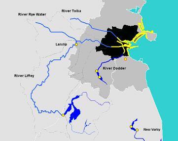
12 LEGEND Medieval Flood Plain Coastal Zone A protected: Main rivers Zone A Secondary Rivers & streams Dam Failure Pluvial (Exceptional rain) event Extreme/Climate Change 12


13 Drainage Dams Coastal Rivers Pluvial GDSDS Greater Dublin Strategic Drainage Study Review As 1976 UK Reservoirs Act DCCFP Dublin Coastal Flooding Protection Proj. CFRAMs Catchment Flood Risk Assessment & Management FRC FloodResilienCity Regional Study good practise guide lines codes of practice Strategic Review, dam improvements operational GLs for: - DCC water supply - ESB power supply Strategic Study, new procedures new defences, flood atlas, forecast system. 3 Catchment Studies, modelling multi criteria assessment, flood mapping City wide study, meteorology, indexing, flood mapping, adaptive works, codes of practice emergency response Etc GL = Guide Line
14 DCC = Dublin City Council

15 1963, Highest 1Hr Record Impractical to Retro-Fit existing drainage systems to cater for SHORT duration HIGH intensity storms. Look to managing surface water flows at ground level: :100 YR PLUVIAL STRATEGY 1: 50 YR 1: 30 YR 1: 20 YR Brick Arch / Clay Invert Masonry / Stone BlockBrick Ovoid Amount of Rain in mm which fell in period opposite Pipe : 10 YR 1: 5 YR NB Dublin has seen 3 or 4 pluvial events circa 1:100yr since 2000.
16 HAZARD ANALYSES ~MITIGATION ~ PLAN PREPARE water level rain intensity etc RESPOND DUBLIN CITY COUNCIL M.E.P. (MAJOR EMERGENCY PLAN) RECOVERY DUBLIN CITY COUNCIL F.E.R.P. (FLOOD EMERGENCY RESPONSE PLAN SPONTANEOUS ESCALATION FLOOD INCIDENT MAJOR FLOOD EMERGENCY SPONTANEOUS FLOOD ISSUE No Flood Issues RECOVERY PLANS Dublin CC Departments RECOVERY PLANS Government Agencies & Insurance Industry
17 FloodResilienCity Dublin Flood Initiative Dublin Pluvial Study Progress
18 PLUVIAL FRM IMPLEMENTATION Spatial Planning & Structural Measures CoP1- New Development CoP2 Corrective & Adaptive Measures Flood Emergency Response Plans (FERP) Additions to existing FERP FERP information& management PLUVIAL CATEGORISATION MODELLING MAPPING systemtype1. Preliminary Flood Risk Assess Definition&Categorisation Metric for Floods Dir Art 6. City Overview Assessment & Flood Atlas Climate Change Software modelling & training. Type2. Detailed Exceedance Models allowance Pluvial 5 Areas most at risk categorisation. Type 2 modelling, template & Significant report. Cluster Flood Hazard maps Forecasting Flood risk maps (before & after Improve monitoring scenarios) elements Software modelling & training. Stakeholder Engagement Forecasting system New FRM Technologies Politicians & Policy Makers specification Local & central government Report & guide : Professionals New hardware Practitioners & responders New software Insurance Industry Information management Public Industry fair etc Communities Business Streets as Streams Roads as Rivers 3D Visualisation SAS RaR Pilot Sites Selection Design Construction Monitoring Templates
19 - Dublin s External Expert
20 SWMP = Surface Water Management Plan

21 :- 15 FRC TASKS 1. Client support & co-ordination 2. Pluvial information, monitoring & forecasting system 3. Pluvial temporal (return period) & spatial variation 4. Type 1 Modelling 5. City Overview Mapping 6. Type 2 Detailed Modelling & Mapping 7. Flood Partnership Framework 8. Spatial planning & building Regulations 10. Streets as Streams; Roads as Rivers 11. Emergency response information management system 12. Hardware 13. Information handling & processing 14. New technology fostering & trade fair. 15. Health & Safety
22 SaS RaR = Streets as Streams Roads as Rivers; SWMP = Surface Water Management Plan FloodResilienCity Dublin Flood Initiative Dublin Pluvial Study Progress


23 Cumulative Rainfall th Aug nd Jul :100Yr :100Yr Z Z Z Z Z Z Z m m in I m in Z Z Z Z Accum ulated mm Event (Z) + mins OSi = Ordinance Survey Ireland

24

25
On the use of radar rainfall estimates and nowcasts in an operational heavy rainfall warning service
 On the use of radar rainfall estimates and nowcasts in an operational heavy rainfall warning service Alan Seed, Ross Bunn, Aurora Bell Bureau of Meteorology Australia The Centre for Australian Weather
Preliminary Vulnerability Assessment of Coastal Flooding Threats - Taylor County, Florida
 Preliminary Vulnerability Assessment of Coastal Flooding Threats - Taylor County, Florida North Central Florida Regional Planning Council Northeast Florida Regional Council April 28, 2016 BACKGROUND This
Climate Services in Practice UK Perspective
 Climate Services in Practice UK Perspective Chris Hewitt ICCS, Columbia University, October 2011 Overview Perspectives on: Why have a climate service? What is a climate service? UK activities Examples
Dublin City Council. Item 10. Flood Risk in Dublin Interim Report on Extreme Pluvial Flooding event 24 th October 2011.
 Dublin City Council November 2011 Flood Risk in Dublin Interim Report on Extreme Pluvial Flooding event 24 th October 2011 Tom Leahy Executive Manager (Engineering) FLOODING MANY CAUSES RAINFALL RIVERS
United States Multi-Hazard Early Warning System
 United States Multi-Hazard Early Warning System Saving Lives Through Partnership Lynn Maximuk National Weather Service Director, Central Region Kansas City, Missouri America s s Weather Enterprise: Protecting
Flood Risk Mapping and Forecasting in England
 Flood Risk Mapping and Forecasting in England Mark Franklin Environment Agency, England NORDESS Workshop on Risk Assessment and Acceptable Risk Outline Flood risk in England Who we are and how we work
How advances in atmospheric modelling are used for improved flood forecasting. Dr Michaela Bray Cardiff University
 How advances in atmospheric modelling are used for improved flood forecasting Dr Michaela Bray Cardiff University Overview of current short term rainfall forecasting Advancements and on going research
Landslide Hazard Assessment Methodologies in Romania
 A Scientific Network for Earthquake, Landslide and Flood Hazard Prevention SciNet NatHazPrev Landslide Hazard Assessment Methodologies in Romania In the literature the terms of susceptibility and landslide
Terms of Reference for the Comparative Environmental Review (CER) of. Options for the Mactaquac Project, Mactaquac, New Brunswick
 of. Options for the Mactaquac Project, Mactaquac, New Brunswick") Terms of Reference for the Comparative Environmental Review (CER) of Options for the Mactaquac Project, Mactaquac, New Brunswick Preamble The New Brunswick Power Corporation ( NB Power ) operates the Mactaquac
Terms of Reference for the Comparative Environmental Review (CER) of Options for the Mactaquac Project, Mactaquac, New Brunswick Preamble The New Brunswick Power Corporation ( NB Power ) operates the Mactaquac
Modeling Great Britain s Flood Defenses. Flood Defense in Great Britain. By Dr. Yizhong Qu
 Modeling Great Britain s Flood Defenses AIRCurrents Editor s note: AIR launched its Inland Flood Model for Great Britain in December 2008. The hazard module captures the physical processes of rainfall-runoff
Weather forecasts and warnings: Support for Impact based decision making
 Weather forecasts and warnings: Support for Impact based decision making Gerry Murphy, Met Éireann www.met.ie An Era of Change Climate and weather is changing Societal vulnerability is increasing The nature
EFFICIENCY OF THE INTEGRATED RESERVOIR OPERATION FOR FLOOD CONTROL IN THE UPPER TONE RIVER OF JAPAN CONSIDERING SPATIAL DISTRIBUTION OF RAINFALL
 EFFICIENCY OF THE INTEGRATED RESERVOIR OPERATION FOR FLOOD CONTROL IN THE UPPER TONE RIVER OF JAPAN CONSIDERING SPATIAL DISTRIBUTION OF RAINFALL Dawen YANG, Eik Chay LOW and Toshio KOIKE Department of
David R. Vallee Hydrologist-in-Charge NOAA/NWS Northeast River Forecast Center
 David R. Vallee Hydrologist-in-Charge NOAA/NWS Northeast River Forecast Center Record flooding along the Shawsheen River during the 2006 Mother s Day Floods Calibrate and implement a variety of hydrologic
DOWNLOAD OR READ : GIS BASED FLOOD LOSS ESTIMATION MODELING IN JAPAN PDF EBOOK EPUB MOBI
 DOWNLOAD OR READ : GIS BASED FLOOD LOSS ESTIMATION MODELING IN JAPAN PDF EBOOK EPUB MOBI Page 1 Page 2 gis based flood loss estimation modeling in japan gis based flood loss pdf gis based flood loss estimation
Flooding and Climate Change APSE Seminar, 9 February 2017
 Flooding and Climate Change APSE Seminar, 9 February 2017 Local Roads Maintenance 1 Department for Transport OFFICIAL Preparations for Winter Important the transport sector, including local highway authorities,
SECTION II Hydrological risk
 Chapter 3 Understanding disaster risk: hazard related risk issues SECTION II Hydrological risk Peter Salamon Coordinating lead author Hannah Cloke Lead author 3.4 Giuliano di Baldassarre Owen Landeg Florian
Initial OPW Designation APSR AFRR IRR Co-ordinates Easting: Northing: River / Catchment / Sub-catchment Type of Flooding / Flood Risk
 Location: Shannon International Airport Radar Station, Co. Clare Unique ID: 275485 (from PFRA database) Initial OPW Designation APSR AFRR IRR Co-ordinates Easting: 137684 Northing: 160636 River / Catchment
County Clare Flood Forecasting System
 County Clare Flood Forecasting System Paul Moroney BE (Civil), C. Eng. M.I.E.I. M.C.I.Arb. Head of the Environment Section Clare County Council (The views expressed in this paper represent the professional
The UK Flood Forecasting Centre
 Storm Surge Networking Forum, Venice: Tuesday 19 th November 2013 The UK Flood Forecasting Centre Dave Cox - Senior Hydrometeorologist FFC Exeter, England. In My talk today I will cover: Ü Overview of
Results of Intensity-Duration- Frequency Analysis for Precipitation and Runoff under Changing Climate
 Results of Intensity-Duration- Frequency Analysis for Precipitation and Runoff under Changing Climate Supporting Casco Bay Region Climate Change Adaptation RRAP Eugene Yan, Alissa Jared, Julia Pierce,
Changes to Extreme Precipitation Events: What the Historical Record Shows and What It Means for Engineers
 Changes to Extreme Precipitation Events: What the Historical Record Shows and What It Means for Engineers Geoffrey M Bonnin National Oceanic and Atmospheric Administration National Weather Service Office
Trip Distribution Model for Flood Disaster Evacuation Operation
 Trip Distribution Model for Flood Disaster Evacuation Operation The devastating consequences of disasters in both developed and developing countries indicate significant lack or absence of disaster management
Rainfall-River Forecasting: Overview of NOAA s Role, Responsibilities, and Services
 Dr. Thomas Graziano Chief Hydrologic Services Division NWS Headquarters Steve Buan Service Coordination Hydrologist NWS North Central River Forecast Center Rainfall-River Forecasting: Overview of NOAA
Flood intelligence an international collaborative case study. Karin Geraghty, CIO, DEWNR
 Flood intelligence an international collaborative case study Karin Geraghty, CIO, DEWNR Karin.geraghty@sa.gov.au Flood has come the forefront of our thinking recently Victorian & Queensland Flood Inquiries
WMO Guide on Integrated Urban Weather, Environment and Climate Services for Cities (IUWECS) Hong Kong- an experience from a high-density city
 Hong Kong- an experience from a high-density city") WMO Guide on Integrated Urban Weather, Environment and Climate Services for Cities (IUWECS) Hong Kong- an experience from a high-density city Dr. Chao REN Associate Professor School of Architecture The
WMO Guide on Integrated Urban Weather, Environment and Climate Services for Cities (IUWECS) Hong Kong- an experience from a high-density city Dr. Chao REN Associate Professor School of Architecture The
CLIMATE CHANGE ADAPTATION BY MEANS OF PUBLIC PRIVATE PARTNERSHIP TO ESTABLISH EARLY WARNING SYSTEM
 CLIMATE CHANGE ADAPTATION BY MEANS OF PUBLIC PRIVATE PARTNERSHIP TO ESTABLISH EARLY WARNING SYSTEM By: Dr Mamadou Lamine BAH, National Director Direction Nationale de la Meteorologie (DNM), Guinea President,
Disaster Management in Republic of Korea
 The Third UN-GGIM-AP Plenary Meeting Disaster Management in Republic of Korea ~Coordination among NGIA & Other Related Organizations and Recommendations~ Bali Indonesia 10 November 2014 Sanghoon Lee, Ph.D.
A New National Flood Inundation Mapping Science Initiative
 A New National Flood Inundation Mapping Science Initiative William Guertal, PhD. Director, USGS Indiana and Kentucky Water Science Centers U.S. Department of the Interior U.S. Geological Survey Courtesy
The Kentucky Mesonet: Entering a New Phase
 The Kentucky Mesonet: Entering a New Phase Stuart A. Foster State Climatologist Kentucky Climate Center Western Kentucky University KCJEA Winter Conference Lexington, Kentucky February 9, 2017 Kentucky
Disaster Risk Assessment: Opportunities for GIS and data management with Open DRI
 Disaster Risk Assessment: Opportunities for GIS and data management with Open DRI Jacob Opadeyi Department of Geomatics Engineering and Land Management, The University of the West Indies, St. Augustine,
GIS as a tool in flood management
 GIS for the United Nations and the International Community Conference Panel: GIS and Capacity - How Territorial Planning Benefits from Geospatial Information 3-5 April 2012 Geneva, Switzerland GIS as a
By Lillian Ntshwarisang Department of Meteorological Services Phone:
 By Lillian Ntshwarisang Department of Meteorological Services Phone: +267 3612200 Email: lntshwarisang@gov.bw/ lntshwarisang@gmail.com Introduction Mandate of DMS Function of the Department Services to
A Comparative Study of the National Water Model Forecast to Observed Streamflow Data
 A Comparative Study of the National Water Model Forecast to Observed Streamflow Data CE394K GIS in Water Resources Term Project Report Fall 2018 Leah Huling Introduction As global temperatures increase,
TOOLS FOR RISK MANAGEMENT Related to climate change
 TOOLS FOR RISK MANAGEMENT Related to climate change copyright CONTENT 1 CLIMATE CHANGE AND ENVIRONMENTAL STUDIES 2 METHODS AND TOOLS DEVELOPED BY EGIS For infrastructures For urban areas For crisis management
An overview of the applications for early warning and mapping of the flood events in New Brunswick
 Flood Recovery, Innovation and Reponse IV 239 An overview of the applications for early warning and mapping of the flood events in New Brunswick D. Mioc 1, E. McGillivray 2, F. Anton 1, M. Mezouaghi 2,
Geographic Information Systems(GIS)
") Geographic Information Systems(GIS) Threat Analysis Techniques Overview What is GIS? Functional capabilities of GIS BCM Process and GIS How to leverage GIS in threat/risk analysis Ron Brown, CBCP Managing
Geographic Information Systems(GIS) Threat Analysis Techniques Overview What is GIS? Functional capabilities of GIS BCM Process and GIS How to leverage GIS in threat/risk analysis Ron Brown, CBCP Managing
Roles of NGII in successful disaster management
 The Second UN-GGIM-AP Plenary Meeting Roles of NGII in successful disaster management Republic of Korea Teheran Iran 28 October 2013 Sanghoon Lee, Ph.D. NGII Outline Type of Disasters Occur in Korea Practical
Chapter 7 Mudflow Analysis
 Chapter 7 Mudflow Analysis 7.0 Introduction This chapter provides information on the potential and magnitude of mud floods and mudflows that may develop in Aspen due to rainfall events, snowmelt, or rain
Miami-Dade County Overview
 Miami-Dade County Overview 2,000 square miles World s busiest cruise port 2.6 million residents Second busiest US airport for international travelers Gateway to the Caribbean and Latin America Natural
Improved rainfall estimates and forecasts for urban hydrological applications
 Improved rainfall estimates and forecasts for urban hydrological applications Innovyze User Days - Drainage and Flooding User Group Wallingford, 20 th June 2013 Contents 1. Context 2. Radar rainfall processing
Doug Kluck NOAA Kansas City, MO National Center for Environmental Information (NCEI) National Integrated Drought Information System (NIDIS)
 National Integrated Drought Information System (NIDIS)") National Integrated Drought Information System (NIDIS) for the Missouri River Basin Drought Early Warning Information System (DEWS) & Runoff Trends in the Missouri Basin & Latest Flood Outlook Doug Kluck
National Integrated Drought Information System (NIDIS) for the Missouri River Basin Drought Early Warning Information System (DEWS) & Runoff Trends in the Missouri Basin & Latest Flood Outlook Doug Kluck
Paul Bridge Meteorologist Vaisala/UKMO Work Groups/Committees: WMO/TRB/AMS
 Paul Bridge Meteorologist Vaisala/UKMO Work Groups/Committees: WMO/TRB/AMS Introduction (a) Identify and establish, if possible, inventories of transport networks in the ECE region which are vulnerable
Flash Flood Guidance System On-going Enhancements
 Flash Flood Guidance System On-going Enhancements Hydrologic Research Center, USA Technical Developer SAOFFG Steering Committee Meeting 1 10-12 July 2017 Jakarta, INDONESIA Theresa M. Modrick Hansen, PhD
Belfast Sea Level Rise A Briefing for Policy Makers
 Belfast Sea Level Rise A Briefing for Policy Makers Version 3, issued 16/02/17 This paper briefly sets out the relative current rate of sea level rise in Belfast, and how this increases the risk of coastal
Northrop Grumman Concept Paper
 Northrop Grumman Concept Paper A Comprehensive Geospatial Web-based Solution for NWS Impact-based Decision Support Services Glenn Higgins April 10, 2014 Northrop Grumman Corporation Information Systems
Forecasting Flood Risk at the Flood Forecasting Centre, UK. Delft-FEWS User Days David Price
 Forecasting Flood Risk at the Flood Forecasting Centre, UK Delft-FEWS User Days 2012 David Price Overview of the Flood Forecasting Centre (FFC) What is the FFC? Partnership between the Met Office and Environment
DECISION SUPPORT SYSTEMS FOR PARTICIPATORY FLOOD RISK AND DISASTER MANAGEMENT
 DECISION SUPPORT SYSTEMS FOR PARTICIPATORY FLOOD RISK AND DISASTER MANAGEMENT PhD Thesis Panayiotis Sophronides, Dipl.-Ing., MSc & DIC, PhD Candidate Advisory committee: Prof. Maria Giaoutzi (Supervisor),
Overview of Early Warning Systems and the role of National Meteorological and Hydrological Services
 Overview of Early Warning Systems and the role of National Meteorological and Hydrological Services South Africa Second Experts Symposium on Multi-Hazard Early Warning Systems With focus on the Role of
Assessing the Vulnerability of Tennessee Transportation Assets to Extreme Weather
 Assessing the Vulnerability of Tennessee Transportation Assets to Extreme Weather Dr. Mark Abkowitz, Vanderbilt University 8 th Annual Intermodal Conference Memphis TN October 7, 2014 Requires states to
Land Administration and Cadastre
 Geomatics play a major role in hydropower, land and water resources and other infrastructure projects. Lahmeyer International s (LI) worldwide projects require a wide range of approaches to the integration
Risk Management Strategy
 Risk Management Strategy 1 Purpose To protect the component parts of the World Heritage property as well as the lives and the property of visitors and residents from disasters such as volcanic eruptions,
Folsom Dam Water Control Manual Update Joint Federal Project, Folsom Dam
 Folsom Dam Water Control Manual Update Joint Federal Project, Folsom Dam Public Workshop May 28, 2015 Library Galleria 828 I Street, Sacramento, CA US Army Corps of Engineers BUILDING STRONG WELCOME &
Understanding Weather and Climate Risk. Matthew Perry Sharing an Uncertain World Conference The Geological Society, 13 July 2017
 Understanding Weather and Climate Risk Matthew Perry Sharing an Uncertain World Conference The Geological Society, 13 July 2017 What is risk in a weather and climate context? Hazard: something with the
User s Guide to Storm Hazard Maps and Data
 Storm Hazard Assessment for St. Lucia and San Pedro/Ambergris Caye, Belize User s Guide to Storm Hazard Maps and Data Prepared For: Caribbean Development Bank Advanced technology and analysis solving problems
Prairie Climate Centre Prairie Climate Atlas. Visualizing Climate Change Projections for the Canadian Prairie Provinces
 Prairie Climate Centre Prairie Climate Atlas Visualizing Climate Change Projections for the Canadian Prairie Provinces Acknowledgements About Us Dr. Danny Blair Dr. Ian Mauro Ryan Smith, MSc Dr. Hank Venema
Integrated Watershed Modeling of the Mystic River: Developing the Right Tools for Climate Change Preparedness
 Integrated Watershed Modeling of the Mystic River: Developing the Right Tools for Climate Change Preparedness David Bedoya, PhD, PE Yovanni Cataño-Lopera, PhD, PE Nicholas Stepina, PE Date Presentation
Flood Map. National Dataset User Guide
 Flood Map National Dataset User Guide Version 1.1.5 20 th April 2006 Copyright Environment Agency 1 Contents 1.0 Record of amendment... 3 2.0 Introduction... 4 2.1 Description of the Flood Map datasets...4
Spatial Planning & Climate Change
 Spatial Planning & Climate Change A GRIP Approach Joseph Scott, Glasgow & Clyde Valley Strategic Development Plan Authority, Scotland Today s presentation Context Spatial Planning & Climate Change Exploring
Flash flood disaster in Bayangol district, Ulaanbaatar
 Flash flood disaster in Bayangol district, Ulaanbaatar Advanced Training Workshop on Reservoir Sedimentation Management 10-16 October 2007. IRTCES, Beijing China Janchivdorj.L, Institute of Geoecology,MAS
Improving global coastal inundation forecasting WMO Panel, UR2014, London, 2 July 2014
 Improving global coastal inundation forecasting WMO Panel, UR2014, London, 2 July 2014 Cyclone Sidr, November 2007 Hurricane Katrina, 2005 Prof. Kevin Horsburgh Head of marine physics, UK National Oceanography
B.2 Sources for Hazard Identification, Profiling, and Ranking (Section 3) Overview of Sussex County s History of Hazards
 Overview of Sussex County s History of Hazards") Appendix B Sources B.1 Sources for Planning Process (Section 2) FEMA. Mitigation Planning Guidance (386 Series). Available on the web at: http://www.fema.gov/plan/mitplanning/planning_resources.shtm FEMA
Appendix B Sources B.1 Sources for Planning Process (Section 2) FEMA. Mitigation Planning Guidance (386 Series). Available on the web at: http://www.fema.gov/plan/mitplanning/planning_resources.shtm FEMA
Aurora Bell*, Alan Seed, Ross Bunn, Bureau of Meteorology, Melbourne, Australia
 15B.1 RADAR RAINFALL ESTIMATES AND NOWCASTS: THE CHALLENGING ROAD FROM RESEARCH TO WARNINGS Aurora Bell*, Alan Seed, Ross Bunn, Bureau of Meteorology, Melbourne, Australia 1. Introduction Warnings are
Sensor networks and urban pluvial flood modelling in an urban catchment
 Environmental virtual observatories: managing catchments with wellies, sensors and smartphones Sensor networks and urban pluvial flood modelling in an urban catchment 28 th February 2013 Contents 1. Context
Disaster RISK Management : Bhutanese Scenario
 Disaster RISK Management : Bhutanese Scenario Expert Group Meeting (EGM) on Geo-referenced Information Systems for Disaster Risk Management (Geo-DRM) and sustaining the Community of Practice (COP), Bangkok,
WwNP / NCM - A Lead Local Flood Authority Guide
 www.conwy.gov.uk/flooding https://flooding.reporting.conwy.gov.uk/en - to report flooding online WwNP / NCM - A Lead Local Flood Authority Guide 3 rd May 2018 Shaun Wasik - CCBC Pedr Jones Waterco Ltd.
Scotland s centre of expertise for waters. Dynamic Coast - National Coastal Change Assessment: Defence Asset Database
 Scotland s centre of expertise for waters Dynamic Coast - National Coastal Change Assessment: Defence Asset Database Scotland s centre of expertise for waters Published by CREW Scotland s Centre of Expertise
GIS Geographical Information Systems. GIS Management
 GIS Geographical Information Systems GIS Management Difficulties on establishing a GIS Funding GIS Determining Project Standards Data Gathering Map Development Recruiting GIS Professionals Educating Staff
Radar-raingauge data combination techniques: A revision and analysis of their suitability for urban hydrology
 9th International Conference on Urban Drainage Modelling Belgrade 2012 Radar-raingauge data combination techniques: A revision and analysis of their suitability for urban hydrology L. Wang, S. Ochoa, N.
REPORT ON LABOUR FORECASTING FOR CONSTRUCTION
 REPORT ON LABOUR FORECASTING FOR CONSTRUCTION For: Project: XYZ Local Authority New Sample Project Contact us: Construction Skills & Whole Life Consultants Limited Dundee University Incubator James Lindsay
investment decisions
 Climate modelling: A guide to investment decisions Vicky Pope Met Office Hadley Centre This is not an ADB material. The views expressed in this document are the views of the author/s and/or their organizations
JCOMM-CHy Coastal Inundation Forecasting Demonstration Project (CIFDP)
") WMO World Meteorological Organization Working together in weather, climate and water JCOMM-CHy Coastal Inundation Forecasting Demonstration Project (CIFDP) Coastal Flooding & Vulnerable Populations Coastal
WMO World Meteorological Organization Working together in weather, climate and water JCOMM-CHy Coastal Inundation Forecasting Demonstration Project (CIFDP) Coastal Flooding & Vulnerable Populations Coastal
USGS Hydrography Overview. May 9, 2018
 + 1 USGS Hydrography Overview May 9, 2018 + 2 The National Geospatial Program Provides the geospatial baseline of the Nation s topography, natural landscape and built environment through The National Map,
Operational modelling & forecasting in urban catchments. Richard Body Product Sector Leader Operational Forecasting
 Operational modelling & forecasting in urban catchments Richard Body Product Sector Leader Operational Forecasting Contents What is operational forecasting Innovyze software ICMLive components Benefits
The EU Arctic Cluster
 The EU Arctic Cluster Implementing the European Arctic Policy and fostering international cooperation Photo: Steffen Olsen www.eu-arcticcluster.eu Integrated European Union Policy for the Arctic 3 priority
Haiti and Dominican Republic Flash Flood Initial Planning Meeting
 Dr Rochelle Graham Climate Scientist Haiti and Dominican Republic Flash Flood Initial Planning Meeting September 7 th to 9 th, 2016 Hydrologic Research Center http://www.hrcwater.org Haiti and Dominican
Complete Weather Intelligence for Public Safety from DTN
 Complete Weather Intelligence for Public Safety from DTN September 2017 White Paper www.dtn.com / 1.800.610.0777 From flooding to tornados to severe winter storms, the threats to public safety from weather-related
2014 San Gabriel Valley Water Forum. October 2, 2014
 2014 San Gabriel Valley Water Forum October 2, 2014 Panel 3 Are we Ready? Flooding, Fires and Earthquakes Don Boland, California Utilities Emergency Association Southern California Catastrophic Earthquake
Tidal flood outline (No changes proposed)
") Tidal flood outline (No changes proposed) SWRBD CFRAM Study Flood Risk Review Site Inspection Report Name: Schull Hydrometric Area: 20 County: Cork Unique OPW ID: 200303 Site Type: CAR Source of Flooding:
Tidal flood outline (No changes proposed) SWRBD CFRAM Study Flood Risk Review Site Inspection Report Name: Schull Hydrometric Area: 20 County: Cork Unique OPW ID: 200303 Site Type: CAR Source of Flooding:
Outline National legislative & policy context Regional history with ESSIM ESSIM Evaluation Phase Government Integration via RCCOM Regional ICOM Framew
 What MSP Implementation could change in the Maritimes Region Tim Hall, Regional Manager Oceans and Coastal Management Division Ecosystem Management Branch Fisheries and Oceans Canada Maritimes Region BIO
Arizona Department of Transportation Extreme Weather Vulnerability Assessment
 Arizona Department of Transportation Extreme Weather Vulnerability Assessment Kris Gade, PhD ADOT Environmental Planning Group February 6, 2015 Presentation to PAG Environmental Planning Advisory Council
COUNTRY PRESENTATION ON MR JAYNAL ABEDIN JOINT SECRETARY ( WORKS & DEVELOPMENT ) MINISTRY OF DEFENCE
 MINISTRY OF DEFENCE") COUNTRY PRESENTATION ON By MR JAYNAL ABEDIN JOINT SECRETARY ( WORKS & DEVELOPMENT ) MINISTRY OF DEFENCE Bangladesh Geographical Location of Bangladesh Bangladesh Country at a Glance Physical Features 1,230
COUNTRY PRESENTATION ON By MR JAYNAL ABEDIN JOINT SECRETARY ( WORKS & DEVELOPMENT ) MINISTRY OF DEFENCE Bangladesh Geographical Location of Bangladesh Bangladesh Country at a Glance Physical Features 1,230
Table G - 6. Mitigation Actions Identified for Implementation by the City of Kent ( ) (From Wilkin County Master Mitigation Action Chart)
 (From Wilkin County Master Mitigation Action Chart)") Table G - 6. Actions Identified by the () (From Master Action Chart) Multi-Hazard Plan, 2017 Action Comments 5 All-Hazards Local Planning & Regulations Update the Operations Plan on an annual basis. Work
Table G - 6. Actions Identified by the () (From Master Action Chart) Multi-Hazard Plan, 2017 Action Comments 5 All-Hazards Local Planning & Regulations Update the Operations Plan on an annual basis. Work
Emerging Needs, Challenges and Response Strategy
 Emerging Needs, Challenges and Response Strategy Development of Integrated Observing Systems in China JIAO Meiyan Deputy Administrator China Meteorological Administration September 2011 Geneva Outline
GUIDANCE DOCUMENT 14 A GUIDE TO SEVERE WEATHER EMERGENCIES
 GUIDANCE DOCUMENT 14 A GUIDE TO SEVERE WEATHER EMERGENCIES DECEMBER 2010 1 A FRAMEWORK FOR MAJOR EMERGENCY MANAGEMENT GUIDANCE DOCUMENT 14 A GUIDE TO SEVERE WEATHER EMERGENCIES 2 Introduction to a Guide
Challenges in providing effective flood forecasts and warnings
 Challenges in providing effective flood forecasts and warnings National Centre for Flood Research Inaugural Symposium Justin Robinson Bureau of Meteorology October 2018 Zero Lives Lost A key responsibility
Proposed Scope of Work Village of Farmingdale Downtown Farmingdale BOA Step 2 BOA Nomination Study / Draft Generic Environmental Impact Statement
 Proposed Scope of Work Village of Farmingdale Downtown Farmingdale BOA Step 2 BOA Nomination Study / Draft Generic Environmental Impact Statement The scope of work that follows incorporates and covers
FLORA: FLood estimation and forecast in complex Orographic areas for Risk mitigation in the Alpine space
 Natural Risk Management in a changing climate: Experiences in Adaptation Strategies from some European Projekts Milano - December 14 th, 2011 FLORA: FLood estimation and forecast in complex Orographic
Title: Concepts of Flood Risk
 Title: Concepts of Flood Risk Title Prepared by: Dr. Mohammed Abdulkadir and Dr. Micha Werner Outline of presentation Hazards Flood Event Flood losses Classification of floods Flood management Concepts
ENGINEERING HYDROLOGY
 ENGINEERING HYDROLOGY Prof. Rajesh Bhagat Asst. Professor Civil Engineering Department Yeshwantrao Chavan College Of Engineering Nagpur B. E. (Civil Engg.) M. Tech. (Enviro. Engg.) GCOE, Amravati VNIT,
THE FIRE AND RESCUE SERVICE S ROLE IN RESPONDING TO FLOODING DAVE RUSSEL ASSISTANT CHIEF FIRE OFFICER
 THE FIRE AND RESCUE SERVICE S ROLE IN RESPONDING TO FLOODING DAVE RUSSEL ASSISTANT CHIEF FIRE OFFICER RESPONDING TO FLOODING NATIONAL CONTEXT Fire and Rescue Services Act 2004: Power to respond to floods
President s Day Weekend Storm Community Meeting and Workshop April 17, 2017
 President s Day Weekend Storm Community Meeting and Workshop April 17, 2017 Meeting outline 1. Progress update on the City of San Jose s recovery efforts 2. Water district presentation on: Weather situation
Overview of a Changing Climate in Rhode Island
 Overview of a Changing Climate in Rhode Island David Vallee, Hydrologist in Charge, National Weather Service Northeast River Forecast Center, NOAA Lenny Giuliano, Air Quality Specialist, Rhode Island Department
Flood Risk Forecasts for England and Wales: Production and Communication
 Staines Surrey Flood Risk Forecasts for England and Wales: Production and Communication Jon Millard UEF 2015 : Quantifying and Communicating Uncertainty FFC What is the FFC? Successful partnership between
Randall W. Parkinson, Ph.D., P.G. Institute of Water and Environment Florida International University
 An Update on Adaptation Action Activities Undertaken Since Completion of the City of Satellite Beach (FL) Vulnerability Assessment to Rising Seas (2010) Randall W. Parkinson, Ph.D., P.G. Institute of Water
From Vulnerability to Resilience And the Tools to Get There. Out of Harm s Way Partnership for the Delaware Estuary August 1, 2012
 From Vulnerability to Resilience And the Tools to Get There Out of Harm s Way Partnership for the Delaware Estuary August 1, 2012 Today s Presentation Tour of New Jersey Challenges Definitions so we re
Application of GIS Technology in Watershed-based Management and Decision Making
 Application of GIS Technology in Watershed-based Management and Decision Making U. Sunday Tim Iowa State University Department of Agricultural and Biosystems Engineering 100 Davidson Hall Email:
EARLY WARNING IN SOUTHERN AFRICA:
 EARLY WARNING IN SOUTHERN AFRICA: Enhancing the Meteorological Early Warning System Eugene Poolman South African Weather Service OUTLINE OF PRESENTATION Impact of Climate Change Meteorological Early Warning
Extreme Weather and Risks to Infrastructure. Heather Auld & Neil Comer Risk Sciences International
 Extreme Weather and Risks to Infrastructure Heather Auld & Neil Comer Risk Sciences International The Science is Valid and the Evidence grows Stronger AGREE Climate Change Disagree More Intense Rainfall
ANALYSIS OF RAINFALL DATA FROM EASTERN IRAN ABSTRACT
 ISSN 1023-1072 Pak. J. Agri., Agril. Engg., Vet. Sci., 2013, 29 (2): 164-174 ANALYSIS OF RAINFALL DATA FROM EASTERN IRAN 1 M. A. Zainudini 1, M. S. Mirjat 2, N. Leghari 2 and A. S. Chandio 2 1 Faculty