UAS Applications Tim McCarthy, NUI Maynooth INFOMAR 9 th Oct
|
|
|
- Erica Booker
- 5 years ago
- Views:
Transcription


1 UAS Applications Tim McCarthy, NUI Maynooth INFOMAR 9 th Oct
 over last six years Research Staff : 25 (Senior Researchers, post-docs & post-graduate level) Research Areas : GI Science, Earth Observation, Spatial Statistics & Analysis,")
2 About Us National Centre for Geocomputation (NCG) Established in 2004 with an SFI PI Grant 4 X PIs coordinate various research projects & generated over 11million in funding (national & international) over last six years Research Staff : 25 (Senior Researchers, post-docs & post-graduate level) Research Areas : GI Science, Earth Observation, Spatial Statistics & Analysis, Visualisation, Machine Learning, Health Geoinformatics, Urban Dynamics, Mobility, Spatial Decision Support

3 Falcon-8 Octocopter UAS Platform, Gnd Stn, Telemetry Operation Daylight Visual Line of Sight o500/120/150/50 oclear of a/field & Control a/space 3 rd Party Liability Basics 1.8kgAUW, 500g payload,
4 UAS Datasets I Topographic/Building Surveys
5 UAS Datasets I Topographic/Building Surveys
6 UAS Datasets I Topographic/Building Surveys

7 UAS Datasets I Topographic/Building Surveys


8 UAS Datasets II Agriculture/Marine Tetracam ADC Micro 90 gm 3.2 Mpixel R-G-NIR
9 UAS Datasets III Thermal Imaging
10 UAS Datasets III Thermal Imaging

11 UAS Datasets III Thermal Imaging

12 UAS Dataset IV Coastal Defence

13 GCP Comparison High Low

14 UAS Flight Planning 14


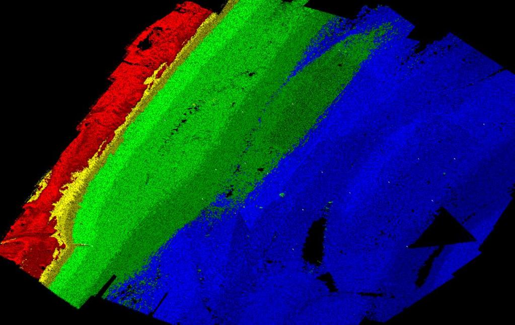
15 Overlap % Along Track % Across Track Waypoint Test Details RSPSoc Paper 4s, 3s, 2s, 1s, 0s. Survey area Iontas, North Campus Need - Terrain, Structures, Power Don t need Vegetation, Pedestrians, Obstructions 300 images 12 batteries, 2 days 15


16 Testing XY Ortho and Z DSM 16

17 Overlap and DSM 17


18 Application : Marine Aerial Surface Potential Applications Sea-floor Ground Truthing Coastal Erosion Pipe & Cable laying Offshore Exploration Fisheries & Aquaculture Pollution Events Damage Assessment Promotion & Education Sub-Surface


19 WAMSAPs
 Real-time aerial feeds to ground devices, SmartPhones (Position, Measure in re 24/7,")


20 Wide Area Monitoring using Smart Airborne Platforms (WAMSAPs) Autonomous platforms (UAS, Aerostats/Helikites) Real-time aerial feeds to ground devices, SmartPhones (Position, Measure in re 24/7, all weather operation, SmartApp control Multispectral, environmental sensors Detect and report change Geofencing, Privacy by Design Non-persistent on skyline Automated mapping/monitoring Cover a few square km eg large installation/infrastructure, Marine Port or Coas Low Carbon Footprint Collaborative, autonomous, no single point failure European GMES Cloud Platform Winners 2012 in Munich, Germany IAA approved to operate Aerostats/Helikites


 Illegal border crossing (Frontex) Avalanche disaster management (Austrian")
21 Chief Aim Design, build & test cloud-based spatial decision-support tools based on EO & in-situ sensor data fusion for managing critical infrastructure in the marine environment, illegal border crossing & government installations Project Partners Norway Ireland (NUI Maynooth & igeotec) Germany Deliverable Operational on-line demonstrators comprising data discovery, fusion, visualisation & decision-support toolsets for three scenarios: Oil-spill in marine environment (SmartBay/Shannon Oil-Spill Response & BP) Illegal border crossing (Frontex) Avalanche disaster management (Austrian Tyrol local government)
22 Viseo-Fusion Demonstrator #1 Oil-Spill in Marine Environment Decision-making over-view Hazard Assessment Action Plan Vulnerability Analysis Response Strategy

23 Oil-spill & Critical Marine Infrastructure Scenario GPS Sat Com HQ EO Context Oil-spill reported Response team assembled Collate infromation Assess the problem Decide on actions Execute the plan Shore-line Clean-up Shore-line Clean-up UAV Oil-Storage Facility Oil-spill Stricken Vessel

24 Oil-spill & Critical Marine Infrastructure Scenario UI/UX Control Map Tools Analysis Data Input Session Layer Control EO Layer VHR SAR GIS Layer Topography Land Use Op#321 Common Overview Map Display Alert#1 UAV Display In-situ Regional Weather Traffic In-situ Locale Asign Ubipix ClientLayer TBC Alert#2 Aersotat Display Event & Resource Management Control Alert#1, 02Nov2012: 10:12:10am, vehicle detected Alert#2, 02Nov2012: 10:12:10am, human activity Resource #12 en-route Alert Resource #13 Web Processing Services Query Update Transformation Fusion Publication Alert
Norwegian spatial data infrastructure supporting disaster risk management Norwegian Mapping Authority
 Norwegian spatial data infrastructure supporting disaster risk management Norwegian Mapping Authority Arvid Lillethun, Norwegian Mapping Authority Land and Poverty 2018 Conference, World Bank 19.-23. March
ASSESSMENT AND RESTORATION OF COASTAL ECOSYSTEMS USING REMOTE SENSING AND VISUALIZATION TOOLS FOR THE GULF OF MEXICO AND BEYOND
 ASSESSMENT AND RESTORATION OF COASTAL ECOSYSTEMS USING REMOTE SENSING AND VISUALIZATION TOOLS FOR THE GULF OF MEXICO AND BEYOND Remote Sensing as a Tool for Ecosystem Restoration George Graettinger Office
Towards eenvironment Prague, March GMES Space Component. Josef Aschbacher Head, ESA GMES Space Office
 Towards eenvironment Prague, 25-27 March 2009 GMES Space Component Josef Aschbacher Head, ESA GMES Space Office Prague from Space Segment 2 05 Nov 2003 CNES 2003 GISAT 2007 ESA GSELAND GMES is an EU led
GEOMATICS. Shaping our world. A company of
 GEOMATICS Shaping our world A company of OUR EXPERTISE Geomatics Geomatics plays a mayor role in hydropower, land and water resources, urban development, transport & mobility, renewable energy, and infrastructure
Copernicus Overview and Emergency Management Service
 Copernicus Overview and Emergency Management Service Frédéric BASTIDE European Commission Open informal session of the United Nations Inter-Agency Meeting on Outer Space Activities 12 March 2013, Geneva
TOSCA RESULTS OVERVIEW
 TOSCA RESULTS OVERVIEW Almost 3 years after the project started, TOSCA has proved capable of improving oil spill tracking systems. TOSCA has brought updated knowledge on surface currents and noticeable
Global UAV-based solutions for the industry and agriculture.
 Global UAV-based solutions for the industry and agriculture. Remote sensing of vegetation from drones (UAS). The example of the Trimble Unmanned Aerial Solution Emmanuel de Maistre, co-founder & CEO demaistre@redbird.fr
Exploit your geodata to enable smart cities and countries
 Exploit your geodata to enable smart cities and countries Carsten Rönsdorf, Head of Advisory Services Middle East Practice Manager Future Cities, standards and 3D 24 November 2014 Importance of Standards
European Space Agency
 Guidelines - Guidelines how/when to interact during the WebEx session: - Due to the number of attendees, please keep always your webcam and microphone switched-off - You can use anytime the chat to all
Climate Risk Visualization for Adaptation Planning and Emergency Response
 Climate Risk Visualization for Adaptation Planning and Emergency Response NCR Flood Fact Finding Workshop Ricardo Saavedra ricardo@vizonomy.com Social Media, Mobile, and Big Data St. Peter s Basilica,
Themes for Geomatics Conference. Geodesy Themes
 Themes for Geomatics Conference Geodesy Themes Geodynamics o Modeling the Deformation of the Earth s Crust o Recent Advances in Geometric Approaches to Deformation Analysis o Monitoring Systems (Sensors
Monitoring the coastal ocean: from local to regional
 Monitoring the coastal ocean: from local to regional Luísa Bastos University of Porto / CIIMAR RAIA partners Ocean monitoring To answer key societal and scientific challenges navigation safety, fisheries,
XXIII CONGRESS OF ISPRS RESOLUTIONS
 XXIII CONGRESS OF ISPRS RESOLUTIONS General Resolutions Resolution 0: Thanks to the Czech Society commends: To congratulate The Czech Society, its president and the Congress Director Lena Halounová, the
Current and Future Technology Applications for Coastal Zone Management. Bruce K. Carlisle, Acting Director Office of Coastal Zone Management
 Current and Future Technology Applications for Coastal Zone Management Bruce K. Carlisle, Acting Director Office of Coastal Zone Management The Massachusetts Coastal Zone Management Program Approved in
2 nd Japan and Republic of Korea LiDAR Survey Symposium
 2 nd Japan and Republic of Korea LiDAR Survey Symposium 2010 年 9 月 20 日 Prof. Woosug Cho wcho@inha.ac.kr Spacematics Lab Department of Civil Engineering Inha University Presentation on Current Status in
The Danish Maritime Spatial Data Infrastructure (MSDI) Geodata of the Sea
 Geodata of the Sea") MSDI/MSP The Danish Maritime Spatial Data Infrastructure (MSDI) Geodata of the Sea Components of an infrastructure: DATA - metadata, datasets FUNCTIONALITY - spatial data services, web services and other
MSDI/MSP The Danish Maritime Spatial Data Infrastructure (MSDI) Geodata of the Sea Components of an infrastructure: DATA - metadata, datasets FUNCTIONALITY - spatial data services, web services and other
Copernicus Overview. Major Emergency Management Conference Athlone 2017
 Copernicus Overview Major Emergency Management Conference Athlone 2017 Copernicus is a European programme implemented by the European Commission. The services address six thematic areas: land, marine,
Understanding oceans in change: Engineering science and technological tools for distributed real-time sensing Kristin Guldbrandsen Frøysa, CMR and
 Understanding oceans in change: Engineering science and technological tools for distributed real-time sensing Kristin Guldbrandsen Frøysa, CMR and University of Bergen Anne A Hageberg, CMR Christian Michelsen
Interest for HOs to cooperate with EU Commission:
 Plenary session of the European IHO Network Working Group (IENWG) Interest for HOs to cooperate with EU Commission: Why HOs and the EU Commission need a closer cooperation Rear Admiral (N) Luigi SINAPI
Open Data meets Big Data
 Open Data meets Big Data Max Craglia, Sven Schade, Anders Friis European Commission Joint Research Centre www.jrc.ec.europa.eu Serving society Stimulating innovation Supporting legislation JRC is Technical
EO Information Services in support of Satellite Tools for Building Flood Defence Systems in Guyana
 EO Information Services in support of Satellite Tools for Building Flood Defence Systems in Guyana F. N. Koudogbo and A. Arnaud Altamira Information J. Leen, Eurosense World Bank HQ, Washington DC Date
Wind Tower Deployments and Pressure Sensor Installation on Coastal Houses Preliminary Data Summary _ Sea Grant Project No.
 Wind Tower Deployments and Pressure Sensor Installation on Coastal Houses Preliminary Data Summary _ Sea Grant Project No.:1020040317 Submitted to: South Carolina Sea Grant Consortium 287 Meeting Street
Esri and GIS Education
 Esri and GIS Education Organizations Esri Users 1,200 National Government Agencies 11,500 States & Regional Agencies 30,800 Cities & Local Governments 32,000 Businesses 8,500 Utilities 12,600 NGOs 11,000
Emergency Management Service (EMS) mapping
 mapping") GMES Emergency Management Service (EMS) mapping Frédéric BASTIDE GMES unit, European Commission UN-SPIDER Expert Meeting: "Crowdsource Mapping for Disaster Risk Management and Emergency Response" 3-5 December,
GMES Emergency Management Service (EMS) mapping Frédéric BASTIDE GMES unit, European Commission UN-SPIDER Expert Meeting: "Crowdsource Mapping for Disaster Risk Management and Emergency Response" 3-5 December,
Bonn Agreement Aerial Surveillance Programme. Annual report on aerial surveillance for 2016 CONTENTS
 Bonn Agreement Aerial Surveillance Programme Annual report on aerial surveillance for 2016 Introduction Commentary CONTENTS Table 1: Summary of data relating to National Flights during 2016 Table 2: Summary
A Broad View of Geospatial Technology & Systems
 A Broad View of Geospatial Technology & Systems Pete Large Vice President, Trimble On the shoulders of giants 1 Since their time, our ability to generate geospatial information has grown exponentially
MeteoGroup FleetGuard. The world s most comprehensive SaaS fleet management system
 MeteoGroup FleetGuard The world s most comprehensive SaaS fleet management system The fleet management challenge Whether you are fleet operator or charter owner, you bear great responsibility for revenue,
VISUALIZING THE SMART CITY 3D SPATIAL INFRASTRUCTURE GEOSMART ASIA- 30 SEP, 2015
 www.aamgroup.com VISUALIZING THE SMART CITY 3D SPATIAL INFRASTRUCTURE GEOSMART ASIA- 30 SEP, 2015 Agenda AAM What is a Smart City? Data Acquisition 3D Modelling Benefits Questions AAM AAM is a Geospatial
International Conference Analysis and Management of Changing Risks for Natural Hazards November 2014 l Padua, Italy
 Abstract Code: B01 Assets mapping products in support of preparedness and prevention measures (examples from Germany, Italy and France) Marc Mueller, Thierry Fourty, Mehdi Lefeuvre Airbus Defence and Space,
ADVANTAGES OF GIS-INTEGRATED MARITIME DATA IN THE BLACK SEA REGION FOR MULTIPURPOSE USE
 INTERAGENCY INTERACTION IN CRISIS MANAGEMENT AND DISASTER RESPONSE 2017 ADVANTAGES OF GIS-INTEGRATED MARITIME DATA IN THE BLACK SEA REGION FOR MULTIPURPOSE USE Lyubka Pashova 1, Anna Kortcheva 2, Vasko
EO-Based Ice and Iceberg Monitoring in Support of Offshore Engineering Design and Tactical Operations
 EO-Based Ice and Iceberg Monitoring in Support of Offshore Engineering Design and Tactical Operations Desmond Power, C-CORE ESA Industry Workshop on Satellite EO for the Oil and Gas Sector Overview Operations
Cutting Edge Engineering for Modern Geospatial Systems Rear Admiral Dr. S Kulshrestha, retd
 Cutting Edge Engineering for Modern Geospatial Systems Rear Admiral Dr. S Kulshrestha, retd 11 Jun 2015 GeoIntelligence Asia 2015 The technology would become so pervasive that it becomes a part of you
Geo-information and Disaster Risk Reduction in the Hindu Kush-Himalayan region
 Geo-information and Disaster Risk Reduction in the Hindu Kush-Himalayan region Basanta Shrestha, Division Head MENRIS, International Centre for Integrated Mountain Development Kathmandu, Nepal The International
HF radarcontribution to South Africa Blue Economy
 HF radarcontribution to South Africa Blue Economy Anton G Kjelaas1, Andres Alonso- Martirena2, Chad Whelan3 South Africa- Norway Science Week 2016 Oct 31- Nov 4 2016 1 2 3 BLUE ECONOMY Sustainable use
Smart use of Geographic Information System (GIS) platform for delivering weather information and nowcasting services
 platform for delivering weather information and nowcasting services") Smart use of Geographic Information System (GIS) platform for delivering weather information and nowcasting services C. K. Pan Hong Kong Observatory Hong Kong, China It is a world of beauty Source: Image
Smart use of Geographic Information System (GIS) platform for delivering weather information and nowcasting services C. K. Pan Hong Kong Observatory Hong Kong, China It is a world of beauty Source: Image
Low Cost Weather Stations for Developing Countries (Kenya)
") Low Cost Weather Stations for Developing Countries (Kenya) Charles Mwangi Kenya Space Agency 7 th UNSPIDER Conference 23th-25th October 2017 Prepared with support of: Martin Steinson/Paul Kucera - UCAR/NCAR
Low Cost Weather Stations for Developing Countries (Kenya) Charles Mwangi Kenya Space Agency 7 th UNSPIDER Conference 23th-25th October 2017 Prepared with support of: Martin Steinson/Paul Kucera - UCAR/NCAR
ELEVATION IS FOUNDATIONAL. A DEM that is inaccurate or of poor resolution will pass those characteristics onto other data layers
 ELEVATION IS FOUNDATIONAL A DEM that is inaccurate or of poor resolution will pass those characteristics onto other data layers THE DEM IS FOUNDATIONAL TO ALL GIS (Geospatial Information System) LAYERS
Reducing Vulnerability to Extreme Heat: Science-Policy Interface
 Reducing Vulnerability to Extreme Heat: Science-Policy Interface Olga Wilhelmi, Mary Hayden, Jennifer Boehnert, Ursula Lauper and SIMMER research team October 23, 2013 Toronto SIMMER workshop Science-Policy
ArcGIS is Advancing. Both Contributing and Integrating many new Innovations. IoT. Smart Mapping. Smart Devices Advanced Analytics
 ArcGIS is Advancing IoT Smart Devices Advanced Analytics Smart Mapping Real-Time Faster Computing Web Services Crowdsourcing Sensor Networks Both Contributing and Integrating many new Innovations ArcGIS
You are Building Your Organization s Geographic Knowledge
 You are Building Your Organization s Geographic Knowledge And Increasingly Making it Available Sharing Data Publishing Maps and Geo-Apps Developing Collaborative Approaches Citizens Knowledge Workers Analysts
NOAA Surface Weather Program
 NOAA Surface Weather Program Maintenance Decision Support System Stakeholder Meeting #9 Jim O Sullivan NOAA Surface Weather Program Manager NWS Office of Climate, Water, and Weather Services September
Geological information for Europe : Towards a pan-european Geological Data Infrastructure
 Geological information for Europe : Towards a pan-european Geological Data Infrastructure Integrating geoscientific information for EU competitiveness Co-funded by the European Union European societal
DEVELOPMENT OF A FORECAST EARLY WARNING SYSTEM ethekwini Municipality, Durban, RSA. Clint Chrystal, Natasha Ramdass, Mlondi Hlongwae
 DEVELOPMENT OF A FORECAST EARLY WARNING SYSTEM ethekwini Municipality, Durban, RSA Clint Chrystal, Natasha Ramdass, Mlondi Hlongwae LOCATION DETAILS AND BOUNDARIES ethekwini Municipal Area = 2297 km 2
GIS-based Smart Campus System using 3D Modeling
 GIS-based Smart Campus System using 3D Modeling Smita Sengupta GISE Advance Research Lab. IIT Bombay, Powai Mumbai 400 076, India smitas@cse.iitb.ac.in Concept of Smart Campus System Overview of IITB Campus
EUSAIR on sea topics from Slovenian perspective
 MINISTRY OF FOREIGN AFFAIRS REPUBLIC OF SLOVENIA EUSAIR on sea topics from Slovenian perspective Mag. Andreja Jerina National Coordinator 4 EU MRS: 270 millions of population 19 MS 12 non MS Sea basin
Arctic Observing Systems Challenges, New opportunities and Integration
 Arctic Observing Systems Challenges, New opportunities and Integration Japan Norway Arctic Science Week 03 June 2016 By Stein Sandven, NERSC Building an integrated Arctic Observing System Need to collect,
Spatial Data Science. Soumya K Ghosh
 Workshop on Data Science and Machine Learning (DSML 17) ISI Kolkata, March 28-31, 2017 Spatial Data Science Soumya K Ghosh Professor Department of Computer Science and Engineering Indian Institute of Technology,
Digital Development of Territories. Pedro Leite Member of the Board of Directors
 Digital Development of Territories Pedro Leite Member of the Board of Directors Digital Development of Territories Pedro Leite Member of the Board of Directors Azores Archipelago 9 islands located in the
Weather in the Connected Cockpit
 Weather in the Connected Cockpit What if the Cockpit is on the Ground? The Weather Story for UAS Friends and Partners of Aviation Weather November 2, 2016 Chris Brinton brinton@mosaicatm.com Outline Mosaic
CityGML & opendrive Urban Simulation Based on Open Standards
 CREATE MAINTAIN DISTRIBUTE 3D Mapping Solutions CityGML & opendrive Urban Simulation Based on Open Standards Dr.-Ing. Stefan Trometer virtualcitysystems GmbH virtualcitysystems Experts for 3D City Models
Oak Ridge Urban Dynamics Institute
 Oak Ridge Urban Dynamics Institute Presented to ORNL NEED Workshop Budhendra Bhaduri, Director Corporate Research Fellow July 30, 2014 Oak Ridge, TN Our societal challenges and solutions are often local
Weather and ice information as a tool for arctic marine and offshore services
 Weather and ice information as a tool for arctic marine and offshore services World Meteorological Organization Executive Council Panel of Experts on Polar Observations, Research and Services President
Pipeline Integrity Monitoring
 A Global Communications and Information Company Pipeline Integrity Monitoring is subject to the restrictions on the title page of this document. COPYRIGHT 2014 MDA 1 1 Corporate Overview Business Space-based
Applied Geoscience and Technology Division SOPAC. Joy Papao, Risk Information Systems Officer
 Joy Papao, Risk Information Systems Officer Secretariat of the Pacific Community SPC 22 Pacific Island States Head office in Noumea, New Caledonia 2 Regional offices (Pohnpei and Honiara) 600 staff 9 Technical
An Unmanned Aerial Vehicle-based Radiation Surveillance System. Seungwoo Lee Korea Electronics Technology Institute
 An Unmanned Aerial Vehicle-based Radiation Surveillance System Seungwoo Lee Korea Electronics Technology Institute The Research on Radiation Dispersion Prevention Systems All the Physical Barriers and
Dual-Frequency Ku- Band Radar Mission Concept for Snow Mass
 Dual-Frequency Ku- Band Radar Mission Concept for Snow Mass Chris Derksen Environment and Climate Change Canada Study Team: Climate Research Division/Meteorological Research Division, ECCC Canadian Space
China-U.S. Collaboration on Rapid Urbanization. Jonathan Fink Vice President for Research and Economic Affairs Arizona State University August, 2004
 China-U.S. Collaboration on Rapid Urbanization Jonathan Fink Vice President for Research and Economic Affairs Arizona State University August, 2004 Why have an urban system science research agenda? More
SUPPORTS SUSTAINABLE GROWTH
 DDSS BBUUN NDDLLEE G E O S P AT I A L G O V E R N A N C E P A C K A G E SUPPORTS SUSTAINABLE GROWTH www.digitalglobe.com BRISBANE, AUSTRALIA WORLDVIEW-3 30 CM International Civil Government Programs US
TOWARDS CLIMATE-RESILIENT COASTAL MANAGEMENT: OPPORTUNITIES FOR IMPROVED ICZM IN BELIZE
 TOWARDS CLIMATE-RESILIENT COASTAL MANAGEMENT: OPPORTUNITIES FOR IMPROVED ICZM IN BELIZE CHANTALLE SAMUELS Coastal Zone Management Authority and Institute The Caribbean Community Climate Change Centre VULNERABILITY
Weather Needs for UAS Operations
 Minneapolis - Denver - Washington, D.C. Weather Needs for UAS Operations Brian Haynes - President November 2016 1 Sensurion Background: 10-year company history UAS Weather Needs Sensurion Perspective Extensive
E x a m p l e s o f t o o l s f o r s e a s i t u a t i o n a l a w a r e n e s s u s i n g C M E M S d a t a. Copernicus EU
 E x a m p l e s o f t o o l s f o r s e a s i t u a t i o n a l a w a r e n e s s u s i n g C M E M S d a t a Copernicus EU Copernicus EU Copernicus EU www.copernicus.eu S e a S i t u a t i o n a l A w
WMO Guide on Integrated Urban Weather, Environment and Climate Services for Cities (IUWECS) Hong Kong- an experience from a high-density city
 Hong Kong- an experience from a high-density city") WMO Guide on Integrated Urban Weather, Environment and Climate Services for Cities (IUWECS) Hong Kong- an experience from a high-density city Dr. Chao REN Associate Professor School of Architecture The
WMO Guide on Integrated Urban Weather, Environment and Climate Services for Cities (IUWECS) Hong Kong- an experience from a high-density city Dr. Chao REN Associate Professor School of Architecture The
1) make sure folks know what s available in terms of geospatial data and resources that could contribute to their decision support toolkits;
 make sure folks know what s available in terms of geospatial data and resources that could contribute to their decision support toolkits;") Introduction 1 2001 It was born out of the recognition that several of the regions prominent resource management agencies have similar, if not shared, requirements for GIS data. Some of the underlying
Introduction 1 2001 It was born out of the recognition that several of the regions prominent resource management agencies have similar, if not shared, requirements for GIS data. Some of the underlying
Situational Report HOW PLANET MONITORS DEVELOPMENTS IN THE SOUTH CHINA SEA AUGUST 1, 2016 IMAGE ACQUIRED: JULY 22, 2015 PLANET.
 Situational Report IMAGE ACQUIRED: JULY 22, 2015 HOW PLANET MONITORS DEVELOPMENTS IN THE SOUTH CHINA SEA AUGUST 1, 2016 PRESS@PLANET.COM PLANET.COM THE SITUATION An international tribunal in The Hague
Key Points Sharing fosters participation and collaboration Metadata has a big role in sharing Sharing is not always easy
 Sharing Resources Geoff Mortson esri, Inc. SDI Solutions Team Key Points Sharing fosters participation and collaboration Metadata has a big role in sharing Sharing is not always easy Data Sharing is Good
Mapping a Nation in 3D Singapore s Journey. Bryan Chew Registrar of Titles Assistant Chief Executive Singapore Land Authority
 Mapping a Nation in 3D Singapore s Journey Bryan Chew Registrar of Titles Assistant Chief Executive Singapore Land Authority Singapore Size - 719 sq km Population - 5.5 million Density 7,600/sq km Singapore
GI Technology for Disaster Management
 GI Technology for Disaster Management 17 th ICC on the Regional Space Applications Programme for Sustainable Development (RESAP) 26 th Nov 2013 Bangkok Thailand Period and time of seasonal in thailand
STAMP Spa)al Tools for Arc)c Mapping & Planning. Creating an interactive data tool to improve access and usability of Arctic data
al Tools for Arc)c Mapping & Planning. Creating an interactive data tool to improve access and usability of Arctic data") STAMP Spa)al Tools for Arc)c Mapping & Planning Creating an interactive data tool to improve access and usability of Arctic data Mission Provide easy access to physical, chemical, and biological data Network
STAMP Spa)al Tools for Arc)c Mapping & Planning Creating an interactive data tool to improve access and usability of Arctic data Mission Provide easy access to physical, chemical, and biological data Network
UAV s in Geoinformatics - Trends and Perspectives
 UAV s in Geoinformatics - Trends and Perspectives Torsten Prinz & Christian Knoth Institute for Geoinformatics (IFGI), University of Muenster (WWU) GeoNetzwerk Münsterland (29.11.2013) I. Introduction
Current Research Trends from an Australian Perspective. Dr Philip Collier Research Director
 Current Research Trends from an Australian Perspective Dr Philip Collier Research Director Growth in the spatial sector. 11% pa in the Global Navigation Satellite System market 2010-2020 300% growth in
Land Administration and Cadastre
 Geomatics play a major role in hydropower, land and water resources and other infrastructure projects. Lahmeyer International s (LI) worldwide projects require a wide range of approaches to the integration
DMS-UAV Accuracy Assessment: AP20 with Nikon D800E
 DMS-UAV Accuracy Assessment: AP20 with Nikon D800E Joe Hutton, Greg Lipa, James Lutes, Omer Mian Applanix, William Chan - GeoPixel Air Introduction The Direct Mapping Solution for Unmanned Aerial Vehicles
Current experiences in the use of satellite information in development aid activities
 Current experiences in the use of satellite information in development aid activities Meeting at ESA/ESRIN in Frascati 16 th of September 2017 #WorldInCommon AGENCE FRANÇAISE DE DÉVELOPPEMENT FRENCH DEVELOPMENT
Mapping Coastal Change Using LiDAR and Multispectral Imagery
 Mapping Coastal Change Using LiDAR and Multispectral Imagery Contributor: Patrick Collins, Technical Solutions Engineer Presented by TABLE OF CONTENTS Introduction... 1 Coastal Change... 1 Mapping Coastal
Developing integrated remote sensing and GIS procedures for oil spill monitoring on the Libyan coast
 Coastal Processes III 125 Developing integrated remote sensing and GIS procedures for oil spill monitoring on the Libyan coast A. Eljabri & C. Gallagher Department of Civil Engineering and Built Environment,
1. Baltic SCOPE Towards coherence and cross-border solutions in Baltic Maritime Spatial Plans
 NSHC 32th Conference Explanatory Note Dublin, Ireland Item E.2 MSP 21-23 June 2016 Germany Cross border MSP for the EEZ, a case study from the Baltic Sea The Federal Maritime and Hydrographic Agency of
Environmental Data In Support of Search & Rescue Operations in the Central Mediterranean Sea
 Environmental Data In Support of Search & Rescue Operations in the Central Mediterranean Sea Dr. Eric Comerma (RPS ASA) eric.comerma@rpsgroup.com Cathleen Turner (RPS ASA) Prof. Aldo Drago (Univ. of Malta)
ZRCSAZU. Remote sensing and Earth observation data at ZRC SAZU. dr. Tatjana Veljanovski Atrij ZRC Ljubljana
 ZRCSAZU Remote sensing and Earth observation data at ZRC SAZU dr. Tatjana Veljanovski 2016-06-08 Atrij ZRC Ljubljana Remote Sensing Department Remote Sensing Department 20 years of experience application,
COVERAGE-Sargasso Sea
 COVERAGE-Sargasso Sea A Collaborative Project between NASA and the Sargasso Sea Commission Dr. Vardis Tsontos Dr. Jorge Vazquez NASA Jet Propulsion Laboratory, California Institute of Technology UN-HQ
Ocean Observatories Initiative. Oscar Schofield Rutgers University. Ocean Leadership October 2010
 Ocean Observatories Initiative Oscar Schofield Rutgers University Ocean Leadership October 2010 What is OOI? THE VISION To launch an era of scientific discovery across and within the ocean basins, utilizing
CLIMATE CHANGE ADAPTATION BY MEANS OF PUBLIC PRIVATE PARTNERSHIP TO ESTABLISH EARLY WARNING SYSTEM
 CLIMATE CHANGE ADAPTATION BY MEANS OF PUBLIC PRIVATE PARTNERSHIP TO ESTABLISH EARLY WARNING SYSTEM By: Dr Mamadou Lamine BAH, National Director Direction Nationale de la Meteorologie (DNM), Guinea President,
Road Ahead: Linear Referencing and UPDM
 Road Ahead: Linear Referencing and UPDM Esri European Petroleum GIS Conference November 7, 2014 Congress Centre, London Your Work Making a Difference ArcGIS Is Evolving Your GIS Is Becoming Part of an
Building a National Data Repository
 Building a National Data Repository Mladen Stojic, Vice President - Geospatial 1/30/2013 2012 Intergraph Corporation 1 Information has meaning and gives power only when shared and distributed. Information,
INSPIREd solutions for Air Quality problems Alexander Kotsev
 INSPIREd solutions for Air Quality problems Alexander Kotsev www.jrc.ec.europa.eu Serving society Stimulating innovation Supporting legislation The European data puzzle The European data puzzle 24 official
Advances in Synoptic Observations with Robotic Vehicles
 Advances in Synoptic Observations with Robotic Vehicles Kanna Rajan (NTNU & UPorto, Norway) Tor Arne Johansen (NTNU, Norway) Joao Sousa (UPorto, Portugal) Javier Gilabert (UPCT, Spain) Air surface space
Conference at a Glance
 Conference at a Glance 8:30 AM MONDAY ROOM 333 ROOM 327/328 ROOM 238 ROOM 296/298 WELCOME and KEYNOTE SPEAKER MICHAEL MILASKA 10 AM BREAK 10:30 AM Web Applications I 12 PM 1:30 PM Intro to R Data Science
European Spatial Data Research. EuroSDR. Prof. Dr. Ir. Joep Crompvoets. General Assembly CLGE Tirana 18 March
 EuroSDR Prof. Dr. Ir. Joep Crompvoets General Assembly CLGE - 2016 Tirana 18 March 2016 INTRODUCTORY QUESTIONS Who knows what is EuroSDR? Who does NOT know what is EuroSDR? Who is employed at mapping agencies?
Current Ph.D. College of Public Service and Community Solutions School of Public Affairs, Arizona State University, Expected Graduation-2019
 Jake R. Nelson October 2017 Arizona State University College of Public Service and Community Solutions 411 N Central Ave, Phoenix, AZ 85004. email:jakenels@gmail.com, jrnels20@asu.edu, nelsonjr@netl.doe.gov
US National Spatial Data Infrastructure A Spatial Framework for Governance and Policy Development to Enable a Location-Based Digital Ecosystem
 GeoPlatform Workshop 7 Dec 2016, Department of the Interior Washington, D.C. US National Spatial Infrastructure A Spatial Framework for Governance and Policy Development to Enable a Location-Based Digital
NVF Digitalization Committee 6 th meeting Big data and data analytics using data to deal with tourism and natural forces
 1 NVF Digitalization Committee 6 th meeting Big data and data analytics using data to deal with tourism and natural forces 13.-14.6.2018, Reykjavik, Iceland 1. Introduction of the participants Members
The Role of Data & Information Infrastructures in Supporting Climate Change Adaptation in Latin America & the Caribbean
 The Role of Data & Information Infrastructures in Supporting Climate Change Adaptation in Latin America & the Caribbean Emil A. Cherrington Senior Scientist Water Center for the Humid Tropics of Latin
Environmental Response Management Application
 Environmental Response Management Application Coastal Response Research Center Nancy Kinner, Michele Jacobi, Rob Braswell, Kurt Schwehr & Amy Merten RRT III May 14, 2008 1 Talk Outline Overview of Center
Remote Sensing and EO activities at the University of Turku
 Remote Sensing and EO activities at the University of Turku Niina Käyhkö Associate Professor Department of Geography and Geology GEO meeting/syke May 23rd, 2018 Geospatial competence at the University
Seatrack Web Developments
 Seatrack Web Seatrack Web Developments HELCOM RESPONSE 16/2012, 21 November 2012 Johan Mattsson, DCOO Seatrack Web Contents Short overview Recent developments Online demonstration (experimental) Questions
Operational ice charting in mid-latitudes using Near-Real-Time SAR imagery
 Operational ice charting in mid-latitudes using Near-Real-Time SAR imagery Sergey Vernyayev Ice Engineer ICEMAN.KZ Carles Debart Project Manager Energy, Environment and Security Yevgeniy Kadranov Ice charting
13 th EUMETSAT User Forum in Africa
 13 th EUMETSAT User Forum in Africa GMES & Africa implementation in Western Africa Dogbeda M.Y. Azumah Regional Marine Centre University of Ghana Pictures zone UG GMES Presentation Layout UG G Project
Options in Capacity Building. Underpinning the Blue Economy. Slide 1/78. Derrick R. Peyton. 14 th MACHC Meeting. IIC Technologies. December 9-13, 2013
 Options in Capacity Building Underpinning the Blue Economy Derrick R. Peyton IIC Technologies 14 th MACHC Meeting December 9-13, 2013 Slide 1/78 Overview Blue Economy Defined Challenges (SDI, MSDI, Standards)
v=7tat9croynk&feature=youtu.be
 https://www.youtube.com/watch? v=7tat9croynk&feature=youtu.be Malta Summer School 2018 Operational Oceanography for Blue Growth EMODnet in a nutshell: unlocking, and offering access to, European marine
Climate Resilience Decision Making Framework in the Caribbean. A case of Spatial Data Management
 Climate Resilience Decision Making Framework in the Caribbean A case of Spatial Data Management Bishwa Pandey Sr. Data Management Specialist The World Bank Background The mission of The World Bank s Latin
Ramani Geosystems. Putting Africa On The Map. Authorized Resellers
 Ramani Geosystems Putting Africa On The Map Authorized Resellers Ramani Profile Started in 1999 Aerial, Land Surveying & Mapping Solutions + 10 Countries in the region + 80 Staff working in projects Asset