Requirement for Hydrographic Surveying and Nautical Charting for Small Island Developing States within the South West Pacific Region
|
|
|
- Lewis Morris
- 5 years ago
- Views:
Transcription

1 Requirement for Hydrographic Surveying and Nautical Charting for Small Island Developing States within the South West Pacific Region John Maschke September 2013
2 Overview Welcome Introduction Current Situation Understanding of Requirement Use of Hydrographic Data International Organisations & International Conventions

3 Overview cont d Status of Maritime Safety Information Determination of Maritime Delineation Benefits Way Ahead Conclusion

4 Hydrographic Surveying International Hydrographic Organization definition: Hydrography is the branch of applied sciences which deals with the measurement and description of the physical features of oceans, seas, coastal areas, lakes and rivers, as well as with the prediction of their change over time, for the primary purpose of safety of navigation and in support of all other marine activities, including economic development, security and defence, scientific research, and environmental protection. Hydrographic Specialisations: - Nautical Charting - Industrial Offshore Surveying - Coastal Zone Management (CZM) - Military Hydrography

5 Introduction Strong Hydrographic Services Vital to SW Pacific SIDS Maritime Transport - Primary Mode of Trade within SW Pacific Fundamental to SW Pacific SIDS Economies, Marine Environment, SAR, Maritime Safety, Border Control, Fisheries


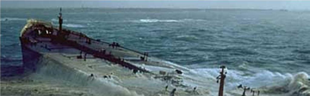
6 The ever increasing demand for better surveys due to increasing ship size and draft!

7 Current Situation State of Nautical Charting in SW Pacific Region Reliance on Maritime Transport & Seaborne Tourist Trade Lack of Hydrographic Surveying Expertise
 00% 00% 00% New Zealand 00% 30% 30% Papua New Guinea 72% 0% 72% Solomon Islands 60% 30% 90% Tonga 00% 90% 90% Tuvalu 60% 30% 90% Vanuatu 40% 55% 95% Unsurveyed & Resurvey Coverage")
8 Current state of Hydrographic Survey in SW Pacific Region Depths < 200m Unsurveyed Resurvey required to meet modern standards Australia 45% 20% 65% Fiji 25% 70% 95% Kiribati 80% 20% 100% New Caledonia (France) 00% 00% 00% New Zealand 00% 30% 30% Papua New Guinea 72% 0% 72% Solomon Islands 60% 30% 90% Tonga 00% 90% 90% Tuvalu 60% 30% 90% Vanuatu 40% 55% 95% Unsurveyed & Resurvey Coverage of hydrographic surveying at depths <200m for selected SW Pacific countries. (IHO Publication C-55 dated 17 Aug 2011)

9 Status of Maritime Safety Information Lack of in-country focus within many SIDS Lack of coordination Lack of appropriate & up-to-date charts Potential for litigation against SIDS without appropriate hydrographic surveys and nautical charting
10 Cost Benefits Hard to quantify, but for most maritime states benefits are significant 90% - 95% internal and external trade by sea for most SIDS Marine industries - Fishing industry - Tourism - Mineral Resource Exploration (potential)
11 Understanding of Requirement Prioritisation of Requirements Ojinnaka (1997) stated: For a nation to make maximum utilisation of her marine resources, her waters must be properly charted and the charts regularly updated. Unfortunately due to the different disciplines involved, the highly specialised techniques required, the high cost of marine operations and the apparent lack of awareness of the importance of these charts, it has been difficult for most developing nations of the world to pay serious attention to the charting of their waters. Lack of Equal Focus Importance of Hydrographic Services

12 Use of Hydrographic Data Uses of Data and Products: - Planning - Conduct of Operations - Border Control & Law Enforcement - Maritime & Coastal Development - Maritime Safety Capability Development Aid Assistance Use of Independent Advisers Maritime Safety Infrastructure
13 Use of Hydrographic Products cont d There are a myriad of uses of hydrographic data and information: Planning: - Strategic - Operational - Anti-pollution - Environmental - Hydrographic Survey - Shipping Route - Navigation Aid Positioning - Maritime Development - Beach Protection - Resource Development Conduct of Operations: - Search and Rescue - Oil Spill Containment - Hydrographic Survey - Protection of Sensitive Areas - General Navigation - Oil, gas and mineral exploration Border Control and Law Enforcement: - Identification and Establishment of Marine Jurisdictional Areas (such as territorial sea baselines, exclusive economic zones, special marine zones, marine park limits, harbour limits, etc.) - Fisheries - Immigration - Crime Prevention (State and International)
14 Use of Hydrographic Products cont d Maritime and Coastal Development: - Marine Research and Development - Capability Development - Transport Infrastructure - Port and Harbour Infrastructure - Fisheries - Supplementation of Topographic Mapping Maritime Safety: - Shipping Operation Safety Analyses - Nautical Charting - Notices to Mariners - Value Adding to Existing Data Sets - Archiving and Databasing - Operational Training for Hydrographers and Mariners


15 Automatic Identification Systems *Regulation 19 of SOLAS Chapter V - Carriage requirements for shipborne navigational systems and equipment Hydrographic services in conjunction with Maritime Safety Authorities can assist in identifying critical shipping routes and areas requiring hydrographic survey and charting Compliments of Australian Maritime Safety Authority August 2013 Compliments of Land Information New Zealand April 2013
16 International Organisations and International Conventions Membership & Ratification IMO & IHO Safety of Life at Sea Convention (SOLAS): - In July 2002, the revised Chapter V of the IMO Safety of Life at Sea (SOLAS) Convention entered into force. Under the new Regulation 9, the Contracting Governments of SOLAS are now required to provide and maintain Hydrographic Services and products. UN Convention on the Law of the Sea (UNCLOS)
17 Membership of IMO and IHO SW Pacific SW Pacific countries that are member states of the IMO, include: Australia, Cook Islands, Fiji, France, Kiribati, Marshall Islands, New Zealand, Papua New Guinea, Solomon Islands, Tonga, Tuvalu and Vanuatu. SW Pacific countries that are member states of the IHO and the SW Pacific Hydrographic Commission (SWPHC) include: Australia, Fiji, France (New Caledonia), New Zealand, Papua New Guinea and Tonga. SW Pacific countries that are associate members of the SWPHC include: Cook Islands, Kiribati, Niue, Palau, Solomon Islands and Vanuatu
18 Safety of Life at Sea Convention 1974 A State that is a party to the Safety of Life at Sea Convention (SOLAS), is obliged to provide hydrographic services in accordance with Regulations 9 of Chapter V of that Convention as follows: Chapter V Regulation 9 - Hydrographic services 1. Contracting Governments undertake to arrange for the collection and compilation of hydrographic data and the publication, dissemination and keeping up to date of all nautical information necessary for safe navigation. 2. In particular, Contracting Governments undertake to co-operate in carrying out, as far as possible, the following nautical and hydrographic services, in the manner most suitable for the purpose of aiding navigation: 2.1. to ensure that hydrographic surveying is carried out, as far as possible, adequate to the requirements of safe navigation;
19 Safety of Life at Sea Convention to prepare and issue nautical charts, sailing directions, lists of lights, tide tables and other nautical publications, where applicable, satisfying the needs of safe navigation; 2.3. to promulgate notices to mariners in order that nautical charts and publications are kept, as far as possible, up to date; and 2.4. to provide data management arrangements to support these services. 3. Contracting Governments undertake to ensure the greatest possible uniformity in charts and nautical publications and to take into account, whenever possible, relevant international resolutions and recommendations. 4. Contracting Governments undertake to co-ordinate their activities to the greatest possible degree in order to ensure that hydrographic and nautical information is made available on a world-wide scale as timely, reliably, and unambiguously as possible.

20 United Nations Convention on the Law of the Sea (UNCLOS) Excerpt of Article24 - Duties of the coastal State: 2. The coastal State shall give appropriate publicity to any danger to navigation, of which it has knowledge, within its territorial sea. Articles 47, 48, 75 and 94 give further requirements regarding the provision of baseline data, geographic positions relating to maritime zones and duties of the Flag State


21 International Exclusive Economic Zone Boundaries Provided by: Professor Hyunsoo KIM, School of Law, INHA University, Korea Vice President, Hydrographic Society of Korea 16 Aug 2013

, Solomon Islands, Tonga, Tuvalu, Vanuatu SW Pacific")
22 Determination of Maritime Delineation Some current SW Pacific maritime boundary discussions include: - Fiji, France (New Caledonia, Wallis & Fortuna Is.), Solomon Islands, Tonga, Tuvalu, Vanuatu SW Pacific maritime boundary discussion areas
23 Benefits of Hydrographic Surveys and Nautical Charting Maritime safety provides confidence in navigating the waters within the SW Pacific. Tourism, especially cruise ship tourism, strongly benefits from hydrographic surveys due to identification of areas of marine and scenic interest and increased maritime safety, bringing greater financial benefits to national and local economies. National economic development and trade benefits from facilitation of maritime trade, internally, regionally and internationally. Identification of new, efficient and safer shipping routes to promote use of lager more modern vessels. Support of environmental protection and enable identification of sensitive marine areas, plus identification and formulation of maritime boundaries around such areas.
24 Benefits of Hydrographic surveys and nautical charting cont d Enhances maritime security through use of accurate nautical charts and hydrographic information for enforcement operations related to border control encompassing international crime, fisheries, quarantine and immigration. Supports humanitarian aid and natural disaster relief operations through accurate charts to assist in recovery effort following cyclones, earthquakes, volcanic eruptions and tsunamis. The hydrographic information and associated charts also assists in pre-planning for relief operations and assessment of potential impact areas. Maritime transport infrastructure and development of port facilities and shipping routes highly dependent upon hydrographic surveys and accurate nautical charting to ensure safety of shipping and assist in identification of sites for port facilities.
25 Way Ahead Government support IHO assistance Aid assistance Maintain engagement with Principal Charting Authorities (e.g. UKHO
26 Recommendations Formal designation of National Hydrographic Authorities responsible for coordination, and ensuring the provision, of appropriate nautical charting services in accordance with the requirements of the International Conventions, and in accordance with the principles established by the IHO. Allocation of regular funding and travel support for the National Hydrographic Authority to fulfil the duties and representation at appropriate forums, particularly attendance at SWPHC, SPC-SOPAC, and IHO meetings. Establish Maritime Safety Information (MSI) Coordinator positions to fulfil treaty obligations under SOLAS V/4 - navigational warnings.
27 Recommendations cont d Development and execution of National Hydrographic Survey Plan, National Charting Plan, Maritime Safety Information Plan and seek assistance from regional neighbours and from relevant international agencies, including SPC-SOPAC and international funding and aid agencies, to carry out chart improvement surveys and new surveys within significant areas required to facilitate maritime trade and cruise ship operations. Establishment of basic level in-country capability for hydrographic surveying by training existing government land surveyors in hydrographic surveying Provision of at least one in-country outfit of portable hydrographic surveying equipment. On-going funding will be required for the regular maintenance of the equipment and for the training and requalification of operators.
28 Recommendations cont d Overseas hydrographic advisers should be sought to guide and assist the National Hydrographic Authority and the National Lands Department and survey during the establishment of an in-country hydrographic data gathering capability and to foster close liaison and possible support from recognized national hydrographic authorities in other countries. SWP SIDS should apply for membership of the IHO (application details are available in IHO publication M-2 The Need for National Hydrographic Services), including allocating on-going funding for the annual subscription (based on registered flag tonnage) and travel support for National delegates to attend relevant IHO meetings.
29 Basic Equipment and Software Cost (As at Jan 2013) Item Approximate Price USD Single beam echo sounder - 200khz 7,500 Single beam echo sounder - dual 200 khz+ 30khz. 9,800 Combined echo sounder and logger khz. 13,500 Combined echo sounder and logger 200 khz +30khz. (15800) optional DGPS service, annually 1,700 Acoustic Tide Gauge 10,500 Post processing for DGPS, single frequency 12,000 Digital side scan sonar 20,000 Hydrographic data processing software 6,500 Ruggedized laptop 5,000 Desktop PC for processing 2,250 Plotters 8,000 Accessories 5,000 Approximate total for equipment (echo sounder, sonar, tide gauge, 110K-140K data logger, GPS, plotter, post-processor) Training in regional centre (inclusive of travel, etc.) 50,000 Lightweight portable multibeam sonar is now available at approx. USD$75 000
30 Conclusion State of hydrographic surveys and nautical charting is generally poor Lack of understanding of the requirement for hydrographic surveys and nautical charting Lack of equal focus on the need for hydrographic surveys, including appropriate prioritisation Without improvement in hydrographic surveys and nautical charting, SW Pacific economies will not grow due to lack of maritime transport infrastructure and maritime safety issues Without initial and continued hydrographic surveying and nautical charting, the economic wellbeing of a maritime state such as a SIDS cannot be optimised
31 Contact details: John Maschke Hydrographic Surveying and Maritime Policy ABN: PO Box 533 Earlville QLD 4870 Australia Tel:


32 Questions
33 Biography 38 years experience in Royal Australian Navy as hydrographic surveyor, specialising in nautical charting and military geospatial information Captain of five Royal Australian Navy hydrographic surveying ships Extensive experience in high level hydrographic and maritime policy making, development of mapping & charting standards, international relationship building and strategic planning within Aust Department of Defence & Aust Hydrographic Office Inaugural and Past Chair Surveying & Spatial Sciences Institute Hydrography Commission Project Manager for mapping of Vanuatu, Solomon Islands and Timor Leste Certified Professional Hydrographic Surveyor Level 1 Qualified IHO Category A Hydrographic Surveyor Fellow of Surveying & Spatial Sciences Institute Masters Degree in Maritime Policy (University of Wollongong) Current Chairman, Australasian Hydrographic Society East Australia & SW Pacific Regions, Education Awards Panel Member of Australian Institute of Management
14 th NIOHC, Myanmar National Report MYANMAR NAVAL HYDROGRAPHIC CENTRE (MNHC) NATIONAL REPORT HYDROGRAPHIC DEPARTMENT, ROYAL THAI NAVY-HDRTN
 NATIONAL REPORT HYDROGRAPHIC DEPARTMENT, ROYAL THAI NAVY-HDRTN") 14 th NIOHC, Myanmar National Report MYANMAR NAVAL HYDROGRAPHIC CENTRE (MNHC) NATIONAL REPORT 14 th NORTH INDIAN OCEAN HYDROGRAPHIC COMMISSION CONFERENCE HYDROGRAPHIC DEPARTMENT, ROYAL THAI NAVY-HDRTN
14 th NIOHC, Myanmar National Report MYANMAR NAVAL HYDROGRAPHIC CENTRE (MNHC) NATIONAL REPORT 14 th NORTH INDIAN OCEAN HYDROGRAPHIC COMMISSION CONFERENCE HYDROGRAPHIC DEPARTMENT, ROYAL THAI NAVY-HDRTN
Pacific Islands Regional Maritime Boundaries Project
 Pacific Islands Regional Maritime Boundaries Project 31 st Star Conference, Nadi, FIJI 6-8 June 2016 Jens Kruger Head of Ocean & Coastal Geoscience Sector Andrick Lal Project Officer (Surveying) Emily
Pacific Islands Regional Maritime Boundaries Project the latest Update. Malakai Vakautawale (Mr) Maritime Boundaries Adviser
 Maritime Boundaries Adviser") Pacific Islands Regional Maritime Boundaries Project the latest Update Malakai Vakautawale (Mr) Maritime Boundaries Adviser Consortium Partners 2 What we do? Provide technical advice and support on MB
Pacific Islands Regional Maritime Boundaries Project the latest Update Malakai Vakautawale (Mr) Maritime Boundaries Adviser Consortium Partners 2 What we do? Provide technical advice and support on MB
Briefing document of the status of maritime boundaries in Pacific island countries
 Secretariat of the Pacific Community Seventh Heads of Fisheries Meeting (28 Feb. 4 March 2011, Noumea, New Caledonia) Working Paper 5 Original: English Briefing document of the status of maritime boundaries
Seabed knowledge In support of UN SDGs
 Seabed knowledge In support of UN SDGs Evert Flier Fiskerifaglig forum 2. november 2017 Hydrography & small scale fishing Hydrography in Transition Serving the Maritime Community Hydrography in Transition
IHO Input to the Report of the UN Secretary General on Oceans and Law of the Sea Executive Summary General
 IHO Input to the Report of the UN Secretary General on Oceans and Law of the Sea The following notes provide information on activities of the International Hydrographic Organization that are relevant to
Pacific Geospatial and Surveying Council (PGSC) Geospatial and GNSS CORS Infrastructure Forum. Kuala Lumpur October
 Geospatial and GNSS CORS Infrastructure Forum. Kuala Lumpur October") Pacific Geospatial and Surveying Council (PGSC) Geospatial and GNSS CORS Infrastructure Forum. Kuala Lumpur 16-17 October Beginning and Progress Members PGSC Charter PGSC Strategy 2017-2027 Meetings Geodetic
Pacific Geospatial and Surveying Council (PGSC) Geospatial and GNSS CORS Infrastructure Forum. Kuala Lumpur 16-17 October Beginning and Progress Members PGSC Charter PGSC Strategy 2017-2027 Meetings Geodetic
Options in Capacity Building. Underpinning the Blue Economy. Slide 1/78. Derrick R. Peyton. 14 th MACHC Meeting. IIC Technologies. December 9-13, 2013
 Options in Capacity Building Underpinning the Blue Economy Derrick R. Peyton IIC Technologies 14 th MACHC Meeting December 9-13, 2013 Slide 1/78 Overview Blue Economy Defined Challenges (SDI, MSDI, Standards)
Tsunami Response and the Enhance PTWC Alerts
 Tsunami Response and the Enhance PTWC Alerts Ken Gledhill GeoNet Project Director Chair, Intergovernmental Coordination Group, Pacific Tsunami Warning and Mitigation System (PTWS) Overview 1. Procedures
Reference Frame in Practice Workshop 1A
 Reference Frame in Practice Workshop 1A Status of Geodetic Infrastructure in the Pacific Region Case Studies Rob Sarib - FIG Commission 5 Vice Chair of Administration Welcome! Bula! Who are the International
CANADIAN HYDROGRAPHIC SERVICE
 CANADIAN HYDROGRAPHIC SERVICE Surveying and Charting Canada s Waters Since 1883 Ilulisat Maritime Workshop 2017 The Importance and Need for Hydrography Denis Hains, Hydrographer General of Canada & Director
THAILAND NATIONAL REPORT
 NIOHC18 TH National Report THAILAND NATIONAL REPORT 18 th NORTH INDIAN OCEAN HYDROGRAPHIC COMMISSION (NIOHC) CONFERENCE Goa, India 9 th 12 th April 2018-1 - CONTENTS 1. Hydrographic Office / Service 3
NOAA Nautical Charts and Coastal and Marine Spatial Planning. Meredith Westington Chief Geographer NOAA/NOS/Office of Coast Survey
 NOAA Nautical Charts and Coastal and Marine Spatial Planning Meredith Westington Chief Geographer NOAA/NOS/Office of Coast Survey Ocean Policy Task Force What is CMSP? A comprehensive, adaptive, integrated,
Faatasi Malologa (PGSC Chair) Director Department of Lands & Survey, Tuvalu
 Director Department of Lands & Survey, Tuvalu") Seventh Session of the United Nations Committee of Experts on Global Geospatial Information Management (UN-GGIM) - 31 July -4 August 2017 Faatasi Malologa (PGSC Chair) Director Department of Lands & Survey,
Seventh Session of the United Nations Committee of Experts on Global Geospatial Information Management (UN-GGIM) - 31 July -4 August 2017 Faatasi Malologa (PGSC Chair) Director Department of Lands & Survey,
National Report Suriname 2014
 MARITIEME AUTHORITY SURINAME National Report Suriname 2014 15th MEETING OF THE MESO AMERICAN AND CARIBBEAN SEA HYDROGRAPHIC COMMISSION (MACHC) 10 13 December 2013 Manzanillo, Mexico 1. Hydrographic Office
THIRD MEETING OF THE PACIFIC METEOROLOGICAL COUNCIL. Theme: "Sustainable Weather and Climate Services for a Resilient Pacific "
 PMC-3/InformationPaper-1-Provisional Agenda THIRD MEETING OF THE PACIFIC METEOROLOGICAL COUNCIL Theme: "Sustainable Weather and Climate Services for a Resilient Pacific " 20-23 July 2015 Fa'onelua Convention
The Danish Maritime Spatial Data Infrastructure (MSDI) Geodata of the Sea
 Geodata of the Sea") MSDI/MSP The Danish Maritime Spatial Data Infrastructure (MSDI) Geodata of the Sea Components of an infrastructure: DATA - metadata, datasets FUNCTIONALITY - spatial data services, web services and other
MSDI/MSP The Danish Maritime Spatial Data Infrastructure (MSDI) Geodata of the Sea Components of an infrastructure: DATA - metadata, datasets FUNCTIONALITY - spatial data services, web services and other
THAILAND NATIONAL REPORT
 NIOHC19 TH National Report THAILAND NATIONAL REPORT 19 th MEETING OF THE NORTH INDIAN OCEAN HYDROGRAPHIC COMMISSION (NIOHC19) MUSCAT, OMAN 25 th 28 th March 2019-1 - CONTENTS 1. Hydrographic Office / Service
INTERNATIONAL HYDROGRAPHIC ORGANIZATION MESO AMERICAN & CARIBBEAN SEA HYDROGRAPHIC COMMISSION
 INTERNATIONAL HYDROGRAPHIC ORGANIZATION MESO AMERICAN & CARIBBEAN SEA HYDROGRAPHIC COMMISSION CAPACITY BUILDING PLAN Programme document for the period 2010-2012 1. INTRODUCTION 1.1. Rationale It is estimated
R E P U B L I C O F C Y P R U S. NATIONAL REPORT OF CYPRUS TO THE 19 th MEDITERRANEAN AND BLACK SEAS HYDROGRAPHIC COMMISSION (MBSHC)
") R E P U B L I C O F C Y P R U S NATIONAL REPORT OF CYPRUS TO THE 19 th MEDITERRANEAN AND BLACK SEAS HYDROGRAPHIC COMMISSION (MBSHC) BATUMI MEETING 30 JUNE TO 02 JULY 2015 NATIONAL REPORT OF CYPRUS TO THE
R E P U B L I C O F C Y P R U S NATIONAL REPORT OF CYPRUS TO THE 19 th MEDITERRANEAN AND BLACK SEAS HYDROGRAPHIC COMMISSION (MBSHC) BATUMI MEETING 30 JUNE TO 02 JULY 2015 NATIONAL REPORT OF CYPRUS TO THE
INTERNATIONAL HYDROGRAPHIC BUREAU 4b, quai Antoine 1er BP 445 MC MONACO CEDEX PRINCIPAUTE DE MONACO
 IHO Input to Part I of the Report of the UN Secretary General on Oceans and Law of the Sea This contribution is provided in response to letter LOS/SGR/2015 dated 10 December 2014 as the input from the
Australia Government Geospatial Capacity Building Efforts in Asia and the Pacific. Dr John Dawson
 Australia Government Geospatial Capacity Building Efforts in Asia and the Pacific Dr John Dawson Presentation Overview About Geoscience Australia Examples of Geospatial Capacity Building Activity Geodesy
PAKISTAN NATIONAL REPORT. 12 th MEETING NORTH INDIAN OCEAN HYDROGRAPHIC COMMISSION (NIOHC) Colombo, Sri Lanka March 2012
 Colombo, Sri Lanka March 2012") PAKISTAN NATIONAL REPORT 12 th MEETING NORTH INDIAN OCEAN HYDROGRAPHIC COMMISSION (NIOHC) Colombo, Sri Lanka 20-23 March 2012 BY PAKISTAN NAVY HYDROGRAPHIC DEPARTMENT HYDROGRAPHIC DEPARTMENT OF PAKISTAN
PAKISTAN NATIONAL REPORT 12 th MEETING NORTH INDIAN OCEAN HYDROGRAPHIC COMMISSION (NIOHC) Colombo, Sri Lanka 20-23 March 2012 BY PAKISTAN NAVY HYDROGRAPHIC DEPARTMENT HYDROGRAPHIC DEPARTMENT OF PAKISTAN
THAILAND NATIONAL REPORT
 NIOHC14 TH National Report THAILAND NATIONAL REPORT 14 th NORTH INDIAN OCEAN HYDROGRAPHIC COMMISSION (NIOHC) CONFERENCE Bangkok, Thailand 26 th 28 th February 2014 1 CONTENTS 1. Hydrographic Office / Service...
Pacific Islands Regional Maritime Boundaries Project
 Pacific Islands Regional Maritime Boundaries Project Presented By Filimoni Yaya (Andrick Lal, Sachindra Singh, Emily Artack) Geoscience Division Pacific Community (SPC Geoscience Division, GSD STAR Sessions,
REPORT BY THE HYDROGRAPHIC AND GEODETIC SERVICE OF THE REPUBLIC OF CUBA. 18 th MESO AMERICAN AND CARIBBEAN SEA HYDROGRAPHIC COMMISSION MEETING
 REPORT BY THE HYDROGRAPHIC AND GEODETIC SERVICE OF THE REPUBLIC OF CUBA 18 th MESO AMERICAN AND CARIBBEAN SEA HYDROGRAPHIC COMMISSION MEETING 1. STRUCTURE OF THE HYDROGRAPHIC AND GEODETIC SERVICE OF THE
IHO STAKEHOLDERS FORUM. Hydrographic data and its role in MSDI. Thursday 27 September Jens Peter Hartmann KMS
 IHO STAKEHOLDERS FORUM Hydrographic data and its role in MSDI Thursday 27 September Jens Peter Hartmann KMS Agenda Traditional approach to hydrographic data Expectations within the marine / maritime field
This page intentionally left blank
 Version 3.0.6 December 2016 1 This page intentionally left blank 2 Copyright Notice Copyright International Hydrographic Organization 2016 This work is copyright. Apart from any use permitted in accordance
This page intentionally left blank
 Version 3.0.1 October 2011 This page intentionally left blank Copyright Notice Copyright International Hydrographic Organization 2011 This work is copyright. Apart from any use permitted in accordance
NATIONAL REPORT TO THE 6 TH SOUTHERN AFRICAN AND ISLANDS HYDROGRAPHIC COMMISSION MEETING TO BE HELD IN PREPARED BY B. N. OWIN0
 REPUBLIC OF KENYA NATIONAL REPORT TO THE 6 TH SOUTHERN AFRICAN AND ISLANDS HYDROGRAPHIC COMMISSION MEETING TO BE HELD IN MANGOCHI, MALAWI, 27th 28 th AUGUST, 2007. PREPARED BY B. N. OWIN0 SENIOR ASSISTANT
Arctic Regional Hydrographic Commission (ARHC) Portsmouth, New Hampshire, United States, January 29-30, Hydrographic National Report of Denmark
 Portsmouth, New Hampshire, United States, January 29-30, Hydrographic National Report of Denmark") ARHC4-2.2 Arctic Regional Hydrographic Commission (ARHC) Portsmouth, New Hampshire, United States, January 29-30, 2014 Hydrographic National Report of Denmark January 2014 1. Hydrographic Office January
ARHC4-2.2 Arctic Regional Hydrographic Commission (ARHC) Portsmouth, New Hampshire, United States, January 29-30, 2014 Hydrographic National Report of Denmark January 2014 1. Hydrographic Office January
PAKISTAN NATIONAL REPORT
 PAKISTAN NATIONAL REPORT 16 th MEETING NORTH INDIAN OCEAN HYDROGRAPHIC COMMISSION (NIOHC) CHITTAGONG, BANGLADESH 14-16 MARCH 2016 BY PAKISTAN NAVY HYDROGRAPHIC DEPARTMENT HYDROGRAPHIC DEPARTMENT OF PAKISTAN
Pan American Institute of Geography and History. 12th MACHC 5-9 December 2011
 Pan American Institute of Geography and History 12th MACHC 5-9 December 2011 1 PAIGH Mission and Objectives To encourage, coordinate, and publicize cartographical, geographical, geophysical and historical
HONIARA MINISTERIAL STATEMENT For STRENGTHENING SUSTAINABLE WEATHER, CLIMATE, OCEAN AND WATER SERVICES FOR A RESILIENT PACIFIC
 HONIARA MINISTERIAL STATEMENT For STRENGTHENING SUSTAINABLE WEATHER, CLIMATE, OCEAN AND WATER SERVICES FOR A RESILIENT PACIFIC 18 August 2017, Honiara, Solomon Islands 1. The Second Pacific Ministerial
The role of the Italian Navy Hydrographic Institute in the Arctic activities
 The role of the Italian Navy Hydrographic Institute in the Arctic activities Luigi Sinapi Director of the Italian Hydrographic Institute Early Arctic hydrographic surveys ICE ICE Arctic hydrographic monitoring
THE CURRENT STATUS OF MAPPING IN THE WORLD - SPOTLIGHT ON PACIFIC ISLANDS
 THE CURRENT STATUS OF MAPPING IN THE WORLD - SPOTLIGHT ON PACIFIC ISLANDS John C. Trinder School of Civil and Environmental Engineering, UNSW SYDNEY NSW 2052, Australia (j.trinder@unsw.edu.au) Commission
IHO Perspective on a Marine Spatial Data Infrastructure
 IHO Perspective on a Marine Spatial Data Infrastructure Anthony Pharaoh (International Hydrographic Bureau) Definitions of Hydrography on the Web: The study of the surface waters of the Earth. www.geographic.org/glossary.html
Hydrographic National Report of Denmark
 18th Conference Agenda item B.2 Tallinn, Estonia National report 16-18 September 2013 Denmark Hydrographic National Report of Denmark Marts 2013 1. Hydrographic Office January 1, 2013 Kort & Matrikelstyrelsen
PAKISTAN NATIONAL REPORT. 3 rd ROPME Sea Area Hydrographic Commission (RSAHC) Meeting 8 and 9 June Monaco PAKISTAN NAVY HYDROGRAPHIC DEPARTMENT
 Meeting 8 and 9 June Monaco PAKISTAN NAVY HYDROGRAPHIC DEPARTMENT") PAKISTAN NATIONAL REPORT 3 rd ROPME Sea Area Hydrographic Commission (RSAHC) Meeting 8 and 9 June 2009 Monaco PAKISTAN NAVY HYDROGRAPHIC DEPARTMENT HYDROGRAPHIC DEPARTMENT OF PAKISTAN (NATIONAL REPORT
PAKISTAN NATIONAL REPORT 3 rd ROPME Sea Area Hydrographic Commission (RSAHC) Meeting 8 and 9 June 2009 Monaco PAKISTAN NAVY HYDROGRAPHIC DEPARTMENT HYDROGRAPHIC DEPARTMENT OF PAKISTAN (NATIONAL REPORT
Applied Geoscience and Technology Division SOPAC. Joy Papao, Risk Information Systems Officer
 Joy Papao, Risk Information Systems Officer Secretariat of the Pacific Community SPC 22 Pacific Island States Head office in Noumea, New Caledonia 2 Regional offices (Pohnpei and Honiara) 600 staff 9 Technical
OUTLINE OF PRESENTATION
 XXIV FIG International Congress 2010 SIDS Workshop, Small Island Developing States and The Millennium Development Goals 14 th and 15 th April 2010, Sydney, Australia. Case Study of the Papua New Guinea
Cooperation is the key, FIG can facilitate
 Cooperation is the key, FIG can facilitate Mikael Lilje Vice President 2017-2020 Head, Geodetic infrastructure, Swedish mapping, cadastral and land registration authority Presented at the GIS/RS Conference
Executive Summary and Recommendations
 ANNEX I: EXECUTIVE SUMMARY AND RECOMMENDATIONS OF THE 12RMSD TWELFTH REGIONAL MEETING OF THE METEOROLOGICAL SERVICE DIRECTORS 30 -JUNE to 6 -JULY 2007 Rarotonga, Cook Islands Executive Summary and Recommendations
Nineteenth SPREP Meeting
 Page 1 SECRETARIAT OF THE PACIFIC REGIONAL ENVIRONMENT PROGRAMME Nineteenth SPREP Meeting Pohnpei, Federated States of Micronesia 04 12 September 2008 Agenda Item 9.2.5: Regional Meteorological Services
PAKISTAN NAVY HYDROGRAPHIC DEPARTMENT
 PAKISTAN NATIONAL REPORT 5th MEETING ROPME SEA ARAE HYDROGRAPHIC COMMISSION (RASHC) Riyadh, Saudi Arabia 04-06 March 2013 PAKISTAN NAVY HYDROGRAPHIC DEPARTMENT HYDROGRAPHIC DEPARTMENT OF PAKISTAN (NATIONAL
Baltic Sea Hydrographic Commission 22nd meeting
 Agenda item B3.1 Baltic Sea Hydrographic Commission 22nd meeting Rostock, Germany, 19 21 September 2017 National Report of Denmark August 2017 Executive summary This report gives a summary of the main
Report of PCGIAP to the 18 th United Nations Regional Cartographic Conference for Asia and the Pacific (UNRCC-AP) for the period
 for the period") Permanent Committee on GIS Infrastructure for Asia and the Pacific (PCGIAP) Established in 1995 by a United Nations Resolution Report of PCGIAP to the 18 th United Nations Regional Cartographic Conference
Permanent Committee on GIS Infrastructure for Asia and the Pacific (PCGIAP) Established in 1995 by a United Nations Resolution Report of PCGIAP to the 18 th United Nations Regional Cartographic Conference
MARINE SPATIAL PLANNING & MARINE CADASTRE: CHALLENGES AND ISSUES
 MARINE SPATIAL PLANNING & MARINE CADASTRE: CHALLENGES AND ISSUES Roger Longhorn Secretary General, GSDI Association rlonghorn@gsdi.org Member, IHO Marine SDI Working Group ral@alum.mit.edu Member, UNESCO
R E P U B L I C O F C Y P R U S NATIONAL REPORT OF CYPRUS TO THE MEDITERRANEAN AND BLACK SEAS HYDROGRAPHIC COMMISSION (MBSHC)
") R E P U B L I C O F C Y P R U S NATIONAL REPORT OF CYPRUS TO THE MEDITERRANEAN AND BLACK SEAS HYDROGRAPHIC COMMISSION (MBSHC) ISTANBUL MEETING 25-27 SEPTEMBER 2013 NATIONAL REPORT OF CYPRUS TO THE MEDITERRANEAN
R E P U B L I C O F C Y P R U S NATIONAL REPORT OF CYPRUS TO THE MEDITERRANEAN AND BLACK SEAS HYDROGRAPHIC COMMISSION (MBSHC) ISTANBUL MEETING 25-27 SEPTEMBER 2013 NATIONAL REPORT OF CYPRUS TO THE MEDITERRANEAN
xxv PART I THE DIVIDED OCEANS: INTERNATIONAL LAW GOVERNING JURISDICTIONAL ZONES 1
 Contents Preface page xv List of Figures xvii List of Tables xviii List of Abbreviations xix Table of Cases xxi Table of Treaties and Instruments xxv PART I THE DIVIDED OCEANS: INTERNATIONAL LAW GOVERNING
Underwater Parks: Three Case Studies, and a Primer on Marine Boundary Issues. Robert E. Johnson Leland F. Thormahlen
 Robert E. Johnson Leland F. Thormahlen Underwater Parks: Three Case Studies, and a Primer on Marine Boundary Issues Unlike boundaries on land, most marine boundaries are not marked with monuments or fences.
IHO MSDI Forum 30 January 2013 The IHO perspective - Is there a new role for national HO and IHO?
 International Hydrographic Organization IHO MSDI Forum 30 January 2013 The IHO perspective - Is there a new role for national HO and IHO? Michel Huet IHB XVIIIth IHC, Monaco, Apr. 2012 The main aim for
Economic and Social Council
 United Nations Economic and Social Council Distr.: General 18 July 2016 Original: English Committee of Experts on Global Geospatial Information Management Sixth session New York, 3-5 August 2016 Item 2
United Nations Group Of Experts On Geographical Names
 Rudolph MATINDAS, Indonesia or William WATT, Australia Key words: place names, UNGEGN SUMMARY UNGEGN Discussing the strategic aims of UNGEGN and its divisional structure, future direction, and the benefits
HYDROGRAPHIC SECTION QATAR NATIONAL REPORT TO THE 6 TH ROPME SEA AREA HYDROGRAPHIC COMMISSION MEETING
 HYDROGRAPHIC SECTION QATAR NATIONAL REPORT TO THE 6 TH ROPME SEA AREA HYDROGRAPHIC COMMISSION MEETING ABU DHABI, UNITED ARAB EMIRATES 9 11 FEBRUARY 2015 Page left intentionally blank 1. Hydrographic Section
ANNEX 23 RESOLUTION MSC.231(82) ADOPTION OF AMENDMENTS TO THE EXISTING MANDATORY SHIP REPORTING SYSTEM IN THE GULF OF FINLAND
 ADOPTION OF AMENDMENTS TO THE EXISTING MANDATORY SHIP REPORTING SYSTEM IN THE GULF OF FINLAND") RESOLUTION MSC.231(82) (adopted on 5 December 2006) ADOPTION OF AMENDMENTS TO THE EXISTING MANDATORY SHIP REPORTING SYSTEM IN THE GULF OF FINLAND THE MARITIME SAFETY COMMITTEE, RECALLING Article 28(b)
RESOLUTION MSC.231(82) (adopted on 5 December 2006) ADOPTION OF AMENDMENTS TO THE EXISTING MANDATORY SHIP REPORTING SYSTEM IN THE GULF OF FINLAND THE MARITIME SAFETY COMMITTEE, RECALLING Article 28(b)
Report of the Regional Committee of UN-GGIM for Asia and the Pacific (UN-GGIM-AP)
") Report of the Regional Committee of UN-GGIM for Asia and the Pacific (UN-GGIM-AP) At the Eighth Session of UN-GGIM UN Headquarters, New York, 1 3 August 2018 About UN-GGIM-AP One of the five regional committees
Report of the Regional Committee of UN-GGIM for Asia and the Pacific (UN-GGIM-AP) At the Eighth Session of UN-GGIM UN Headquarters, New York, 1 3 August 2018 About UN-GGIM-AP One of the five regional committees
Introduction to IMP: need and added value
 Introduction to IMP: need and added value Christophe Le Visage Consultant Stratégies Mer et Littoral 1 Summary IMP : Why? The case for integration 1 What is IMP? 2 Content, process IMP: Added Value 3 2
The Changing Arctic: Strategic Opportunities and Challenges
 The Changing Arctic: Strategic Opportunities and Challenges Sherri Goodman Senior Vice President & General Counsel Executive Director, CNA Military Advisory Board 1 New Access to Resources Oil and Gas
Economic and Social Council 10 July 2013
 ADVANCE UNEDITED VERSION UNITED NATIONS E/C.20/2013/10/Add.1 Economic and Social Council 10 July 2013 Committee of Experts on Global Geospatial Information Management Third session Cambridge, United Kingdom
PACIFIC ISLANDS REGIONAL OCEAN POLICY. A healthy Ocean that sustains the livelihoods and aspirations of Pacific Island communities.
 PACIFIC ISLANDS REGIONAL OCEAN POLICY VISION A healthy Ocean that sustains the livelihoods and aspirations of Pacific Island communities. THIS IS OUR OCEAN 1. The care of the ocean is the responsibility
Cross-Border Infrastructure Connectivity: Needs, Facts and Challenges
 Cross-Border Infrastructure Connectivity: Needs, Facts and Challenges Matthias Helble Research Economist Asian Development Bank Institute Financing Quality Infrastructure 19-20 December, 2016 Contents
PARC NATUREL DE LA MER DE CORAIL. The planned management project. with 15 objectives. Jean-Michel Boré - IRD
 Jean-Michel Boré - IRD PARC NATUREL DE LA MER DE CORAIL The planned management project with 15 objectives 1 CHAPTER 1 Protected natural and cultural heritage OBJECTIVE 1 Carefully protect the ecosystems
Positioning in the Pacific Islands
 Positioning in the Pacific Islands Andrick Lal United Nations/Nepal Workshop on the Applications of Global Navigation Satellite Systems Kathmandu - Nepal 15 th December 2016 Presentation Outline Introduction
INTEGRATION OF HYDROGRAPHIC AND TOPOGRAPHIC DATA FOR COASTAL GIS SOLUTIONS
 Integration of data for coastal GIS INTEGRATION OF HYDROGRAPHIC AND TOPOGRAPHIC DATA FOR COASTAL GIS SOLUTIONS Igor KARNIČNIK (Geodetic Institute of Slovenia, Jamova 2, Ljubljana, Slovenia; igor.karnicnik@geod-is.si)
Maritime Weather Information: Automatic Reporting, A New Paradigm
 Maritime Weather Information: Automatic Reporting, A New Paradigm Joe Sienkiewicz, NOAA/NWS Ocean Prediction Center Responsibilities under SOLAS Met Services Contracting governments Observations Limited
Status & Challengers of Cook Islands GEO DRM. Cook Islands GEO S/GIS History
 Status & Challengers of Cook Islands GEO DRM By Patrick A. ARIOKA Planning & Advisory Officer EMERGENCY MANAGEMENT COOK ISLANDS Cook Islands GEO S/GIS History 1990 NZODA/MFAT trained by Landcare Research
NUKU ALOFA MINISTERIAL DECLARATION For SUSTAINABLE WEATHER AND CLIMATE SERVICES FOR A RESILIENT PACIFIC. 24th July 2015, Nuku alofa, Tonga
 NUKU ALOFA MINISTERIAL DECLARATION For SUSTAINABLE WEATHER AND CLIMATE SERVICES FOR A RESILIENT PACIFIC 24th July 2015, Nuku alofa, Tonga The First Pacific Ministerial Meeting on Meteorology was held on
Council conclusions on Arctic issues. 2985th FOREIGN AFFAIRS Council meeting Brussels, 8 December 2009
 COU CIL OF THE EUROPEA U IO EN Council conclusions on Arctic issues 2985th FOREIGN AFFAIRS Council meeting Brussels, 8 December 2009 The Council adopted the following conclusions: The Council recalls its
Current status of operations of Pacific Islands Climate Outlook Forum (PICOF) Alexander Montoro Technical Expert on Climate and Weather Services
 Alexander Montoro Technical Expert on Climate and Weather Services") Current status of operations of Pacific Islands Climate Outlook Forum (PICOF) Alexander Montoro Technical Expert on Climate and Weather Services Secretariat of the Pacific Regional Environment Programme
Current status of operations of Pacific Islands Climate Outlook Forum (PICOF) Alexander Montoro Technical Expert on Climate and Weather Services Secretariat of the Pacific Regional Environment Programme
S-100 the geospatial standard for Hydrographic Data
 International Hydrographic Organisation S-100 the geospatial standard for Hydrographic Data John G Pepper Head of GI Strategy & Policy United Kingdom Hydrographic Office www.iho.org About the IHO The IHO
PARTICIPATION IN THE WMO VOLUNTARY OBSERVING SHIPS (VOS) SCHEME
 SCHEME") INTERNATIONAL MARITIME ORGANIZATION 4 ALBERT EMBANKMENT LONDON SE1 7SR Telephone: 020 7735 7611 Fax: 020 7587 3210 IMO E Ref. T2-OSS/1.4 MSC.1/Circ.1293 10 December 2008 PARTICIPATION IN THE WMO VOLUNTARY
INTERNATIONAL MARITIME ORGANIZATION 4 ALBERT EMBANKMENT LONDON SE1 7SR Telephone: 020 7735 7611 Fax: 020 7587 3210 IMO E Ref. T2-OSS/1.4 MSC.1/Circ.1293 10 December 2008 PARTICIPATION IN THE WMO VOLUNTARY
The Integration of Land and Marine Spatial Data Set As Part of Indonesian Spatial Data Infrastructure Development
 UNITED NATIONS E/CONF.97/6/IP. 46 ECONOMIC AND SOCIAL COUNCIL Seventeenth United Nations Regional Cartographic Conference for Asia and the Pacific Bangkok, 18-22 September 2006 Item 7 of the provisional
VOYAGE (PASSAGE) PLANNING
 PLANNING") VOYAGE (PASSAGE) PLANNING Introduction O Passage planning or voyage planning is a procedure of developing a complete description of a vessel's voyage from start to finish. O Production of a passage plan
VOYAGE (PASSAGE) PLANNING Introduction O Passage planning or voyage planning is a procedure of developing a complete description of a vessel's voyage from start to finish. O Production of a passage plan
Public Disclosure Copy
 Public Disclosure Authorized EAST ASIA AND PACIFIC Vanuatu Social, Urban, Rural and Resilience Global Practice Global Practice Recipient Executed Activities Technical Assistance Loan FY 2013 Seq No: 7
Offshore Energy and Maritime Spatial Planning in the German EEZ
 Offshore Energy and Maritime Spatial Planning in the German EEZ Bettina Käppeler, BSH Federal Maritime and Hydrographic Agency On Duty for Shipping and Seas German Exclusive Economic Zone EEZ not part
ISRAEL NATIONAL REPORT 2015
 State of Israel Ministry of Construction Survey of Israel Geodesy, Cadastre, Hydrography, Mapping and GIS ISRAEL NATIONAL REPORT 2015 to the 19 th MEDITERRANEAN AND BLACK SEA HYDROGRAPHIC COMMISSION (MBSHC)
The Urban Sea and Coastal Zone Management
 The Urban Sea and Coastal Zone Management David NEALE, Trinidad and Tobago Key words: hydrography, Caribbean, coastal zone management, land use. SUMMARY Within the coastal zone of Eastern Caribbean States,
Chapter 12: Pacific Realm and Polar Futures
 Geography: Realms, Regions and Concepts 15 th Edition By de Blij and Muller Chapter 12: Pacific Realm and Polar Futures Defining the Realm Sea Hemisphere: seas covering nearly an entire hemisphere Fragmented,
COMNAP REPORT TO HCA OCT 09
 HCA9-06.2A COMNAP REPORT TO HCA-9 12-14 OCT 09 About COMNAP Pupose : To develop and promote best practice in managing the support of scientific research in Antarctica How Serving as a forum to develop
Prime Minister s Office- Meteorological Services
 15.3 METEOROLOGICAL SERVICES 15.3.1 The Mauritius Meteorological Services (MMS) operates under the aegis of the Prime Minister s Office. Its mission is to provide accurate, timely weather information and
Ocean Governance and the Japanese Basic Act on Ocean Policy
 Ocean Governance and the Japanese Basic Act on Ocean Policy Hiroshi Terashima Executive Director Ocean Policy Research Foundation 14 April 2009 The United Nations Nippon Foundation Fellowship Programme
On establishing the traffic separation schemes, separation of sea corridors and maritime special areas in the territorial sea of Georgia
 THE ORDER OF THE PRESIDENT OF GEORGIA 380 June 21, 2007 Tbilisi On establishing the traffic separation schemes, separation of sea corridors and maritime special areas in the territorial sea of Georgia
Geodesy. orientation. shape. gravity field
 Geodesy noun Science of measuring the shape, orientation and gravity field of the Earth and how it changes over time. shape orientation gravity field Positioning has always been important Downstream applications
A National Ocean Policy for Malaysia: Rationale and Proposed Components. Mohd Nizam Basiron and Cheryl Rita Kaur Maritime Institute of Malaysia
 A National Ocean Policy for Malaysia: Rationale and Proposed Components Mohd Nizam Basiron and Cheryl Rita Kaur Maritime Institute of Malaysia Outline of Presentation Objectives of Presentation Introduction
STATUS QUO REPORT ON ENC ACTIVITIES
 NETWORK OF DANUBE WATERWAY ADMINISTRATIONS South-East European Transnational Cooperation Programme STATUS QUO REPORT ON ENC ACTIVITIES UA - SHS Document ID: Activity: 5.2 Author / Project Partner: Date:
Policy framework The Netherlands and the Polar Regions, Summary and priorities
 Policy framework The Netherlands and the Polar Regions, 2011-2015 Summary and priorities The policy outlined in this Policy Framework for the Polar Regions (2011-2015) is part of the government s orientation
Slide 1 Geography: Realms, Regions, and Concepts 15 th Edition. Slide 2. Slide 3 Defining the Realm. Chapter 12: Pacific Realm and Polar Futures
 Slide 1 Geography: Realms, Regions, and Concepts 15 th Edition Chapter 12: Pacific Realm and Polar Futures Slide 2 Slide 3 Defining the Realm Sea Hemisphere: seas cover nearly an entire hemisphere: Fragmented,
2018/1 The integration of statistical and geospatial information. The Regional Committee of UN-GGIM: Americas:
 The following are the conclusions and recommendations of the Regional Committee of the United Nations on Global Geospatial Information Management for the Americas, during its Fifth Session, Thursday 8
Iceland and the Arctic: The Politics of Territoriality. Valur Ingimundaron Professor of Contemporary History, University of Iceland
 Iceland and the Arctic: The Politics of Territoriality Valur Ingimundaron Professor of Contemporary History, University of Iceland Drivers of Icelandic Arctic Policies Geostrategic Position Economic Interests
COUNTRY REPORT ON CARTOGRAPHIC ACTIVITIES IN SINGAPORE ( ) Submitted by Singapore **
 Submitted by Singapore **") UNITED NATIONS E/CONF.97/5/CRP. 9 ECONOMIC AND SOCIAL COUNCIL Seventeenth United Nations Regional Cartographic Conference for Asia and the Pacific Bangkok, 18-22 September 2006 Item 6 (b) of the provisional
UNITED NATIONS E/CONF.97/5/CRP. 9 ECONOMIC AND SOCIAL COUNCIL Seventeenth United Nations Regional Cartographic Conference for Asia and the Pacific Bangkok, 18-22 September 2006 Item 6 (b) of the provisional
Spatial Data Infrastructure in the Pacific
 Spatial Data Infrastructure in the Pacific. Sachindra Singh Senior Geospatial Systems Architect ICT for Development, Geoscience Division Pacific Community (SPC) OrganisationalBackground SPC - The Pacific
Economic and Social Council
 United Nation E/C.20/2012/4/Add.1 Economic and Social Council Distr.: General 2 July 2012 Original: English Committee of Experts on Global Geospatial Information Management Second session New York, 13-15
Topographic Strategy National Topographic Office March 2015
 www.linz.govt.nz Topographic Strategy National Topographic Office March 2015 >> Foreword Topographic information is vital to understanding our country and its assets, and for supporting economic development.
CONFERENCE STATEMENT
 Final draft CONFERENCE STATEMENT We, the elected representatives of Canada, Denmark/Greenland, the European Parliament, Finland, Iceland, Norway, Russia, Sweden and the United States of America; In collaboration
CLICK HERE TO KNOW MORE
 CLICK HERE TO KNOW MORE GENERALIZATION OF TOPOGRAPHIC DATABASE FOR SERVING GEOSPATIAL DATA FOR MILITARY AND SOCIO-ECONOMIC TASKS IN VIETNAM Speaker: Lieutenant Colonel, Nguyen Dinh Minh GENERAL STAFF -
CANADIAN HYDROGRAPHIC SERVICE & OCEANOGRAPHIC SERVICES
 CANADIAN HYDROGRAPHIC SERVICE & OCEANOGRAPHIC SERVICES Presentation to Warming of the North Conference Ottawa, March 2 nd, 2015 Denis Hains, Director General & Hydrographer General of Canada TIP OF THE
NATIONAL REPORT OF POLAND
 NATIONAL REPORT OF Executive summary This report summarizes activities of the Hydrographic Office/Service in the field of hydrography since the previous Baltic Sea Hydrographic Commission 18th Conference
NGIAs' roles in successful disaster response
 The Second UN-GGIM-AP Plenary Meeting NGIAs' roles in successful disaster response Japan Teheran Iran 28 October 2013 Shin-ichi SAKABE, Director of International Affairs Division Geospatial Information
NATIONAL REPORT OF HYDROGRAPHIC SERVICE OF THE RUSSIAN FEDERATION NAVY
 2nd Meeting Arctic Regional Hydrographic Commission Copenhagen Denmark September 28-29, 2011 ARHC2-02B National report Russian Federation NATIONAL REPORT OF HYDROGRAPHIC SERVICE OF THE RUSSIAN FEDERATION