Pacific Islands Regional Maritime Boundaries Project the latest Update. Malakai Vakautawale (Mr) Maritime Boundaries Adviser
|
|
|
- Elijah Stevens
- 5 years ago
- Views:
Transcription
 Maritime Boundaries")
1 Pacific Islands Regional Maritime Boundaries Project the latest Update Malakai Vakautawale (Mr) Maritime Boundaries Adviser
2 Consortium Partners 2
3 What we do? Provide technical advice and support on MB s work as in accordance with the legal/technical provisions of UNCLOS (UN Convention on the law of the Sea); Provide technical advice and support on Extended Continental Shelf (Art. 76 UNCLOS) claims; Provide ongoing capacity building and training of member country boundary technical teams; Develop comprehensive data-sets which facilitate definition of the legal and administrative offshore limits for member countries, in accordance with the provisions of UNCLOS; Act as an information and data repository; Ensure that all maritime boundaries information follow the PIRMBIS data structure; 3
4 Maritime Limits: The Envelope of Arcs Ocean Basepoints G Distance from basepoints A B C F Envelope of arc E D Maritime zone limit Land Irrelevant basepoint Baselines versus Basepoints: Not all of the baseline contributes to defining the limits of maritime jurisdiction
 Technical solutions")

5 Regional Maritime Boundaries Unit (3) Technical solutions prepared with PICs for shared/overlapping EEZs * Not drawn to scale


6 Maritime Boundary Computation MarZone Calculates the median line between two countries based on equi-distance ratio

7 MarZone Part 1; Median Line Results Median Line output in log file Median Line is also saved as a line output from MarZone


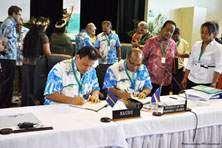
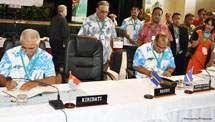
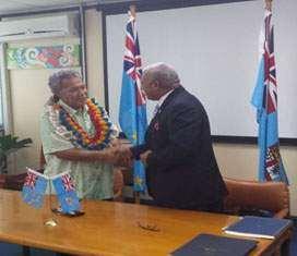
8 Maritime Boundaries Bilateral Treaties 2012 To Date NIUE & COOK IS KIRIBATI & COOK IS KIRIBATI & TUVALU KIRIBATI & TOKELAU KIRIBATI & NAURU NAURU & MARSHALL IS KIRIBATI & MARSHALL IS KIRIBATI NAURU-MARSHALL IS TUVALU & FIJI 8 VANUATU & SOLOMON IS

9 Treaty Statistics & Map No. of treaties signed 32 No. of treaties to be signed 13 9
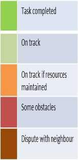
10 Maritime boundaries work 10
11 Extended Continental Shelf Submission Country Cook Islands Ongtong Java Joint submission Fiji Fiji Nth Fiji Basin Kiribati Palau Palau additional area Solomon Is. East Solomon Is. Nth Fiji Basin PNG-FSM Massau Submission completed/lodged Presented to CLCS Sub-commission elected Submission defence In progress In progress Recommendations PNG-FSM Eurapick Tonga Tonga West Tonga East Tuvalu -NZ- France Vanuatu Nth Fiji Basin 11
12 Why is it important? The clear definition of the limits of the maritime jurisdiction is important as it provides the legal framework for the governance of maritime space and the management of the valuable marine resources within the country s national jurisdiction areas: Fisheries management Deep sea minerals development Security Biodiversity Conservation Research Transport Vessel monitoring 12
13 Constraints Policies Political will of National Governments (17 years of project establishment at SPC) National Maritime Laws and Legislation needs to be reviewed and updated to reflect the technical datasets being used to develop the baselines and maritime zones. Resources & Priorities Member states - working with limited resources and different government priorities. There are certain technical and legal capacity constraints within the project teams (trained staff get promoted internally) 13
14 Constraints.(cont) The 10 project states who have submitted their claims for Extended Continental Shelf (under Article 76 of UNCLOS) are facing capacity constraints in the process of the defence of the these claims to the UN. Official Boundaries vs Provisional Boundaries. 14


15 Official Boundaries VS Provisional Boundaries Cook Islands Official Boundary 1km Current VMS EEZ 6km 2km 15
 36km")

16 Kiribati (Line Island Group) 36km Official EEZ 11km 4km Current VMS EEZ 16


17 Emerging Opportunities FSM, Normwin Charts World View II 17


18 Emerging Opportunities.cont Offset Offset 2013 Landset Image Pikelot, FSM World View II Adjusted Baseline 18


19 Emerging Opportunities (cont) 2012 LandSat of Samoa 2015 LIDAR of Samoa 19

20 Emerging Opportunities (cont) Extracted contour Adjusted boundary 20
21 Service Level Agreement with FFA
 to be updated with publicly available and legislated boundaries for the purpose of fisheries")


22 The 2016 SLA underlined the need for the maritime zones lines in the Pacific Islands Forum Fisheries Agency (FFA) Vessel Monitoring System (VMS) to be updated with publicly available and legislated boundaries for the purpose of fisheries monitoring, control, surveillance and enforcement and management. Data delivered will be based on IHO S-121 Maritime Limits and Boundaries Exchange format and will be disseminated via OGC web services in PacGeo portal Full documentation, tools and processes on maritime boundaries i.e. updates and revisions with incorporation of new datasets Features delivered to FFA will be in points, lines and polygons Global dataset(vliz) will be used where there is no treaty or data available

23 Vessel Monitoring System
 Increasing reports of IUU fishing activities in the region Leaders need to formally establish their maritime boundaries")
24 Future Challenges (cont.) Increasing reports of IUU fishing activities in the region Leaders need to formally establish their maritime boundaries (including signed treaties for overlapping EEZs) in a legal manner and deposit this information with the UN.
 Deep Sea Mining Implications Application")

25 Future Challenges.(cont.) Deep Sea Mining Implications Application and approval of mining leases for seabed exploration and exploitation within a country s EEZ and also in the Area

26 Future Challenges Climate Change Sea Level rise and Shifting Maritime Jurisdiction Limits
27 Thank you Malakai Vakautawale 27
Pacific Islands Regional Maritime Boundaries Project
 Pacific Islands Regional Maritime Boundaries Project Presented By Filimoni Yaya (Andrick Lal, Sachindra Singh, Emily Artack) Geoscience Division Pacific Community (SPC Geoscience Division, GSD STAR Sessions,
Pacific Islands Regional Maritime Boundaries Project
 Pacific Islands Regional Maritime Boundaries Project 31 st Star Conference, Nadi, FIJI 6-8 June 2016 Jens Kruger Head of Ocean & Coastal Geoscience Sector Andrick Lal Project Officer (Surveying) Emily
Briefing document of the status of maritime boundaries in Pacific island countries
 Secretariat of the Pacific Community Seventh Heads of Fisheries Meeting (28 Feb. 4 March 2011, Noumea, New Caledonia) Working Paper 5 Original: English Briefing document of the status of maritime boundaries
Pacific Geospatial and Surveying Council (PGSC) Geospatial and GNSS CORS Infrastructure Forum. Kuala Lumpur October
 Geospatial and GNSS CORS Infrastructure Forum. Kuala Lumpur October") Pacific Geospatial and Surveying Council (PGSC) Geospatial and GNSS CORS Infrastructure Forum. Kuala Lumpur 16-17 October Beginning and Progress Members PGSC Charter PGSC Strategy 2017-2027 Meetings Geodetic
Pacific Geospatial and Surveying Council (PGSC) Geospatial and GNSS CORS Infrastructure Forum. Kuala Lumpur 16-17 October Beginning and Progress Members PGSC Charter PGSC Strategy 2017-2027 Meetings Geodetic
Niue Maritime Boundaries Delimitation Project. Christchurch FIGMM
 Niue Maritime Boundaries Delimitation Project Christchurch FIGMM 30 th April 6 th May 2016 Hubert Mana Kalauni Secretary for Justice Department of Justice, Lands and Survey Ministry of Social Services
Deep Sea Minerals in the Pacific Islands Region: Occurrence, Potential and Case Studies`
 Deep Sea Minerals in the Pacific Islands Region: Occurrence, Potential and Case Studies` 1st DSM Project Regional Workshop 6th 8th June 2011 Tanoa International Hotel Nadi, Fiji Akuila Tawake SPC/SOPAC
THIRD MEETING OF THE PACIFIC METEOROLOGICAL COUNCIL. Theme: "Sustainable Weather and Climate Services for a Resilient Pacific "
 PMC-3/InformationPaper-1-Provisional Agenda THIRD MEETING OF THE PACIFIC METEOROLOGICAL COUNCIL Theme: "Sustainable Weather and Climate Services for a Resilient Pacific " 20-23 July 2015 Fa'onelua Convention
Requirement for Hydrographic Surveying and Nautical Charting for Small Island Developing States within the South West Pacific Region
 Requirement for Hydrographic Surveying and Nautical Charting for Small Island Developing States within the South West Pacific Region John Maschke September 2013 Overview Welcome Introduction Current Situation
Clive Schofield * and David Freestone **
 Holding Back the Waves: Options to Secure Maritime Jurisdictional Claims in the Face of Sea Level Rise Clive Schofield * and David Freestone ** *Australian National Centre for Ocean Resources and Security
Chapter 12: Pacific Realm and Polar Futures
 Geography: Realms, Regions and Concepts 15 th Edition By de Blij and Muller Chapter 12: Pacific Realm and Polar Futures Defining the Realm Sea Hemisphere: seas covering nearly an entire hemisphere Fragmented,
Slide 1 Geography: Realms, Regions, and Concepts 15 th Edition. Slide 2. Slide 3 Defining the Realm. Chapter 12: Pacific Realm and Polar Futures
 Slide 1 Geography: Realms, Regions, and Concepts 15 th Edition Chapter 12: Pacific Realm and Polar Futures Slide 2 Slide 3 Defining the Realm Sea Hemisphere: seas cover nearly an entire hemisphere: Fragmented,
Deep Sea Minerals in the Pacific Islands region: Status, Challenges and Opportunities
 Deep Sea Minerals in the Pacific Islands region: Status, Challenges and Opportunities Pacific Mining Symposium Noumea, New Caledonia 21 st 25 th November 2011 Akuila Tawake SOPAC Division Secretariat of
Country Report Vanuatu
 Country Report Vanuatu Ministry Infrastructure and Public Utilities. Application of Space Technology and the Geographic information system for DRR and Sustainable Development 18 th 22 nd December 2012
Faatasi Malologa (PGSC Chair) Director Department of Lands & Survey, Tuvalu
 Director Department of Lands & Survey, Tuvalu") Seventh Session of the United Nations Committee of Experts on Global Geospatial Information Management (UN-GGIM) - 31 July -4 August 2017 Faatasi Malologa (PGSC Chair) Director Department of Lands & Survey,
Seventh Session of the United Nations Committee of Experts on Global Geospatial Information Management (UN-GGIM) - 31 July -4 August 2017 Faatasi Malologa (PGSC Chair) Director Department of Lands & Survey,
Maritime Boundary Negotiations National Considerations Dr. Robert W. Smith
 Maritime Boundary Negotiations National Considerations Dr. Robert W. Smith ABLOS: ADDRESSING DIFFICULT ISSUES IN UNCLOS 28 OCTOBER 2003 Practical Steps in the Negotiating Process 1. The Delimitation Process
Current status of operations of Pacific Islands Climate Outlook Forum (PICOF) Alexander Montoro Technical Expert on Climate and Weather Services
 Alexander Montoro Technical Expert on Climate and Weather Services") Current status of operations of Pacific Islands Climate Outlook Forum (PICOF) Alexander Montoro Technical Expert on Climate and Weather Services Secretariat of the Pacific Regional Environment Programme
Current status of operations of Pacific Islands Climate Outlook Forum (PICOF) Alexander Montoro Technical Expert on Climate and Weather Services Secretariat of the Pacific Regional Environment Programme
MAPS AND COORDINATES...
 Table of Contents 1 INTRODUCTION... 2 2 MAPS AND COORDINATES... 3 3 ADVISORY ASSISTANCE FROM COMMISSION MEMBERS... 3 4 PROVISIONS OF ARTICLE 76 INVOKED... 3 5 OUTSTANDING MARITIME DELIMITATIONS... 4 6
JOINT SUBMISSION TO THE COMMISSION ON THE LIMITS OF THE CONTINENTAL SHELF BY TUVALU, THE REPUBLIC OF FRANCE AND NEW ZEALAND (TOKELAU)
") JOINT SUBMISSION TO THE COMMISSION ON THE LIMITS OF THE CONTINENTAL SHELF BY TUVALU, THE REPUBLIC OF FRANCE AND NEW ZEALAND (TOKELAU) TABLE OF CONTENTS i. PREFACE... iii ii. LIST OF FIGURES... iv iii.
JOINT SUBMISSION TO THE COMMISSION ON THE LIMITS OF THE CONTINENTAL SHELF BY TUVALU, THE REPUBLIC OF FRANCE AND NEW ZEALAND (TOKELAU) TABLE OF CONTENTS i. PREFACE... iii ii. LIST OF FIGURES... iv iii.
MARITIME PLANNING IN PORTUGAL
 MARITIME PLANNING IN PORTUGAL Marta Chantal Ribeiro 2 May 2007 In Portugal there is currently no strategic planning system in force for the maritime area as a whole The maritime area under Portuguese jurisdiction
Areas Beyond National Jurisdiction (ABNJ) 2016 Regional Leaders Program. March 22 to April 1, 2016 United Nations, New York
 2016 Regional Leaders Program. March 22 to April 1, 2016 United Nations, New York") Areas Beyond National Jurisdiction (ABNJ) 2016 Regional Leaders Program March 22 to April 1, 2016 United Nations, New York Welcome and Introductions Biliana Cicin-Sain President, Global Ocean Forum Vladimir
Areas Beyond National Jurisdiction (ABNJ) 2016 Regional Leaders Program March 22 to April 1, 2016 United Nations, New York Welcome and Introductions Biliana Cicin-Sain President, Global Ocean Forum Vladimir
Monitoring Surveys PSLMP COSPPac
 Monitoring Surveys PSLMP COSPPac Andrick Lal, Marika Kalouniviti & Veenil Rattan Science, Technology And Resources (STAR) Conference 26 th 29 th June 2017 Nadi FIJI Geodetic Survey Unit (SPC) Andrick Lal,
OUTER CONTINENTAL SHELF CLAIMS IN THE ARCTIC. Presentation given by Dr. Kamrul Hossain ASA University Bangladesh 15 March 2010
 OUTER CONTINENTAL SHELF CLAIMS IN THE ARCTIC Presentation given by Dr. Kamrul Hossain ASA University Bangladesh 15 March 2010 Contents Historical background of the continental shelf Concept of continental
EXECUTIVE SUMMARY A SUBMISSION OF DATA AND INFORMATION ON THE OUTER LIMITS OF THE CONTINENTAL SHELF OF THE REPUBLIC OF NIGERIA PURSUANT TO
 EXECUTIVE SUMMARY A SUBMISSION OF DATA AND INFORMATION ON THE OUTER LIMITS OF THE CONTINENTAL SHELF OF THE REPUBLIC OF NIGERIA PURSUANT TO PART VI OF AND ANNEX II TO THE UNITED NATIONS CONVENTION ON THE
STATUS OF MARINE SPATIAL DATA INFRASTRUCTURE
 STATUS OF MARINE SPATIAL DATA INFRASTRUCTURE IN PACIFIC ISLAND COUNTRIES 26 th January, 2016 7 th IHO Marine Spatial Data Infrastructure Working Group Meeting Tokyo Sachindra Singh Senior Geospatial Systems
Marine/Maritime Spatial Planning Andrej Abramić
 Marine/Maritime Spatial Planning Andrej Abramić EcoAqua SUMMER SCHOOL: Ecosystem approach to aquaculture 26-29th of October 2015 Research and Technology to enhance excellence in Aquaculture development
Remember we are not managing the ocean, but the behavior of the people who use the ocean!
 TOWARDS INTEGRATED NATIONAL OCEAN POLICY IN THE SOUTH PACIFIC: Solomon Islands. Competing & Conflicting Issues in Ocean Policy Rudolf H. Dorah UN-The Nippon of Japan Foundation Fellow (2006-07 Remember
NUKU ALOFA MINISTERIAL DECLARATION For SUSTAINABLE WEATHER AND CLIMATE SERVICES FOR A RESILIENT PACIFIC. 24th July 2015, Nuku alofa, Tonga
 NUKU ALOFA MINISTERIAL DECLARATION For SUSTAINABLE WEATHER AND CLIMATE SERVICES FOR A RESILIENT PACIFIC 24th July 2015, Nuku alofa, Tonga The First Pacific Ministerial Meeting on Meteorology was held on
Linking Global and Regional Levels in the Management of Marine Areas Beyond National Jurisdiction
 Linking Global and Regional Levels in the Management of Marine Areas Beyond National Jurisdiction South Atlantic Region Session 4: «Experiences, Priorities and Opportunities in the South Atlantic and Indian
Community based approaches to natural resource management governance and the role of government
 Community based approaches to natural resource management governance and the role of government Hugh Govan LMMA Network Content A challenge An opportunity Recent progress in (M)PA development A workable
Tsunami Response and the Enhance PTWC Alerts
 Tsunami Response and the Enhance PTWC Alerts Ken Gledhill GeoNet Project Director Chair, Intergovernmental Coordination Group, Pacific Tsunami Warning and Mitigation System (PTWS) Overview 1. Procedures
CONFERENCE OF PARLIAMENTARIANS OF THE ARCTIC REGION. UN LOS Convention and the extended continental shelf in the Arctic
 CONFERENCE OF PARLIAMENTARIANS OF THE ARCTIC REGION UN LOS Convention and the extended continental shelf in the Arctic Presentation given by Dr. Kamrul Hossain Finnish Parliament 18 November 2009 Contents
HONIARA MINISTERIAL STATEMENT For STRENGTHENING SUSTAINABLE WEATHER, CLIMATE, OCEAN AND WATER SERVICES FOR A RESILIENT PACIFIC
 HONIARA MINISTERIAL STATEMENT For STRENGTHENING SUSTAINABLE WEATHER, CLIMATE, OCEAN AND WATER SERVICES FOR A RESILIENT PACIFIC 18 August 2017, Honiara, Solomon Islands 1. The Second Pacific Ministerial
COMPLICATIONS IN DELIMITING THE OUTER CONTINENTAL SHELF. Ron Macnab Geological Survey of Canada (Retired)
") COMPLICATIONS IN DELIMITING THE OUTER CONTINENTAL SHELF Ron Macnab Geological Survey of Canada (Retired) DISCLAIMER The contents of this presentation are the author s personal views only, and do not represent
COMPLICATIONS IN DELIMITING THE OUTER CONTINENTAL SHELF Ron Macnab Geological Survey of Canada (Retired) DISCLAIMER The contents of this presentation are the author s personal views only, and do not represent
Economic and Social Council
 United Nations Economic and Social Council Distr.: General 18 July 2016 Original: English Committee of Experts on Global Geospatial Information Management Sixth session New York, 3-5 August 2016 Item 2
The Contribution of Hydrographic Charting to the Resolution and Portrayal of Offshore Property and Jurisdictional Boundaries.
 The Contribution of Hydrographic Charting to the Resolution and Portrayal of Offshore Property and Jurisdictional Boundaries. Susan Nichols, Geodesy and Geomatics Engineering, University of New Brunswick
Applied Geoscience and Technology Division SOPAC. Joy Papao, Risk Information Systems Officer
 Joy Papao, Risk Information Systems Officer Secretariat of the Pacific Community SPC 22 Pacific Island States Head office in Noumea, New Caledonia 2 Regional offices (Pohnpei and Honiara) 600 staff 9 Technical
A Pacific Regional Economics of Climate Change Study: Assessing adaptation needs in Small Island Developing States
 Regional Economics of Climate Change: Practitioners Workshop 4-5 March 2009 Washington, DC, USA A Pacific Regional Economics of Climate Change Study: Assessing adaptation needs in Small Island Developing
Mortality Rates of Dengue Fever and Dengue Haemorrhagic Fever (DF/DHF) in the Western Pacific Region,
 in the Western Pacific Region,") Mortality Rates of Dengue Fever and Dengue Haemorrhagic Fever (DF/DHF) in the Western Pacific Region, 2000-2010 Acknowledgement Improved data gathering, reporting and surveillance are key to dengue outbreak
Mortality Rates of Dengue Fever and Dengue Haemorrhagic Fever (DF/DHF) in the Western Pacific Region, 2000-2010 Acknowledgement Improved data gathering, reporting and surveillance are key to dengue outbreak
Cross-Border Infrastructure Connectivity: Needs, Facts and Challenges
 Cross-Border Infrastructure Connectivity: Needs, Facts and Challenges Matthias Helble Research Economist Asian Development Bank Institute Financing Quality Infrastructure 19-20 December, 2016 Contents
Incidence Rates of Dengue Fever and Dengue Haemorrhagic Fever (DF/DHF) in the Western Pacific Region,
 in the Western Pacific Region,") Incidence Rates of Dengue Fever and Dengue Haemorrhagic Fever (DF/DHF) in the Western Pacific Region, 2004-2010 Acknowledgement Improved data gathering, reporting and surveillance are key to dengue outbreak
Incidence Rates of Dengue Fever and Dengue Haemorrhagic Fever (DF/DHF) in the Western Pacific Region, 2004-2010 Acknowledgement Improved data gathering, reporting and surveillance are key to dengue outbreak
Natura 2000 in the marine environment: state of implementation and next steps
 Life on the blue planet: biodiversity research and the new European marine policies EPBRS European Platform on Biodiversity Research Strategy Porto, Portugal 7-9 November 2007 Natura 2000 in the marine
Australia Government Geospatial Capacity Building Efforts in Asia and the Pacific. Dr John Dawson
 Australia Government Geospatial Capacity Building Efforts in Asia and the Pacific Dr John Dawson Presentation Overview About Geoscience Australia Examples of Geospatial Capacity Building Activity Geodesy
Sam Bateman and. State Practice Regarding Straight Baselines In East Asia Legal, Technical and Political Issues in a
 State Practice Regarding Straight Baselines In East Asia Legal, Technical and Political Issues in a Changing Environment Sam Bateman and Clive Schofield The Australian National Centre for Ocean Resources
Status, progress and challenges in application of space technology and GIS for disaster risk reduction in the Pacific
 Status, progress and challenges in application of space technology and GIS for disaster risk reduction in the Pacific Mr. Sunny Seuseu Climate Prediction Services Coordinator Outline 1. What is SPREP?
CONTINENTAL SHELF SUBMISSION OF ANGOLA - EXECUTIVE SUMMARY -
 CONTINENTAL SHELF SUBMISSION OF ANGOLA - EXECUTIVE SUMMARY - INDEX List of Figures 2 List of Tables 3 1 Introduction 5 2 Provisions of Article 76 7 3 Angolan Institutions responsible for the Submission
Assisting Countries in the Collection and Analysis of National Statistics
 Assisting Countries in the Collection and Analysis of National Statistics Peter O. Way, Ph.D., Chief International Programs Center U.S. Census Bureau Censuses in the 21 st Century: Improving Data Utilization
Reference Frame in Practice Workshop 1A
 Reference Frame in Practice Workshop 1A Status of Geodetic Infrastructure in the Pacific Region Case Studies Rob Sarib - FIG Commission 5 Vice Chair of Administration Welcome! Bula! Who are the International
Indonesia s Internal Maritime Boundaries
 University of Wollongong-Lecture in Boundaries, November 2005 Indonesia s Internal Maritime Boundaries 1 Lecture Outline Indonesia's internal maritime boundaries Law no. 22/1999 --> Law no. 32/2004 Technical
PACIFIC ISLANDS APPLIED GEOSCIENCE COMMISSION
 PACIFIC ISLANDS APPLIED GEOSCIENCE COMMISSION MARINE SURVEY AND MAPPING ACTIVITIES, 2009-2010 SOPAC Report to the South West Pacific Hydrographic Commission (SWPHC) 10 th IHO SWPHC Conference, Honiara,
NOAA Nautical Charts and Coastal and Marine Spatial Planning. Meredith Westington Chief Geographer NOAA/NOS/Office of Coast Survey
 NOAA Nautical Charts and Coastal and Marine Spatial Planning Meredith Westington Chief Geographer NOAA/NOS/Office of Coast Survey Ocean Policy Task Force What is CMSP? A comprehensive, adaptive, integrated,
Deep-sea Mining: The Basics. Overview. A fact sheet from June 2018
 A fact sheet from June 2018 Deep-sea Mining: The Basics NOAA Office of Ocean Exploration and Research Overview The deepest parts of the world s ocean feature ecosystems found nowhere else on Earth. They
Valuing and conserving the benefits of marine biodiversity in the South Pacific
 Valuing and conserving the benefits of marine biodiversity in the South Pacific Five years of support for integrated ocean governance in Pacific Island Countries 2 We are the sea, we are the ocean we must
Nineteenth SPREP Meeting
 Page 1 SECRETARIAT OF THE PACIFIC REGIONAL ENVIRONMENT PROGRAMME Nineteenth SPREP Meeting Pohnpei, Federated States of Micronesia 04 12 September 2008 Agenda Item 9.2.5: Regional Meteorological Services
Oceans in transition
 Oceans governance Oceans in transition OECD: Ocean industry value-added projected to double by 2030 from ~USD 1.5 to 3.0 trillion However, meeting anticipated demand for ocean space and resources will
Underwater Parks: Three Case Studies, and a Primer on Marine Boundary Issues. Robert E. Johnson Leland F. Thormahlen
 Robert E. Johnson Leland F. Thormahlen Underwater Parks: Three Case Studies, and a Primer on Marine Boundary Issues Unlike boundaries on land, most marine boundaries are not marked with monuments or fences.
EXECUTIVE SUMMARY A PARTIAL SUBMISSION OF DATA AND INFORMATION ON THE OUTER LIMITS OF THE CONTINENTAL SHELF OF THE KINGDOM OF TONGA PURSUANT TO
 EXECUTIVE SUMMARY A PARTIAL SUBMISSION OF DATA AND INFORMATION ON THE OUTER LIMITS OF THE CONTINENTAL SHELF OF THE KINGDOM OF TONGA PURSUANT TO PART VI OF AND ANNEX II TO THE UNITED NATIONS CONVENTION
Capacity Development and ABNJ
 ABNJ Regional Leaders Program First Session Capacity Development and ABNJ Regional and National Perspectives Examples from Africa January 21, 2015 Conference Room 7, United Nations HQ New York, USA Outline
Deep Sea Minerals: A New Development Opportunity in the Pacific?
 Deep Sea Minerals: A New Development Opportunity in the Pacific? 3 rd SPC-EU DSM Project Regional Training Workshop Social Impacts of DSM Activities and Stakeholder Participation 10 th 14 th June 2013,
The Regional Integrated Multi-Hazard Early Warning System for Africa and Asia CAP in RIMES
 The Regional Integrated Multi-Hazard Early Warning System for Africa and Asia CAP in RIMES 2018 CAP Implementation Workshop OUTLINE 1. RIMES Overview 2. DSS tools developed in RIMES 3. CAP Integration
Seabed knowledge In support of UN SDGs
 Seabed knowledge In support of UN SDGs Evert Flier Fiskerifaglig forum 2. november 2017 Hydrography & small scale fishing Hydrography in Transition Serving the Maritime Community Hydrography in Transition
SCIENTIFIC COMMITTEE THIRTEENTH REGULAR SESSION
 SCIENTIFIC COMMITTEE THIRTEENTH REGULAR SESSION Rarotonga, Cook Islands 9-17 August 2017 TRENDS IN THE SOUTH PACIFIC ALBACORE LONGLINE AND TROLL FISHERIES WCPFC-SC13-2017/SA-WP-08 Stephen Brouwer 1, Graham
MARINE SPATIAL PLANNING & MARINE CADASTRE: CHALLENGES AND ISSUES
 MARINE SPATIAL PLANNING & MARINE CADASTRE: CHALLENGES AND ISSUES Roger Longhorn Secretary General, GSDI Association rlonghorn@gsdi.org Member, IHO Marine SDI Working Group ral@alum.mit.edu Member, UNESCO
Item 9.1 The Pacific Meteorological Desk Partnership (PMDP) Salesa Nihmei and Alex Montoro SPREP
 Salesa Nihmei and Alex Montoro SPREP") 1993 RMSD-1 Item 9.1 The Pacific Meteorological Desk Partnership (PMDP) Salesa Nihmei and Alex Montoro SPREP Content Who/what is the PMDP Partnerships The Pacific Met. Strategy Pacific Meteorological
1993 RMSD-1 Item 9.1 The Pacific Meteorological Desk Partnership (PMDP) Salesa Nihmei and Alex Montoro SPREP Content Who/what is the PMDP Partnerships The Pacific Met. Strategy Pacific Meteorological
Maritime Spatial Planning Framework Directive Supported by INSPIRE
 Maritime Spatial Planning Framework Directive Supported by INSPIRE Andrej Abramić, Vanda Nunes de Lima, Paul Smits, Emanuele Bigagli, Chris Schubert European Commission Joint Research Centre Institute
Pacific Oceanscape Vision:
 Oceania is vast, Oceania is expanding, Oceania is hospitable and generous, Oceania is humanity rising from the depths of brine and regions of fire deeper still, Oceania is us. We are the sea, we are the
Climate Forecasting the Southwest Pacific experience. Dr Jim Salinger, National Institute of Water and Atmospheric Research, Auckland, New Zealand
 Climate Forecasting the Southwest Pacific experience Dr Jim Salinger, National Institute of Water and Atmospheric Research, Auckland, New Zealand Climate Prediction in the South Pacific The Island Climate
State Practice on the Establishment of Multiple Maritime Boundaries: Assessing the Challenges of Separating Seabed and Water Column Boundaries
 State Practice on the Establishment of Multiple Maritime Boundaries: Assessing the Challenges of Separating Seabed and Water Column Boundaries Professor Clive Schofield The Australian National Centre for
Panel III: Islands and Rocks:
 KMI, COLP, and NILOS Conference on Globalization and the Law of the Sea Panel III: Islands and Rocks: How Much Can a Rock Get? A Reflection from the Okinotorishima Rocks 1-3 December 2010 Marriot Metro
Executive Summary and Recommendations
 ANNEX I: EXECUTIVE SUMMARY AND RECOMMENDATIONS OF THE 12RMSD TWELFTH REGIONAL MEETING OF THE METEOROLOGICAL SERVICE DIRECTORS 30 -JUNE to 6 -JULY 2007 Rarotonga, Cook Islands Executive Summary and Recommendations
Use of GIS and Remote Sensing for risk assessment related to climate change in the Pacific
 Use of GIS and Remote Sensing for risk assessment related to climate change in the Pacific Professor Lalit Kumar University of New England, Armidale NSW AUSTRALIA Two parts to this presentation Developing
THE CURRENT STATUS OF MAPPING IN THE WORLD - SPOTLIGHT ON PACIFIC ISLANDS
 THE CURRENT STATUS OF MAPPING IN THE WORLD - SPOTLIGHT ON PACIFIC ISLANDS John C. Trinder School of Civil and Environmental Engineering, UNSW SYDNEY NSW 2052, Australia (j.trinder@unsw.edu.au) Commission
Ocean Governance and the Japanese Basic Act on Ocean Policy
 Ocean Governance and the Japanese Basic Act on Ocean Policy Hiroshi Terashima Executive Director Ocean Policy Research Foundation 14 April 2009 The United Nations Nippon Foundation Fellowship Programme
Pacific Islands Climate Outlook Forum (PICOF) Status Report (Survey) Prepared by: Secretariat of the Pacific Regional Environment Programme (SPREP)
 Status Report (Survey) Prepared by: Secretariat of the Pacific Regional Environment Programme (SPREP)") Pacific Islands Climate Outlook Forum (PICOF) Status Report (Survey) Prepared by: Secretariat of the Pacific Regional Environment Programme (SPREP) Annotated Outline Specific Climate features of concerned
Pacific Islands Climate Outlook Forum (PICOF) Status Report (Survey) Prepared by: Secretariat of the Pacific Regional Environment Programme (SPREP) Annotated Outline Specific Climate features of concerned
DELIMITATION OF THE MOZAMBIQUE MARITIME BOUNDARIES WITH NEIGHBORING STATES (INCLUDING THE EXTENDED CONTINENTAL SHELF) AND MANAGEMENT OF OCEAN ISSUES
 AND MANAGEMENT OF OCEAN ISSUES") DELIMITATION OF THE MOZAMBIQUE MARITIME BOUNDARIES WITH NEIGHBORING STATES (INCLUDING THE EXTENDED CONTINENTAL SHELF) AND MANAGEMENT OF OCEAN ISSUES Elisio B. Jamine United Nations The Nippon Fellowship
DELIMITATION OF THE MOZAMBIQUE MARITIME BOUNDARIES WITH NEIGHBORING STATES (INCLUDING THE EXTENDED CONTINENTAL SHELF) AND MANAGEMENT OF OCEAN ISSUES Elisio B. Jamine United Nations The Nippon Fellowship
Ocean governance in Samoa: A case study of ocean governance in the South Pacific
 Ocean governance in Samoa: A case study of ocean governance in the South Pacific Anama Solofa UN-Nippon Nippon Foundation of Japan Fellowship 2009-2010 2010 Outline: I. Ocean governance in the South Pacific
Item 10.1 The Pacific Meteorological Desk Partnership (PMDP) Henry Taiki (PMDP) WMO
 Henry Taiki (PMDP) WMO") Item 10.1 The Pacific Meteorological Desk Partnership (PMDP) Henry Taiki (PMDP) WMO Content Who/what is the PMDP Partnerships Pacific Meteorological Council and Ministerial Meeting outcomes Activities/Projects
Item 10.1 The Pacific Meteorological Desk Partnership (PMDP) Henry Taiki (PMDP) WMO Content Who/what is the PMDP Partnerships Pacific Meteorological Council and Ministerial Meeting outcomes Activities/Projects
World Oceans Day 2010 Our oceans: opportunities and challenges
 World Oceans Day 2010 Our oceans: opportunities and challenges Roundtable discussion on the United Nations Convention on the Law of the Sea fifteen years after its entry into force HOW EFFECTIVELY IS UNCLOS
Marine Spatial Planning in the Baltic Sea Region
 Marine Spatial Planning in the Baltic Sea Region Towards coherence and cross-border solutions in Baltic Maritime Spatial Plans Coordinator & Project manager Dr Ingela Isaksson Swedish Agency for Marine
1. Baltic SCOPE Towards coherence and cross-border solutions in Baltic Maritime Spatial Plans
 NSHC 32th Conference Explanatory Note Dublin, Ireland Item E.2 MSP 21-23 June 2016 Germany Cross border MSP for the EEZ, a case study from the Baltic Sea The Federal Maritime and Hydrographic Agency of
A National Ocean Policy for Malaysia: Rationale and Proposed Components. Mohd Nizam Basiron and Cheryl Rita Kaur Maritime Institute of Malaysia
 A National Ocean Policy for Malaysia: Rationale and Proposed Components Mohd Nizam Basiron and Cheryl Rita Kaur Maritime Institute of Malaysia Outline of Presentation Objectives of Presentation Introduction
Options in Capacity Building. Underpinning the Blue Economy. Slide 1/78. Derrick R. Peyton. 14 th MACHC Meeting. IIC Technologies. December 9-13, 2013
 Options in Capacity Building Underpinning the Blue Economy Derrick R. Peyton IIC Technologies 14 th MACHC Meeting December 9-13, 2013 Slide 1/78 Overview Blue Economy Defined Challenges (SDI, MSDI, Standards)
Stewardship of the Central Arctic Ocean: The Arctic 5 versus the international community
 Stewardship of the Central Arctic Ocean: The Arctic 5 versus the international community The Central Arctic Ocean Ilulissat Declaration 2008 By virtue of their sovereignty, sovereign rights and jurisdiction
JMA s Cooperation with
 JMA s Cooperation with the Pacific Island Countries (PICs) Tomoyuki KITAMURA Japan Meteorological Agency Bali, Indonesia, 7 March 2018 Contents Background Steps to issue weather forecast/warning JMA s
The Danish Maritime Spatial Data Infrastructure (MSDI) Geodata of the Sea
 Geodata of the Sea") MSDI/MSP The Danish Maritime Spatial Data Infrastructure (MSDI) Geodata of the Sea Components of an infrastructure: DATA - metadata, datasets FUNCTIONALITY - spatial data services, web services and other
MSDI/MSP The Danish Maritime Spatial Data Infrastructure (MSDI) Geodata of the Sea Components of an infrastructure: DATA - metadata, datasets FUNCTIONALITY - spatial data services, web services and other
The Efforts of Building GIS Infrastructure in a Newly Independent State: The case of Timor Leste *
 UNITED NATIONS E/CONF.100/IP.12 ECONOMIC AND SOCIAL COUNCIL Eighteenth United Nations Regional Cartographic Conference for Asia and the Pacific Bangkok, 26-29 October 2009 Item 7(b) of the provisional
EXPERIENCES, PRIORITIES AND OPPORTUNITIES IN THE SOUTH EAST PACIFIC
 WORKSHOP ON LINKING GLOBAL AND REGIONAL LEVELS IN THE MANAGEMENT OF MARINE AREAS BEYOND NATIONAL JURISDICTION EXPERIENCES, PRIORITIES AND OPPORTUNITIES IN THE SOUTH EAST PACIFIC CN JULIÁN AUGUSTO REYNA
Spatial Data Infrastructure in the Pacific
 Spatial Data Infrastructure in the Pacific. Sachindra Singh Senior Geospatial Systems Architect ICT for Development, Geoscience Division Pacific Community (SPC) OrganisationalBackground SPC - The Pacific
Why do we need a global framework for MPAs in ABNJ? Kristina M. Gjerde IUCN High Seas Policy Advisor
 Why do we need a global framework for MPAs in ABNJ? Kristina M. Gjerde IUCN High Seas Policy Advisor kgjerde@eip.com.pl 40% ocean heavily affected by humans (c) Halpern et al. 2008. Scientists found that
IMA s ROLE IN COASTAL AND OCEAN GOVERNANCE IN TRINIDAD AND TOBAGO
 IMA s ROLE IN COASTAL AND OCEAN GOVERNANCE IN TRINIDAD AND TOBAGO Presented by Rahanna Juman, Deputy Director (Ag.) About the Institute of Marine Affairs Institute of Marine Affairs (IMA) was established,
Article 76, variations in annotation and implementation seen in submission documents for the claim of Extended Continental Shelf
 Article 76, variations in annotation and implementation seen in submission documents for the claim of Extended Continental Shelf Mr. Shin Tani Chairman, IHO/IAG Advisory Board on the Law of the Sea (ABLOS)
2018/1 The integration of statistical and geospatial information. The Regional Committee of UN-GGIM: Americas:
 The following are the conclusions and recommendations of the Regional Committee of the United Nations on Global Geospatial Information Management for the Americas, during its Fifth Session, Thursday 8
UNEP Regional Seas Programme
 Module8 Authorities and Processes Related to ABNJ at the Regional Level: Experiences and Lessons Learnt UNEP Regional Seas Programme Kanako Hasegawa Associate Programme Officer UNEP Regional Seas Coordination
Ocean & Islands Programme May 2007
 1 st RIF level trilateral May 2007 PIROP Pacific Island Regional Ocean Policy & Strategic Action Plan 5 Guiding Principles of PIROP 1. Improving our understanding of the ocean. 2. Sustainably developing
Lorna V Inniss, Ph.D SAGE Workshop, New York City
 Lorna V Inniss, Ph.D SAGE Workshop, New York City 2014-05-21 Why me? The globally recognized success of the Barbados ICZM programme has generated requests for technical assistance and CD from many Governments
Coastal Mapping Follow on? Bruno Frachon Corine Lochet Gaël Morvan
 Coastal Mapping Follow on? Bruno Frachon Corine Lochet Gaël Morvan Shared objectives; IHO DG MARE CPMR Development of a Joint European Coastal Mapping Programme (JECMaP) within the IHO EU network with
GIS, Charts and UNCLOS Can they live together?
 GIS, Charts and UNCLOS Can they live together? Bill Hirst 1 and David Robertson 2 Address 1 Geoscience Australia GPO Box 378 Canberra, ACT 2601 Phone: 02 6249 9741 Fax: 02 6249 9939 Email: Bill.Hirst@ga.gov.au
HAMILTON DECLARATION ON COLLABORATION FOR THE CONSERVATION OF THE SARGASSO SEA
 HAMILTON DECLARATION ON COLLABORATION FOR THE CONSERVATION OF THE SARGASSO SEA Hamilton, Bermuda 11 March, 2014 WE, THE SIGNATORIES LISTED BELOW: Recognising that the islands of Bermuda are the only land
Status & Challengers of Cook Islands GEO DRM. Cook Islands GEO S/GIS History
 Status & Challengers of Cook Islands GEO DRM By Patrick A. ARIOKA Planning & Advisory Officer EMERGENCY MANAGEMENT COOK ISLANDS Cook Islands GEO S/GIS History 1990 NZODA/MFAT trained by Landcare Research
Marine Geospatial Software: Generating Economic Benefits from Hydrographic Data and Calculation of Maritime Boundaries
 Marine Geospatial Software: Generating Economic Benefits from Hydrographic Data and Calculation of Serge LEVESQUE and Alexis CARDENAS, Canada Key words: marine geospatial data, hydrography, economic benefits,
TOWARDS CLIMATE-RESILIENT COASTAL MANAGEMENT: OPPORTUNITIES FOR IMPROVED ICZM IN BELIZE
 TOWARDS CLIMATE-RESILIENT COASTAL MANAGEMENT: OPPORTUNITIES FOR IMPROVED ICZM IN BELIZE CHANTALLE SAMUELS Coastal Zone Management Authority and Institute The Caribbean Community Climate Change Centre VULNERABILITY