Positioning in the Pacific Islands
|
|
|
- Marcus Ralph Carroll
- 5 years ago
- Views:
Transcription


1 Positioning in the Pacific Islands Andrick Lal United Nations/Nepal Workshop on the Applications of Global Navigation Satellite Systems Kathmandu - Nepal 15 th December 2016
2 Presentation Outline Introduction History Positioning in the Pacific Islands Importance Building Capacity & Resilience Future Directions Pacific Geospatial & Surveying Council

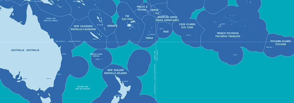
3 SPC Member Countries

4 SPC Geoscience Division Goal to apply geoscience and technology to realise new opportunities for improving livelihoods of Pacific communities. SPC Headquarters: Noumea. Regional Offices: Suva, Fiji Islands and Pohnpei, Federated States of Micronesia. Country Office: Honiara, Solomon Islands. For contact details Website:


5 Global Geodetic Reference Frame The UN-GGIM Roadmap In February 2015 the UN General Assembly adopted the resolution A Global Geodetic Reference Frame for Sustainable Development -the first resolution recognizing the importance of a globally-coordinated approach to geodesy. As per UN Resolution A/69/L.53 In the Pacific Australia, Fiji, New Zealand, Papua New Guinea, Samoa, Solomon Islands, Tuvalu, Vanuatu
6 Postioning Infrastructure underpins ALL Infrastructure
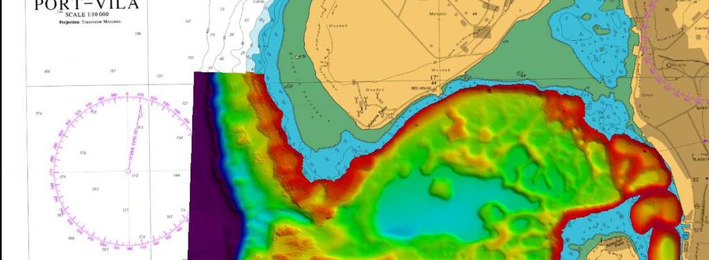
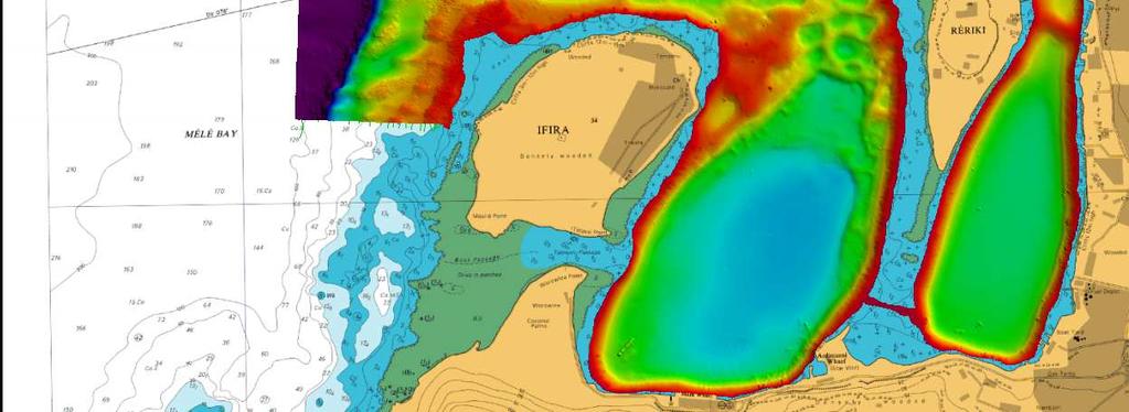
7 Topographical Maps and Hydrographic Charts
8 Pacific Sea Level Monitoring Project (PSLMP) The Pacific Sea Level Monitoring (PSLM), operates under the Climate and Oceans Support Program in the Pacific (COSPPac). It is a continuation of the 20-year South Pacific Sea Level and Climate Monitoring Project (SPSLCMP) Comprises of a tide gauge network component and geodetic monitoring component To monitor sea level over a long time period, vertical crustal movement of the earth needs to be accounted for, to provide an absolute reading from the tide gauge Geodetic monitoring component is maintained by Geoscience Australia Providing a long term height time series of data Consistent, accurate, global geocentric terrestrial reference frame ITRF2008 Meeting accuracy requirements to match the expected sea level rise determined from over a century previous global tide gauge measurements of 1mm/annum


9 Pacific Sea Level Monitoring Project Tide Gauge Station


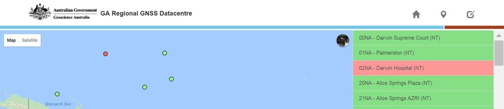
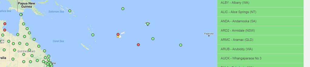
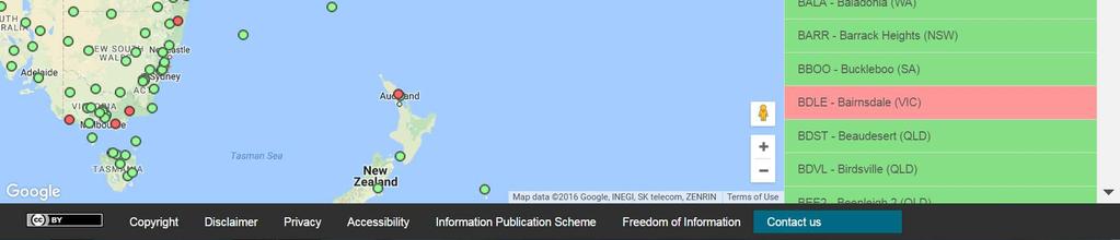
10 GNSS Station (CORS) Lautoka, Fiji. Established in November 2002; Supported by Survey Department - Fiji ftp://ftp.ga.gov.au/geodesy-outgoing/gnss/data/
11 13 sites across the pacific 1 x permanent tide gauge at each, measuring local sea level 1 x Constant GNSS station at each, measuring local earth movement in an absolute coordinate system Regular levelling survey between the tide gauge and CGNSS station allow absolute determination of the vertical height of the tide gauges that measure sea level
12
 Lautoka,")


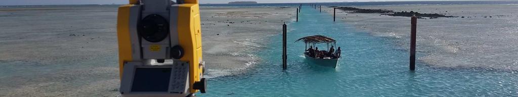
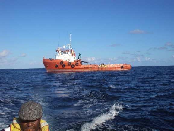
13 GNSS Station (CORS) Lautoka, Fiji. IGS Network


14 Online GNSS Solutions AUSPOS, OPUS, PositioNZ, Canadian PPP
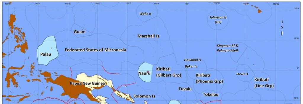
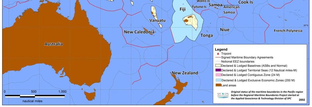


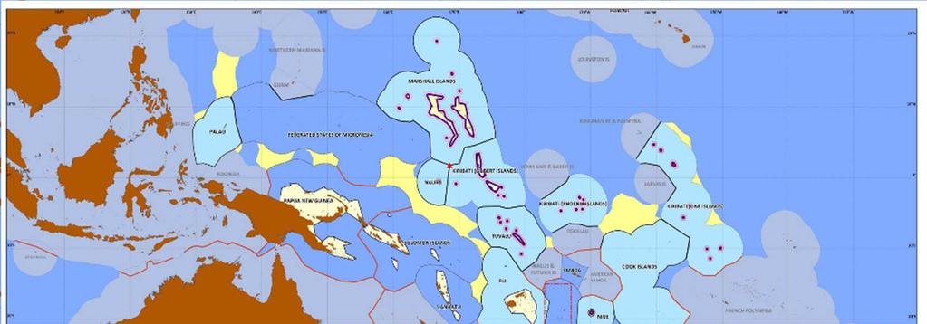
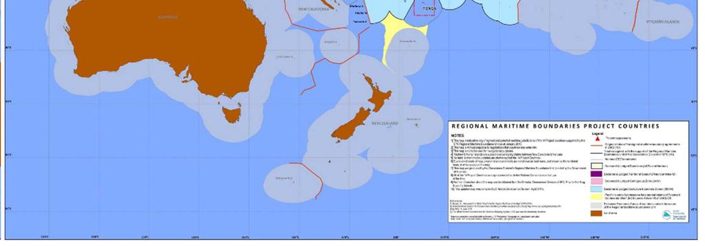
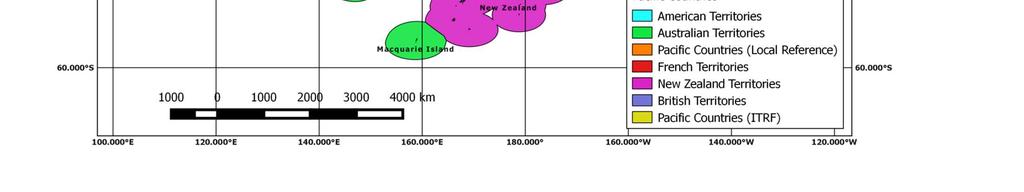
15 Maritime Boundaries of the Pacific Island Countries July 2002 Dec 2016


16 Geodetic Reference Frame - Pacific

17 Tonga Geodetic Reference TGD2005

18 Fiji Islands Geodetic Reference Frame THE DEFINITION AND ADJUSTMENT OF THE FIJI GEODETIC DATUM J. Hannah and J. Maseyk Department of Survey and Land Information, Wellington, New Zealand Fiji Map Grid (FMG1986 is based on the Gauss- Krüger Transverse Mercator projection where: Latitude of Origin = South Central Meridian = East Scale Factor at Origin = False Northing = m False Easting = m Ellipsoid of reference = WGS 72 where a = m 1/f =

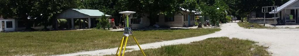


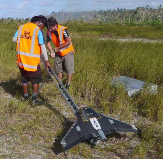
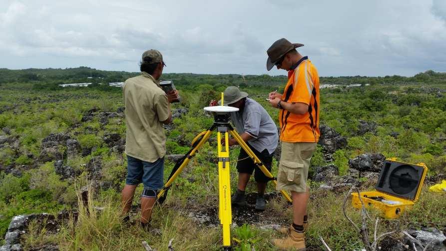
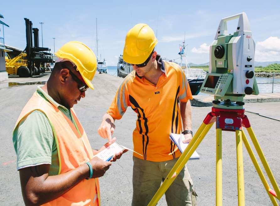
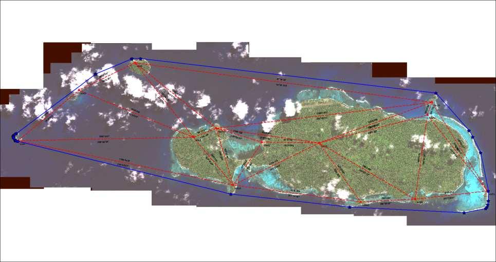
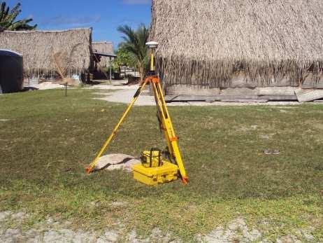
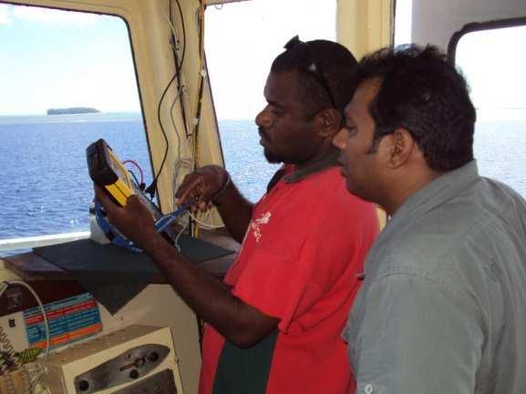
19 GNSS Surveys


20 Tide Gauge Installation & Tide Watch
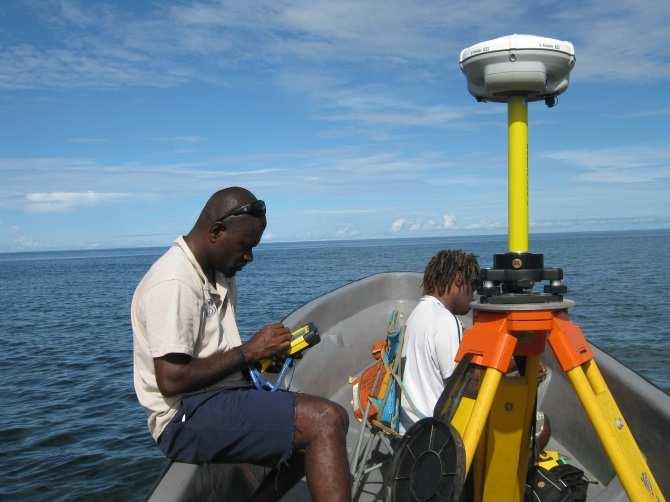
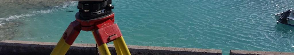
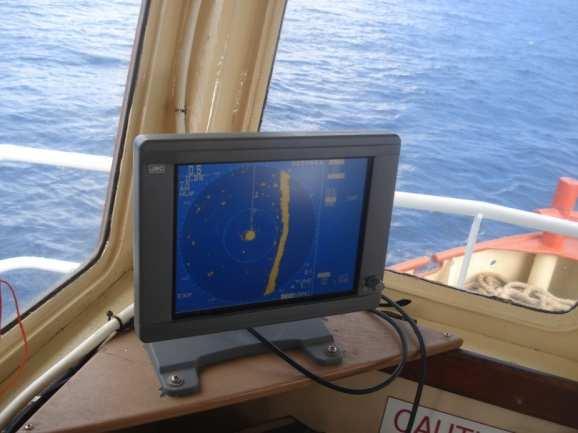
21 Hydrographic Surveys

22 Topographical Surveys RTK GNSS

23 Local Vertical Reference Frame A local Constant GNSS site can provide the opportunity to preform accurate baseline measurements when the user only has 1 geodetic quality GNSS receiver available. Having observations from a CORS available will allow local Lands & Survey departments to update their current network of survey control from a Local coordinate system onto the International Terrestrial Reference Frame [currently ITRF2008].


24 Cadastre and Satellite Imagery


25 GNSS Surveys Reference Image Points


26 GNSS Surveys & Satellite Imagery
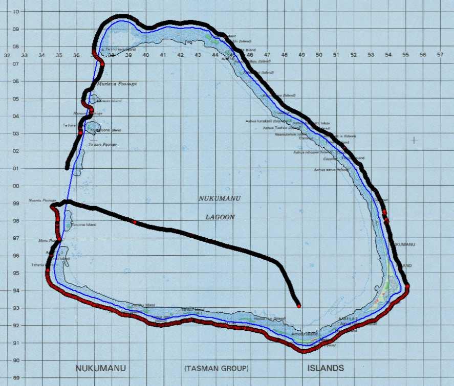
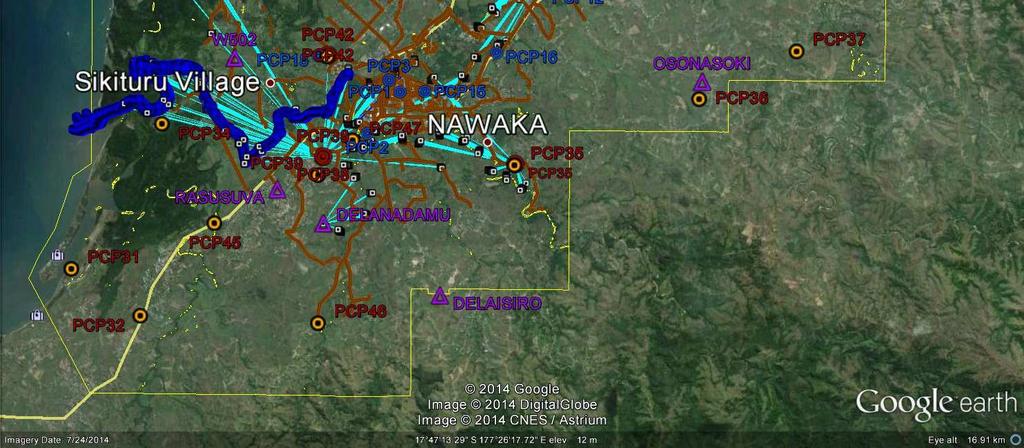
27 Reef Delineation Surveys - GNSS Tauu Islands (Papua New Guinea)


28 Why it is Important? Natural Disasters Climate Change Sea Level Changes Urban Development and etc.
29 Building Capacity & Resilience Survey Technology Field Survey Operations Planning Geodetic/Hydrographic/Topographical Surveys Survey Data Processing & Analysis Reporting Survey Standards & Specifications Survey Guidelines
30 Future Directions Geodetic Infrastructure Global Geodetic Reference Frame Geodetic Registry (Spatial Database) Capacity Development for Pacific


 For more info, visit: http://gsd.spc.")
31 Pacific Geospatial & Surveying Council Independent regional body advancing geospatial and surveying standards and capacity Established in the margins of the GIS/RS User Conference in November 2014 Governed by the PGSC Charter endorsed by 11 Pacific Island governments Supported by PGSC Partnership Desk (SPC) For more info, visit:


32 PGSC Vision Sustainable development in the Pacific enabled by world class geospatial information and surveying services


33 PGSC Strategy 10-year regional plan for developing geospatial and surveying capacity Collaborative process Member ownership


34 Purpose Purpose 1. To demonstrate the critical nature of geospatial and surveying information and services and the development and maintenance of these services in the Pacific region; 2. To articulate the collaborative aspirations of the region s geospatial and surveying professionals in advancing capacity; 3. To guide the development of sustainable geospatial and surveying information and services in Pacific Island Countries & Territories, and; 4. To serve as an entry point for engagement with internal and external partners.


 and improved technology underpinning geospatial systems and")

35 PGSC Strategy Goals 1. Leadership and Visibility The PGSC enables regional leadership, guidance and support for members to engage stakeholders and the community on geospatial and surveying activities. 2. Standards and Technology Countries across the region adopt a modern Geodetic Reference Frame (GRF) and improved technology underpinning geospatial systems and applications. 3. Sustainability Geospatial and surveying activities at the national and regional level are supported by a diverse and sustainable resource base. 4. Capacity Building The geospatial and surveying community is selfreliant with a culture supportive of learning innovation and gender equity.

36 Thank You
Faatasi Malologa (PGSC Chair) Director Department of Lands & Survey, Tuvalu
 Director Department of Lands & Survey, Tuvalu") Seventh Session of the United Nations Committee of Experts on Global Geospatial Information Management (UN-GGIM) - 31 July -4 August 2017 Faatasi Malologa (PGSC Chair) Director Department of Lands & Survey,
Seventh Session of the United Nations Committee of Experts on Global Geospatial Information Management (UN-GGIM) - 31 July -4 August 2017 Faatasi Malologa (PGSC Chair) Director Department of Lands & Survey,
Monitoring Surveys PSLMP COSPPac
 Monitoring Surveys PSLMP COSPPac Andrick Lal, Marika Kalouniviti & Veenil Rattan Science, Technology And Resources (STAR) Conference 26 th 29 th June 2017 Nadi FIJI Geodetic Survey Unit (SPC) Andrick Lal,
Vertical Reference Frame Pacific
 Vertical Reference Frame Pacific Andrick Lal SPC Geoscience Division GIS&RS User Conference 29 th November 2016 USP, Fiji. What does it mean? All buildings and features have a height. But what is it relative
Pacific Geospatial and Surveying Council (PGSC) Geospatial and GNSS CORS Infrastructure Forum. Kuala Lumpur October
 Geospatial and GNSS CORS Infrastructure Forum. Kuala Lumpur October") Pacific Geospatial and Surveying Council (PGSC) Geospatial and GNSS CORS Infrastructure Forum. Kuala Lumpur 16-17 October Beginning and Progress Members PGSC Charter PGSC Strategy 2017-2027 Meetings Geodetic
Pacific Geospatial and Surveying Council (PGSC) Geospatial and GNSS CORS Infrastructure Forum. Kuala Lumpur 16-17 October Beginning and Progress Members PGSC Charter PGSC Strategy 2017-2027 Meetings Geodetic
FIG Asia Pacific Capacity Development Network
 FIG Asia Pacific Capacity Development Network Report to the 41th General Assembly FIG Congress 2018, Istanbul - Turkey Rob Sarib Chair FIG Asia Pacific Capacity Development Network (AP CDN) Story of the
Working Group 1. Geodetic Reference Frame. Activity Report. for. The UN-GGIM-AP Plenary Meeting
 Regional Committee of United Nations Global Geospatial Information Management for Asia and the Pacific (UN-GGIM-AP) Established by a United Nations Resolution Working Group 1 Geodetic Reference Frame Activity
Reference Frame in Practice Workshop 1A
 Reference Frame in Practice Workshop 1A Status of Geodetic Infrastructure in the Pacific Region Case Studies Rob Sarib - FIG Commission 5 Vice Chair of Administration Welcome! Bula! Who are the International
Background Document: Report of the Regional Committee of United Nations Global Geospatial Information Management for Asia and the Pacific
 Background Document: Report of the Regional Committee of United Nations Global Geospatial Information Management for Asia and the Pacific 1. Summary 1. This report highlights the activities carried out
Report of the Regional Committee of UN-GGIM for Asia and the Pacific (UN-GGIM-AP)
") Report of the Regional Committee of UN-GGIM for Asia and the Pacific (UN-GGIM-AP) At the Eighth Session of UN-GGIM UN Headquarters, New York, 1 3 August 2018 About UN-GGIM-AP One of the five regional committees
Report of the Regional Committee of UN-GGIM for Asia and the Pacific (UN-GGIM-AP) At the Eighth Session of UN-GGIM UN Headquarters, New York, 1 3 August 2018 About UN-GGIM-AP One of the five regional committees
Geodesy. orientation. shape. gravity field
 Geodesy noun Science of measuring the shape, orientation and gravity field of the Earth and how it changes over time. shape orientation gravity field Positioning has always been important Downstream applications
Cooperation is the key, FIG can facilitate
 Cooperation is the key, FIG can facilitate Mikael Lilje Vice President 2017-2020 Head, Geodetic infrastructure, Swedish mapping, cadastral and land registration authority Presented at the GIS/RS Conference
Applied Geoscience and Technology Division SOPAC. Joy Papao, Risk Information Systems Officer
 Joy Papao, Risk Information Systems Officer Secretariat of the Pacific Community SPC 22 Pacific Island States Head office in Noumea, New Caledonia 2 Regional offices (Pohnpei and Honiara) 600 staff 9 Technical
Development of the Kingdom of Tonga Cyclone Emergency Recovery and Management System using Geospatial Tools
 Development of the Kingdom of Tonga Cyclone Emergency Recovery and Management System using Geospatial Tools Case Studies from Small Island States FIG Commissions 3, 7 and 8 Malcolm Archbold General Manager
Regional Capacity Development Network (RCDN) Pacific Islands Countries and Territories (PICTs)
 Pacific Islands Countries and Territories (PICTs)") Business Plan Regional Capacity Development Network (RCDN) for the Pacific Islands Countries and Territories (PICTs) 1. Summary The purpose of this proposal is to provide the rationale and the plan for
Business Plan Regional Capacity Development Network (RCDN) for the Pacific Islands Countries and Territories (PICTs) 1. Summary The purpose of this proposal is to provide the rationale and the plan for
Pacific Islands Regional Maritime Boundaries Project
 Pacific Islands Regional Maritime Boundaries Project 31 st Star Conference, Nadi, FIJI 6-8 June 2016 Jens Kruger Head of Ocean & Coastal Geoscience Sector Andrick Lal Project Officer (Surveying) Emily
South Pacific Sea Level and Climate Monitoring Project
 G E O S C I E N C E A U S T R A L I A South Pacific Sea Level and Climate Monitoring Project GPS Coordinate Time Series, 2007.0 to Manoj N. Deo, Guorong Hu, John Dawson and Minghai Jia Record 2012/34 GeoCat
Building Institutional Capacity for Multi-Hazard Early Warning in Pacific Countries Subtitle
 Building Institutional Capacity for Multi-Hazard Early Warning in Pacific Countries Subtitle Title Keran Wang Chief, Space Applications Section ICT and Disaster Risk Reduction Division 30 March 2018 Slide
Item 9.1 The Pacific Meteorological Desk Partnership (PMDP) Salesa Nihmei and Alex Montoro SPREP
 Salesa Nihmei and Alex Montoro SPREP") 1993 RMSD-1 Item 9.1 The Pacific Meteorological Desk Partnership (PMDP) Salesa Nihmei and Alex Montoro SPREP Content Who/what is the PMDP Partnerships The Pacific Met. Strategy Pacific Meteorological
1993 RMSD-1 Item 9.1 The Pacific Meteorological Desk Partnership (PMDP) Salesa Nihmei and Alex Montoro SPREP Content Who/what is the PMDP Partnerships The Pacific Met. Strategy Pacific Meteorological
Reference frames and positioning
 The APREF Project: an Improved Geodetic Infrastructure for Asia and the Pacific (4861) John Dawson (Australia), Graeme Blick (New Zealand), Manoj Deo, Guorong Hu and Gary Johnston (Australia) Reference
Frames for the Future New Datum Definitions for Modernization of the U.S. National Spatial Reference System
 Figure 10. Horizontal position differences (in meters) between NAD 83 and ITRF 08 at time 2022.00 (January 1, 2022). Positional differences are shown for the North American and Pacific tectonic plates.
Next Generation Australian Datum. Permanent Committee on Geodesy, ICSM
 Next Generation Australian Datum Permanent Committee on Geodesy, ICSM 2 Presentation: Next Generation Australian Datum Trends in the geospatial sector The Geocentric Datum of Australia 1994 (GDA94) Progress
This presentation covers the following areas
 Geodetic Datums and Coordinate Systems for Surveying and Mapping in Hong Kong FIG Working Week 2012 Rome, Italy 6-10 May Simon KWOK Hong Kong, China 1 This presentation covers the following areas Explains
What is the FIG Asia Pacific Capacity Development Network?
 What is the FIG Asia Pacific Capacity Development Network? What are the capacity development challenges with respect to Geospatial and Geodetic Infrastructure? The International Federation of Surveyors
Building Institutional Capacity for Multi-Hazard Early Warning in Asia and the Pacific Subtitle
 Building Institutional Capacity for Multi-Hazard Early Warning in Asia and the Pacific Subtitle Title Keran Wang Chief, Space Applications Section ICT and Disaster Risk Reduction Division 22 May 2018 Pillar
Report for 15th PCGIAP Meeting at 18th UNRCC-AP Working Group 1 Regional Geodesy
 Report for 15th PCGIAP Meeting at 18th UNRCC-AP Working Group 1 Regional Geodesy Chairman Shigeru Matsuzaka, Japan - shigeru@gsi.go.jp Vice Chairman Prof. Pengfei Cheng, China - chengpf@casm.ac.cn John
A Strategic Plan for Geodesy in Sweden. Mikael Lilje Lars E. Engberg Geodesy Department Lantmäteriet Sweden
 A Strategic Plan for Geodesy in Sweden Mikael Lilje Lars E. Engberg Geodesy Department Lantmäteriet Sweden Our vision is to be able to meet Swedish society s needs for a homogeneous, sustainable geodetic
CORS Network and Datum Harmonisation in the Asia-Pacific Region. Richard Stanaway and Craig Roberts
 CORS Network and Datum Harmonisation in the Asia-Pacific Region Richard Stanaway and Craig Roberts School of Surveying and Spatial Information Systems University of New South Wales CORS Networks in the
Operational Aspects of GNSS CORS DRAFT PROGRAM
 References Frame in Practice Seminar Operational Aspects of GNSS CORS Venue: Lali Room, Holiday Inn, Suva - Fiji DRAFT PROGRAM Tuesday 18 th September 2018 08:30 8:50 Registration 09:00 9:45 Welcome and
UN GGIM and National SDI Strategy
 MSDI Open Forum on 26 th January 2016 Contributing to the successful delivery of MSDI UN GGIM and National SDI Strategy Hiroshi Murakami Deputy Administrator Geospatial Information Authority of Japan Geospatial
The International Federation of Surveyors (FIG)
") The International Federation of Surveyors (FIG) What is the FIG Asia Pacific Capacity Development Network? What are the capacity development challenges with respect to Data, Maps, Geospatial and Geodetic
The International Federation of Surveyors (FIG) What is the FIG Asia Pacific Capacity Development Network? What are the capacity development challenges with respect to Data, Maps, Geospatial and Geodetic
Briefing document of the status of maritime boundaries in Pacific island countries
 Secretariat of the Pacific Community Seventh Heads of Fisheries Meeting (28 Feb. 4 March 2011, Noumea, New Caledonia) Working Paper 5 Original: English Briefing document of the status of maritime boundaries
2018/1 The integration of statistical and geospatial information. The Regional Committee of UN-GGIM: Americas:
 The following are the conclusions and recommendations of the Regional Committee of the United Nations on Global Geospatial Information Management for the Americas, during its Fifth Session, Thursday 8
The Global Statistical Geospatial Framework and the Global Fundamental Geospatial Themes
 The Global Statistical Geospatial Framework and the Global Fundamental Geospatial Themes Sub-regional workshop on integration of administrative data, big data and geospatial information for the compilation
Global Geodetic Reference Frame GGRF & Implications for GNSS
 Global Geodetic Reference Frame GGRF & Implications for GNSS On behalf of Gary Johnston Chair GIAC, Ruth Neilan Vice Chair, Global Geodetic Observing System ICG-9 Prague, 10 November 2014 UN GGRF Working
HONIARA MINISTERIAL STATEMENT For STRENGTHENING SUSTAINABLE WEATHER, CLIMATE, OCEAN AND WATER SERVICES FOR A RESILIENT PACIFIC
 HONIARA MINISTERIAL STATEMENT For STRENGTHENING SUSTAINABLE WEATHER, CLIMATE, OCEAN AND WATER SERVICES FOR A RESILIENT PACIFIC 18 August 2017, Honiara, Solomon Islands 1. The Second Pacific Ministerial
Do we need to update PNG94 to PNG2020?
 Do we need to update PNG94 to PNG2020? Richard Stanaway Quickclose Pty Ltd Robert Rosa PNG University of Technology, Lae Does PNG94 have a use by date? PNG94 is now 23 years old (reference epoch) Users
THE ROLE OF GEOSPATIAL AT THE WORLD BANK
 THE ROLE OF GEOSPATIAL AT THE WORLD BANK INSPIRE Conference Barcelona, Spain September 26, 2016 Kathrine Kelm Senior Land Administration Specialist Global Land and Geospatial Unit The World Bank Group
What are the social, technical, environmental and economic benefits and opportunities of accessing and sharing geodetic data?
 What are the social, technical, environmental and economic benefits and opportunities of accessing and sharing geodetic data? Graeme Blick Group Manager Positioning and Resilience Land Information New
Operational Aspects of GNSS CORS What is a GNSS CORS system used for?
 Please insert a picture (Insert, Picture, from file). Size according to grey field (10 cm x 25.4 cm). Scale picture: highlight, pull corner point Cut picture: highlight, choose the cutting icon from the
International Union of Geodesy and Geophysics. Resolutions
 International Union of Geodesy and Geophysics Resolutions ADOPTED BY THE COUNCIL AT THE XXVI GENERAL ASSEMBLY PRAGUE, CZECH REPUBLIC (22 JUNE 2 JULY 2015) 0 Page Resolution 1: Role of Ocean in Climate
Development of the Kingdom of Tonga Cyclone Emergency Recovery and Management System using Geospatial Tools
 Development of the Kingdom of Tonga Cyclone Emergency Recovery and Management System using Geospatial Tools Malcolm ARCHBOLD, New Zealand and Sione Nailasikau (Naila) HALATUITUIA, Tonga. Key words: Tonga,
Australia Government Geospatial Capacity Building Efforts in Asia and the Pacific. Dr John Dawson
 Australia Government Geospatial Capacity Building Efforts in Asia and the Pacific Dr John Dawson Presentation Overview About Geoscience Australia Examples of Geospatial Capacity Building Activity Geodesy
RESAP Progress Report
 RESAP Progress Report December 2016 to October 2017 Presentation to the Twenty-first session of the Intergovernmental Consultative Committee on the Regional Space Applications Programme for Sustainable
NGS and the Modernization of the National Spatial Reference System (NSRS)
") NGS and the Modernization of the National Spatial Reference System (NSRS) Dr. Dana Caccamise Pacific Southwest Region (CA,NV) Geodetic Advisor dana.caccamise@noaa.gov NOAA s National Geodetic Survey geodesy.noaa.gov
NGS and the Modernization of the National Spatial Reference System (NSRS) Dr. Dana Caccamise Pacific Southwest Region (CA,NV) Geodetic Advisor dana.caccamise@noaa.gov NOAA s National Geodetic Survey geodesy.noaa.gov
UN-GGIM: Strengthening Geospatial Capability
 Fifth Plenary Meeting of UN-GGIM: Europe Brussels, 6-7 June 2018 UN-GGIM: Strengthening Geospatial Capability Walking the talk to leave no one behind Greg Scott, UN-GGIM Secretariat Environmental Statistics
THIRD MEETING OF THE PACIFIC METEOROLOGICAL COUNCIL. Theme: "Sustainable Weather and Climate Services for a Resilient Pacific "
 PMC-3/InformationPaper-1-Provisional Agenda THIRD MEETING OF THE PACIFIC METEOROLOGICAL COUNCIL Theme: "Sustainable Weather and Climate Services for a Resilient Pacific " 20-23 July 2015 Fa'onelua Convention
UN-GGIM: Europe GRF-Europe. Markku Poutanen
 UN-GGIM: Europe GRF-Europe Markku Poutanen Global Geodetic Reference Frame GGRF The UN Committee of Experts on Global Geospatial Information Management (UN-GGIM) decided in July 2013 to formulate and facilitate
BUILDING AN ACCURATE GIS
 BUILDING AN ACCURATE GIS 2006 GIS in the Rockies Denver, Colorado September 13, 2006 William E. Linzey United States Department of Commerce National Oceanic and Atmospheric Administration National Geodetic
From PCGIAP to UN GGIM AP: A Regional Perspective on GGIM
 Regional Committee of United Nations Global Geospatial Information Management for Asia and the Pacific (UN-GGIM-AP) Established by a United Nations Resolution From PCGIAP to UN GGIM AP: A Regional Perspective
An Assessment of the Accuracy of PPP in Remote Areas in Oman
 An Assessment of the Accuracy of PPP in Remote Areas in Oman Rashid AL ALAWI, Sultanate of Oman and Audrey MARTIN, Ireland Keywords: GNSS, PPP, Oman Survey Infrastructure SUMMARY Traditionally, high accuracy
A Deformation Model to support a Next Generation Australian Geodetic Datum
 A Deformation Model to support a Next Generation Australian Geodetic Datum Richard Stanaway, Surveying and Geospatial Engineering School of Civil and Environmental Engineering multi-gnss + augmentation
Perspectives and Status Asia Pacific Capacity Development Network
 Perspectives and Status Asia Pacific Capacity Development Network Rob Sarib FIG John Dawson UN GGIM AP WG1 Reference Frames The International Federation of Surveyors (FIG) Established in Paris 1878; Federation
Niue Maritime Boundaries Delimitation Project. Christchurch FIGMM
 Niue Maritime Boundaries Delimitation Project Christchurch FIGMM 30 th April 6 th May 2016 Hubert Mana Kalauni Secretary for Justice Department of Justice, Lands and Survey Ministry of Social Services
Economic and Social Council 2 July 2015
 ADVANCE UNEDITED VERSION UNITED NATIONS E/C.20/2015/11/Add.1 Economic and Social Council 2 July 2015 Committee of Experts on Global Geospatial Information Management Fifth session New York, 5-7 August
SIRGAS: Basis for Geosciences, Geodata, and Navigation in Latin America
 SIRGAS: Basis for Geosciences, Geodata, and Navigation in Latin America Claudio Brunini President of SIRGAS Universidad Nacional de La Plata, Argentina María Virginia Mackern President of SIRGAS/WG-I:
The Regional Integrated Multi-Hazard Early Warning System for Africa and Asia CAP in RIMES
 The Regional Integrated Multi-Hazard Early Warning System for Africa and Asia CAP in RIMES 2018 CAP Implementation Workshop OUTLINE 1. RIMES Overview 2. DSS tools developed in RIMES 3. CAP Integration
NATRF 2022 AND LDP OCTOBER 11, 2017
 NATRF 2022 AND LDP OCTOBER 11, 2017 MODERNIZATION OF THE NSRS Why? Leaving passive control marks behind and relying solely on the CORS network for 3D positions: Older methodology relies on terrestrial
The Southeast Asia and Pacific Biosphere Reserves Network SeaBRnet and PacMAB
 WORKSHOPS ON THE MAB REGIONAL NETWORKS The Southeast Asia and Pacific Biosphere Reserves Network SeaBRnet and PacMAB Tuesday 15 March 2016 Armatambo Room Shahbaz Khan Director UNESCO Office, Jakarta Southeast
UN Resolution on GGRF ( and its implementation in Europe)
") Presented at the FIG Working Week 2017, UN Resolution on GGRF ( and its implementation in Europe) May 29 - June 2, 2017 in Helsinki, Finland Markku Poutanen, FGI Contents Global Geodetic Reference Frame
Presented at the FIG Working Week 2017, UN Resolution on GGRF ( and its implementation in Europe) May 29 - June 2, 2017 in Helsinki, Finland Markku Poutanen, FGI Contents Global Geodetic Reference Frame
Space Applications for Disaster Risk Reduction and Sustainable Development
 Space Applications for Disaster Risk Reduction and Sustainable Development Space Applications Section (SAS) ICT and Disaster Risk Reduction Division (IDD) UNESCAP Contents I. RESAP Activities 2016-2017
From Global to National Geodetic Reference Frames: how are they connected and why are they needed?
 From Global to National Geodetic Reference Frames: how are they connected and why are they needed? Zuheir ALTAMIMI Institut National de l Information Géographique et Forestière, France Vice-President,
Update on the International Terrestrial Reference Frame (ITRF) : ITRF2014. Zuheir Altamimi
 : ITRF2014. Zuheir Altamimi") Update on the International Terrestrial Reference Frame (ITRF) : ITRF2014 Zuheir Altamimi Head of the IERS ITRF Product Center IAG Vice President IGN, France E-mail: zuheir.altamimi@ign.fr Key Points Introduction:
Update on the International Terrestrial Reference Frame (ITRF) : ITRF2014 Zuheir Altamimi Head of the IERS ITRF Product Center IAG Vice President IGN, France E-mail: zuheir.altamimi@ign.fr Key Points Introduction:
A Pacific Regional Economics of Climate Change Study: Assessing adaptation needs in Small Island Developing States
 Regional Economics of Climate Change: Practitioners Workshop 4-5 March 2009 Washington, DC, USA A Pacific Regional Economics of Climate Change Study: Assessing adaptation needs in Small Island Developing
NUKU ALOFA MINISTERIAL DECLARATION For SUSTAINABLE WEATHER AND CLIMATE SERVICES FOR A RESILIENT PACIFIC. 24th July 2015, Nuku alofa, Tonga
 NUKU ALOFA MINISTERIAL DECLARATION For SUSTAINABLE WEATHER AND CLIMATE SERVICES FOR A RESILIENT PACIFIC 24th July 2015, Nuku alofa, Tonga The First Pacific Ministerial Meeting on Meteorology was held on
Integration Activities in Indonesia: The Integration of Land and Marine Spatial Data Sets as Part of Indonesian SDI Development
 Integration Activities in Indonesia: The Integration of Land and Marine Spatial Data Sets as Part of Indonesian SDI Development M. Arief Syafi i National Coordination Agency for Surveys and Mapping (B
THE CURRENT STATUS OF MAPPING IN THE WORLD - SPOTLIGHT ON PACIFIC ISLANDS
 THE CURRENT STATUS OF MAPPING IN THE WORLD - SPOTLIGHT ON PACIFIC ISLANDS John C. Trinder School of Civil and Environmental Engineering, UNSW SYDNEY NSW 2052, Australia (j.trinder@unsw.edu.au) Commission
ECONOMIC AND SOCIAL COUNCIL
 UNITED NATIONS E/CONF.102/3 ECONOMIC AND SOCIAL COUNCIL Nineteenth United Nations Regional Cartographic Conference for Asia and the Pacific Bangkok, 29 October 1 November 2012 Item 4 of the provisional
Country Report on SDI Activities in Singapore *
 UNITED NATIONS E/CONF.100/CRP.9 ECONOMIC AND SOCIAL COUNCIL Eighteenth United Nations Regional Cartographic Conference for Asia and the Pacific Bangkok, 26-29 October 2009 Item 7(a) of the provisional
Chris Rizos (IAG), Chair William Cartwright (ICA), immediate past Chair
, Chair William Cartwright (ICA), immediate past Chair") Chris Rizos (IAG), Chair William Cartwright (ICA), immediate past Chair Global Spatial Data Infrastructure (GSDI) Association IEEE Geoscience & Remote Sensing Society (IEEE-GRSS) International Association
Chris Rizos (IAG), Chair William Cartwright (ICA), immediate past Chair Global Spatial Data Infrastructure (GSDI) Association IEEE Geoscience & Remote Sensing Society (IEEE-GRSS) International Association
Country Report On Sdi Activities In Singapore ( )
") UNITED NATIONS E/CONF.102/IP.4 ECONOMIC AND SOCIAL COUNCIL Nineteenth United Nations Regional Cartographic Conference for Asia and the Pacific Bangkok, 29 October 1 November 2012 Item 6(b) of the provisional
UNITED NATIONS E/CONF.102/IP.4 ECONOMIC AND SOCIAL COUNCIL Nineteenth United Nations Regional Cartographic Conference for Asia and the Pacific Bangkok, 29 October 1 November 2012 Item 6(b) of the provisional
Concept Formulation of Geospatial Infrastructure. Hidenori FUJIMURA*
 Concept Formulation of Geospatial Infrastructure 1 Concept Formulation of Geospatial Infrastructure Hidenori FUJIMURA* (Published online: 28 December 2016) Abstract Technical trends in the field of surveying
Positioning the Pacific: NOAA s Geospatial Activities. Juliana Blackwell, Director NOAA s National Geodetic Survey March 6, 2012
 Positioning the Pacific: NOAA s Geospatial Activities Juliana Blackwell, Director NOAA s National Geodetic Survey March 6, 2012 A Common Problem of the Early 19 th Century 1807 President Thomas Jefferson
Report of the Working Group 2 Data Sharing and Integration for Disaster Management *
 UNITED NATIONS E/CONF.104/6 ECONOMIC AND SOCIAL COUNCIL Twentieth United Nations Regional Cartographic Conference for Asia and the Pacific Jeju, 6-9 October 2015 Item 5 of the provisional agenda Report
Current status of operations of Pacific Islands Climate Outlook Forum (PICOF) Alexander Montoro Technical Expert on Climate and Weather Services
 Alexander Montoro Technical Expert on Climate and Weather Services") Current status of operations of Pacific Islands Climate Outlook Forum (PICOF) Alexander Montoro Technical Expert on Climate and Weather Services Secretariat of the Pacific Regional Environment Programme
Current status of operations of Pacific Islands Climate Outlook Forum (PICOF) Alexander Montoro Technical Expert on Climate and Weather Services Secretariat of the Pacific Regional Environment Programme
A donor partner view. Olaf Magnus Østensen. 'Modernization of spatial data infrastructure to reduce risks and impacts of floods'
 A donor partner view Olaf Magnus Østensen 'Modernization of spatial data infrastructure to reduce risks and impacts of floods' About the EEA Grants programme http://eeagrants.org/ Beneficiary country Donor
KUNMING FORUM ON UNITED NATIONS GLOBAL GEOSPATIAL INFORMATION MANAGEMENT CITIES OF THE FUTURE: SMART, RESILIENT
 KUNMING FORUM ON UNITED NATIONS GLOBAL GEOSPATIAL INFORMATION MANAGEMENT CITIES OF THE FUTURE: SMART, RESILIENT and SUSTAINABLE Yunnan Zhenzhuang Guest House, Kunming, China 10 12 May 2017 BACKGROUND CONCEPT
Report on the Actions Taken on Resolutions of the Eighteenth United Nations Regional Cartographic Conference for Asia and the Pacific
 UNITED NATIONS E/CONF.102/7 ECONOMIC AND SOCIAL COUNCIL Nineteenth United Nations Regional Cartographic Conference for Asia and the Pacific Bangkok, 29 October 1 November 2012 Item 4 of the provisional
Report of PCGIAP to the 18 th United Nations Regional Cartographic Conference for Asia and the Pacific (UNRCC-AP) for the period
 for the period") Permanent Committee on GIS Infrastructure for Asia and the Pacific (PCGIAP) Established in 1995 by a United Nations Resolution Report of PCGIAP to the 18 th United Nations Regional Cartographic Conference
Permanent Committee on GIS Infrastructure for Asia and the Pacific (PCGIAP) Established in 1995 by a United Nations Resolution Report of PCGIAP to the 18 th United Nations Regional Cartographic Conference
Economic and Social Council
 United Nations Economic and Social Council Distr.: General 18 July 2016 Original: English Committee of Experts on Global Geospatial Information Management Sixth session New York, 3-5 August 2016 Item 2
GEODETIC NETWORK OF SAUDI ARABIA AND FIDUCIAL STATIONS. GFN OF Saudi Arabia in Based on ITRF2000 Datum
 STUDIES OF TECTONIC MOVEMENTS IN SAUDI ARABIA USING CORS M. Al Rajhi, Ali Al Omar, R. Yanar, F. Kartal, K. Eren, SUBJECT TO TALKS BACKGROUND GEODETIC NETWORK OF SAUDI ARABIA AND FIDUCIAL STATIONS GFN OF
Positioning a nation for the future: Modernizing the United States National Spatial Reference System
 Positioning a nation for the future: Modernizing the United States National Spatial Reference System Dr. Dana Caccamise USA Representative Pacific Southwest Region Geodetic Advisor dana.caccamise@noaa.gov
Pacific Islands Regional Maritime Boundaries Project
 Pacific Islands Regional Maritime Boundaries Project Presented By Filimoni Yaya (Andrick Lal, Sachindra Singh, Emily Artack) Geoscience Division Pacific Community (SPC Geoscience Division, GSD STAR Sessions,
Shape of the Earth. Data Output by the Receiver
 It is quite common for confusion to arise about the process used during a hydrographic survey when GPS-derived water surface elevation is incorporated into the data as an RTK Tide correction. This article
The APREF Project. The Asia-Pacific regional geodetic
 The GEODESY APREF Project The Asia-Pacifi c Reference Frame (APREF) is an initiative that recognizes the importance of improving the regional geodetic framework in the Asia-Pacifi c region Lennard Huisman
WELCOME SPEECH OF THE CIT PRESIDENT
 COSTA RICA FROM NOVEMBER 12 TO 15, 2007 WELCOME SPEECH OF THE CIT PRESIDENT Cordial Greetings, good morning. Bach. Fernando Zumbado Minister of Housing Eng. Stig Enemack President of the FIG Dear partners
Incorporation of the Caribbean to the Geocentric Reference System for the Americas SIRGAS
 Incorporation of the Caribbean to the Geocentric Reference System for the Americas SIRGAS W. Martínez M. V. Mackern V. Cioce R. Rodino S.R. De Freitas UN-GGIM: Americas Third Session, October 5 2016, Mexico
Remote sensing and GIS for multi-hazard risk assessments in the coastal zone: recent applications and challenges in the Pacific Jens Kruger
 Remote sensing and GIS for multi-hazard risk assessments in the coastal zone: recent applications and challenges in the Pacific Jens Kruger Geoscience Division Pacific Community (SPC) The First Pacific
MODERNIZATION OF THE NSRS
 NATRF 2022 AND LDP SEPTEMBER 12, 2017 MODERNIZATION OF THE NSRS Why? Leaving passive control marks behind and relying solely on the CORS network for 3D positions: Older methodology relies on terrestrial
Spatial Data Infrastructure in the Pacific
 Spatial Data Infrastructure in the Pacific. Sachindra Singh Senior Geospatial Systems Architect ICT for Development, Geoscience Division Pacific Community (SPC) OrganisationalBackground SPC - The Pacific
HMK Swedish handbook in surveying and mapping
 HMK Swedish handbook in surveying and mapping A Alfredsson, J Sunna, C-G Persson TS07B - Standards and Recommended Practices for Positioning and Measurement, Paper no 7072 FIG Congress 2014 Engaging the
National Report of New Zealand
 National Report of New Zealand Prepared for GLOSS Training Course Tokyo May 2006 Glen Rowe Data Analyst Hydrographic Services Land Information New Zealand National Office 160 Lambton Quay Wellington New
Modernization of National Geodetic Datum in China *
 UNITED NATIONS E/CONF.102/IP.16 ECONOMIC AND SOCIAL COUNCIL Nineteenth United Nations Regional Cartographic Conference for Asia and the Pacific Bangkok, 29 October 1 November 2012 Item 6(b) of the provisional
Modernising the Northern Territory s GRS
 Modernising the Northern Territory s GRS Geospatial & GNSS CORS Forum Kuala Lumpur, Malaysia Amy Peterson; Rob Sarib DIPL Land Information Survey Services Sunday 16 October 2016 Presentation Outline Our
The APREF Project: First Results and Analysis
 The APREF Project: First Results and Analysis Lennard Huisman 1*, John Dawson 2, and Peter J G Teunissen 1 1 GNSS Research, Curtin University of Technology, Australia, l.huisman@curtin.edu.au 2 Earth Monitoring
8 th Arctic Regional Hydrographic Commission Meeting September 2018, Longyearbyen, Svalbard Norway
 8 th Arctic Regional Hydrographic Commission Meeting 11-13 September 2018, Longyearbyen, Svalbard Norway Status Report of the Arctic Regional Marine Spatial Data Infrastructures Working Group (ARMSDIWG)
Bonriki Inundation Vulnerability Assessment
 Bonriki Inundation Vulnerability Assessment Single Beam Survey Salesh Kumar, Jens Kruger, Zulfikar Begg, Aseri Baleilevuka Bonriki Inundation Vulnerability Assessment (BIVA) Single Beam Survey Salesh
1/28/16. EGM101 Skills Toolbox. Oblate spheroid. The shape of the earth Co-ordinate systems Map projections. Geoid
 EGM101 Skills Toolbox Oblate spheroid The shape of the earth Co-ordinate systems Map projections The geoid is the shape that the surface of the oceans would take under the influence of Earth's gravitation
JCOMM-CHy Coastal Inundation Forecasting Demonstration Project (CIFDP)
") WMO World Meteorological Organization Working together in weather, climate and water JCOMM-CHy Coastal Inundation Forecasting Demonstration Project (CIFDP) Coastal Flooding & Vulnerable Populations Coastal
WMO World Meteorological Organization Working together in weather, climate and water JCOMM-CHy Coastal Inundation Forecasting Demonstration Project (CIFDP) Coastal Flooding & Vulnerable Populations Coastal
System of Geodetic Parameters Parametry Zemli 1990 PZ-90.11
 System of Geodetic Parameters Parametry Zemli 1990 PZ-90.11 Authors: PhD Anastasiya N. Zueva, PhD Evgeniy V. Novikov, Dr. Dmitriy I. Pleshakov, PhD Igor V. Gusev Speaker: Igor Gusev 9 th Mee'ng of the
Executive Summary and Recommendations
 ANNEX I: EXECUTIVE SUMMARY AND RECOMMENDATIONS OF THE 12RMSD TWELFTH REGIONAL MEETING OF THE METEOROLOGICAL SERVICE DIRECTORS 30 -JUNE to 6 -JULY 2007 Rarotonga, Cook Islands Executive Summary and Recommendations