REAL-TIME GIS OF GENDER
|
|
|
- Magdalene Bridges
- 5 years ago
- Views:
Transcription


")


1 2 nd Conference on Advanced Modeling and Analysis MOPT/IGOT/CEG REAL-TIME GIS OF GENDER A telegeomonitoring approach PT07 Mainstreaming Gender Equality and Promoting Work Life Balance (2nd Open Call - Support the development of tools and methods to promote gender equality at the local level ) European Economic Area Financial Mechanism (EEA GRANTS) Institute of Geography and Spatial Planning, University of Lisbon, Portugal Margarida Queirós Nuno M. da Costa Paulo Morgado Mário Vale Nelson Mileu Fábio Rodrigues Júlia Guerreiro
2 OUTLINE About the project why is it important? goals and expectations About the methodology how do we address the problem? Analysis & results space-time proxies Synthesis & conclusions work in progress


3 ABOUT THE PROJECT why is it important? in Portugal women still earn on average less than 18% of base pay than men MARKED ASSYMETRY
4 ABOUT THE PROJECT why is it important? 1. Gender awareness of mobility/travel behaviours: implications for city planning and transport planning 2. Deeper understanding of gender differences in daily trips associated with gendered divisions of labour. 3. New methodology VGI (Volunteered Geographic Information)using smartphones, trackers, software, GIS and the Web. 4. Wider understanding of time uses between paid employment and unpaid work (in the home, care, personal, leisure and related) in urban space.
5 ABOUT THE PROJECT why is it important? there are no systematic studies on mobility and the use of time (Queirós & Costa, 2012), Employed population domestic work and care work There is a Survey but: time sequence irregularity Questionnaires based Source: INE, Inquérito à Ocupação do Tempo, 1999
 Complying with objectives Europe 2020 (smart,")


6 ABOUT THE PROJECT goals and expectations Promoting gender equality at the local level (balancing professional/private life) Complying with objectives Europe 2020 (smart, sustainable and inclusive growth), Community directives and regulations, Portuguese Constitution, Portuguese laws Combining smart cities and big data analysis with qualitative research Developing tools and methods (GIS, VGI, PPGI, GeoVisualisation) We are addressing an XIX century issue with XX century methodology and techniques for a XXI century generation
7 ABOUT THE METHODOLOGY how do we address the issue? Traditional Surveys/Diaries Based on surveyed memory Subjectivity Depends on each surveyed person s perception of the trip/activity Census track data: only for home-work trips or home-school trips for each parish to home parish or municipality destination GenMob Approach Real Time Data acquisition Accurate and objective Data Georeferenced Detailed Spatial Statistics Low cost for data acquisition Faster data manipulation VGI bottom-up, open process, data cocreation; positive emotional value to users, (satisfaction, social connection and ethics)

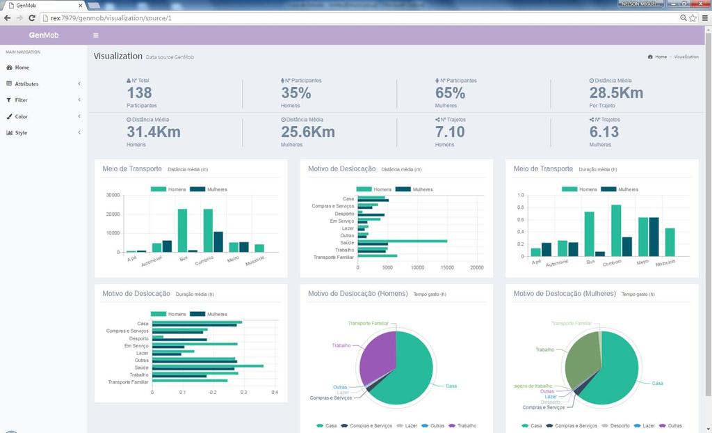
8 ABOUT THE METHODOLOGY how do we address the issue?

9 ABOUT THE METHODOLOGY how do we address the issue?
10 ANALYSIS & RESULTS Space-time proxies A sample from Alcochete, Barreiro and Lisboa GenMob VGI (participants / volunteers /citizens actors / people as sensors) (Jan May 2016)
11 ANALYSIS & RESULTS Space-time proxies Number of stops per person (ID) Avg time spent in each stop per person (ID) Number of paths by person and sex Total and Avg distance for each path and sex Avg distance (m) by sex for different motives Avg distance (m) by sex by trip for transport mode Avg time spent (hours) by sex for different motives Avg time spent (hours) by sex by trip for transport modes Age, job, academic qualifications, income, marital status, etc. Source: GenMob, 2016
12 ANALYSIS & RESULTS Space-time proxies A sample from Lisbon Metropolitan Area: Alcochete, Montijo and Lisbon Avg Distances, Nr of paths, Paths executed from A to B Distance (km) Nº Path Path Length Men 21,55 5, ,91 Women 22,41 6, ,32 Nr of Participants Women Men Total Alcochete Barreiro Lisboa Total Source: GenMob, 2016
13 ANALYSIS & RESULTS Space-time proxies Avg distance (m) by sex for the following motives: Avg time spent (hours) by sex for the following motives: Lunch Sports Others Family Care Shopping and Services Leisure Work Home Women Men Avg distance (m) by sex for each trip by modes: Bicicle Train Motocicle Metro Bus Car Walking Source: GenMob, 2016 Lunch Sports Others Family Care Shopping and Services Leisure Work Home Avg time spent (hours) by sex for each trip by modes: Bicicle Train Motocicle Metro Bus Car Walking
14 ANALYSIS & RESULTS Space-time proxies Avg time (hours) spent on each activity Home Paid Work Leisure Shopping & Services Care Work Sports Meals (out) Volunteering Men 13,75 6,81 1,44 0,52 0,19 1,99 0,82 0,00 Alcochete 13,92 6,63 0,00 0,57 0,00 0,00 0,78 0,00 Barreiro 13,24 6,98 0,00 0,52 0,07 1,99 0,00 0,00 Lisboa 13,93 6,82 1,44 0,46 0,24 0,00 0,84 0,00 Women 13,32 6,93 0,58 0,58 0,41 1,14 0,74 1,49 Alcochete 13,24 6,85 0,38 0,47 1,04 0,76 0,91 0,00 Barreiro 13,09 7,23 0,29 0,69 0,46 0,83 0,64 1,49 Lisboa 13,64 6,67 1,28 0,55 0,07 1,84 0,00 0,00 Source: GenMob, 2016

15 ANALYSIS & RESULTS Space-time proxies ALCOCHETE Source: GenMob, 2016

16 ANALYSIS & RESULTS Space-time proxies Standard deviation elipses Show the space range for gender for a working day. How far and in what directions men and women go on a daily basis Source: GenMob, 2016

17 ANALYSIS & RESULTS Space-time proxies Classical Time-Geography, the Prism (Hagerstrand 1970) GenMob, 2016 Developing Time-space GIS space time path in continuous three-dimensional space space time path in continuous two-dimensional space

18 ANALYSIS & RESULTS Space-time proxies
19 GENDER MOBILITY Synthesis & conclusions Men Do less activities than women Spend less time traveling but travel longer distances Spend more time in leisure activities Women Do more daily activities than men Use more the car for traveling than men Spend more time in care work and travelling (multiple trip chain) Spend more time in shopping activities
20 GENDER MOBILITY Synthesis & conclusions Bottom-up methodology and synchronic data VGI, turning people into sensors (the willingness of women and men to contribute to data collection, sharing and to causes that matter ) BIG messy data (real time insights) on the cloud Ground-based knowledge. A more accurate data Smartphones/trackers as mobile sensors for enhancing public policies Fitting policies to the reality spatial planning paradigm More balanced and inclusive society is a better society.
21 2 nd Conference on Advanced Modeling and Analysis MOPT/IGOT/CEG REAL-TIME GIS OF GENDER A telegeomonitoring approach Thanks for your attention! Institute of Geography and Spatial Planning, University of Lisbon, Portugal Margarida Queirós Nuno M. da Costa Paulo Morgado Mário Vale Nelson Mileu Fábio Rodrigues Júlia Guerreiro
FROM PHYSICAL TO DIGITAL SPACES Exploring space-time mobility through a telegeomonitoring approach
 1 July 2016 Session 7: The potential of open data and big data for territorial information designed to respond to the PT07 Mainstreaming Gender Equality and Promoting Work Life Balance (2nd Open Call -Support
Gender equality and the City A methodological approach to mobility in space-time
 Gender equality and the City A methodological approach to mobility in space-time EEA Grants PT 07 Margarida Queirós (Coordinator) Institute of Geography and Spatial Planning (IGOT) Geographical Studies
SPACE-TIME ACCESSIBILITY MEASURES FOR EVALUATING MOBILITY-RELATED SOCIAL EXCLUSION OF THE ELDERLY
 SPACE-TIME ACCESSIBILITY MEASURES FOR EVALUATING MOBILITY-RELATED SOCIAL EXCLUSION OF THE ELDERLY Izumiyama, Hiroshi Institute of Environmental Studies, The University of Tokyo, Tokyo, Japan Email: izumiyama@ut.t.u-tokyo.ac.jp
RESIDENTIAL SATISFACTION IN THE CHANGING URBAN FORM IN ADELAIDE: A COMPARATIVE ANALYSIS OF MAWSON LAKES AND CRAIGBURN FARM, SOUTH AUSTRALIA
 RESIDENTIAL SATISFACTION IN THE CHANGING URBAN FORM IN ADELAIDE: A COMPARATIVE ANALYSIS OF MAWSON LAKES AND CRAIGBURN FARM, SOUTH AUSTRALIA by Michael Chadbourne BEPM (Hons) University of Adelaide Thesis
The Spatial Structure of Cities: International Examples of the Interaction of Government, Topography and Markets
 Module 2: Spatial Analysis and Urban Land Planning The Spatial Structure of Cities: International Examples of the Interaction of Government, Topography and Markets Alain Bertaud Urbanist Summary What are
A route map to calibrate spatial interaction models from GPS movement data
 A route map to calibrate spatial interaction models from GPS movement data K. Sila-Nowicka 1, A.S. Fotheringham 2 1 Urban Big Data Centre School of Political and Social Sciences University of Glasgow Lilybank
Travel behavior of low-income residents: Studying two contrasting locations in the city of Chennai, India
 Travel behavior of low-income residents: Studying two contrasting locations in the city of Chennai, India Sumeeta Srinivasan Peter Rogers TRB Annual Meet, Washington D.C. January 2003 Environmental Systems,
Advances in Geographic Data Science and Urban Analytics
 Advances in Geographic Data Science and Urban Analytics Alex Singleton Professor of Geographic Information Science Department of Geography and Planning Consumer Data Research Centre www.cdrc.ac.uk www.geographicdatascience.com
Introduction to time-use surveys
 Regional seminar on time-use surveys Introduction to time-use surveys Kingstown, Saint Vincent and the Grenadines 10-11 December 2014 Iliana Vaca Lucía Scuro Division of Gender Affairs WHAT IS TIME? Measured
Indicator 5.4.1: Proportion of time spent on unpaid domestic and care work, by sex, age and location
 Goal 5: Achieve gender equality and empower all women and girls Target 5.4: Recognize and value unpaid care and domestic work through the provision of public services, infrastructure and social protection
Joint-accessibility Design (JAD) Thomas Straatemeier
 Thomas Straatemeier") Joint-accessibility Design (JAD) Thomas Straatemeier To cite this report: Thomas Straatemeier (2012) Joint-accessibility Design (JAD), in Angela Hull, Cecília Silva and Luca Bertolini (Eds.) Accessibility
Joint-accessibility Design (JAD) Thomas Straatemeier To cite this report: Thomas Straatemeier (2012) Joint-accessibility Design (JAD), in Angela Hull, Cecília Silva and Luca Bertolini (Eds.) Accessibility
Assessing spatial distribution and variability of destinations in inner-city Sydney from travel diary and smartphone location data
 Assessing spatial distribution and variability of destinations in inner-city Sydney from travel diary and smartphone location data Richard B. Ellison 1, Adrian B. Ellison 1 and Stephen P. Greaves 1 1 Institute
Application of WebGIS and VGI for Community Based Resources Inventory. Jihn-Fa Jan Department of Land Economics National Chengchi University
 Application of WebGIS and VGI for Community Based Resources Inventory Jihn-Fa Jan Department of Land Economics National Chengchi University OUTLINE Introduction Methodology Results Conclusions 2 MOTIVATION
Labour MarketAreas: ThePortuguese case
 «Labour MarketAreas: ThePortuguese case Elsa Soares Rossano Figueiredo Unit for the Coordination of Territorial Statistics Lisboa, 30 June 2016 « Overview 1 THE IMPORTANCE OF DEFINING FUNCTIONAL REGIONS
Application of GIS in Public Transportation Case-study: Almada, Portugal
 Case-study: Almada, Portugal Doutor Jorge Ferreira 1 FSCH/UNL Av Berna 26 C 1069-061 Lisboa, Portugal +351 21 7908300 jr.ferreira@fcsh.unl.pt 2 FSCH/UNL Dra. FCSH/UNL +351 914693843, leite.ines@gmail.com
The use of the city in space and time as a new social approach for prioritising transport corridors in the metropolitan area of Barcelona (Spain)
") The Sustainable World 459 The use of the city in space and time as a new social approach for prioritising transport corridors in the metropolitan area of Barcelona (Spain) J. Cerda & C. Marmolejo Centro
The Sustainable World 459 The use of the city in space and time as a new social approach for prioritising transport corridors in the metropolitan area of Barcelona (Spain) J. Cerda & C. Marmolejo Centro
Governance approaches to ruralurban partnerships: a functional perspective to policy making
 Governance approaches to ruralurban partnerships: a functional perspective to policy making web page: www.oecd.org/regional/rurban Paolo Veneri Regional Development Policy Division GOV OECD Warsaw, 24
Tomás Eiró Luis Miguel Martínez José Manuel Viegas
 Acknowledgm ents Tomás Eiró Luis Miguel Martínez José Manuel Viegas Instituto Superior Técnico, Lisboa WSTLUR 2011 Whistler, 29 July 2011 Introduction Background q Spatial interactions models are a key
Extracting mobility behavior from cell phone data DATA SIM Summer School 2013
 Extracting mobility behavior from cell phone data DATA SIM Summer School 2013 PETER WIDHALM Mobility Department Dynamic Transportation Systems T +43(0) 50550-6655 F +43(0) 50550-6439 peter.widhalm@ait.ac.at
USER PARTICIPATION IN HOUSING REGENERATION PROJECTS
 USER PARTICIPATION IN HOUSING REGENERATION PROJECTS Dr. Hatice Sadıkoğlu Bahçeşehir University, Faculty of Architecture and Design Prof. Dr. Ahsen Özsoy Istanbul Technical University, Faculty of Architecture
How the science of cities can help European policy makers: new analysis and perspectives
 How the science of cities can help European policy makers: new analysis and perspectives By Lewis Dijkstra, PhD Deputy Head of the Economic Analysis Unit, DG Regional and European Commission Overview Data
COUNCIL OF THE EUROPEAN UNION. Brussels, 2 May /14 CULT 68
 COUNCIL OF THE EUROPEAN UNION Brussels, 2 May 2014 9129/14 CULT 68 NOTE from: General Secretariat of the Council to: Permanent Representatives Committee (Part 1) / Council No. prev. doc.: 8892/14 CULT
Mapping Accessibility Over Time
 Journal of Maps, 2006, 76-87 Mapping Accessibility Over Time AHMED EL-GENEIDY and DAVID LEVINSON University of Minnesota, 500 Pillsbury Drive S.E., Minneapolis, MN 55455, USA; geneidy@umn.edu (Received
MOR CO Analysis of future residential and mobility costs for private households in Munich Region
 MOR CO Analysis of future residential and mobility costs for private households in Munich Region The amount of the household budget spent on mobility is rising dramatically. While residential costs can
Might using the Internet while travelling affect car ownership plans of Millennials? Dr. David McArthur and Dr. Jinhyun Hong
 Might using the Internet while travelling affect car ownership plans of Millennials? Dr. David McArthur and Dr. Jinhyun Hong Introduction Travel habits among Millennials (people born between 1980 and 2000)
GIS Analysis of Crenshaw/LAX Line
 PDD 631 Geographic Information Systems for Public Policy, Planning & Development GIS Analysis of Crenshaw/LAX Line Biying Zhao 6679361256 Professor Barry Waite and Bonnie Shrewsbury May 12 th, 2015 Introduction
Typical information required from the data collection can be grouped into four categories, enumerated as below.
 Chapter 6 Data Collection 6.1 Overview The four-stage modeling, an important tool for forecasting future demand and performance of a transportation system, was developed for evaluating large-scale infrastructure
Policy Note 6. Measuring Unemployment by Location and Transport: StepSA s Access Envelope Technologies
 6 Measuring Unemployment by Location and Transport: StepSA s Access Envelope Technologies Introduction Increasing emphasis is coming onto spatial planning as government in South Africa moves to address
Victorian Liveability Indicator Program: Definition, Measurement and Application
 Victorian Liveability Indicator Program: Definition, Measurement and Application Dr Hannah Badland Senior Research Fellow Place, Health, and Liveability Program Melbourne School of Population and Global
SCORE. INSPIRE-ing VOLUNTEERED GEOGRAPHIC INFORMATION: CASES FROM SOUTH EAST EUROPE. mashing up community and spatial technology
 mashing up community and spatial technology INSPIRE-ing VOLUNTEERED GEOGRAPHIC INFORMATION: CASES FROM SOUTH EAST EUROPE Spatial Consulting and Research Group integrating geospatial and organizational
How is public transport performing in Australia
 How is public transport performing in Australia CILTA Moving People Thursday 17 March 2011 Professor Corinne Mulley Institute of Transport and Logistics Studies Outline Measuring performance Australia
ESSENTIAL CONCEPTS AND SKILL SETS OF THE IOWA CORE CURRICULUM
 ESSENTIAL CONCEPTS AND SKILL SETS OF THE IOWA CORE CURRICULUM SOCIAL STUDIES PROVIDED BY THE IOWA DEPARTMENT OF EDUCATION INTRODUCTION Social studies is the integrated study of the social sciences and
Research Group Cartography
 Research Group Cartography Research Group Cartography Towards supporting wayfinding LBS components 1. Mobile devices 2. Communication Network 3. Positioning Component 4. Service and Application Provider
Conurbano s Atlas MALENA HOPP M A L H OO.COM. AR
 Conurbano s Atlas MALENA HOPP M A L ENAHOPP@YA H OO.COM. AR R ESEARCH GRO UP IN LIVING CONDITIONS IN BUENOS A I R ES CONURBANO. UNIVERSI DAD N ACIONAL DE AV E L L A N E DA Conurbano, an heterogeneous region
A/Prof. Mark Zuidgeest ACCESSIBILITY EFFECTS OF RELOCATION AND HOUSING PROJECT FOR THE URBAN POOR IN AHMEDABAD, INDIA
 A/Prof. Mark Zuidgeest ACCESSIBILITY EFFECTS OF RELOCATION AND HOUSING PROJECT FOR THE URBAN POOR IN AHMEDABAD, INDIA South African Cities Network/University of Pretoria, 09 April 2018 MOBILITY Ability
Discovering Urban Spatial-Temporal Structure from Human Activity Patterns
 ACM SIGKDD International Workshop on Urban Computing (UrbComp 2012) Discovering Urban Spatial-Temporal Structure from Human Activity Patterns Shan Jiang, shanjang@mit.edu Joseph Ferreira, Jr., jf@mit.edu
Sustainable tourism in for Sustaibale Danang
 Sustainable tourism in for Sustaibale Danang A case study of Balearic Ecotax in Spain toward Sustainable tourism Miki Yoshizumi Associate Professor College of Gastronomy Management Ritsumeikan University
Data Collection. Lecture Notes in Transportation Systems Engineering. Prof. Tom V. Mathew. 1 Overview 1
 Data Collection Lecture Notes in Transportation Systems Engineering Prof. Tom V. Mathew Contents 1 Overview 1 2 Survey design 2 2.1 Information needed................................. 2 2.2 Study area.....................................
Understanding Individual Daily Activity Space Based on Large Scale Mobile Phone Location Data
 Understanding Individual Daily Activity Space Based on Large Scale Mobile Phone Location Data Yang Xu 1, Shih-Lung Shaw 1 2 *, Ling Yin 3, Ziliang Zhao 1 1 Department of Geography, University of Tennessee,
Behavioural Analysis of Out Going Trip Makers of Sabarkantha Region, Gujarat, India
 Behavioural Analysis of Out Going Trip Makers of Sabarkantha Region, Gujarat, India C. P. Prajapati M.E.Student Civil Engineering Department Tatva Institute of Technological Studies Modasa, Gujarat, India
The Recognition of Temporal Patterns in Pedestrian Behaviour Using Visual Exploration Tools
 The Recognition of Temporal Patterns in Pedestrian Behaviour Using Visual Exploration Tools I. Kveladze 1, S. C. van der Spek 2, M. J. Kraak 1 1 University of Twente, Faculty of Geo-Information Science
Demographic Data in ArcGIS. Harry J. Moore IV
 Demographic Data in ArcGIS Harry J. Moore IV Outline What is demographic data? Esri Demographic data - Real world examples with GIS - Redistricting - Emergency Preparedness - Economic Development Next
BIG IDEAS. Area of Learning: SOCIAL STUDIES Urban Studies Grade 12. Learning Standards. Curricular Competencies
 Area of Learning: SOCIAL STUDIES Urban Studies Grade 12 BIG IDEAS Urbanization is a critical force that shapes both human life and the planet. The historical development of cities has been shaped by geographic,
MOBILITIES AND LONG TERM LOCATION CHOICES IN BELGIUM MOBLOC
 MOBILITIES AND LONG TERM LOCATION CHOICES IN BELGIUM MOBLOC A. BAHRI, T. EGGERICKX, S. CARPENTIER, S. KLEIN, PH. GERBER X. PAULY, F. WALLE, PH. TOINT, E. CORNELIS SCIENCE FOR A SUSTAINABLE DEVELOPMENT
Regional Snapshot Series: Transportation and Transit. Commuting and Places of Work in the Fraser Valley Regional District
 Regional Snapshot Series: Transportation and Transit Commuting and Places of Work in the Fraser Valley Regional District TABLE OF CONTENTS Complete Communities Daily Trips Live/Work Ratio Commuting Local
European Regional and Urban Statistics
 European Regional and Urban Statistics Dr. Berthold Feldmann berthold.feldmann@ec.europa.eu Eurostat Structure of the talk Regional statistics in the EU The tasks of Eurostat Regional statistics Urban
Section III: Poverty Mapping Results
 Section III: Poverty Mapping Results Figure 5: Gewog level rural poverty map 58. The most prominent result from the poverty mapping exercise of Bhutan is the production of a disaggregated poverty headcount
Instituto Superior Técnico Masters in Civil Engineering. Theme 3: Transport networks and external costs. Transport land-use interaction
 Instituto Superior Técnico Masters in Civil Engineering REGIÕES E REDES () Theme 3: Transport land-use interaction Prof. Filipe Moura 1 OUTLINE Transport networks, external costs and market failures Transport
Commentary on Tourism and Mobilities The End of Tourism as We Know it?
 Chris Cooper Oxford Brookes University, UK Email: ccooper@brookes.ac.uk Commentary on Tourism and Mobilities The End of Tourism as We Know it? Introduction The twenty first century has seen the social
Data driven approaches to Urban Planning Experience from Derry/Londonderry
 Data driven approaches to Urban Planning Experience from Derry/Londonderry Anna Rose RTPI Belfast 11 th of September 1 June 26 07:47AM 2 The value of the City The space of the city is a theatre: playing
Generic Success Criteria
 Generic Success Criteria Significance I can identify a short term and long term impact that a development/event/issue has/had locally/globally. I can discuss (verbally, graphically, etc.) how a development/event/issue
Analysis of the urban travel structure using smartcard and GPS data from Santiago, Chile
 Analysis of the urban travel structure using smartcard and GPS data from Santiago, Chile Marcela Munizaga, Felipe Hernández, Universidad de Chile Ricardo Hurtubia, Pontificia Universidad Católica de Chile
ROUNDTABLE ON SOCIAL IMPACTS OF TIME AND SPACE-BASED ROAD PRICING Luis Martinez (with Olga Petrik, Francisco Furtado and Jari Kaupilla)
") ROUNDTABLE ON SOCIAL IMPACTS OF TIME AND SPACE-BASED ROAD PRICING Luis Martinez (with Olga Petrik, Francisco Furtado and Jari Kaupilla) AUCKLAND, NOVEMBER, 2017 Objective and approach (I) Create a detailed
ROUNDTABLE ON SOCIAL IMPACTS OF TIME AND SPACE-BASED ROAD PRICING Luis Martinez (with Olga Petrik, Francisco Furtado and Jari Kaupilla) AUCKLAND, NOVEMBER, 2017 Objective and approach (I) Create a detailed
SPATIAL ANALYSIS OF POPULATION DATA BASED ON GEOGRAPHIC INFORMATION SYSTEM
 SPATIAL ANALYSIS OF POPULATION DATA BASED ON GEOGRAPHIC INFORMATION SYSTEM Liu, D. Chinese Academy of Surveying and Mapping, 16 Beitaiping Road, Beijing 100039, China. E-mail: liudq@casm.ac.cn ABSTRACT
New insights about the relation between modal split and urban density: the Lisbon Metropolitan Area case study revisited
 Urban Transport 405 New insights about the relation between modal split and urban density: the Lisbon Metropolitan Area case study revisited J. de Abreu e Silva 1, 2 & F. Nunes da Silva 1 1 CESUR Centre
BROOKINGS May
 Appendix 1. Technical Methodology This study combines detailed data on transit systems, demographics, and employment to determine the accessibility of jobs via transit within and across the country s 100
Development of modal split modeling for Chennai
 IJMTES International Journal of Modern Trends in Engineering and Science ISSN: 8- Development of modal split modeling for Chennai Mr.S.Loganayagan Dr.G.Umadevi (Department of Civil Engineering, Bannari
PRIMA. Planning for Retailing in Metropolitan Areas
 PRIMA Planning for Retailing in Metropolitan Areas Metropolitan Dimension to sustainable retailing futures Metropolitan strategies Retailing in city and town centres will be a primary component of any
Developing harmonised indicators on urban public transport in Europe
 Developing harmonised indicators on urban public transport in Europe Hugo Poelman European Commission DG Regional and Urban GIS team Regional May 2015 context EU Cohesion European Regional Development
Foreword. Vision and Strategy
 GREATER MANCHESTER SPATIAL FRAMEWORK Friends of Walkden Station Consultation Response January 2017 Foreword Friends of Walkden Station are a group of dedicated volunteers seeking to raise the status and
JOB DESCRIPTION. Research Associate - Urban Economy and Employment
 JOB DESCRIPTION Research Associate - Urban Economy and Employment 2 Research Associate Urban Economy and Employment About Us The Indian Institute for Human Settlements (IIHS) is a national education institution
Towards a City Model for Heritage-Led Regeneration and Tourism Development
 Towards a City Model for Heritage-Led Regeneration and Tourism Development Brian Smith, Secretary General European Association of Historic Towns and Regions Summary of Presentation Objective Background
6 th GLOBAL SUMMIT ON URBAN TOURISM 4 6 December 2017, Kuala Lumpur (Malaysia)
") 6 th GLOBAL SUMMIT ON URBAN TOURISM 4 6 December 2017, Kuala Lumpur (Malaysia) SUMMARY/CONCLUSIONS Esencan TERZIBASOGLU Director Destination Management and Quality eterzibasoglu@unwto.org 6TH GLOBAL SUMMIT
6 th GLOBAL SUMMIT ON URBAN TOURISM 4 6 December 2017, Kuala Lumpur (Malaysia) SUMMARY/CONCLUSIONS Esencan TERZIBASOGLU Director Destination Management and Quality eterzibasoglu@unwto.org 6TH GLOBAL SUMMIT
The distribution of human beings in relation to population dynamics, economic development, and cultural diversity.
 Geography104: Introduction to Human Geography SOFI 2011: July 2- August 10 Instructor: Dr. James C. Saku Office Phone: 301-687-4724 Home: 301-687-0519 Administrative Assistant: 301-687-4369 Office Location:
Implementation of the ESPON 2020 cooperation program. 16 January 2017 Anneloes van Noordt
 Implementation of the ESPON 2020 cooperation program 16 January 2017 Anneloes van Noordt Outline! ESPON Cooperation Program! Specific Objectives! Applied Research! Targeted Analysis! Database & Tools!
Smart Citizens. Maria Antonia Brovelli Politecnico di Milano, Italy
 Smart Citizens Maria Antonia Brovelli Politecnico di Milano, Italy UN-GGIM Academic Network Forum Secure Land Rights and Smart Cities: Making It Work for Sustainable Development New York, 31 July 2017
Public Transport Versus Private Car: GIS-Based Estimation of Accessibility Applied to the Tel Aviv Metropolitan Area
 Public Transport Versus Private Car: GIS-Based Estimation of Accessibility Applied to the Tel Aviv Metropolitan Area Itzhak Benenson 1, Karel Martens 3, Yodan Rofe 2, Ariela Kwartler 1 1 Dept of Geography
Understanding Your Community A Guide to Data
 Understanding Your Community A Guide to Data Alex Lea September 2013 Research and Insight Team LeicestershireCounty Council Understanding Geographies Important to understand the various geographies that
SPIMA Spatial dynamics and strategic planning in metropolitan areas
 SPIMA Spatial dynamics and strategic planning in metropolitan areas Dr. Vanya Simeonova Wageningen Environmental Research Wageningen University and research, The Netherlands Key outcomes: SPIMA Framework
HORIZON 2030: Land Use & Transportation November 2005
 PROJECTS Land Use An important component of the Horizon transportation planning process involved reviewing the area s comprehensive land use plans to ensure consistency between them and the longrange transportation
CHANGES IN THE STRUCTURE OF POPULATION AND HOUSING FUND BETWEEN TWO CENSUSES 1 - South Muntenia Development Region
 TERITORIAL STATISTICS CHANGES IN THE STRUCTURE OF POPULATION AND HOUSING FUND BETWEEN TWO CENSUSES 1 - South Muntenia Development Region PhD Senior Lecturer Nicu MARCU In the last decade, a series of structural
GI AND WATERSHED MANAGEMENT: Discussing GI relevance Towards monitoring EU Legal Framework
 DGT- Direcção Geral do Território GI AND WATERSHED MANAGEMENT: Discussing GI relevance Towards monitoring EU Legal Framework Maria José Vale and Raquel Saraiva INSPIRE CONFERENCE 2012 ISTAMBUL Summary
INSPIRing Geospatial Framework For Local Administrations
 This project is financed by the European Union and the Republic of Turkey Presented at the FIG Congress 2018, May 6-11, 2018 in Istanbul, Turkey National Programme for Turkey 2010 Instrument for Pre-Accession
Measurement of human activity using velocity GPS data obtained from mobile phones
 Measurement of human activity using velocity GPS data obtained from mobile phones Yasuko Kawahata 1 Takayuki Mizuno 2 and Akira Ishii 3 1 Graduate School of Information Science and Technology, The University
Provision of Web-Based Childcare Support Maps by Local Governments in Japan
 Provision of Web-Based Childcare Support Maps by Local Governments in Japan Mikoto Kukimoto*, Yoshiki Wakabayashi** * Nara Women s University ** Tokyo Metropolitan University Abstract. The aim of this
Gonçalo José Poeta Fernandes PLANNED SD. - - Identify the key concepts associated with the Leisure and Tourism;
 Course Tourism and Leisure Academic year 2015/2016 Subject Touristic and Leisure Territories ECTS 5 Type of course Compulsory Year 1 st Semester 1 st Sem. Student Workload: Professor(s) Emanuel de Castro
TOWARDS A JUST CITY JAVIER MARTINEZ. URBAN STUDIES SYMPOSIUM: URBANIZATION FUTURES June
 TOWARDS A JUST CITY JAVIER MARTINEZ URBAN STUDIES SYMPOSIUM: URBANIZATION FUTURES June 14 2018 THE JUST CITY - BACKGROUND 1970s mainstream in planing was stimulating growth and the functional city The
TERRITORIAL IMPACT ASSESSMENT: AN APPROACH TO IMPROVE THE VERTICAL AND HORIZONTAL INTEGRATION OF EU POLICIES
 TERRITORIAL IMPACT ASSESSMENT: AN APPROACH TO IMPROVE THE VERTICAL AND HORIZONTAL INTEGRATION OF EU POLICIES Naja Marot & Mojca Golobič Biotehnical Faculty, University of Ljubljana, Slovenia RSA Workshop
An Investigation on Employment Situation of Sociology Graduates and Effective Foctors Influencing on It
 165 An Investigation on Employment Situation of Sociology Graduates and Effective Foctors Influencing on It S. Ahmadi 1 One of the most important social problems in Iran is widespread unemployment of university
Regional Performance Measures
 G Performance Measures Regional Performance Measures Introduction This appendix highlights the performance of the MTP/SCS for 2035. The performance of the Revenue Constrained network also is compared to
Non-parametric bootstrap and small area estimation to mitigate bias in crowdsourced data Simulation study and application to perceived safety
 Non-parametric bootstrap and small area estimation to mitigate bias in crowdsourced data Simulation study and application to perceived safety David Buil-Gil, Reka Solymosi Centre for Criminology and Criminal
Building a Vibrant and Enduring Spatial Science John P. Wilson IWGIS2014 Beijing, China
 Building a Vibrant and Enduring Spatial Science John P. Wilson IWGIS2014 Beijing, China Outline Spatial roots o Geography o Landscape architecture o Computer science The (current) opportunity Guiding principles
Regional Performance Measures
 G Performance Measures Regional Performance Measures Introduction This appendix highlights the performance of the MTP/SCS for 2035. The performance of the Revenue Constrained network also is compared to
Introduction to the Study of Urban Geography
 38: 281 Urban Unit I Introduction to the Study of Urban Introduction to the Study of Urban 1.1 Urban as an Academic Discipline 1.2 The Object of Urban 1.2.i What is a City, What is Urban? 1.2.ii What is
The ESPON Programme. Goals Main Results Future
 The ESPON Programme Goals Main Results Future Structure 1. Goals Objectives and expectations Participation, organisation and networking Themes addressed in the applied research undertaken in ESPON projects
Geospatial Analysis of Job-Housing Mismatch Using ArcGIS and Python
 Geospatial Analysis of Job-Housing Mismatch Using ArcGIS and Python 2016 ESRI User Conference June 29, 2016 San Diego, CA Jung Seo, Frank Wen, Simon Choi and Tom Vo, Research & Analysis Southern California
Accounting for inertia in modal choices:
 Workshop on Discrete Choice Models EPFL, Lausanne - August 2010 Accounting for inertia in modal choices: Some new evidence using RP/SP dataset Content of the presentation Backgrounds Modal choice model
Questionnaire-based person trip visualization and its integration to quantitative measurements in Myanmar
 IOP Conference Series: Earth and Environmental Science PAPER OPEN ACCESS Questionnaire-based person trip visualization and its integration to quantitative measurements in Myanmar To cite this article:
Correlation of Neighborhood Map Machine to Grade 1 Ontario Social Studies Curriculum
 Correlation of to Grade 1 Ontario Curriculum Related Concepts of Strand A. Heritage and Identity: Our Changing Roles and Responsibilities A1. describe some of the ways in which Continuity and people s
Determinants of the structural dimension of daily behaviour in a traditional African City: A case study of Ilorin, Nigeria
 15 Determinants of the structural dimension of daily behaviour in a traditional African City: A case study of Ilorin, Nigeria Adedokun Olutoyin Moses 1 1 Department of Geography, Federal College of Education,
Sustainable urban mobility: a comparative study and the basis for a management system in Brazil and Portugal
 Urban Transport 323 Sustainable urban mobility: a comparative study and the basis for a management system in Brazil and Portugal M. S. Costa 1, A. N. R. Silva 1 & R. A. R. Ramos 2 1 Department of Transportation,
A Markov system analysis application on labour market dynamics: The case of Greece
 + A Markov system analysis application on labour market dynamics: The case of Greece Maria Symeonaki Glykeria Stamatopoulou This project has received funding from the European Union s Horizon 2020 research
Application Issues in GIS: the UCL Centre for Advanced Spatial Analysis. Paul Longley UCL
 Application Issues in GIS: the UCL Centre for Advanced Spatial Analysis Paul Longley UCL GIS: inclusive, shared understanding Geodemographics as a focus of interest Profiling public goods and services
Bus Landscapes: Analyzing Commuting Pattern using Bus Smart Card Data in Beijing
 Bus Landscapes: Analyzing Commuting Pattern using Bus Smart Card Data in Beijing Ying Long, Beijing Institute of City Planning 龙瀛 Jean-Claude Thill, The University of North Carolina at Charlotte 1 INTRODUCTION
Building capacity for gender responsive planning and budgeting, the Mozambican experience
 UNIVERSIDADE EDUARDO MONDLANE Building capacity for gender responsive planning and budgeting, the Mozambican experience Generosa Cossa José Director, Centre for Coordination of Gender Issues Eduardo Mondlane
How Geography Affects Consumer Behaviour The automobile example
 How Geography Affects Consumer Behaviour The automobile example Murtaza Haider, PhD Chuck Chakrapani, Ph.D. We all know that where a consumer lives influences his or her consumption patterns and behaviours.
PLANNING (PLAN) Planning (PLAN) 1
 Planning (PLAN) 1") Planning (PLAN) 1 PLANNING (PLAN) PLAN 500. Economics for Public Affairs Description: An introduction to basic economic concepts and their application to public affairs and urban planning. Note: Cross-listed
Planning (PLAN) 1 PLANNING (PLAN) PLAN 500. Economics for Public Affairs Description: An introduction to basic economic concepts and their application to public affairs and urban planning. Note: Cross-listed
BeMInE consortium project
 BeMInE consortium project www.bemine.fi Project presentation 9.9.2016 Raine Mäntysalo 1 2 Hypothesis The current MALPE work has several problems that hinder it from gaining strategic and integrative foresight
An Ontology-based Framework for Modeling Movement on a Smart Campus
 An Ontology-based Framework for Modeling Movement on a Smart Campus Junchuan Fan 1, Kathleen Stewart 1 1 Department of Geographical and Sustainability Sciences, University of Iowa, Iowa City, IA, 52242,
University of Sheffield Department of Town & Regional Planning. Urban Design & Place- making Credit Value: 20 Level: 2
 TRP210 Urban Design & Place- making Autumn Module Coordinator: Dr Aidan While A3 group report and presentation & Individual report The nature and concerns of urban design Modernism and the contemporary