SA Geospatial Analysis Platform (GAP) Methodology*, collaborators & data sources
|
|
|
- Stanley Sparks
- 6 years ago
- Views:
Transcription


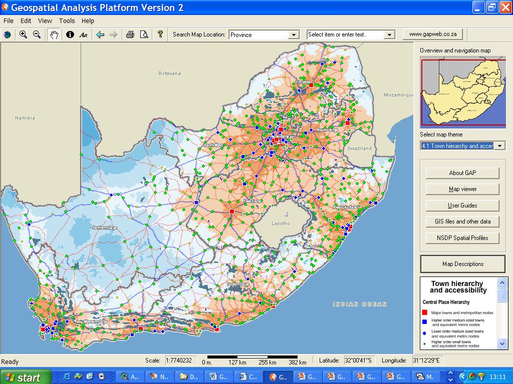
1 SA Geospatial Analysis Platform (GAP) Methodology*, collaborators & data sources Mesoframe CSIR, dti, the Presidency & GTZ Demarcation of South Africa into a grid of 50 Km 2 mesozones, nested within important boundaries Data and data mining methodology CSIR & StatsSA Urban function index, land cover & other spatial distribution variables Global Insight Control totals per Magisterial District CSIR & L Zietsman Strategic road network & related analysis tools * The underlying Mesoframe methodology was developed by CSIR, funded by the DST Parliamentary Grant
2 Preview: What is GAP? = a common, mesoscale spatial data assembly and analysis platform for: 1. Developing an enhanced, more balanced understanding of South Africa s human/economic geography and the associated interactions with the built and natural environment
 Understanding of human activity/ ecosystem")
3 Physical/ environmental geography Human/ economic geography Understanding of populationrelated needs & pressures Understanding of economic base/ development potential Understanding of transport/ economic linkages and accessibility (to markets & services) Understanding of human activity/ ecosystem interactions
4 What is GAP? = a common, mesoscale spatial data assembly and analysis platform for: 1. Developing an enhanced understanding of SA s human/economic geography and the associated interactions with the built and natural environment 2. Profiling and comparing local development magnitudes (needs, potentials, service and economic accessibility levels) from a strategic, district/ regional perspective 3. Providing a basis for addressing key development planning questions How much (of population/ economic activity) is where? Where are the main concentrations/ hot spots to be targeted? What (proportion of population in need) can we reach from where?


5 Limited data and model inter-operability Wrong scale of data: Need for more localised/ disaggregated data Mpumulanga s economic statistics (per Magisterial District, 2001) Differing analysis units: Economic model cannot talk to ecosystem model Mpumulanga s ecosystem statistics (per water catchment)
6 The problem of differing analysis units & scales Gordonia District Zone is very large and internally heterogeneous Gordonia problem : Zonesize distortions of quantity maps i.e. maps indicating how much is happening where * Upington Wynberg District Zone is too small to see at this scale ** Map of districts with high levels of labour intensive economic activity (2002 NSDP)

")
7 Example of distorted picture (population per SAL area) New GAP-based picture (population per mesozone)
8 The solution (1): Mesoframe demarcation: A demarcation of South Africa into more than mesozones / Standard Local Economic Areas: 1) each approximately 50 km 2 big, and 2) nested within important administrative & physiographic boundaries Municipal boundary
 Estimated Rand value of economic activity per mesozone")
9 The solution (2): Data mining Mining and integration of: Aggregate area statistics Point data (e.g. facilities per town) Land cover data (e.g. derived from satellite images) Estimated Rand value of economic activity per mesozone

10

11

12 G-Econ output: similar method applied to world

13 Population densities
14 The Island Approach to spatial profiling (e.g. of needs/opportunities) and targeting (e.g. of service delivery) The increasing availability of sub-place, ward-level, and local municipality data gives quite good indicators of service demand and available facilities, services and jobs per local area But this does not necessarily provide a good basis for assessing accessible services and other opportunities, some of which might just across the ward or municipal border Available services per local area Potentially accessible cross-border jobs, services & other livelihood resources
 within a 20 min travel")
15 The solution (3): Geo-linking, concentration and accessibility mapping Link each zone to the road network and to other zones in relevant wider regions Calculate quantities of economic & other human activities within specified distance or travel time ranges Accessibility of employment (numbers of jobs) within a 20 min travel distance range
 and the quantities within")
16 First calculation method Economic concentrations PROXIMITY COUNT Sum of own Distance or travel time range quantity & the quantities of other zones within the distance or travel time range Proximity counts are sums or counts of local or own quantities (such as the total volume of local economic activity within a 4km radius or 50km2 mesozone) and the quantities within surrounding zones or wider regions

17 Second calculation method Population concentrations WS Weighted sum of near and further magnitudes


18 Third calculation method 25% 40% 35%
19
20 Example of using different features of GAP Combining quantity mapping (maps of how much is where) with accessibility mapping (maps of what can be reached from where)
 per 50sq km standard")
21 The part of South Africa where it is really possible and/or desirable to sustain significant levels of human activity* 54.7% of surface area 99.2% of population 99.9% of GVA * Economic activity of more than R per sq km, and thus able to sustain more than one very small enterprise (with turnover of R ) per 50sq km standard local econ area

22 Percentage surface area, population and economic activity Populated South Africa High density high accessibility 7% 71% 88% High density low accessibility 4% 9% 24% Low density high accessibility 6% 2% 15% Low density low accessibility 2% 2% 23% Sparse South Africa 0% 1% 45% Surface area Population Economic activity
23 Achievements thus far Solution for Gordonia problem & associated distortions of geostatistical indicators & comparisons (of how much is where? ) Good utilisation of datamining tools to address critical spatial data gaps High profile applications and good responses from clients and other stakeholders Remaining/new challenges APPLICATIONS Demonstrate extended range of applications (from pattern analysis to interaction/ dynamics modelling) DEPLOYMENT/ SUSTAINABILITY Get user feedback, pilot and develop Web-linked Version 3 Explore wider applications in rest of Africa


24 Version 2 upgrade & new form of dissemination GAP data updating and analysis server DBSA s LGNet Planner with enhanced analysis capabilities Mini GIS with on-and offline capabilities GAP data Smart Board for interactive sketch planning Google Earth Planner GIS specialist GIS

 3.")

25 Longer-term linkage & deployment plan Geoportals & Web mapping / Geoprocessing Services 2. GeoICT support services (focussed on spatially intelligent rural collaboration & service delivery) 3. Urban & regional dynamics modelling Sensor-webs Remote sensing & processing Land cover 1. Spatial Analysis/ Modelling infrastructure 1a. Planning SDI, & Geospatial Analysis Platforms 1b. Multi-scale geo-modelling & spatial decision support Land Use
26
 & 2) analysis of spatial")
27 Basis for: 1) upscaling (from meso-level to a variety on macro-levels) & 2) analysis of spatial linkages
Sharthi Laldaparsad Statistics South Africa, Policy Research & Analysis. Sub-regional workshop on integration of administrative data,
 Sub-regional workshop on integration of administrative data, big data and geospatial information for the compilation of SDG indicators and International Workshop on Global Fundamental Geospatial Data Themes
Harmonizing spatial databases and services at local and regional level
 Harmonizing spatial databases and services at local and regional level A. Ionita 1, M. Caian 2, V. Vassilev 3, V. Craciunescu 2, I. Nedelcu 4 1 Research Institute for Artificial Intelligence, Bucuresti,
Geo-Enabling Digital India. 15 th Esri India User Conference GIS and Smart Cities
 15 th Esri India User Conference 2014 GIS and Smart Cities 15 th Esri India User Conference 2014 GIS and Smart Cities Agendra Kumar President, Esri India Our World Is Facing Serious Challenges Our World
INDONESIA S S UPDATE: GEOSPATIAL INFORMATION FOR SUSTAINABLE DEVELOPMENT RELATED TO INA SDI Dr. Asep Karsidi, M.Sc
 INDONESIA S S UPDATE: GEOSPATIAL INFORMATION FOR SUSTAINABLE DEVELOPMENT RELATED TO INA SDI Dr. Asep Karsidi, M.Sc GEOSPATIAL INFORMATION AGENCY 08 August, 2012 OUTLINE 1. Transformation Bakosurtanal into
The Global Statistical Geospatial Framework and the Global Fundamental Geospatial Themes
 The Global Statistical Geospatial Framework and the Global Fundamental Geospatial Themes Sub-regional workshop on integration of administrative data, big data and geospatial information for the compilation
GIS Building Communities beyond National Borders (Building Successful Spatial Data Infrastructures) Nick Land, ESRI Europe
 Nick Land, ESRI Europe") GIS Building Communities beyond National Borders (Building Successful Spatial Data Infrastructures) Nick Land, ESRI Europe UK worst flooding in the last 60 years 350,000 households without drinking water
GIS Building Communities beyond National Borders (Building Successful Spatial Data Infrastructures) Nick Land, ESRI Europe UK worst flooding in the last 60 years 350,000 households without drinking water
Building a National Data Repository
 Building a National Data Repository Mladen Stojic, Vice President - Geospatial 1/30/2013 2012 Intergraph Corporation 1 Information has meaning and gives power only when shared and distributed. Information,
Key Points Sharing fosters participation and collaboration Metadata has a big role in sharing Sharing is not always easy
 Sharing Resources Geoff Mortson esri, Inc. SDI Solutions Team Key Points Sharing fosters participation and collaboration Metadata has a big role in sharing Sharing is not always easy Data Sharing is Good
Achieving the Vision Geo-statistical integration addressing South Africa s Developmental Agenda. geospatial + statistics. The Data Revolution
 Achieving the Vision Geo-statistical integration addressing South Africa s Developmental Agenda geospatial + statistics The Data Revolution humble beginnings, present & future - South Africa UN World Data
Land Use in the context of sustainable, smart and inclusive growth
 Land Use in the context of sustainable, smart and inclusive growth François Salgé Ministry of sustainable development France facilitator EUROGI vice president AFIGéO board member 1 Introduction e-content+
National Spatial Development Perspective (NSDP) Policy Coordination and Advisory Service
 Policy Coordination and Advisory Service") National Spatial Development Perspective (NSDP) Policy Coordination and Advisory Service 1 BACKGROUND The advances made in the First Decade by far supersede the weaknesses. Yet, if all indicators were
National Spatial Development Perspective (NSDP) Policy Coordination and Advisory Service 1 BACKGROUND The advances made in the First Decade by far supersede the weaknesses. Yet, if all indicators were
How the science of cities can help European policy makers: new analysis and perspectives
 How the science of cities can help European policy makers: new analysis and perspectives By Lewis Dijkstra, PhD Deputy Head of the Economic Analysis Unit, DG Regional and European Commission Overview Data
Integration for Informed Decision Making
 Geospatial and Statistics Policy Intervention: Integration for Informed Decision Making Greg Scott Global Geospatial Information Management United Nations Statistics Division Department of Economic and
2007 / 2008 GeoNOVA Secretariat Annual Report
 2007 / 2008 GeoNOVA Secretariat Annual Report Prepared for: Assistant Deputy Minister and Deputy Minister of Service Nova Scotia and Municipal Relations BACKGROUND This report reflects GeoNOVA s ongoing
Transport Planning in Large Scale Housing Developments. David Knight
 Transport Planning in Large Scale Housing Developments David Knight Large Scale Housing Developments No longer creating great urban spaces in the UK (Hall 2014) Transport Planning Transport planning processes
TRAITS to put you on the map
 TRAITS to put you on the map Know what s where See the big picture Connect the dots Get it right Use where to say WOW Look around Spread the word Make it yours Finding your way Location is associated with
ESPON 2020 Cooperation Programme. Anneloes van Noordt MC-member Belgium
 ESPON 2020 Cooperation Programme Anneloes van Noordt MC-member Belgium Anneloes.vannoordt@vlaanderen.be Outline ESPON 2020 Cooperation Programme Applied Research Targeted Analysis Database & Tools Outreach
CAPE FARM MAPPER - an integrated spatial portal
 CAPE FARM MAPPER - an integrated spatial portal Skukuza Dr Mike Wallace June 2017 Overview of GIS applications in WCDoA Spatial information and technology has become indispensable across a wide range of
Developing a geo-data frame using dasymetric mapping principles to facilitate data integration
 Developing a geo-data frame using dasymetric mapping principles to facilitate data integration Gerbrand Mans 1 1 Planning Support Systems, Built Environment, CSIR, South Africa, gmans@csir.co.za Abstract
BACKGROUND INFORMATION DOCUMENT
 Strategic Environmental Assessment of the SKA Phase 1 in South Africa BACKGROUND INFORMATION DOCUMENT www.skaphase1.csir.co.za SKAPhase1@csir.co.za Introduction The MeerKAT and SKA projects are part of
KUNMING FORUM ON UNITED NATIONS GLOBAL GEOSPATIAL INFORMATION MANAGEMENT CITIES OF THE FUTURE: SMART, RESILIENT
 KUNMING FORUM ON UNITED NATIONS GLOBAL GEOSPATIAL INFORMATION MANAGEMENT CITIES OF THE FUTURE: SMART, RESILIENT and SUSTAINABLE Yunnan Zhenzhuang Guest House, Kunming, China 10 12 May 2017 BACKGROUND CONCEPT
2 nd Semester. Core Courses. C 2.1 City and Metropolitan Planning. Module 1: Urban Structure and Growth Implications
 2 nd Semester Core Courses C 2.1 City and Metropolitan Planning Module 1: Urban Structure and Growth Implications Growth of cities; cities as engine of growth; urban sprawl; land value, economic attributes
GEOSPATIAL ONLINE WEB-TOOLS CapeFarmMapper & CAMIS
 GEOSPATIAL ONLINE WEB-TOOLS CapeFarmMapper & CAMIS F.C. Basson 14 March 2017 Overview Spatial information and technology has become more important and relevant Applications Mapping of Agricultural footprint
Using OGC standards to improve the common
 Using OGC standards to improve the common operational picture Abstract A "Common Operational Picture", or a, is a single identical display of relevant operational information shared by many users. The
Improving rural statistics. Defining rural territories and key indicators of rural development
 Improving rural statistics Defining rural territories and key indicators of rural development Improving rural statistics Improving Rural Statistics In 2016, the Global Strategy to improve Agricultural
National GIS Platform for Digital India. Dr.(Mrs.) Vandana Sharma Deputy Director General National Informatics Centre
 Vandana Sharma Deputy Director General National Informatics Centre") National GIS Platform for Digital India Dr.(Mrs.) Vandana Sharma Deputy Director General National Informatics Centre sharma.vandana@nic.in NIC DEITY - National e-governance Infrastructure Meghraj Cloud
National GIS Platform for Digital India Dr.(Mrs.) Vandana Sharma Deputy Director General National Informatics Centre sharma.vandana@nic.in NIC DEITY - National e-governance Infrastructure Meghraj Cloud
IDEBarcelona: Cooperating for a Smart Region Infrastructure
 IDEBarcelona: Cooperating for a Smart Region Infrastructure Marta Codinachs Serra Diputació de Barcelona Territory and Sustainability Area Territorial Information Systems Department SMART CITY EXPO WORLD
Voices from Private Sector: Insights for Future NSDI Development in Indonesia
 Voices from Private Sector: Insights for Future NSDI Development in Indonesia Ta n d a n g Yu l i a d i D w i P u t ra, Ryosuke S h i b a s a k i I n st i t u t e o f I n d u st r i a l S c i e n c e,
Upgrade the Datasets in NSDI for Smarter Services with the Cases of China
 Upgrade the Datasets in NSDI for Smarter Services with the Cases of China By Dr. JIANG Jie Dept of GeoInformaiton Service Platform National Geomatics Center of China October 7, 2015 Jeju, Republic of Korea
THE NATIONAL SPATIAL DEVELOPMENT PERSPECTIVE (NSDP) AND ASSUMPTIONS ON SMALL TOWN ECONOMIC INVESTMENT BY GOVERNMENT
 AND ASSUMPTIONS ON SMALL TOWN ECONOMIC INVESTMENT BY GOVERNMENT") THE NATIONAL SPATIAL DEVELOPMENT PERSPECTIVE (NSDP) AND ASSUMPTIONS ON SMALL TOWN ECONOMIC INVESTMENT BY GOVERNMENT Mark Oranje (University of Pretoria) and Elsona van Huyssteen and Cathy Meiklejohn (CSIR,
THE NATIONAL SPATIAL DEVELOPMENT PERSPECTIVE (NSDP) AND ASSUMPTIONS ON SMALL TOWN ECONOMIC INVESTMENT BY GOVERNMENT Mark Oranje (University of Pretoria) and Elsona van Huyssteen and Cathy Meiklejohn (CSIR,
Methodological issues in the development of accessibility measures to services: challenges and possible solutions in the Canadian context
 Methodological issues in the development of accessibility measures to services: challenges and possible solutions in the Canadian context Alessandro Alasia 1, Frédéric Bédard 2, and Julie Bélanger 1 (1)
Smart Cities and Urban Governance. The urbanapi Project: Bologna Case Study David C. Ludlow, Maria Paola Mauri, Chiara Caranti
 1 ABSTRACT Smart Cities and Urban Governance. The urbanapi Project: Bologna Case Study David C. Ludlow, Maria Paola Mauri, Chiara Caranti (David C. Ludlow, UWE University of the West of England, Bristol-
Preparing the GEOGRAPHY for the 2011 Population Census of South Africa
 Preparing the GEOGRAPHY for the 2011 Population Census of South Africa Sharthi Laldaparsad Statistics South Africa; E-mail: sharthil@statssa.gov.za Abstract: Statistics South Africa (Stats SA) s Geography
Geo Business Gis In The Digital Organization
 We have made it easy for you to find a PDF Ebooks without any digging. And by having access to our ebooks online or by storing it on your computer, you have convenient answers with geo business gis in
The South African Social Security
 Visualisation Spatial optimisation of the SA Social Security Agency service offices by Larry Zietsman, Geographical Systems Research Bureau, and Cobus van Doorn, SITA Location-allocation modelling provides
In order to determine the accuracy
 Visualisation Developing a geo-data frame to facilitate data integration (Part 2) by Gerbrand Mans, CSIR This article discusses the development of a disaggregation procedure for socio-economic data based
The Social Life of Location. David Sonnen September 2008
 The Social Life of Location David Sonnen September 2008 Three Transformations Traditional Cartography -- 2300 B.C. - ~ 1980 Maps represent location and attributes Portable, persistent communication/ reference
Discovery and Access of Geospatial Resources using the Geoportal Extension. Marten Hogeweg Geoportal Extension Product Manager
 Discovery and Access of Geospatial Resources using the Geoportal Extension Marten Hogeweg Geoportal Extension Product Manager DISCOVERY AND ACCESS USING THE GEOPORTAL EXTENSION Geospatial Data Is Very
Module 3 Indicator Land Consumption Rate to Population Growth Rate
 Regional Training Workshop on Human Settlement Indicators Module 3 Indicator 11.3.1 Land Consumption Rate to Population Growth Rate Dennis Mwaniki Global Urban Observatory, Research and Capacity Development
CHAPTER 4 HIGH LEVEL SPATIAL DEVELOPMENT FRAMEWORK (SDF) Page 95
 Page 95") CHAPTER 4 HIGH LEVEL SPATIAL DEVELOPMENT FRAMEWORK (SDF) Page 95 CHAPTER 4 HIGH LEVEL SPATIAL DEVELOPMENT FRAMEWORK 4.1 INTRODUCTION This chapter provides a high level overview of George Municipality s
CHAPTER 4 HIGH LEVEL SPATIAL DEVELOPMENT FRAMEWORK (SDF) Page 95 CHAPTER 4 HIGH LEVEL SPATIAL DEVELOPMENT FRAMEWORK 4.1 INTRODUCTION This chapter provides a high level overview of George Municipality s
Bentley Map Advancing GIS for the World s Infrastructure
 Bentley Map Advancing GIS for the World s Infrastructure Presentation Overview Why would you need Bentley Map? What is Bentley Map? Where is Bentley Map Used? Red text signifies new things in Bentley Map
Merging statistics and geospatial information
 Merging statistics and geospatial information Demography / Commuting / Spatial planning / Registers Mirosław Migacz Chief GIS Specialist Janusz Dygaszewicz Director Central Statistical Office of Poland
DBSA Knowledge Week Yusuf Patel South African Planning Institute
 Sustainable Human Settlements - Institutional Issues DBSA Knowledge Week Yusuf Patel South African Planning Institute 20 October 2010 Spatial Planning for Long Term Apartheid engineered spatial economy
Future Proofing the Provision of Geoinformation: Emerging Technologies
 Future Proofing the Provision of Geoinformation: Emerging Technologies An Exchange Forum with the Geospatial Industry William Cartwright Chair JBGIS Second High Level Forum on Global Geospatial Information
Crime Analysis. GIS Solutions for Intelligence-Led Policing
 Crime Analysis GIS Solutions for Intelligence-Led Policing Applying GIS Technology to Crime Analysis Know Your Community Analyze Your Crime Use Your Advantage GIS aids crime analysis by Identifying and
Institute of Statistical and Geographical Information of Jalisco State Subnational Statistical and Geographical System India.
 Institute of Statistical and Geographical Information of Jalisco State Subnational Statistical and Geographical System India. January 2017 Subnational Statistical and Geographical System National Statistical
Web-GIS based Framework for Solid Waste Complaint Management for Sustainable and Smart City
 Cloud Publications International Journal of Advanced Remote Sensing and GIS 2016, Volume 5, Issue 10, pp. 1930-1936 ISSN 2320-0243, DOI: 10.23953/cloud.ijarsg.71 Research Article Open Access Web-GIS based
Indicator: Proportion of the rural population who live within 2 km of an all-season road
 Goal: 9 Build resilient infrastructure, promote inclusive and sustainable industrialization and foster innovation Target: 9.1 Develop quality, reliable, sustainable and resilient infrastructure, including
Systems (GIS) - with a focus on.
 - with a focus on.") Introduction to Geographic Information Systems (GIS) - with a focus on localizing the MDGs Carmelle J. Terborgh, Ph.D. ESRI www.esri.com Flying Blind Jul 24th 2003 The Economist We Live in Two Worlds Natural
Introduction to Geographic Information Systems (GIS) - with a focus on localizing the MDGs Carmelle J. Terborgh, Ph.D. ESRI www.esri.com Flying Blind Jul 24th 2003 The Economist We Live in Two Worlds Natural
Spatially Enabled Society
 International Seminar on Land Administration Trends and Issues in Asia and the Pacific Region Spatially Enabled Society Abbas Rajabifard Vice Chair PCGIAP-WG3 Vice-President (President Elect), GSDI Association
Geographical Information Systems Energy Database Report. WP1 T1.3- Deliverable 1.9
 Geographical Information Systems Energy Database Report WP1 T1.3- Deliverable 1.9 March 2015 1 314164 (ENER/FP7/314164) Project acronym: InSMART Project full title: Integrative Smart City Planning Coordination
The GIS Path Forward Saskatchewan s Geomatics Strategic Plan
 The GIS Path Forward Saskatchewan s Geomatics Strategic Plan John Potter, SK Ministry of Central Services Office of Geomatics Coordination Sept.17/13 Table of Contents 1. 2011-2016, Geomatics Strategic
Integrating Official Statistics and Geospatial Information NBS Experience
 Integrating Official Statistics and Geospatial Information NBS Experience Presented by Eng. Reda AL Sabbagh Director of IT Dept. Prepared by Eng. Adham Makky GIS Specialist Topics to be covered: Background
THE ROLE OF REGIONAL SPATIAL PLANNING IN SUPPORTING LONG-TERM ECONOMIC GROWTH IN NORTHERN IRELAND
 THE ROLE OF REGIONAL SPATIAL PLANNING IN SUPPORTING LONG-TERM ECONOMIC GROWTH IN NORTHERN IRELAND Jenny Pyper Director 6 th Annual ICLRD Conference 20 January 2011 PURPOSE OF REGIONAL PLANNING Framework
SMART CITIES NEED LOCATION DATA
 SMART CITIES NEED LOCATION DATA Carsten Rönsdorf 27 May 2015 Lisbon Future Cities need Location Data Geospatial World Forum 27 May 2015 Carsten Rönsdorf, Head of Advisory Services, OS International OFFICIAL
Statistical-geospatial integration - The example of Sweden. Marie Haldorson Director, Statistics Sweden
 Statistical-geospatial integration - The example of Sweden Marie Haldorson Director, Statistics Sweden Spatial data and geospatial applications at Statistics Sweden Long tradition GI integrated in production
Designing smart & Resilient cities:
 Designing smart & Resilient cities: How can Egyptian cities learn from an emerging global practice On the Cuspof Change Professor Samer Bagaeen FRICS MRTPI FRSA AoU 1. GLOBAL CHALLENGES POPULATION GROWTH,
Oman NSDI Business Values and Future Directions. Hassan Alawi Alghazali Acting Director General National Spatial Data Infrastructure
 Oman NSDI Business Values and Future Directions Hassan Alawi Alghazali Acting Director General National Spatial Data Infrastructure Presentation Outline Geospatial Maturity Current Challenges NCSI s Role
Key Indicators for Territorial Cohesion and Spatial Planning in Preparing Territorial Development Strategies
 ESPON Evidence in a North European Context Challenges and Opportunities for Territorial Development and Cohesion in a North European Macro Region, 10-11 April, 2014, Vilnius, Lithuania Key Indicators for
Compact guides GISCO. Geographic information system of the Commission
 Compact guides GISCO Geographic information system of the Commission What is GISCO? GISCO, the Geographic Information System of the COmmission, is a permanent service of Eurostat that fulfils the requirements
Task A4, Appendix A: Maryland Land Use and Impact Assessment Model
 Task A4, Appendix A: Maryland Land Use and Impact Assessment Model The LEAM Model During the last two decades, spatial analysis tools, geographic information systems (GIS), and remote-sensing (RS) technologies
SDI DEVELOPMENT UPDATES OF INDONESIA
 SDI DEVELOPMENT UPDATES OF INDONESIA DR. ANTONIUS B. WIJANARTO Center For Management And Dissemination Of Geospatial Information GEOSPATIAL INFORMATION AUTHORITY GOVERNMENT OF THE REPUBLIC OF INDONESIA
Funding systems used in Mexico to support institutional arrangements: INEGI case
 Funding systems used in Mexico to support institutional arrangements: INEGI case Sistemas de financiamiento usados en México, para soportar arreglos institucionales: Caso INEGI United Nations Committee
Exploring Digital Welfare data using GeoTools and Grids
 Exploring Digital Welfare data using GeoTools and Grids Hodkinson, S.N., Turner, A.G.D. School of Geography, University of Leeds June 20, 2014 Summary As part of the Digital Welfare project [1] a Java
ReCAP Status Review of the Updated Rural Access Index (RAI) Stephen Vincent, Principal Investigator
 Stephen Vincent, Principal Investigator") ReCAP Status Review of the Updated Rural Access Index (RAI) Stephen Vincent, Principal Investigator Establishment of RAI in 2005/2006 2006 Definition of the RAI Note by Peter Roberts Dated September 2005
ReCAP Status Review of the Updated Rural Access Index (RAI) Stephen Vincent, Principal Investigator Establishment of RAI in 2005/2006 2006 Definition of the RAI Note by Peter Roberts Dated September 2005
Marine Transportation and Ocean Use
 Marine Transportation and Ocean Use Data Needs for Multi-Disciplinary Long-Term Planning 4 th Biennial TRB-CMTS Research and Development Conference Matt Campo Rutgers University 6/22/2016 Overview What
Geospatial SDI Portal for effective Governance of Pune METROPOLIS region
 Geospatial SDI Portal for effective Governance of Pune METROPOLIS region Mr. Praveen Gautam Senior Manager 19 th January 2018 PMRDA Overview Provide a Spatial Framework for the entire region with various
Accessibility as an Instrument in Planning Practice. Derek Halden DHC 2 Dean Path, Edinburgh EH4 3BA
 Accessibility as an Instrument in Planning Practice Derek Halden DHC 2 Dean Path, Edinburgh EH4 3BA derek.halden@dhc1.co.uk www.dhc1.co.uk Theory to practice a starting point Shared goals for access to
Targeting the Poor. Towards evidence-based implementation. Johan A. Mistiaen (World Bank)
") Targeting the Poor Towards evidence-based implementation Johan A. Mistiaen (World Bank) Presentation at Joint Poverty Assessment Workshop Nairobi - May 19, 2005 Outline Integrating Data Sources - GIS What
Targeting the Poor Towards evidence-based implementation Johan A. Mistiaen (World Bank) Presentation at Joint Poverty Assessment Workshop Nairobi - May 19, 2005 Outline Integrating Data Sources - GIS What
GIS (GEOGRAPHICAL INFORMATION SYSTEMS) AS A FACILITATION TOOL FOR SUSTAINABLE DEVELOPMENT IN AFRICA
 AS A FACILITATION TOOL FOR SUSTAINABLE DEVELOPMENT IN AFRICA") GIS (GEOGRAPHICAL INFORMATION SYSTEMS) AS A FACILITATION TOOL FOR SUSTAINABLE DEVELOPMENT IN AFRICA a presentation by Elizabeth Hicken GDEST Conference on Geospatial Sciences for Sustainable Development
GIS (GEOGRAPHICAL INFORMATION SYSTEMS) AS A FACILITATION TOOL FOR SUSTAINABLE DEVELOPMENT IN AFRICA a presentation by Elizabeth Hicken GDEST Conference on Geospatial Sciences for Sustainable Development
ASSESSMENT. Industry Solutions Harness the Power of GIS for Property Assessment
 ASSESSMENT Industry Solutions Harness the Power of GIS for Property Assessment Esri Canada has thousands of customers worldwide who are using the transforming power of GIS technology to collect, maintain,
BROADBAND DEMAND AGGREGATION: PLANNING BROADBAND IN RURAL NORTHERN CALIFORNIA
 BROADBAND DEMAND AGGREGATION: PLANNING BROADBAND IN RURAL NORTHERN CALIFORNIA Steven J. Steinberg, Ph.D a,b, *, Rebecca Degagne a, M.S., Michael Gough a a Institute for Spatial Analysis, Humboldt State
Evaluating e-government : implementing GIS services in Municipality
 Evaluating e-government : implementing GIS services in Municipality Municipality of Thessaloniki - G.I.S. Unit Misirloglou Symeon Head of the GIS Unit ESRI UC - 2016 The GIS Section - subset of the department
Spatial Data Management of Bio Regional Assessments Phase 1 for Coal Seam Gas Challenges and Opportunities
 Spatial Data Management of Bio Regional Assessments Phase 1 for Coal Seam Gas Challenges and Opportunities By Dr Zaffar Sadiq Mohamed-Ghouse Principal Consultant, Spatial & IT, GHD zaffar.sadiq@ghd.com
Application Issues in GIS: the UCL Centre for Advanced Spatial Analysis. Paul Longley UCL
 Application Issues in GIS: the UCL Centre for Advanced Spatial Analysis Paul Longley UCL GIS: inclusive, shared understanding Geodemographics as a focus of interest Profiling public goods and services
INSPIRing Geospatial Framework For Local Administrations
 This project is financed by the European Union and the Republic of Turkey Presented at the FIG Congress 2018, May 6-11, 2018 in Istanbul, Turkey National Programme for Turkey 2010 Instrument for Pre-Accession
a national geological survey perspective François ROBIDA BRGM (French Geological Survey)
") a national geological survey perspective François ROBIDA BRGM (French Geological Survey) Pre-Conference Seminar on Socio-Economic Value of Geospatial for National and Regional Development 21 August 2017,
a national geological survey perspective François ROBIDA BRGM (French Geological Survey) Pre-Conference Seminar on Socio-Economic Value of Geospatial for National and Regional Development 21 August 2017,
The National Spatial Strategy
 Purpose of this Consultation Paper This paper seeks the views of a wide range of bodies, interests and members of the public on the issues which the National Spatial Strategy should address. These views
Principle 3: Common geographies for dissemination of statistics Poland & Canada. Janusz Dygaszewicz Statistics Poland
 Principle 3: Common geographies for dissemination of statistics Poland & Canada Janusz Dygaszewicz Statistics Poland Reference materials Primary: Ortophotomap, Cadastral Data, Administrative division borders,
Copernicus Overview. Major Emergency Management Conference Athlone 2017
 Copernicus Overview Major Emergency Management Conference Athlone 2017 Copernicus is a European programme implemented by the European Commission. The services address six thematic areas: land, marine,
PIBC Annual Conference, 2016
 Land Use Quantified PIBC Annual Conference, 2016 A collaboration between: Christy & Associated Planning Consultants The Sustainable Transportation Partnership of the Central Okanagan Hazel Christy Rafael
Gistat: moving towards a location information management system
 Gistat: moving towards a location information management system (merging geographical, statistical and historical information) Pina Grazia Ticca Marco Ballin Istat - Italy Aguascalientes, Mexico 2-4 December
Geospatial Information and Services for Disasters (GIS4D)
") Geospatial Information and Services for Disasters (GIS4D) 31 July 2017 Tae Hyung KIM ICT and Disaster Risk Reduction Division (IDD) UNESCAP 1 About ESCAP Who is ESCAP? United Nations Economic and Social
Geospatial Information and Services for Disasters (GIS4D) 31 July 2017 Tae Hyung KIM ICT and Disaster Risk Reduction Division (IDD) UNESCAP 1 About ESCAP Who is ESCAP? United Nations Economic and Social
Esri and GIS Education
 Esri and GIS Education Organizations Esri Users 1,200 National Government Agencies 11,500 States & Regional Agencies 30,800 Cities & Local Governments 32,000 Businesses 8,500 Utilities 12,600 NGOs 11,000
Qatar Statistical Geospatial Integration
 Qatar Statistical Geospatial Integration A Presentation by the Ministry of Development Planning & Statistics (MDPS), State of Qatar http://www.mdps.gov.qa (Fourth UN-GGIM Arab States Committee Meeting,
TOWARDS THE DEVELOPMENT OF A MONITORING SYSTEM FOR PLANNING POLICY Residential Land Uses Case study of Brisbane, Melbourne, Chicago and London
 TOWARDS THE DEVELOPMENT OF A MONITORING SYSTEM FOR PLANNING POLICY Residential Land Uses Case study of Brisbane, Melbourne, Chicago and London Presented to CUPUM 12 July 2017 by Claire Daniel Urban Planning/Data
A Collective Approach to Spatial Data Management. Scottish Local Government
 A Collective Approach to Spatial Data Management Scottish Local Government Iain McKay Improvement Service @iainwk Slide 1 of 142 Spatial Information Service Context Scottish Local Government is facing:-
SITMUN: Cooperating to Build Local SDIs in the Barcelona Region
 SITMUN: Cooperating to Build Local SDIs in the Barcelona Region Diputació de Barcelona Territory and Sustainability Area Territorial Information Systems Department INSPIRE CONFERENCE Barcelona, September
Brazil Paper for the. Second Preparatory Meeting of the Proposed United Nations Committee of Experts on Global Geographic Information Management
 Brazil Paper for the Second Preparatory Meeting of the Proposed United Nations Committee of Experts on Global Geographic Information Management on Data Integration Introduction The quick development of
Building Institutional Capacity for Multi-Hazard Early Warning in Pacific Countries Subtitle
 Building Institutional Capacity for Multi-Hazard Early Warning in Pacific Countries Subtitle Title Keran Wang Chief, Space Applications Section ICT and Disaster Risk Reduction Division 30 March 2018 Slide
Use of GIS in road sector analysis
 Use of GIS in road sector analysis Uwe Deichmann, DECRG March 30, 2007 Transport Forum and Learning Week 2007 Transport Measurement Matters Indicators of Performance and Impact Geographic information Using
ADDRESSING THE DATA AND INFORMATION NEEDS FOR GOOD GOVERNANCE, SHARING EXPERIENCES FROM COTE D IVOIRE. 20 April 2016 to 22 April 2016 ADDIS ABABA
 20 April 2016 to 22 April 2016 ADDIS ABABA ADDRESSING THE DATA AND INFORMATION NEEDS FOR GOOD GOVERNANCE, SHARING EXPERIENCES FROM COTE D IVOIRE Dr. Edouard FONH-GBEI Director General of CNTIG, General
ArcGIS for INSPIRE. Marten Hogeweg Satish Sankaran
 ArcGIS for INSPIRE Marten Hogeweg Satish Sankaran Outline What is ArcGIS ArcGIS for INSPIRE Web GIS Case Studies Roadmap Q&A What is INSPIRE? INSPIRE is the legal framework for a European Spatial Data
How GIS based Visualizations Support Land Use and Transportation Modeling
 How GIS based Visualizations Support Land Use and Transportation Modeling ESRI International Users Conference San Diego, CA - July 23, 2015 Prepared by: Troy Hightower Introduction This presentation will
Egypt Public DSS. the right of access to information. Mohamed Ramadan, Ph.D. [R&D Advisor to the president of CAPMAS]
![Egypt Public DSS. the right of access to information. Mohamed Ramadan, Ph.D. [R&D Advisor to the president of CAPMAS]](/thumbs/89/98483713.jpg "Egypt Public DSS. the right of access to information. Mohamed Ramadan, Ph.D. [R&D Advisor to the president of CAPMAS]") Egypt Public DSS ì the right of access to information Central Agency for Public Mobilization and Statistics Arab Republic of Egypt Mohamed Ramadan, Ph.D. [R&D Advisor to the president of CAPMAS] Egypt
Egypt Public DSS ì the right of access to information Central Agency for Public Mobilization and Statistics Arab Republic of Egypt Mohamed Ramadan, Ph.D. [R&D Advisor to the president of CAPMAS] Egypt
Corporate. Information. Railway Infrastructure Administrator. Year indracompany.com
 geospatial and mobility Corporate Geographic Information System of ADIF Railway Infrastructure Administrator. Year 2009-2010 Corporate Geographic Information System of ADIF ADIF. Spanish Administrator
Incorporating ArcGIS Pro in your Curriculum
 AAG, Boston 2017 April 5, 2017 Incorporating ArcGIS Pro in your Curriculum Geri Miller Agenda Concerns Acknowledged Learning curve ArcGIS Pro does not have all the tools (perception) Licensing and offline
Excel Geomatics. Rajesh Paul Excel Geomatics Pvt. Ltd., Noida February, 2015 India Geospatial Forum, Hyderabad
 Excel Geomatics Geo-marketing for Product Sales and Customer Services Rajesh Paul Excel Geomatics Pvt. Ltd., Noida 10-12 February, 2015 India Geospatial Forum, Hyderabad Presentation Outline About Excel
Available online at I-SEEC Proceeding - Science and Engineering (2013)
") Available online at www.iseec2012.com I-SEEC 2012 Proceeding - Science and Engineering (2013) 409 415 Proceeding Science and Engineering www.iseec2012.com Science and Engineering Symposium 4 th International
Available online at www.iseec2012.com I-SEEC 2012 Proceeding - Science and Engineering (2013) 409 415 Proceeding Science and Engineering www.iseec2012.com Science and Engineering Symposium 4 th International
Launch of the ESPON 2013 Programme. European observation network on territorial development and cohesion
 Launch of the ESPON 2013 Programme European observation network on territorial development and cohesion Framework conditions for the ESPON 2013 Programme Policy development in use of territorial evidence