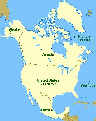
Introducing North America
|
|
|
- Deirdre Gilbert
- 6 years ago
- Views:
Transcription
1 Introducing North America
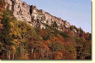
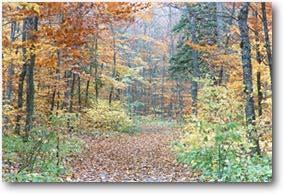
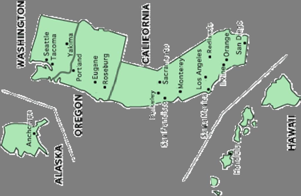
2 I. Quick Stats Includes U.S. & Canada U.S consists of 50 States Federal Government Democracy 4 th in world w/ land area 3 rd in population Economic leader of free world
3
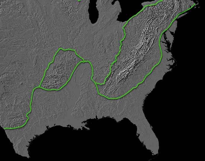
4 II. Major Landform Regions Atlantic Coastal Plains Piedmont Appalachian Highlands Interior Highlands Great Plains Rocky Mountains Intermountain Pacific Mtn/Valley Interior Plains Canadian Shield Central Lowlands
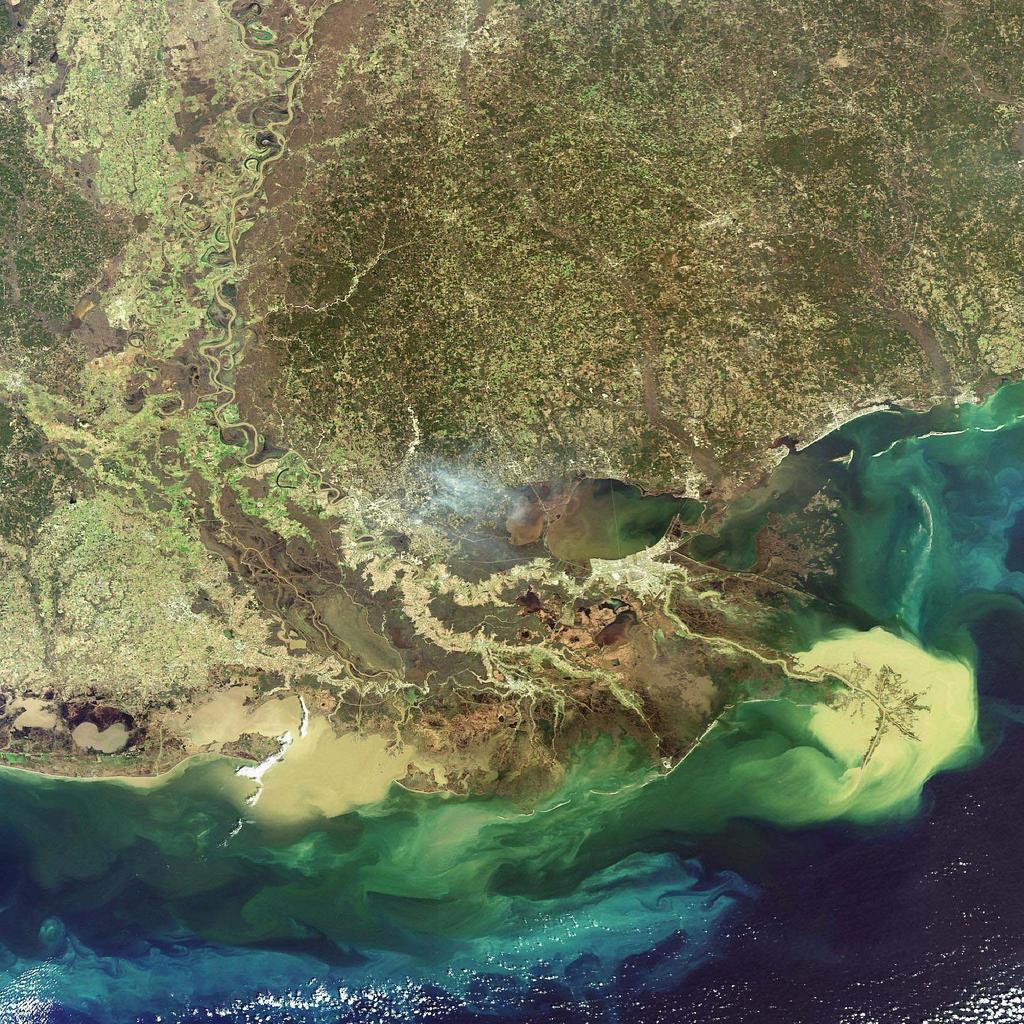
5 Atlantic Coastal Plains
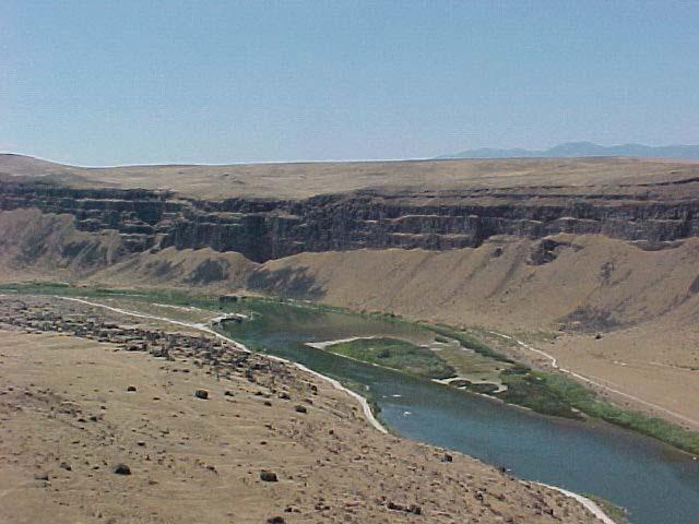
6
7 Piedmont
8
9 Appalachian Highlands
10

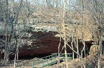
11 Interior Highlands
12

13 Great Plains
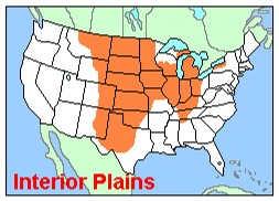
14

15 Rocky Mountains

16
17 Intermountain

18

19 Pacific Mtn/Valley
20
21 Interior Plains

22

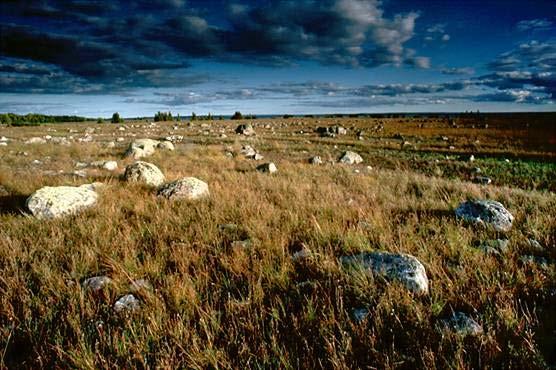
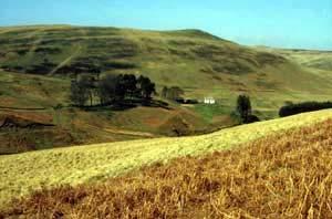
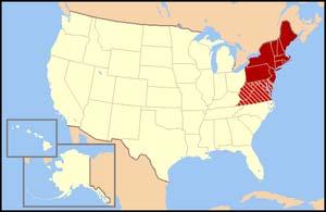
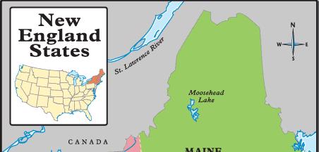
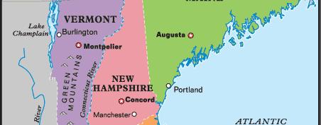
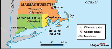
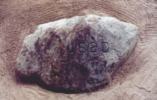
23 Canadian Shield
24

25 Central Lowlands
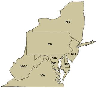
26
27 Unit 2 Lecture 2 The United States
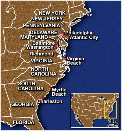
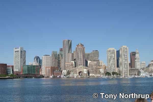
28 Quick Facts Most populated region in U.S. Consists of 3 Sub-regions New England states Middle Atlantic states Megalopolis Overlaps previous two sub-regions
29
30 New England States Maine, New Hampshire, Vermont, Massachusetts, Rhode Island, and Connecticut. Over 5% of total U.S. population Home of 1 st colonist to come to N. America 1 st industrialized region in N. America
31
32
33 Mid-Atlantic States New York, Pennsylvania, New Jersey, Delaware, Maryland, West Virginia 20% of total U.S. population Major cities Industrial giant Major hub for economic/political decisions
34
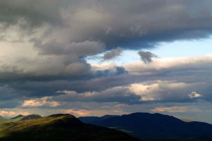
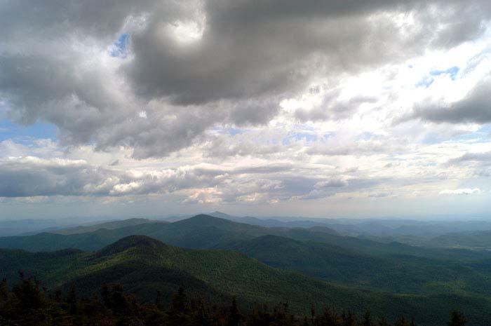
35 Megalopolis Boston, New York, Philadelphia, Baltimore, Washington D.C. Major issues: Over population Lack of land Lack of jobs pollution
36
37

38
39

40
41
42 Major Landforms Appalachian Mountains White Mountains Green Mountains Glacial deposits Coastal Plain Piedmont region

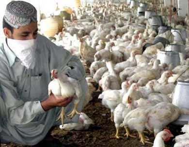
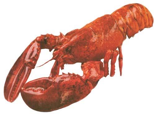
43
44
45
46 Climate Humid-Continental in the north Hot summers/cold winters Humid subtropical in the south Hot summers/mild winters
47 Agriculture North Rocky soil limits farming Cranberries/potatoes Good for dairy and poultry farms South Fruits/vegetables

48
49
50 Resources North Major fishing industry (Cod/Lobster) Forests Mining for building stone (granite/marble) South Coal deposits Iron ore

51
52
53
54
55

56
57 Industry First area for heavy textile plants Higher education Major schools (Harvard, Yale, etc.) Biotechnology Biology in industrial process Tourism Many historic sites
58
59 Unit 2 Lecture 3 Southeastern United States

60
61 Quick Facts Includes Texas, Louisiana, Arkansas, Mississippi, Tennessee, Kentucky, Alabama, Georgia, Florida, South Carolina, North Carolina, Virginia Majority of population lives on small farms Major plantation industry History tied to slavery Ethnically diverse
62 Major Landforms Barrier Islands Everglades Mississippi Delta Blue Ridge Mountains Smokey Mountains Ozark Plateau
63
64
65
66
67 Climate Humid Sub-Tropical Steppe/Desert (Further West in Texas) Average rain inches per year Late summer area prone to hurricanes
68 River Systems Mississippi River one of largest in world Drains nearly half of U.S. Prone to flooding Levee system Delta system
69 Agriculture Cotton Tobacco Citrus Peanuts Soybeans Beef
70 Major Industry Oil refineries Petrochemical Plants Tourism
71 Regional Issues Ethnic issues Flooding/Hurricanes Droughts High unemployment High poverty rates
72 Unit 2 Lecture 4 MIDWESTERN STATES
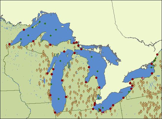
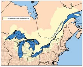
73 Quick Facts Ohio, Indiana, Illinois, Michigan, Wisconsin, Minnesota, Iowa, and Missouri. Nation s agricultural center Great Lakes increases international trade Rich Native American roots

74
75 Major Landforms Interior Plains Ozark Plateau Many lakes due to glaciers Humid-Continental Climate
76

77
78
79
80 The Great Lakes Largest freshwater lake system in the world Includes 20% of entire world s fresh water Includes Lakes Superior, Michigan, Huron, Erie, and Ontario. St. Lawrence River is highway system to lakes.
81

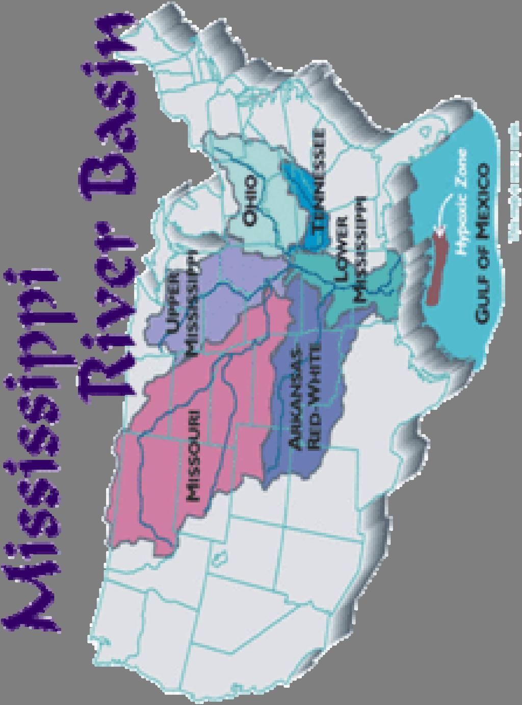
82

83
84
85
86
87
88
89 Mississippi River Drains all the Mid-west Major tributaries include Ohio, Missouri, and Illinois.
90
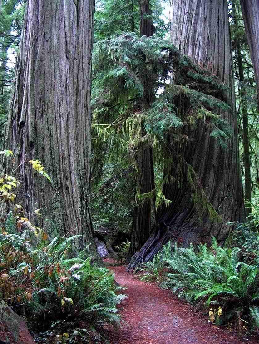
91
92
93 Agriculture Leading producers in dairy products, port, corn, and soybeans The Corn Belt The Dairy Belt
94
95

96
97
98 Natural Resources/Industry Pine forests Wildlife/hunting Lead/copper/iron mining Coal

99
100 Issues Heavy industrialized area High levels of unemployment (Ford?) Water quality Pollution
101 Unit 2 Lecture 5 The Interior West

102
103 Quick Facts Idaho, Montana, North/South Dakotas, Wyoming, Nebraska, Kansas, Oklahoma, Colorado, New Mexico, Arizona, Nevada, and Utah. Old West 3 Sub-regions Great Plains Rocky Mtns Intermountain West

104
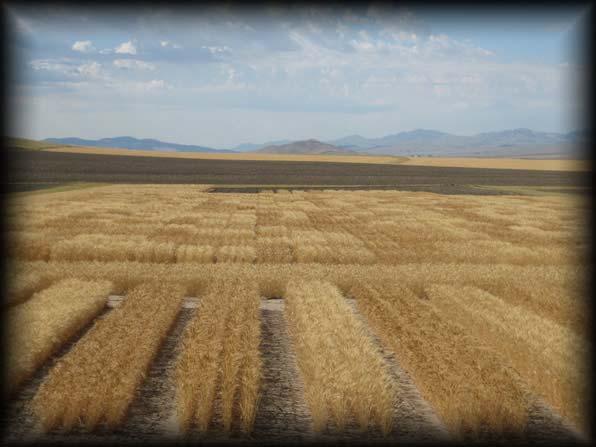
105
106
107 Great Plains Major Landforms The Great Plains Sand hills Badlands Climate Steppe
108
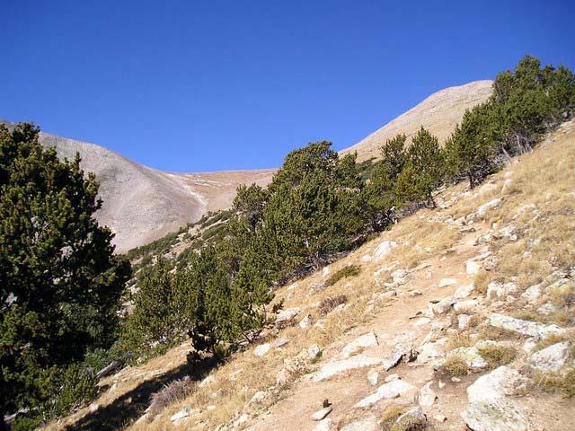
109
110
111
112 Great Plain cont.. Major issues Droughts End of open range Major wheat production Over use of water supplies Foreign markets for wheat Strip mining of natural resources

113
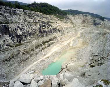
114
115
116 Rocky Mountains Rich in natural resources Continental Divide Highland climates Tree line
117
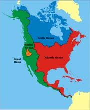
118
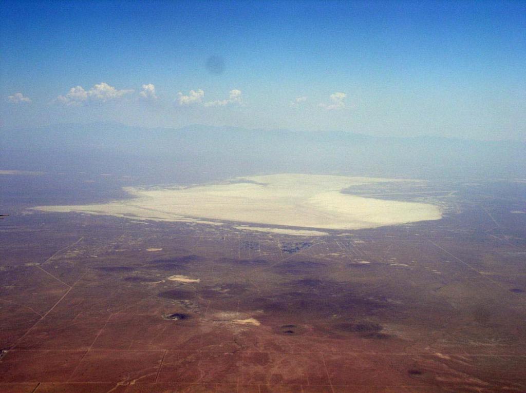
119
120
121 Economic geography Mostly still wild Gold, silver mining Ranching Forestry Tourism
122
123

124
125 Intermountain West Physical Geography Between Rocky/Cascade Mtns Three regions Great Basin Colorado Plateau Columbia Plateau
126 Great Basin Centered in Nevada Rivers flow into basins and dry up Dry lake beds/salt flats
127
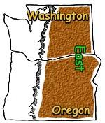
128
129 Colorado Plateau Deep canyons (Grand Canyon) Dry, desert climate Columbia Plateau Northern part of Intermtn west Centered in central Idaho Snake River major tributary to Columbia
130

131
132
133
134 Agriculture Irrigated Small portion used for farming Major rivers are the life blood of region
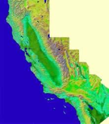
135 UNIT 2 LECTURE 6 THE PACIFIC STATES
136
137 Quick Facts Washington, Oregon, California, Hawaii, Alaska Coldest state, only island state Mountains, volcanoes, earthquakes Rich natural resources
138

139
140
141
142 California Major landforms Coast Ranges Rugged coastline Sierra Nevada Lies inland from coast Central Valley Between coast and Sierra-Nevadas Desert Basin East of Sierra-Nevadas

143
144
145
146
147 Climate Marine West Coast up North Mediterranean in coastal Southern Desert/Steppe inland behind Sierra- Nevadas
148
149 Agriculture Leads nation Year-round growing seasons Irrigation uses 85% of water supply Variety of fruits/vegetables/citrus
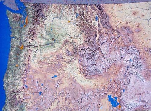
150
151 Natural Resources Gold Oil Fishing tourism


152
153 Major Industry Aerospace Entertainment Microelectronics Lumber

154

155
156
157 Oregon & Washington Landforms Coastal Ranges Puget Sound Willamette Valley Cascades Columbia Basin
158
159
160
161
162
163
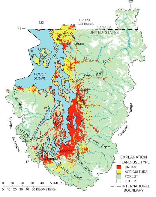
164
165
166
167 Climate Marine West Coast in West Due to windward side of Cascades Desert/steppe in east Due to leeward side of Cascades
168 Agriculture Dairy, fruit, vegetables, vineyards Located mainly: Willamette Valley Puget Sound lowlands Columbia Basin
169
170 Resources & Industry Forestry Fishing Recreation
171 Major urban areas I-5 Corridor Seattle Portland Spokane Tri-Cities Mainly rural communities
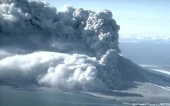
172 Alaska Sparsely populated Inuit Eskimos Landforms Very rugged Mountainous Volcanic
173
174 Climate Marine-West Coast Sub arctic Tundra
175
176 Resources Oil Gold Fishing forests
177

178
179 Hawaii 8 major islands Stretch over 1,500 miles Volcanic Humid-tropical climate Heavy tourism
180
181
Unit 2. United States Physical Geography
 Unit 2 United States Physical Geography Physical Geography U.S. extends from the Atlantic to Pacific U.S. is the 3rd largest country U.S. has fertile soils, vast forests, and variety of minerals All major
discussion of North America s physical features, including its landforms and bodies of
 Chapter 7 Natural Environments of North America Chapter 7 focuses on the natural environments of North America. The chapter opens with a discussion of North America s physical features, including its landforms
The United States & Canada. A Regional Study of Anglo America
 A Regional Study of Anglo America Landform Regions of the United States & Canada world leaders in agricultural and industrial production because of... VAST LANDS stretch from the Atlantic Ocean on the
A. Geography Students know the location of places, geographic features, and patterns of the environment.
 Learning Targets Elementary Social Studies Grade 5 2014-2015 A. Geography Students know the location of places, geographic features, and patterns of the environment. A.5.1. A.5.2. A.5.3. A.5.4. Label North
Grade 7 History Mr. Norton
 Grade 7 History Mr. Norton Section 1: Thinking Geographically Section 2: Land and Climates of the United States Section 3: The Tools of History Section 4: Economics and Other Social Sciences Grade 7 History
Physical Geography of the United States and Canada Chapter 5 A Land of Contrasts
 Physical Geography of the United States and Canada Chapter 5 A Land of Contrasts Land Area Together the U.S. and Canada cover more than 7 million square miles. In total area, Canada ranks 2 nd and the
Standard Indicator That s the Latitude! Students will use latitude and longitude to locate places in Indiana and other parts of the world.
 Standard Indicator 4.3.1 That s the Latitude! Purpose Students will use latitude and longitude to locate places in Indiana and other parts of the world. Materials For the teacher: graph paper, globe showing
Guided Reading Activity
 Guided Reading Activity Lesson 1 Physical Features Essential Question: How does geography influence the way people live? A Vast Land Directions: Read the lesson and use your text to decide whether each
Challenge 1: Learning About the Physical Geography of Canada and the United States
 60ºN S T U D E N T H A N D O U T Challenge 1: Learning About the Physical Geography of Canada and the United States 170ºE 10ºW 180º 20ºW 60ºN 30ºW 1 40ºW 160ºW 50ºW 150ºW 60ºW 140ºW N W S E 0 500 1,000
Preview: Making a Mental Map of the Region
 Preview: Making a Mental Map of the Region Draw an outline map of Canada and the United States on the next page or on a separate sheet of paper. Add a compass rose to your map, showing where north, south,
Unit 1: Geography. For additional information, refer to this website: 1 G e o g r a p h y
 Unit 1: Geography For additional information, refer to this website: http://mryoungtms.weebly.com/ 1 G e o g r a p h y Continents and Oceans SOL USI. 2a Essential Understanding: Continents are large land
New Educators Campaign Weekly Report
 Campaign Weekly Report Conversations and 9/24/2017 Leader Forms Emails Collected Text Opt-ins Digital Journey 14,661 5,289 4,458 7,124 317 13,699 1,871 2,124 Pro 13,924 5,175 4,345 6,726 294 13,086 1,767
Life East of the Mississippi
 Life East of the Mississippi Physical Features ESSENTIAL QUESTION: How does geography influence the way people live? ~The United States can be divided into regions based on physical characteristics. Learning
Correction to Spatial and temporal distributions of U.S. winds and wind power at 80 m derived from measurements
 JOURNAL OF GEOPHYSICAL RESEARCH, VOL. 109,, doi:10.1029/2004jd005099, 2004 Correction to Spatial and temporal distributions of U.S. winds and wind power at 80 m derived from measurements Cristina L. Archer
Summary of Natural Hazard Statistics for 2008 in the United States
 Summary of Natural Hazard Statistics for 2008 in the United States This National Weather Service (NWS) report summarizes fatalities, injuries and damages caused by severe weather in 2008. The NWS Office
Terms. divide headwaters tributary fall line fishery
 Chapter 5 Preview Section 1 The Land Objectives Identify some key similarities and differences in the physical geography of the United States and Canada. Explain why rivers have played such an important
Cooperative Program Allocation Budget Receipts Southern Baptist Convention Executive Committee May 2018
 Cooperative Program Allocation Budget Receipts May 2018 Cooperative Program Allocation Budget Current Current $ Change % Change Month Month from from Contribution Sources 2017-2018 2016-2017 Prior Year
Cooperative Program Allocation Budget Receipts Southern Baptist Convention Executive Committee October 2017
 Cooperative Program Allocation Budget Receipts October 2017 Cooperative Program Allocation Budget Current Current $ Change % Change Month Month from from Contribution Sources 2017-2018 2016-2017 Prior
Cooperative Program Allocation Budget Receipts Southern Baptist Convention Executive Committee October 2018
 Cooperative Program Allocation Budget Receipts October 2018 Cooperative Program Allocation Budget Current Current $ Change % Change Month Month from from Contribution Sources 2018-2019 2017-2018 Prior
Topography of the conterminous United States
 Topography of the conterminous United States Potential Natural Vegetation Geology Coastal Ranges physiographic province Cascade-Sierra Mountains Cascades Mount Hood California central valley Sierra-Nevada
QF (Build 1010) Widget Publishing, Inc Page: 1 Batch: 98 Test Mode VAC Publisher's Statement 03/15/16, 10:20:02 Circulation by Issue
 Widget Publishing, Inc Page: 1 Batch: 98 Test Mode VAC Publisher's Statement 03/15/16, 10:20:02 Circulation by Issue") QF 1.100 (Build 1010) Widget Publishing, Inc Page: 1 Circulation by Issue Qualified Non-Paid Circulation Qualified Paid Circulation Individual Assoc. Total Assoc. Total Total Requester Group Qualified
QF 1.100 (Build 1010) Widget Publishing, Inc Page: 1 Circulation by Issue Qualified Non-Paid Circulation Qualified Paid Circulation Individual Assoc. Total Assoc. Total Total Requester Group Qualified
EQ: Discuss main geographic landforms of the U.S. & Canada and examine varied landforms in relation to their lifestyles.
 EQ: Discuss main geographic landforms of the U.S. & Canada and examine varied landforms in relation to their lifestyles. Places & Terms for Discussion Appalachian Mountains Great Plains Canadian Shield
Physical Features of Canada and the United States
 Physical Features of Canada and the United tates 170 ARCTIC OCA Aleutian s 1 1 Bering ea ALAKA Yukon R. Mt. McKinley (20,320 ft. 6,194 m) Gulf of Alaska BROOK RAG RAG Queen Charlotte s R Vancouver O C
High School World History Cycle 2 Week 2 Lifework
 Name: Advisory: Period: High School World History Cycle 2 Week 2 Lifework This packet is due Monday, November 7 Complete and turn in on Friday for 10 points of EXTRA CREDIT! Lifework Assignment Complete
North American Geography. Lesson 2: My Country tis of Thee
 North American Geography Lesson 2: My Country tis of Thee Unit Overview: As students work through the activities in this unit they will be introduced to the United States in general, different regions
, District of Columbia
 State Capitals These are the State Seals of each state. Fill in the blank with the name of each states capital city. (Hint: You may find it helpful to do the word search first to refresh your memory.),
LATITUDE. Latitude lines run to, but are measured & The 0 of latitude that circles the earth is called the?
 LATITUDE Latitude lines run to, but are measured & The 0 of latitude that circles the earth is called the? LATITUDE 0 0 Latitude lines run east to west, but are measured north & south The 0 of latitude
Additional VEX Worlds 2019 Spot Allocations
 Overview VEX Worlds 2019 Spot s Qualifying spots for the VEX Robotics World Championship are calculated twice per year. On the following table, the number in the column is based on the number of teams
Physical Features of Canada and the United States
 I VIUAL Physical Features of Canada and the United tates 170 ARCTIC OCA Aleutian s 1 Bering ea ALAKA Yukon R. Mt. McKinley (20,320 ft. 6,194 m) Gulf of Alaska BROOK RAG RAG Queen Charlotte s R Vancouver
Jakarta International School 6 th Grade Formative Assessment Graphing and Statistics -Black
 Jakarta International School 6 th Grade Formative Assessment Graphing and Statistics -Black Name: Date: Score : 42 Data collection, presentation and application Frequency tables. (Answer question 1 on
4th Grade Social Studies First Nine Weeks
 4th Grade Social Studies First Nine Weeks Multiple Choice Identify the choice that best completes the statement or answers the question. 1 Name the mountains that are located in the eastern United States.
United States Geography Unit 1
 United States Geography Unit 1 I WANT YOU TO STUDY YOUR GEORGAPHY Name: Period: Due Date: Geography Key Terms Absolute Location: Relative Location: Demographic Map: Population Density: Sun-Belt: Archipelago:
Landforms and Bodies of Water
 Chapter 5, Section 1 For use with textbook pages 115 120. The Land Terms to Know divide A high point or ridge that determines the direction that rivers flow (page 118) headwaters The source waters of a
Abortion Facilities Target College Students
 Target College Students By Kristan Hawkins Executive Director, Students for Life America Ashleigh Weaver Researcher Abstract In the Fall 2011, Life Dynamics released a study entitled, Racial Targeting
Physiographic Provinces (West, Ch. 13)
") Geology 229 Engineering Geology Lecture 13 Physiographic Provinces (West, Ch. 13) The definition of the term Physiography Physiography (n.) The science which treats of the earth's exterior physical features,
Geology 229 Engineering Geology Lecture 13 Physiographic Provinces (West, Ch. 13) The definition of the term Physiography Physiography (n.) The science which treats of the earth's exterior physical features,
Chapter 6, Part Colonizers arriving in North America found extremely landscapes. It looked different to region showing great.
 Social Studies 9 Unit 1 Worksheet Chapter 6, Part 1. 1. Colonizers arriving in North America found extremely landscapes. It looked different to region showing great. 2. The Earth is years old and is composed
Unit 1: Geography CLASS WEBSITE: QUIZLET GAMES: ONLINE RESOURCES
 Unit 1: Geography ONLINE RESOURCES CLASS WEBSITE: HTTPS://MRYOUNGTMS.WEEBLY.COM/GEOGRAPHY.HTML QUIZLET GAMES: HTTPS://QUIZLET.COM/JOIN/MSFYY94T5 1 G e o g r a p h y Continents and Oceans The Seven Continents
CANADA S LANDFORM REGIONS
 CANADA S LANDFORM REGIONS Canada s Regions Canada is divided into Eight major regions. A Region is an area that is defined on the basis of the presence or absence of certain characteristics: Age of rock
4th Grade U.S. Regional Geography
 4th Grade U.S. Regional Geography Multiple Choice Identify the choice that best completes the statement or answers the question. What does the term mainland mean in the sentence above? A the continent
Terms to Know. divide headwaters tributary fall line fishery
 Chapter Objectives Describe the dominant landforms and natural resources of the United States and Canada. Discuss climate and vegetation in the United States and Canada. Section 1 The Land Section Objectives
Meteorology 110. Lab 1. Geography and Map Skills
 Meteorology 110 Name Lab 1 Geography and Map Skills 1. Geography Weather involves maps. There s no getting around it. You must know where places are so when they are mentioned in the course it won t be
ELEMENTS OF BASIC WORLD GEOGRAPHY TABLE OF CONTENTS UNIT 1 THE BASICS OF GEOGRAPHY AND NORTH AMERICA
 TABLE OF CONTENTS UNIT 1 THE BASICS OF GEOGRAPHY AND NORTH AMERICA IMPORTANT WORDS TO KNOW... 1 CHAPTER 1 THE BASICS OF GEOGRAPHY GEOGRAPHY... 2 TOOLS OF GEOGRAPHY... 3 EARTH...4 SEASONS, CLIMATE, AND
Hourly Precipitation Data Documentation (text and csv version) February 2016
 February 2016") I. Description Hourly Precipitation Data Documentation (text and csv version) February 2016 Hourly Precipitation Data (labeled Precipitation Hourly in Climate Data Online system) is a database that gives
I. Description Hourly Precipitation Data Documentation (text and csv version) February 2016 Hourly Precipitation Data (labeled Precipitation Hourly in Climate Data Online system) is a database that gives
Osteopathic Medical Colleges
 Osteopathic Medical Colleges Matriculants by U.S. States and Territories Entering Class 0 Prepared by the Research Department American Association of Colleges of Osteopathic Medicine Copyright 0, AAM All
Printable Activity book
 Printable Activity book 16 Pages of Activities Printable Activity Book Print it Take it Keep them busy Print them out Laminate them or Put them in page protectors Put them in a binder Bring along a dry
GEOGRAPHY OF THE WEST
 GEOGRAPHY OF THE WEST ROCKIES TO THE PACIFIC The Rocky Mountains run through North America from north to south. They mark the end of the Midwest and the beginning of the West. MOUNTAINS AND MORE The Rocky
JAN/FEB MAR/APR MAY/JUN
 QF 1.100 (Build 1010) Widget Publishing, Inc Page: 1 Circulation Breakdown by Issue Qualified Non-Paid Qualified Paid Previous This Previous This Total Total issue Removals Additions issue issue Removals
Intercity Bus Stop Analysis
 by Karalyn Clouser, Research Associate and David Kack, Director of the Small Urban and Rural Livability Center Western Transportation Institute College of Engineering Montana State University Report prepared
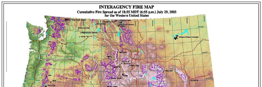
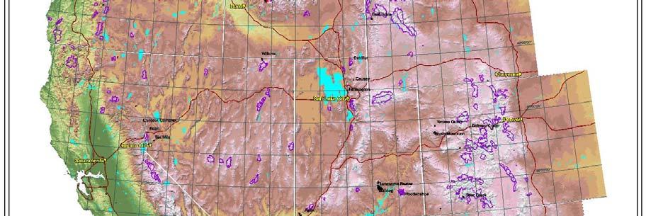
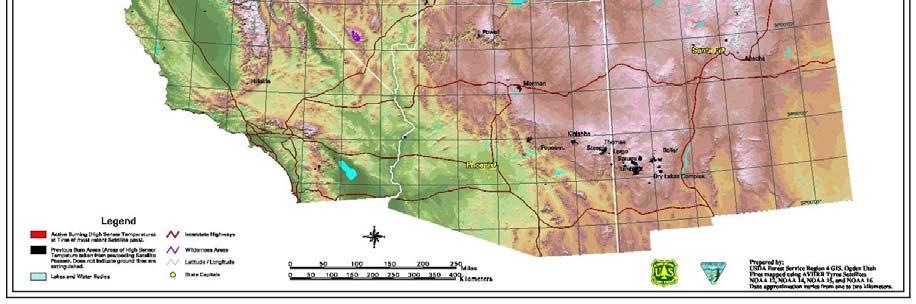
National Wildland Significant Fire Potential Outlook
 National Wildland Significant Fire Potential Outlook National Interagency Fire Center Predictive Services Issued: April 1, 2008 Next Issue: May 1, 2008 Wildland Fire Outlook April 2008 through July 2008
Crop / Weather Update
 Crop / Weather Update Corn Crop Condition Percent of Acreage Rated Good or Excellent 85 80 75 70 65 60 55 50 45 The U.S. corn crop was rated 69% good-to-excellent on September 23, up 1% from week-ago,
Crop / Weather Update
 Crop / Weather Update Corn Crop Condition Percent of Acreage Rated Good or Excellent 85 80 75 70 65 60 55 50 45 As of September 9, USDA rates the crop at 68% good to excellent. The rating is up one point
2 Georgia: Its Heritage and Its Promise
 TERMS region, erosion, fault, elevation, Fall Line, aquifer, marsh, climate, weather, precipitation, drought, tornado, hurricane, wetland, estuary, barrier island, swamp PLACES Appalachian Mountains, Appalachian
Erik Kabela and Greg Carbone, Department of Geography, University of South Carolina
 Downscaling climate change information for water resources Erik Kabela and Greg Carbone, Department of Geography, University of South Carolina As decision makers evaluate future water resources, they often
OUT-OF-STATE 965 SUBTOTAL OUT-OF-STATE U.S. TERRITORIES FOREIGN COUNTRIES UNKNOWN GRAND TOTAL
 Report ID: USSR8072-V3 Page No. 1 Jurisdiction: ON-CAMPUS IL Southern Illinois University - Carb 1 0 0 0 Black Hawk College Quad-Cities 0 0 1 0 John A Logan College 1 0 0 0 Rend Lake College 1 0 0 0 Aurora
4 th Grade Virginia Studies SOL Review Packet Geography of Virginia. 1. The Algonquian language group of Indians lived in what region of Virginia?
 4 th Grade Virginia Studies SOL Review Packet Geography of Virginia 1. The Algonquian language group of Indians lived in what region of Virginia? A. Allegheny B. Piedmont C. Ridge and Valley D. Tidewater
PHYSIOGRAPHIC REGIONS OF THE LOWER 48 UNITED STATES
 PHYSIOGRAPHIC REGIONS OF THE LOWER 48 UNITED STATES LAURENTIAN UPLAND 1. Superior Upland ATLANTIC PLAIN 2. Continental Shelf (not on map) 3. Coastal Plain a. Embayed section b. Sea Island section c. Floridian
Crop Progress. Corn Mature Selected States [These 18 States planted 92% of the 2017 corn acreage]
![Crop Progress. Corn Mature Selected States [These 18 States planted 92% of the 2017 corn acreage]](/thumbs/89/98128758.jpg "Crop Progress. Corn Mature Selected States [These 18 States planted 92% of the 2017 corn acreage]") Crop Progress ISSN: 00 Released October, 0, by the National Agricultural Statistics Service (NASS), Agricultural Statistics Board, United s Department of Agriculture (USDA). Corn Mature Selected s [These
Crop Progress ISSN: 00 Released October, 0, by the National Agricultural Statistics Service (NASS), Agricultural Statistics Board, United s Department of Agriculture (USDA). Corn Mature Selected s [These
Multivariate Statistics
 Multivariate Statistics Chapter 3: Principal Component Analysis Pedro Galeano Departamento de Estadística Universidad Carlos III de Madrid pedro.galeano@uc3m.es Course 2017/2018 Master in Mathematical
Club Convergence and Clustering of U.S. State-Level CO 2 Emissions
 Methodological Club Convergence and Clustering of U.S. State-Level CO 2 Emissions J. Wesley Burnett Division of Resource Management West Virginia University Wednesday, August 31, 2013 Outline Motivation
MINERALS THROUGH GEOGRAPHY
 MINERALS THROUGH GEOGRAPHY INTRODUCTION Minerals are related to rock type, not political definition of place. So, the minerals are to be found in a variety of locations that doesn t depend on population
All-Time Conference Standings
 All-Time Conference Standings Pac 12 Conference Conf. Matches Sets Overall Matches Team W L Pct W L Pct. Score Opp Last 10 Streak Home Away Neutral W L Pct. Arizona 6 5.545 22 19.537 886 889 6-4 W5 4-2
All of Virginia's 4 main rivers flow into the... Chesapeake Bay. Along which river would Jamestown be found? James River. Appalachian Mountains
 All of Virginia's 4 main rivers flow into the... Along which river would Jamestown be found? The Blue Ridge Mountains and Valley and Ridge are part of what large mountain system? Define climate. Define
Office of Special Education Projects State Contacts List - Part B and Part C
 Office of Special Education Projects State Contacts List - Part B and Part C Source: http://www.ed.gov/policy/speced/guid/idea/monitor/state-contactlist.html Alabama Customer Specialist: Jill Harris 202-245-7372
National Council for Geographic Education Curriculum & Instruction Committee Geography Club Submitted by: Steve Pierce
 National Council for Geographic Education Curriculum & Instruction Committee Geography Club Submitted by: Steve Pierce stevepierce@charter.net Ninth Month Activities Geography for Life: National Geography
What Lies Beneath: A Sub- National Look at Okun s Law for the United States.
 What Lies Beneath: A Sub- National Look at Okun s Law for the United States. Nathalie Gonzalez Prieto International Monetary Fund Global Labor Markets Workshop Paris, September 1-2, 2016 What the paper
2005 Mortgage Broker Regulation Matrix
 2005 Mortgage Broker Regulation Matrix Notes on individual states follow the table REG EXEMPTIONS LIC-EDU LIC-EXP LIC-EXAM LIC-CONT-EDU NET WORTH BOND MAN-LIC MAN-EDU MAN-EXP MAN-EXAM Alabama 1 0 2 0 0
RELATIONSHIPS BETWEEN THE AMERICAN BROWN BEAR POPULATION AND THE BIGFOOT PHENOMENON
 RELATIONSHIPS BETWEEN THE AMERICAN BROWN BEAR POPULATION AND THE BIGFOOT PHENOMENON ETHAN A. BLIGHT Blight Investigations, Gainesville, FL ABSTRACT Misidentification of the American brown bear (Ursus arctos,
Rank University AMJ AMR ASQ JAP OBHDP OS PPSYCH SMJ SUM 1 University of Pennsylvania (T) Michigan State University
 Michigan State University") Rank University AMJ AMR ASQ JAP OBHDP OS PPSYCH SMJ SUM 1 University of Pennsylvania 4 1 2 0 2 4 0 9 22 2(T) Michigan State University 2 0 0 9 1 0 0 4 16 University of Michigan 3 0 2 5 2 0 0 4 16 4 Harvard
Rank University AMJ AMR ASQ JAP OBHDP OS PPSYCH SMJ SUM 1 University of Pennsylvania 4 1 2 0 2 4 0 9 22 2(T) Michigan State University 2 0 0 9 1 0 0 4 16 University of Michigan 3 0 2 5 2 0 0 4 16 4 Harvard
Monthly Long Range Weather Commentary Issued: SEPTEMBER 19, 2016 Steven A. Root, CCM, Chief Analytics Officer, Sr. VP,
 Monthly Long Range Weather Commentary Issued: SEPTEMBER 19, 2016 Steven A. Root, CCM, Chief Analytics Officer, Sr. VP, sroot@weatherbank.com SEPTEMBER 2016 Climate Highlights The Month in Review The contiguous
Grade Five Social Studies Assessment Regions/Native Americans
 Name Grade Five Social Studies Assessment Regions/Native Americans Use the map below to answer questions 1 and 2 1. (Geo 1) For this location give the name of the city found there. 38 N, 100 W a. Scottsbluff
extreme weather, climate & preparedness in the american mind
 extreme weather, climate & preparedness in the american mind Extreme Weather, Climate & Preparedness In the American Mind Interview dates: March 12, 2012 March 30, 2012. Interviews: 1,008 Adults (18+)
Weather and Climate Risks and Effects on Agriculture
 Weather and Climate Risks and Effects on Agriculture Dr. Eric Snodgrass Official Journal of the Fluid Fertilizer Foundation Vol. 26, No. 2, Issue #100 DOWNLOAD Summary: So, what do we need to watch for?
Chapter. Organizing and Summarizing Data. Copyright 2013, 2010 and 2007 Pearson Education, Inc.
 Chapter 2 Organizing and Summarizing Data Section 2.1 Organizing Qualitative Data Objectives 1. Organize Qualitative Data in Tables 2. Construct Bar Graphs 3. Construct Pie Charts When data is collected
Chapter 1: America s Land Lesson 1: Land and Climate
 Chapter 1: America s Land Lesson 1: Land and Climate Geography: Describe landforms and other physical features of the United States. Geography: Explain how and why climate varies throughout the United
Monday September 11, 2017
 Monday September 11, 2017 Need: 9/11 Interview Paper Agenda: Good things Warm Up: Video and Reflection Circles Sharing Interview Stories Discussion Questions Whole group sharing Summarizer: Living in a
MINERALS THROUGH GEOGRAPHY. General Standard. Grade level K , resources, and environmen t
 Minerals through Geography 1 STANDARDS MINERALS THROUGH GEOGRAPHY See summary of National Science Education s. Original: http://books.nap.edu/readingroom/books/nses/ Concept General Specific General Specific
Crop / Weather Update
 Crop / Weather Update Corn Crop Condition Percent of Acreage Rated Good or Excellent 85 80 75 70 65 60 55 50 45 Corn condition this week is the same as the last two weeks in the good/excellent category,
GUIDED READING CHAPTER 1: THE LAY OF THE LAND (Page 1)
") CHAPTER 1: THE LAY OF THE LAND (Page 1) Section 1 The Tidewater Region Directions: Use the information from pages 6-11 to complete the following statements. 1. In the southern part of the coast, the Tidewater
CHAPTER 1: THE LAY OF THE LAND (Page 1) Section 1 The Tidewater Region Directions: Use the information from pages 6-11 to complete the following statements. 1. In the southern part of the coast, the Tidewater
SUPPLEMENTAL NUTRITION ASSISTANCE PROGRAM QUALITY CONTROL ANNUAL REPORT FISCAL YEAR 2008
 SUPPLEMENTAL NUTRITION ASSISTANCE PROGRAM QUALITY CONTROL ANNUAL REPORT FISCAL YEAR 2008 U.S. DEPARTMENT OF AGRICULTURE FOOD AND NUTRITION SERVICE PROGRAM ACCOUNTABILITY AND ADMINISTRATION DIVISION QUALITY
Virginia Regions Study Guide
 Name/Number: Date: Virginia Regions Study Guide Standard VS.2a: SWBAT demonstrate knowledge of the physical geography and native peoples, past and present, of Virginia by locating Virginia and its bordering
Multivariate Statistics
 Multivariate Statistics Chapter 4: Factor analysis Pedro Galeano Departamento de Estadística Universidad Carlos III de Madrid pedro.galeano@uc3m.es Course 2017/2018 Master in Mathematical Engineering Pedro
Five Themes of Geography Project Ms. Kiesel, Per 5. The United States of America
 Five Themes of Geography Project Ms. Kiesel, Per 5 The United States of America Location Absolute Location : The USA is located in the continent of North America in the northern and western hemispheres.
5th social studies geography (5thsocstud_geography)
") Name: Date: 1. Many of the Native Americans who lived on the Great Plains were nomadic people. Why did they move from place to place? A. They were finding new areas to mine. B. They were looking for fertile
Name: Date: 1. Many of the Native Americans who lived on the Great Plains were nomadic people. Why did they move from place to place? A. They were finding new areas to mine. B. They were looking for fertile
GEOGRAPHY OF THE UNITED STATES & CANADA. By Brett Lucas
 GEOGRAPHY OF THE UNITED STATES & CANADA By Brett Lucas THE APPALACHIANS & THE OZARKS Setting the Boundaries What states and provinces are part of the region? Eastern TN, western NC, eastern KY, western
Locations of Monitoring Stations in the Mercury Trends Network
 Locations of Monitoring Stations in the Mercury Trends Network Three sets of geographic criteria were used to determine the locations for the regionally representative MTN monitoring stations: ecoregion,
March 1, 2003 Western Snowpack Conditions and Water Supply Forecasts
 Natural Resources Conservation Service National Water and Climate Center 101 SW Main Street, Suite 1600 Portland, OR 97204-3224 Date: March 17, 2003 Subject: March 1, 2003 Western Snowpack Conditions and
Online Appendix: Can Easing Concealed Carry Deter Crime?
 Online Appendix: Can Easing Concealed Carry Deter Crime? David Fortunato University of California, Merced dfortunato@ucmerced.edu Regulations included in institutional context measure As noted in the main
National Wildland Significant Fire Potential Outlook
 National Wildland Significant Fire Potential Outlook National Interagency Fire Center Predictive Services Issued: September, 2007 Wildland Fire Outlook September through December 2007 Significant fire
Regional Geography C. LANGDON WHITE. Professor Emeritus Stanford University EDWIN J. FOSCUE TOM L. MCKNIGHT
 Regional Geography of Anglo-America Sixth Edition C. LANGDON WHITE Professor Emeritus Stanford University EDWIN J. FOSCUE Late of Southern Methodist University TOM L. MCKNIGHT Professor of Geography University
Weather and Climate Summary and Forecast March 2018 Report
 Weather and Climate Summary and Forecast March 2018 Report Gregory V. Jones Linfield College March 7, 2018 Summary: The ridge pattern that brought drier and warmer conditions from December through most
National Drought Summary August 14, 2018
 National Drought Summary August 14, 2018 The discussion in the Looking Ahead section is a description of what the official national guidance from the National Weather Service (NWS) National Centers for
Monthly Long Range Weather Commentary Issued: APRIL 18, 2017 Steven A. Root, CCM, Chief Analytics Officer, Sr. VP,
 Monthly Long Range Weather Commentary Issued: APRIL 18, 2017 Steven A. Root, CCM, Chief Analytics Officer, Sr. VP, sroot@weatherbank.com MARCH 2017 Climate Highlights The Month in Review The average contiguous
Module 11: Meteorology Topic 3 Content: Climate Zones Notes
 Introduction Latitude is such an important climate factor that you can make generalizations about a location's climate based on its latitude. Areas near the equator or the low latitudes are generally hot
Confronting Climate Change in the Great Lakes Region. Technical Appendix Climate Change Projections MIGRATING CLIMATES
 Confronting Climate Change in the Great Lakes Region Technical Appendix Climate Change Projections MIGRATING CLIMATES A helpful indicator of the projected climate effects is to estimate where selected
Alpine Funds 2016 Tax Guide
 Alpine s 2016 Guide Alpine Dynamic Dividend ADVDX 01/28/2016 01/29/2016 01/29/2016 0.020000000 0.017621842 0.000000000 0.00000000 0.017621842 0.013359130 0.000000000 0.000000000 0.002378158 0.000000000
MO PUBL 4YR 2090 Missouri State University SUBTOTAL-MO
 Report ID: USSR8072-V3 Page No. 1 Jurisdiction: ON-CAMPUS IL American Intercontinental Universit 0 0 1 0 Northern Illinois University 0 0 4 0 Southern Illinois Univ - Edwardsvil 2 0 2 0 Southern Illinois
The Mississippi, Missouri, and Ohio Rivers
 The Mississippi, Missouri, and Ohio Rivers Mississippi River Mississippi River begins at Lake Itasca in northwest Minnesota and runs 2,320 miles to the Gulf of Mexico approx. 90 days for a drop of rain
Acadia National Park, Maine
 Acadia National Park, Maine Monument Valley, Utah The Tongass National Forest in Southeastern Alaska, covering nearly 17 million acres, is the single largest national forest in America. Geography Handbook
Grand Total Baccalaureate Post-Baccalaureate Masters Doctorate Professional Post-Professional
 s by Location of Permanent Home Address and Degree Level Louisiana Acadia 19 13 0 3 0 3 0 0 0 Allen 5 5 0 0 0 0 0 0 0 Ascension 307 269 2 28 1 6 0 1 0 Assumption 14 12 0 1 0 1 0 0 0 Avoyelles 6 4 0 1 0
Your web browser (Safari 7) is out of date. For more security, comfort and the best experience on this site: Update your browser Ignore
 is out of date. For more security, comfort and the best experience on this site: Update your browser Ignore") Your web browser (Safari 7) is out of date. For more security, comfort and the best experience on this site: Update your browser Ignore Educator Version TRACKING GRO W TH IN THE U.S. Late 19th century
Your web browser (Safari 7) is out of date. For more security, comfort and the best experience on this site: Update your browser Ignore Educator Version TRACKING GRO W TH IN THE U.S. Late 19th century