Landslide Hazard Analysis at Jelapangof North-South Expressway in Malaysia Using High Resolution Airborne LiDAR Data
|
|
|
- Gerard Mosley
- 6 years ago
- Views:
Transcription
1 Landslide Hazard Analysis at Jelapangof North-South Expressway in Malaysia Using High Resolution Airborne LiDAR Data NORBAZLAN MOHD YUSOF GEOSPATIAL WORLD FORUM 2015 Geospatial World Forum, Portugal MAY 2015


2 CONTENT Overview Research Methodology Analysis Conclusion & Way Forward


3 OVERVIEW OF UEM GROUP BERHAD Khazanah Nasional Berhad is the investment holding arm of the Government of Malaysia, with investments in over 50 major companies in Malaysia and abroad. 100 % EXPRESSWAYS TOWNSHIP/ PROPERTY DEVELOPMENT ENGINEERING & CONSTRUCTION ASSET & FACILITIES MANAGEMENT Listed on Bursa Malaysia (3) Projek Lebuhraya Usahasama Bhd. SUNRISE PLUS Malaysia Berhad


4 LARGEST EXPRESSWAY OPERATOR IN MALAYSIA & ASIA WITH MORE THAN 25 YEARS OF EXPERIENCE Length PLUS North-South Expressway 846 km ELITE NSE Central Link 63 km LINKEDUA BKE Malaysia-Singapore Second Crossing 47 km Butterworth-Kulim Expressway 17 km PBSB Penang Bridge 13.5km km Open Toll System: Generic to city highways Close Toll System: Generic to interurban highways
5 PLUS GIS : Improvement Plan (IP) Dec 2013 June 2014 Dec 2014 June 2015 Dec 2015 June 2016 Dec 2016 GPS Data Collection for Road Furniture Project (Phase II) [02/14-06/15] GPS Data Collection for Road Furniture Project (Phase III) [09/15-09/16] LiDAR Data Acquisition Phase III [01/14-08/14] Mobile TEMAN [11/14-07/15] Road shows and training Web-Based TEMAN Phase II [06/13 06/14] Road shows and training Web-Based M&E [12/15 08/16] 360 Degree Panoramic View (Phase III) [01/14-07/14] Road shows and training Web-Based Land Information System [8/15 03/16] Establishing First Order Geodetic Control Network [01/14-07/14] Landslide Analysis (Phase II) 09/13 09/15 Mass Movement Detection 03/15 02/16 Web-Based TEMAN Underground Utilities [11/15 6/16)

6 RESEARCH METHODOLOGY Overview Research Methodology Analysis Conclusion & Way Forward
7 1 2 3 OBJECTIVES To define landslide conditioning parameters influencing the characters of landslides in the study areas; To analyse various types of landslide related data in a Geographic Information System (GIS), at site specific scale as well as using remote sensing data; To assimilate remote sensing data; data from PLUS Highways Berhad and field data into a GIS format for quantitative modelling; 3 To provide landslide risk map for the pilot study areas; 4 5 To design and develop probabilistic based evidential belief (EBF) and statistical based logistic regression (LR) models for landslide susceptibility and hazard analysis for the study areas;
 PULAU PINANG PERAK KELANTAN")


. ii.")

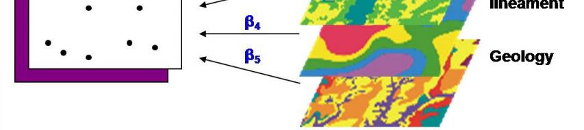
8 STUDY AREA JELAPANG (28.4KM 2 ) PULAU PINANG PERAK KELANTAN Jelapang GeoEye-1 Captured : Jan 21 st, 2011 Malacca Strait PAHANG Records and observation from 2004 to 2011 found that: i. Many scars of hillside slope failures on the eastern side of the expresswaysare alsooccurred atoutside of the Rightof Way(ROW). ii. There are many lineament across Jelapang area which may give impact to slope stability of surrounding rock formation. iii. Different characteristics on the water catchments.
9 TERMS Risk = f (hazard, vulnerability) RISK Expected losses (of lives, persons injured, property damaged, and economic activity disrupted) due to a particular hazard for a given area and reference period. Based on mathematical calculations, Risk is the product of hazard and vulnerability. HAZARD A threatening event, or the probability of occurrence of a potentially damaging phenomenon within a given time period and area. VULNERABILITY Degree of loss resulting from a potentially damaging phenomenon. Source : The United Nations Office for Disaster Risk Reduction (UNISDR), United Nations Department of Humanitarian Affairs, 1992
10 FACTOR SYSTEM LANDSLIDE RISK MAP ULTIMATE GOAL HAZARD MAP VULNERABILITY MAP LEVEL 1 GOAL Triggering parameter C o n d i t i o n i n g f a c t o r S o c i o - E c o n o m i c f a c t o r RAINFALL TERRAIN WATERSHED RIVER HIGHWAY SOCIO ECONOMIC LEVEL 2 GOAL PRECIPI TATION ALTITUDE SLOPE ASPECT CURVATURE SPI TRI TWI STI DISTANCE OVERALL CRITERIA ADOPTED FROM TEMAN LEVEL 3 GOAL
11 DATA USED [1] ORIGINAL LAYER LiDAR Drainage Road Rainfall Historical Landslide Element at Risk RESULTED LAYER DEM / Altitude Slope Angle Aspect Curvature Stream Power Index (SPI) Topographic Wetness Index (TWI) Terrain Roughness Index (TRI) Distance from drainage Distance from road Precipitation Map Landslide inventory map Adopted from TEMAN system e.g. Vista point, Lay-by, Highway, Cut Slope
![DATA USED [2] Find the scenes](/docs-images/74/70287072/images/12-1.jpg "Create LAS dataset LAS dataset to")


12 DATA USED [2] Find the scenes Create LAS dataset LAS dataset to DEM LiDAR Data Processing Creating LAS Dataset Finding the scenes which cover the study areas Create LAS dataset LAS dataset to DEM Masking the DEM using the study area layer Derive the topological parameters
13 DATA USED [3] Input Data Layers ALTITUDE SLOPE ASPECT CURVATURE
14 DATA USED [4] Input Data Layers STREAM POWER INDEX (SPI) Describe the potential flow erosion at the given point of the topographic surface. SPI= Ln (A s * tan β) Where; A s is the upstream area βis the slope in the given cell
15 DATA USED [5] Input Data Layers TOPOGRAPHIC WETNESS INDEX (TWI) Describe the propensity for a site to be saturated to the surface given its contributing area and local slope characteristics. TWI= Ln (A s / tan β) Where; A s is the upstream area βis the slope in the given cell
16 DATA USED [6] Input Data Layers TERRAIN ROUGHNESS INDEX (TRI) TRI is one of the morphological factors and which is broadly utilized in landslide analysis. TRI= Abs (max2 min2) DISTANCE FROM DRAINAGE

17 ANALYSIS Overview Research Methodology Analysis Conclusion & Way Forward
18 METHODOLOGY FLOWCHART
19 DATA MODELING [1] Evidential Belief Function (EBF) Modeling The framework of the EBF model is based on the Dempster- Shafer theory of evidence. Estimation of EBFs of evidential data always relates to a proposition. EBFs involve degrees of belief (Bel), uncertainty (Unc), disbelief (Dis), and plausibility (Pls)intherange[0,1]. Belief (Bel) lower degree of belief that attribute data support the proposition Disbelief (Dis) degree of disbelief that attribute data support the proposition Uncertainty (Unc) ignorance whether attribute data support the proposition or not Plausibility (Pls) higher degree of belief that attribute support the proposition

20 Pls Bel Pls Bel= Unc Bel+ Dis +Unc= 1 Dis = 1-Unc Bel DATA MODELING [2]
![DATA MODELING [3] EBF Model Output BELIEF (Bel) e.](/docs-images/74/70287072/images/21-2.jpg "g: ALTITUDE DISBELIEF (Dis) PLAUSIBILITY (Pls)")
21 DATA MODELING [3] EBF Model Output BELIEF (Bel) e.g: ALTITUDE DISBELIEF (Dis) PLAUSIBILITY (Pls) UNCERTAINTY (Unc)
22 EBF Model Probability Map DATA MODELING [4]
23 DATA MODELING [5] Logistic Regression (LR) Modeling Among the wide range of statistical methods, LR analysis has provento be oneof the mostreliableapproaches.theapproachis to analyze the relationship between the categorical or binary response variable and one or more continuous or categorical or binary explanatory variables derived from samples. The equation below was used to calculate the logistic regression coefficients with landslides(y) and conditioning factors = Where; =( =0,1,2,, ), ( =0,2,, )represents thelrcoefficients, and ( =0,1,2,, )denotestheconditioningfactors

![[6]](/docs-images/74/70287072/images/24-3.jpg)
24 DATA MODELING [6]
25 DATA MODELING [7] To predict the possibility of a landslide event in each pixel, the probability index was measured by using the equation below: =1/(1+e ) Where; P is the landslide probability attained between 0 and 1 on an S-shaped curve.
26 DATA MODELING [8] The resulted equation: ( * "Altitude") -( * "Slope") -( * "Aspect") + ( * "Curvature") + ( * "SPI") - ( * "TWI") -( *"TRI") -( * "Distance from drainage") Parameter LR coefficient Parameter LR coefficient Altitude Slope Aspect Curvature Distance from River SPI TWI TRI Constant
27 LR Model Probability Map DATA MODELING [9]
![VALIDATION [1] Model Validation [EBF vs.](/docs-images/74/70287072/images/28-2.jpg "LR] ROC Curve In a ROC curve the true positive rate (Sensitivity) is plotted in function of the false positive rate (100-Specificity) for different cut- off points Area Under Curve The area between")
28 VALIDATION [1] Model Validation [EBF vs. LR] ROC Curve In a ROC curve the true positive rate (Sensitivity) is plotted in function of the false positive rate (100-Specificity) for different cut- off points Area Under Curve The area between the graph of y = f(x) and the x-axis is given by the definite integral below. This formula gives a positive result for a graph above the x- axis, and a negative result for a graph below the x-axis.
29 VALIDATION [2] EBF vs. LR
30 HAZARD MODELING [1] Triggering factor The transformation of landslide susceptibility map into a hazard map requires consideration of landslide triggering parameters. For this purpose, precipitation is a triggering factor and was taken into account. We analyzed the annual average precipitation values for the period of The annual average precipitation density map was made by the data obtained from 15 rainfall stations in and around the study area. Inverse Distance Weight (IDW) was used and validated for this Purpose.
31 HAZARD MODELING [2] Precipitation Map Using IDW Interpolation
32 HAZARD MODELING [3] Hazard Map Using EBF Model Output
33 HAZARD MODELING [4] Hazard Map Using LR Model Output
34 Existing Hazard Map from TEMAN HAZARD MODELING [5] Covers the cut slope only. No analysis for the Highway itself. No analysis outside the study area. High and very high hazard classes are inflated.
35 Hazard Map : Comparison HAZARD MODELING [6] LR Model Output vs. TEMAN
![HAZARD MODELING [7]](/docs-images/74/70287072/images/36-2.jpg "Hazard Map : Field")

36 HAZARD MODELING [7] Hazard Map : Field Investigation Slope ID SL/C1/ML/H/305.04/-/-/NB/E/-


37 Hazard Modeling HAZARD MODELING [8]
38 VULNERABILITY MODELING [1] Term When attempting to assess landslide risk, vulnerability to landslide is often considered as equivalent to complete loss oftheassetsortotaldestructionoftheelementsatrisk. Mathematically, landslide vulnerability (VL) can be expressed as; = [ 0 [L], 0 1] Where DL is the assessed (definite) or the expected (forecasted) damage to an element given the occurrence of a hazardous landslide
39 VULNERABILITY MODELING [2] Adopted Criteria (TEMAN) Risk to Road User Possibility of inflicting injury or damage to the property and the road users Relative Risk of Failure Possibility of an existing failure enlarging and affecting other parts of the slope or the stability itself Likely Effect on Traffic Possibility of failure encroaching onto expressway, existence of alternative route to bypass that particular location Likely Repair Costs Relates to possible volumeof earthwork, sufficient space for access / construction and complexity of earthwork
40 Vulnerability Map of TEMAN VULNERABILITY MODELING [3]
41 RISK MODELING [1] What is Risk Landslides Risk analysis aims to determine : the probability that a specific hazard will cause harm, and it investigates the relationship between the frequency of damaging events and the intensity of the consequences. the expected degree of loss due to a landslide and the expected number of lives lost, people injured, damage to property and disruption of economic activity. landslide risk is commonly expressed by the product of landslide hazard(hl) and landslide vulnerability(vl), Risk = f (hazard, vulnerability) Or it can be expressed in the following equation R S = H L X V L Where HL is the hazard probability and VL is the probability of the vulnerability
42 Risk Map of TEMAN RISK MODELING [2]
43 CONCLUSION AND WAY FORWARD Overview Research Methodology Analysis Conclusion & Way Forward Presentation on : LANDSLIDE ANALYSIS
44 CONCLUSION Landslide susceptibility, hazard and risk maps were scientifically produced for the study areas using high resolution of LiDAR data. The comparison between the produced hazard maps and the existing TEMAN shows: Very high and high hazardous areas are inflated in the TEMAN. This may incur more cost for maintenance of areas which are not necessarily high risk areas. The resultant risk map can help PLUS to cut cost on maintenance by focusing more on the high risky areas. PLUS will embark on prediction landslides model in the future.
45 THANK YOU PRESENTATION ON : Landslide Hazard Analysis At Jelapang Of North-South Expressway in Malaysia Using High Resolution Airborne LiDAR Data
Landslide Susceptibility, Hazard, and Risk Assessment. Twin Hosea W. K. Advisor: Prof. C.T. Lee
 Landslide Susceptibility, Hazard, and Risk Assessment Twin Hosea W. K. Advisor: Prof. C.T. Lee Date: 2018/05/24 1 OUTLINE INTRODUCTION LANDSLIDE HAZARD ASSESSTMENT LOGISTIC REGRESSION IN LSA STUDY CASE
OBSERVATIONS AND ANALYSIS ON RAINFALL INDUCED SLOPE FAILURES FOR JELAPANG AND GUA TEMPURUNG AREA USING G.I.S.
 PRESENTATION TO THE BOARD OF DIRECTORS PLUS BERHAD OBSERVATIONS AND ANALYSIS ON RAINFALL INDUCED SLOPE FAILURES FOR JELAPANG AND GUA TEMPURUNG AREA USING G.I.S. MAY 2015 TABLE OF CONTENTS Introduction:
GIS Application in Landslide Hazard Analysis An Example from the Shihmen Reservoir Catchment Area in Northern Taiwan
 GIS Application in Landslide Hazard Analysis An Example from the Shihmen Reservoir Catchment Area in Northern Taiwan Chyi-Tyi Lee Institute of Applied Geology, National Central University, No.300, Jungda
Natural Terrain Risk Management in Hong Kong
 Natural Terrain Risk Management in Hong Kong Nick Koor Senior Lecturer in Engineering Geology School of Earth and Environmental Sciences Slope failures in Hong Kong Man-made Slope Failure - 300 landslides
Georeferencing and Satellite Image Support: Lessons learned, Challenges and Opportunities
 Georeferencing and Satellite Image Support: Lessons learned, Challenges and Opportunities Shirish Ravan shirish.ravan@unoosa.org UN-SPIDER United Nations Office for Outer Space Affairs (UNOOSA) UN-SPIDER
Landslide Hazard Assessment Methodologies in Romania
 A Scientific Network for Earthquake, Landslide and Flood Hazard Prevention SciNet NatHazPrev Landslide Hazard Assessment Methodologies in Romania In the literature the terms of susceptibility and landslide
USING 3D GIS TO ASSESS ENVIRONMENTAL FLOOD HAZARDS IN MINA
 King Fahd University of Petroleum & Minerals College of Environmental Design Geographical Information system USING 3D GIS TO ASSESS ENVIRONMENTAL FLOOD HAZARDS IN MINA Prepared by : Ali AL-Zahrani OUTLINE
SUB CATCHMENT AREA DELINEATION BY POUR POINT IN BATU PAHAT DISTRICT
 SUB CATCHMENT AREA DELINEATION BY POUR POINT IN BATU PAHAT DISTRICT Saifullizan Mohd Bukari, Tan Lai Wai &Mustaffa Anjang Ahmad Faculty of Civil Engineering & Environmental University Tun Hussein Onn Malaysia
Hendra Pachri, Yasuhiro Mitani, Hiro Ikemi, and Ryunosuke Nakanishi
 21 2nd International Conference on Geological and Civil Engineering IPCBEE vol. 8 (21) (21) IACSIT Press, Singapore DOI: 1.7763/IPCBEE. 21. V8. 2 Relationships between Morphology Aspect and Slope Failure
Multicriteria GIS Modelling of Terrain Susceptibility to Gully Erosion, using the Example of the Island of Pag
 14th International Conference on Geoinformation and Cartography Zagreb, September 27-29, 2018. Multicriteria GIS Modelling of Terrain Susceptibility to Gully Erosion, using the Example of the Island of
SECTION II Hydrological risk
 Chapter 3 Understanding disaster risk: hazard related risk issues SECTION II Hydrological risk Peter Salamon Coordinating lead author Hannah Cloke Lead author 3.4 Giuliano di Baldassarre Owen Landeg Florian
GEOMATICS. Shaping our world. A company of
 GEOMATICS Shaping our world A company of OUR EXPERTISE Geomatics Geomatics plays a mayor role in hydropower, land and water resources, urban development, transport & mobility, renewable energy, and infrastructure
Understanding Weather and Climate Risk. Matthew Perry Sharing an Uncertain World Conference The Geological Society, 13 July 2017
 Understanding Weather and Climate Risk Matthew Perry Sharing an Uncertain World Conference The Geological Society, 13 July 2017 What is risk in a weather and climate context? Hazard: something with the
Topographic Laser Scanning of Landslide Geomorphology System: Some Practical and Critical Issues
 Topographic Laser Scanning of Landslide Geomorphology System: Some Practical and Critical Issues Khamarrul Azahari Razak, Rozaimi Che Hasan UTM Razak School of Engineering and Advanced Technology, UTM
Response on Interactive comment by Anonymous Referee #1
 Response on Interactive comment by Anonymous Referee #1 Sajid Ali First, we would like to thank you for evaluation and highlighting the deficiencies in the manuscript. It is indeed valuable addition and
Australian Journal of Basic and Applied Sciences. Landslide Hazard Mapping with New Topographic Factors: A Study Case of Penang Island, Malaysia
 Australian Journal of Basic and Applied Sciences, 8(4) Special 014, Pages: 387-39 AENSI Journals Australian Journal of Basic and Applied Sciences ISSN:1991-8178 Journal home page: www.ajbasweb.com Landslide
Climate Change and. roads in Poland. The example of Polish National Roads projects. Commission Training Session. G. Łutczyk, E.
 Climate Change and Adaptation Major to CC Projects for national roads in Poland The example of Polish National Roads projects Commission Training Session Results of Stages I, II and beginning of Stage
Geotechnical Risks and Management Systems: An FHWA Perspective
 October 13, 2010 2010 STGE Conference Charleston, WV Geotechnical Risks and Management Systems: An FHWA Perspective Silas C. Nichols, PE, Senior Bridge Engineer - Geotechnical Federal Highway Administration
Topographical Change Monitoring for Susceptible Landslide Area Determination by Using Multi-Date Digital Terrain Models and LiDAR
 Topographical Change Monitoring for Susceptible Landslide Area Determination by Using Multi-Date Digital Terrain Models and Chanist PRASERTBURANAKUL 1, Parkorn SUWANICH 2, Kanchana NAKHAPAKORN 3, and Sukit
SPATIAL MODELS FOR THE DEFINITION OF LANDSLIDE SUSCEPTIBILITY AND LANDSLIDE HAZARD. J.L. Zêzere Centre of Geographical Studies University of Lisbon
 SPATIAL MODELS FOR THE DEFINITION OF LANDSLIDE SUSCEPTIBILITY AND LANDSLIDE HAZARD J.L. Zêzere Centre of Geographical Studies University of Lisbon CONCEPTUAL MODEL OF LANDSLIDE RISK Dangerous Phenomena
Landslide Susceptibility Mapping by Using Logistic Regression Model with Neighborhood Analysis: A Case Study in Mizunami City
 Int. J. of GEOMATE, Dec. Int. 2011, J. of Vol. GEOMATE, 1, No. 2 (Sl. Dec. No. 2011, 2), pp. Vol. 99-104 1, No. 2 (Sl. No. 2), pp. 99-104 Geotec., Const. Mat. and Env., ISSN:2186-2982(P), 2186-2990(O),
EIT-Japan Symposium 2011 on Human Security Engineering
 EIT-Japan Symposium 2011 on Human Security Engineering 2011 Disastrous Landslides at Khao Panom, Krabi, Thailand Suttisak Soralump Geotechnical Engineering Research and Development Center (GERD) Faculty
Land Administration and Cadastre
 Geomatics play a major role in hydropower, land and water resources and other infrastructure projects. Lahmeyer International s (LI) worldwide projects require a wide range of approaches to the integration
Investigation of landslide based on high performance and cloud-enabled geocomputation
 Investigation of landslide based on high performance and cloud-enabled geocomputation Jun Liu 1, Shuguang Liu 2,*, Qiming Zhou 3, Jing Qian 1 1 Shenzhen Institutes of Advanced Technology, Chinese Academy
Statistical Seismic Landslide Hazard Analysis: an Example from Taiwan
 Statistical Seismic Landslide Hazard Analysis: an Example from Taiwan Chyi-Tyi Lee Graduate Institute of Applied Geology, National Central University, Taiwan Seismology Forum 27: Natural Hazards and Surface
- facilitate the preparation of landslide inventory and landslide hazard zonation maps for the city, - development of precipitation thresholds,
 Date of Submission 29.03.2012 IPL Project Proposal Form 2012 (MAXIMUM: 3 PAGES IN LENGTH) 1. Project Title: (2 lines maximum)-introducing Community-based Early Warning System for Landslide Hazard Management
Geotechnical Risks and Slope Management Systems: An FHWA Perspective
 August 20, 2010 10 th Annual Technical Forum Geohazards Impacting Transportation in the Appalachian Region Geotechnical Risks and Slope Management Systems: An FHWA Perspective Silas C. Nichols, PE, Senior
Preparing Landslide Inventory Maps using Virtual Globes
 Introduction: A landslide is the movement of a mass of rock, debris, or earth down a slope, under the influence of gravity. Landslides can be caused by different phenomena, including intense or prolonged
International Symposium on Natural Disaster Mitigation. Local vulnerability assessment of landslides and debris flows
 International Symposium on Natural Disaster Mitigation of landslides and debris flows Lessons learnt from Cam Pha town and Van Don district, Quang Ninh province, Vietnam Nguyen Quoc Phi Faculty of Environment
Use of Geospatial data for disaster managements
 Use of Geospatial data for disaster managements Source: http://alertsystemsgroup.com Instructor : Professor Dr. Yuji Murayama Teaching Assistant : Manjula Ranagalage What is GIS? A powerful set of tools
SLOPE HAZARD AND RISK MAPPING: A TECHNOLOGICAL PERSPECTIVE
 International Symposium on Multi-Hazard and Risk 2015 23-24 March 2015, UTM Kuala Lumpur SLOPE HAZARD AND RISK MAPPING: A TECHNOLOGICAL PERSPECTIVE Very high resolution DTM derived from LiDAR LiDAR Ortho
Advanced Geospatial Data for Cascading Geo-Hazard and Disaster Risk Assessment: A case study of 2015 earthquakes in Sabah
 Advanced Geospatial Data for Cascading Geo-Hazard and Disaster Risk Assessment: A case study of 2015 earthquakes in Sabah Presented at the FIG Working Week 2016, May 2-6, 2016 in Christchurch, New Zealand
Geologic Hazards. Montour County Multi-jurisdictional. General. Earthquake
 Geologic Hazards General s are very rare in Pennsylvania and have caused little damage with no reported injuries or causalities. s that do occur in Pennsylvania happen deep within the Earth s crust. This
USGS Hydrography Overview. May 9, 2018
 + 1 USGS Hydrography Overview May 9, 2018 + 2 The National Geospatial Program Provides the geospatial baseline of the Nation s topography, natural landscape and built environment through The National Map,
Flash Flood Guidance System On-going Enhancements
 Flash Flood Guidance System On-going Enhancements Hydrologic Research Center, USA Technical Developer SAOFFG Steering Committee Meeting 1 10-12 July 2017 Jakarta, INDONESIA Theresa M. Modrick Hansen, PhD
GIS-aided Statistical Landslide Susceptibility Modeling And Mapping Of Antipolo Rizal (Philippines)
") IOP Conference Series: Earth and Environmental Science PAPER OPEN ACCESS GIS-aided Statistical Landslide Susceptibility Modeling And Mapping Of Antipolo Rizal (Philippines) To cite this article: A J Dumlao
IOP Conference Series: Earth and Environmental Science PAPER OPEN ACCESS GIS-aided Statistical Landslide Susceptibility Modeling And Mapping Of Antipolo Rizal (Philippines) To cite this article: A J Dumlao
Hydrologic and Hydraulic Analyses Using ArcGIS
 Hydrologic and Hydraulic Analyses Using ArcGIS Two day training class Overview ArcGIS and Arc Hydro provide strong foundation for support of hydrologic and hydraulic (H&H) analyses. This two-day course
A probabilistic approach for landslide hazard analysis
 A probabilistic approach for landslide hazard analysis S. Lari, P. Frattimi, G.B. Crosta Engineering Geology 182 (2014) 3-14 報告者 : 符智傑 指導教授 : 李錫堤老師 報告日期 :2016/05/05 Introduction A general framework for
MAPPING THE FLASH FLOOD PRONE AREA IN THE TAITA WATERSHED (ROMANIA) USING TOPOGRAPHIC INDEXES AND HYDRAULIC MODEL
 USING TOPOGRAPHIC INDEXES AND HYDRAULIC MODEL") ICNAR 2014 MAPPING THE FLASH FLOOD PRONE AREA IN THE TAITA WATERSHED (ROMANIA) USING TOPOGRAPHIC INDEXES AND HYDRAULIC MODEL C. Maftei K. Papatheodorou Outline Research context Research objective Research
ICNAR 2014 MAPPING THE FLASH FLOOD PRONE AREA IN THE TAITA WATERSHED (ROMANIA) USING TOPOGRAPHIC INDEXES AND HYDRAULIC MODEL C. Maftei K. Papatheodorou Outline Research context Research objective Research
Using Weather and Climate Information for Landslide Prevention and Mitigation
 Using Weather and Climate Information for Landslide Prevention and Mitigation Professor Roy C. Sidle Disaster Prevention Research Institute Kyoto University, Japan International Workshop on Climate and
The Richter Scale. Micro Less than 2.0 Microearthquakes, not felt. About 8,000/day
 Geologic Hazards General s are very rare in Pennsylvania and have caused very little damage and no reported injuries or casualties. Since the Commonwealth is not on an active fault, the earthquakes that
DOWNLOAD OR READ : GIS BASED FLOOD LOSS ESTIMATION MODELING IN JAPAN PDF EBOOK EPUB MOBI
 DOWNLOAD OR READ : GIS BASED FLOOD LOSS ESTIMATION MODELING IN JAPAN PDF EBOOK EPUB MOBI Page 1 Page 2 gis based flood loss estimation modeling in japan gis based flood loss pdf gis based flood loss estimation
Integrated and Multi-Hazard Disaster Management
 GeoSmart Asia 2016: GI for Disaster Preparedness and Risk Reduction Bandung, Indonesia 12 October 2016 Integrated and Multi-Hazard Disaster Management Lim Choun Sian & Nurfashareena Muhamad Centre for
Flood Risk Map Based on GIS, and Multi Criteria Techniques (Case Study Terengganu Malaysia)
") Journal of Geographic Information System, 2015, 7, 348-357 Published Online August 2015 in SciRes. http://www.scirp.org/journal/jgis http://dx.doi.org/10.4236/jgis.2015.74027 Flood Risk Map Based on GIS,
Journal of Geographic Information System, 2015, 7, 348-357 Published Online August 2015 in SciRes. http://www.scirp.org/journal/jgis http://dx.doi.org/10.4236/jgis.2015.74027 Flood Risk Map Based on GIS,
Hydrological parameters Controls Vulnerable Zones in Calicut Nilambur Gudalur Ghat section, Gudalur, The Nilgiris, Tamil Nadu.
 International Journal of ChemTech Research CODEN (USA): IJCRGG ISSN: 0974-4290 Vol.9, No.03 pp 248-253, 2016 Hydrological parameters Controls Vulnerable Zones in Calicut Nilambur Gudalur Ghat section,
Figure B.15 - Example of plotting the landslide potential points
 Figure B.15 - Example of plotting the landslide potential points Figure B.16 - Example of landslide potential map based on topographic factor in north area of kabupaten Jember 37 from 61 Figure B.17 -
VINCENT COOPER Flood Hazard Mapping Consultant
 FLOOD HAZARD MAPPING OF GRENADA FINAL REPORT (NON-TECHNICAL) By VINCENT COOPER Flood Hazard Mapping Consultant For the Caribbean Development Bank January, 2006 TABLE OF CONTENTS INTRODUCTION 1 METHODOLOGY
2014 Summer Training Courses on Slope Land Disaster Reduction Hydrotech Research Institute, National Taiwan University, Taiwan August 04-15, 2014
 Final Project Report 2014 Summer Training Courses on Slope Land Disaster Reduction Hydrotech Research Institute, National Taiwan University, Taiwan August 04-15, 2014 Landslides in Mt. Umyeon Susceptibility
Applications of GIS in Electrical Power System. Dr. Baqer AL-Ramadan Abdulrahman Al-Sakkaf
 Applications of GIS in Electrical Power System Dr. Baqer AL-Ramadan Abdulrahman Al-Sakkaf OUTLINES: Objective Importance of GIS GIS data development Application of GIS Findings Conclusions and Recommendations
MULTI-HAZARD RISK ASSESSMENT AND DECISION MAKING
 MULTI-HAZARD RISK ASSESSMENT AND DECISION MAKING JULINDA KEÇI Epoka University Logo of the institution CONTENT: Introduction Multi Hazard Risks Multi-Hazard Risk Assessment Quantitative Assessment Event
FIRST PASS METHODOLOGY OF CITYWIDE FLOOD INUNDATION MAPPING
 FIRST PASS METHODOLOGY OF CITYWIDE FLOOD INUNDATION MAPPING R. VanDrie 1 *, M. Simon 2 1 Shellharbour City Council, PO Box 155, Shellharbour City Centre, 2529 NSW, Australia e-mail rudy.vandrie@shellharbour.nsw.gov.au
LARGE-SCALE INDUSTRIAL SITE SELECTION USING A MINIMUM NATURAL RISK APPROACH CONCEPT AND PROTOTYPIC IMPLEMENTATION. Master Thesis Defence Anne Birckigt
 LARGE-SCALE INDUSTRIAL SITE SELECTION USING A MINIMUM NATURAL RISK APPROACH CONCEPT AND PROTOTYPIC IMPLEMENTATION Master Thesis Defence Anne Birckigt Dresden, Dresden, 23.09.2011 Outline 1. Motivation
A National Scale Landslide Susceptibility Assessment for St. Lucia, Caribbean Sea
 A National Scale Landslide Susceptibility Assessment for St. Lucia, Caribbean Sea Submitted by James Varghese As a part of M.Sc. Module On Empirical Modeling of Hazard Processes TABLE OF CONTENTS INTRODUCTION...
2013 Esri Europe, Middle East and Africa User Conference October 23-25, 2013 Munich, Germany
 2013 Esri Europe, Middle East and Africa User Conference October 23-25, 2013 Munich, Germany Environmental and Disaster Management System in the Valles Altos Region in Carabobo / NW-Venezuela Prof.Dr.habil.Barbara
Modeling Great Britain s Flood Defenses. Flood Defense in Great Britain. By Dr. Yizhong Qu
 Modeling Great Britain s Flood Defenses AIRCurrents Editor s note: AIR launched its Inland Flood Model for Great Britain in December 2008. The hazard module captures the physical processes of rainfall-runoff
Practical reliability approach to urban slope stability
 University of Wollongong Research Online Faculty of Engineering - Papers (Archive) Faculty of Engineering and Information Sciences 2011 Practical reliability approach to urban slope stability R. Chowdhury
RiskCity Training package on the Application of GIS for multi- hazard risk assessment in an urban environment.
 RiskCity Training package on the Application of GIS for multi- hazard risk assessment in an urban environment. Cees van Westen (Westen@itc.nl) & Nanette C. Kingma (Kingma@itc.nl) ITC: Training & Research
LANDSLIDE SUSCEPTIBILITY MAPPING USING INFO VALUE METHOD BASED ON GIS
 LANDSLIDE SUSCEPTIBILITY MAPPING USING INFO VALUE METHOD BASED ON GIS ABSTRACT 1 Sonia Sharma, 2 Mitali Gupta and 3 Robin Mahajan 1,2,3 Assistant Professor, AP Goyal Shimla University Email: sonia23790@gmail.com
Landslide Susceptibility Model of Tualatin Mountains, Portland Oregon. By Tim Cassese and Colby Lawrence December 10, 2015
 Landslide Susceptibility Model of Tualatin Mountains, Portland Oregon By Tim Cassese and Colby Lawrence December 10, 2015 Landslide Closes Highway 30 at St. John's Bridge Introduction: Study Area: Tualatin
Indicators and trends
 Indicators and trends Monitoring climate change adaptation Indicator name Version BT22 Landslide events affecting the road network; 14/03/16 BT23 Road closures due to landslides Indicator type: Risk/opportunity
Floodplain modeling. Ovidius University of Constanta (P4) Romania & Technological Educational Institute of Serres, Greece
 Romania & Technological Educational Institute of Serres, Greece") Floodplain modeling Ovidius University of Constanta (P4) Romania & Technological Educational Institute of Serres, Greece Scientific Staff: Dr Carmen Maftei, Professor, Civil Engineering Dept. Dr Konstantinos
Floodplain modeling Ovidius University of Constanta (P4) Romania & Technological Educational Institute of Serres, Greece Scientific Staff: Dr Carmen Maftei, Professor, Civil Engineering Dept. Dr Konstantinos
LANDSLIDE HAZARD MAPPING BY USING GIS IN THE LILLA EDET PROVINCE OF SWEDEN
 LANDSLIDE HAZARD MAPPING BY USING GIS IN THE LILLA EDET PROVINCE OF SWEDEN Arzu ERENER 1, Suzanne LACASSE 2, Amir M. KAYNIA 3 1 Geodetic and Geographic Information Technologies, Middle East Technical University,
Natural Hazards Large and Small
 Specialty Seminar on Engineering of Geo-Hazards ASCE Met Section Geotechnical Group and Geo-Institute of ASCE 16 May 2007 Natural Hazards Large and Small Evaluation and Mitigation Edward Kavazanjian, Jr.,
Geo-hazard Potential Mapping Using GIS and Artificial Intelligence
 Geo-hazard Potential Mapping Using GIS and Artificial Intelligence Theoretical Background and Uses Case from Namibia Andreas Knobloch 1, Dr Andreas Barth 1, Ellen Dickmayer 1, Israel Hasheela 2, Andreas
Mapping a Nation in 3D Singapore s Journey. Bryan Chew Registrar of Titles Assistant Chief Executive Singapore Land Authority
 Mapping a Nation in 3D Singapore s Journey Bryan Chew Registrar of Titles Assistant Chief Executive Singapore Land Authority Singapore Size - 719 sq km Population - 5.5 million Density 7,600/sq km Singapore
GIS feature extraction tools in diverse landscapes
 CE 394K.3 GIS in Water Resources GIS feature extraction tools in diverse landscapes Final Project Anna G. Kladzyk M.S. Candidate, Expected 2015 Department of Environmental and Water Resources Engineering
HYDROLOGIC AND WATER RESOURCES EVALUATIONS FOR SG. LUI WATERSHED
 HYDROLOGIC AND WATER RESOURCES EVALUATIONS FOR SG. LUI WATERSHED 1.0 Introduction The Sg. Lui watershed is the upper part of Langat River Basin, in the state of Selangor which located approximately 20
Exploring the boundaries of your built and natural world. Geomatics
 Exploring the boundaries of your built and natural world Geomatics Before the Luxor brought magic to the Las Vegas strip and before the South LRT extension in Edmonton gave residents a new route to travel,
Estimating Probable Maximum Precipitation for Linau River Basin in Sarawak
 Estimating Probable Maximum Precipitation for Linau River Basin in Sarawak M. Hussain, S. Nadya and F.J. Chia Hydropower Development Division, Sarawak Energy Berhad, 93050, Kuching, Sarawak, Malaysia Date
ISSN Vol.03,Issue.10 May-2014, Pages:
 www.semargroup.org, www.ijsetr.com ISSN 2319-8885 Vol.03,Issue.10 May-2014, Pages:2187-2191 YIN YIN HTWE 1, AYE AYE THANT 2 1 Dept of Civil Engineering, Mandalay Technological University, Mandalay, Myanmar,
Disaster Risk Assessment: Opportunities for GIS and data management with Open DRI
 Disaster Risk Assessment: Opportunities for GIS and data management with Open DRI Jacob Opadeyi Department of Geomatics Engineering and Land Management, The University of the West Indies, St. Augustine,
Assessment of the Incidence of Landslides Using Numerical Information
 PAPER Assessment of the Incidence of Landslides Using Numerical Information Atsushi HASEGAWA Takehiro OHTA, Dr. Sci. Assistant Senior Researcher, Senior Researcher, Laboratory Head, Geology Laboratory,
GENERAL. CHAPTER 1 BACKGROUND AND PURPOSE OF THE GUIDELINES Background of the Guidelines Purpose of the Guidelines...
 GENERAL CHAPTER 1 BACKGROUND AND PURPOSE OF THE GUIDELINES... 1 1.1 Background of the Guidelines... 1 1.2 Purpose of the Guidelines... 3 CHAPTER 2 APPLICATION OF THE GUIDELINES... 3 2.1 Potential Users
12/05/2016. The First step in Adaptation to future climate change Reduce Vulnerability and Exposure to present Climate Variability (IPCC 2014)
") Integrating CCA, DRR and L+D to Address Emerging Challenges due to Slow Onset Processes Joy Jacqueline Pereira (Project Leader), SEADPRI-Universiti Kebangsaan Malaysia, Nguyen Van Thang (Collaborator),
Integrating CCA, DRR and L+D to Address Emerging Challenges due to Slow Onset Processes Joy Jacqueline Pereira (Project Leader), SEADPRI-Universiti Kebangsaan Malaysia, Nguyen Van Thang (Collaborator),
3D Slope Stability Analysis for Slope Failure Probability in Sangun mountainous, Fukuoka Prefecture, Japan
 3D Slope Stability Analysis for Slope Failure Probability in Sangun mountainous, Fukuoka Prefecture, Japan Hendra PACHRI (1), Yasuhiro MITANI (1), Hiro IKEMI (1), and Wenxiao JIANG (1) (1) Graduate School
Landslide Susceptibility in Tryon State Park, Oregon
 1 Landslide Susceptibility in Tryon State Park, Oregon Tracy E. Handrich 1 1 Geology Department, Portland State University, P.O. Box 751, Portland, Oregon, 97207 ABSTRACT LIDAR and topographic data were
Detecting Flood Susceptible Areas Using GIS-based Analytic Hierarchy Process
 2012 International Conference on Future Environment and Energy IPCBEE vol.28(2012) (2012)IACSIT Press, Singapoore Detecting Flood Susceptible Areas Using GIS-based Analytic Hierarchy Process Dano Umar
Using Morphometric models and Open Source Software to locate Flood prone areas A guide to pilot Implementation
 SciNetNatHaz Project Progress Meeting - 23-26 Oct 2014, Burgas, Bulgaria SciNetNatHaz Project Progress Meeting - 7-9 May 2015, Thessaloniki, Hellas Using Morphometric models and Open Source Software to
USING HYPERSPECTRAL IMAGERY
 USING HYPERSPECTRAL IMAGERY AND LIDAR DATA TO DETECT PLANT INVASIONS 2016 ESRI CANADA SCHOLARSHIP APPLICATION CURTIS CHANCE M.SC. CANDIDATE FACULTY OF FORESTRY UNIVERSITY OF BRITISH COLUMBIA CURTIS.CHANCE@ALUMNI.UBC.CA
ESTIMATING LAND VALUE AND DISASTER RISK IN URBAN AREA IN YANGON, MYANMAR USING STEREO HIGH-RESOLUTION IMAGES AND MULTI-TEMPORAL LANDSAT IMAGES
 ESTIMATING LAND VALUE AND DISASTER RISK IN URBAN AREA IN YANGON, MYANMAR USING STEREO HIGH-RESOLUTION IMAGES AND MULTI-TEMPORAL LANDSAT IMAGES Tanakorn Sritarapipat 1 and Wataru Takeuchi 1 1 Institute
Vulnerability assessment of Sta.Rosa-Silang subwatershed using SWAT
 Vulnerability assessment of Sta.Rosa-Silang subwatershed using SWAT Damasa B. Magcale-Macandog, Charles Gunay and Milben A. Bragais Institute of Biological Sciences, University of the Philippines Los Baños,
THE STUDY ON 4S TECHNOLOGY IN THE COMMAND OF EARTHQUAKE DISASTER EMERGENCY 1
 THE STUDY ON 4S TECHNOLOGY IN THE COMMAND OF EARTHQUAKE DISASTER EMERGENCY 1 Zhou Wensheng 1, Huang Jianxi 2, Li Qiang 3, Liu Ze 3 1 Associate Professor, School of Architecture, Tsinghua University, Beijing.
Applying Hazard Maps to Urban Planning
 Applying Hazard Maps to Urban Planning September 10th, 2014 SAKAI Yuko Disaster Management Expert JICA Study Team for the Metro Cebu Roadmap Study on the Sustainable Urban Development 1 Contents 1. Outline
Need of Proper Development in Hilly Urban Areas to Avoid
 Need of Proper Development in Hilly Urban Areas to Avoid Landslide Hazard Dr. Arvind Phukan, P.E. Cosultant/Former Professor of Civil Engineering University of Alaska, Anchorage, USA RI District Governor
Assessing the Vulnerability of Tennessee Transportation Assets to Extreme Weather
 Assessing the Vulnerability of Tennessee Transportation Assets to Extreme Weather Dr. Mark Abkowitz, Vanderbilt University 8 th Annual Intermodal Conference Memphis TN October 7, 2014 Requires states to
ENGINEERING HYDROLOGY
 ENGINEERING HYDROLOGY Prof. Rajesh Bhagat Asst. Professor Civil Engineering Department Yeshwantrao Chavan College Of Engineering Nagpur B. E. (Civil Engg.) M. Tech. (Enviro. Engg.) GCOE, Amravati VNIT,
Graduate Courses Meteorology / Atmospheric Science UNC Charlotte
 Graduate Courses Meteorology / Atmospheric Science UNC Charlotte In order to inform prospective M.S. Earth Science students as to what graduate-level courses are offered across the broad disciplines of
Using Remote Sensing to Analyze River Geomorphology
 Using Remote Sensing to Analyze River Geomorphology Seeing Water from Space Workshop August 11 th, 2015 George Allen geoallen@unc.edu Rivers impact: Geology Ecology Humans The atmosphere River Geomorphology
Sediment Disasters and Mass Movement (SD&M 2 ) NATIONAL DISASTER MANAGEMENT RESEARCH INSTITUTE
 NATIONAL DISASTER MANAGEMENT RESEARCH INSTITUTE") Sediment Disasters and Mass Movement (SD&M 2 ) Contents Outline of SD&M 2 Major outcomes Issues and conclusions Prologue Mass movement in Ulsan, Korea by Typhoon CHABA on Oct. 5. Outline of SD&M 2 Activities
Sediment Disasters and Mass Movement (SD&M 2 ) Contents Outline of SD&M 2 Major outcomes Issues and conclusions Prologue Mass movement in Ulsan, Korea by Typhoon CHABA on Oct. 5. Outline of SD&M 2 Activities
STEREO ANALYST FOR ERDAS IMAGINE Stereo Feature Collection for the GIS Professional
 STEREO ANALYST FOR ERDAS IMAGINE Stereo Feature Collection for the GIS Professional STEREO ANALYST FOR ERDAS IMAGINE Has Your GIS Gone Flat? Hexagon Geospatial takes three-dimensional geographic imaging
They include earthquakes, volcanic eruptions, floods, landslides, and other processes and occurrences. They are included in the broader concept of.
 They include earthquakes, volcanic eruptions, floods, landslides, and other processes and occurrences. They are included in the broader concept of. In general, natural processes are labeled hazardous only
Interpretive Map Series 24
 Oregon Department of Geology and Mineral Industries Interpretive Map Series 24 Geologic Hazards, and Hazard Maps, and Future Damage Estimates for Six Counties in the Mid/Southern Willamette Valley Including
CS 350 A Computing Perspective on GIS
 CS 350 A Computing Perspective on GIS What is GIS? Definitions A powerful set of tools for collecting, storing, retrieving at will, transforming and displaying spatial data from the real world (Burrough,
EO Information Services. Assessing Vulnerability in the metropolitan area of Rio de Janeiro (Floods & Landslides) Project
 Project") EO Information Services in support of Assessing Vulnerability in the metropolitan area of Rio de Janeiro (Floods & Landslides) Project Ricardo Armas, Critical Software SA Haris Kontoes, ISARS NOA World
EO Information Services in support of Assessing Vulnerability in the metropolitan area of Rio de Janeiro (Floods & Landslides) Project Ricardo Armas, Critical Software SA Haris Kontoes, ISARS NOA World
Introduction to GIS I
 Introduction to GIS Introduction How to answer geographical questions such as follows: What is the population of a particular city? What are the characteristics of the soils in a particular land parcel?
Vulnerability of Flood Hazard in Selected Ayeyarwady Delta Region, Myanmar
 Vulnerability of Flood Hazard in Selected Ayeyarwady Delta Region, Myanmar Khin Thandar Win Department of Civil Engineering Nilar Aye Department of Civil Engineering Kyaw Zaya Htun Department of Remote
NRC Workshop - Probabilistic Flood Hazard Assessment Jan 2013
 Regional Precipitation-Frequency Analysis And Extreme Storms Including PMP Current State of Understanding/Practice Mel Schaefer Ph.D. P.E. MGS Engineering Consultants, Inc. Olympia, WA NRC Workshop - Probabilistic
URBAN WATERSHED RUNOFF MODELING USING GEOSPATIAL TECHNIQUES
 URBAN WATERSHED RUNOFF MODELING USING GEOSPATIAL TECHNIQUES DST Sponsored Research Project (NRDMS Division) By Prof. M. GOPAL NAIK Professor & Chairman, Board of Studies Email: mgnaikc@gmail.com Department
Welcome to NetMap Portal Tutorial
 Welcome to NetMap Portal Tutorial Potential Applications What Can you do with the Portal? At least 25 things! 1) Locate the best potential fish habitats. 2) Identify biological hotspots. 3) Map floodplain
CONCEPTUAL AND TECHNICAL CHALLENGES IN DEFINING FLOOD PLANNING AREAS IN URBAN CATCHMENTS
 CONCEPTUAL AND TECHNICAL CHALLENGES IN DEFINING FLOOD PLANNING AREAS IN URBAN CATCHMENTS C Ryan 1, D Tetley 2, C Kinsey 3 1 & 2 Catchment Simulation Solutions, NSW 3 Co-ordinator Stormwater and Structural