The New York City Soil Survey
|
|
|
- Ami Bennett
- 5 years ago
- Views:
Transcription


1 The New York City Soil Survey Olga Vargas, USDA-NRCS Soil Scientist May 2018

2 New York City Soil Survey Program Since 1995 A partnership was established between: NRCS NYC-SWCD Cornell University To address the complexities of urban needs with a multi-faceted soil survey program.
 Soils training, workshops, lectures, conferences; outreach d) Volunteer & internship")
3 The NYC Soil Survey Program a) Soil mapping & survey-related studies/special projects b) Onsite Investigations c) Soils training, workshops, lectures, conferences; outreach d) Volunteer & internship opportunities
 Soils in HA-HTM Human-altered or human-transported mat ls (fill) Miscellaneous Areas Urban land (sealed soils) Also Beaches, Rock outcrop, Dune land, etc.")
4 NYC Survey Methods: Differentiating Criteria Native Soils in NDM Naturally deposited materials (by ice, water, wind, etc.) Soils in HA-HTM Human-altered or human-transported mat ls (fill) Miscellaneous Areas Urban land (sealed soils) Also Beaches, Rock outcrop, Dune land, etc. Soil series: similar parent material, particle size & drainage class, sequence of horizons. We also differentiated HA-HTM soils by artifact type & content, and thickness of fill. 1:12,000 field sheet

5 NYC Survey Methods: Inputs Spatial data Topo maps & DEMs Geologic maps Remote imagery Aerial photos Stereoscope & aerial photography Field observations


6 Geologic maps USGS NYC Folio; Merrill et al., 1902 Guide to parent material, substratum type USGS national Geologic Map Dataset (PDF, GeoTiff, JPG, KMZ)

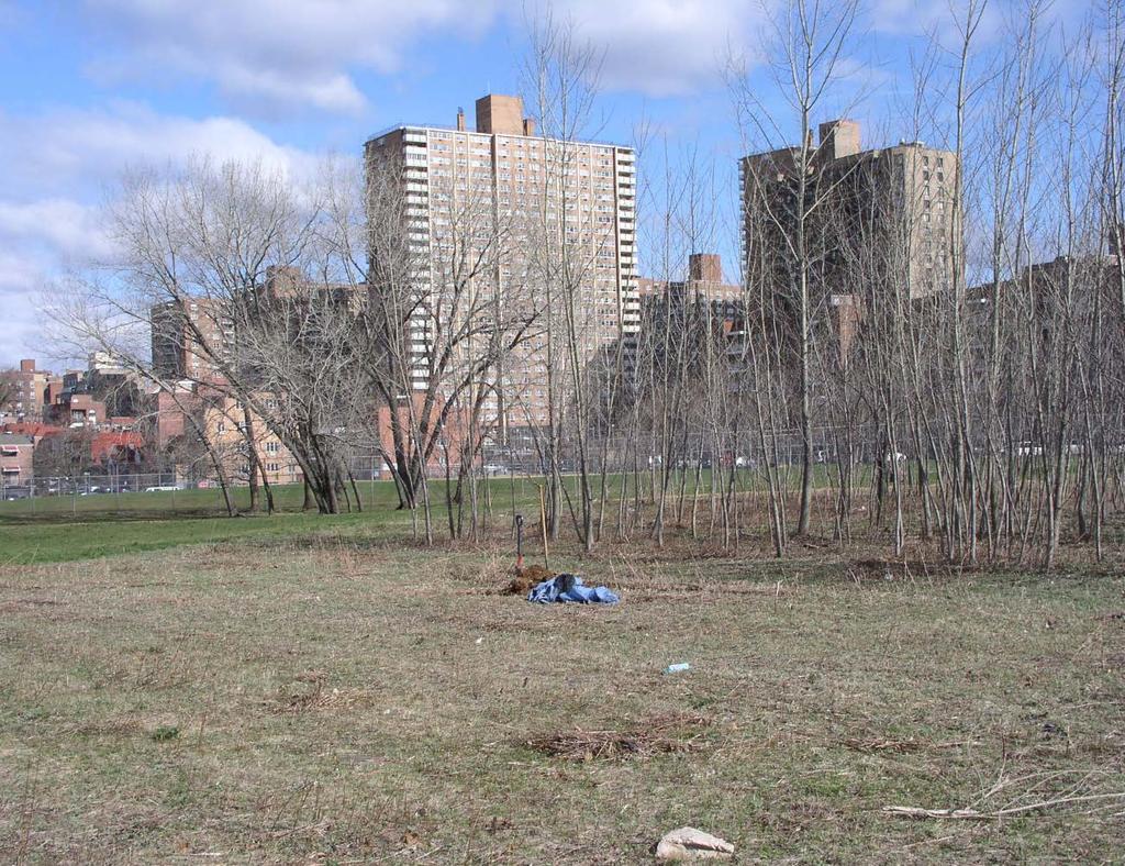
7 NYC Survey Methods: Delineation soil landscape units reflect: Topography Parent material Land use / cover Bunker Ponds Park, Staten Island


8 USDA-NRCS NYC Soil Surveys acres scale msd Central Park 843 1:4, acres South Latourette Park 320 1:6, acres Gateway Nat Rec Area 6,300 1:4, acres Bronx River Watershed 6,900 1:6, acres Reconnaissance 193,024 1:62, acres City-Wide Initial 190,764 1:12, acres (Web Soil Survey available)
 Clean fill spolic (HAHT class) Dredge materials dredgic Construction debris - artifactic Coal & fly ash combustic Solid waste landfill - methanogenic Bigapple series Dredge materials Urban")
9 NYC initial soil survey 1:12,000 scale (1.5 acre MSD) 236 Map units 37 Natural soil series (4 est. in NYC) 29 HAHT soil series (27 est. in NYC) Clean fill spolic (HAHT class) Dredge materials dredgic Construction debris - artifactic Coal & fly ash combustic Solid waste landfill - methanogenic Bigapple series Dredge materials Urban land mapunits 6 substratum phases (from USGS map) Till Tidal marsh Outwash Sandy Alluvium Reclaimed

10 NYC Citywide totals (USDA-NRCS Soil Survey) % of land area Urban land (sealed soils) 62.7 HAHT* (fill) Soils 27.6 Native Soils 8.6 Other Misc. Areas** 1.1 * Human-altered & human-transported **Rock outcrop, Beaches, etc. Cross Bronx Expressway (NY Times photo)

11 NYC Pedodiversity Soil Type % of land area Sealed soils 62.6 Clean fill 16.4 Artifactual fill 6.0 Dredge fill 2.9 Brown till 2.6 Red till 2.1 Tidal marsh 2.0 Landfill 1.6 Outwash 1.5 Sand dunes 0.3 Coal ash 0.1 Serpentine 0.1
 minimum size delineation available on Web Soil Survey: http://websoilsurvey.nrcs.usda.gov/app/homepage.")
12 USDA-NRCS Soil Survey of New York City :12,000 scale ( Official data) 1.5 acre (0.6 ha) minimum size delineation available on Web Soil Survey: Create soil map & custom report for Area of Interest Download spatial & tabular data (by county/boro)

13 Web Soil Survey: Soil Data Explorer Soil Properties and Qualities aggregate data Soil Chemical Properties Soil Physical Properties Soil Erosion Factors Soil Qualities and Features Water Features Greenbelt soil clean fill

14 Web Soil Survey: Soil Data Explorer Suitabilities and Limitations for Use Building Site Development Construction Materials Disaster Recovery Planning Land Classifications Land Management Military Operations Recreational Development Sanitary Facilities Vegetative Productivity Waste Management Water Management Mosholu soil Coal combustion ash

15 NRCS survey-related projects & Lab Data, NYC 118 pedons sampled to date Atmospheric inputs of trace metals in woodland soils Manhattan trace metal/pah background levels with Con-Edison Infiltration & Land Use Artifacts & trace metals Citywide soil organic carbon stocks
 Bulk density Water retention ph & EC CEC Soil test analyses (extractions) Total elemental")
16 Lab Data Mart: point data Particle size (USDA & Engineering) Bulk density Water retention ph & EC CEC Soil test analyses (extractions) Total elemental analysis (C, N, S, etc.) Trace metals Mineralogy Laguardia soil construction debris


17 NYC Soils available on: Soil Web Applications


18 NYC Soils available on Google Earth:

19 NYC Soils available in gssurgo Geospatial Data Gateway Direct Download Gridded Soil Survey Geographic (gssurgo) by State gssurgo/ssurgo ArcTools (ArcGIS) Create gssurgo, download SSURGO and create interpretative soil maps; Soil Development Toolbox Soil Data Viewer an extension to ArcMap that allows a user to create soil-based thematic maps Value Added Look UP Table Database Soil organic Carbon Soil Data Access Query (SQL)
 of NYC soils Systems are distinct groups of soils or catenas produced by the interaction of geology, geomorphology,")

20 Soil Systems of New York City Intro/Guide to NYC Soils Accompaniment to Web Soil Survey Info on parent materials, landscapes, properties (including lab data) of NYC soils Systems are distinct groups of soils or catenas produced by the interaction of geology, geomorphology, hydrology and climate. 34 total for NYC, including: Tidal soil system Red serpentine till system Brown till, meltout till subsystem Red sedimentary till, fragipan subsystem Deep fill, artifact subsystem Pavement system, brown till subsystem Landscape block diagram, Brown meltout till


21 Soil Shops- NY, NJ & PA soil lead screening The Agency for Toxic Substances and Disease Registry (ATSDR), NY Department of Health Brooklyn College Cornell Cooperative Extension Rutgers University USDA-NRCS Portable X-ray fluorescence environmental analyzer EPA Method 6200 How Healthy is your soil? Albany, NY Utica, NY Newburgh, NY Staten Island, NY Camden, NJ Philadelphia, PA
22 Non- Discrimination Statement In accordance with Federal civil rights law and U.S. Department of Agriculture (USDA) civil rights regulations and policies, the USDA, its Agencies, offices, and employees, and institutions participating in or administering USDA programs are prohibited from discriminating based on race, color, national origin, religion, sex, gender identity (including gender expression), sexual orientation, disability, age, marital status, family/parental status, income derived from a public assistance program, political beliefs, or reprisal or retaliation for prior civil rights activity, in any program or activity conducted or funded by USDA (not all bases apply to all programs). Remedies and complaint filing deadlines vary by program or incident. Persons with disabilities who require alternative means of communication for program information (e.g., Braille, large print, audiotape, American Sign Language, etc.) should contact the responsible Agency or USDA s TARGET Center at (202) (voice and TTY) or contact USDA through the Federal Relay Service at (800) Additionally, program information may be made available in languages other than English. To file a program discrimination complaint, complete the USDA Program Discrimination Complaint Form, AD-3027, found online at How to File a Program Discrimination Complaint and at any USDA office or write a letter addressed to USDA and provide in the letter all of the information requested in the form. To request a copy of the complaint form, call (866) Submit your completed form or letter to USDA by: (1) mail: U.S. Department of Agriculture Office of the Assistant Secretary for Civil Rights 1400 Independence Avenue, SW Washington, D.C ; (2) fax: (202) ; or (3) program.intake@usda.gov. USDA is an equal opportunity provider, employer, and lender.
What is a published soil survey?
 What is a published soil survey? A soil survey is a detailed report on the soils of an area. The soil survey has maps with soil boundaries and photos, descriptions, and tables of soil properties and features.
CRP HEL CRP Ortho Imagery. Tract Cropland Total: acres
 United States Department of Agriculture Madison County, Iowa 17 4.09 23 1.26 6 10.74 14 2.89 12 1.7 1 18.02 230TH LN T 347 3 34 4.65 13 2.81 2 11.4 ELMWOOD AVE 16 3 6.49 18 6.5 1.59 21 2.35 8.76 24 11
Abbreviated 156 Farm Record
 MISSOURI HOWARD Form: FSA-156EZ See Page 3 for non-discriminatory Statements. United States Department of Agriculture Farm Service Agency Abbreviated 156 Farm Record FARM : Prepared : Crop Year : 4825
Management and Use of LiDAR-derived Information. Elizabeth Cook, GIS Specialist
 Management and Use of LiDAR-derived Information Elizabeth Cook, GIS Specialist Advanced LiDAR Workshop March 15, 2012 50-100 gb/county Now What? Project Deliverables LAS mass point files, classification
Custom Soil Resource Report for Multnomah County Area, Oregon
 United States Department of Agriculture Natural Resources Conservation Service A product of the National Cooperative Soil Survey, a joint effort of the United States Department of Agriculture and other
MATHEWS FARM TUNICA MISSISSIPPI 1130 ACRES (+/ ) TUNICA AND DESOTO COUNTY FOR SALE. List Price $6,100,000.
 TUNICA AND DESOTO COUNTY FOR SALE. List Price $6,100,000.") MATHEWS FARM TUNICA MISSISSIPPI 1130 ACRES (+/ ) TUNICA AND DESOTO COUNTY FOR SALE List Price $6,100,000. FARM ACREAGE BREAKDOWN: Map Acres FSA Crop Acres Shop, bins, turn rows, and ditches Tract 1 Main
MATHEWS FARM TUNICA MISSISSIPPI 1130 ACRES (+/ ) TUNICA AND DESOTO COUNTY FOR SALE List Price $6,100,000. FARM ACREAGE BREAKDOWN: Map Acres FSA Crop Acres Shop, bins, turn rows, and ditches Tract 1 Main
Custom Soil Resource Report for Clackamas County Area, Oregon
 United States Department of Agriculture Natural Resources Conservation Service A product of the National Cooperative Soil Survey, a joint effort of the United States Department of Agriculture and other
Custom Soil Resource Report for Valley County, Montana
 United States Department of Agriculture Natural Resources Conservation Service A product of the National Cooperative Soil Survey, a joint effort of the United States Department of Agriculture and other
Custom Soil Resource Report for Clackamas County Area, Oregon
 United States Department of Agriculture Natural Resources Conservation Service A product of the National Cooperative Soil Survey, a joint effort of the United States Department of Agriculture and other
Custom Soil Resource Report for Clark County, Washington
 United States Department of Agriculture Natural Resources Conservation Service A product of the National Cooperative Soil Survey, a joint effort of the United States Department of Agriculture and other
12- TOL MLRA Soil Survey Area Approximately 15,000,000 Acres
 !@ 12- TOL MLRA Soil Survey Area Approximately 15,000,000 Acres Office Location: Tolland, Connecticut Staff: Donald Parizek Acting Soil Survey Office Party Leader Jacob Isleib Soil Scientist Marissa Theve
Custom Soil Resource Report for St. Lucie County, Florida
 United States Department of Agriculture Natural Resources Conservation Service A product of the National Cooperative Soil Survey, a joint effort of the United States Department of Agriculture and other
Custom Soil Resource Report for Santa Fe Area, New Mexico, Santa Fe County and Part of Rio Arriba County; and Santa Fe County Area, New Mexico
 United States Department of Agriculture Natural Resources Conservation Service A product of the National Cooperative Soil Survey, a joint effort of the United States Department of Agriculture and other
USDA NRCS Soil Survey
 USDA NRCS Soil Survey Thomas Reinsch National Leader World Soil Resources Slide 1 Slide 2 National Cooperative Soil Survey Congress Has Directed The Secretary Of Agriculture To: 1899-2011 Inventory Soils
Custom Soil Resource Report for Polk County, Oregon
 United States Department of Agriculture Natural Resources Conservation Service A product of the National Cooperative Soil Survey, a joint effort of the United States Department of Agriculture and other
Custom Soil Resource Report for Bell County, Texas
 United States Department of Agriculture Natural Resources Conservation Service A product of the National Cooperative Soil Survey, a joint effort of the United States Department of Agriculture and other
Soils of Hawai i Dr. Greg Bruland NREM 461
 Soils of Hawai i Dr. Greg Bruland NREM 461 Figure modified from Gavenda et al. 1998 Island Age = million years (mya) Map modified from Gavenda et al. 1998 Island Age = mya 9 of 11 soil orders present Map
Custom Soil Resource Report for Forrest County, Mississippi
 United States Department of Agriculture Natural Resources Conservation Service A product of the National Cooperative Soil Survey, a joint effort of the United States Department of Agriculture and other
 United States Department of Agriculture Natural Resources Conservation Service A product of the National Cooperative Soil Survey, a joint effort of the United States Department of Agriculture and other
Custom Soil Resource Report for Clackamas County Area, Oregon
 United States Department of Agriculture Natural Resources Conservation Service A product of the National Cooperative Soil Survey, a joint effort of the United States Department of Agriculture and other
Custom Soil Resource Report for Fresno County, California, Western Part
 United States Department of Agriculture Natural Resources Conservation Service A product of the National Cooperative Soil Survey, a joint effort of the United States Department of Agriculture and other
Near Sledge, Mississippi. Please call to arrange a private viewing
 $3,958,000.00 $1,685,000 ($4,010/Acre) ($3,539/Acre) Precision Leveled Cropland 936.7 Total Acres - 598.39 Cropland Acres - 32.54 CRP Acres - 252.7 Timberland Acres (5) Irrigation Wells CRP Income: $6,500
Custom Soil Resource Report for Kern County, California, Northwestern Part
 United States Department of Agriculture Natural Resources Conservation Service A product of the National Cooperative Soil Survey, a joint effort of the United States Department of Agriculture and other
160 Acres of Tillable Land, Alfalfa, Pasture, Building Site, and Rec Area in Sun Prairie Township! Thursday, November 1, 2018 at NOON
 160+/- Acres of McCook County land 160 Acres of Tillable Land, Alfalfa, Pasture, Building Site, and Rec Area in Sun Prairie Township! Thursday, November 1, 2018 at NOON Located from Salem, SD on US HWY
The Wildland Fire Chemical
 United States Department of Agriculture Forest Service Technology & Development Program Airtanker 157-284-MTDC January 21 51/57 Drop Guides Ground Pattern Performance of the National Guard Black Hawk Helicopter
O\.OLSSON \ ASSOC I ATES
 O\.OLSSON \ ASSOC I ATES NRCS Soils Report Larry D. Knox Juniper Hills Private Landing Strip ) OAProject No. 012-1776 760 Horizon Drive, Suite 1021 Grand Junction, CO 815061 TEL 970.263.7800 I FAX 970.263.7456
Introduction to Geographic Information Systems (GIS): Environmental Science Focus
: Environmental Science Focus") Introduction to Geographic Information Systems (GIS): Environmental Science Focus September 9, 2013 We will begin at 9:10 AM. Login info: Username:!cnrguest Password: gocal_bears Instructor: Domain: CAMPUS
Introduction to Geographic Information Systems (GIS): Environmental Science Focus September 9, 2013 We will begin at 9:10 AM. Login info: Username:!cnrguest Password: gocal_bears Instructor: Domain: CAMPUS
Custom Soil Resource Report for Potter County, Texas
 United States Department of Agriculture Natural Resources Conservation Service A product of the National Cooperative Soil Survey, a joint effort of the United States Department of Agriculture and other
Airtanker. Drop Guides
 United States Department of Agriculture Forest Service Technology & Development Program Airtanker 57-2852-MTDC September 2 51/57 Drop Guides Ground Pattern Performance of the Snow Air Tractor with Constant
GIS APPLICATIONS IN SOIL SURVEY UPDATES
 GIS APPLICATIONS IN SOIL SURVEY UPDATES ABSTRACT Recent computer hardware and GIS software developments provide new methods that can be used to update existing digital soil surveys. Multi-perspective visualization
Total Acres: Tillable Acres: Irrigated Acres: All Improvements will be managed by Farmers National Company / CHS.
 GROUP P Parcel # Acres Twp County FSA Farm FSA Tract Tillable Acres Irrigated Acres 14-040-011-022-00 105.00 Lagrange Cass 7797 7858 262.12 72.50 14-040-011-022-10 5.00 Lagrange Cass 7797 7858 w 040-011-022-00
Custom Soil Resource Report for Coryell County, Texas
 United States Department of Agriculture Natural Resources Conservation Service A product of the National Cooperative Soil Survey, a joint effort of the United States Department of Agriculture and other
A Help Guide for Using gssurgo to Find Potential Wetland Soil Landscapes
 A Help Guide for Using gssurgo to Find Potential Wetland Soil Landscapes Wetland Mapping Consortium Webinar September 17, 2014 Dr. John M. Galbraith Crop & Soil Environmental Sciences Virginia Tech Wetland
Jim Turenne. Soils on Social Media
 Jim Turenne USDA-NRCS 60 Quaker Lane, Suite 46 Warwick, RI. 02886 401-822-8832 Jim.turenne@ri.usda.gov Soils on Social Media www.twitter.com/soilsne www.fb.com/soilsne www.nesoil.com U.S. Department of
Custom Soil Resource Report for Stevens County, Washington
 United States Department of Agriculture Natural Resources Conservation Service A product of the National Cooperative Soil Survey, a joint effort of the United States Department of Agriculture and other
Custom Soil Resource Report for San Juan Area, Puerto Rico
 United States Department of Agriculture Natural Resources Conservation Service A product of the National Cooperative Soil Survey, a joint effort of the United States Department of Agriculture and other
Chesapeake Bay Remote Sensing Pilot Executive Briefing
 Chesapeake Bay Remote Sensing Pilot Executive Briefing Introduction In his Executive Order 13506 in May 2009, President Obama stated The Chesapeake Bay is a national treasure constituting the largest estuary
Custom Soil Resource Report for Polk County, Oregon
 United States Department of Agriculture Natural Resources Conservation Service A product of the National Cooperative Soil Survey, a joint effort of the United States Department of Agriculture and other
Custom Soil Resource Report for Clackamas County Area, Oregon, and Marion County Area, Oregon
 United States Department of Agriculture Natural Resources Conservation Service A product of the National Cooperative Soil Survey, a joint effort of the United States Department of Agriculture and other
Custom Soil Resource Report for Wright County, Minnesota
 United States Department of Agriculture Natural Resources Conservation Service A product of the National Cooperative Soil Survey, a joint effort of the United States Department of Agriculture and other
YELLOW MEDICINE COUNTY FARMS FOR SALE
 YELLOW MEDICINE COUNTY FARMS FOR SALE Owners Rhea Trusts 790+ acres of high quality cropland in western Yellow Medicine County, MN. The land has been owned by the Rhea family for many years. The land includes
Custom Soil Resource Report for Southampton County, Virginia
 United States Department of Agriculture Natural Resources Conservation Service A product of the National Cooperative Soil Survey, a joint effort of the United States Department of Agriculture and other
Custom Soil Resource Report for Okeechobee County, Florida
 United States Department of Agriculture Natural Resources Conservation Service A product of the National Cooperative Soil Survey, a joint effort of the United States Department of Agriculture and other
2.a.. Physical Factors General Map
 2.a.. Physical Factors General Map General Map: Provide map showing proposed site location within the State and County, depicting road(s) accessing the site. i. Provide information depicting the location
An Internet-Based Integrated Resource Management System (IRMS)
") An Internet-Based Integrated Resource Management System (IRMS) Third Quarter Report, Year II 4/1/2000 6/30/2000 Prepared for Missouri Department of Natural Resources Missouri Department of Conservation
An Internet-Based Integrated Resource Management System (IRMS) Third Quarter Report, Year II 4/1/2000 6/30/2000 Prepared for Missouri Department of Natural Resources Missouri Department of Conservation
Custom Soil Resource Report for Livingston Parish, Louisiana
 United States Department of Agriculture Natural Resources Conservation Service A product of the National Cooperative Soil Survey, a joint effort of the United States Department of Agriculture and other
Watershed Application of WEPP and Geospatial Interfaces. Dennis C. Flanagan
 Watershed Application of WEPP and Geospatial Interfaces Dennis C. Flanagan Research Agricultural Engineer USDA-Agricultural Research Service Adjunct Professor Purdue Univ., Dept. of Agric. & Biol. Eng.
Custom Soil Resource Report for Atlantic County, New Jersey
 United States Department of Agriculture Natural Resources Conservation Service A product of the National Cooperative Soil Survey, a joint effort of the United States Department of Agriculture and other
Maggie Payne Jim Turenne
 Maggie Payne Jim Turenne USDA-NRCS 60 Quaker Lane, Suite 46 Warwick, RI. 02886 401-822-8832 maggie.payne@ri.usda.gov U.S. Department of Agriculture 1935: Soil Conservation Service (SCS) Natural Resources
Custom Soil Resource Report for Missoula County Area, Montana
 United States Department of Agriculture Natural Resources Conservation Service A product of the National Cooperative Soil Survey, a joint effort of the United States Department of Agriculture and other
Custom Soil Resource Report for Palo Verde Area, California
 United States Department of Agriculture Natural Resources Conservation Service A product of the National Cooperative Soil Survey, a joint effort of the United States Department of Agriculture and other
Crop Progress. Corn Mature Selected States [These 18 States planted 92% of the 2017 corn acreage]
![Crop Progress. Corn Mature Selected States [These 18 States planted 92% of the 2017 corn acreage]](/thumbs/89/98128758.jpg "Crop Progress. Corn Mature Selected States [These 18 States planted 92% of the 2017 corn acreage]") Crop Progress ISSN: 00 Released October, 0, by the National Agricultural Statistics Service (NASS), Agricultural Statistics Board, United s Department of Agriculture (USDA). Corn Mature Selected s [These
Crop Progress ISSN: 00 Released October, 0, by the National Agricultural Statistics Service (NASS), Agricultural Statistics Board, United s Department of Agriculture (USDA). Corn Mature Selected s [These
CRUM RANCH AREA MAP YOLO COUNTY, California, AC +/-
 CRUM RANCH AREA MAP YOLO COUNTY, California, 235.59 AC +/- Map data 2016 Google Imagery 2016, CAPCOG, DigitalGlobe, Texas Orthoimagery Program, U.S. Geological Survey, USDA Farm Service Agency Boundary
What s New in Topographic Information - USGS National Map
 + What s New in Topographic Information - USGS National Map SARGIS Workshop November 14, 2016 Rob Dollison, 703-648-5724 rdollison@usgs.gov + USGS 2 National Geospatial Program The National Geospatial
StreamStats: Delivering Streamflow Information to the Public. By Kernell Ries
 StreamStats: Delivering Streamflow Information to the Public By Kernell Ries U.S. Department of the Interior U.S. Geological Survey MD-DE-DC District 410-238-4317 kries@usgs.gov StreamStats Web Application
Alliance Ag Services, LLC
 United States Department of Agriculture Natural Resources Conservation Service Alliance Ag Services, LLC A product of the National Cooperative Soil Survey, a joint effort of the United States Department
Custom Soil Resource Report for Victoria County, Texas
 United States Department of Agriculture Natural Resources Conservation Service A product of the National Cooperative Soil Survey, a joint effort of the United States Department of Agriculture and other
Custom Soil Resource Report for Clackamas County Area, Oregon
 United States Department of Agriculture Natural Resources Conservation Service A product of the National Cooperative Soil Survey, a joint effort of the United States Department of Agriculture and other
Custom Soil Resource Report for Island County, Washington
 United States Department of Agriculture Natural Resources Conservation Service A product of the National Cooperative Soil Survey, a joint effort of the United States Department of Agriculture and other
Commentary on Factors Affecting Transverse Vibration Using an Idealized Theoretical Equation
 United States Department of Agriculture Forest Service Forest Products Laboratory Research Note FPL RN 076 Commentary on Factors Affecting Transverse Vibration Using an Idealized Theoretical Equation Joseph
Custom Soil Resource Report for Kern County, California, Southwest Part
 United States Department of Agriculture Natural Resources Conservation Service A product of the National Cooperative Soil Survey, a joint effort of the United States Department of Agriculture and other
Evaluating e-government : implementing GIS services in Municipality
 Evaluating e-government : implementing GIS services in Municipality Municipality of Thessaloniki - G.I.S. Unit Misirloglou Symeon Head of the GIS Unit ESRI UC - 2016 The GIS Section - subset of the department
COMMUNITY SERVICE AREA
 INSTITUTE FOR TRIBAL ENVIRONMENTAL PROFESSIONALS Tribal Waste and Response Assistance Program (TWRAP) Developing and Implementing a Tribal Integrated Solid Waste Management Plan April 12-14, 2016 Palm
Custom Soil Resource Report for Franklin County, Missouri
 United States Department of Agriculture Natural Resources Conservation Service A product of the National Cooperative Soil Survey, a joint effort of the United States Department of Agriculture and other
Custom Soil Resource Report for Gem County Area, Idaho
 United States Department of Agriculture Natural Resources Conservation Service A product of the National Cooperative Soil Survey, a joint effort of the United States Department of Agriculture and other
Geospatial Technologies for the Agricultural Sciences
 Geospatial Technologies for the Agricultural Sciences Maggi Kelly Assoc. Cooperative Extension Specialist Department of Environmental Science, Policy & Management Director, GIIF UC Berkeley Karin Tuxen
SoilView: Development of a Custom GIS Application for Publishing Soil Surveys
 SoilView: Development of a Custom GIS Application for Publishing Soil Surveys Allan Johnson and Mike Wigginton Abstract Currently, digital soils information can be obtained from many sources. Numerous
PERCEPTION and Focus on Maps. Focus on Maps 8/29/2014. English and Dutch Maps from the 1600s and 1680 British Maps of N. Am.
 PERCEPTION English and Dutch Maps from the 600s The Nature of New York Dutch67 Prof. Anthony Grande English 67 Copyright 04 AFG 676 and 680 British Maps of N. Am. 70 and 776 4 Focus on Maps Maps are geographers
GIS Resources for Local Governments
 ISSUE PAPER SERIES GIS Resources for Local Governments February 2018 NEW YORK STATE TUG HILL COMMISSION DULLES STATE OFFICE BUILDING 317 WASHINGTON STREET WATERTOWN, NY 13601 (315) 785-2380 WWW.TUGHILL.ORG
Electronic Submission Format Guide Large Noncoal (Industrial Minerals) Mine Permit Application (5600-PM-BMP0315)
 Mine Permit Application (5600-PM-BMP0315)") Electronic Submission Format Guide Large Noncoal (Industrial Minerals) Mine Permit Application (5600-PM-BMP0315) Module 1: Application Section A through Section I, the Application Checklist, and all narrative
Electronic Submission Format Guide Large Noncoal (Industrial Minerals) Mine Permit Application (5600-PM-BMP0315) Module 1: Application Section A through Section I, the Application Checklist, and all narrative
Utah UIC Geospatial Integration EIEN Project
 Utah UIC Geospatial Integration EIEN Project ESRI UC, June 2007 Bert Granberg Utah Automated Geographic Reference Center Utah Automated Geographic Reference Center (AGRC) AGRC Responsibilities Facilitate
Custom Soil Resource Report for Solano County, California
 United States Department of Agriculture Natural Resources Conservation Service A product of the National Cooperative Soil Survey, a joint effort of the United States Department of Agriculture and other
Appendix 2b. NRCS Soil Survey
 Appendix 2b NRCS Soil Survey 118 19' 25'' W Nonirrigated Capability Class Antelope Valley Area, California (Del Sur Solar Site) 118 17' 28'' W 378900 379200 379500 379800 380100 380400 380700 381000 381300
Custom Soil Resource Report for Marion County Area, Oregon
 United States Department of Agriculture Natural Resources Conservation Service A product of the National Cooperative Soil Survey, a joint effort of the United States Department of Agriculture and other
Development of a GIS Interface for WEPP Model Application to Great Lakes Forested Watersheds
 Development of a GIS Interface for WEPP Model Application to Great Lakes Forested Watersheds J.R. Frankenberger 1, S. Dun 2, D.C. Flanagan 1, J.Q. Wu 2, W.J. Elliot 3 1 USDA-ARS, West Lafayette, IN 2 Washington
NEW CONCEPTS - SOIL SURVEY OF THE FUTURE
 NEW CONCEPTS - SOIL SURVEY OF THE FUTURE The new process of doing soil surveys by Major Land Resource Areas (MLRA) highlights this section. Special emphasis is given to an overview of the National Soil
A Comprehensive Inventory of the Number of Modified Stream Channels in the State of Minnesota. Data, Information and Knowledge Management.
 A Comprehensive Inventory of the Number of Modified Stream Channels in the State of Minnesota Data, Information and Knowledge Management Glenn Skuta Environmental Analysis and Outcomes Division Minnesota
Custom Soil Resource Report for Wasco County, Oregon, Northern Part
 United States Department of Agriculture Natural Resources Conservation Service A product of the National Cooperative Soil Survey, a joint effort of the United States Department of Agriculture and other
GIS = Geographic Information Systems;
 What is GIS GIS = Geographic Information Systems; What Information are we talking about? Information about anything that has a place (e.g. locations of features, address of people) on Earth s surface,
Long Island Breast Cancer Study and the GIS-H (Health)
") Long Island Breast Cancer Study and the GIS-H (Health) Edward J. Trapido, Sc.D. Associate Director Epidemiology and Genetics Research Program, DCCPS/NCI COMPREHENSIVE APPROACHES TO CANCER CONTROL September,
Long Island Breast Cancer Study and the GIS-H (Health) Edward J. Trapido, Sc.D. Associate Director Epidemiology and Genetics Research Program, DCCPS/NCI COMPREHENSIVE APPROACHES TO CANCER CONTROL September,
Geospatial Data, Services, and Products. National Surveying, mapping and geospatial conference
 Geospatial Data, Services, and Products Federal Programs -- USDA NRCS National Surveying, mapping and geospatial conference March 15, 2016 NRCS Applications using Geosaptial Products & Services Field
POSITION DESCRIPTION. Position Title: Geographic Information Systems (GIS) Coordinator Department: Engineering
 Coordinator Department: Engineering") POSITION DESCRIPTION Position Title: Geographic Information Systems (GIS) Coordinator Department: Engineering Reports To: Engineering Supervisor FLSA Status: Exempt Date: April 2018 PRIMARY OBJECTIVE OF
POSITION DESCRIPTION Position Title: Geographic Information Systems (GIS) Coordinator Department: Engineering Reports To: Engineering Supervisor FLSA Status: Exempt Date: April 2018 PRIMARY OBJECTIVE OF
Custom Soil Resource Report for Washoe County, Nevada, South Part
 United States Department of Agriculture Natural Resources Conservation Service A product of the National Cooperative Soil Survey, a joint effort of the United States Department of Agriculture and other
Land Accounts - The Canadian Experience
 Land Accounts - The Canadian Experience Development of a Geospatial database to measure the effect of human activity on the environment Who is doing Land Accounts Statistics Canada (national) Component
Nomination Form. Clearinghouse. New York State Office for Technology. Address: State Capitol-ESP, PO Box
 NASIRE 2001 RECOGNITION AWARDS Recognizing Outstanding Achievement in the Field of Innovative Use of Technology Nomination Form Title of Nomination: Manager/Job Title: Agency: NYS Geographic Information
Class Schedule and Assignments
 Class Schedule and Assignments Course Title: Soil Morphology and Mapping (PLNTSOIL 597T) Instructor: Time: Peter Fletcher (www.pfdigsoil@gmail.com) Home phone: (774) 202-5695 Cell phone: (508) 524-1397
RANCHO de DOS PALMAS DAVIS, California, AC +/-
 RANCHO de DOS PALMAS DAVIS, California, 507.28 AC +/- Boundary Transmission Line Pond / Tank Well SCOTT STONE P: (530) 662-4094 sastone57@gmail.com 37874 County Road 28, Woodland, Ca. 95695 The information
Custom Soil Resource Report for Northumberland County, Pennsylvania
 United States Department of Agriculture Natural Resources Conservation Service A product of the National Cooperative Soil Survey, a joint effort of the United States Department of Agriculture and other
Electronic Submission Format Guide Anthracite Preparation Plant Permit Application
 Electronic Submission Format Guide Anthracite Preparation Plant Permit Application Module 1: Application Section A through Section J, the Application Checklist, and all narrative responses Act 67 / 68
Understanding China Census Data with GIS By Shuming Bao and Susan Haynie China Data Center, University of Michigan
 Understanding China Census Data with GIS By Shuming Bao and Susan Haynie China Data Center, University of Michigan The Census data for China provides comprehensive demographic and business information
Custom Soil Resource Report for Pinal County, Arizona, Western Part
 United States Department of Agriculture Natural Resources Conservation Service A product of the National Cooperative Soil Survey, a joint effort of the United States Department of Agriculture and other
Mapping Your Land and Introduction to Web Soil Survey. Elizabeth Cook GIS Specialist USDA-NRCS (retired)
") Mapping Your Land and Introduction to Web Soil Survey Elizabeth Cook GIS Specialist USDA-NRCS (retired) Using Geographic Information Systems (GIS), Global Positioning System (GPS), digital aerial photography
Mapping Your Land and Introduction to Web Soil Survey Elizabeth Cook GIS Specialist USDA-NRCS (retired) Using Geographic Information Systems (GIS), Global Positioning System (GPS), digital aerial photography
Michael Thomas Sullivan
 Michael Thomas Sullivan michael.sullivan2@lc.cuny.edu Home Address 2319 Brigham Street Brooklyn, NY 11229 Cell (516) 729-8870 Academic Address Geographic Information Science Dept. Lehman College, CUNY
Georeferencing and Satellite Image Support: Lessons learned, Challenges and Opportunities
 Georeferencing and Satellite Image Support: Lessons learned, Challenges and Opportunities Shirish Ravan shirish.ravan@unoosa.org UN-SPIDER United Nations Office for Outer Space Affairs (UNOOSA) UN-SPIDER
Electronic Submission Format Guide Bituminous Coal Surface Mine Permit Application (5600-PM-BMP0311)
") Electronic Submission Format Guide Bituminous Coal Surface Mine Permit Application (5600-PM-BMP0311) Module 1: Application Section A through Section J, the Application Checklist, and all narrative responses.
Electronic Submission Format Guide Bituminous Coal Surface Mine Permit Application (5600-PM-BMP0311) Module 1: Application Section A through Section J, the Application Checklist, and all narrative responses.
BxM9. Throgs Neck, Bronx, and Midtown, Manhattan. Between. Express Service. Bus Timetable. Effective Winter MTA Bus Company
 Bus Timetable Effective Winter 2019 MTA Bus Company BxM9 Express Service Between Throgs Neck, Bronx, and Midtown, Manhattan If you think your bus operator deserves an Apple Award our special recognition
ADMINISTRATION DEPARTMENT Land Management Information Center. An Inventory of Its Records
 MINNESOTA HISTORICAL SOCIETY Minnesota State Archives ADMINISTRATION DEPARTMENT Land Management Information Center An Inventory of Its Records OVERVIEW OF THE RECORDS Agency: Series Title: Land Management
Custom Soil Resource Report for Polk County, Oregon
 United States Department of Agriculture Natural Resources Conservation Service A product of the National Cooperative Soil Survey, a joint effort of the United States Department of Agriculture and other
NCSS/NRCS Updates & New Horizon Designation for ^Anthropogenic Soils. Jim Turenne, CPSS Assistant State Soil Scientist RI USDA NRCS
 NCSS/NRCS Updates & New Horizon Designation for ^Anthropogenic Soils Jim Turenne, CPSS Assistant State Soil Scientist RI USDA NRCS http://nesoil.com NCSS / NRCS Updates Major reorganization of the NCSS
Custom Soil Resource Report for Cuyahoga County, Ohio
 United States Department of Agriculture Natural Resources Conservation Service A product of the National Cooperative Soil Survey, a joint effort of the United States Department of Agriculture and other