NCSS/NRCS Updates & New Horizon Designation for ^Anthropogenic Soils. Jim Turenne, CPSS Assistant State Soil Scientist RI USDA NRCS
|
|
|
- MargaretMargaret Newton
- 5 years ago
- Views:
Transcription
1 NCSS/NRCS Updates & New Horizon Designation for ^Anthropogenic Soils Jim Turenne, CPSS Assistant State Soil Scientist RI USDA NRCS
2 NCSS / NRCS Updates Major reorganization of the NCSS by MMA. WSS Version 2.0 many new features (bug fixes, topo image, transparency, map unit information, custom reports). Soil Resource Inventory Toolbox GIS interface and Pedon PC (Access program) Northeast NCSS Conference CT/RI Host. Mapping details available for private sector (?) and hiring of new soil scientists.
 some new interps/ratings. Plymouth County some areas digitized (eastern part).")
3 Digital Soils Data CT, MA, RI Franklin County using 3D Mapper and ArcMap for a paperless survey. Statewide survey (CT600) some new interps/ratings. Plymouth County some areas digitized (eastern part). State-wide survey, archived surveys and DVD ROM.

4 Soil Survey Reorganization by MLRA
5 Recent History of Anthropogenic Soils ICOMANTH formed in 1995, charged with defining appropriate classes in Soil Taxonomy for soils that have their major properties derived from human activities. Prior most soil surveys mapped undifferentiated units for human altered landforms (Udorthents, Udipsamments, Arents, etc.). Ideas ranged from a new soil order, great group level (urbic, garbic), map unit phases and series, master horizons for fill and so on.


6 History Major soil survey work on anthropogenic soils were made with the mapping of NYC. 24 soil series established, urban interpretations built, pedon descriptions taken. Anthropogenic tours conducted.
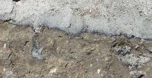
7 ICOMANTH Circular 6 most recent Circular6.pdf human transported material Organic or mineral soil material (or any other material that can function as a soil material) that has been moved horizontally onto a pedon from a source area outside of that pedon by directed human activity, usually with the aid of machinery. There has been little or no subsequent reworking by wind, gravity, water, or ice. Human transported materials are most commonly associated with building sites, mining or dredging operations, land fills, or other similar activities that result in the formation of a constructional anthropogenic landform. NSSH Definition. See handout from Mark Stolt talk at the 2005 recent advances in soil science session.
8 Circular 6 highlights Does not address classification of HTM main purpose is in describing HTM. Make recommendations for NSSH, SSM, etc. Define HTM as a type of parent material. Define Anthropogenic features, manufactured layers, and artifacts (along with categories of artifacts) Detailed descriptions of artifacts. Horizon designation: M, ^, u.


9 Keys to Taxonomy 10 th edition


10 Why Needed? Major human modification of soils in the SNE region. Major soil work involves describing and interpreting soils for septic system evaluations and hydric soil delineation. Need to use this new nomenclature consistently.
 may want to check and describe any redox")
11 No information described. Hydric soil (?) may want to check and describe any redox features in fill.

12 Is it Soil? No: misc. area active gravel pit. No: pavement and buildings Yes: vegetated area, Fortress and Tihonet Series.

13 Historic Imagery 1800 s to 2005


14 ^A: 0-4, 10YR 3/1, sl, 0,m, Fr. ^C1: 4-23, 2.5Y 5/3, ls, 0,m, Fr (no artifacts). ^Cg: Y 5/2, 5% 5Y 5/1 redox depletions, ls, 0,m, Fr, +rx to alpha dye. 2Ab: 26-28, 2.5Y 2.5/1, msl, 1,f,sbk, fr 2Bg: Y 5/1, sl, 1msbk, fr. 2Cd: Y 5/1, 20% 10YR 5/6 conc. Fi.
 in ^Cg = reduced iron = my call for")
15 Recommend using alpha alpha Positive reaction (turns pink) in ^Cg = reduced iron = my call for ESWT.


16 Redox or Mottles? Need to determine if the color patterns in the HTM are just mixing of material, redox features that were formed originally in place then placed as HTM or if they formed in place after being transported often difficult! Redox formed in place Mottling caused by mixing


17 HTM over buried Sutton Soil ^Apu: Sl, AW boundary, 5% artifacts of electrical wire and plastic. 2^C: AW boundary, sand, 0,sg, loose, thin 1 cm layer of black material along bottom of horizon. 3^A/Cu: Abrupt irregular boundary, artifcatual sandy loam, 15% artifacts of wood, metal, and concrete. 4Bwb buried solum of the Sutton soil Cg: 2.5Y 5/2, gsl, 0,ma, fr, positive rxn to alpha alpha.
18 Pedogenesis?

19 Natural Alluvial Deposits (Winooski Soils) = Ap C Ab C Ab, etc. HTM buried foundation 17 th century = 2^Cu

20 ^M: 0-5, 10YR 3/1, manufactured layer, asphalt, extremely firm. 2^C1 Buried Hinckley Soil 3Ab, etc.

21 Cranberry Bed Soil HTM added late 70 s 80 s tape is in CM (< 50 cm not a buried soil but a sanded phase of Freetown). ^A ^Bw 10YR 5/3 with Redox concentrations. ^Cg 2Oab buried Freetown Soils Question arise about use of the b for organic horizons. It is OK to have Oab!

22 Hinesburg overwash phase (not buried < 50cm) A Not HTM all natural material! C A C 2Ab 2Bw1 2Bw2 3C

23 Hinckley Soil with Hinckley PM used for HTM ^A ^C Ab Bwb C1 C2
 Oe 2C1")
24 Tihonet Soil gravel pit excavated to water table (PD hydric soil) Oe 2C1 2Cg
25 b Buried genetic horizon This symbol is used to indicate identifiable buried horizons with major genetic features that were formed before burial. Genetic horizons may or may not have formed in the overlying material, which may be either like or unlike the assumed parent material of the buried soil. The symbol is not used to separate organic layers forming at the soil surface from underlying mineral layers. It is not used in organic soils, unless they are buried by mineral soil materials.
NCSS Soil Survey Updates & Intro to Coastal Zone and Subaqueous Soil Data
 NCSS Soil Survey Updates & Intro to Coastal Zone and Subaqueous Soil Data Jim Turenne, CPSS Assistant State Soil Scientist RI USDA NRCS http://nesoil.com/sas and www.mapcoast.org Digital Soils Data CT,
Soil Surveys. What are the most important properties to consider in a taxonomic system used for making a soil survey?
 Soil Surveys What are the most important properties to consider in a taxonomic system used for making a soil survey? What is a Soil Survey? Inventory of soil resources Delineation of spatial distribution
Jim Turenne. Soils on Social Media
 Jim Turenne USDA-NRCS 60 Quaker Lane, Suite 46 Warwick, RI. 02886 401-822-8832 Jim.turenne@ri.usda.gov Soils on Social Media www.twitter.com/soilsne www.fb.com/soilsne www.nesoil.com U.S. Department of
Maggie Payne Jim Turenne
 Maggie Payne Jim Turenne USDA-NRCS 60 Quaker Lane, Suite 46 Warwick, RI. 02886 401-822-8832 maggie.payne@ri.usda.gov U.S. Department of Agriculture 1935: Soil Conservation Service (SCS) Natural Resources
Introduction to Soil Science and Wetlands Kids at Wilderness Camp
 Introduction to Soil Science and Wetlands Kids at Wilderness Camp Presented by: Mr. Brian Oram, PG, PASEO B.F. Environmental Consultants http://www.bfenvironmental.com and Keystone Clean Water Team http://www.pacleanwater.org
12- TOL MLRA Soil Survey Area Approximately 15,000,000 Acres
 !@ 12- TOL MLRA Soil Survey Area Approximately 15,000,000 Acres Office Location: Tolland, Connecticut Staff: Donald Parizek Acting Soil Survey Office Party Leader Jacob Isleib Soil Scientist Marissa Theve
Geology and New England Landscapes
 Geology and New England Landscapes Jim Turenne, CPSS USDA-NRCS Warwick, RI. http://nesoil.com Why Geology? Provides the big picture of site conditions. Major part of soil formation (parent material and
On-Site Soils Investigation. Buttermilk Way Storm water Treatment Project Buzzards Bay. MA. February 28 th, 2012
 1 On-Site Soils Investigation Buttermilk Way Storm water Treatment Project Buzzards Bay. MA February 28 th, 2012 Glenn Stanisewski, Resource Soil Scientist, USDA-NRCS, West Wareham, MA Introduction: The
Custom Soil Resource Report for Forrest County, Mississippi
 United States Department of Agriculture Natural Resources Conservation Service A product of the National Cooperative Soil Survey, a joint effort of the United States Department of Agriculture and other
Class Schedule and Assignments
 Class Schedule and Assignments Course Title: Soil Morphology and Mapping (PLNTSOIL 597T) Instructor: Time: Peter Fletcher (www.pfdigsoil@gmail.com) Home phone: (774) 202-5695 Cell phone: (508) 524-1397
Soil Map Polk County, Florida
 Soil Map Polk County, Florida 28 9' 21'' 28 8' 23'' 3113000 3113200 3113400 3113600 3113800 3114000 3114200 3114400 3114600 81 51' 19'' 81 51' 19'' 416000 416000 ± 416200 416200 68 416400 68 416400 7 13
Standards and Procedures for Site Specific Soil Mapping in Rhode Island. Pg 1
 Standards and Procedures for Site Specific Soil Mapping in Rhode Island Pg 1 The Task Take This and Create This The Task Take This and Create This and a Report Pg 2 How is this different than the RI Soil
RANCHO de DOS PALMAS DAVIS, California, AC +/-
 RANCHO de DOS PALMAS DAVIS, California, 507.28 AC +/- Boundary Transmission Line Pond / Tank Well SCOTT STONE P: (530) 662-4094 sastone57@gmail.com 37874 County Road 28, Woodland, Ca. 95695 The information
LAB 3 FIELD STUDY OF SOIL: EXAMINING AND DESCRIBING SOIL PROFILE
 LAB 3 FIELD STUDY OF SOIL: EXAMINING AND DESCRIBING SOIL PROFILE Learning outcomes The student is able to: 1. understand and identify the soil horizons 2. describe some properties of soil horizon Introduction
GIS APPLICATIONS IN SOIL SURVEY UPDATES
 GIS APPLICATIONS IN SOIL SURVEY UPDATES ABSTRACT Recent computer hardware and GIS software developments provide new methods that can be used to update existing digital soil surveys. Multi-perspective visualization
Custom Soil Resource Report for Kern County, California, Southwest Part
 United States Department of Agriculture Natural Resources Conservation Service A product of the National Cooperative Soil Survey, a joint effort of the United States Department of Agriculture and other
Soils of Rhode Island What s Under It?
 Soils of Rhode Island What s Under It? Jim Turenne, CPSS Assistant State Soil Scientist USDA-NRCS60 Quaker Lane. Suite 46 Warwick, RI. http://nesoil.com www.ri.nrcs.usda.gov www.twitter.com/soil_sne Objective
HYDRIC SOILS. Background
 Background HYDRIC SOILS Soils consist of natural bodies that occur on a landform within a landscape and have properties that result from the integrated effects of climate and living organisms, acting on
Soils of Rhode Island
 Soils of Rhode Island Jim Turenne, RI State Soil Scientist USDA-NRCS 60 Quaker Ln. Suite 46 Warwick, RI. 02886 401-822-8830 http://nesoil.com Jim.turenne@ri.usda.gov About NRCS Established as the Soil
Guidelines for Using the NTCHS Indicators of Hydric Soils. 1.NTCHS Indicators of Hydric Soils (p1)
") Guidelines for Using the NTCHS Indicators of Hydric Soils Outline: 1. Glossary of Terms and Guides Used with Soil Descriptions 2. Soil Plug Extraction Procedure 3. Caveats for Using the Indicators Ref:
Guidelines for Using the NTCHS Indicators of Hydric Soils Outline: 1. Glossary of Terms and Guides Used with Soil Descriptions 2. Soil Plug Extraction Procedure 3. Caveats for Using the Indicators Ref:
O\.OLSSON \ ASSOC I ATES
 O\.OLSSON \ ASSOC I ATES NRCS Soils Report Larry D. Knox Juniper Hills Private Landing Strip ) OAProject No. 012-1776 760 Horizon Drive, Suite 1021 Grand Junction, CO 815061 TEL 970.263.7800 I FAX 970.263.7456
Four Soil Orders on a Vermont mountaintop One-third of the world s soil orders in a 2500 square meter research plot
 Four Soil Orders on a Vermont mountaintop One-third of the world s soil orders in a 2500 square meter research plot Thomas R. Villars, Scott W. Bailey, Donald S. Ross 38% of world s soils are in these
Custom Soil Resource Report for Clackamas County Area, Oregon
 United States Department of Agriculture Natural Resources Conservation Service A product of the National Cooperative Soil Survey, a joint effort of the United States Department of Agriculture and other
Morphogenesis of Soils Associated with Frost Boils
 Morphogenesis of Soils Associated with Frost Boils C.L. Ping 1, G.J. Michaelson 1 J. M. Kimble 2, Y. L. Shur 3, D. A. Walker 4 1. Palmer Research Center, SALRM, University of Alaska 2. USDA-NRCS National
CRUM RANCH AREA MAP YOLO COUNTY, California, AC +/-
 CRUM RANCH AREA MAP YOLO COUNTY, California, 235.59 AC +/- Map data 2016 Google Imagery 2016, CAPCOG, DigitalGlobe, Texas Orthoimagery Program, U.S. Geological Survey, USDA Farm Service Agency Boundary
Landscape Analysis of Mineral Resources A View from Home Tree ( Avatar )
") NRC Workshop on Landscape Approaches and Multi-Resource Analysis for Sustainable Natural Resource Management: June 2, 2015 Landscape Analysis of Mineral Resources A View from Home Tree ( Avatar ) Murray
NRC Workshop on Landscape Approaches and Multi-Resource Analysis for Sustainable Natural Resource Management: June 2, 2015 Landscape Analysis of Mineral Resources A View from Home Tree ( Avatar ) Murray
Custom Soil Resource Report for Santa Fe Area, New Mexico, Santa Fe County and Part of Rio Arriba County; and Santa Fe County Area, New Mexico
 United States Department of Agriculture Natural Resources Conservation Service A product of the National Cooperative Soil Survey, a joint effort of the United States Department of Agriculture and other
Custom Soil Resource Report Soil Map
 121 3' 56'' W Custom Soil Resource Report Soil Map 121 2' 49'' W 45 16' 39'' N 5013800 5014000 5014200 5014400 5014600 5014800 5015000 5015200 5015400 5015600 651800 652000 652200 652400 652600 652800
USDA NRCS Soil Survey
 USDA NRCS Soil Survey Thomas Reinsch National Leader World Soil Resources Slide 1 Slide 2 National Cooperative Soil Survey Congress Has Directed The Secretary Of Agriculture To: 1899-2011 Inventory Soils
COASTAL QUATERNARY GEOLOGY MAPPING FOR NSW: EXAMPLES AND APPLICATIONS
 COASTAL QUATERNARY GEOLOGY MAPPING FOR NSW: EXAMPLES AND APPLICATIONS A Troedson Geological Survey of New South Wales Abstract Detailed geological mapping of the coastal plains of regional NSW was undertaken
Soil Map Boulder County Area, Colorado (Planet Blue Grass) Web Soil Survey National Cooperative Soil Survey
 Web Soil Survey National Cooperative Soil Survey") 475910 476000 476090 476180 476270 476360 105 16' 21'' W 476450 476540 476630 476720 476810 4453350 4453440 4453260 4453350 4453170 4453260 4453080 4453170 4453080 475820 475910 4452990 476000 476090 476180
475910 476000 476090 476180 476270 476360 105 16' 21'' W 476450 476540 476630 476720 476810 4453350 4453440 4453260 4453350 4453170 4453260 4453080 4453170 4453080 475820 475910 4452990 476000 476090 476180
LAA. Wassents that have sulfidic materials within 50 cm of the mineral soil surface. Sulfiwassents
 Wassents Wassents are subaqueous Entisols. Defined as Entisols that have a positive water potential at the soil surface for at least 90% of each day. These soils are the first suborder to classify out
Custom Soil Resource Report for Missoula County Area, Montana
 United States Department of Agriculture Natural Resources Conservation Service A product of the National Cooperative Soil Survey, a joint effort of the United States Department of Agriculture and other
Custom Soil Resource Report for Clackamas County Area, Oregon
 United States Department of Agriculture Natural Resources Conservation Service A product of the National Cooperative Soil Survey, a joint effort of the United States Department of Agriculture and other
Parent Materials. & some of Seattle s soils
 Parent Material & some of Seattle s soils ESRM 311/SEFS 507 Week 3 SOILS = f(cl, r, o, p, t) Parent Materials 1) Sedentary a) residual (bedrock weathered in place) b) organic 2) Transported by a) gravity
Custom Soil Resource Report for Clark County, Washington
 United States Department of Agriculture Natural Resources Conservation Service A product of the National Cooperative Soil Survey, a joint effort of the United States Department of Agriculture and other
Hydric Rating by Map Unit Harrison County, Mississippi 30 27' 27'' 30 26' 57''
 Hydric Rating by Map Unit Harrison County, Mississippi 30 27' 27'' 30 26' 57'' 3370400 3370500 3370600 3370700 3370800 3370900 3371000 3371100 3371200 89 2' 40'' 89 2' 41'' 303700 303700 303800 303800
Diagnostic materials
 Diagnostic materials It appeared appropriate to define diagnostic soil materials. These diagnostic soil materials are intended to reflect the original parent materials, in which pedogenetic processes have
Figure DR3. Constraints on the depth of the hiatus surface based on 10 Be concentration of middle core sample.
 GSA Data Repository Item 2018099 Del Vecchio, J., DiBiase, R.A., Denn, A.R., Bierman, P.R., Caffee, M.W., and Zimmerman, S.R., 2018, Record of coupled hillslope and channel response to Pleistocene erosion
Subaqueous Soils A A New Frontier in Soil Survey. By Jim Turenne
 Subaqueous Soils A A New Frontier in Soil Survey By Jim Turenne http://nesoil.com.sas Subaqueous History Traditional soil survey conducted on land. Not a lot of work in wetlands and tidal marshes until
BUNCOMBE COUNTY NORTH CAROLINA
 PROJECT SITE ² 0 0. 75 1. 5 LOCATION MAP MARCH 2018 2. 25 3 Mil es AID: PROJECT # 2018-01122 18.05301 Sheet 1 of 7 Sources: Esri, HERE, DeLorme, USGS, Intermap, INCREMENT P, NRCan, Esri Japan, METI, Esri
Hydric Rating by Map Unit Ocean County, New Jersey (Larsen & N New Prospect Jackson Twp., NJ)
") 74 16' 14'' W Hydric Rating by Map Unit Ocean County, New Jersey ( ) 74 15' 50'' W 40 9' 17'' N 40 8' 53'' N 4444460 4444550 4444640 4444730 4444820 4444910 4445000 4445090 4445180 562120 562210 562300
74 16' 14'' W Hydric Rating by Map Unit Ocean County, New Jersey ( ) 74 15' 50'' W 40 9' 17'' N 40 8' 53'' N 4444460 4444550 4444640 4444730 4444820 4444910 4445000 4445090 4445180 562120 562210 562300
Custom Soil Resource Report for St. Lucie County, Florida
 United States Department of Agriculture Natural Resources Conservation Service A product of the National Cooperative Soil Survey, a joint effort of the United States Department of Agriculture and other
Custom Soil Resource Report for Yates County, New York
 United States Department of Agriculture Natural Resources Conservation Service A product of the National Cooperative Soil Survey, a joint effort of the United States Department of Agriculture and other
The Future of Soil Mapping using LiDAR Technology
 The Future of Soil Mapping using LiDAR Technology Jessica Philippe Soil Scientist/GIS Specialist March 24, 2016 Natural Resources Conservation Service Helping People Help the Land Area 12-STJ covers parts
IMPERIAL COUNTY PLANNING AND DEVELOPMENT
 IMPERIAL COUNTY PLANNING AND DEVELOPMENT GEODATABASE USER MANUAL FOR COUNTY BUSINESS DEVELOPMENT GIS June 2010 Prepared for: Prepared by: County of Imperial Planning and Development 801 Main Street El
Hydric Rating by Map Unit Harrison County, Mississippi
 89 6' 12'' W 89 5' 54'' W 30 28' 47'' N 30 28' 26'' N 3373210 3373290 3373370 3373450 3373530 3373610 3373690 3373770 3373850 298080 298160 298240 298320 298400 298480 298560 30 28' 47'' N Soil Map may
Soil Profiles (West, Ch. 8)
") Geology 229 Engineering Geology Lecture 24 Soil Profiles (West, Ch. 8) We have just finished the discussion of rock weathering. One direct consequence of weathering is the formation of the soil profile.
Geology 229 Engineering Geology Lecture 24 Soil Profiles (West, Ch. 8) We have just finished the discussion of rock weathering. One direct consequence of weathering is the formation of the soil profile.
Ongoing soil survey work: what and why, data revisions. The future of soil survey: new technologies
 Ongoing soil survey work: what and why, data revisions The future of soil survey: new technologies Jacob Isleib, Soil Scientist MLRA Soil Survey Office Tolland, CT USDA-NRCS Glaciated Soil Survey Region
TEXTURE ANALYSIS. Unknown 1 Unknown 2. Unknown 3 6O 6O O Z 14X 10Z X X 8Z
 Unknown 1 Unknown 2 TEXTURE ANALYSIS Unknown 3 O 2O 10Z X X 8Z O 2X O Z 14X X 2O 6O 6O Parent Material & some of Seattle s soils ESRM 311/SEFS 507 Week 3 SOILS = f(cl, r, o, p, t) Parent Materials 1) Sedentary
Soils of the GLBRC Marginal Land Experiment (MLE) Sites
 Sites") KBS LTER Special Publication Soils of the GLBR Marginal Land Experiment (MLE) Sites. S. Kasmerchak and R. Schaetzl Department of Geography, Environmental, and Spatial Sciences Michigan State University
KBS LTER Special Publication Soils of the GLBR Marginal Land Experiment (MLE) Sites. S. Kasmerchak and R. Schaetzl Department of Geography, Environmental, and Spatial Sciences Michigan State University
Hydric Rating by Map Unit Harrison County, Mississippi. Web Soil Survey National Cooperative Soil Survey
 89 9' 7'' W 89 8' 38'' W 30 34' 13'' N 30 33' 57'' N 3383480 3383560 3383640 3383720 3383800 3383880 3383960 293640 293720 293800 293880 293960 294040 294120 294200 294280 294360 3383480 3383560 3383640
Custom Soil Resource Report for Valley County, Montana
 United States Department of Agriculture Natural Resources Conservation Service A product of the National Cooperative Soil Survey, a joint effort of the United States Department of Agriculture and other
Custom Soil Resource Report for Multnomah County Area, Oregon
 United States Department of Agriculture Natural Resources Conservation Service A product of the National Cooperative Soil Survey, a joint effort of the United States Department of Agriculture and other
Custom Soil Resource Report for Victoria County, Texas
 United States Department of Agriculture Natural Resources Conservation Service A product of the National Cooperative Soil Survey, a joint effort of the United States Department of Agriculture and other
5.11 MINERAL RESOURCES
 5.11 This section of the Draft PEIR evaluates the potential impacts to mineral resources in the Plan Area from implementation of the Clovis General Plan and Development Code Update (proposed project).
 United States Department of Agriculture Natural Resources Conservation Service A product of the National Cooperative Soil Survey, a joint effort of the United States Department of Agriculture and other
Custom Soil Resource Report for Cumberland County, New Jersey
 United States Department of Agriculture Natural Resources Conservation Service A product of the National Cooperative Soil Survey, a joint effort of the United States Department of Agriculture and other
Custom Soil Resource Report for Atlantic County, New Jersey
 United States Department of Agriculture Natural Resources Conservation Service A product of the National Cooperative Soil Survey, a joint effort of the United States Department of Agriculture and other
David Moore, PacifiCorp Cultural Resources Coordinator Denise DeJoseph, Project Archaeologist
 References DeJoseph, Denise 2011 Lewis River HPMP: Swift Camp FSC Survey Negative Results. Memo report submitted by Historical Research Associates to PacifiCorp, Portland, Oregon. Copies available at PacifiCorp,
Monitoring and modelling hydrological fluxes in support of nutrient cycling studies in Amazonian rain forest ecosystems Tobon-Marin, C.
 UvA-DARE (Digital Academic Repository) Monitoring and modelling hydrological fluxes in support of nutrient cycling studies in Amazonian rain forest ecosystems Tobon-Marin, C. Link to publication Citation
Urban Tree Canopy Assessment Purcellville, Virginia
 GLOBAL ECOSYSTEM CENTER www.systemecology.org Urban Tree Canopy Assessment Purcellville, Virginia Table of Contents 1. Project Background 2. Project Goal 3. Assessment Procedure 4. Economic Benefits 5.
Custom Soil Resource Report for Southampton County, Virginia
 United States Department of Agriculture Natural Resources Conservation Service A product of the National Cooperative Soil Survey, a joint effort of the United States Department of Agriculture and other
PRELIMINARY WORKING DRAFT Work in Progress
 IV. ENVIRONMENTAL IMPACT ANALYSIS H. MINERAL RESOURCES 1.0 INTRODUCTION This section addresses the potential impacts of the Proposed Project on mineral resources (i.e., sand, gravel and petroleum). The
Engineering Geology ECIV 3302
 Engineering Geology ECIV 3302 Instructor : Dr. Jehad Hamad 2019-2018 Chapter (5) Weathering & Soil Chapter 5: Weathering, Soil, and Mass Wasting External processes include : (1) Weathering (2) Mass wasting
Subaqueous Landforms, Features, and Materials ( much content from Jim Turenne, NRCS, & Mark Stolt, URI )
") Subaqueous Landforms, Features, and Materials ( much content from Jim Turenne, NRCS, & Mark Stolt, URI ) 1) Discrete underwater features or geoforms (that commonly can support rooted plants), and adjacent
Subaqueous Landforms, Features, and Materials ( much content from Jim Turenne, NRCS, & Mark Stolt, URI ) 1) Discrete underwater features or geoforms (that commonly can support rooted plants), and adjacent
Custom Soil Resource Report for Polk County, Oregon
 United States Department of Agriculture Natural Resources Conservation Service A product of the National Cooperative Soil Survey, a joint effort of the United States Department of Agriculture and other
 estrandh@uoregon.edu Introduction The general topic of this paper describes a unique cartographic project depicting a mountain landscape for the Friends of Opal Creek (F.O.C.), a non-profit organization.
CALIFORNIA AGRICULTURAL PR OPERTIES, IN C. BOWLSBEY 320 LIBERTY ISLAND ROAD BUYER: RASSMUSSEN TRUST
 CALIFORNIA AGRICULTURAL PR OPERTIES, IN C. BOWLSBEY 320 LIBERTY ISLAND ROAD SELLER: BOWLSBEY TRUST BUYER: RASSMUSSEN TRUST LOCATION: The Bowlsbey 320 is located ten (10) miles southeast of the City of
2017 NACTA Contest FAQs for 4-Year Universities
 2017 NACTA Contest FAQs for 4-Year Universities 2-6-17 1. Do you recognize Cd horizons in the contest area? a. We have Permian mudstones and shales in the contest area that have traditionally been described
Curtis Monger USDA-NRCS Developments in Soil Taxonomy
 Curtis Monger USDA-NRCS Developments in Soil Taxonomy rice ANTHROPOCENE? Ca Curtis Monger USDA-NRCS Developments in Soil Taxonomy rice ANTHROPOCENE? Soil sustainability differs across the landscape. Ca
Custom Soil Resource Report for Okeechobee County, Florida
 United States Department of Agriculture Natural Resources Conservation Service A product of the National Cooperative Soil Survey, a joint effort of the United States Department of Agriculture and other
Custom Soil Resource Report for Marion County Area, Oregon
 United States Department of Agriculture Natural Resources Conservation Service A product of the National Cooperative Soil Survey, a joint effort of the United States Department of Agriculture and other
Custom Soil Resource Report for Montgomery County, Pennsylvania
 United States Department of Agriculture Natural Resources Conservation Service A product of the National Cooperative Soil Survey, a joint effort of the United States Department of Agriculture and other
ARCH 1250 APPLIED ENVIRONMENTAL STUDIES
 John Seitz, RA, LEED AP Assistant Adjunct Professor Professor Paul C. King, RA, AIA, ARA Assistant Professor Geology Geology is the scientific study of the structure and composition of the earth s surface
NACTA 2013 Soils Judging-2 Year Division
 Department of Animal and Food Sciences NACTA 2013 Soils Judging-2 Year Division Date: April 5, 2013 Contact: Dr. Richard Zartman richard.zartman@ttu.edu Rules: 1.Each team will consist of four (4) members
2017 NACTA Contest FAQs for 2-Year and 4-Year Universities
 2017 NACTA Contest FAQs for 2-Year and 4-Year Universities 1. Have you determined how many practice days there will be? a. We plan on having 10 practice sites. They will be open on Tuesday, Wednesday,
Custom Soil Resource Report for Washoe County, Nevada, South Part
 United States Department of Agriculture Natural Resources Conservation Service A product of the National Cooperative Soil Survey, a joint effort of the United States Department of Agriculture and other
Web (Java, ArcGIS Server [WebADF, flex, silverlight]) Mobile (ArcGIS Mobile, ArcPad, Windows Mobile) Deskt
![Web (Java, ArcGIS Server [WebADF, flex, silverlight]) Mobile (ArcGIS Mobile, ArcPad, Windows Mobile) Deskt](/thumbs/96/129284052.jpg "Web (Java, ArcGIS Server [WebADF, flex, silverlight]) Mobile (ArcGIS Mobile, ArcPad, Windows Mobile) Deskt") GIS Services company in Lincoln, NE Custom GIS database design and build (for local, county, state and private corporations) Custom (ESRI and non-esri) application design and build in Java, C++, C#,.Net
GIS Services company in Lincoln, NE Custom GIS database design and build (for local, county, state and private corporations) Custom (ESRI and non-esri) application design and build in Java, C++, C#,.Net
Custom Soil Resource Report. Soil Map. Map projection: Web Mercator Corner coordinates: WGS84 Edge tics: UTM Zone 14N WGS84. Feet.
 Custom Soil Resource Report Soil Map 3188500 3188700 3188900 3189100 3189300 3189500 3189700 96 43' 30'' W 3188500 3188700 3188900 3189100 3189300 3189500 3189700 96 42' 11'' W 28 48' 59'' N 28 48' 59''
The New York City Soil Survey
 The New York City Soil Survey Olga Vargas, USDA-NRCS Soil Scientist May 2018 New York City Soil Survey Program Since 1995 A partnership was established between: NRCS NYC-SWCD Cornell University To address
Changing Ecoregional Map Boundaries
 February 12, 2004 By Robert G. Bailey, USDA Forest Service, Inventory & Monitoring Institute Changing Ecoregional Map Boundaries The Forest Service has developed a mapping framework to help managers better
SOIL PROFILE STUDY GUIDE
 2017 USDA, Natural Resources Conservation Service Yuri Plowden Ecological Site Specialist SOIL PROFILE STUDY GUIDE The purpose of this study guide is to help familiarize you with different characteristics
APPENDIX G GLOSSARY. Mn/DOT/WR-0200
 APPENDIX G GLOSSARY Mn/DOT/WR-0200 Alluvial - comprised of clay, silt, sand, gravel, and/or other detritus deposited by water. Usually refers to accretionary overbank, floodplain or levee deposits. Biomantling
Essentials of Geology, 11e
 Essentials of Geology, 11e and s Chapter 5 Instructor Jennifer Barson Spokane Falls Community College Geology 101 Stanley Hatfield Southwestern Illinois College Jennifer Cole Northeastern University Earth
Custom Soil Resource Report for Wright County, Minnesota
 United States Department of Agriculture Natural Resources Conservation Service A product of the National Cooperative Soil Survey, a joint effort of the United States Department of Agriculture and other
Custom Soil Resource Report for Gillespie County, Texas
 United States Department of Agriculture Natural Resources Conservation Service A product of the National Cooperative Soil Survey, a joint effort of the United States Department of Agriculture and other
Custom Soil Resource Report for Pinal County, Arizona, Western Part
 United States Department of Agriculture Natural Resources Conservation Service A product of the National Cooperative Soil Survey, a joint effort of the United States Department of Agriculture and other
MINERALOGICAL ALTERATIONS OF SOIL IRRIGATED WITH ACIDIC MINE WATER IN THE ALAMOSA RIVER BASIN
 MINERALOGICAL ALTERATIONS OF SOIL IRRIGATED WITH ACIDIC MINE WATER IN THE ALAMOSA RIVER BASIN by Stephanie J. Connolly Steve W. Blecker Grant E. Cardon Eugene Kelly Colorado State University, Department
Custom Soil Resource Report for Clackamas County Area, Oregon
 United States Department of Agriculture Natural Resources Conservation Service A product of the National Cooperative Soil Survey, a joint effort of the United States Department of Agriculture and other
Metallic Mineral Exploration in Minnesota: Typical Exploration Activities. Division of Lands and Minerals Minnesota Department of Natural Resources
 Metallic Mineral Exploration in Minnesota: Typical Exploration Activities Division of Lands and Minerals Minnesota Department of Natural Resources Metallic minerals can only be mined economically where
2.a.. Physical Factors General Map
 2.a.. Physical Factors General Map General Map: Provide map showing proposed site location within the State and County, depicting road(s) accessing the site. i. Provide information depicting the location
MATRIX COLOR TEXTURE STRUCTURE CONSISTENCE REDOX FEATURES NOTES / OBSERVATIONS (IN.) O 0-1. granular friable None. λa
 O 0-1. granular friable None. λa") SITE IDENTIFICATION: Test Pit #1 DRAINAGE CLASS: Poorly Drained SOIL SERIES (CLOSEST MATCH): Scantic HYDRIC CLASSIFICATION: National A11, NE VI TO LIMITING FACTOR: SSWWD 12E 0 to swt (9 for design of replacement)
SITE IDENTIFICATION: Test Pit #1 DRAINAGE CLASS: Poorly Drained SOIL SERIES (CLOSEST MATCH): Scantic HYDRIC CLASSIFICATION: National A11, NE VI TO LIMITING FACTOR: SSWWD 12E 0 to swt (9 for design of replacement)
Custom Soil Resource Report for Island County, Washington
 United States Department of Agriculture Natural Resources Conservation Service A product of the National Cooperative Soil Survey, a joint effort of the United States Department of Agriculture and other
Ecological Site Description Overview
 Ecological Site Description Overview 2018 Coastal Zone Soil Survey (CZSS) Work Planning Conference Savannah, GA January 9th, 2018 Greg Taylor Senior Regional Soil Scientist USDA-NRCS Raleigh, NC j.greg.taylor@nc.usda.gov
Custom Soil Resource Report for Franklin County, Missouri
 United States Department of Agriculture Natural Resources Conservation Service A product of the National Cooperative Soil Survey, a joint effort of the United States Department of Agriculture and other
Custom Soil Resource Report for Fresno County, California, Western Part
 United States Department of Agriculture Natural Resources Conservation Service A product of the National Cooperative Soil Survey, a joint effort of the United States Department of Agriculture and other
Custom Soil Resource Report for Hutchinson County, Texas
 United States Department of Agriculture Natural Resources Conservation Service A product of the National Cooperative Soil Survey, a joint effort of the United States Department of Agriculture and other
Custom Soil Resource Report for Palo Verde Area, California
 United States Department of Agriculture Natural Resources Conservation Service A product of the National Cooperative Soil Survey, a joint effort of the United States Department of Agriculture and other
seth denizen URBAN SOIL TAXONOMY IN THE ANTHROPOCENE JORG SIEWEKE
 seth denizen URBAN SOIL TAXONOMY IN THE ANTHROPOCENE JORG SIEWEKE Capitalist production, therefore, develops technology, and the combining together of various processes into a social whole, only by sapping