Challenges in Photogrammetry and Remote Sensing
|
|
|
- Charla Gaines
- 6 years ago
- Views:
Transcription

1 Challenges in Photogrammetry and Remote Sensing Norbert Pfeifer Vienna University of Technology Institute of Photogrammetry and Remote Sensing I.P.F.
2 Statements Photogrammetry is finished Professor Rinner (bundle block formulation) 1960ies Remote Sensing has always been the method of the future Saying in Forest Science Old stuff, that never will work? 2
3 Economic Predictions Mapping Opportunities, Gewin, 2004: Nature 427(6972) 21st Century growth markets seen by US Bureau of Labour Nano-technology Bio-technology Geo-technology The economic value of the Dutch geo-information sector, Castelein et al., 2010: Int.J. Spatial Data Infrastructure Research Geo-Information sector is 0.25% of Dutch GDP 3

4 Obvious Demands Geoinformation for Disaster and Risk Management, Altan et al. (eds.), 2010: Presented at UNOOSA July
, 2010: Presented at UNOOSA July, 2010.")
5 Obvious Demands Geoinformation for Disaster and Risk Management, Altan et al. (eds.), 2010: Presented at UNOOSA July, Climate Change and Adaptation Earth Observation Monitoring Remote Sensing 5


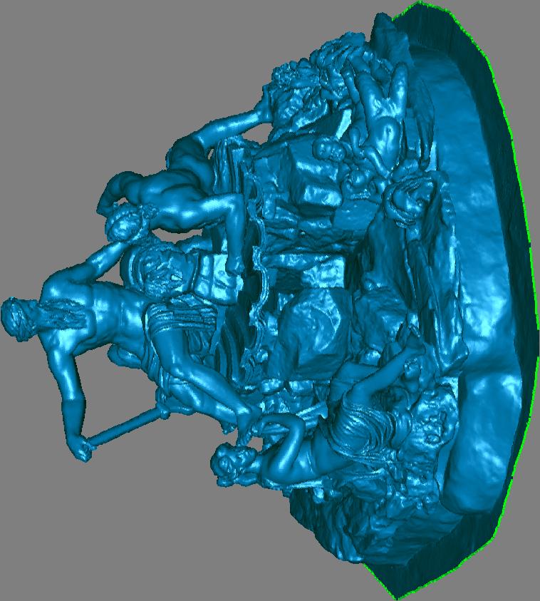
6 Obvious Demands Resources Forests is 25% of land mass Fauna-Flora-Habitat Directive Megacities, space consumption Cultural Heritage natura2000.eea.europa.eu Afghan Buddha Statues, TU Wien, Faculty of Architecture and Spatial Planning 6

7 to moving measurement platforms from single to multi-sensor systems to higher autonomy and automation to new fields of applications
8 Presentation outline the art and science of infering metric information from images Photogrammetry, Remote Sensing and their neighboring disciplines Challenges Sensors, Methods, and Applications
9 Photogrammetry Geo Geometry the Earth object-based area-based Germanisches Nationalmuseum Nürnberg 9


10 object based Photogrammetry Geo Geometry the Earth Photogrammetry area based Image object-based understanding area-based Physics Processes 10


11 from States to Processes 11

12 P & RS neighbor: Spatial Information Science Geo-data infrastructures (GDI) and ubiquituos geo-information Virtual Globes: NASA, Google, Microsoft, Navigation LBS Web 2.0 geodata mash-ups Omnipresent Geo-Data

13 Omnipresent Geo-data Geo-data infrastructures (GDI) and ubiquituos geo-information Virtual Globes: NASA, Google, Microsoft, Navigation LBS Web 2.0 geodata mash-ups Wiki mapping, collaborative mapping, crowd sourcing, interest driven update stream Free global Geo-data SRTM CBERS, open street map
14 Omnipresent Geo-data National GDI Commercial GDI Open-Source GDI Methods for collaboration not yet settled Academic contribution to Open Source GDI very little Free national Orthophotos, US-Lidar for the nation EuroSDR: Crowd sourcing for updating national databases
15 geo-referenced and geo-physical P&RS Mission geo-data and models for a sustainable development of the natural and cultural environment Where s the challenge? Exploit new sensor technology Increase automation in modeling Adopt new applications Strengthen Sensor Method Application feedback


16 New Sensors Vexcel Patent Vienna, July 4, SPOT, Microsoft, Leica, Riegl


17 Standard Imaging Sensors Texture sensors Digital aerial camera: digital workflow Digital semi-metric and consumer cameras Hi-Res/Med-Res RBGNir Satellite Imager (hardly large image blocks!) Radiometric and spectral sensors Multispectral Satellite Imager Airborne Imaging Spectroscopy Microwave/SAR Satellite Imager FLIR cameras Range sensors Aerial/Terrestrial Laser Scanner Active Triangulation Structured Light Leica, Specim, Optech, Minolta, SMOS


18 Sensors Developments Sensors combinations Radiometric exploitation of digital aerial cameras (EuroSDR-Test, FGI) Full Waveform Laser Scanning Multi-spectral Laser Scanning Time-of-Flight Cameras Single Lens Stepping Frame Terrestrial InSAR Antonov of Geokosmos: Optech, Z/I, Rollei u-blox GPS/Galileo chip xsens, MEMS IMU After Gordon Petrie
19 Challenges Tighter sensor integration physically Integrated processing of data streams e.g. of GNSS, INS, LiDAR, and imaging spectrometer Corresponding features, orientation Calibration: geometrically and geo-physically Understanding measurement processes Approach Tigther integration of physical and geometrical views Coupling of Orientation, calibration and primitive modeling
20 Improve Automation Photogrammetry: Remote Sensing: Lack of Automation Lack of Reliability / Transferability ,940,000 2 km 2 km Land SPOT Classification by Kressler, Kim, Steinocher 21


21 Improve Automation Photogrammetry: Remote Sensing: Lack of Automation Lack of Reliability / Transferability km Efficient represenation and retrieval of implicit and explicit knowledge and experience 2 148,940,000 km Land SPOT Classification by Kressler, Kim, Steinocher 22

22 Standardized Methods and Products Satellite image classifications Surface/terrain models, orthophotos, point clouds 3D city models (roof landscape, facades)

23 Challenges Modeling from different sources: time, scale, observable Reliability, correlated observations, quality control Represenation and retrieval of knowledge and experience Contradictory information Processing time Approach Exploit redundancy, compression Advance from empirical to geo-physical process models Exploit machine learning competence Difference: mirror left mirror right What is a house?


24 Different sources example Forest inventory data and airborne laser scanning Airborne and terrestrial point clouds W. Dorigo, M. Hollaus, W. Wagner, K. Schadauer: An application-oriented automated approach for co-registration of forest inventory and airborne laser scanning data; Int. J. of Remote Sensing, 31 (2010), 5; Doneus, Briese, Studnicka


25 New Applications Cartography, Urban Planning, GDI Industry, Cultural Heritage, Hydrology Quantification Processes Geography, Geomorphology, Geology Biology, Ecology, Forestry Simon Buckley, Norway biodiversity, hydraulic resistance, timber volume, channel erosion, dead ice, grain size distribution, Vienna, July 4, 2010 Beyond the ISPRS Centenary 26


26 Sensors Methods Applications Feedback Feed Forward Loops be scientifically sustainable by persistent development of methods 27
27 Loads of interesting work & research ahead Openness for applications & sensors essential Modeling of geo-physical (and geo-social!) processes Integration of geometry and physics 3D model global dynamic geo-physical etc. etc. model
Photogrammetry and Remote Sensing Beyond the Centenary
 Photogrammetry and Remote Sensing Beyond the Centenary Norbert Pfeifer Vienna University of Technology Institute of Photogrammetry and Remote Sensing I.P.F. Statements Photogrammetry is completed Professor
Themes for Geomatics Conference. Geodesy Themes
 Themes for Geomatics Conference Geodesy Themes Geodynamics o Modeling the Deformation of the Earth s Crust o Recent Advances in Geometric Approaches to Deformation Analysis o Monitoring Systems (Sensors
GEOMATICS. Shaping our world. A company of
 GEOMATICS Shaping our world A company of OUR EXPERTISE Geomatics Geomatics plays a mayor role in hydropower, land and water resources, urban development, transport & mobility, renewable energy, and infrastructure
Remote Sensing and EO activities at the University of Turku
 Remote Sensing and EO activities at the University of Turku Niina Käyhkö Associate Professor Department of Geography and Geology GEO meeting/syke May 23rd, 2018 Geospatial competence at the University
State of Israel Ministry of Housing and Construction Survey of Israel. The Hydrological project case
 State of Israel Ministry of Housing and Construction Survey of Israel The Hydrological project case Survey of Israel Content Introduction To the Survey of Israel The operation assumptions The main responsibilities
European Spatial Data Research. EuroSDR. Prof. Dr. Ir. Joep Crompvoets. General Assembly CLGE Tirana 18 March
 EuroSDR Prof. Dr. Ir. Joep Crompvoets General Assembly CLGE - 2016 Tirana 18 March 2016 INTRODUCTORY QUESTIONS Who knows what is EuroSDR? Who does NOT know what is EuroSDR? Who is employed at mapping agencies?
Overview of Remote Sensing in Natural Resources Mapping
 Overview of Remote Sensing in Natural Resources Mapping What is remote sensing? Why remote sensing? Examples of remote sensing in natural resources mapping Class goals What is Remote Sensing A remote sensing
GIS and Remote Sensing
 Spring School Land use and the vulnerability of socio-ecosystems to climate change: remote sensing and modelling techniques GIS and Remote Sensing Katerina Tzavella Project Researcher PhD candidate Technology
Cutting Edge Engineering for Modern Geospatial Systems Rear Admiral Dr. S Kulshrestha, retd
 Cutting Edge Engineering for Modern Geospatial Systems Rear Admiral Dr. S Kulshrestha, retd 11 Jun 2015 GeoIntelligence Asia 2015 The technology would become so pervasive that it becomes a part of you
XXIII CONGRESS OF ISPRS RESOLUTIONS
 XXIII CONGRESS OF ISPRS RESOLUTIONS General Resolutions Resolution 0: Thanks to the Czech Society commends: To congratulate The Czech Society, its president and the Congress Director Lena Halounová, the
Frank Hegyi President, Ferihill Technologies Ltd Victoria, B.C.
 REMOTE SENSING TECHNIQUES IN ENVIRONMENTAL MONITORING By Frank Hegyi President, Ferihill Technologies Ltd Victoria, B.C. ABSTRACT Increasing public awareness about environmental concerns is creating pressures
Introduction To A New Geo-Referenced Street Level Content: 3D GEOPANO
 Free and Open Source Software for Geospatial (FOSS4G) Conference Proceedings Volume 15 Seoul, South Korea Article 10 2015 Introduction To A New Geo-Referenced Street Level Content: 3D GEOPANO Boram Yoon
History & Scope of Remote Sensing FOUNDATIONS
 History & Scope of Remote Sensing FOUNDATIONS Lecture Overview Introduction Overview of visual information Power of imagery Definition What is remote sensing? Definition standard for class History of Remote
EuroSDR (European Spatial Data Research)
") EuroSDR (European Spatial Data Research) ROLLING RESEARCH PLAN 2015-2018 EuroSDR Secretariat Public Governance Institute KU Leuven Parkstraat 45 bus 3609 3000 Leuven Belgium Tel.: +32 16 32 31 80 Fax:
EuroSDR (European Spatial Data Research) ROLLING RESEARCH PLAN 2015-2018 EuroSDR Secretariat Public Governance Institute KU Leuven Parkstraat 45 bus 3609 3000 Leuven Belgium Tel.: +32 16 32 31 80 Fax:
GEOGRAPHY (GE) Courses of Instruction
 Courses of Instruction") GEOGRAPHY (GE) GE 102. (3) World Regional Geography. The geographic method of inquiry is used to examine, describe, explain, and analyze the human and physical environments of the major regions of the
GEOGRAPHY (GE) GE 102. (3) World Regional Geography. The geographic method of inquiry is used to examine, describe, explain, and analyze the human and physical environments of the major regions of the
GENERATION OF 3D CITY MODELS FROM TERRESTRIAL LASER SCANNING AND AERIAL PHOTOGRAPHY: A CASE STUDY
 GENERATION OF 3D CITY MODELS FROM TERRESTRIAL LASER SCANNING AND AERIAL PHOTOGRAPHY: A CASE STUDY Hakan KARABORK 1, Fatih SARI 1 1 Selcuk University in Konya, Faculty of Engineering and Architecture Konya,
Urban Geo-Informatics John W Z Shi
 Urban Geo-Informatics John W Z Shi Urban Geo-Informatics studies the regularity, structure, behavior and interaction of natural and artificial systems in the urban context, aiming at improving the living
Introduction. Elevation Data Strategy. Status and Next Steps
 1 2 Introduction Elevation Data Strategy Status and Next Steps 3 Canada is the 2nd largest country in the world - 9.9 million sq km Surrounded by 3 oceans with 202 000 km of coastline Population over 35
What is special about geospatial? or A discipline in constant transition
 What is special about geospatial? or A discipline in constant transition Marinos Kavouras NTUA Ensuring the Rapid Response to Change, Ensuring the Surveyor of Tomorrow FIG 2015 Several paradigm shifts
STEREO ANALYST FOR ERDAS IMAGINE Stereo Feature Collection for the GIS Professional
 STEREO ANALYST FOR ERDAS IMAGINE Stereo Feature Collection for the GIS Professional STEREO ANALYST FOR ERDAS IMAGINE Has Your GIS Gone Flat? Hexagon Geospatial takes three-dimensional geographic imaging
Land Administration and Cadastre
 Geomatics play a major role in hydropower, land and water resources and other infrastructure projects. Lahmeyer International s (LI) worldwide projects require a wide range of approaches to the integration
New opportunities for high-resolution countrywide tree type mapping
 New opportunities for high-resolution countrywide tree type mapping Lars T. Waser, Bronwyn Price, Nataliia Rehush, Marius Rüetschi, and David Small* Swiss National Forest Inventory Swiss Federal Research
Graduate Courses Meteorology / Atmospheric Science UNC Charlotte
 Graduate Courses Meteorology / Atmospheric Science UNC Charlotte In order to inform prospective M.S. Earth Science students as to what graduate-level courses are offered across the broad disciplines of
A Broad View of Geospatial Technology & Systems
 A Broad View of Geospatial Technology & Systems Pete Large Vice President, Trimble On the shoulders of giants 1 Since their time, our ability to generate geospatial information has grown exponentially
Land Use in the context of sustainable, smart and inclusive growth
 Land Use in the context of sustainable, smart and inclusive growth François Salgé Ministry of sustainable development France facilitator EUROGI vice president AFIGéO board member 1 Introduction e-content+
Case Study microdrones in Geomatics Remote Sensing
 Case Study microdrones in Geomatics Remote Sensing Version 1.0 Presented by: Carlos Espadas (INGECOR Geomática SL) & Michael Thoss (microdrones GmbH) Profiles: microdrones / Ingecor Geomática Contact information
Geospatial data and analysis fundamentals applied to renewable energies potential assessment
 Geospatial data and analysis fundamentals applied to renewable energies potential assessment Network analysis: Do we go to Perugia by car? Guideline Introduction renewable energy and Geospatial Technologies
Manual of Digital Earth
 V8.0 March 27, 2018 International Society for Digital Earth Manual of Digital Earth (Tentative Title) OUTLINE Foreword Chapter 1 Understanding Digital Earth 1.1 Origins and Precursors of Digital Earth
Land Accounts - The Canadian Experience
 Land Accounts - The Canadian Experience Development of a Geospatial database to measure the effect of human activity on the environment Who is doing Land Accounts Statistics Canada (national) Component
GIS = Geographic Information Systems;
 What is GIS GIS = Geographic Information Systems; What Information are we talking about? Information about anything that has a place (e.g. locations of features, address of people) on Earth s surface,
Basics of GIS reviewed
 Basics of GIS reviewed Martin Breunig Karlsruhe Institute of Technology martin.breunig@kit.edu GEODETIC INSTITUTE, DEPARTMENT OF CIVIL ENGINEERING, GEO AND ENVIRONMENTAL SCIENCES, CHAIR IN GEOINFORMATICS
Spanish national plan for land observation: new collaborative production system in Europe
 ADVANCE UNEDITED VERSION UNITED NATIONS E/CONF.103/5/Add.1 Economic and Social Affairs 9 July 2013 Tenth United Nations Regional Cartographic Conference for the Americas New York, 19-23, August 2013 Item
EuroGEOSS Protected Areas Pilot
 EuroGEOSS Protected Areas Pilot Max Craglia European Commission Joint Research Centre Part 1: the present MyNatura2000 Mobile app. Awareness raising & volunteered data collection. Natura2000 covers 18%
Challenges in data management during disasters
 Challenges in data management during disasters Sisi Zlatanova Associate Professor section GIST technology Leader Theme Group Geo-information for Crisis management OTB Research Institute for the built Environment
ENVS S102 Earth and Environment (Cross-listed as GEOG 102) ENVS S110 Introduction to ArcGIS (Cross-listed as GEOG 110)
 ENVS S110 Introduction to ArcGIS (Cross-listed as GEOG 110)") ENVS S102 Earth and Environment (Cross-listed as GEOG 102) 1. Describe the fundamental workings of the atmospheric, hydrospheric, lithospheric, and oceanic systems of Earth 2. Explain the interactions
ENVS S102 Earth and Environment (Cross-listed as GEOG 102) 1. Describe the fundamental workings of the atmospheric, hydrospheric, lithospheric, and oceanic systems of Earth 2. Explain the interactions
ESM 186 Environmental Remote Sensing and ESM 186 Lab Syllabus Winter 2012
 ESM 186 Environmental Remote Sensing and ESM 186 Lab Syllabus Winter 2012 Instructor: Susan Ustin (slustin@ucdavis.edu) Phone: 752-0621 Office: 233 Veihmeyer Hall and 115A, the Barn Office Hours: Tuesday
CARTOGRAPHIC INFORMATION MANAGEMENT IN COLOMBIA REACH A LEVEL OF PERFECTION
 CARTOGRAPHIC INFORMATION MANAGEMENT IN COLOMBIA REACH A LEVEL OF PERFECTION Jaime Alberto Duarte Castro 1 Carrera 30 No. 48 51 Bogotá - Colombia, jduarte@igac.gov.co Claudia Inés Sepúlveda Fajardo 2 Carrera
3D BUILDING MODELS IN GIS ENVIRONMENTS
 A. N. Visan 3D Building models in GIS environments 3D BUILDING MODELS IN GIS ENVIRONMENTS Alexandru-Nicolae VISAN, PhD. student Faculty of Geodesy, TUCEB, alexvsn@yahoo.com Abstract: It is up to us to
USING GIS CARTOGRAPHIC MODELING TO ANALYSIS SPATIAL DISTRIBUTION OF LANDSLIDE SENSITIVE AREAS IN YANGMINGSHAN NATIONAL PARK, TAIWAN
 CO-145 USING GIS CARTOGRAPHIC MODELING TO ANALYSIS SPATIAL DISTRIBUTION OF LANDSLIDE SENSITIVE AREAS IN YANGMINGSHAN NATIONAL PARK, TAIWAN DING Y.C. Chinese Culture University., TAIPEI, TAIWAN, PROVINCE
ZRCSAZU. Remote sensing and Earth observation data at ZRC SAZU. dr. Tatjana Veljanovski Atrij ZRC Ljubljana
 ZRCSAZU Remote sensing and Earth observation data at ZRC SAZU dr. Tatjana Veljanovski 2016-06-08 Atrij ZRC Ljubljana Remote Sensing Department Remote Sensing Department 20 years of experience application,
Horizon Scanning and Research Lead Innovation
 Horizon Scanning and Research Lead Innovation Helsinki, Finland 25 January 2013 Future Challenges,, Future Cooperation Joep 1 Crompvoets eurosdr@soc.kuleuven.be Objectives 1. EuroSDR 2. Horizon Scanning
Spatial Data Science. Soumya K Ghosh
 Workshop on Data Science and Machine Learning (DSML 17) ISI Kolkata, March 28-31, 2017 Spatial Data Science Soumya K Ghosh Professor Department of Computer Science and Engineering Indian Institute of Technology,
ESRI Survey Summit August Clint Brown Director of ESRI Software Products
 ESRI Survey Summit August 2006 Clint Brown Director of ESRI Software Products Cadastral Fabric How does Cadastral fit with Survey? Surveyors process raw field observations Survey measurements define high-order
Better Topographic Map Production Using ArcGIS. A Comprehensive Solution for Mapping Organizations
 Better Topographic Map Production Using ArcGIS A Comprehensive Solution for Mapping Organizations The World Is Always Changing As a member of a national mapping organization, you know this is true. You
THE RESEARCH GOALS AND THE RESEARCH STRATEGY OF THE EuroSDR
 THE RESEARCH GOALS AND THE RESEARCH STRATEGY OF THE EuroSDR Martien Molenaar Vice President of EuroSDR International Institute for geo-information Science and Earth Observation (ITC) Enschede, The Netherlands
INTEGRATION OF HIGH RESOLUTION QUICKBIRD IMAGES TO GOOGLEEARTH
 INTEGRATION OF HIGH RESOLUTION QUICKBIRD IMAGES TO GOOGLEEARTH M. Alkan a, *, U.G. Sefercik a, M. Oruç a a ZKU, Engineering Faculty, 67100 Zonguldak, Turkey - (mehmetalkan44@yahoo.com) Interactive Sessions,
Virtual 3D Cities. Chapter VIII. Virtual 3D Cities. 8.1 Introduction. Components. Chapter VIII: Virtual 3D Cities 1
 Chapter VIII Virtual 3D Cities 8.1 Introduction 8.2 CityGML 8.3 Google Earth 8.4 Virtual Earth 8.5 Conclusions Virtual 3D Cities 8.1 Introduction 3D Visualization of cities Languages such as CityGML New
Airborne Corridor-Mapping. Planning and documentation of company infrastructure: precise, rapid, and cost effective
 Airborne Corridor-Mapping Planning and documentation of company infrastructure: precise, rapid, and cost effective Technology Airborne Laser-Scanning, digital orthophotos and thermal imaging: one flight
Greening of Arctic: Knowledge and Uncertainties
 Greening of Arctic: Knowledge and Uncertainties Jiong Jia, Hesong Wang Chinese Academy of Science jiong@tea.ac.cn Howie Epstein Skip Walker Moscow, January 28, 2008 Global Warming and Its Impact IMPACTS
Manitoba s Elevation (LiDAR) & Imagery Datasets. Acquisition Plans & Opportunities for Collaboration
 & Imagery Datasets. Acquisition Plans & Opportunities for Collaboration") Manitoba s Elevation (LiDAR) & Imagery Datasets Acquisition Plans & Opportunities for Collaboration Manitoba Planning Conference May 2017 Presentation Outline Manitoba s Elevation (LiDAR) and Imagery Datasets
Manitoba s Elevation (LiDAR) & Imagery Datasets Acquisition Plans & Opportunities for Collaboration Manitoba Planning Conference May 2017 Presentation Outline Manitoba s Elevation (LiDAR) and Imagery Datasets
Imagery and the Location-enabled Platform in State and Local Government
 Imagery and the Location-enabled Platform in State and Local Government Fred Limp, Director, CAST Jim Farley, Vice President, Leica Geosystems Oracle Spatial Users Group Denver, March 10, 2005 TM TM Discussion
THE NEW CHALLENGES FOR THE HIGHER EDUCATION OF GEODESY IN UACEG SOFIA
 THE NEW CHALLENGES FOR THE HIGHER EDUCATION OF GEODESY IN UACEG SOFIA Ivan Kunchev University of Architecture, Civil Engineering and Geodesy, 1 Hristo Smirnenski Blvd., Sofia 1046, Bulgaria Abstract Report
Excel Geomatics: Offering Excellence with Unique Consultancy & Services
 Excel Geomatics: Offering Excellence with Unique Consultancy & Services Providing consultancy and value Added Services using Remote Sensing, Photogrammetry and LiDAR in areas such as Agriculture, Forestry,
2 nd Japan and Republic of Korea LiDAR Survey Symposium
 2 nd Japan and Republic of Korea LiDAR Survey Symposium 2010 年 9 月 20 日 Prof. Woosug Cho wcho@inha.ac.kr Spacematics Lab Department of Civil Engineering Inha University Presentation on Current Status in
ROBUST FILTERING OF AIRBORNE LASER SCANNER DATA FOR VEGETATION ANALYSIS
 ROBUST FILTERING OF AIRBORNE LASER SCANNER DATA FOR VEGETATION ANALYSIS W. Wagner a, C. Eberhöfer b, M. Hollaus a, G. Summer a a Christian Doppler Laboratory for Spatial Data from Laser Scanning and Remote
3D Laser Scanning for Digital Preservation and Dissemination of Cultural Heritage
 3D Laser Scanning for Digital Preservation and Dissemination of Cultural Heritage Main scanned objects - Four Temples of Different Religions in Sofia Eng. Zlatan Zlatanov, Eng. Milush Blagoev, Irina Nikoevska
SPATIAL CHANGE ANALISYS BASED ON NDVI VALUES USING LANDSAT DATA: CASE STUDY IN TETOVO, MACEDONIA
 Physical Geography; Cartography; Geographic Information Systems & Spatial Planing SPATIAL CHANGE ANALISYS BASED ON NDVI VALUES USING LANDSAT DATA: CASE STUDY IN TETOVO, MACEDONIA DOI: http://dx.doi.org/10.18509/gbp.2016.11
United Nations International Conference on Spacebased Technologies for Disaster Risk Reduction
 United Nations International Conference on Spacebased Technologies for Disaster Risk Reduction Muti-resource data management and sustainable development indicators related to the monitoring of cultural
Sustainable and Harmonised Development for Smart Cities The Role of Geospatial Reference Data. Peter Creuzer
 Sustainable and Harmonised Development for Smart Cities The Role of Geospatial Reference Data Peter Creuzer 1. Introduction - Smart Cities and Geodata 2. Geodata in Germany 3. Examples 4. Data and Service
OBJECT BASED IMAGE ANALYSIS FOR URBAN MAPPING AND CITY PLANNING IN BELGIUM. P. Lemenkova
 Fig. 3 The fragment of 3D view of Tambov spatial model References 1. Nemtinov,V.A. Information technology in development of spatial-temporal models of the cultural heritage objects: monograph / V.A. Nemtinov,
HMK Swedish handbook in surveying and mapping
 HMK Swedish handbook in surveying and mapping A Alfredsson, J Sunna, C-G Persson TS07B - Standards and Recommended Practices for Positioning and Measurement, Paper no 7072 FIG Congress 2014 Engaging the
DEPARTMENT OF GEOGRAPHY B.A. PROGRAMME COURSE DESCRIPTION
 DEPARTMENT OF GEOGRAPHY B.A. PROGRAMME COURSE DESCRIPTION (3 Cr. Hrs) (2340100) Geography of Jordan (University Requirement) This Course pursues the following objectives: - The study the physical geographical
GISc Technologist model. Adv. Diploma or B Degree in GISc / Geoinformatics. NQF level 7. Minimum 360 credits
 Knowledge area (KA) Outcomes Units Themes and / or key words GSc: Geographical science Understanding Geographical sience as it relates to GISc GISc Technologist model. Adv. Diploma or B Degree in GISc
Last date for submission of Assignments is Title of the course: PGD-GARD - II Semester. Third Batch (2018) - ASSIGNMENT
 - ASSIGNMENT") Last date for submission of Assignments is 31-12-2018 Title of the course: PGD-GARD - II Semester Third Batch (2018) - ASSIGNMENT Course No. GARD-507: Course Title: Remote Sensing -II Total Marks: 30 Note:
Last date for submission of Assignments is 31-12-2018 Title of the course: PGD-GARD - II Semester Third Batch (2018) - ASSIGNMENT Course No. GARD-507: Course Title: Remote Sensing -II Total Marks: 30 Note:
Preparation of Database for Urban Development
 Preparation of Database for Urban Development By PunyaP OLI, 1. Chairman, ERMC (P) Ltd., Kathmandu, Nepal. Email: punyaoli@ermcnepal.com 2. Coordinator, Himalayan College of Geomatic Engineering and Land
Cities in Space and Time: A Spatial-Temporal Visualization Model of Urban Environments
 Cities in Space and Time: A Spatial-Temporal Visualization Model of Urban Environments Li Yin Assistant Professor Department of Urban and Regional Planning University at Buffalo, The State University of
Contemporary Data Collection and Spatial Information Management Techniques to support Good Land Policies
 Contemporary Data Collection and Spatial Information Management Techniques to support Good Land Policies Ch. Ioannidis Associate Professor FIG Commission 3 Workshop Paris, 25-28 October 2011 Introduction
Data for Spatial Planning A Comparison of Three Cities
 Data for Spatial Planning A Comparison of Three Cities Dr. Gerhard Navratil1 Dr. Johannes Scholz1 DI Ladislav Danek2 Dr. Farid Karimipour3 1 TU Vienna, Institute of Geoinformation and Cartography, Austria
An Industry Perspective. Bryn Fosburgh Vice President Trimble
 An Industry Perspective Bryn Fosburgh Vice President Trimble Who are we? Professionals & Consultants Geospatial Professionals working at or with: AEC Consultants Transportation Departments Construction
COURSE OUTLINE. GEO 101 Geography 3 Course Number Course Title Credits. Reference Liberal Arts Division Book List
 MERCER COUNTY COMMUNITY COLLEGE LIBERAL ARTS DIVISION COURSE OUTLINE GEO 101 Geography 3 Course Number Course Title Credits Required Materials: Catalog Description: Reference Liberal Arts Division Book
Industry Trends and Direction: a quick look! John Whitehead Trimble Navigation Ltd.
 Industry Trends and Direction: a quick look! John Whitehead Trimble Navigation Ltd. Converging forces have placed geospatial information at the center of an evolving ecosystem Technology Societal Forces
Cartographic and Geospatial Futures
 Cartographic and Geospatial Futures 1. Web Cartography, WebGIS, & Virtual Globes--New Roles for Maps, GIS, and GIS professionals 2. Map Mashups, the Neo Neo-geography Movement, & Crowd-sourcing Geospatial
Uncertainties in spatial modelling of the cultural environment
 Uncertainties in spatial modelling of the cultural environment Tomaž PODOBNIKAR 1, 3 / Christian BRIESE 1 / Michael DONEUS 2 / Norbert PFEIFER 1 1 Institute of Photogrammetry and Remote Sensing of the
Mapping a Nation in 3D Singapore s Journey. Bryan Chew Registrar of Titles Assistant Chief Executive Singapore Land Authority
 Mapping a Nation in 3D Singapore s Journey Bryan Chew Registrar of Titles Assistant Chief Executive Singapore Land Authority Singapore Size - 719 sq km Population - 5.5 million Density 7,600/sq km Singapore
Draft GISc B Hon/ BSc/Professional Degree Framework Level NQF 8. Minimum 480 credits
 One credit is considered to be 10 hours of notional learning KA teaching may be included in more than one course / module Draft GISc B Hon/ BSc/Professional Degree Framework Level NQF. Minimum 40 credits
Unmanned Aerial Systems (UAS) Innovation for affordable, improved and accelerated spatial data acquisition
 Innovation for affordable, improved and accelerated spatial data acquisition") Unmanned Aerial Systems (UAS) Innovation for affordable, improved and accelerated spatial data acquisition Kathrine Kelm, The World Bank Rumyana Tonchovska, FAO Walter Volkmann, Micro Aerial Projects,
Unmanned Aerial Systems (UAS) Innovation for affordable, improved and accelerated spatial data acquisition Kathrine Kelm, The World Bank Rumyana Tonchovska, FAO Walter Volkmann, Micro Aerial Projects,
Geographic information for Strasbourg : from historical land register to 3D GIS city modelling 09/07/2017
 Geographic information for Strasbourg : from historical land register to 3D GIS city modelling 09/07/2017 Table of contents 1. Introduction of Strasbourg 2. A century of land surveying and cadastre 3.
THE ESTABLISHMENT OF DIGITAL HIGH RESOLUTION GEODATABASES FOR WEBGIS: FROM DIGITAL CAMPUS TO DIGITAL NATIONAL PARK
 THE ESTABLISHMENT OF DIGITAL HIGH RESOLUTION GEODATABASES FOR WEBGIS: FROM DIGITAL CAMPUS TO DIGITAL NATIONAL PARK Y. C. Ding a, *, C. C. Huang a a Digital Earth Research Center (DERC), Chinese Culture
Liana Talaue McManus. Division of Marine Affairs and Policy Rosenstiel School of Marine & Atmospheric Science University of Miami
 Liana Talaue McManus Division of Marine Affairs and Policy Rosenstiel School of Marine & Atmospheric Science University of Miami Outline 1. Coasts as vulnerable & resilient social ecological systems 2.
Building a Vibrant and Enduring Spatial Science John P. Wilson IWGIS2014 Beijing, China
 Building a Vibrant and Enduring Spatial Science John P. Wilson IWGIS2014 Beijing, China Outline Spatial roots o Geography o Landscape architecture o Computer science The (current) opportunity Guiding principles
Challenges and Potentials of Place Based Information Management in Nepal"
 Nineteenth United Nations Regional Cartographic Conference for Asia and the Pacific, Bangkok, Thailand, 29 October 1 November 2012 Challenges and Potentials of Place Based Information Management in Nepal"
Urban land cover and land use extraction from Very High Resolution remote sensing imagery
 Urban land cover and land use extraction from Very High Resolution remote sensing imagery Mengmeng Li* 1, Alfred Stein 1, Wietske Bijker 1, Kirsten M.de Beurs 2 1 Faculty of Geo-Information Science and
Geography (GEOG) Courses
 Courses") Geography (GEOG) 1 Geography (GEOG) Courses GEOG 100. Introduction to Human Geography. 4 (GE=D4) Introduction to the global patterns and dynamics of such human activities as population growth and movements,
Geography (GEOG) 1 Geography (GEOG) Courses GEOG 100. Introduction to Human Geography. 4 (GE=D4) Introduction to the global patterns and dynamics of such human activities as population growth and movements,
Creating and Using 3D City Models
 Creating and Using 3D City Models Traditional 3D City Models vs. Google Earth and Virtual Earth Wolfgang Dokonal Graz University of Technology http://www.stdb.tugraz.at Dokonal@tugraz.at Abstract. City
Cláudio Carneiro dell Ecole Polytechnique Federale de Lausanne
 URBAN UTILITY _ milano 22 03 2013 LA COSTRUZIONE DEL DATO COME PRESUPPOSTO DELLA DECISIONE PRIMA SESSIONE THE USE 3D GIS AND LIDAR DATA FOR URBAN PLANNING AND DECISION MAKING Cláudio Carneiro dell Ecole
Yrd. Doç. Dr. Saygın ABDİKAN Öğretim Yılı Güz Dönemi
 Yabancı Dil III (YDL285) Introduction to Geomatics Yrd. Doç. Dr. Saygın ABDİKAN 2017-2018 Öğretim Yılı Güz Dönemi 1 géomatique Geo (Earth) + informatics Geodesy + Geoinformatics Geomatics: The mathematics
Geographical Information System (GIS) Prof. A. K. Gosain
 Prof. A. K. Gosain") Geographical Information System (GIS) Prof. A. K. Gosain gosain@civil.iitd.ernet.in Definition of GIS GIS - Geographic Information System or a particular information system applied to geographical data
Geographical Information System (GIS) Prof. A. K. Gosain gosain@civil.iitd.ernet.in Definition of GIS GIS - Geographic Information System or a particular information system applied to geographical data
Background. Points of Discussion. Hydrographic Models
 Airborne Laser Remote Sensing Technology: Providing Essential Hydrologic Information in the 21 st Century Warwick Hadley, Optech Incorporated Presented by: Warwick Hadley Sales Manager, Middle East and
USGIF Essential Body of Knowledge Competency Areas
 GEOINT Job/Practice Analysis USGIF, in consultation with psychometric consultants and the GEOINT community, executed a job/practice analysis to identify common competencies within the GEOINT profession.
Land Use / Land Cover Mapping in
 Land Use / Land Cover Mapping in Eastern and Southern African Regions RCMRD Experience by 6/24/2013, Nairobi Kenya Dr. Tesfaye Korme Director of RS, GIS and Mapping, RCMRD I. About RCMRD, Its Vision and
3D City GIS. Agenda. Why 3D City GIS? What does 3D City GIS mean?
 3D City GIS 1 of 60 WWW.BENTLEY.COM Ben Fredericque, Product Manager, Geospatial Agenda Why 3D City GIS? What does 3D City GIS mean? 2 of 60 WWW.BENTLEY.COM Sydney, Australia, 11 16 April 2010 1 Why 3D
GIScience - Activities. Geomatics Department. Humboldt University Berlin. Tobia Lakes Patrick Hostert
 Institute of Geography GIScience - Activities Geomatics Department Humboldt University Berlin Tobia Lakes Patrick Hostert GIScience Meeting, 2nd February 2007 Content Geomatics Department at the Humboldt
Radiometric calibration of ALS intensity
 Radiometric calibration of ALS intensity Sanna Kaasalainen a, Juha Hyyppä a, Paula Litkey a, Hannu Hyyppä b, Eero Ahokas a, Antero Kukko a, and Harri Kaartinen a a) Department of Remote Sensing and Photogrammetry
You are Building Your Organization s Geographic Knowledge
 You are Building Your Organization s Geographic Knowledge And Increasingly Making it Available Sharing Data Publishing Maps and Geo-Apps Developing Collaborative Approaches Citizens Knowledge Workers Analysts
SCIENTIFIC PROGRAM. Overall Program Oral Presentations and Posters Student Consortium Plenary Speakers
 206 SCIENTIFIC PROGRAM Overall Program Oral Presentations and Posters Student Consortium Plenary Speakers Overall Program 207 208 Oral Presentations and Posters Monday, 11 July, 2016 08:30-12:00 Faculty
Derivation of 3D landscape metrics from airborne laser scanning data. Werner Mücke*, Markus Hollaus and Martin Prinz
 Derivation of 3D landscape metrics from airborne laser scanning data Werner Mücke*, Markus Hollaus and Martin Prinz Institute of Photogrammetry and Remote Sensing, Vienna University of Technology, Gußhausstraße
Planning in a Geospatially Enabled Society. Michael F. Goodchild University of California Santa Barbara
 Planning in a Geospatially Enabled Society Michael F. Goodchild University of California Santa Barbara What is a geospatially enabled society? Knowing the locations of all points of interest and their
Future Proofing the Provision of Geoinformation: Emerging Technologies
 Future Proofing the Provision of Geoinformation: Emerging Technologies An Exchange Forum with the Geospatial Industry William Cartwright Chair JBGIS Second High Level Forum on Global Geospatial Information
SOLUTIONS ADVANCED GIS. TekMindz are developing innovative solutions that integrate geographic information with niche business applications.
 ADVANCED GIS SOLUTIONS TekMindz are developing innovative solutions that integrate geographic information with niche business applications. TEK INDZ TM GIS Services Overview At the leading edge of geospatial
CITYGML MODELLING FOR SINGAPORE 3D NATIONAL MAPPING
 CITYGML MODELLING FOR SINGAPORE 3D NATIONAL MAPPING K. H. Soon* and V. H. S. Khoo Land Survey Division, Singapore Land Authority, 55 Newton Road, #12-01, 307987 Singapore - (soon_kean_huat, victor_khoo)@sla.gov.sg